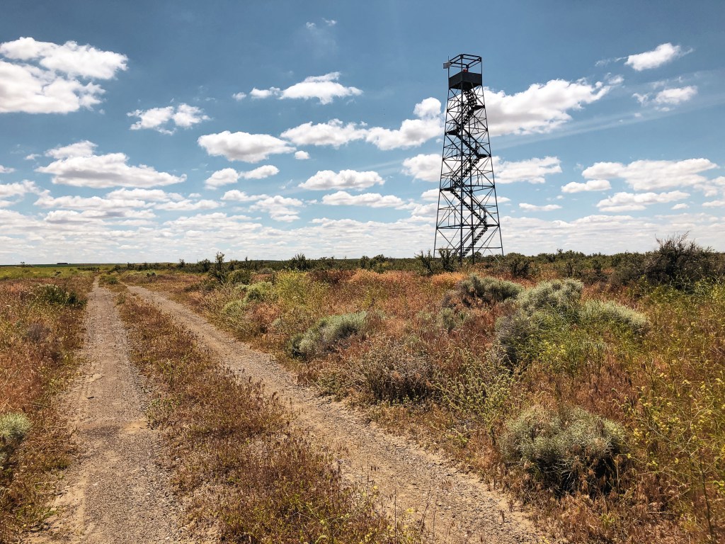
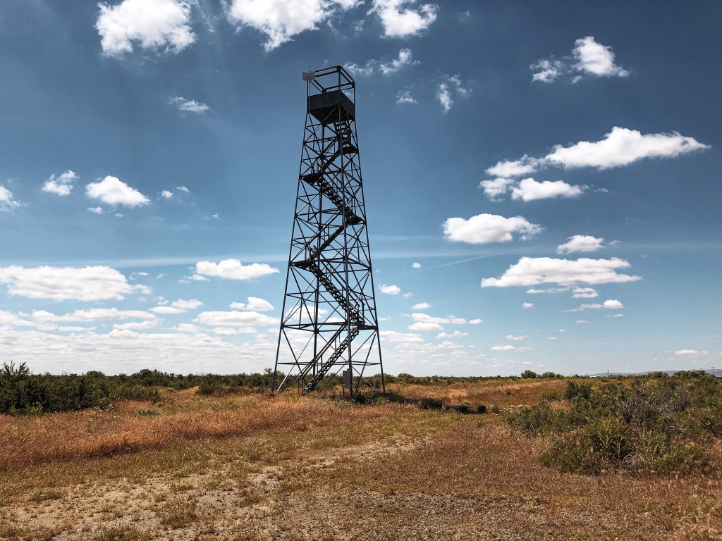
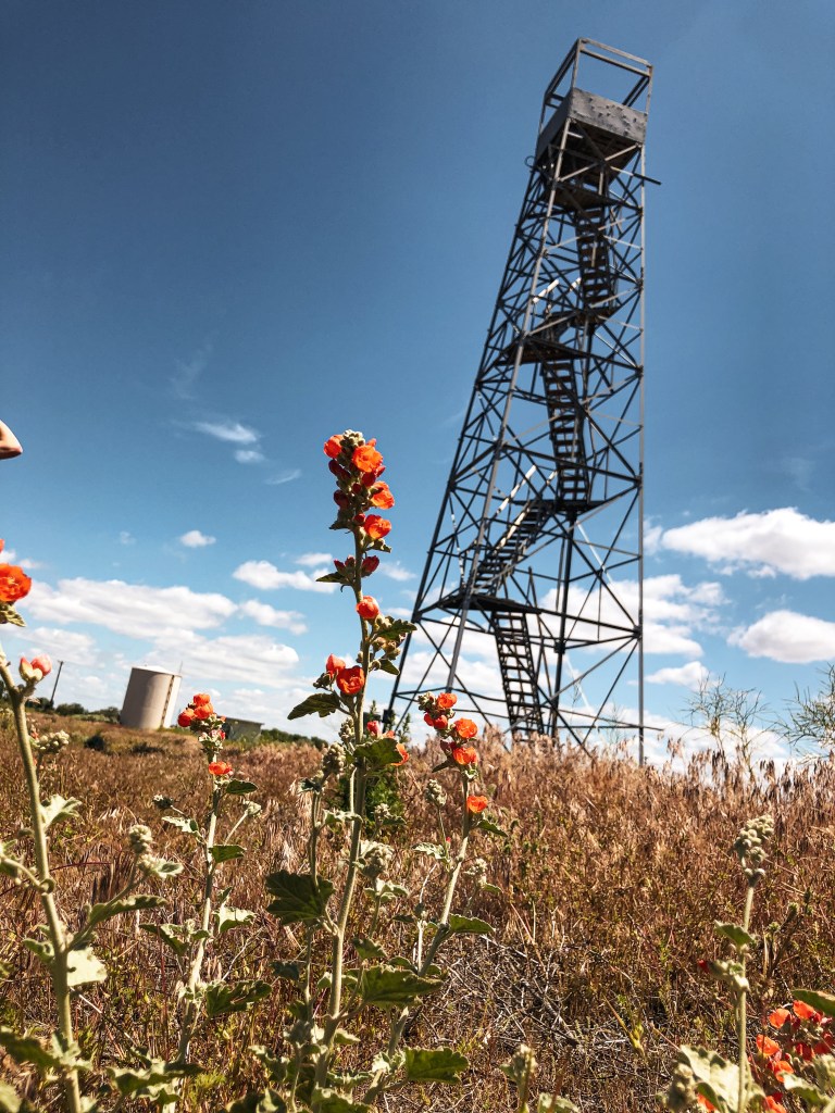
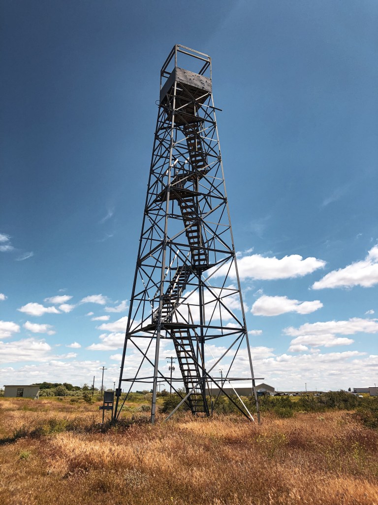
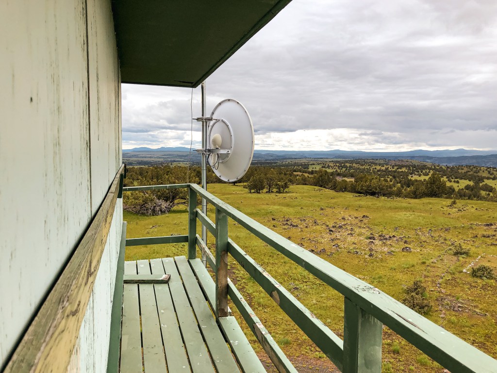
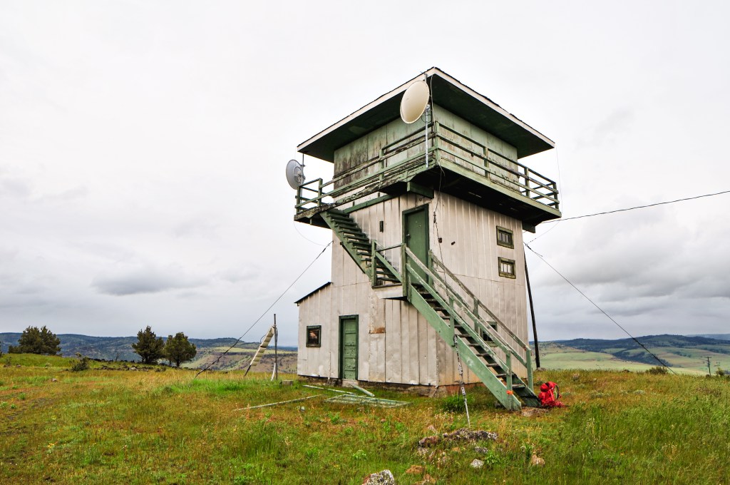
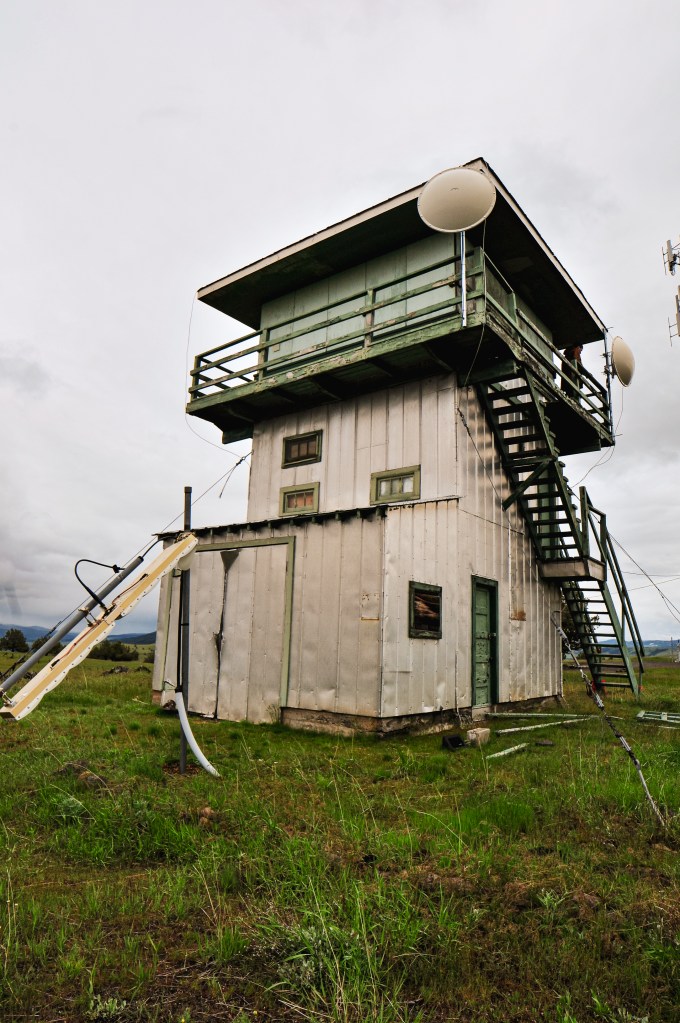
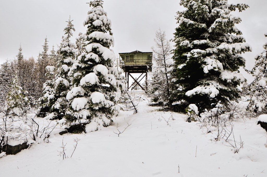
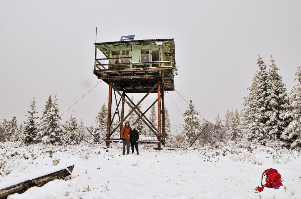
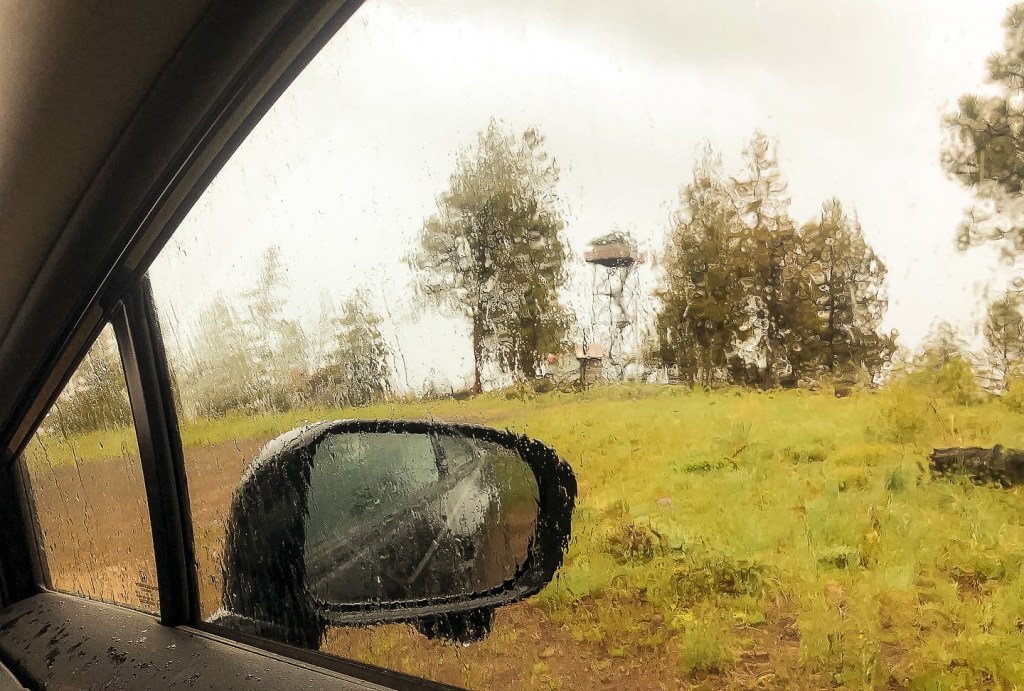
After a successful but unarguably wet camping trip for Memorial Weekend, we were headed back to Portland from the Umatilla NF. The weather had cleared off significantly and was supposed to be in the mid-70s. My partner informed me there was another fire lookout just off the highway in Boardman we could see on our way home. I figured what was one more to round out the weekend. You should be able to see it from the highway if you know what you’re looking for. From I-84, we took the exit for Tower Road just after Boardman, or before depending on which way you’re driving. You will want to head towards the Love’s Travel Stop and continue past on Tower Road. It should be very obvious from this point. We turned right on one of the first roads leading off to its relative direction and then left onto an unmarked access road. We were able to walk right up to it. It was another easy on and off. I used to drive past Boardman often when I would come home from college. I always remembered it for its tree farm, but had no idea there was a fire lookout here.
History.
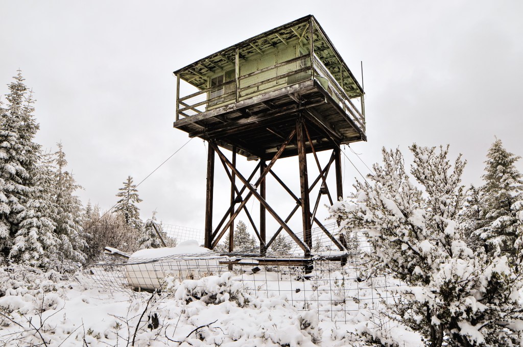
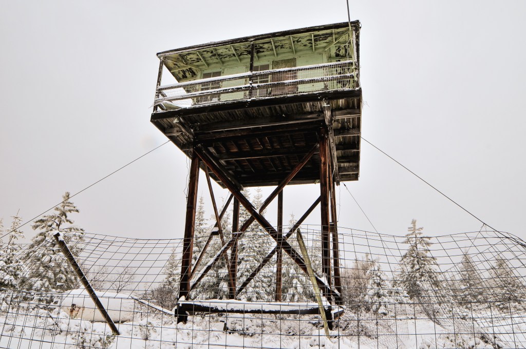
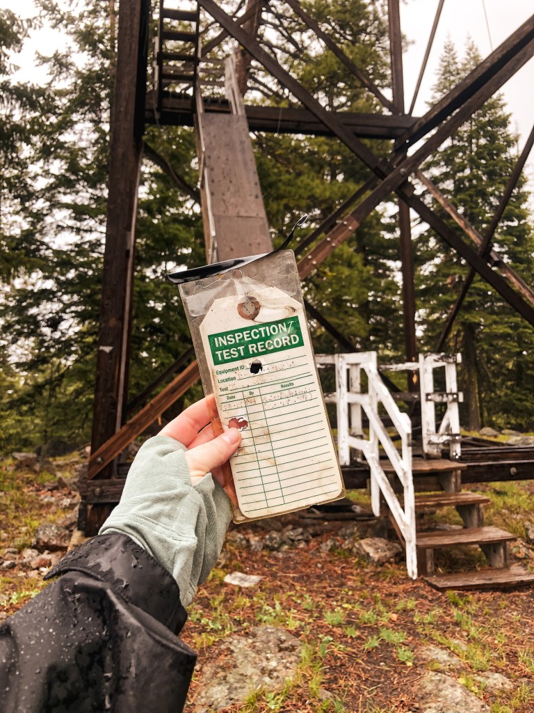
My partner discovered this lookout from a post in the Oregon Fire Lookouts Facebook group by Howard Verschoor. All this information was provided by Howard and I was unable to confirm the validity of this information through additional online sources. He is the head of the FFLA Oregon Chapter, so I’d consider him a reliable source for information. I am unsure of its origin date or timeline. The Aermotor tower was originally moved from the Malheur National Wildlife Refuge. It was used by the US Navy Bombing Range to watch for fires after their bombing practice until it was converted into a beacon light for the Boardman Airport.
Before reaching the community of Dale, we passed a road marked Bone Point Road. Based on previous trip reports we knew this was not a direct route to the lookout despite the name. On a map it does look like it eventually connects after taking some roads through private land, but there is no guarantee that they are open roads for public access. Instead we continued past Dale to the NF-3963 road. It crosses the North Fork of the John Day before heading steeply into the forest. The first part of NF-3963 is riddled with pot holes that can be troublesome for lower clearance vehicles. We were able to navigate them in my Civic with caution. As we started to head up I let my partner take over driving. He is more confident on forest service roads especially ones shouldered by steep drop offs and road hazards. Yay, fear of heights! Yay, anxiety from our Tower Point attempt (post)!
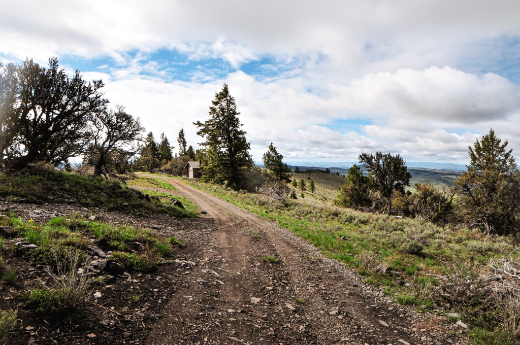
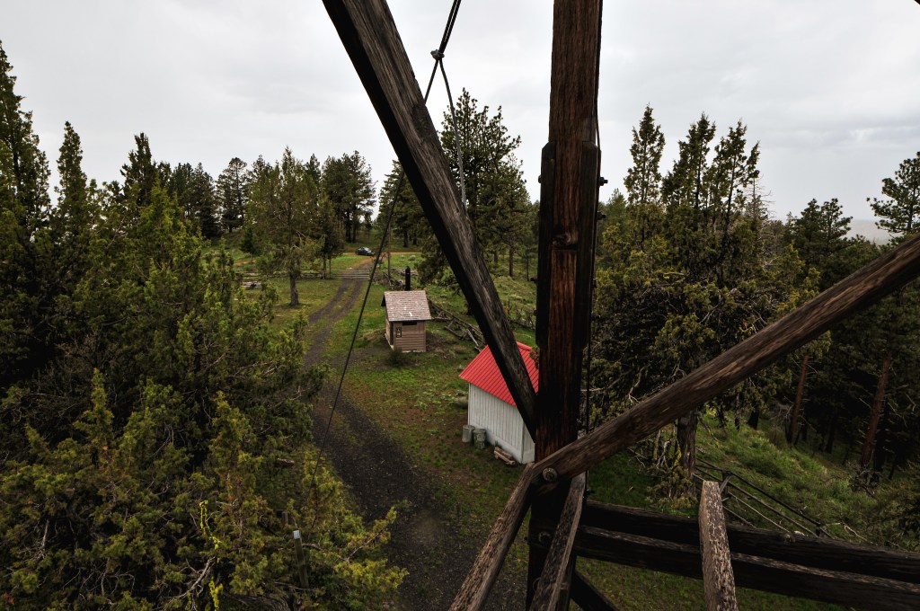
You will stay on this forest service road for about 5 miles. Some of the spurs are signed such as NF-020 and NF-040, but the one leading to Bone Point L.O. is not. It’s supposed to be marked as NF-060 but the sign is long gone. After passing NF-040, there will be an un-marked spur off to the right. This is not the one you want to reach Bone Point. After this spur, you will pass a tree with the number 5 spray painted on it marking that you have made it 5 miles. The next un-marked road off to the right will be the correct one. You will know you are at the right junction when the road opens up and flattens out into a meadow. There is also a seasonal gate and dispersed camp spot off NF-060. If you hit the cattle guard you’ve gone too far. We were elated to find a camp spot close to where we wanted to be and set up camp around 7PM. The weather even seemed to be clearing off and provided a lovely evening sunset.
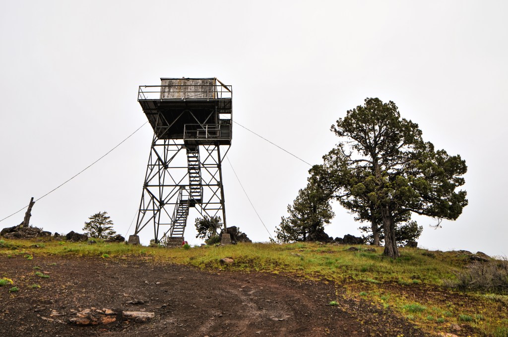
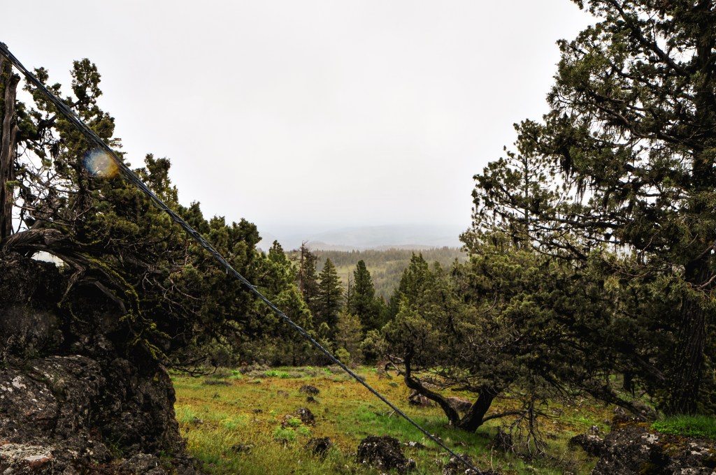
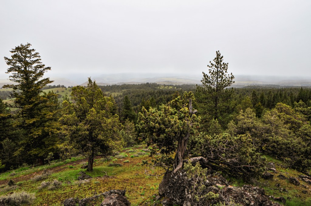
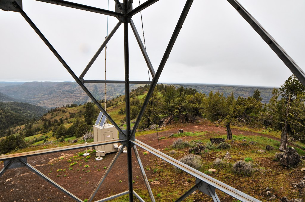
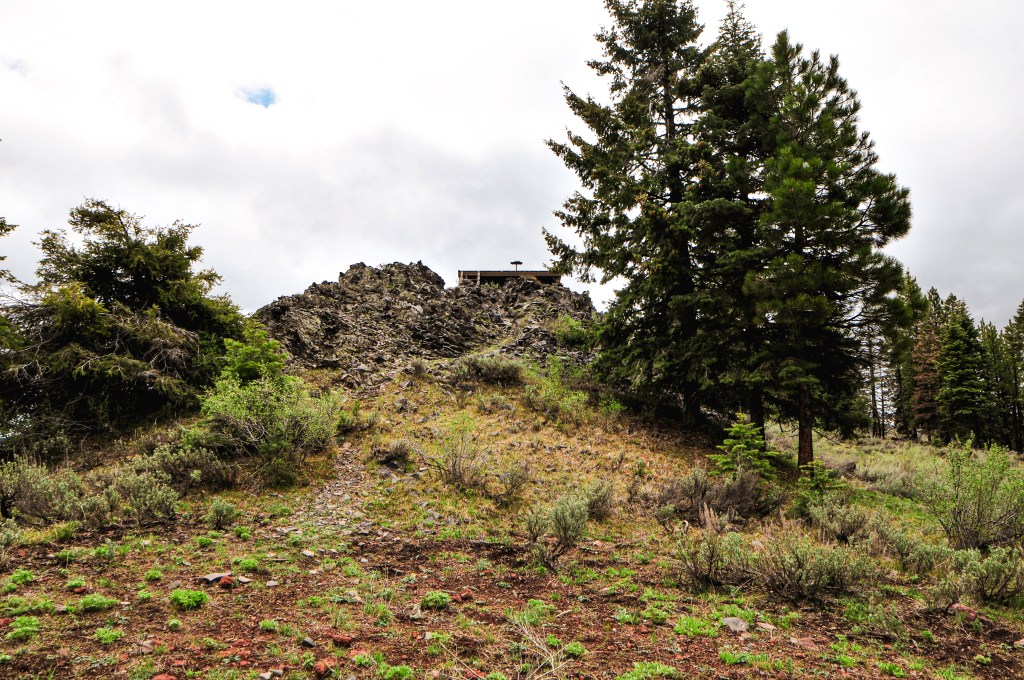
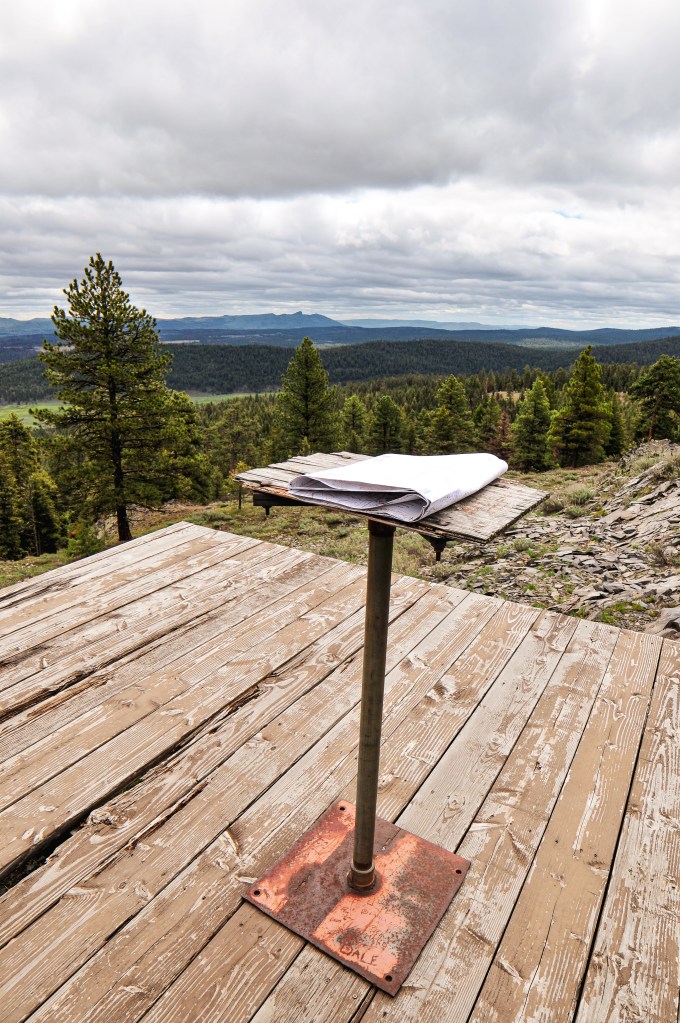
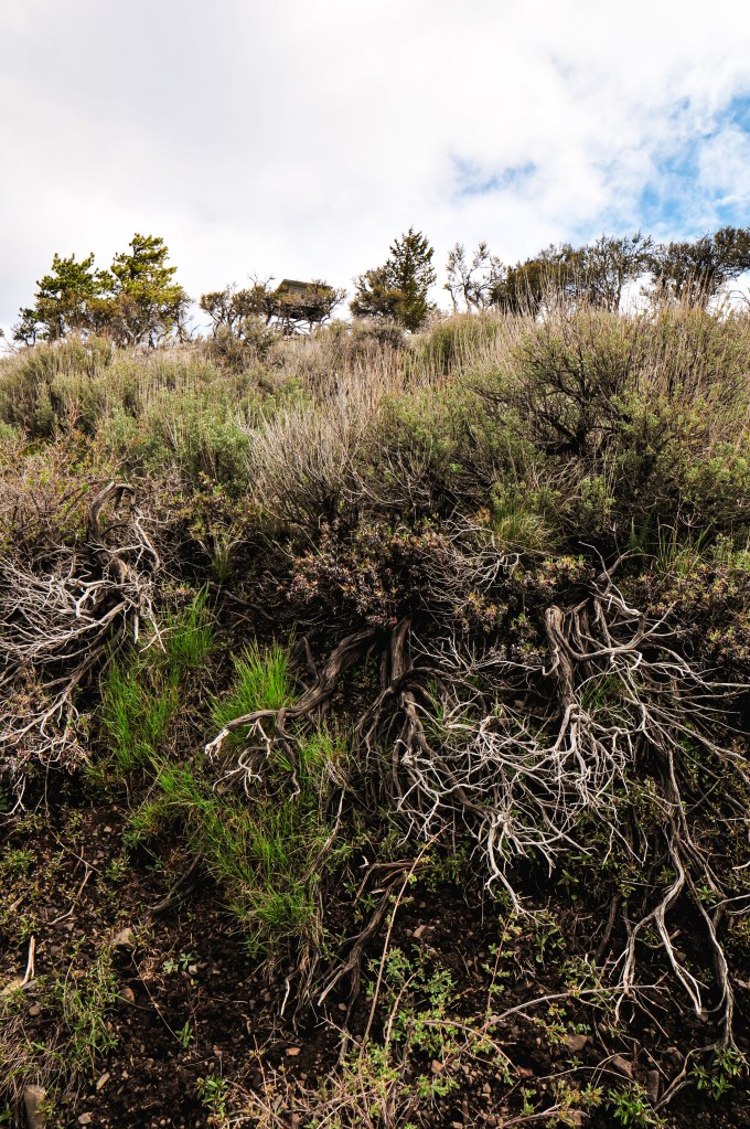
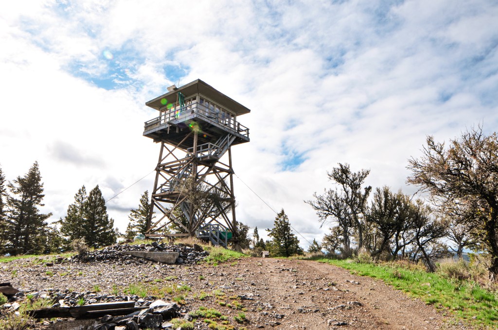
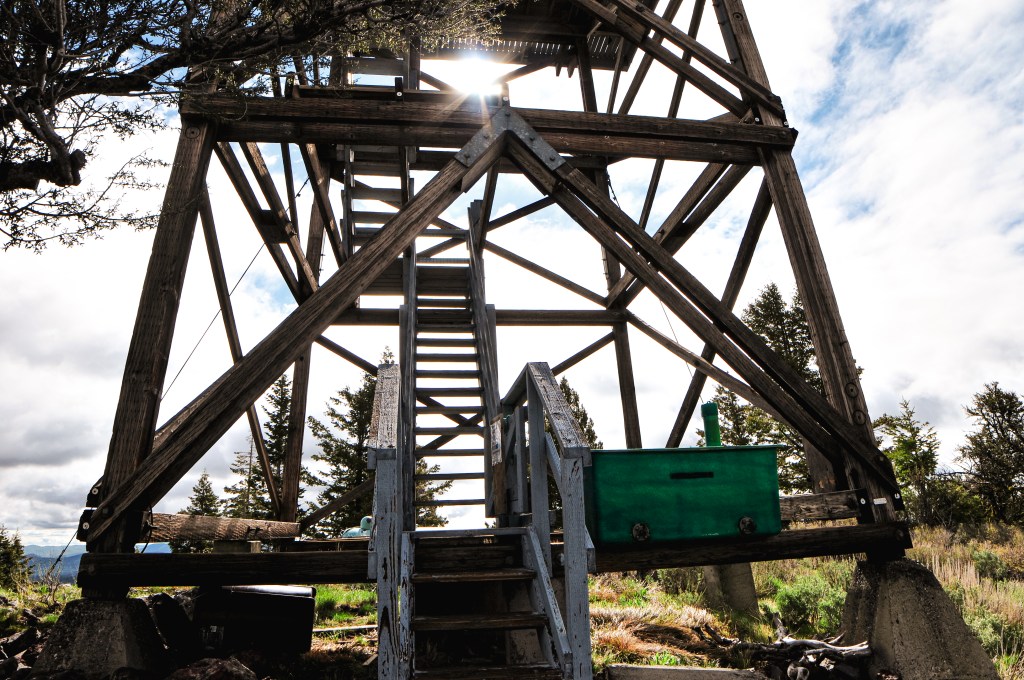
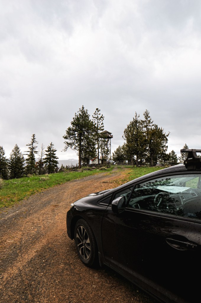
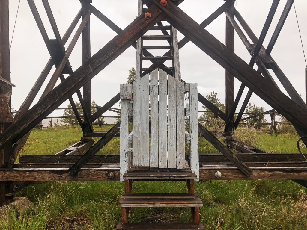
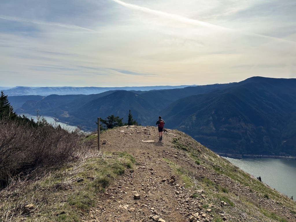
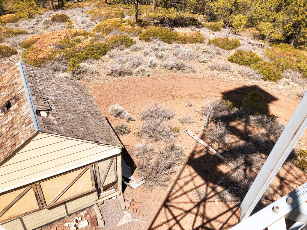
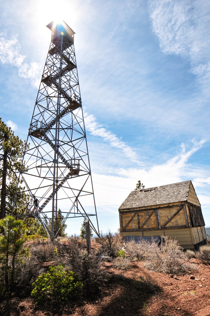
We woke up the next morning to even more cloudy conditions. We didn’t rush to get up since we weren’t moving camps and didn’t need to drive any farther to our destination for the day. Waffles were on the menu for breakfast. YUM! Bone Point was only a mile from our camp and we decided to walk there after breakfast. The seasonal gate on the road is closed to motorized vehicles from December 1st thru April 30th. The road is very mucky after any precipitation and has been rutted out due to people driving in wet conditions. Even if we had wanted to drive, my car would have never made it. It’s a relatively nice flat walk to the summit though. We even heard an owl hooting near by. The last section of road is very rocky and would need caution to navigate even in a high clearance vehicle. Once on the summit it started to sprinkle a mix of rain and snow. The forecast for today was supposed to be nicer than the last few days, but that proved to be wrong. We weren’t completely in a rain cloud yet and still managed to see some of the surrounding peaks while on the summit. There were some coyotes yipping off in the distance on a neighboring peak as well. It looked like at one point the stairs had been wrapped in barbed wire to prevent people from climbing it. Someone had moved this and cut a chunk out of the trap door to access the catwalk. The structure itself felt pretty sound, but I only went up to the first landing. The metal style lookout towers, besides Aermotors, are pretty uncommon in Oregon.
We were back at camp before noon and the rain had settled into a consistent shower. It continued to rain for 6 more hours with no end in sight. We spent the remainder of our time hiding in the car reading. We hoped it would clear off for a nice sunset again, or maybe in the morning, to return to Bone Point under better conditions. It unfortunately did not clear off until we were already out of the forest on our way back to Portland.
History.
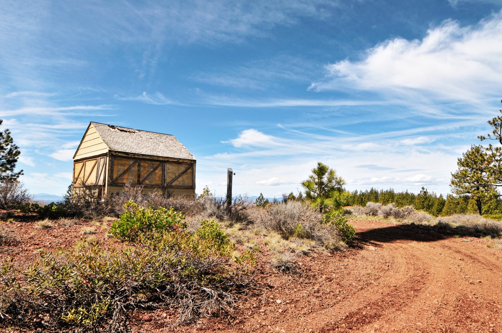
Bone Point has had a few different types of lookouts on its summit during its fire detection years. In the 1920’s, a cupola cabin was used which was replaced in the 1930’s by a 40′ wooden live-in tower. In 1947, it was replaced by a 30′ steel live-in tower which in turn was replaced by the current structure. The existing lookout was built in 1961 as a 30′ all steel live-in tower. It is noted on standby for emergency use during high fire danger despite not being actively staffed for many years. Its last recorded use was in August 2003 when it was staffed by a district employee during a period of lightning storms.
From the Malheur NF, we headed farther north on HWY-395 towards the community of Dale. On the drive, we contemplated whether it made more sense to stop at Ritter Butte today or back track to it tomorrow. We didn’t have much day left to search for a camp but Ritter Butte was along the way. Our decision was quickly made when we realized we could see Ritter Butte from HWY-395. We knew it was only about a half mile off the highway but seeing how close it was for ourselves made it an easy decision to stop. The turn will be marked as Old Ritter Lane on the left once you reach the highway summit for Ritter Butte. The access road is the first un-marked road off to the left. They recently added a gate to deter people from driving to the summit. We parked in a pull out on Old Ritter Lane and made the short hike up. The road was also made up of large rocks instead of fine gravel, so I wouldn’t have tried to drive up anyway.
The summit was filled with wildflowers that were beginning to bloom and we even had a small break in weather. There were newer power tools and fresh wood stored in the bottom shed portion of the lookout. It looked like they were working on replacing or updating the structure. We thought this was odd since it is no longer actively staffed, but speculated it needed to stay up to date for camera maintenance. Someone had completely removed the trap door for the catwalk and the second level was unlocked. We decided to take a quick look on the open catwalk since it seemed to be in somewhat decent shape. We once again didn’t stay too long on the summit due to time constraints. But this one is an easy on and off if you’re ever passing through the area. We quickly popped on HWY-395 again and continued on to the Umatilla NF. We were headed up towards Bone Point L.O. (post) and hoped there would be a dispersed camp spot somewhere along the road.
History.
The Ritter Butte L.O. is a 3-story enclosed ODF tower with live-in cab and was built in 1950. It was actively staffed into the 1980’s and then moved to emergency status. There are multiple sources stating that it was actively staffed again in 2012, but it is unclear if it was just for that season or for a few years after that as well. In 2017, similar to other ODF lookouts, a fire detection camera was installed and will be the main source for fire detection.
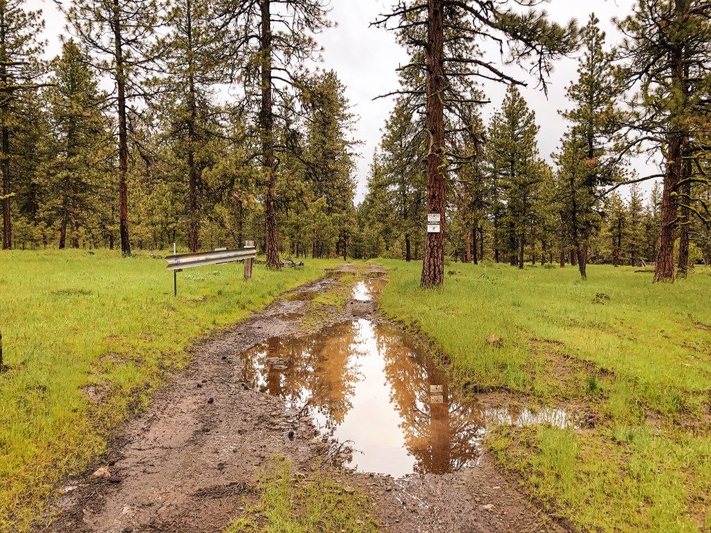
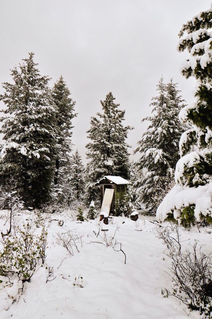
We woke up to snow flurries in the morning. It was cold but a welcome drier form of precipitation. Due to our previous day pre-pack, we only had to pack up our tent and sleeping gear before heading out. We shoved a quick bagel in our mouths and drove out of the forest back to HWY-395. Our plan was to head farther north on HWY-395 past Mount Vernon to Black Butte L.O. on the Malheur NF. We knew there was a nice dispersed camp along the road to the lookout thanks to an online source. From HWY-395, we turned left on CR-88 just after leaving the Malheur NF and before reaching the community of Fox. There will be a sign for Black Butte L.O. from the turn on the highway. You will shortly re-enter the forest after you head down this road. From here you will turn left on NF-3955, left on NF-3956, and then left on NF-034 to reach the summit. As we started to gain elevation on the road we realized we would be hiking in snow today. I parked the car a little after the junction with NF-3955 and NF-3956 due to additional snow on the road. The camp we were originally planning on staying at for the night had a fresh blanket as well. We would need to revisit that plan once we were back at the car.
NF-3956 continues to the left
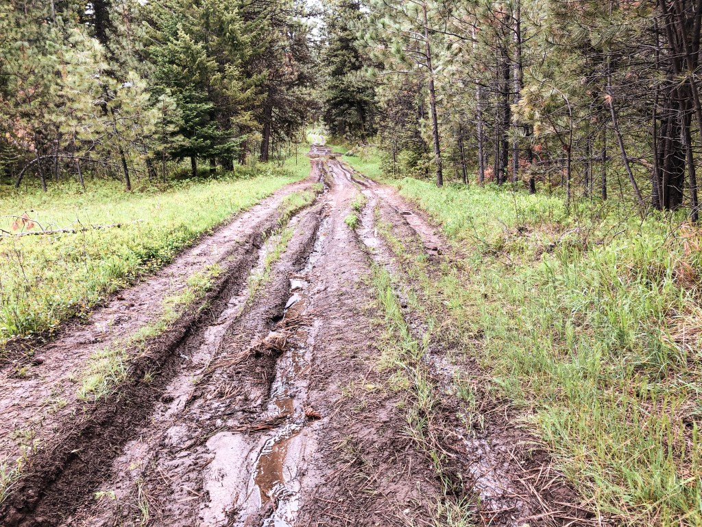
I was moving slower this morning and my partner had hiked ahead. I could still see him until he continued around a bend in the road. He had hesitated at a junction before continuing on straight. When I reached the junction myself I realized the road we needed continued to the left instead of straight. I headed straight to see if I could catch up with him but he was long gone. I mustered up all my lung power to call for him until he came back. Luckily, he wasn’t out of ear shot and was heading back shortly after I called out a few times. The road at the junction with NF-3956 is unmarked and can look like NF-3956 continues straight. There are road signs for NF-3956 though, so keep an eye out for those. If you reach the spur NF-146 on the right you have missed your turn. If you’re driving a grocery getter like me, you will want to park at this junction and walk the remaining 2 miles to the lookout. We couldn’t see the exact conditions of the road but even covered in snow it looked really bad with large rocks and wash outs.
These flowers weren’t expecting snow either
The fresh snow made the walking slow and we didn’t reach the summit until 2PM. It’s crazy to think just yesterday there was likely little to no snow here, but it now had at least 3 to 4 inches. Can you believe it’s the end of May?? As much as I complain, I know this precipitation is good for the east side and will hopefully delay the impending fire season. The lookout on Black Butte has seen better days. The solar panel is surprisingly still there, but they have removed the stairs and added a fence around it to help deter vandals. We briefly enjoyed the summit since it was cold and still snowing here and there. We once again said our good byes to Black Butte before hiking down since it is expected to be removed by the Forest Service. After 4 miles of cold feet, we decided camping in the snow sounded less than ideal. It seemed a bit ambitious to add Ritter Butte L.O. (post) to our agenda for the day, but we concluded our best bet for drier camp spots was to continue on to the Umatilla NF.
History.
Black Butte L.O. was constructed in 1933 as a 20′ tower with L-4 cab and still stands today. The tower legs, trap door, and roof were all replaced in the 1960’s. The foundation was later replaced in 1994. It was staffed during emergencies up until more recently. As of 2017, the structure has been listed as condemned and is slated to be removed by the Forest Service.
We headed back out on NF-14 after visiting Antelope Mountain L.O. (post) until we reached NF-185. We were unsure how close we’d be able to get to Crane Point since we’d have to take three different three numbered roads. Three numbered roads in the forest are typically rough and best driven by high-clearance vehicles. Some were noted on the ranger district map as well maintained gravel, but I was skeptical. You will take NF-185 all the way to a major four way junction with NF-1450. From here you will turn right on to NF-1450, right on to NF-380, and then another right on NF-407 to get to Crane Point. We were able to drive all the way to NF-380 with no issues in my Civic. We made it about a mile down NF-380 before we decided to pull over and walk the remaining distance. The road was muddy and soft after all the recent rain. I think it would be a relatively drivable road in drier conditions for most.
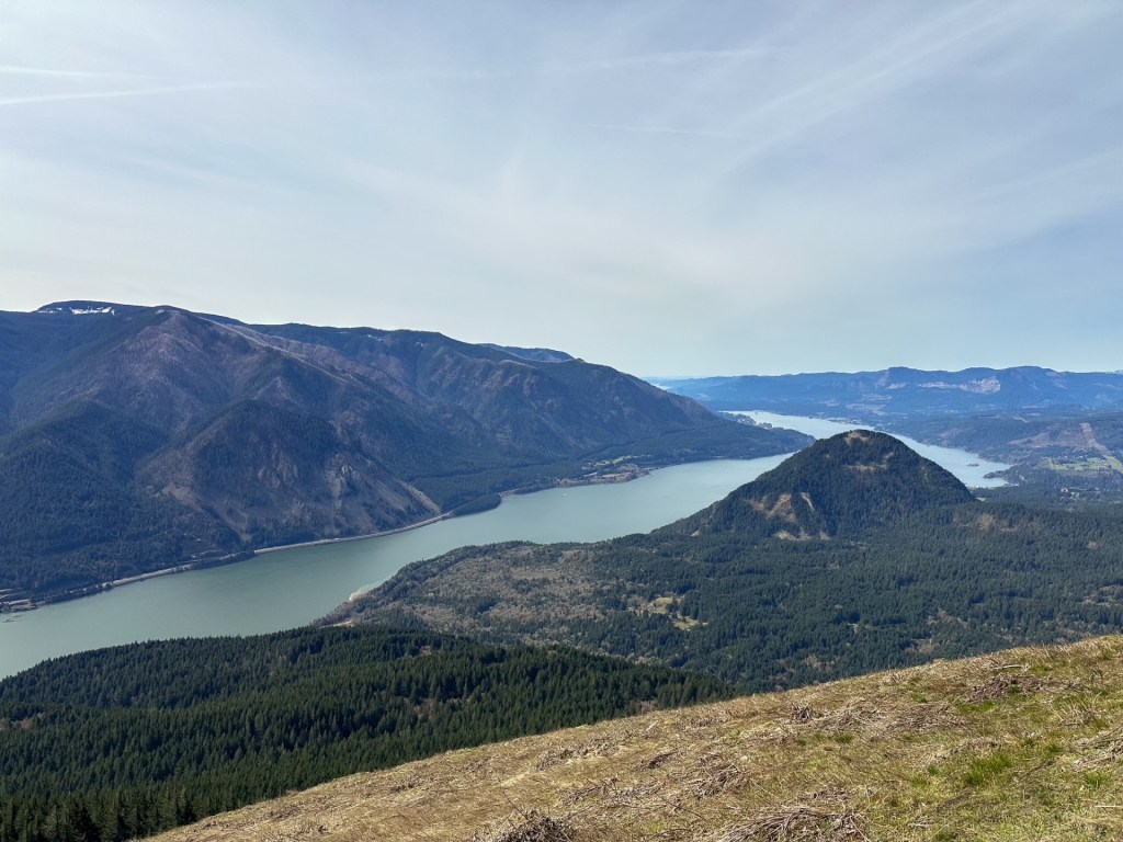
I’d estimate we only walked a mile and a half to get to the platform. The road is signed for NF-407 but it would be easy to miss while driving. The platform used for Crane Point is still there along with the stand for the fire finder. It sits atop a rocky outcropping with views toward Monument Rock Wilderness and Strawberry Mountain Wilderness. We were even able to spot Antelope Mountain L.O. (post) and what we thought to be Table Rock L.O. in the distance. I was surprised to find the fire finder stand was not bolted down to anything and still there. It has a heavy metal base, but people will walk off with anything. The platform itself was still in decent condition minus a few boards that had signs of rot. We were lucky enough to get to enjoy this summit rain free as well. As we started our walk back to the car another storm rolled in and we were once again in a rain cloud. A couple out on their ATV even stopped to ask us if we were doing ok. I always think about how odd it must be to come upon a couple just walking down a random Forest Service road. We told them about the old lookout structure just up the road and continued on. They probably assumed we were lost or broken down initially, especially since we drove a Civic and parked it in a seemingly random spot. I personally have never seen another Civic or equivalent car in the nitty gritty of the forest driving around unless I’ve been at a trailhead.
We made it back to camp relatively early in the afternoon and I decided to take a nap in the tent. My partner chose to wonder down the spur road we were camping on to explore a bit more. Eventually the rain storm turned into a thunderstorm. I read a book in the tent for a while before I decided to check and see if he made it back. He was hiding out from the rain in the car by the time I checked. Neither of us were looking forward to cooking dinner in the rain. We waited in the car until what seemed like a break in the weather. Once we were out and cooking it started raining again. We enjoyed our dinner from the warmth of the car. It obviously wasn’t going to get any drier here, so we decided to pre-pack most things wet for tomorrow morning since we would be moving camps.
History.
Crane Point is listed on the Former Fire Lookout Site, but the platform and fire finder stand are still there. I would consider this an existing fire lookout site since the structure used is still partially there. It is also noted that fire crew’s will still use this area as a vantage point. The site was originally established in the 1930’s. The tent cabin used for the living quarters is no longer there. There is not much information on this lookout but based on older photos it was at least used up until the early 1960’s.
There are a surprising lack of dispersed camp spots off of the main four and two number roads in this area of the Malheur NF. We didn’t have a lot of day light left after visiting Dry Soda L.O. (post) and Frazier Point L.O. (post). Normally, we’d take the time to bump down every little spur that looked like it had potential until we found one that we both liked. We headed towards our next destinations in hopes that there would be a camp close to both. We eventually found one a few miles from the Antelope Mountain access road around 7:30PM and set up camp for the next two nights. After spending all day in a rain cloud, we were surprised that it had seemed to have cleared off for the evening. We were even able to muster up a nice camp fire before passing out. There was more rain in the forecast for tomorrow and we wanted to savor it while we could. My phone alarm abruptly woke us up the next morning at 6AM. I had forgotten to turn if off from the previous morning. We debated going back to bed for a few more hours but there were clear skies outside of our tent that told us to get up. We decided to catch the nice weather while it was here.
I made us a hearty breakfast of eggs, bacon, and potatoes to fuel us for the day ahead. Our plan was to head up to Antelope Mountain and Crane Point (post). We were camped very close to Antelope Mountain and it only took us a few minutes to reach the spur. The most direct route here is NF-14 to NF-1663 to NF-534. NF-534 is located just past the four way junction where NF-14 and NF-1663 meet. There is a sign for Antelope Mountain at the junction that makes it seem like you just need to continue straight on NF-1663 but you will need to turn right on to the first spur. The road up to Antelope Mountain was in great condition up until the last quarter mile. There seemed to be fresh gravel on this road as well. If you are driving a low clearance vehicle, you will want to park just before the fresh gravel ends and walk the remaining distance. There is no gate to stop you from continuing up the road, but the large rocks might.
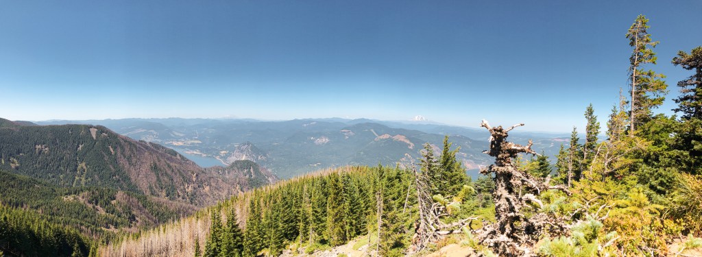
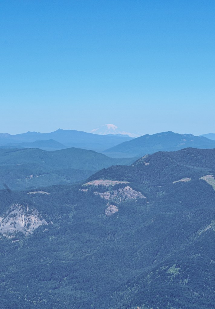
We were surprised to see an SUV driving down the road when were parking to walk. We’ve hardly ever ran into anyone else while visiting fire lookouts unless they are off of a hiking trail or actively staffed. It was also still relatively early in the morning, we were on the summit before 9AM. Besides Steliko Point L.O. (post), where we were physically staying in the lookout, this is probably the earliest we’ve been able to reach a fire lookout. It looked like the Forest Service had been up here recently prepping the lookout for the season. The shutters had been removed and were still on the catwalk. A ladder was also on the catwalk to gain access to the solar panel. Antelope Mountain is quite a ways out there, you can even see the edge of where the forest ends from the summit. We appreciated the nice break in weather that provided some decent views, but didn’t stay too long. We wanted to head on to Crane Point (post) before anymore clouds rolled in for the day.
History.
Antelope Mountain L.O. was first established in 1930 when a 30′ tower and L-4 gable roofed cab. This original lookout was unique in that it didn’t have a catwalk. A 16’x18′ garage was constructed on the summit in 1934. An inspection of this lookout was done in 1966 which found many deficiencies that needed repair or replacement. In 1974, the Forest Service put out a bid for work to move the lookout structure from Lake Butte to Antelope Mountain and remove the existing. The lookout on Lake Butte was a 16’x16′ R-6 flat top cab with catwalk and 31′ tower. The work was awarded to the Emert Industrial Corp from Clackamas, OR. They were able to complete this work in the fall of 1974 by loading the tower on a lowboy and the house on a flatbed truck. They used an 80′ boom truck to lift the house back on the tower once they reached Antelope Mountain. The pictures from relocations are some of my favorites from the archives online. Nothing looks quite as out of place as a fully intact lookout cab on the back of a small truck. Antelope Mountain continues to be staffed every summer due to it being one of the most southern lookouts in the Malheur NF that covers the driest portions of the district.
Memorial weekend we set out with a plan. We’ve decided to focus on fire lookouts listed for decommission by the Forest Service. Our original plan was to see 6 fire lookouts over 5 days within the Malheur NF and Umatilla NF. It eventually evolved into 7 fire lookouts and ended with 8 total visited. As my partner likes to quote Elwood from The Blues Brothers: “We’re on a mission from God”. Despite neither of us being religious, we do feel a strong drive to see them while they are still standing. Each year the fire season poses a threat to these historic structures as large wildfires become more common and dangerous. The irony is not lost on me that they’ve played a role in the fire suppression that has helped lead to our current situation. But that is a topic for another post.
Our long weekend started on Friday, we woke up at 6AM and began our drive out to the Malheur NF. Our goal for the first day was Dry Soda and Frazier Point (post) before setting up camp. Dry Soda is not on the list of fire lookouts for decommission, but it was on our way. Other trip reports mentioned the roads getting there were drivable to any vehicle. It’s one of the many aspects of the Malheur NF that I love. They always seem to have well maintained gravel roads, even the 3 number spurs, and are usually well signed. From HWY-395, you will turn onto CR-65. This county road turns into NF-15 once you have entered the forest. You will stay on this road until you reach the Wickiup Campground off to the right. You will turn right on this road and head up NF-1516 past the campground. This road will take you to a major four way junction where you will want to take another right on to NF-3925. The lookout is gated behind a short spur off of this major Forest Service road. We had no issues driving here in my Civic which added it to the short list of lookouts I’ve been able to drive all the way to.
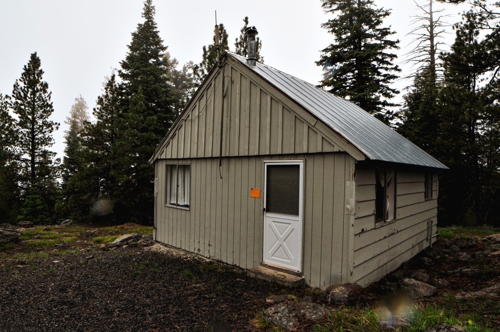
Dry Soda is an active lookout, but it was still too early in the season for the lookout attendant to be there. Especially with this years late season snow and rain. While we were there, the rain clouds started to roll in for the weekend. I made a joke that we weren’t on Dry Soda anymore and that it should be called Wet Soda instead. We would continue to battle with this storm all weekend. We rejoiced on how easy it was to get here and hoped Frazier Point (post) would be similar as we headed back down to NF-15.
History.
The lookout on Dry Soda was built in 1941 as a 14’x14′ L-4 cab with treated timber tower. A few sources listed the tower height as 50′ and other sources listed it as 60′, but I’m unsure which of these sources are the most accurate. There is also a shed and pit toilet on the summit. The structure almost burned in the 2015 Canyon Creek Fire. You can see signs of how close the burn got on your drive up. It continues to be staffed every summer.
We headed deeper into the forest on NF-15 after a successful visit to Dry Soda L.O. (post) You will stay on NF-15 until you reach the major junction with NF-16. Take a left on to NF-16 and then eventually a right on to NF-1630 that is only a short drive from the junction. NF-1630 is another well maintained gravel road with no hazards for low clearance vehicles. Good gravel, great gravel even! It’s better than some paved roads in Portland. The gravel looked very fresh and we speculated that it was possibly recently re-graded. You will stay on this road for a while until you reach the spur NF-849. It will be hard to miss because there is a sign for Frazier Point L.O. It is only another mile down NF-849. Most cars can make it the majority of the way on this spur. We decided to stop less than half of a mile from the lookout and walk due to some larger rocks in the road and wet conditions.
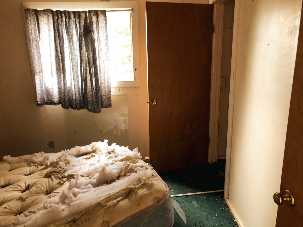
The lookout and living quarters are not in the best condition and the stairs have been boarded to prevent people from climbing the tower. The trees are tall here so you don’t get any views from the ground. This was fine considering we were socked in a rain cloud anyway. The cabin used for living quarters was unlocked and still had some items left inside; a table, bed frame, mattress, pot holders, and even a pan. I wanted to check out more in the bedroom but there seemed to be a nest of wood rats cozied up in the old mattress and some of the kitchen cabinets too. My partner hates rats and rodents of any kind, so he decided not to come inside the cabin. We said our good byes to the lookout before heading out to find a camp spot. Since it is listed for decommission by the Forest Service, we are never sure if we’ll be back before they tear it down. I’m always hopeful someone with more resources and money can restore or relocate these lookouts instead of having them torn down. And maybe one day I’ll be one of those people.
History.
The existing lookout on Frazier Point was built in 1936 as a 100′ ring connected treater timber tower with 7’x7′ L-6 cab. It is accompanied by a 20’x20′ ground cabin, built in 1938, that used to be the garage. It was converted to the living quarters in the 1970’s when the original 14’x16′ cabin burned down. This tall tower has a collection of interesting stories in the book Fire Lookouts of the Northwest. It seems the height of the lookout had negative effects on a few of the attendants that have staffed it over the years. One of the more notable stories is of an unfortunate accident where a 4-year-old boy fell from one of the landings and died. This story is believed to be the reason why the Forest Service adds screens to the stairs and landings on every lookout. The site was originally established in the early 1930s as an emergency lookout post. They used a rocky point 1/2 mile from the current lookout site. It was actively staffed every season up until 2008. As of July 2019, the structure has been listed as condemned and is slated to be removed by the Forest Service.
In the prime of fire suppression, Oregon had over 800 fire lookouts and Washington had around 750 topped on almost every high peak within both states. Many were dismantled, destroyed, or burned down in a blaze of glory. But remains of the foundation can usually be found on the summits as a reminder to what once stood. Below lists 3 popular hikes close to Portland, OR that have a history in fire detection and lookouts.
Saddle Mountain
Former Fire Lookout Site Register: US 723; OR 134
Location.
Saddle Mountain State Natural Area
Estimated drive time from Portland, OR.
1-1/2 hours
Mileage.
5.2 miles RT
Elevation.
3,283′
The top of Saddle Mountain offers expansive views from the Pacific Ocean all the way to Mt Hood. It is no question why they would want to have a lookout on this summit. The trail switchbacks through an old growth forest until you reach the last push up the rocky slope. Parts of the trail are covered in mesh wiring to help with erosion and traction. It is a steep 1,640′ gain in elevation over 2.5 miles to the summit. Saddle Mountain was established as a fire camp in 1913 with a log cabin situated below the summit. In 1920, a frame cabin with observation platform was built. It was replaced in 1953 by a 2-story live-in cabin. The lookout structure was destroyed in 1966. I have been on this summit a few different times but didn’t take the time to look for any remnants of foundation.
Former Fire Lookout Site Register: US 1313; WA 213
Location.
Gifford Pinchot National Forest – Columbia River Gorge
Estimated drive time from Portland, OR.
1-1/2 hours
Mileage.
6.5 miles RT
Elevation.
2,480′
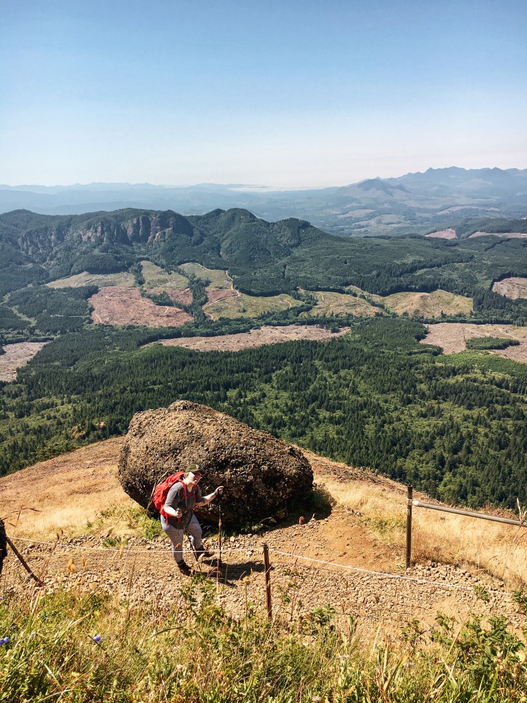
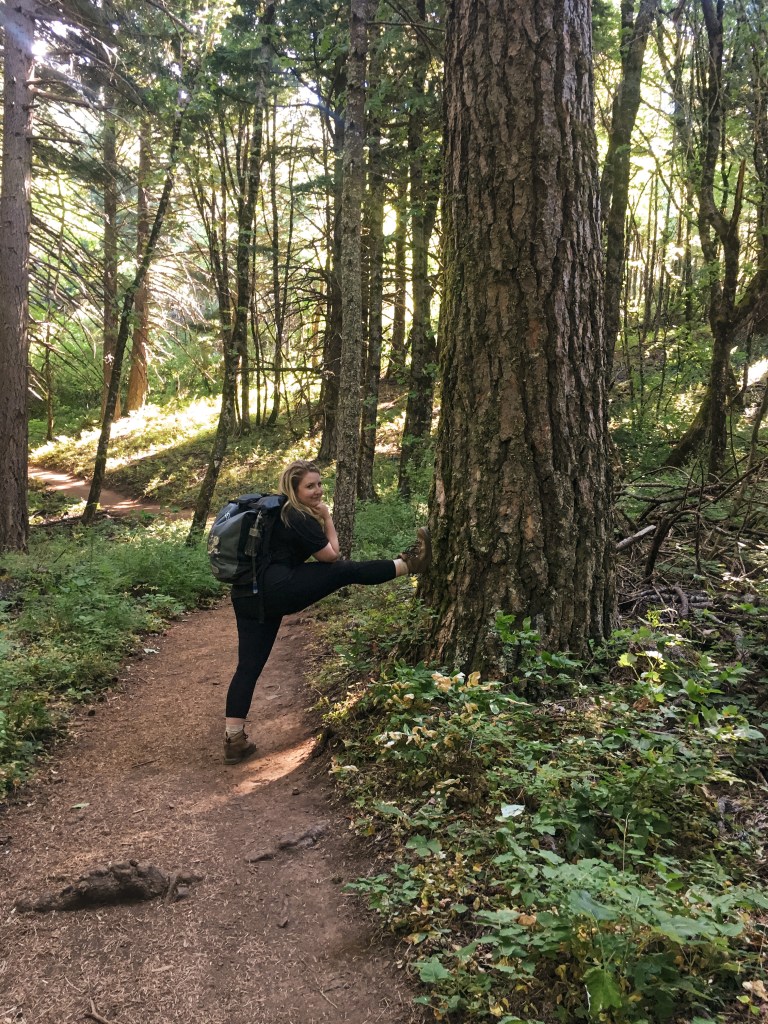
Stretching my calves on the way up
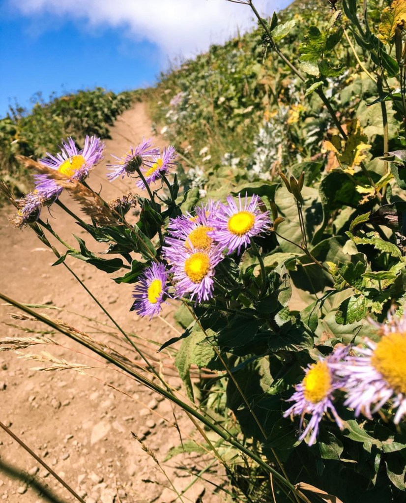
wildflowers on the trail!
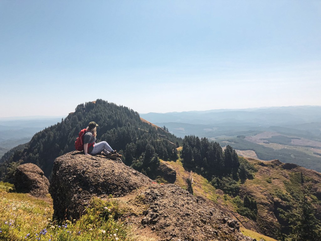
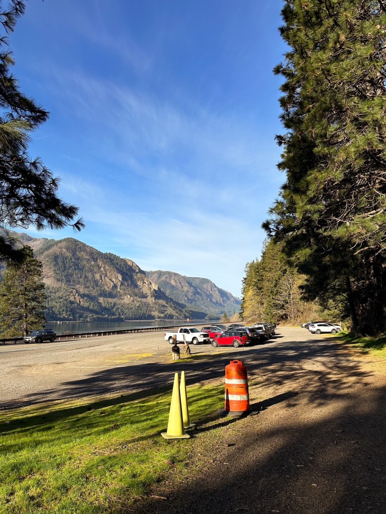
Near the summit where we turned around
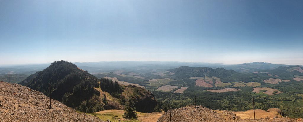
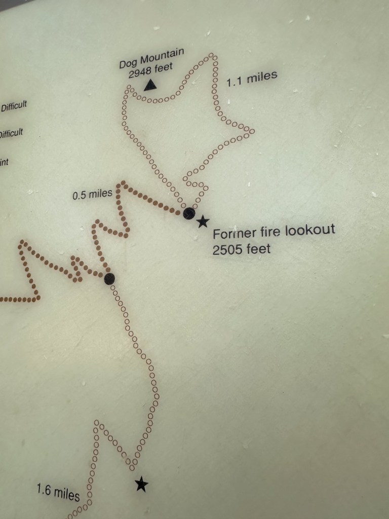
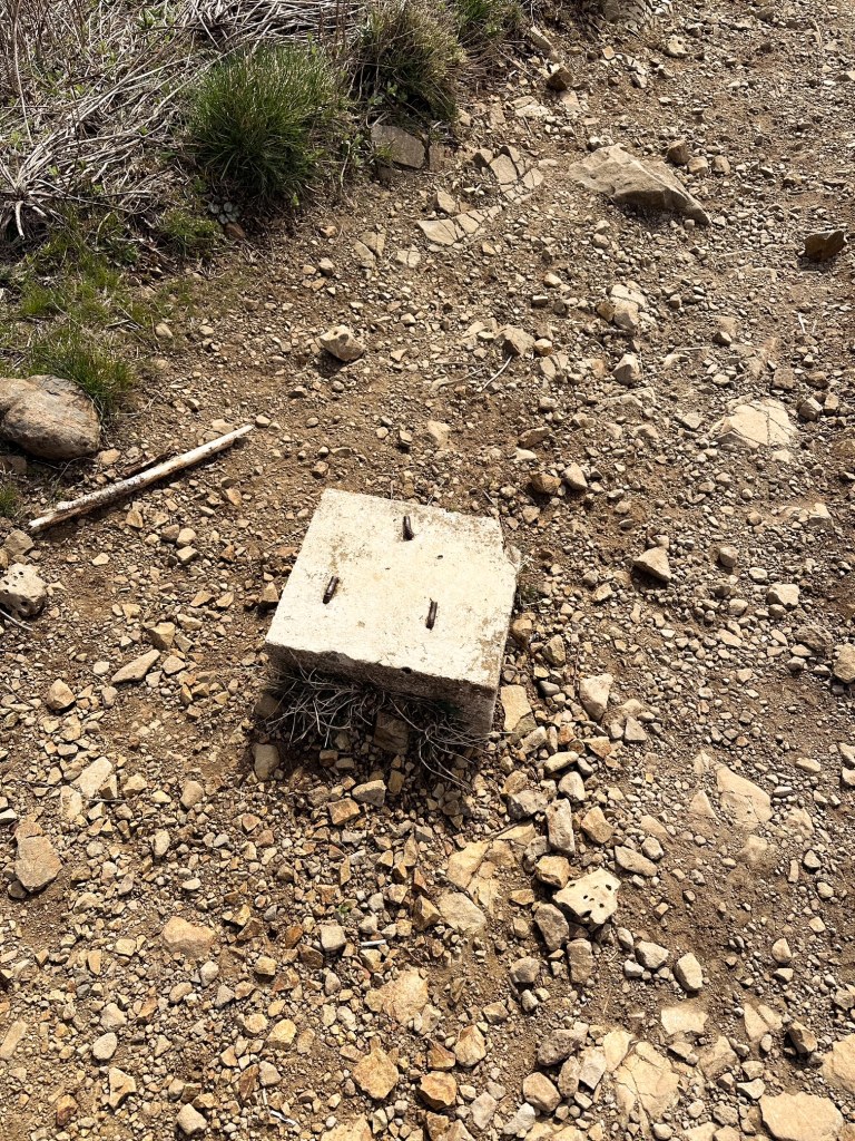
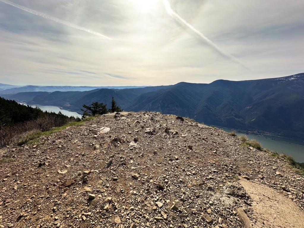
Dog Mountain is a very popular hike in the Columbia River Gorge due to its proximity to town and being right off of HWY-14. In the spring, between March 31st and July 1st, permits are required to hike this trail on the weekends. This is due to the hazardous conditions created for the cars on the highway by the overflow of people during wildflower season. There are a few different routes and loops that can be done to reach the summit once at the trailhead. My friend and I completed this hike on a hot July day before the permit system was in place. We arrived to the trailhead early to give us enough time to reach the summit and attempt to beat the crowds. We took the “less difficult” route which is the newer trail and offers more views on your steep climb up. We made it just past the former fire lookout site, also known as the Puppy Dog Lookout site, before turning around. I vaguely remember there still being some foundation there. The trail originally was developed to service this fire lookout that was destroyed in 1967. The original lookout was constructed in 1931 as a gable-roofed L-4 cab with windows only on three sides. It was replaced in 1953 by a standard L-4 cab. Both structures were located 1/4 mile from the actual summit of Dog Mountain. I used to have more pictures from this hike, even one of us standing on the former lookout site, but they have been lost in multiple phone transitions since 2017.
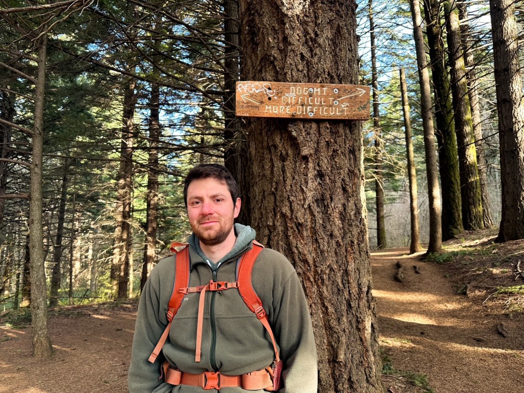
Update 03/22/2026: I finally decided to make a return trip to Dog Mountain with my partner who had never been. We went prior to the permit season, which helped curb the crowds and offered better temperatures than my previous visit in July. The hike was still a butt burner, but not as difficult as I remembered it. We opted to take the “more difficult” (most difficult) side up and come down the “difficult” (more difficult) side, depending on which sign you are referencing. I also made it to the official summit this time instead of just below it and looped around the back side as well. Aside from the summit it felt like we had the trail mostly to ourselves and only passed a handful of people despite a mostly full parking lot. My knees were definitely sore afterwards! Strava calculated this at 6.57 miles RT with 3,047′ of elevation gain.
Mt. Defiance is one of the more brutal hikes I’ve done. It is the highest peak in the Columbia River Gorge and offers views out towards Mt Hood NF as well. This made it the perfect candidate for a fire lookout site. I recommend starting this hike early if you want to make it to the summit and back before dark. Or at least hike a lot faster than I do. We didn’t start this hike until mid-morning and ended up getting back to the car after dark. The hike starts out paved and passes some pretty waterfalls. Once you have reached the junction with the un-paved trail you will start to go up and continue to go up the rest of the way. There are still some communication buildings on the summit and I’m sure there are foundation remnants if you spend some time looking for them. We didn’t spend much time here since it took me so long to get there. The trail had recently re-opened after the Eagle Creek Fire in 2017. The ashy portions of the trail made for un-stable ground and was hard for me on the hike down. By the time I got back to the car my feet felt like they were going to fall off completely. The first fire lookout on this site was a crow’s nest and tent in 1925. A more substantial structure was built in 1934 as a 40′ pole tower with L-4 cab. This was eventually replaced by a 41′ treated timber tower with L-4 cab in 1952. In 1959, the lookout was destroyed by a windstorm. The Forest Service didn’t build a replacement lookout until 1962 which was a R-6 flat top cab and 41′ treated timber tower. It was completely removed from the summit in 1971.
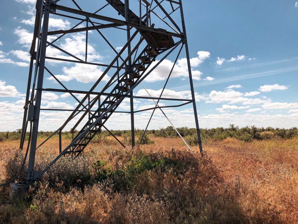
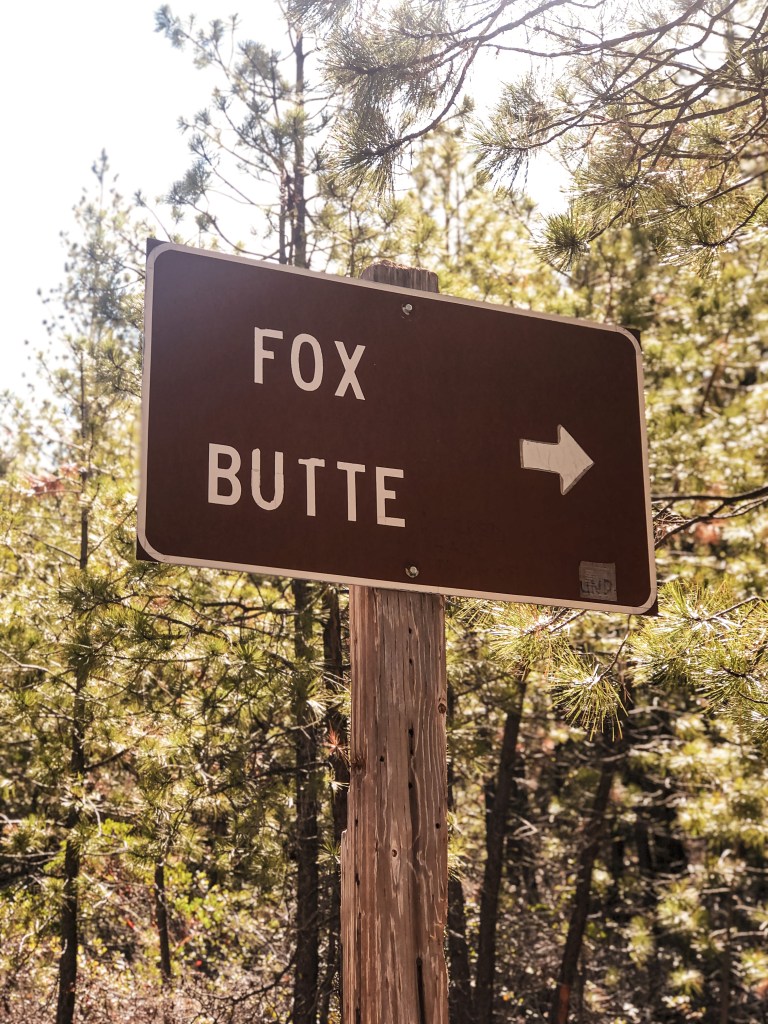
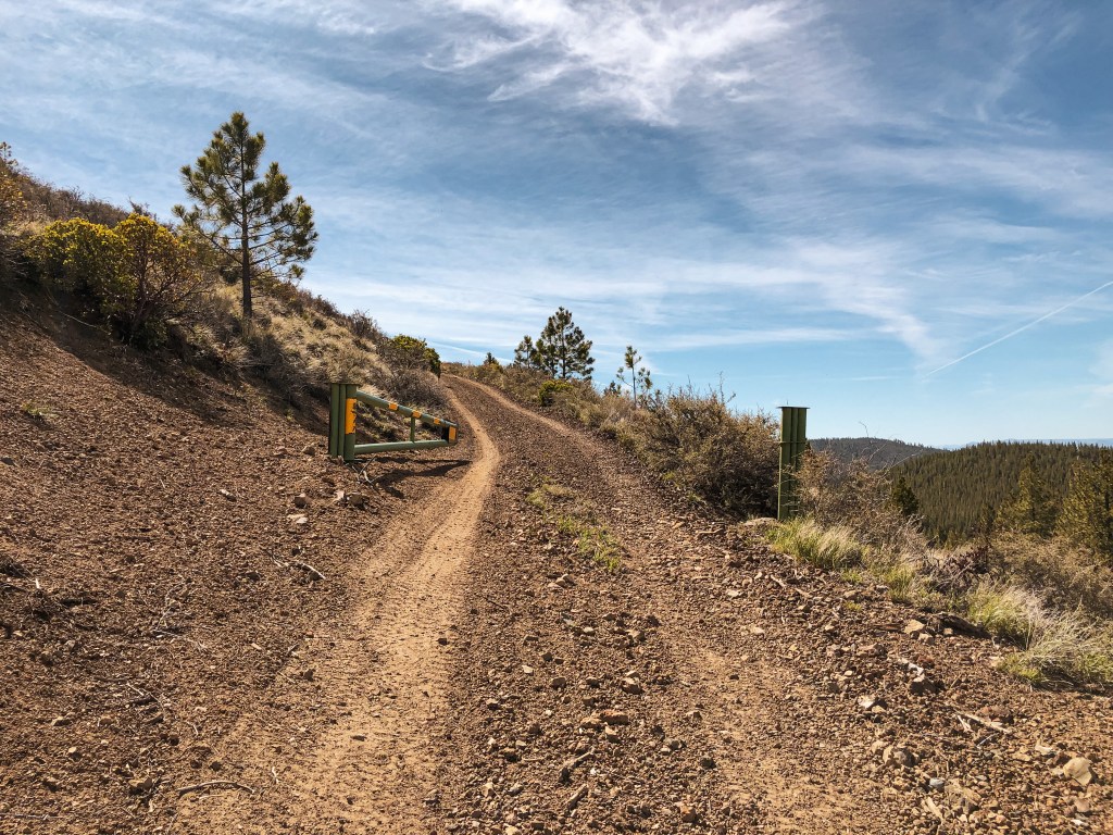
Sunday was our last full day of the trip. Our only set plan was to attempt to locate the Pumice Springs crows nest. I was given the choice to add on East Butte (post) or Fox Butte since my partner had already been to both last year. I decided Fox Butte made the most sense since it was closer to our camp and recently slated for decommission. My partner’s dad decided to hang back at camp instead. After breakfast and packing a lunch, we headed out on NF-23 to NF-550. It didn’t take us very long to get there from camp. There are three water bars along NF-550 that will need caution if you are in a lower clearance vehicle. We obviously had no issues in the truck and parked at the signed junction for Fox Butte. There is a locked gate up the road that doesn’t have a pull out or turn around spot. We were well aware of this gate beforehand and didn’t attempt to drive up. The lookout is about a mile or so road walk from this junction. As we headed up the road, we were surprised to find the gate was actually open. I speculated that maybe the Forest Service was on top of their plan for once and had already torn down the lookout. Luckily, I was wrong and someone had just cut the lock. We made sure to close the gate on our way out in hopes to deter at least some vandals. The weather was clear and it felt like summer as we hiked the road. Once on the summit we checked out the L-4 ground cabin that had seen better days and climbed part of the Aermotor tower. My partner climbed all the way to the top, but I stopped on the second landing. It seems to still be in somewhat decent shape, but be wary to climb at your own risk. We spent some extended time on the summit since this would most likely be our last time up here before it’s gone.
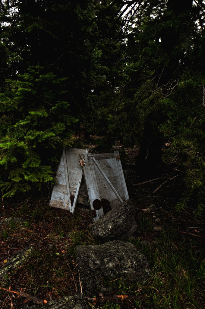
After hiking back down to the truck, we headed out on NF-23 towards Sand Springs Campground. We were following directions based on a Geocache that was supposed to take us to the area of the crows nest. We turned left at the four way junction near Sand Springs Campground than right on to NF-900. The cache and crows nest were supposed to be right off the NF-900 road according to the coordinates. We wondered around the area for 2 hours trying to find the tree but all existing pines looked too young to host a crows nest. It was definitely not down this road. Another source had mentioned it was located half way between Pumice Springs and Sand Springs. We drove out towards Pumice Springs and kept an eye out for significantly taller trees in the area. I assume it is probably farther off the road than the eye can see but we didn’t have the hours to spend hiking off of every road in the area. We were unsuccessful in our attempt which was disappointing. This just means another trip to the area is in our future.
History.
Fox Butte started as a lookout site in 1919 when a heliograph was set up on the west point. A year later, in 1920, they ran a telephone line to the butte from the Cabin Lake Ranger Station. A standard D-6 cupola was built on the western summit in 1924. The lookout was later destroyed by the Fox Butte Fire in 1926 that burned over 15,000 acres of timber. They started to rebuild a new lookout tower the following year. This was noted as a pole tower with ground cabin for living quarters. In 1933, they started construction on the eastern summit of the existing 80′ steel Aermotor tower. The living quarters from the western summit were moved to the eastern summit for use with the new tower. A 16×18 wood frame garage was added in 1934. The living quarters were eventually replaced with the L-4 ground house moved from Sixteen Butte in 1948. There is record of it being consistently staffed up until the late 1950s. It could have been used for longer but I wasn’t able to find a definitive date on when it was abandoned. The Forest Service briefly used the lookout for a season in 1995 while the East Butte L.O. was being reconstructed. It is now apart of their proposed plan to be removed.