Bunker Hill L.O.

Oregon Lookouts

Location.

Coos Bay, OR

Status.

Interpretive site; Currently standing

Estimated drive time from Portland, OR.

4 hours

Date visited.

December 31, 2021

Elevation.

240′

National Historic Lookout Register.

Yes

Trip Report.

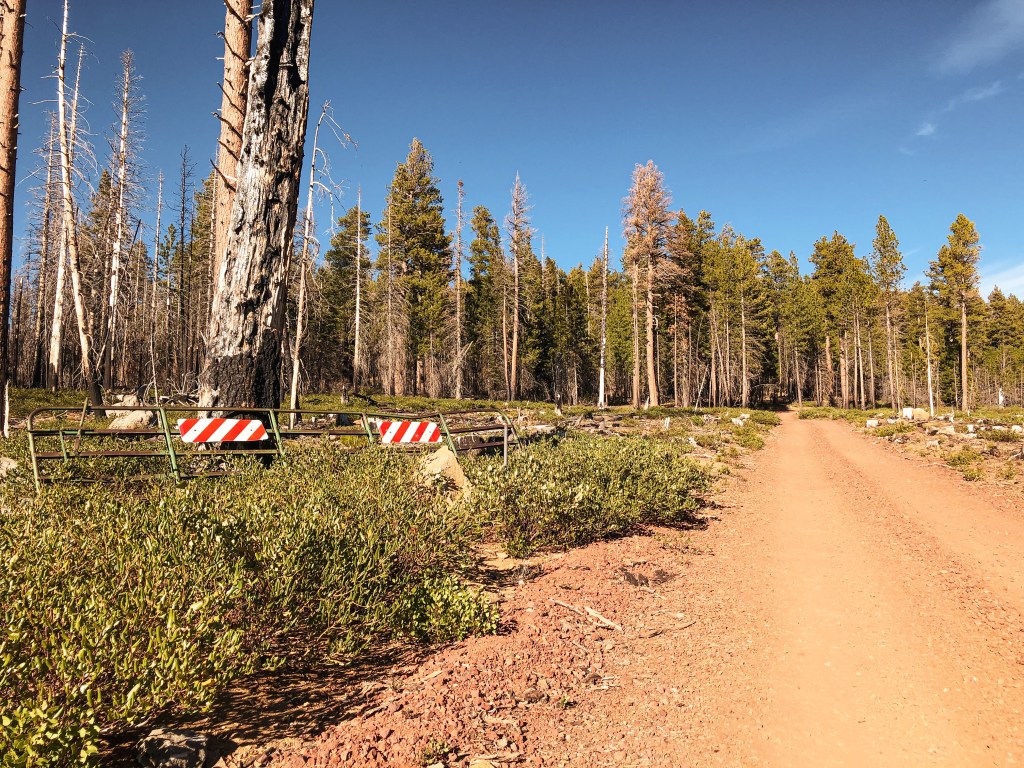
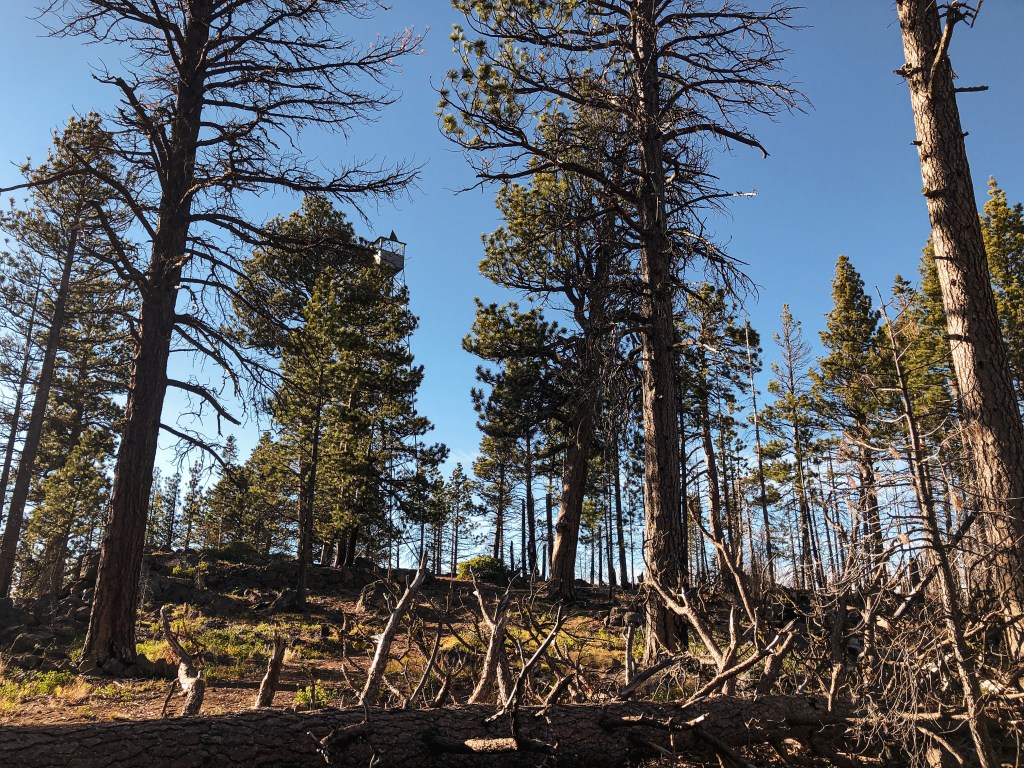
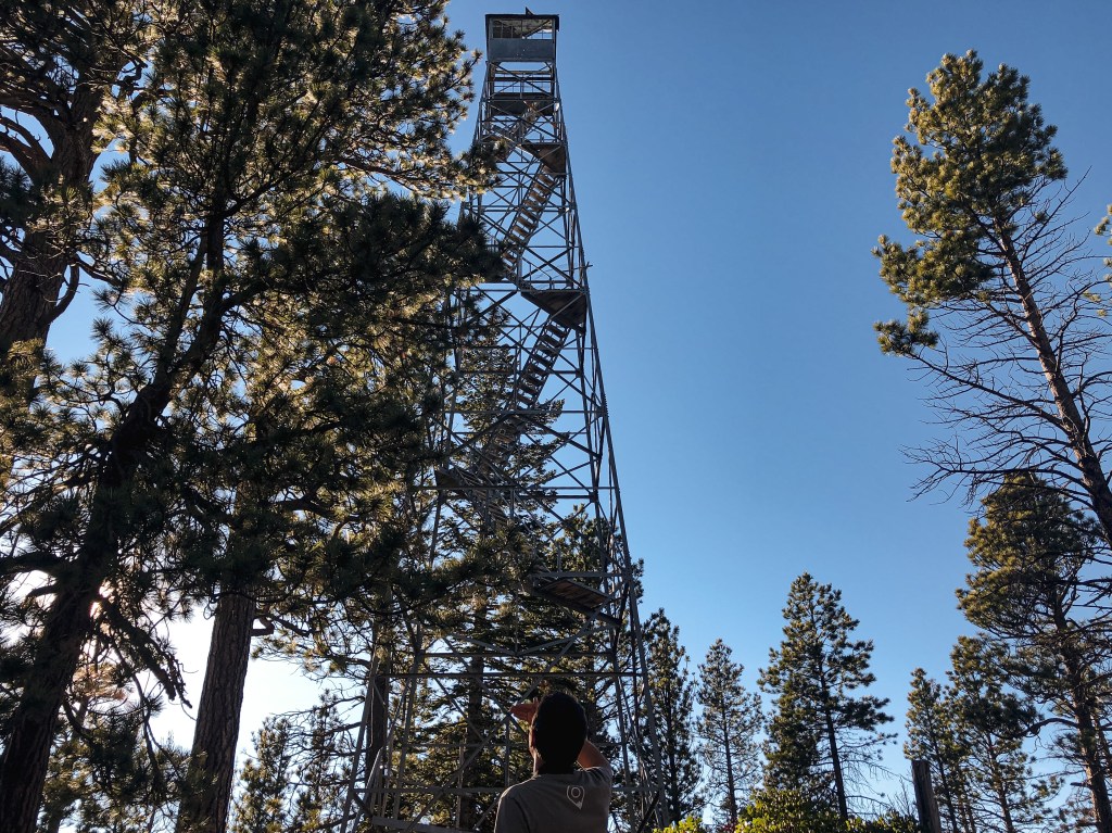
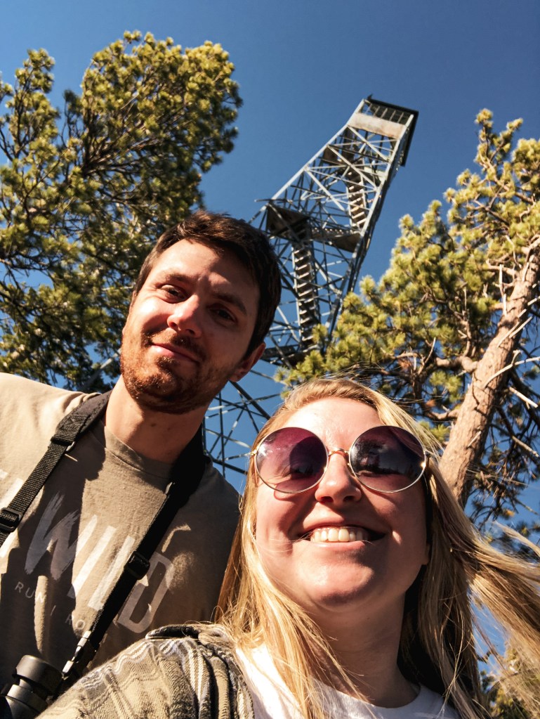
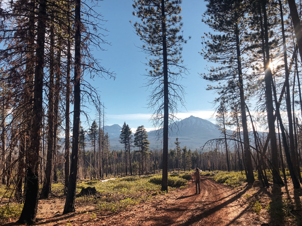
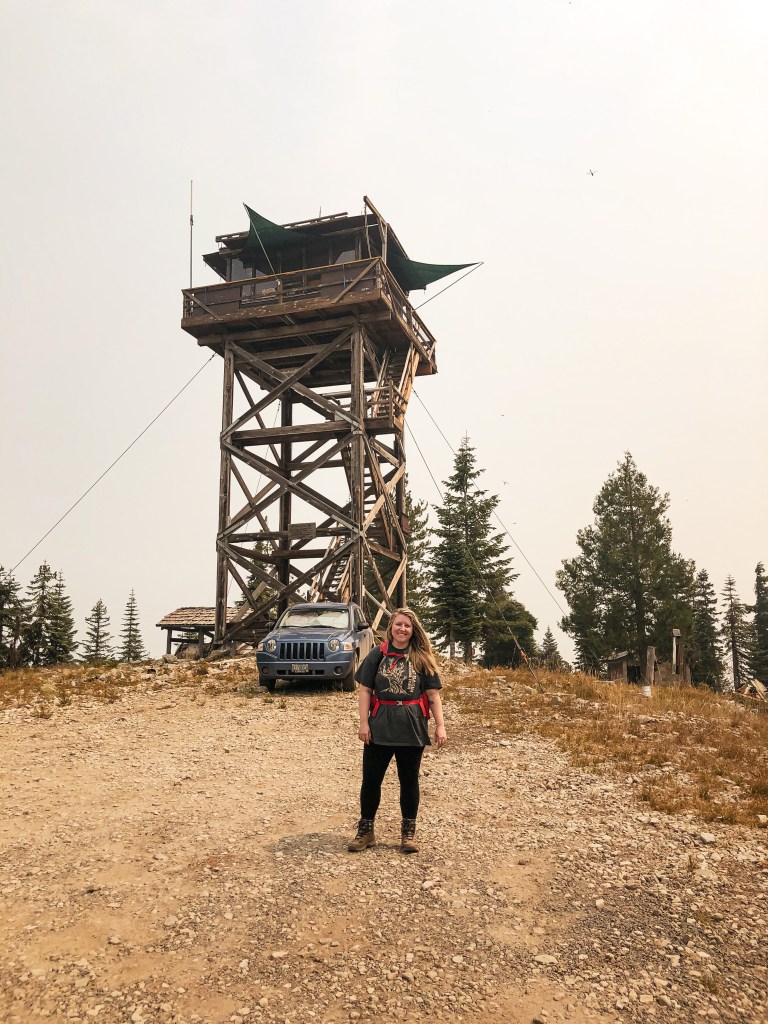
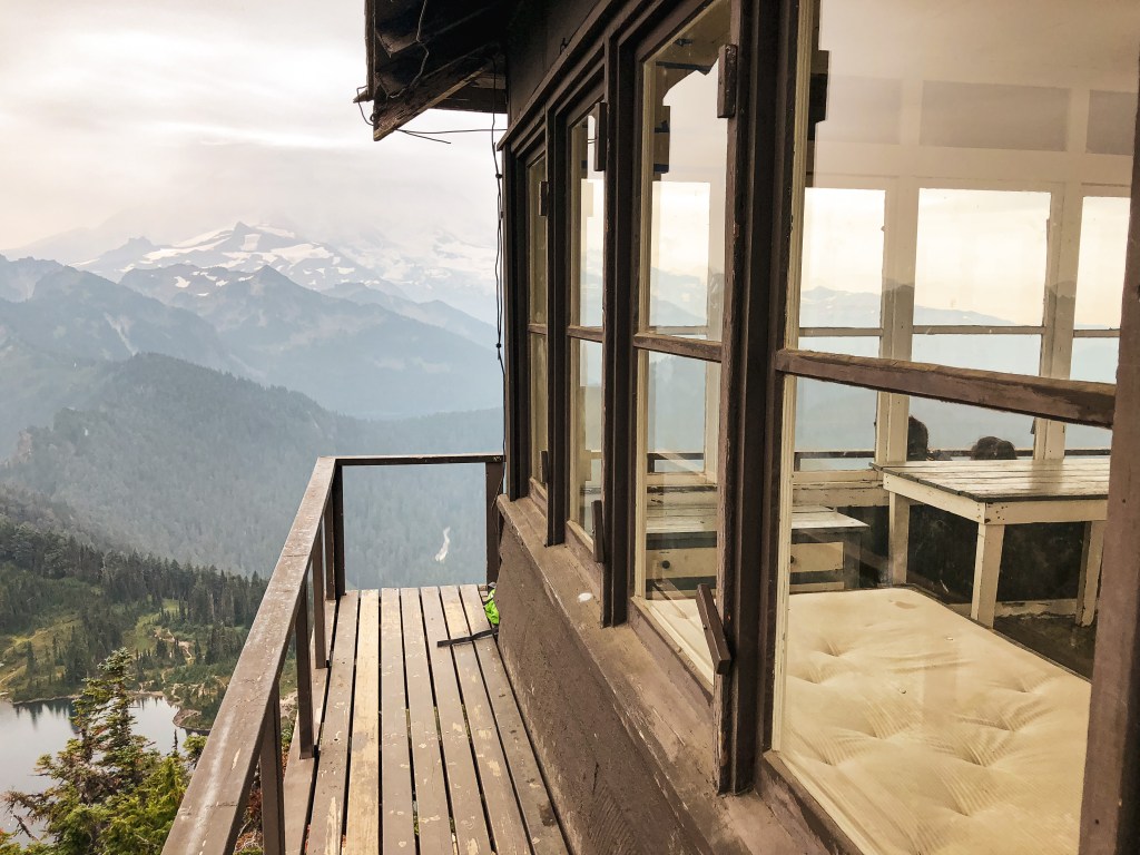
My partner and I decided to book a rental in Reedsport for the New Year and our 3-year anniversary. We chose Reedsport for it’s proximity to two lookouts along the coast. We figured we could end and start the year doing what we enjoyed most. We headed to Bunker Hill L.O. since we had some time to kill before checking into our rental. This will be our last lookout visit for the year! It’s located in the coastal town of Coos Bay at the Oregon Department of Forestry building. We were able to find it by following signs to the ODF building from HWY-101. Heading south on HWY-101 you will turn right on to Flanagan Road. You will stay on Flanagan Road until you reach Lookout Lane. Turn Left on to Lookout Lane. If you end up driving past Lookout Lane you can still get there by turning left on to Bay Park Lane and then another left on Fifth Road. The junction of Bay Park Lane and Fifth Road has an ODF sign. The buildings were closed for the holiday but we were still able to access the grounds and view the lookout from the parking lot. There is marked visitor parking just past the gate.

History.

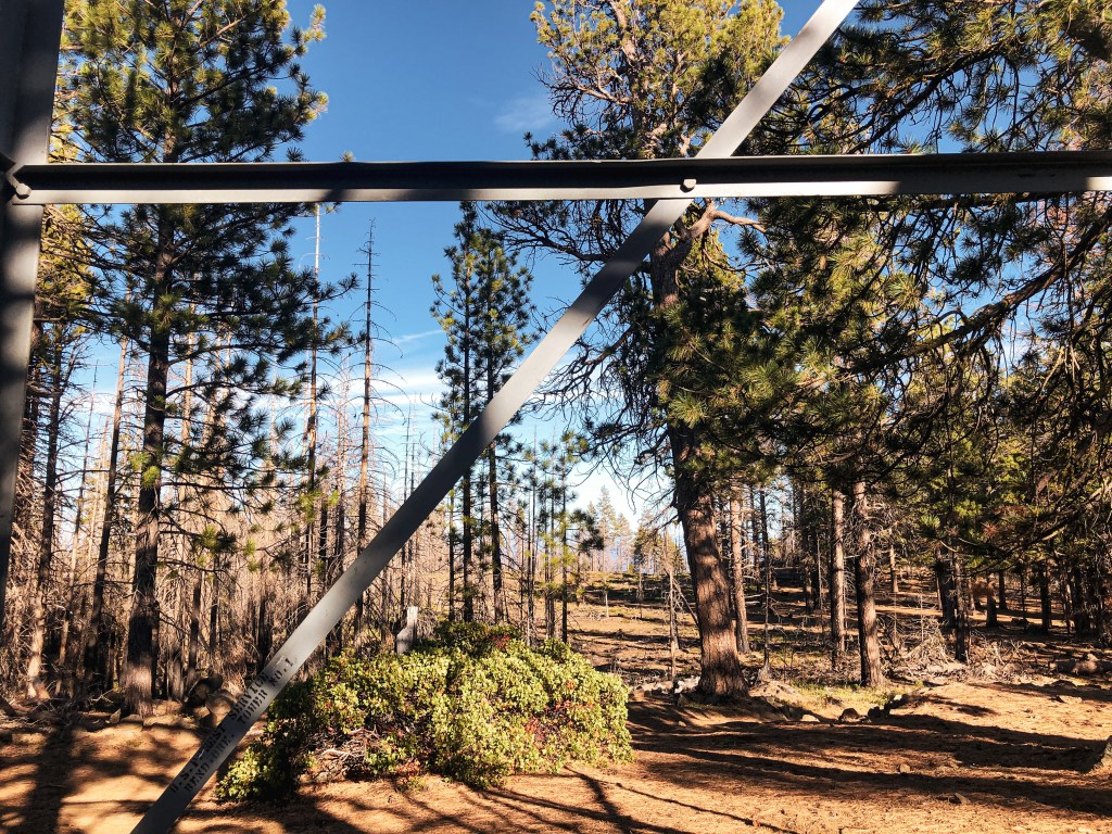
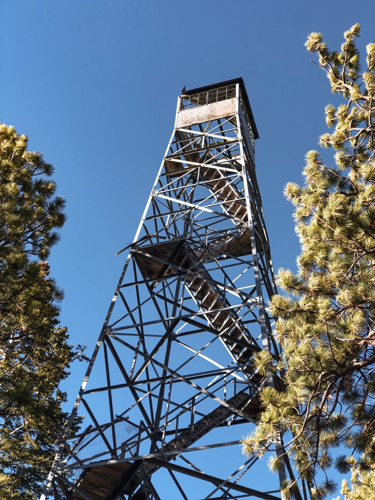
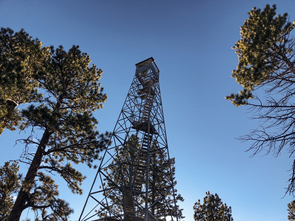
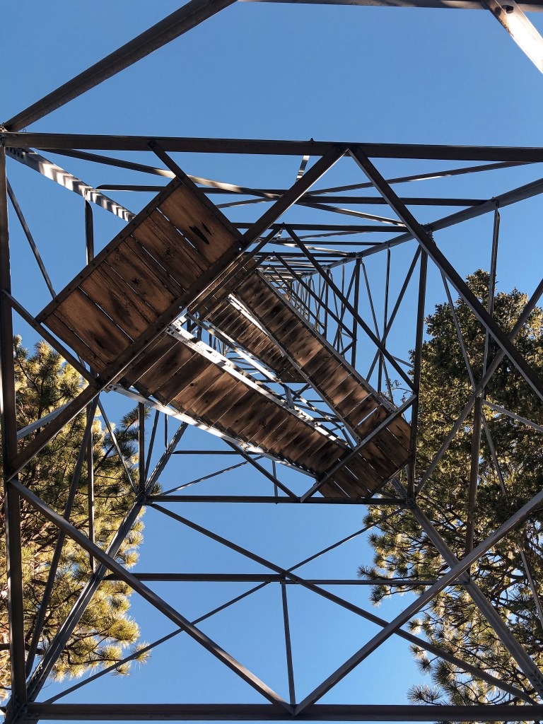
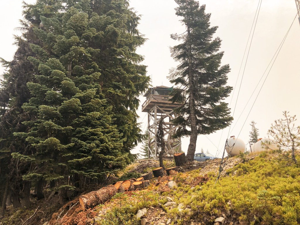
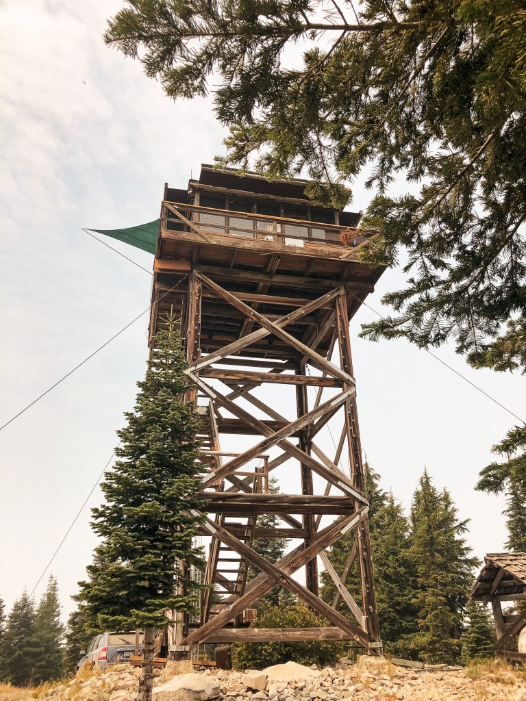
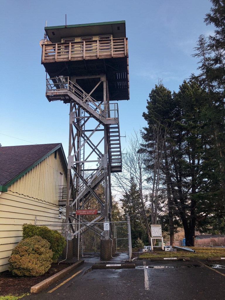
In 1937, a combination lookout and water tower were built for the ODF by the CCC of Camp Walker. A 7’x7′ lookout cab was built atop a 3,000 gallon 52′ water tank. This lookout tower was used by the Coos Fire Patrol until the 1950’s. It was also used briefly for air raid spotting during the war, but it was found that most spotting had been done from the ground. The combined lookout and water tower was dismantled in 1965. It wasn’t until 1996 that they decided to build a new lookout tower on Bunker Hill for training. The existing 12’x12′ lookout sits atop a 40′ steel tower next to the district headquarters. The steel tower used was donated by the U.S. Coast Guard. It is currently an interpretive site for visitors and listed on the National Historic Lookout Register. it’s labeled as the Coos Bay Lookout on the tower itself.

Bonus: We visited the Umpqua Lighthouse State Park to check out the lighthouse before heading to Bunker Hill L.O. It is ran by the U.S. Coast Guard and tours are offered through the museum. While parked we spotted another structure closer to the ocean that resembled a lookout. I’m sure it’s used by the U.S. Coast Guard for some sort of training but the base looked almost identical to Bunker Hill L.O.

Trout Creek Butte L.O.

Oregon Lookouts

Location.

Deschutes National Forest

Status.

Abandoned; Currently standing

Estimated drive time from Portland, OR.

3-1/2 hours

Date visited.

October 9, 2021

Elevation.

5,546′

National Historic Lookout Register.

Yes

Trip Report.

My partner and I decided to make a quick one-night trip down to the Deschutes National Forest area for the weekend. We wanted to try and see Henkle Butte, Trout Creek Butte, and Lava Butte lookouts. Trout Creek Butte L.O. is an easy drive outside of Sisters. To get there you will take the Mackenzie HWY-242 to signed NF-15. NF-15 starts out paved and eventually turns to well-maintained gravel. After 5 miles it will fork to become NF-1524 and NF-1522. You will keep right to stay on NF-1524. Eventually it will fork again with NF-1524 continuing to the left and NF-1018 to the right. You will stay right at this junction as well. Continue on NF-1018 until you find spur NF-800 on the right. It is a pretty notable road since it is still red rock instead of fresh gravel. FS-800 will take you the remaining way to the summit. All roads were in decent condition and are manageable in a passenger vehicle. There are a few bumps on NF-800 but you’ll make it with caution. We decided not to drive to the summit and parked in a pull out near the old gate. The gate is still there but no longer blocks the road. It’s about a 1/2 mile to the summit from this point in the road. Walking up the road to the summit, we became worried that the tower might have fallen or already been removed. The area was burned in the 2017 Milli Fire but there are still a lot of tall trees on the summit obscuring the view. We weren’t able to see the tower until we were almost to the base of it. It was like playing Where’s Waldo? with a lookout. Scroll down if you want to try and spot it in my pictures. The first three levels of stairs are removed due to safety concerns and to help deter vandalism. The tower is in terrible condition. The cab on top is missing its floor, window glass, and part of the roof. Although there is not much of a view from the summit, the views from the road before the summit are worth the stop alone. We drove back down NF-800 to the junction with NF-1018. Instead of heading back out the way we came, we turned to take NF-1018 in the other direction. If you stay on NF-1018, it will eventually take you all the way back to HWY-242. But it will pass Whispering Pine C.G. beforehand. We were running out of day light so we decided to camp there for the night.

History.

This 75′ steel Aermotor tower with 7×7 cab is the original built by the CCC in 1933. Some sources note this as a 86′ tower instead, but I believe this is counting the concrete poured for the tower. The tower was last used for emergencies up until the 1970s. There used to be a T-1E 16×18 garage and 14×16 wood living cabin on the summit as well. Both were built a year after the tower in 1934, but I couldn’t confirm any information on what happened to these structures. The outhouse was relocated to Sand Mountain L.O. as part of a restoration project in 1992. The tower is the only remaining structure on the summit and is slated to be decommissioned by the Deschutes NF.

Can you spot the lookout?

Pull the slider to the left to see where the lookout is located in the below pictures.

Rustler Peak L.O.

Oregon Lookouts

Location.

Rogue River-Siskiyou National Forest

Status.

Active; Currently standing

Estimated drive time from Portland, OR.

5-1/2 hours

Date visited.

August 14, 2021

Elevation.

6,208′

National Historic Lookout Register.

Yes

Trip Report.

My partner and I took a long weekend to visit this area of Oregon. Our plan was to see Rustler Peak, Halls Point and White Point lookouts while camping in the area. There were a few other points of interest that we could check out as well if we had time. We were pretty close to the Devil’s Knob Complex fire and the area was socked in with smoke. I don’t recommend camping that close to an active wildfire. Even though we weren’t close enough to assume any risk, the air quality was at unhealthy levels. We thought about switching up our plans to avoid the smoke but most of Oregon and Washington were smoked out depending on how the wind was blowing that day. We decided to visit Rustler Peak L.O. first. We were driving down FS-37 from the north, and there appeared to be multiple roads leading up to Rustler Peak L.O. We decided to check out the route starting from Parker Meadows Campground since it was before the other road junction and looked to be a shorter route. Parker Meadows is noted as a campground on the map but it looks like it has since been decommissioned. There were no vault toilets or picnic tables. There were camp spots but they looked more like dispersed camp spots with rock fire rings. One of the camp spots had a snow shelter but there were no other notable structures. We headed down FS-661 only to quickly realize this was not a drivable road for my Civic. We walked up the road a bit to see if it improved at all and debated whether we should road walk up this way or attempt the other road. After consulting our map I noticed that FS-640 led all the way up to the lookout and was most likely the main route to get there. We exited Parker Meadows C.G. and continued on FS-37 until we met up with FS-640. You could tell this was a well used route and the road looked like it was in great condition. We headed up this road and only encountered a few bumps along the way. It was one of the easiest Forest Service roads I’ve driven in my Civic to get to a lookout. The last mile to the lookout is a gated road. We parked my car in a pullout before the gate and started walking. It’s a relatively easy road walk from the gate to the summit. Because this is an actively staffed fire lookout, we were hopeful we’d get to meet the lookout attendant since they were noted as being friendly on another trip report. Unfortunately they were either busy working or didn’t feel like socializing that day and we were unable to check out the cab. Always make sure to be respectful of the lookout attendant’s space and only climb the tower if you’ve been invited up. There wouldn’t have been much to look at from the catwalk anyway since the summit was shrouded in smoke. Even on the hike up we had a hard time making out the peaks only a few miles away. We enjoyed lunch on the summit’s picnic table before hiking back down.

History.

Rustler Peak has been noted as an active fire lookout site since 1913. I’m not sure what kind of structure was used for the fire lookout back then. In 1917, they built a cupola cabin on top of a 18′ steel tower. Maintenance on the lookout was performed by the South Fork CCC camp throughout the years. They even helped build the current lookout, which was erected in 1948. It is a 31′ 6″ tower with an L-4 cab. I couldn’t find any information on what happened to the previous lookout but it wasn’t on the summit when we visited. I can only assume it was moved or disassembled. They had contractors add a modern vault toilet to the summit in 2006. This lookout has been staffed every fire season and will continue to be for many more.

Black Butte L.O. (Deschutes NF)

Oregon Lookouts

Location.

Deschutes National Forest

Status.

Active; Currently standing

Estimated drive time from Portland, OR.

4 hours

Date visited.

October 20, 2018

Elevation.

6,436′

National Historic Lookout Register.

Yes

Trip Report.

This was another early morning hike where I met up with a friend from out of town. They were driving from Coos Bay and we were planning on spending the weekend in Bend after completing this hike. We met at Black Butte Ranch which is just down the highway from the Forest Service road you need to take to get to the trailhead. We decided to take their Subaru due to the AllTrails reviews of the road. The NF-1110 to the trailhead is rough but doable. I did see a few sedans up there. You can access the trail from Camp Sherman if you don’t want to make the trek up the “treacherous” road according to an AllTrails review. I did not attempt this road with my Civic. A Northwest Forest Pass is required for parking.

The hike itself was just shy of 2 miles one way and gained 1,538 feet of elevation. It will definitely get your blood pumping before you reach the top. The trail is rocky and exposed which makes the sun beat down much hotter than normal. Once on top you can check out the old D-6 cupola that use to be the main lookout. You can also see the taller lookout that is actively staffed, but you are not supposed to go within a few feet of it. There are posted signs due to the popularity of this hike. However, from the ground you can still see Mt. Jefferson, the Three Sisters, Mt. Saint Helens, Mt. Hood and beyond. From recent pictures and reviews on AllTrails, there seems to be an added platform with noted mountains and peaks. It also looks like they have made some repairs to the cupola and updated the staircase. These were not here when I visited in 2018.

History.

Black Butte became the first lookout site in the Deschutes NF in 1910 when two tree lookouts were built. They were replaced in 1919 by a platform lookout supported by the trunks of four trees. In 1922 an Aladdin D-6 Cupola was built. The D-6 was the first standardized lookout style for the Forest Service in the Pacific Northwest. The design was meant to simplify the construction of fire lookouts, requiring just few people, minimal tools, and simple diagrams. In 1934, the CCC built a 83′ tower with a 7’x7′ L-6 cab to increase visibility from the original cupola. This structure was used as the active lookout until 1993 when it was condemned due to unsafe conditions. The cupola again served as the lookout until the current 65′ lookout with 10’x10′ cab was completed in 1996. The condemned lookout collapsed during a heavy winter storm in December 2001. You can still see the 1922 D-6 Cupola and the 1996 structure on this hike.

More Information.

US Forest Service

Oregon Hikers

AllTrails

Tolmie Peak L.O.

Washington Lookouts

Location.

Mount Rainier National Park

Status.

Maintained; Currently standing

Estimated drive time from Portland, OR.

4 hours

Date visited.

August 25, 2018

Elevation.

5,939′

National Historic Lookout Register.

Yes

Trip Report.

I woke up early in the morning to meet my friend for this hike. They live in the Seattle area and I’m located in Portland. The drive time is about the same for us but we met in the middle to carpool the remainder of the way. The trail is located on the park’s northwestern corner off of Mowich Lake Road. Driving down Mowich Lake Road is 17 miles of dusty gravel one way. It’s a maintained gravel road and I had no issues in my Civic aside from the constant bump of washboard. Although you do not pass a National Park kiosk you will still need a National Park pass to park and recreate in this area. The trail starts on the north side of Mowich Lake near Mowich Lake C.G. The trail hikes gradually up through forest to Eunice Lake where you will get your first glimpse of the lookout. From Eunice Lake you only have a steep mile left to climb to the lookout. Please only hike on the already constructed trails in this area. The subalpine meadows and shores of Eunice Lake are delicate and easily damaged.

After hiking a total of 3.25 miles and gaining 1,010 feet of elevation you will reach the summit. Tolmie Peak L.O. offers commanding views of Mount Rainier and the surrounding area. It’s a great place to stop and enjoy lunch before hiking back out. There are no backcountry camp spots in this area of the park which means it can only be reached via a day hike.

History.

The lookout itself is in great condition and well maintained by the National Park Service. It’s the original 2-story frame cab that was built by the CCC in 1933. It’s also one of the four remaining lookouts within the National Park. You have access to the cat walk but the doors to the inside are locked. The shutters were open when I visited, so I was able to get a glimpse into what life inside the lookout once was. The name Tolmie Peak comes from Dr. William Tolmie who allegedly led a botanical expedition into this area. But recent research now shows that Dr. Tolmie actually ascended Hessong Rock instead.

More Information.

Washington Trail Association

National Park Service

AllTrails