
Location.
Malheur National Forest
Status.
Abandoned; Currently standing
Estimated drive time from Portland, OR.
7 hours
Date visited.
May 28, 2022
Elevation.
6,414′
Former Fire Lookout Site Register.
US 1057; OR 415
Trip Report.
We headed back out on NF-14 after visiting Antelope Mountain L.O. (post) until we reached NF-185. We were unsure how close we’d be able to get to Crane Point since we’d have to take three different three numbered roads. Three numbered roads in the forest are typically rough and best driven by high-clearance vehicles. Some were noted on the ranger district map as well maintained gravel, but I was skeptical. You will take NF-185 all the way to a major four way junction with NF-1450. From here you will turn right on to NF-1450, right on to NF-380, and then another right on NF-407 to get to Crane Point. We were able to drive all the way to NF-380 with no issues in my Civic. We made it about a mile down NF-380 before we decided to pull over and walk the remaining distance. The road was muddy and soft after all the recent rain. I think it would be a relatively drivable road in drier conditions for most.

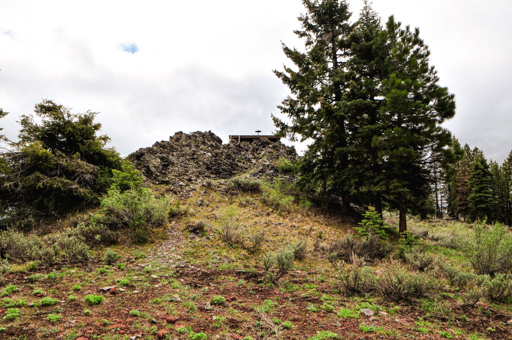
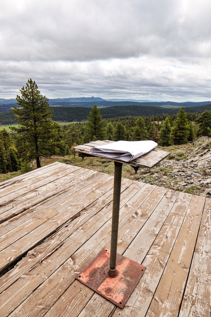
I’d estimate we only walked a mile and a half to get to the platform. The road is signed for NF-407 but it would be easy to miss while driving. The platform used for Crane Point is still there along with the stand for the fire finder. It sits atop a rocky outcropping with views toward Monument Rock Wilderness and Strawberry Mountain Wilderness. We were even able to spot Antelope Mountain L.O. (post) and what we thought to be Table Rock L.O. in the distance. I was surprised to find the fire finder stand was not bolted down to anything and still there. It has a heavy metal base, but people will walk off with anything. The platform itself was still in decent condition minus a few boards that had signs of rot. We were lucky enough to get to enjoy this summit rain free as well. As we started our walk back to the car another storm rolled in and we were once again in a rain cloud. A couple out on their ATV even stopped to ask us if we were doing ok. I always think about how odd it must be to come upon a couple just walking down a random Forest Service road. We told them about the old lookout structure just up the road and continued on. They probably assumed we were lost or broken down initially, especially since we drove a Civic and parked it in a seemingly random spot. I personally have never seen another Civic or equivalent car in the nitty gritty of the forest driving around unless I’ve been at a trailhead.


We made it back to camp relatively early in the afternoon and I decided to take a nap in the tent. My partner chose to wonder down the spur road we were camping on to explore a bit more. Eventually the rain storm turned into a thunderstorm. I read a book in the tent for a while before I decided to check and see if he made it back. He was hiding out from the rain in the car by the time I checked. Neither of us were looking forward to cooking dinner in the rain. We waited in the car until what seemed like a break in the weather. Once we were out and cooking it started raining again. We enjoyed our dinner from the warmth of the car. It obviously wasn’t going to get any drier here, so we decided to pre-pack most things wet for tomorrow morning since we would be moving camps.
History.
Crane Point is listed on the Former Fire Lookout Site, but the platform and fire finder stand are still there. I would consider this an existing fire lookout site since the structure used is still partially there. It is also noted that fire crew’s will still use this area as a vantage point. The site was originally established in the 1930’s. The tent cabin used for the living quarters is no longer there. There is not much information on this lookout but based on older photos it was at least used up until the early 1960’s.


One thought on “Crane Point L.O.”