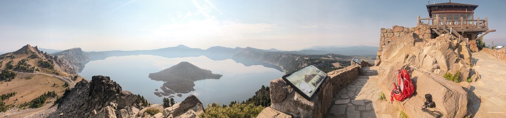
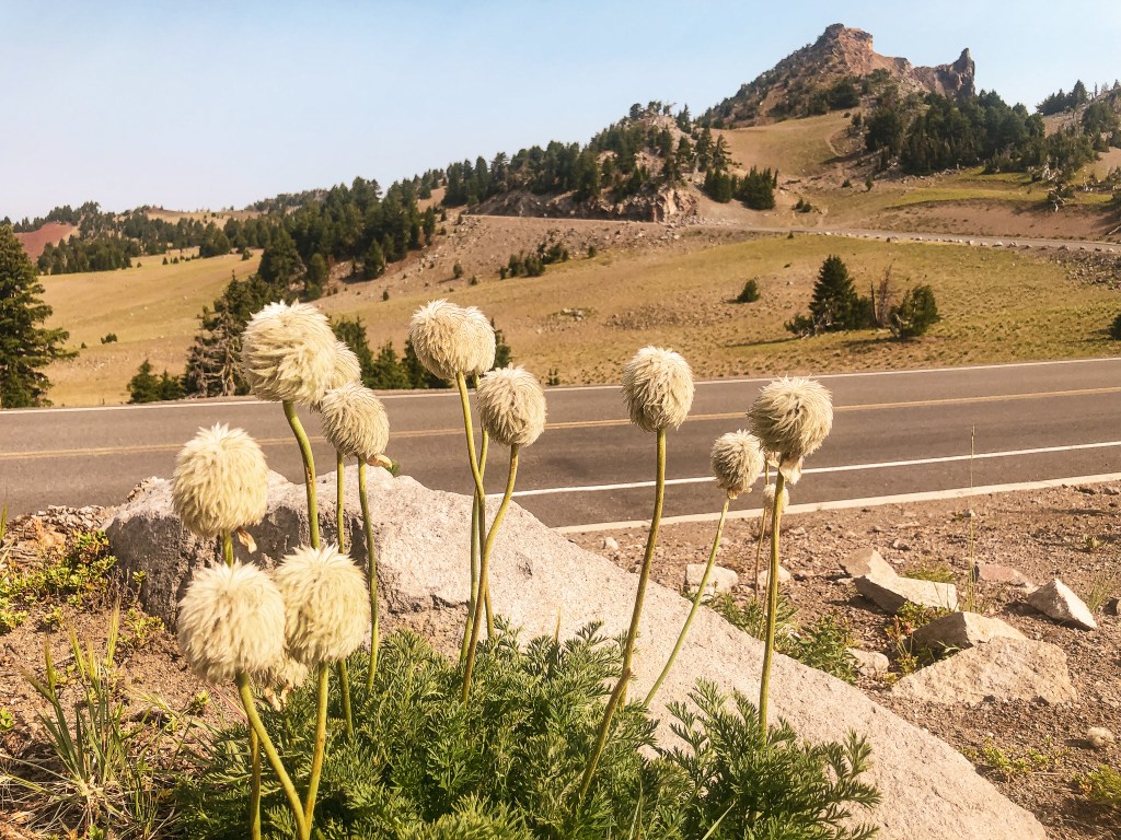
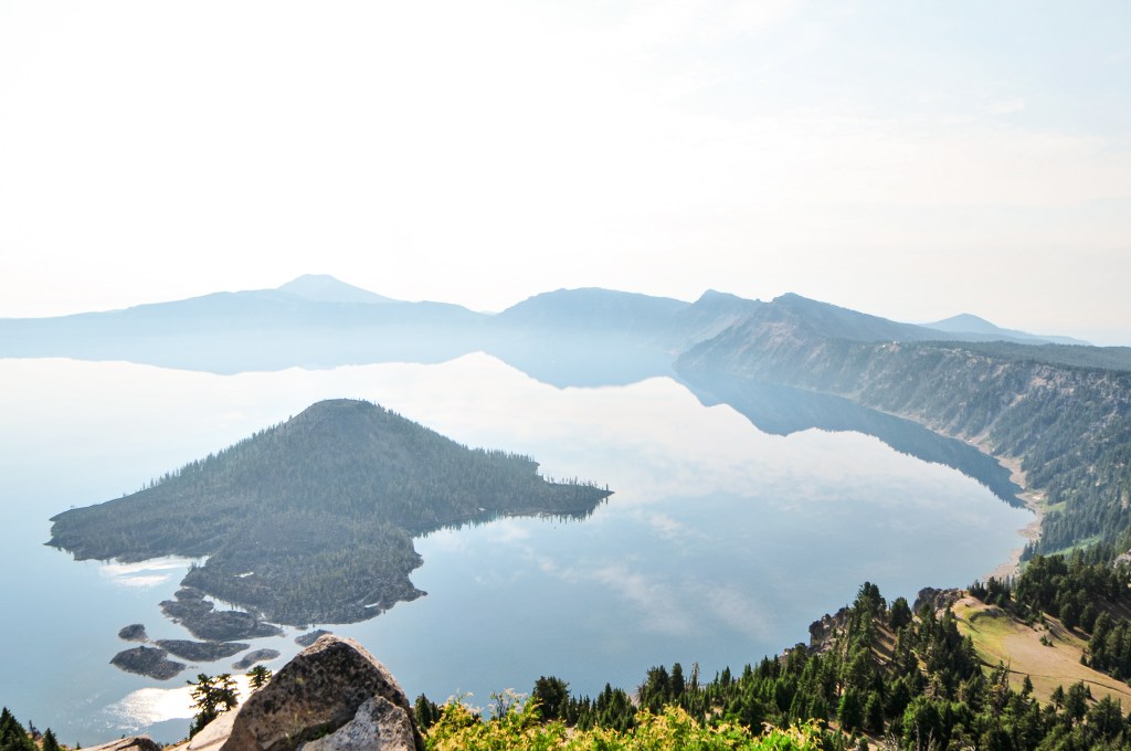
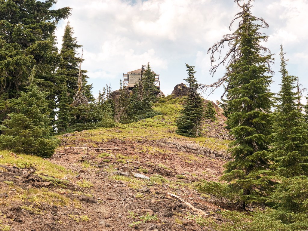
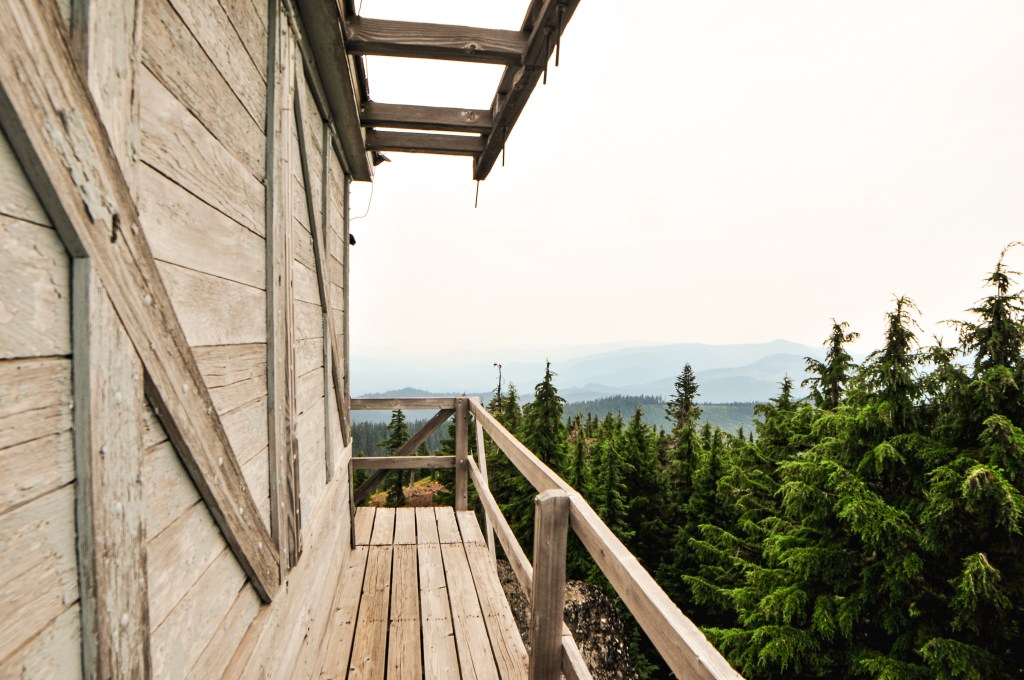
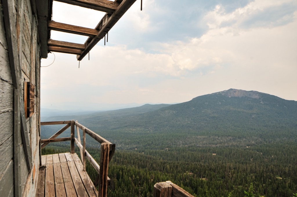
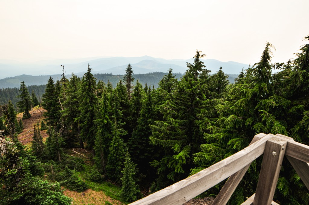
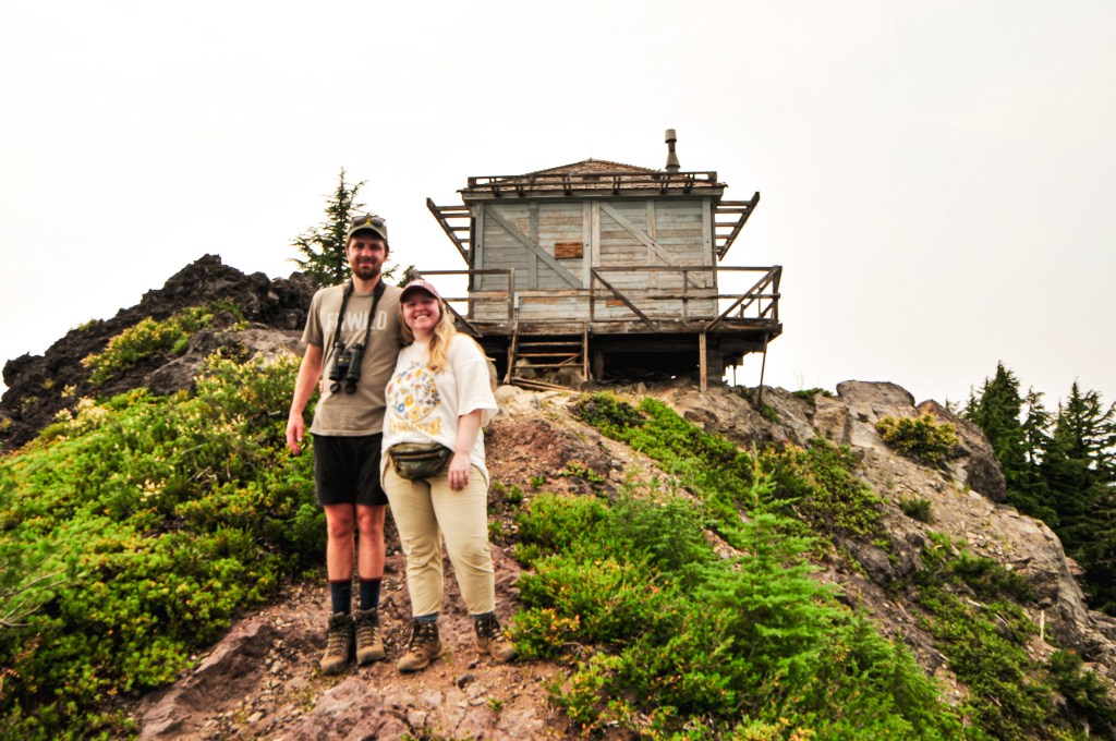
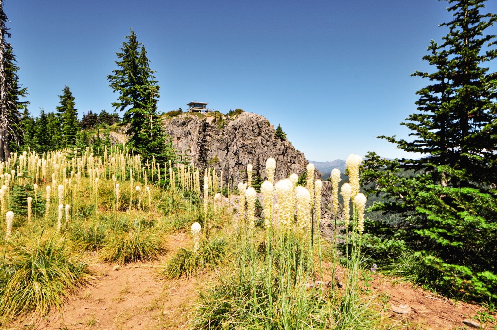
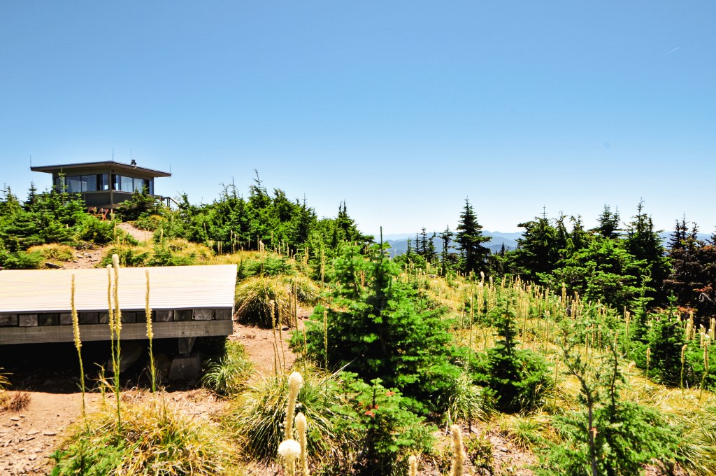
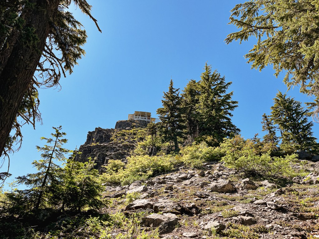
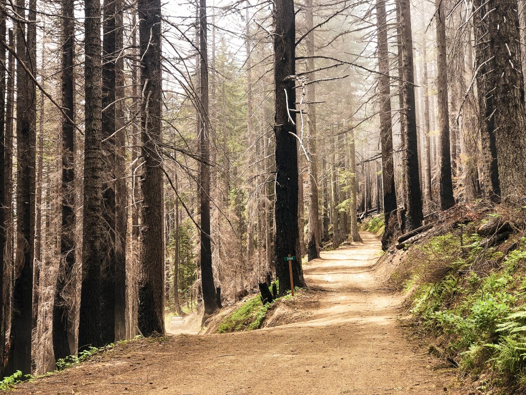
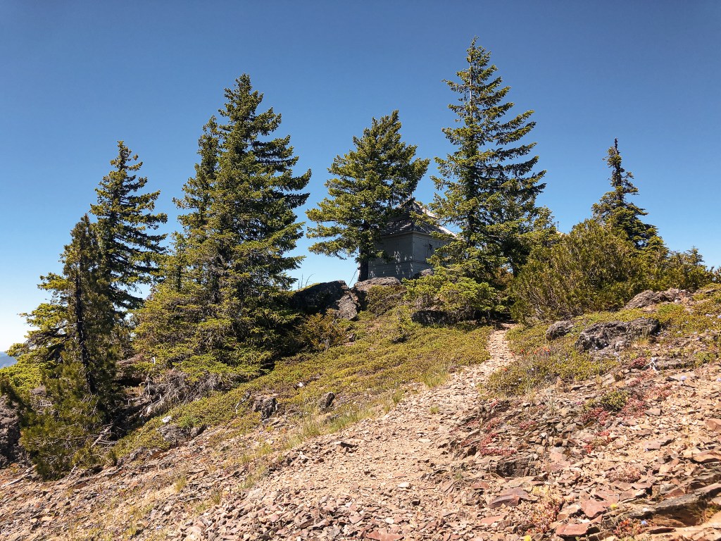
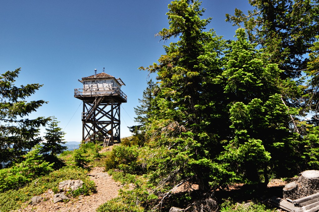
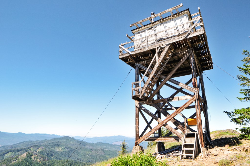
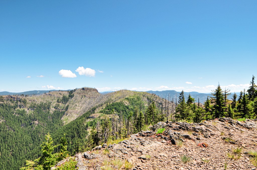
Our alarms were set for 5:30AM in an attempt to get an early start. We were both pretty grumbly this morning and hit snooze until a little past 6AM. I let my partner get up first to start making breakfast while I sleepily packed our tent. We weren’t moving very fast this morning. By the time we were done eating, packed up, and on the road to the Northern entrance of Crater Lake NP it was already 8AM. The entrance kiosk was not open yet, but we already had a National Parks pass for the season and let ourselves into the park. We kept right once we reached the rim road to stay on the western side of the crater. It didn’t take very long for us to reach the parking area for The Watchman. It is painfully obvious where you need to park. Not only is it well signed, but the lookout is visible from the road. It is one of the busiest trails in the park and we assumed we would see a lot of people here. There were only a few spots left in the main parking area which has enough room for at least 20 to 30 cars. We parked and headed up the well graded trail. It’s a short 0.8 miles with 400′ in elevation gain to the summit. There were these neat blooms along the beginning of the trail that resembled something out of a Dr. Seuss novel. I know I over-use that reference, but these truly do look like miniature Truffula Trees from The Lorax. I later found out they are known as the Western Pasqueflower, or Anemone Occidentalis. I want to try and get better at identifying wildflowers in Oregon. I always ask my partner if he knows what the flowers are called, but he’s better at identifying the types of trees and birds. We passed a large group and a few other people on our way up that were heading down to the parking lot. The trail was still mostly shaded this morning which made for a really nice temperature. My partner reached the summit before me, per usual, as the last few people were leaving. We were shocked to have the summit briefly to ourselves. The lookout was blocked to public use but you still get a great view from the base. A couple joined us shortly after, but they didn’t stay long. We soaked in our time at the summit waiting to see when the next person would arrive. We stayed up there for at least 15 to 20 minutes without anyone else before deciding to head back down. We were up there fairly early, but it was still shocking to have it to ourselves. As we leisurely hiked down, we realized we were just slightly ahead of the crowds and had come at the perfect time. There were roughly 45 people heading up the trail on our way back down. The parking lot was full when got back to our car and people were starting to park in the overflow area. It seemed that a good amount of them were just stopping to check out the view point before moving on than actually hiking the trail. The flow of cars was pretty even on those coming in versus those leaving. The next time we’re in the Crater Lake NP we hope to hike to its highest point on Mount Scott.
History.
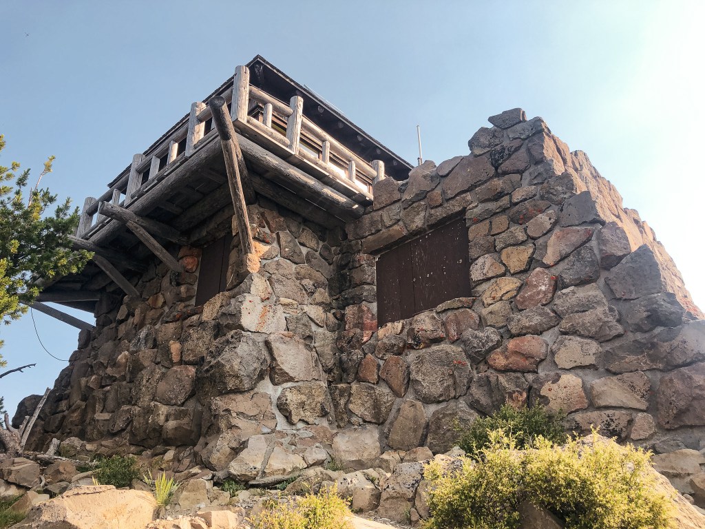
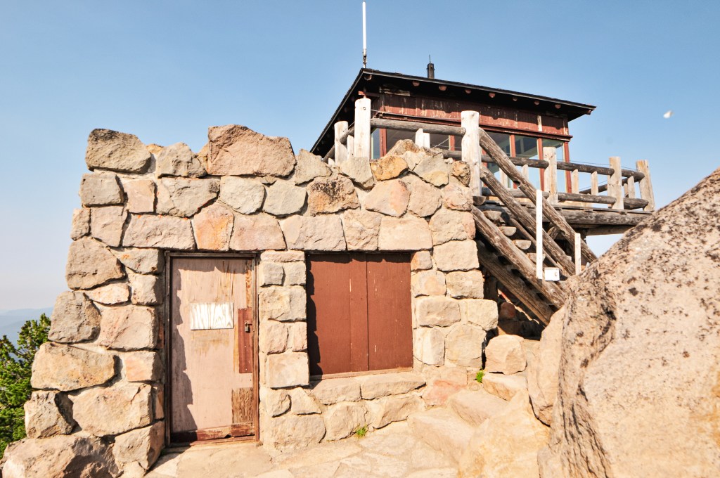
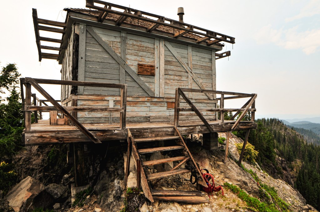
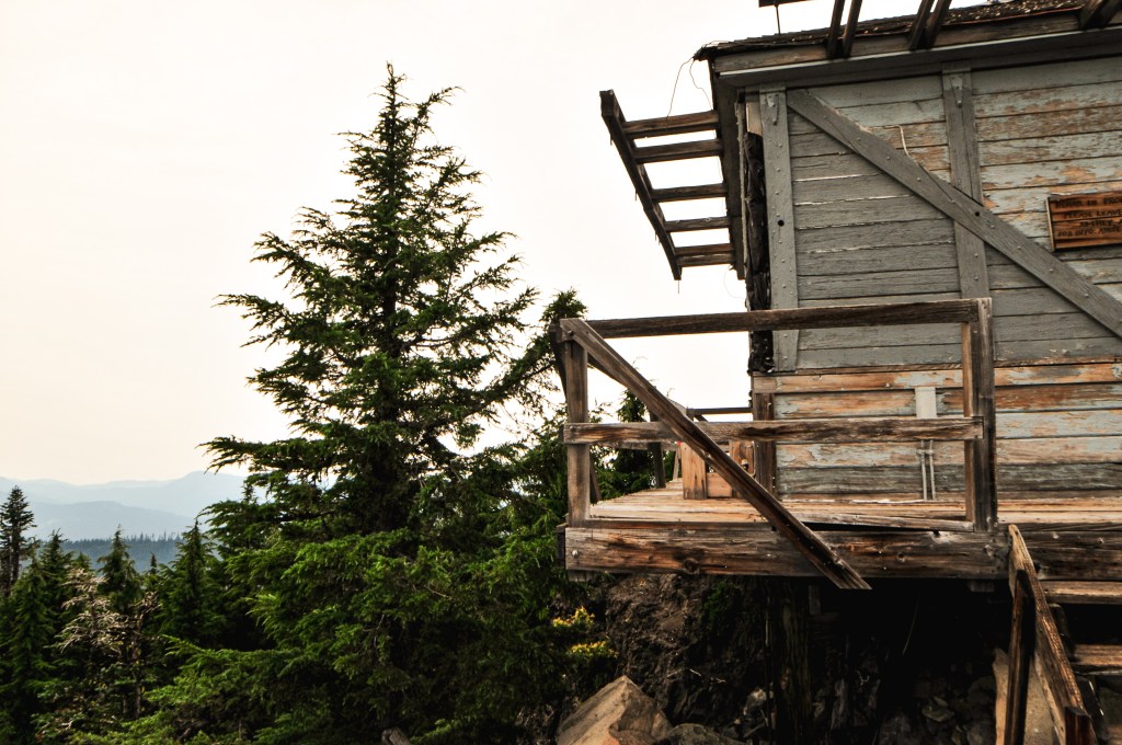
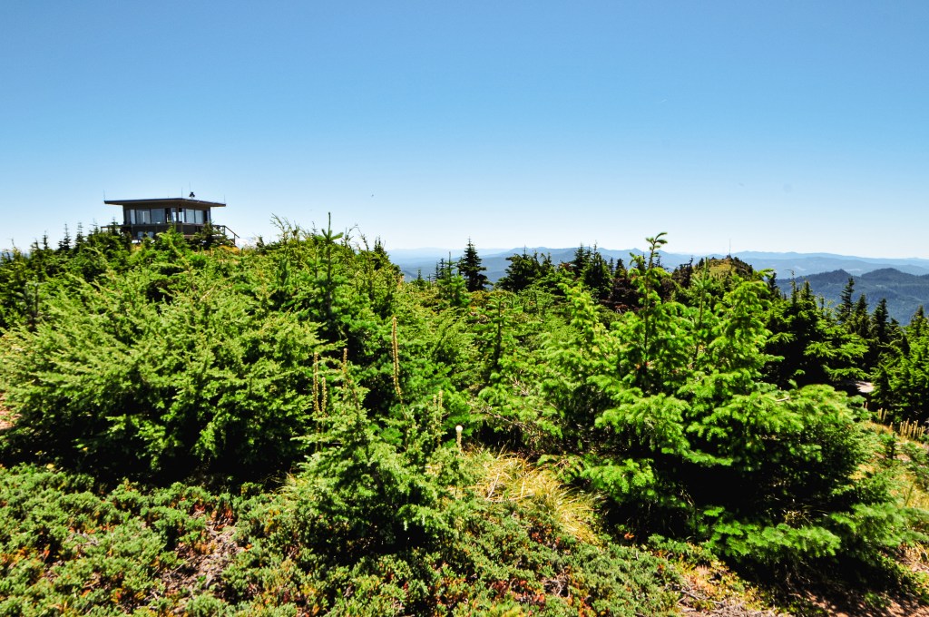
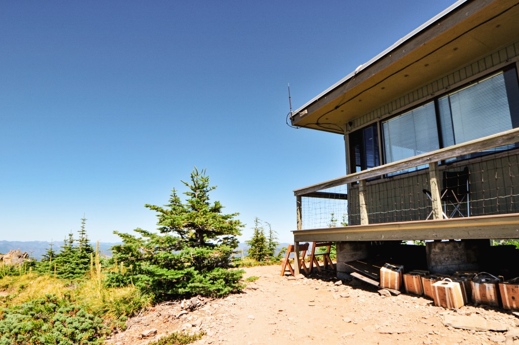
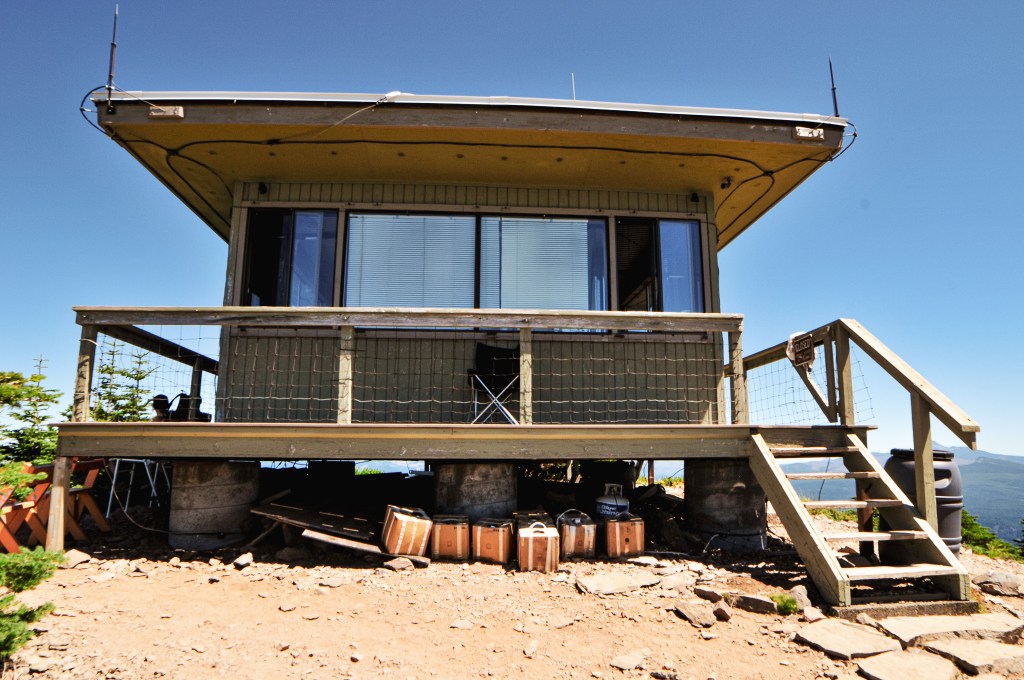
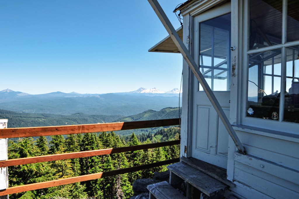
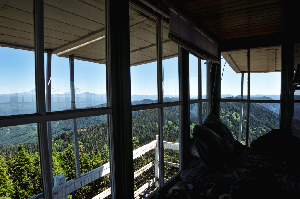
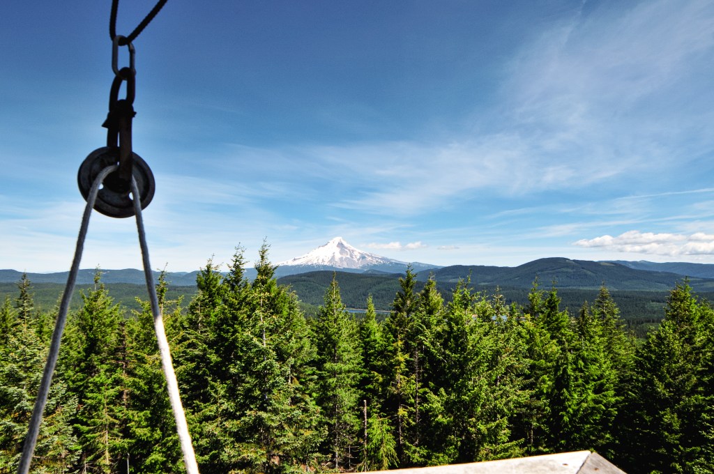
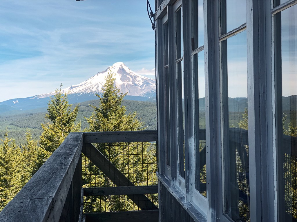
The first trail to the summit was established in 1916. It was shortly followed by the construction of a cupola-style lookout in 1917. The site was always intended for dual use of a fire lookout and an educational interpretive site. The existing two-story observation station was built from native materials with the intention of blending in with its surroundings. It was designed by Francis Lange as part of the 1920s Crater Lake Master Plan. Construction on the station started in 1931 and was completed in 1933. It was recently restored in 1999 and re-opened for public access. The mountain top museum had been previously closed since 1975. It is still occasionally staffed by a National Park Ranger in extreme emergencies.
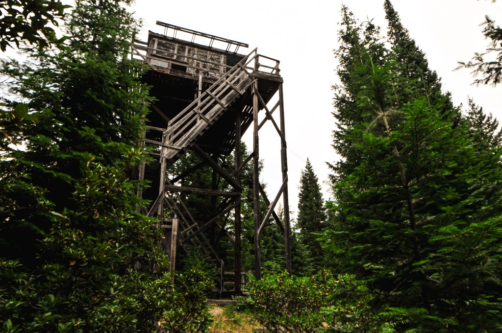
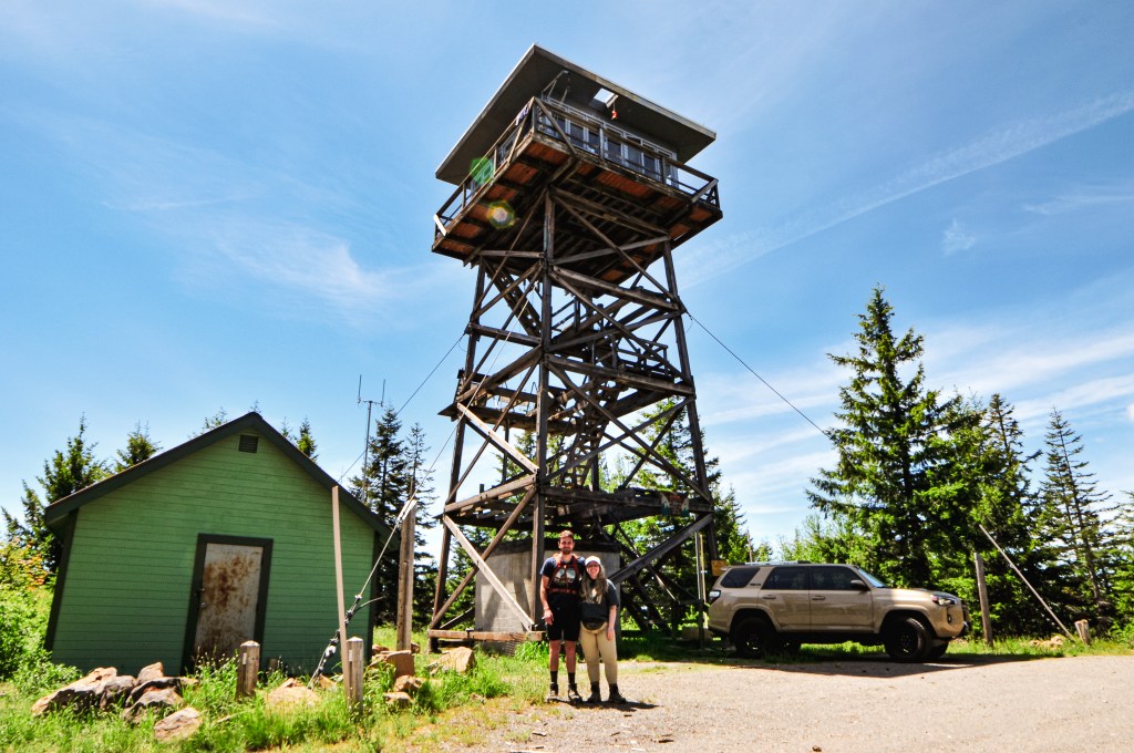
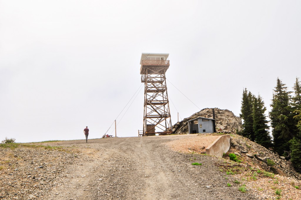
My partner and I decided beforehand that if we only had time to add one other fire lookout to our trip to Garwood Butte (post), it should be Mount Stella. We both really wanted to see The Watchman (post) as well, but Mount Stella is in poor condition. It was on our priority list due to its higher risk for collapse, being torn down, or burning down in a wildfire. We didn’t reach our car until around 4:30PM after visiting Garwood (post). We knew there was still enough time to squeeze in Mount Stella for the evening, but only if we left immediately. This was also with the assumption that the road conditions to the gate were in our favor. We briefly contemplated setting up camp and visiting Mount Stella in the morning. But, if we successfully visited Mount Stella now that meant there would be time for The Watchman (post) in the morning. As we headed out of the forest to HWY-230 we could see darker clouds on the horizon. The forecast did mention a chance of rain and thunderstorms in the area, but we figured it unlikely with the heat. I could see some flashes in the clouds and we passed through a minor drizzle. Unfortunately, not enough to clean off the collected dirt on my car’s exterior. Thunderstorms are typically not ideal for visiting fire lookouts since you are on a higher point that can be more exposed to the elements. But, they seemed to be moving quickly in the opposite direction. Although these didn’t pose much fret for us at the time, it seems they were the same thunderstorms to kick off Oregon’s Wildfire season. The first, currently known as the Windigo Fire, being reported Saturday night within the Umpqua NF. The second, currently known as the Potter Fire, being reported the following morning within the Willamette NF. Both were just barely north of where we were camped this weekend. It’s a bit unsettling how quickly we turned from our wettest spring to our current fire season with little to no transition period. I’m inclined to stay hopeful for a mild season, but I’m also not holding my breath.
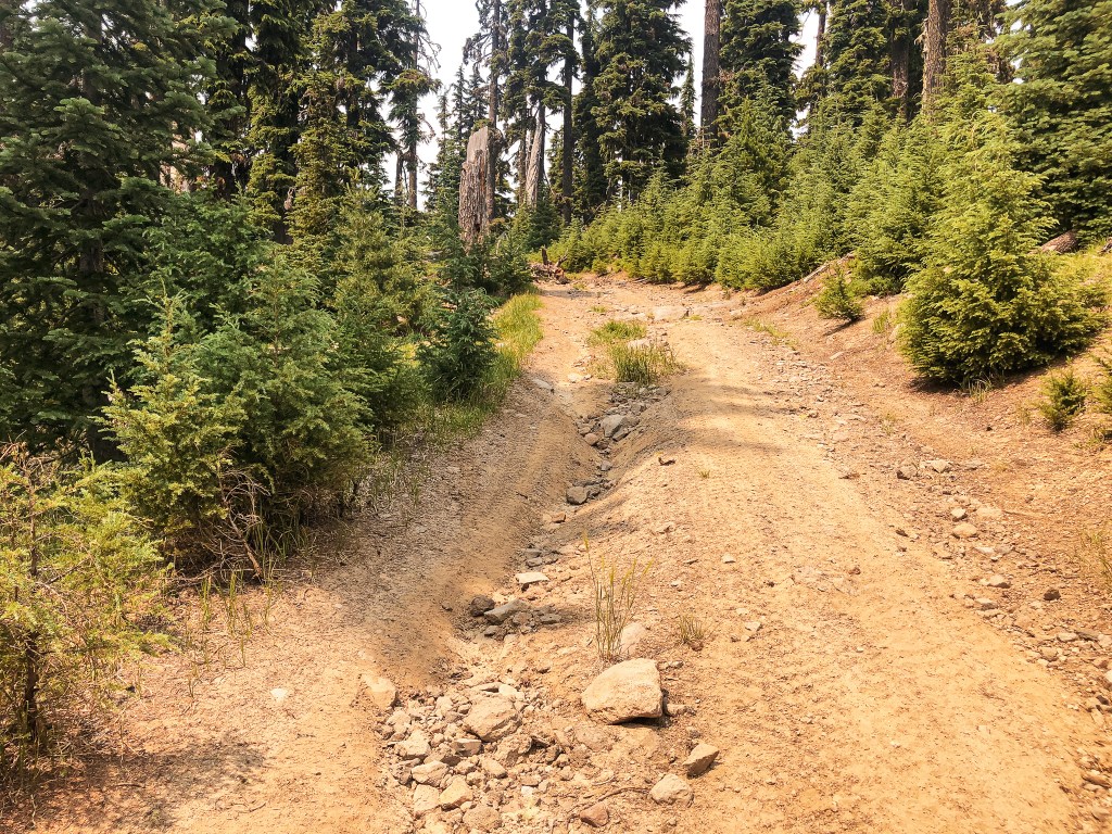
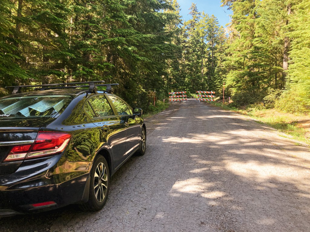
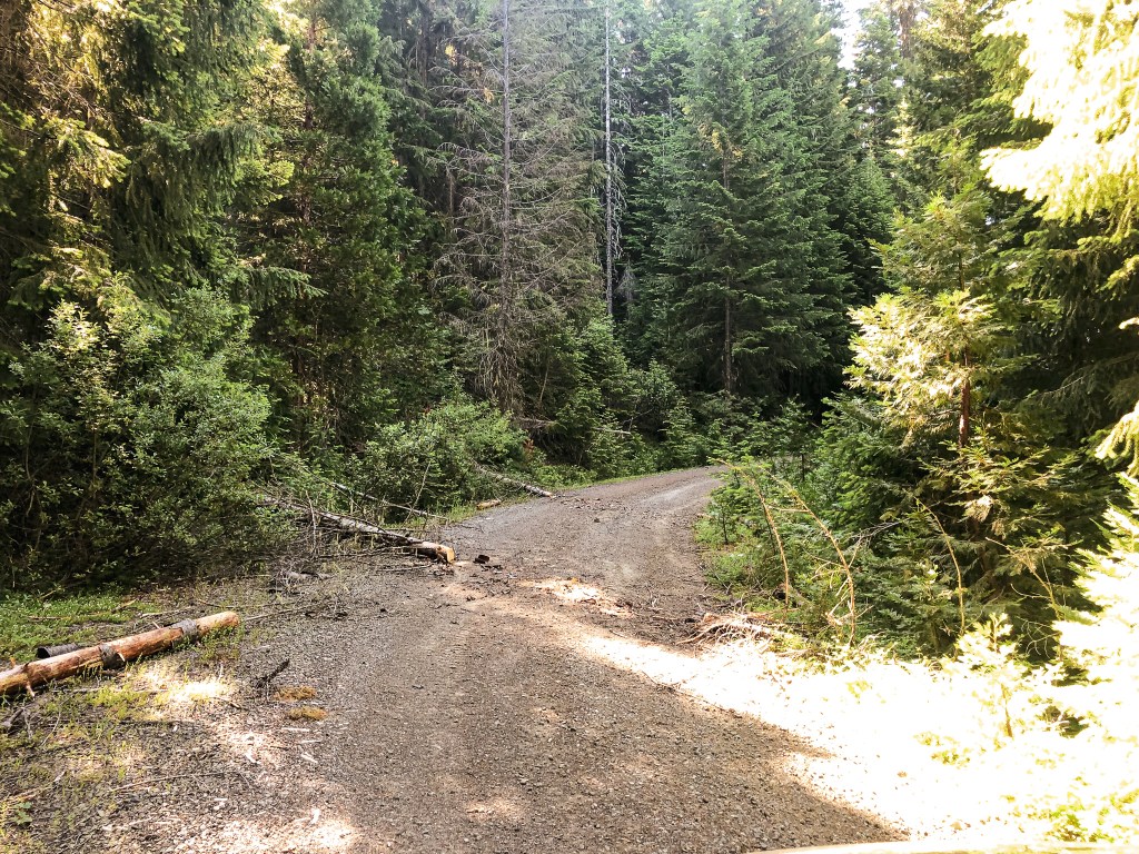
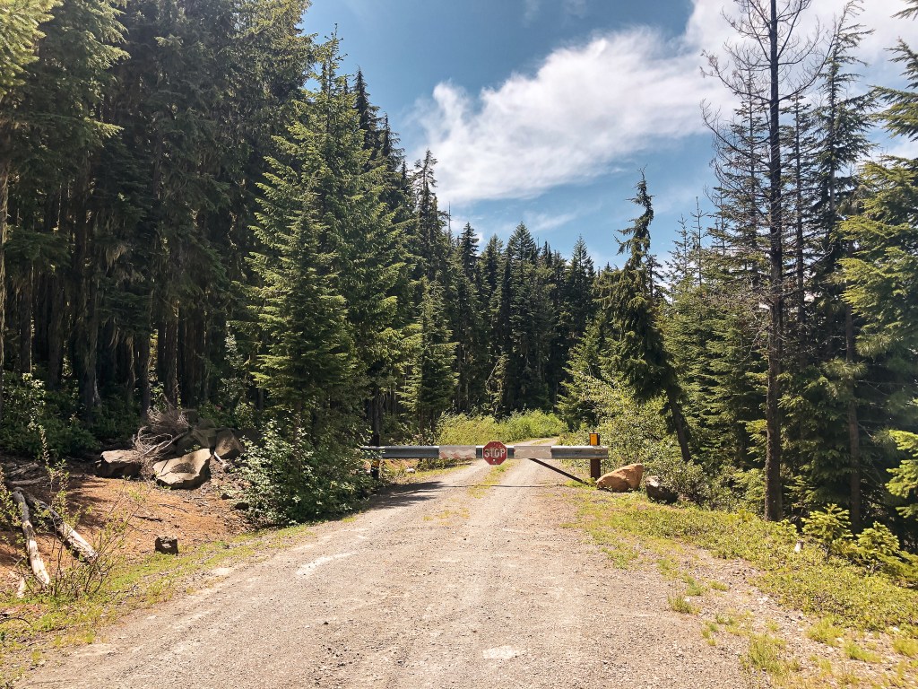
We were back on HWY-230 around 5PM and thankful for the longer summer days. We turned right on to NF-6510 just past where the highway crosses Bybee Creek. There were a lot more people camping in this area due to the water access. Once the road started to head away from the creek, we reached a fork. We took a left to stay on NF-6510, while NF-6520 was to the right. It is three miles from HWY-230 to the junction with NF-200. The NF-200 spur didn’t have a sign, but it is off to the left at a four way junction. The NF-100 spur was signed off to the right which helped us identify it on the map. It was roughly one mile down NF-200 to the gate and another three quarters of a mile to the lookout from the gate. The NF-200 spur was in decent condition, albeit a bit overgrown. We were able to drive the Civic to the gate with minimal caution. We ended up parking near the decommissioned road off to the right and walking from there. The gate was open but there were some large rocks embedded in the road that stopped us from continuing on in the car. It had potential to be worse than the access road to Garwood Butte (post), but it improved significantly after the first rocky section.
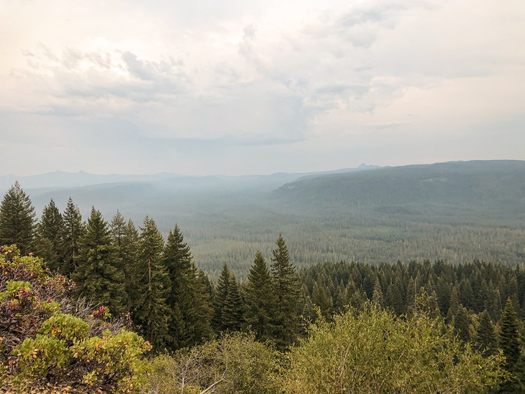
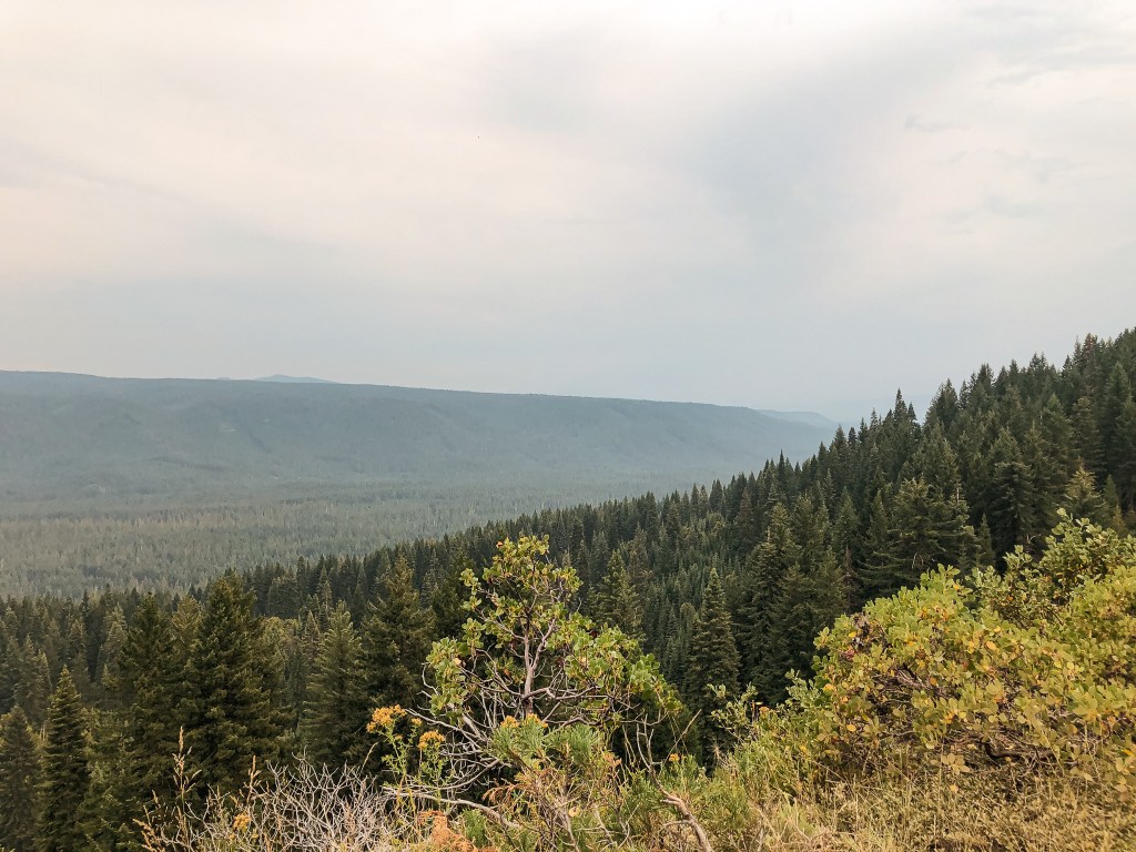
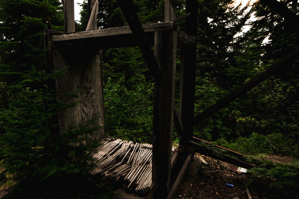
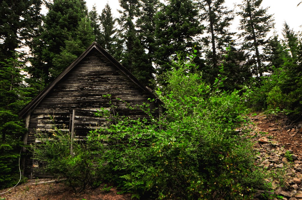
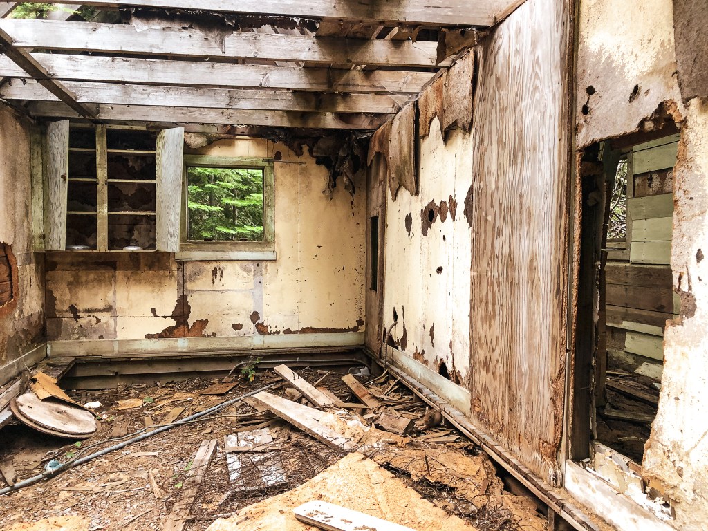
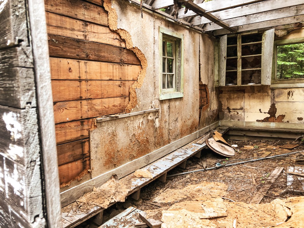
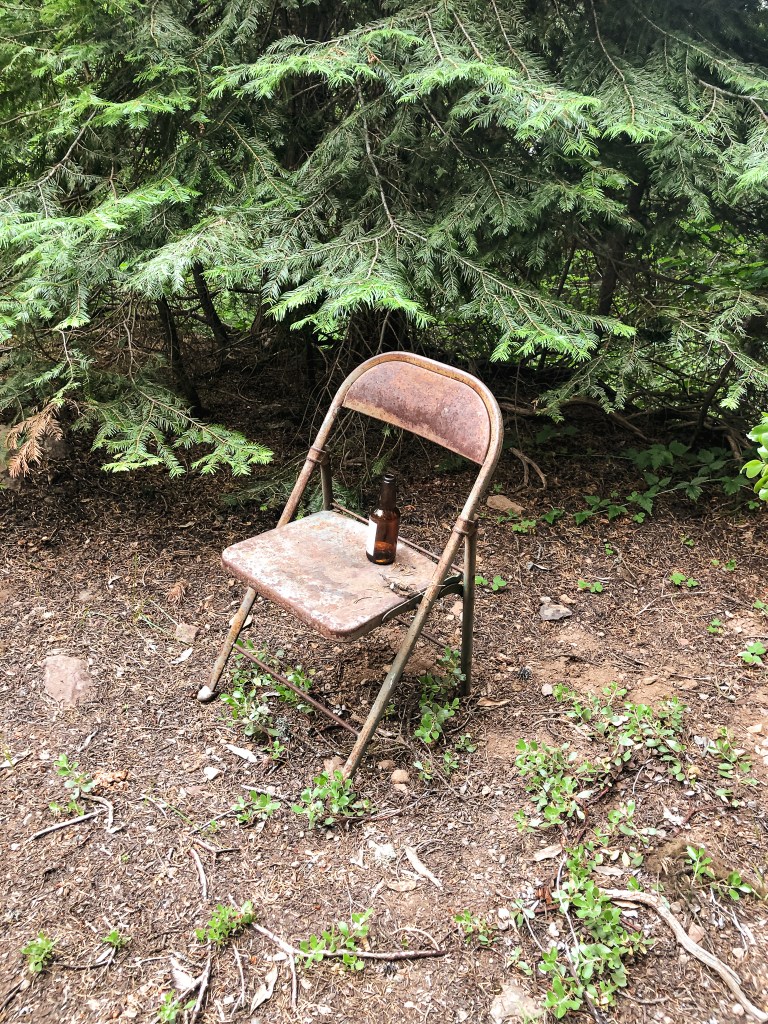
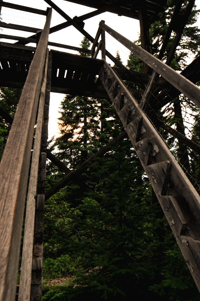
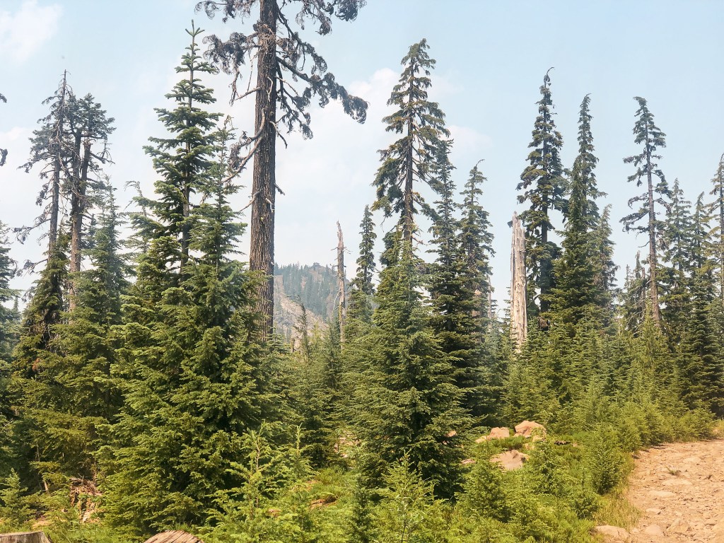
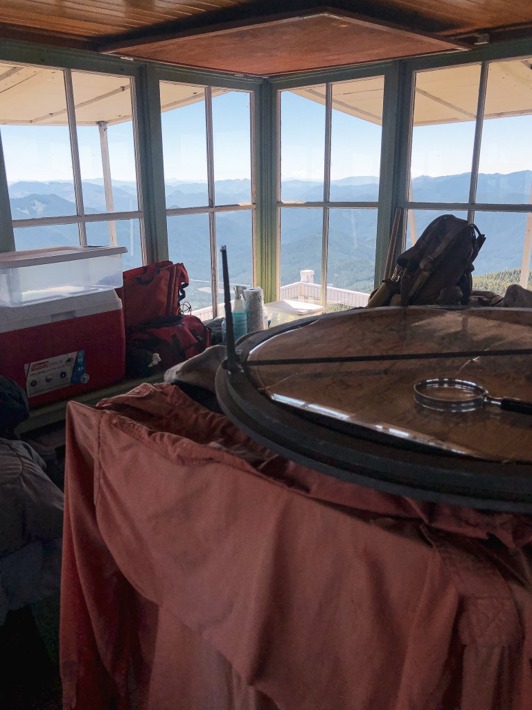
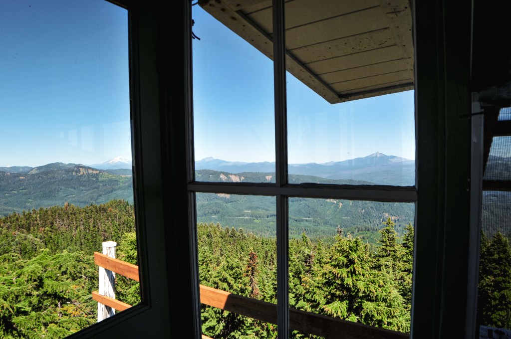
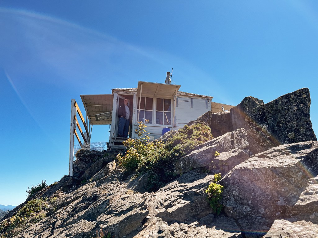
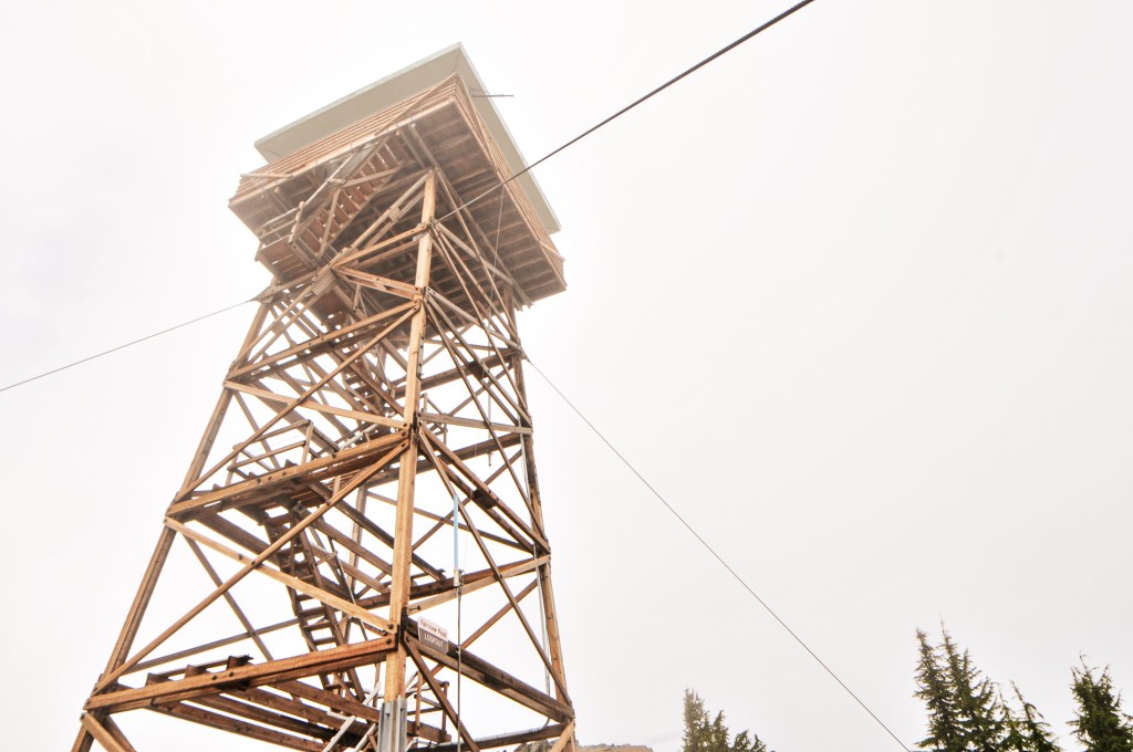
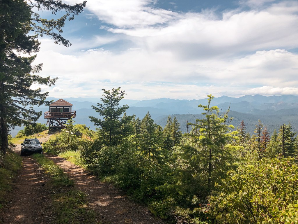
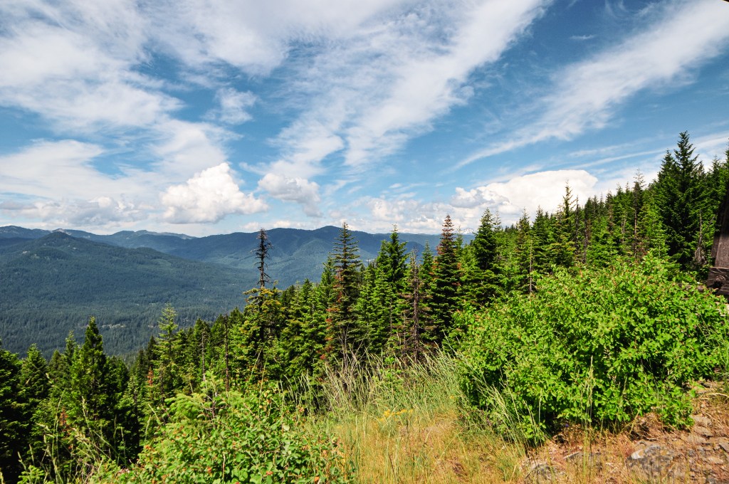
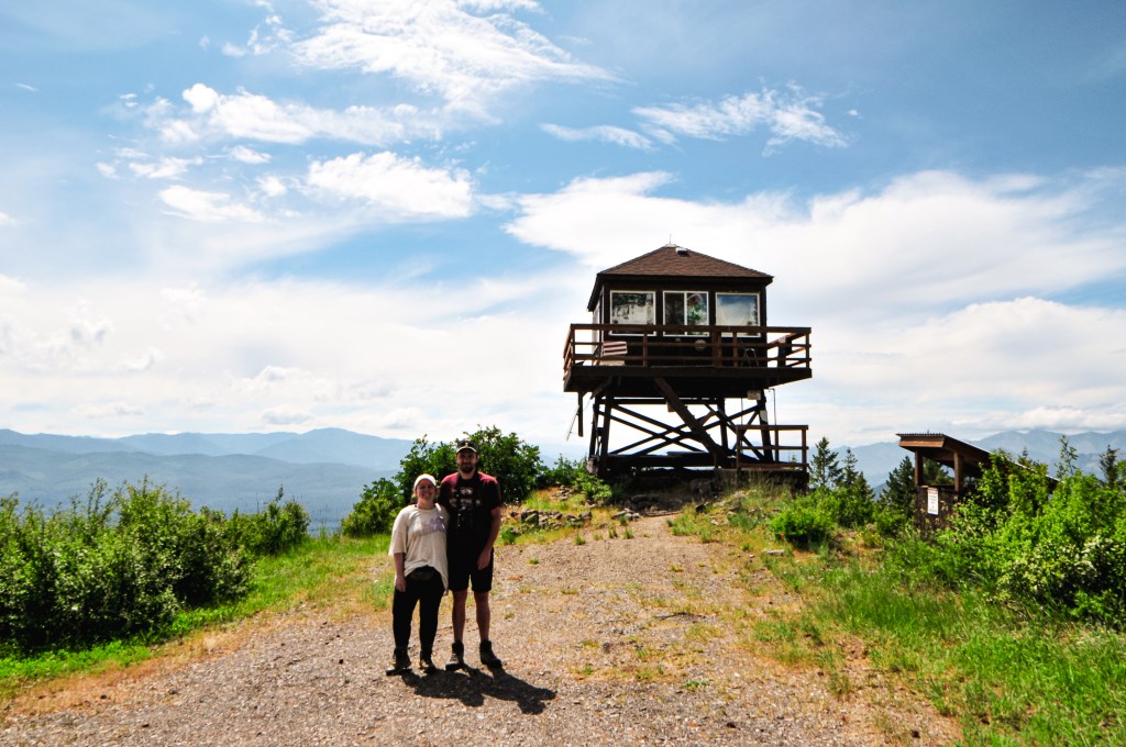
By this time, the heat had caught up with me. I was feeling completely drained of energy and dehydrated while nursing a headache. Despite my best effort to drink as much water as possible, it was no match to the heat. My partner took off at his usual pace for the summit while I meandered behind. It’s a mostly forested road walk until you come to a sharp bend. At the bend, it opens up to views of the valley just south of the summit. These are the only views we would get from Mount Stella. The remaining area is overgrown with tall trees and shrubs. I could hear rumbles of thunder in the distance as I reached the clearing. It wasn’t an immediate concern, but I also wasn’t inclined to stay on the summit for too long either. I quickly took some pictures of the tower and made my way over to the garage. As I was entering through the door to the garage something larger scurried towards me. I screamed and ran out of its way thinking it was a large wood rat. My partner had already warned me of the rabbit he spooked up in the garage earlier. Turns out I spooked the same poor rabbit. It was now past 6:30PM and we knew we needed to head back so we could set up a camp. As we were hiking down the road, we were surprised to be met by a vehicle. It was a government vehicle from the BLM fire crew. They didn’t stop to say anything, but I can only assume they were driving up to the view point to watch for fires. Based on that, one could argue the site is still used in emergencies even though they don’t use the tower anymore.
Art?
No stairs for Stella
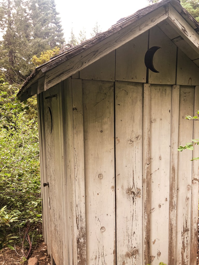
Privy
We had planned on camping near Mount Stella if there were decent options and heading to The Watchman (post) in the morning via the Southern park entrance. But, it seemed most of the decent camps were already taken in this area. We decided it made more sense to head back towards the other camps we found closer to Garwood Butte (post). This would set us up for easy access to the Northern park entrance instead. We didn’t set up camp until after 8PM, but it was overall a successful day.
History.
A 20′ native timber tower with L-4 hip-roofed cab was the first structure built on Mount Stella in 1932. Similar to other Fire Lookouts, it was activated as a Aircraft Warning Station during 1942 until 1943. In 1946, the Forest Service replaced it with a 30′ treated timber tower and L-4 cab. This structure still stands today but has been abandoned since the 1980s.
NOTICE: This area was apart of the July 20, 2024 closure area for the Diamond Complex fires but has since been reopened. This area does not appear to have been impacted.
Location.
Umpqua National Forest
Status.
Abandoned; Currently standing
Estimated drive time from Portland, OR.
4-1/2 hours
Date visited.
July 30, 2022
Elevation.
7,017
National Historic Lookout Register.
US 1615; OR 139
Trip Report.
UPDATE: October 12, 2024 – while we were camping in the area we had drove down the NF-3703 road and it appears to have been regravelled recently which eliminated the majority of the potholes and hazards we originally saw. They were minor then but almost non existent now. We didn’t drive the entire way to the NF-370 spur but I assume the spur road conditions are still the same.
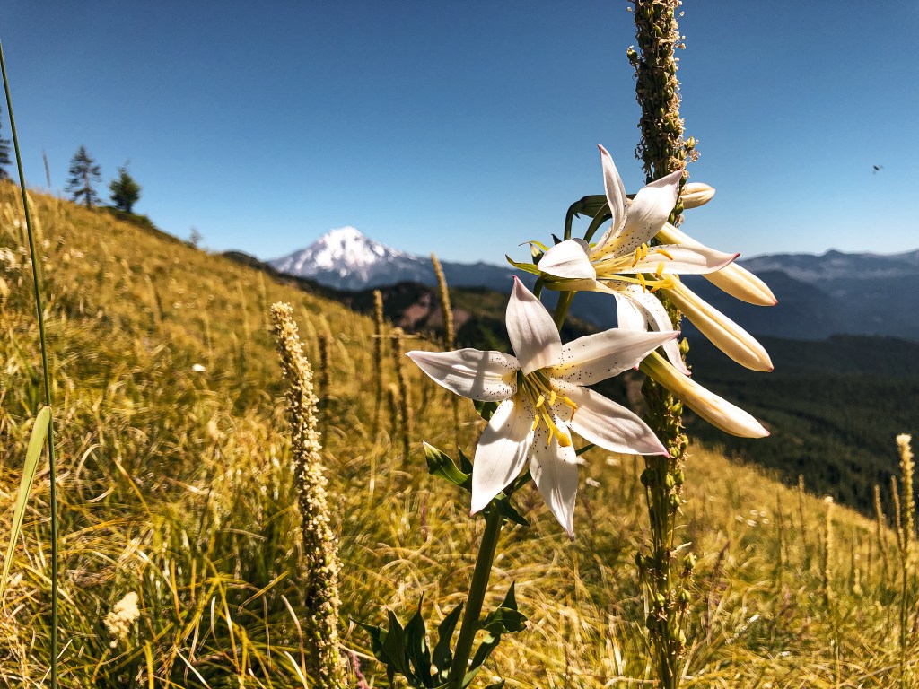
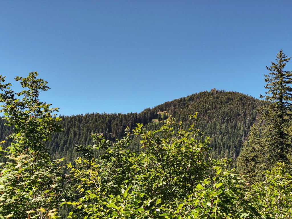
Oregon has been in a heat advisory for the last week with temperatures ranging in the mid to high 90s. It even briefly jump up into the low 100s a couple of those days. A haze was expected to settle over all of Oregon for the weekend due to a new wildfire in northern California. Is it too soon to say I miss the rain? Anyway, what better time to head into the forest than when you’re sweltering at home? It turns out it’s pretty hot out there too. But, my partner and I headed on as we always do. This weekend we set our sights on Garwood Butte. We figured we could do The Watchman (post) or Mount Stella (post) while in the area too. Yes, both were also an option. It’s a bit of a drive for a one-night trip, but we’ve come to the conclusion that we’re a bit crazy. Garwood Butte has been on our minds for a while. Mostly, because my partner’s name is Garnet and he goes by Gar on occasion. I couldn’t possibly visit Garwood without him. For this reason alone, we felt a connection to the fire lookout. It’s also just a really cute L-4 perched on top of a rocky outcropping with views towards Mount Bailey and the Crater Lake rim. What’s not to love about that? We had originally thought about adding it to our road trip itinerary, but were worried about the potential for snow. After our visit to Pig Iron (post), we could see it was snow free and that it would be accessible for a future visit to the area this year.
Start of the NF-370 spur
Parking Spot
First glimpse of Garwood
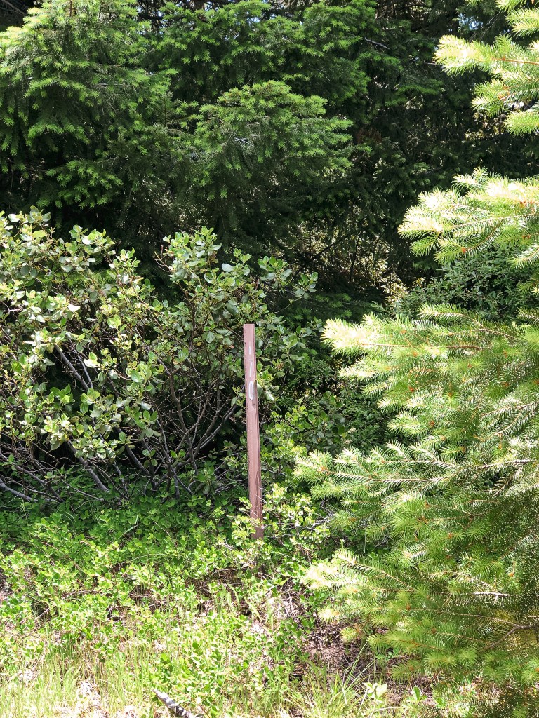
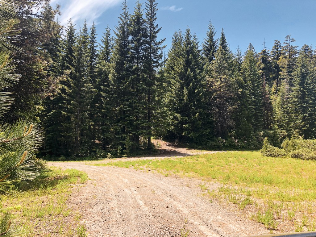
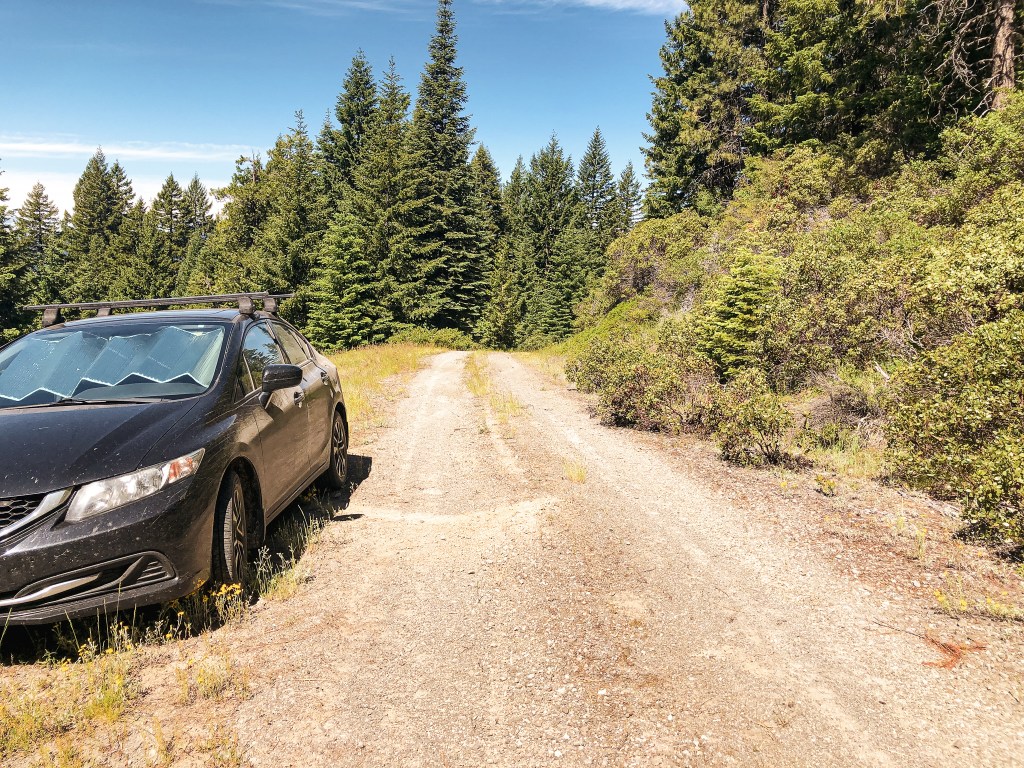
Our alarms were set for 6AM and we were on the road as early as possible. We headed down the I-5 corridor once more, but this time cut over on HWY-58 to meet up with HWY-97. We gave a quick wave to Odell Butte L.O. and Walker Mountain L.O. (post) as we drove past their marked highway turn offs. After a quick refuel in our now frequented stop in Chemult, we turned on to HWY-138 towards Crater and Diamond Lake. We passed the north entrance to Crater Lake NP and stayed on HWY-138 until we reached the turn for HWY-230 off to the left. I have been through this area a few times now on various different trips throughout the years. We were also familiar with the route due to an unsuccessful attempt of Garwood during our visit to Cinnamon Butte (post) last December. From HWY-230, we turned right at the access for Three Lakes Sno-Park. We continued straight to stay on NF-3703 until we reached the turn off for NF-370 spur. There were minimal potholes and ruts to avoid along the NF-3703 road. We didn’t even have to attempt a drive up the NF-370 spur to see it wasn’t a drive-able road. There were large ruts and rocks embedded in it that were not low-clearance compatible. The road is marked but the sign is sun-bleached and indecipherable. It is best identified by its terrible condition and a ski post marked with the number 36. We parked in a pull out just past the road. It was already noon by the time we got there, so we decided to have lunch in the comforts of our air conditioned car instead of the summit. While we were hiding out in the car, an ATV came brapping by and waited at the NF-370 junction. At first, we were confused on what they were doing or thought maybe they stopped because they were confused by what we were doing. But then, another ATV followed which triggered the first one to head up the road. When the second ATV reached the junction it proceeded to wait as well. The same thing continued to repeat itself until 8 ATVs had turned up the NF-370 spur. We weren’t too keen on starting a road walk that we knew would end in us being dusted up and decided to wait. The road eventually just dead ends and they would have to come back down. Luckily, we didn’t have to wait long and their brapping continued on to somewhere else.
Start of Connector Trail
Where the Connector Trail meets the road again
Beginning of Main Trail
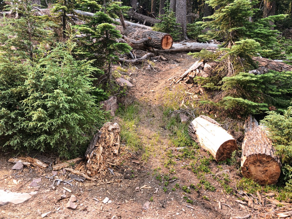
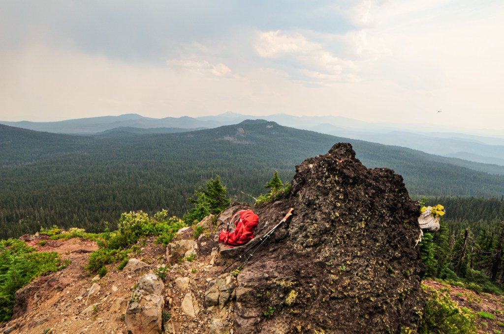
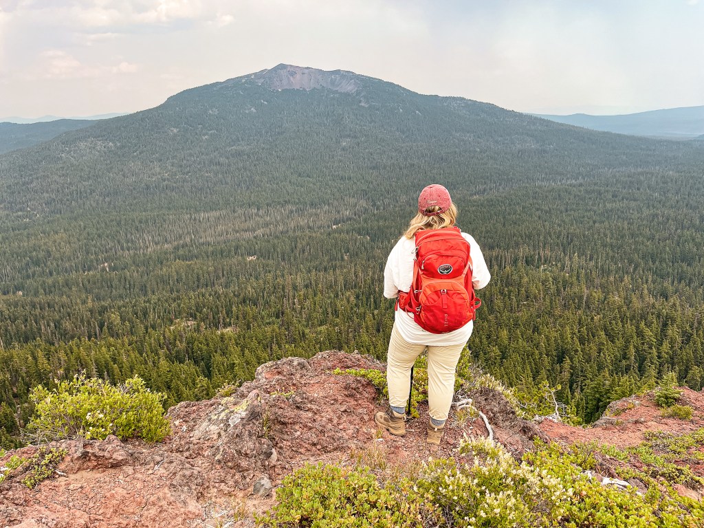
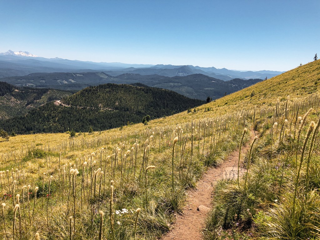
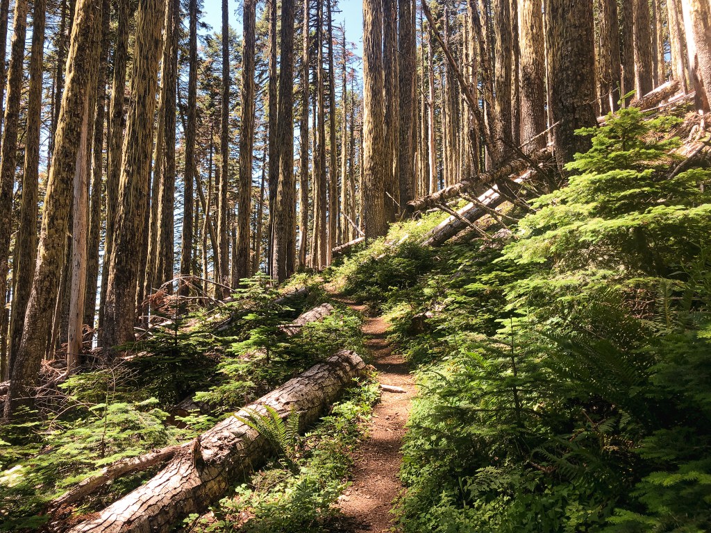
It was hot and dusty when we started our hike up the road. We knew it was roughly two miles to the Fire Lookout from the junction, if you stayed on the road and didn’t use the connector trail. As we walked along, the road conditions continued to deteriorate with larger embedded rocks, downed trees, and wash out. There was a point in the road where the ATVs even turned around. A large tree had come down across it and there wasn’t enough room on either side for them to get around. Ah, that’s why they didn’t take long. It would have required a chain saw to remove it. We both agreed, this was officially the worst road we’ve been on so far. I took some pictures of the road, but it never quite captures the true conditions. We eventually reached a more open area with a view of Garwood Butte. There was a defined trail off to the left that we assumed was the connector trail. A peakbagger report had mentioned this trail was no longer here in 2012, but from what we could see it was now. If you take this trail you can cut off a half of a mile of road walking. It meets back up with the road where the official trail #1471 to Garwood Butte begins. There is no official trail sign, but it was a well defined junction. If you have trouble finding it, always look for the cut logs first. As we headed up the trail, it appeared to have been brushed out more recently. It was clear to us that someone had been taking care of this route somewhat regularly despite the road conditions. It was a hot and slightly humid slog to the summit. The trail switch-backed through an interestingly mixed forest until it opened up to an exposed slope. The trail was in great condition besides a few loose sections that made finding my footing more difficult.
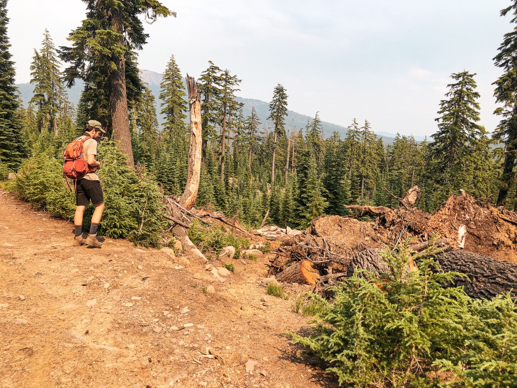
My partner reached the summit before me and was already making his rounds on the catwalk as I tried not to completely wilt away in the sun. I always seem to struggle more than him, specifically on steeper trails and in the heat. Partially, because I’m not in as good of shape but there are various other reasons as well. Garwood has a really nice summit on the edge of a rock that dropped off to views of the drainage below. The lookout structure was looking a bit worse for wear on the catwalk. Some of the stairs had broken and one corner was being supported by two boards. There was a sign posted on the cab mentioning the ongoing restoration, but I’m not sure if that is still active. Please use caution if you decide to climb the catwalk. We headed down after taking in the hazed over views and debated our next step. We had already found some decent dispersed camp spots and could have easily set up camp early to relax. But, there was also just enough time left in the day to move on to Mount Stella. We were both torn between wanting to maximize our short trip and just taking it easy for once. Who were we really kidding though? Of course, we headed on to Mount Stella (post).
History.
Formerly known as Bear Butte, it was renamed to Garwood Butte in 1946 to commemorate Leroy E. Garwood. Leroy was a former Forest Service District Ranger that died in March 1944. He was known as an old-timer on the forest and was the first to develop the lookout station atop the butte. The renaming also helped to eliminate another “bear” named feature within the forest. At the time the following features included the name bear; 6 Bear Creeks, 2 Bear Buttes, 2 Bear Camps, 1 Bear Bluff, 1 Bear Bones, 1 Bear Gulch, 1 Bear Lake, 1 Bear Wallows, 1 Bear Trap Mountain, and 2 Bear Mountains. Not the most creative. The structure on Garwood Butte was built in 1942 as a 14’x14′ L-4 ground cab. It was last staffed in 1973 and has since been abandoned. In 2012, the lookout was threatened by a nearby fire and had to be wrapped by fire fighters in Structure Protection Wrap. I believe it was the Butte Fire, but there were a few other larger fires during that year that could have caused this to be wrapped. There has been ongoing restoration work in more recent years, but it still needs a lot of work.
Coffin Mountain L.O. has been on my short list to visit since November 2018. A friend and I had been staying in Eugene for the weekend and tried to check it out. Our plans were immediately foiled when we met up with snow and ice on the road. We ended up exploring around a snow-park instead. I’m not sure why it took me so long to attempt another visit, but here we are almost 4 years later.
My partner and I had a toss up between adding Sand Mountain or Coffin Mountain to our weekend. My partner was leaning towards Sand Mountain due to the popularity of Coffin Mountain during this time of year. While, I was partial to Coffin Mountain. Alternatively, we could do neither but that was the least likely to happen. Based on reviews and trip reports online, we knew Sand Mountain would be a longer hike due to the gate and road conditions. The hike could have potentially been 10 miles RT depending on how far we’d make it down the road. We ended up waking up later than expected on Sunday morning which defaulted us to Coffin Mountain. We probably could have squeezed in Sand Mountain, but we both agreed we didn’t want to get back in town too late. Fine by me, Coffin Mountain it is!
We packed up and headed out from our camp on NF-15 to meet up with HWY-20. There were portions of NF-15 that were a bit rough for my Civic due to some recent logging in the area. We were able to make it out without incident, but it definitely slowed us down. We headed east on HWY-20 to connect with HWY-22. From HWY-22, the road you want is off to the left. It is NF-11 on the map, but was only marked as Straight Creek Road. It is located just past a bend in the highway, so make sure to keep an eye out for it. You will stay on this paved road until you reach NF-1168. There are two turns onto NF-1168, but you will want to take the second one. There is a sign at the first junction with NF-1168 that will point you in the direction of pavement. The NF-1168 road is well maintained gravel all the way to the trailhead. The trailhead can be found just off of the junction with NF-450. It should be obvious as you approach since you will get a glimpse of the lookout before you reach the trail. The NF-1168 road continues on to the Bachelor Mountain trailhead.
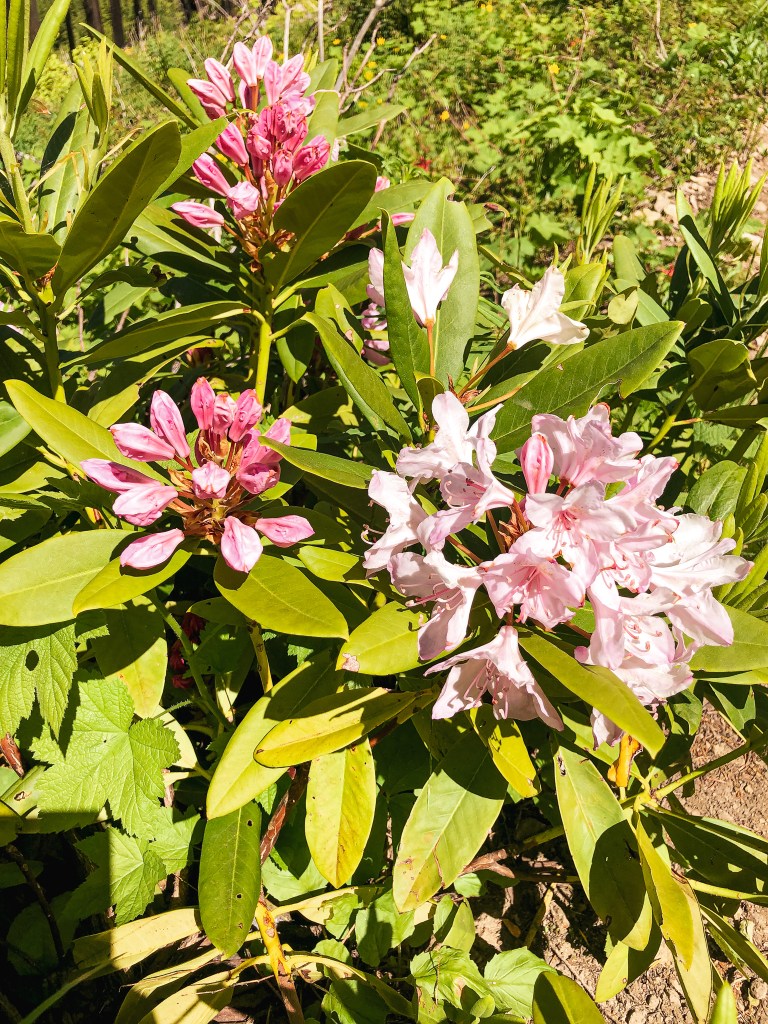
There is parking for a few cars directly at the trailhead and a few pull outs for additional parking. There were already cars here, but it was not as busy as my partner thought it would be. He can be a bit overzealous in his predictions when it comes to busier trails. We had just missed the peak bloom of Beargrass in the main meadow which helped to decrease the foot traffic. There was still a significant amount of wildflowers in bloom though. I always find it interesting what makes a certain trail popular over another. Ease of access? Length of trail? Views or points of interest? We were in the same National Forest, hiking to a fire lookout on a similar length of trail, and it offered similar views. Yet, Carpenter Mountain (post) is significantly less visited. I can’t help but think social media plays a dominating role. But, even then, what makes a spot blow up on Instagram versus another? I often see the same regurgitated spots on “must see lists” for Oregon, but there is still so much more to be seen. I am thankful in some ways that these lists curated by influencers and photographers aren’t usually unique. It helps keep other spots from being overcrowded. But, on the other hand, if there were more unique lists people might be more dispersed in general. Which in turn could lead to less impact on the current areas being overcrowded. This is a topic my partner and I revisit often, but I digress.
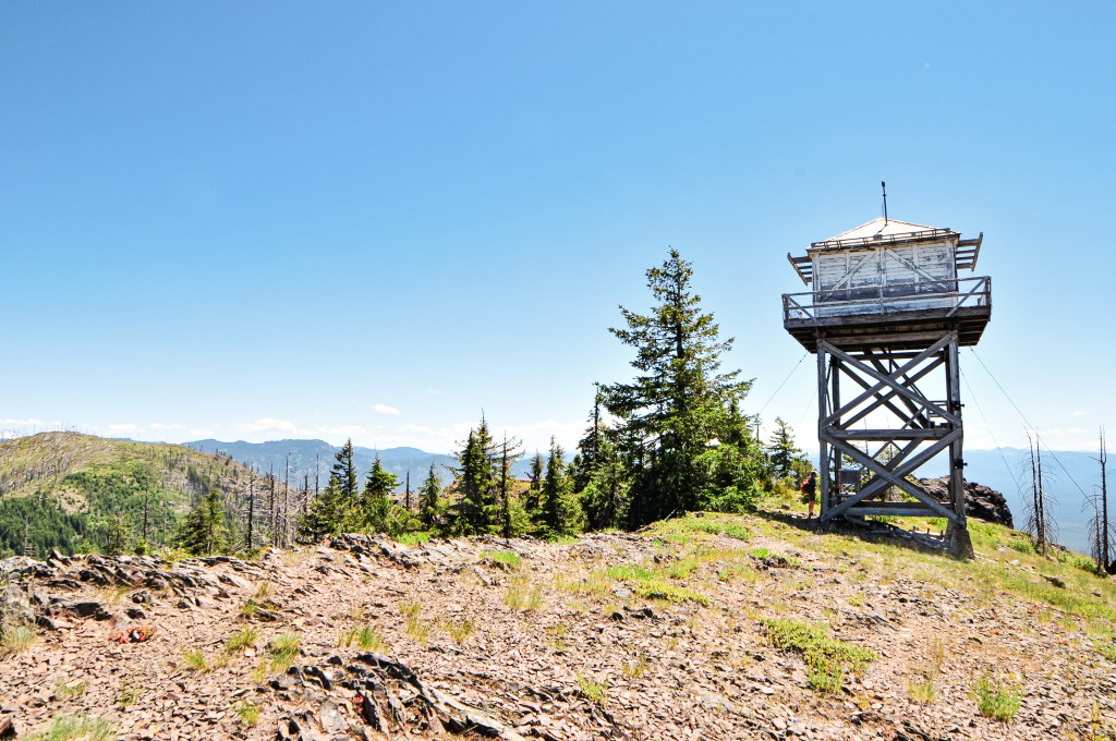
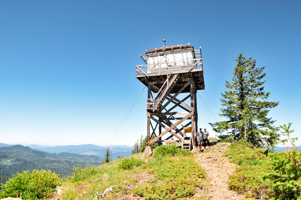
The hike to the summit is a little less than a mile and a half one way. You will climb over 1,000′ in elevation as you switch back up the side of the mountain through an open meadow. Today was forecasted to be hotter than Saturday which didn’t bode well for a more exposed hike. I quickly fell behind as I struggled with my tight calves and feeling dehydrated again. The main bloom of Beargrass might have already been done, but as I climbed the ridge line more and more blooms became present. Beargrass, or Xerophyllum Tenax, has such a unique flowering pattern. It resembles a q-tip or something out of a Dr. Seuss book. They can even reach up to five feet in height, which is almost as tall as me! As we neared the summit, we were lucky to have it briefly to ourselves aside from the lookout attendant on duty. He was doing his best to ignore everyone in sight. We gave him a hello which only warranted a wave and nothing more. I don’t blame him though, after watching a few hikers completely disregard his personal space I too wouldn’t want to try and talk to anyone. The poor guy was just trying to read his book and enjoy a lunch without being bothered. We enjoyed our lunch on the helispot before heading back down to the car. I was happy to be able to finally check this one off my list.
History.
Established as early as 1905 with a rudimentary platform pole structure, Coffin Mountain has been used as a site for fire detection for a long time. It received its morbid name due to the Coffin shape of the summit. In 1921, a D-6 cupola style cabin was erected in place of the platform. This structure housed the lookouts for 15 years until it was replaced in 1936. Its replacement was a 14’x14′ L-4 ground cab. The current lookout is a modified 15’x15′ R-6 flat top cab and was built in 1984. It is still actively staffed every summer.
NOTICE: August 27, 2023 – this area was impacted by the Lookout Fire that burned 24,754 acres on the Willamette National Forest.
Location.
Willamette National Forest; H.J. Andrews Experimental Forest
Status.
Active; Currently standing
Estimated drive time from Portland, OR.
3 hours
Date visited.
July 23, 2022
Elevation.
5,369′
National Historic Lookout Register.
US 484; OR 77
Trip Report.
My partner and I set out on another one-night weekend trip in search of more fire lookouts. We decided to start picking our way through the closer options within the Willamette NF. We set our sights on Carpenter Mountain and figured we could either add Sand or Coffin Mountain (post) to the weekend itinerary. Carpenter Mountain is doable as a really long day trip from Portland, but we wanted to test our luck in finding a camp spot within a busier western forest. I love a quick overnight trip, but it has become more tedious for us this year. We moved into an apartment near the beginning of the year after deciding to officially part ways with roommate living. The trade-off for our own space was three flights of stairs that we now have to haul our gear up and down every trip. This has helped us to become more efficient and stream line in our packing. Any item accidentally left in the apartment pays the penalty of three more flights up and down. You learn quick to grab everything you can in as minimal trips as possible and leave nothing unchecked. No essentials left behind!
That being said, we left Portland mid-morning with a packed car headed down I-5 towards HWY-126. From HWY-126, we turned into the forest on NF-15 just past the community of Blue River. We stayed on this road until we reached the Lookout Campground. There is a sign for Carpenter Mountain that states it is 13 miles away in the direction towards NF-1506. We forked right to follow the sign and enter the H.J. Andrews Experimental Forest. There are multiple junctions along this route, but all roads are marked and you will want to stay on NF-1506. The NF-1506 road starts out paved but eventually turns into well maintained gravel. We stayed on this road until we reached NF-350 off to the left. According to my odometer, it was 5.7 miles up NF-350 to the trailhead. This is a fairly decent spur road with only a few rocky spots and potholes to avoid up until the last mile. The last mile is where the road deteriorates and becomes very rocky. It was slow going in a low clearance vehicle but passable with caution. We made it to the trailhead just before 1pm. It is a short but steep one mile hike to the fire lookout. You will gain over 800′ in elevation. It was shaded most of the way which offered a nice reprieve from the heat.
I was struggling with tight calves and didn’t want to trigger a Charlie Horse, so I took my time on the hike. My partner reached the summit before me and was already talking to the lookout attendant, Rob, upon my arrival. Rob was friendly and willing to answer our questions. He was a bit reserved at first, but eventually warmed up to us. A few times he would leave the conversation and return to the interior of his lookout. We figured a few times he was done talking, but then he would eventually come back out to continue on before we had packed up. We talked for a while about photography and he gave me some tips on camera use. He pointed us towards an old growth trail that is located just past the NF-350 road on NF-1506. It’s a 3-1/2 mile trail one way, but we only had time to walk down to the log bridge. It was worth the stop and a great recommendation. There were a lot of old trees to ogle at in the short section that we walked along. Afterwards, we headed deeper into the forest via NF-15 to find a camp for the night. There were limited options as we had expected but we were still able to find a place suitable to set up camp for the night.
Lookout Rob
Rob has been the lookout on Carpenter for 9 seasons. He used to work on Wildland fire crews and was an Archeologist as well. He has a degree in Anthropology. In the off season, he lives in Eugene with his wife. He has a special interest in wildlife and ecosystems photography. His work can be found and purchased as prints on his photography website (link). His site offers more detailed information about him, but above is what we talked about in person. Though, I found out through his website that he went to WSU too, Go Cougs!
History.
Carpenter Mountain was first established in 1914 as a rag camp. They built an open sided cupola style fire finder shelter in 1917. This was used up until 1921 when a direct hit from a lightning strike destroyed it. A new or similar structure must have been rebuilt to replace this since there are still records of the site being used as a fire lookout. In 1935, a L-4 cab was built by the CCC on the summit. This was actively staffed until the 1960s. Eventually, it fell into disrepair with another lightning strike causing excessive damage to the structure in 1986. A Ranger reported that the strike caused 14 windows to blow out, the door to blow off, the steps to blow over the side, and the roof to be raised off the frame. It was officially restored in the 1990s and has since been moved back into active service.
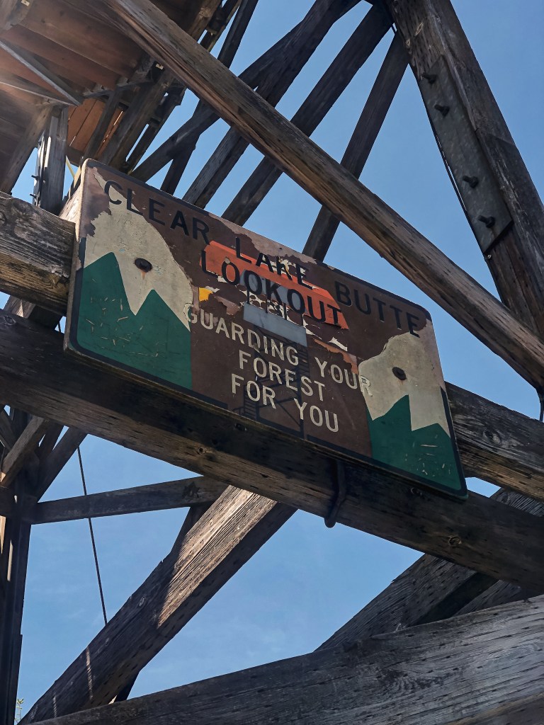
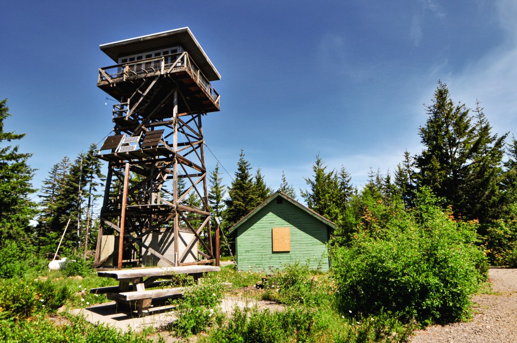
After our week long road trip dedicated to seeing fire lookouts in southern and south-eastern Oregon, we decided to look somewhere a little closer to home for a day trip. Clear Lake Butte has been in our back pocket for such an occasion given its easy access and proximity to Portland. Its popularity as a winter destination has kept us away in the colder months, but we knew it was actively staffed in the summer. I personally much rather talk to the lookout attendant than come upon some random renters during their winter stay. We left fairly early in the morning and found ourselves at the gated road before 10am. From Portland, you will want to head out to HWY-26 towards Government Camp. We turned right onto NF-42 which is past the turn off for Clear Lake Campground. The road to Clear Lake Butte is NF-240 off to the right. It should be obvious due to the gate, but it will be the second road down NF-42 on the right hand side. All roads are paved and parking is just a pull out at the beginning of NF-240. In the winter, you’d want to park at the snow park and hike in from there.
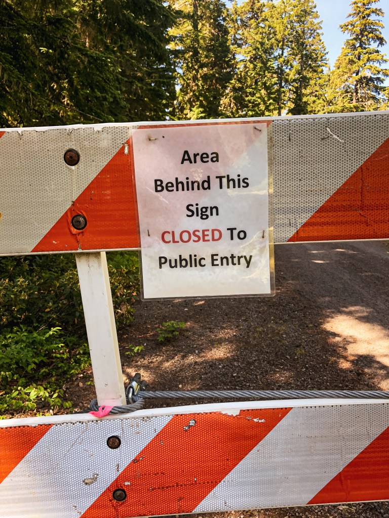
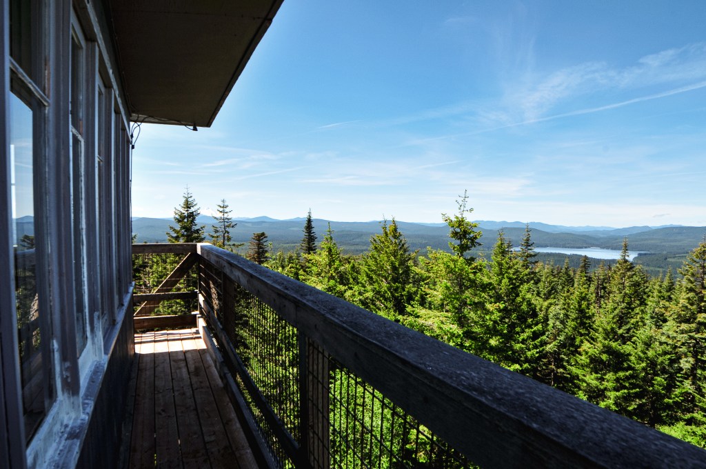
A renter, or some yayhoo, had ripped out the gate with their vehicle during the winter season. There were make shift road blocks and a sign that stated “Area Behind This Sign CLOSED to Public Entry” as replacement during our visit. The sign made us pause for a minute, but we decided to continue on since the Forest Service website noted the area as open. I assumed the sign was added to help deter any additional vandalism and disturbances to the lookout. We hoped for the best as we headed up the road. From the gate, it is a 2 mile road walk on mostly pavement with close to 1000′ in elevation gain. There’s not much of a view from the road or base of the lookout, but it is a nice walk in the woods. Once we reached the summit, all our worries about the sign were quickly squashed when Michelle greeted us. She was very friendly and immediately invited us up to check out the view. We even got to meet her very adorable dog. We talked with her for a long time about fire lookouts, the FFLA, the pros/cons of a fire lookout on the rental program, along with other interests. Based on her visitor log, we were only the fourth group up here for the season or at least that signed her book. She wondered if the sign would deter some people from visiting this year. After our visit, we had a brief lunch at the picnic table below the lookout and tried to find the crows nest on our walk back to the car. There are allegedly remnants of it remaining, but we were unsuccessful in our attempt to locate it.
Lookout Michelle
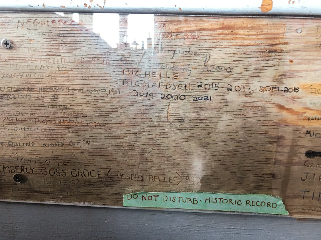
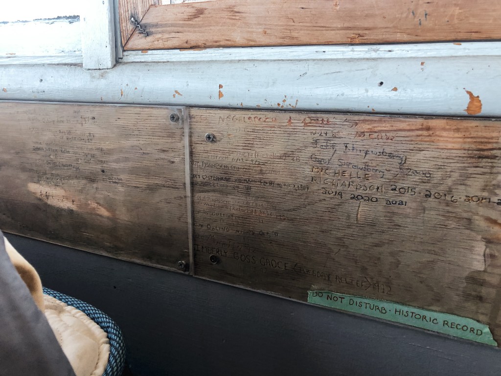
Michelle has worked on Clear Lake Butte for the last 8 seasons and the Mt Hood National Forest since 2004. She is accompanied by her sweet 13 year old rescue dog, Gidget. She can work up to 14 days straight since she doesn’t have a designated relief. She used to work in dispatch for the Forest Service and has also done work on a timber crew. She started working on fire lookouts when the primary lookout on Hickman Butte needed someone to fill in for them. Despite being in a busy area of Mt Hood NF, she only received around 84 visitors in 2021. Clear Lake Butte is currently part of the rental program which has caused problems for her during the start of season. Renters will move her stuff around, leave food/items that she has to clean up (this also attracts mice), someone stole her National Historic Lookout Register sign, and even tore out the gate to the road last season. There is even a protected board on the interior of the lookout that has been signed by everyone who has staffed it in the past. Renters will sometimes pry off the protected layer to try and crave their names with everyone else. Michelle has had to sand out a few names.
Book recommendation: Tatoosh by Martha Hardy
History.
Clear Lake Butte started with a crows nest tree just southeast of the true summit. I couldn’t find any information on what year the crows nest was built though. In 1932, a ring-connected timber tower with cab was built. It stood somewhere between 100′ to 110′ tall (Every site listed it at a different height and I couldn’t find a consensus). Old pictures show a cabin at the base for living quarters. The tower looked similar to the L-6 design on Frazier Point (post). This tower was briefly used for Aircraft Warning in the early 1940s. In 1962, it was replaced with the current 41′ treated timber tower and R-6 cab. It is still actively staffed every season.
Sign at the junction with NF-2212 and County Road 2460
Fork in road, County Road 2460 heads up
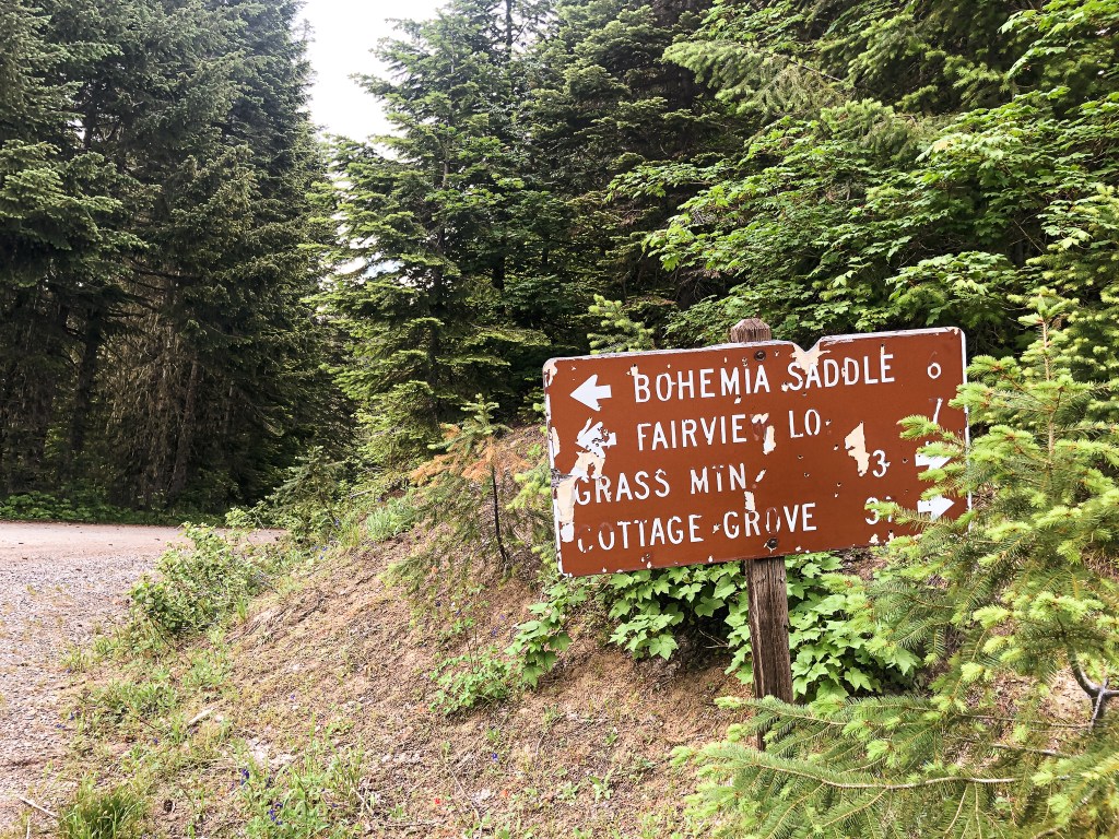
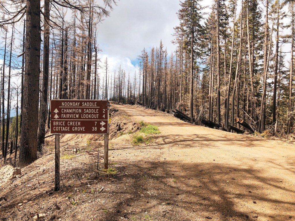
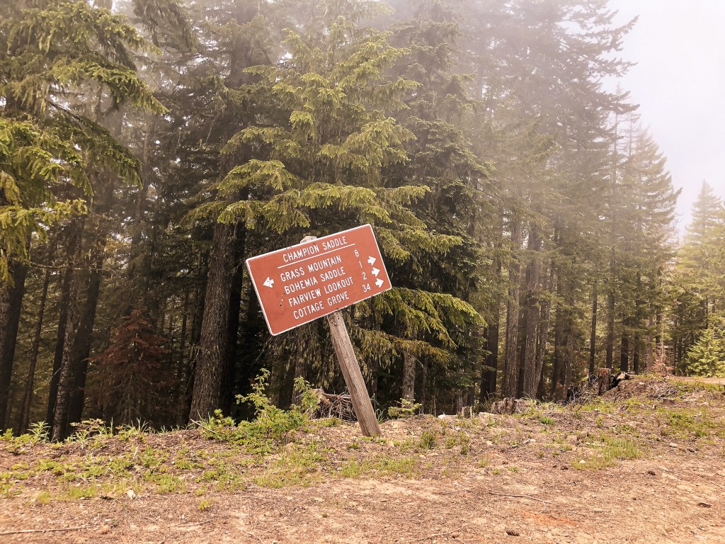
It was our last full day and we had already hit all of our expected fire lookouts for the trip. We had now moved on to our “if we have time” list which left Fairview Peak as our next alternative. We decided to pack up and move camps for the last night. This would set us up closer to Cottage Grove and make our drive home the next day shorter. This time the pavement route around the forest was significantly longer than cutting through on potentially iffy roads. We decided to risk it and headed up NF-38 to connect via NF-3831. NF-3831 is in relatively decent shape, but still required caution. We had to buck up a small tree, ride a few high lines, and move some rocks to get by. Eventually NF-3831 ends at a T-Junction where we took a left on to NF-2213. This junction used to be a four way junction but the NF-925 road has since been decommissioned. There was still a worn out sign for it though. Along this route, we found some impressive old growth Douglas Fir. NF-2213 will take you to another T-junction where it continues off to the right. We turned left here on to NF-767. This was another unsigned road, but there was a sign for Fairview Peak L.O. and Bohemia Saddle. It was roughly 8 miles of gravel roads from NF-38 to NF-767. Surprisingly, NF-767 was the best of all the roads with minimal hazards. It follows along the Calapooya Divide for a little over 2-1/2 miles to connect with NF-2212. There was another sign at this junction pointing towards Fairview Peak. We turned left here. NF-2212 goes directly through the burn area from the Rough Patch fire in 2021. The road was rough, rocky, and full of pot holes from here. It eventually meets up with County Road 2460 at another signed T-junction. The road conditions here were just as bad. We ended up parking in a pull out just before the Musick Guard Station where the road heads steeply up to the Bohemia Saddle. We road walked the remaining distance to the saddle and lookout. At the Bohemia Saddle, there is a large parking area with a trailhead for the Bohemia Mountain trail. The road to the lookout is directly across the saddle from the trailhead. It can be distinguished as the only road continuing up and by the gate with a fire lookout icon. The gate was open during our visit, but I assume they typically close it.
The gate for the Guard Station and my car
View from the road walk
At the Bohemia Saddle looking towards Fairview Peak Road
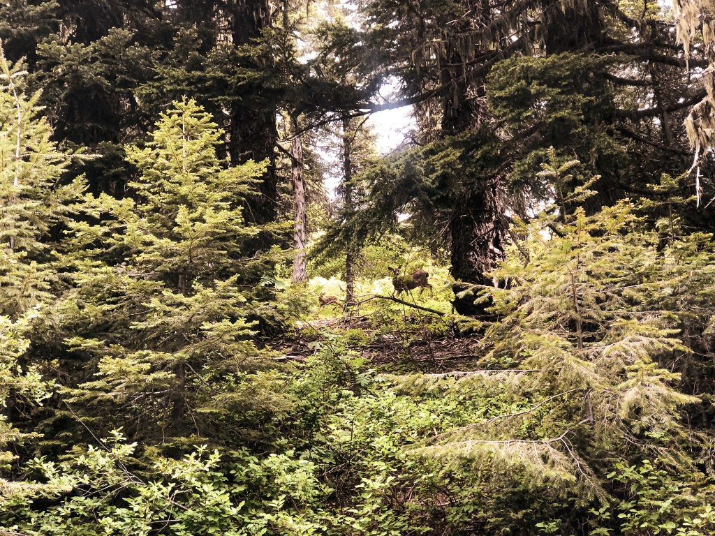
Doe and Fawn
This area is high-traffic in comparison to other towers we have visited. We were dusted up multiple times on our walk due to passing vehicles. We did end up seeing a doe and her fawn along the road though. A reminder that road walking isn’t all that bad and that it was something we wouldn’t have seen otherwise. When we finally reached the summit we were shrouded in a fog cloud, but had it to ourselves. We were also confused since there was no vehicle onsite. At first I assumed that meant there was no lookout here, but we both heard someone moving around in the cab. Interestingly enough, the catwalk door and door to the cab were both open. We assumed this meant someone had to be here. Previous years, this lookout has been apart of the rental program through the Forest Service. But, it was recently pulled into active duty for the 2022 fire season. We didn’t want to risk disturbing the lookout attendant by climbing the tower and they did not come out to greet us. There had been a fleet of vehicles and ATVs that had been coming and going from the area. I would hide out in my tower too if I was them. We enjoyed a lunch and waited for a while to see if the clouds would eventually lift, but had no luck.
We walked back to our parked car and were dusted up a few more times for good measure. We headed back out via NF-2212 to find a camp and hoped the rest of the road was in better condition. Spoiler: It was not. There were portions of it starting to wash out and one particularly large rock embedded in the road that was tricky to maneuver. Someone had spray painted it bright pink to make it more visible to oncoming traffic. It was still a well traveled road and we met a few vehicles on our way out. There were even a couple people who were driving a Prius. After what felt like a life time crawling down NF-2212, we finally reached NF-22. There had been a few dispersed camps along NF-2212 but none were particularly flat or secluded. We quickly ran out of dispersed options and ended up spending the last bit of cash we had on hand at Lund Park Campground. Overall, it had been a successful trip.
Day 10/10: We drove home without incident.
History.
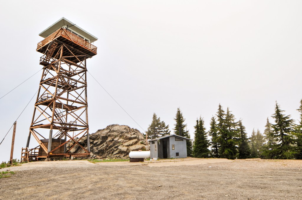
Fairview peak was established for fire detection as early as 1912 with a cabin and an Alidade. In 1921, a standard 12’x12′ D-6 cupola cabin was built. The cupola was eventually lowered and it was converted for additional storage or living quarters after a new tower was built. A 30′ pole tower with L-4 cab was added in 1936. For a brief time, in the late 1950s and early 1960s, the tower was used for an Air Force Gap Filler Radar station. It was used for this function up until 1964. Eventually, the tower was replaced with the existing 53′ timber tower and 15’x15′ R-6 cab in 1972. It was moved to the rental program for a while, but I am unsure on when or for how long it was apart of this program. All I know is it was temporarily removed from the program to be actively staffed again for the 2022 fire season. It looks like the lookout received a new super structure as well. It is unclear at this time if it will be actively staffed every season or moved back to a rental.
We headed out from camp towards HWY-138 once more. Today we were backtracking to Watson Butte and Pig Iron (post). They are located on opposite ends of the same ridgeline. This made it an easy day for driving since they were both along the same route. From HWY-138 heading east, we turned left on to Mowich Loop Road. The road does as it describes and loops back around to HWY-138. That means there are two opportunities to turn onto this road. If you are coming from Diamond Lake, you will want to take the second turn off to the right that is across from Stump Lake near milepost 67. Technically, both will get you to where you want to go but it’s shorter from this route. We bumped down a pothole filled road until we came to a junction. If you continue straight, it will take you to the Clearwater Forebay. You will want to turn right to stay on Mowich Loop Road. There is a gate here that is seasonally closed to winter traffic. The road improved after the gate but still had a few potholes to avoid. Eventually, you will come to an unmarked T-junction. Mowich Loop Road continues to the right and NF-100 is to the left. We turned left on to NF-100. If you stay on this road it will take you all the way to the gate for Pig Iron L.O. (post). We decided to visit Watson Butte first.
NF-170 sign
Looking at Watson Saddle junction from NF-170
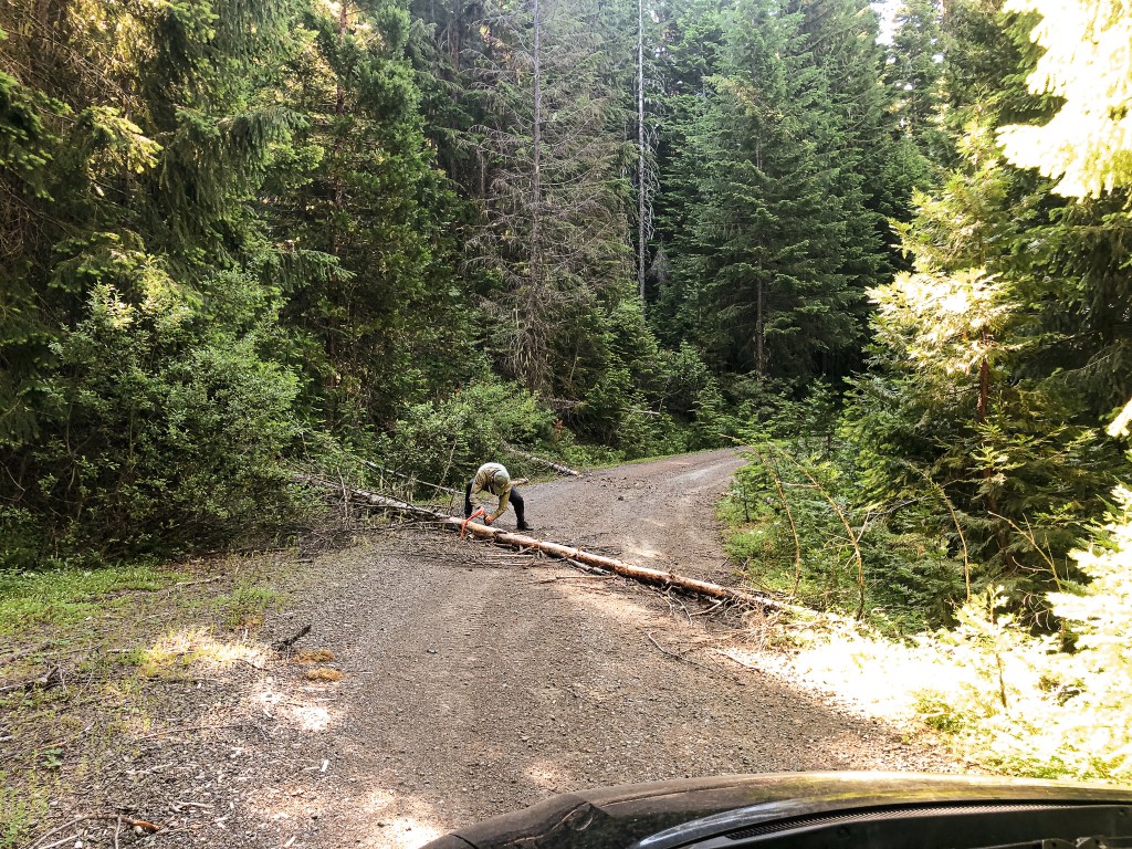
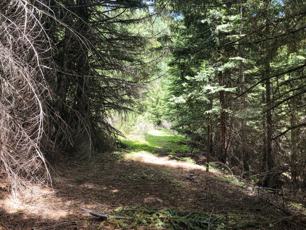
From NF-100, we turned on the first road off to the right. This is the NF-150 spur and does have a sign. We were slightly worried about the roads after seeing the condition of the Mowich Loop Road. The rest of the route was along three number spurs and we hoped we would be able to get close enough to make the hike. We were pleasantly surprised to find the three number roads were in better condition. The only road hazards we met along NF-150 were downed trees. Some of the trees were already cleared by tree cutters, but some were not. We had a buck saw with us and decided to do some road maintenance for the Forest Service. And by we, I mean my partner. I helped clear the area once the trees had been cut though. NF-150 eventually leads to a odd 5-way junction at the Watson Saddle. On the topo map, the road we wanted was labeled NF-164. Based on the directions from the Forest Service, you should take the road farthest to the right. Most of the roads at the junction are not marked though. We were able to find an NF-170 road marker on the road farthest to the right. This was confusing to us since it didn’t match the road numbers on the map and NF-170 should be off to the left. But, It did look like the road most traveled and was farthest off to the right as the Forest Service had recommended. We headed up NF-170 to the right until we were met with a section that started to get brushy. This made us second guess our decision and we headed back to the odd junction. We walked around the junction looking for any confirmation that NF-170 was the correct road. Eventually, we gave up and drove back up NF-170 to the brushy section. We parked in a pull out on the exposed portion of the road just past the brush and decided to start walking.
Where the old road bed starts
Where the trail starts
trail conditions
can you spot the trail?
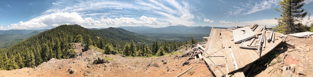
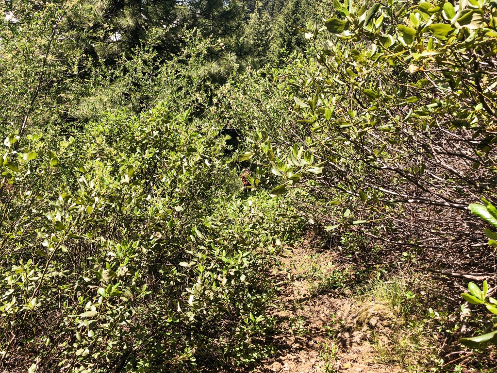
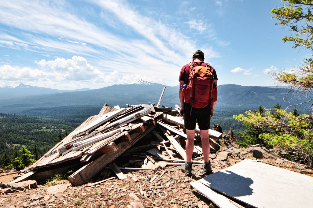
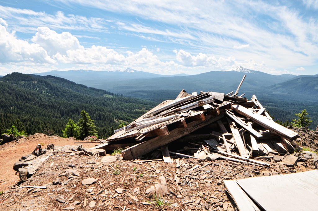
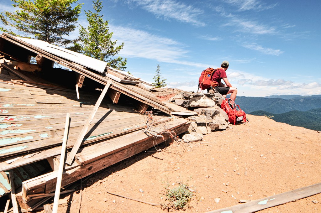
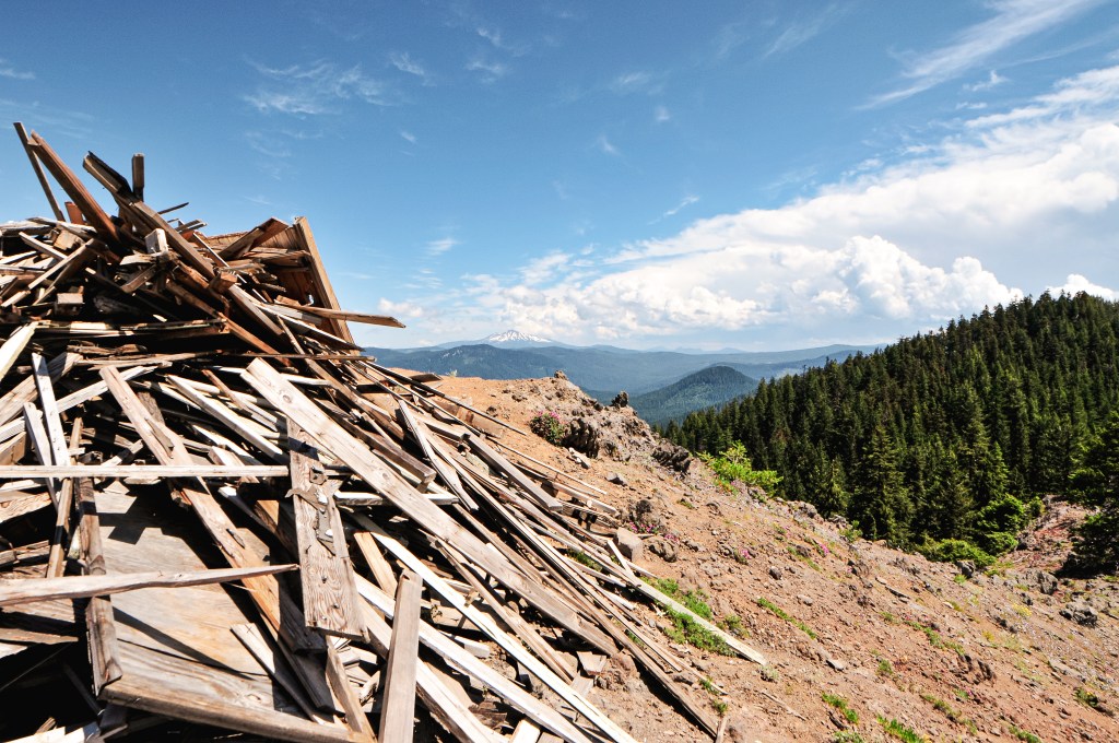
The Manzanita and Ceanothus were encroaching on the road in some portions and there were a couple down trees, but otherwise it wasn’t in terrible shape. There was a point in the road where it opened up to a view of what we assumed to be Watson Butte. I could see signs of a structure, but it was hard to tell exactly what I was looking at from that distance. I thought it looked collapsed, but I was hopeful my view was just obstructed. We walked for about a mile until we came to the trailhead. There is still a sign noting where the Watson Butte Trail #1443 starts. There was even enough room for a couple cars to park. It is obvious that this trail doesn’t see much use. From the trailhead, it is another 1.1 miles to the summit gaining around 600′ in elevation. We started out by following an old decommissioned road bed until it met with the base of the butte. The trail started to gain more elevation once we left the road. The trail continues faintly through a mostly shaded forest. It was especially faint among the switchbacks. We were able to stay on track by looking for the trail bench in the more overgrown sections. The final push is steep, but eventually opens up to an exposed summit. My partner had made it to the summit before me and I called out to ask if it was still there. He was oddly quiet in response. Eventually, I rounded the corner and saw why. We were too late. We had known Watson Butte L.O. was in bad shape and had been for years, which is why it was on our priority list to visit. There were posts of it standing the year before and we thought we had time. But, we were still too late. Watson Butte L.O. was nothing more than a pile of boards.
I’m not sure if we were the first to discover this or even hike the trail this year, but we were the first to report on it. Nothing can prepare you for coming upon a fire lookout you thought would be standing only to find it destroyed. My partner was in disbelief and even speculated that maybe someone vandalized it. But, to me, it looked like it had succumbed to the elements and time. We had a moment of silence for the lookout that once was before heading back down. It was a sad reminder that we are not going to be able to see them all standing. Some will burn in our ever present fire season, some will be removed by the Forest Service, and others will simply waste away in time. But for now, up a confusing network of poorly marked roads to an overgrown and fading trail you can still hike to what remains of Watson Butte L.O.
History.
Umpqua National Forest Archive – Sept 1942
Normally, I only like to post pictures I’ve taken myself of the fire lookouts but I decided to make an exception for Watson Butte. This lookout was built in the 1930s as an L-4 ground cabin. The Forest Service notes this as being built in 1934, but other sources claim it was built in 1937. Either way it had been standing for at least the last 84 years. Before the lookout structure was built, it was established as a camp and a telephone line was extended to the summit in 1920. It hasn’t been actively staffed since the 1960s. At one point there was talk of salvaging it for the rental program, but this never happened. According to Facebook, the last person to have record of it standing was on May 24, 2021. It most likely collapsed under the snow during the winter of 2021/2022.
We somberly headed back out to NF-100 after our unfortunate discovery on Watson Butte (post). Instead of heading back to Mowich Loop Road, we turned right to head to the other side of the ridge. We stayed on NF-100, which was a fairly well maintained gravel road, until we reached the gate. As described in my post about Watson Butte (post), access is from Mowich Loop Road off of HWY-138 near Stump Lake and milepost 67. Take a right at the junction with the road to Clearwater Forebay. You will pass through a seasonal gate to stay on Mowich Loop Road. Take a left at the unmarked T-junction to turn onto NF-100. From the gate, it is a mile road walk to the fire lookout. You can also access the fire lookout from Pig Iron Trail #1438, but I’ve read that it is an overgrown and steep trail. It was a fairly pleasant and flat road walk. Based on information I read online, I had thought Pig Iron was only staffed on a volunteer basis. We weren’t sure if we’d meet anyone during our visit though. Once we had a view of the lookout we could see a car parked and hoped they were friendly. We didn’t have to wait long before the lookout decided to come out and greet us. She introduced herself as Lisa and asked if we had come up the road or trail. We mentioned we had come from the road. She said her gate had been cut by vandals at some point during the beginning of the season and it was kind of scary not knowing who could drive up. Luckily, it seemed one of the Forest Service crews had recently fixed this issue. When we had walked around the gate there had been a new chain added and it was safely locked. She didn’t leave her post often, so she was relieved to hear that. We talked for a while about the surrounding area, Illahee Rock (post), the FFLA, and the importance of volunteers and advocacy within the community. We didn’t get invited up on the catwalk or in the cab, but the views were the same from the base. We mentioned our trip up to Watson Butte (post) and she said she didn’t even realize it had still been up there. She thought it had been removed a while back, possibly due to the misinformation listed on the Former Fire Lookout Site. It has since been corrected after I submitted a request to update the listing. We didn’t stay for too long since it was already fairly late in the afternoon and we still had to drive back to our base camp. We made sure to thank Lisa for her time and information before heading back to the car.
Lookout Lisa
Lisa is the current lookout attendant on Pig Iron and is employed through the Forest Service. She is accompanied by her cat. She has staffed this lookout since 2017 and was the last person to staff Illahee Rock (post) in 2016. She has worked on many different lookouts including, but not limited to, the Watchman, Mt Scott, Mt Harkness, & Pickett Butte. She started her work with the Forest Service in Air Quality which lead her to fire lookouts. She has worked as a Ranger for Crater Lake and the North Cascades National Parks. I believe she said she worked at Crater Lake NP for 15 seasons. She mentioned she used to do wilderness snowshoe trips for kids in the park. Pig Iron had recently had some work done on the catwalk, stairs, and windows due to damage during the 2021/2022 winter season.
History.
In 1950, the site on Pig Iron had been established with a fire camp. The lookout used a tent for living quarters and had a Fire Finder situated outside. There was a cover for when the Fire Finder was not in use and a small shed nearby for storage. A lookout structure was built during the same year. It is described as a 14’x14′ hip-roofed cab (the NHLR describes it as 10’x10′) with a 10′ wooden tower. It has 3’x3′ solid pane windows. It’s a similar structure to a standard L-4 design but not quite the same. It is situated below the actual summit for a better view.
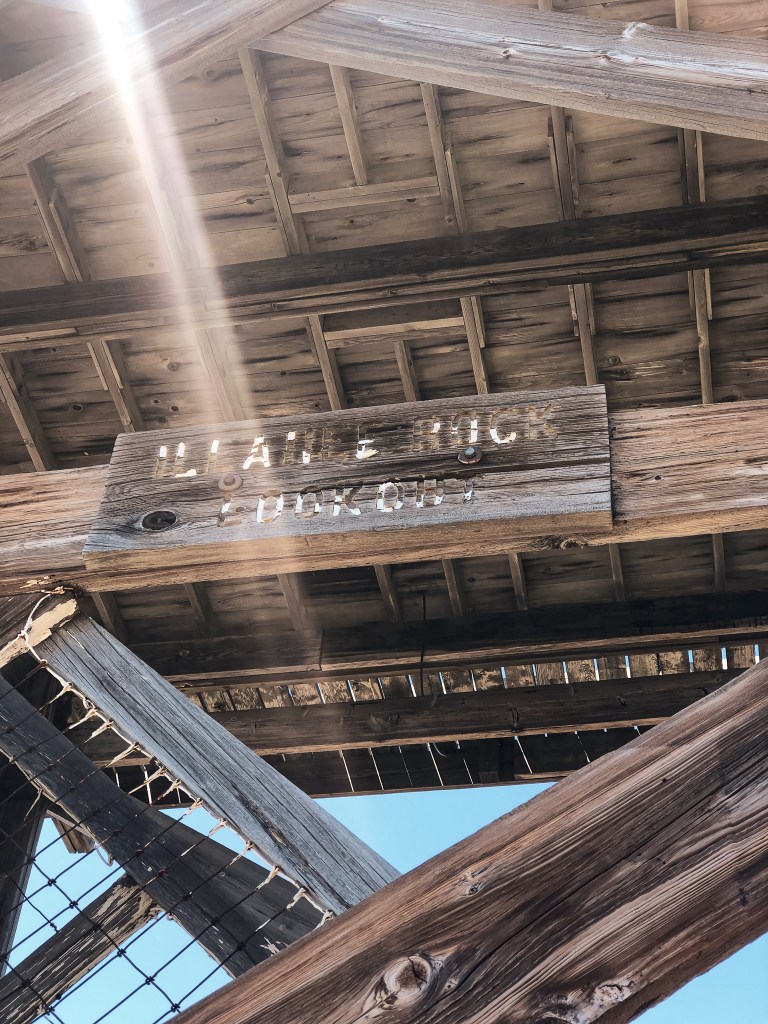
Please reference our original trip report on Illahee Rock L.O. for information on the history of the lookout, status, our initial site visit, and directions (post).
Ever since our not so graceful redemption visit to Illahee Rock, we have wanted to revisit during more ideal conditions. It wasn’t a high priority since there are so many other fire lookouts to see and only a short window to see them. But, Illahee Rock holds a special place in our hearts. It was the catalyst that triggered our pursuit to visit as many standing fire lookouts as possible. We had this as a potential add on to our road trip if conditions were favorable and we had extra time while in the area. Thanks to a recent trip report by the Wandering Yuncks we knew it’d be snow free this time too (site).
This was essentially a rest day for us from the go-go of the trip. We were already situated close to the access road for Illahee Rock and it was our only plan for the remainder of the day. We had a leisurely breakfast at camp before packing a lunch and heading out to HWY-138. The access road is fittingly named Illahee Road, which is also NF-4760. It is located just past the Umpqua’s Last Resort. You will wind up this decent gravel road for 7-1/2 miles to the junction with NF-100. Make sure to watch for fallen rocks along the way. We decided to park at this junction and walk since I recalled NF-100 having some larger potholes. After further inspection, all the potholes would have been passable to the Civic with caution. We stayed on NF-100 for about a mile before we reached the NF-104 spur off to the left. This will take you to the trailhead. The NF-104 spur is pretty overgrown and rocky. I wouldn’t attempt driving it in a low-clearance vehicle. From the trailhead, it is a short hike to the summit. It was really nice to see everything snow free for a change. The trail is still in great shape, even after the fires, with only a few downed trees to navigate. The wildflowers were in bloom too and we had commanding views in every direction. There is a hole in the catwalk that someone had cut just big enough for access. It was here during our last visit as well, but I didn’t have the energy to climb through it then. Also, in case it needs to be said, please do not cut holes in the catwalks of fire lookouts.But, since it was already there, I decided to get a better look. We had the trail and summit to ourselves aside from a kettle of Turkey Vultures that checked us out. I knew I didn’t smell great, but it must have been much worse than I thought to attract the Vultures. They eventually realized we weren’t road kill and moved on to something else. We enjoyed our lunch on the catwalk and soaked in the sunshine before heading back to the car.
The next day we were able to get a bit more clarification on the status of Illahee Rock from the lookout attendant we met on Pig Iron (post). She was the last lookout to staff Illahee Rock in 2016. She didn’t go into details on why they stopped staffing it or if they planned to staff it again. We could tell she was very passionate about Illahee Rock and would’ve preferred to be stationed there instead. The Forest Service had moved her to Pig Iron (post) as an alternative. Any friend of Illahee Rock is a friend to her.