Ant Hill L.O.

Oregon Lookouts

Location.

Umatilla National Forest

Status.

Abandoned; Currently standing

Estimated drive time from Portland, OR.

4-1/2 hours

Date visited.

July 15, 2023

Elevation.

4,602′

Former Fire Lookout Site Register.

US 1775; OR 515

Trip Report.

Day 8/9: Lookout Road Trip 2023

We headed back to NF-24 from Tamarack Mountain (post) and turned right to continue through the forest. We stayed on NF-24 until we reached NF-180 off to the right. We decided to park here to wait out the heat of the day. Ant Hill was only a little bit farther up the road, but it was so hot that the air was thick with heat even in the shade. We ate lunch and killed time by napping in our camp chairs or reading until we could feel the day starting to cool down. We walked the remaining distance up NF-180 to the junction with the decommissioned road NF-182. You could easily drive to this junction as well, the road is in decent condition. There is no sign at the NF-182 junction to indicate the turn besides a “closed to all motorized equipment” sign and a post with rocks. It’ll be off to the right once the road starts to curve and opens up to a view. The NF-182 road is closed to motorized traffic and you will need to walk from here. Though there is no gate or berm to stop someone from driving up. We could see tire tracks leading up the road despite the sign. Obviously, don’t be those people. No one likes those kinds of people. The NF-182 road will wind you around until you reach the summit of Ant Hill. There are no views from the summit except for just below it on the road. From where we parked our car at the junction with NF-180 and NF-24, the Strava app calculated the road walk at 1.30 miles RT with 136′ elevation gain.

Day 9/9: We drove home without incident. This trip might not have gone as smoothly as we initially hoped, but we still successfully made it to all our destinations with only a few additional scrapes added to the car. Somewhere along the way I visited my 100th fire lookout as well. I can’t say for sure which one it was since it’s dependent on your definition of an official fire lookout. One could make arguments for or against some of the ones I have listed and for that reason I am not going to claim one specific lookout as my official 100th visited. We can celebrate once I reach my 100th visited in Oregon, but even that might come with a few asterisks in place.

History.

The first lookout structure was built on the summit in 1935. It was a pole timber tower between 16′ to 24′ with an L-4 cab. I’m unsure of the exact height. It is listed on the Former Fire Lookout Site register due to the tower being dismantled and removed in 1956. I personally would consider this an existing lookout site due to the 10′ open platform tower that still stands today. There is no information on when this structure was built or if it was utilized for fire detection. The only mention of it I could find was on the geocache site. It states this structure was built from recycled material of the previous lookout. It reminds me of the lookout structures utilized on Green Butte (post) and Craft Point (post).

Tamarack Mountain L.O.

Oregon Lookouts

Location.

Umatilla National Forest

Status.

Active; Rental program; Currently standing

Estimated drive time from Portland, OR.

4 hours

Date visited.

July 15, 2023

Elevation.

4,979′

National Historic Lookout Register.

US 1516; OR 130

Trip Report.

Day 8/9: Lookout Road Trip 2023

We leisurely packed up our camp to move towards Tamarack and Ant Hill (post) for the day. We didn’t have to drive very far from where we were currently situated. Garnet had previously been to that area of the Umatilla NF during the 2017 solar eclipse and already had an idea of where we could camp. We followed NF-21 out of the forest until it turned into CR-847. This took us all the way out to HWY-207 where we turned left to head south. We didn’t have to stay on HWY-207 for very long before we took another left onto NF-24. There was a sign for Tamarack L.O. at the junction that stated it was only 9 miles away. This area seemed to be well signed and the road was made up of good gravel. We stayed on NF-24 until we reached another signed junction with NF-2407. This stated we only had 3 miles left to go to Tamarack L.O. as we turned right. Prior trip reports and some helpful information from other lookout enthusiasts we met told us the road would be good most of the way. After 2 miles the road turns into NF-040 and becomes rockier. We started up this section before deciding to abort and walk the remaining distance. Unfortunately, I was already in the rockiest section and the heat shield once again caught on something as I was backing down to the saddle. It was already hanging lower than normal from our mishap at the Mt. Ireland trailhead (post). Garnet had spent some time bending it back as best as he could for not having much more than some basic tools with us. This basically undid all the work he had done. It was even worse than before but we wouldn’t be able to touch it until it cooled down. I was annoyed at myself for not being more cautious and I was annoyed at the heat shield for causing more problems. We parked in the saddle between Tamarack and Little Tamarack to start our hike up the road. The last mile isn’t terrible, but it would have required some caution in a lower clearance vehicle.

Sign at junction along NF-24
Sign at NF-2407 junction

It didn’t take us long to reach the summit. It was only a 0.8 mile hike (1.66 RT) with 304′ of elevation gain from where we parked. The lookout tower on Tamarack is a tall Aermotor with a cabin at the base. It’s unique in that the cabin is rented out for recreational use, while the tower is still staffed every season. This leaves the lookout attendant to provide their own means of housing. A bit backwards and greedy in my opinion. We learned from Chuck on Madison Butte (post) that this was due to it being managed by two separate agencies. The Forest Service no longer wanted to staff the fire lookout and moved it to the rental program to make some profit. The state felt it was a crucial lookout to keep staffed and started staffing it themselves. The Forest Service let the state use the tower, but decided to keep the cabin for rentals. It’s not surprising that two government agencies wouldn’t agree on something, but it is unfortunate to those staffing the lookout. I would also feel terrible as a renter at this location. I’m sure most are unaware of the situation or at least I hope that is the case. There were renters onsite during our visit, but the lookout attendant was gone for the day. We knew their name was Sarah from our conversation with Chuck. We were bummed we didn’t get to meet them, but I left a note in their visitor log. I was able to connect with them later via Instagram.

We climbed the tower to get a better view since there was not much to see from the base and no one was onsite to disturb. Garnet climbed all the way to the last landing while I stopped around the 5th landing. There was a custom camper, hammock, and veggie garden at the base of the tower as well. It looked like a nice set up despite the circumstances. We had never seen a lookout trying to grow fresh veggies before and I thought it was a neat touch. After taking in the view, we headed back to the car to deal with the heat shield. Garnet was able to bend it back to a better position, but we would have to address it again once we were back home. Driving a Civic through the forest always keeps things interesting. Our next stop for the day would be Ant Hill (post).

History.

Tamarack Mountain is named after the Western Larch, a tree that frequently grows under the drier conditions of the Blue and Wallowa Mountain ranges. I guess Tamarack is another common name used for larch trees of all varieties. The site was first established for fire detection with a crows nest platform on top of a tree. Most resources, including the Forest Service website, state this platform was built in 1925. But, Ron Kemnow’s collection of articles from withdrawal records, Morning Oregonian, Heppner Harold, and Heppner Gazette Times shows the site could have been used as early as 1908. In 1933, a 96′ steel Aermotor tower was built with a cabin for living quarters. The cabin accidentally burned down in 1966, but the original tower still stands today. Instead of rebuilding the cabin, the garage/utility shed was converted for the living quarters. It’s unclear when the Forest Service decided to stop staffing the fire lookout and add it to the rental program. The cabin is rentable to the public from May 15th to November 23rd. The lookout is currently actively staffed by the Oregon Department of Forestry every season, but I am unsure when they took this over. The Friends of Blue Mountain Lookouts, a volunteer run group, replaced the stairs in September 2021.

Madison Butte L.O.

Oregon Lookouts

Location.

Umatilla National Forest

Status.

Active; Currently standing

Estimated drive time from Portland, OR.

4-1/2 hours

Date visited.

July 14, 2023

Elevation.

5,711′

National Historic Lookout Register.

US 1632; OR 150

Trip Report.

Day 7/9: Lookout Road Trip 2023

From Ukiah, we headed west on HWY-244 to cross HWY-395 into the Umatilla NF via NF-53. This starts out as a county road before entering the forest, but I don’t recall seeing a sign with a road name. There was a road construction sign at the junction noting they were doing a chip seal on this road and to expect delays. We seemed to be hitting all the activity this trip with work around the fire lookouts or on the roads getting there. Luckily, this time we missed the crews working on the road or they had already completed most of the work when we drove through. The NF-53 road is paved all the way to the junction with NF-21 and is in good condition. We turned left to continue on NF-21 which winds its way in and out of drainages. This was made up of good gravel and took us past the rentable Ditch Creek guard station and the staffed Tupper work center. Our plan was to camp in the area and hike the trail to Madison Butte the following day. Madison Butte can be accessed via a road as well from a completely different direction, but I believe it is seasonally gated and in terrible condition. Garnet’s dad mentioned the road getting there was not great years ago when he had been there and we were inclined to believe it hadn’t improved. Our biggest concern would be the conditions of the trail instead. Upon setting up camp, we came to the conclusion we wouldn’t have to move camps for the first time this trip. We had buffered an entire day for Madison Butte and since we were already in the area there was no need to move camps for 2 nights. The only stops we had left on our itinerary (after Madison Butte, of course!) were Tamarack (post) and Ant Hill (post), both easily accessible and close to each other.

The Madison Butte Trail #3054 starts from a trailhead just off NF-21 adjacent to the Tupper work center. There was a sign at the junction, but it only faced the direction we came in from. This is just something to keep in mind if you are heading in from HWY-207 instead of Ukiah. There’s not much else in the area so it should be fairly easy to find. We parked the car near the gate just before 9:30AM and prepped for our hike. The trail sign looked fairly new and listed Tupper Butte at 1 mile, NF-033 at 3 miles, and Madison Butte at 3-1/2 miles. There was also a warning notice posted to the tree next to the trail sign stating there was fire activity along one of the connecting trails. This was not new and out of date information from a previous fire in the area. We thought it was ironic that even with a work center full of fire crews right across the road no one had removed the warning sign. It just goes to show this is not a frequently visited trail.

The trail starts from behind the gate. You will need to pass through a cattle fence on the side or squeeze below the gate for access. The trail starts out as an old road bed and wastes no time gaining elevation in the first 1/2 mile. It follows up the side of Tupper Butte gaining around 700′ by the time you reach the junction with the Tupper Butte Trail #3065. The trail to Tupper Butte continues to the left for another 1/2 mile to the summit. This junction was only indicated by a wooden post. We decided against visiting Tupper Butte this time and continued straight to stay on the Madison Butte trail. Once the trail gains the side of Tupper Butte it levels out to enter a dense forest. There is a cattle gate here that you will have to pass through. Make sure to always close any gate behind you after you’ve passed through it. There was a confusing makeshift arrow at the base of the gate pointing to follow the fence line. This could be misleading to hikers who haven’t done prior research. There even appeared to be a trail along the fence line, but it was nothing more than a game trail. The trail started to gradually lose elevation from here until it opened up to an exposed slope where we were greeted with a view out to Madison Butte (and how far we still had to hike). The trail sharply turned down to reach a saddle and lost a lot of the elevation we previously gained. Make sure to pay attention in this section, there was a tricky switch back that appeared to continue straight. From the saddle, the trail turns up again to skirt around another butte before dipping into another saddle. The final climb up to the NF-033 road is more gradual and continuous. Once we reached the piped Bottle Spring, we knew we were almost to the road. The plants around the spring have started to over take the trail and it was hard to see where it continued. I headed up the drainage cross country toward what looked like a fence post (it was definitely man made) and was able to meet up with the last portion of trail. The fence post ended up being the trailhead and I was at the road. Garnet was still cooling off at the spring, but he planned to catch up shortly. I turned right to head the last 1/2 mile up the road to the summit.

Tupper Butte Junction
Cattle Gate with Arrow
Bottle Spring

The heat was starting to get to me and I couldn’t seem to keep up on my water intake. The trail had varied between shaded forest and exposed slopes with tall grass. It was faint in some sections with a bit of blow down, but we never had any trouble staying on track. There were white markers in the trees to help. I wouldn’t classify it as a lost trail yet, but it definitely doesn’t see a lot of foot traffic. The tall grass also really aggravated my allergies and had me sniffling the majority of the way. Despite the ups and downs, the grass allergies, and the heat we were constantly rewarded with huckleberries and wild strawberries along the way. This helped to keep us motivated. On a small section of road just below the lookout there were tons of butterflies enjoying the flowers. I had never seen so many in an area all at once. This trail had a lot of fun surprises that I didn’t expect.

We were greeted by the lookout attendant, Chuck, shortly after approaching the base of the fire lookout. His dog seemed protective of the space so we didn’t get too close, but we did have a nice conversation from the road. He had been at the base of the tower grabbing some more water to haul up when we arrived. He asked if we came up the road or the trail. We said the trail to which he confirmed we missed the “fun” road conditions below. We talked for a while about his experiences as a lookout and our trip as well. When I introduced myself, he mentioned the lookout attendant on Aldrich Mountain (post) was also named Danielle. She had staffed Tamarack Mountain (post) the year prior, but it was now staffed by her friend Sarah. He also seemed passionate about the cryptocurrency market. I’ve never dabbled myself because, just like the stock market, it requires a lot of time and effort to be successful in knowing the trends. It all feels like made up monopoly money to me anyway (no offense to the finance bros!). He asked me about my camera and tripod, which made me realize I actually know very little about it. I had more interest and momentum in learning the dynamics of it when I first started, but have become more of a point and shoot photographer along the way. My Nikon doesn’t work as an auto adjust point and shoot since I have an off brand lens. But, I don’t fuss with it beyond the ISO, shutter speed, and aperture. My tripod on the other hand is a low grade Manfrotto, which is a brand that came recommended by a photographer I knew. It’s sturdy but definitely not as robust as some. I couldn’t justify spending more as an amateur though. He told me about his camera and that he found a nice tripod package on sale at Walmart for around $30. It came with a few attachments for his camera and even his phone. I told him that seemed like a nice deal since I spent closer to $80 on mine and it didn’t come with any of those fun attachments. I also mentioned how it would be nice to have an attachment for my phone when I don’t need or want to use my camera. He quickly offered me one of his since he ended up getting two of the tripod packs, but had no use for two phone attachments. I insisted he didn’t have to do that, but before I knew it he had climbed his tower and came back with the attachment still in the package. I accepted his gift and thanked him profusely for the kindness. It has already come in handy a few times and I will forever remember that it came from the lookout on Madison Butte.

We didn’t get invited up to check out the view from the cab, but it is their home for the summer and should always be respected. We said our goodbyes after taking a few more pictures and headed down the road to have lunch on the slope below with a view. I think the dry conditions along with the grass allergies really irritated my nose because while we were enjoying lunch it started bleeding for no apparent reason. It was an inconvenient place for a bloody nose. The quick loss of blood made me a bit light headed as well which wasn’t a great way to start our hike back. I had already drank my 32oz Nalgene full of water and was half way through my 32oz Nalgene of electrolytes. Garnet had already drank a lot of his 64 ounces of water as well. Typically, this would be enough water to get us back since we are usually hiking down hill on the return. But, something to keep in mind about this trail is the return trip takes just as much energy as the hike there. We tried to keep ourselves cool by soaking our shirts and hats in the Bottle Spring. We took more breaks on the return and kept our energy up with huckleberries. By the time we reached the final mile, both of us had diminished our water supply. We were both feeling the effects of dehydration. At least we knew there would be water waiting for us back at the car and we were close. This hike made me realize I really need to start packing my water filter on day hikes. If I had it with me, we could have easily replenished water at the Bottle Spring and would have been in much better shape on our return. I was even tempted to risk drinking the unfiltered water directly from the spring, but Garnet had advised against this. We made it back in one piece and chugged as much water as we could safely handle. My Strava App calculated this hike at 8.44 miles with 2,638′ of elevation gain. This made us extra thankful that we didn’t have to move camps until the morning.

Lookout Chuck.

Chuck has been the lookout on Madison Butte for 10 seasons, but has also worked on Lookout Mountain and Goat Peak in Washington. He is accompanied by his most recent rescue dog, Oliver. He lives in Northern Washington in his off seasons. He used to do work as a wildland fire fighter prior to becoming a fire lookout. This has allowed him to extend his seasons by assisting with slash pile burning in the shoulder seasons. His hobbies include photography and cryptocurrency. His favorite things to photographs are the thunderstorms that roll through the area.

History.

It’s possible the site of Madison Butte has been used for fire detection as early as 1909. Some old withdrawal records listed on Ron Kemnow’s site makes mention of plans to build a small cabin for men on lookout at this station once funds are available. It is unclear if that ever happened. A new telephone line was constructed to the summit in 1922 and by 1923 a D-6 Cupola ground cabin had been built to house the lookout. It was replaced in 1957 by a 37′ steel tower with CL-100 cab. We’ve realized the majority of CL-100’s in Oregon were built during that year. It is still actively staffed every season.

More Information.

US Forest Service

Go-Oregon

AllTrails

Johnson Rock L.O.

Oregon Lookouts

Location.

Wallowa-Whitman National Forest

Status.

Active; Currently standing

Estimated drive time from Portland, OR.

5 hours

Date visited.

July 13, 2023

Elevation.

5,714′

National Historic Lookout Register.

US 1628; OR147

Trip Report.

Day 6/9: Lookout Road Trip 2023

We headed out from Tower Mountain (post) the same way we came in on NF-5226. One might argue we should have continued through the forest on NF-5226 to connect with HWY-244 since we were planning on going that way to get to Johnson Rock. But, I didn’t feel like taking any chances on another forest service road and we wanted to stop in Ukiah for amenities. We drove the remaining distance of NF-52 out of the forest until it turned into CR-1475. This county road will dump you into the heart of Ukiah. We decided to check the Ranger Station in Ukiah to see if they knew anything about the NF-51 road closure. It was technically out of their forest management, but we figured they might know anyway. Unfortunately, when we got there the station was only open to visitors by appointment. Strike one. Ukiah also didn’t have any cell service for us, so we weren’t able to call the La Grande station from here. Strike two. We moved on to check out the local business we thought would have gas, but it appeared to be closed indefinitely. Strike three. It appeared our luck had run out completely. The only amenities we were able to secure were refilling our water reservoirs in the local county park. Ukiah did have another convenience store that was open where we were able to buy some ice for our cooler too. In hindsight we probably should have asked the locals about their gas station, but we just assumed they no longer had any available. For future reference, I think they still offer gas at the Byrnes Oil off of Pine Street. It appeared people were stopped there filling their tanks when we drove through again the following day.

We sat along side the county park for a while debating what we should do. Do we risk it and drive to see if the road is open for ourselves? Or do we assume the worst and move on to our next destination? Garnet had the idea to start driving in the direction of Johnson Rock until we could find suitable service to call the La Grande Ranger Station. We decided to go that route and headed east out of Ukiah on HWY-244. We didn’t get service until we were on the Blue Mountain summit and pulled over to make the call. The ranger we spoke with was aware of the NF-51 closure but wasn’t sure when it would be re-opened. Also, just doing a basic search on the Forest Service road closure notices there was nothing mentioned about this road being closed (so any prior research wouldn’t have brought this to our attention). We asked the ranger about access to the Johnson Rock lookout. He wasn’t sure if that was part of the closure which meant he would have to get back to us, but he knew you could at least drive to the Spool Cart campground which is just before the turn. We gave him our contact information and we were back at square one. No one seemed to know much about this closure or at least the information we needed. We sat on the side of HWY-244 debating our options again. How long should we wait to see if he’ll call back? Do we drive to see if the road is open for ourselves? Or, once again, do we assume the worst and move on to our next destination?

We decided we were close enough that it made sense to check it out for ourselves. We also knew we should probably refuel soon and La Grande was our next closest option. We turned right onto NF-51 from HWY-244 towards the community of Starkey, this was marked as the Grande Ronde River Road prior to entering the forest again. There was no road closure sign posted at the junction, but we passed one that said “Road Closed 16 miles Ahead” once we got closer to the boundary. Based on our estimated mileage calculation prior this would put the road closure past the turn off we needed. We passed the Spool Cart campground with no issues and figured we’d make it to our turn after all. We reached NF-5115 off to the right only to be met with two more signs. Both said “Road Closed Ahead” and were partially blocking the road. Garnet and I debated what that meant. Did it mean the road behind the sign was closed ahead? Or was it referring to the other road closure on NF-51? At this point I was willing to throw in the towel on Johnson Rock, no one knew anything and it was unclear if we should be driving up this road. Garnet rationalized with me that if the road was actually closed there would be a road block farther up and we could turn around from there if needed. We continued up NF-5115 past the signs and hoped for the best. The NF-5115 road was in good shape and after a mile and a half we came to the junction with NF-5120. We turned left onto NF-5120 that would take us the remaining distance to the lookout, if road conditions were on our side. The conditions of the road deteriorated after leaving NF-5115. There were quite a few wide shallow pot holes that consumed the whole road and blind hills that would be a bad spot to meet oncoming traffic. Minor highlines and wash outs were also something to be aware of along this road. John was right about the road deteriorating significantly around 2 miles from the lookout. We made it to the NF-500 spur before deciding this was as far as we should probably drive. This was just beyond where the map said the road stopped being maintained. We set up camp in the flattest spot we could find and planned to hike to the fire lookout in the morning. We still weren’t 100% sure if we should be here, but we were never met with a road closure beyond the signs. We could hear and see the large helicopter doing work along the Grande Ronde. I had thought that I heard John mention they were practicing water drops on the phone with Mike. This lead to the irrational thought that they would accidentally drop a metric ton of water on us thinking no one would be in the area. I asked Garnet what would happen if they dropped that amount of water on someone and he said one would probably die from the shear force. A comforting thought.

The next morning, I woke up early to the sound of the helicopter again and had a hard time going back to sleep since it sounded closer to us than it was yesterday. We eventually got up and packed lunch for our hike up the road. We also packed up our camp so things would be ready to move when we got back to the car. As we started up the road we realized quickly where we had stopped was a good call. There were portions of the road that were fine, but the few significant rocky sections would be un-passable in our car without bottoming out. When Mike had talked to John the day before he mentioned there was a private contractor thinning the trees around the lookout that kept starting their chainsaws at 5am every morning. I didn’t recall hearing a car drive by that morning but it’s possible we didn’t hear it due to the helicopter starting around the same time. It was a pleasant walk from where we had parked but it was already getting hot for the day. The most notable things from our road walk were an occasional Pileated woodpecker flying across it, wild strawberries, and having something grunt at us from the bushes. We were pretty sure this was an elk but never saw it to confirm. As we got closer to the fire lookout, we could finally hear the symphony of chainsaws. I’m sure this wasn’t relaxing for John to hear all day, but they were making good work of thinning out the area. John was aware we’d be attempting to visit him sometime based on his call with Mike. We walked over to the viewpoint at the edge of the rock and wondered if we should try to make ourselves known. Before we could decide what to do, John called down from his catwalk and asked if we wanted to come up.

We climbed the tower and were not only greeted by John but his very large string bass. He also had a guitar and a mandolin there as well. I couldn’t believe he had hauled such a large string instrument all the way up there. He said he didn’t use the winch either because he didn’t trust it with such an item. He also confirmed that the helicopter we had seen along the Grande Ronde was moving logs to build salmon habitat. This made more sense than practicing water drops and I was happy to know my fears were unwarranted. We chatted for a bit about his experiences as a lookout and our trip around the area before heading back down to have lunch. While enjoying our lunch under the shade of a tree, an official Forest Service vehicle drove up. There were two rangers in the vehicle, and we wondered if they’d say anything to us about being there. It was still a grey area in our minds at this point, but less so now that we had made it to the lookout itself. They were only here to inspect the work of the private contractors and didn’t give us much more than a wave. I’m sure they were more confused than concerned about why we were there. We didn’t dilly dally much after we finished lunch and made the short hike back to the car. My Strava App recorded this road walk at 5.02 miles RT with 905’ of elevation gain.

The drive out felt much shorter than the day before. The signs that had previously blocked the road were now gone. Garnet’s phone also had a voicemail from the ranger we spoke with in La Grande confirming the road was open for recreation. It was good to know we had no reason to worry, but it felt a little too late at this point. We drove the remaining distance of HWY-244 to La Grande in search of fuel. Once we had a full tank, we backtracked to Ukiah again. We can now say we’ve driven the full length of HWY-244 twice. Our next destination was Madison Butte (post) on the Umatilla NF.

Lookout John.

This was John’s first season on Johnson Rock, a fittingly named lookout for him. He has worked as a fire lookout for 9 seasons on different towers such as Numa Ridge in Glacier NP, Tower Point in Oregon, and Aztec in Arizona to name a few. Prior to his seasonal work as a fire lookout he was a teacher. He uses his free time as a fire lookout to learn new skills and hobbies such as playing the string bass, guitar, and mandolin.

History.

There isn’t too much history behind the fire lookout on Johnson Rock. The first structure was built in 1938 as an L-4, but there is no information listed on if this was a ground cabin or tower. Given that the current 14’x14’ L-4 cab was built on an 82’ treated timber tower, I can only assume its predecessor also had a tall tower. The existing lookout was built in 1952 and is still actively staffed every season. Although the structure is still utilized the cab could use some work. The shutters on own side were blown off during the previous season and it would benefit from a new roof.

Not sure what happened to our picture together so here’s another picture of the lookout

Heybrook L.O.

Washington Lookouts

Location.

Mt. Baker-Snoqualmie National Forest

Status.

Rental program; Currently standing

Estimated drive time from Portland, OR.

4 hours (5 hours with traffic)

Date visited.

August 4, 2023

Elevation.

1,701′

National Historic Lookout Register.

US 1094; WA 60

Trip Report.

One thing I try and do every year is make time to go on a ladies only backpacking trip with my friend, Anjelica. I always think it’s important to make time for friends and yourself outside of a relationship, sorry Garnet! We’ve invited other lady friends in the past, but most have not been interested in taking the extra step from car camping to backpacking. This trip was just the two of us. Our original plan was to spend two nights somewhere in northern Washington, but her work schedule recently changed which limited us to one night. I don’t work on Fridays so I was left with an extra day to potentially do something else in the area after my drive up. She lives in Kirkland and I noticed her place was less than an hour from Heybrook. This is a popular fire lookout that is shared all over social media and it was still on my list of Washington lookouts to check off. This felt like the perfect solution to drive up earlier to beat traffic, but still be able get to her house around the same time she’d be off work.

I set out from Portland around 10AM via I-205 north towards Washington and eventually merged with I-5 after passing Vancouver. There are more than a few ways that you can take to get to HWY-2 from I-5. Given the accessibility and popularity of this trail, you can easily get here via GPS navigation without getting lost. This goes against my normal recommendation to always use a paper map. But, I didn’t have the luxury of Garnet being my navigator, so GPS it was. The route it took me was most likely an unnecessary maze of turns through rural roads, but it could have also been avoiding the afternoon traffic. From I-5, I headed on I-405 to HWY-520 until the highway ended and turned into Avondale Road. I turned right on to Novelty Hill Road, left onto Snoqualmie Valley Road, and then right onto Woodinville-Duval Road until I reached the community of Duval. This road met up with HWY-203 in the center of Duval where I turned left to continue heading north. HWY-203 will take you all the way to Monroe where it meets up with HWY-2. I turned right to head east on HWY-2 passing through the towns of Sultan, Startup, and Gold Bar. I passed the turn off for Index and the trailhead was only a little farther past this off to the left. There wasn’t a sign from the highway to indicate the pull out was for the trailhead, but most likely there will be other cars to make it obvious. This is where the GPS actually came in handy for a change.

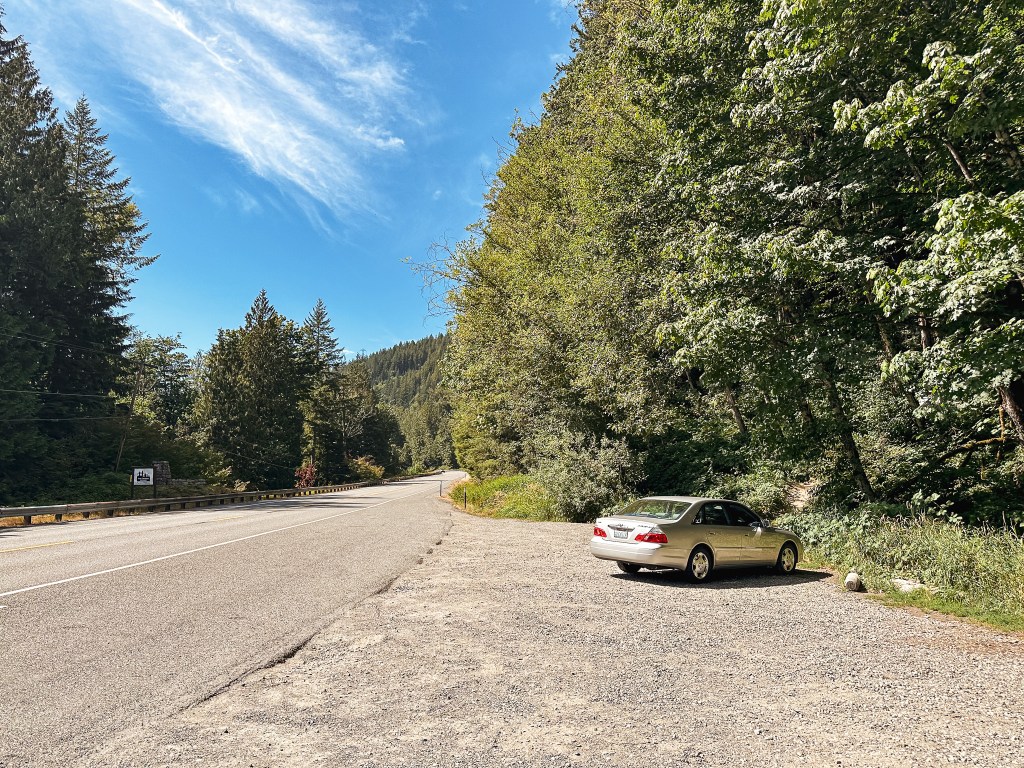
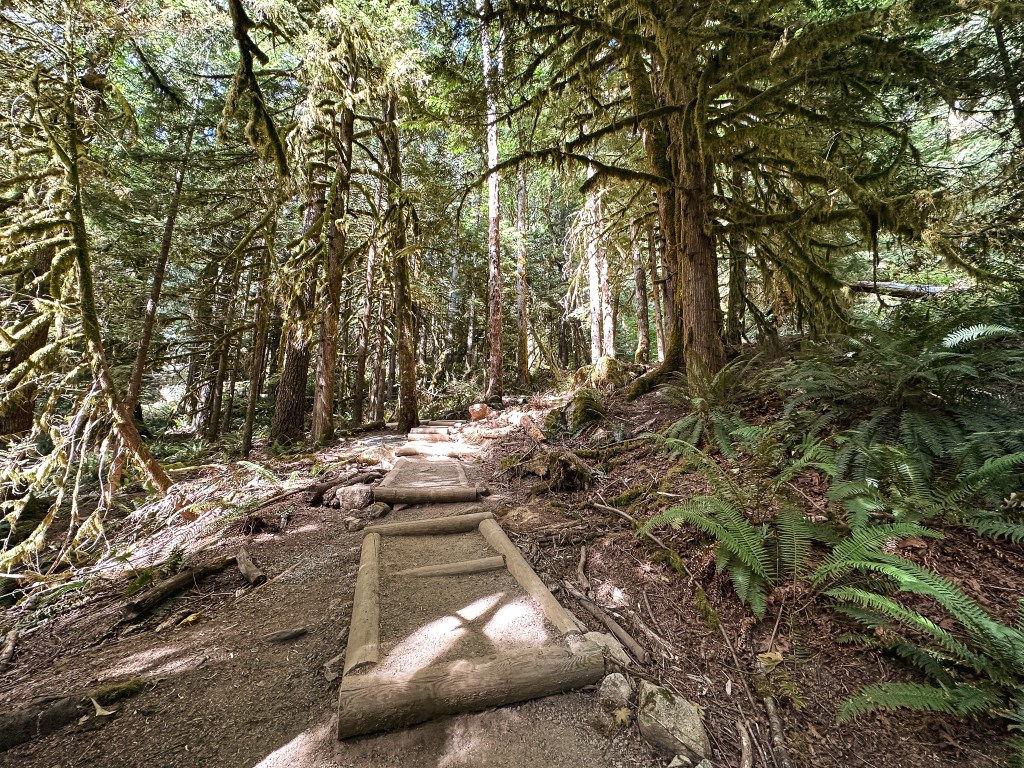
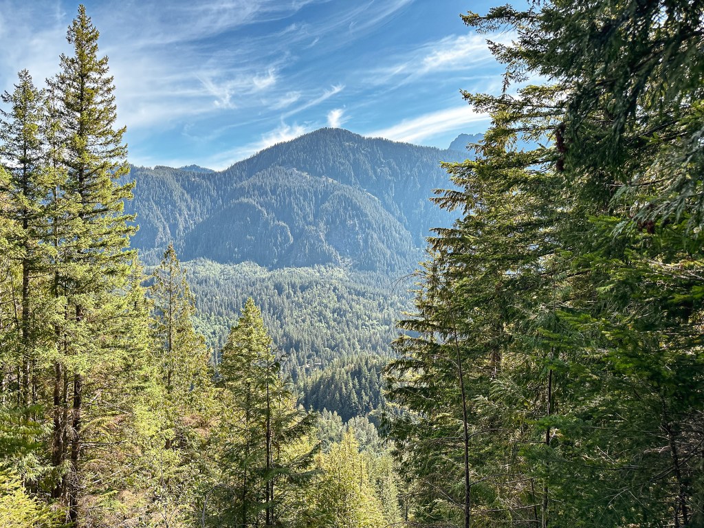
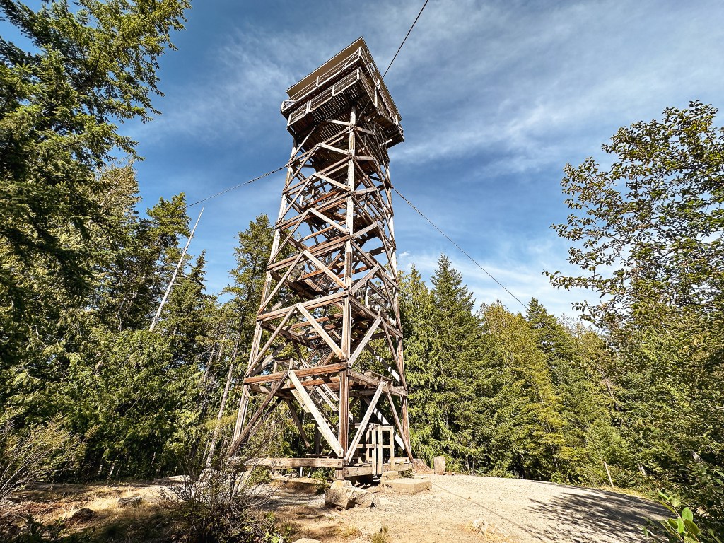
I pulled into the parking area just after 3PM and there were only 5 other cars besides mine. I would barely count one of those since there was a couple getting into their car to leave when I arrived. There is plenty of space for parking right off of HWY-2, but I can imagine it fills up quickly on weekends. I actually expected to see more people here on a Friday afternoon. I stopped briefly to read the trailhead board to see if there was anything of note I should be aware of. I noticed a sign asking to count the cars at the trailhead and to text it to a phone number. This was for an Outdoor Recreation & Data lab hosted by the University of Washington (link). I thought it was interesting that they were collecting data on usage of this trail and sent them a text. You will get an automated response that takes you through a few other questions and prompts about your visit to the area. I started my hike up the trail and could immediately feel the heat from the day. Since I was hiking alone, I made sure to stop and take breaks often. I didn’t make it very far up the trail before I was met by another pair of hikers coming back to the trailhead. But, after I had passed them, I had the entire hike up to the fire lookout to myself. There are a lot of steps in the first steeper portions of the trail that you can tell the WTA has put effort into for erosion control. Once you reach the ridge line the trail becomes more gradual until the final steps to the lookout. The trail is completely forested until you reach the base of the lookout, but even then most of the views are gained from the viewing platform on the tower.

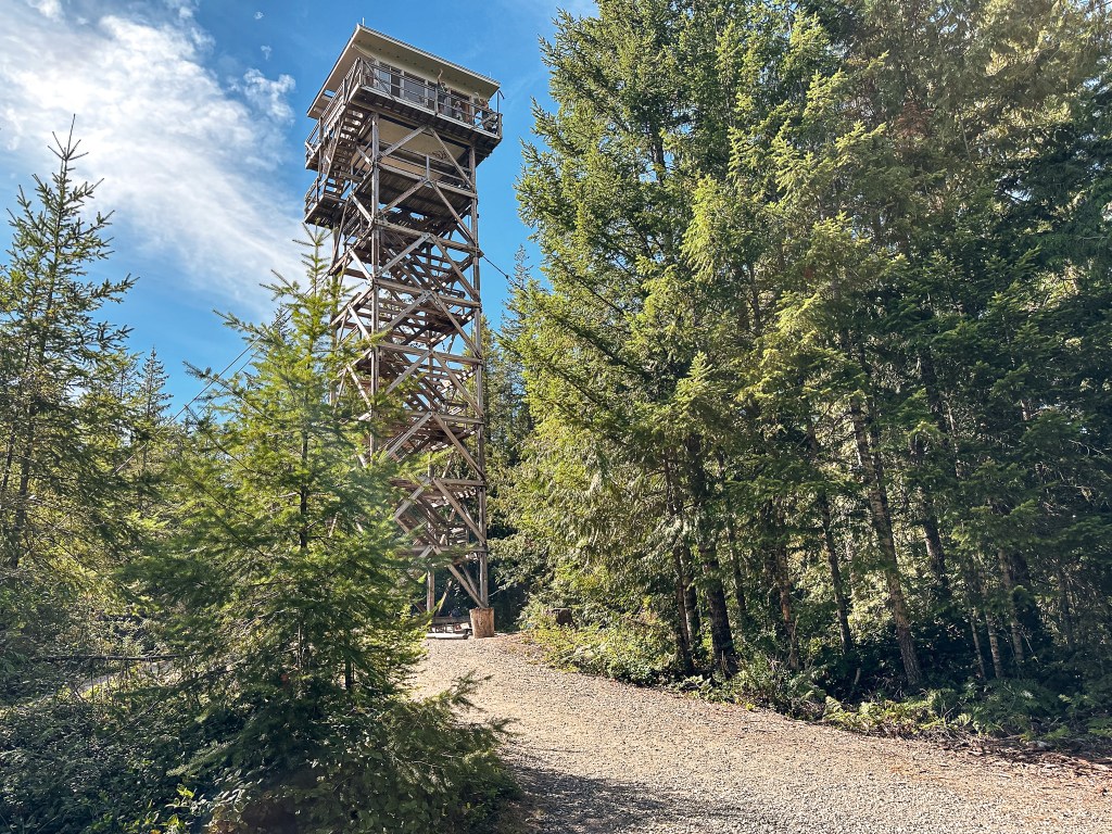
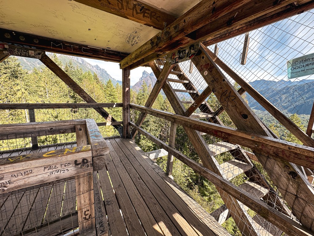
I walked around the base of the fire lookout first to take a few pictures before heading up the stairs. There was a group of four on the catwalk which I assumed were the renters for the evening. I think they thought I waved at them when I raised my hand to shield my face from the sun while taking a picture. I said hello back, but you can see them waving in one of the pictures. Aside from them there was no one else on the summit. I climbed the stairs to the viewing platform that sits just below the catwalk. It’s nice that they added this for day hikers to take in the view, but as a renter I personally would find this slightly annoying. I’m sure you can hear people climbing the stairs at all hours. I did appreciate that there were a couple signs stating not to bother the renters. Not all fire lookout rentals will include this small step to offer some privacy. There was also a disappointing amount of graffiti on the platform. Unfortunately, busier places like this attract all walks of life including the disrespectful and damaging.

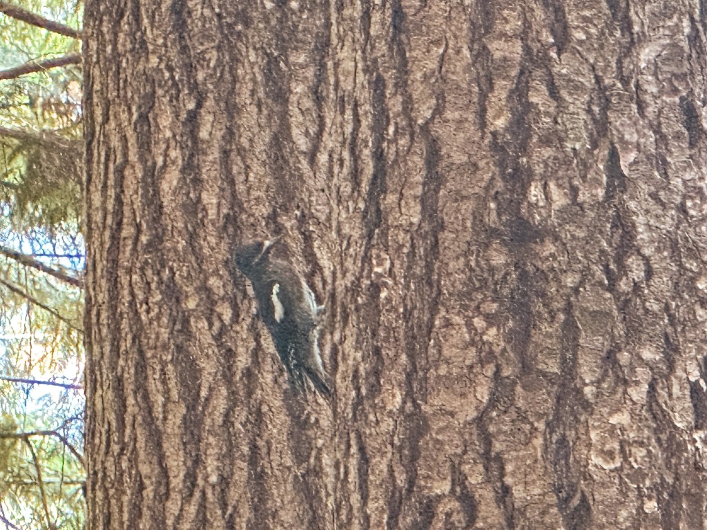
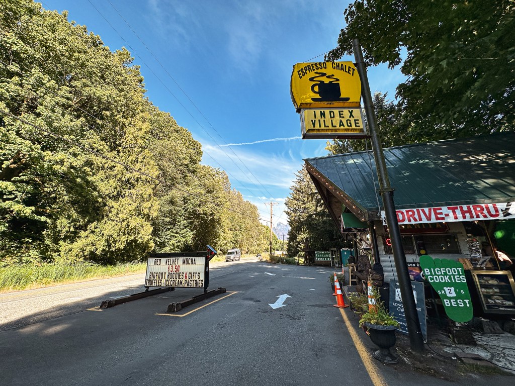
I was passed by another pair of hikers as I headed down the stairs. Once back on the more gradual portion of trail along the ridge, I was typing some notes on my phone from the hike and ended up slipping on some loose dirt. This caught me off balance and I slowly slid right onto my butt. I chuckled to myself and was glad no one else was around to see it. I’m normally more paranoid of falling and take extra careful steps, especially by myself. I had put too much faith in the well graded trail this time. I once again had most of the trail to myself until just before the trailhead. There wasn’t much wildlife around either except for a few ground squirrels and robins. I did stop to watch a mostly black woodpecker for a while though. I originally thought it was a female black backed woodpecker, but after doing some research it appears to be a type of sapsucker instead. The white wing bar was a defining characteristic. I passed two more groups of hikers just before reaching the trailhead, but it was an overall quiet hike for me. It felt good to complete a solo hike for a change. I used to solo hike all the time and it was how I reintroduced myself to nature. But I don’t often find myself alone anymore between my friends and partner that are down to adventure. My Strava app calculated this hike at 2.25 miles RT with 897′ of elevation gain. I decided to stop to get a small latte, as a treat, at the Index Espresso Chalet before heading on to meet my friend in Kirkland. It’s a cute road side coffee stand that offers views from the back deck and sasquatch merch.

History.

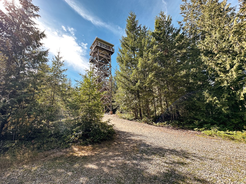
Heybrook has been used as a fire detection site since 1925 when a platform tower was built. This was later replaced by a 45′ tower with L-4 cab in 1932. The existing 67′ treated timber tower with 14’x14′ cab was built sometime between 1963 to 1965. The cab was specially designed by the Forest Product Labs per the request of USFS Region 6 engineers. It looks similar to an R-6 cab but was designed to use lighter weight material and be prefabricated off site. It was built with the intention of being packaged and bundled to be delivered by helicopter. This was the only lookout to use this cab design. It was actively staffed into the early 1970s until it was abandoned. The Forest Service site states that the lookout was rebuilt by the Everett Mountaineer Volunteers. But, Rex’s site mentions that volunteers worked on reconstructing the cab during the late 1990s. While TrailChick’s site states the outdoor retailer, Filson, partnered with the National Forest Foundation to refurbish the lookout for rentals. It’s unclear if those three things are referencing the same incident of the lookout being reconstructed or if there were multiple times it received work. Either way, it was opened to the public for overnight stays in 2017 and is still a part of the rental program today.

More Information.

US Forest Service

Washington Trails Association

AllTrails

Recreation.gov

Tower Mountain L.O.

Oregon Lookouts

Location.

Umatilla National Forest

Status.

Active; Currently standing

Estimated drive time from Portland, OR.

5-1/2 hours

Date visited.

July 12, 2023

Elevation.

6,850′

National Historic Lookout Register.

US 142; OR 20

Trip Report.

Day 5/9: Lookout Road Trip 2023

I got back to the car from our hike up to Mount Ireland (post) much later than my partner. He said he had been waiting for me for close to 40 minutes. I didn’t feel like I was going much slower than normal, but the back to back mileage must have been taking its toll. I felt it mostly on the downhill. We had to rethink our camping plans since the flat area near the trailhead was no longer viable. We decided to start heading towards Johnson Rock (post) and hoped to find a camp along the way. As we were backing out from the trailhead, my car’s heat shield caught on a small tree we had rolled over to get into the spot. This ended up bending it to hang lower than normal which caused us to scrape on the loose bits of gravel on our way out. It has never been the same since our Tower Point incident (post) and has been a reoccurring issue. It’s just a protective plate so it’s not a concern to my car’s functionality, but it is definitely an annoyance that I need to find a better solution for. This is just some of the joys that come with driving a low clearance vehicle to these kinds of places.

We backtracked on NF-73 towards Granite passing the junction to head into the Umatilla NF again. The NF-73 road skirts along the boundary of the Umatilla NF and Wallowa-Whitman NF until it makes a hard right turn to head towards Anthony Lakes. We stayed straight to continue onto NF-52 past the North Fork John Day campground. We briefly debated camping here since it was getting late, but ultimately decided to continue on to find a dispersed spot. A little ways past the campground we came to another junction where NF-52 continued left and NF-51 was to the right. We had planned to take NF-51 to connect to the Johnson Rock road, but we were met with a sign that said “Road Closed 3 Miles Ahead”. We optimistically headed on NF-51 anyway in hopes that it was an old road closure sign. Sure enough though, around the three mile mark, the road was completely closed. We cursed ourselves for not checking on road closures prior to the trip. We decided to pivot our plans to Tower Mountain instead and would check the road status once we had service again. This meant continuing farther on NF-52 until we reached the NF-5226 road. We eventually found a place to camp before the last bit of day light was gone, but we had to set everything up in the dark.

The next morning we headed up NF-5226 and kept our fingers crossed that we would make it all the way to the tower without any road walking. The research I found prior to our trip said that the NF-5226 road was best coming from the south and should be suitable for most. You have the option to access Tower Mountain and NF-5226 from HWY-244 in the north, but it is a much longer route. There is also access via a hiking trail, Tower Mountain Trail #3156, through the North Fork of the John Day wilderness that starts from the NF-52 road. The Wandering Yuncks have a trip report from June 2021 that describes the conditions of the trail in detail (post). We caught glimpses of the tower and where we were headed as we drove along NF-5226. It was a mostly decent road with only a few bumps, ruts, and narrow sections to mind. We parked at the junction where the road leads to the cabin and tower to walk the remaining distance.

We could see someone looking out of the tower from where we parked. Garnet had been in contact with the lookout attendant, Mike, prior to our visit via a group chat. He was aware we’d be coming within the next couple of days. We were a day early though given our change in plans. He gave us a wave as we started to walk towards the tower and asked if we were planning on coming up. We both said yes and started up the stairs. Half way up the tower I got a bit squeamish of the height and decided to take pictures around the base instead. Garnet ended up talking to Mike for well over an hour. I had been waiting at the base checking updates on my phone, but the service was slow and spotty. Eventually, I decided to suck it up and make the final push to the top of the tower. When I reached the cab, Mike said I looked like I was doing well for someone afraid of heights. It wasn’t so bad once I finally got up there, but it’s more a fear of falling than being high up. I didn’t ask as many questions as I normally would since I wasn’t sure what they had already talked about and I didn’t want to make him repeat himself. We asked if he knew about the NF-51 road closure, but he didn’t. He reached out to John, who is currently staffing Johnson Rock (post), but he wasn’t sure if the road was closed before or after the turn off from the north end. There was a wash out somewhere along the NF-51 road with some helicopter activity on the Grande Ronde. We were able to ask him about the road conditions and he said it depended on how adventurous we were. He said the worst of it was within the last 2 miles. He suggested calling the Ranger Station in La Grande to confirm access. While we were still visiting with Mike, a fire crew drove up and the foreman climbed the tower. It’s a pretty tight fit to have four adults in an Aermotor cab. She climbed to ask Mike about the trees that needed to be removed around the tower. They were going to replace the communication tower for the lookout and needed to clear a path for the equipment. We took that as our cue to head out and thanked Mike for his time.

Lookout Mike.

Mike Duffy has been a lookout on Tower Mountain for 14 non-consecutive seasons. He has also worked on Madison and Desolation Butte. He keeps in contact with Table Rock, Desolation Butte, and Indian Rock during his season. He is gregarious and will invite most people up for a chat in the tower if they are willing to make the climb. The area gets a lot of visitors due to the extensive ATV trails in the vicinity. His most asked question is about the wildlife he sees in the area. The most unique animal he has seen from the tower is a Lynx.

History.

The existing fire lookout on Tower Mountain is a 92′ Aermotor with 7’x7′ steel cab and was built in 1935. The living quarters were moved from the Lucky Strike lookout site sometime in the late 1940s. Prior to its move, the ground cabin was built on the Lucky Strike site in 1936. The surrounding area was burned by the 1996 Tower Complex that threatened the lookout, but was saved due to the efforts of our Wildland Fire Crews. Rex’s website also mentions there being a previous fire lookout on the summit in the 1920s. It states that this was a 60′ pole tower with 6’x6′ cab. This wasn’t mentioned anywhere else to confirm. He also states that Tower Mountain used to be Lookout Mountain until it was renamed in 1925. I wasn’t able to confirm this anywhere else either, but I wouldn’t be surprised if that’s true. There is a Lookout Mountain in every forest, if not multiple.

I’m not sure what happened to the picture of us together, but for every picture of us there is a picture of Garnet waiting

Mount Ireland L.O.

Oregon Lookouts

Location.

Wallowa-Whitman National Forest

Status.

Active; Currently standing

Estimated drive time from Portland, OR.

7 hours

Date visited.

July 11, 2023

Elevation.

8,346′

National Historic Lookout Register.

US 1338; OR 153

Trip Report.

Day 4/9: Lookout Road Trip 2023

Garnet had already visited Mount Ireland in September 2022 while heading to the FFLA Western Regional Conference (post). He had met the lookout attendant staffing the lookout at the time, Warren, and his wife. Garnet ended up talking to him for hours, helping around the lookout, and exchanging phone numbers. He talked very highly about Warren and his passion for Mount Ireland. We knew we wanted to go back sooner than later in hopes that I would get a chance to meet him as well. Unfortunately, his wife was having back issues and struggling to make the climb by the end of season. We were disappointed to find they wouldn’t be back this season after working it into our route. I believe she was having surgery to help with her back issues and I’m hoping she makes a good recovery. Hopefully, we will get a chance for our paths to cross again. Based on the information we had from the other lookouts in the area, the Forest Service hadn’t found a suitable replacement and there wouldn’t be anyone staffing it during our visit.

While packing up our camp, a truck driving by stopped to let us know the O’Rouick spring on NF-1010 had good water for drinking. They appeared to be locals, so we took their word for it and topped off our water reservoirs. Normally we wouldn’t trust drinking untreated water directly from a spring, but this one was piped and we had no issues with it afterwards. We headed out of the Umatilla NF via NF-10 towards Granite. You are essentially in the Wallowa-Whitman NF by the time you reach the small mining town. We took a quick spin through Granite while we were there. The main convenience store with gas was posted for sale, so I’m not sure if this would be a reliable source for fuel. We turned onto NF-73 to head towards Sumpter (a left turn if you’re coming out of Granite, but a right turn if you’re coming from NF-10). We followed this until we reached NF-7370 off to the left. It was on a blind corner from the direction we were coming and we initially drove past it. Garnet noticed it as we were already driving by, so it was a quick turn around. It’s a more obvious road coming from the other direction. There is actually a sign for the Mt Ireland L.O., but it is offset from the road and slightly being overtaken by brush. We followed the NF-7370 road to the junction with NF-100 that will take you the last bit to the trailhead. This is a drivable road for low-clearance vehicles, but it is narrow and steep with drop offs along some sections. We arrived at the trailhead, or what was left of it, just before noon. Garnet said that last year there was a big flat pull around area that used to offer a lot more parking. It appeared they had done some much needed thinning of the trees in the area, but used the previous trailhead for the slash piles. There’s only a few pull outs left for parking now. We picked one in the shade and started prepping for the hike. There was also a large white truck parked in the pull out closest to the start of the trail. We were surprised to see anyone else here since it’s already considered a pretty lonely trail and we were here on a Tuesday.

Trail heads to the left
Trail heads to the right
Trail heads to the left
Where we were headed
Campsite at the road crossing
Headed towards Mt. Ireland, trail heads left
Headed towards the trailhead, trail heads right

There is a surprising lack of online information for this trail. It’s not listed on AllTrails, Oregon Hikers (minus a trip report), or even the Forest Service’s website. This probably explains why it’s not heavily trafficked. The hike starts along the old decommissioned road that is marked with a sign post for Mt. Ireland L.O. Trail #1604. The road steeply climbs for a half of a mile to meet up with the trail. There are a few turns along the road to note, but all seemed to be well flagged or blocked off to corral you in the right direction. The first turn was off to the left where some flagging and a make shift arrow pointed the way. The second was shortly after to the right, the path to the left had some branches laid across it to signal not to head that direction. The final turn is off to the left after a particularly steep section of road where the official trail begins. It looks like the road might continue straight, but there were once again more branches laid across to signal you shouldn’t go that way. Once on the trail it starts to level out for the next mile. Make sure to look up occasionally for old insulators in the trees along this section, we were able to spot more than a few. You will get glimpses of where you are headed through the trees, which will either be encouraging or discouraging to your progress. While we were stopped to look at the fire lookout through the binoculars we heard a helicopter in the distance. We patiently watched as it landed on the helispot for Mt. Ireland and took off again. This could only mean one thing, they found someone to staff the lookout. Now it made sense why someone else was parked at the trailhead on a Tuesday. The trail eventually crosses an old road with a camp spot and starts to gain elevation again. Garnet remembered there being a trail sign here, but it looks like the sign or the tree have since been removed. A trip report from the Wandering Yuncks a year prior confirms this sign existed (post). We came to an exposed junction with an ATV trail around the 2.5 mile mark. We turned left to head up the last steep mile to the lookout. You will start to lose tree coverage here, so make sure to take advantage of the shade and bring lots of water. The whole while we were hiking we were able to watch the helicopter return 3 or 4 more times. Unfortunately, we didn’t make it to the summit in time to see their last run up close but it was still neat to watch from the trail below. There was an official U.S. Forest Service ATV parked on the trail where it became significantly more rocky. This allegedly used to be the old road to the lookout, but even an ATV wouldn’t be able to make it all the way now. The last pitch of trail before you reach the summit is steep, dusty, and loose for footings. Along this section we were passed by a group of four fire crew members heading back to the ATV. They had been there to help open up the fire lookout for the season and get the new lookout situated, it was his first day! It looks like we had just missed all the commotion, most likely for the better though since we’d probably be in their way.

Photo taken by Garnet

As I reached the saddle below the fire lookout, I looked up to see someone on the catwalk looking down at us. I waved up to them to say hello to which they said “you’re doing better than I did”. I laughed and replied “I’m not so sure about that” as I wheezed my way closer to the lookout. He ended up inviting us on the catwalk if we were interested. We gladly joined him and talked for a while about fire lookouts, our trip, and the surrounding area. He joked about how he couldn’t wait to get up here for the peace and quiet only to have his first visitors come mere minutes after the fire crews had left. He was very hospitable as he offered his stools for us to sit on in the shade and even refilled our empty water bottles before we left. We mentioned how we could see the helicopter making deliveries on our way up and he said that they only get one for the season so he had to make it count. Anything else that he might want throughout his season he would have to be pack up himself. This is also typically a good spot to see mountain goats, there is even a salt lick for them provided by the Forest Service, but they were no where to be seen after all the noise. We thanked him for his time and wished him a good (and more importantly quiet) first season!

Lookout Darren.

This was not only Darren’s first day on the job, but also his first season as a fire lookout ever. He said it had been a bucket list item for him ever since he visited a family member that used to staff one. He has two dogs that he plans to accompany him, but they weren’t there yet since he was planning to hike out the next day. His official season didn’t start until that following Monday. He used to be a state trooper for the Oregon State Police and has also done work for ODOT auditing trucking companies. He grew up in Baker City and currently resides there now, but has lived in different parts of Oregon as well during his time working for the state.

History.

A cabin with open platform on the roof was constructed on a stacked rock foundation in 1916. It was first staffed by Orlin L. Ireland, the son of Henry Ireland who was the mountains namesake. At the time, the mountain was named Bald Mountain. The US Geographic board approved the name change to Ireland Mountain in 1917. This was to commemorate the late Henry Ireland who was the supervisor of the Whitman NF for a decade. A cupola was added in 1928 to enclose the fire finder. In 1957, the cupola and previous foundation were destroyed by blasting it off the mountain to prep for the new lookout. It was replaced with a 13×13 CL-100 all steel live-in cab that still stands today. It is actively staffed every season.

More Information.

Wandering Yuncks

Oregon Hikers