Location.
Gifford Pinchot National Forest
Status.
Restoration in progress; Currently standing
Estimated drive time from Portland, OR.
3 hours
Date visited.
August 13, 2022
Elevation.
5,304′
National Historic Lookout Register.
US 356; WA 37
Trip Report.

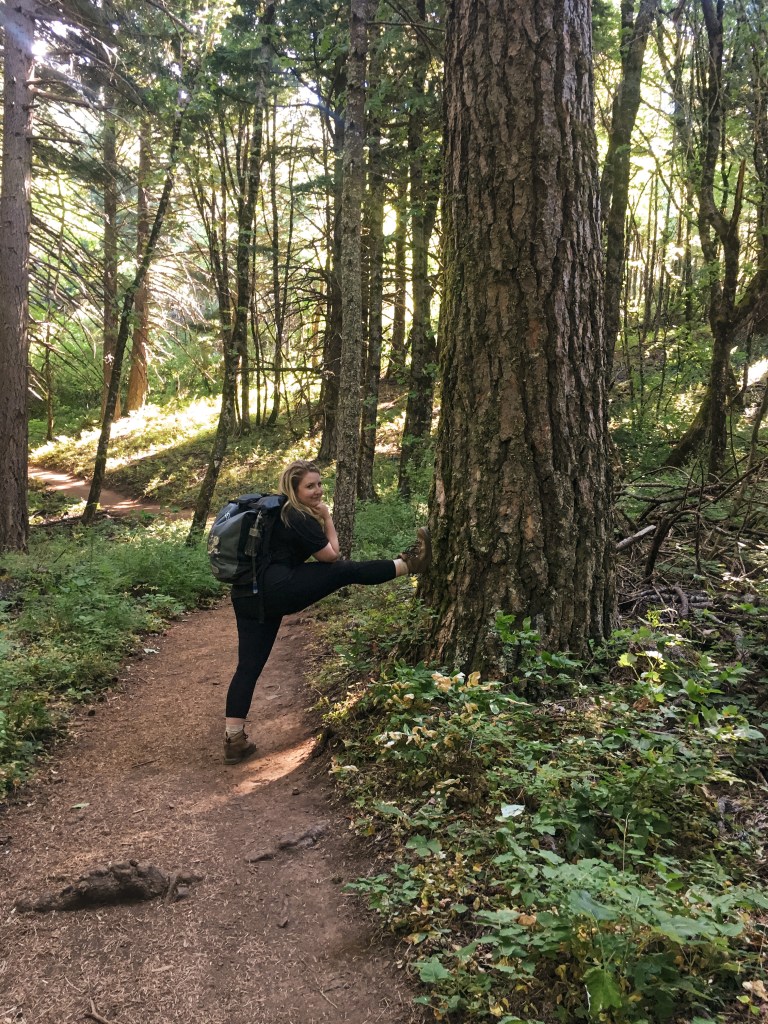
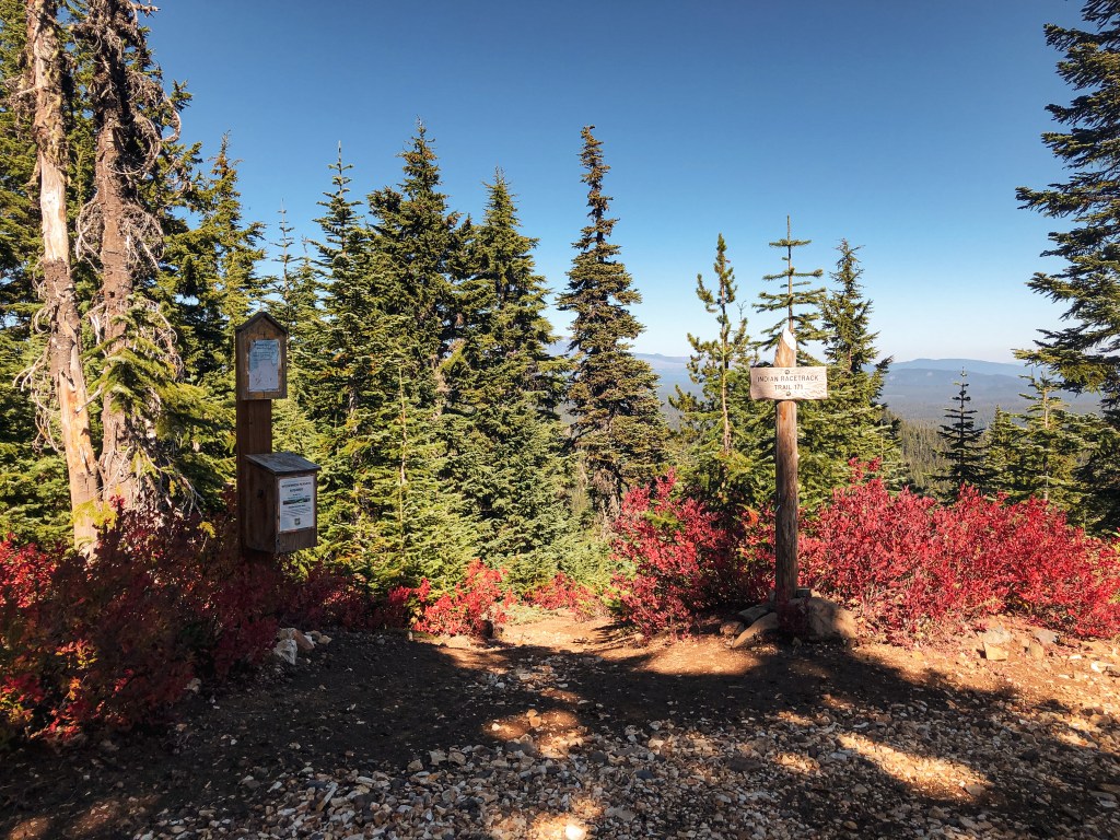
My partner and I weren’t as motivated to get up this morning. We planned to head to Burley Mountain as a day trip since I had family obligations on Sunday. This definitely would have been better for an overnight trip, but it’s doable as a really long day. We hit snooze a few times before grumbling out of bed around 8AM. After getting ourselves in order, we were able to get on the road before 9AM. We headed north on I-5 into Washington until it met up with HWY-12. The section of HWY-12 from I-5 to Packwood provides great access to different recreation opportunities in Central Washington. I’ve used this same highway to access Suntop Mountain L.O., Shriner Peak L.O., and some other trips not mentioned on the blog. This time we stayed on HWY-12 until we reached the community of Randle. We turned right onto Cispus Road which also starts out as HWY-131. Shortly after crossing a bridge you will want to bear left to diverge from HWY-131 and stay on Cispus Road. We stayed on Cispus Road until we reached the Cispus Learning Center. There were a few needed turns to stay on the right road but all were marked with a sign. You can either park at the trailhead here for a 14 mile RT hike via the Covel Creek Trail or continue past to attempt a drive up. I’ve read the trail is riddled with dead fall that can be difficult to navigate. We opted to attempt a drive up to get as close as possible for a road walk. From the Cispus Learning Center the Cispus Road turns into NF-76. There are two different access routes from here. You can either turn left onto NF-77 or NF-7605. I read that NF-7605 is a rough high clearance only route, so we opted for NF-77 that is partially paved. There is a sign for Burley Mountain at the NF-77 junction that notes it at 16 miles away. I zeroed my odometer here.

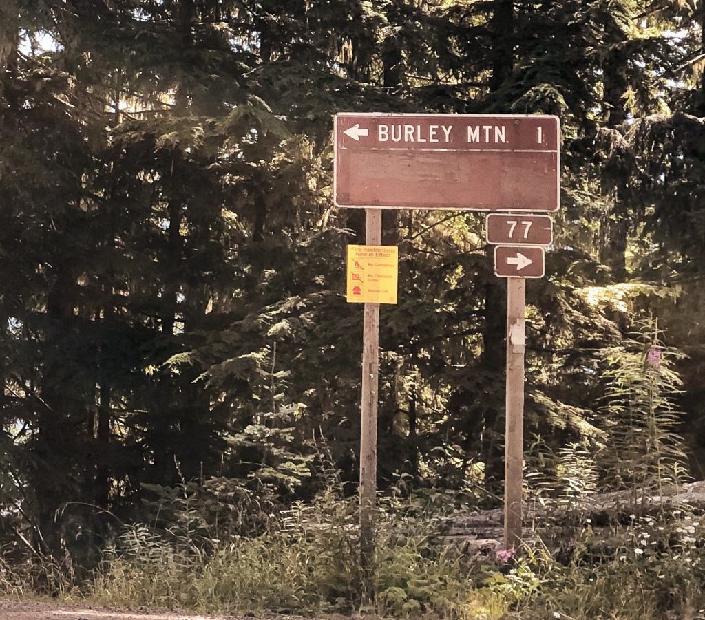


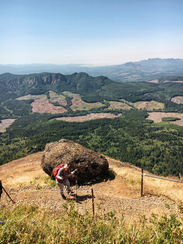
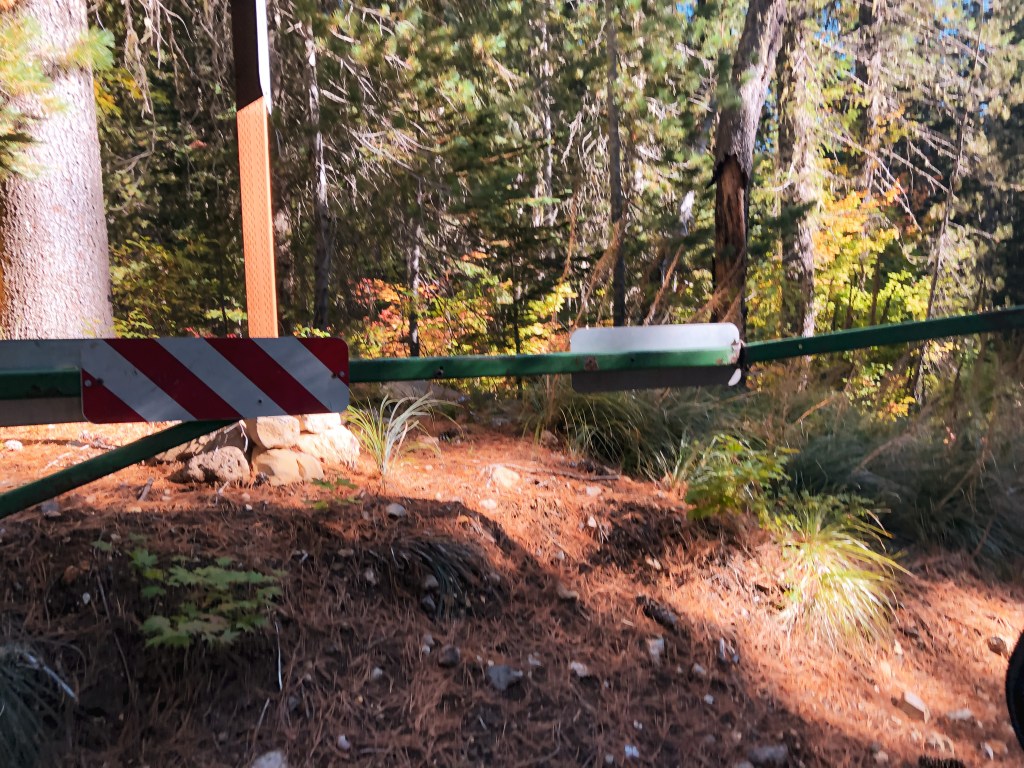
The NF-77 road might be paved, but it is not a good road. My partner and I have found that paved roads in the forest tend to be worse than gravel. Any deterioration, pothole, or washout becomes significantly more treacherous with broken pavement. They just don’t see the maintenance needed to stay in decent condition. We were on pavement until the road reached a junction with NF-7708. After NF-7708, the NF-77 road turns to gravel and the conditions improve significantly. There were still a few potholes to avoid and a section that was covered by a landslide, but it all felt like gliding over silk in comparison. Eventually, we came to a four way junction that was signed. The sign noted Burley Mountain was only a mile away. Not only is this sign incorrect on mileage, but if you’re not paying attention you could head down the wrong road. We took a left onto NF-7605 at the junction, which is marked by a road sign. I was worried about the conditions along NF-7605 and that we’d get stuck in a tricky situation. While my partner was worried about not having enough time for a long road walk and getting back late. But, I was motivated to get in some hiking miles since we seem to be doing more driving than walking these days. I pulled us over in a pull out shortly after heading up NF-7605 and we started our road walk. My odometer read that we drove 14 miles. We walked along NF-7605 for at least a mile or mile and a half until we reached the junction with NF-086. There is another sign here for Burley Mountain that says it’s only a mile away. Deja vu! This time it was accurate. After walking along NF-7605, we realized the Civic could have made it to the junction with NF-086. I wouldn’t drive a low clearance vehicle on NF-086 though.

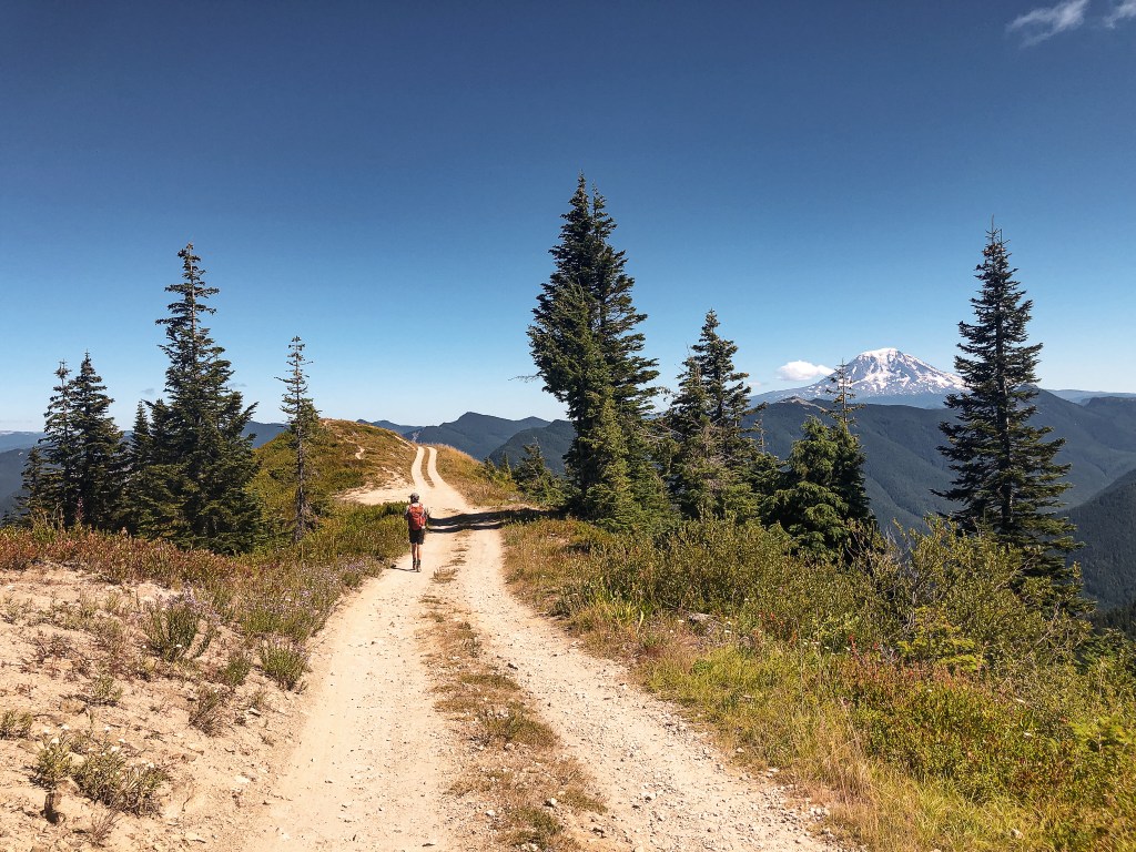
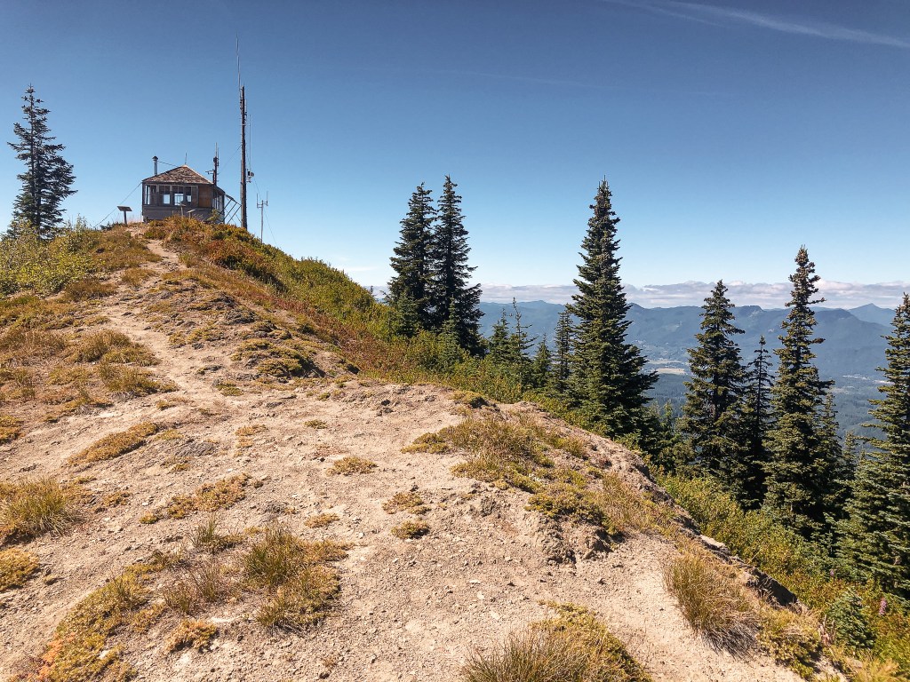

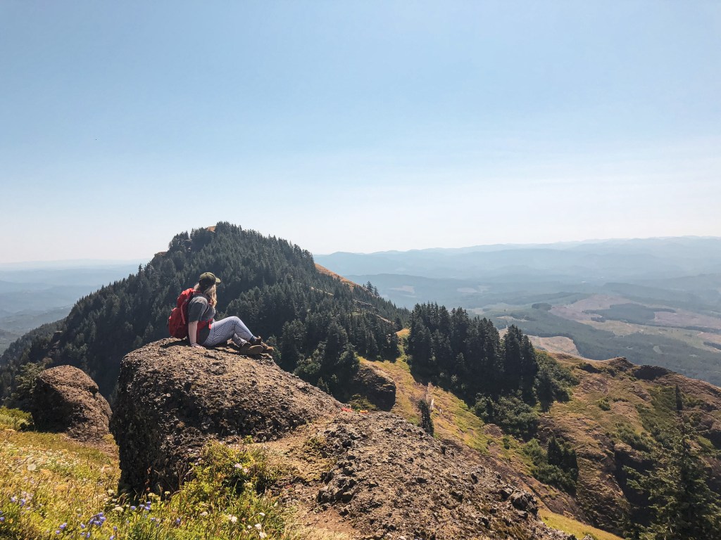
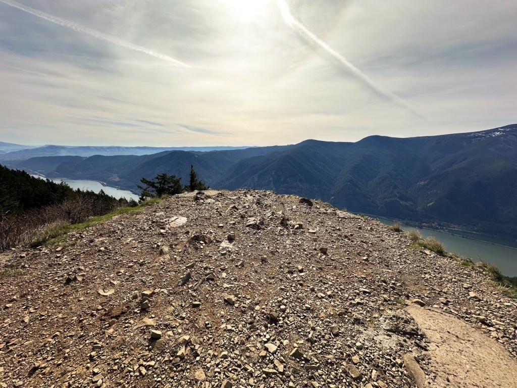
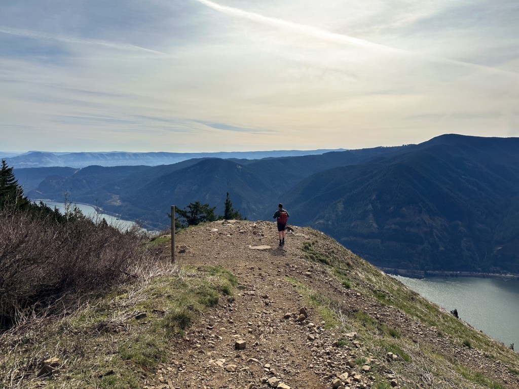
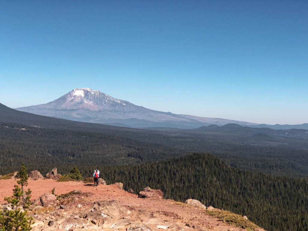
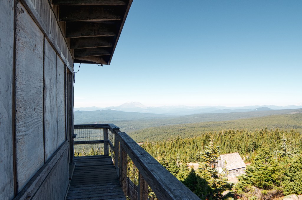
The final mile to Burley Mountain was hot, dusty, and exposed. It’s a narrow road with steep drop offs and is fairly busy to vehicle traffic. I would proceed with caution if you decide to drive the road. There is no where to pass on certain sections if you meet oncoming traffic. There was a dirt bike and truck heading down as we were walking up. The only people on the summit when we arrived was an older couple from Nevada that had parked in the lower pull out. We briefly spoke to them because they had initially been trying to find the alternate trail to Angel Falls. This is a hike that starts at the trailhead by the Cispus Learning Center. They had heard the bridges were washed out and wanted to try from the Burley Trailhead. Instead, they had accidentally ended up all the way up here after following their GPS. I’m not sure if by Burley Trailhead they meant where the trail meets up with NF-7605. But, if they did, it would have been a long and steep hike down to the waterfall. I asked if it wasn’t a ford-able creek, but it sounded like they only read online about the bridge washouts and didn’t check it out for themselves. We couldn’t offer them much more information than that since we walked the road instead of the trail. We wished them luck as they headed back to their truck and we continued to check out the lookout.

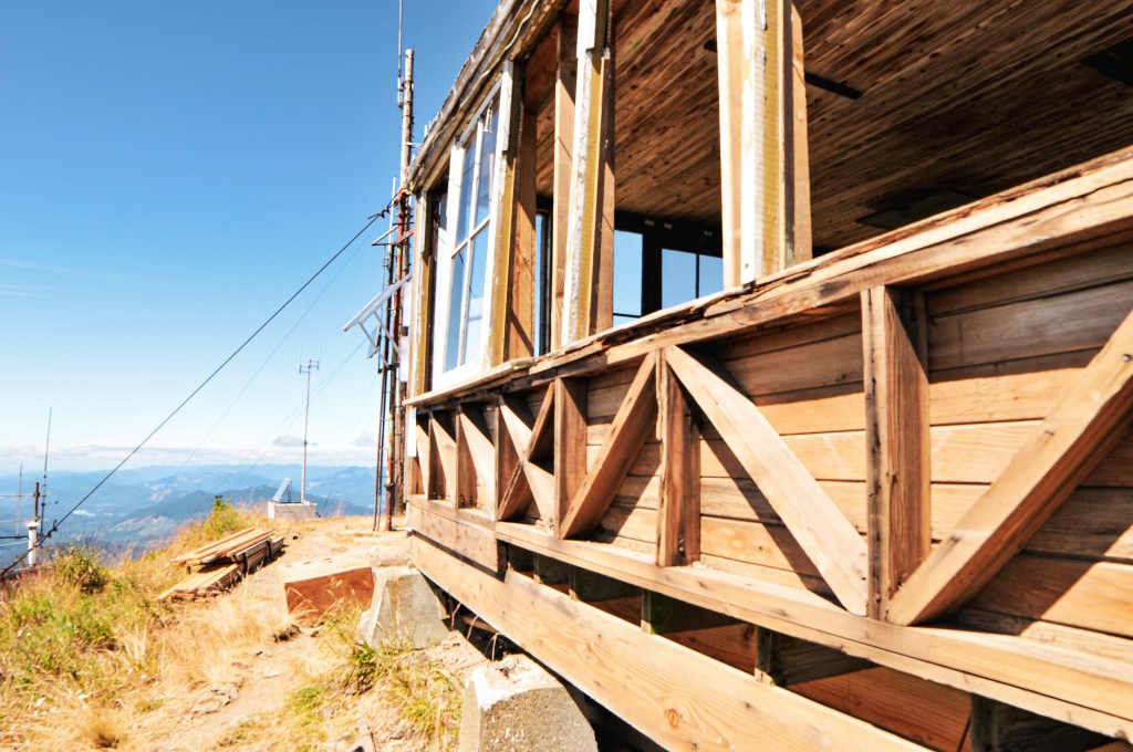


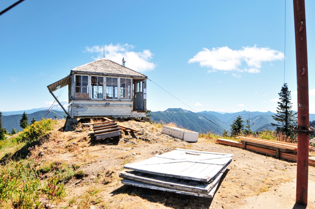
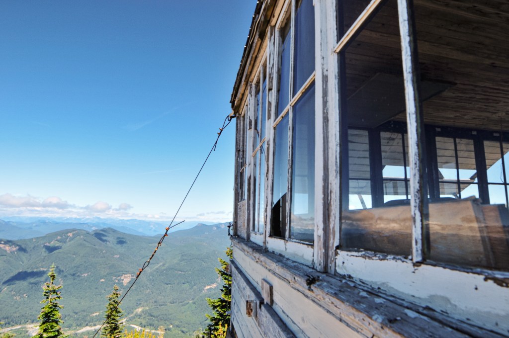

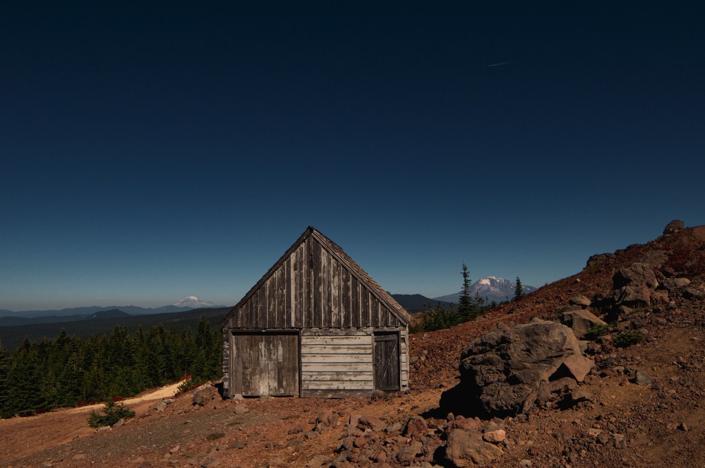
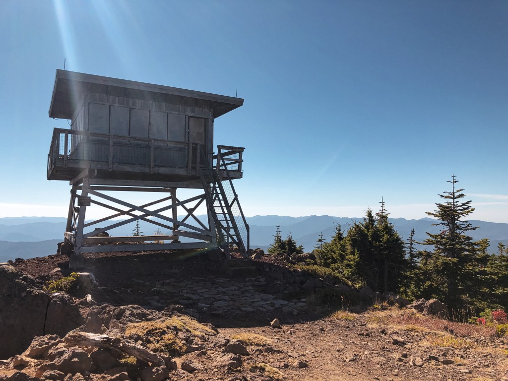
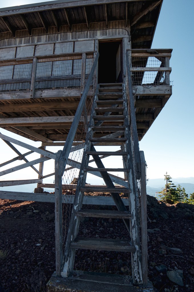
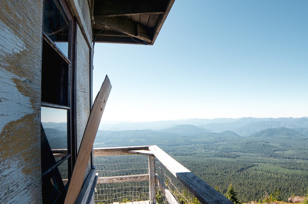
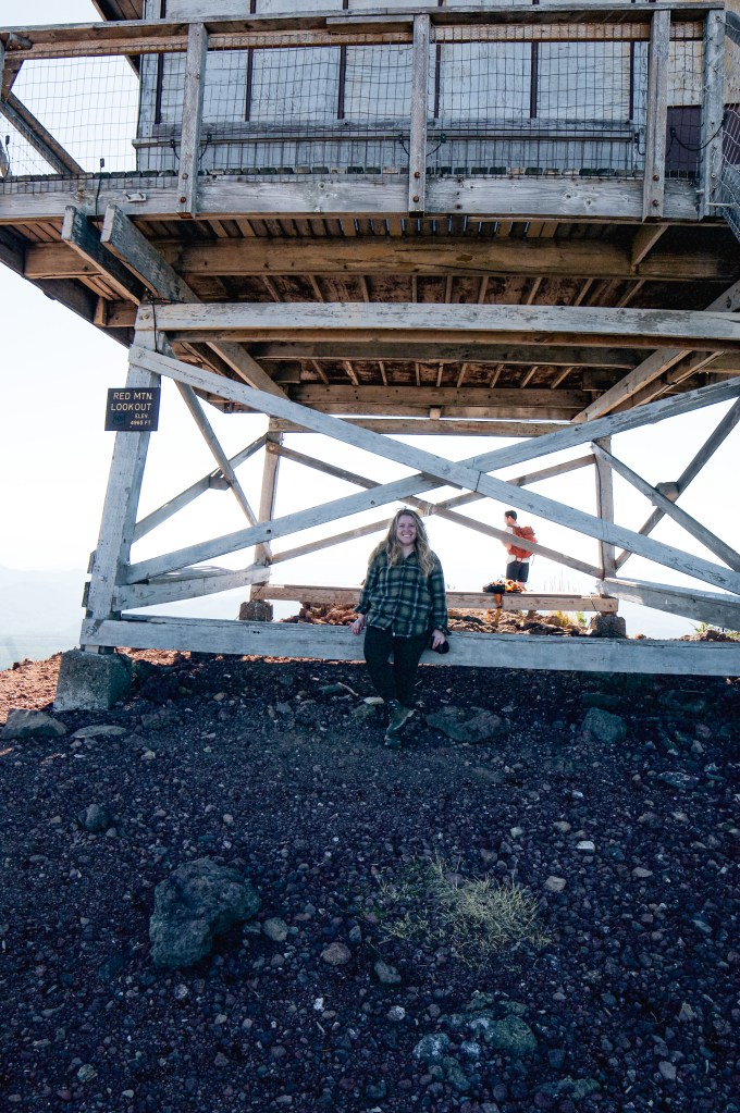
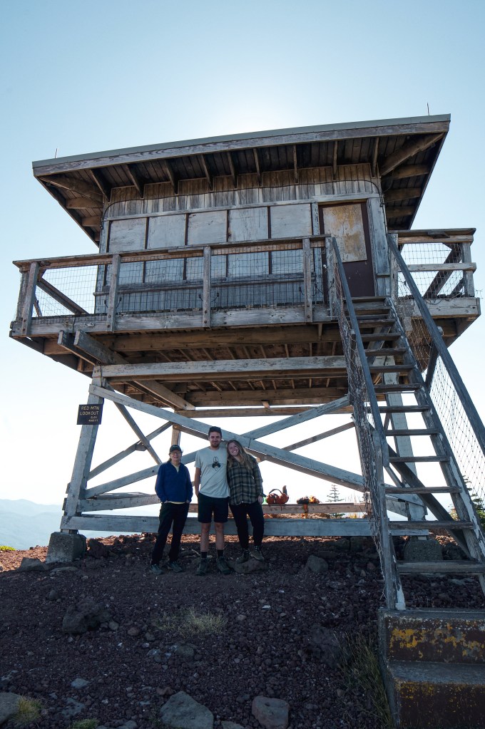
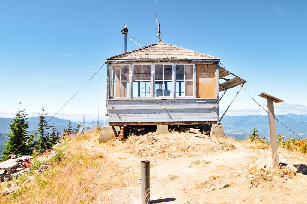
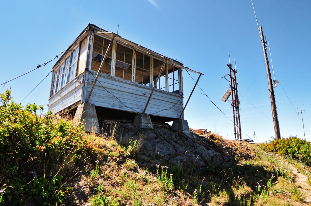
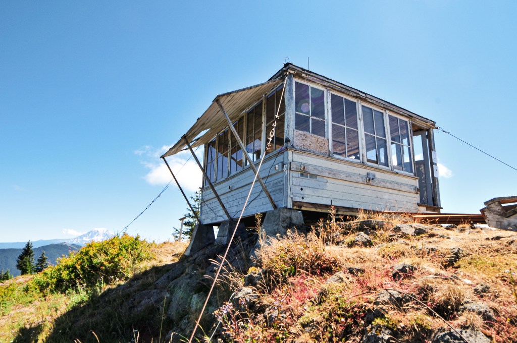
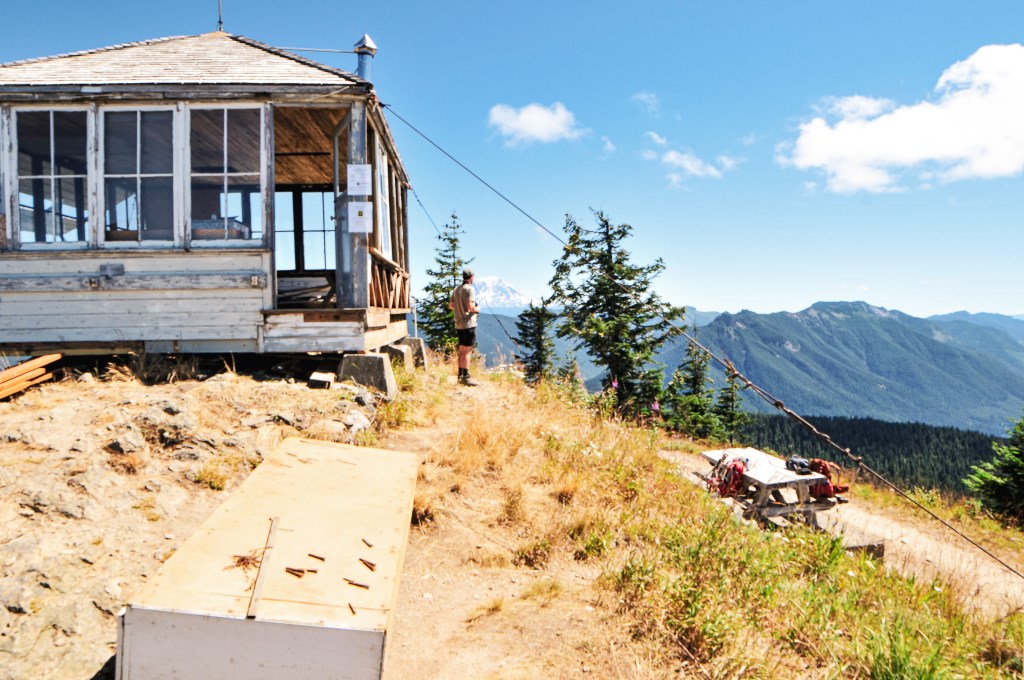
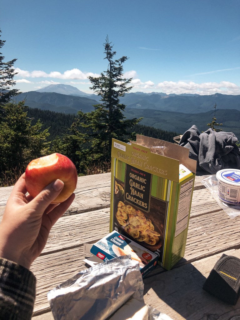
As far as I had known, Burley Mountain was still available for overnight stays on a first-come first-serve basis. We had even talked about potentially doing that, but we were dissuaded by the popularity of this area. We had read of reports from people driving up at all hours of the night which would, personally, freak me out. But, after seeing the condition of the lookout it is obvious that this is no longer an option. There were signs posted on it from the Forest Service stating it was currently under restoration work and being proposed for the rental program. You can tell it was recent work too. The windows were gone on one side and it looked like there were new wall supports added. The stairs had been removed and it looked like there was work being done on the foundation as well. Inside the lookout there is still a logbook to sign and a hand written note stating that the USFS is planning restoration work for the Summers of 2022 and 2023. We had the summit to ourselves after the couple from Nevada left and enjoyed a late lunch at the picnic table. It seemed we were getting lucky on our timing visiting some of these busier fire lookouts. We didn’t see anyone else until we started to head back down the road. A truck, 4-runner, and two dirt bikes proceeded to pass us all within our walk back down NF-086. We didn’t get back to the car until close to 4PM and home until around 7PM. It was a long day.

If you have any questions about the Burley Mountain project, you can e-mail matthew.mawhirter@usda.gov or call the Randle ranger station.
History.
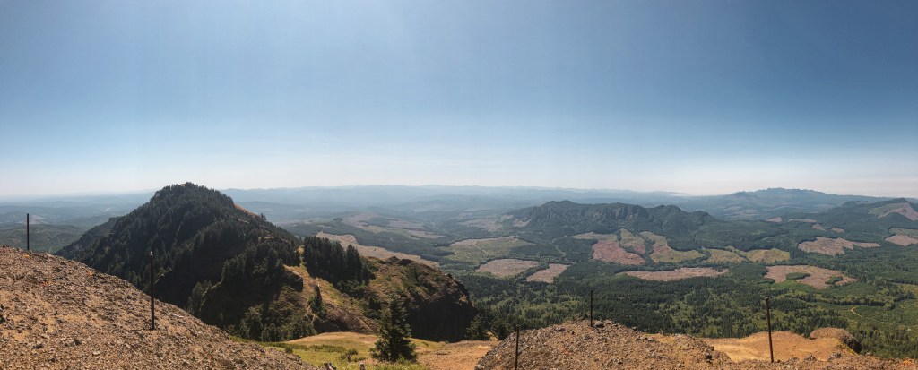
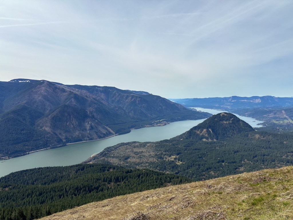
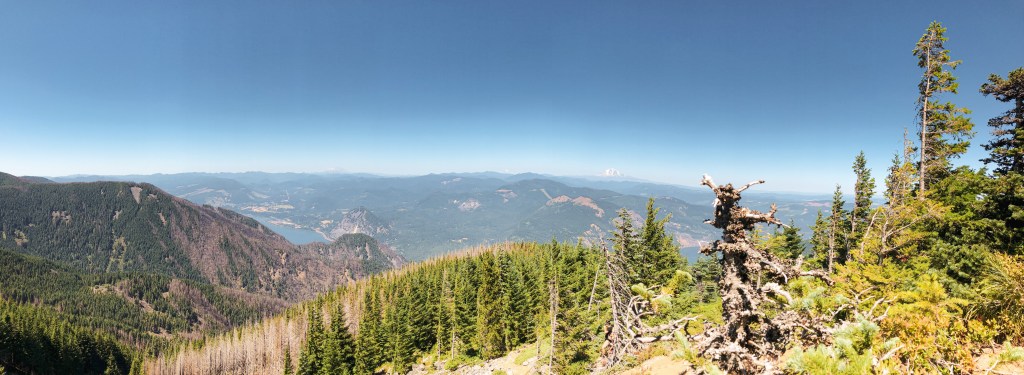
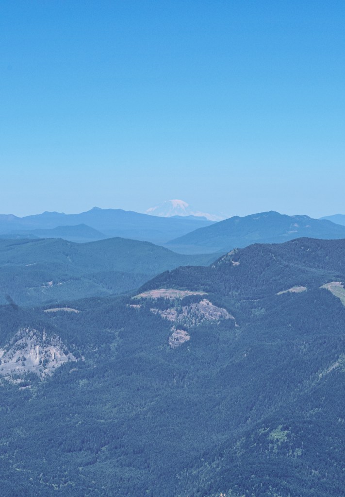
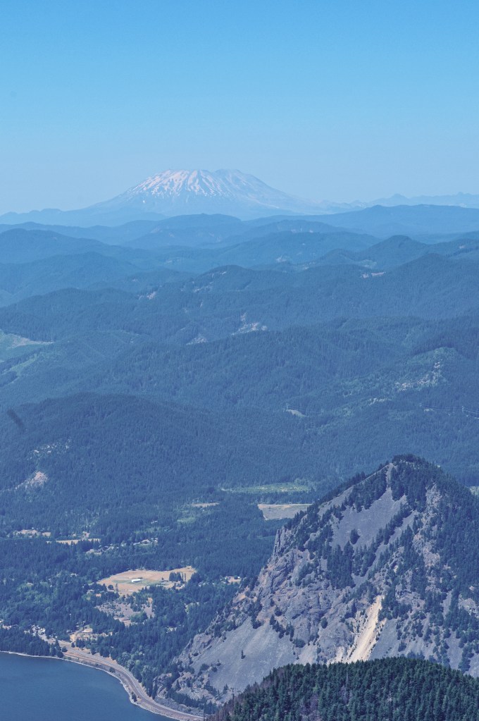
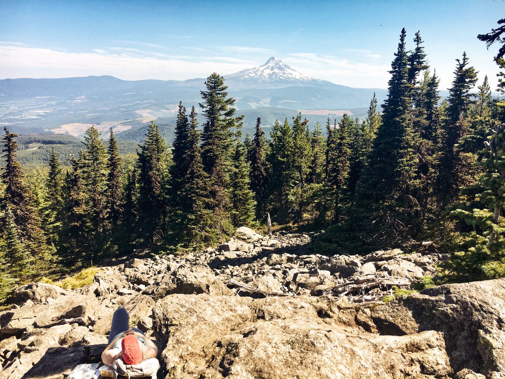
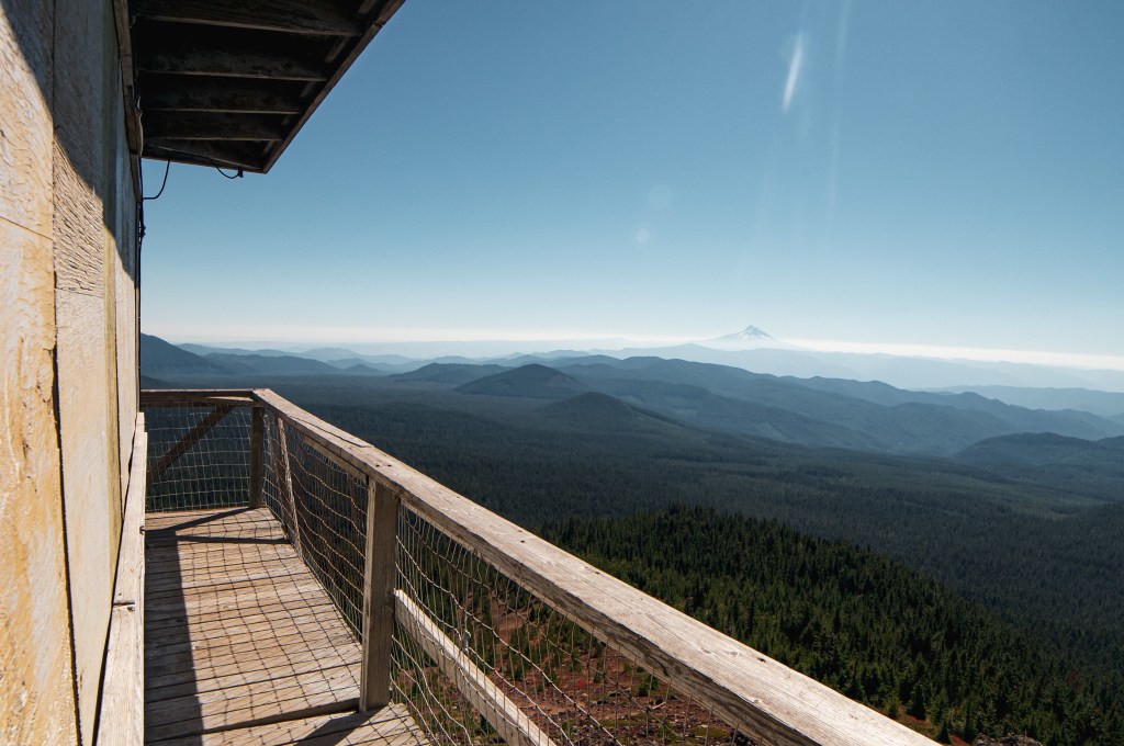
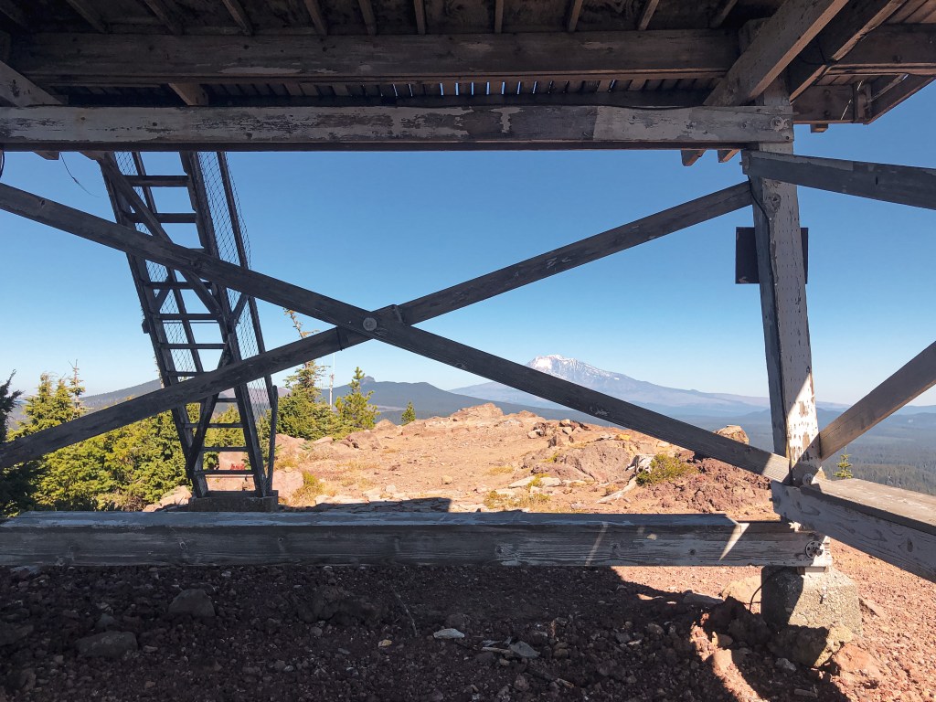
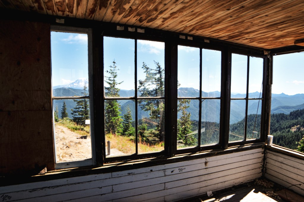
Burley Mountain started as a fire camp in the 1930s back when the forest was known as the Rainier National Forest. In 1934, a 14’x14′ L-4 ground cab was built on the summit and still stands today. It offers views to Mount Rainier, Mount Adams, Mount Saint Helens, and even Mount Hood. It was actively staffed every summer until 1974 when it was subsequently abandoned. It had been vandalized and neglected over the years, but was updated in 1984 by a group of Volunteers and Forest Service employees. The most recent restoration work was completed in 2009 by FFLA member Dick Morrison and volunteers. For a long time, it has been open to the public for first-come first-serve overnight stays. But, it seems even with the love of the community this Fire Lookout has fallen into bad shape once again. Possibly due to the popularity of the area and the ability to drive up. The Forest Service has taken restoration work into their hands once again to potentially add this on to their rental program. We will see if their venture is successful. I’d personally recommend adding a gate.


More Information.