
Location.
Umatilla National Forest
Status.
Emergency; Currently standing
Estimated drive time from Portland, OR.
4-1/2 hours
Date visited.
May 30, 2022
Elevation.
4,527′
National Historic Lookout Register.
US 1600; OR 132
Trip Report.
Before reaching the community of Dale, we passed a road marked Bone Point Road. Based on previous trip reports we knew this was not a direct route to the lookout despite the name. On a map it does look like it eventually connects after taking some roads through private land, but there is no guarantee that they are open roads for public access. Instead we continued past Dale to the NF-3963 road. It crosses the North Fork of the John Day before heading steeply into the forest. The first part of NF-3963 is riddled with pot holes that can be troublesome for lower clearance vehicles. We were able to navigate them in my Civic with caution. As we started to head up I let my partner take over driving. He is more confident on forest service roads especially ones shouldered by steep drop offs and road hazards. Yay, fear of heights! Yay, anxiety from our Tower Point attempt (post)!


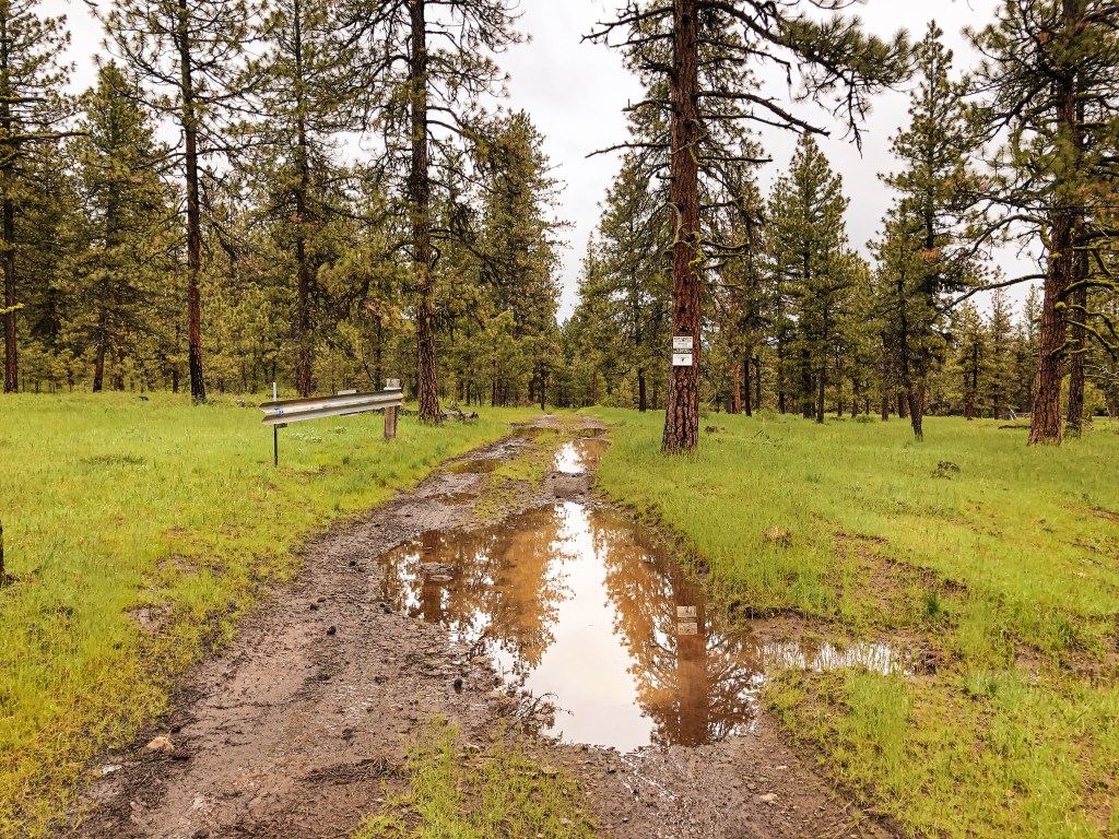
You will stay on this forest service road for about 5 miles. Some of the spurs are signed such as NF-020 and NF-040, but the one leading to Bone Point L.O. is not. It’s supposed to be marked as NF-060 but the sign is long gone. After passing NF-040, there will be an un-marked spur off to the right. This is not the one you want to reach Bone Point. After this spur, you will pass a tree with the number 5 spray painted on it marking that you have made it 5 miles. The next un-marked road off to the right will be the correct one. You will know you are at the right junction when the road opens up and flattens out into a meadow. There is also a seasonal gate and dispersed camp spot off NF-060. If you hit the cattle guard you’ve gone too far. We were elated to find a camp spot close to where we wanted to be and set up camp around 7PM. The weather even seemed to be clearing off and provided a lovely evening sunset.
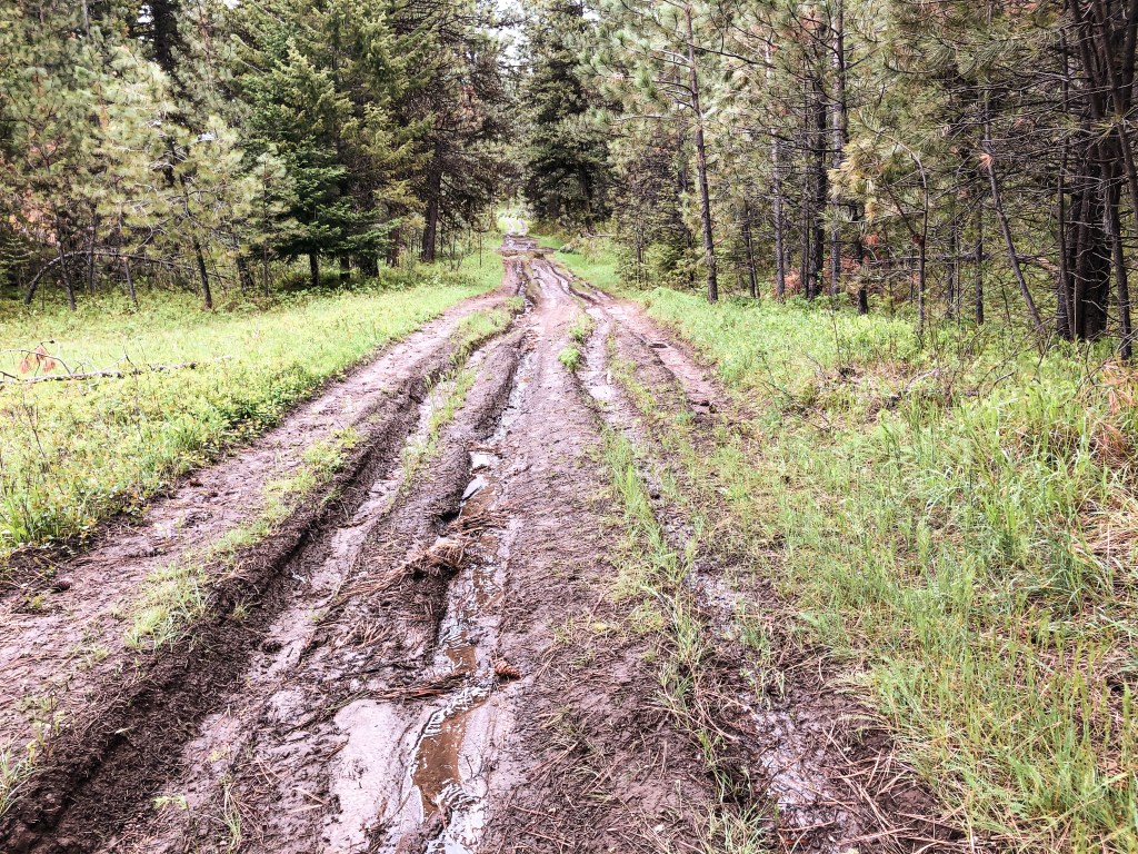


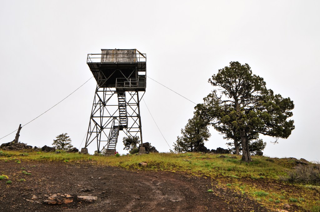
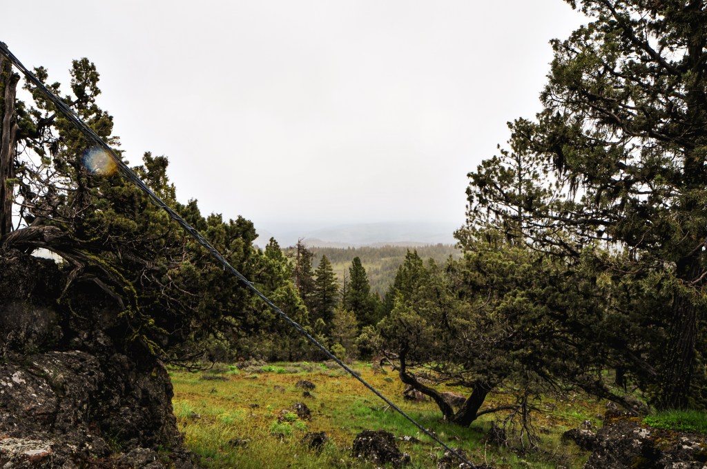
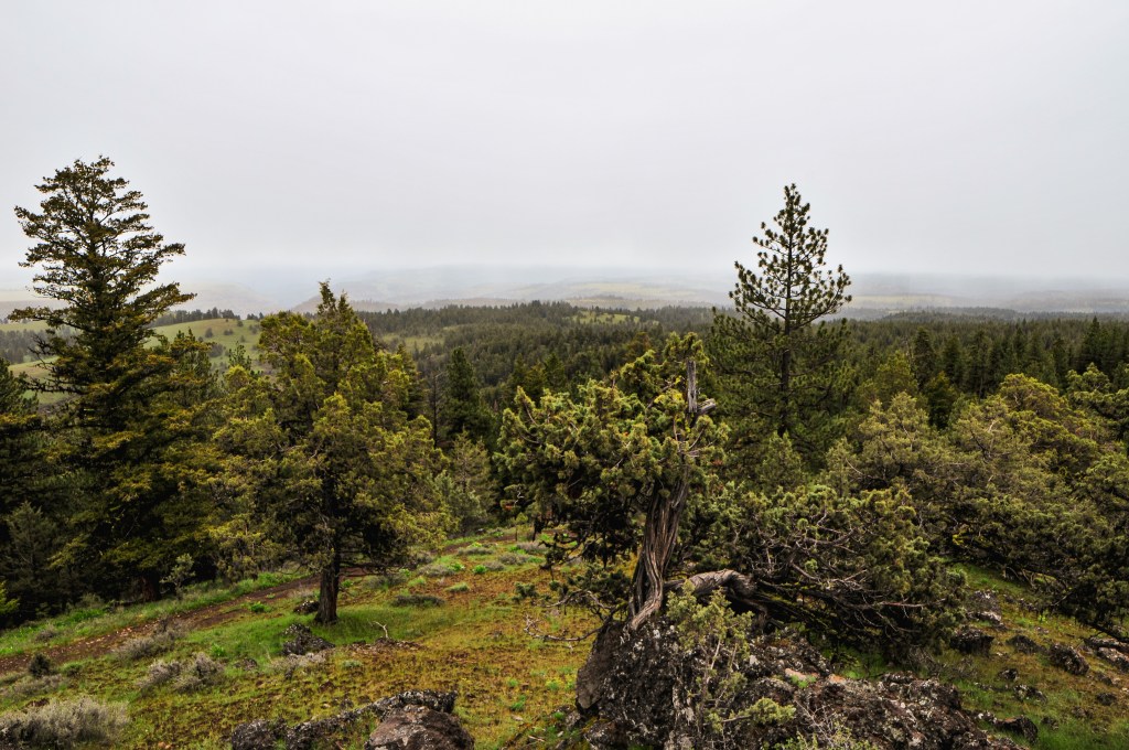
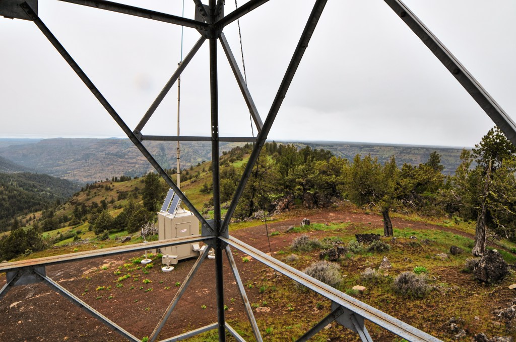
We woke up the next morning to even more cloudy conditions. We didn’t rush to get up since we weren’t moving camps and didn’t need to drive any farther to our destination for the day. Waffles were on the menu for breakfast. YUM! Bone Point was only a mile from our camp and we decided to walk there after breakfast. The seasonal gate on the road is closed to motorized vehicles from December 1st thru April 30th. The road is very mucky after any precipitation and has been rutted out due to people driving in wet conditions. Even if we had wanted to drive, my car would have never made it. It’s a relatively nice flat walk to the summit though. We even heard an owl hooting near by. The last section of road is very rocky and would need caution to navigate even in a high clearance vehicle. Once on the summit it started to sprinkle a mix of rain and snow. The forecast for today was supposed to be nicer than the last few days, but that proved to be wrong. We weren’t completely in a rain cloud yet and still managed to see some of the surrounding peaks while on the summit. There were some coyotes yipping off in the distance on a neighboring peak as well. It looked like at one point the stairs had been wrapped in barbed wire to prevent people from climbing it. Someone had moved this and cut a chunk out of the trap door to access the catwalk. The structure itself felt pretty sound, but I only went up to the first landing. The metal style lookout towers, besides Aermotors, are pretty uncommon in Oregon.


We were back at camp before noon and the rain had settled into a consistent shower. It continued to rain for 6 more hours with no end in sight. We spent the remainder of our time hiding in the car reading. We hoped it would clear off for a nice sunset again, or maybe in the morning, to return to Bone Point under better conditions. It unfortunately did not clear off until we were already out of the forest on our way back to Portland.
History.
Bone Point has had a few different types of lookouts on its summit during its fire detection years. In the 1920’s, a cupola cabin was used which was replaced in the 1930’s by a 40′ wooden live-in tower. In 1947, it was replaced by a 30′ steel live-in tower which in turn was replaced by the current structure. The existing lookout was built in 1961 as a 30′ all steel live-in tower. It is noted on standby for emergency use during high fire danger despite not being actively staffed for many years. Its last recorded use was in August 2003 when it was staffed by a district employee during a period of lightning storms.


One thought on “Bone Point L.O.”