Grasshopper Point & Rocky Butte

Former Lookouts

Location.

Mt. Hood National Forest

Date visited.

October 29, 2022

Trip Report.

View from Rocky Butte
Conduit in tree
Where the trail meets NF-130
Dead end at NF-130
Where the trail continues from NF-130

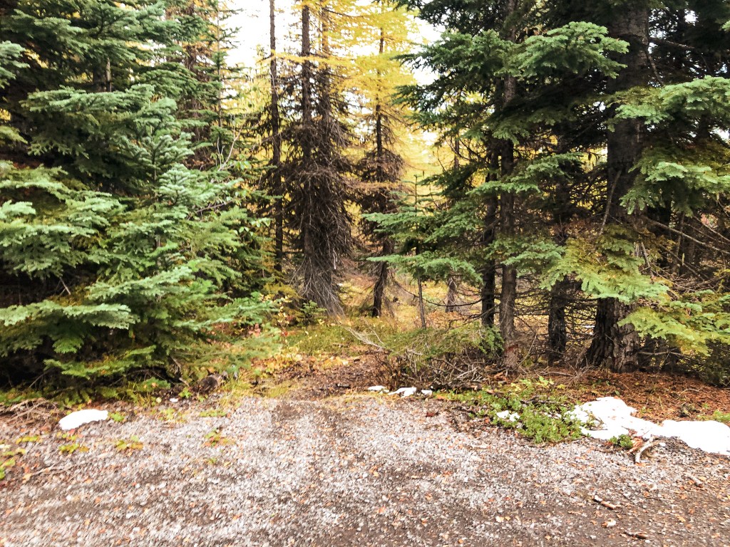
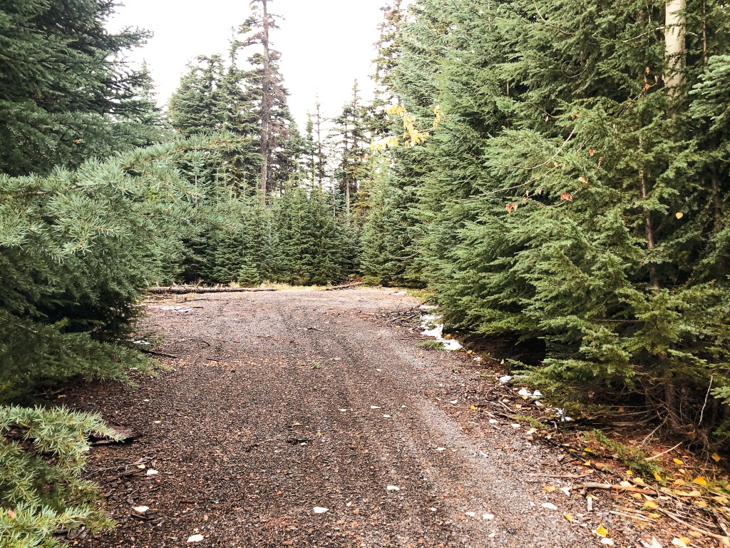
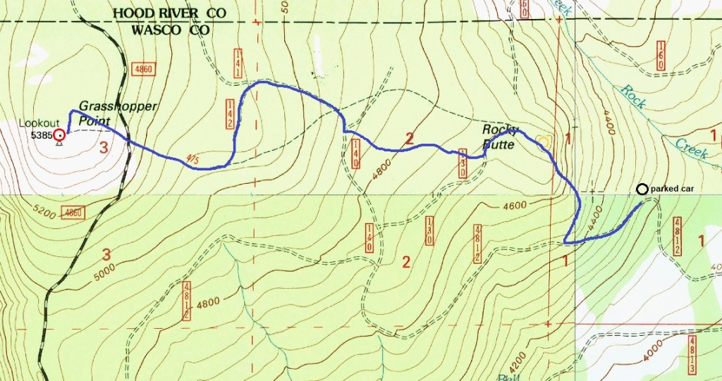
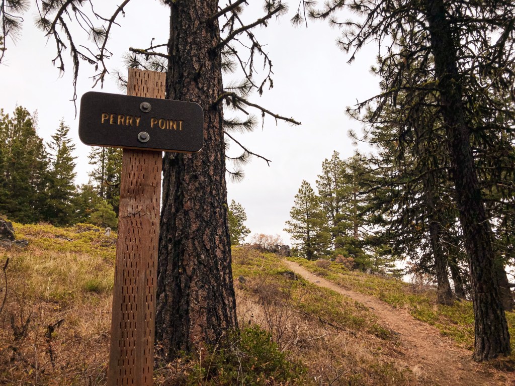
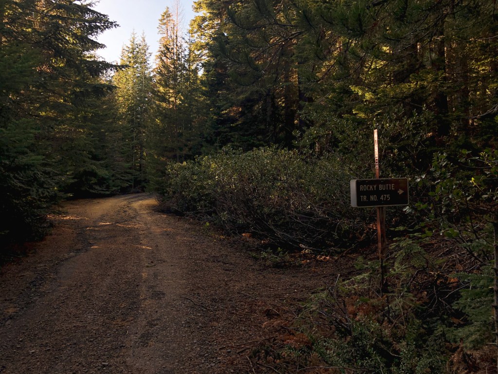
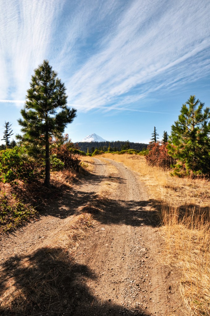
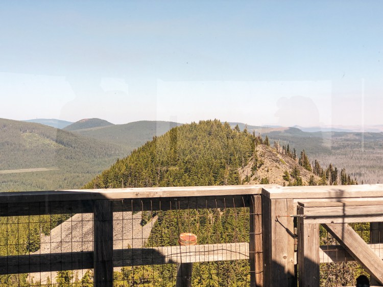
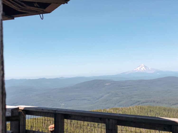
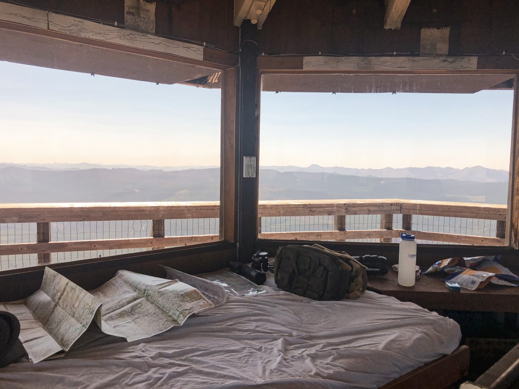
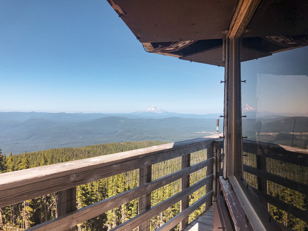
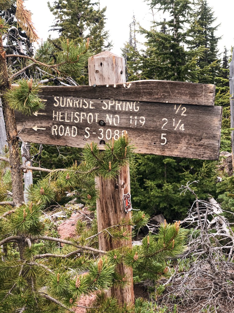
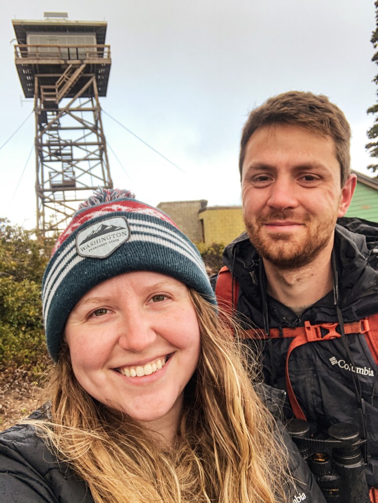
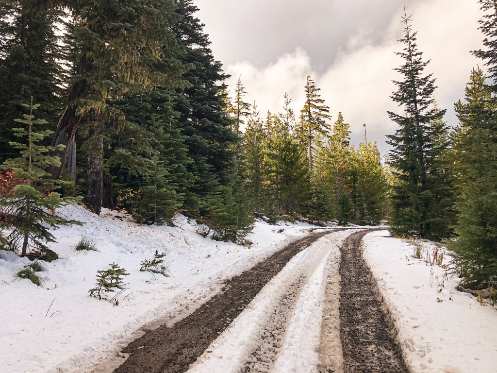
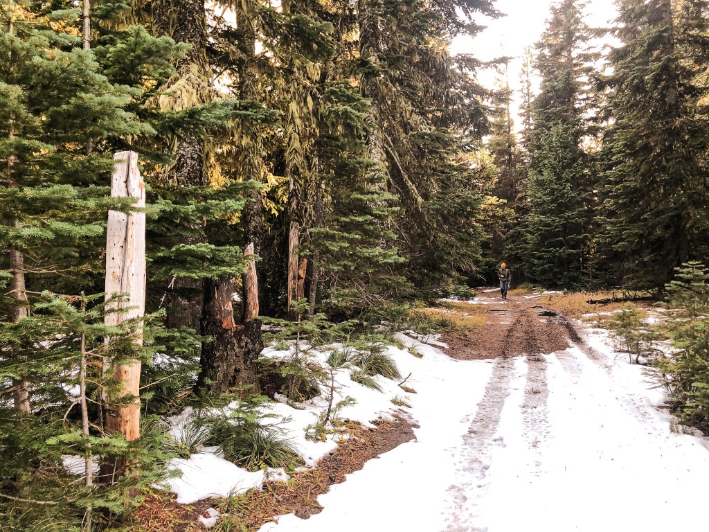
Ever since our first trip up to Rocky Butte (post) last winter, we have wanted to connect the trail to Grasshopper Point. We also wanted to squeeze one last backpacking trip in before calling our end of season. This isn’t a traditional backpacking destination given that it’s not in a wilderness and the trail is short. We planned to hike to Rocky Butte and drop our gear before continuing our hike to Grasshopper Point. Directions to the trailhead for Rocky Butte can be found in my previous post. There is an old fire ring on the summit of Rocky Butte that was most likely left over from when it was in service and where we would set up camp for the night. Oregon Hikers (post) has marked this hike as a lost hike, so continue at your own risk. We pin pointed our bearing with a compass and ranger district map before starting the remainder of our hike. Or I should say, my partner did this and I watched to learn. This is helpful if you know where you are currently located on a map and where you are wanting to head. It will help keep you on track in the general direction from point A to point B. Continuing up and over Rocky Butte the trail is still well defined. We followed this to the first road crossing with NF-130 and picked the trail up down the road to the left. From here the trail alternated between visible tread and following the flagging. There were only a few spots that caused us to pause and search a bit harder for flagging, cut logs, or a blaze in the trees. The cross-country hiking here is fairly easy and could still be accomplished by following the path of least resistance along the compass bearing. We reached a second road crossing with NF-140 that had an OHV trail #475 sign on the ground pointing towards an old decommissioned road. We followed this well worn tread until we spotted an old trail sign for #475 nailed in a tree off to the left. Reading the detailed description from Oregon Hikers led us to believe we should turn here. There was also another old sign nailed to a tree off to the right side of the OHV trail. This implied that the hiker use trail crossed the OHV trail here. After searching around the signed tree we were unable to find any obvious tread or flagging to indicate a trail. We decided to follow the OHV trail instead since it was well defined and if it truly did follow the old NF-142 road it would get us close enough to cross country back to the actual trail.

Trail condition example: tree flagging & worn down log
Where the trail meets NF-140
Trail #475 OHV sign
Start of OHV trail on abandoned NF-142
Trail #475 hiker sign
Trail condition example: visible tread

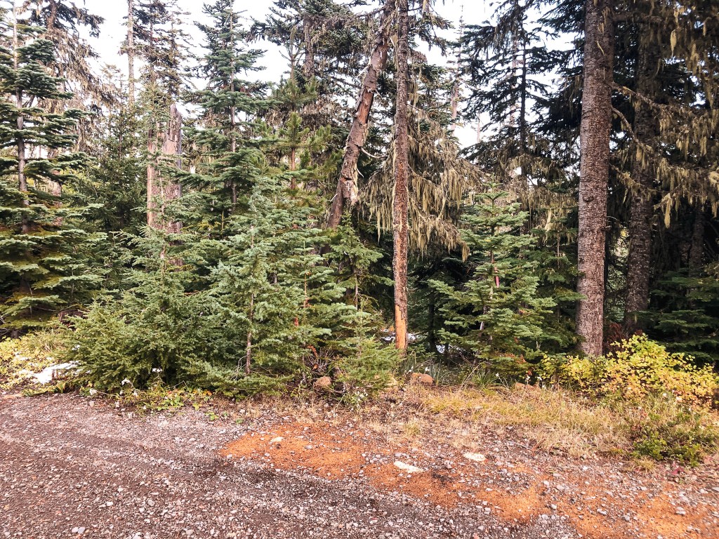
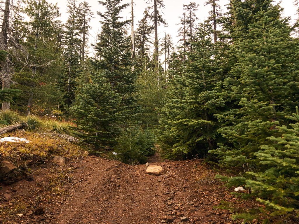
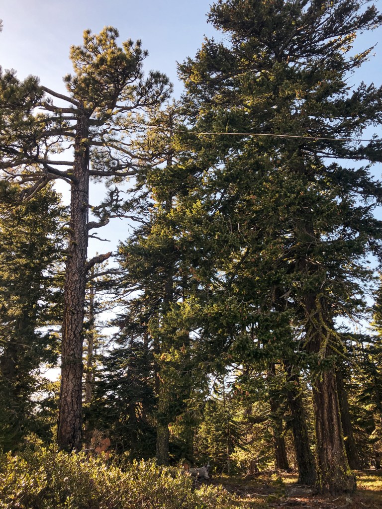
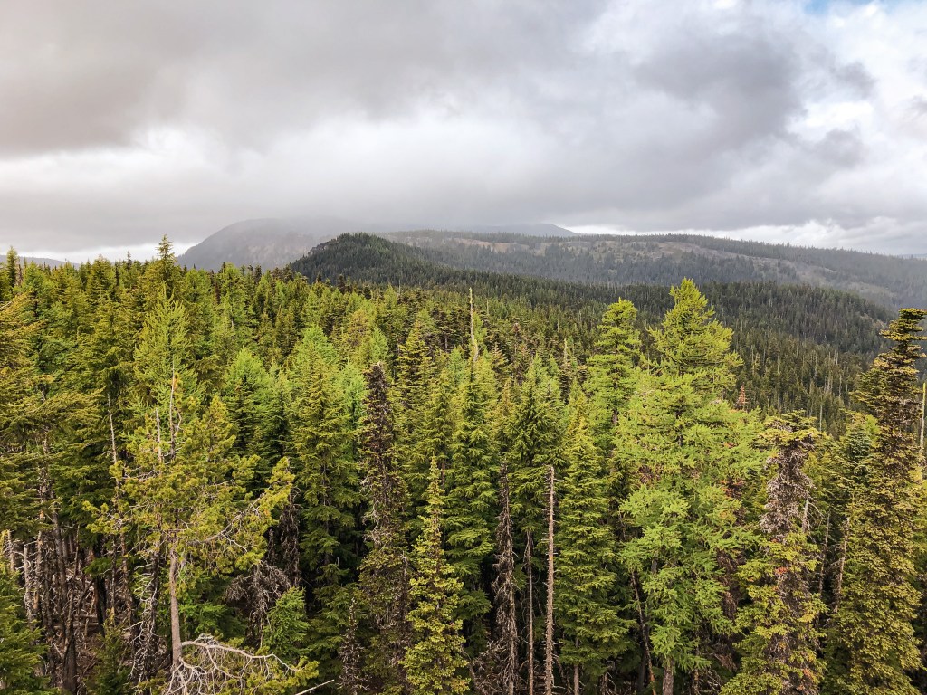
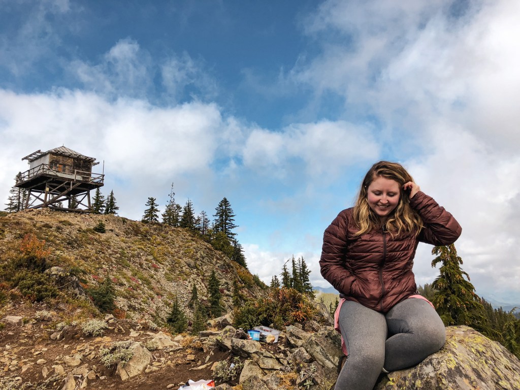
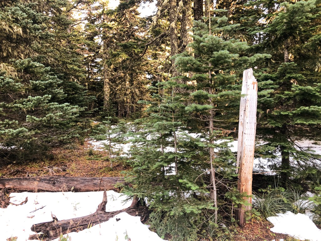
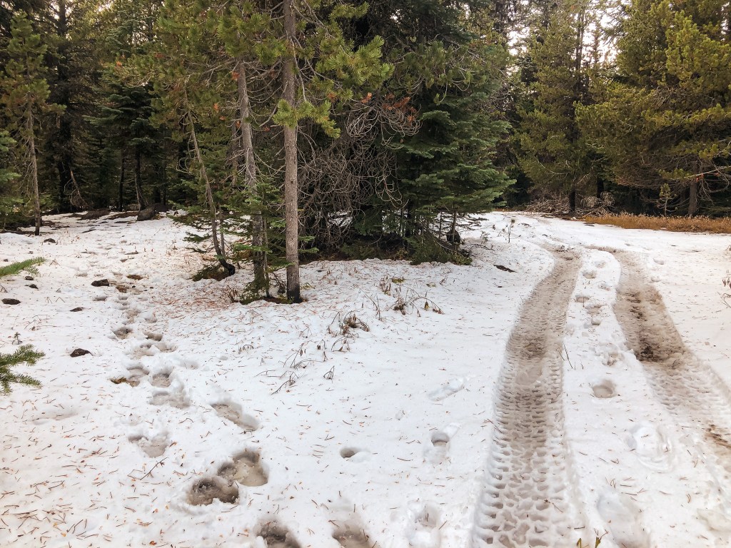
We followed the road tread until it petered out and turned into a user trail with flagging to the left. This eventually connected to a more obvious trail that we could only assume was the one we needed. It seemed well defined heading both left and right, but given the lack of trail near the signs we found we didn’t believe it stayed that way for too long. We turned right to continue towards Grasshopper Point. There were patches of snow through out the trail as we gained elevation, but now most of the trail was covered. Someone had been here fairly recently as we started to follow footprints. I assumed they were a hunter given that it was Elk Season and not many other people head out this way during this time of year. It’s always good to be aware of your state hunting seasons when recreating in the shoulder season. We like to use the big game magazine to gauge the risk of the area by checking the type of hunt and number of tags taken out. We also wear blaze orange beanies while hiking during hunting season. This felt particularly necessary since we were hiking on a less traveled trail and somewhat cross-country. We followed the snowy track and footprints all the way to the NF-4860 road crossing. There is a post here to mark the trail for OHV users. The footprints and trail continued directly across the road to head up the final side of the point. We followed the footprints and flagging for a while but it seemed like the trail started to head down the slope. The footprints had also disappeared and deviated from the trail here. We decided to head straight up the slope instead of following the trail down. This is were things got confusing for us. We figured we were very close but couldn’t find anything in the obvious clearings. The description we had of the area wasn’t very helpful either and, if anything, confused us more. We spent a good chunk of time backtracking and circling around the broad summit. We were about to give up and start heading back when my partner stumbled upon the foundation blocks. Success! It looks like some of them have been moved from their original location, but they are still there. I will continue the directions from where we left the “trail”. After heading up the slope to the flat summit, you will continue farther until you reach a well defined road. This road was not listed on our ranger district map. Where we came out there was a post which made us think this was at one time a trail. Take a left on the road and follow it. The road makes a bend to the right where we found another post with a US Forest Service marker off to the left. This also seemed to be marking a “trail” and might be where the trail we were following earlier comes out but I can’t say for sure. We continued on the road past the bend. Shortly after this the road makes a fork. The left fork is faint while the right fork is defined. If you head down the faint left fork you can find the foundation off to the left of the road. It is in a rocky area and might be hard to spot if you’re not looking closely. We saved ourselves any further confusion on the way back by going the same way and avoiding the other potential “trails”. This hike was around 4.7 miles RT with 1,010′ in elevation gain.

The user trail we connected via NF-142 (left); Main #475 trail (right)
Where the trail meets NF-4860
NF-4860
Where the trail continues across NF-4860
Old post where we met the unmarked road
Unmarked road heading left
Where I think the real “trail” meets the unmarked road
Post at real “trail” junction
Fork in unmarked road, head left to find foundation

History.

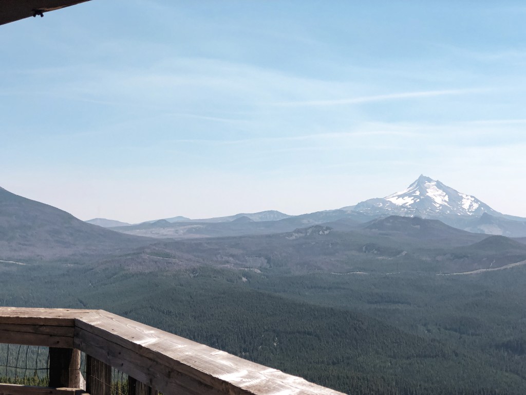
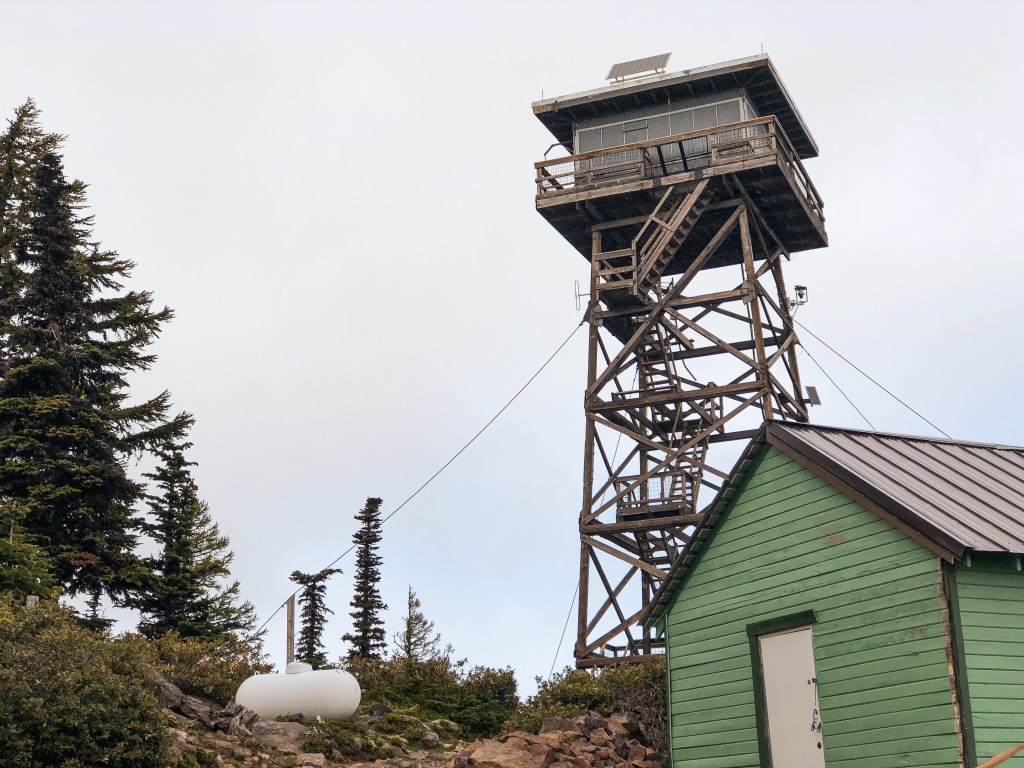
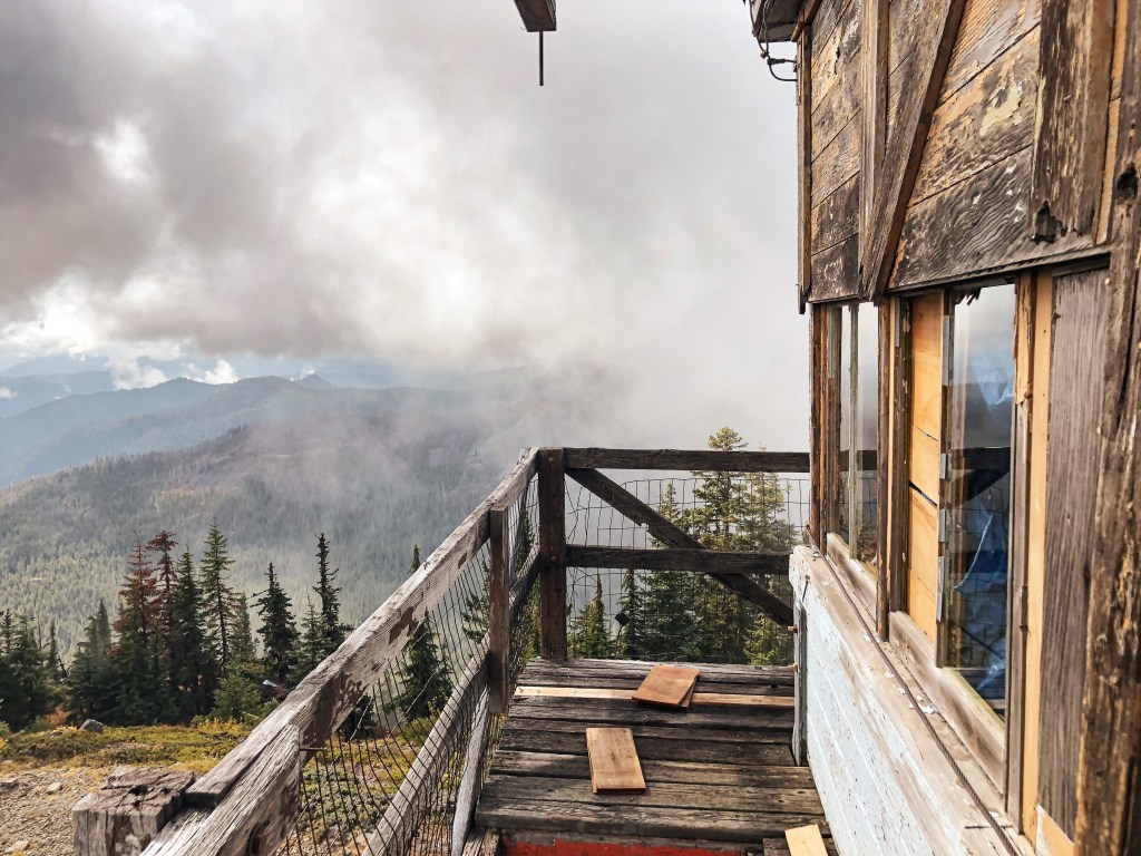
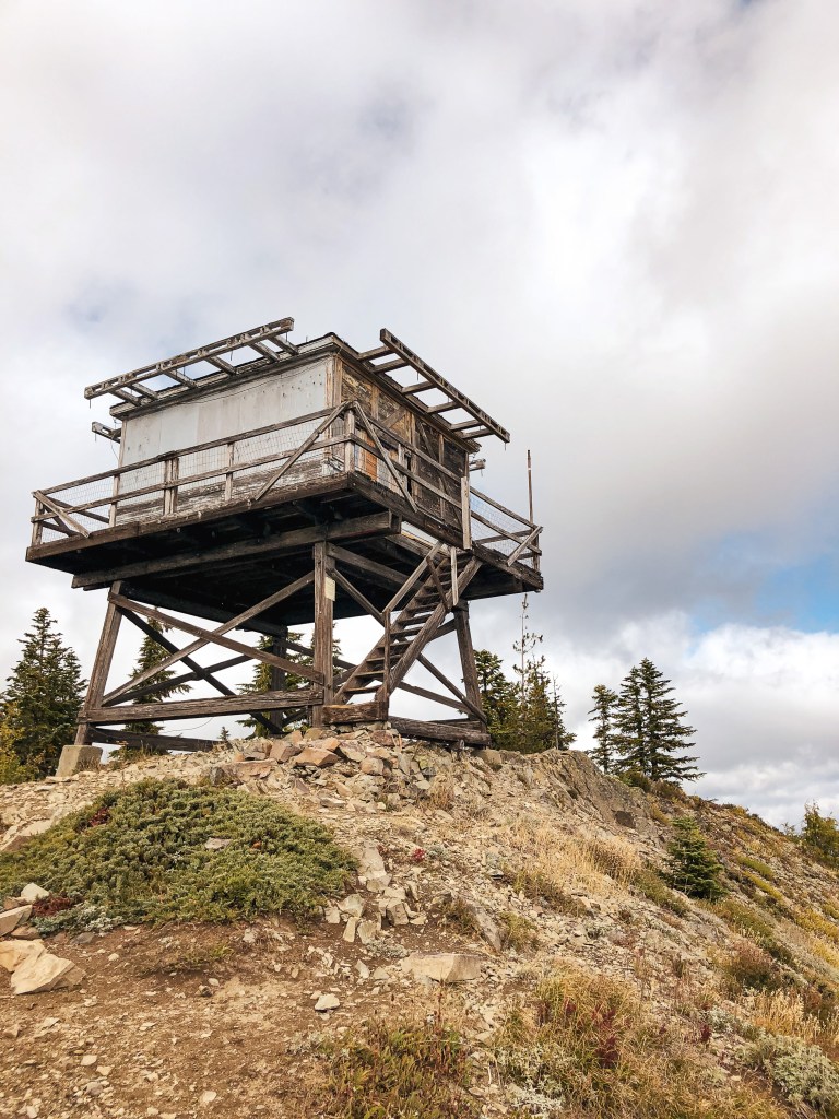
Grasshopper Point (5,385′).

Former Fire Lookout Site Register: US 597; OR 38

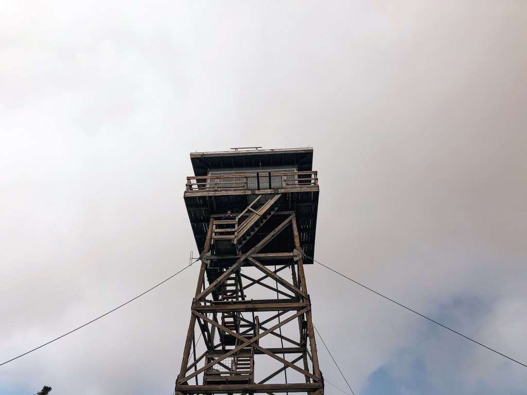
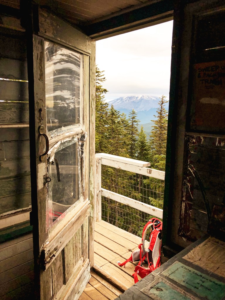
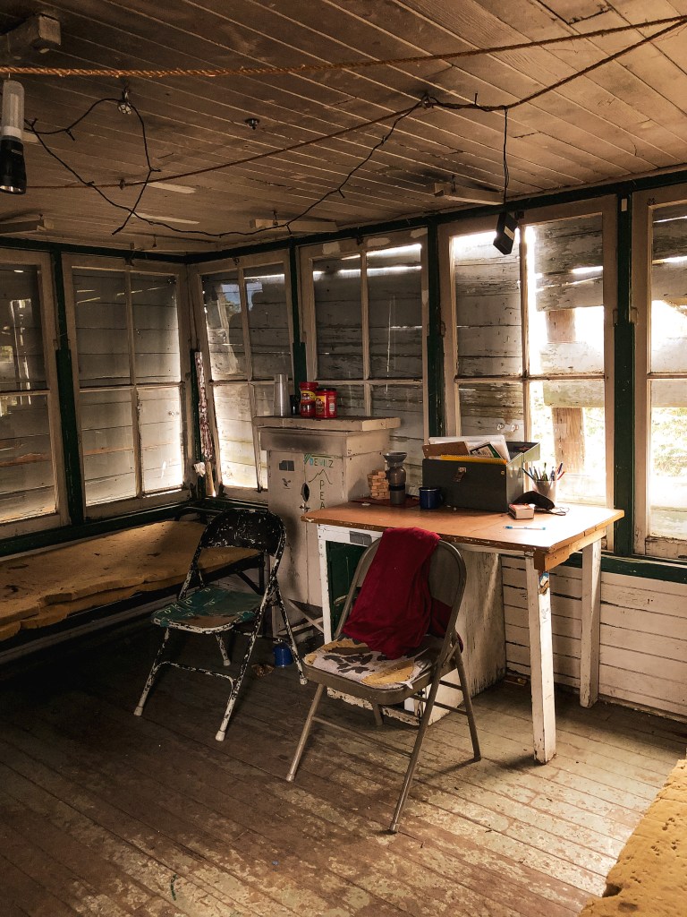
A tower was first built on Grasshopper Point in 1933 as a 72′ timber tower with L-6 cab. The following winter it was blown over during a storm. They re-erected the tower in 1934. I’m inclined to believe they built it taller given other sources list it as an 84′ treater timber tower, but it’s also possible these are conflicting heights. It was used as an Aircraft Warning Station in the 1940s. Old photos show there was a cabin for living quarters and another structure that was either used for storage or a garage at the base. It was last staffed in 1964 and destroyed sometime between 1967 and 1969 by intentional burning.

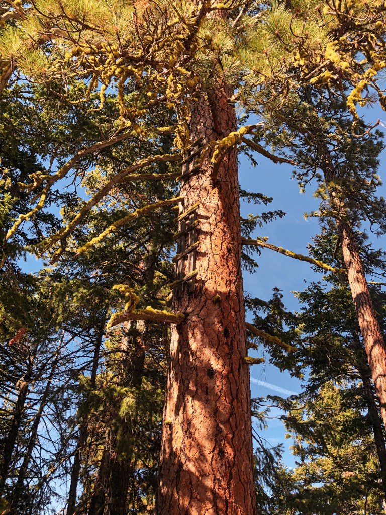
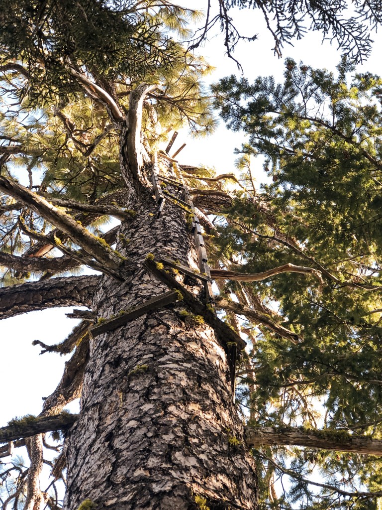
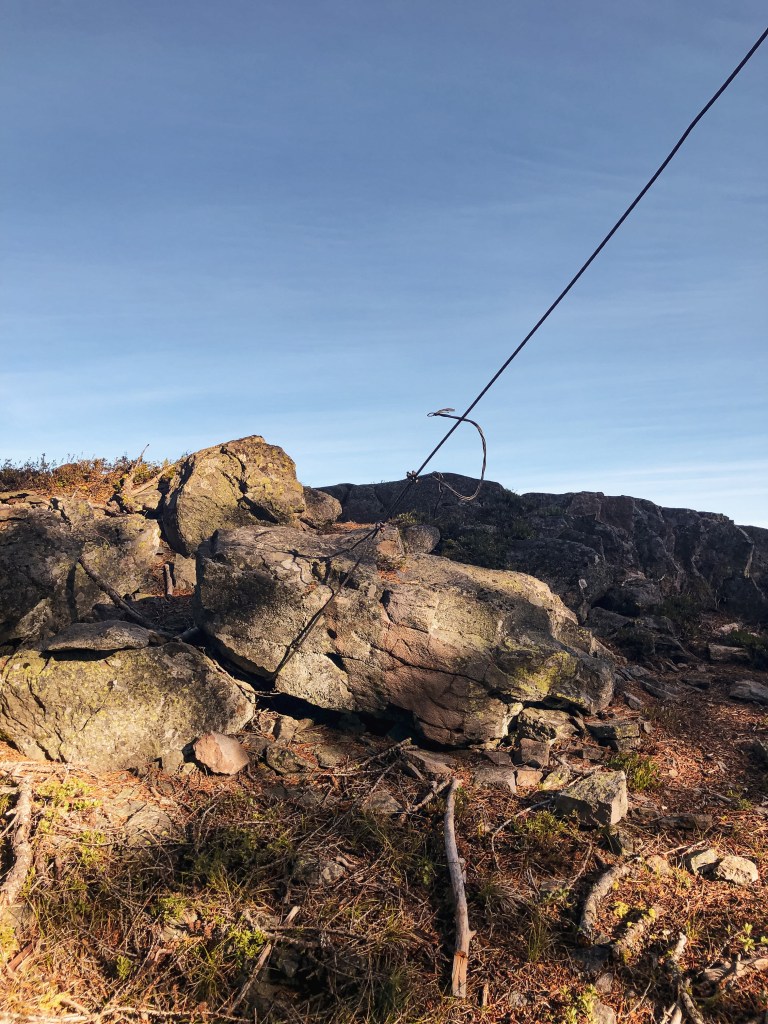
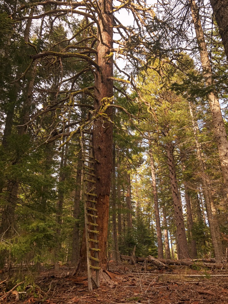
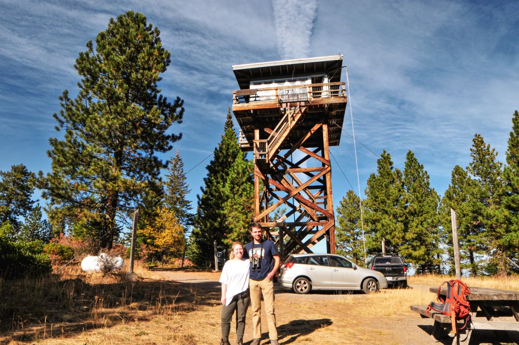
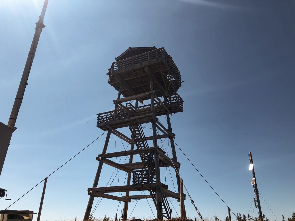
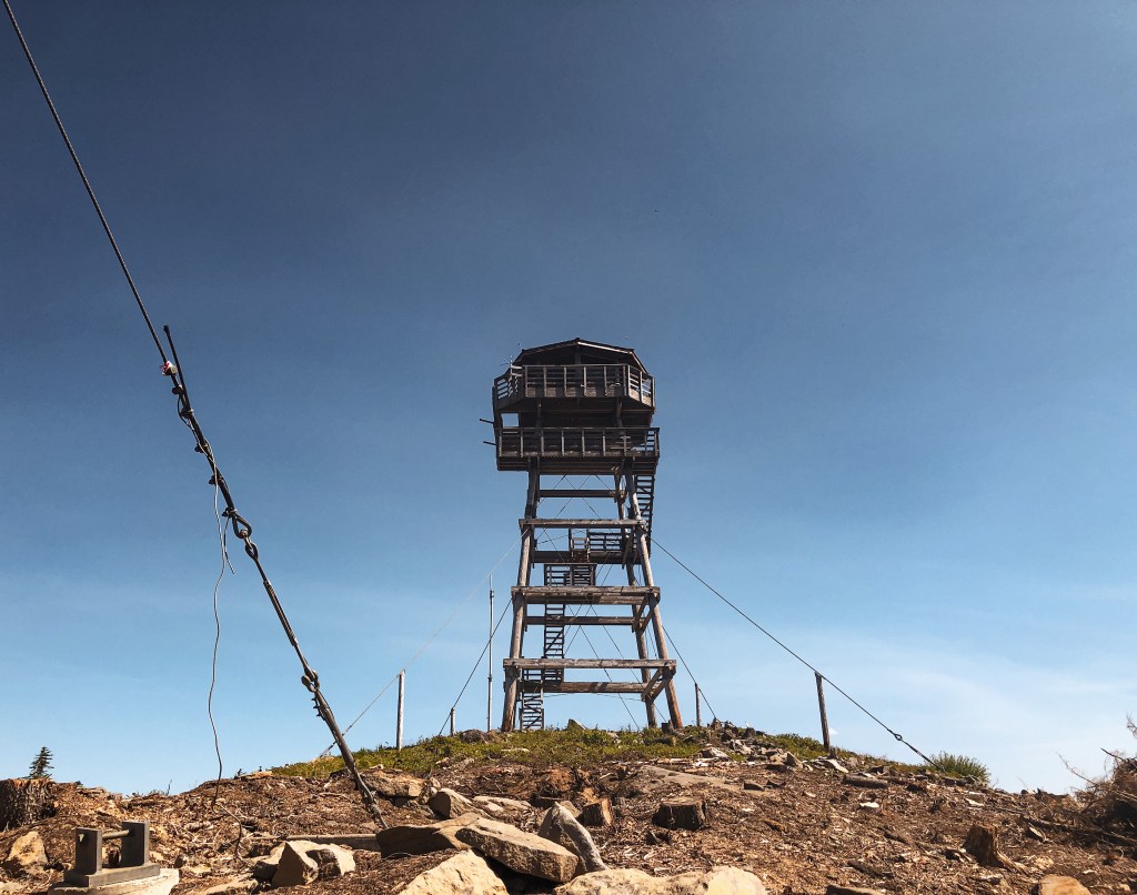
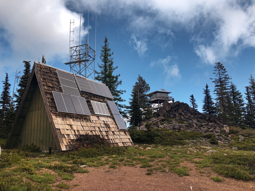
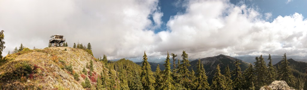
Rocky Butte (4,796′).

Not registered on the National Historic Lookout or the Former Fire Lookout Site Register.

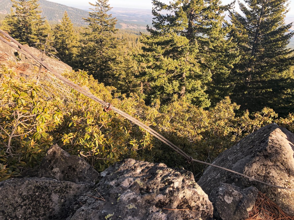
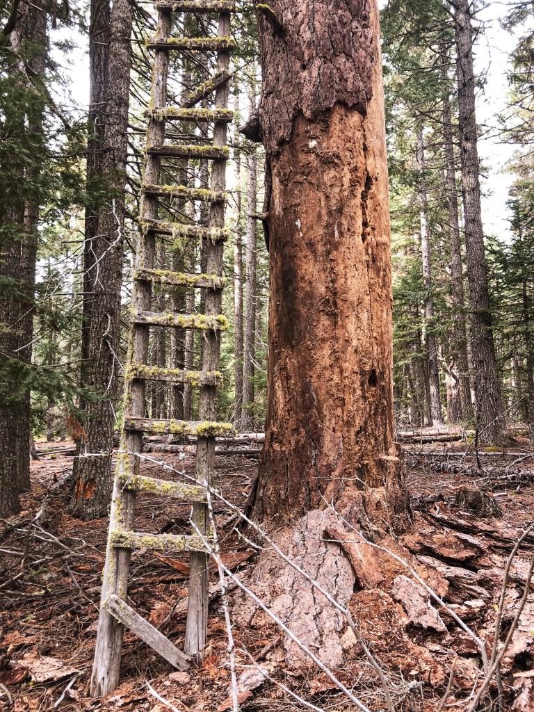
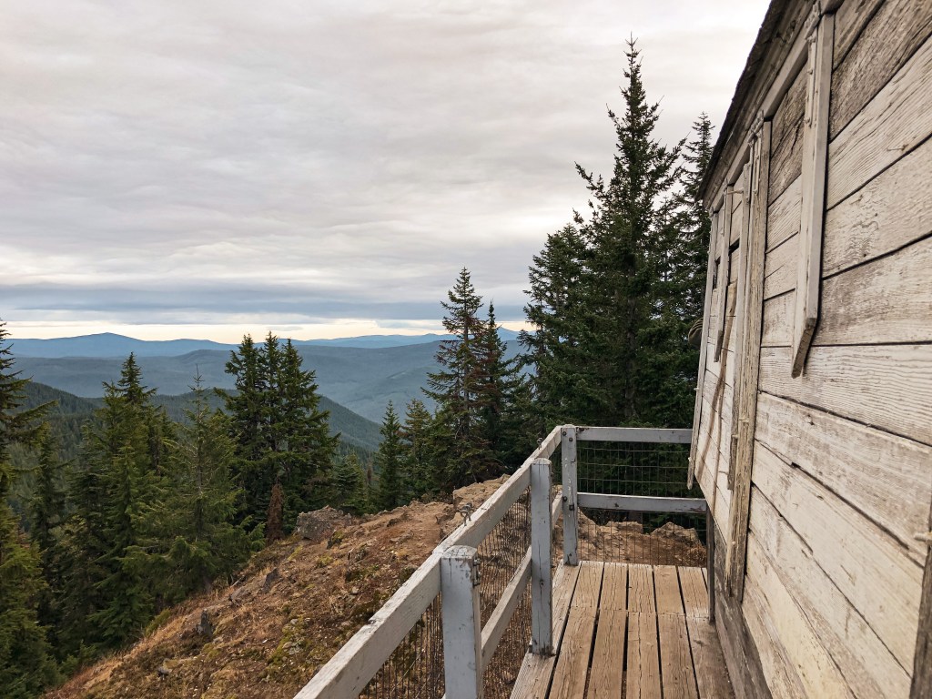
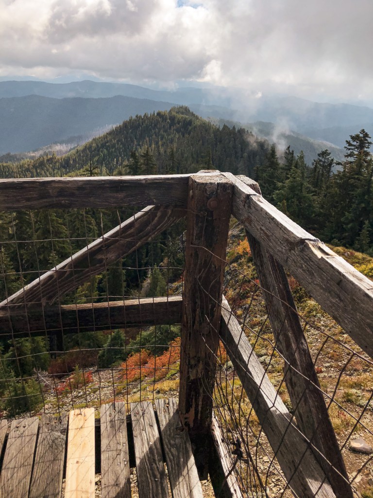
There is minimal information on when Rocky Butte was built but it pre-dates 1930. It was most likely abandoned in the 1930s or 1940s, but still stands today. This crows nest sits atop a 60′ Ponderosa pine. The guy wires, some of the top boards, and most of the ladder are still present.

a rudimentary outline of our route

Crow’s Nests of Mt Hood National Forest

Oregon Lookouts

Remnants to the early days of fire detection can still be found in parts of the Mt Hood National Forest. Crow’s nest lookouts are typically a platform that sits on top of a tree with a ladder nailed to the trunk. Before there were lookout towers, fire attendants used to climb the trees to spot fires in the area.

Joe’s Point.

Date visited.

October 16, 2021; October 9, 2022

Elevation.

3,653′

History.

Joe’s point was an open platform built atop a large Ponderosa Pine in the 1930s. There was also a 12×12 cabin built for the lookout in the 1940s. The cabin is no longer on the summit, but you can still see pieces of the old platform and ladder. There’s a nice view of Mt Hood from the rock quarry where you park your car.

Directions.

Take NF-44 to NF-4440 to NF-140. Drive to the end of NF-140 and park your car. NF-140 is a bit bumpy in a passenger vehicle but doable. Once parked you will need to hike the old decommissioned road for about a mile. Follow the blue diamond markers on the trees, but be aware there are other roads in this area marked with blue diamonds that could lead you astray.

Perry Point.

Date visited.

October 17, 2021

Elevation.

4,920′

History.

Perry point was a crow’s nest platform built atop a Douglas Fir in the 1930s and abandoned in the 1940s. It was noted as a potential patrol point for Fivemile Butte L.O. There are only a few boards left on top of the tree and will most likely not be there for much longer. The view from the point is still worth the short hike up.

Directions.

Take NF-44 to NF-120 and park you car at the trailhead for Eightmile Loop Trail #496. From the trailhead it is a little under a mile to Perry Point. You will want to follow the signs for Bottle Prairie Trail #455. The first trail junction is only marked in one direction. You will want to take the trail to the right until you meet the second junction. From the second junction stay left until you see a sign for Perry Point. The trail to the right of the sign will take you directly to the crow’s nest. It is the tree at the very end of a rocky butte and can be hard to spot.

Take the trail to the right
Take the trail to the left
Take the trail to the right of the sign

Rocky Butte.

Date visited.

November 20, 2021

Elevation.

4,796′

History.

Rocky Butte crows nest was built in 1929 atop a 60′ Ponderosa Pine. It has been abandoned for a long time, but remnants of the ladder and guy wires can still be found on the summit. You can also find a USDA Forest Service Benchmark on the summit dated back to 1924. This is my favorite of the crow’s nests we’ve been able to locate. The views from the summit are worth the short climb up alone.

Directions.

From Tygh Valley take Wamic-Market Road through Wamic. This road eventually turns into NF-48. Turn right onto NF-4810 towards Camp Cody. Stay on NF-4810 until you reach a four way junction with NF-4811 and NF-4813. Turn right onto NF-4811 and then left on to NF-4812 shortly after. Continue on this road until you reach the trailhead sign. The road washes out about a 1/2 mile from the trailhead but a higher clearance vehicle will have no issues. There is limited pull out room for parking. It’s only a short 1/2 mile hike up the trail once you find the trailhead.

Bus Point.

Date visited.

November 21, 2021

Elevation.

3,333′

History.

Bus point was built as a crow’s nest in 1933 but has since been abandoned. It sat atop a 95′ Ponderosa Pine and was accessed via a 32′ ladder. The ladder leaned against the tree and was wired in place. From the ladder, the lookout attendant then had to navigate the branches to reach the top. The ladder and tree were still standing when we visited but the tree is no longer living and there are visible signs of rot. I would recommend seeing this one sooner than later.

Directions.

Same directions as Rocky Butte but instead of turning right on to NF-4811 at the four way junction, you will turn left. You will take NF-4811 until you reach an un-signed three way junction. NF-4811 in this directions has some large potholes but I was able to maneuver them with caution in my Civic. You will pass NF-4814 on the right and paved NF-4820 on the left before reaching the major junction where you will park. It’s good to have a detailed map of this area since there are a lot of skid roads you will pass as well and no definitive marker for this one. From the junction you will cross country hike off the road to the right following a game path. My tracker said we only went 0.16 miles before reaching the tree. We were able to find it right away with no issues.

Parking at Junction

Where the game trail starts

Eightmile Point.

Date visited.

October 8, 2022

Elevation.

5,280′

History.

There isn’t much history on this crow’s nest. It was built in the 1930’s atop a Fir and I presume abandoned in the 1940s with the rest of them. Unfortunately, this one is no longer standing and we were only able to find remnants of it. It was hard to pin point which tree was the previous lookout tree on the ground. But, we found the general area with some remaining wire, boards, an insulator, and the help of some other lookout enthusiasts that were also trying to find it that day.

Directions.

Head into the Mt. Hood NF from Dufur taking a right on Dufur Valley Road that eventually turns into NF-44 once you reach the forest. Turn left on NF-4420 until you reach a junction with a major gravel road leading right. From here, if you continue straight it turns into NF-2730. But, you will want to stay on NF-4420 and turn right onto the gravel. You will stay on this road until you reach the trailhead for Fifteenmile Trail #456 off to the left (parking on the right). It’s an obvious trail just past the junction with spur road NF-160. Park your car and walk the remaining distance up the trail to reach Eightmile Point. It is less than a half of a mile up the trail. The trail connects to other roads and can be reached from other directions, but we found this to be the most direct.

Fivemile Butte L.O.

Oregon Lookouts

Location.

Mount Hood National Forest

Status.

Rental program; Currently standing

Estimated drive time from Portland, OR.

2 hours

Date visited.

October 16, 2021

Elevation.

4,627′

National Historic Lookout Register.

Yes

Trip Report.

My partner already visited Fivemile Butte L.O. earlier this year with his dad. We decided to come back for the weekend since I still needed to check it off my list. We also wanted to see if we could locate some of the crow’s nests in the area. The best access for passenger vehicles is to take NF-44 to NF-4430 until you reach the gate on NF-122. Reminder to not block the gate and park near the road junction instead. From the gate, it is a short 1/2 mile road walk. The road is drivable but requires caution on some of the more rutted out portions. It can also be accessed via hiking trails if you are not comfortable driving. In the winter, you can access it via the Billy Bob Sno-Park. This lookout is part of the rental program and can be booked year-round. Fivemile Butte L.O. is very popular due to its easy access and proximity. There were renters there when we checked it out which was expected but a bit awkward. Make sure to respect their space and do not climb the stairs. We didn’t stay long except to take a few pictures before heading back to my car for lunch. We were surprised to find no other visitors on the summit since we had passed a full trailhead. I think I would have a hard time staying here with all the day hikers and traffic. I assume you would get less visitation in the winter months though.

History.

The current lookout on Fivemile Butte was built in 1957 as a 14×14 R-6 flat roof cab atop a 40′ treated timber tower. It is furnished with a small bed, wood stove, propane cooking stove, table, chairs, and solar-powered lights. There is a vault toilet, storage shed full of firewood, picnic table, and fire ring on the summit as well. Everything else is on a pack it in, pack it out basis. The original lookout for this site was built in the 1920s. It was a 30′ pole tower with a small cab. It was replaced in 1932 by another 30′ tower with standard L-4 cab. This was later destroyed by heavy snow in 1942. The L-4 tower that replaced it untraditionally had a trap door inside the cab. I couldn’t find any information on when this lookout stopped being staffed and became part of the rental program.

Bonus pictures of our camp spot because we had a view of Flag Point L.O. on the ridgeline.

More Information.

US Forest Service

Recreation.gov

Sisi Butte L.O.

Oregon Lookouts

Location.

Mount Hood National Forest

Status.

Active; Currently standing

Estimated drive time from Portland, OR.

2-1/2 hours

Date visited.

July 24, 2021

Elevation.

5,617′

National Historic Lookout Register.

Yes

Trip Report.

My partner and I decided to explore somewhere a little closer to home this weekend. We set out seeking dispersed camp spots near Sisi Butte L.O. with the expectation of hiking to it before heading out the next morning. We figured we would have to spend the majority of the day finding a camp spot since Mount Hood NF is a popular area, but we were able to find one fairly early in the day. After finding camp we decided we had enough day light to hike up to Sisi Butte L.O. that evening instead. We found the gated road NF-120 off of NF-4220. Driving here with my Civic posed no issues. We almost drove past it since it wasn’t signed, but after seeing previous trip reports with pictures of the gate we knew we were at the right road. There are no trails up to the summit and they keep the road gated to help deter vandals. The only way to reach the lookout is via road walking. It’s a fairly easy 3 miles one-way with 1,400 feet of elevation gain. Just remember to not block the gate when you park your car. Given the condition of the road, we most likely would’ve had to walk to the summit even if it wasn’t gated. We passed a trailer camped in a pull out on the hike up where the full-time lookout attendant stays during the night instead of in the tower. The trailer didn’t appear to be currently occupied. Sisi Butte L.O. is staffed in high fire danger so we knew there would be an active lookout attendant when we reached the summit. Always make sure to be respectful of the active lookout attendant’s space and only climb the tower if you’ve been invited up. When we reached the summit we were greeted by Brent who was the lookout fill in for the weekend. We assumed the full time lookout that stays here during the week must have gone to town since they weren’t in their trailer. Brent invited us up and offered to let us explore the cab. It was his first official day up there for the season. Wildfire season had already started but we were lucky enough to get some spectacular views that weren’t completely hazy. We chatted with Brent for a while about wildfires and other lookouts in the area. He used to be a wildland fire fighter and was very knowledgeable on the subject. He showed us the active Bruler Fire, that was burning on the Deschutes NF, with the fire finder. He said it was the only one he could currently see. I found it interesting that he didn’t stay in the lookout cab either. He lived close enough to make the drive up and down everyday during the weekends. We didn’t want to pester him too long so we said our good byes, thanked him for the visit, and started our hike back down.

Mt Jefferson

Part of Sisi Butte
Mt Hood

History.

I couldn’t find information on the first lookout that was built on this butte except that it was sometime in the 1940s. It was later replaced with a 40′ tower and standard L-4 cab in 1953. It served as the main lookout until it was dismantled in 1997 to prepare for the current lookout to be built. Similar to Calamity Butte, the current lookout is a 50′ tower with an octagonal cab. I’m not sure how many other lookouts where built in this style between 1996 and 2001 but these are the only two I’ve seen so far. The tower was in good condition despite missing its copper wires. Those help to ground it during a lightning storm. Brent said that instead of replacing the wire they are expected to vacate the area whenever a lightning storm passes through. He stated that it was low on their priority list for budget in replacements. They did recently do some maintenance around the base of the lookout though. They cut down all the trees closest to the lookout on the summit when it was threatened by the Riverside/Lionshead Fires. They hoped to create a more defensible space for fire breaks.

More Information.

Oregon Hikers

NW Hiker

Flag Point L.O.

Oregon Lookouts

Location.

Mount Hood National Forest

Status.

Active; Currently standing

Estimated drive time from Portland, OR.

2-1/2 hours

Date visited.

June 5th, 2021

Elevation.

5,650′

National Historic Lookout Register.

Yes

Trip Report.

There are multiple ways to get to Flag Point Lookout via roads and trails. My partner and I had decided to disperse camp in the area for a night due to the proximity to Portland. We hadn’t planned on hiking this trail but knew we were close when we were looking for camp spots along FS-2720. We ended up reaching the end of the road and decided to hike to the lookout since we were already there. There is an un-marked connector trail that starts from the end of the road on the left side and meets up with Tygh Creek trail #460 in the Badger Creek Wilderness. You’ll follow this trail until you come to a fork where it continues up or down the ridge, you will want to continue up along the Tygh Creek trail #460. The trail leading down is the Tygh Creek Cut-Off trail #460A and will only take you farther into the wilderness. You could potentially do this as a loop using Little Badger Trail #469 from Tygh Creek Cut-Off Trail #460A . We did meet two people hiking out before we started that mentioned they had done this loop. They said there were still some patches of snow along Little Badger Trail #469 so we opted for an out and back. Eventually Tygh Creek trail #460 meets up with FS-200. You will have to road walk the remainder of the distance to get to the lookout. From FS-2720 to the lookout is about 2.5 miles one-way and gains 1,122 feet of elevation. It was a cold day with some stormy gusts of wind rolling through when we visited. We even had a rain and snow mix on the summit. Due to the weather we didn’t get the prominent view of Mount Hood that is visible from the summit. Be careful on your hike back down if you take this route. We completely missed the unmarked connector trail back to FS-2720 and ended up hiking along Tygh Creek Trail #460 for longer than we needed. Eventually we were able to find it after paying closer attention and back tracking a couple times.

History.

The current lookout is an R-6 15’x15′ flat top style cab that was built in 1973. It is still actively staffed in the summer but was boarded up for the season when we were there. Flag Point Butte had two other lookouts on the summit before being replaced with the current one. The first lookout was built in 1924 as a 6’x6′ observation cabin on a 40′ tower. The fire lookout used to tent camp below since it wasn’t a live in cabin. In 1932 the observation cabin was replaced by a standard L-4 cab on a 30′ tower. The existing lookout used to be available for rentals in the winter but was removed from the register in 2016. They had trouble maintaining this in the winter conditions due to the remote location and vandalism.

Devil’s Peak L.O.

Oregon Lookouts

Location.

Salmon-Huckleberry Wilderness; Mount Hood National Forest

Status.

Maintained; Currently standing

Estimated drive time from Portland, OR.

1-1/2 hours

Date visited.

November 9, 2019

Elevation.

5,045′

National Historic Lookout Register.

Yes

Trip Report.

My partner and I decided to do Devil’s Peak L.O. as a day hike via Cool Creek Trail #794. There are other access trails to this lookout but this one seemed to be the most direct. And by most direct I mean very steep. It was like the Stairmaster of hikes. For 3.5 miles you are essentially walking straight up and when you think you’re close you will continue to hike up. It climbs a grueling 3,200 feet of elevation in those few miles. The trail starts off of NF-2612 which is also marked as Still Creek Road. It is paved most of the way until the last 1/2 mile where it turns to maintained gravel. The trailhead is just a pullout along the one lane road and can be missed if you’re not looking for the sign. We didn’t see anyone else our whole hike up to the lookout. We had a quick lunch at the summit as we explored the inside. It was a cloudy November day and we were rapidly losing sunlight. As we raced down the trail we passed another couple on their way to the summit. We were surprised to see someone else heading up so late. They only had day packs as well so we knew they weren’t staying the night. Most of our hike down was in blue hour and by the last mile we had our head lamps out. We didn’t reach my Civic until it was already dark out. The other couple came down shortly after us with their own set of head lamps. Off season hiking always becomes a race against the sun.

History.

Devil’s Peak L.O. was originally built in 1924 and decommissioned in 1964. It is an 8′ tower with an L-4 cab and listed on the National Historic Lookout Register. The lookout is maintained by volunteers and they have kept it in great condition. The entire structure is open to the public and you can even stay in it on a first-come first-serve basis. I really want to do this sometime but the thought of lugging a heavy backpack up this trail is less appealing. There is no water source up there either, so not only do you have to carry your standard gear but water as well. You still get views of Mt Hood and the surrounding peaks but since it hasn’t been active in years the trees are slowly obstructing the tower’s views.

More Information.

US Forest Service

Oregon Hikers

AllTrails

Bull of the Woods L.O.

Former Lookouts, Oregon Lookouts

Location.

Bull of the Woods Wilderness; Mount Hood National Forest

Status.

Burned in Bull Complex Fire; September 6, 2021

Estimated drive time from Portland, OR.

1-1/2 hours

Date visited.

September 23, 2018

Elevation.

5,520′

National Historic Lookout Register.

Yes

Incident Management Team officials confirmed last night that the Bull of the Woods Lookout located within the Bull of the Woods Wilderness was lost due to fire activity yesterday. This lookout was listed on the National Register of Historic Places and frequently visited by those who enjoy the history and background of Fire Lookouts. “We acknowledge that losing this historic Lookout is a loss that will be felt by many in the area and beyond,” said Rick Connell, Incident Commander of NR Team 4.

Over the past several weeks as the fire moved towards the historic Lookout, several actions had been taken by firefighters to protect it. Plans to wrap the Lookout in structure wrap material were made several times but had to be cancelled due to dangerous conditions to firefighter safety and the unavailability of trained personnel. Working on dangerously high and structurally compromised materials in a remote wilderness location to wrap a structure requires firefighters who are specifically trained for that type of work. If a person falls from a high surface without appropriate fall protection training and equipment the consequences could be severe. The extremely steep terrain on all sides of the Lookout’s location also creates dangerous wildfire conditions where fire can move quickly uphill without warning. The combination of safe forecasted fire behavior conditions and trained personnel needed were never able to converge for structure wrapping. The safety of the public and firefighters is always the highest priority in fire response.

On August 31 a helicopter rappelling fire crew flew to the site and cleared trees and brush around the Lookout to make it more defensible. The crew could not safely remain at the site since it was on steep terrain directly in front of the approaching fire. For the past six days numerous hours of helicopter flight time had been used to drop water to slow the movement towards and intensity of the fire near the lookout. Yesterday, smoke obscured visibility on the north side of the fire and it wasn’t safe to fly aviation in that area.

On September 5 fire activity increased on three slope aspects below the Lookout site. This type of fire behavior is what was concerning for firefighter safety every time the discussion came up about firefighters working at the Lookout site. A smoke inversion and active fire behavior limited visibility for aircraft to safely fly and limited the tactical operations that could be performed for fire suppression. There are no safety zones or roads near the Lookout for firefighters to safely engage in firefighting on the ground. The fire was also making a push and threatening multiple values at risk on other portions of the fire at the same time. It is disappointing to see a historic structure like this Lookout destroyed by fire. However, many photos and stories have been preserved to continue to tell the story of the Bull of the Woods Lookout for years to come

-Mt Hood NF, September 6th 2021

Trip Report.

I’m reminiscing about this beautiful fire lookout in the middle of a rugged Oregon wilderness. Unlike most fire lookouts, there are no roads that lead here. Access was via the multiple interlocking trails found in the wilderness. The most direct route, and the one I took to get there, was the Bull of the Woods Trail #550. The trail switchbacks through shady woods until you crest the ridge line. You will gain 1,250 feet of elevation over 3.2 miles. Once you reach the ridge you are exposed to spectacular views as far as Three Sisters, Mount Jefferson, and Three Fingered Jack.

I hiked this trail with one of my good friends back in September 2018. I feel lucky now that we were able to see this when it was still standing. NF-6340 was a decent gravel road up until the end where it was rutted out due to people driving it in wet conditions. But my Civic was able to make it to the trailhead with some careful maneuvering. It was a colder day that felt like the beginning of fall. The understory was still wet from a recent rain and the clouds were rolling over the sun throughout the day. We had the trail to ourselves for the entire hike up and our summit lunch. It wasn’t until we were packing up to leave that we met an older couple and their dog at the summit. They even made a comment about my Civic being at the trailhead and that they were impressed it made it up there.

History.

This lookout was an L-4 built in 1942 and regularly used until 1963. The forest service intermittently staffed it in high fire danger until the mid-1980s. In the early 2000s, volunteers with the Sand Mountain Society helped renovate it but it had seen better days. When I visited in 2018 the cabin was shuttered and locked aside from the few boards that were pried off and a broken window. The catwalk was mostly useable but had some broken boards as well. Unfortunately, its structural integrity is a moot point, given that it burned in the 2021 Bull Complex fire. The trail and forest will recover and still make for a great day hike once the area is reopened.

My heart breaks as we lose more of these historic structures every year. All I can do is hope that I get a chance to experience them while they’re still here!