Dog Mountain L.O. (Fremont NF)

Oregon Lookouts

Location.

Fremont-Winema National Forest

Status.

Unknown; Currently standing

Estimated drive time from Portland, OR.

7 hours

Date visited.

June 27, 2022

Elevation.

6,936′

National Historic Lookout Register.

Yes

Trip Report.

Day 3/10: Lookout Road Trip 2022

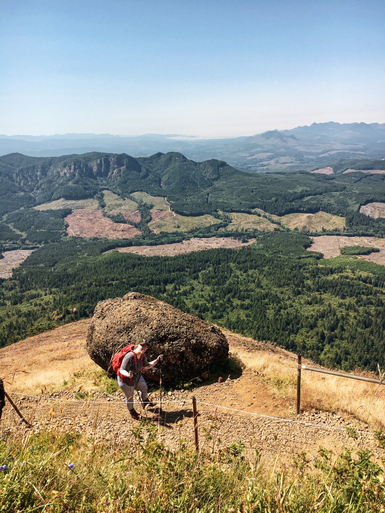
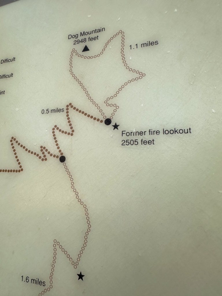
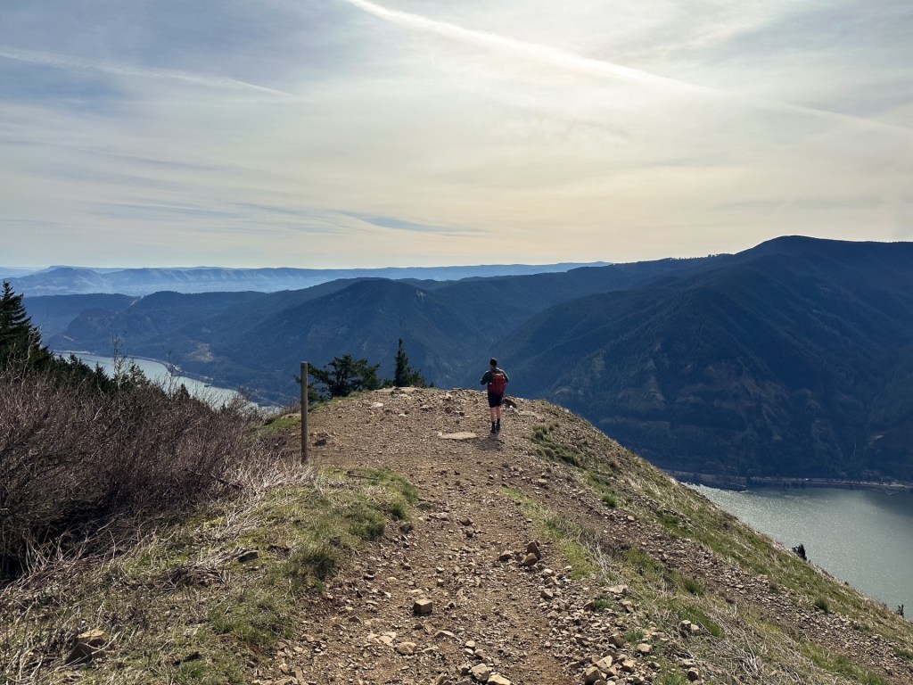
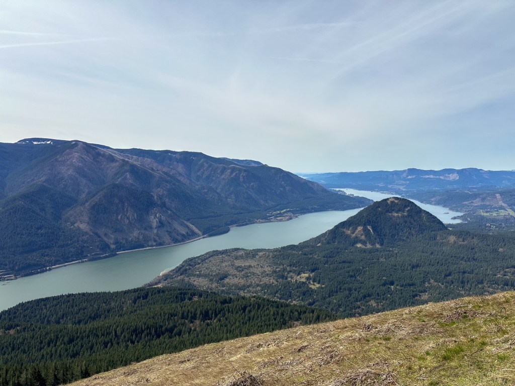
Our last stop for the day was Dog Mountain L.O. on the Fremont-Winema NF. This is another one we expected to be staffed during our visit. From Bly, you can either cut across the forest via connecting Forest Service roads or take the highway. It seemed that most who visited this lookout previously came in from Lakeview. Some of the trip reports even mentioned it was a good road for low clearance vehicles all the way to the summit. I was skeptical to say the least. I felt the pavement would be the quickest way and we headed out of Bly on HWY-140. There are a few different routes you can take from here. We ended up turning onto Tunnel Hill Road that eventually turned into Westside Road. We stayed on this road until we reached Dog Lake Lane. Take a right. As the name of the road indicates it will take you all the way to Dog Lake. There is a campground and day use area here. You should be able to see the fortress of a lookout from the road as you drive in. Once past the reservoir the road turns to gravel. We turned on the first major gravel road off to the right. This is supposedly NF-3752 but I didn’t see a sign. We briefly stayed on this road and then turned right on to NF-406. I didn’t see a sign for this road either but it appeared to head in the right direction. Some indicators that you’re on the right road; there will be a cattle guard and it will be at a junction with NF-085 off to the left (this road is signed). From this junction, it is about 5-1/2 miles to the summit. The NF-406 road will take you all the way. You will want to bear right when you reach the junction with NF-052 to stay on the correct path. The road is exposed and narrow as it winds up and around. We hoped not to meet anyone on it. There is no gate for this lookout and you can, in fact, drive all the way to the summit. Even in a low clearance vehicle.

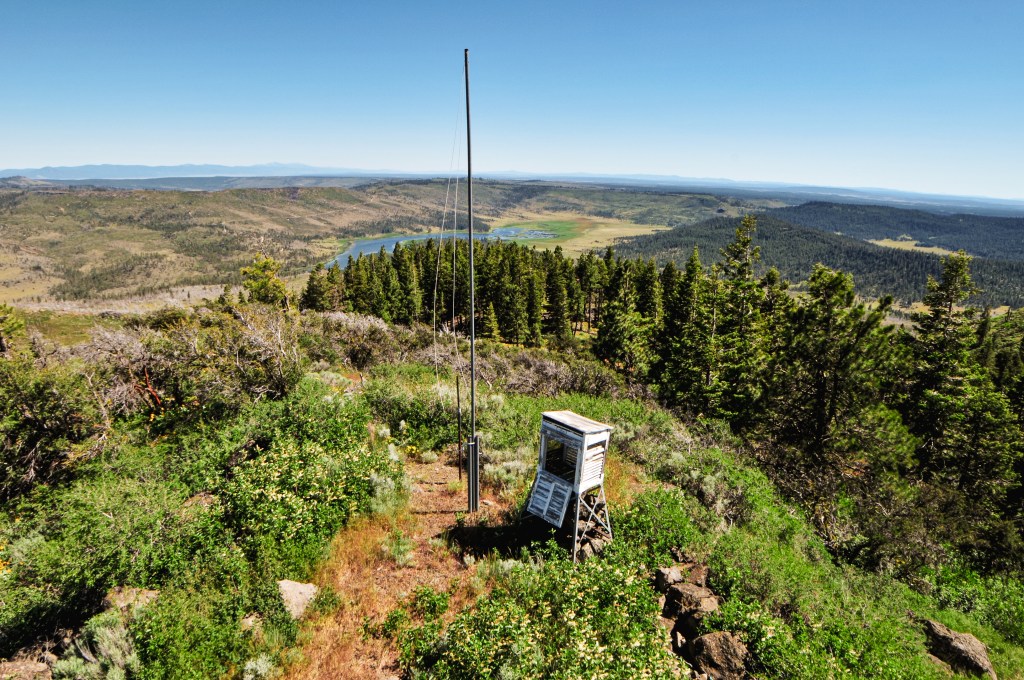
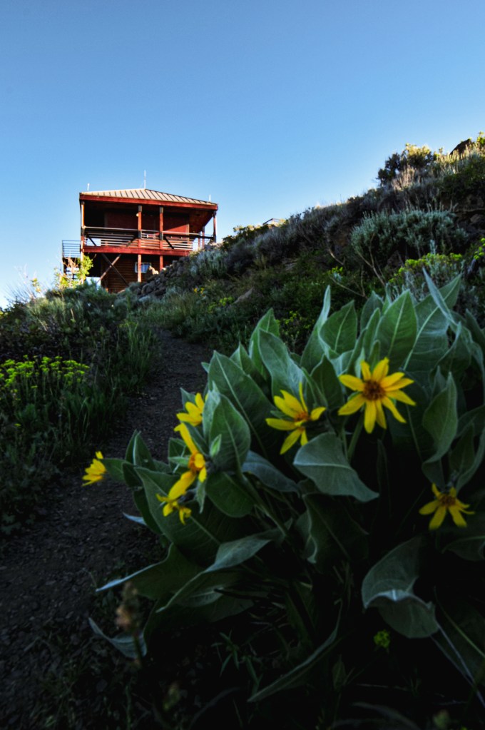
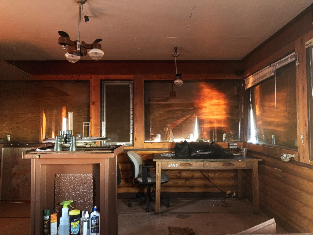
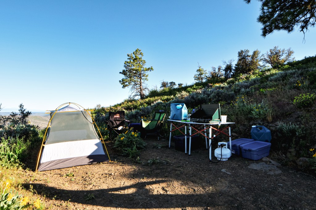
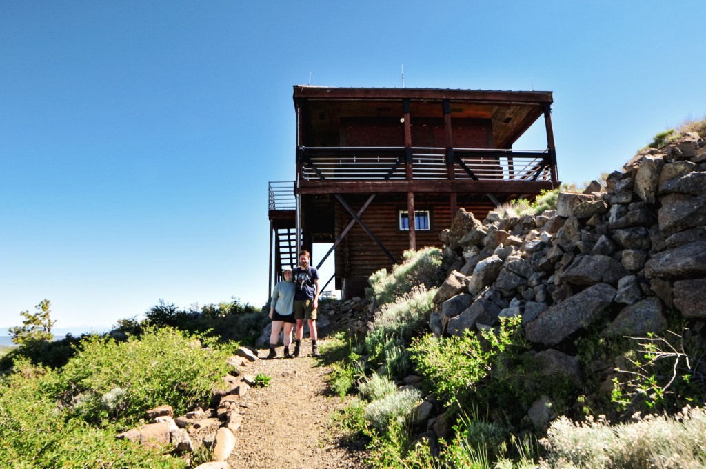
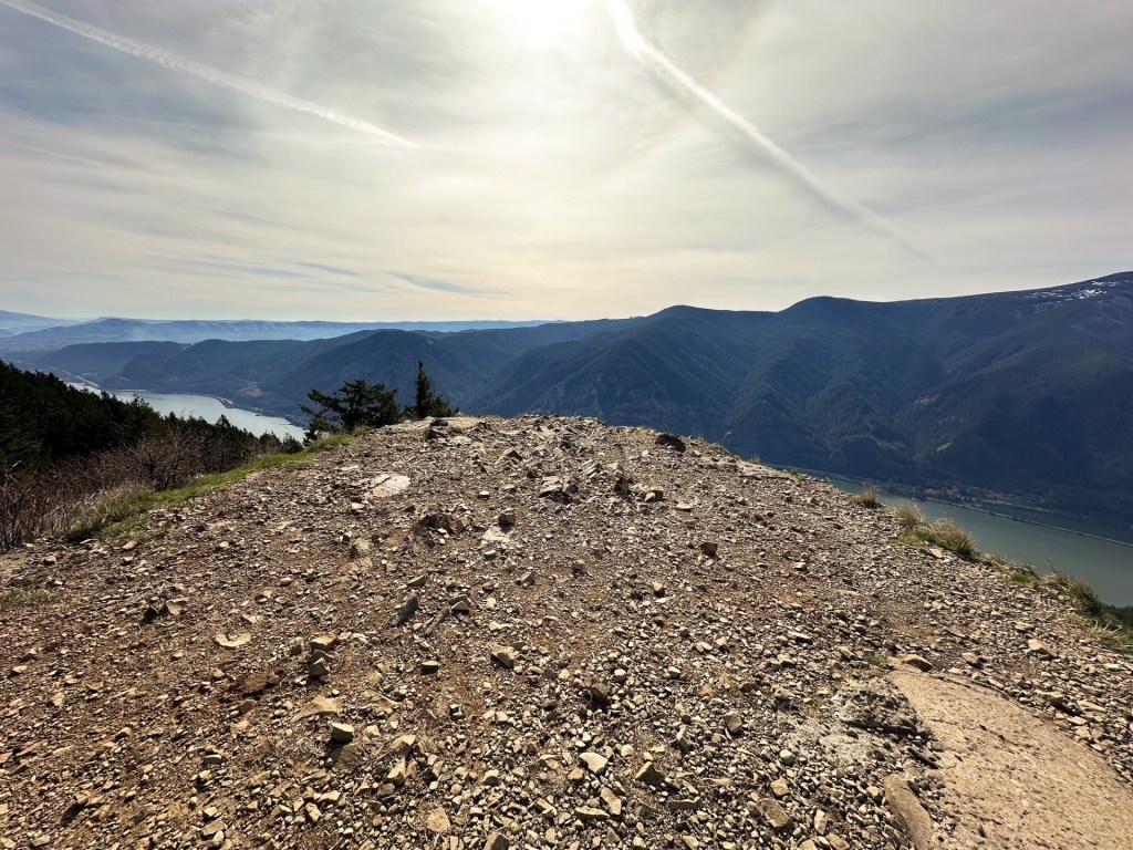
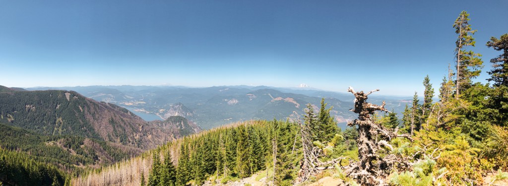
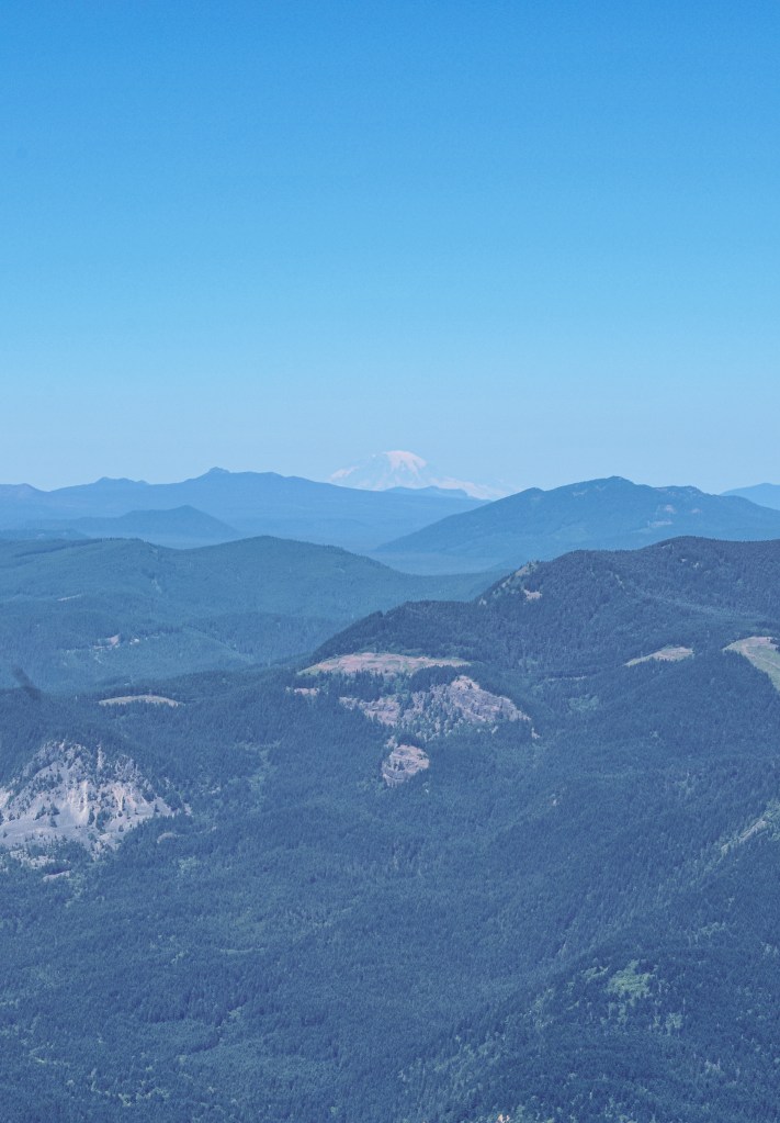
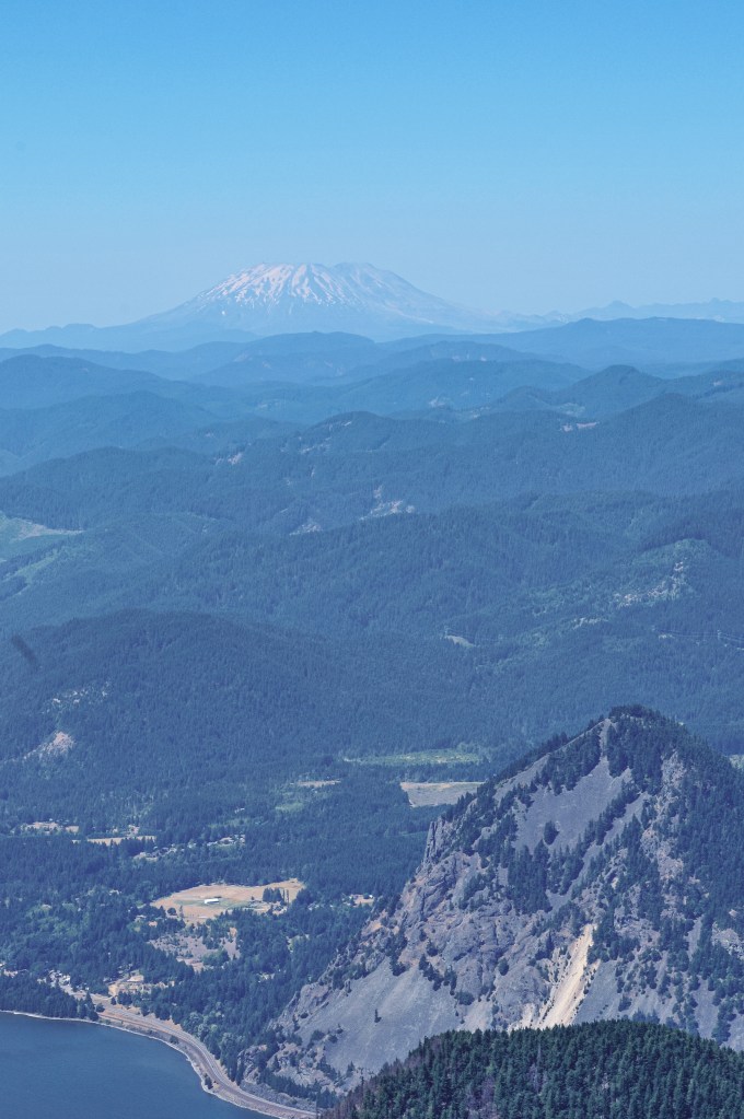
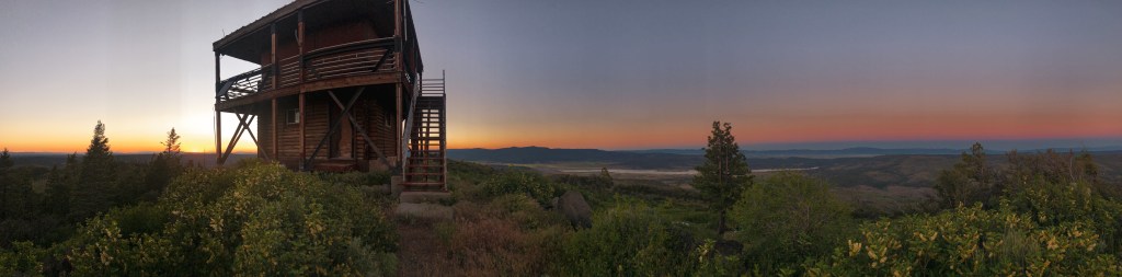
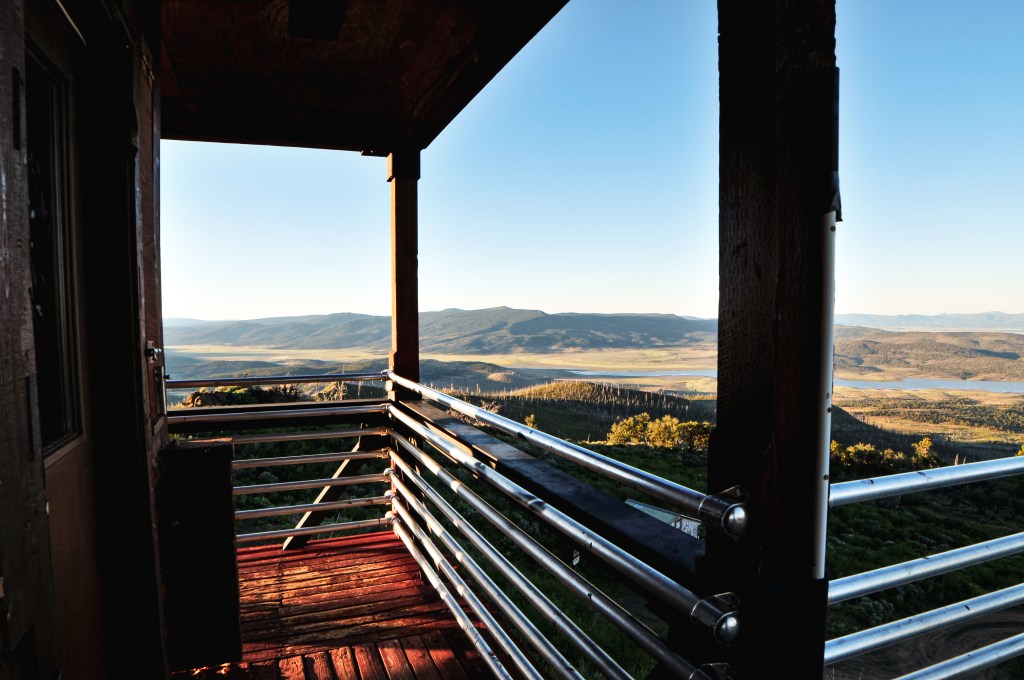
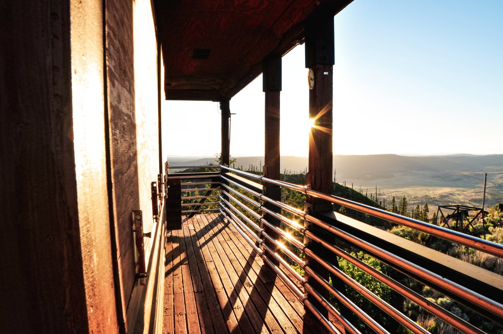
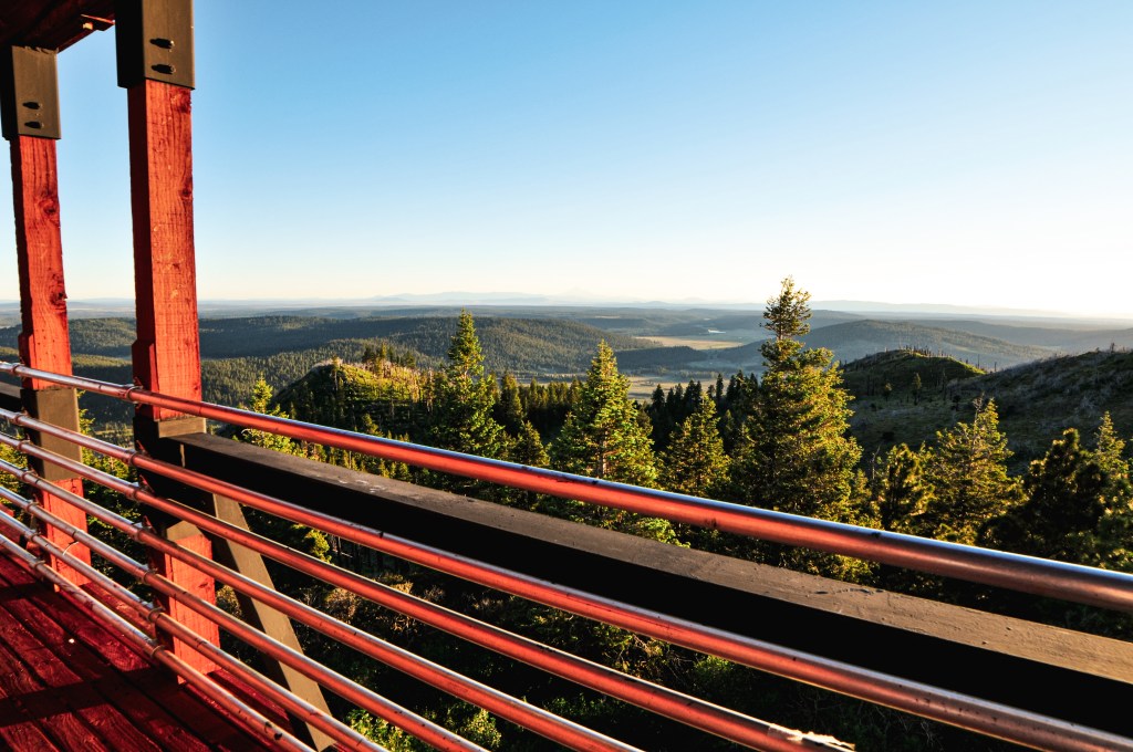
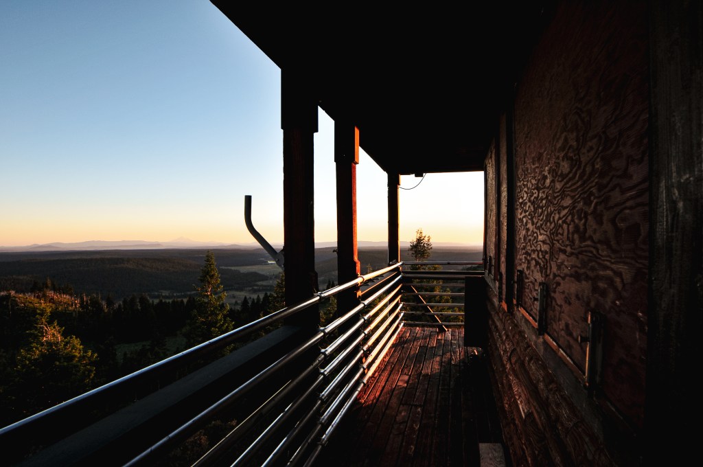
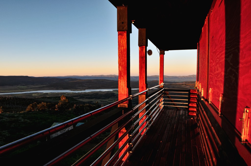
There was no other vehicle here and the lookout seemed to still be locked up for the season. We found this odd since most sources noted it as staffed. We looked around through the windows and it was still stocked like a lookout in use. There was a fire finder, desk, and chairs along with some other items that indicated someone had been up there more recently. But, on the other hand, there was a visible Lookout Fire Report sheet that was last used in June 2020, the toilet seat was broken in the privy, and a wood rat had made its home in between one of the shutters. There was also a fire alarm beeping in the living quarters below that needed the batteries changed. Our guess was that it might have been recently moved to emergency status or had a staffing issue. We decided to camp on the summit for the night since no one was there. Someone else drove up a little after we set up our camp. We panicked and thought it might be the lookout attendant, but they was only there with their dog for a brief time and didn’t say a word to us. The views from here were commanding. We could see all the way to Lassen Peak in California. It was one of my favorite camps of the trip.

History.

Dog Mountain started with a simple Alidade and has been used as a lookout site since 1918. Possibly earlier. A standard D-6 cupola cabin wasn’t added until 1926. An accompanying 16×18 wood framed garage was added in 1934 by the local CCC. In 1947, a new 14×14 Aladdin style house was constructed as a lookout with no catwalk. It was maintained into the 1980s. The Forest Service didn’t consider replacing it until an inspection report in 1995. The site was also noted as being used for a long-term weather station. In 1997, the lookout that stands today was built by Hargrove Construction as a replacement. They built a unique 2-story house with living quarters on the first floor and the lookout office with catwalk on the second. It reminds me of a log cabin.

4 Popular Hikes That Are Former Fire Lookout Sites

Former Lookouts

In the prime of fire suppression, Oregon had over 800 fire lookouts and Washington had 750 fire lookouts topped on almost every high peak in both the states. Many were dismantled, destroyed, or burned down in a blaze of glory. But remains of the foundation can usually be found on the summits as a reminder to what once stood. Below lists 4 popular hikes close to Portland, OR that have a history in fire detection and lookouts.

Beacon Rock

Location.

Beacon Rock State Park – Columbia River Gorge

Estimated drive time from Portland, OR.

1 hour

Mileage.

1.5 miles RT

Elevation.

730′

Beacon rock is one of the tallest monoliths in North America and stands at 848 feet tall. It is also considered one of the most distinctive geological features in the Columbia River Gorge. The route follows a mostly blasted and bridged trail on the exposed west side of the rock. Parts of the trail have been paved over throughout the years and is completely lined with handrails. It is basically just a series of short continuous switchbacks to the summit. The history behind Beacon Rock is extensive and interesting. The feature itself was once the core of a volcano and what remains is what was able to withstand the force of ice-age floods. It was noted and named as Beacon Rock by Lewis & Clark during their voyage in 1805. Though I’m sure it had a different name for those native to the area. It was even slated for demolition at one point for either railroad construction or a new jetty on the Columbia River Gorge. Henry Biddle bought the rock and surrounding area before this happened. He is also the one who originally built the trail between 1915 to 1918. His property was later offered to the Washington State Parks by his estate for $1. The Washington State Parks originally refused this offer until Oregon expressed interest in maintaining it as a park. It was purchased by the Washington State Parks in 1935. Although you won’t find any remnants of a former lookout structure on the summit of this rock, it does have a history in fire detection. Given the height of the rock, it was used as a fire detection camp from the 1930s up until the 1950s when it was abandoned. I’ve hiked this trail more than any other trail and with more people than any other trail I’ve every hiked. It is a good beginner trail or trail for showing your out of town friends to a quick hike.

More Information.

Oregon Hikers

AllTrails

Saddle Mountain

Location.

Saddle Mountain State Natural Area

Estimated drive time from Portland, OR.

1-1/2 hours

Mileage.

5.2 miles RT

Elevation.

3,283′

The top of Saddle Mountain offers expansive views from the Pacific Ocean all the way to Mt Hood. It is no question why they would want to have a lookout on this summit. The trail switchbacks through an old growth forest until you reach the last push up the rocky slope. Parts of the trail are covered in mesh wiring to help with erosion and traction. It is a steep 1,640′ gain in elevation over 2.5 miles to the summit. Saddle Mountain was established as a fire camp in 1913 with a log cabin situated below the summit. In 1920, a frame cabin with observation platform was built. It was replaced in 1953 by a 2-story live-in cabin. The lookout structure was destroyed in 1966. I have been on this summit a few different times but didn’t take the time to look for any remnants of foundation.

More Information.

Oregon Hikers

AllTrails

Dog Mountain

Location.

Gifford Pinchot National Forest – Columbia River Gorge

Estimated drive time from Portland, OR.

1-1/2 hours

Mileage.

6.5 miles RT

Elevation.

2,480′

Stretching my calves on the way up
wildflowers on the trail!
Near the summit where we turned around

Dog Mountain is a very popular hike in the Columbia River Gorge due to its proximity to town and being right off of HWY-14. In the spring, between March 31st and July 1st, permits are required to hike this trail on the weekends. This is due to the hazardous conditions created for the cars on the highway by the overflow of people during wildflower season. There are a few different routes and loops that can be done to reach the summit once at the trailhead. My friend and I completed this hike on a hot July day before the permit system was in place. We arrived to the trailhead early to give us enough time to reach the summit and attempt to beat the crowds. We took the “less difficult” route which is the newer trail and offers more views on your steep climb up. We made it just past the former fire lookout site, also known as the Puppy Dog Lookout site, before turning around. I vaguely remember there still being some foundation there. The trail originally was developed to service this fire lookout that was destroyed in 1967. The original lookout was constructed in 1931 as a gable-roofed L-4 cab with windows only on three sides. It was replaced in 1953 by a standard L-4 cab. Both structures were located 1/4 mile from the actual summit of Dog Mountain. I used to have more pictures from this hike, even one of us standing on the former lookout site, but they have been lost in multiple phone transitions since 2017.

More Information.

Oregon Hikers

AllTrails

Mt. Defiance

Location.

Mt Hood National Forest – Columbia River Gorge

Estimated drive time from Portland, OR.

1 hour

Mileage.

12.5 miles RT

Elevation.

4,960′

Mt Rainier
Mt Adams
Mt Hood
Mt Saint Helens & Wind Mountain

Mt. Defiance is one of the more brutal hikes I’ve done. It is the highest peak in the Columbia River Gorge and offers views out towards Mt Hood NF as well. This made it the perfect candidate for a fire lookout site. I recommend starting this hike early if you want to make it to the summit and back before dark. Or at least hike a lot faster than I do. We didn’t start this hike until mid-morning and ended up getting back to the car after dark. The hike starts out paved and passes some pretty waterfalls. Once you have reached the junction with the un-paved trail you will start to go up and continue to go up the rest of the way. There are still some communication buildings on the summit and I’m sure there are foundation remnants if you spend some time looking for them. We didn’t spend much time here since it took me so long to get there. The trail had recently re-opened after the Eagle Creek Fire in 2017. The ashy portions of the trail made for un-stable ground and was hard for me on the hike down. By the time I got back to the car my feet felt like they were going to fall off completely. The first fire lookout on this site was a crow’s nest and tent in 1925. A more substantial structure was built in 1934 as a 40′ pole tower with L-4 cab. This was eventually replaced by a 41′ treated timber tower with L-4 cab in 1952. In 1959, the lookout was destroyed by a windstorm. The Forest Service didn’t build a replacement lookout until 1962 which was a R-6 flat top cab and 41′ treated timber tower. It was completely removed from the summit in 1971.

Struggling on the way up, but with a view!
Dying on the summit, also with view!

More Information.

Oregon Hikers

AllTrails