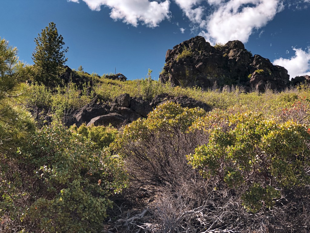
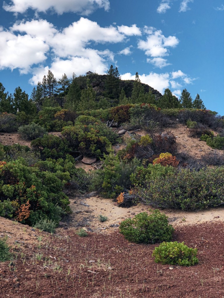
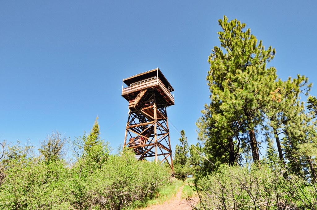
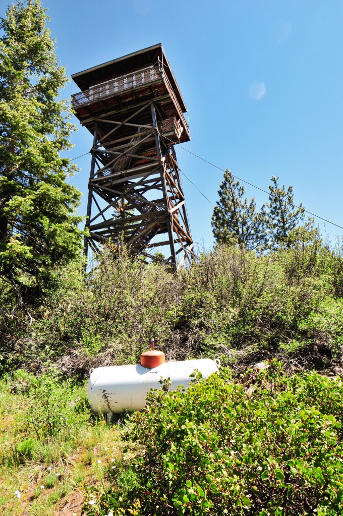
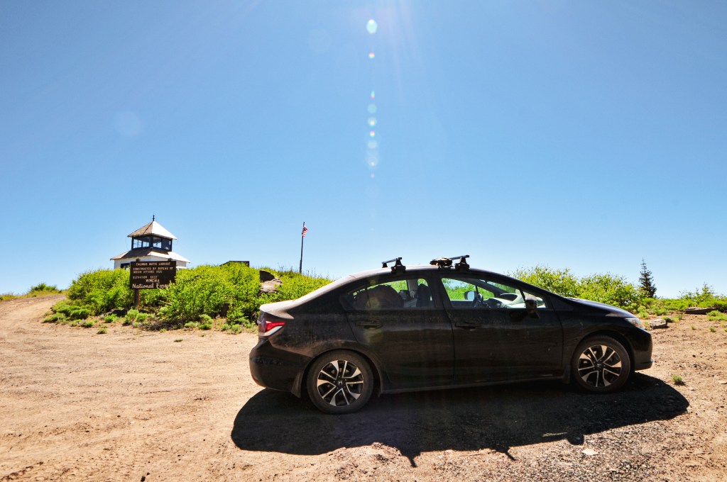
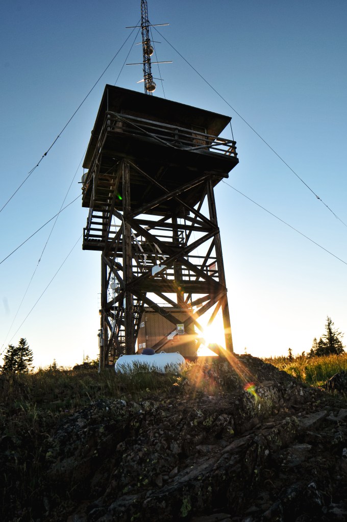
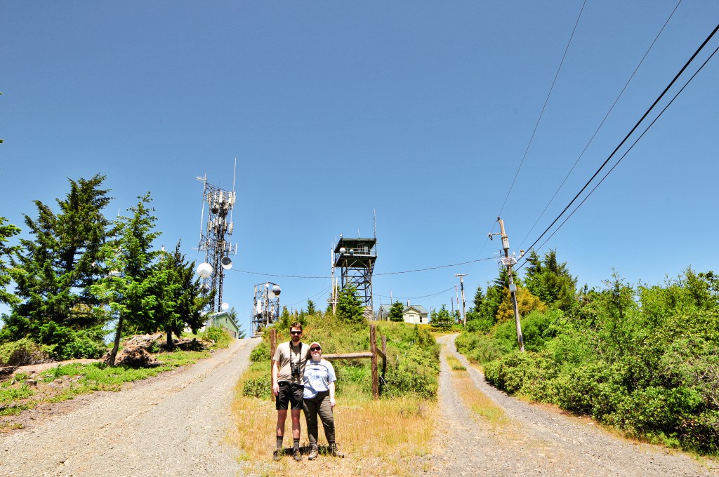
From Sugarpine Mountain (post), we continued southeast on NF-86 until we reached NF-76. This road is also considered CR-676 or Silver Lake Road. We turned left towards the community of Silver Lake and stayed on this road until we could visibly see Bear Butte. The roads off to the left before you reach the butte are not marked. You will need to turn left on to one of these roads before your pass the butte. There should be a road that parallels NF-76 and has two different access points. It can be hard to see and we had to turn around to make sure we were picking the right roads. Once the road turns away from NF-76, you will want to take a right at the second un-marked road. This road should take you to a large cinder pit with a view of the lookout. We ended up parking at the junction with this road and walking to the cinder pit. I personally didn’t feel like running into any additional road surprises for the day.
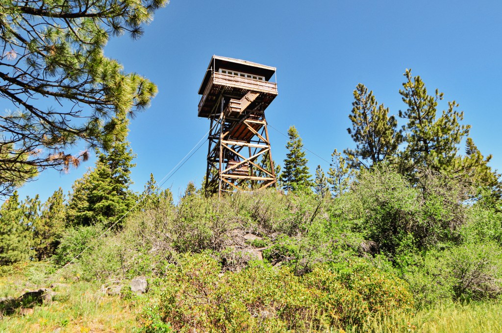
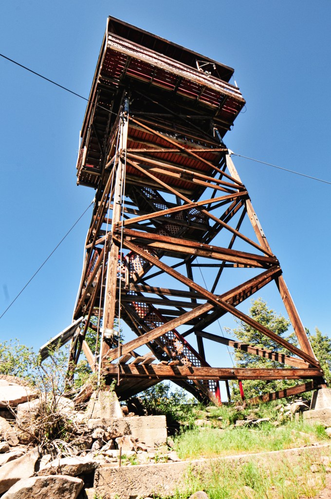
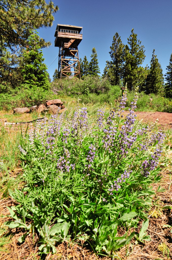
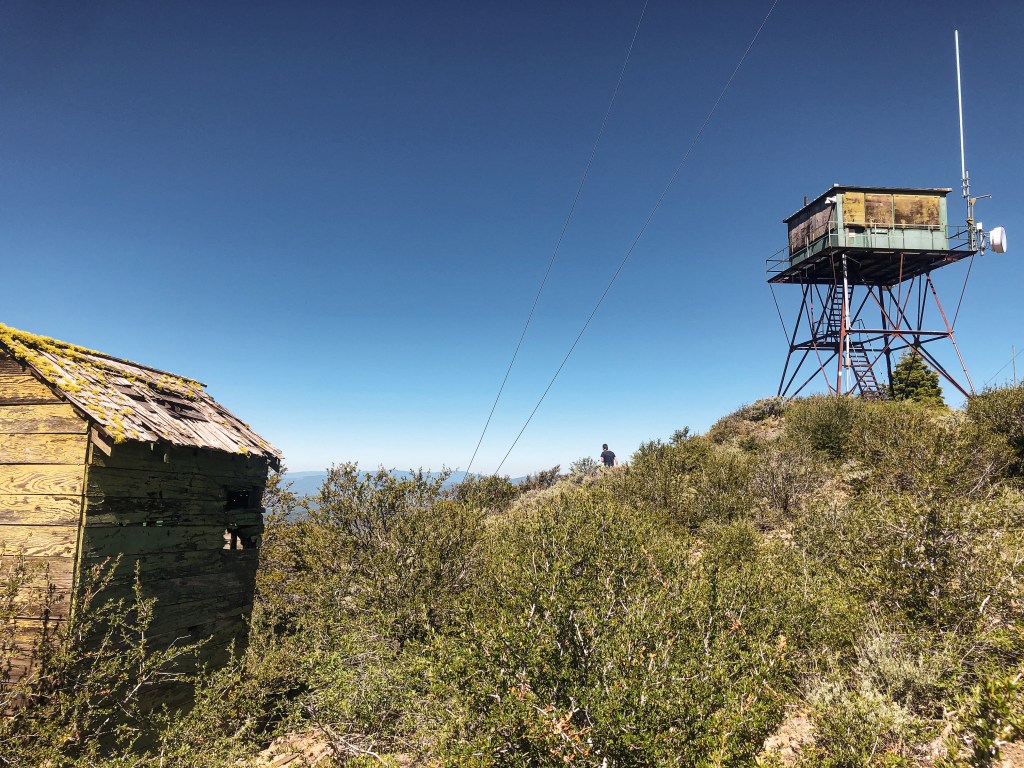
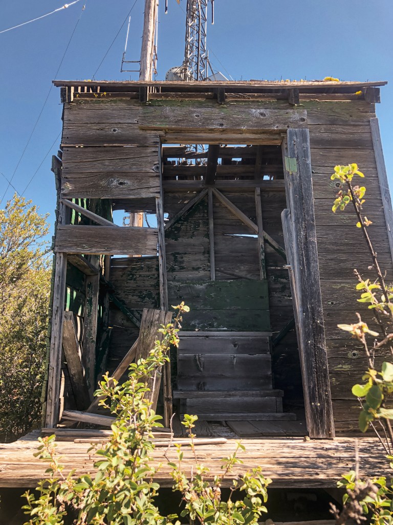
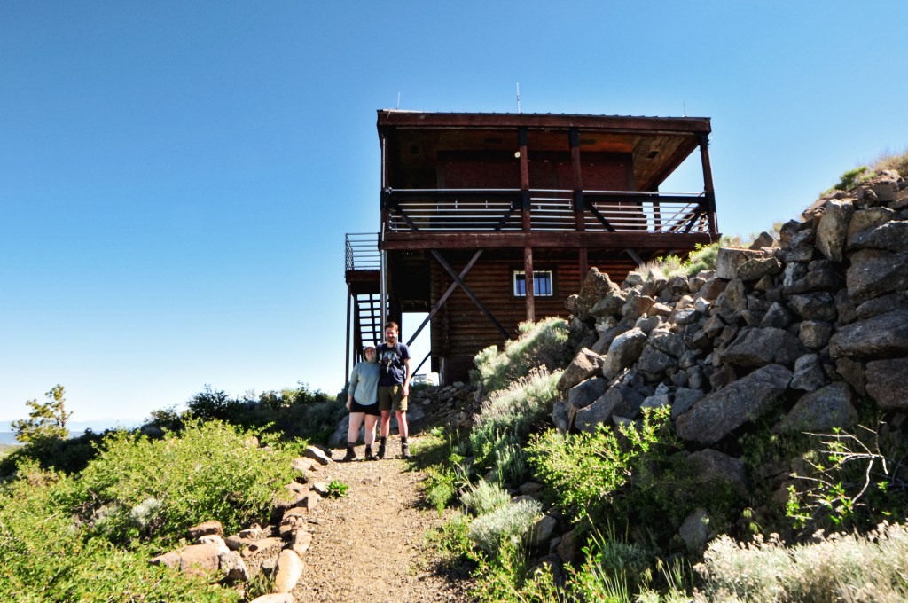
There are no formal trails to take you to the summit, so from here you will have to get creative. We headed to the right of the cinder pit and gradually climbed the slope at an angle. Eventually, we met up with the old road bed that used to circle the butte and followed it to a communication tower. Unfortunately, I don’t do well in soft terrain or rock scrambles. I accepted that this was most likely as close as I’ll ever be to Bear Butte L.O. and let my partner continue on without me. From the communication tower, he headed straight up the slope. He said he was able to find an old game trail from here that led to the rocky top. There are no longer any stairs to get to the structure and you will have to rock scramble the remainder of the way.
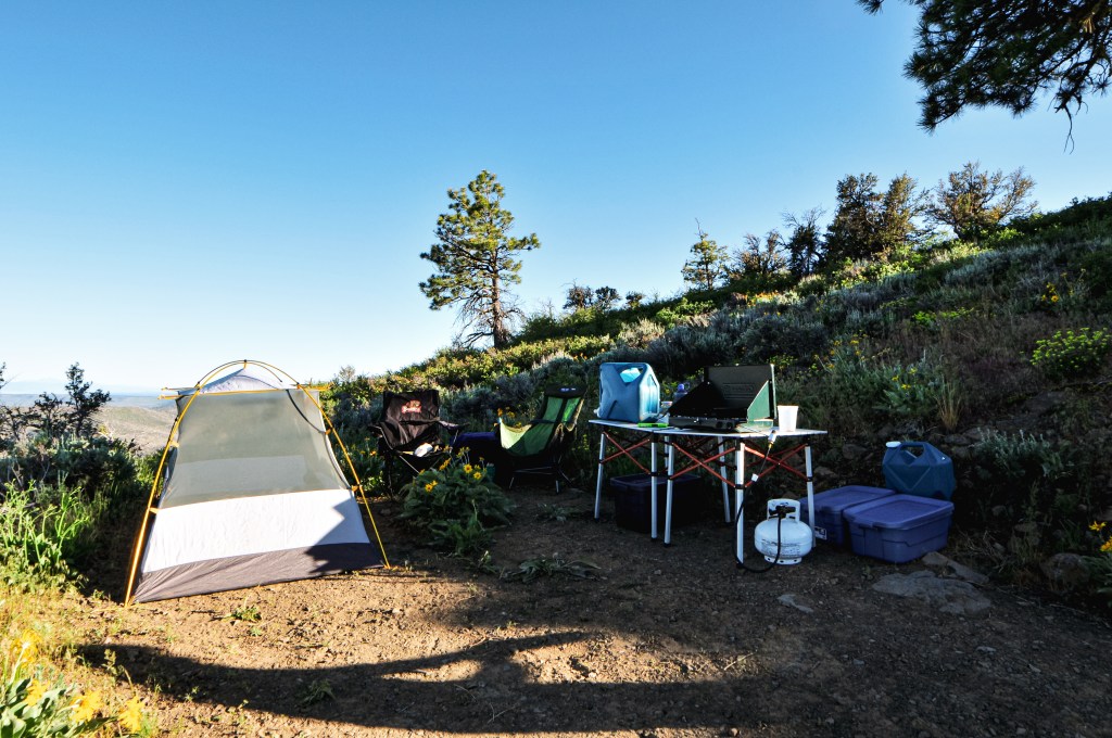
After we slid our way back down the side of Bear Butte, we continued east on Silver Lake Road. We re-entered the forest by turning right on to NF-2516 just past Antelope Flat. We were able to find a small camp a little ways down this road in a nice grove of Ponderosa Pine. This road would take us all the way to the needed spur for Bald Mountain (post) in the morning.
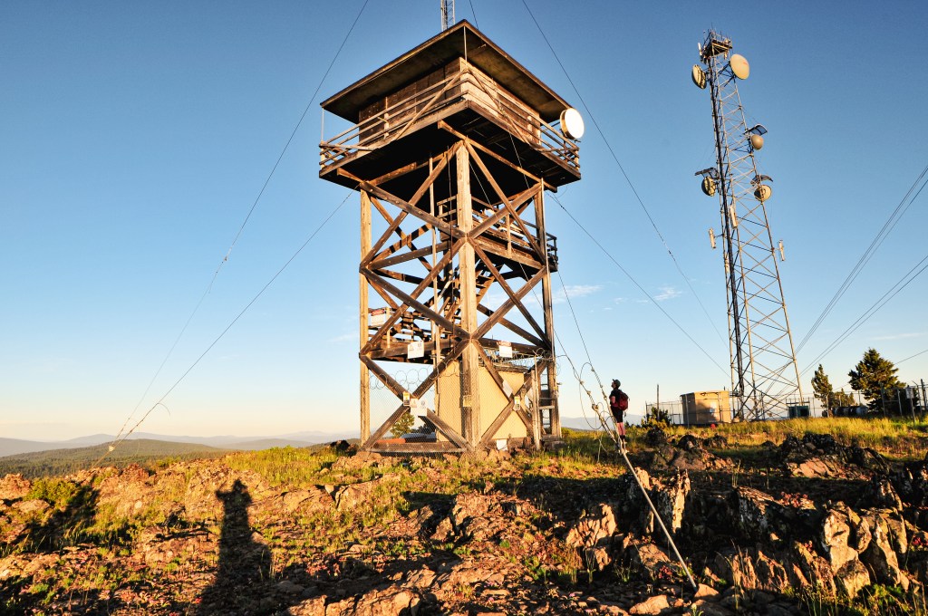
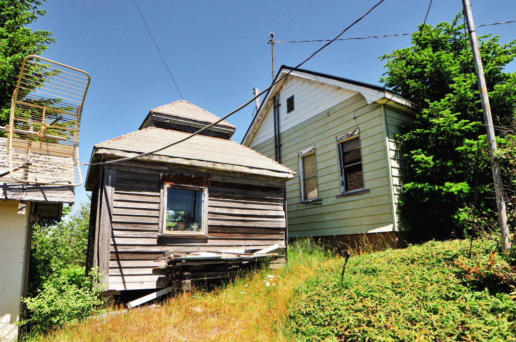
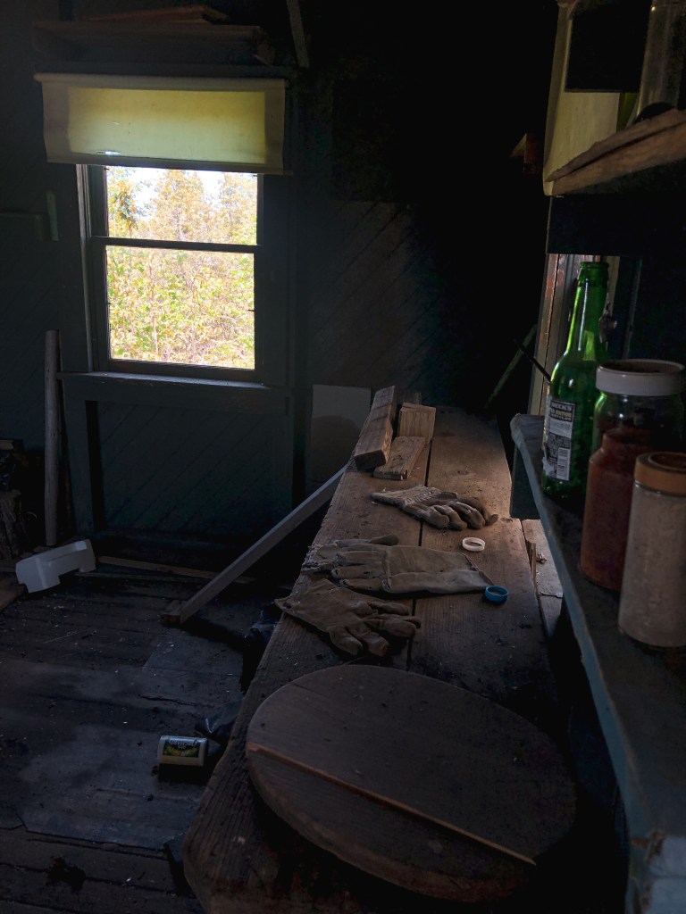
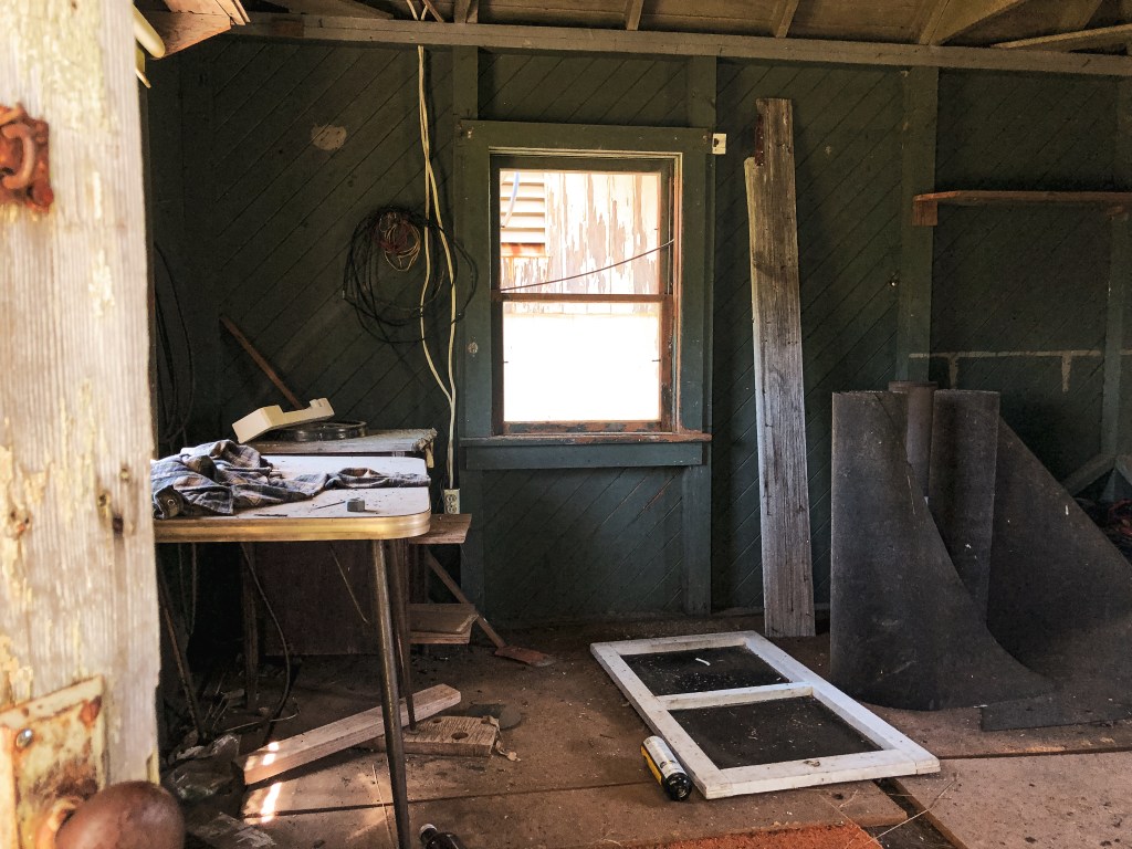
Pictures of Bear Butte cab courtesy of my partner
History.
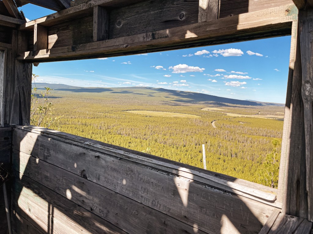
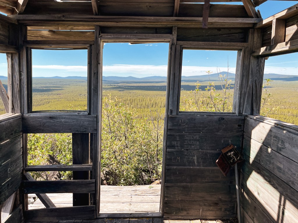
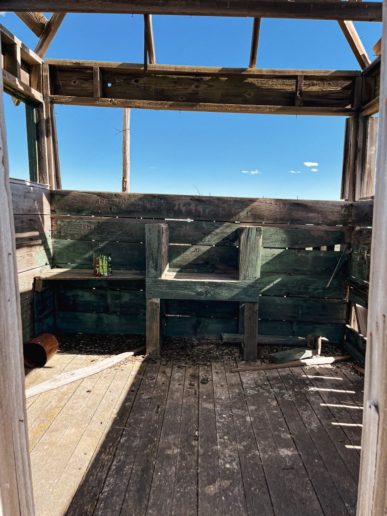
Bear Butte was established as a lookout site in 1930 with a cabin stationed below and a firefinder set atop the butte. In 1949, a 9×9 wooden lookout cab was added to the summit. It was abandoned in 1966 when state radios were placed on Yamsay Mountain and Bald Mountain (post). It’s in bad shape, but has been standing strong for 70+ years.
We started our morning on Dog Mountain (post) and woke up a little after the sun had rose. It’s hard to sleep in when you’re on a mountain side with the sun in your face. We would be moving farther north today and needed to get up anyway. We packed the car and sleepily rolled our way down the mountain. We headed back out to Bly the same way we had came the day before and proceeded on to Horsefly Mountain. There was a brief pit stop at the Bly Ranger Station again to see if their water spigots were on. Unfortunately, they were not. We had checked a few State Parks and County Parks on our way to Dog Mountain (post) the day before as well, but all were off. Our next planned water refill wasn’t until 3 to 4 days from now in a completely different National Forest. After researching online, we realized the entire Klamath County had been declared in a state of emergency due to drought. This declaration prompted the county to restrict public access by shutting off water fill stations to conserve as much water as possible. If we had known before entering the county, we would have had the fore thought to refill at the Cascade-Siskiyou National Monument before leaving. Obviously, this is only a minor inconvenience for us to the larger issue at hand. Our solution was to buy 4 gallons of water at the gas station before heading on to our next stop.
I spy no lookout onsite
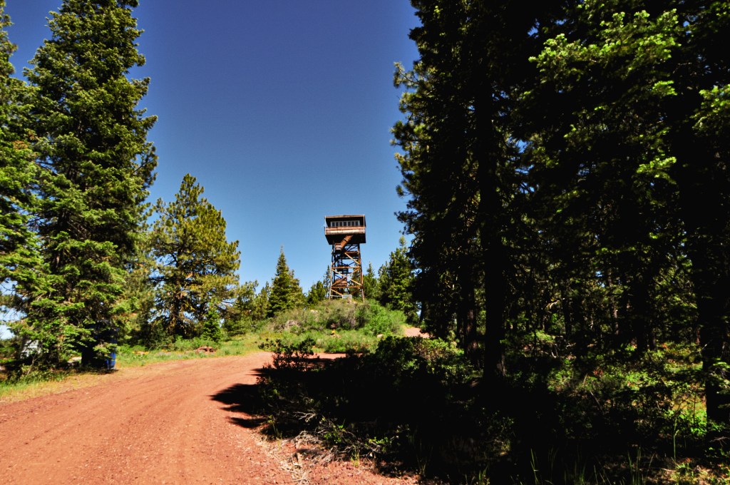
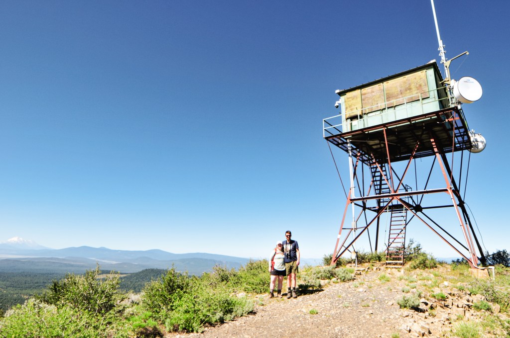
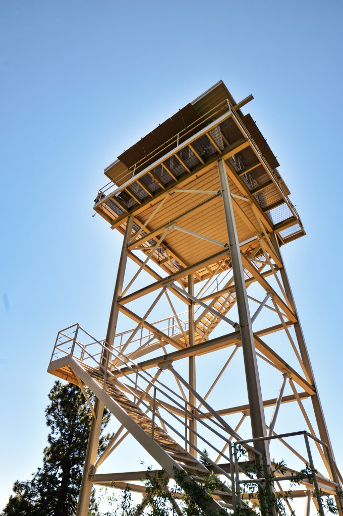
As the crow flies, Horsefly Mountain is only 9 miles south of the community of Bly. We headed out of downtown Bly via Elder Street and turned left onto NF-3752. Based on the map we planned to take NF-3752 to NF-3815 to NF-011 since it was a mostly four number route. But, the trip reports from Peakbagger (site) had a description of a different route. They mentioned the roads were good via NF-3752 to NF-3814 to NF-105 to NF-3815 to NF-011. If you’ve been on enough Forest Service roads you will know that the rule of thumb is two number roads are great, four number roads are good, and three number roads are trash. Obviously, this isn’t a hard fact but it is a good foundation when looking at routes within the forest. We were wary of the connecting NF-105 route, but turns out luck decided our route for us. As we were heading down NF-3752, we noticed that there were recent heavy equipment tracks along the edges of the road. The road itself seemed to have recently been regraded with only minor rocks and potholes to avoid. Apparently, it was more recently regraded than we thought because we were soon met with the grading machine slowly making it’s way along NF-3752. We were right at the junction with NF-3814 and the grader was blocking the road to continue any farther in the other direction. NF-3814 it is! We drove along this road until we came to the first major road leading off to the left. This was NF-105. There was a sign standing at some point but it is now worn out and on the ground. We were happily surprised to find NF-105 was a decent road and had minimal hazards to avoid. You should be able to reach the gate as along as you keep right at all the junctions along this road. The first junction is with NF-3815 but is unsigned. The second junction is with NF-011 and does have a sign. All the roads ended up being drivable in a low clearance vehicle with minimal caution. From the gate, it is only a few hundred yard walk to the lookout.
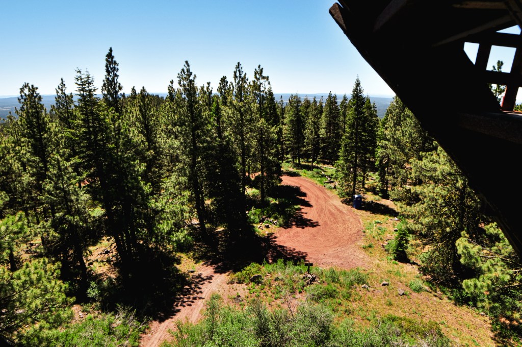
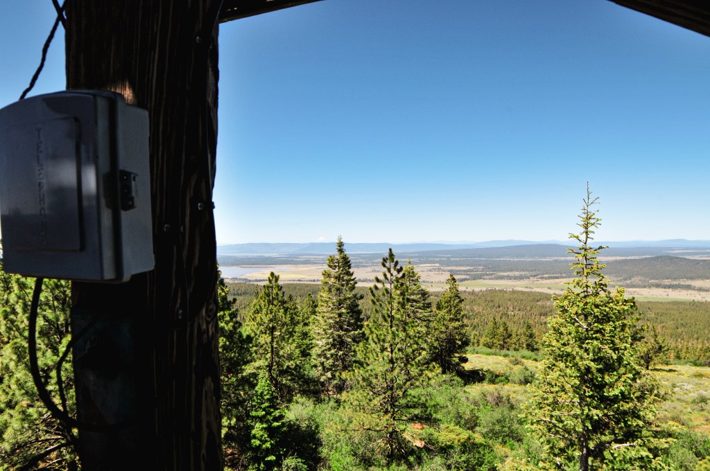
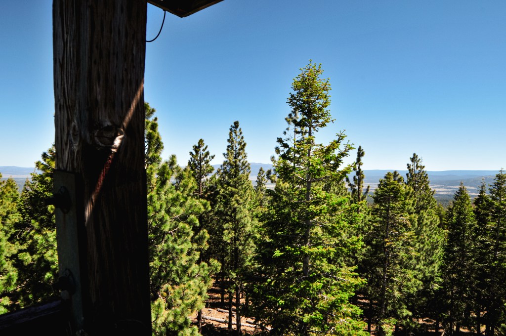
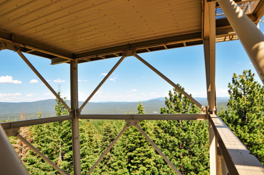
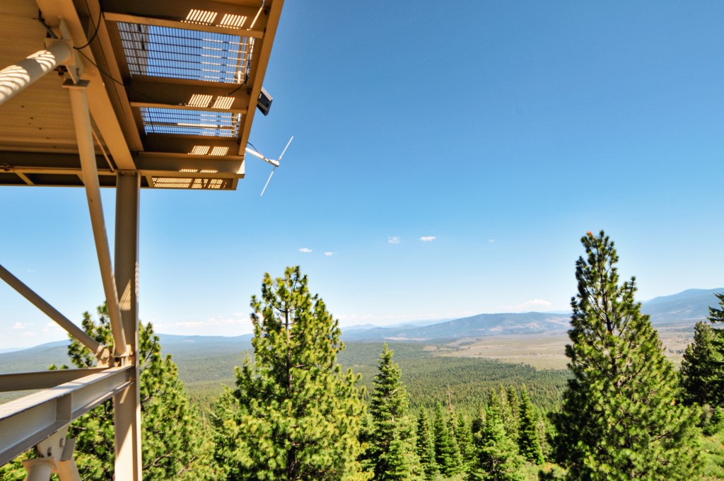
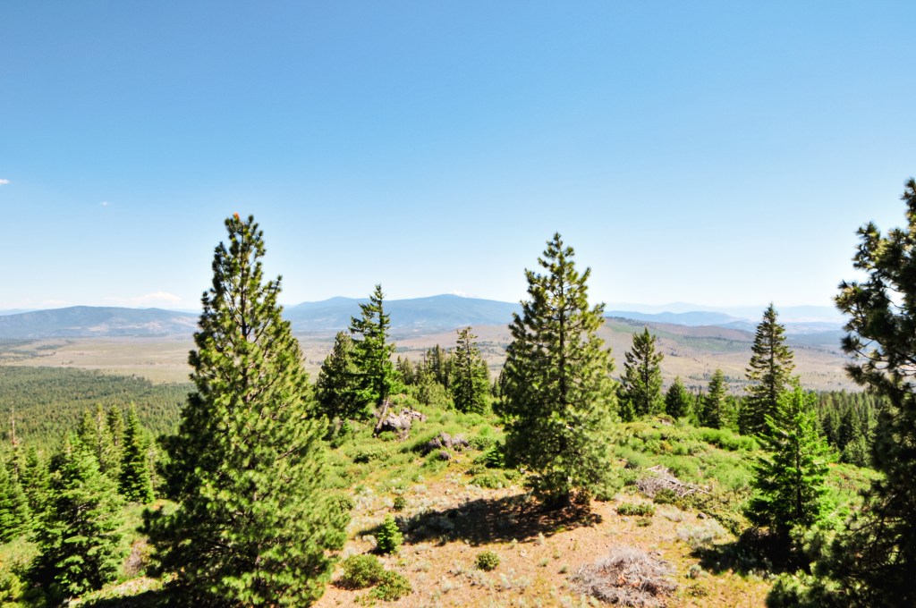
We were once again met with a lookout open for the season with no one currently occupying it. We assumed this was a similar situation to Parker Mountain (post), where we had shown up on their day off or they had yet to start their season. Given the upcoming holiday, we were still a bit surprised. We climbed the tower to get a better view since we couldn’t see anything from the ground. The catwalk was locked up, but we were still able to see a few points of interest between the trees. Our timing on this portion of the trip was a bit flexible. We planned it that way since we weren’t sure how much road walking we would have to do to get to some of these lookouts. Things seemed to be going in our favor, driving wise at least, and we had additional time in the day to move on to the next lookout. We hoped to have similar luck at Calimus Butte (post).
History.
In 1932, the Klamath FPA built an open platform tower on the southern portion of Horsefly Mountain. This site was built to assist Yainax Butte with cross shot views in their blind spots. It was quickly replaced by a more substantial structure in 1934 by the CCC. The new lookout was a 14×14 L-4 cab with 37′ timber tower and accompanying 16×18 wood framed garage. The current structure was built in 1961 when the previous lookout was considered unsafe for continued use. This lookout is an R-6 cab with 41′ treated timber tower and continues to be staffed every season.
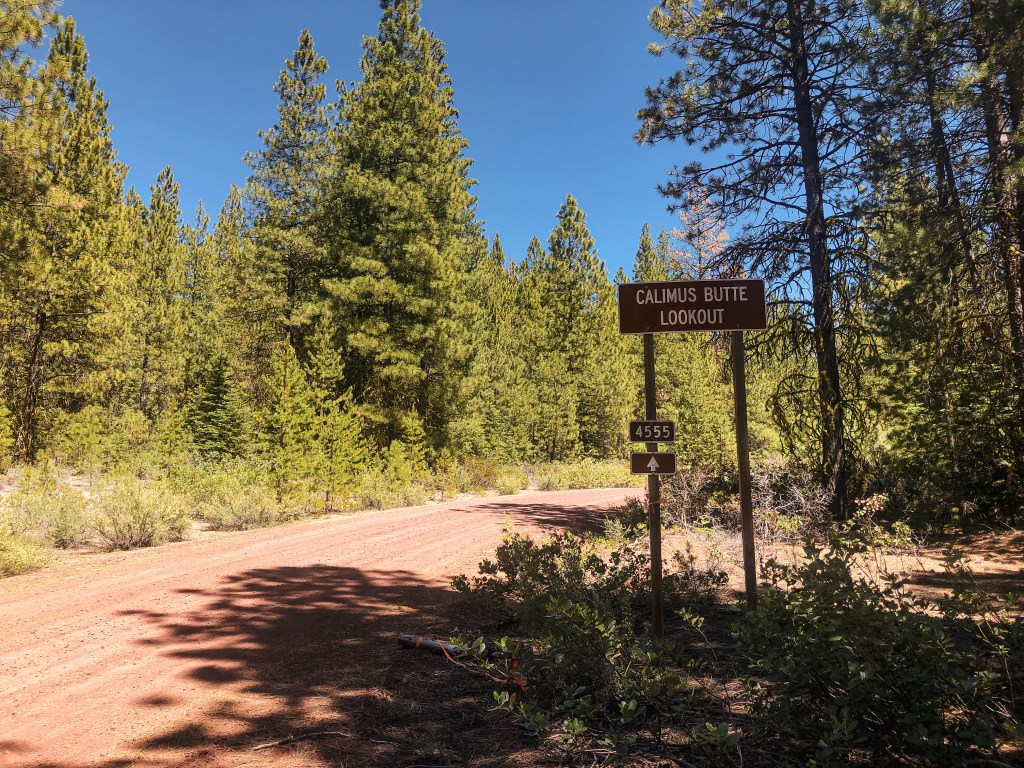
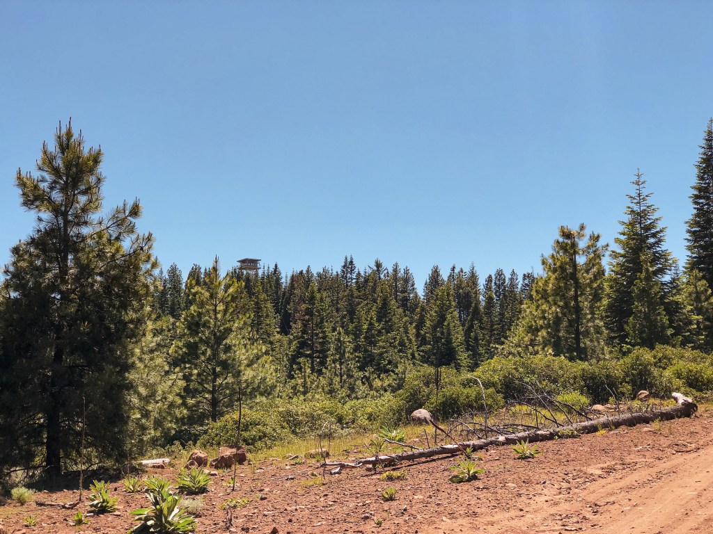
We headed northwest towards the community of Sprague River. From HWY-140, we turned right on to Sprague River Road and followed it to Lone Pine Road. Immediately after turning right on to Lone Pine Road you will take another right on to NF-44. This road skirts between National Forest and private land. You will turn left on to NF-4542 from here. This road passes through an older burn area that is now covered in a dog-hair thicket of Lodgepole Pine. You will eventually come to a junction with NF-4555 off to the right that has a sign for Calimus Butte. Take this road to NF-150 which also has a sign for the lookout. There is no gate and the roads are manageable, so we were able to drive all the way to the summit once again. All the roads leading up to NF-150 were very good graveled or cinder roads. The only road that requires some caution is NF-150, but it’s not terrible.
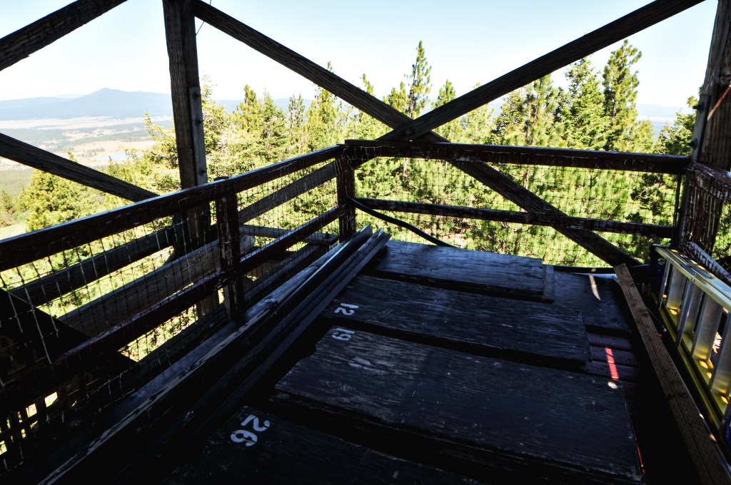
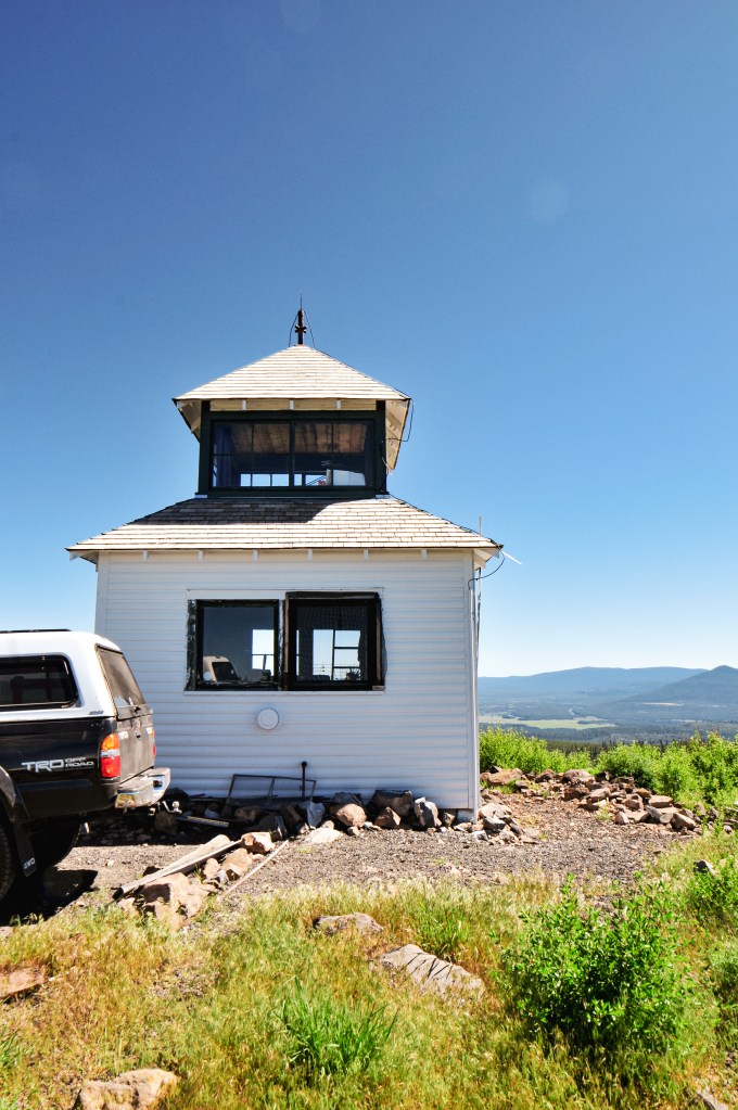
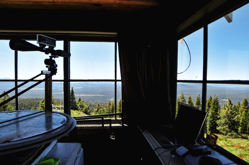
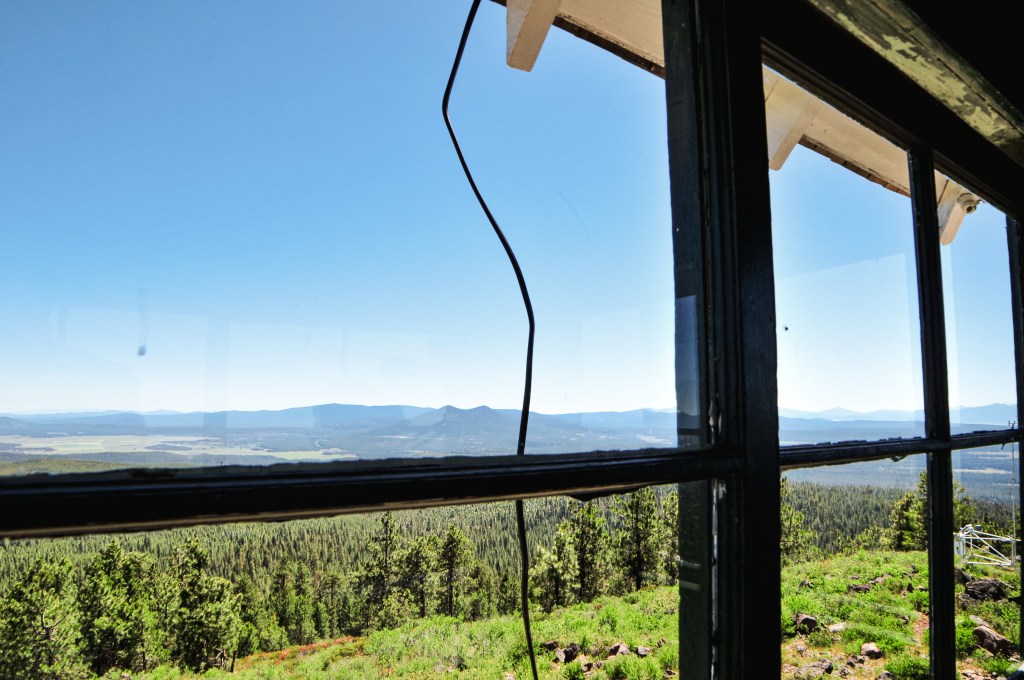
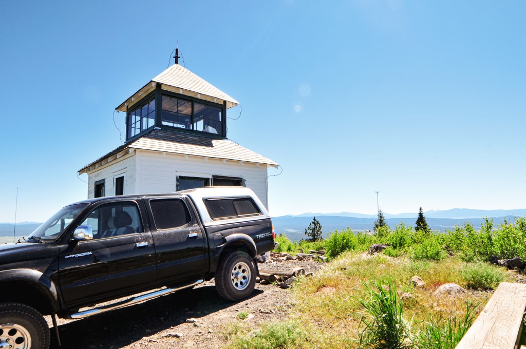
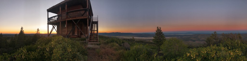
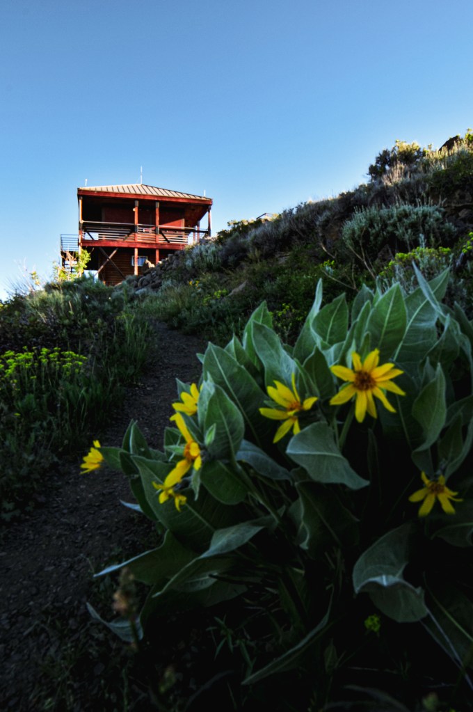
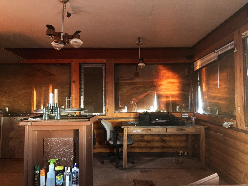
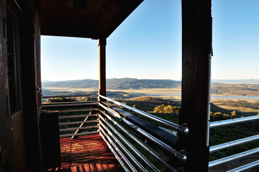
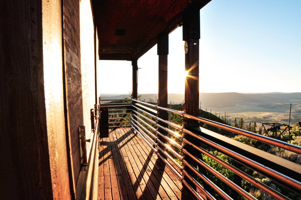
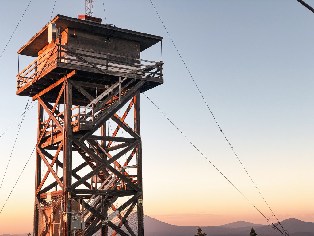
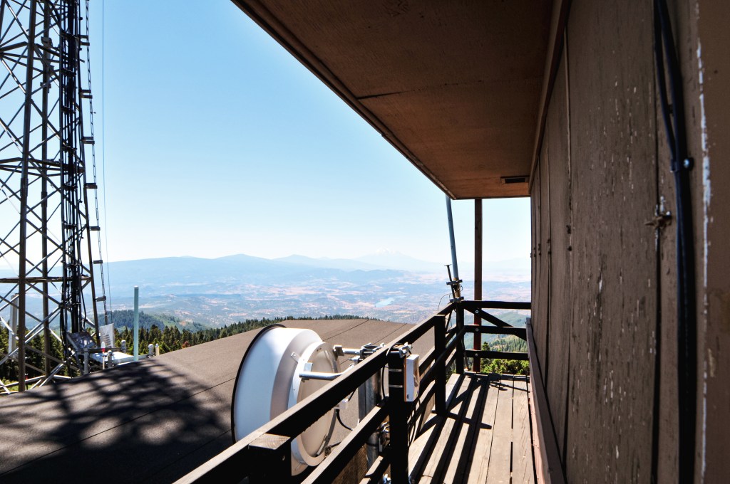
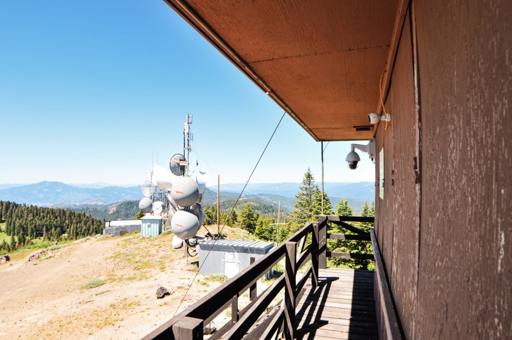
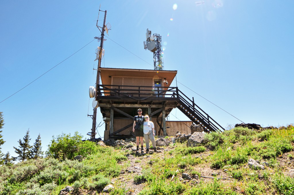
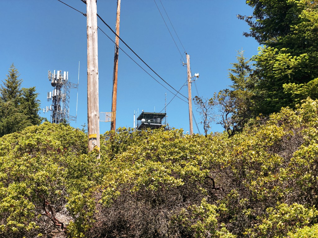
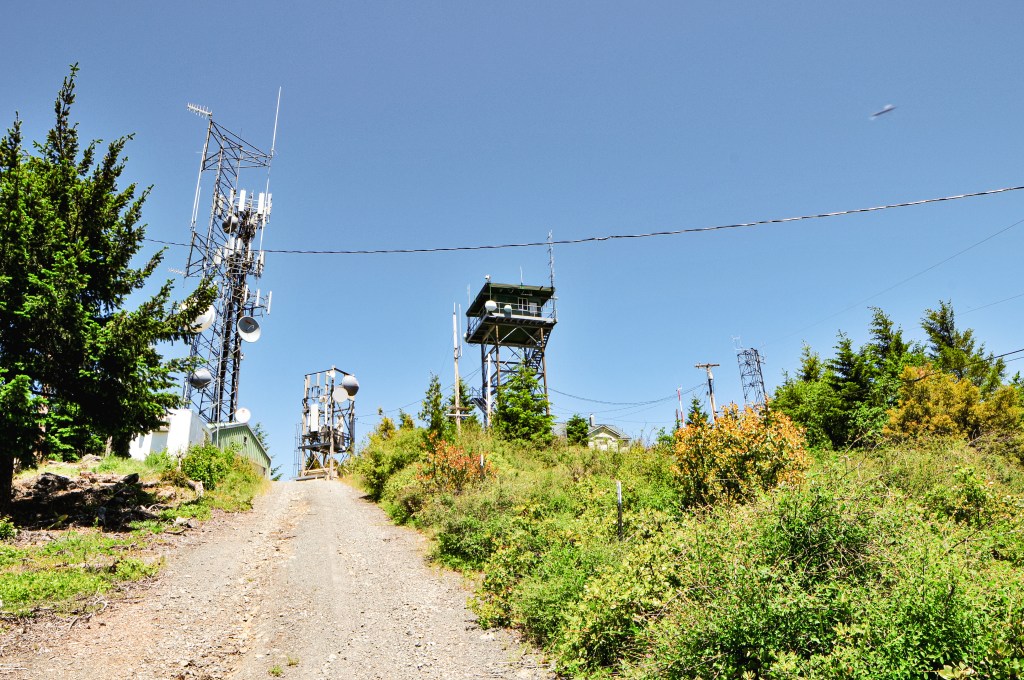
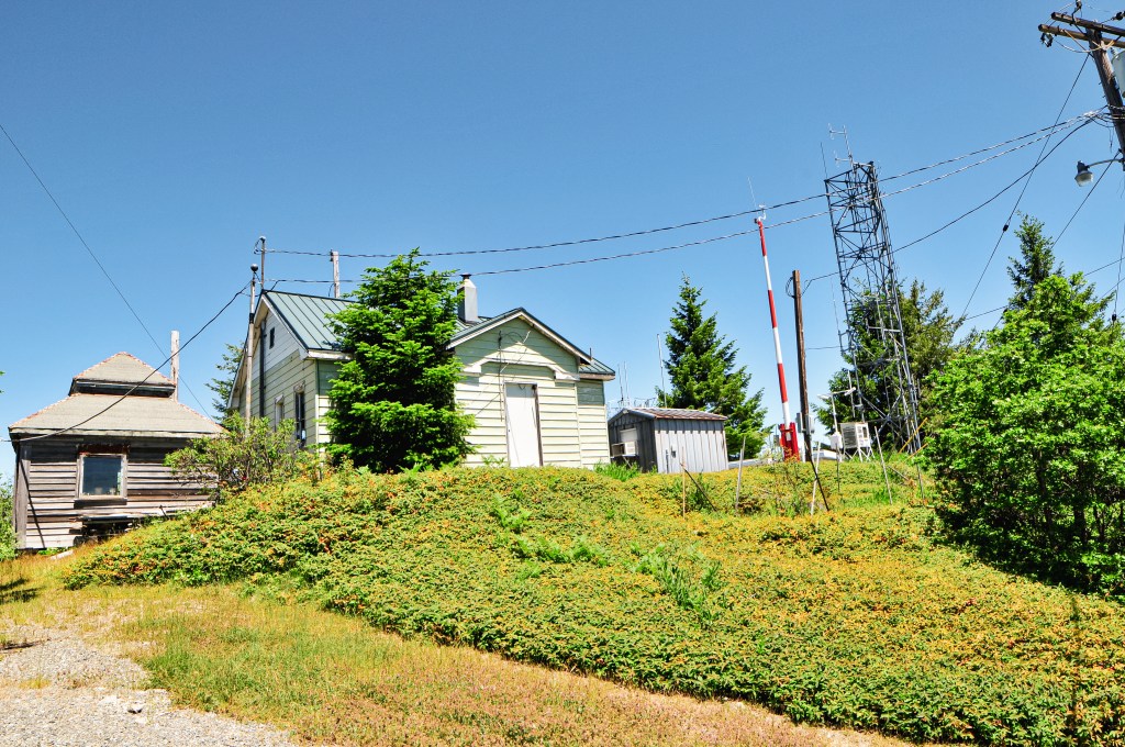
We finally reached a fire lookout that we expected to be staffed with someone here. A reminder to respect the space of the lookout attendants and only approach or climb the tower if you’ve been invited to do so. After parking the car, we walked to the side of the lookout to take in the view. We hoped we would be invited inside since neither of us had been in a cupola before, but we never expect it either. The cupola style lookouts are my partner’s favorite. We heard some voices inside and eventually received a greeting from the lookout. She had poked her head out of the cupola window and apologized for not seeing us earlier. She offered to give us a tour, if we wanted, and we excitedly accepted. The lookout who was staffing Calimus Butte this season was named Sharon, she was accompanied by her dog and cat. One of her grandsons were visiting at the time as well. It was a full house. She showed off her National Historic Lookout Register from the FFLA and gave us a brief history on the lookout. We all climbed up to the cupola where she pointed out points of interest. This included surrounding peaks and other lookouts in the area. She also mentioned that she used the DragonPlot system and gave us a brief overview on how it works. The only other time we had heard of this system was on Sugarloaf Mountain (post) when we met the weekend relief. It was interesting to see it in action and what it can actually do. She has the main computer for the system, while Sugarpine (post) and Spodue mountain only have the tools and rely on her to get the information for them. Sharon was full of interesting stories of her time as a lookout at different towers. She was also very knowledgeable about the surrounding area and southwestern Oregon.
We told her about our current trip and that we were headed to Sugarpine Mountain (post) tomorrow. She told us that the lookout was staffed by Ed who was a sweetheart. She also gave us the tip to camp at Head of the River, which is a primitive free campground. We did our best not to bombard her with too many questions, but we could have talked for hours. After saying our good-byes and taking a few more pictures, we headed out to the Williamson River Road. This is the road you would take to get to Calimus Butte if you were heading in from HWY-97. We turned into the forest to check out Head of the River and other potential dispersed spots. Unfortunately, the area just past the Head of the River was where the 2021 Bootleg Fire Complex burned. This fire was even spotted and called in by the Calimus Butte L.O. We drove through it a bit to see how bad it was, but it was not an area you’d want to camp in currently. We picked a spot at the Head of the River and set up camp for the night.
Lookout Sharon
Sharon has been a fire lookout since she was 17 years old and grew up in the Galice OR area. She got her start when her boss at ODF needed someone to staff a local lookout. He told her she was going to do it since no one else would. Throughout her years as a fire lookout she has staffed many different towers; Sexton Mountain (post), Manzanita Mountain, Calimus Butte, Little Greyback, Onion Mountain, along with some in Idaho and Colorado. She jokingly considers Ron Kemnow her stalker because he has visited her at multiple different lookouts within different states unintentionally. One time was even during a thunderstorm. He lives close to Calimus Butte in the Sprague River Valley below. She was the last person to staff Onion Mountain through a contract with ODF and the Forest Service in 2009. She has staffed Calimus Butte for 5 non-consecutive seasons with the Forest Service. Her seasons on Calimus Butte typically run from Memorial Day to the end of October.
History.
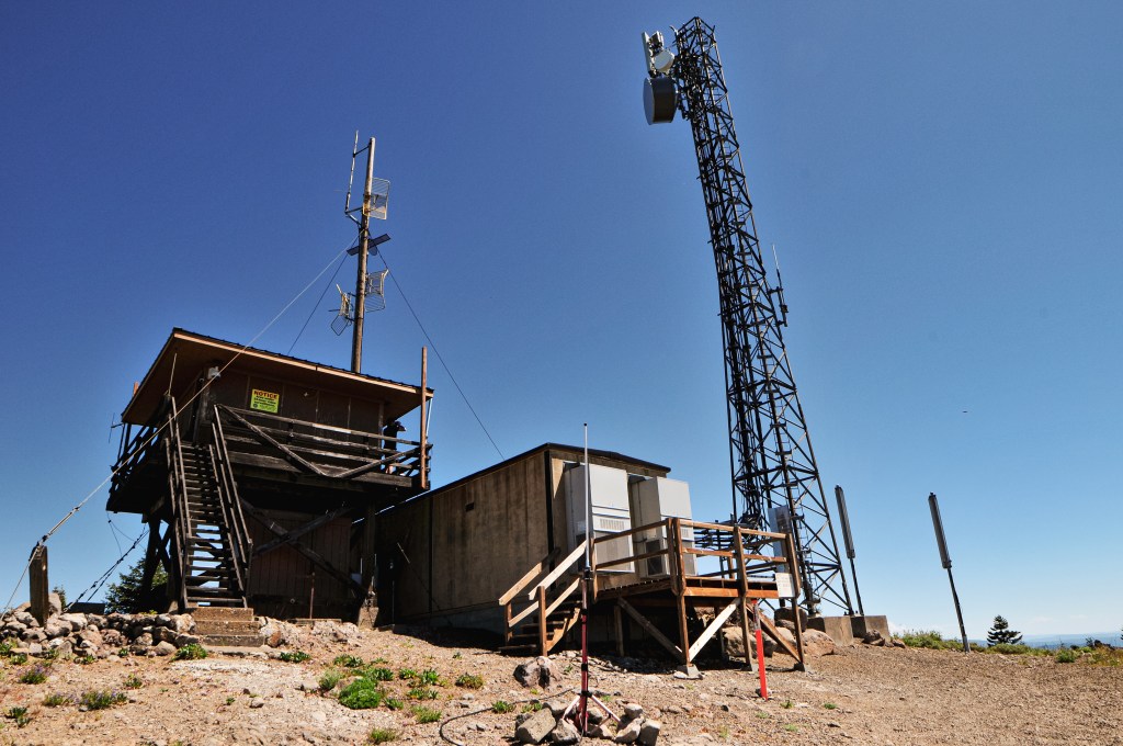
The history on Calimus Butte dates back to 1919 when a telephone line was strung to the summit with tent camp. A year later a 16×16 lookout with cupola was built. In 1922, the 14×20 2-room guard cabin was completed 2-1/2 miles from the summit. These were both built on reserved land for the Indian Reservation. In 1930, the cupola cabin was replaced with the existing D-6 cupola that stands today. Those who have managed this lookout has changed hands a few times throughout the years. In early years, the Forest Service had an agreement with the Klamath Indian Agency, who owned the lookout at the time, to help staff and maintain the lookout under contract. In 1961, the Termination Act lead to Calimus Butte Lookout becoming the responsibility of the Klamath FPA. It didn’t become the full responsibility of the Forest Service until the 1970s. It has been maintained and updated throughout the years, but its age is still a concern. It is still actively staffed every season.
We were up, packed, and headed east on HWY-66 before 9AM this morning. The plan for the day was to hit Chase Mountain, Bly Ranger Station (post), and Dog Mountain (post). If possible, we would find a dispersed camp spot close to Dog Mountain (post) in the Fremont-Winema NF for the night. We passed the turn off for Parker Mountain L.O. (post) again and then passed a sign for Mule Hill L.O. We both did a double take and pulled over to see if we could get service to verify. The service was slow and spotty, but we were pretty confident it was no longer there. We decided to head on to Chase Mountain without checking it out, but would re-verify on the summit. Spoiler: it’s gone. From HWY-66, we turned on to Hamacker Mountain Road. This is a paved road that will do most of the climbing for you and can take you all the way to the summit of Hamacker Mountain. The turn off for Chase Mountain is roughly 5-1/2 miles up the pavement off to the right. It is an unmarked road, so it was helpful to turn on our odometer. There were two roads off to the right around this mile point. One was dirt and the other was gravel. You will want to take the good gravel road. The gravel ends just before you reach the summit and the road deteriorates. We parked in a pull out slightly after where the road turned to cinder.
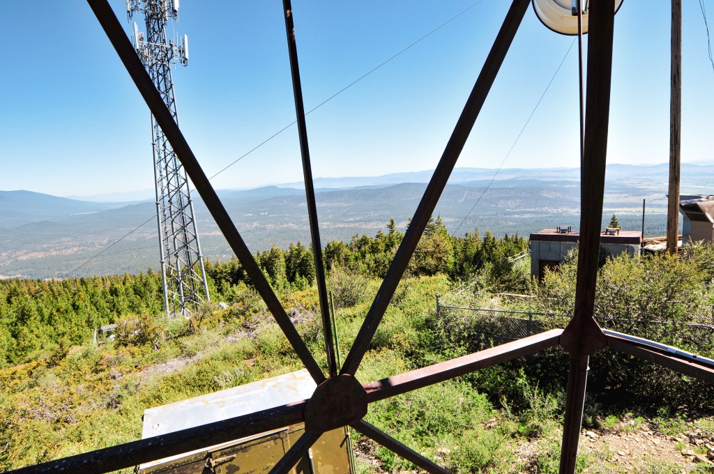
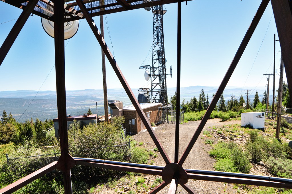
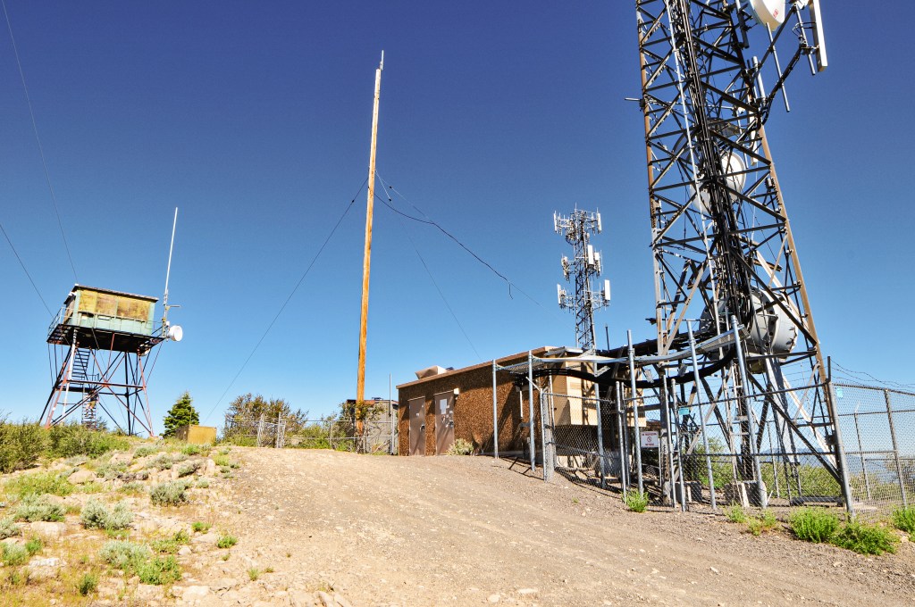
Despite camping near a reservoir the last two nights, the bugs had been minimal. When we stepped out of our car here, we were immediately swarmed by mosquitoes. I had forgotten how annoying these little buggers are. It was already feeling warm for the day, so we were thankful for a short walk. We were on the summit a little after 10AM. This is another summit covered in communication buildings, shocking I know. They obstructed a lot of the views north and south of the lookout. But we got a pretty good view to the west from where we had come. The lookout tower itself is no longer staffed and looked a little worse for wear. We were pleased that our progress had been successful so far and moved on to our next target for the day.
History.
The existing fire lookout on Chase Mountain was built in 1951 by Pade & Holland Sheet Metal Co. It was constructed as a 20′ steel tower with 14×14 cab. It was actively staffed up until the 2010s and even had some remodel work done in 2004. It was initially started with an observation platform atop a 12×12 cabin in the early 1920s. This was later moved below the summit and converted to living quarters. It has seen a few different structures since then. A 10×10 gable roofed structure was added in the late 1920s. In 1935, a new tower was constructed. In 1943, another frame cabin was built. I couldn’t find the specifics on the size and shape of these structures. One of them was moved to Hamelton Butte after the steel tower was built, but it is unclear which structure it was.
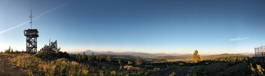
Our last stop for the day was Dog Mountain L.O. on the Fremont-Winema NF. This is another one we expected to be staffed during our visit. From Bly, you can either cut across the forest via connecting Forest Service roads or take the highway. It seemed that most who visited this lookout previously came in from Lakeview. Some of the trip reports even mentioned it was a good road for low clearance vehicles all the way to the summit. I was skeptical to say the least. I felt the pavement would be the quickest way and we headed out of Bly on HWY-140. There are a few different routes you can take from here. We ended up turning onto Tunnel Hill Road that eventually turned into Westside Road. We stayed on this road until we reached Dog Lake Lane. Take a right. As the name of the road indicates it will take you all the way to Dog Lake. There is a campground and day use area here. You should be able to see the fortress of a lookout from the road as you drive in. Once past the reservoir the road turns to gravel. We turned on the first major gravel road off to the right. This is supposedly NF-3752 but I didn’t see a sign. We briefly stayed on this road and then turned right on to NF-406. I didn’t see a sign for this road either but it appeared to head in the right direction. Some indicators that you’re on the right road; there will be a cattle guard and it will be at a junction with NF-085 off to the left (this road is signed). From this junction, it is about 5-1/2 miles to the summit. The NF-406 road will take you all the way. You will want to bear right when you reach the junction with NF-052 to stay on the correct path. The road is exposed and narrow as it winds up and around. We hoped not to meet anyone on it. There is no gate for this lookout and you can, in fact, drive all the way to the summit. Even in a low clearance vehicle.
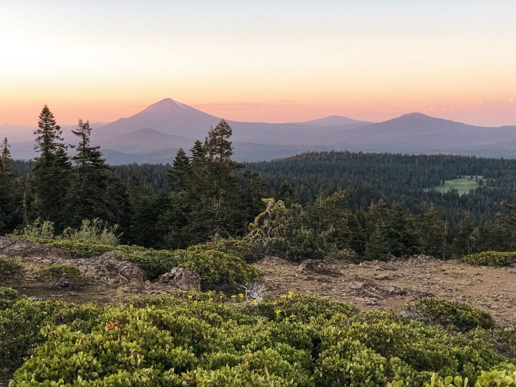
There was no other vehicle here and the lookout seemed to still be locked up for the season. We found this odd since most sources noted it as staffed. We looked around through the windows and it was still stocked like a lookout in use. There was a fire finder, desk, and chairs along with some other items that indicated someone had been up there more recently. But, on the other hand, there was a visible Lookout Fire Report sheet that was last used in June 2020, the toilet seat was broken in the privy, and a wood rat had made its home in between one of the shutters. There was also a fire alarm beeping in the living quarters below that needed the batteries changed. Our guess was that it might have been recently moved to emergency status or had a staffing issue. We decided to camp on the summit for the night since no one was there. Someone else drove up a little after we set up our camp. We panicked and thought it might be the lookout attendant, but they were only there with their dog for a brief time and didn’t say a word to us. The views from here were commanding. We could see all the way to Lassen Peak in California. It was one of my favorite camps of the trip.
History.
Dog Mountain started with a simple Alidade and has been used as a lookout site since 1918. Possibly earlier. A standard D-6 cupola cabin wasn’t added until 1926. An accompanying 16×18 wood framed garage was added in 1934 by the local CCC. In 1947, a new 14×14 Aladdin style house was constructed as a lookout with no catwalk. It was maintained into the 1980s. The Forest Service didn’t consider replacing it until an inspection report in 1995. The site was also noted as being used for a long-term weather station. In 1997, the lookout that stands today was built by Hargrove Construction as a replacement. They built a unique 2-story house with living quarters on the first floor and the lookout office with catwalk on the second. It reminds me of a log cabin.
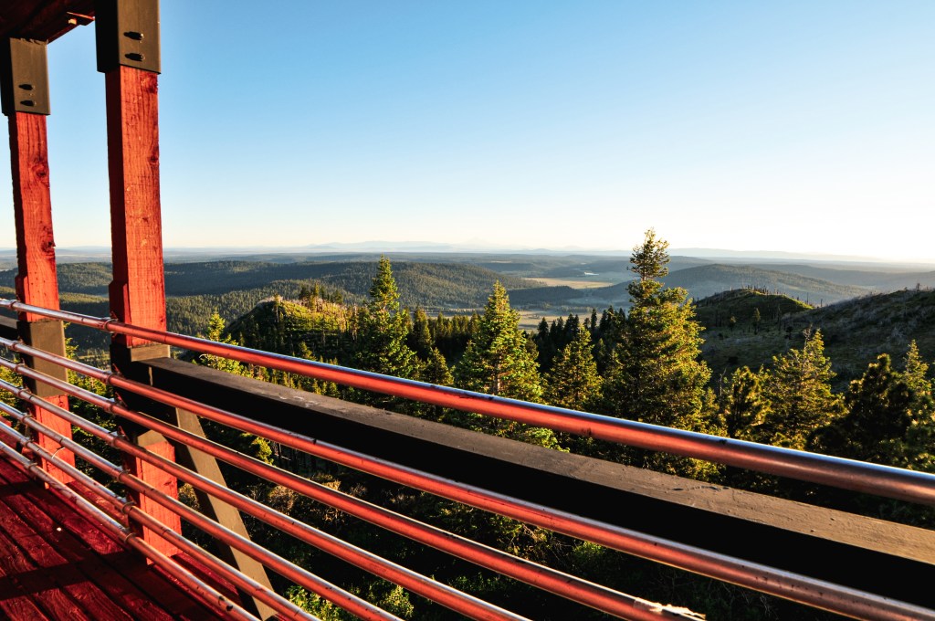
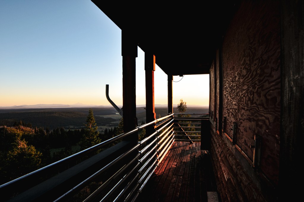
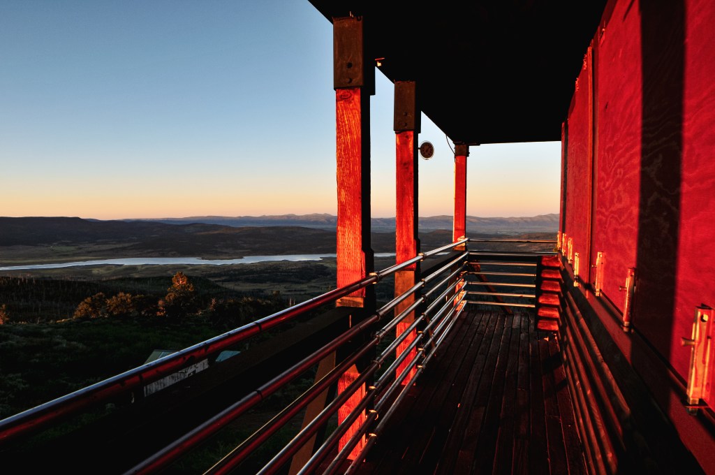
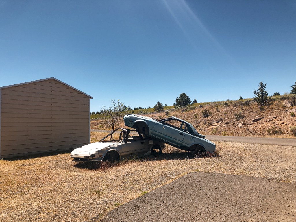
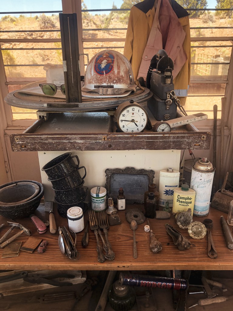
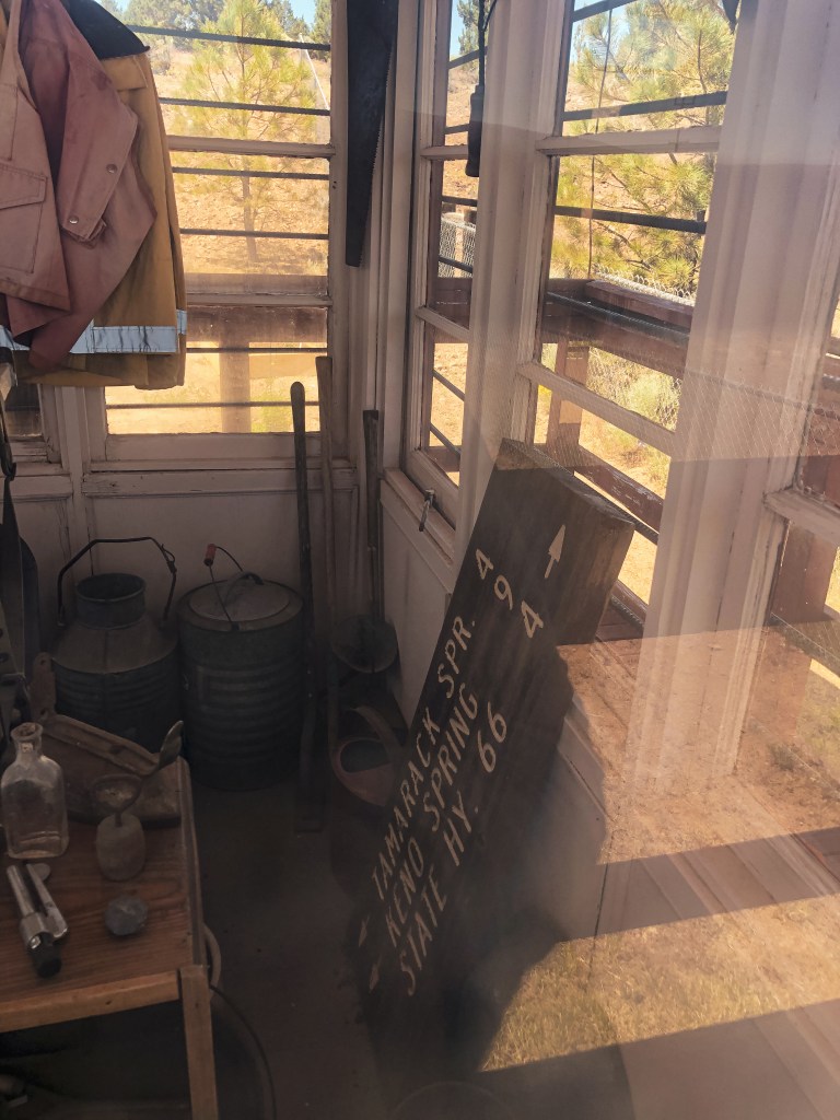
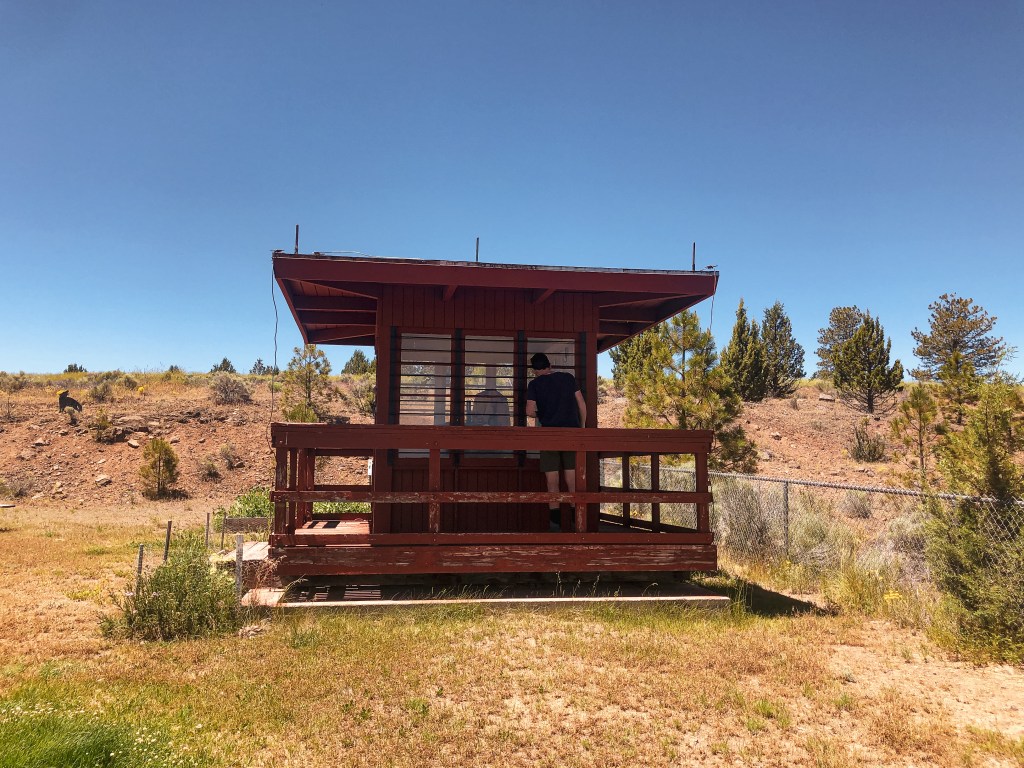
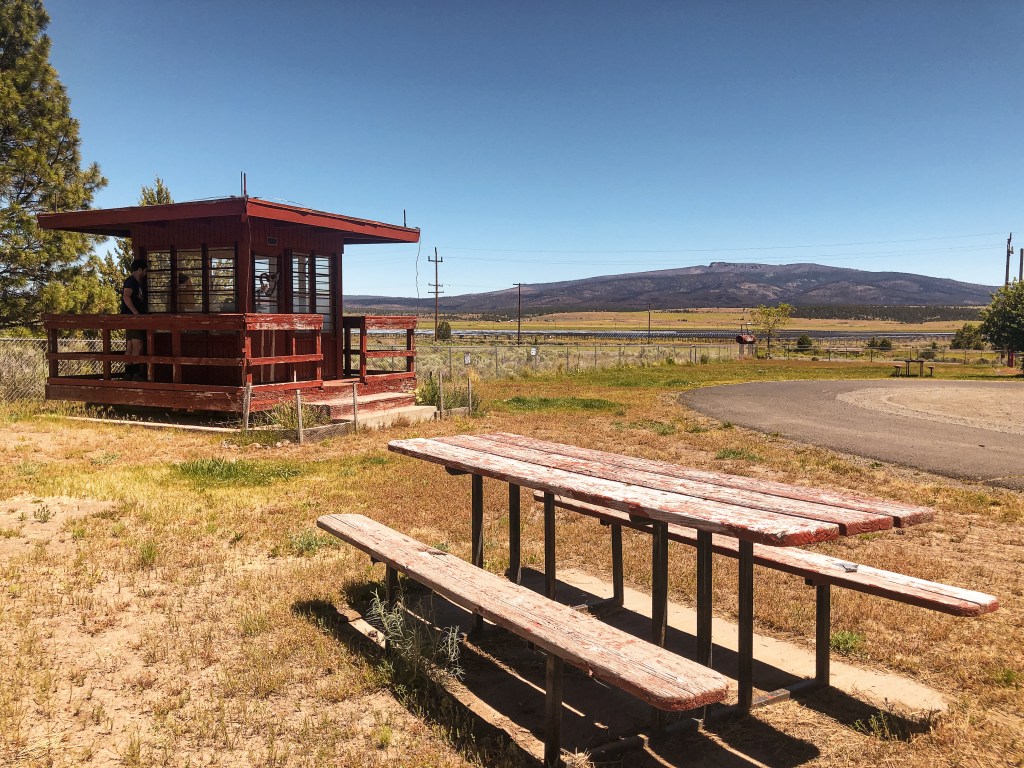
After a quick visit to Chase Mountain (post), we were back on HWY-66 heading east once again. We skirted around Klamath Falls and connected to HWY-140 towards the community of Bly. The fire lookout is located in a small community park labeled The Perch. It’s a bright red lookout, so you won’t be able to miss it from the highway. It’s fittingly located next to the Bly Rural Fire Protection District building. We made a quick stop here to check it out. There was no one else at the park during our visit. I’m not sure if that was due to the heat or the swarm of mosquitoes that seemed to be living here. The lookout cab was filled with all sorts of different fire related paraphernalia. Other than the lookout, there were some picnic tables, a play ground, public restrooms, two stacked cars (art display?), and an informative Oregon History kiosk about the Balloon Bombs from World War II.
We continued on to the Ranger Station afterwards to see if they were finally open and if they had some Ranger District maps that we wanted. For the last two years, it felt like they would never open again or at least that’s what my partner thought. We were surprised to find them open, but they didn’t have the maps we needed. A fire crew had apparently cleared them out. We headed briefly on HWY-140 again to the Sprague River National Forest Picnic Area. We stopped here to have lunch and refill our water jugs. Little did we know all of Klamath County was in a drought and had turned off all public water access in parks and campgrounds. Even with an exponentially wet spring some places were still in drought. A crucial misstep in our route planning as the majority of our trip was within Klamath County. We decided not to completely panic yet since we still had seven gallons. But, we knew at some point we’d have to figured something else out. On to Dog Mountain (post) for now.
History.
The Bly Ranger Station was first used as a fire lookout in 1934 with a platform on top of the warehouse roof. In 1958, a 20′ timber tower with 7×7 flat roof cab was constructed on the compound. It was only ever used during emergencies. In 2007, the lookout tower was decommissioned and dismantled. The superstructure was destroyed, but the cab was moved to the community park for display. The community park is less than a mile from the Ranger Station.
Table Mountain was a nice way to end a long day. After dinner, we headed out of camp once more to catch the sunset. We took the Hyatt Prairie Road and turned on the road towards the Table Mountain Winter Play Area. It was only 2 miles to the lookout from this junction. The road condition alternated between pavement with potholes and good gravel. We stayed on the main road until we reached a 4-way junction. None of the roads are marked but you will want to take a right. You will meet a fork in the road shortly after this junction, stay right again. We decided to park here and walk the remaining distance since there is a gate. There is also a pull out just before the gate that offers parking for a couple cars.
The evening temperatures had dropped significantly from the 90+ degree day and made the short walk up very pleasant. This summit does have quite a few communication towers on it, but was surprisingly pretty. The tower is blocked off to visitors by a barbed wire gate. We were still able to spot Robinson Butte (post), Parker Mountain (post), Chase Mountain (post), and Soda Mountain (post) from the base. Robinson Butte (post) looked like David with Goliath Mt McLoughlin looming over it. We stayed on the summit for as long as possible watching the colors change from warm yellows to different shades of pinks and purples. We wanted to stay longer, but driving back in the dark didn’t sound appealing to either of us. We were also moving camps for the first time this trip and needed to prep for a longer drive day.
History.
A 30′ pole tower with live-in cab was built on Table Mountain in 1931 by what was then known as the Crater National Forest. The Moon Prairie CCC camp added a garage and wood shed in 1933. It was replaced in 1958 with a 30′ treated timber tower and ODF-style cab. I believe it was decommissioned in the mid-1960s given that the garage was torn down and burned in 1963. The last noted use was in 1975 when it was staffed while Parker (post) and Chase Mountain (post)were being remodeled.
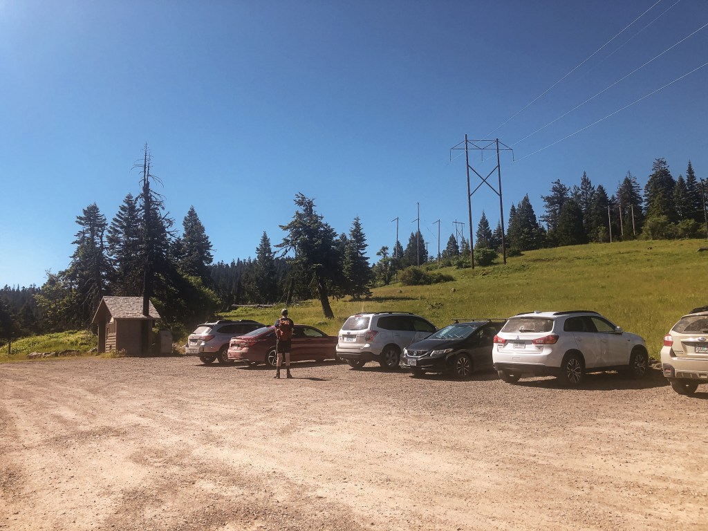
Another early morning was on the schedule. Though, we were able to sleep in an extra hour due to the central location of our camp. The plan for the day was to hike to Soda Mountain via the PCT, potentially visit Parker Mountain (post) if we finished early, and check off Table Mountain (post) near sunset. We packed a lunch and headed out of the Hyatt Lake Recreation Area towards HWY-66. From HWY-66, we took a road conveniently marked as Soda Mountain Road. This lead us all the way to the Hobart Bluff Trailhead to start our hike. The road is decent gravel but has a few potholes to avoid. It was nothing unmanageable to us low clearance folk. There were a few cars parked at the trailhead already. We figured this would be the busiest lookout we’d visit this trip given its proximity to the PCT and being within a National Monument.
The trail starts out on the PCT heading south towards the California border over an exposed slope. It was covered in all sorts of wildflowers while we were there. Eventually, it enters a shaded forest that occasionally opens up to views out towards Pilot Rock and Mt Ashland. You will stay on the PCT for about a mile until you reach a trail junction. There is no sign stating this is the trail to Soda Mountain but there is a trail marker to help identify the junction. It takes a sharp left up the slope and connects with the road that will take you to the summit. Be aware of where you come out on the road, the trail becomes faint here. There is a “Soda Mountain-Pilot Rock Jeep Road” sign that can be used as a marker to find where you need to turn on the way back. You also have the option to walk the road back to the trailhead. We passed a few day and section hikers along the PCT, but once we turned up the connector trail we surprisingly had it to ourselves. There was a section hiker sitting at the junction that asked where we were headed. We mentioned the lookout and he asked how far it was from there. I didn’t know the exact distance but guesstimated about a mile or mile and a half. Too far for him he grunted. His pack looked pretty loaded and I agreed. Round trip from the trailhead it is roughly 4 miles with a little over 800′ in elevation gain. It was a pleasant hike that was mostly in the shade.
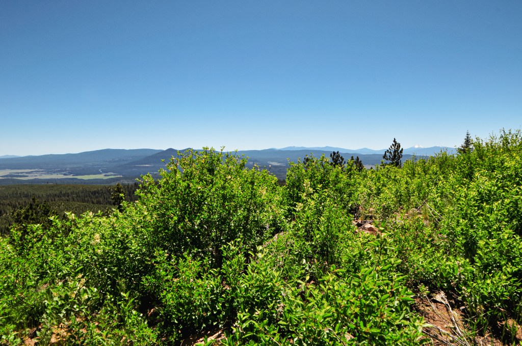
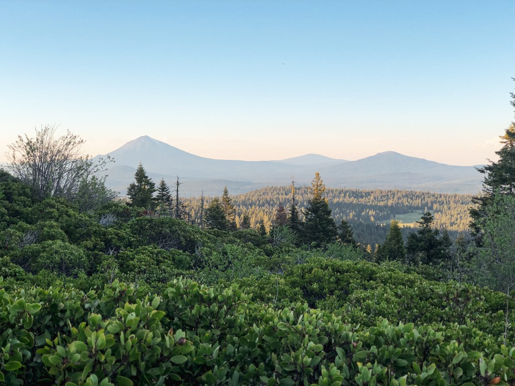
Once on the summit, you are exposed to the excessive amount of communication towers. The short little fire lookout can be found tucked in between them. Despite minor obstructions, you still get pretty great views of Mt Shasta, Mt McLoughlin, Mt Ashland, Soda Mountain Wilderness, and the surrounding valleys. We enjoyed our lunch in the shade of the catwalk with no other visitors. Once we decided to head down we figured we’d run into at least one person. It’s the weekend for Pete’s Sake! But, we only ever saw people hiking on the PCT portion. The day was still young when we reached the car and we decided we had time to head farther east to Parker Mountain (post).
History.
Established in 1933, Soda Mountain was built by the CCC as a 6′ enclosed tower with L-4 cab. It was located on land owned by the Bureau of Land Management just four miles north of the California border, but it seems it was managed by the ODF. In 1962, the lookout was rebuilt raising the tower to 8′ and restructuring the cab as a 14’x14′ ODF flat top. A communication site was added to the summit in 1968 which was able to provide electricity to the lookout as well. Cellular towers were added in 1992 that partially blocked the view. A year later they raised the tower to 10′ and added a storage shed underneath. The area wasn’t considered a National Monument until June 2000. It was designated by President Clinton to protect the biodiversity of where the Cascade Range and Siskiyou Mountains meet. In 2015, the metal roof sustained damage from the harsh winter and had to be temporarily tarped to cover the exposed area. It was actively staffed every season up until 2017. I assume that’s when they installed a camera similar to most other ODF fire lookouts we’ve visited.
My partner, for some reason, only brought one 32oz water bottle with him for the day and had easily drank it all on our hike to Soda Mountain (post). We were headed east on HWY-66 towards the community of Pinehurst, but we needed to find water if we wanted to continue on to Parker Mountain. We stopped near the Green Springs Inn & Cabins to see if there was anywhere to fill up. It had a small information center dedicated to the Cascade-Siskiyou National Monument, but no one was inside. The BBQ restaurant attached to the Inn was closed too, but they had an accessible water fill station outside. Thank you Green Springs Inn! We came to the conclusion on our drive to Parker Mountain that HWY-66 is one of the sleepiest highways we’ve ever driven. You might pass one car every 10 minutes. There will be a sign from the highway for the needed turn to Parker Mountain L.O. It is otherwise an unmarked junction. Once off the highway, we immediately passed through an open gate to a four way junction. I believe the gate is closed seasonally during the winter. This is unsigned but you will want to continue straight. We followed this road to another junction that was surprisingly signed for Parker Mountain. It looked like a fairly new sign too. If for some reason the sign isn’t there, you will want to take the road to the right. The road starts to deteriorate after this junction with larger rocks to avoid. We decided to park near the sign and walk the remaining mile and a half to the lookout.
We started hiking during the hottest part of the day. I had to take a much needed break in every patch of shade I found. It felt like it took us forever to get anywhere. There are some spurs leading off of this road, but I felt it was fairly obvious which road you needed to stay on. Parker Mountain was one of the few lookouts during this trip that was supposedly staffed. We eventually came to the gate and found it was open. Just past the gate you will get your first glimpse of the lookout. It appeared to be open for the season. As we got closer, we approached with caution. We never want to disturb the fire attendant or make them feel like we are invading their space. Turns out it was all for naught since no one was there. Though, there were signs of someone recently being there and the cab had been opened up. We speculated that they were either on their day off or hadn’t started their season yet. Either way it gave us free range to climb the tower and explore the summit fully. The catwalk was still locked, of course, but we were able to get a pretty good view from the highest landing. It was nice to be on a summit without a bunch of communication equipment for a change. I really enjoyed the sizing of the staircase on this lookout too. The steps weren’t as narrow or steep as other towers. There was also a water barrel and trough located under one of the trees for the wildlife. It was fun to watch all the different little birdies come down to take a drink. After Parker Mountain, we decided to head back to camp for a quick dinner in between lookouts.
History.
The first fire lookout was constructed on Parker Mountain in 1934 by the CCC. It was a 50′ round timber tower with a steeply pitched roof. John Colvard of the Klamath Forest Protective Association primarily staffed this lookout for almost 20 years until he passed away in 1952. He previously worked on Calimus Butte (post) for 3 years when it was used as the main fire lookout for the Klamath Indian Reservation. In 1956, the previous tower was replaced by a 30′ steel tower with 14×14 wooden cab. In 1965, Parker Mountain was considered one of four lookouts located on Weyerhaeuser Company land. They allowed a permit for the Klamath FPA to continue maintaining and staffing the existing lookout. Eventually, it was managed and operated by the Oregon Department of Forestry. I’m not sure when exactly the land and fire lookout changed hands though. There was an old 16×24 living quarters cabin that was purposefully burned in 1968 due to being unusable. The steel tower was damaged by an arsonist in 1995 and needed to be replaced. In 1997, the existing lookout was constructed by the Steve Burrows Construction Company. It is an ODF design with 40′ steel tower and 15×15 wood cab. It is still actively staffed every season.
Our alarm went off begrudgingly at 6:30AM, a time at which we would wake many more times this trip. We had a jam packed road trip planned to visit 17 fire lookouts, potentially 18 if things went our way, in southern Oregon over the next 10 days. My partner and I knew we needed to get up if we wanted this to work, but the lack of sleep had us calling for the snooze button. I made the mistake of thinking I could squeeze in an afternoon hike and dinner with my friend before finishing off my needed prep the night before. Of course, things took longer than expected and I wasn’t in bed until well after midnight. My partner works a swing shift, so he’s typically not home until around that time as well. Needless to say, we are not early risers by any means (although I was for a brief time during my mid-twenties). Eventually we were able to collect ourselves enough to climb out of bed and start packing the car. Our plan for the day was to bomb down I-5 towards the most southern portions of Oregon. We would hit Sexton Mountain then cross over HWY-140 to Robinson Butte (post), and if time permitted we would head up to Table Mountain (post) on our way to camp.
Sexton Mountain is located just off I-5 outside of the community of Sunny Valley. We were following directions from a Geocache (site) that mentioned a route suitable for most vehicles. From I-5, we took exit 71 and turned left onto Sunny Valley Loop Road. You will want to take a right on to Placer Road that is immediately after the single lane covered bridge over Grave Creek. You will take another right onto Beecher Road that will eventually turn into BLM Road 34-6-12 that takes you to the junction of BLM Road 34-6-23 with a locked gate. It is around 5 miles from Placer Road to the gate. The road was passable but not necessarily great for low clearance vehicles. On the steeper sections there was wash out from water run off to straddle and the flatter sections had pot holes to avoid. The junction before the gate has ample parking for a few cars, though I doubt you will see anyone else. From the gate, you will need to road walk a little under a mile to reach the summit.
Summer decided to finally show itself with 90+ degree weather forecasted for the upcoming week. Given our recent bout with a wet spring, we had little to no time to acclimate to this warmer weather. I could feel the moisture leave my body the second I stepped out of the car and started hiking up the road. I was drier than the Alvord Desert despite constantly consuming as much water as possible. The hike to the summit isn’t long but it felt fairly steep. I struggled my way to the top with every hot dusty step. On the hike up, we were surprised to see two jeeps bumping down from the summit. At first I thought they must be some sort of maintenance crew since they were behind the gate, but then they took off on a bumpy road that seemingly headed straight down the side of the mountain. The summit is littered with communication towers and the lookout tower itself is locked behind a barbed wire fence. There wasn’t much of a view from the base either. It was definitely one of the least pretty summits we’ve been to so far. The original historic D-6 cupola cabin from the 1920s was cool though. We spent very little time on the summit due to the oppressive heat and pressed on to Robinson Butte (post).
History.
Sexton Mountain was first established for fire detection in 1914 with a tent camp. A D-6 cupola cabin was constructed in 1920 and was used as the main lookout until 1932. They moved the existing D-6 cupola cabin over, lowered the cupola, and converted it into living quarters while a house with taller cupola was built for their working quarters. In 1962, the house with taller cupola was moved and turned over to the US Weather Bureau. A 30′ timber tower with Amort ODF cab was built to replace the house. It was maintained and used up until April 2006 when some vandals burned it to the ground along with some repeater antennas. The damages were estimated around $500,000 according to the Oregon State Police. A replacement all-steel 40′ live-in tower with flat roofed cab was built in 2007 and staffed well into the 2010’s. It is now only used in emergencies and the original D-6 Cupola from the 1920s can still be found on the summit.