Location.
Fremont-Winema National Forest
Status.
Active; Currently standing
Estimated drive time from Portland, OR.
4-1/2 hours
Date visited.
June 29, 2022
Elevation.
6,393′
National Historic Lookout Register.
US 1641; OR 159
Trip Report.
Day 5/10: Lookout Road Trip 2022
My partner and I woke up early again with a quick pack up and breakfast. Our stops for the day were Sugarpine Mountain and Bear Butte (post). We hoped to find a camp in the direction of Bald Mountain (post) to set us up for easier access the next morning. Our concern was that we’d find more thickets of Lodgepole Pine that wouldn’t offer much for dispersed camping options. We headed out from Head of the River, our camp from the night before, on the Williamson River Road towards Chiloquin to access HWY-97. We ended up turned around in Chiloquin trying to get to the Ranger Station. We wanted to see if they had the ranger district maps that Bly lacked. It was once again nice to see that they were open and they did have the maps my partner wanted. Success! We continued north on HWY-97 to Chemult. Our needed turn off for NF-86 was before Chemult, but we made the last minute decision to refuel before heading back into the forest. It’s always a good idea to have a full tank, if possible. This did subsequently make our access a bit more complicated since we now had to cross traffic on HWY-97 to access NF-86. We were lucky when we reached the junction that there was just a big enough break and no one behind us to make the turn safely. HWY-97 is a treacherously busy highway with only two lanes and most traveling around 70 to 80 mph. This makes any needed turn a bit hazardous unless there’s a provided turn lane.


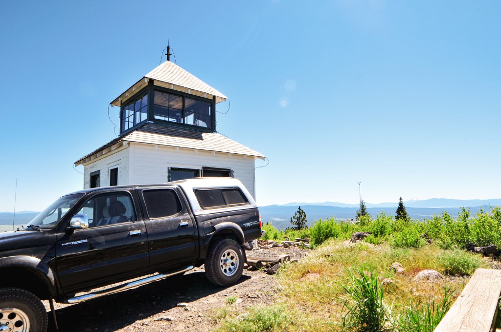
Once on NF-86, we crossed the railroad grade and continued on past some private land until we entered the forest. We stayed right on NF-86 when we reached a major fork with NF-88. We knew we needed to take NF-8608 to get to the spur NF-370 to reach the lookout. The NF-8608 road makes a loop from NF-86, so there are two potential routes. The first turn is a longer route from NF-86 to NF-370 but it appeared more gradual on the map. The second turn is shorter, but steeper. We opted to take the longer route since it was more gradual, which usually translates to less road hazards and better driving conditions for a low clearance vehicle. Emphasis on the word USUALLY. This section of NF-8608 started out ok with a few potholes and highlines, but progressively got worse. The road is mostly made of pumice and dirt, which is very light and terrible for traction. The worst section was actually on the flattest portion of the road before our first junction. It had been majorly rutted out due to winter traffic and looked like ocean waves within the road. There was no where for us to safely turn around from here, so we had to continue through the mess. We decided once we reached the junction we would re-assess the situation. We creeped and crawled over the ruts, but made it to the junction without incident. If you decide to follow in our footsteps for a road adventure, you will want to take a right at this junction to stay on NF-8608. The road seemed to improve here, so we decided to continue our slug pace and assess the road upon any additional hazards. It wasn’t as bad as the flat section from here but it wasn’t great either. The manzanita and ceanothus were encroaching on the road which lead to some scraping against the sides of my car. A higher clearance vehicle could have avoided this, but we had to hug certain corners of the road to avoid hazards. This wasn’t the first time we’ve cozied up to some shrubs, but these scrapes seemed to be more permanent than previous. New racing stripes! We did eventually make it to the junction with NF-370 after what felt like a life time down a terrible road. So, I guess you could say the road is passable to low clearance vehicles, but I don’t recommend it. We could tell from the junction that the other portion of NF-8608 was the main route of travel. We hoped the lookout was there so we could ask them about their route conditions. We were both a bit tired of driving at this point and decided to walk the remaining mile and a half along NF-370 to the lookout.


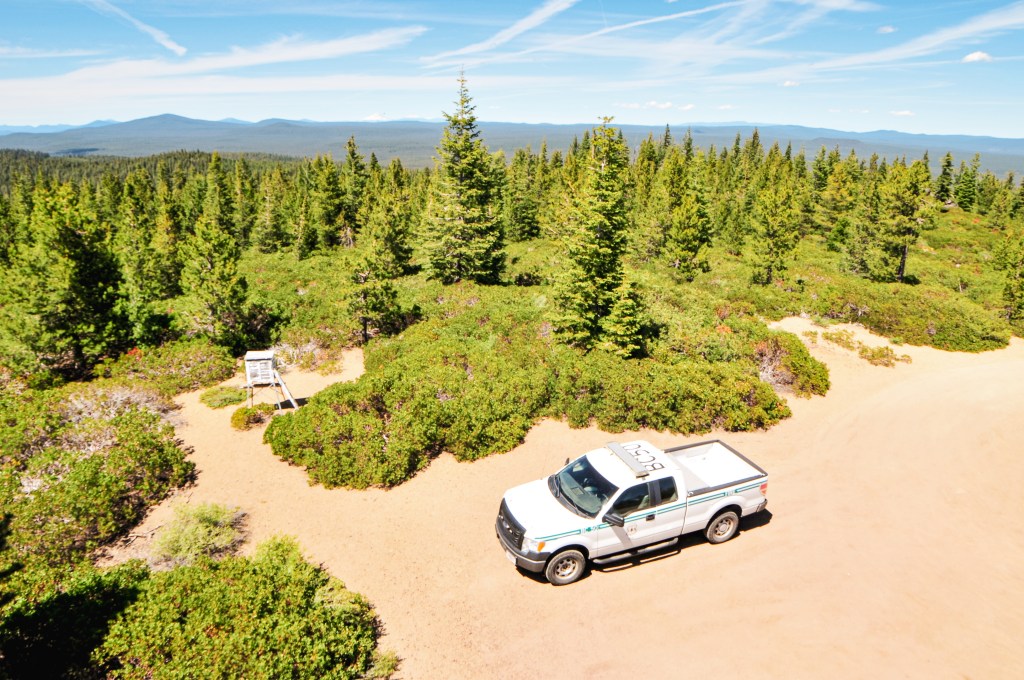


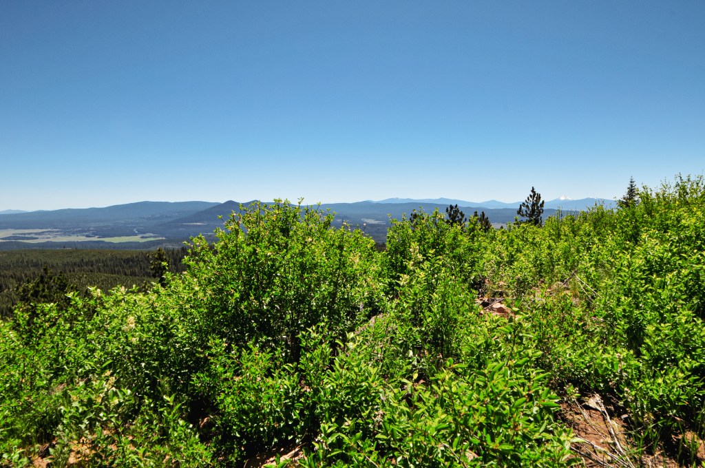
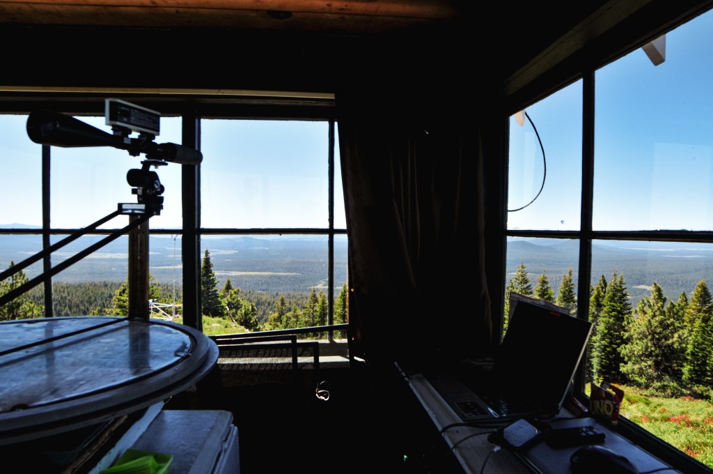
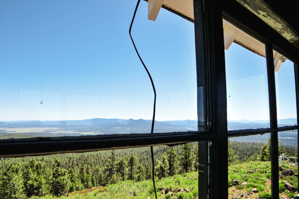
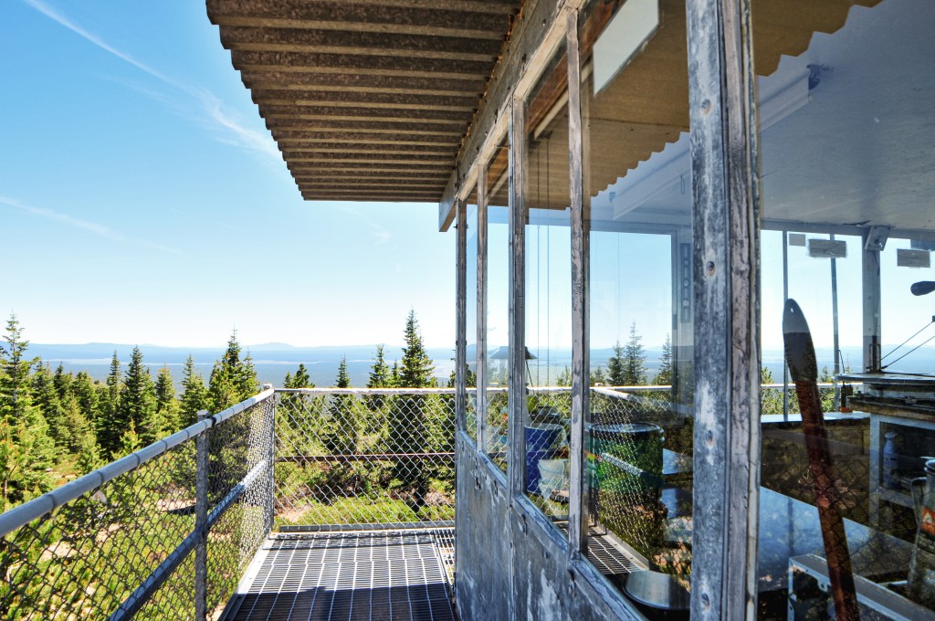
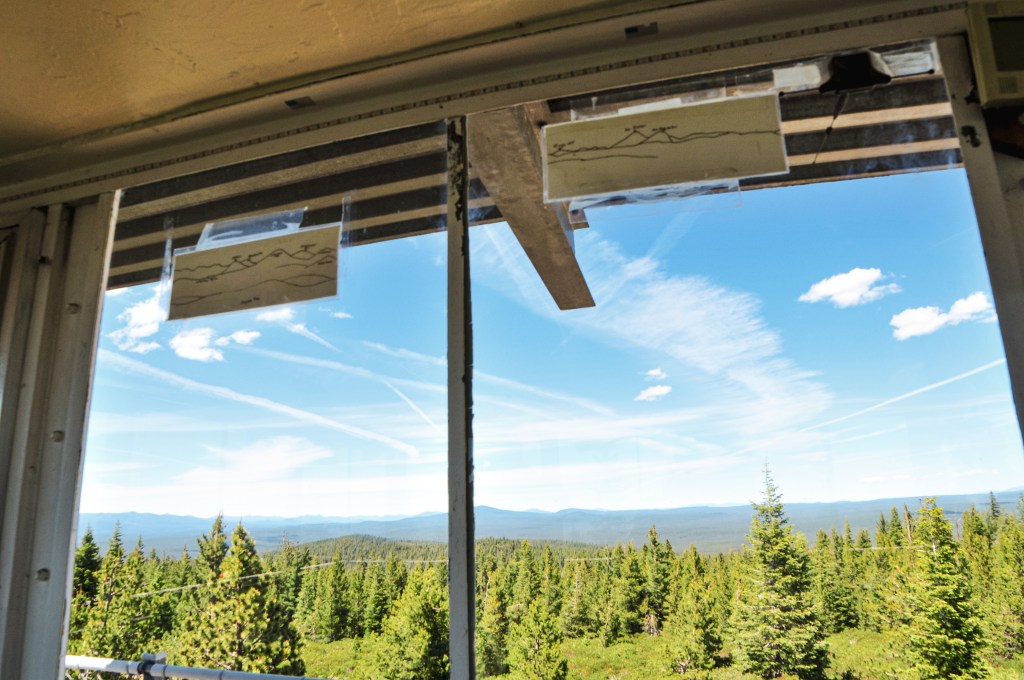
The road walk was dusty and hot. I saw some black bear prints and a really fat caterpillar though, so that was neat. I’m hoping one day I’ll have the opportunity to see a black bear from a safe distance. My partner has seen them a few times in the wild, but I haven’t been as fortune. As we approached the summit we could see a Forest Service vehicle parked near the lookout. Typically, the full time lookout attendant will drive their personal vehicle. We speculated that maybe Ed was off today and it was a relief instead. We wondered if Sharon from Calimus Butte (post) had notified them that we were planning on coming. We didn’t make our presence known since we weren’t sure if they wanted visitors or if it was even Ed. We setup to have a lunch at the picnic table and took some pictures around the base. Eventually the lookout came out on the catwalk and greeted us. He asked if Sharon had sent us. Indeed she did. We smiled and asked if he was Ed. Indeed he was. He invited us up to look around. Ed was happy to answer our questions, share stories, and show us the points of interest in the area. He joked that he thought he was going crazy because he could hear voices, but saw no vehicle when he looked out the window. He confirmed that the other route out of NF-8608 was much better. He used to drive lower clearance vehicles up to the summit from that route as well. We briefly rejoiced that we wouldn’t have to drive out the way we came. He was shocked that we were able to make it from that route and he said he doesn’t even drive his truck that way. We talked about some of the surrounding lookouts and asked if he knew who staffed Bald Mountain (post). He mentioned that the lookout on Bald Mountain (post) tomorrow would be Ron and that he’d put in a good word for us. We also asked about potential dispersed camp spots in the area and he pointed us towards a nice campground, Jackson Creek. We didn’t end up camping there since it was a little more off our route than we wanted, but it was tempting to be able to rinse off in a creek. He wanted to make sure our visit was as pleasant as possible and even offered to drive us back to our car. We graciously accepted. He dropped us off and we said our good-byes. The drive out was drastically different than the drive in with little to no hazards. So, if you’re visiting this lookout learn from our mistake and take the second turn for NF-8608. We continued onwards to Bear Butte (post).


Lookout Ed
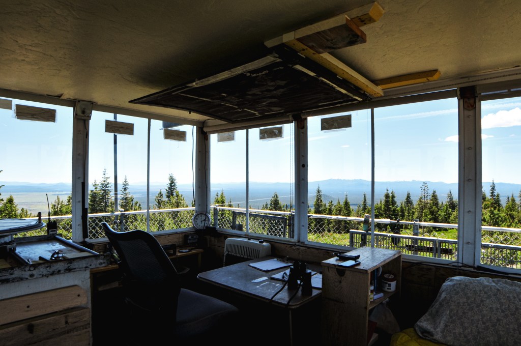
Ed is 80-years old and has been a lookout on Sugarpine Mountain for the last 11 seasons. His wife used to staff the lookout with him but she passed away 3 years ago. He had an interesting history of jobs from flooring to owning a grocery store, car wash, and other rental properties. He mentioned his wife was a dental assistant and the brains behind their operations. His kids live close by in Roseburg. He loves the wildlife in the area. He also said he usually bakes his visitors chocolate chip cookies, but he was all out of chocolate chips during our visit.

History.
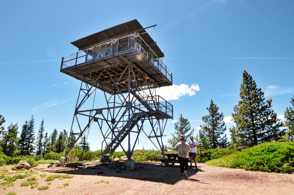
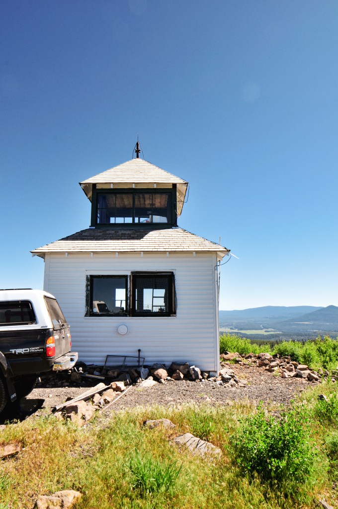
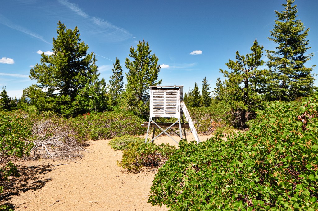
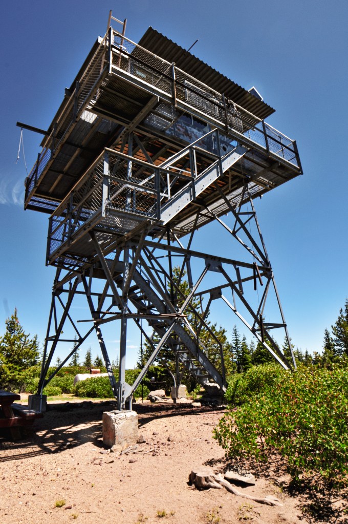
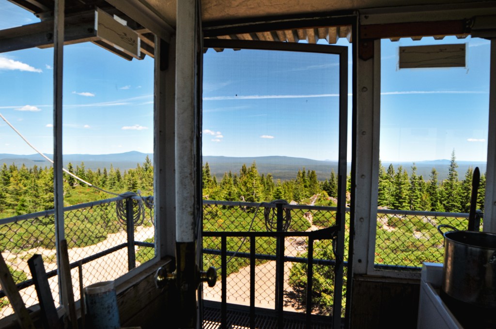
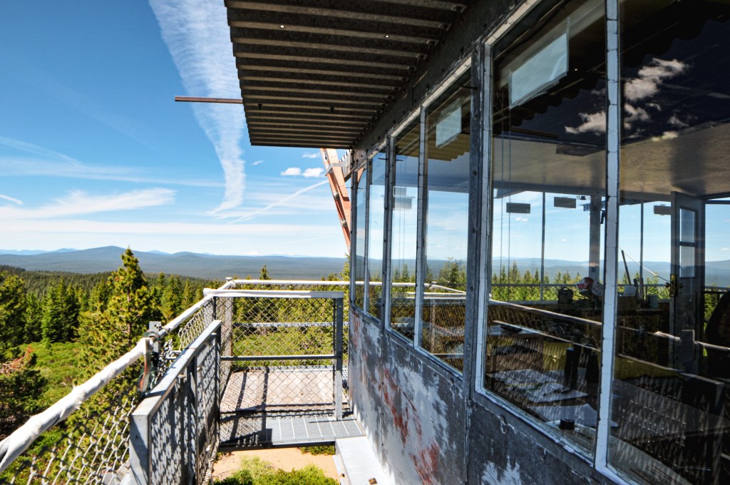
Sugarpine Mountain has a unique history in that it has never had a tower built specifically for it. It started as a fire camp in the 1930s, but it didn’t have a permanent structure on it until 1970. The lookout structure was airlifted from its original location at Fort Klamath. It was built in 1958 as a 20′ x-brace steel tower and 13×13 plan CL-100 cab. It’s actively staffed every season.