
NOTICE: As of July 14, 2024 this area is currently closed due to the active Falls Fire.
Location.
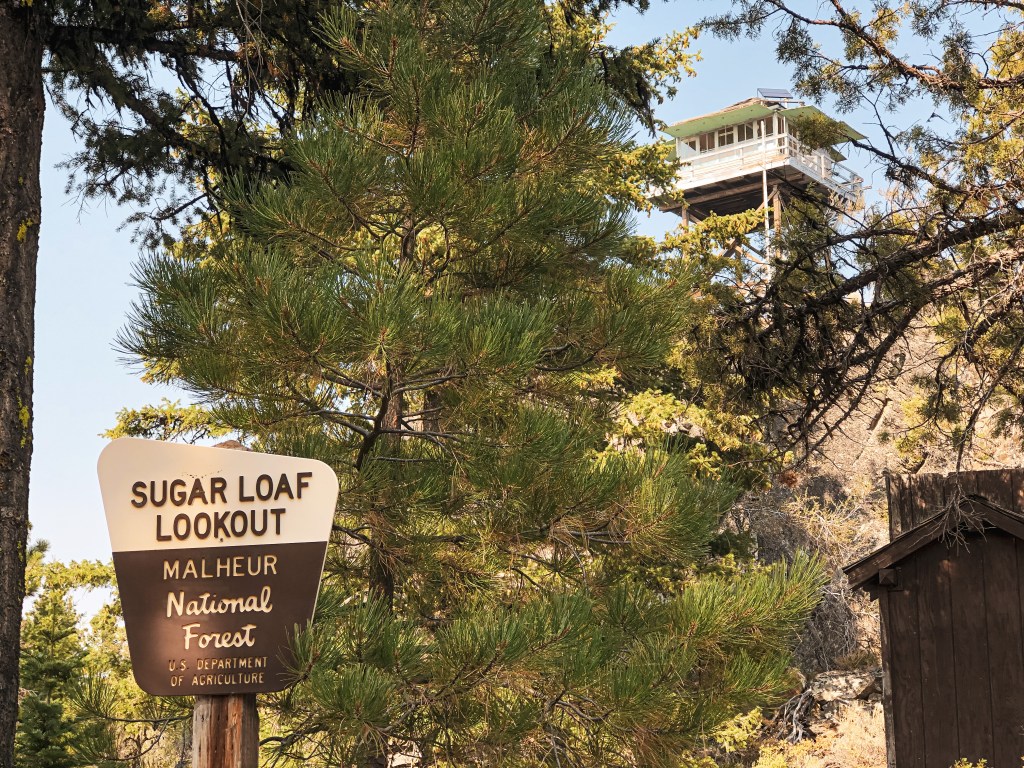
Malheur National Forest
Status.
Active; Currently standing
Estimated drive time from Portland, OR.
6-1/2 hours
Date visited.
September 4, 2021
Elevation.
6,128′
National Historic Lookout Register.
US 427; OR 52

Trip Report.
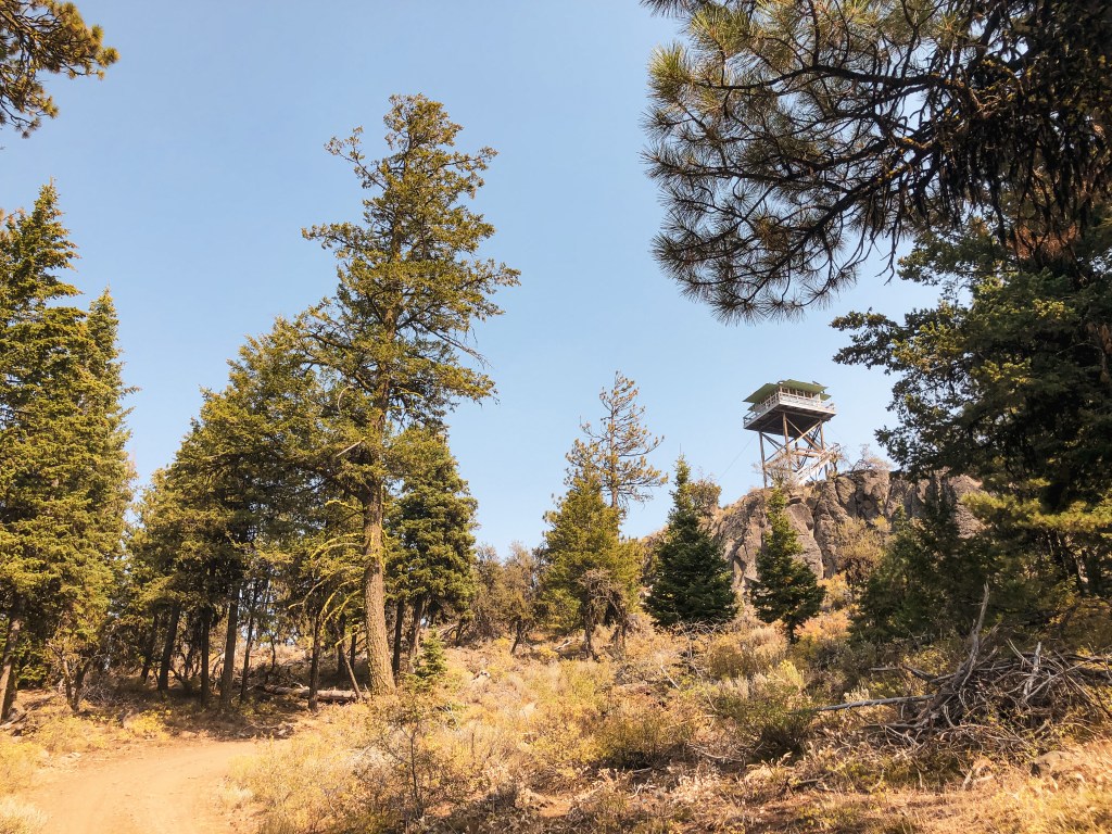
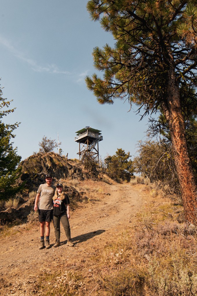
We decided we had enough time left in the day, after an easy visit to West Myrtle (post), to visit Sugarloaf Mountain as well. We drove back down NF-37 until we passed Yellowjacket Reservoir and reached the junction with NF-3740. NF-3740 has a sign that notes Sugarloaf Mountain L.O. as 5 miles away. The road was basically graded over a scab which made it a bumpy 5 miles to the gate of the lookout. It wasn’t a great road to drive on but passable to my Civic with caution. We parked near the gate and hiked the remaining 0.64 miles to the summit. There was a Forest Service vehicle parked at the top and we were greeted by the fill-in lookout attendant a few minutes later. She was very friendly and chatted with us for 30 minutes before returning to work. She said she’d been serving in that role for the past 30 years. She had previously worked at King Mountain (post) and Dry Mountain (post), but Sugarloaf Mountain was her favorite by far. She hoped that once she retired the Forest Service would let her continue to be the fill-in there on the weekends. She was disappointed there wasn’t a clearer view to show off the forest to us. She also mentioned it made her sad that she had to close the gate to the lookout. You could tell she enjoyed interacting with people and sharing her love of the forest with them. Unfortunately, we forgot to catch her name or what kind of work she does for the Forest Service during the week. We didn’t get invited up to check out the cab, but we assumed this was due to COVID-19 precautions given some comments she made during our visit. We enjoyed lunch at the picnic table below the lookout before heading back down the road. As we took a last look from the road, the lookout attendant came out to give us a parting wave and good-bye.

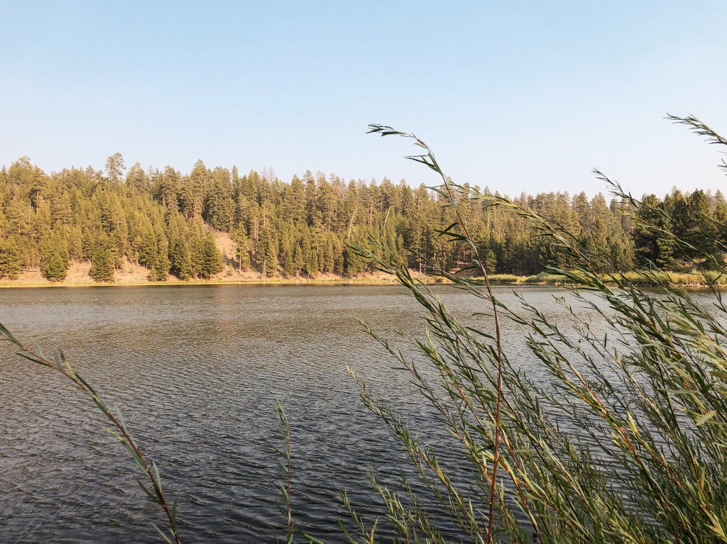
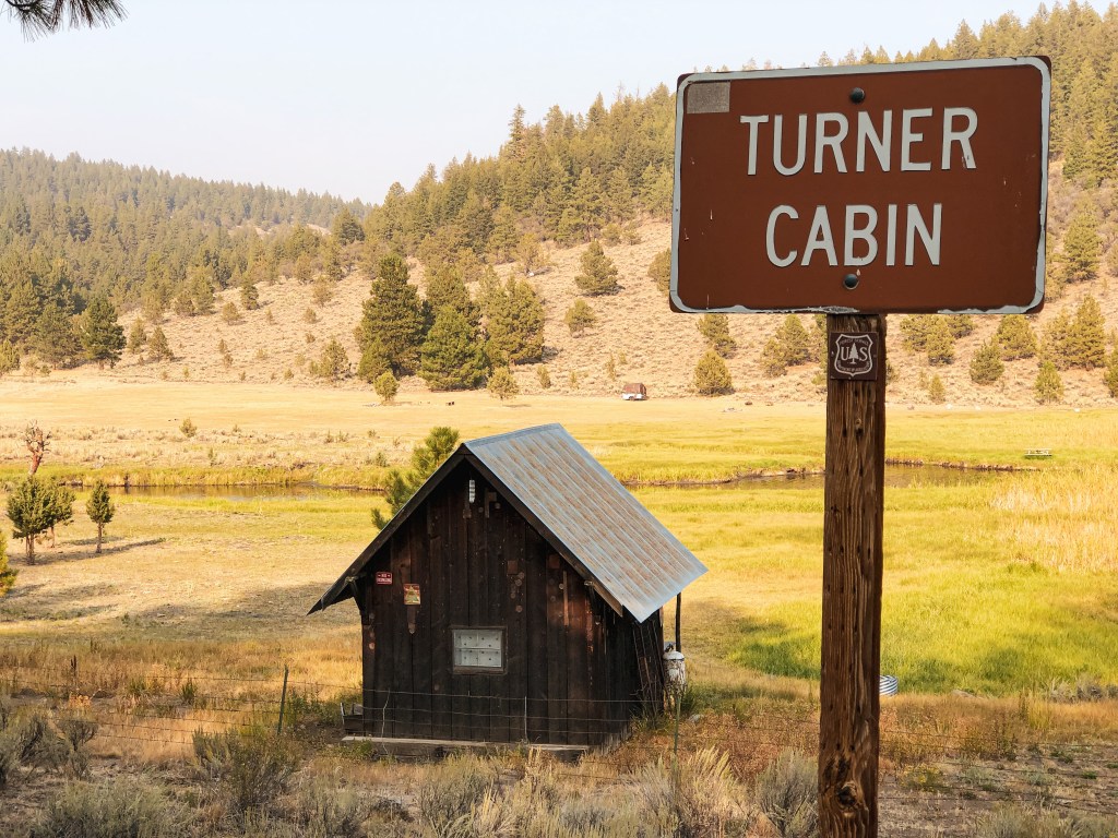
We stopped at Yellowjacket Reservoir on our way back to camp to see if it had water to refill our containers. The campground next to the reservoir was surprisingly empty given the holiday weekend, there were only a few campers and the host. It was a decent sized campground with vault toilets, potable water, and at least 20 spots. The reservoir was larger than I expected too, but still not large enough for motorized boats. It did have a ramp area for non-motorized boats and off-shore fishing though. We also stopped to take a look at the noted Turner Cabin along the road to Yellowjacket Reservoir. It’s technically on private property but it can be seen from the road. It looks to be well maintained by the owners and has even been updated.


History.
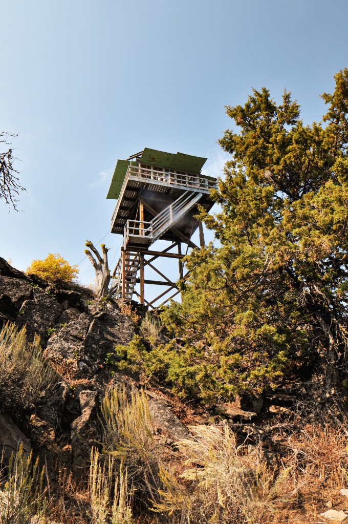
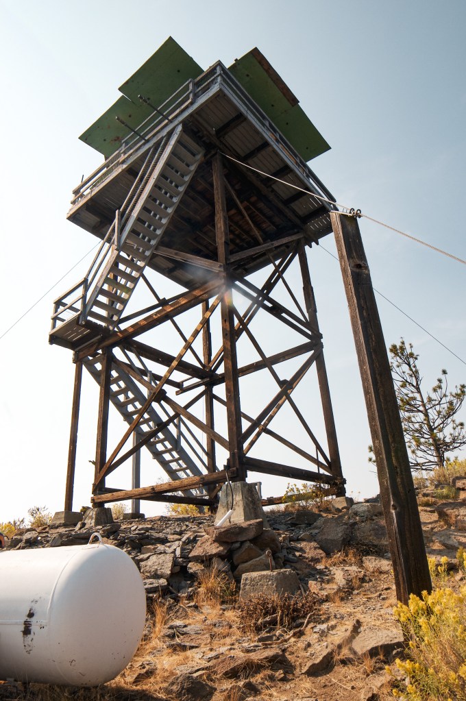
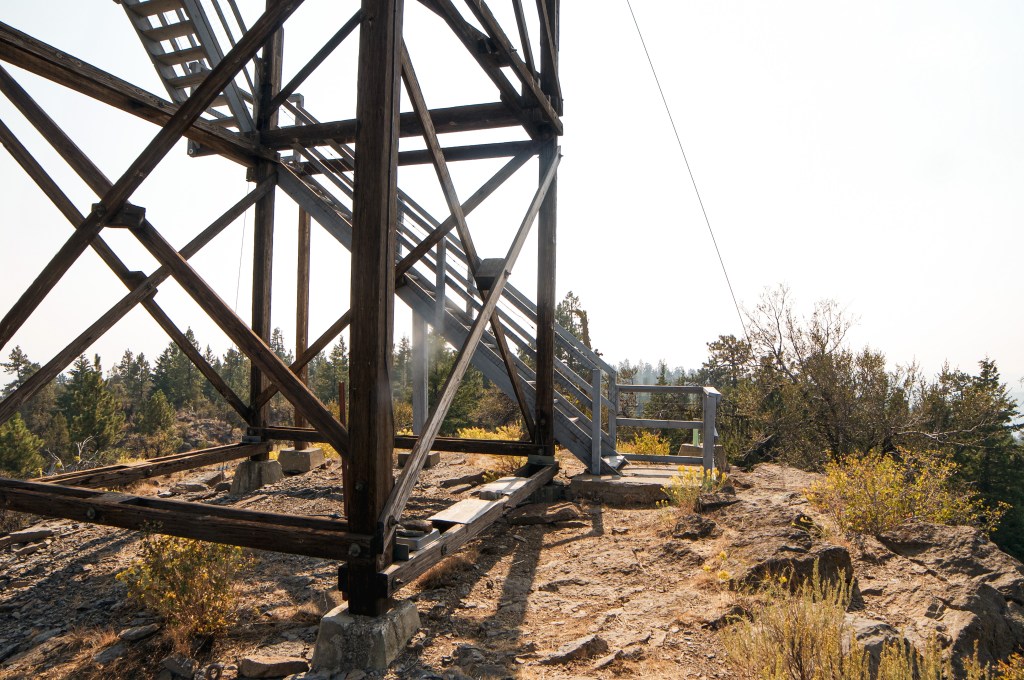
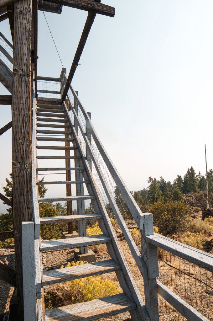
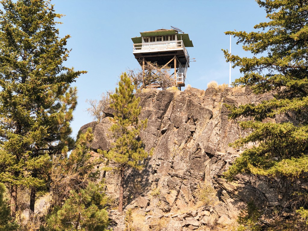
Sugarloaf Mountain has been used for fire detection since 1933 when a 15′ round tower with L-4 cab was built. The 16×18 garage was added in 1934 but has since collapsed. The roof remains can still be found on the summit. The present tower is a 32′ tower of treated timber with L-4 cab. It was built in 1949 to replace the older tower despite it still being in fair condition.


There was a cross made out of horseshoes nailed to a juniper tree on the summit. This was added as a memorial for the previous full-time lookout attendant who passed away due to heart failure last year.


3 thoughts on “Sugarloaf Mountain L.O.”