Location.
Ochoco National Forest; Managed by Malheur National Forest
Status.
Abandoned; Currently standing
Estimated drive time from Portland, OR.
6 hours
Date visited.
June 17th, 2022
Elevation.
5,920′
National Historic Lookout Register.
US 425; OR 50
Trip Report.
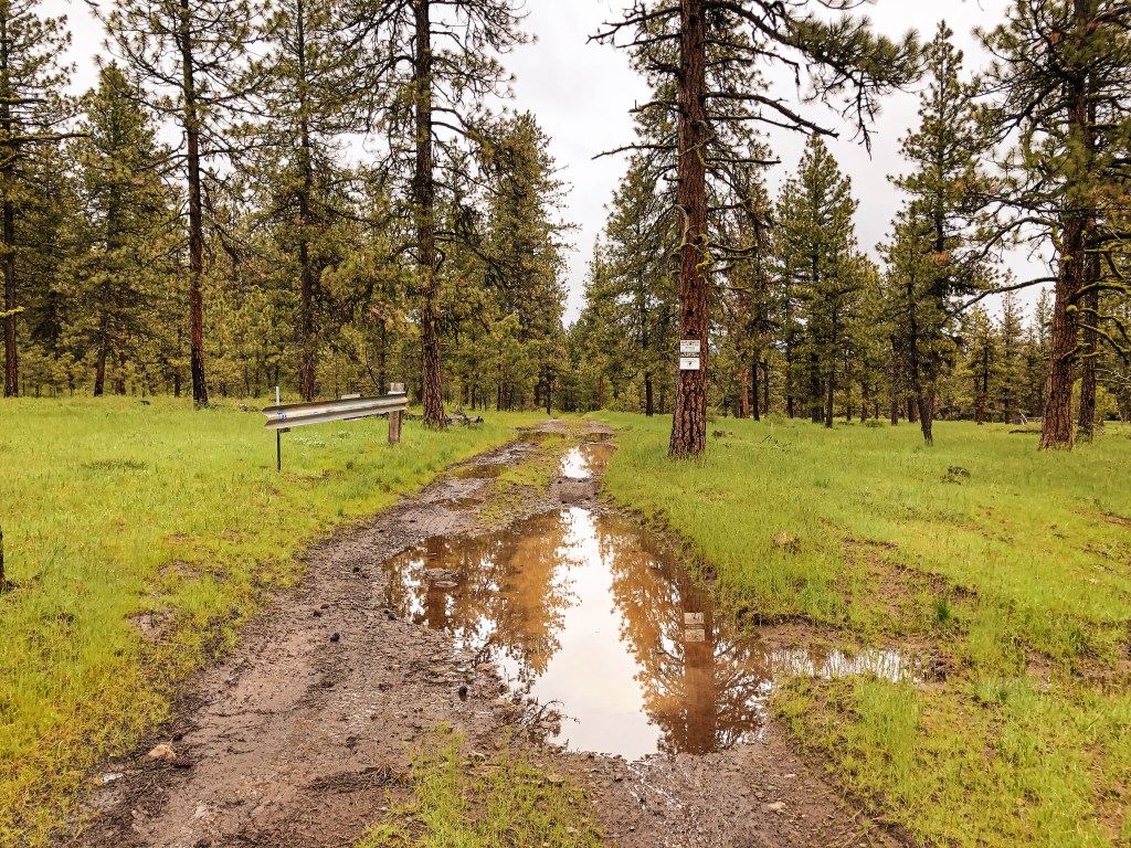
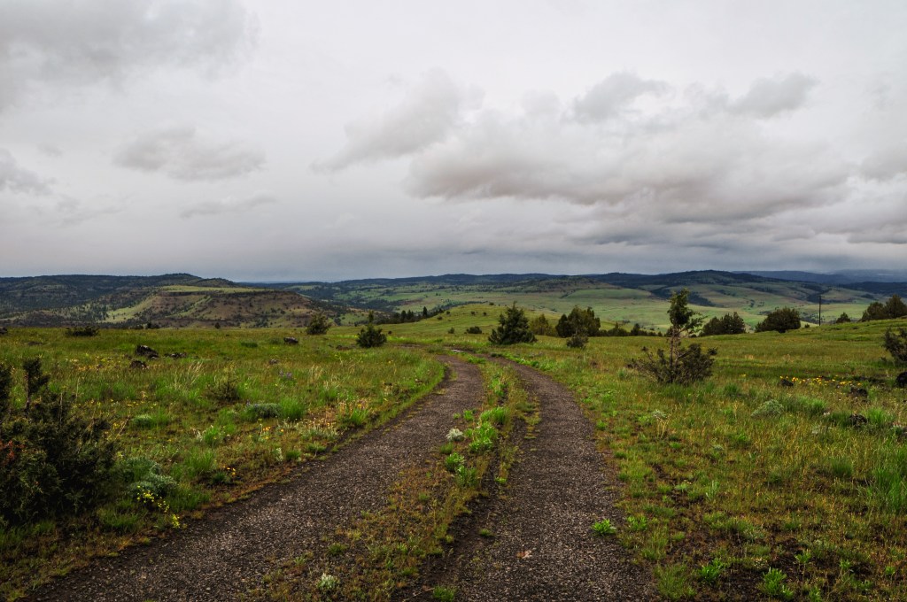
My partner, his mom, and I headed out on a 3-day camping trip to kick off her recent retirement. We left it up to her on what kind of trip she wanted to take, whether it be backpacking or car camping. She decided she was interested in visiting some fire lookouts with us and we set out to plan accordingly. Bald Butte, Dry Mountain (post), and Wagontire Mountain (post)were all lookouts we had planned for our road trip this summer. They were a bit farther out than the rest of our route and we figured it would make a decent 3-day trip instead. This way we could re-route our road trip to other fire lookouts farther south as well. We headed out early Friday morning towards Hines, Oregon. We decided to drive her Honda HR-V since it can fit three people plus camping gear more comfortably than my Civic. It also has the added benefit of additional clearance for the rougher Forest Service roads. From Hines, we headed into the forest via the Hines Logging Road that is right next to the Sinclair truck stop. It will eventually turn into NF-47 once you reach the boundary. Our plan was to visit Bald Butte and Dry Mountain (post) before setting up camp for two nights. You will want to take a left onto NF-41 after entering the forest to get to both of these. The turn is signed but it was hard to see from the approach out of Hines. We actually drove past it and had to turn around.
On our drive in we noticed there were interesting arrows and signage noting there would be bikes on the road tomorrow, June 18th. My partner and I joked that we always seem to run into these extreme races while out in the woods. It turns out we were right in assuming it was another one. We looked it up when we had service the next day and found the Skull 120/60/30, also considered America’s Gnarliest Gravel Race (site). It’s a gravel bike race hosted by Harney County to help showcase Eastern Oregon and help bring money into the county. There are three different lengths to the race you can sign up for; 38 miles, 65 miles, or the gnarliest 128 miles. We have also managed to stumbled upon the Baker City Cycling Classic during their Stage 4 Anthony Lakes Road Race in June of 2021 (site). We were driving home from a 9-day backpacking trip through the North Fork of the John Day Wilderness when we had to drive around the peloton. My partner was also passed by some racers from the America’s Toughest Race while camping in the Deschutes NF with his dad in May of 2021 (site). They even had a chance to talk to one of the racers and asked them where they were coming from to which they responded “a long ways away”. The America’s Toughest Race is a combination of foot travel, water travel, and cycle travel through rugged off trail routes. Everyone from your team must finish together otherwise you are disqualified. Anyway, it seems most of these races attract extreme masochists. It’s not what I would consider a fun time outside, but to each their own.
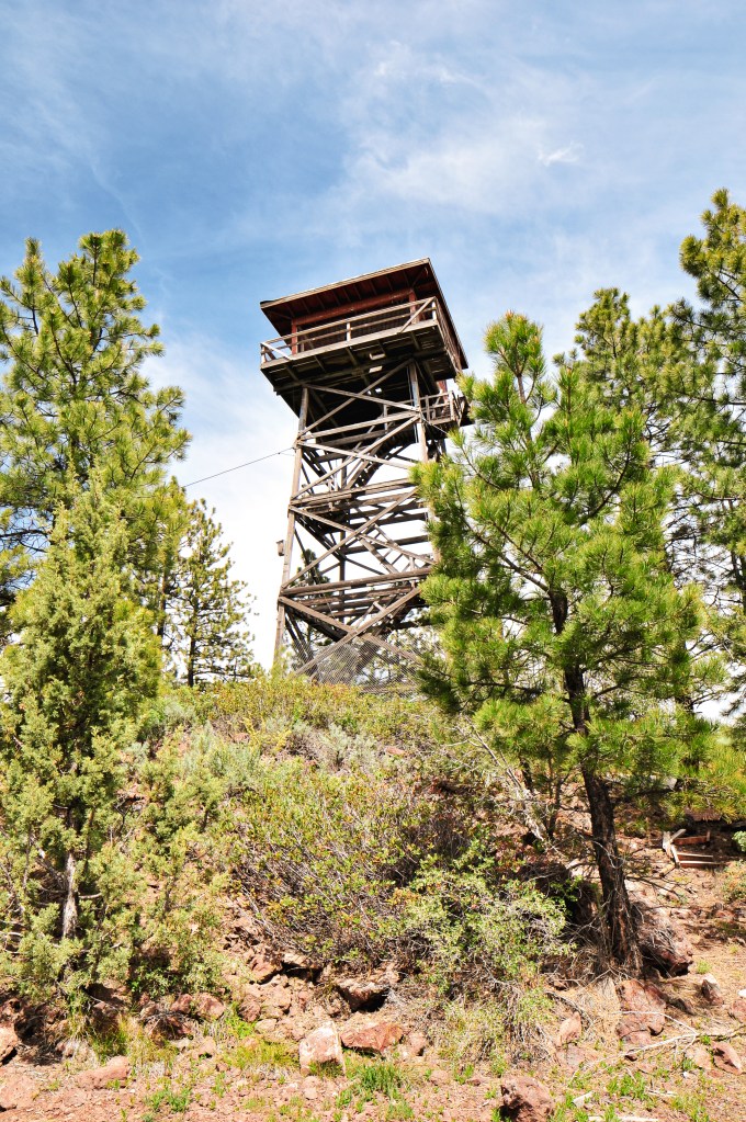
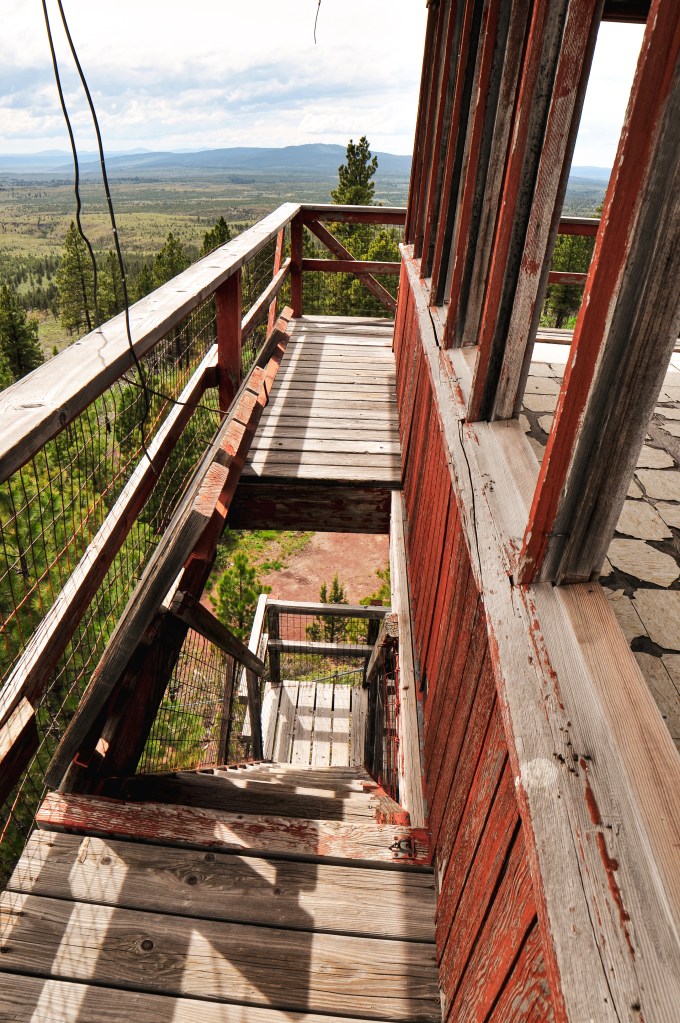


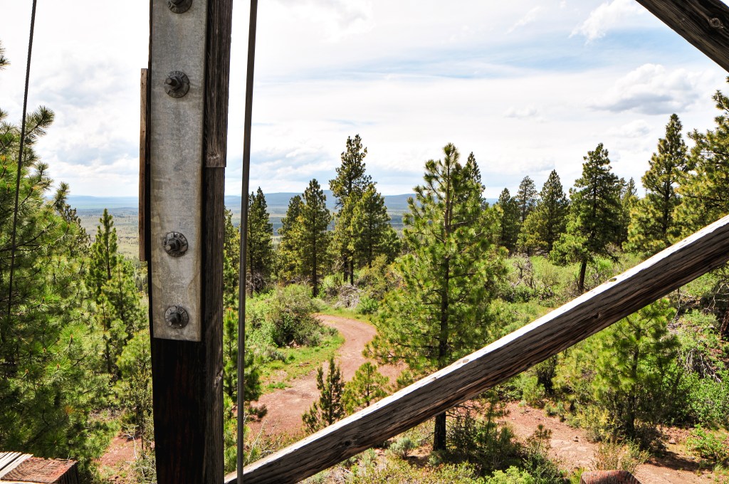


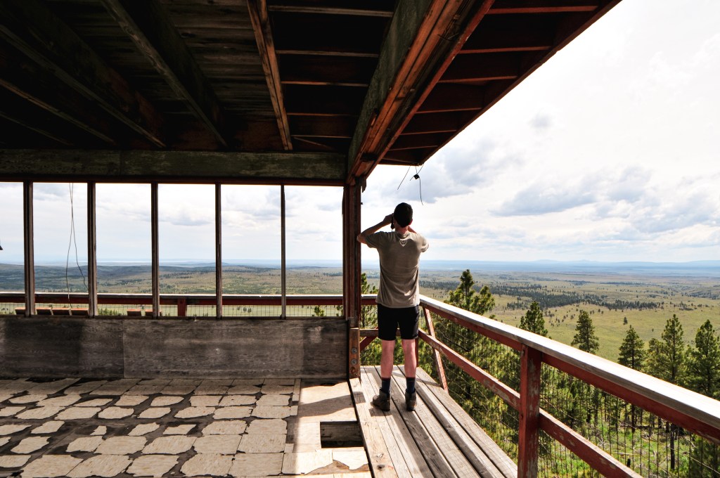
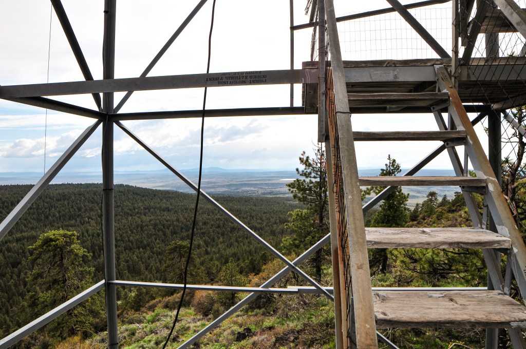
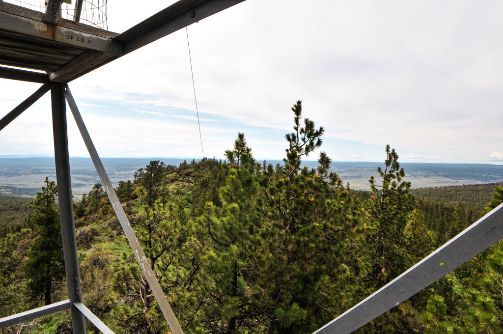
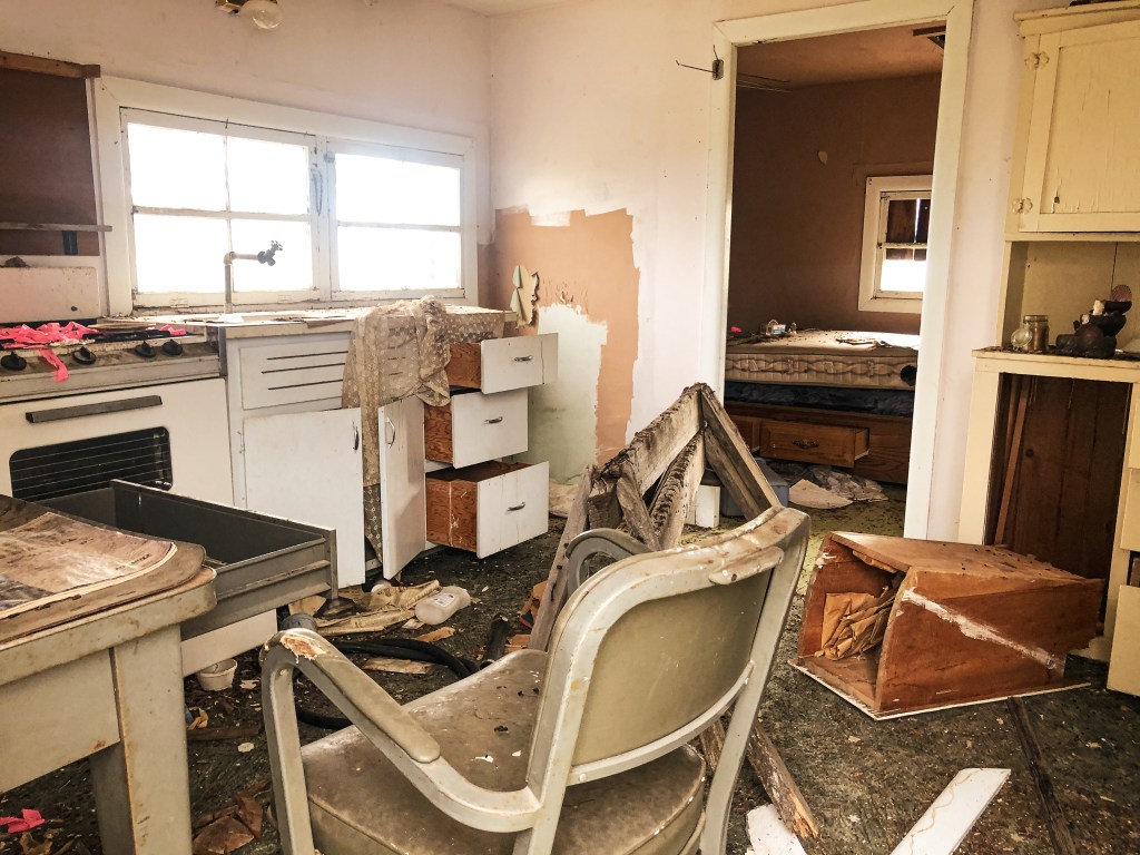
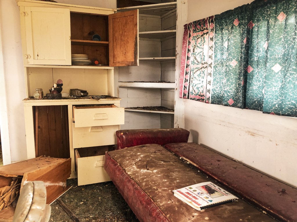
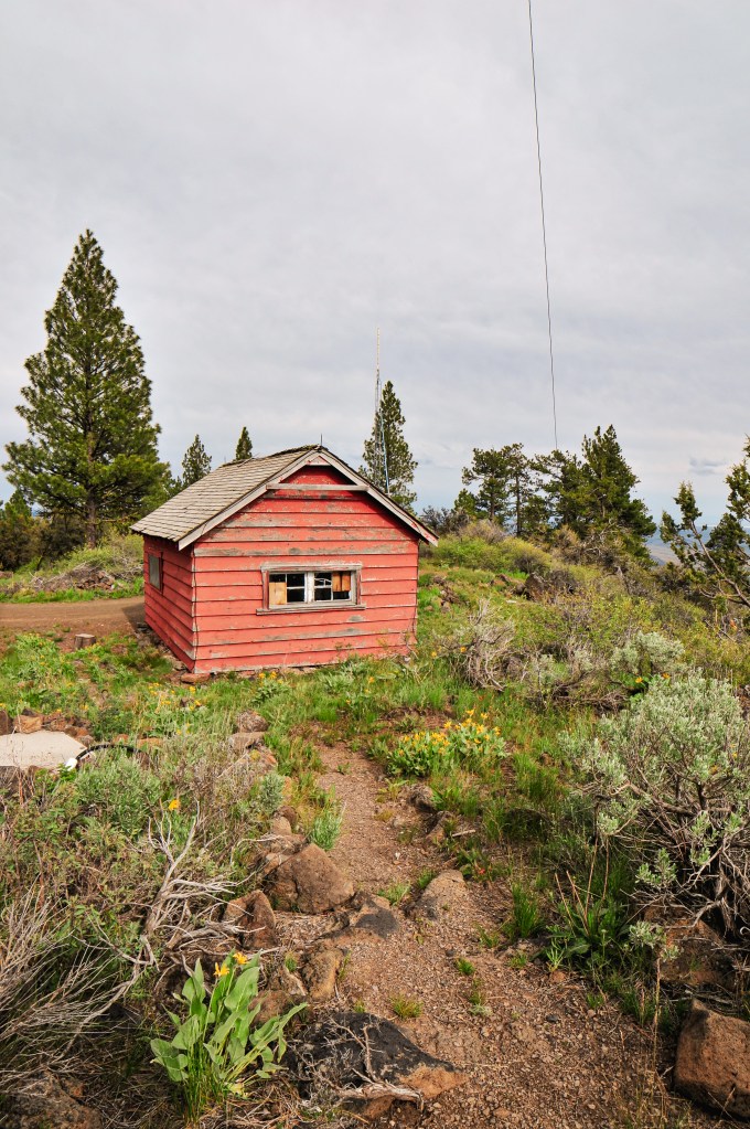
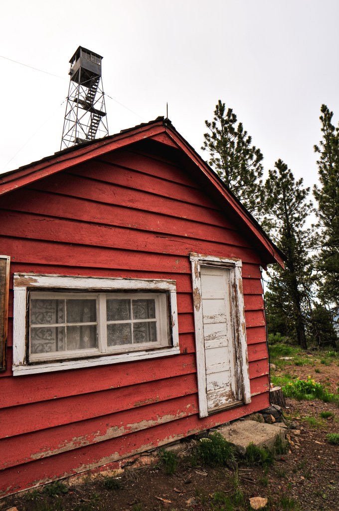
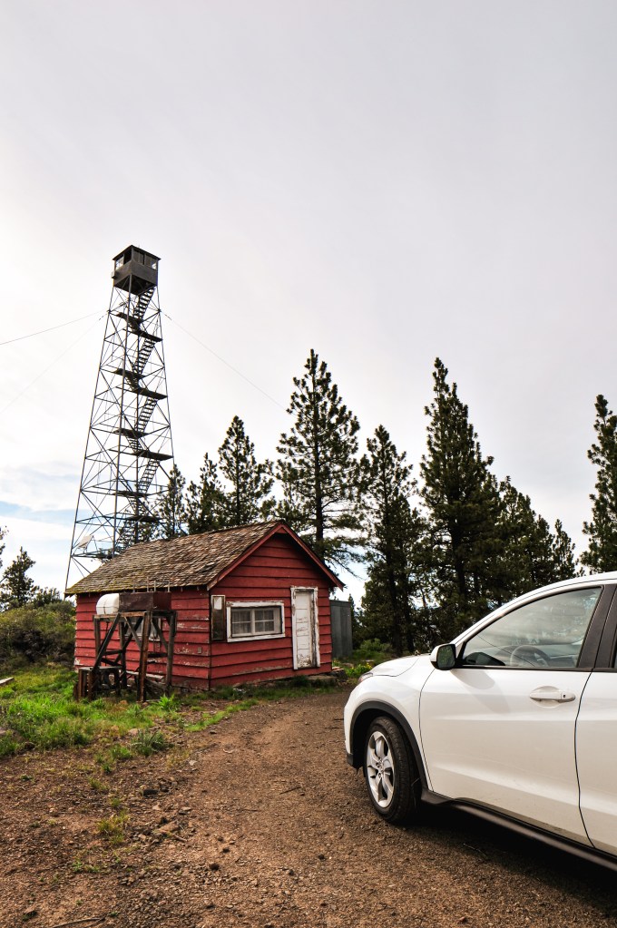
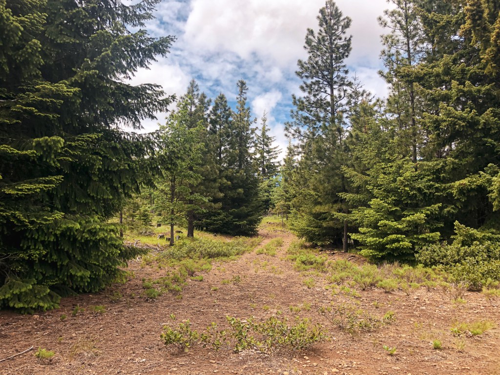
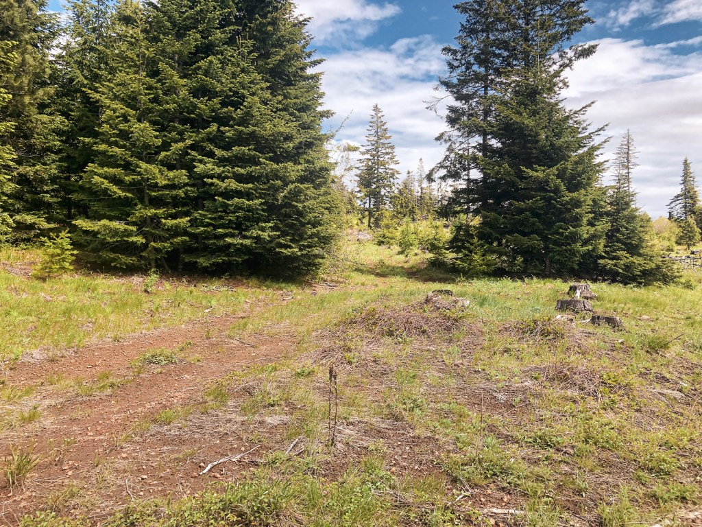
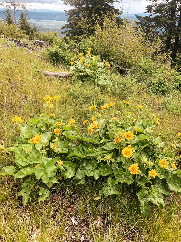
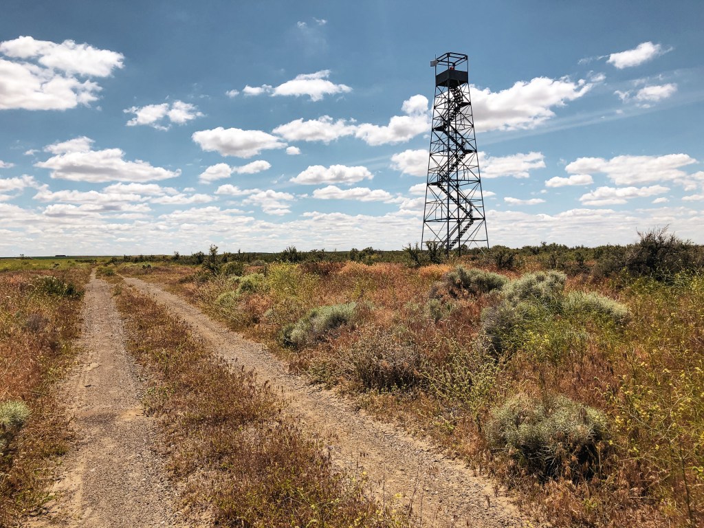
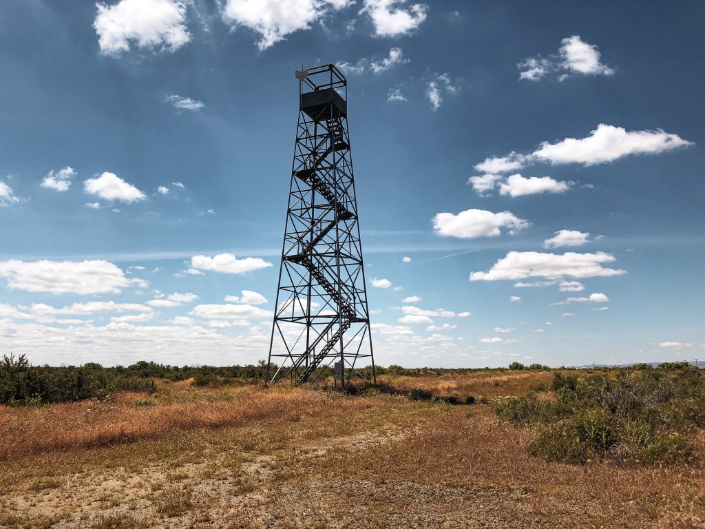
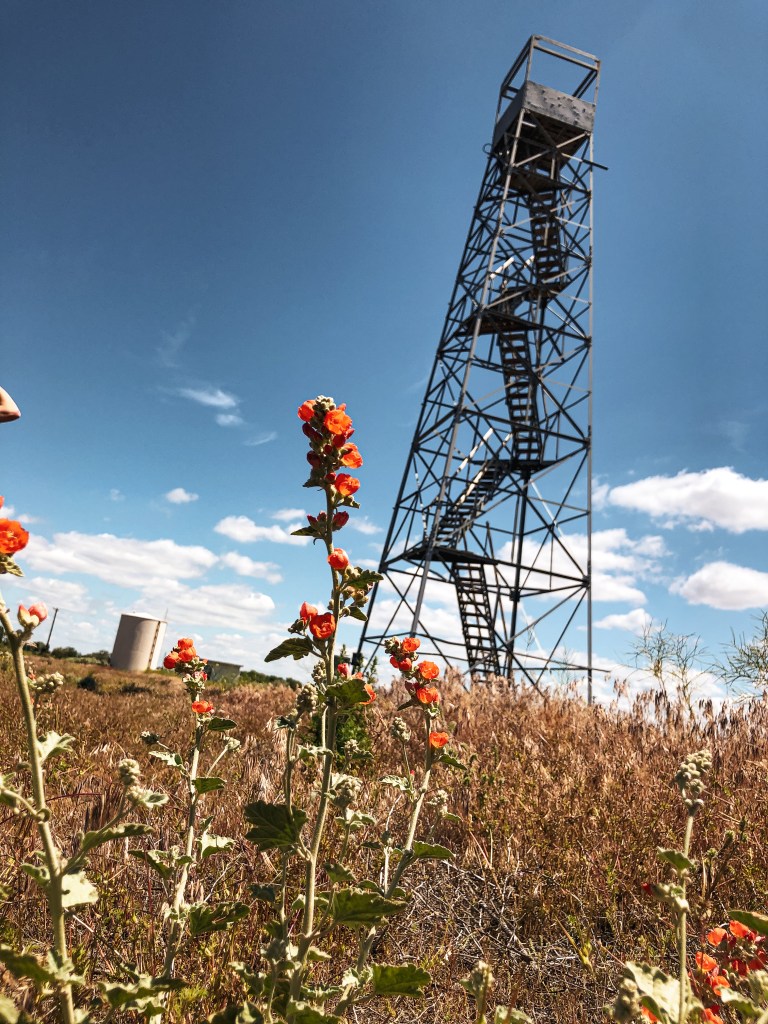
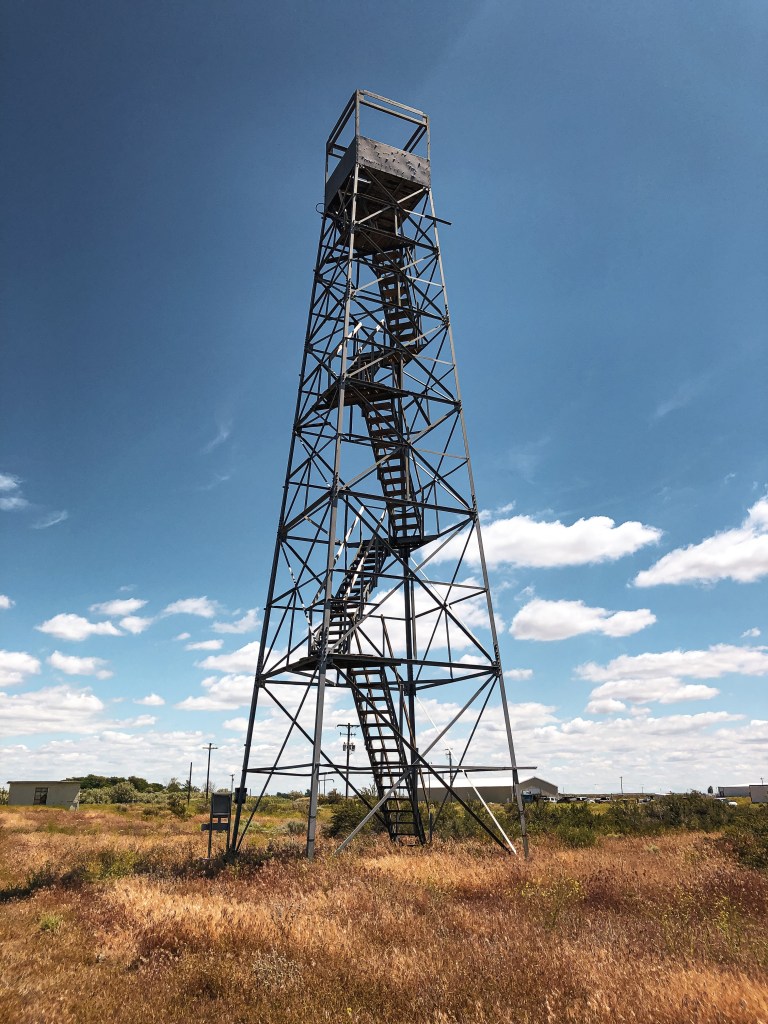
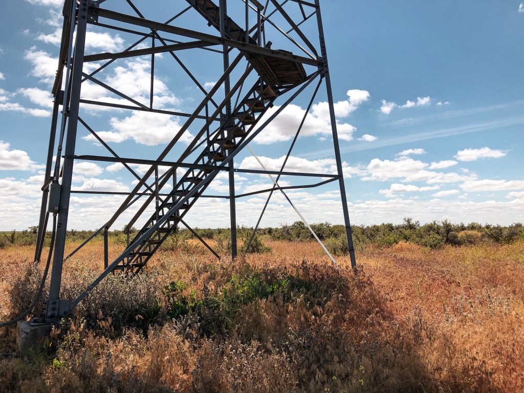
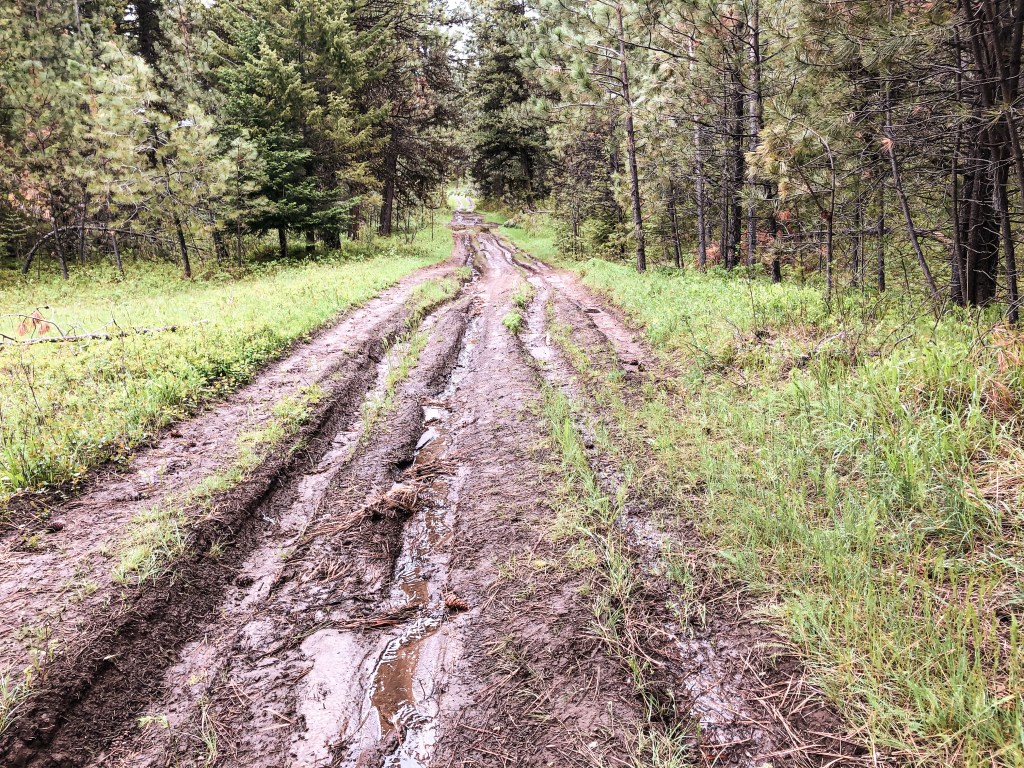
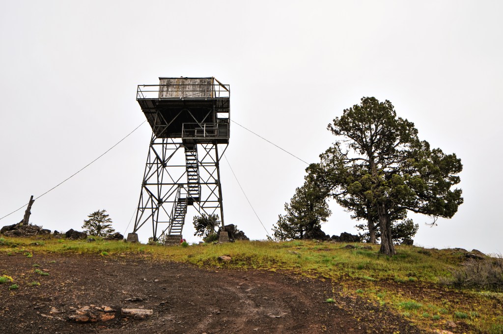
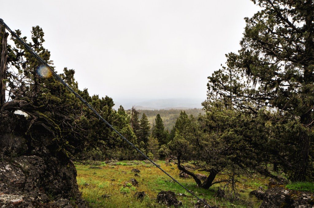
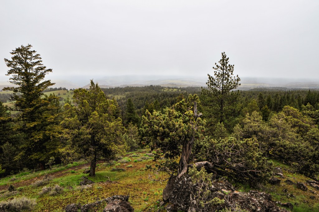
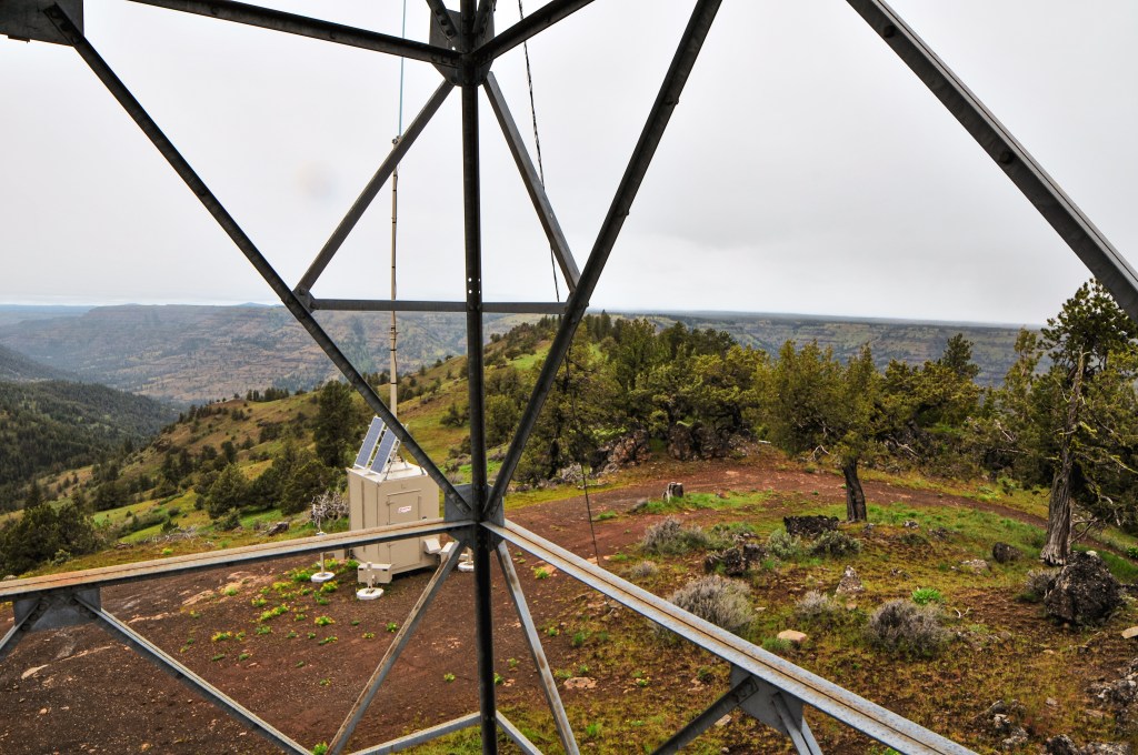
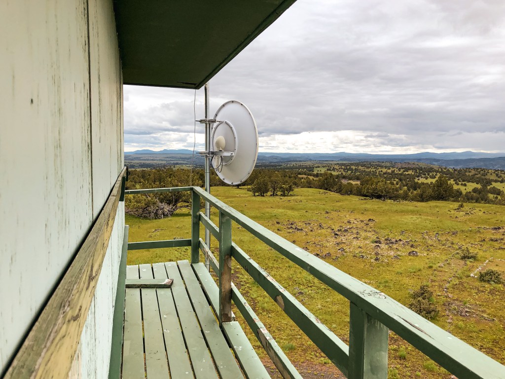
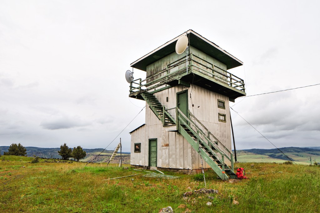
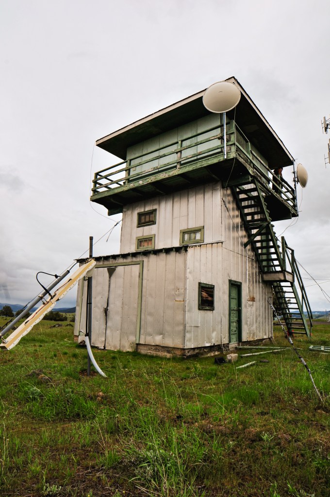
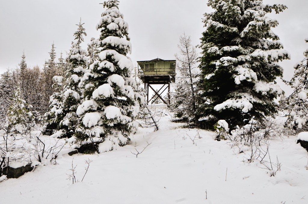
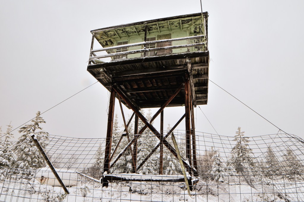
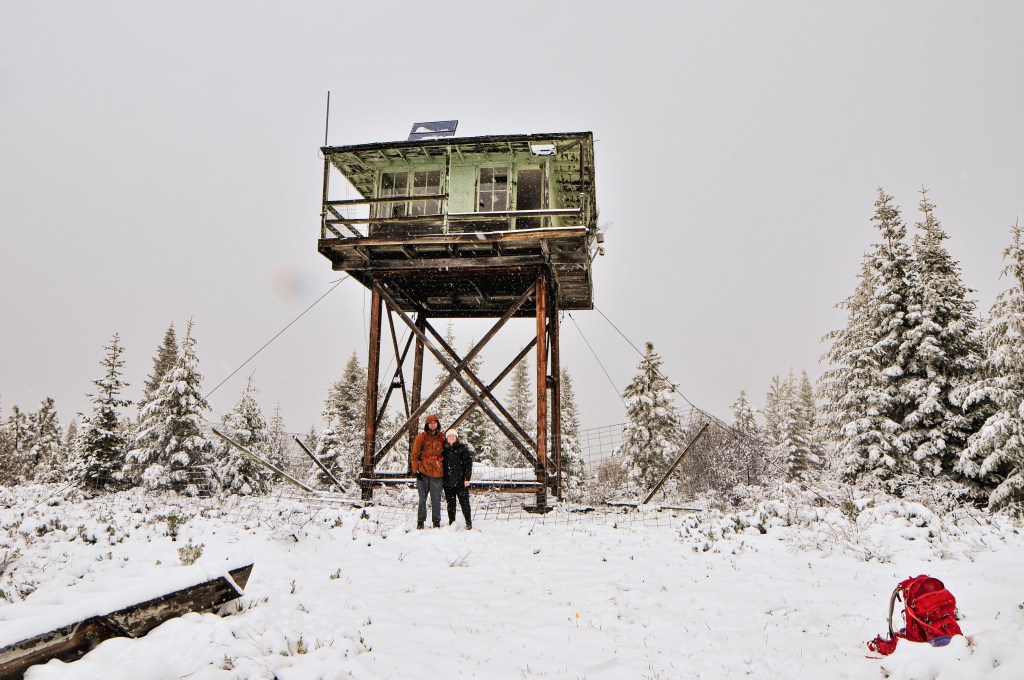
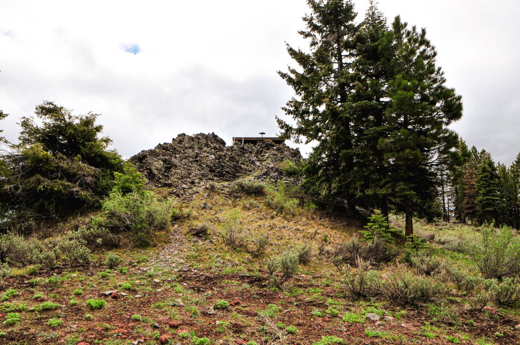
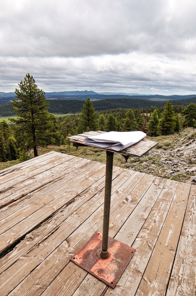
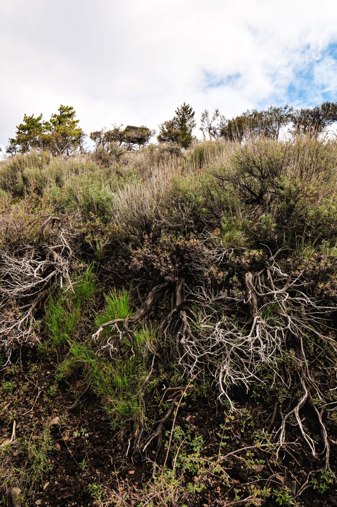
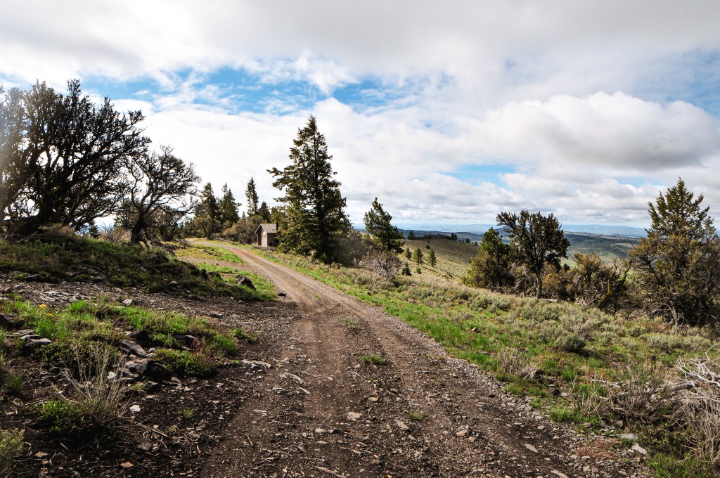
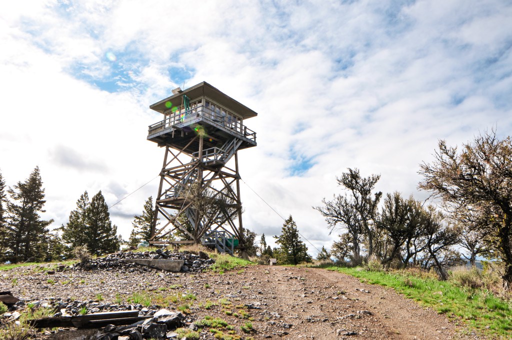
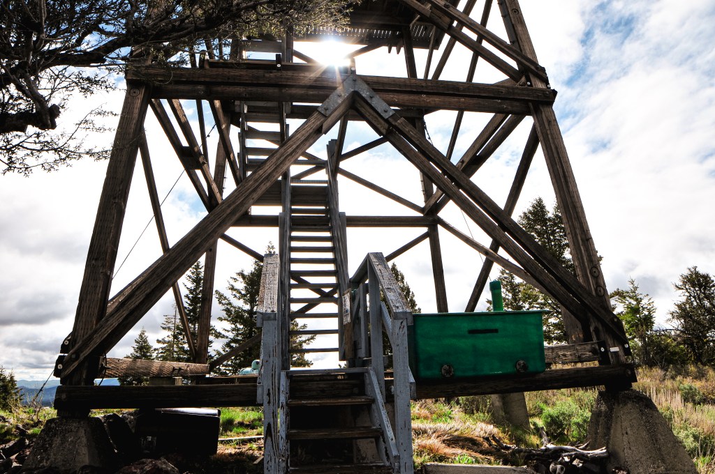
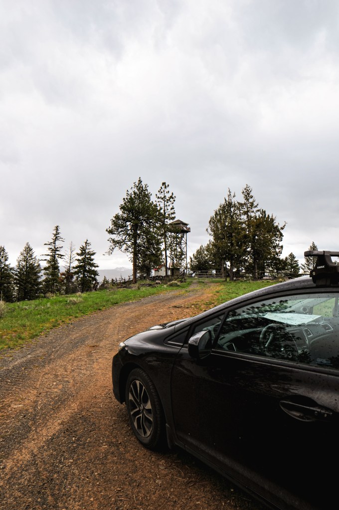
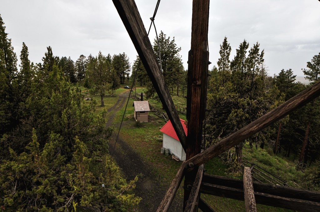
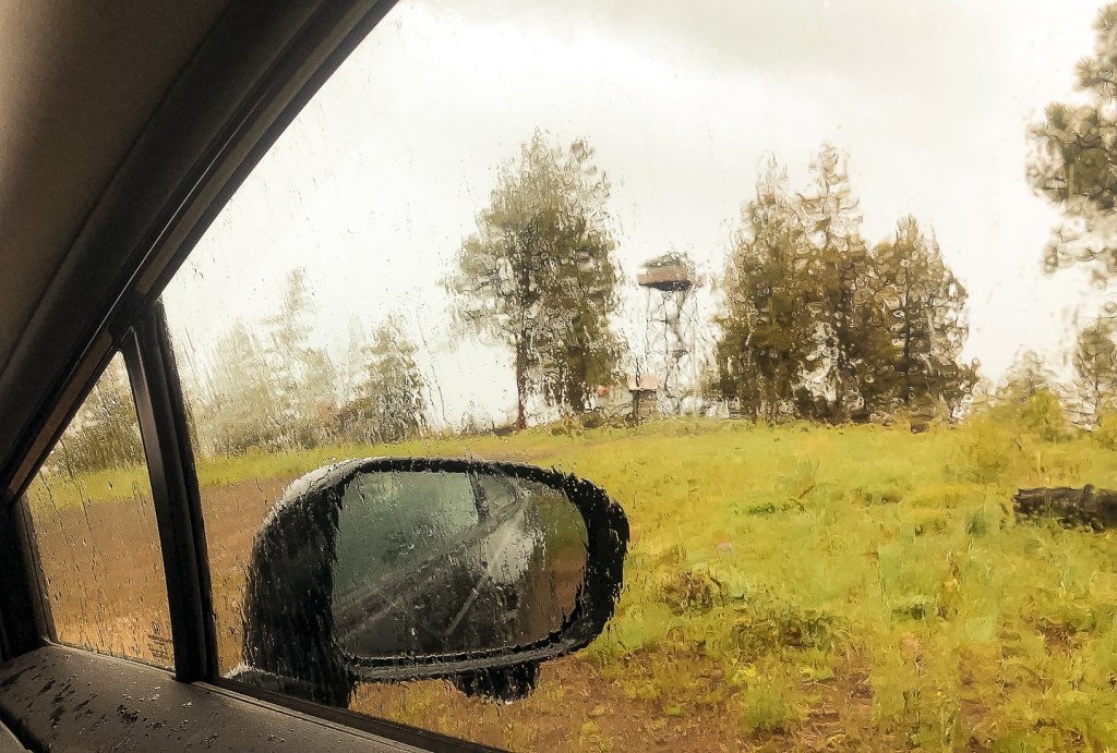
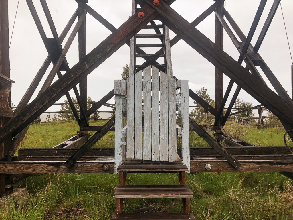
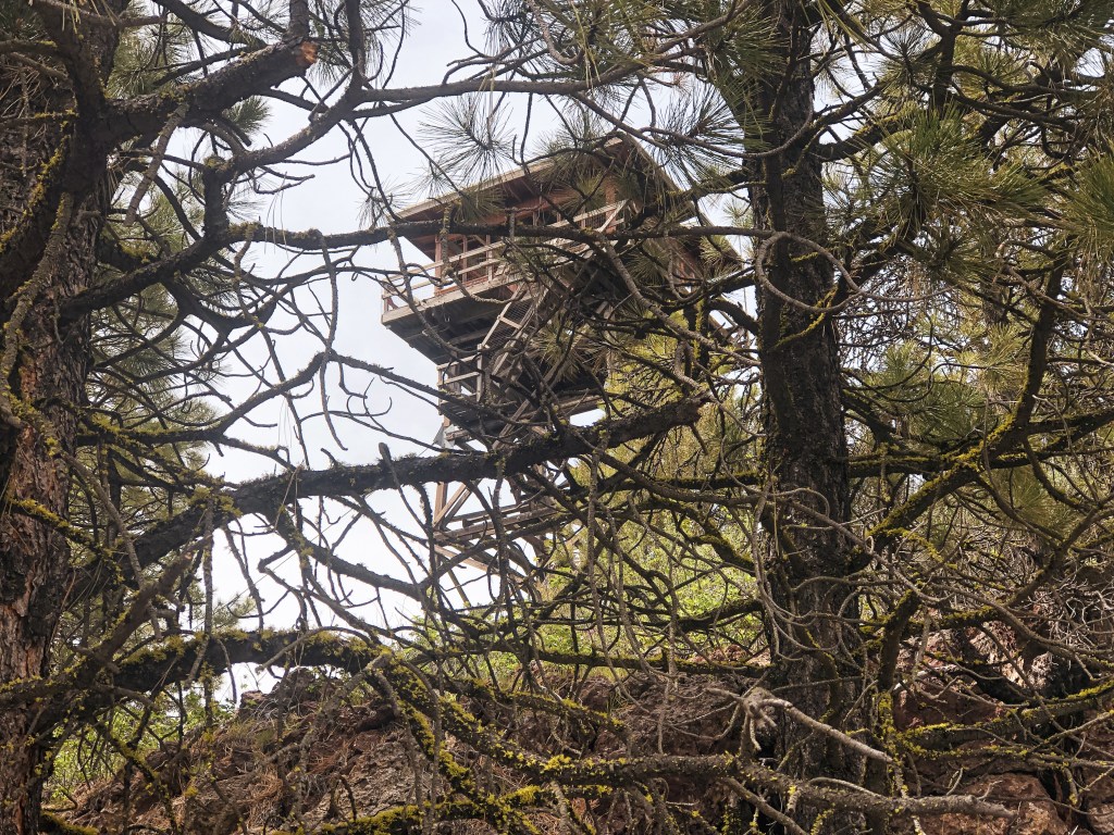
We were glad that we decided to do Bald Butte and Dry Mountain (post) on Friday instead of Saturday. It seemed that a lot of the bike route for the Skull 120/60/30 was along the roads we needed to take to get there. You will be able to see Bald Butte L.O. as you drive along NF-41. It is a surprisingly nice paved Forest Service road that I expected to be gravel. From NF-41, Bald Butte is less than a mile up NF-4117 off to the left. There is a sign but it is covered by trees and I wasn’t able to spot it until we were driving out. Luckily, even without the sign it is pretty obvious which road will take you to the summit. There are some deep washouts and water bars along NF-4117 that would make the drive difficult to impossible for lower clearance vehicles. I wasn’t comfortable driving the HR-V up the road, so we parked near the NF-050 spur and walked the remainder. It was a pleasant walk to the summit and the road had a lot of wildflowers along it. The lookout on Bald Butte, unfortunately, has seen better days. The tower seems to be standing strong but the cab has lost a supporting wall and a few support beams. I wouldn’t be surprised if the cab collapses under heavy snow within the next few years. I believe the glass was removed and salvaged by Howard Verschoor though. An assessment done by the Friends of the Blue Mountains Lookouts in 2021 found it to be too unstable for any additional salvage work. They even mentioned that it would be torn down later that year. We were happy to find that they were wrong and the lookout was still standing. There is a wire fence surrounding the base but someone had cut a hole in it and the trap door was open to the catwalk. Climb at your own risk. We savored the views and said our good-byes to the lookout before hiking down to the car and heading on to Dry Mountain (post).


History.
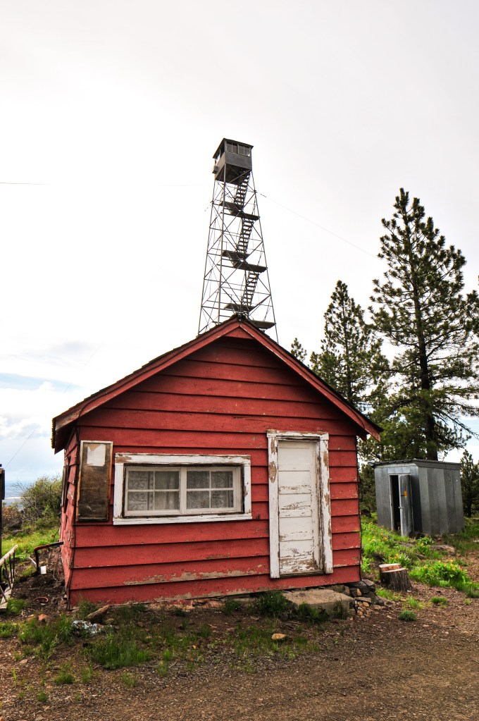
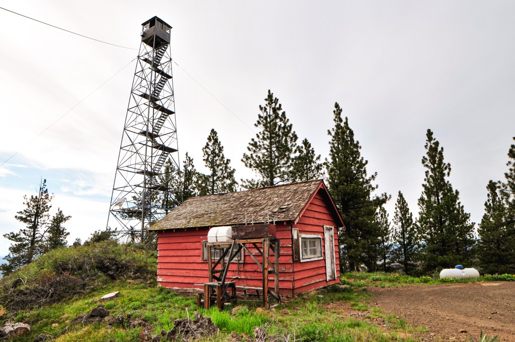
Established in 1931, Bald Butte originally had a 45′ pole tower with 8’x8′ cab. It was replaced in 1959 with the existing R-6 cab and 41′ treated timber tower. It was moved to emergency use in 1964 and on the emergency list up until the 1990s. As of 2017, it has been listed for decommission by the Forest Service.