Green Point L.O.

Former Lookouts, Oregon Lookouts

Location.

Siuslaw National Forest; Cascade Head Experimental Forest

Status.

Abandoned; Partially standing

Estimated drive time from Portland, OR.

2 hours

Date visited.

April 23, 2022

Elevation.

1,303′

National Historic Lookout Register.

No

Trip Report.

Green Point, not to be confused with Green Mountain, Green Butte, Green Peter, or Green Ridge, is a crows nest located outside the community of Otis within the Oregon coastal range. You can access the community of Otis via HWY-101 or HWY-18. From Otis, you will want to follow the Old Scenic Highway towards the Cascade Experimental Forest Headquarters. Continue on past the headquarters until you reach a four way junction. Turn right here onto NF-1861 until you reach the road with a gate off to the left. Park here. All roads were in good condition for driving a low clearance vehicle.

The above map shows our rudimentary route. The black dots indicate our driving route with the larger dots representing Otis, Green Point, Cascade Experimental Forest Headquarters, and our parked car. The purple indicates our hiking route. We parked the car in a pull out across from an old road with a gate. You could potentially park at the gate, but someone was already parked here during our visit. I’m not sure what they were doing since they were just sitting in their car, but I’m sure they thought the same about us. Especially, after we headed uphill into the brush. We had drove to the junction past this gated road initially because there was supposed to be another road off to the left that headed closer to the summit. We weren’t able to find any indication of an old road along this section. We hiked a bit up the gated road, but it just followed around the point. It was also significantly overgrown and brushed over by prickly berry bushes. It seemed easier to head cross-country to the summit instead. We started up at an angle from the junction towards the high point. It was fairly easy and open walking for a while, but as we grew closer to the summit we were met with downed trees and thicker brush. I didn’t expect it to be a walk in the park, it is the coast range after all, but this section made me want to turn around. My partner encouraged me to continue on and we eventually broke through into another open area. We followed some game trails until we reached the plateau that is Green Point. It is fairly flat on the summit with a nice park-like stand of trees. We searched around for a while until we found the correct tree. It was on the more northern side of the summit right before it slopes down again.

Heading back down, it was much easier to find a more open route that avoided most of the brush. We were even able to find the old road bed. It was only visible due to the cut bank, otherwise completely overgrown. It was virtually invisible from the main road and un-walkable. Actually, the whole area was overgrown near the main road. We had to push through a dense thicket to get back on the road to our car. There were two bikers stopped and talking on the road where we were headed out. I’m sure they were caught off guard when we emerged out of the brush for no apparent reason. We tried to act casual and headed back to the car. The only marker to identify where to start is a paper plate nailed to a tree with a 3 spray painted on it. This is the better route even if it might not look like it from the road.

History.

Green Point used to have a 53′ pole lookout tower with L-4 cab and garage built by the CCC in 1939. It was used for aircraft surveillance in 1942 and later destroyed in a windstorm during 1951. The crows nest pre-dates the tower and was added to the summit in 1933. I’d say this one doubles as a former fire lookout site and existing lookout.

Meadow Butte L.O.

Washington Lookouts

Location.

Washington State Division of Forestry

Status.

Abandoned; Currently standing

Estimated drive time from Portland, OR.

2 hours

Date visited.

June 11, 2022

Elevation.

3,620′

National Historic Lookout Register.

Yes

Trip Report.

The weather in the Pacific Northwest the last few weeks has been nothing but rain. This is good for our fire season but has been a bit depressing for finding motivation. It seems to not matter what corner of the state you look in, you will find rain in the forecast. It has been a much wetter spring than the past few years. According to The Oregonian, it’s the wettest spring we’ve had in the past 81 years. My partner and I have surrendered to the fact that we’re just going to have to do some things in the rain since staying home does little for our mental health. I am not one to let a little rain stop me but it is that time of year where I’m ready for some sun and clearer skies. We first looked farther south towards Wagontire Mountain L.O. which seemed to have the least predicted precipitation for the weekend. We debated whether a one way 5-hour drive plus 6 miles RT hiking in potentially rainy weather was worth it for one night. On most weekends, this would be a yes from me but my motivation was severely drained. The area was also forecasted for windy conditions with potential thunderstorms. It was less than ideal after our Memorial weekend trip. On a whim I decided to look at the forecast for Meadow Butte. I was shocked to find a partly sunny forecast. This one had been on our list to revisit since our first failed attempt in November last year. We concluded that Wagontire Mountain could wait and it was time for a redemption.

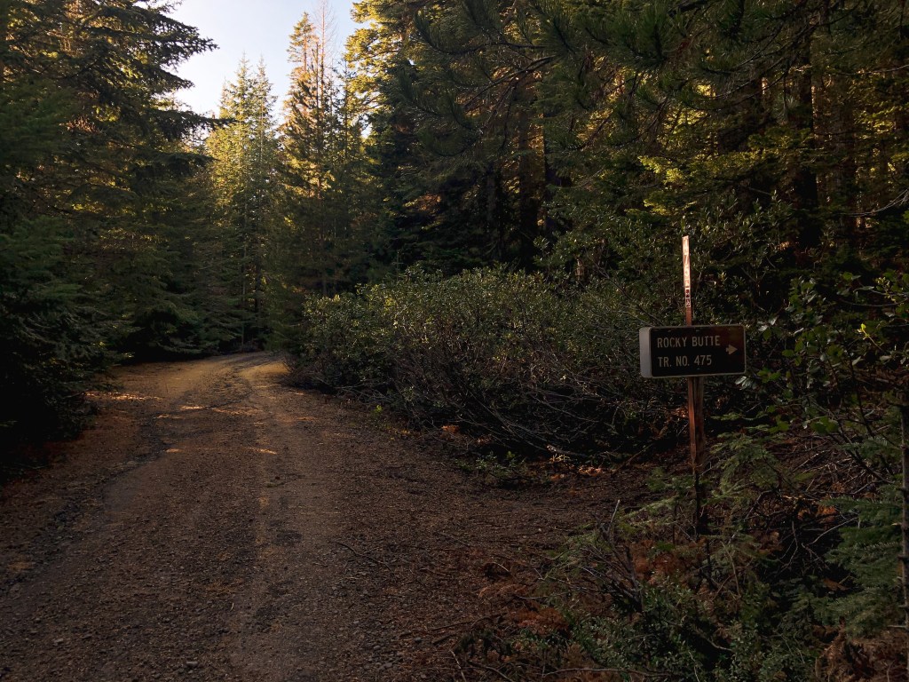
November 6th, 2021 – We attempted to visit Meadow Butte on a rainy fall day. Meadow Butte is a crows nest lookout and we figured there wouldn’t be any significant views from the summit. From Trout Lake, we took the right at a Y-intersection onto the Mount Adams Recreation HWY then another right onto Sunnyside Road. If you continue straight on Sunnyside Road it eventually turns into the Trout Lake HWY. The Trout Lake HWY will take you up out of the valley into a more forested area. Once in the forested area you will want to take a left on to S-1400. The wood road sign is small, weathered, and easy to miss. You will stay on S-1400 until you reach a 6-way junction. The roads out here are poorly marked, but you will want to continue straight at this junction onto S-4210. S-4210 isn’t as good of a road and has some road hazards for lower clearance vehicles. We parked in a pull out after an unmarked spur junction. The spur is off to the right and you will want to stay to the left. I think most of the road hazards could be navigated with caution if you have the determination to drive all the way in a low clearance vehicle. We walked up the road another 1/3 of a mile to where it ends. You will pass another unmarked spur on the left but you will want to keep to the right. Once at the end of the road you will need to start walking if you haven’t already. It was elk rifle season when we went so there were already a few trucks parked here. Make sure to wear something bright when hiking during hunting season and always be cautious of where you’re traveling. We wore blaze orange beanies to help us stand out. You will walk on old decommissioned roads all the way to the summit. It is roughly 2.5 to 3 miles from this point to the crows nest. We knew the weather wasn’t going to be good, but we didn’t expect it would be as bad as it was. It started snowing on us with significant wind shortly after we started hiking the decommissioned road. We were following directions and a map from Eric Willhite’s website. You should be able to see the crows nest from your road walk but our visibility was only about 100 yards. The roads out here are not marked either. We first headed up the fourth spur off to the left based on Whillhite’s map but it seemed to head away from the butte, so my partner and I decided to turn around. We then headed up the third spur from the left but as it headed up hill we still couldn’t see any signs of a lookout. We were both cold, frustrated, and tired of being pelted in the face by snow. We disappointedly surrendered to the weather and headed back to the car.

S-1400 sign
Start of S-1400 road
End of S-4210; Park here
Start of the hike
5-way junction; continue straight
Junction with 4th spur; Head left
View up the 4th spur road
1st junction off the spur; head left
View up the left turn
Overgrown junction across the meadow from the approach; Take a hard right between the trees
overgrown junction; head up the road between the trees
This road will take you to the summit

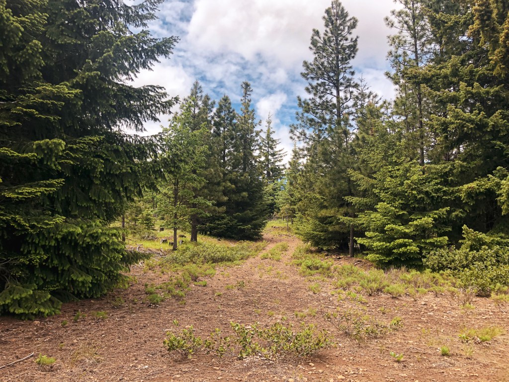
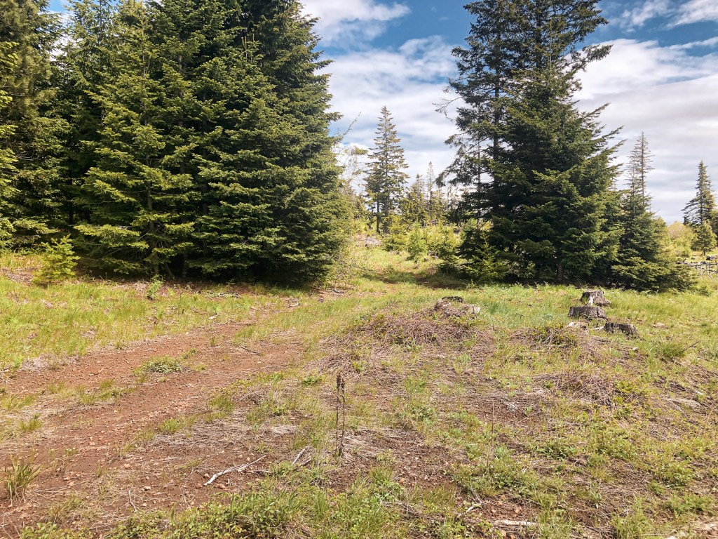
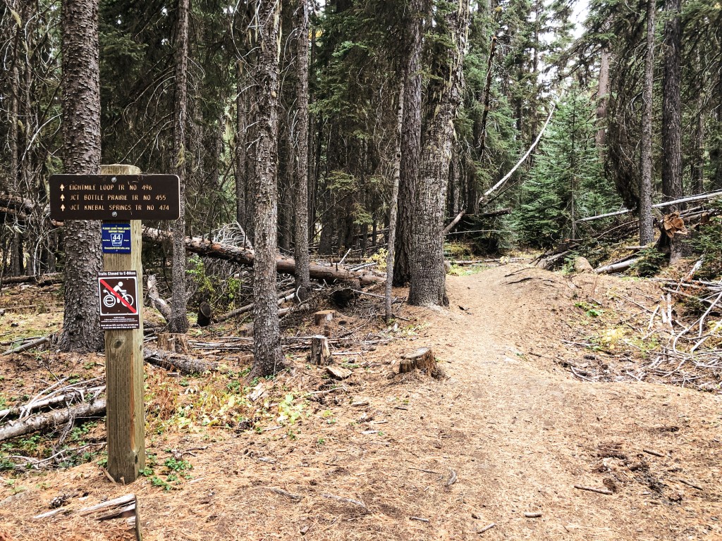
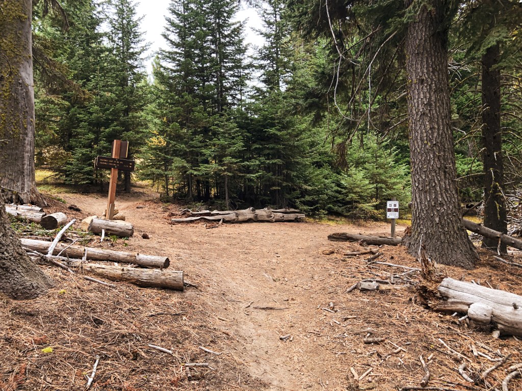
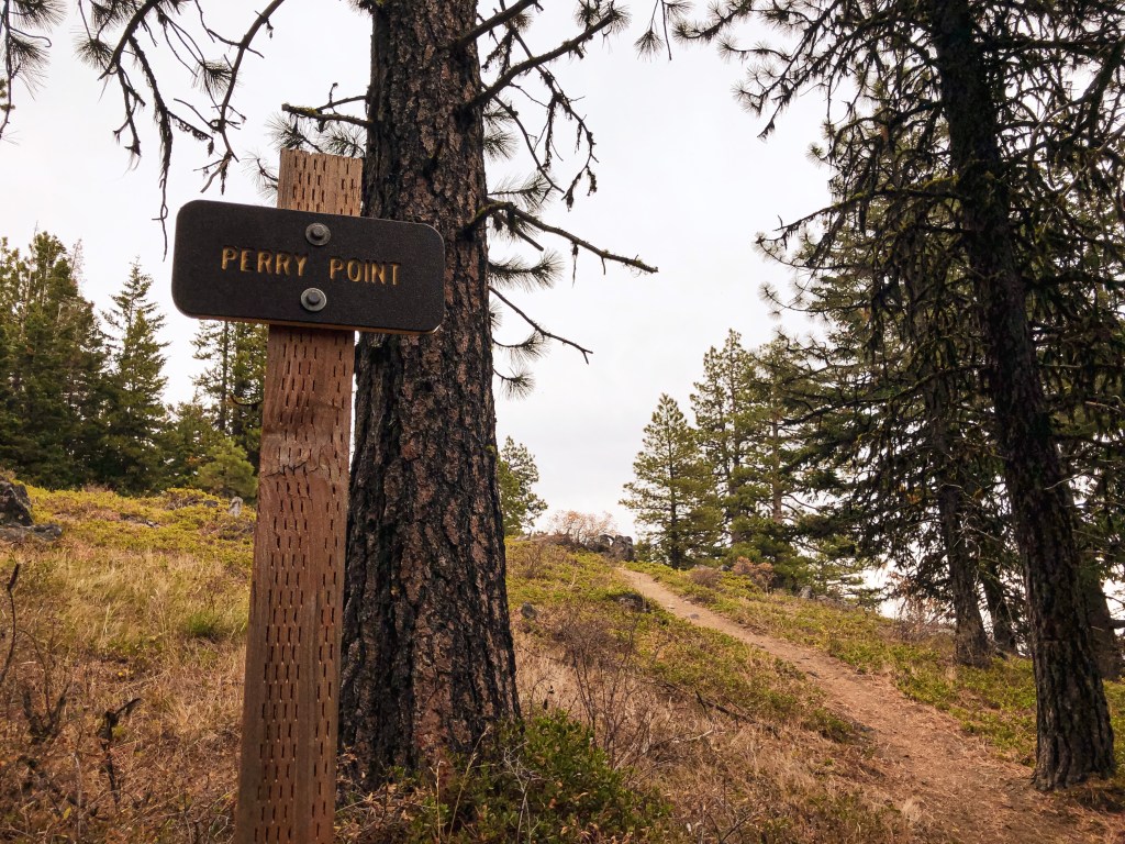
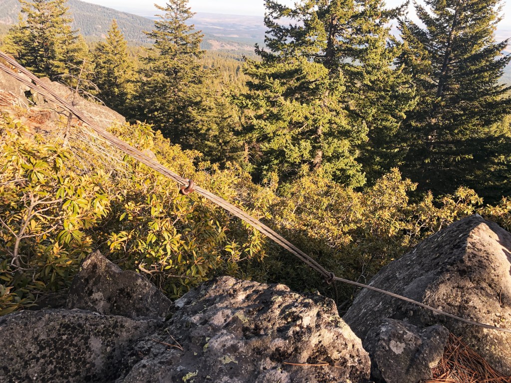
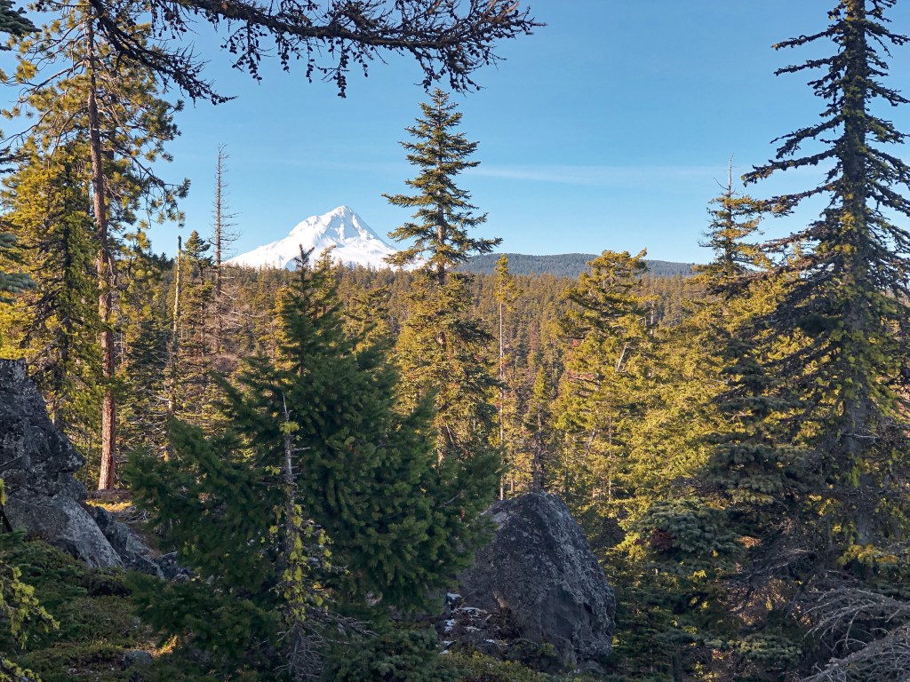
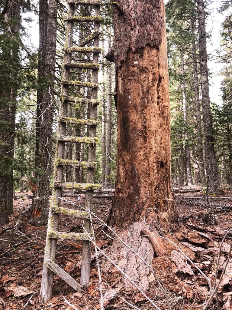
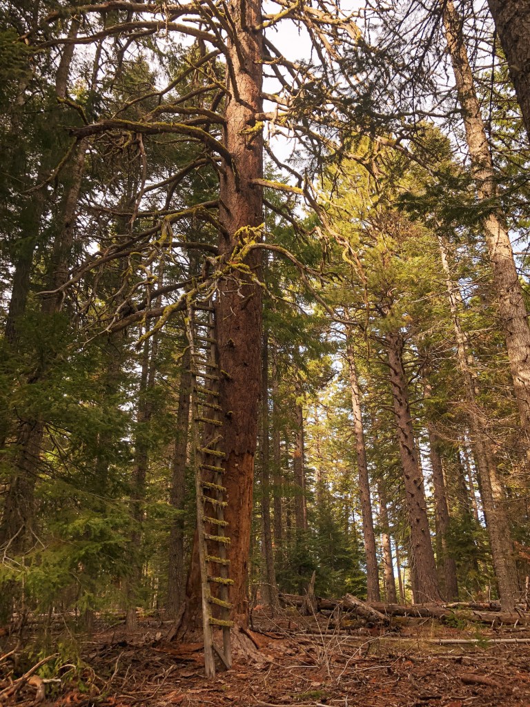
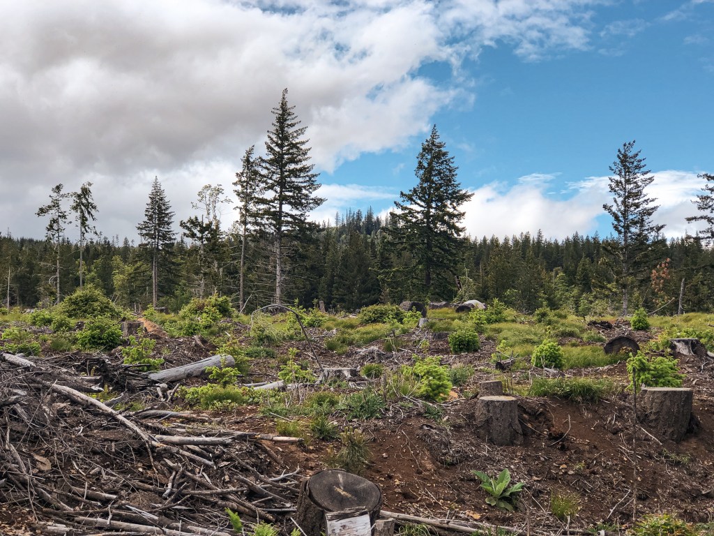
June 11th, 2022 – We parked our car before 11AM in another pull out on the same road and walked up the remainder of the way. Our drive over was wet but the forecast called for a break in weather closer to noon. The sun made an appearance shortly after we parked and decided to stick around this time. I even had to break out my sunscreen. The old road starts out fairly overgrown and opens up into an area that has been logged significantly. Once in the clear cut, we had a direct view of Meadow Butte. This made it much easier to determine where we were headed and if we were on the right roads. You will pass three roads off to the left before you reach the correct road. The first spur off to the left looks like it climbs steeply up to Quigley Butte. The second road is at a major 5-way junction where you will want to continue straight. The third road looks like it might head towards Meadow Butte but is not the route you want. The fourth spur off to the left is the correct road. You will lose sight of the crows nest before reaching this spur. It turns out we initially had the right road during our first attempt, we just didn’t continue far enough up. We were probably less than half of a mile from it. Once on this road you will meet a couple more junctions as you climb towards the summit. The first junction is with an overgrown road off to the right, you will want to stay left. The road to the left heads up the butte and eventually provides a view of the crows nest again. You will be very close from here and have the option to bushwhack to the summit or continue on the road. We decided to continue on the road which will appear to head away from the direction you need to go and drops down into a meadow. The road is faint here but continues across the meadow. At the end of the meadow the road meets a junction which makes a sharp right turn back towards the butte. This road will take you all the way to the summit. Once on the summit, we were surprised to get decent views towards Mount Adams and the Trout Lake valley. I believe on a clearer day you would be able to see most of the high peaks. We enjoyed a late lunch while taking pictures. It’s amazing how much of it is still here after being abandoned for over 60 years. We said our goodbyes to Meadow Butte and celebrated a successful redemption on our way back to the car. Despite some ominous clouds in the distance threatening to come our way, we didn’t get rained on at all during our hike.

History.

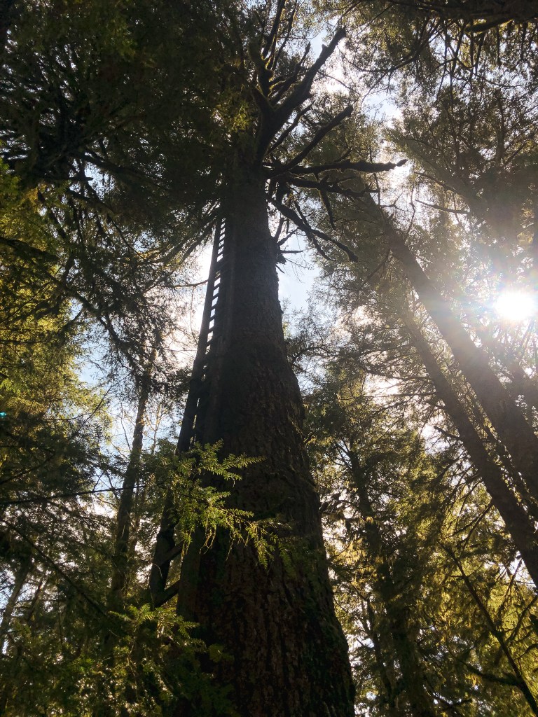
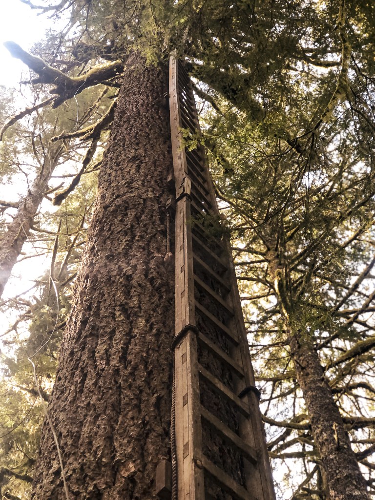
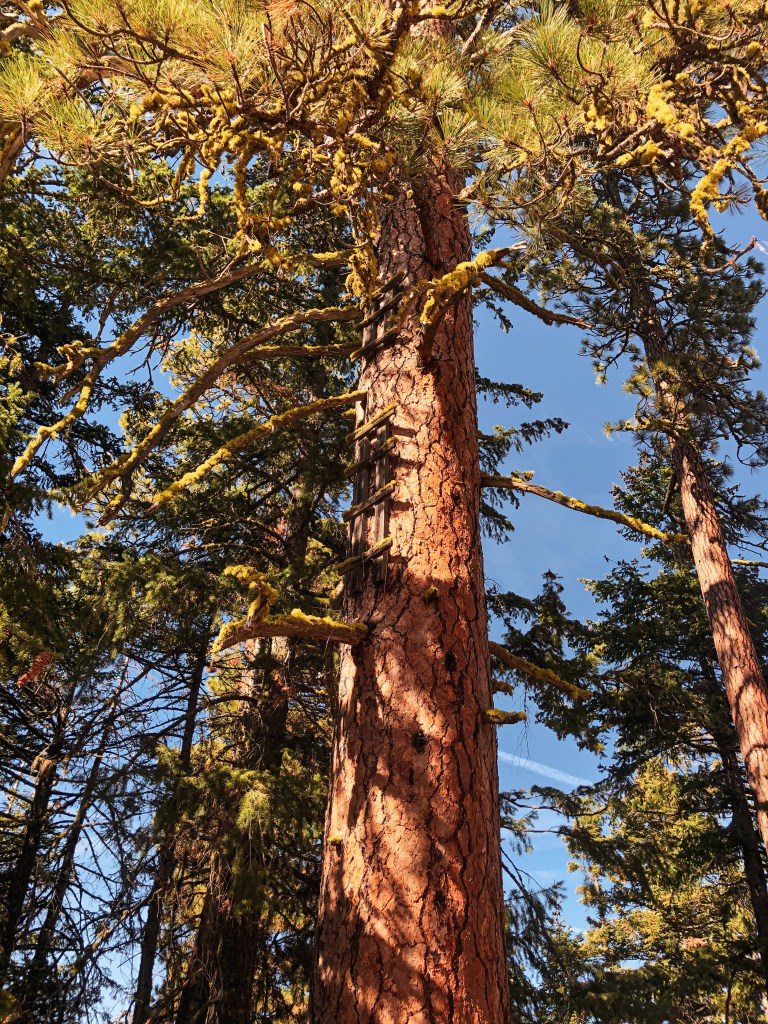
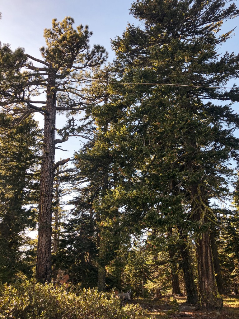
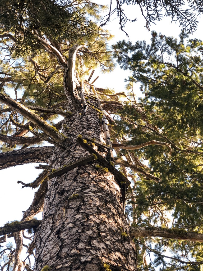
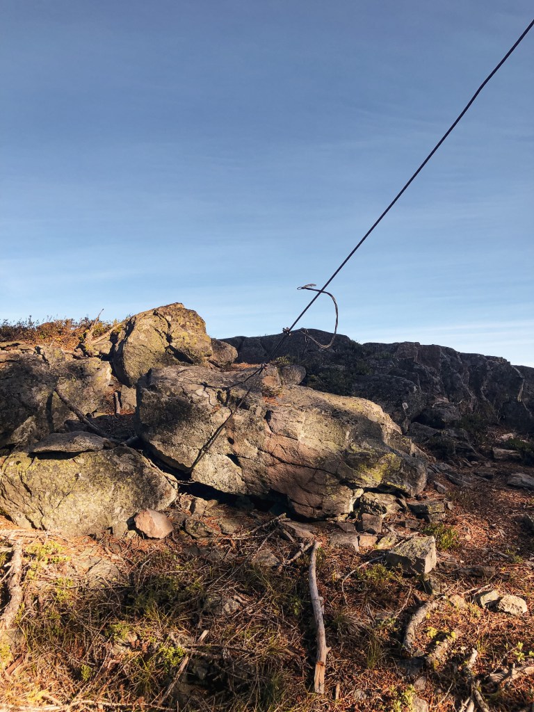
Meadow Butte was established in the early 1940s when an enclosed cab was built atop of a 86′ ponderosa pine tree. It was originally used to oversee railroad logging operations by the J. Neal Lumber Company until the Washington Division of Forestry took ownership in 1944. A cabin was built during this time for the lookout attendants to use as living quarters. It’s presumed they used a tent before this was built. The crows nest was abandoned in 1958 but is still standing strong. The cabin used for the living quarters was moved to the DNR compound in Glenwood and used as a storm shelter. There is also some sort of communication building and rod on the summit that look like a fairly recent addition.

Crow’s Nests of Mt Hood National Forest

Oregon Lookouts

Remnants to the early days of fire detection can still be found in parts of the Mt Hood National Forest. Crow’s nest lookouts are typically a platform that sits on top of a tree with a ladder nailed to the trunk. Before there were lookout towers, fire attendants used to climb the trees to spot fires in the area.

Joe’s Point.

Date visited.

October 16, 2021; October 9, 2022

Elevation.

3,653′

History.

Joe’s point was an open platform built atop a large Ponderosa Pine in the 1930s. There was also a 12×12 cabin built for the lookout in the 1940s. The cabin is no longer on the summit, but you can still see pieces of the old platform and ladder. There’s a nice view of Mt Hood from the rock quarry where you park your car.

Directions.

Take NF-44 to NF-4440 to NF-140. Drive to the end of NF-140 and park your car. NF-140 is a bit bumpy in a passenger vehicle but doable. Once parked you will need to hike the old decommissioned road for about a mile. Follow the blue diamond markers on the trees, but be aware there are other roads in this area marked with blue diamonds that could lead you astray.

Perry Point.

Date visited.

October 17, 2021

Elevation.

4,920′

History.

Perry point was a crow’s nest platform built atop a Douglas Fir in the 1930s and abandoned in the 1940s. It was noted as a potential patrol point for Fivemile Butte L.O. There are only a few boards left on top of the tree and will most likely not be there for much longer. The view from the point is still worth the short hike up.

Directions.

Take NF-44 to NF-120 and park you car at the trailhead for Eightmile Loop Trail #496. From the trailhead it is a little under a mile to Perry Point. You will want to follow the signs for Bottle Prairie Trail #455. The first trail junction is only marked in one direction. You will want to take the trail to the right until you meet the second junction. From the second junction stay left until you see a sign for Perry Point. The trail to the right of the sign will take you directly to the crow’s nest. It is the tree at the very end of a rocky butte and can be hard to spot.

Take the trail to the right
Take the trail to the left
Take the trail to the right of the sign

Rocky Butte.

Date visited.

November 20, 2021

Elevation.

4,796′

History.

Rocky Butte crows nest was built in 1929 atop a 60′ Ponderosa Pine. It has been abandoned for a long time, but remnants of the ladder and guy wires can still be found on the summit. You can also find a USDA Forest Service Benchmark on the summit dated back to 1924. This is my favorite of the crow’s nests we’ve been able to locate. The views from the summit are worth the short climb up alone.

Directions.

From Tygh Valley take Wamic-Market Road through Wamic. This road eventually turns into NF-48. Turn right onto NF-4810 towards Camp Cody. Stay on NF-4810 until you reach a four way junction with NF-4811 and NF-4813. Turn right onto NF-4811 and then left on to NF-4812 shortly after. Continue on this road until you reach the trailhead sign. The road washes out about a 1/2 mile from the trailhead but a higher clearance vehicle will have no issues. There is limited pull out room for parking. It’s only a short 1/2 mile hike up the trail once you find the trailhead.

Bus Point.

Date visited.

November 21, 2021

Elevation.

3,333′

History.

Bus point was built as a crow’s nest in 1933 but has since been abandoned. It sat atop a 95′ Ponderosa Pine and was accessed via a 32′ ladder. The ladder leaned against the tree and was wired in place. From the ladder, the lookout attendant then had to navigate the branches to reach the top. The ladder and tree were still standing when we visited but the tree is no longer living and there are visible signs of rot. I would recommend seeing this one sooner than later.

Directions.

Same directions as Rocky Butte but instead of turning right on to NF-4811 at the four way junction, you will turn left. You will take NF-4811 until you reach an un-signed three way junction. NF-4811 in this directions has some large potholes but I was able to maneuver them with caution in my Civic. You will pass NF-4814 on the right and paved NF-4820 on the left before reaching the major junction where you will park. It’s good to have a detailed map of this area since there are a lot of skid roads you will pass as well and no definitive marker for this one. From the junction you will cross country hike off the road to the right following a game path. My tracker said we only went 0.16 miles before reaching the tree. We were able to find it right away with no issues.

Parking at Junction

Where the game trail starts

Eightmile Point.

Date visited.

October 8, 2022

Elevation.

5,280′

History.

There isn’t much history on this crow’s nest. It was built in the 1930’s atop a Fir and I presume abandoned in the 1940s with the rest of them. Unfortunately, this one is no longer standing and we were only able to find remnants of it. It was hard to pin point which tree was the previous lookout tree on the ground. But, we found the general area with some remaining wire, boards, an insulator, and the help of some other lookout enthusiasts that were also trying to find it that day.

Directions.

Head into the Mt. Hood NF from Dufur taking a right on Dufur Valley Road that eventually turns into NF-44 once you reach the forest. Turn left on NF-4420 until you reach a junction with a major gravel road leading right. From here, if you continue straight it turns into NF-2730. But, you will want to stay on NF-4420 and turn right onto the gravel. You will stay on this road until you reach the trailhead for Fifteenmile Trail #456 off to the left (parking on the right). It’s an obvious trail just past the junction with spur road NF-160. Park your car and walk the remaining distance up the trail to reach Eightmile Point. It is less than a half of a mile up the trail. The trail connects to other roads and can be reached from other directions, but we found this to be the most direct.