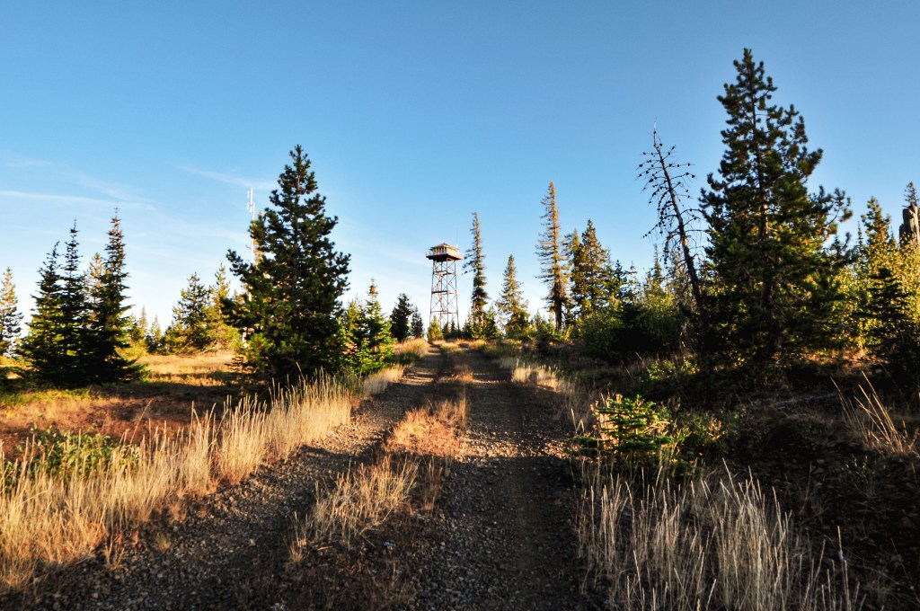
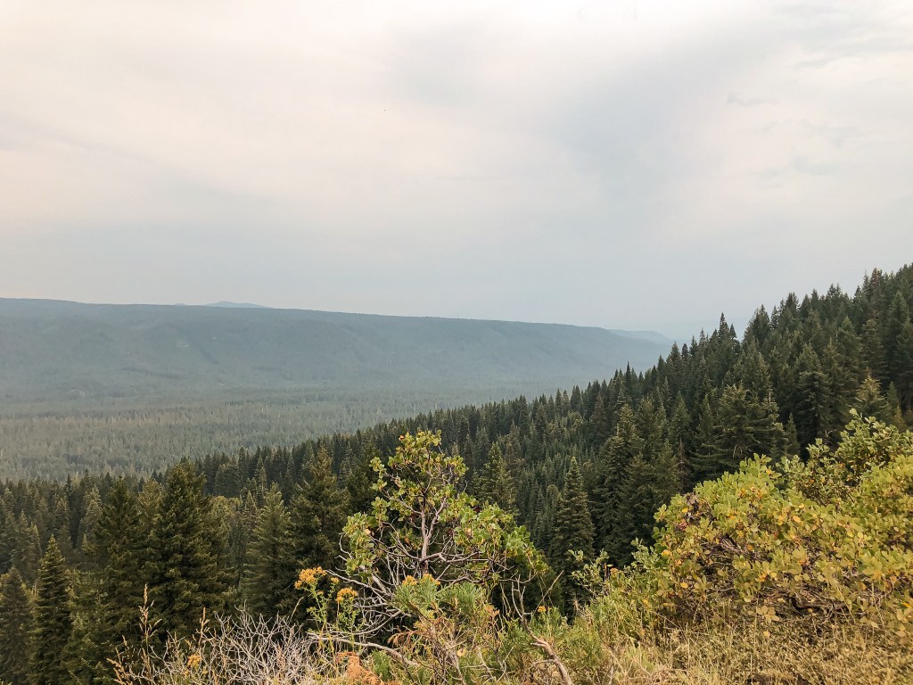
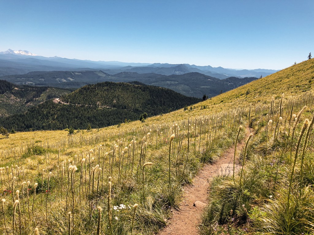
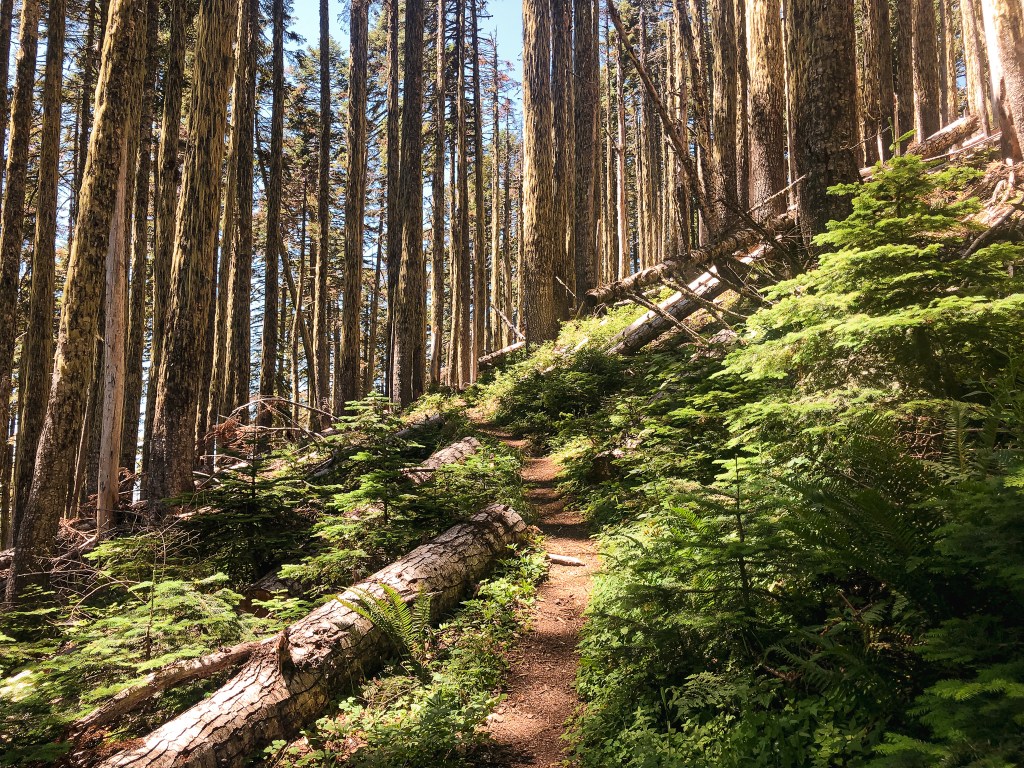
We headed back out to HWY-3 from Courtney Butte once we were free from the confines of the caravan. We headed south towards Enterprise for another 20 miles until we reached the turn for NF-46 off to the left. According to the map, Red Hill would be situated just off of NF-46 and should be obvious. Though we knew this wasn’t always the case, an immediate example being our visit to Lookout Mountain the previous evening. As we headed up NF-46, I was less confident that we’d have enough time to get there and back before dinner. I wasn’t going to miss out on that this time! I gave us a cut off time of 5:30PM. If we hadn’t made it there by then we would ultimately turn around and plan to visit on Sunday instead. The first portion of NF-46 is paved and wide enough for two large vehicles to pass each other, it looked like relatively fresh pavement too. Once it turned to gravel there were some pot holes from wet condition drivers in certain areas. It was a mostly decent road and you would be able to drive it in a passenger vehicle with some caution.
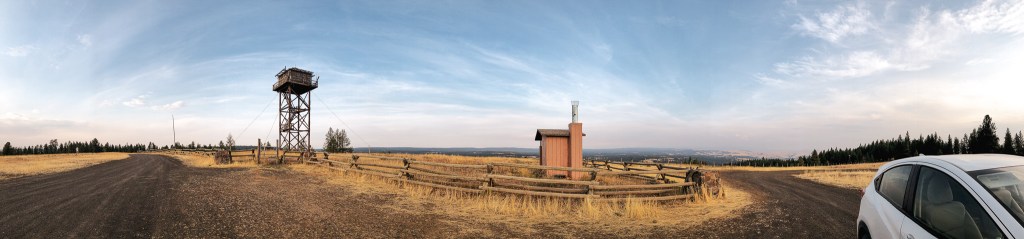
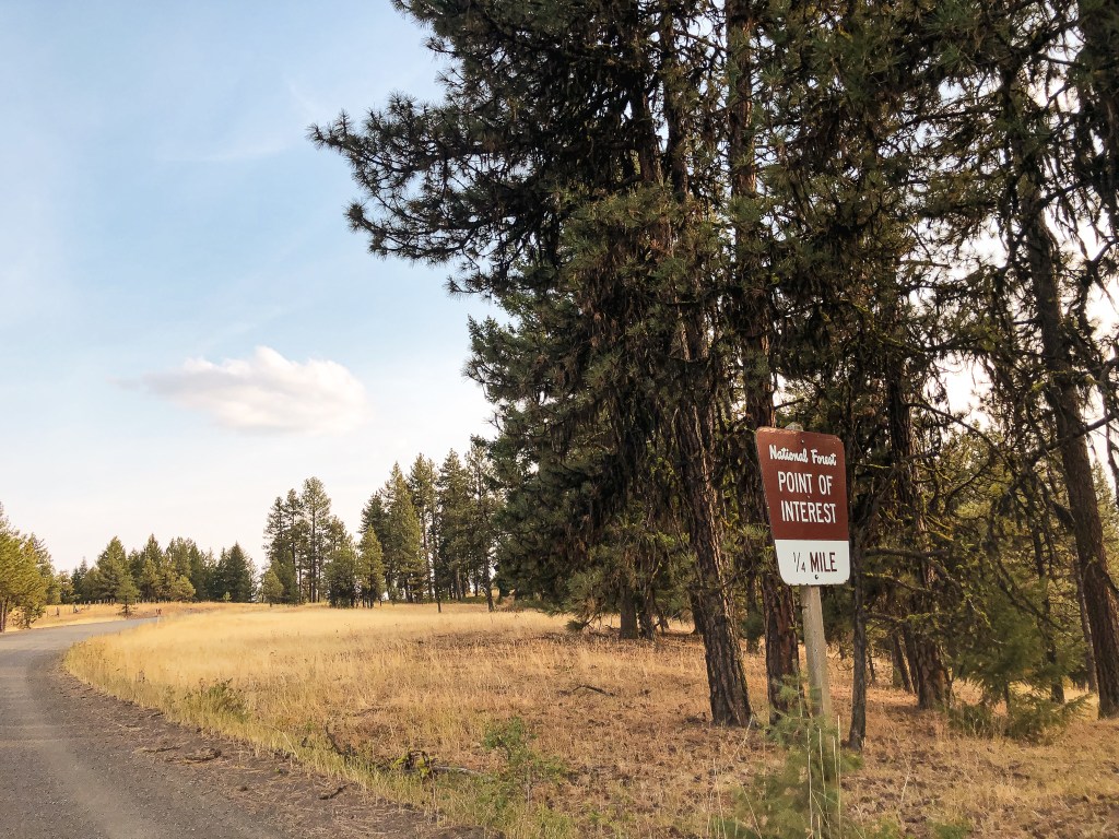
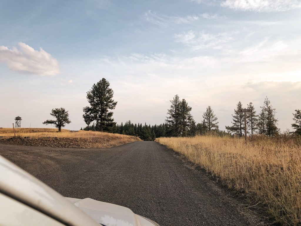
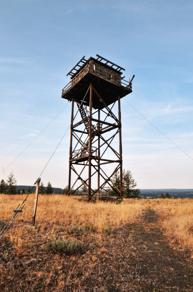
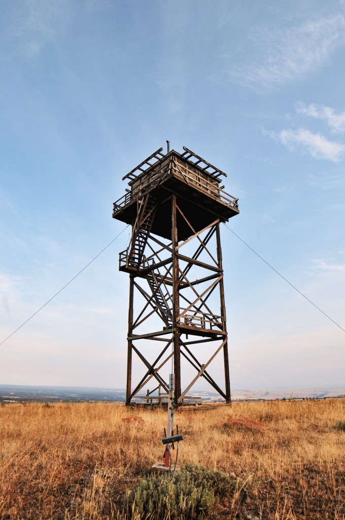
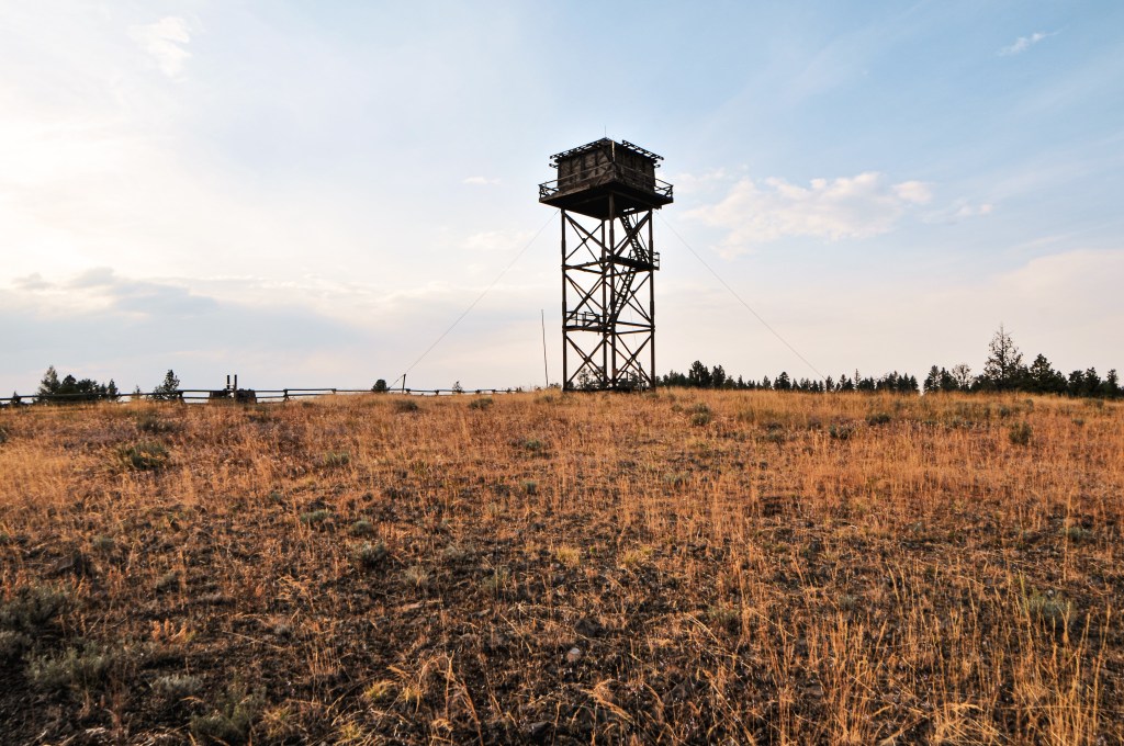
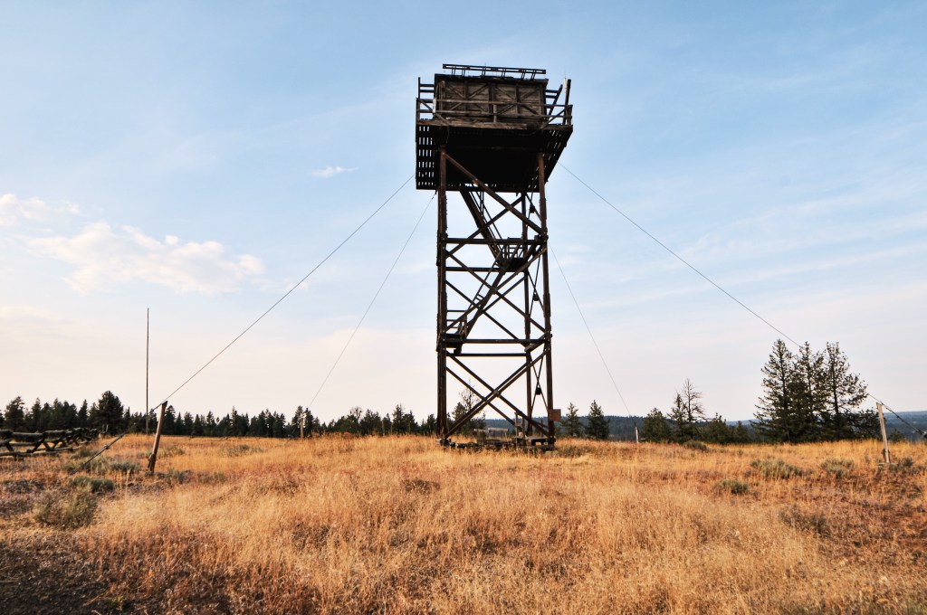
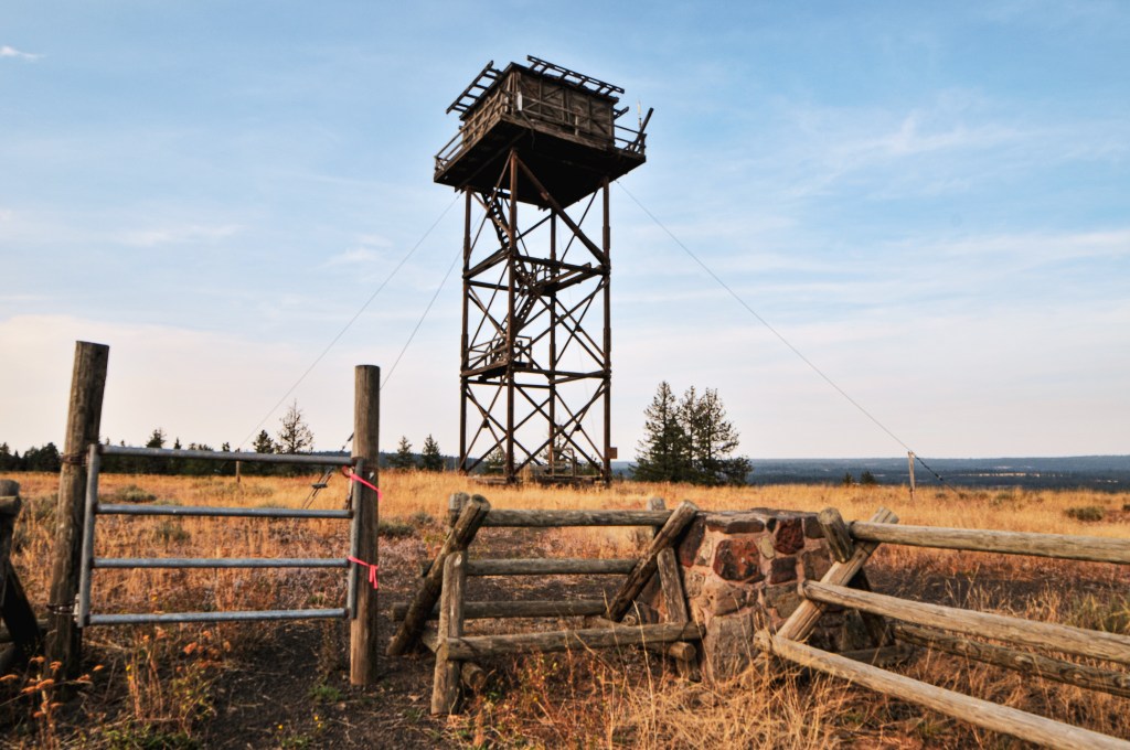
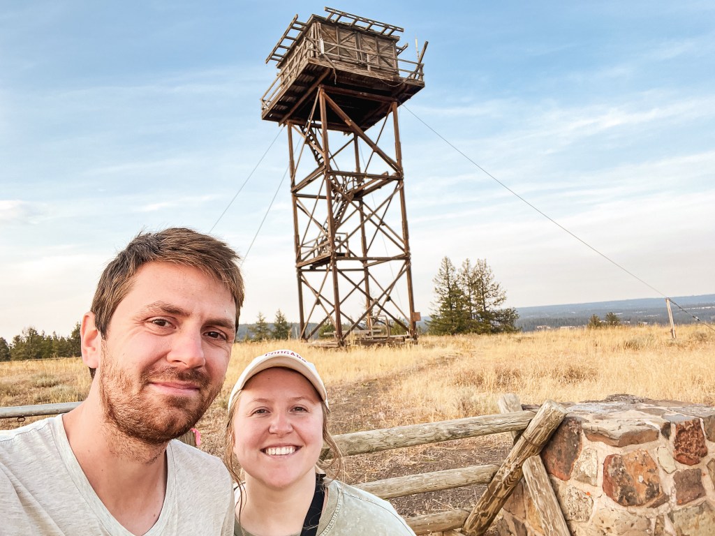
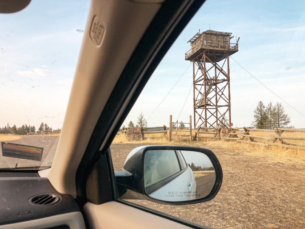
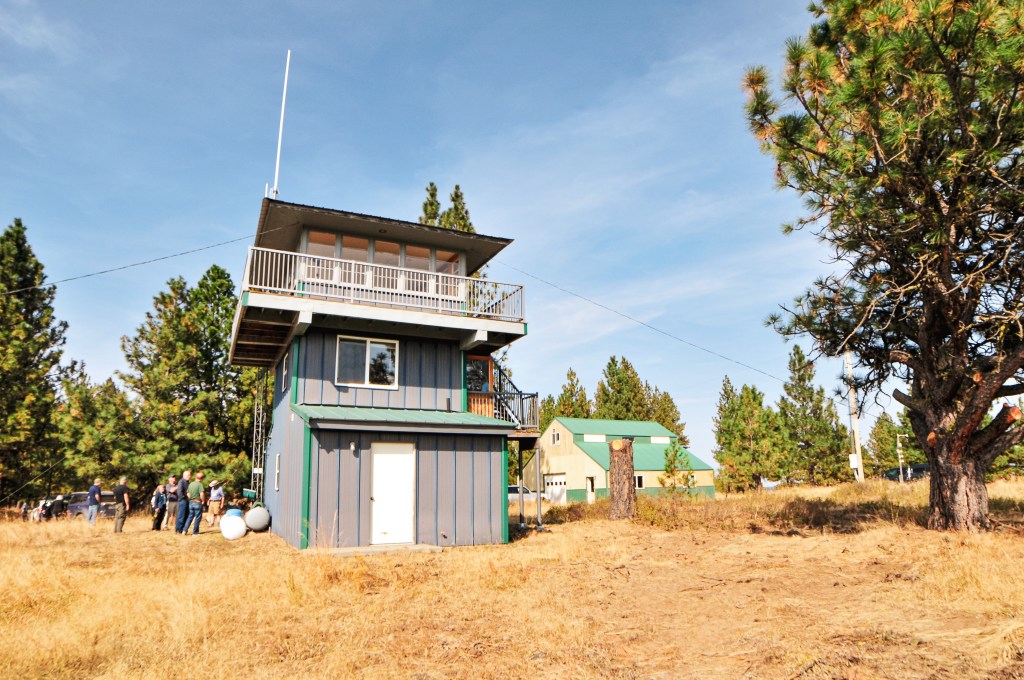
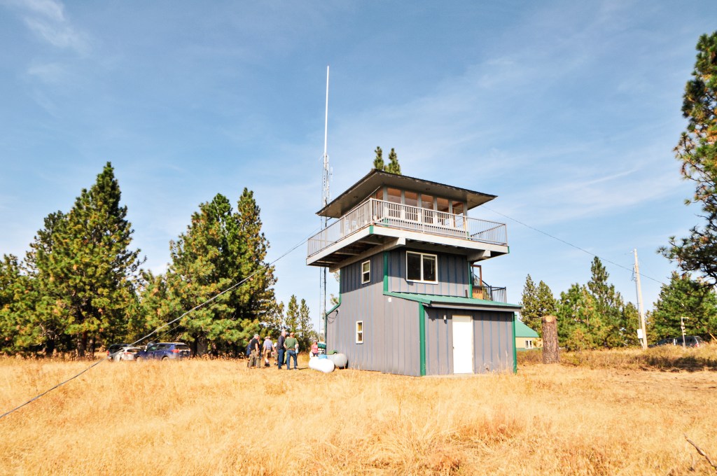
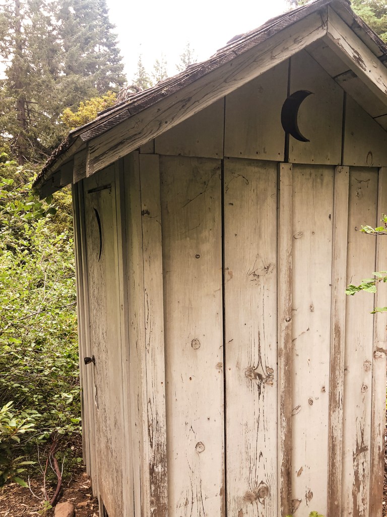
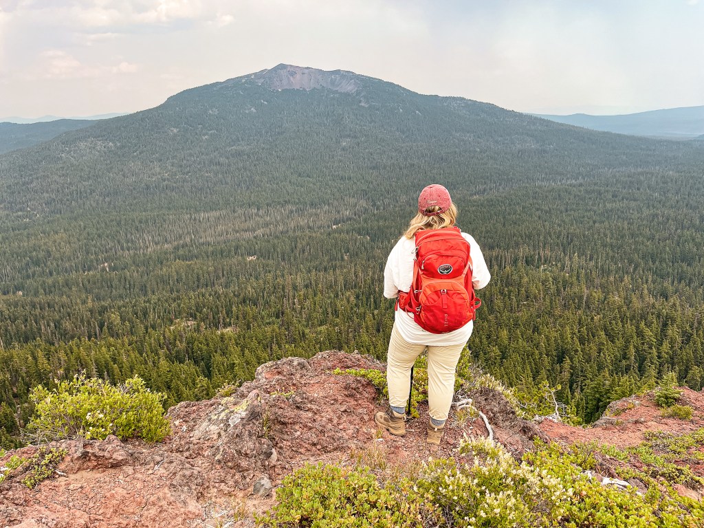
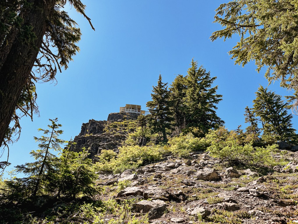
We reached Red Hill almost exactly at 5:30PM. It was about 22-1/2 miles from HWY-3 to the lookout. There was a sign 1/4 of a mile from the turn off to Red Hill that just said “point of interest”. We thought that was interesting, but knew it was referring to the fire lookout. There was also a small sign for Red Hill L.O. at the turn. The lookout is located in a open field and would be hard to miss even without all the signage. We had planned to head to Kirkland Butte as well since it was so close, but there just wasn’t enough time to do it all. We would be back in the area sometime to get the ones we missed.
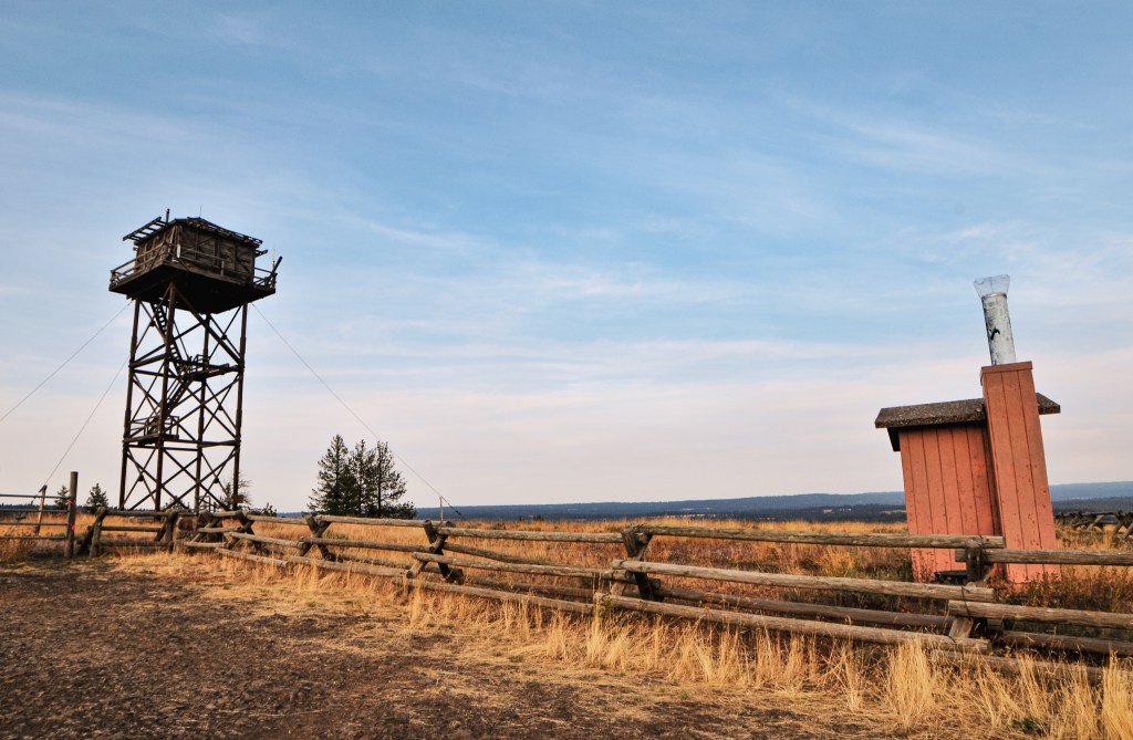
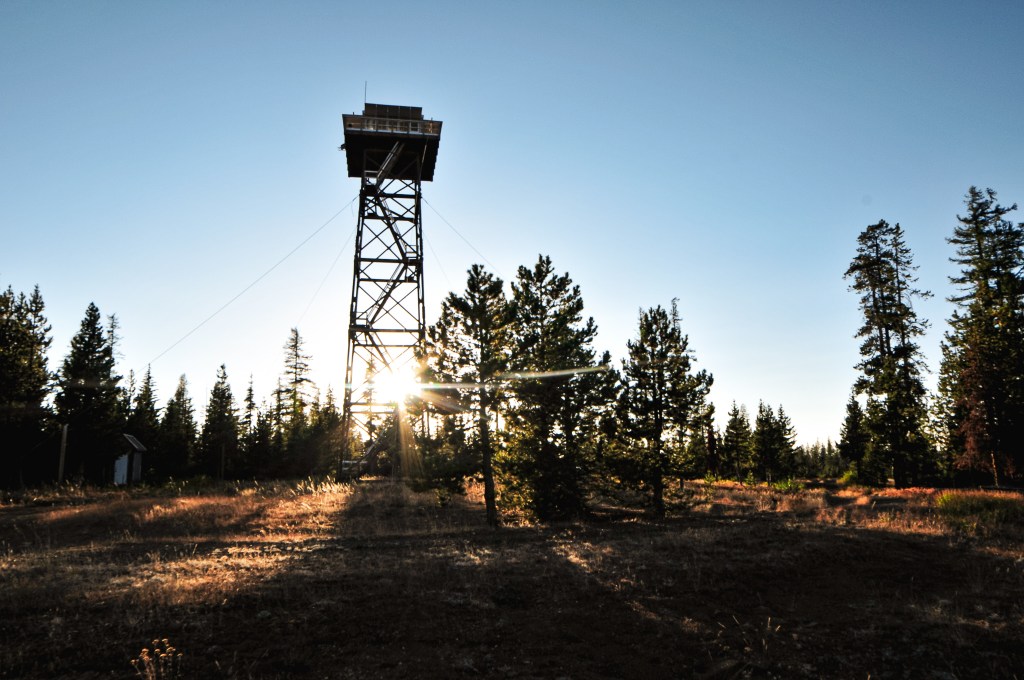
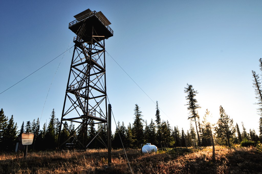
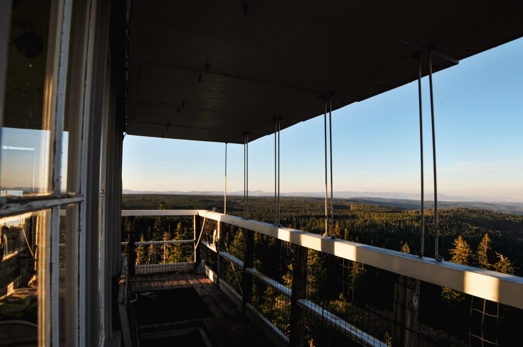
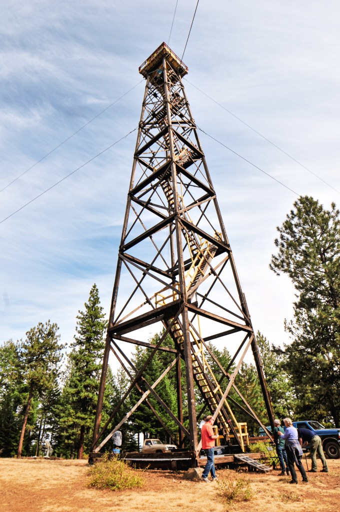
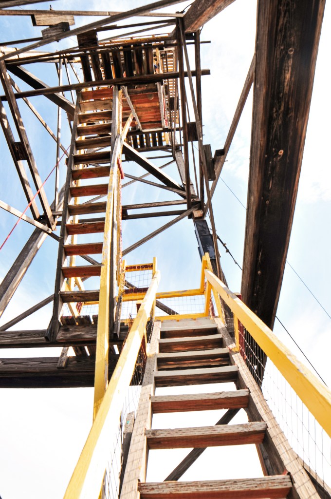
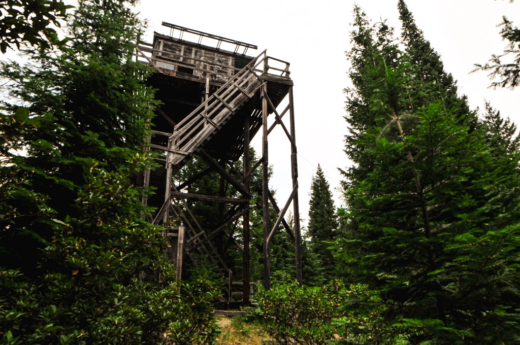
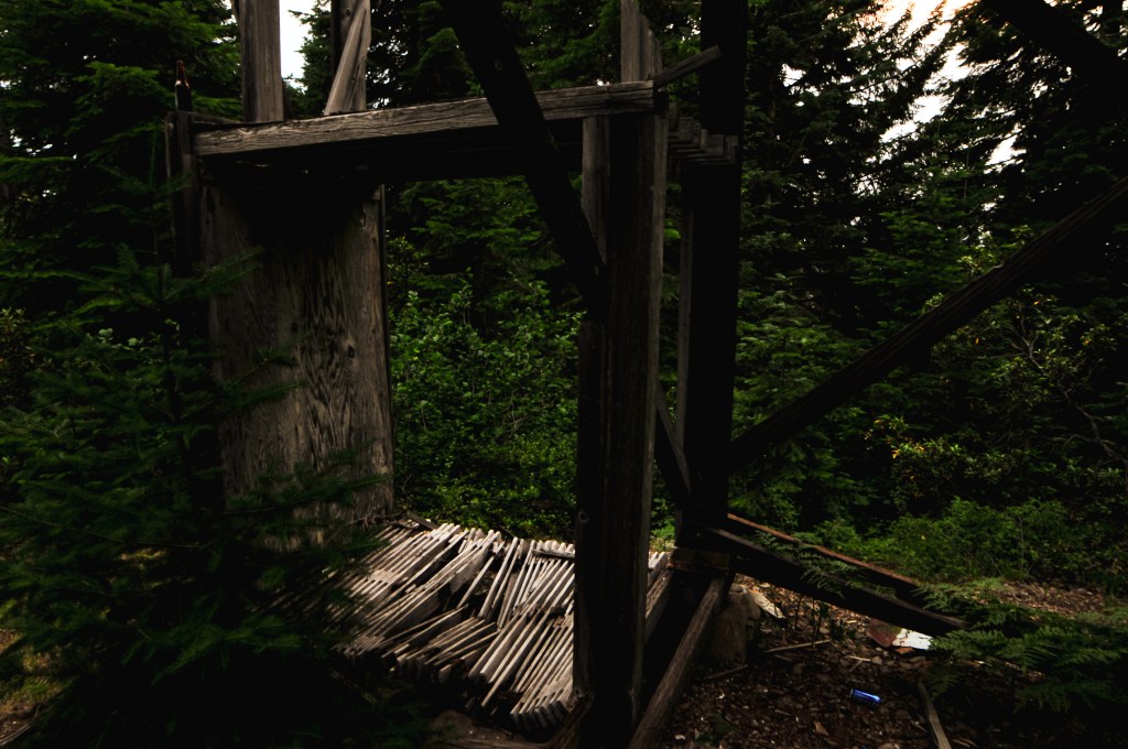
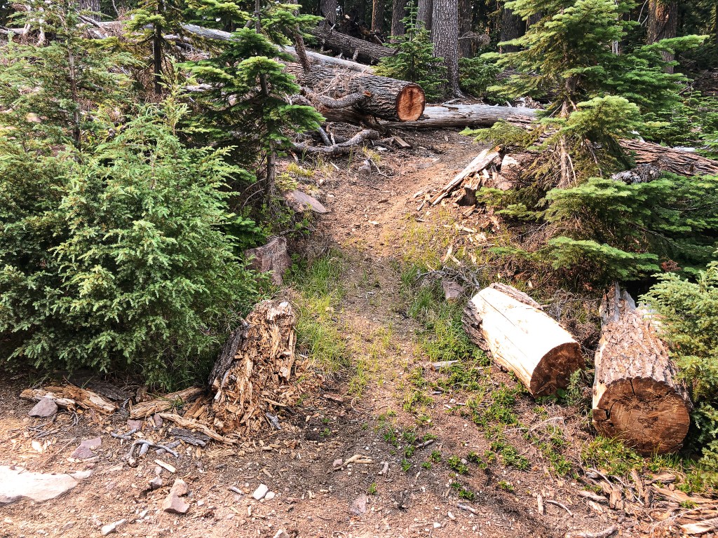
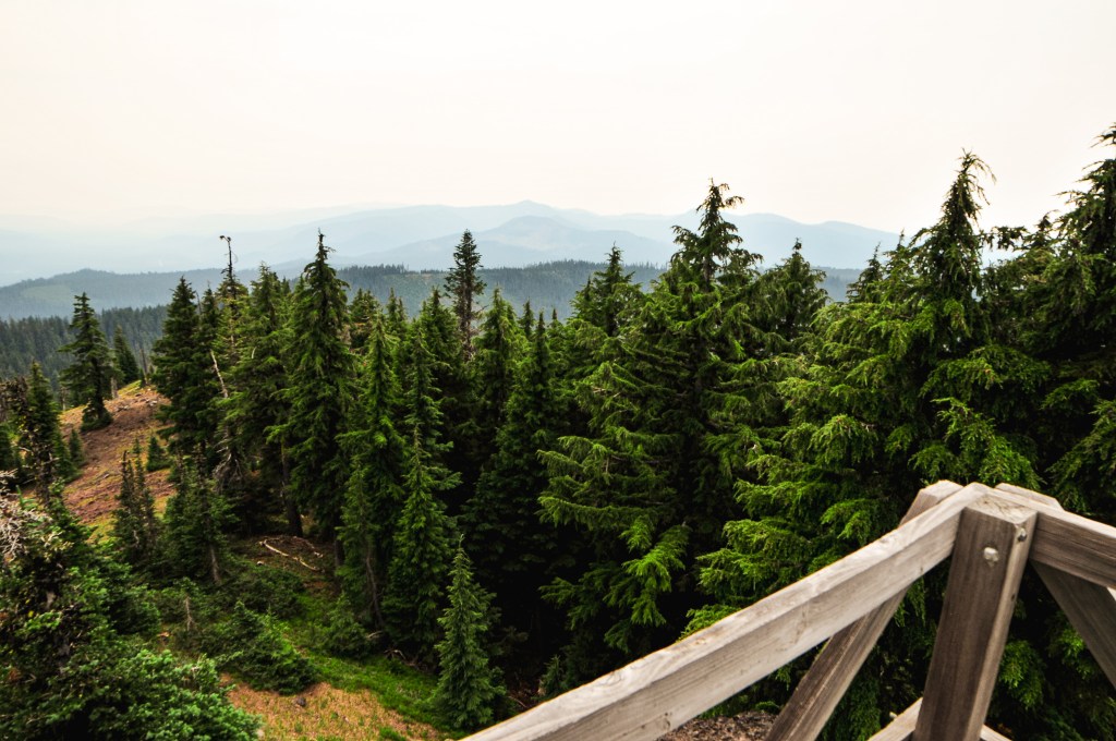
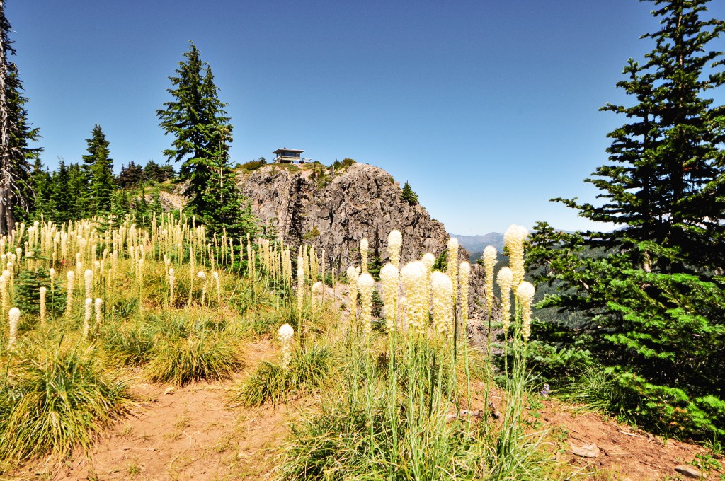
We parked and walked around the base of the lookout while taking pictures. We knew we couldn’t spend too much time here and gave ourselves 10 to 15 minutes to explore around. The first flight of stairs is completely removed to keep people from climbing the tower. I’m sure it helps to deter vandalism as well. The cab wasn’t in the best of shape, but the super structure looked fairly sturdy. This would make a good project for the FFLA. We left around 5:45PM and it took us almost an hour exactly to get back to the VFW post. I would’ve liked to spend more time on Red Hill, but I also really wanted the Pizza dinner they were offering.
History.
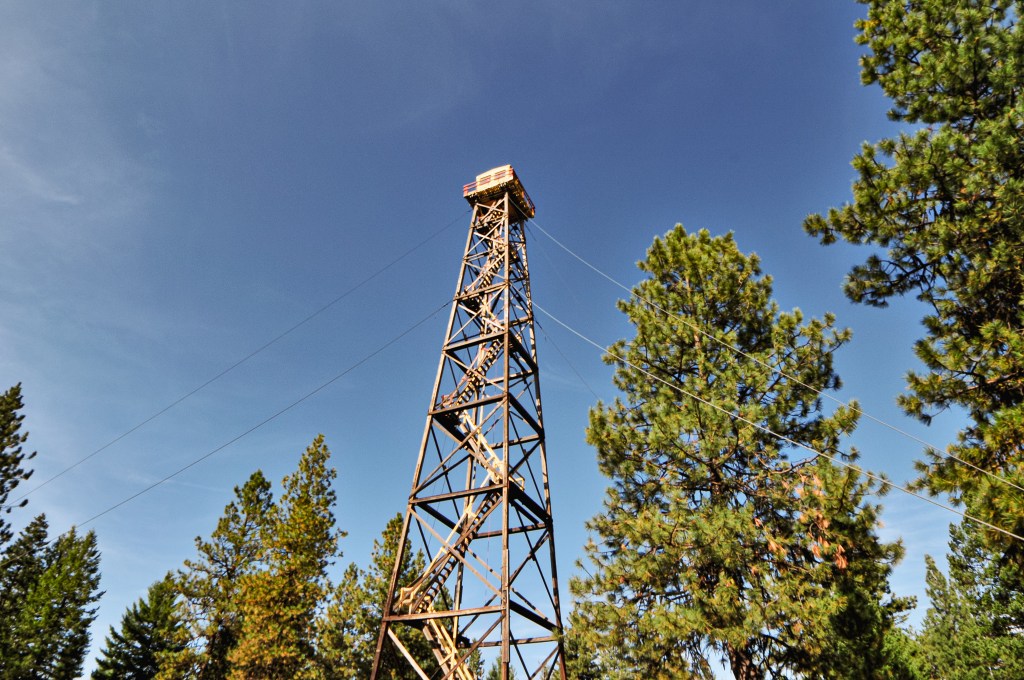
The site on Red Hill has been used for fire detection since 1922, possibly even as early as 1917. The first tower was a tree with added spikes to aid in climbing. This tree was over 115′ and the lookout attendant would climb to where the tree forked a few feet from the top. It even had its own 25′ flag pole attached to the top. In 1924, a pole tower with 10’x10′ cab was built to replace the tree. The current lookout was completed in 1949 as a 40′ treated timber tower with L-4 cab. It has since been abandoned and is in bad enough shape that they removed the first flight of stairs to prevent people from climbing the tower.
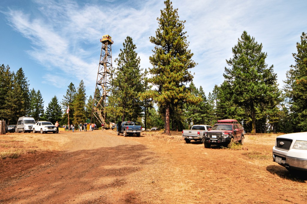
The Saturday lookout tour hosted by the FFLA Western Conference was to Courtney Butte. This is another fire lookout located on private property and requires prior permission by the land owner to visit. Similar to the day before, we were expected to meet back at the VFW post after our lunch break around 1:30PM. Garnet and I made a point not to be late this time. We drove the HR-V this morning and only left the post to make a quick trip out to refuel. Otherwise, we brought and ate our lunch there. We were ready this time when the caravan rolled out almost exactly at 1:30PM. From the post, we all took a right to head out of Enterprise on HWY-3 towards Flora Junction. We stayed on this highway for over 30 miles through alternating sections of National Forest and private land. At one point we passed a junction that pointed left towards the community of Flora. My partner pointed this out and questioned whether that was our turn. The caravan had continued straight though, so we followed them instead. I nit picked at the written directions they had given us. I rationalized that it didn’t specifically say “turn at Flora Junction”, just that we needed to head towards it. I figured since we passed it we were looking for the turn to Courtney Butte Lane now. Eventually, the highway started to head steeply down the canyon towards the Grande Ronde River. It didn’t feel like we should be going this far, or down for that matter, but we continued to blindly follow the caravan. As we were half way down the grade, the head of the caravan pulled over to turn around. Oops! They did in fact miss the turn back at Flora Junction. We all quickly fixed our mistake and turned around to head towards Flora once again.
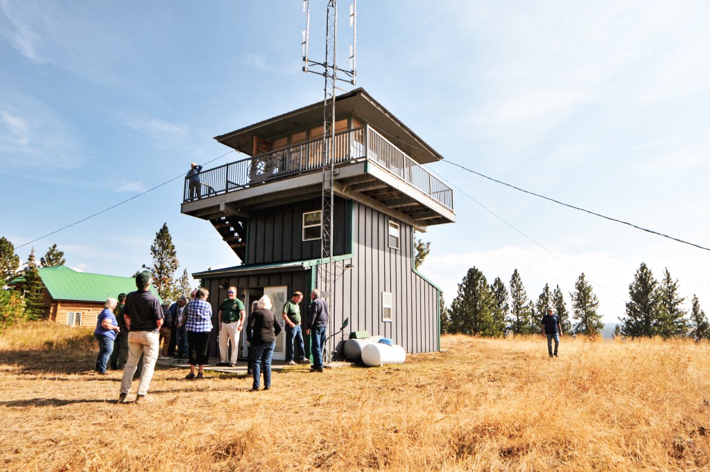
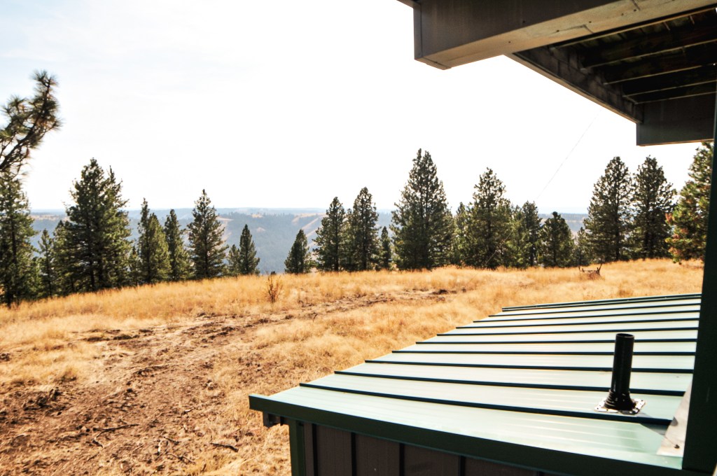
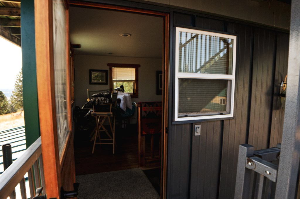
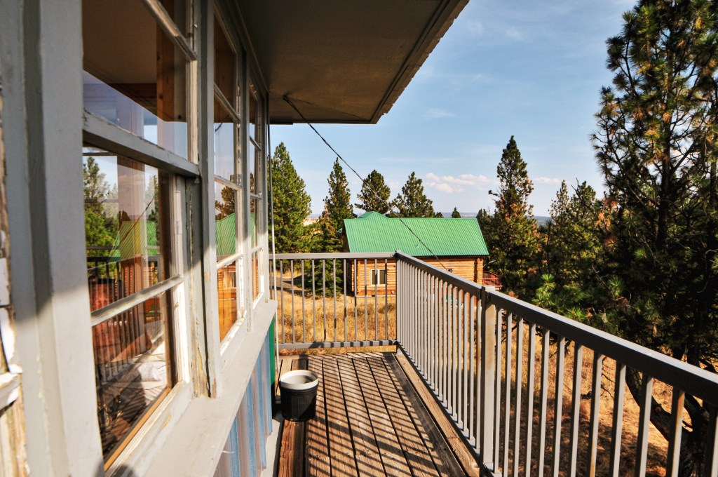
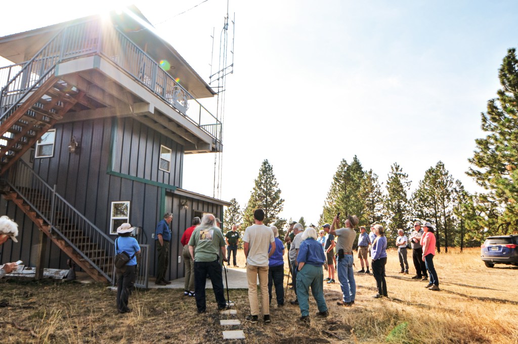
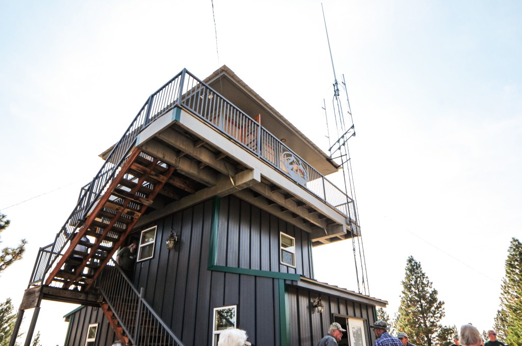
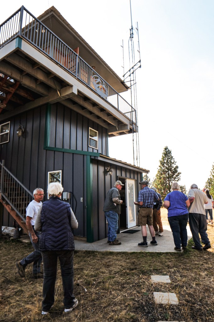
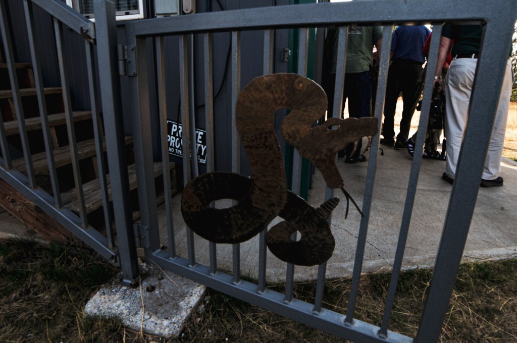
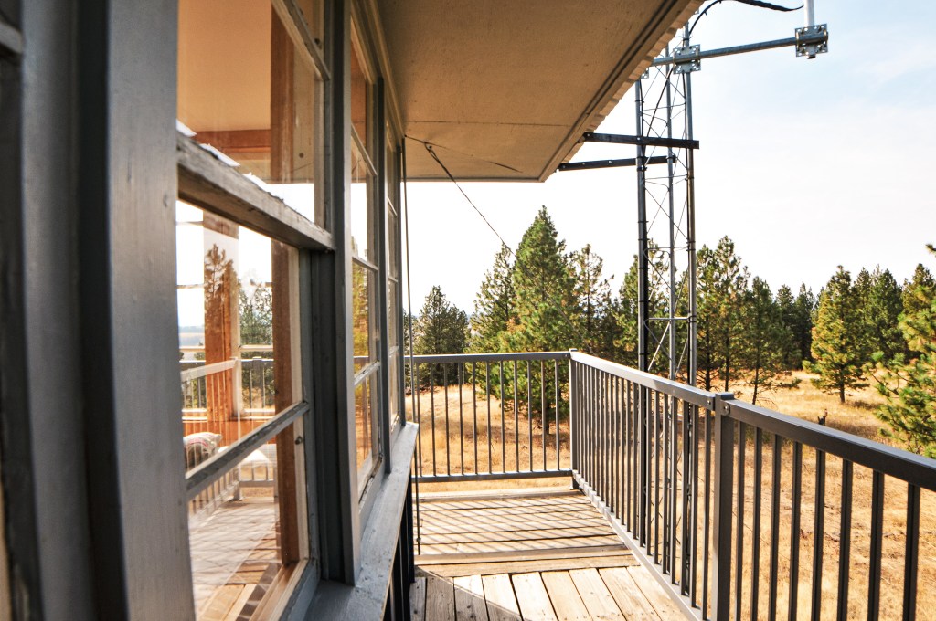
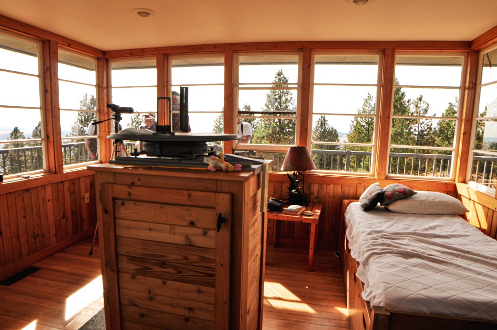
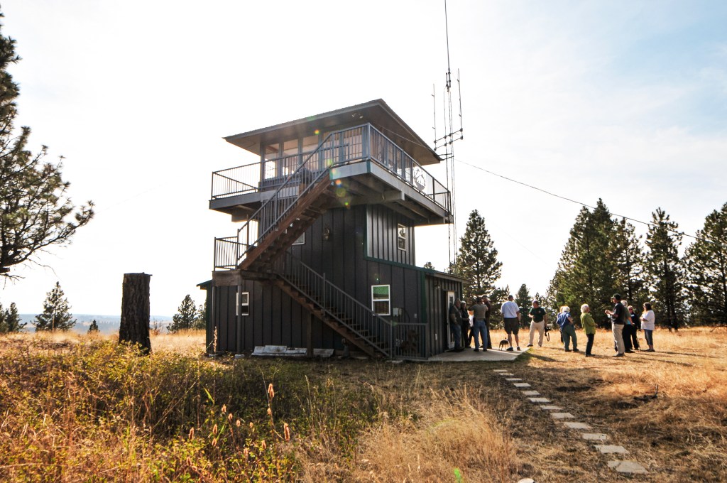
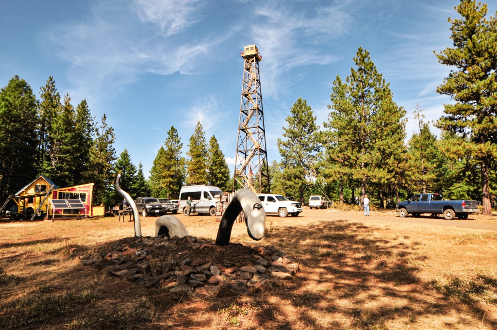
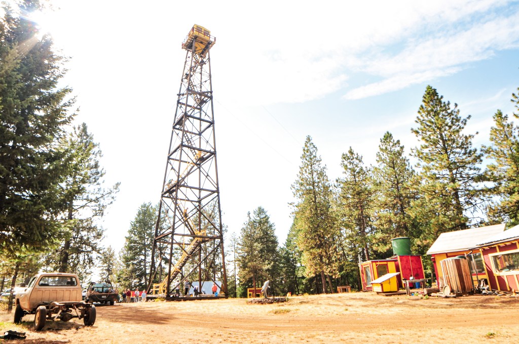
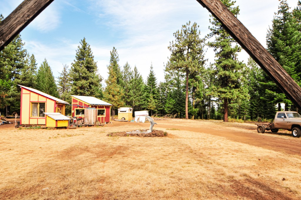
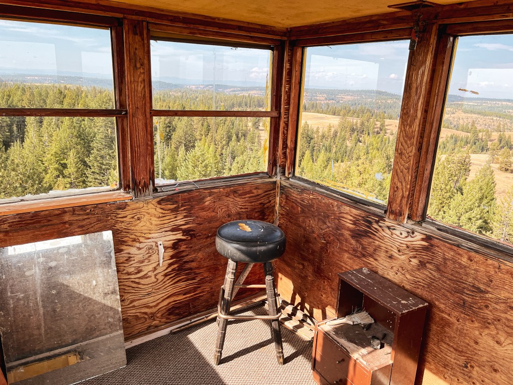
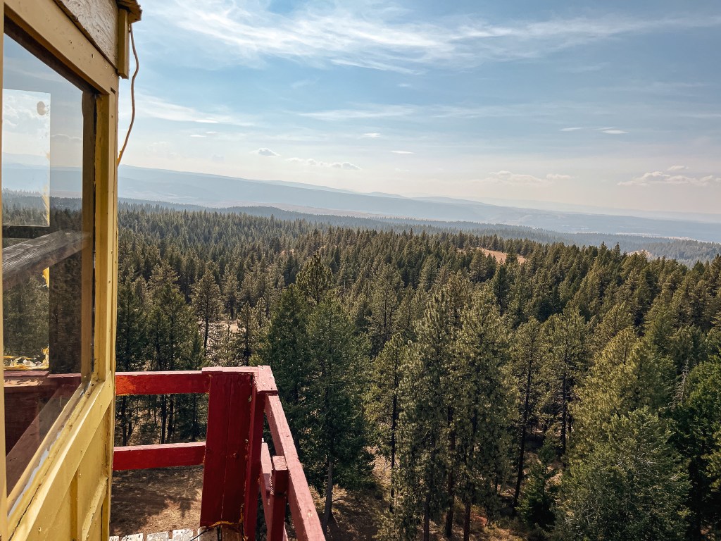
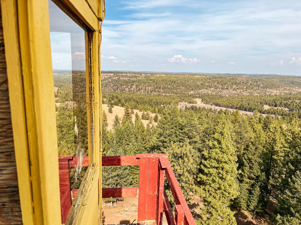
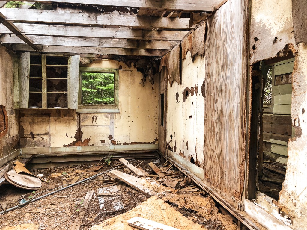
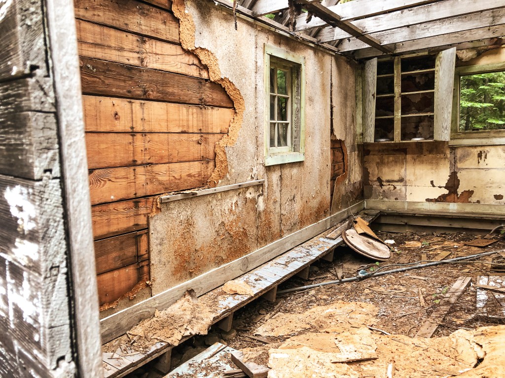
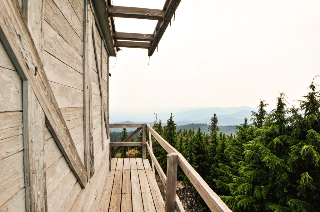
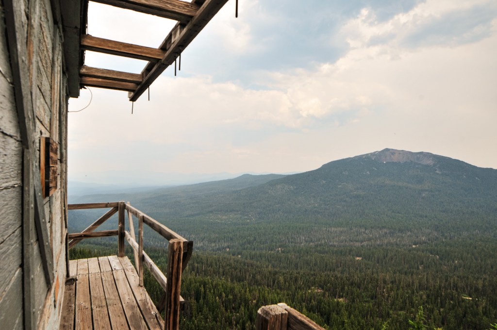
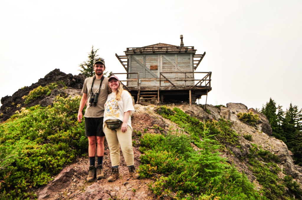
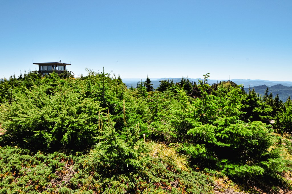
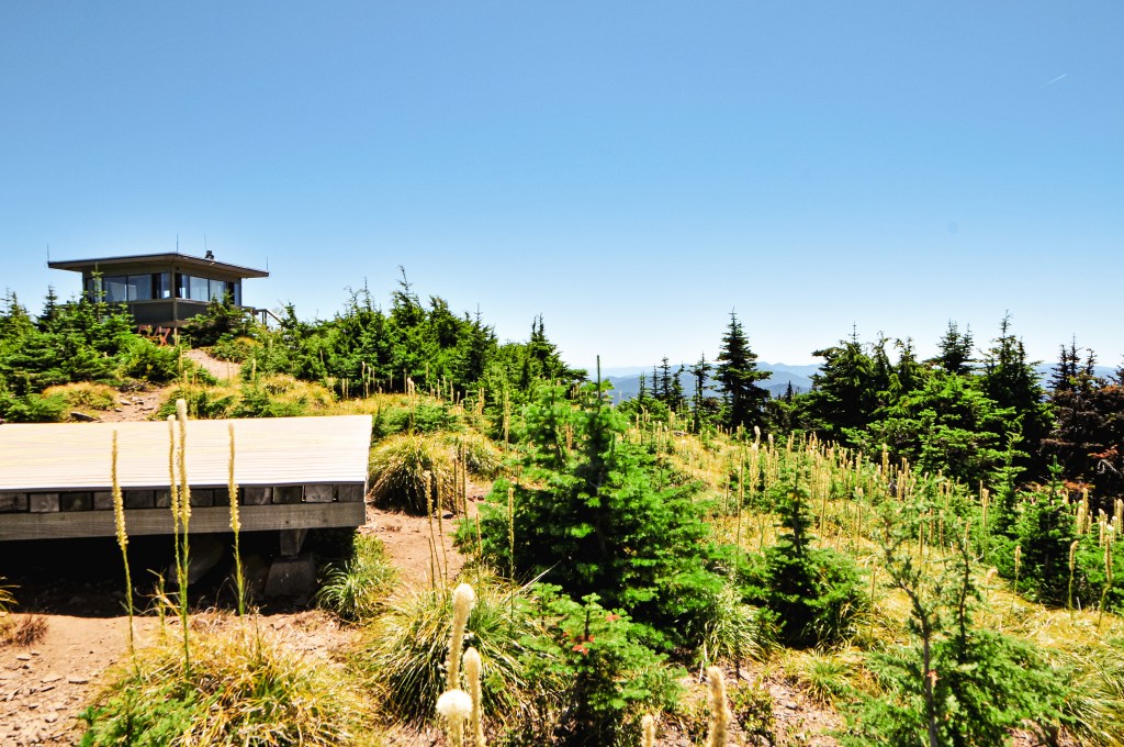
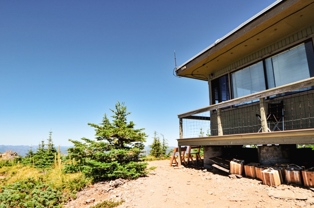
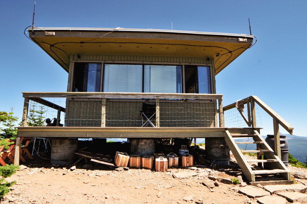
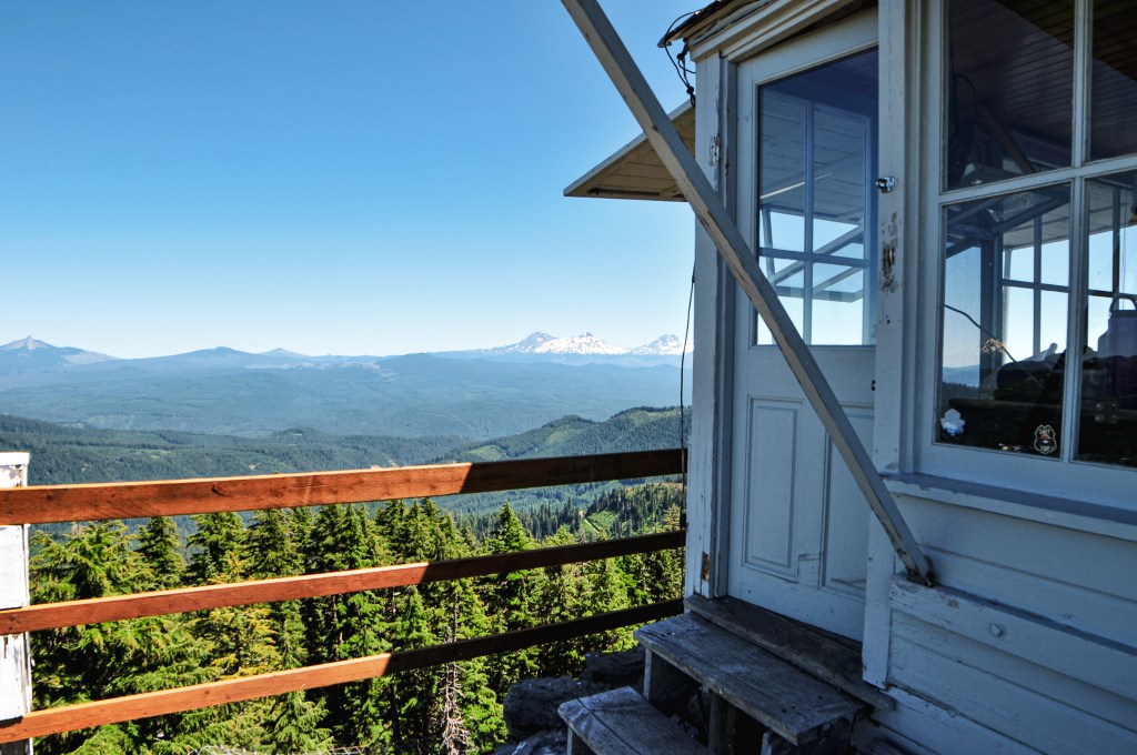
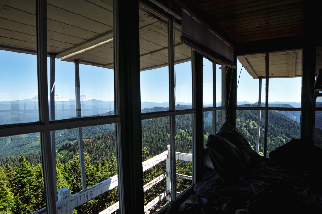
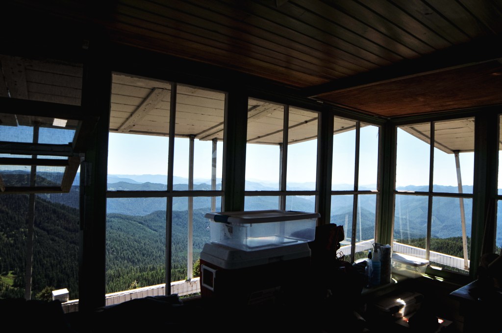
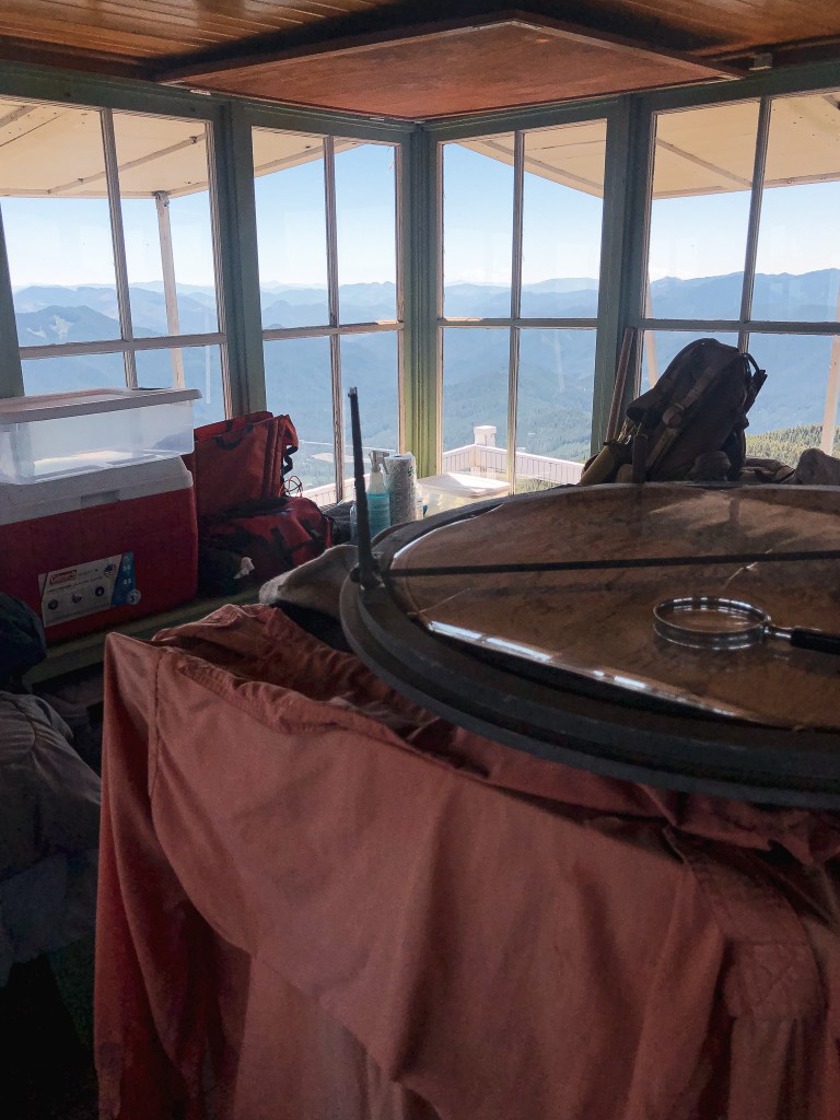
From HWY-3, heading south-bound now, we turned right onto Flora Lane. We only stayed on this road for 1-1/2 miles before reaching the junction with Courtney Butte Lane. Flora Lane continues to the right to reach the Community of Flora. While, Courtney Butte Lane is straight on and will take you all the way to the ranch. The road turned to gravel here and became a dusty show with the caravan. We stayed on this road for around 5 miles before reaching the fire lookout. We only had to pause briefly to open and close the gate. I assume this was to make sure no cattle escaped during our visit. We all parked in a line near the tower and got out to start exploring the area. I started by walking around the tower to take pictures. The owners were there to give us a brief presentation on their lookout and what they’ve done with it. The railing had some custom designs on it, one of which was a rattlesnake. The owner said they had that made, not only because it was rattlesnake country, but because one of their dogs was bit by one twice while here. The tower had some add-ons to convert it into a more live-able space for guests and it looked like it was kept in great condition. The cab still had its Osborne fire finder and stand. While walking around on the catwalk, we ran into the fire lookout attendant that staffs Spodue Mountain L.O. on the Fremont-Winema NF. She asked if we had been at the conference the whole time and we told her that we had. I mentioned that we had met her counter part, Sharon, earlier this summer on Calimus Butte. The only reason we hadn’t made it over to Spodue Mountain during that trip was because we thought it was still apart of the fire closure area. She mentioned that she vaguely remembered Sharon talking about our visit.
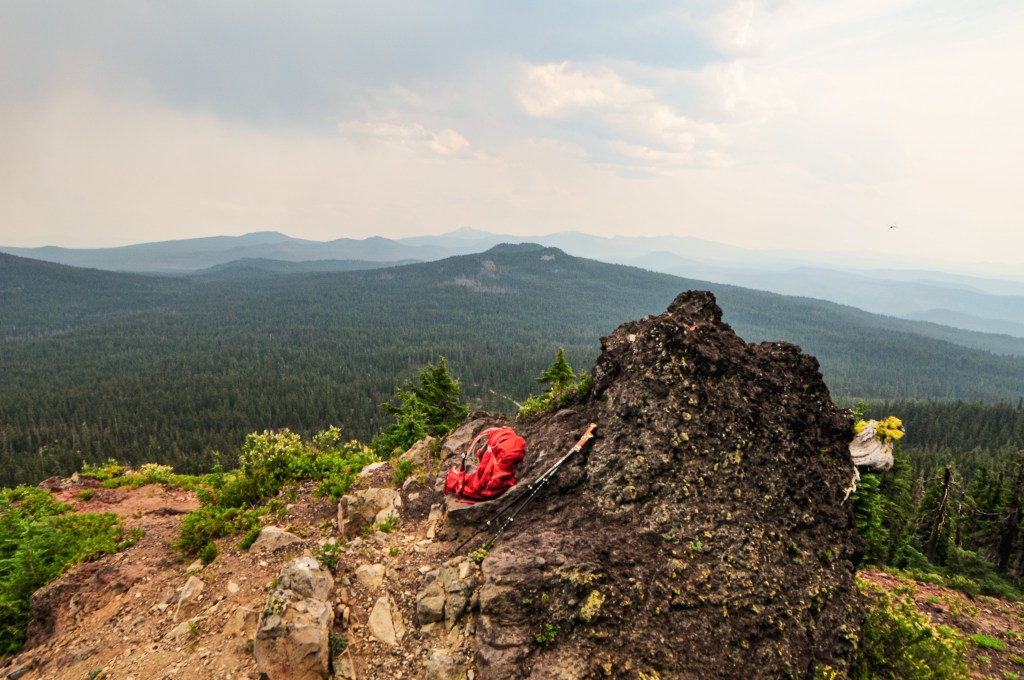
After taking some more pictures on the catwalk and in the cab, they gathered the group on the stairs to take a few pictures with everyone. I took some more pictures at the base for good measure and we eventually felt like we had our fill of Courtney Butte. We decided to pull out a map of the area while we waited for people to start leaving. The closest option if we wanted to visit another fire lookout before dinner was Red Hill. Kirkland Butte was also very close to there and would be a good second option if we had enough time. We unfortunately were boxed in by the caravan of cars and had to wait for them to move. Most people weren’t heading on to another lookout after this, so there was no sense of urgency to leave. This was our own fault though for not trying to park in a better spot for leaving early. Some of the other cars started leaving, but we had to wait for almost all of them because we had been near the end. Finally, the last car in front of us was getting ready to leave and we were free to continue on to Red Hill.
History.
In 1955, a 3-story enclosed ODF cab was built on the site of Courtney Butte. Prior to that, in the early 1950s, it was used for fire observation and the Ground Observer Corps station. It was regularly used by the ODF during emergencies into the early 2000s. The current owner mentioned that the ODF will still occasionally send someone up during thunderstorms. I am unsure when it changed hands to a private owner, but they have since modified and added to it for over-night stays. It’s not listed for public rental, but they let their friends and family stay in it. They seemed open to visitors as long as you get prior permission.
We headed down Whiskey Creek Road from Tope Creek L.O. towards HWY-82. Instead of turning back the way we came on Jim Town Road, we stayed on Whiskey Creek Road to meet up with HWY-82 in Wallowa. The directions we had for Howard Butte L.O. were part of a loop driving tour the FFLA Western Conference was planning on hosting Sunday. This meant we would be coming from the opposite direction mentioned which really only mattered for where the turn off would be along HWY-82. Once we made the turn-off the directions would be the same. We were also not going to be able to stay all day Sunday for this part of the lookout tours, so it was nice that we had time to see some others while here. We turned right onto Yarrington Road which was around 6 miles outside of Minam. The directions said it turned into county road 49 after 3 miles, but it seemed like we just stayed on the same road for roughly 12 miles. This road dropped down to cross the Grande Ronde River over a bridge and met up with Moses Creek Lane that took us to Palmer Junction. At Palmer Junction, there is a paved road that leads off to the left while the gravel continues off to the right. We kept right to stay on the gravel. As we were continuing on the gravel the road forked, this wasn’t mentioned in the directions but it looked like the fork to the right lead to a private residence. The left fork headed up which is typically a good sign when trying to reach a fire lookout and we continued in that direction. The last note on the directions mentioned that there should be a road that heads up the side of the butte to the lookout after 5 to 5-1/2 miles. It didn’t mention what side the road would be on or how far up from the road it would be. That made us assume it would be an obvious junction. After a while of driving, we realized it was getting late and that we wouldn’t make it back in time for the dinner. We also got the sneaking suspicion we were on the wrong road. We stopped after seeing a road marked with a Forest Service road number. Howard Butte is on state land and wouldn’t be marked as such. We decided to re-orient ourselves on a map.
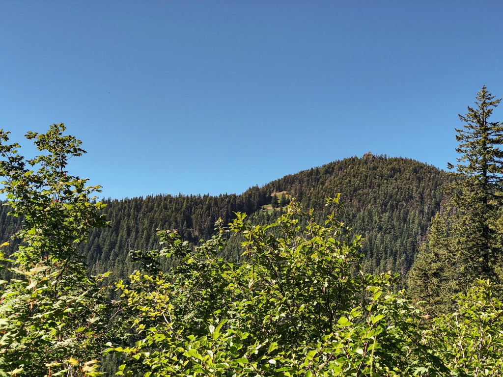
The map we had confirmed our suspicion, we were pretty far off track for getting to Howard Butte L.O. now. We should have forked to the right to head down and across the Grande Ronde River again instead of heading up. We were kicking ourselves for not having the map open while trying to navigate. We had a few options now. The first was to scrap the plan and try to head back to make the dinner at the VFW post. Though it would be unlikely that we would make it back in time. The second was to back track to the correct turn and still try to get to Howard Butte. The third option was to continue further into the forest to reach Lookout Mountain and possibly Hoodoo Ridge too. We had gone far enough off track that we were fairly close to Lookout Mountain now. We figured we could try to stop somewhere, like Terminal Gravity Brewing, in town for dinner with the two latter options. We both agreed Lookout Mountain was the more appealing option and we’d be back in the area to visit Howard Butte some other time.
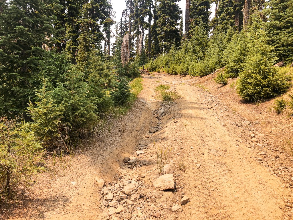
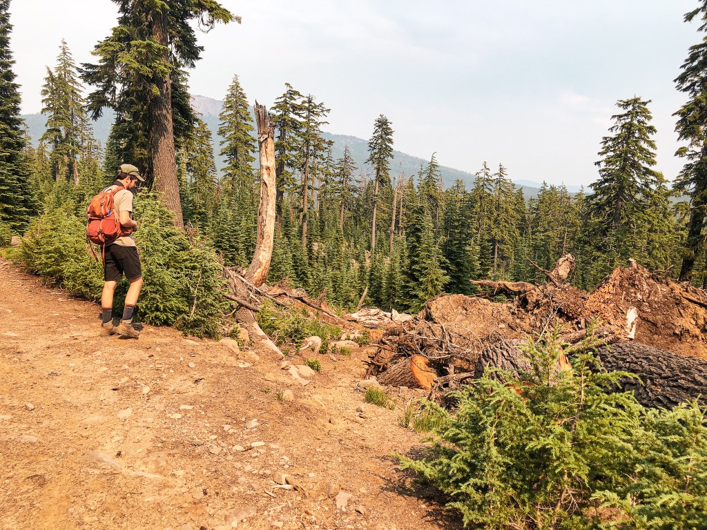
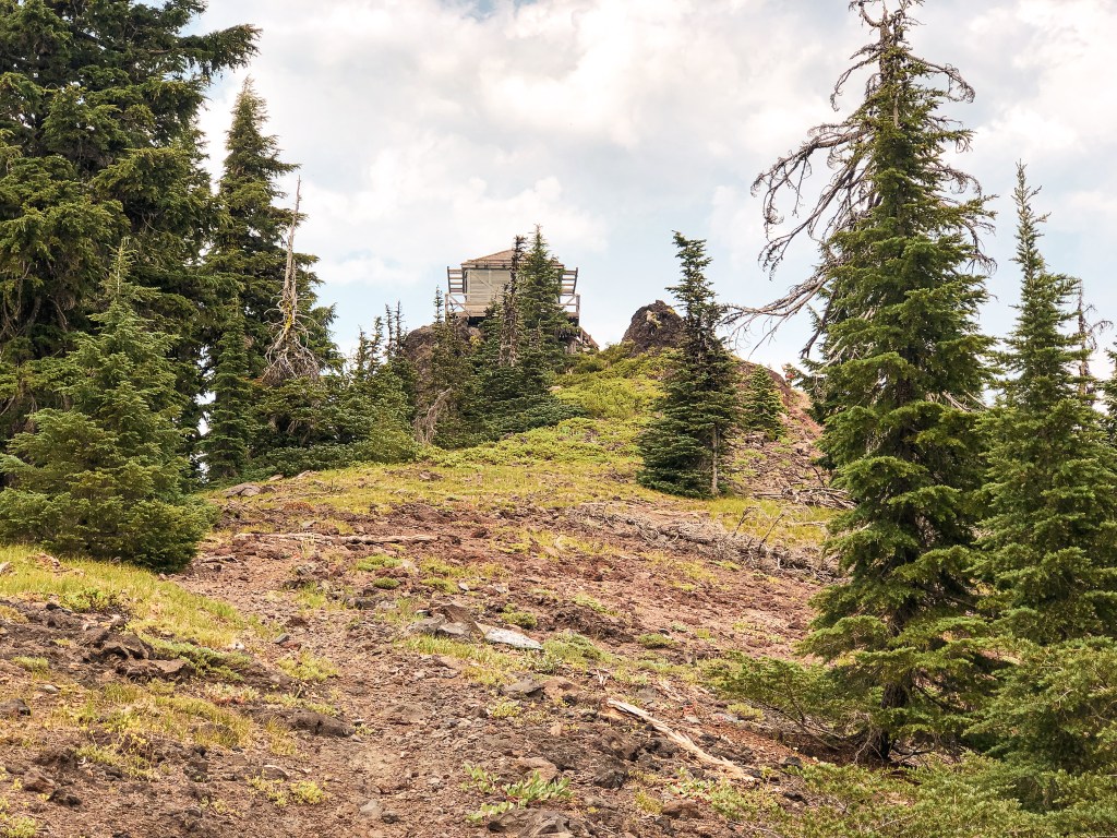
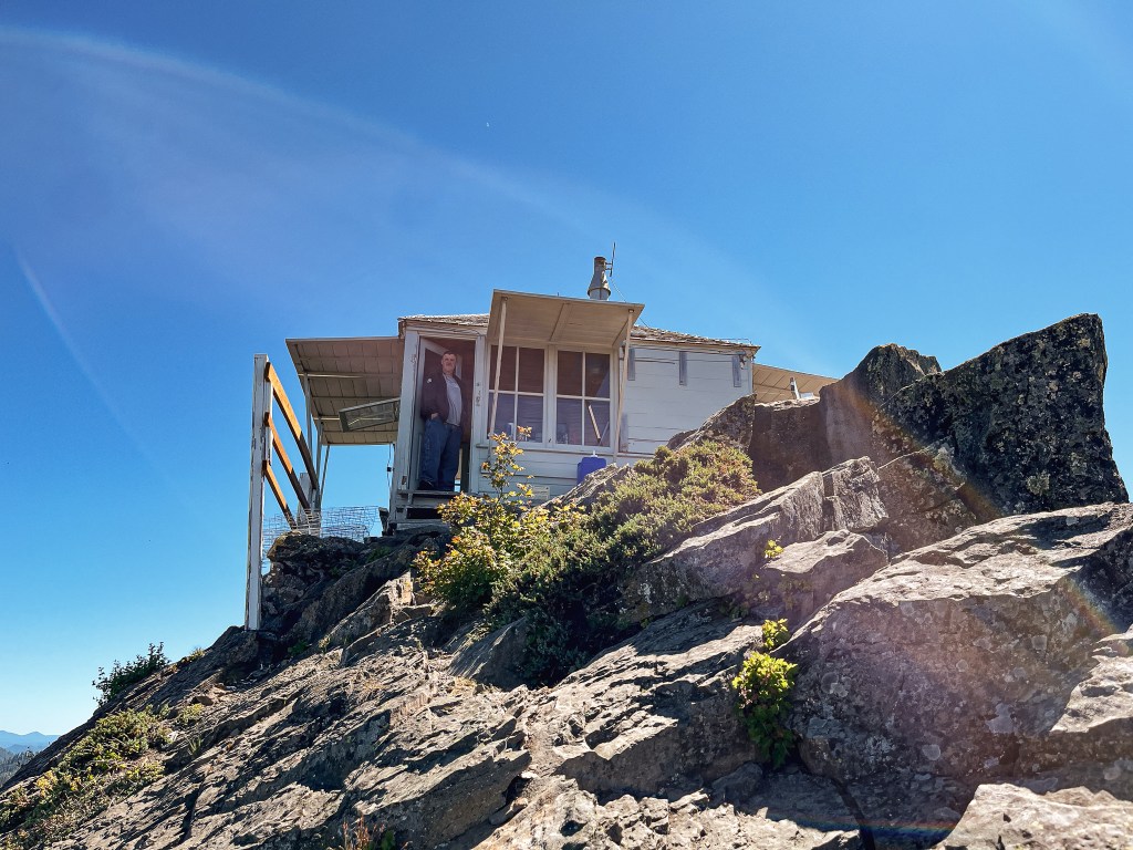
We continued on what was now NF-6231 with our new objective in mind. We stayed on this road until we reached a large four way junction with NF-62 and turned right. The map we had pulled out was the recreational forest map instead of our usual ranger district map. This showed Lookout Mountain being located right off NF-62 and we figured we’d be able to see it from the road. This wasn’t the case, but I luckily saw a gated road with a “no parking” sign posted on it as the road we were on started to head down. We stopped in the nearest pull out and walked back to check it out. Upon closer inspection, there was also a Covid-19 warning sign posted from when all the fire lookouts were closed to public access. We knew we had found the right road and started walking. This is NF-370 if you have a more detailed map, but I didn’t see any sign for it while there. The gate is recessed from the road as well so it could be easy to miss if you’re not paying attention.
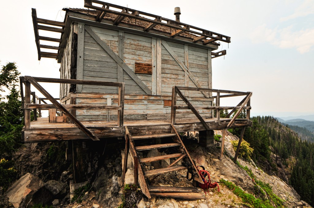
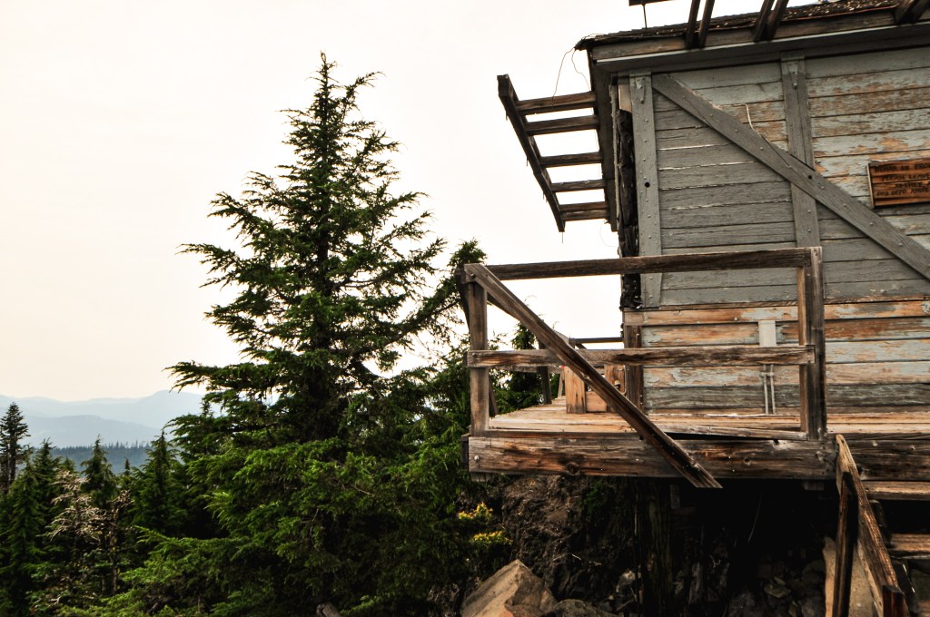
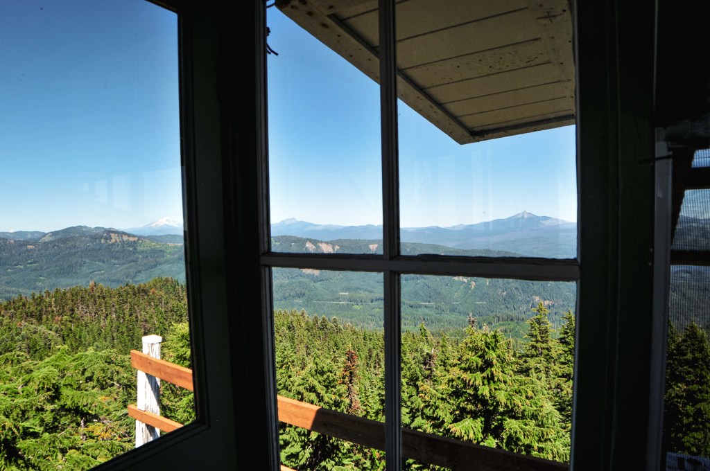
It was already late in the day, much later than we normally would visit a fire lookout. Especially, one that we know is actively staffed. It’s better etiquette to visit between the hours of 9AM and 5PM like you would a business. A reminder that this is their personal space and home for the season. We walked up with that in mind and the intention of only getting pictures of the tower from the ground. The lookout attendant was on the ground working out with a punching bag when we walked up. We gave him his space while we took some pictures and looked at the view. He eventually noticed us and we gave him a wave. He stopped what he was doing and walked over to us to chat. He said he saw us when we first walked up but assumed we were just hunters until he noticed the lack of guns and my camera. He offered to let us climb the tower and take a look around. We told him we didn’t want to impose, but he said it was no problem. This would be the tallest tower I’ve made it to the top of with no issues to date. We talked with him for a while about his background and experience as a lookout. The sun was starting to set and we didn’t want to bother him for too long. We thanked him for his time and headed back to the car.
Before we had left he mentioned the easiest way out was to head back down NF-62 and follow it out until we saw signs for Elign. We followed his direction and turned at the signs for Elign which landed us back at Palmer Junction. This was confusing to us since he said that we’d eventually meet pavement. We also didn’t want to go back the way we came since the road wasn’t great and it was already dark. I thought maybe he meant the paved road that lead out of Palmer Junction, but it only lead us to a dead end at the fish hatchery. We continued back on the gravel road we came from and decided to stay on Moses Creek Lane instead of crossing the Grand Ronde River. This turned out to be the right call as we soon found the pavement and were able to follow it out to Elign. Side note: I would recommend starting in Elign and taking this route to get to Lookout Mountain, it’s low-clearance compatible too. The unfortunate part was Elign is over 50 miles from Wallowa Lake State Park and we still needed to figure out dinner. We realized quickly most places were going to be closed by the time we reached Enterprise. We figured our only option would be to stop at a bar that was open later or head back to camp for the food we already had with us. We cased a few bars as we drove back but none struck our fancy. Eventually, we were too tired to even want to order and wait for food anywhere. We surrendered to the fact that we had plenty of food in camp and had a sad dinner of snacks when we finally got back after 10PM.
Lookout Matt
Matt has been a lookout attendant on Lookout Mountain for 14 seasons. He is from Montana and currently resides in the Billings area during the off-season. He used to live in Portland, Oregon and professionally ice-skated for a while. He also used to staff Bear Mountain L.O. in Idaho that required roughly 8 miles one-way of hiking to reach. He was struck by lightning once while staffing Bear Mountain. He said he had his elbow on the refrigerator when the tower was struck. It sent a bolt from his elbow down through his leg. No scars or major injury, but it did knock the wind out of him. He said a good way to tell a fire lookout has been more recently struck by lightning is to look at the copper wires. If they look shiny and brand new, they were most-likely recently stripped by a lightning strike. If he could staff any fire lookout, he would choose Mineral Peak near Missoula, Montana since it holds a lot of sentimental value and is where he grew up visiting lookouts.
History.
Lookout Mountain was first established with a 60′ round timber tower and enclosed observation cab in 1935. The existing L-4 cab with 87′ treated timber tower replaced this in 1948. A few sources list this as an 82′ tower, but there were two Lookout Mountains in this area at one time. One was 87′ and the other was 82′, I believe the latter was the height of the one that has since been removed. This lookout was actively staffed until 2001 when it sustained damage during a strong wind storm. It was deemed un-safe to staff upon inspection and the lookout on duty was moved to High Ridge L.O. while repairs were completed. Repairs and remodeling were made in 2004. A crane was used to lower the cab from the tower to make the work easier. It received a new roof, wider catwalk, new hand rail, and door during this update. The tower also received work on the cross braces, stair treads, and lightning protection system. It is now actively staffed every season again.
The FFLA stands for Forest Fire Lookout Association and was founded in 1990 by a small gathering of enthusiasts. It has since grown to over 1,400 members across multiple local chapters within the states. Its main goal is to help spread awareness and advocate for the protection, restoration, and maintenance of historical fire lookouts. This is accomplished through grants, donations, and the partnership of volunteers, local public groups, and government agencies such as the Forest Service.
Trip Report.
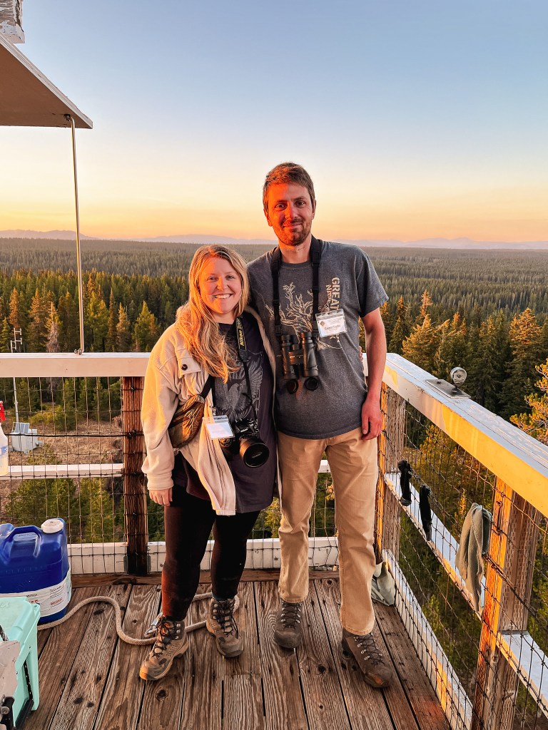
It has been two years since the last FFLA conference was held due to the Pandemic and six years since it has been in Oregon. I wasn’t a member nor was I even aware of the Forest Fire Lookout Association at that time. I didn’t even visit my first fire lookout until 2017 (post). This particular conference was also important since it would be the first with their new chairman. I originally wasn’t going to go due to prior plans for that weekend, but things changed and I decided to commit to going by myself. I was a bit nervous since I would not know anyone there and would likely be younger than most. I also had no background in Forestry or fire lookouts to offer besides the fact that I found them interesting and wanted to be more involved. My partner was going to be out of town on his annual week-long camping trip with his dad. I was relieved when he decided to change around his plans a bit to meet me there. I have no problem traveling on my own or visiting places alone, but the social interactions are what made me the most nervous. My partner could talk for hours about fire lookouts and their history. He also has a better memory for it than I do. I didn’t have confidence that my own knowledge and interest would hold on its own.
This year the conference was being held in Enterprise, Oregon. My partner would be driving separately from their camp in the Ochoco NF to meet me at the Wallowa Lake State Park. And I would be heading over from Portland mid-day Thursday. It is roughly a 5-1/2 hour drive from Portland to Enterprise and closer to 6 hours to Wallowa Lake State Park. As the conference drew near, we were both contemplating whether we should still go or if it would even still happen. The Double Creek Fire had recently taken off and was currently burning at 155,297 acres with 15% containment (source). There were also the smaller Nebo, Sturgill, and Goat Mountain Two Fires burning in the nearby Eagle Cap Wilderness. These were all coming together to cause poor air quality and heavy smoke for the area. Normally, these conditions would cause us to look for other plans. The FFLA didn’t seem too concerned though based on their updates and posts. The state park also had no notices or cautionary warnings about the fires. We figured if they cancelled our reservations that would be the final sign for us not to go. The cancellation never came and the air quality started improving by the day. We ultimately decided to go since the conference probably wouldn’t be held in Oregon for another few years. And it might be our only chance to meet some of these people in person. The weekend forecast called for rain and potential thunderstorms. I was hopeful the rain would be enough to dampen the smoke and that the thunderstorms would be minimal. I ended up working a lot later than expected on Thursday and didn’t make it to our camp until after 9PM.
Friday.
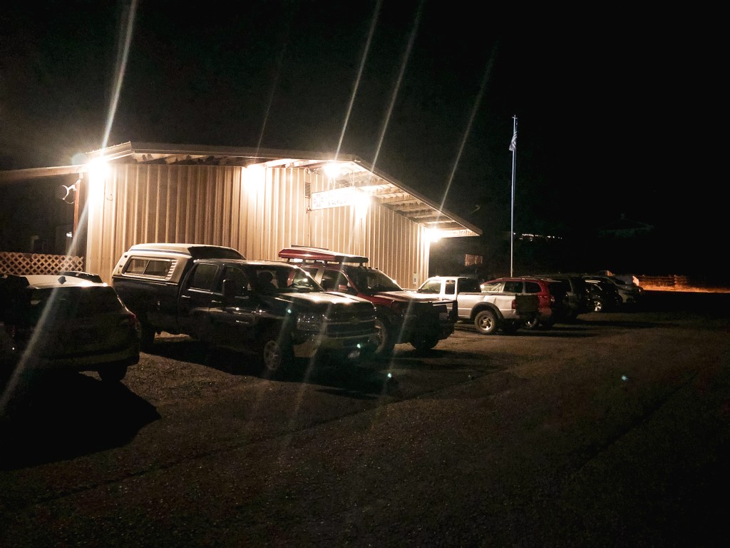
We woke up extra early to give us enough time to make breakfast and head over for check-in around 8:30AM. I was worried about being there late, but we ended up getting there fairly early. We noticed they had muffins, fruit, and coffee set out for the members to enjoy (something that would have saved us some time this morning if we had known beforehand). I was thankful for the coffee since I didn’t have time to percolate any in camp. We found some seats and nervously waited for the conference to start. Bob Bonstead, the head of Friends of Blue Mountains Lookouts, was hosting the conference this year. I had e-mailed him earlier this summer looking for potential volunteer opportunities, but I was a bit too late to be apart of their planned work parties for the season. He started the conference by a short presentation and introduction to our new FFLA chairman, Brad Ells. We also individually introduced ourselves with a short description on where we were from and our background in fire lookouts. It was fun, and a bit weird, to finally match faces to well-known names in the community. I’ve read so much about some of these people I felt like I already knew them. Like I said, weird. After our introductions, the presentations began for the morning and were as followed.
Welcome/FFLA State of Affairs.
Ray Kresek’s Fire Lookout Museum.
Cougar Pass L.O. & Commercial/Residential Pole Lookout Construction.
Pilchuck Restoration Lessons Learned.
During one of the breaks between presentations, I overheard someone asking the check-in if someone named Garnet was here. He was in the bathroom at the time, but I stopped to see how or why they might be looking for my partner. The person who had asked was the lookout relief, Bob LaFrance, for Desolation Peak and Table Mountain. He had heard about my partner through his group chat. My partner had visited Mt. Ireland L.O. the day before to help break up his drive to the area. He had met the lookout attendant, Warren, and his wife currently on duty. They apparently bonded about their interest in fire lookouts and talked for hours. Warren enjoyed it so much that he mentioned him in the group chat and Bob wanted to meet him too. Garnet eventually came back and I waved him down. They talked for a while, but we had to sit back down for a few more presentations. When the conference stopped to take a break for lunch they talked a bit more and exchanged numbers. It was too bad since Bob had to leave to be back on duty, otherwise we would’ve tried to get to know him more. After lunch the conference hosts lookout tours in the area starting at 1:30PM and then a dinner at 6:30PM. We had brought a lunch with us but needed to make a quick stop at the store, gas station, and decided to head back to camp to swap cars. This made us late for the tour caravan. We still managed to see two fire lookouts that evening though, one of which lead us to completely missing the taco dinner that night.
We continued our theme of being late this morning. We had decided to sleep in a bit since we knew there would be some food provided for breakfast this time, but we still had a hard time sticking to the schedule. We came in and quietly stood in the back while the former chairman gave a speech about the projections for the association. There were more people here today and less available chairs. Eventually, someone kindly waved us over between presentations and made room for us to sit the remainder of the time. The presentations for the day were as followed with a break in between.
FFLA Past & Future.
Hat Point L.O. and the Battle Creek Fire.
Piecing Together Olympic Fire Lookout Stories.
AI Software for AlertWildfire Camera System.
Geocaching Lookout Challenge.
Bootleg Fire Forest Management Differences.
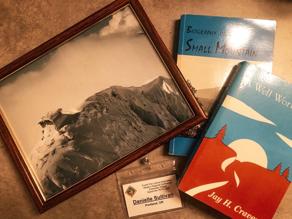
Afterwards, we took an hour break for lunch before meeting back up for another lookout tour. We brought our lunch and stayed at the post to avoid being late again, besides making a quick run to refuel. A few other members stayed behind to eat their lunches as well. We had the pleasure of mainly talking and eating lunch with Leslie Romer, the author of Lost Fire Lookout Hikes and Histories: Olympic Peninsula and Willapa Hills. It’s always interesting to hear about someone’s background and what brought them to the fire lookout community. We checked out some of the items up for silent auction and by then it was time to head out for the tour. We followed the caravan to the lookout we’d be touring for the evening. There was potential for everyone to visit Elk Mountain which is private as well, but the rancher didn’t want any vehicles with a catalytic converter driving through the tall grass. This eliminated almost every vehicle there. We decided to make a stop over at another lookout on the way back. We would’ve tried for a third, but we didn’t want to miss out on another dinner. We were still a few minutes late, but made it in time to eat Pizza and hear some of the final presentations. The night ended with the conclusion of the silent auction. I won my bids on a framed snowy picture of Swiftcurrent L.O. in Glacier NP and two books, Biography of a Small Mountain by Donna Ashworth and A Well Worn Path by Jay H. Cravens. Garnet won his bid on the book How High the Bounty by Jessie Louetta Wright, but was out bid on a shirt.
The conference was hosting an all day tour to multiple fire lookouts in the area. Unfortunately, we had to drive home and didn’t have time to partake in this portion. They had plans to visit Hoodoo Ridge, Lookout Mountain, High Ridge, and Howard Butte. They also offered directions for additional fire lookouts in the area and alternative loop options if you wanted to make your own self-guided tours. We debated making a stop over at High Ridge L.O. on our way home, but we ultimately decided it was too much with the drive if we wanted to make it home at a relatively decent hour. It also started raining before we left which was another deterrent but a good sign for the wildfires.
My Thoughts.
Things Learned.
I learned quite a few different things during the conference that I found interesting. The first was that the white conduits you find in trees near existing or former fire lookouts that were used to string the telephone lines are from 1913 to 1929. The newer ones from 1929 to present are brown to help blend in with the environment. I also learned that it’s best to use an oil-based alkyd paint when refinishing a lookout, otherwise moisture can get trapped in the wood and create rot. The Rhino tool used by most fire crews now was invented by the FMO in the Umatilla NF, Gordon Reinhart, in the 1970s. The copper wiring on a Fire Lookout will look new when it’s been recently struck by lightning. And, unfortunately, the Double Creek fire currently burning in the Willowa-Whitman NF is the largest in that particular forests history.
Observations.
There were two main weaknesses that I noticed the FFLA is facing right now. One is younger members and youth community outreach and the other is our societies reliance on technology, social media, and camera surveillance systems. A few members tried to bring up the topic and ideas to generate interest for younger members, but each time it seemed to be dismissed with a general response and no follow up. As some of the youngest people in the room it was a bit disappointing. I am sure it is a concern to the board members, but they seemed unsure on how to handle it. It’s a hard truth to face, but the association needs younger members to keep it alive. The second issue is a bit more complex. The presentation on the AlertWildfire Camera Systems was very informative and sparked a debate about lookouts versus cameras. I strongly agree that a fire lookout staffing a tower is more effective than just a camera, but trying to fight technology is a losing battle. Cameras will continue to be built and are here to stay, but I think there should be an attempt to change the narrative. Instead of us versus them, it should be viewed as an added tool and resource to fire lookouts. I understand that in some cases, like most of the ODF towers in Oregon, this has replaced people’s jobs. But, as the presentation showed camera detection is not accurate and can mistake clouds for smoke. It also showed that those staffing a fire lookout can have blind spots that could be spotted by cameras. Technology doesn’t always have to be the enemy. I know that’s easier said than done, especially working with government agencies that are already under funded and under staffed. Technology is also a helpful tool in reaching a younger generation that has grown up with it and heavily relies on it for information.
If you are interested in learning more about the FFLA or becoming a member, you can visit their website.
The Friday lookout tour hosted by the FFLA Western Conference was to Tope Creek. This lookout is located on private property and requires prior permission by the land owner to visit. We were expected to meet back at the VFW Post after our lunch break at 1:30PM to start the caravan to the property. Garnet and I had headed back to our camp at the Wallowa Lake State Park during the break to swap our vehicle. We had made the decision to drive my Civic to the conference in the morning with the intention of carpooling with someone. But, after a lack of hands raised for those with available seats to carpool, it seemed easier to drive ourselves. Garnet was borrowing his mom’s HR-V for the week which has better clearance. This decision ultimately put us behind schedule and we didn’t get back to the post until 1:45PM. There were still some vehicles parked here, so we got out to check if they had already left. I asked someone in the building and they confirmed what we had thought. We were both stressed since this wasn’t a good start and we didn’t want to miss out on the opportunity to visit this one. A member had also previously warned that if you’re not willing to drive fast on gravel roads you would be left behind. Luckily, they had printed out directions on how to get there, so we started in that direction with the hope that everyone would still be there.
From Enterprise, we headed west on HWY-82 towards Wallowa and Lostine. We turned right onto Baker Road which is around 4 miles outside of Lostine and can be distinguished by the Wolff Ranch sign. We followed this road until we came to a T-junction with Jim Town Road. There were no road signs here, but you will want to take a left. This brought us to another un-signed T-junction with Whiskey Creek Road. We took a right and stayed on this road until we reached the first house off to the right. The house had a distinguishable bright blue metal roof. We turned right on the road immediately next to it and hoped we were on the right track. We followed this road for a little over 7-1/2 miles until we saw a two-toned blue metal rod marking a road off to the left. We turned and followed this road until we reached a hand-carved W sign. You will want to bear right here to reach the property. The roads getting here were mostly passenger vehicle friendly until we turned onto the road at the blue metal rod. It had some looser sharp rocks on this section of road that gave someone else a flat tire.
We were the last to arrive, but were relieved to see everyone still there exploring the property. I walked around to take some pictures and we signed up to get in line to climb the tower. The structure was a bit rough around the edges and they only wanted 4 people climbing it at a time. Once it was our turn, Garnet headed for the top. I made it to the third landing before I got a bit squeamish of the height. Forrest had passed me on his way down and he said it only got steeper from there, which didn’t help my confidence. I started up towards the fourth landing, but decided I didn’t need to freak myself out and headed back down. I find the 100′ towers that taper towards the top are the ones I have the most trouble climbing. These are typically the Aermotor or L-6 designs. I walked around the property to take some pictures of the sculptures and talked briefly with a few other members while I waited for Garnet to descend. Brain Wizard, who owns the property, is an eccentric artist and author. He lives on the property year round as a survivalist and was snowed in for 120 days last winter. We talked to him briefly while we were waiting for our turn to climb the tower. He mentioned he used to do terrorist surveillance and intel. Some of his work can be viewed on his website. It seems he is open to visitors with prior permission, but I would be wary of visiting without a group. He made a slight off-handed comment directed at me during our visit.
As everyone was getting ready to leave, we decided to look at possibly visiting another Fire Lookout in the area before dinner. This was a benefit to driving ourselves. The VFW Post was hosting a taco night for the conference, but it wasn’t until 6:30PM. This meant we had a little over two hours to kill. Howard Butte L.O. looked the closest on the map, so we headed in that direction next.
Pictures of Tope Creek cab courtesy of my partner.
History.
Tope Creek was built in 1936 as a 103′ timber tower with L-6 cab by the US Forest Service. The cab is listed as 7’x7′ on some sites, but noted as 8’x8′ on the NHLR. I found similar inconsistencies in the listed height from 100′ to 103′. I am unsure which dimensions are accurate. The 14’x18′ one-room ground house, used for the living quarters, was not added until 1938. Ownership was later transferred to the Oregon Department of Forestry and was staffed into the 1970s. It was eventually classified as surplus and sold to a private owner, Zella Guyness, during a state auction in 1978. The tower is still maintained by the current private owner, Brian Wizard.
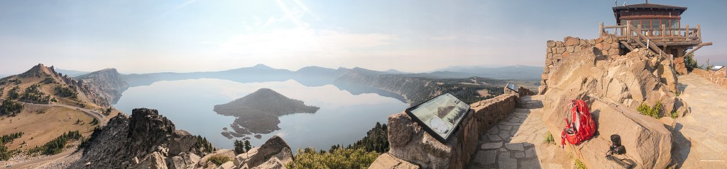
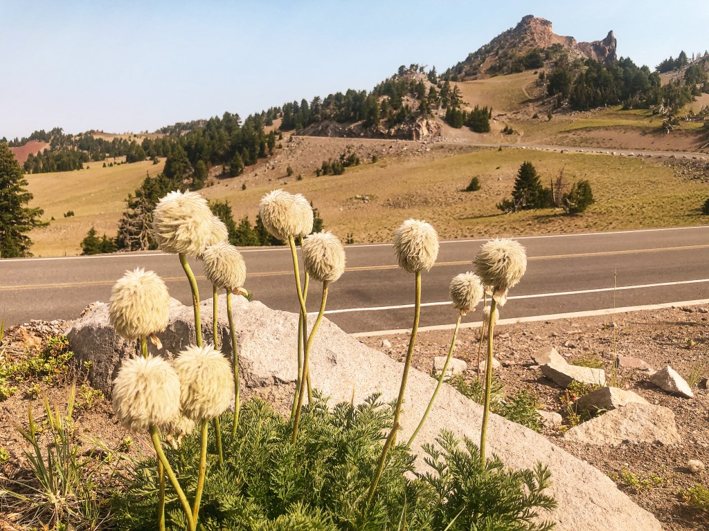
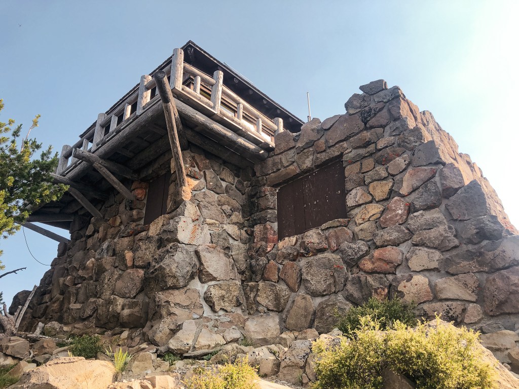
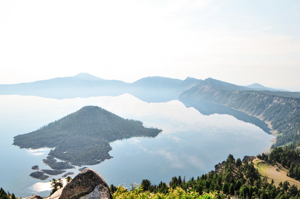
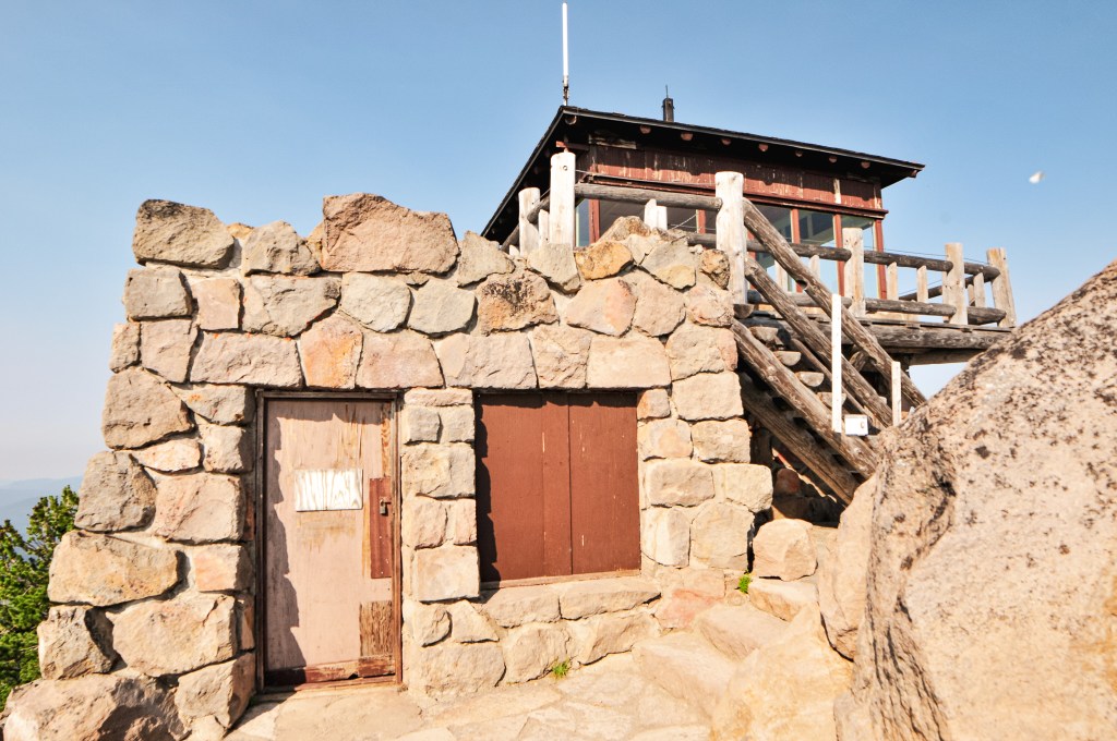
Our alarms were set for 5:30AM in an attempt to get an early start. We were both pretty grumbly this morning and hit snooze until a little past 6AM. I let my partner get up first to start making breakfast while I sleepily packed our tent. We weren’t moving very fast this morning. By the time we were done eating, packed up, and on the road to the Northern entrance of Crater Lake NP it was already 8AM. The entrance kiosk was not open yet, but we already had a National Parks pass for the season and let ourselves into the park. We kept right once we reached the rim road to stay on the western side of the crater. It didn’t take very long for us to reach the parking area for The Watchman. It is painfully obvious where you need to park. Not only is it well signed, but the lookout is visible from the road. It is one of the busiest trails in the park and we assumed we would see a lot of people here. There were only a few spots left in the main parking area which has enough room for at least 20 to 30 cars. We parked and headed up the well graded trail. It’s a short 0.8 miles with 400′ in elevation gain to the summit. There were these neat blooms along the beginning of the trail that resembled something out of a Dr. Seuss novel. I know I over-use that reference, but these truly do look like miniature Truffula Trees from The Lorax. I later found out they are known as the Western Pasqueflower, or Anemone Occidentalis. I want to try and get better at identifying wildflowers in Oregon. I always ask my partner if he knows what the flowers are called, but he’s better at identifying the types of trees and birds. We passed a large group and a few other people on our way up that were heading down to the parking lot. The trail was still mostly shaded this morning which made for a really nice temperature. My partner reached the summit before me, per usual, as the last few people were leaving. We were shocked to have the summit briefly to ourselves. The lookout was blocked to public use but you still get a great view from the base. A couple joined us shortly after, but they didn’t stay long. We soaked in our time at the summit waiting to see when the next person would arrive. We stayed up there for at least 15 to 20 minutes without anyone else before deciding to head back down. We were up there fairly early, but it was still shocking to have it to ourselves. As we leisurely hiked down, we realized we were just slightly ahead of the crowds and had come at the perfect time. There were roughly 45 people heading up the trail on our way back down. The parking lot was full when got back to our car and people were starting to park in the overflow area. It seemed that a good amount of them were just stopping to check out the view point before moving on than actually hiking the trail. The flow of cars was pretty even on those coming in versus those leaving. The next time we’re in the Crater Lake NP we hope to hike to its highest point on Mount Scott.
History.
The first trail to the summit was established in 1916. It was shortly followed by the construction of a cupola-style lookout in 1917. The site was always intended for dual use of a fire lookout and an educational interpretive site. The existing two-story observation station was built from native materials with the intention of blending in with its surroundings. It was designed by Francis Lange as part of the 1920s Crater Lake Master Plan. Construction on the station started in 1931 and was completed in 1933. It was recently restored in 1999 and re-opened for public access. The mountain top museum had been previously closed since 1975. It is still occasionally staffed by a National Park Ranger in extreme emergencies.
My partner and I decided beforehand that if we only had time to add one other fire lookout to our trip to Garwood Butte (post), it should be Mount Stella. We both really wanted to see The Watchman (post) as well, but Mount Stella is in poor condition. It was on our priority list due to its higher risk for collapse, being torn down, or burning down in a wildfire. We didn’t reach our car until around 4:30PM after visiting Garwood (post). We knew there was still enough time to squeeze in Mount Stella for the evening, but only if we left immediately. This was also with the assumption that the road conditions to the gate were in our favor. We briefly contemplated setting up camp and visiting Mount Stella in the morning. But, if we successfully visited Mount Stella now that meant there would be time for The Watchman (post) in the morning. As we headed out of the forest to HWY-230 we could see darker clouds on the horizon. The forecast did mention a chance of rain and thunderstorms in the area, but we figured it unlikely with the heat. I could see some flashes in the clouds and we passed through a minor drizzle. Unfortunately, not enough to clean off the collected dirt on my car’s exterior. Thunderstorms are typically not ideal for visiting fire lookouts since you are on a higher point that can be more exposed to the elements. But, they seemed to be moving quickly in the opposite direction. Although these didn’t pose much fret for us at the time, it seems they were the same thunderstorms to kick off Oregon’s Wildfire season. The first, currently known as the Windigo Fire, being reported Saturday night within the Umpqua NF. The second, currently known as the Potter Fire, being reported the following morning within the Willamette NF. Both were just barely north of where we were camped this weekend. It’s a bit unsettling how quickly we turned from our wettest spring to our current fire season with little to no transition period. I’m inclined to stay hopeful for a mild season, but I’m also not holding my breath.
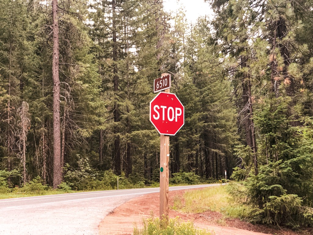
We were back on HWY-230 around 5PM and thankful for the longer summer days. We turned right on to NF-6510 just past where the highway crosses Bybee Creek. There were a lot more people camping in this area due to the water access. Once the road started to head away from the creek, we reached a fork. We took a left to stay on NF-6510, while NF-6520 was to the right. It is three miles from HWY-230 to the junction with NF-200. The NF-200 spur didn’t have a sign, but it is off to the left at a four way junction. The NF-100 spur was signed off to the right which helped us identify it on the map. It was roughly one mile down NF-200 to the gate and another three quarters of a mile to the lookout from the gate. The NF-200 spur was in decent condition, albeit a bit overgrown. We were able to drive the Civic to the gate with minimal caution. We ended up parking near the decommissioned road off to the right and walking from there. The gate was open but there were some large rocks embedded in the road that stopped us from continuing on in the car. It had potential to be worse than the access road to Garwood Butte (post), but it improved significantly after the first rocky section.
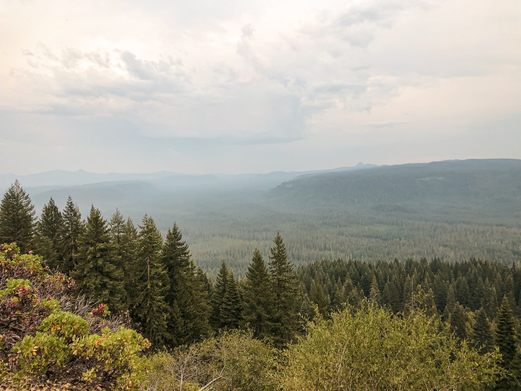
By this time, the heat had caught up with me. I was feeling completely drained of energy and dehydrated while nursing a headache. Despite my best effort to drink as much water as possible, it was no match to the heat. My partner took off at his usual pace for the summit while I meandered behind. It’s a mostly forested road walk until you come to a sharp bend. At the bend, it opens up to views of the valley just south of the summit. These are the only views we would get from Mount Stella. The remaining area is overgrown with tall trees and shrubs. I could hear rumbles of thunder in the distance as I reached the clearing. It wasn’t an immediate concern, but I also wasn’t inclined to stay on the summit for too long either. I quickly took some pictures of the tower and made my way over to the garage. As I was entering through the door to the garage something larger scurried towards me. I screamed and ran out of its way thinking it was a large wood rat. My partner had already warned me of the rabbit he spooked up in the garage earlier. Turns out I spooked the same poor rabbit. It was now past 6:30PM and we knew we needed to head back so we could set up a camp. As we were hiking down the road, we were surprised to be met by a vehicle. It was a government vehicle from the BLM fire crew. They didn’t stop to say anything, but I can only assume they were driving up to the view point to watch for fires. Based on that, one could argue the site is still used in emergencies even though they don’t use the tower anymore.
Art?
No stairs for Stella
Privy
We had planned on camping near Mount Stella if there were decent options and heading to The Watchman (post) in the morning via the Southern park entrance. But, it seemed most of the decent camps were already taken in this area. We decided it made more sense to head back towards the other camps we found closer to Garwood Butte (post). This would set us up for easy access to the Northern park entrance instead. We didn’t set up camp until after 8PM, but it was overall a successful day.
History.
A 20′ native timber tower with L-4 hip-roofed cab was the first structure built on Mount Stella in 1932. Similar to other Fire Lookouts, it was activated as a Aircraft Warning Station during 1942 until 1943. In 1946, the Forest Service replaced it with a 30′ treated timber tower and L-4 cab. This structure still stands today but has been abandoned since the 1980s.
NOTICE: This area was apart of the July 20, 2024 closure area for the Diamond Complex fires but has since been reopened. This area does not appear to have been impacted.
Location.
Umpqua National Forest
Status.
Abandoned; Currently standing
Estimated drive time from Portland, OR.
4-1/2 hours
Date visited.
July 30, 2022
Elevation.
7,017
National Historic Lookout Register.
US 1615; OR 139
Trip Report.
UPDATE: October 12, 2024 – while we were camping in the area we had drove down the NF-3703 road and it appears to have been regravelled recently which eliminated the majority of the potholes and hazards we originally saw. They were minor then but almost non existent now. We didn’t drive the entire way to the NF-370 spur but I assume the spur road conditions are still the same.
Oregon has been in a heat advisory for the last week with temperatures ranging in the mid to high 90s. It even briefly jump up into the low 100s a couple of those days. A haze was expected to settle over all of Oregon for the weekend due to a new wildfire in northern California. Is it too soon to say I miss the rain? Anyway, what better time to head into the forest than when you’re sweltering at home? It turns out it’s pretty hot out there too. But, my partner and I headed on as we always do. This weekend we set our sights on Garwood Butte. We figured we could do The Watchman (post) or Mount Stella (post) while in the area too. Yes, both were also an option. It’s a bit of a drive for a one-night trip, but we’ve come to the conclusion that we’re a bit crazy. Garwood Butte has been on our minds for a while. Mostly, because my partner’s name is Garnet and he goes by Gar on occasion. I couldn’t possibly visit Garwood without him. For this reason alone, we felt a connection to the fire lookout. It’s also just a really cute L-4 perched on top of a rocky outcropping with views towards Mount Bailey and the Crater Lake rim. What’s not to love about that? We had originally thought about adding it to our road trip itinerary, but were worried about the potential for snow. After our visit to Pig Iron (post), we could see it was snow free and that it would be accessible for a future visit to the area this year.
Start of the NF-370 spur
Parking Spot
First glimpse of Garwood
Our alarms were set for 6AM and we were on the road as early as possible. We headed down the I-5 corridor once more, but this time cut over on HWY-58 to meet up with HWY-97. We gave a quick wave to Odell Butte L.O. and Walker Mountain L.O. (post) as we drove past their marked highway turn offs. After a quick refuel in our now frequented stop in Chemult, we turned on to HWY-138 towards Crater and Diamond Lake. We passed the north entrance to Crater Lake NP and stayed on HWY-138 until we reached the turn for HWY-230 off to the left. I have been through this area a few times now on various different trips throughout the years. We were also familiar with the route due to an unsuccessful attempt of Garwood during our visit to Cinnamon Butte (post) last December. From HWY-230, we turned right at the access for Three Lakes Sno-Park. We continued straight to stay on NF-3703 until we reached the turn off for NF-370 spur. There were minimal potholes and ruts to avoid along the NF-3703 road. We didn’t even have to attempt a drive up the NF-370 spur to see it wasn’t a drive-able road. There were large ruts and rocks embedded in it that were not low-clearance compatible. The road is marked but the sign is sun-bleached and indecipherable. It is best identified by its terrible condition and a ski post marked with the number 36. We parked in a pull out just past the road. It was already noon by the time we got there, so we decided to have lunch in the comforts of our air conditioned car instead of the summit. While we were hiding out in the car, an ATV came brapping by and waited at the NF-370 junction. At first, we were confused on what they were doing or thought maybe they stopped because they were confused by what we were doing. But then, another ATV followed which triggered the first one to head up the road. When the second ATV reached the junction it proceeded to wait as well. The same thing continued to repeat itself until 8 ATVs had turned up the NF-370 spur. We weren’t too keen on starting a road walk that we knew would end in us being dusted up and decided to wait. The road eventually just dead ends and they would have to come back down. Luckily, we didn’t have to wait long and their brapping continued on to somewhere else.
Start of Connector Trail
Where the Connector Trail meets the road again
Beginning of Main Trail
It was hot and dusty when we started our hike up the road. We knew it was roughly two miles to the Fire Lookout from the junction, if you stayed on the road and didn’t use the connector trail. As we walked along, the road conditions continued to deteriorate with larger embedded rocks, downed trees, and wash out. There was a point in the road where the ATVs even turned around. A large tree had come down across it and there wasn’t enough room on either side for them to get around. Ah, that’s why they didn’t take long. It would have required a chain saw to remove it. We both agreed, this was officially the worst road we’ve been on so far. I took some pictures of the road, but it never quite captures the true conditions. We eventually reached a more open area with a view of Garwood Butte. There was a defined trail off to the left that we assumed was the connector trail. A peakbagger report had mentioned this trail was no longer here in 2012, but from what we could see it was now. If you take this trail you can cut off a half of a mile of road walking. It meets back up with the road where the official trail #1471 to Garwood Butte begins. There is no official trail sign, but it was a well defined junction. If you have trouble finding it, always look for the cut logs first. As we headed up the trail, it appeared to have been brushed out more recently. It was clear to us that someone had been taking care of this route somewhat regularly despite the road conditions. It was a hot and slightly humid slog to the summit. The trail switch-backed through an interestingly mixed forest until it opened up to an exposed slope. The trail was in great condition besides a few loose sections that made finding my footing more difficult.
My partner reached the summit before me and was already making his rounds on the catwalk as I tried not to completely wilt away in the sun. I always seem to struggle more than him, specifically on steeper trails and in the heat. Partially, because I’m not in as good of shape but there are various other reasons as well. Garwood has a really nice summit on the edge of a rock that dropped off to views of the drainage below. The lookout structure was looking a bit worse for wear on the catwalk. Some of the stairs had broken and one corner was being supported by two boards. There was a sign posted on the cab mentioning the ongoing restoration, but I’m not sure if that is still active. Please use caution if you decide to climb the catwalk. We headed down after taking in the hazed over views and debated our next step. We had already found some decent dispersed camp spots and could have easily set up camp early to relax. But, there was also just enough time left in the day to move on to Mount Stella. We were both torn between wanting to maximize our short trip and just taking it easy for once. Who were we really kidding though? Of course, we headed on to Mount Stella (post).
History.
Formerly known as Bear Butte, it was renamed to Garwood Butte in 1946 to commemorate Leroy E. Garwood. Leroy was a former Forest Service District Ranger that died in March 1944. He was known as an old-timer on the forest and was the first to develop the lookout station atop the butte. The renaming also helped to eliminate another “bear” named feature within the forest. At the time the following features included the name bear; 6 Bear Creeks, 2 Bear Buttes, 2 Bear Camps, 1 Bear Bluff, 1 Bear Bones, 1 Bear Gulch, 1 Bear Lake, 1 Bear Wallows, 1 Bear Trap Mountain, and 2 Bear Mountains. Not the most creative. The structure on Garwood Butte was built in 1942 as a 14’x14′ L-4 ground cab. It was last staffed in 1973 and has since been abandoned. In 2012, the lookout was threatened by a nearby fire and had to be wrapped by fire fighters in Structure Protection Wrap. I believe it was the Butte Fire, but there were a few other larger fires during that year that could have caused this to be wrapped. There has been ongoing restoration work in more recent years, but it still needs a lot of work.
Coffin Mountain L.O. has been on my short list to visit since November 2018. A friend and I had been staying in Eugene for the weekend and tried to check it out. Our plans were immediately foiled when we met up with snow and ice on the road. We ended up exploring around a snow-park instead. I’m not sure why it took me so long to attempt another visit, but here we are almost 4 years later.
My partner and I had a toss up between adding Sand Mountain or Coffin Mountain to our weekend. My partner was leaning towards Sand Mountain due to the popularity of Coffin Mountain during this time of year. While, I was partial to Coffin Mountain. Alternatively, we could do neither but that was the least likely to happen. Based on reviews and trip reports online, we knew Sand Mountain would be a longer hike due to the gate and road conditions. The hike could have potentially been 10 miles RT depending on how far we’d make it down the road. We ended up waking up later than expected on Sunday morning which defaulted us to Coffin Mountain. We probably could have squeezed in Sand Mountain, but we both agreed we didn’t want to get back in town too late. Fine by me, Coffin Mountain it is!
We packed up and headed out from our camp on NF-15 to meet up with HWY-20. There were portions of NF-15 that were a bit rough for my Civic due to some recent logging in the area. We were able to make it out without incident, but it definitely slowed us down. We headed east on HWY-20 to connect with HWY-22. From HWY-22, the road you want is off to the left. It is NF-11 on the map, but was only marked as Straight Creek Road. It is located just past a bend in the highway, so make sure to keep an eye out for it. You will stay on this paved road until you reach NF-1168. There are two turns onto NF-1168, but you will want to take the second one. There is a sign at the first junction with NF-1168 that will point you in the direction of pavement. The NF-1168 road is well maintained gravel all the way to the trailhead. The trailhead can be found just off of the junction with NF-450. It should be obvious as you approach since you will get a glimpse of the lookout before you reach the trail. The NF-1168 road continues on to the Bachelor Mountain trailhead.
There is parking for a few cars directly at the trailhead and a few pull outs for additional parking. There were already cars here, but it was not as busy as my partner thought it would be. He can be a bit overzealous in his predictions when it comes to busier trails. We had just missed the peak bloom of Beargrass in the main meadow which helped to decrease the foot traffic. There was still a significant amount of wildflowers in bloom though. I always find it interesting what makes a certain trail popular over another. Ease of access? Length of trail? Views or points of interest? We were in the same National Forest, hiking to a fire lookout on a similar length of trail, and it offered similar views. Yet, Carpenter Mountain (post) is significantly less visited. I can’t help but think social media plays a dominating role. But, even then, what makes a spot blow up on Instagram versus another? I often see the same regurgitated spots on “must see lists” for Oregon, but there is still so much more to be seen. I am thankful in some ways that these lists curated by influencers and photographers aren’t usually unique. It helps keep other spots from being overcrowded. But, on the other hand, if there were more unique lists people might be more dispersed in general. Which in turn could lead to less impact on the current areas being overcrowded. This is a topic my partner and I revisit often, but I digress.
The hike to the summit is a little less than a mile and a half one way. You will climb over 1,000′ in elevation as you switch back up the side of the mountain through an open meadow. Today was forecasted to be hotter than Saturday which didn’t bode well for a more exposed hike. I quickly fell behind as I struggled with my tight calves and feeling dehydrated again. The main bloom of Beargrass might have already been done, but as I climbed the ridge line more and more blooms became present. Beargrass, or Xerophyllum Tenax, has such a unique flowering pattern. It resembles a q-tip or something out of a Dr. Seuss book. They can even reach up to five feet in height, which is almost as tall as me! As we neared the summit, we were lucky to have it briefly to ourselves aside from the lookout attendant on duty. He was doing his best to ignore everyone in sight. We gave him a hello which only warranted a wave and nothing more. I don’t blame him though, after watching a few hikers completely disregard his personal space I too wouldn’t want to try and talk to anyone. The poor guy was just trying to read his book and enjoy a lunch without being bothered. We enjoyed our lunch on the helispot before heading back down to the car. I was happy to be able to finally check this one off my list.
History.
Established as early as 1905 with a rudimentary platform pole structure, Coffin Mountain has been used as a site for fire detection for a long time. It received its morbid name due to the Coffin shape of the summit. In 1921, a D-6 cupola style cabin was erected in place of the platform. This structure housed the lookouts for 15 years until it was replaced in 1936. Its replacement was a 14’x14′ L-4 ground cab. The current lookout is a modified 15’x15′ R-6 flat top cab and was built in 1984. It is still actively staffed every summer.
NOTICE: August 27, 2023 – this area was impacted by the Lookout Fire that burned 24,754 acres on the Willamette National Forest.
Location.
Willamette National Forest; H.J. Andrews Experimental Forest
Status.
Active; Currently standing
Estimated drive time from Portland, OR.
3 hours
Date visited.
July 23, 2022
Elevation.
5,369′
National Historic Lookout Register.
US 484; OR 77
Trip Report.
My partner and I set out on another one-night weekend trip in search of more fire lookouts. We decided to start picking our way through the closer options within the Willamette NF. We set our sights on Carpenter Mountain and figured we could either add Sand or Coffin Mountain (post) to the weekend itinerary. Carpenter Mountain is doable as a really long day trip from Portland, but we wanted to test our luck in finding a camp spot within a busier western forest. I love a quick overnight trip, but it has become more tedious for us this year. We moved into an apartment near the beginning of the year after deciding to officially part ways with roommate living. The trade-off for our own space was three flights of stairs that we now have to haul our gear up and down every trip. This has helped us to become more efficient and stream line in our packing. Any item accidentally left in the apartment pays the penalty of three more flights up and down. You learn quick to grab everything you can in as minimal trips as possible and leave nothing unchecked. No essentials left behind!
That being said, we left Portland mid-morning with a packed car headed down I-5 towards HWY-126. From HWY-126, we turned into the forest on NF-15 just past the community of Blue River. We stayed on this road until we reached the Lookout Campground. There is a sign for Carpenter Mountain that states it is 13 miles away in the direction towards NF-1506. We forked right to follow the sign and enter the H.J. Andrews Experimental Forest. There are multiple junctions along this route, but all roads are marked and you will want to stay on NF-1506. The NF-1506 road starts out paved but eventually turns into well maintained gravel. We stayed on this road until we reached NF-350 off to the left. According to my odometer, it was 5.7 miles up NF-350 to the trailhead. This is a fairly decent spur road with only a few rocky spots and potholes to avoid up until the last mile. The last mile is where the road deteriorates and becomes very rocky. It was slow going in a low clearance vehicle but passable with caution. We made it to the trailhead just before 1pm. It is a short but steep one mile hike to the fire lookout. You will gain over 800′ in elevation. It was shaded most of the way which offered a nice reprieve from the heat.
I was struggling with tight calves and didn’t want to trigger a Charlie Horse, so I took my time on the hike. My partner reached the summit before me and was already talking to the lookout attendant, Rob, upon my arrival. Rob was friendly and willing to answer our questions. He was a bit reserved at first, but eventually warmed up to us. A few times he would leave the conversation and return to the interior of his lookout. We figured a few times he was done talking, but then he would eventually come back out to continue on before we had packed up. We talked for a while about photography and he gave me some tips on camera use. He pointed us towards an old growth trail that is located just past the NF-350 road on NF-1506. It’s a 3-1/2 mile trail one way, but we only had time to walk down to the log bridge. It was worth the stop and a great recommendation. There were a lot of old trees to ogle at in the short section that we walked along. Afterwards, we headed deeper into the forest via NF-15 to find a camp for the night. There were limited options as we had expected but we were still able to find a place suitable to set up camp for the night.
Lookout Rob
Rob has been the lookout on Carpenter for 9 seasons. He used to work on Wildland fire crews and was an Archeologist as well. He has a degree in Anthropology. In the off season, he lives in Eugene with his wife. He has a special interest in wildlife and ecosystems photography. His work can be found and purchased as prints on his photography website (link). His site offers more detailed information about him, but above is what we talked about in person. Though, I found out through his website that he went to WSU too, Go Cougs!
History.
Carpenter Mountain was first established in 1914 as a rag camp. They built an open sided cupola style fire finder shelter in 1917. This was used up until 1921 when a direct hit from a lightning strike destroyed it. A new or similar structure must have been rebuilt to replace this since there are still records of the site being used as a fire lookout. In 1935, a L-4 cab was built by the CCC on the summit. This was actively staffed until the 1960s. Eventually, it fell into disrepair with another lightning strike causing excessive damage to the structure in 1986. A Ranger reported that the strike caused 14 windows to blow out, the door to blow off, the steps to blow over the side, and the roof to be raised off the frame. It was officially restored in the 1990s and has since been moved back into active service.