Location.
Willamette National Forest
Status.
Active; Currently standing
Estimated drive time from Portland, OR.
3 hours
Date visited.
July 24, 2022
Elevation.
5,771′
National Historic Lookout Register.
US 888; OR 114
Trip Report.
Coffin Mountain L.O. has been on my short list to visit since November 2018. A friend and I had been staying in Eugene for the weekend and tried to check it out. Our plans were immediately foiled when we met up with snow and ice on the road. We ended up exploring around a snow-park instead. I’m not sure why it took me so long to attempt another visit, but here we are almost 4 years later.
My partner and I had a toss up between adding Sand Mountain or Coffin Mountain to our weekend. My partner was leaning towards Sand Mountain due to the popularity of Coffin Mountain during this time of year. While, I was partial to Coffin Mountain. Alternatively, we could do neither but that was the least likely to happen. Based on reviews and trip reports online, we knew Sand Mountain would be a longer hike due to the gate and road conditions. The hike could have potentially been 10 miles RT depending on how far we’d make it down the road. We ended up waking up later than expected on Sunday morning which defaulted us to Coffin Mountain. We probably could have squeezed in Sand Mountain, but we both agreed we didn’t want to get back in town too late. Fine by me, Coffin Mountain it is!
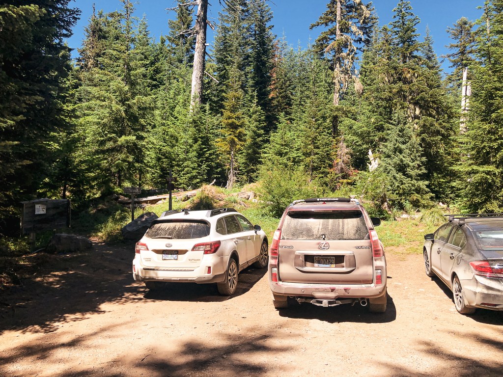

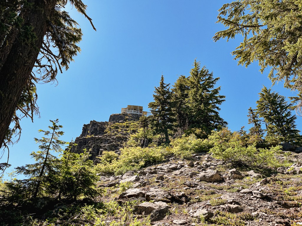
We packed up and headed out from our camp on NF-15 to meet up with HWY-20. There were portions of NF-15 that were a bit rough for my Civic due to some recent logging in the area. We were able to make it out without incident, but it definitely slowed us down. We headed east on HWY-20 to connect with HWY-22. From HWY-22, the road you want is off to the left. It is NF-11 on the map, but was only marked as Straight Creek Road. It is located just past a bend in the highway, so make sure to keep an eye out for it. You will stay on this paved road until you reach NF-1168. There are two turns onto NF-1168, but you will want to take the second one. There is a sign at the first junction with NF-1168 that will point you in the direction of pavement. The NF-1168 road is well maintained gravel all the way to the trailhead. The trailhead can be found just off of the junction with NF-450. It should be obvious as you approach since you will get a glimpse of the lookout before you reach the trail. The NF-1168 road continues on to the Bachelor Mountain trailhead.


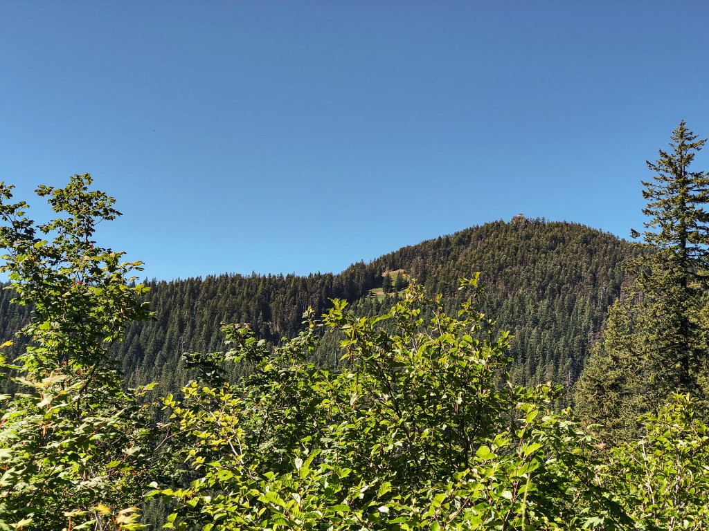
There is parking for a few cars directly at the trailhead and a few pull outs for additional parking. There were already cars here, but it was not as busy as my partner thought it would be. He can be a bit overzealous in his predictions when it comes to busier trails. We had just missed the peak bloom of Beargrass in the main meadow which helped to decrease the foot traffic. There was still a significant amount of wildflowers in bloom though. I always find it interesting what makes a certain trail popular over another. Ease of access? Length of trail? Views or points of interest? We were in the same National Forest, hiking to a fire lookout on a similar length of trail, and it offered similar views. Yet, Carpenter Mountain (post) is significantly less visited. I can’t help but think social media plays a dominating role. But, even then, what makes a spot blow up on Instagram versus another? I often see the same regurgitated spots on “must see lists” for Oregon, but there is still so much more to be seen. I am thankful in some ways that these lists curated by influencers and photographers aren’t usually unique. It helps keep other spots from being overcrowded. But, on the other hand, if there were more unique lists people might be more dispersed in general. Which in turn could lead to less impact on the current areas being overcrowded. This is a topic my partner and I revisit often, but I digress.


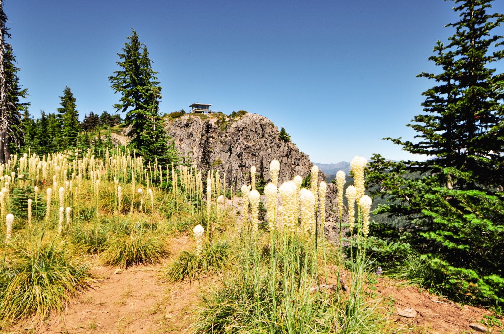

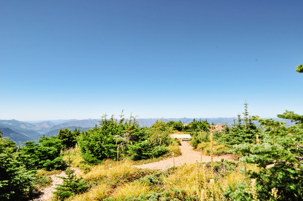


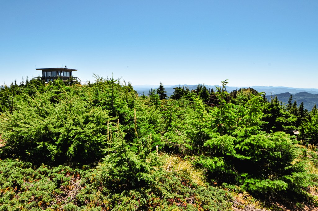
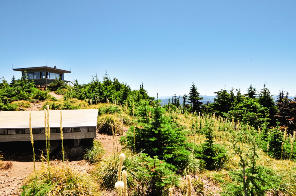
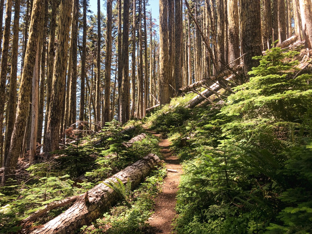
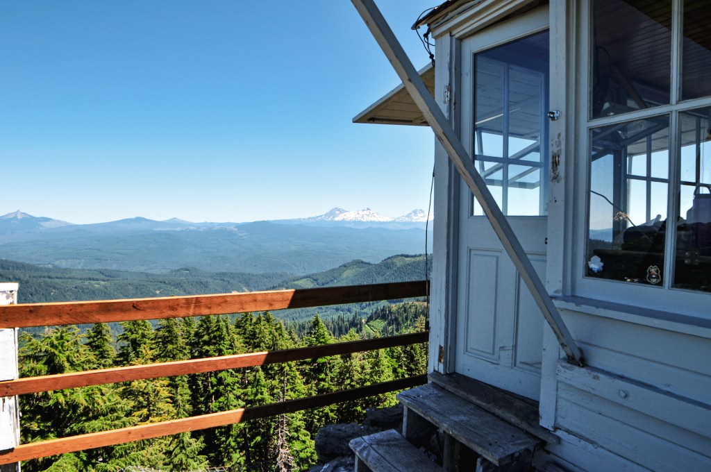
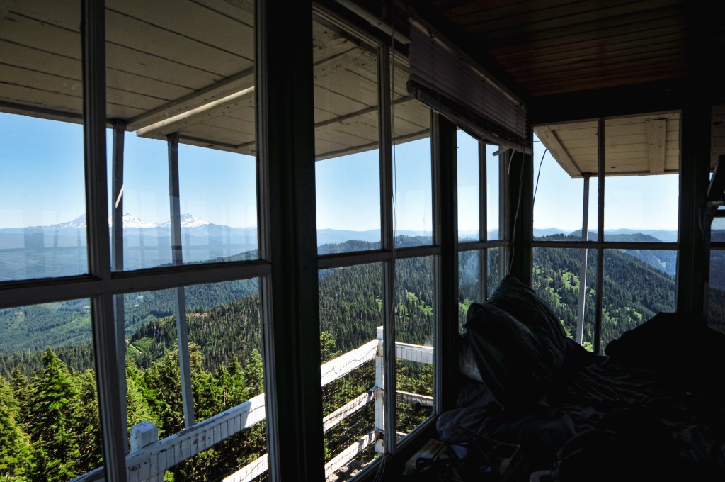
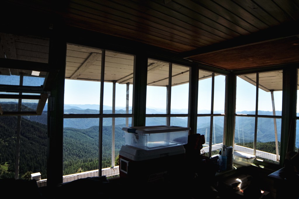
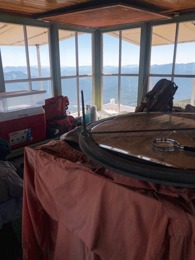
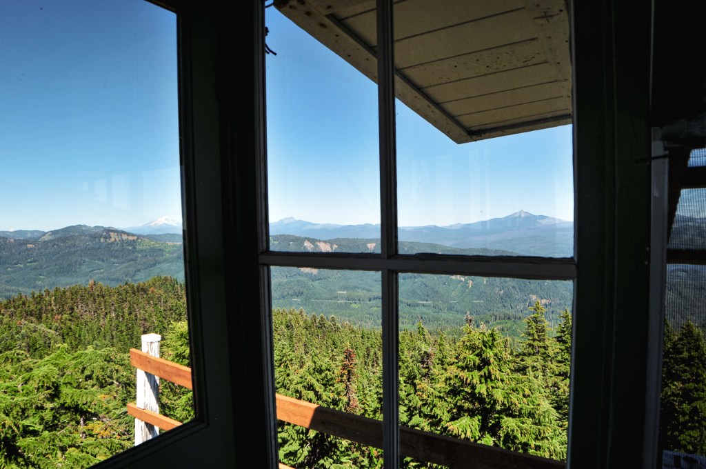
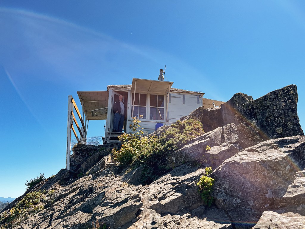
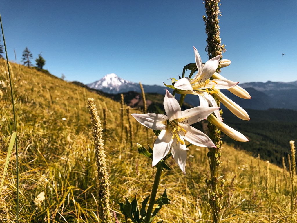
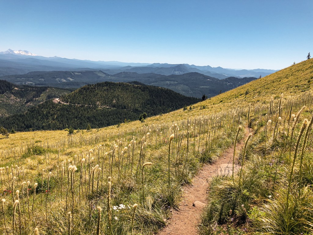
The hike to the summit is a little less than a mile and a half one way. You will climb over 1,000′ in elevation as you switch back up the side of the mountain through an open meadow. Today was forecasted to be hotter than Saturday which didn’t bode well for a more exposed hike. I quickly fell behind as I struggled with my tight calves and feeling dehydrated again. The main bloom of Beargrass might have already been done, but as I climbed the ridge line more and more blooms became present. Beargrass, or Xerophyllum Tenax, has such a unique flowering pattern. It resembles a q-tip or something out of a Dr. Seuss book. They can even reach up to five feet in height, which is almost as tall as me! As we neared the summit, we were lucky to have it briefly to ourselves aside from the lookout attendant on duty. He was doing his best to ignore everyone in sight. We gave him a hello which only warranted a wave and nothing more. I don’t blame him though, after watching a few hikers completely disregard his personal space I too wouldn’t want to try and talk to anyone. The poor guy was just trying to read his book and enjoy a lunch without being bothered. We enjoyed our lunch on the helispot before heading back down to the car. I was happy to be able to finally check this one off my list.


History.
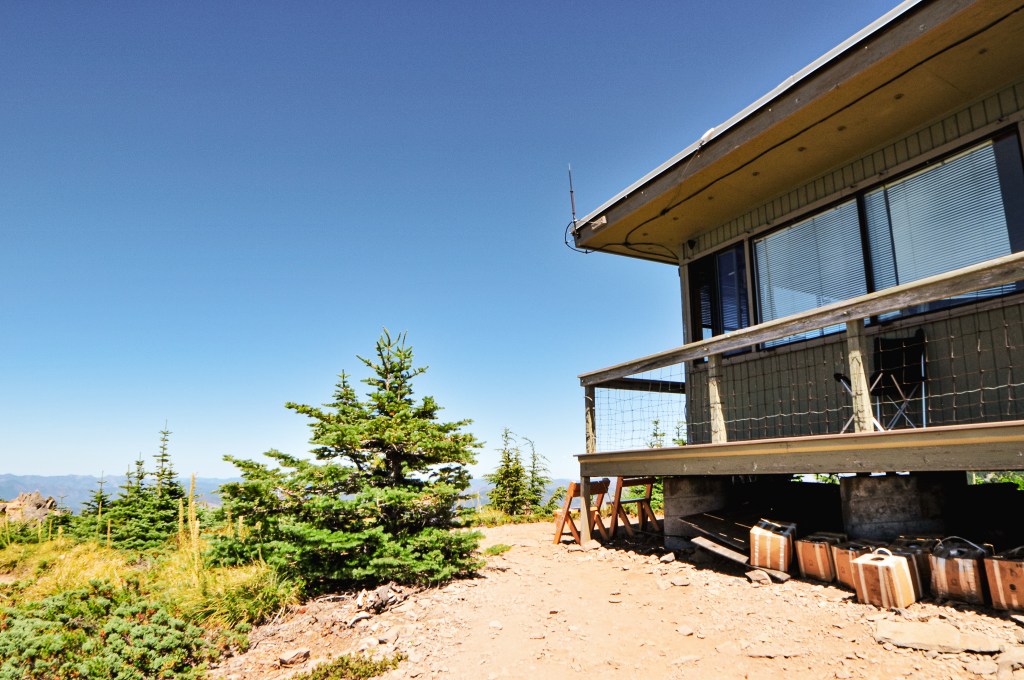
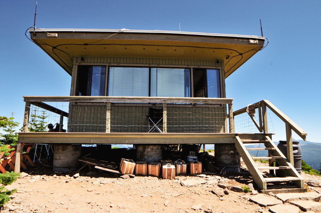
Established as early as 1905 with a rudimentary platform pole structure, Coffin Mountain has been used as a site for fire detection for a long time. It received its morbid name due to the Coffin shape of the summit. In 1921, a D-6 cupola style cabin was erected in place of the platform. This structure housed the lookouts for 15 years until it was replaced in 1936. Its replacement was a 14’x14′ L-4 ground cab. The current lookout is a modified 15’x15′ R-6 flat top cab and was built in 1984. It is still actively staffed every summer.

More Information.