
Location.
Wallowa County; Private property
Status.
Maintained; Currently standing
Estimated drive time from Portland, OR.
6 hours
Date visited.
September 16, 2022
Elevation.
4,720′
National Historic Lookout Register.
US 222; OR 28
Trip Report.
The Friday lookout tour hosted by the FFLA Western Conference was to Tope Creek. This lookout is located on private property and requires prior permission by the land owner to visit. We were expected to meet back at the VFW Post after our lunch break at 1:30PM to start the caravan to the property. Garnet and I had headed back to our camp at the Wallowa Lake State Park during the break to swap our vehicle. We had made the decision to drive my Civic to the conference in the morning with the intention of carpooling with someone. But, after a lack of hands raised for those with available seats to carpool, it seemed easier to drive ourselves. Garnet was borrowing his mom’s HR-V for the week which has better clearance. This decision ultimately put us behind schedule and we didn’t get back to the post until 1:45PM. There were still some vehicles parked here, so we got out to check if they had already left. I asked someone in the building and they confirmed what we had thought. We were both stressed since this wasn’t a good start and we didn’t want to miss out on the opportunity to visit this one. A member had also previously warned that if you’re not willing to drive fast on gravel roads you would be left behind. Luckily, they had printed out directions on how to get there, so we started in that direction with the hope that everyone would still be there.

From Enterprise, we headed west on HWY-82 towards Wallowa and Lostine. We turned right onto Baker Road which is around 4 miles outside of Lostine and can be distinguished by the Wolff Ranch sign. We followed this road until we came to a T-junction with Jim Town Road. There were no road signs here, but you will want to take a left. This brought us to another un-signed T-junction with Whiskey Creek Road. We took a right and stayed on this road until we reached the first house off to the right. The house had a distinguishable bright blue metal roof. We turned right on the road immediately next to it and hoped we were on the right track. We followed this road for a little over 7-1/2 miles until we saw a two-toned blue metal rod marking a road off to the left. We turned and followed this road until we reached a hand-carved W sign. You will want to bear right here to reach the property. The roads getting here were mostly passenger vehicle friendly until we turned onto the road at the blue metal rod. It had some looser sharp rocks on this section of road that gave someone else a flat tire.

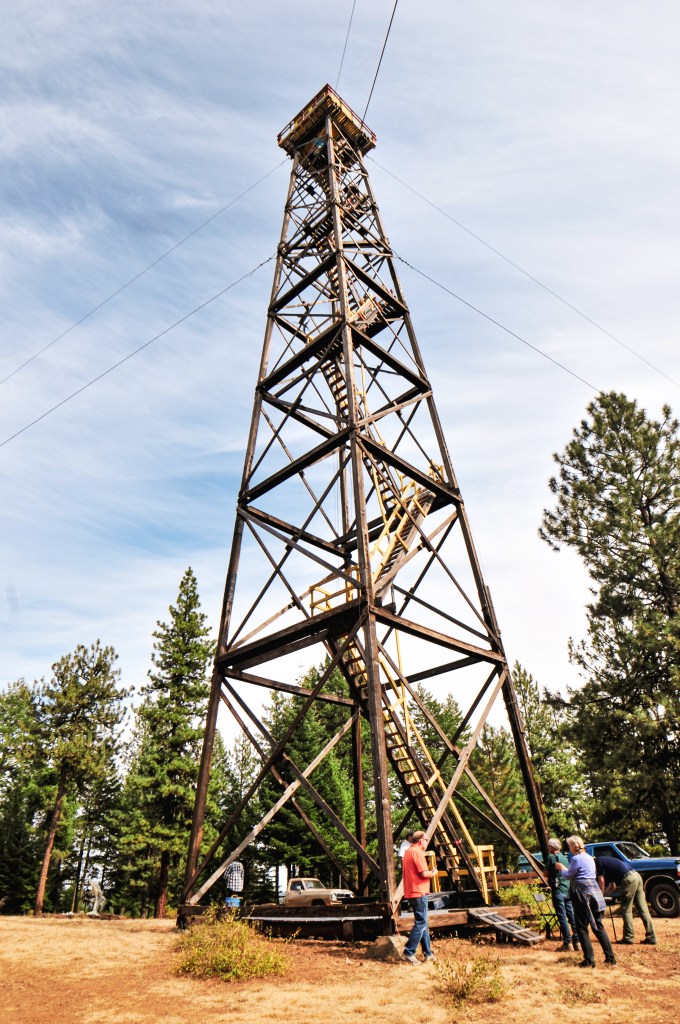

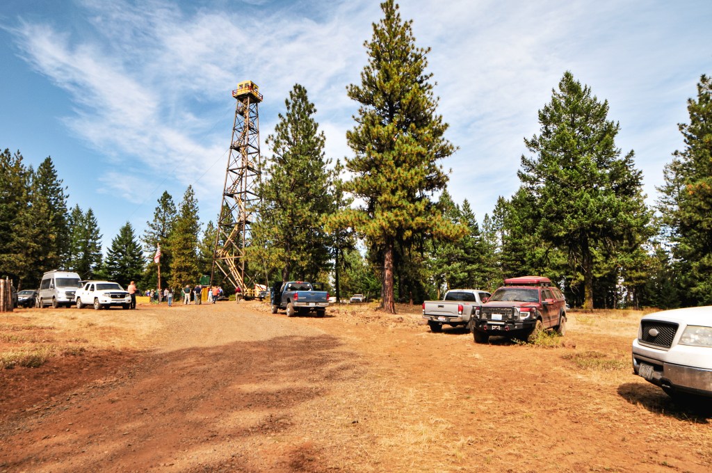
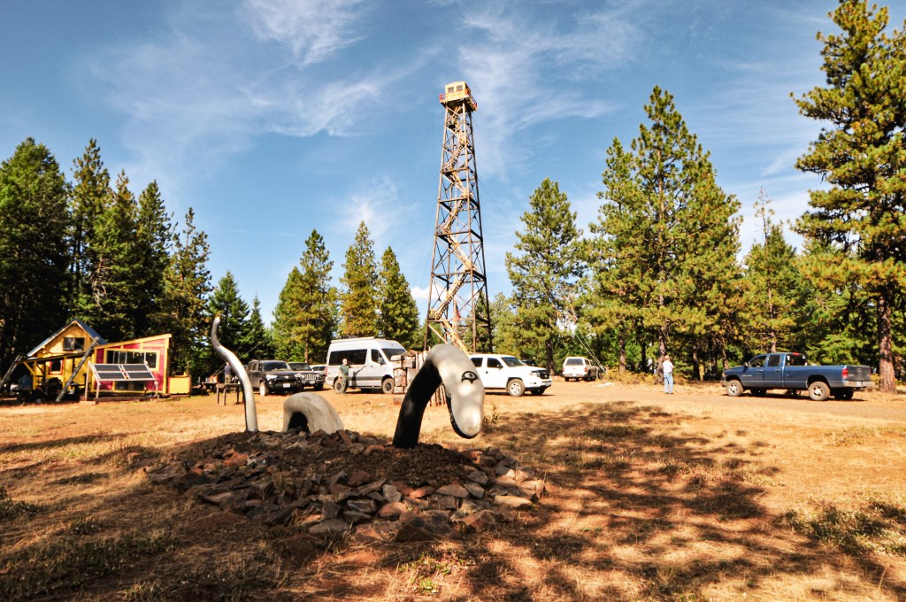
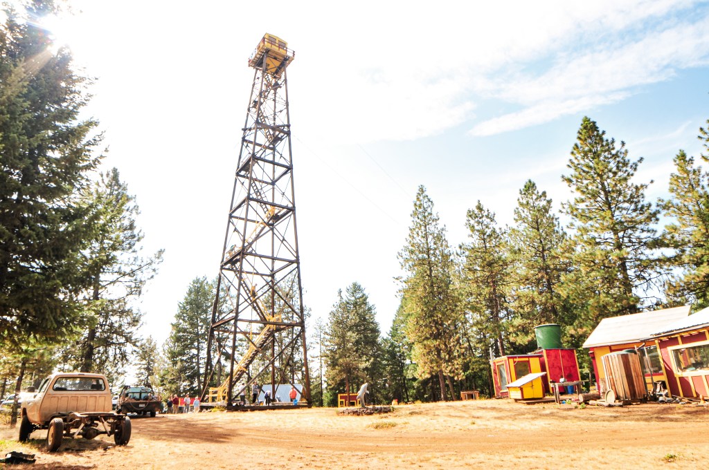

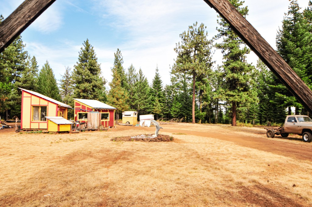

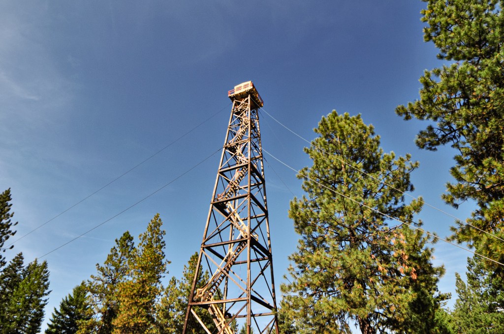
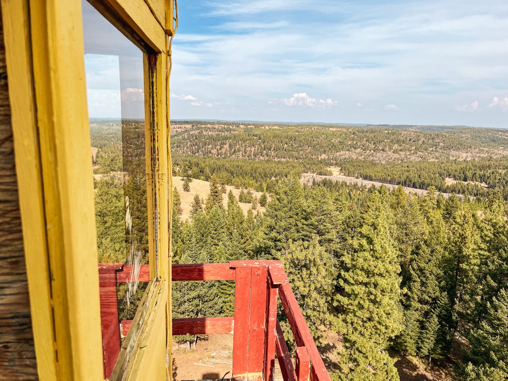
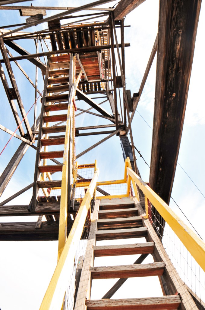
We were the last to arrive, but were relieved to see everyone still there exploring the property. I walked around to take some pictures and we signed up to get in line to climb the tower. The structure was a bit rough around the edges and they only wanted 4 people climbing it at a time. Once it was our turn, Garnet headed for the top. I made it to the third landing before I got a bit squeamish of the height. Forrest had passed me on his way down and he said it only got steeper from there, which didn’t help my confidence. I started up towards the fourth landing, but decided I didn’t need to freak myself out and headed back down. I find the 100′ towers that taper towards the top are the ones I have the most trouble climbing. These are typically the Aermotor or L-6 designs. I walked around the property to take some pictures of the sculptures and talked briefly with a few other members while I waited for Garnet to descend. Brain Wizard, who owns the property, is an eccentric artist and author. He lives on the property year round as a survivalist and was snowed in for 120 days last winter. We talked to him briefly while we were waiting for our turn to climb the tower. He mentioned he used to do terrorist surveillance and intel. Some of his work can be viewed on his website. It seems he is open to visitors with prior permission, but I would be wary of visiting without a group. He made a slight off-handed comment directed at me during our visit.


As everyone was getting ready to leave, we decided to look at possibly visiting another Fire Lookout in the area before dinner. This was a benefit to driving ourselves. The VFW Post was hosting a taco night for the conference, but it wasn’t until 6:30PM. This meant we had a little over two hours to kill. Howard Butte L.O. looked the closest on the map, so we headed in that direction next.
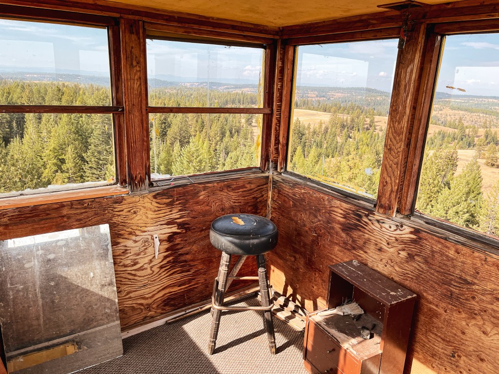
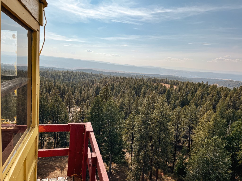
Pictures of Tope Creek cab courtesy of my partner.

History.
Tope Creek was built in 1936 as a 103′ timber tower with L-6 cab by the US Forest Service. The cab is listed as 7’x7′ on some sites, but noted as 8’x8′ on the NHLR. I found similar inconsistencies in the listed height from 100′ to 103′. I am unsure which dimensions are accurate. The 14’x18′ one-room ground house, used for the living quarters, was not added until 1938. Ownership was later transferred to the Oregon Department of Forestry and was staffed into the 1970s. It was eventually classified as surplus and sold to a private owner, Zella Guyness, during a state auction in 1978. The tower is still maintained by the current private owner, Brian Wizard.


2 thoughts on “Tope Creek L.O.”