NOTICE: This area was apart of the July 20, 2024 closure area for the Diamond Complex fires but has since been reopened. This area does not appear to have been impacted.
Location.
Umpqua National Forest
Status.
Abandoned; Currently standing
Estimated drive time from Portland, OR.
4-1/2 hours
Date visited.
July 30, 2022
Elevation.
7,017
National Historic Lookout Register.
US 1615; OR 139
Trip Report.
UPDATE: October 12, 2024 – while we were camping in the area we had drove down the NF-3703 road and it appears to have been regravelled recently which eliminated the majority of the potholes and hazards we originally saw. They were minor then but almost non existent now. We didn’t drive the entire way to the NF-370 spur but I assume the spur road conditions are still the same.
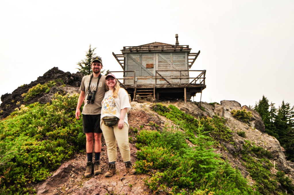
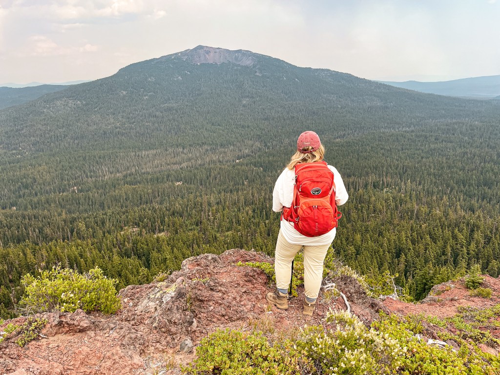
Oregon has been in a heat advisory for the last week with temperatures ranging in the mid to high 90s. It even briefly jump up into the low 100s a couple of those days. A haze was expected to settle over all of Oregon for the weekend due to a new wildfire in northern California. Is it too soon to say I miss the rain? Anyway, what better time to head into the forest than when you’re sweltering at home? It turns out it’s pretty hot out there too. But, my partner and I headed on as we always do. This weekend we set our sights on Garwood Butte. We figured we could do The Watchman (post) or Mount Stella (post) while in the area too. Yes, both were also an option. It’s a bit of a drive for a one-night trip, but we’ve come to the conclusion that we’re a bit crazy. Garwood Butte has been on our minds for a while. Mostly, because my partner’s name is Garnet and he goes by Gar on occasion. I couldn’t possibly visit Garwood without him. For this reason alone, we felt a connection to the fire lookout. It’s also just a really cute L-4 perched on top of a rocky outcropping with views towards Mount Bailey and the Crater Lake rim. What’s not to love about that? We had originally thought about adding it to our road trip itinerary, but were worried about the potential for snow. After our visit to Pig Iron (post), we could see it was snow free and that it would be accessible for a future visit to the area this year.


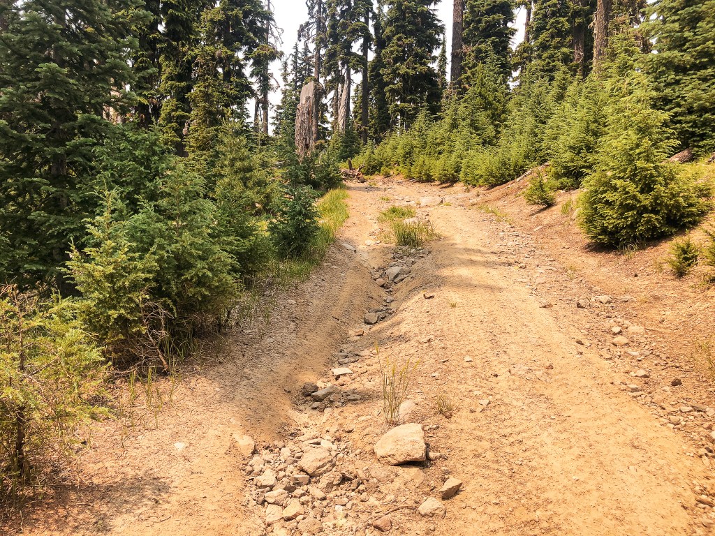

Our alarms were set for 6AM and we were on the road as early as possible. We headed down the I-5 corridor once more, but this time cut over on HWY-58 to meet up with HWY-97. We gave a quick wave to Odell Butte L.O. and Walker Mountain L.O. (post) as we drove past their marked highway turn offs. After a quick refuel in our now frequented stop in Chemult, we turned on to HWY-138 towards Crater and Diamond Lake. We passed the north entrance to Crater Lake NP and stayed on HWY-138 until we reached the turn for HWY-230 off to the left. I have been through this area a few times now on various different trips throughout the years. We were also familiar with the route due to an unsuccessful attempt of Garwood during our visit to Cinnamon Butte (post) last December. From HWY-230, we turned right at the access for Three Lakes Sno-Park. We continued straight to stay on NF-3703 until we reached the turn off for NF-370 spur. There were minimal potholes and ruts to avoid along the NF-3703 road. We didn’t even have to attempt a drive up the NF-370 spur to see it wasn’t a drive-able road. There were large ruts and rocks embedded in it that were not low-clearance compatible. The road is marked but the sign is sun-bleached and indecipherable. It is best identified by its terrible condition and a ski post marked with the number 36. We parked in a pull out just past the road. It was already noon by the time we got there, so we decided to have lunch in the comforts of our air conditioned car instead of the summit. While we were hiding out in the car, an ATV came brapping by and waited at the NF-370 junction. At first, we were confused on what they were doing or thought maybe they stopped because they were confused by what we were doing. But then, another ATV followed which triggered the first one to head up the road. When the second ATV reached the junction it proceeded to wait as well. The same thing continued to repeat itself until 8 ATVs had turned up the NF-370 spur. We weren’t too keen on starting a road walk that we knew would end in us being dusted up and decided to wait. The road eventually just dead ends and they would have to come back down. Luckily, we didn’t have to wait long and their brapping continued on to somewhere else.

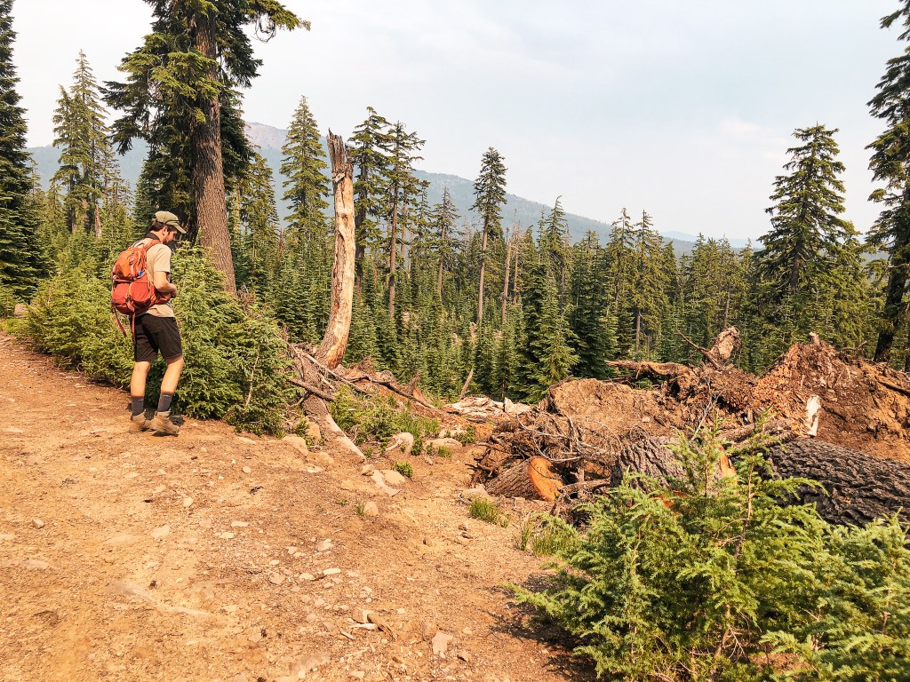
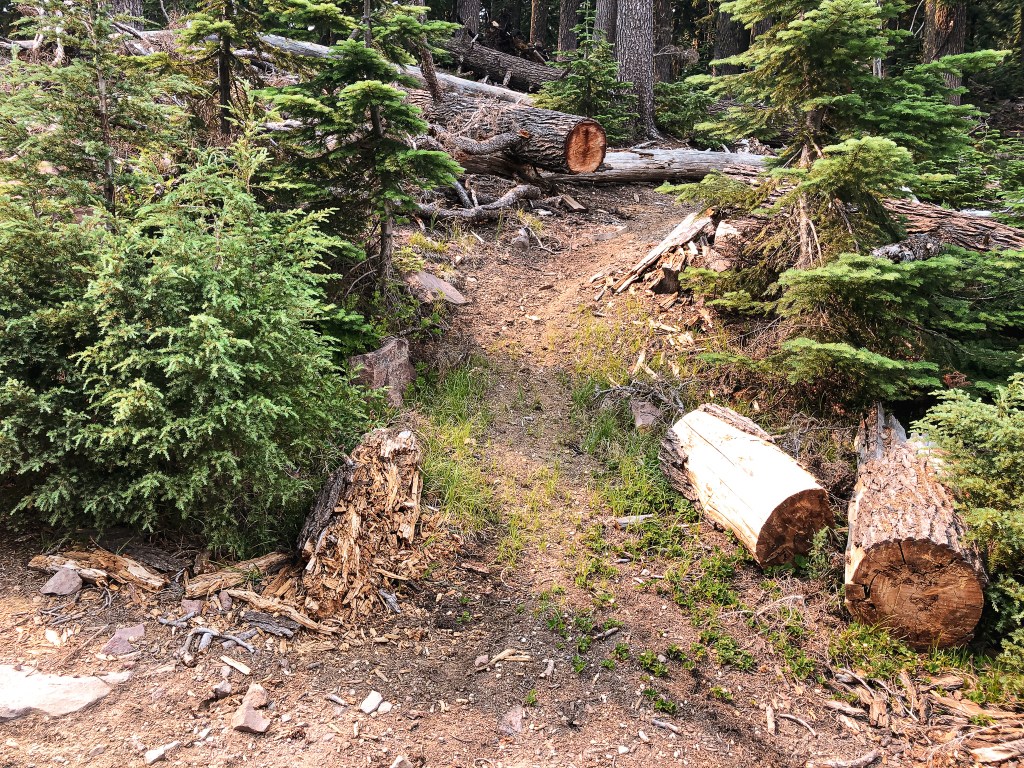
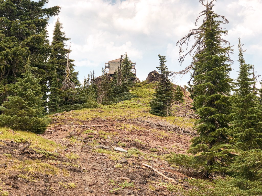
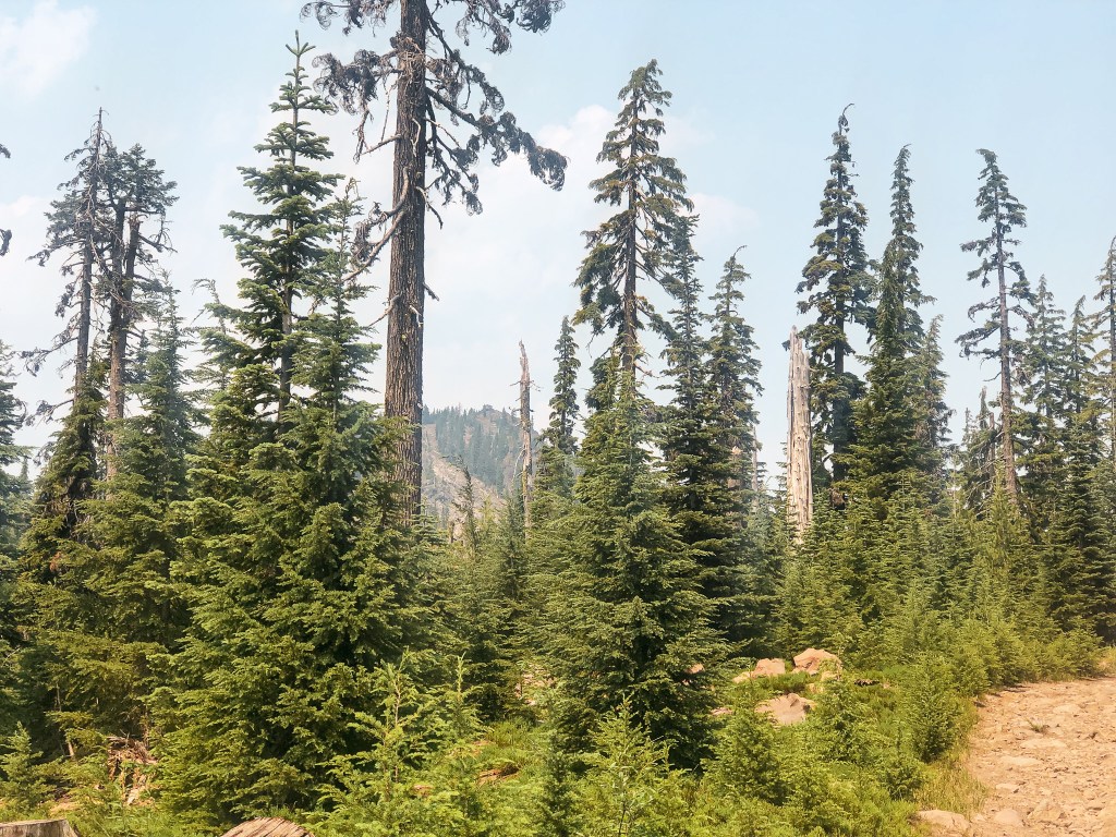
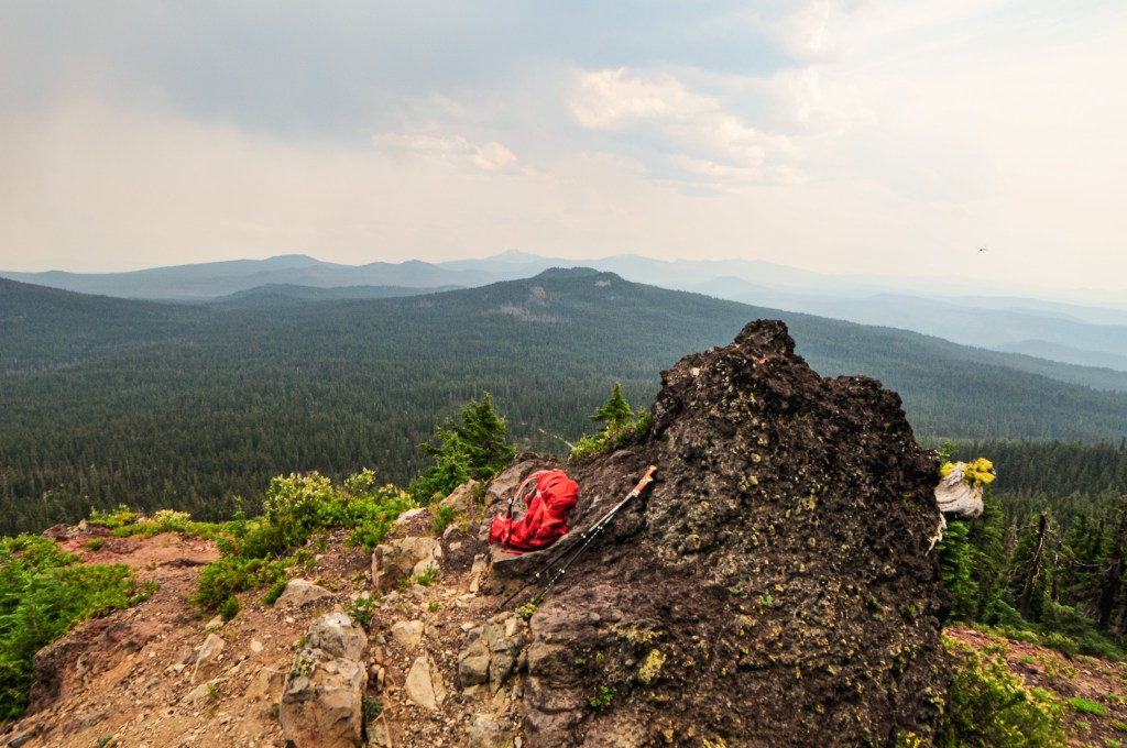
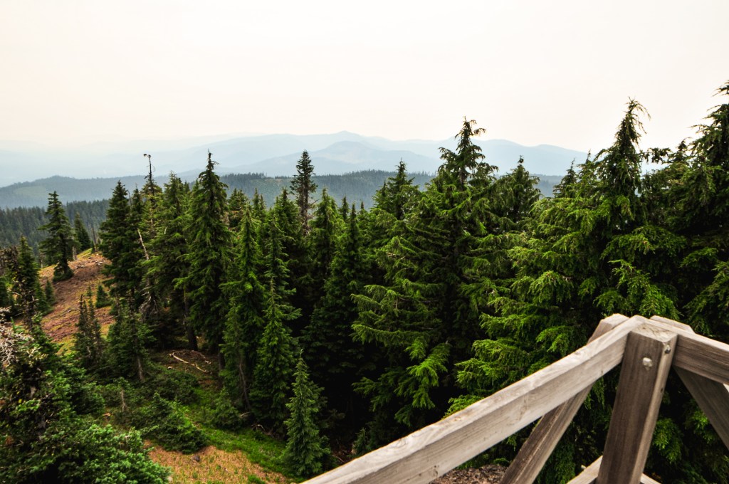
It was hot and dusty when we started our hike up the road. We knew it was roughly two miles to the Fire Lookout from the junction, if you stayed on the road and didn’t use the connector trail. As we walked along, the road conditions continued to deteriorate with larger embedded rocks, downed trees, and wash out. There was a point in the road where the ATVs even turned around. A large tree had come down across it and there wasn’t enough room on either side for them to get around. Ah, that’s why they didn’t take long. It would have required a chain saw to remove it. We both agreed, this was officially the worst road we’ve been on so far. I took some pictures of the road, but it never quite captures the true conditions. We eventually reached a more open area with a view of Garwood Butte. There was a defined trail off to the left that we assumed was the connector trail. A peakbagger report had mentioned this trail was no longer here in 2012, but from what we could see it was now. If you take this trail you can cut off a half of a mile of road walking. It meets back up with the road where the official trail #1471 to Garwood Butte begins. There is no official trail sign, but it was a well defined junction. If you have trouble finding it, always look for the cut logs first. As we headed up the trail, it appeared to have been brushed out more recently. It was clear to us that someone had been taking care of this route somewhat regularly despite the road conditions. It was a hot and slightly humid slog to the summit. The trail switch-backed through an interestingly mixed forest until it opened up to an exposed slope. The trail was in great condition besides a few loose sections that made finding my footing more difficult.
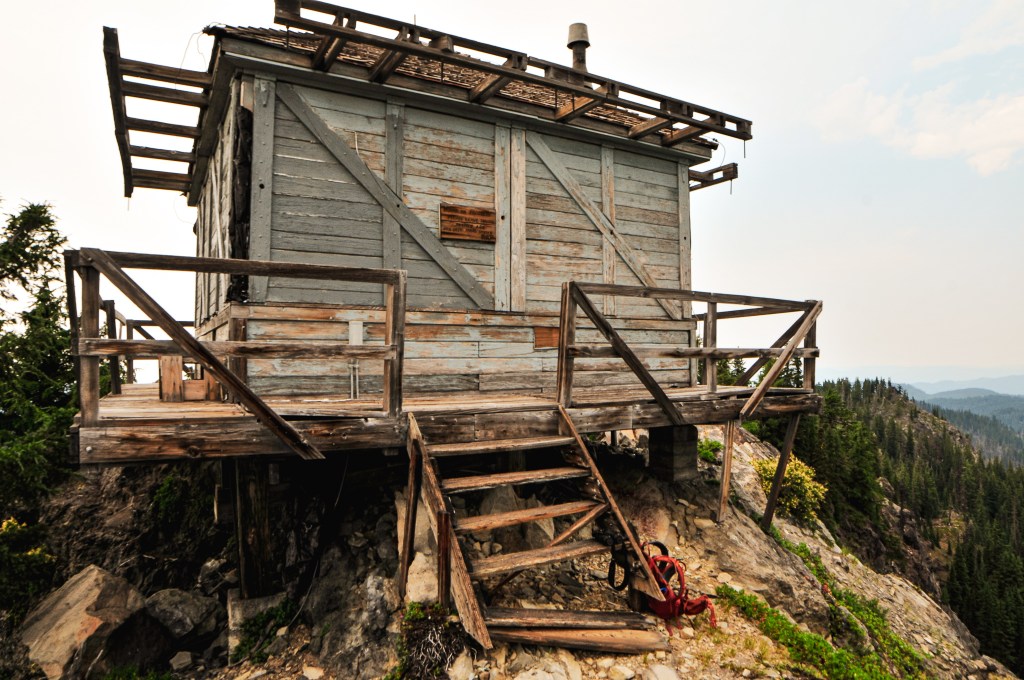
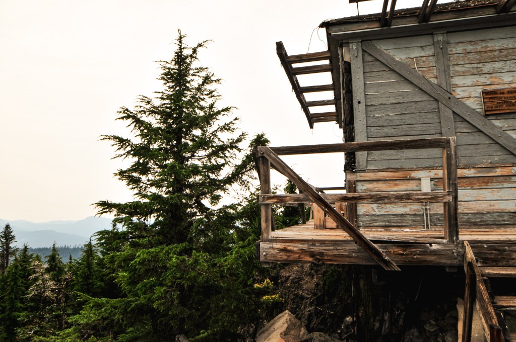


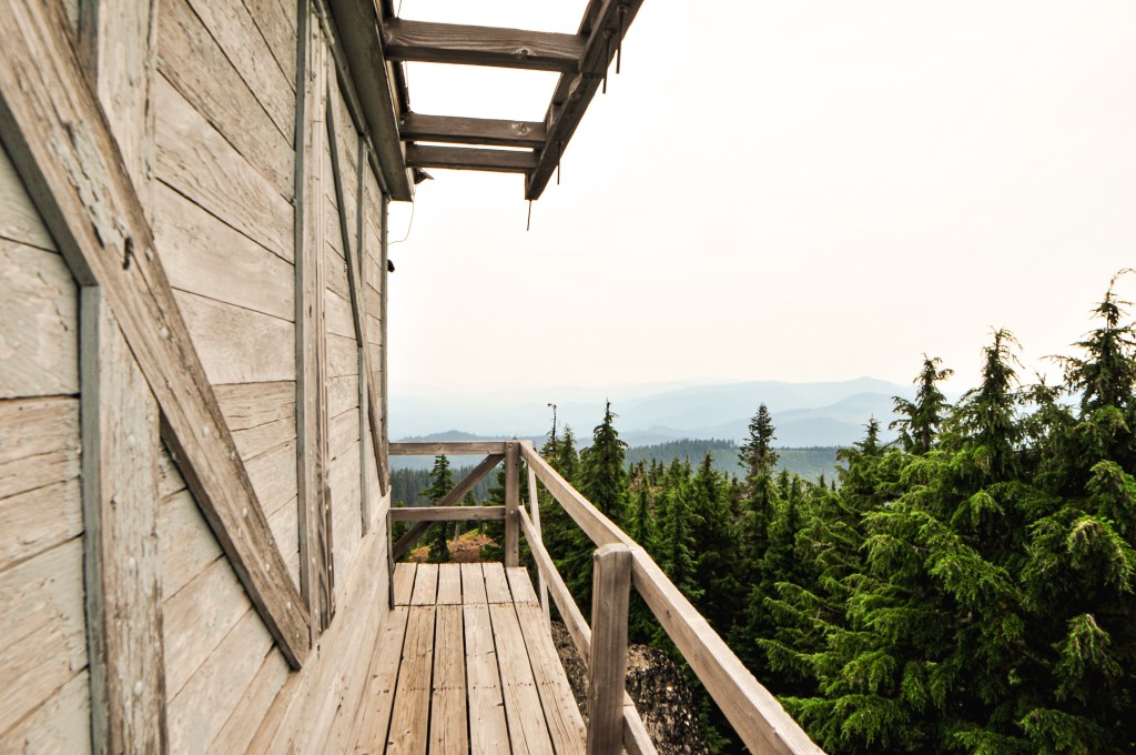

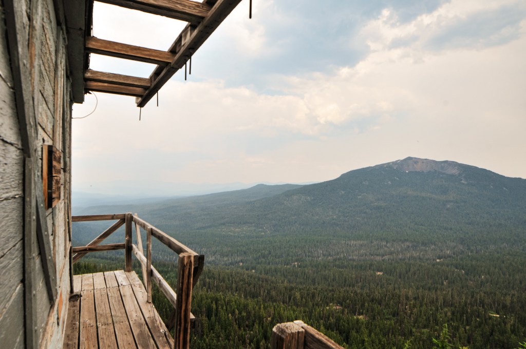
My partner reached the summit before me and was already making his rounds on the catwalk as I tried not to completely wilt away in the sun. I always seem to struggle more than him, specifically on steeper trails and in the heat. Partially, because I’m not in as good of shape but there are various other reasons as well. Garwood has a really nice summit on the edge of a rock that dropped off to views of the drainage below. The lookout structure was looking a bit worse for wear on the catwalk. Some of the stairs had broken and one corner was being supported by two boards. There was a sign posted on the cab mentioning the ongoing restoration, but I’m not sure if that is still active. Please use caution if you decide to climb the catwalk. We headed down after taking in the hazed over views and debated our next step. We had already found some decent dispersed camp spots and could have easily set up camp early to relax. But, there was also just enough time left in the day to move on to Mount Stella. We were both torn between wanting to maximize our short trip and just taking it easy for once. Who were we really kidding though? Of course, we headed on to Mount Stella (post).

History.
Formerly known as Bear Butte, it was renamed to Garwood Butte in 1946 to commemorate Leroy E. Garwood. Leroy was a former Forest Service District Ranger that died in March 1944. He was known as an old-timer on the forest and was the first to develop the lookout station atop the butte. The renaming also helped to eliminate another “bear” named feature within the forest. At the time the following features included the name bear; 6 Bear Creeks, 2 Bear Buttes, 2 Bear Camps, 1 Bear Bluff, 1 Bear Bones, 1 Bear Gulch, 1 Bear Lake, 1 Bear Wallows, 1 Bear Trap Mountain, and 2 Bear Mountains. Not the most creative. The structure on Garwood Butte was built in 1942 as a 14’x14′ L-4 ground cab. It was last staffed in 1973 and has since been abandoned. In 2012, the lookout was threatened by a nearby fire and had to be wrapped by fire fighters in Structure Protection Wrap. I believe it was the Butte Fire, but there were a few other larger fires during that year that could have caused this to be wrapped. There has been ongoing restoration work in more recent years, but it still needs a lot of work.