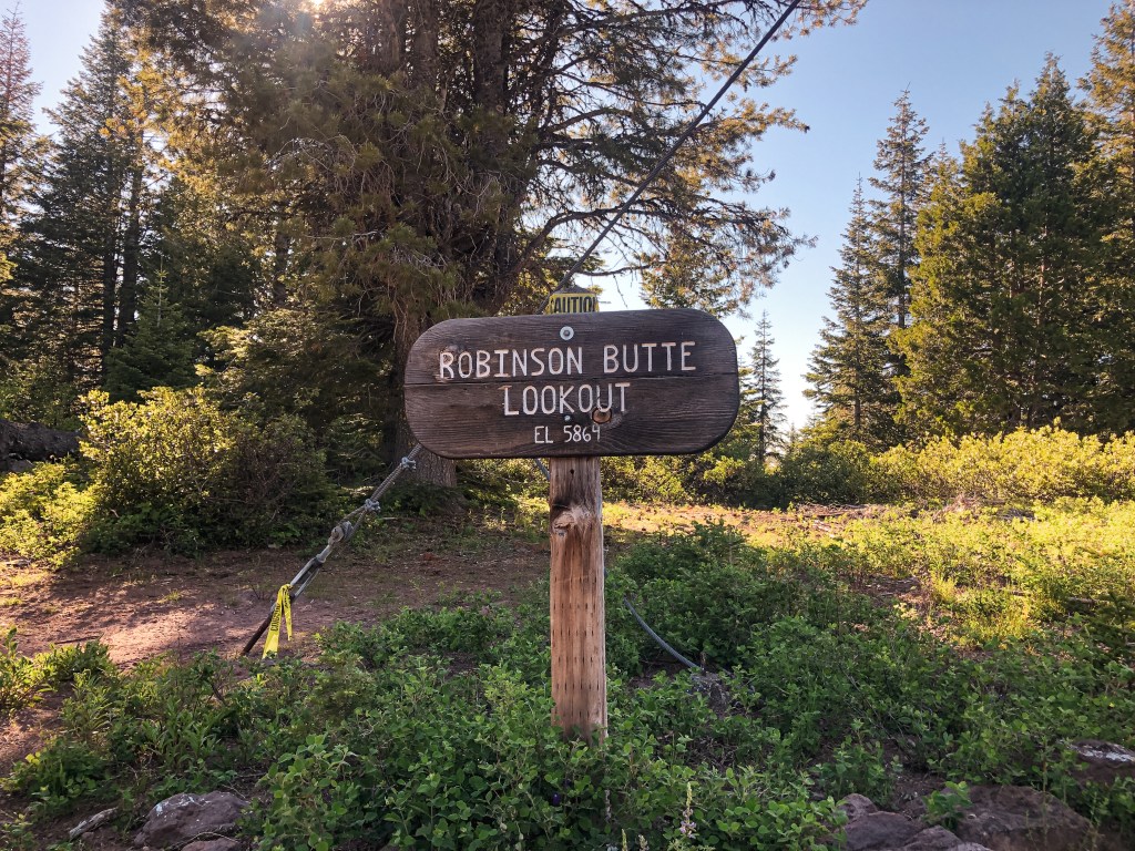
Location.
Rogue River-Siskiyou National Forest
Status.
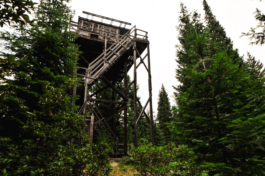
Abandoned; Currently standing
Estimated drive time from Portland, OR.
4-1/2 hours
Date visited.
July 30, 2022
Elevation.
4,715′
National Historic Lookout Register.
US 496; OR 89
Trip Report.
My partner and I decided beforehand that if we only had time to add one other fire lookout to our trip to Garwood Butte (post), it should be Mount Stella. We both really wanted to see The Watchman (post) as well, but Mount Stella is in poor condition. It was on our priority list due to its higher risk for collapse, being torn down, or burning down in a wildfire. We didn’t reach our car until around 4:30PM after visiting Garwood (post). We knew there was still enough time to squeeze in Mount Stella for the evening, but only if we left immediately. This was also with the assumption that the road conditions to the gate were in our favor. We briefly contemplated setting up camp and visiting Mount Stella in the morning. But, if we successfully visited Mount Stella now that meant there would be time for The Watchman (post) in the morning. As we headed out of the forest to HWY-230 we could see darker clouds on the horizon. The forecast did mention a chance of rain and thunderstorms in the area, but we figured it unlikely with the heat. I could see some flashes in the clouds and we passed through a minor drizzle. Unfortunately, not enough to clean off the collected dirt on my car’s exterior. Thunderstorms are typically not ideal for visiting fire lookouts since you are on a higher point that can be more exposed to the elements. But, they seemed to be moving quickly in the opposite direction. Although these didn’t pose much fret for us at the time, it seems they were the same thunderstorms to kick off Oregon’s Wildfire season. The first, currently known as the Windigo Fire, being reported Saturday night within the Umpqua NF. The second, currently known as the Potter Fire, being reported the following morning within the Willamette NF. Both were just barely north of where we were camped this weekend. It’s a bit unsettling how quickly we turned from our wettest spring to our current fire season with little to no transition period. I’m inclined to stay hopeful for a mild season, but I’m also not holding my breath.
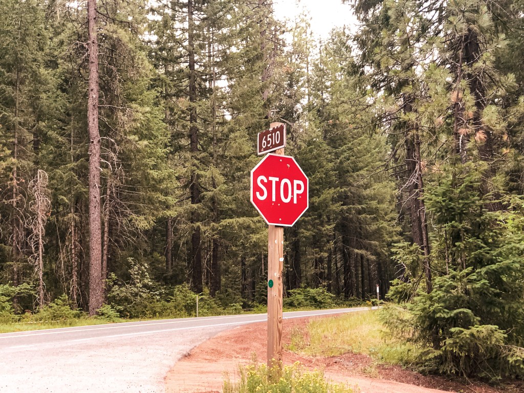

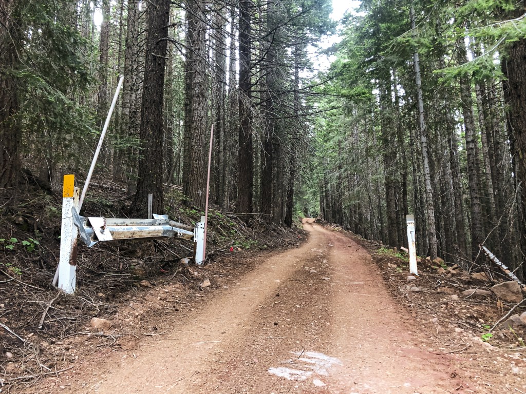
We were back on HWY-230 around 5PM and thankful for the longer summer days. We turned right on to NF-6510 just past where the highway crosses Bybee Creek. There were a lot more people camping in this area due to the water access. Once the road started to head away from the creek, we reached a fork. We took a left to stay on NF-6510, while NF-6520 was to the right. It is three miles from HWY-230 to the junction with NF-200. The NF-200 spur didn’t have a sign, but it is off to the left at a four way junction. The NF-100 spur was signed off to the right which helped us identify it on the map. It was roughly one mile down NF-200 to the gate and another three quarters of a mile to the lookout from the gate. The NF-200 spur was in decent condition, albeit a bit overgrown. We were able to drive the Civic to the gate with minimal caution. We ended up parking near the decommissioned road off to the right and walking from there. The gate was open but there were some large rocks embedded in the road that stopped us from continuing on in the car. It had potential to be worse than the access road to Garwood Butte (post), but it improved significantly after the first rocky section.
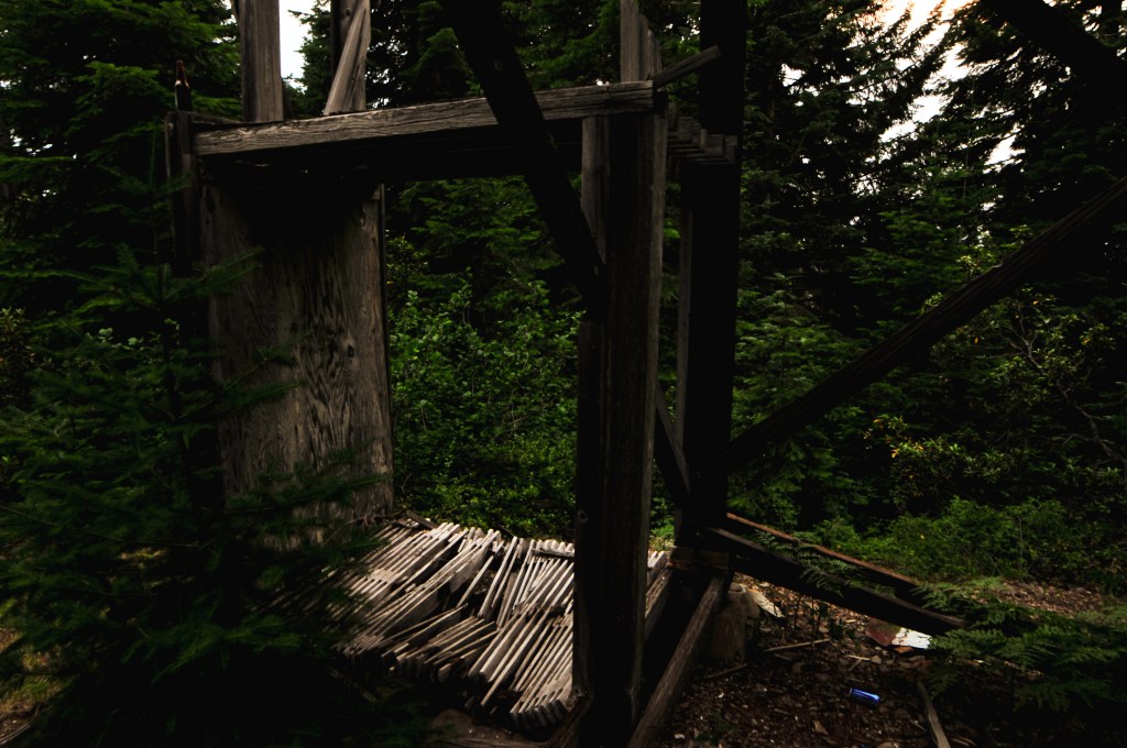
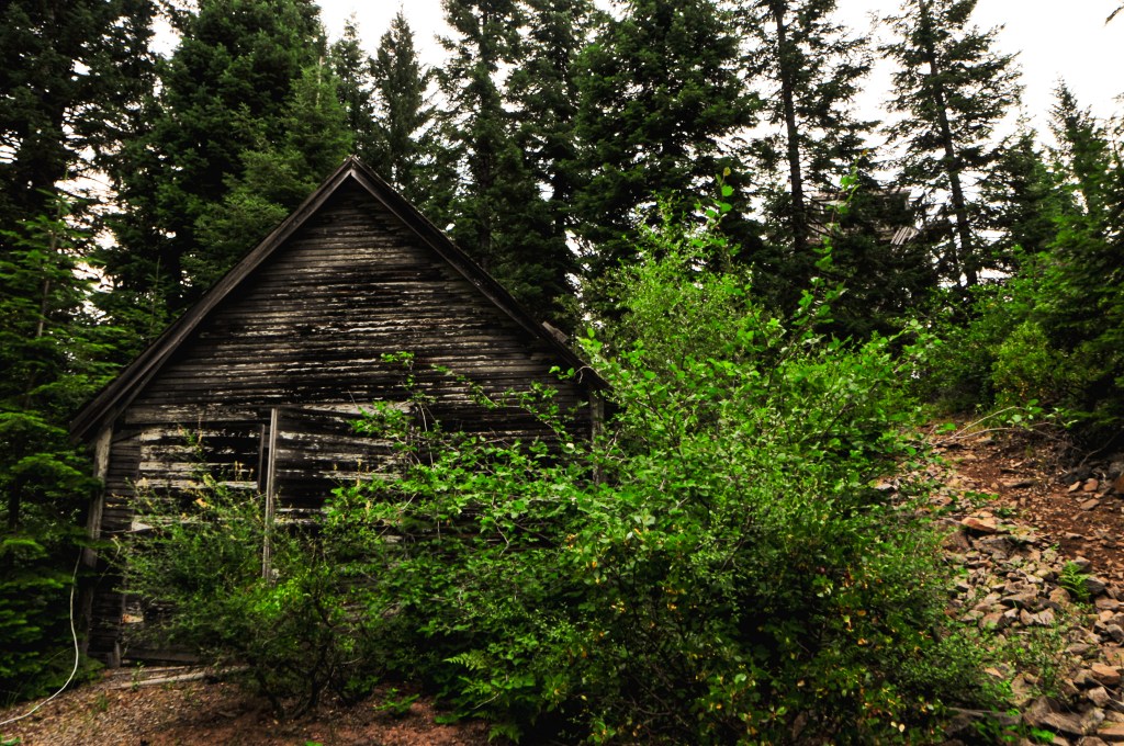
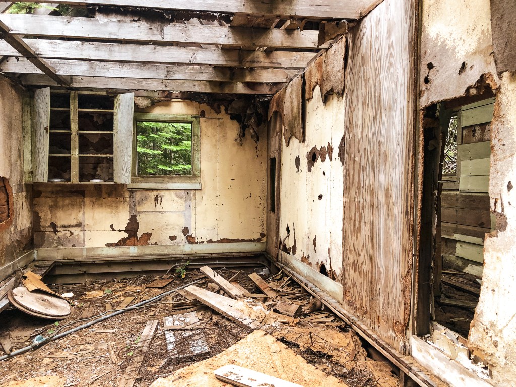
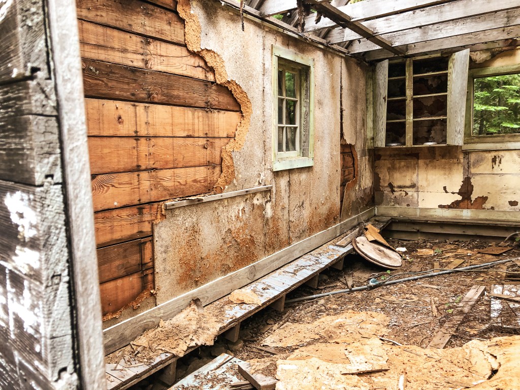
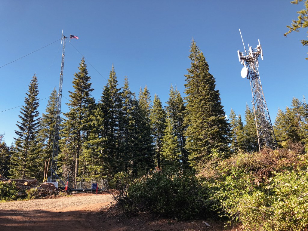
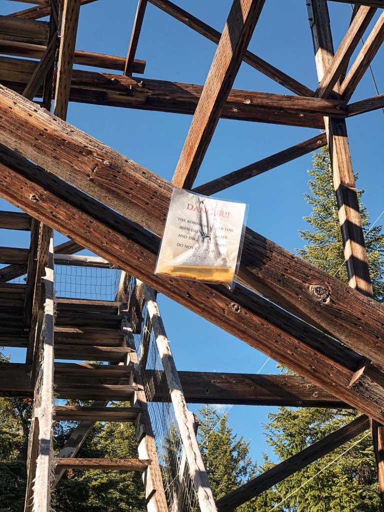
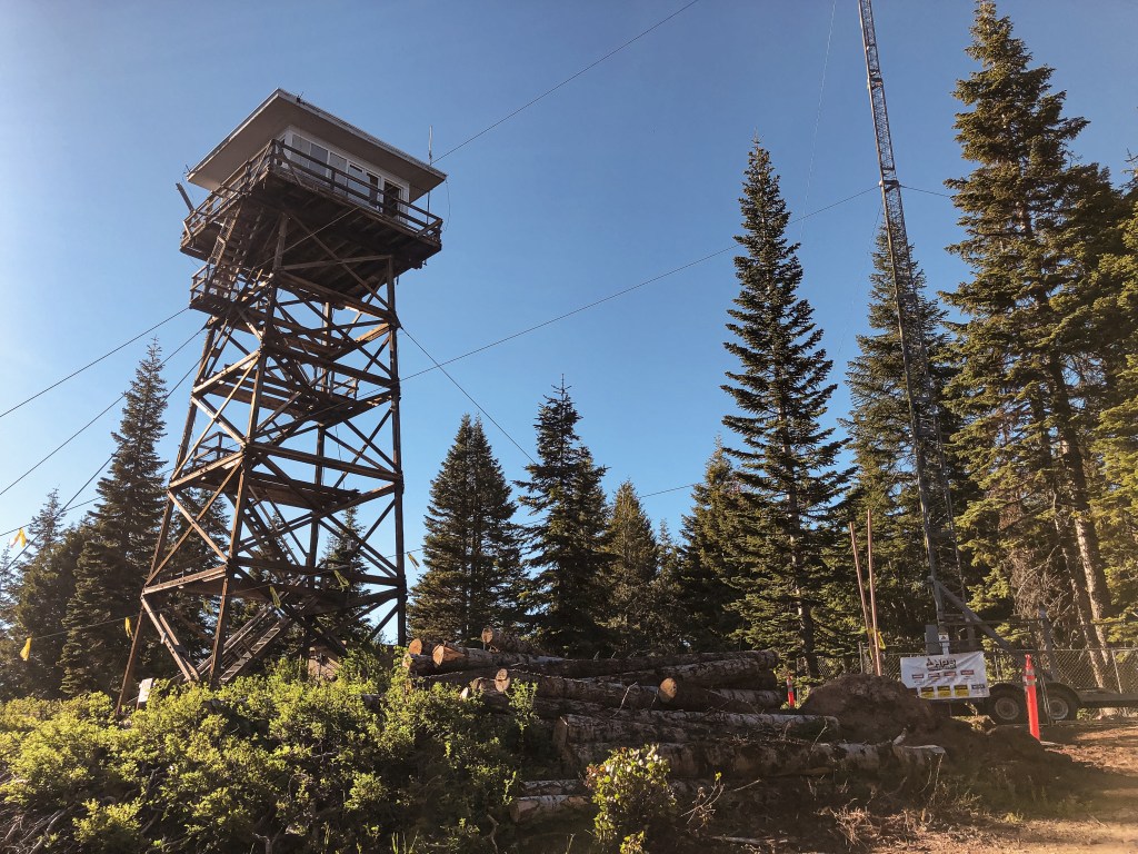
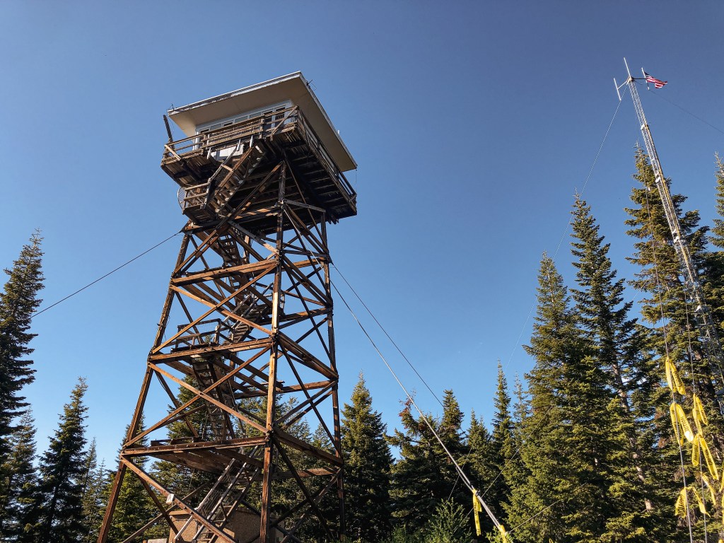
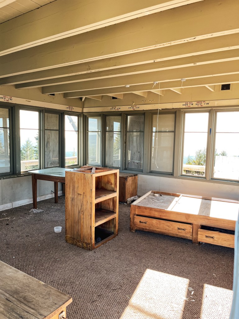
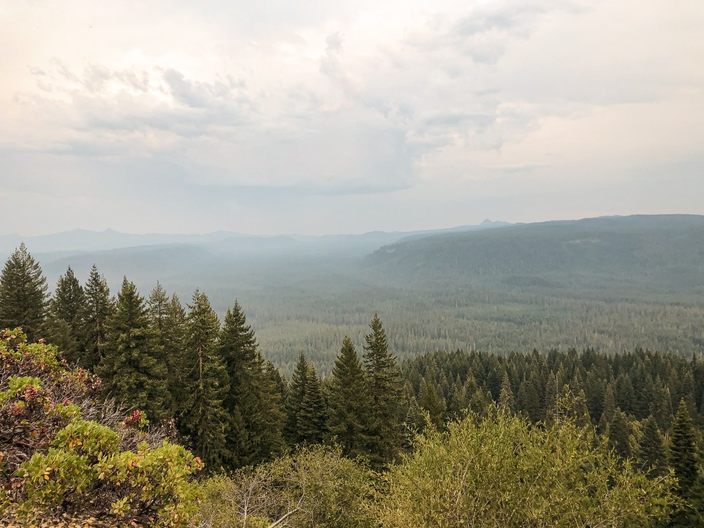
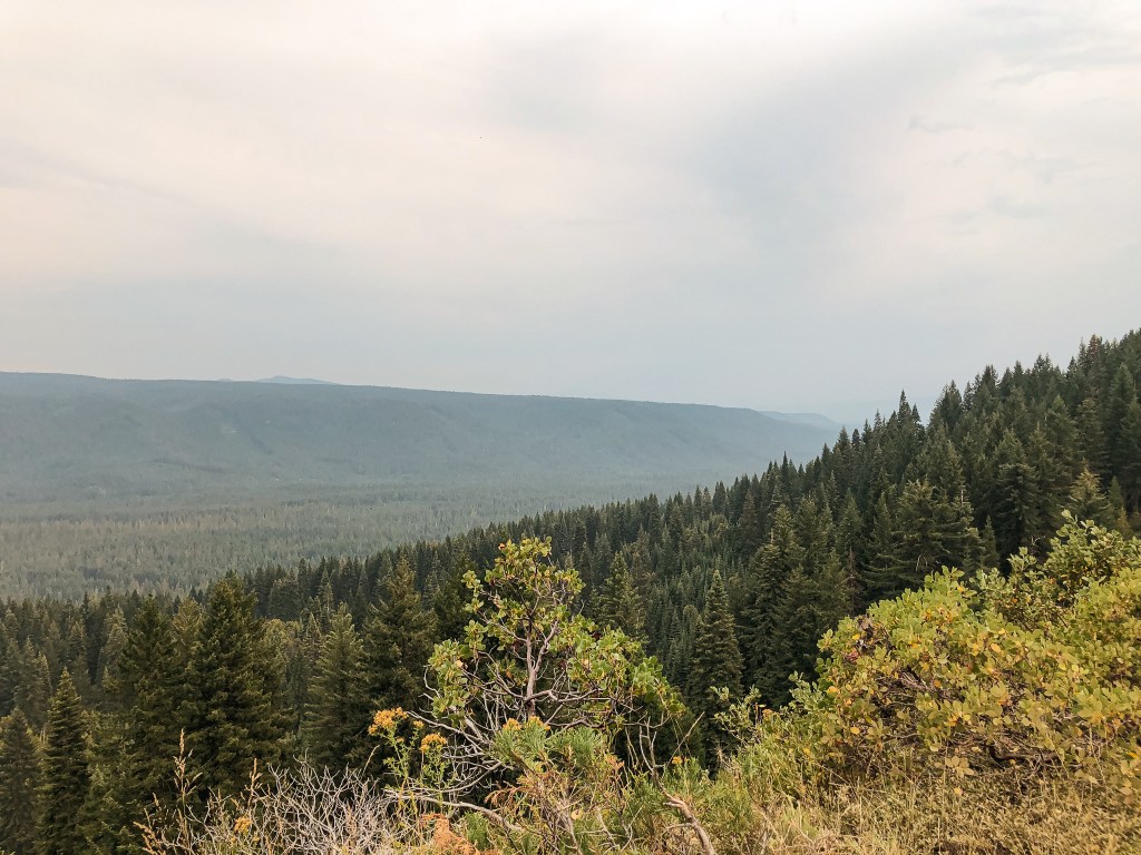
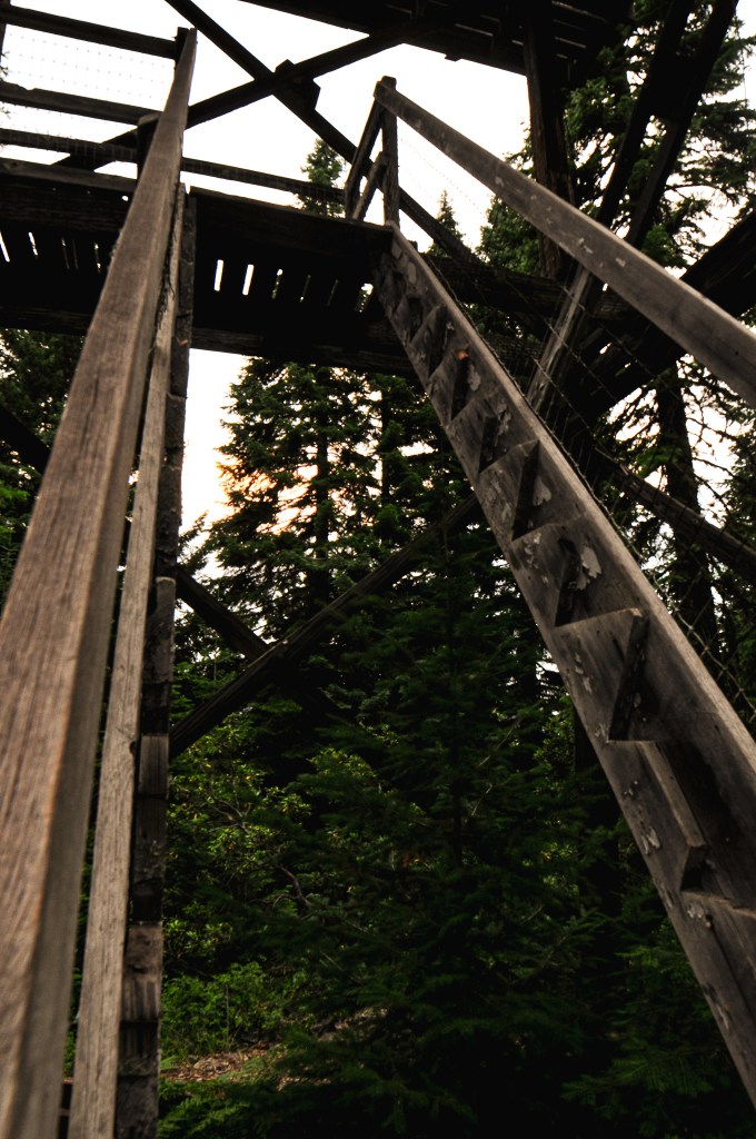
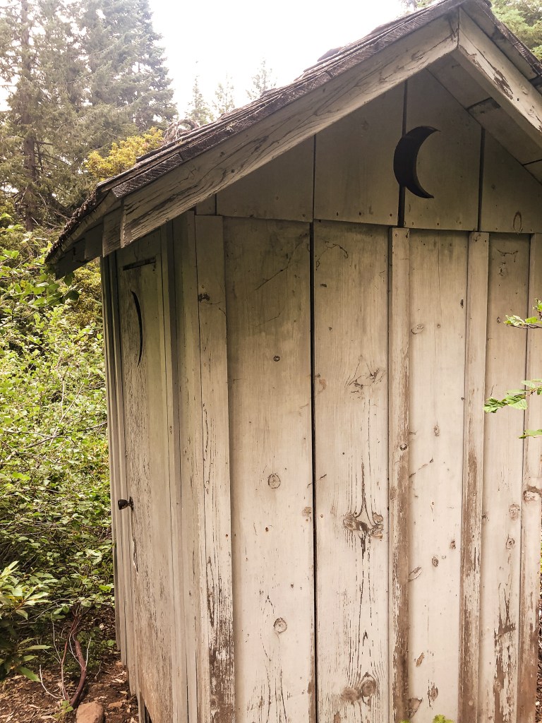
By this time, the heat had caught up with me. I was feeling completely drained of energy and dehydrated while nursing a headache. Despite my best effort to drink as much water as possible, it was no match to the heat. My partner took off at his usual pace for the summit while I meandered behind. It’s a mostly forested road walk until you come to a sharp bend. At the bend, it opens up to views of the valley just south of the summit. These are the only views we would get from Mount Stella. The remaining area is overgrown with tall trees and shrubs. I could hear rumbles of thunder in the distance as I reached the clearing. It wasn’t an immediate concern, but I also wasn’t inclined to stay on the summit for too long either. I quickly took some pictures of the tower and made my way over to the garage. As I was entering through the door to the garage something larger scurried towards me. I screamed and ran out of its way thinking it was a large wood rat. My partner had already warned me of the rabbit he spooked up in the garage earlier. Turns out I spooked the same poor rabbit. It was now past 6:30PM and we knew we needed to head back so we could set up a camp. As we were hiking down the road, we were surprised to be met by a vehicle. It was a government vehicle from the BLM fire crew. They didn’t stop to say anything, but I can only assume they were driving up to the view point to watch for fires. Based on that, one could argue the site is still used in emergencies even though they don’t use the tower anymore.
We had planned on camping near Mount Stella if there were decent options and heading to The Watchman (post) in the morning via the Southern park entrance. But, it seemed most of the decent camps were already taken in this area. We decided it made more sense to head back towards the other camps we found closer to Garwood Butte (post). This would set us up for easy access to the Northern park entrance instead. We didn’t set up camp until after 8PM, but it was overall a successful day.
History.
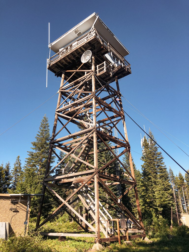
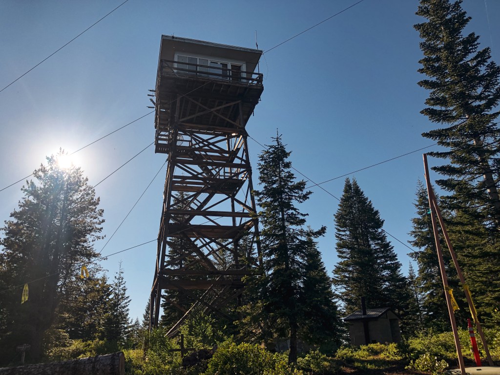
A 20′ native timber tower with L-4 hip-roofed cab was the first structure built on Mount Stella in 1932. Similar to other Fire Lookouts, it was activated as a Aircraft Warning Station during 1942 until 1943. In 1946, the Forest Service replaced it with a 30′ treated timber tower and L-4 cab. This structure still stands today but has been abandoned since the 1980s.