Bald Mountain L.O.

Oregon Lookouts

Location.

Fremont-Winema National Forest

Status.

Active; Currently standing

Estimated drive time from Portland, OR.

5 hours

Date visited.

June 30, 2022

Elevation.

7,396′

National Historic Lookout Register.

US 480; OR 73

Trip Report.

Day 6/10: Lookout Road Trip 2022

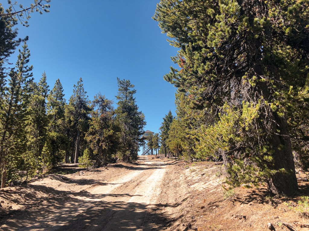
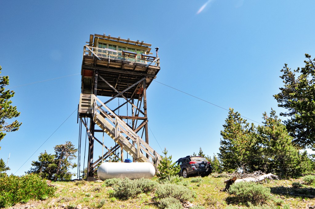
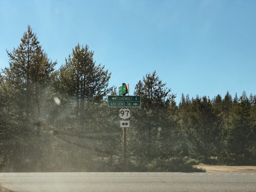
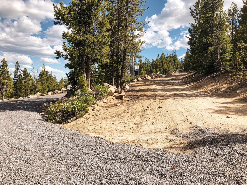
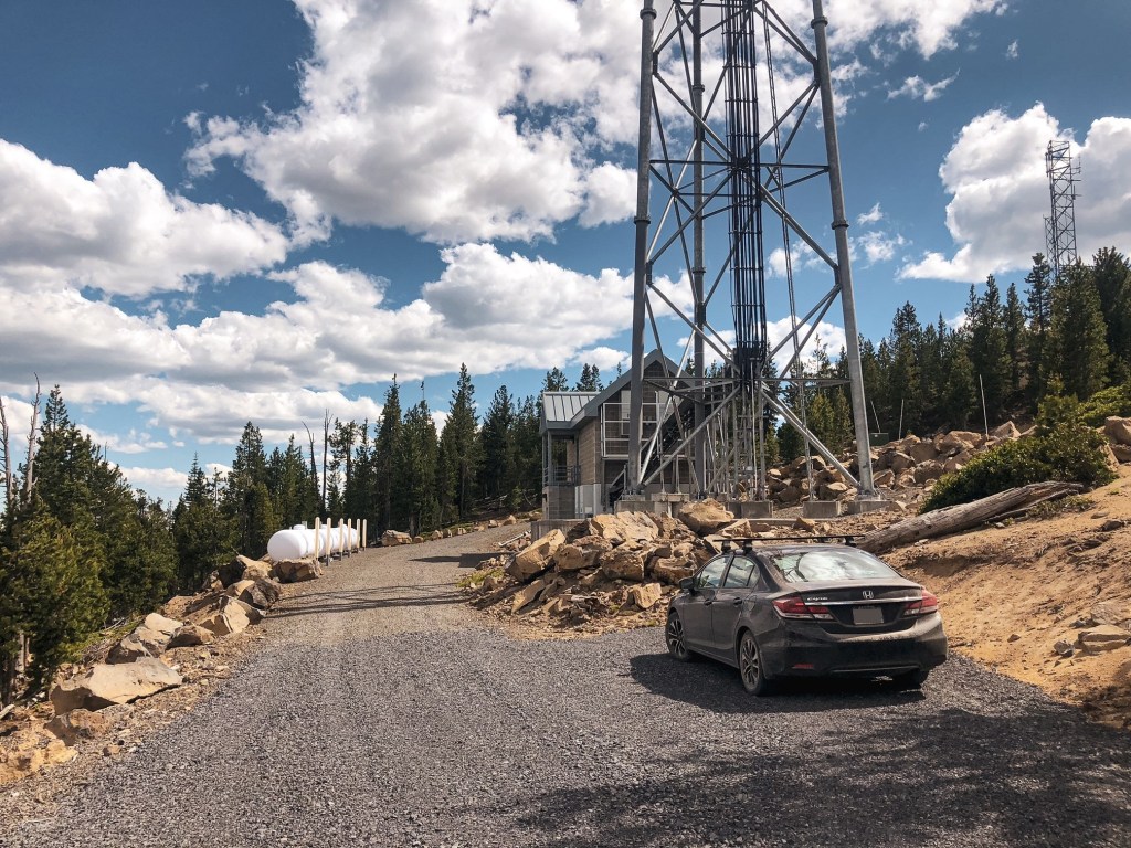
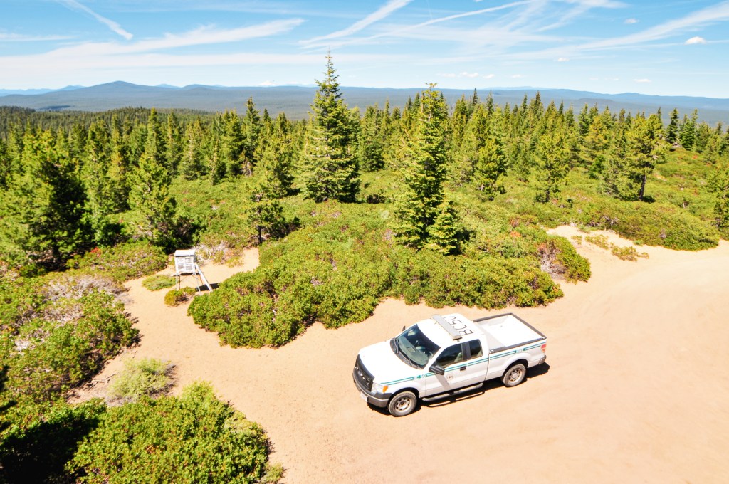
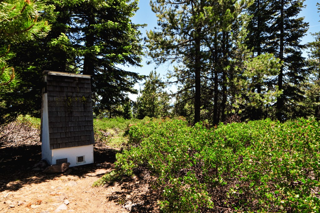
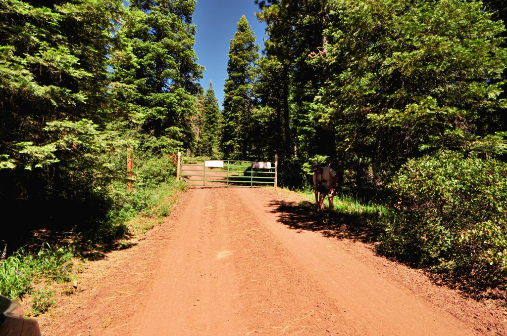
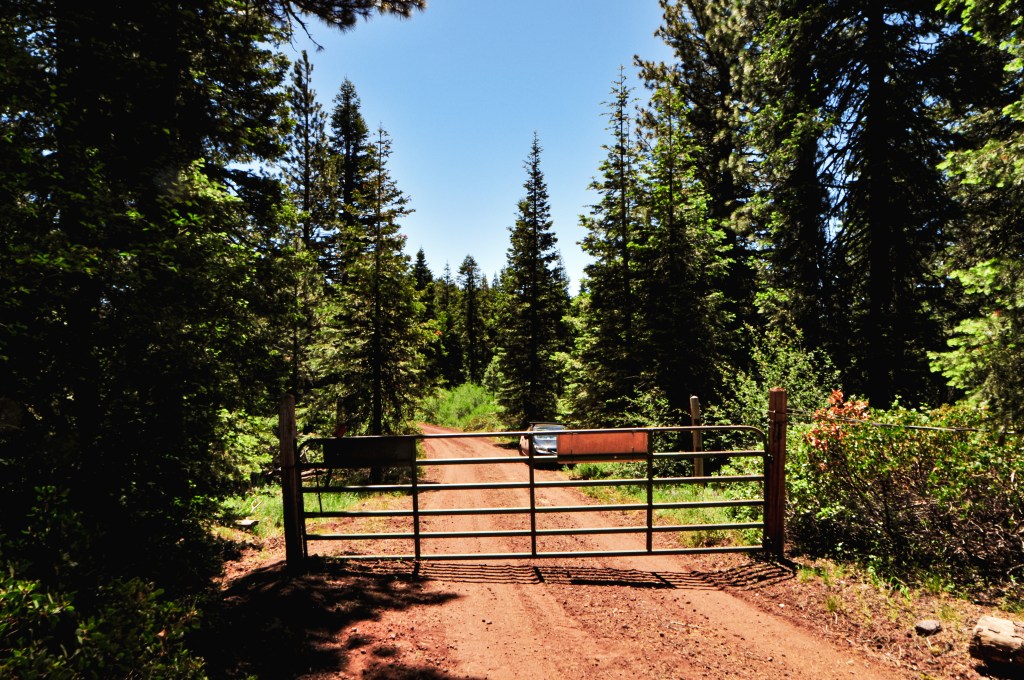
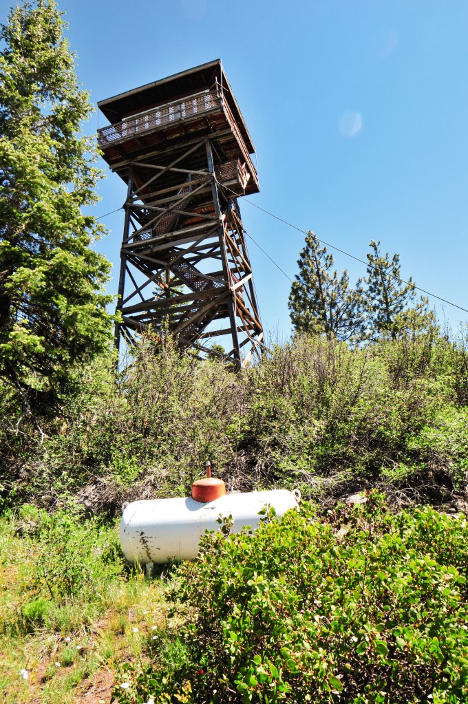
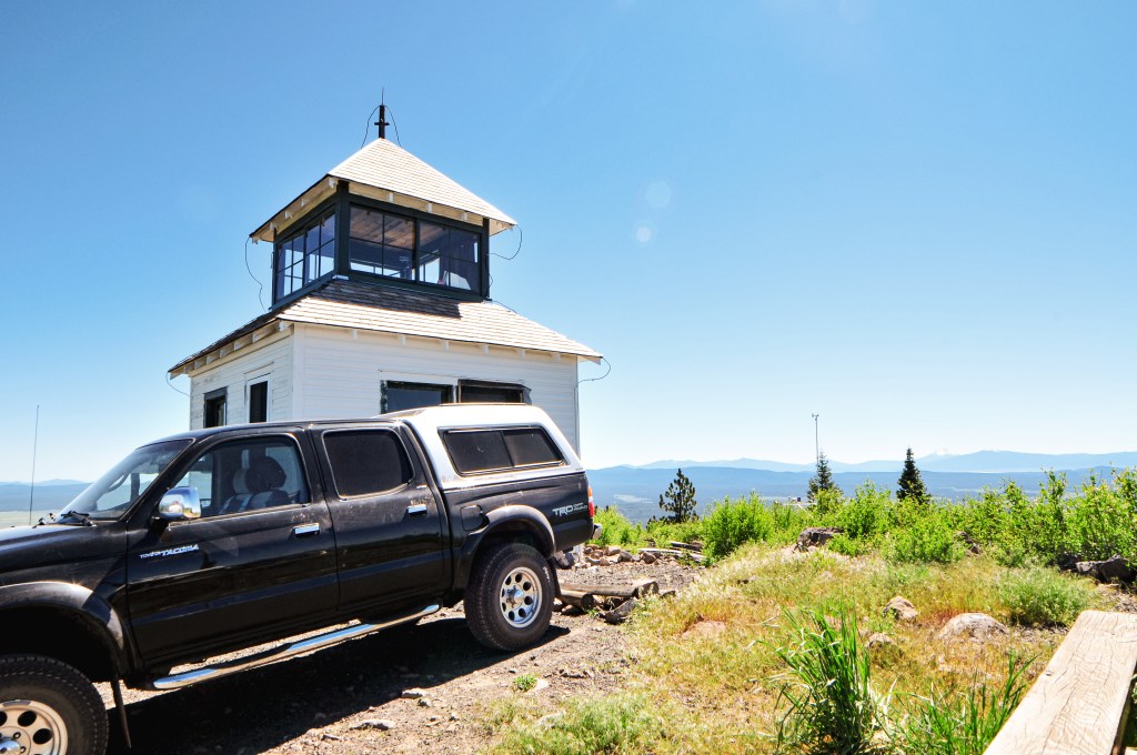
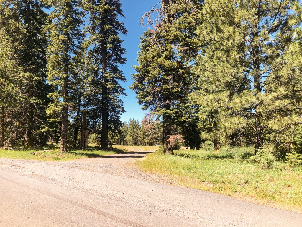
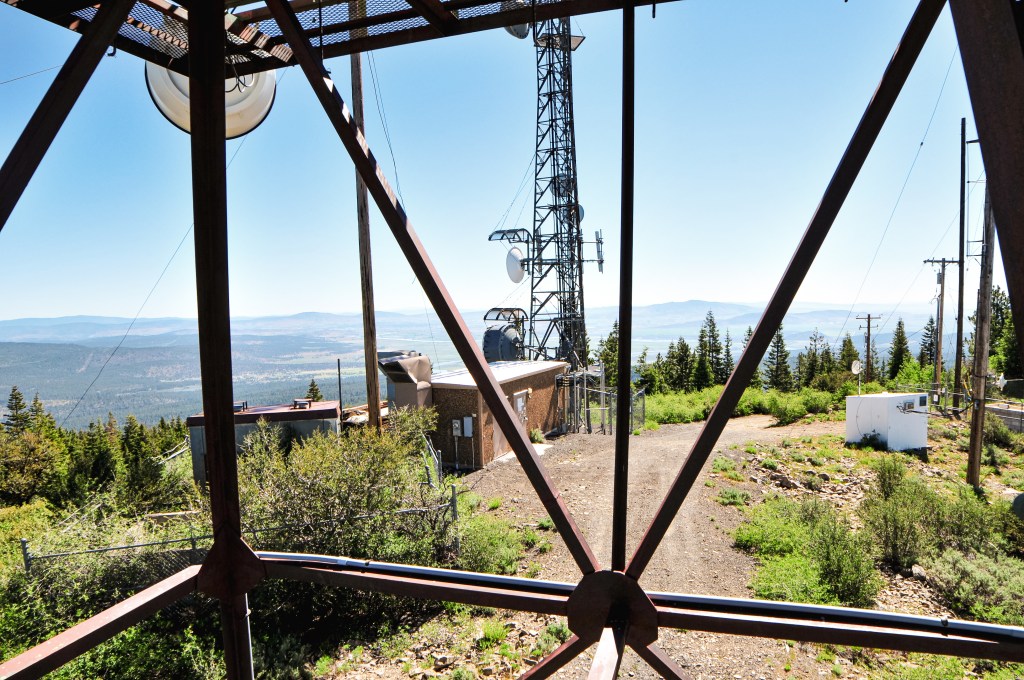
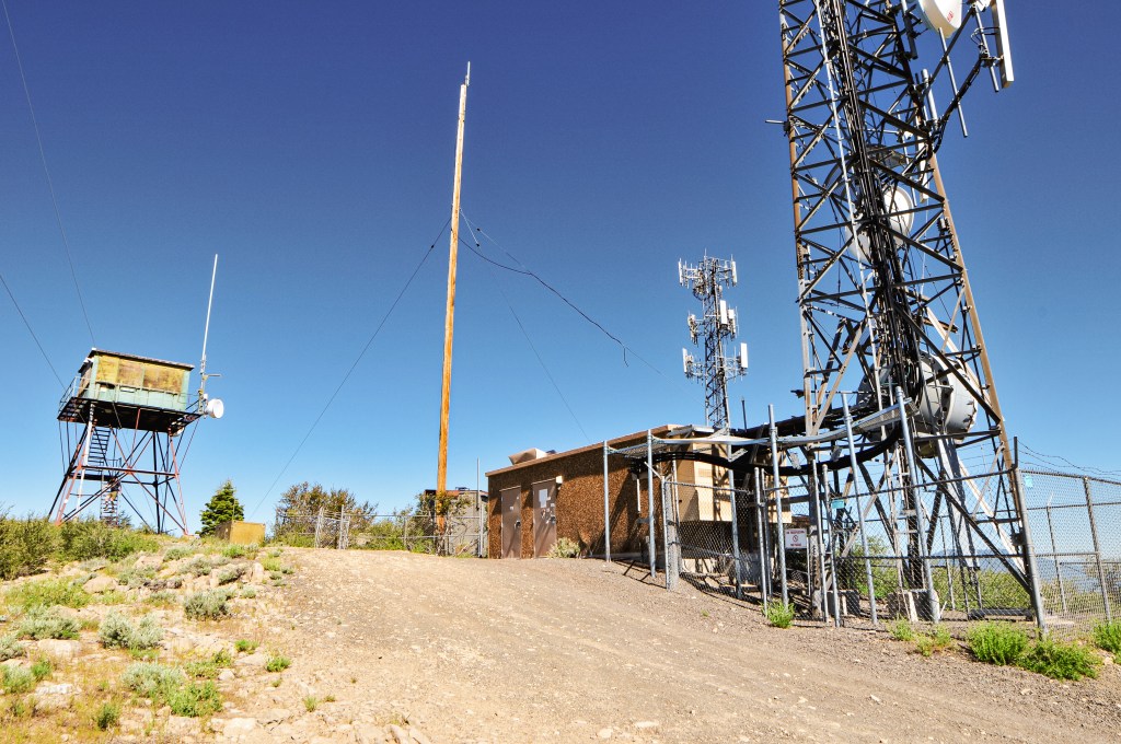
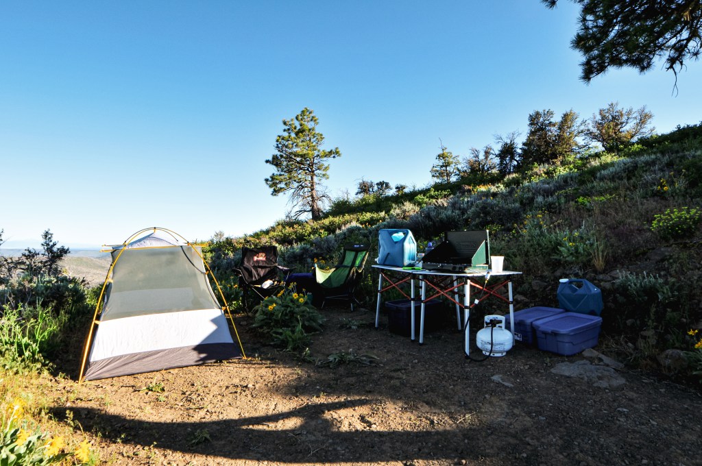
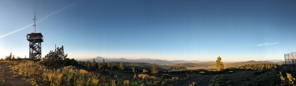
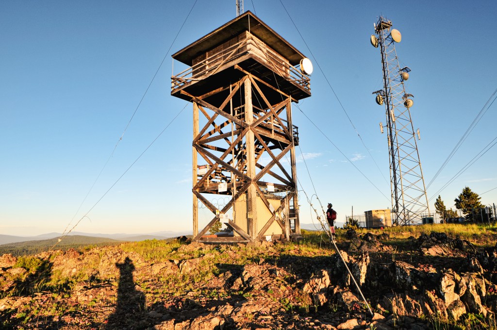
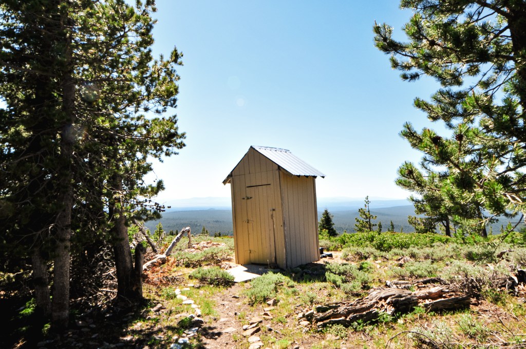
My partner and I packed up to head towards Bald and Walker Mountain (post) for the day. If we finished early enough, we planned to head into the Umpqua NF for our final leg of the trip. We weren’t in as big of a rush this morning since we were only a few miles from Bald Mountain already. We didn’t want to arrive too early and disturb the lookout attendant. We were already situated off of NF-2516 and headed farther north towards the NF-036 spur. The road briefly passes through a section of private residence before re-entering the forest. It was good that we hadn’t tried to find a camp even closer to the lookout the night before. Where we had stopped turned out to be our best option. The forest had turned into another thicket of Lodgepole Pine once we passed through the private area. It was so thick in sections that it felt like we were walled in by trees on both sides. The NF-2516 road is well maintained gravel all the way from Silver Lake Road to HWY-31. From NF-2516, we turned left onto NF-036. If you’re coming from HWY-31, it will be off to the right. We were able to drive all the way up to the gate in my Civic. The NF-036 spur is soft and dusty, but passable. The gate is just after a tight switchback in the road which offers enough room for parking a few cars. We pulled into a pull out just before the gate and prepared to walk. We always like to make sure that we’re not blocking the gate and pulled far enough off the road for additional vehicles to pass. Normally, we don’t meet any traffic in these areas but you never know. This proved to be in good practice since we ended up having a large propane truck drive up during our visit. This only happens every few years to refill the tanks on the summit.

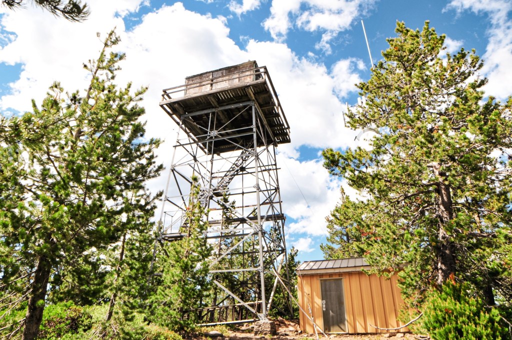
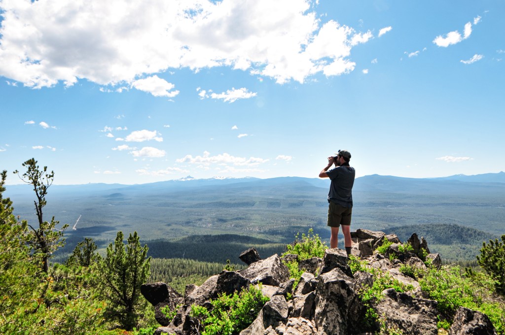
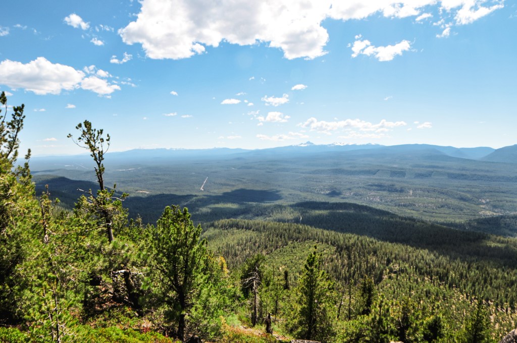
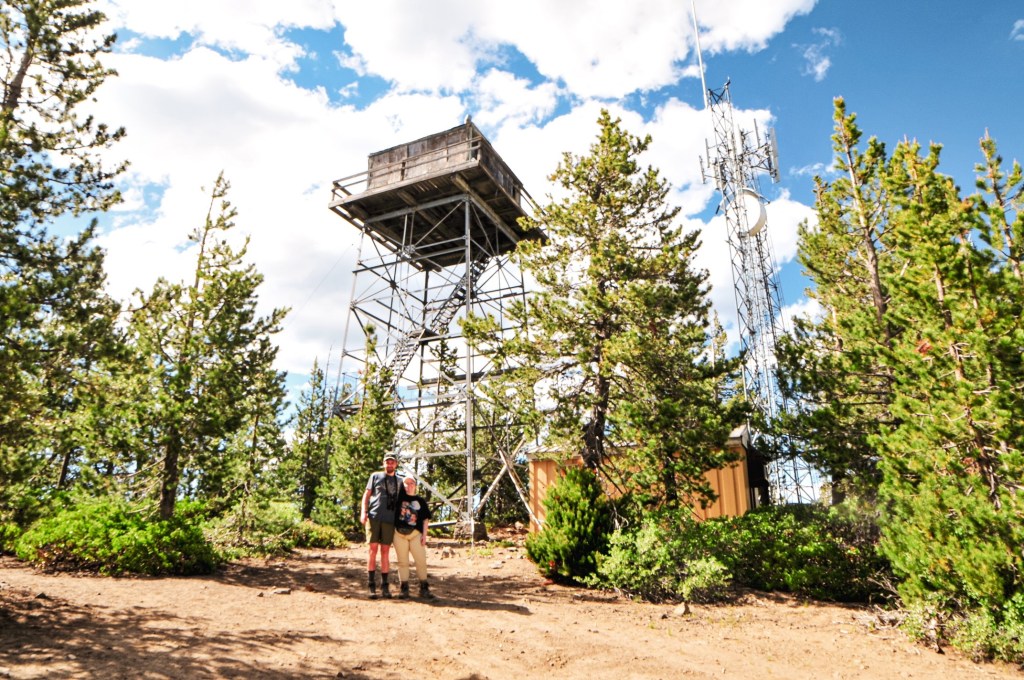
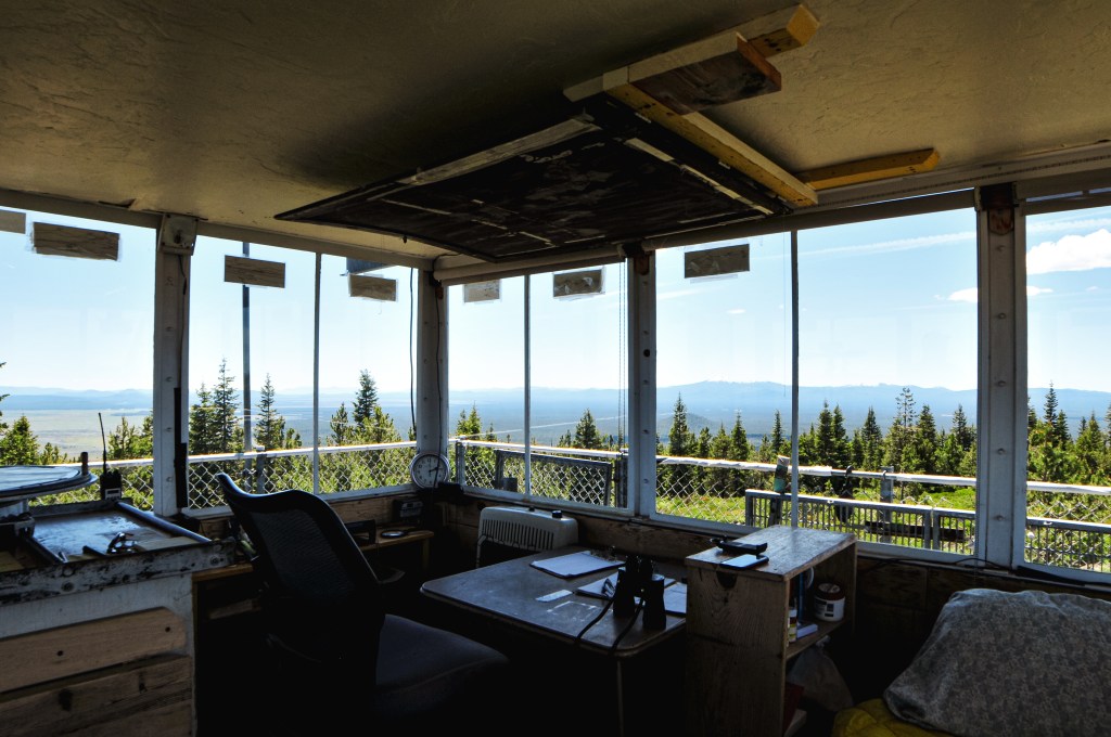
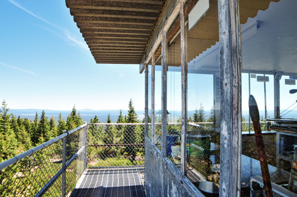
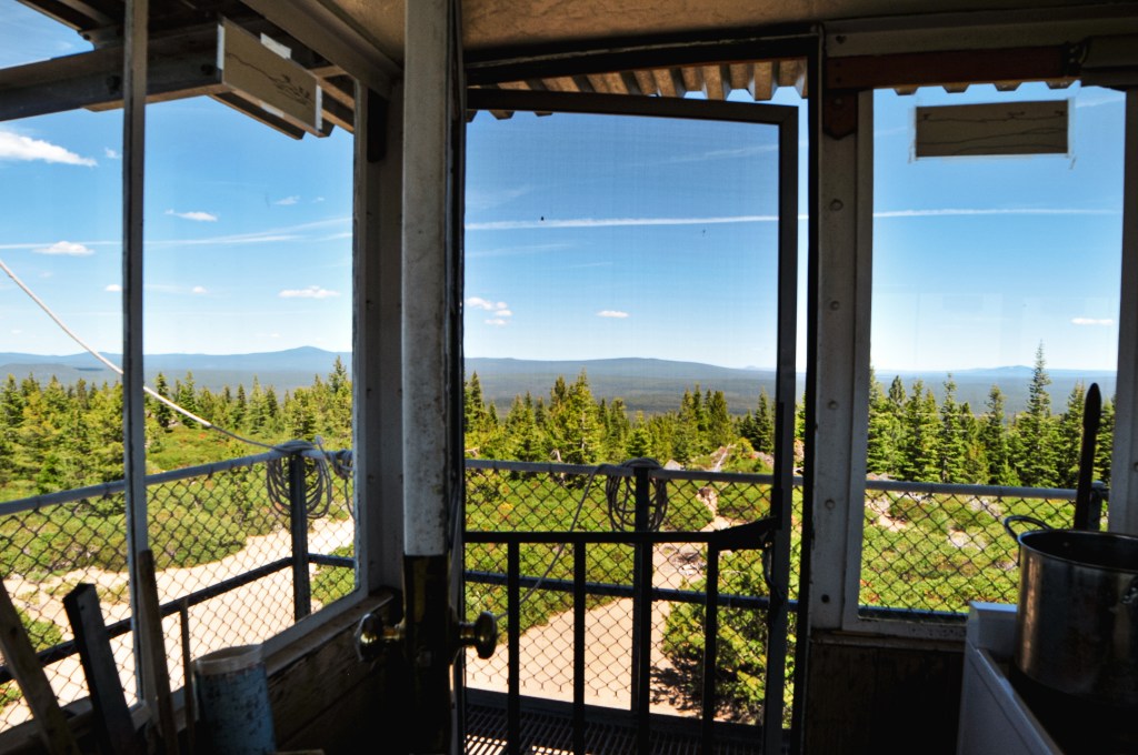
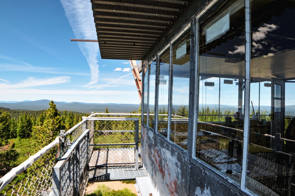
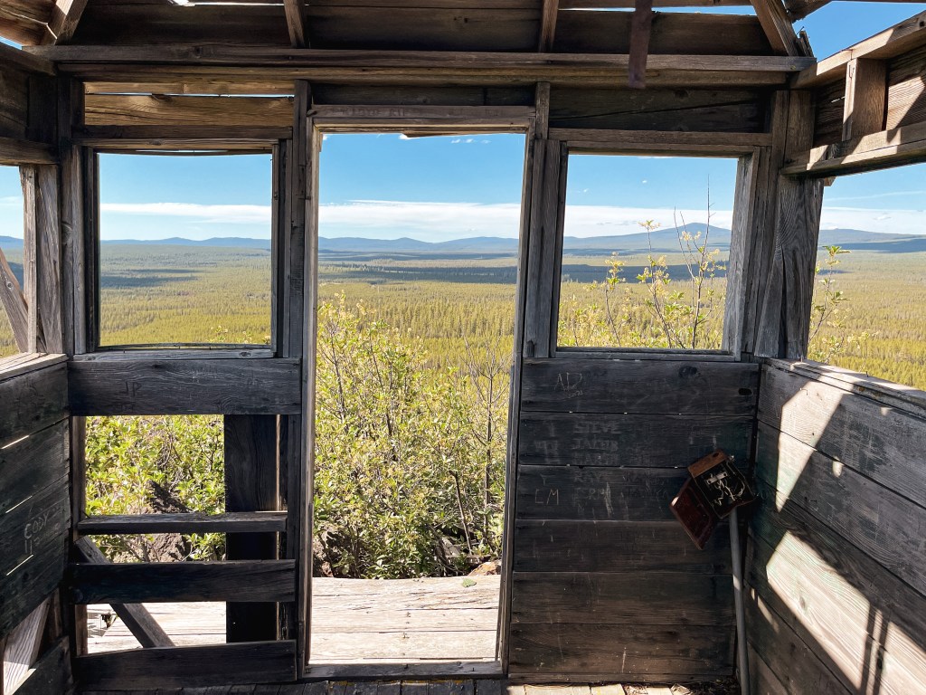
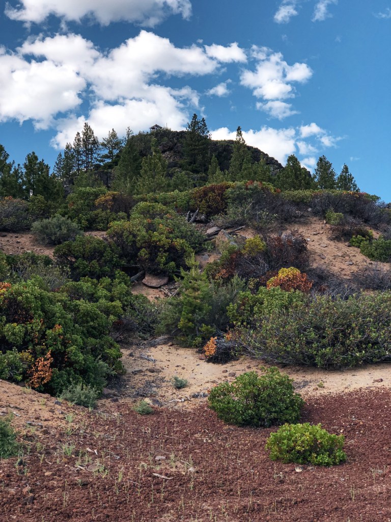
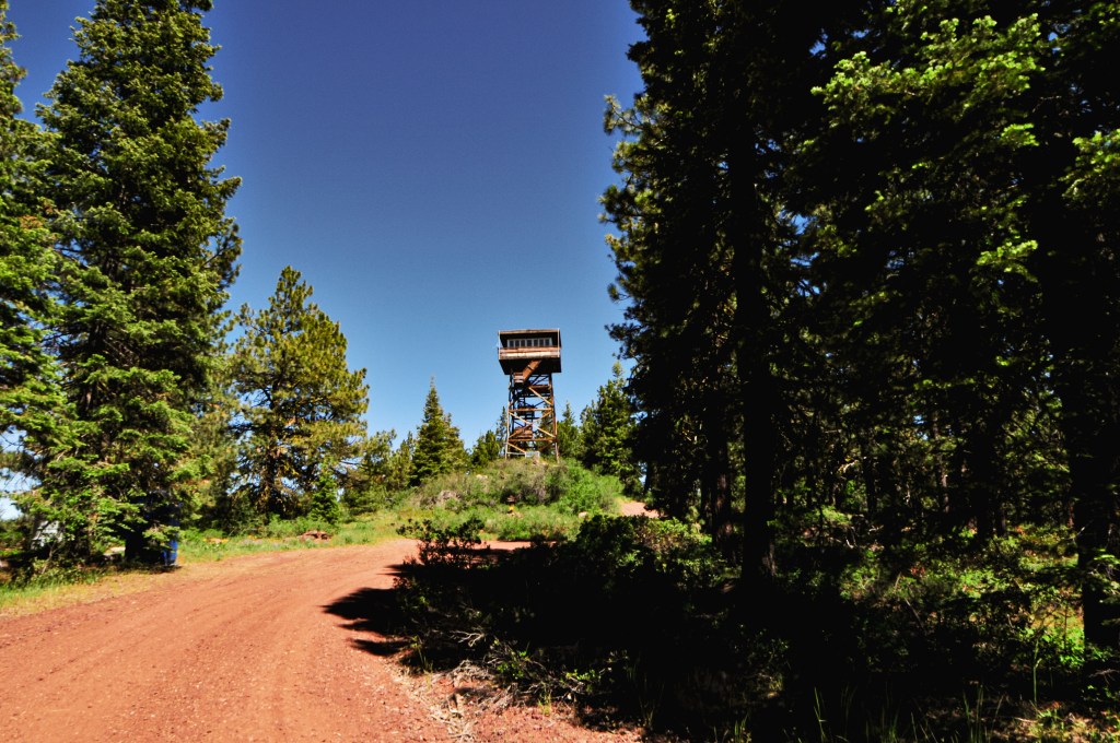
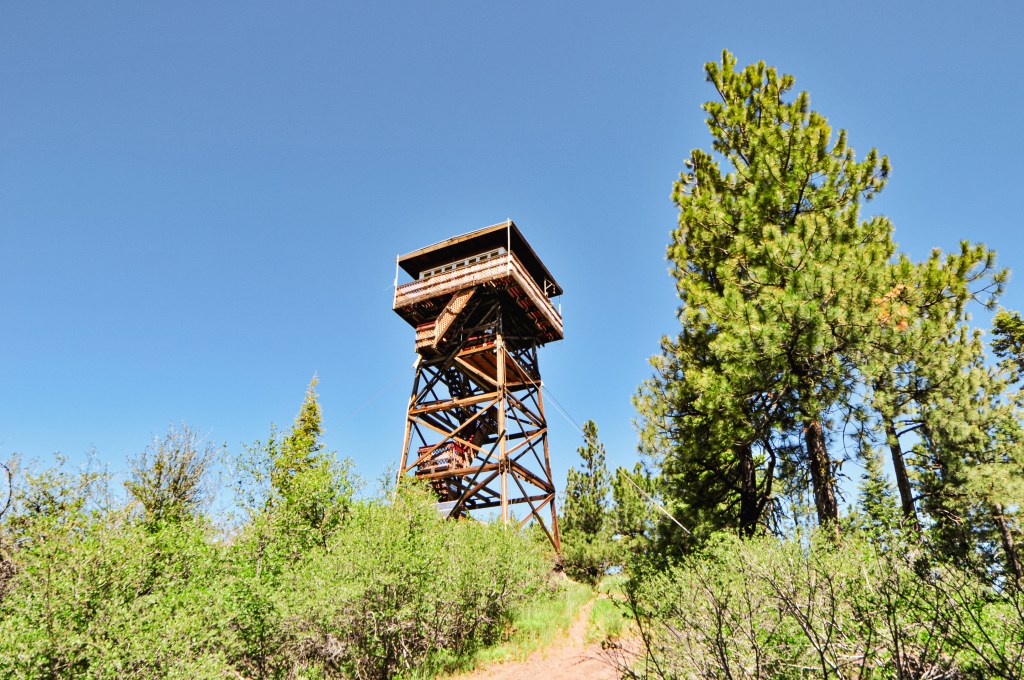
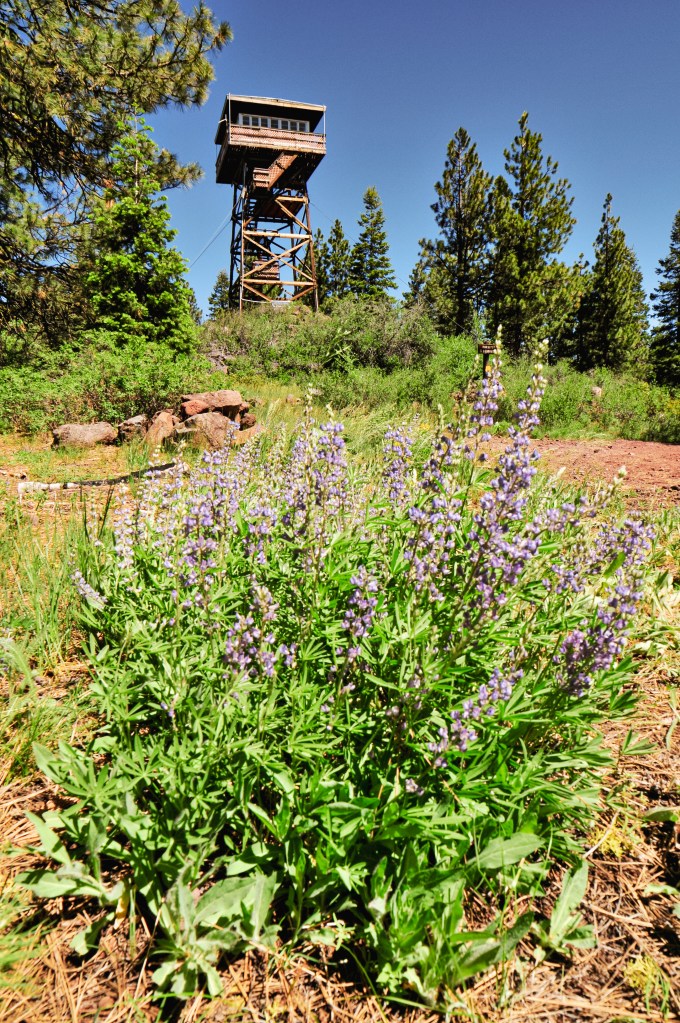
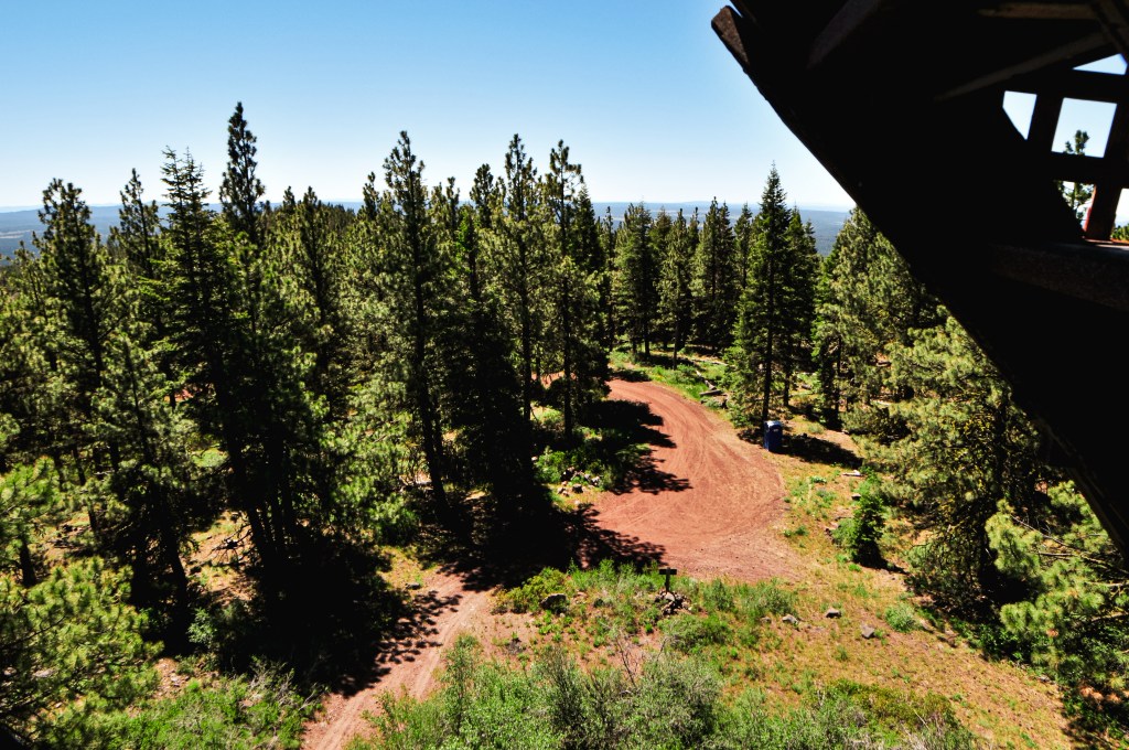
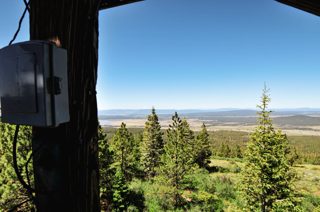
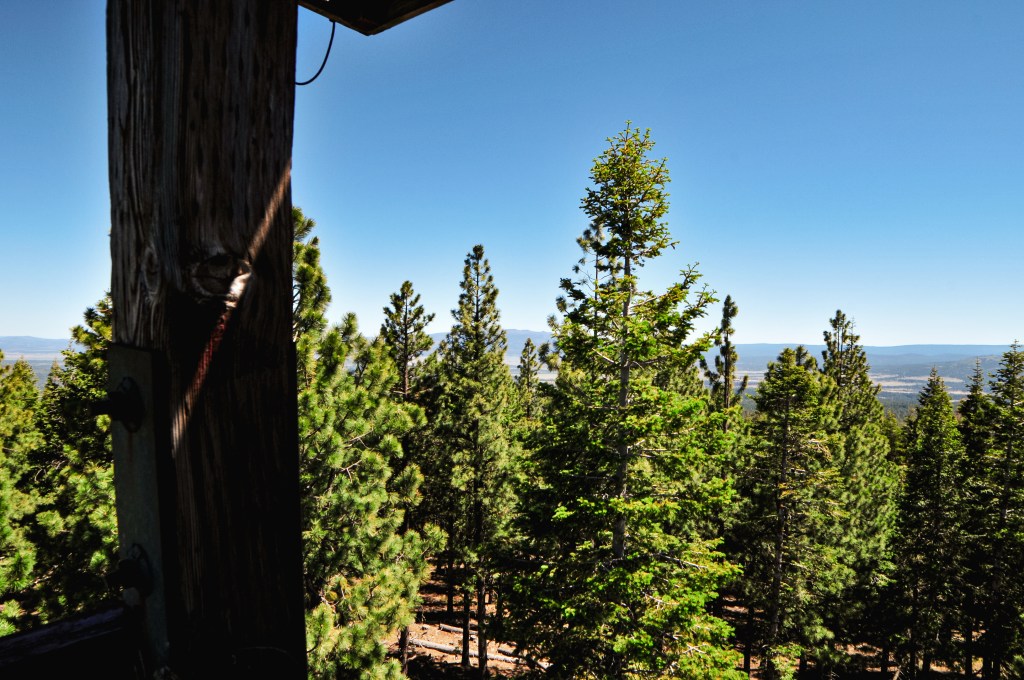
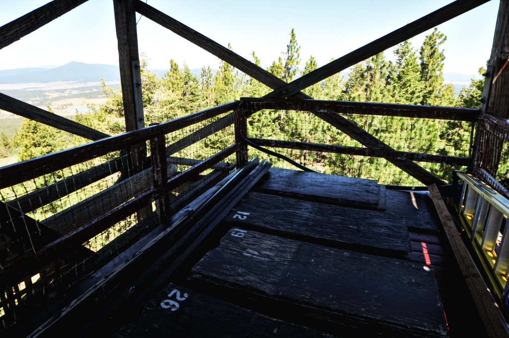
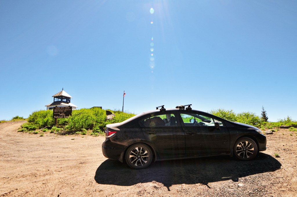
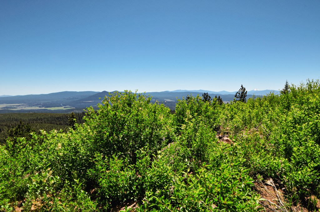
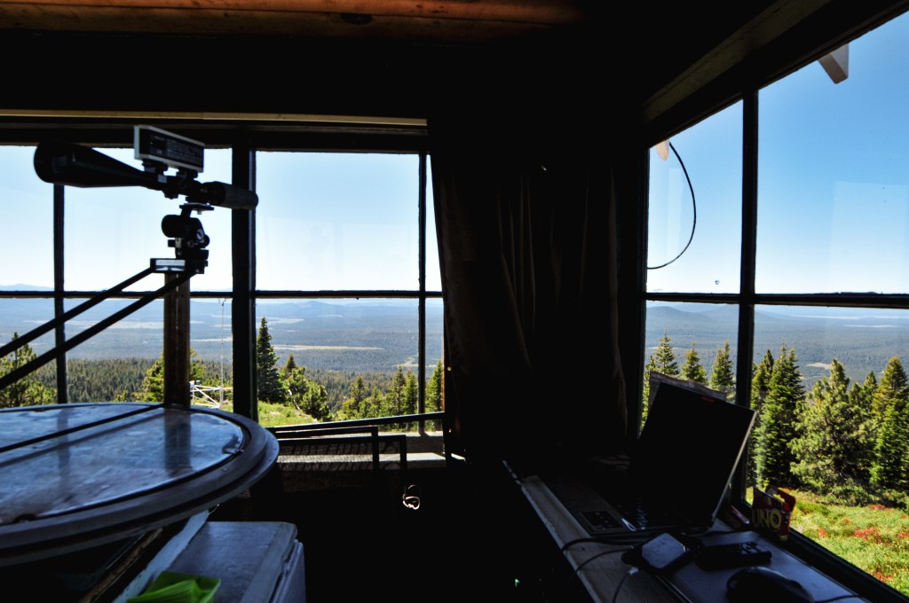
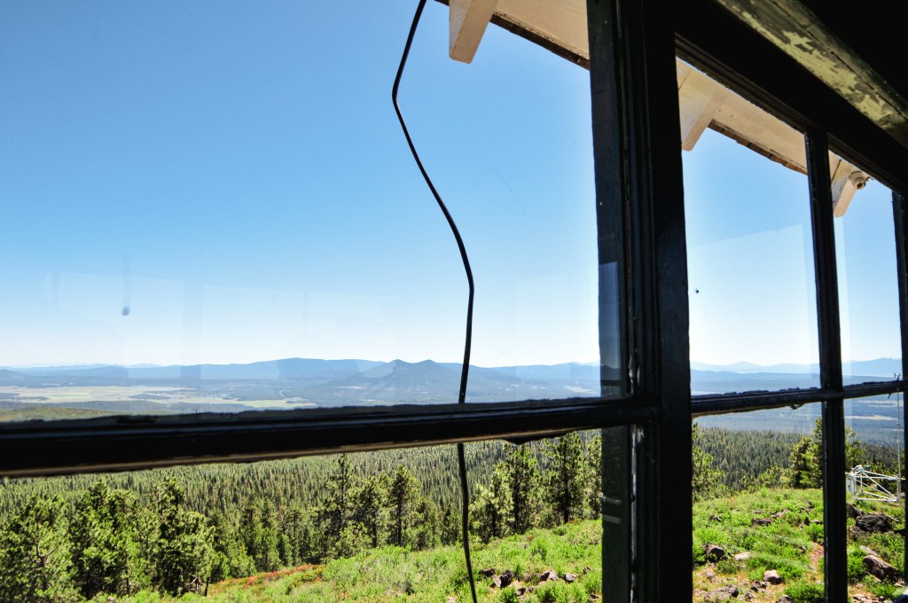
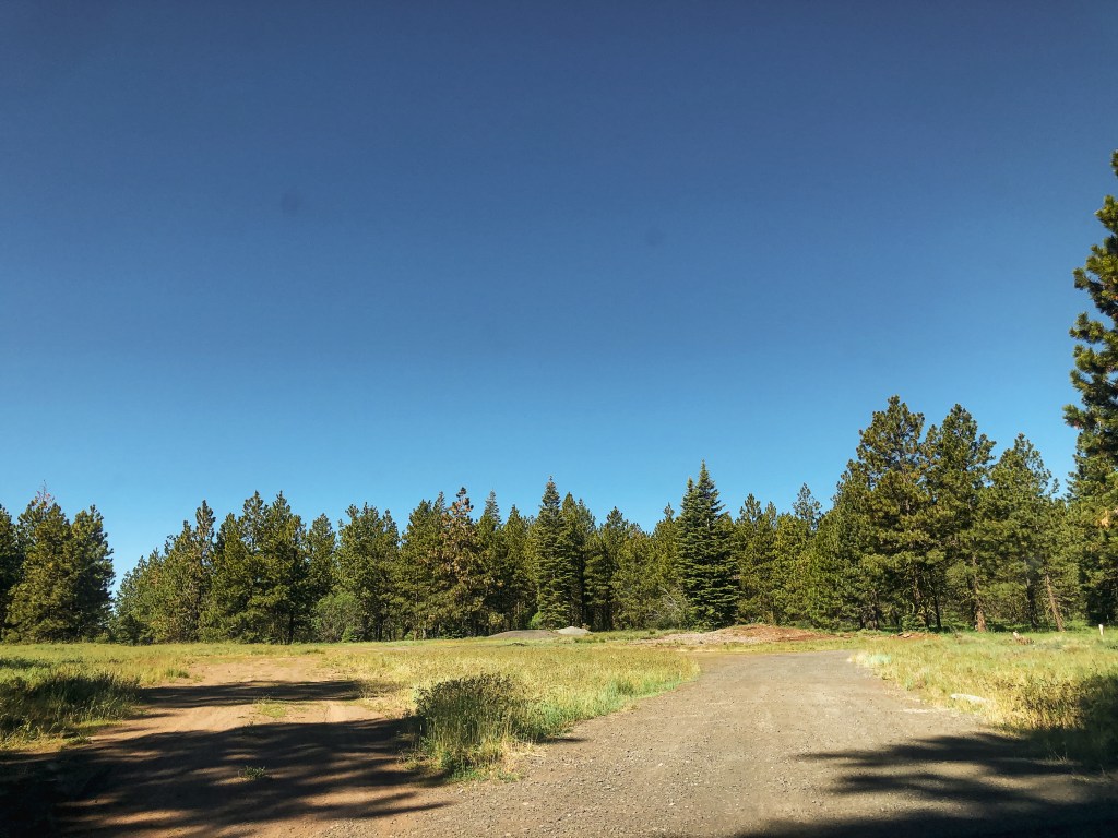
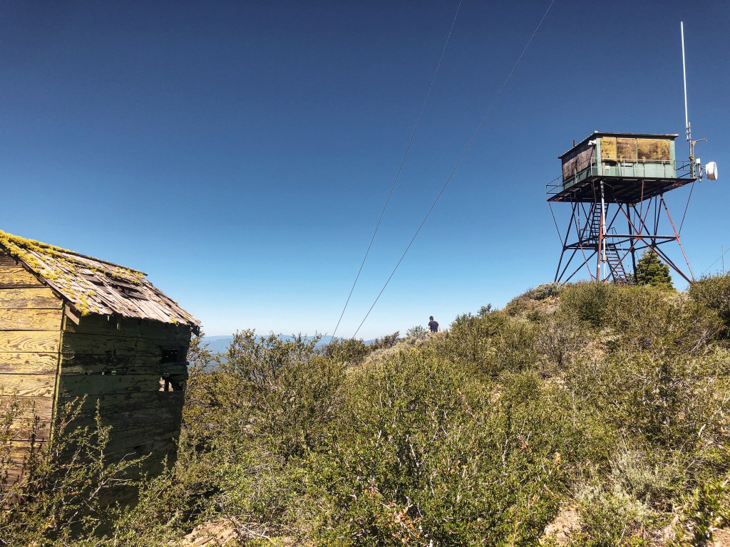
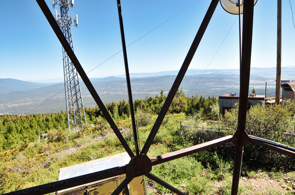
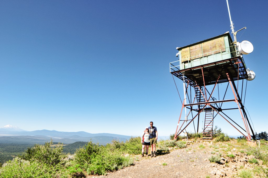
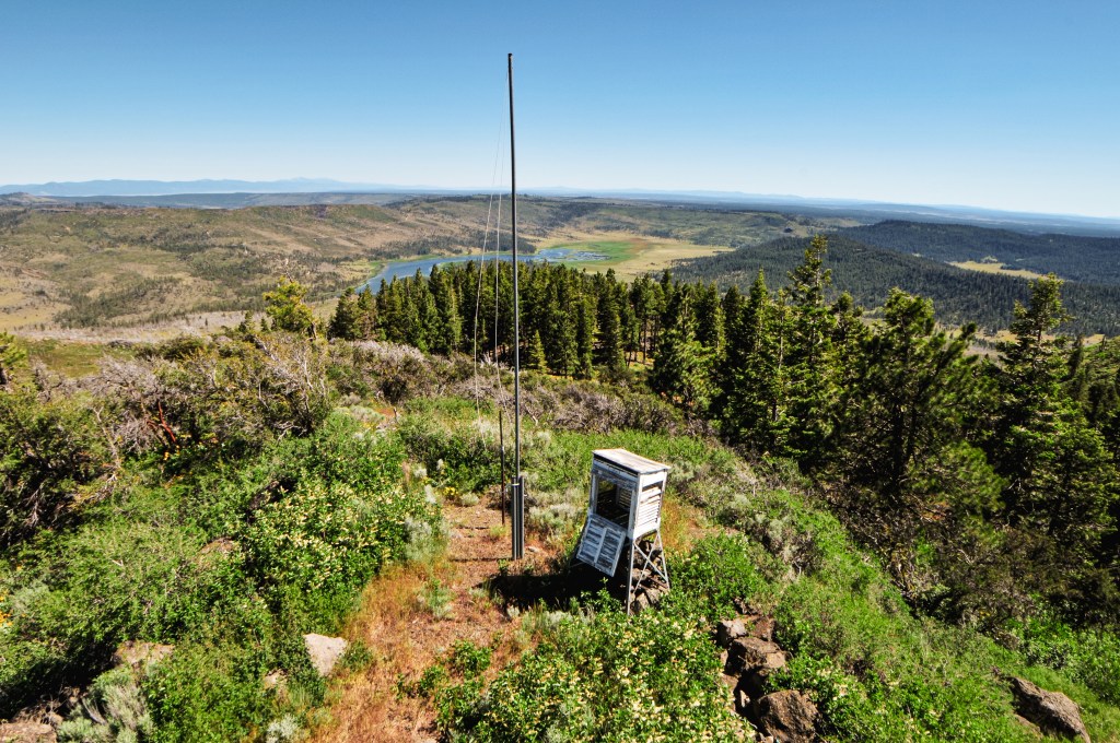
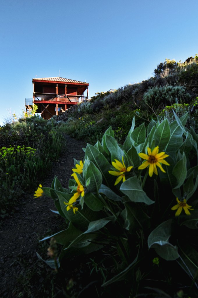
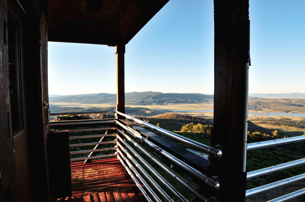
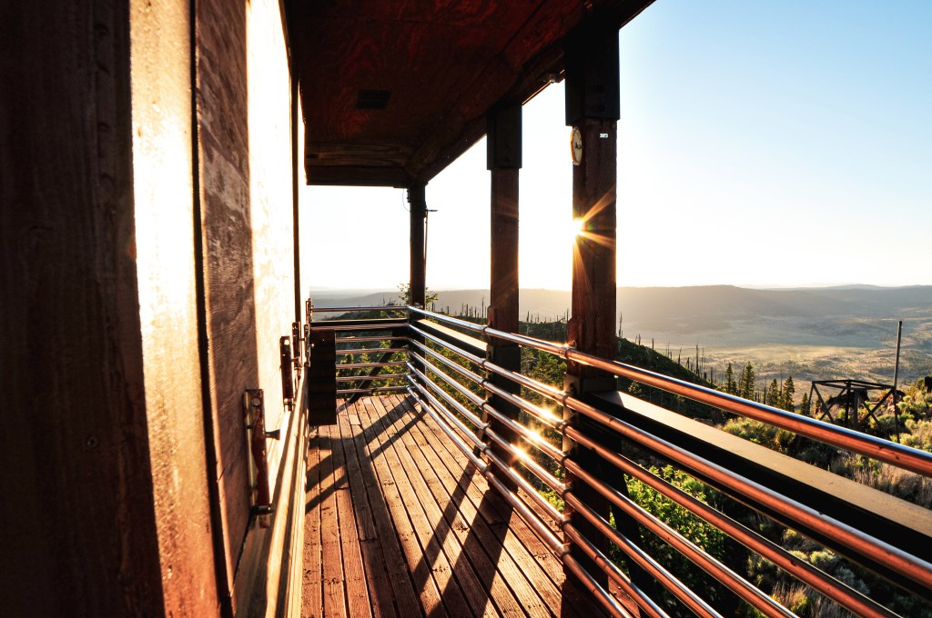
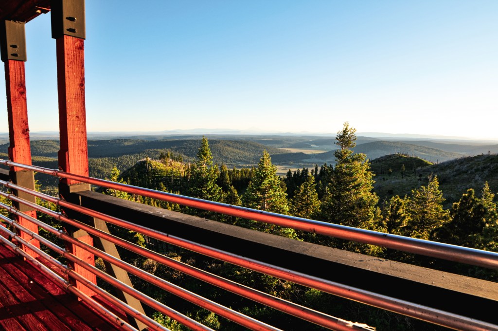
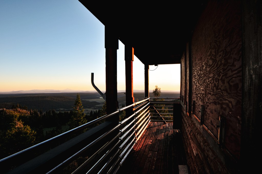
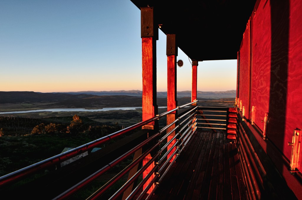
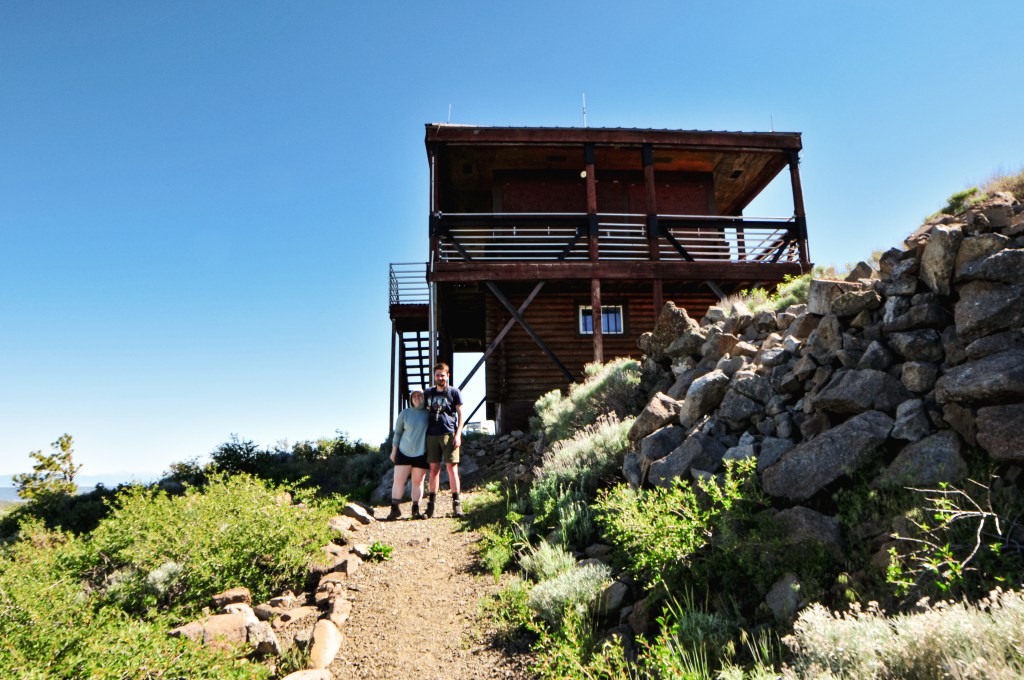
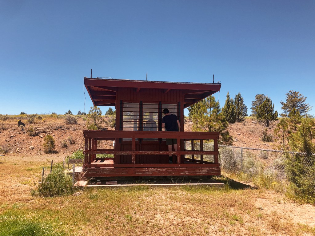
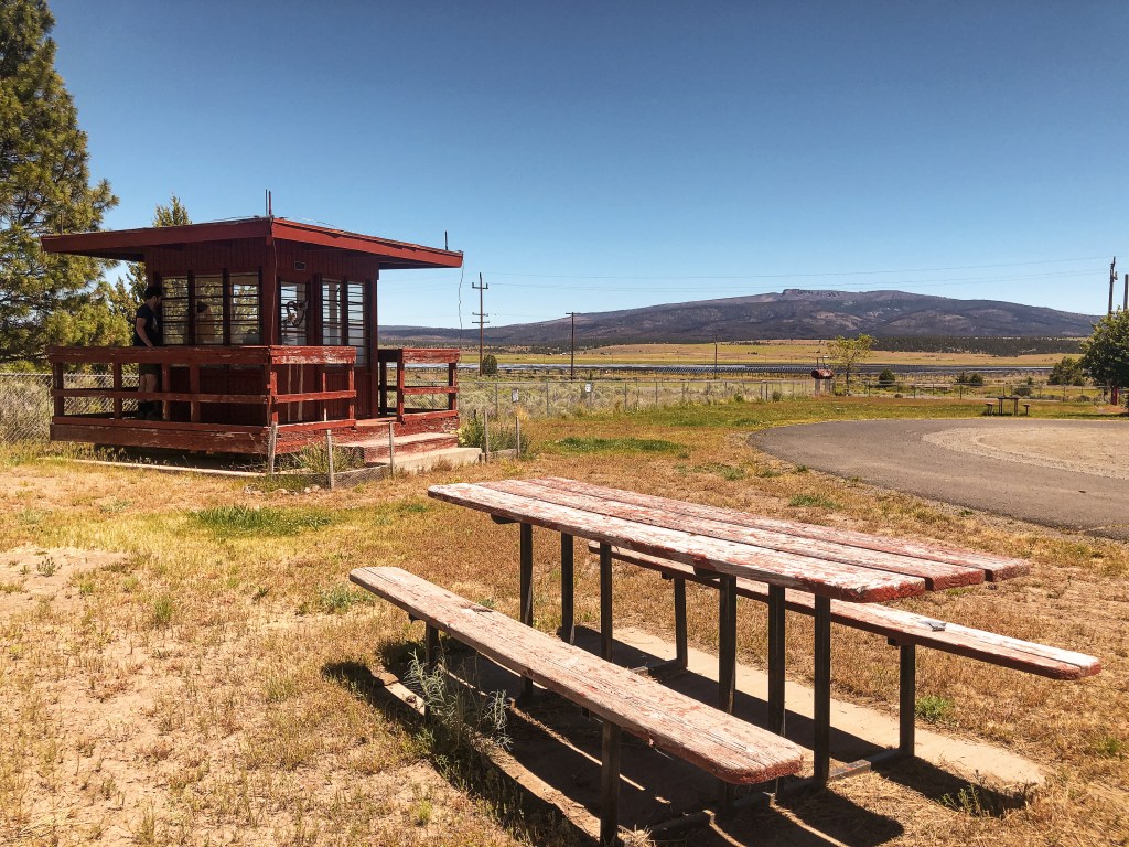
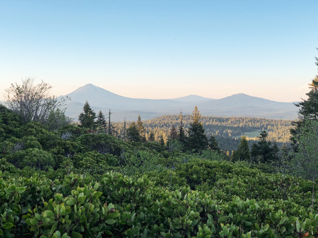
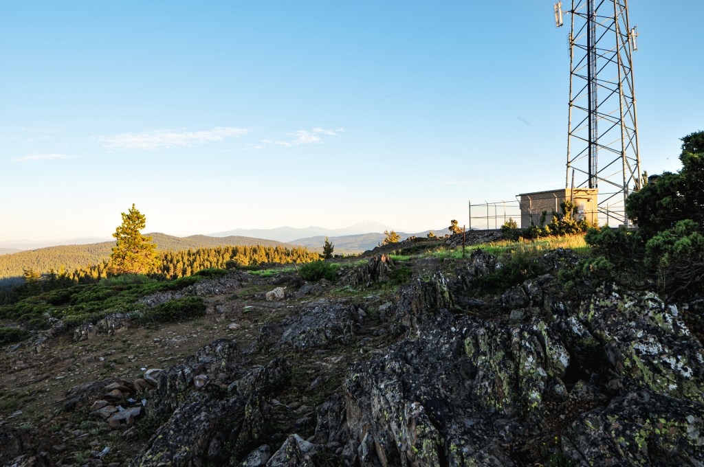
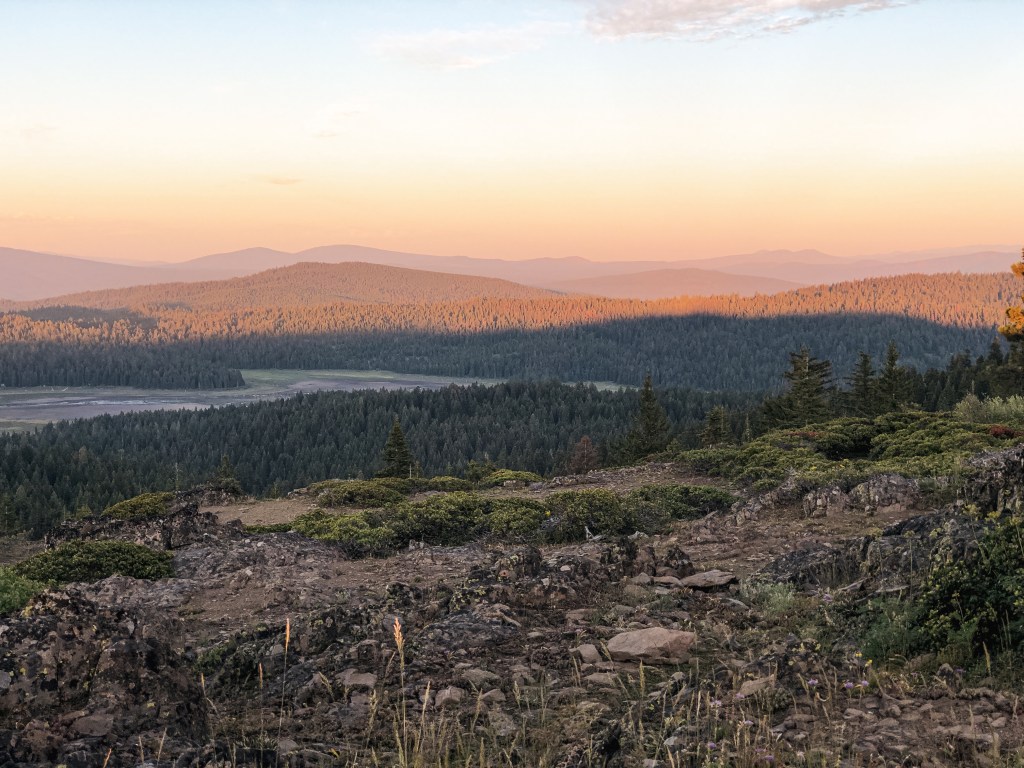
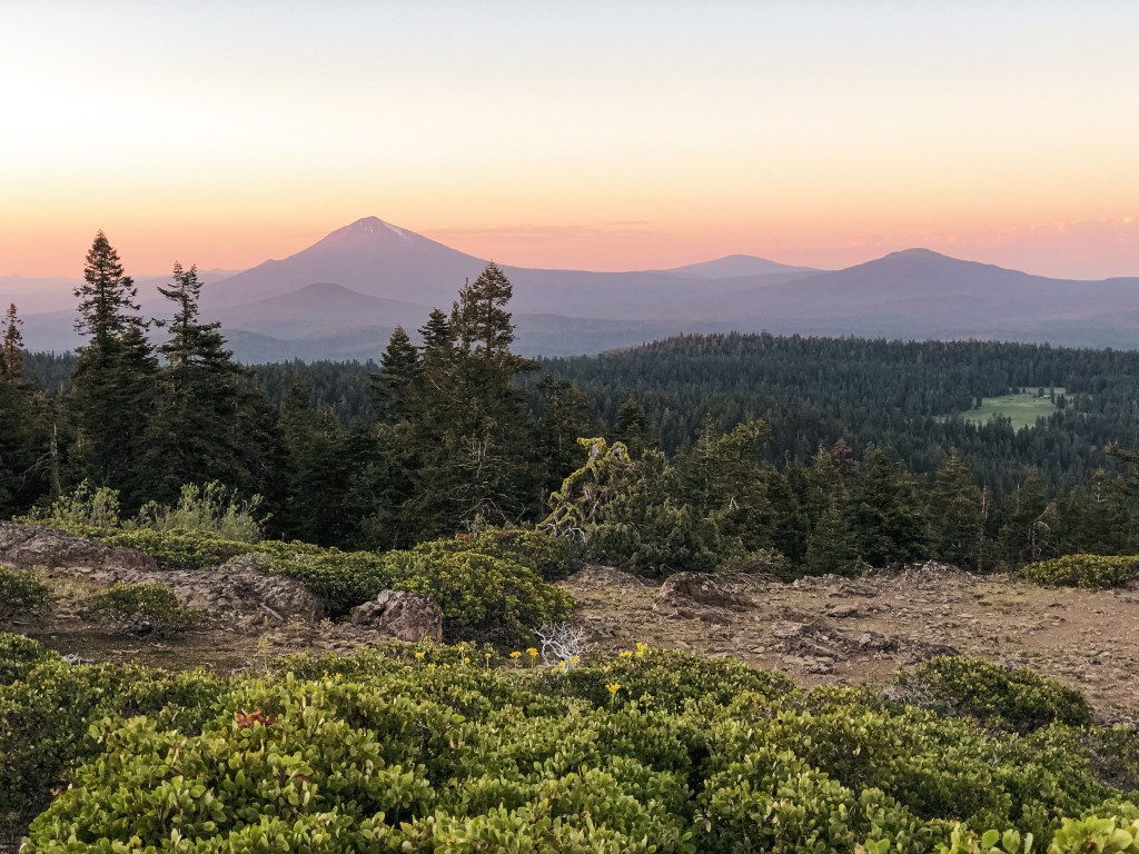
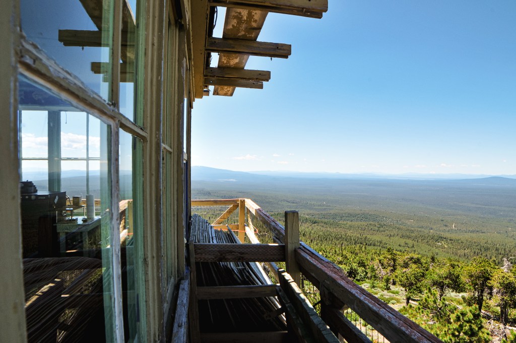
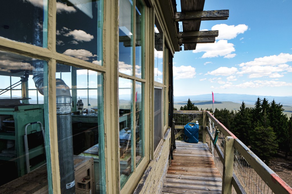
From the gate, it is another mile of road walking to the lookout. This was a pleasant morning walk to the summit. The road starts to open up to views before you reach the lookout and is lined with a variety of trees. We were able to locate White Bark, Ponderosa, and Lodgepole Pine. When we reached the summit we could hear the lookout attendant talking to someone on the phone. We figured Ed mentioned to them that we would be visiting, but didn’t want to assume at the same time. We decided to take photos around the base of the lookout and take in the view while we waited. Eventually, the lookout attendant was finished with their call and came out on the catwalk to greet us. Similar to our interaction on Sugarpine (post), he asked if Ed sent us and we asked if he was Ron. It felt like we were getting passed along on a fun field trip of the area from one lookout attendant to the next. Ron invited us to join him on the catwalk and gave us a brief history of the tower. He was very gregarious and had a lot of knowledge about the surrounding forest. He mentioned he had just wrote a book about forest management and its relationship with fires. It’s called Axe-It First (link). This is why he was on the phone when we arrived. It was published that morning and he had been thanking those that assisted him in the process. We all talked for a long time, 2 hours to be exact, about our current state of things and what needs to change for things to get better. He realized quickly he was preaching to the choir. Ron had many stories to share and was happy to share them with us. So much so that it was hard to find a break in the conversation to even leave. His wife eventually called him and he had to step away to answer. We thanked him for his time and said our good-byes. We wanted to visit for longer, but we knew we needed to keep moving if we wanted to make it to Walker Mountain (post) and the Umpqua NF.

Lookout Ron Rommel

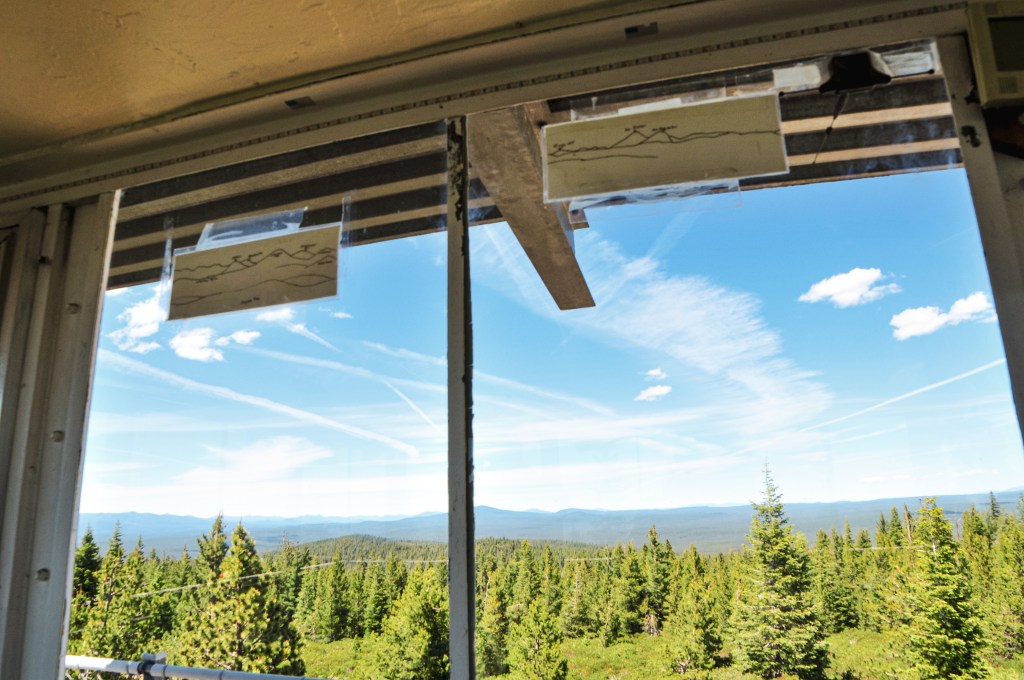
Ron Rommel was born in 1950 and is currently 71-years old. He’s originally from Portland, but currently resides in a community just outside of La Pine. His background is in Forestry and he used to do tree inventory for the Forest Service. He has also worked in manufacturing and has a business degree. He has been a lookout on Bald Mountain for 4 seasons and is employed through the Walker Range FPA. Ron currently works the lookout on Wednesdays and Thursdays. He said he started staffing the lookout when his friend asked if he knew anyone who could help his wife out. She had been staffing the lookout for 30-days straight with no relief. Ron was interested and offered to help. When he first started, it was just the two of them alternating. The lookout is now staffed by three different people. He has communication with 7 different lookouts from Bald Mountain; Odell Butte, Sugarpine Mountain (post), Round Mountain, Hager Mountain, Green Mountain (post), Spring Butte (post), and East Butte (post). He published his book, Axe-It First (link), on June 30th. It is what he dubbed a call to action for our government and general population on our current fire management. Although I haven’t read it yet, it is on its way in the mail. I promised him I would help spread the word.

History.

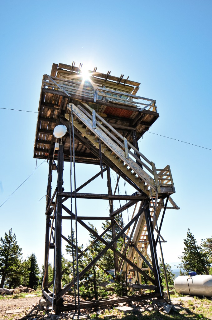
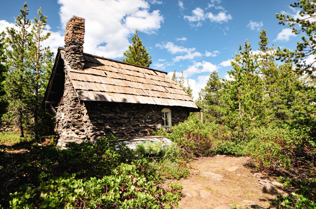
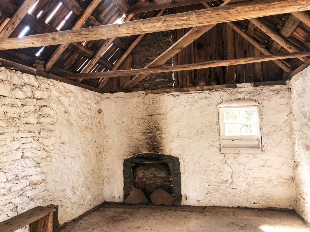
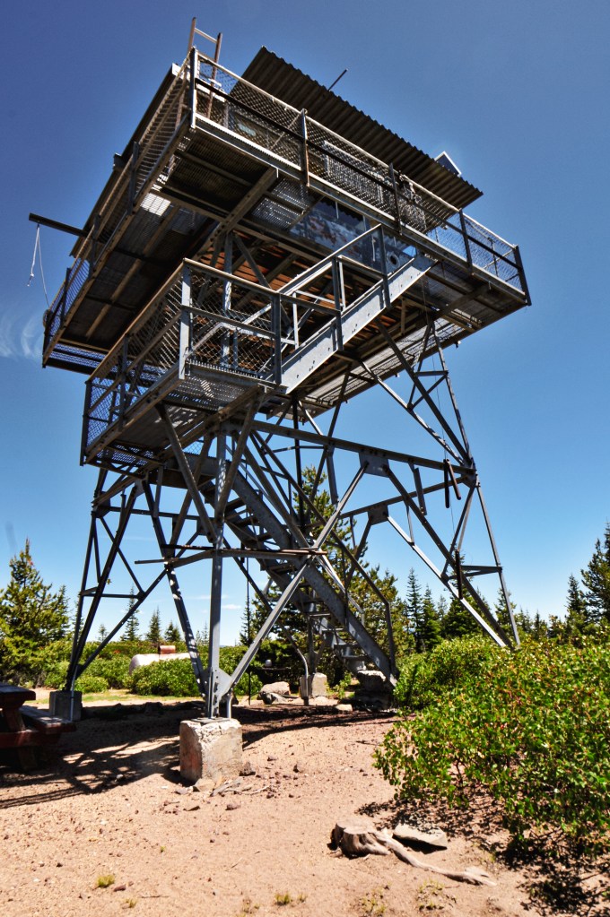
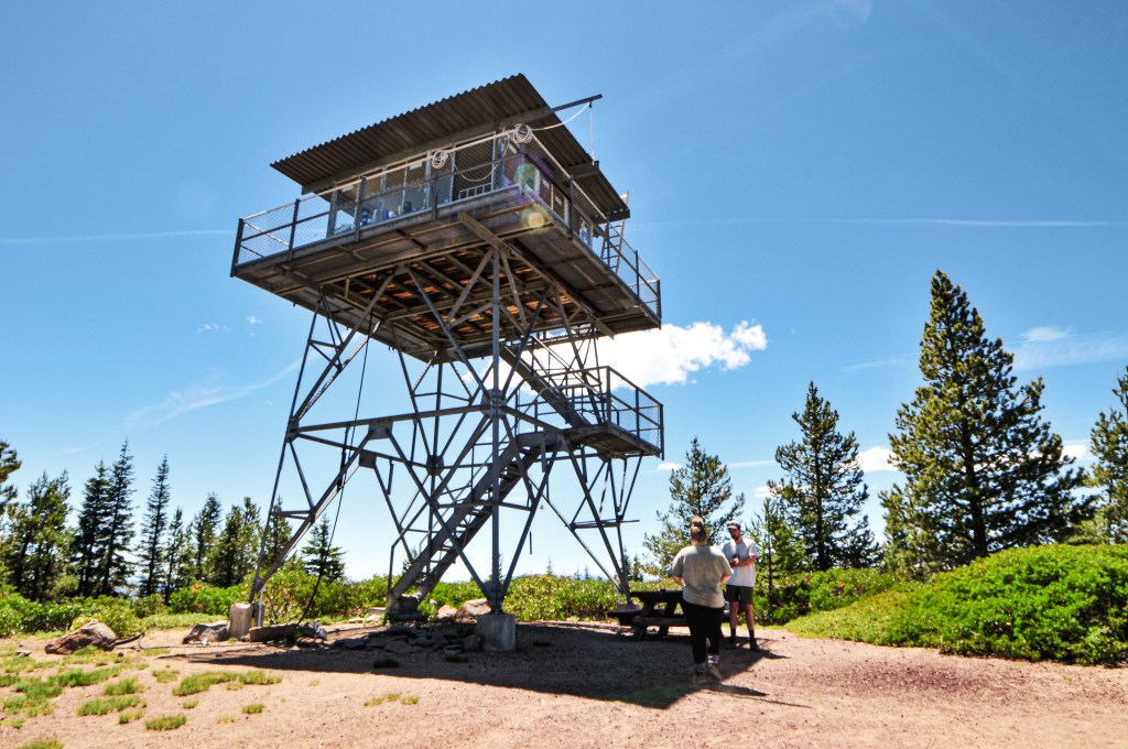
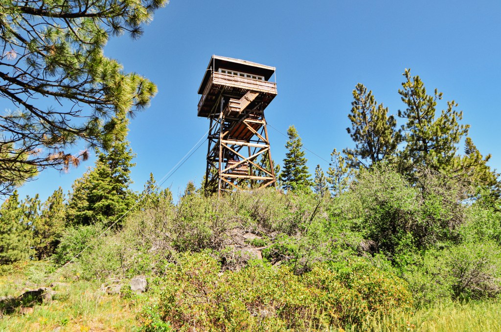
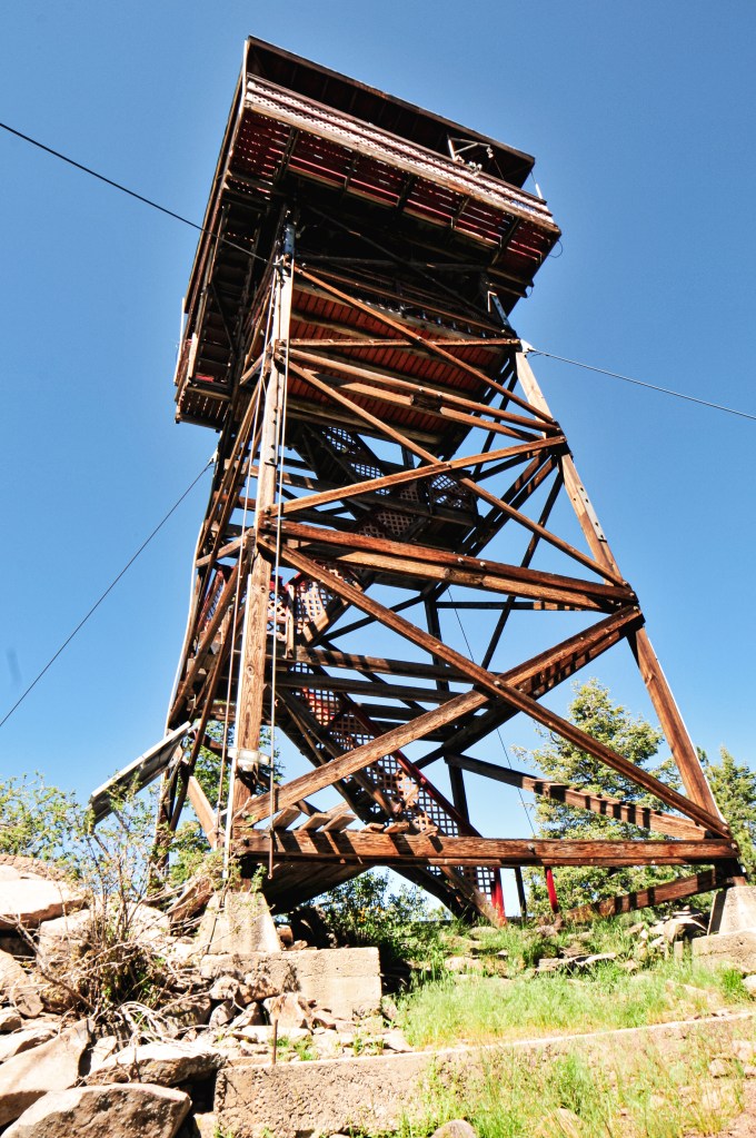
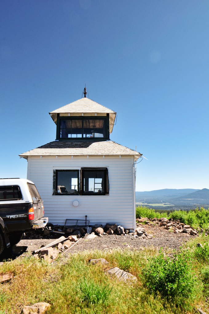
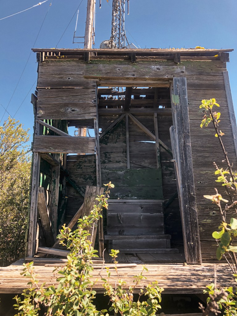
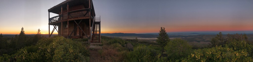
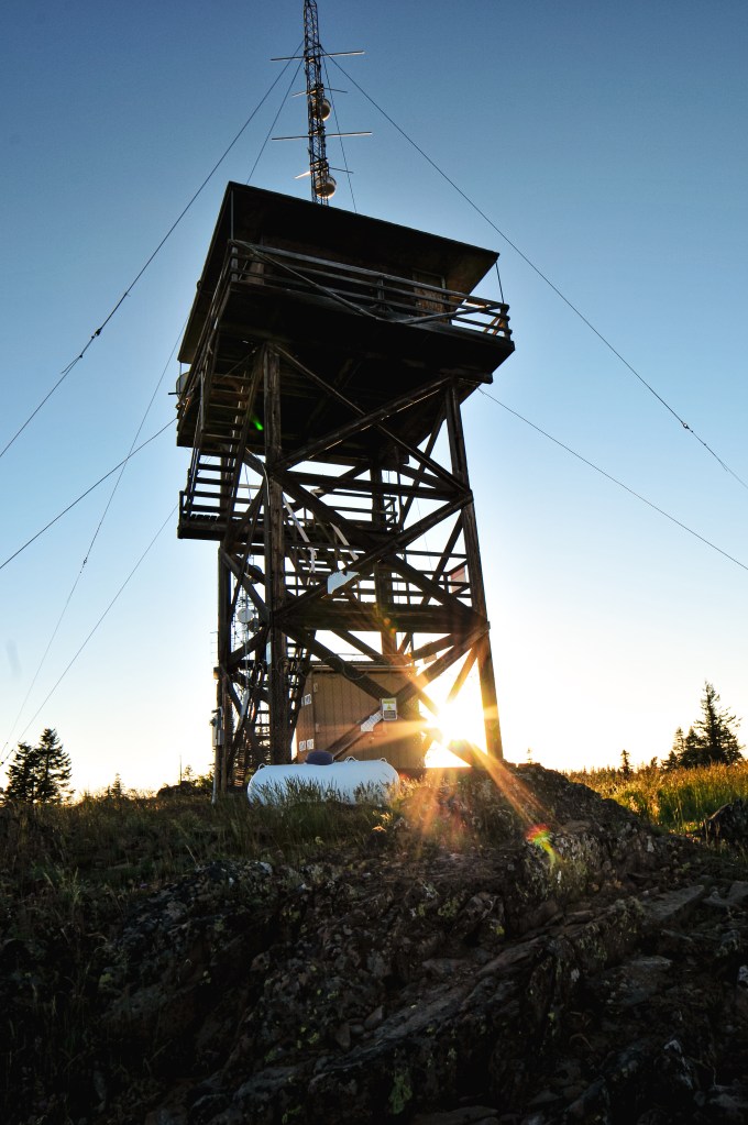
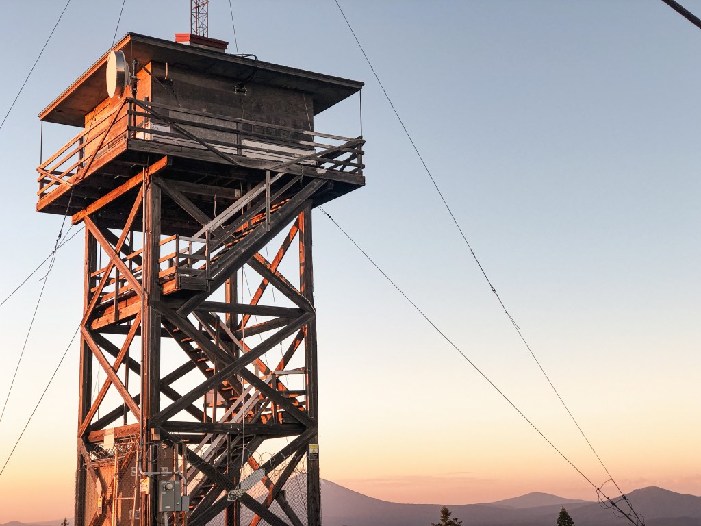
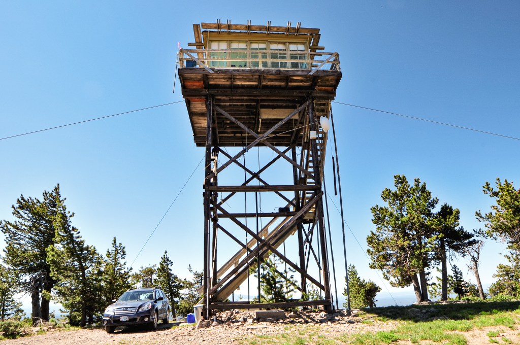
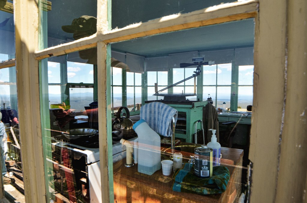
Bald Mountain, also known as Baldy, was first scoped for a fire site in 1907 when they planned on building a trail to the summit. In 1918, a telephone line was strung to the summit where they planned to add an observation station and firefinder. In 1927, they finished building a road on the mountain. A year later they constructed a 40′ steel tower with 12×12 live-in cab. This was a unique design from Aermotor and only a few were constructed like it. In 1941, they removed the old lookout and replaced it with the current one that stands today. It is a classic L-4 cab with treated timber tower and stands just below 30′. This site was originally managed by the Klamath FPA, then the Forest Service, and now the Walker Range FPA. It is still actively staffed every season.

Walker Mountain L.O.

Oregon Lookouts

Location.

Deschutes National Forest

Status.

Abandoned; Currently standing

Estimated drive time from Portland, OR.

4-1/2 hours

Date visited.

June 30, 2022

Elevation.

7,078′

National Historic Lookout Register.

US 145; OR 21

Trip Report.

Day 6/10: Lookout Road Trip 2022

If you’ve ever been on HWY-97 between the junction with HWY-58 and the community of Chemult, you might have noticed a sign for Walker Mountain L.O. You can even see the tower from the highway if you know where to look. It’s located on a peak east of the highway often overshadowed by the excessive amount of communication towers. The first time I remember seeing this sign was back in August 2017. My friends and I were headed south on HWY-97 towards Diamond Lake for a weekend camping trip. That’s not to say my family hasn’t ever driven this way before, but I hadn’t had the same attention or interest for such things. Similar to the millions of other people that drive this route, have driven this route, or even live in the area, I passed the sign many more times without paying a visit to lonely Walker Mountain.

After our visit to Bald Mountain (post), we headed north on NF-2516 towards HWY-31. On the map it looked like we could potentially cut across the forest via a three number spur to connect with NF-94. We were hesitant to commit to this road given that it was marked as different road numbers on our two maps and both had it noted as a high-clearance road. We know from experience that the maps aren’t always correct about the road conditions, but it felt too risky this time. We decided to go up and around via HWY-31 to HWY-97. Sometimes pavement is the faster option even if it’s not the most direct. The only other challenge from this route was that we had to cross HWY-97 once again. The road marked for Walker Mountain off of HWY-97 is NF-94. This road will take you up to the ridge of the mountain where you will want to take a left on to NF-9402. The NF-9402 road follows along the ridge and climbs the remaining way to the summit. We had asked all the lookout attendants we met if they knew the road conditions to Walker Mountain, but none were sure of the current conditions. Ed from Sugarpine Mountain (post) mentioned we would probably be fine since there are communication buildings and they want to maintain them. Turns out he was correct. NF-9402 had been recently regraded with fresh gravel. One might argue that it was even too fresh. From the junction with NF-94 and NF-9402, it is a little over 3-1/2 miles to the summit. As we headed up the ridge we found that the fresh gravel was pretty loose and soft in some spots. This made traction a bit of an issue in some of the steeper sections. It even created a highline from trucks driving up and pushing it around. Instead of water bars, the road had these rubber flaps to help divert the water off the road. There were over 30 of these water diversion flaps along the way. The gravel seemed to have piled up closer to them. All was passable in my Civic, but it’s something to be cautious of if you decide to visit. The last few hundred yards of the road turned to dirt, but it looked passable to most vehicles. We decided to park where the fresh gravel ended and walk the remaining distance.

On the summit, you will find Walker Mountain tucked behind a plethora of communication buildings. The lookout tower has seen better days and has been abandoned since the 1940s. They have since removed the bottom stairs to keep people from climbing the structure. There is an accompanying garage, privy, and stone cabin that you can visit on the summit as well. The stone cabin has seen more recent restoration work since it is considered one of the oldest administrative structures on the forest. It’s unfortunate that they didn’t put some time and effort into the tower as well. It was already fairly late in the day and we needed to get moving if we wanted to find a camp. We were also getting moved along by the amount of mosquitoes here. For some reason, we have met more mosquitoes on summits than in camp this trip. We said our good-byes to Walker Mountain and can now claim we’ve been here every time we pass it from HWY-97.

We were motivated to press on to the Umpqua NF since it would mean we could set up a base camp for the next few nights. We would also be leaving Klamath County and entering Douglas County. This meant we should be able to find water sources and refill our water reservoirs again. We stopped to refuel once more in Chemult. The gas attendant made a comment that our car looked like it had been on some great adventure. To be fair, it was completely covered in dust and looked a bit scratched up from our close encounters with the manzanita. I told him we had been intentionally bumping down some forest service roads for the past few days and left it at that. We made an additional pit stop at Broken Arrow Campground near Diamond Lake to refill our water. We were relieved to find the water was on here. We have dispersed camped in the Umpqua NF before and knew of areas to look. It was mostly a race to get there before the sun was set. The impending holiday weekend was finally upon us and our biggest worry was finding an open spot. We were surprised to find one of our favorite camps open and set up for the next few days.

History.

Walker Mountain was established in 1913 as one of the first few lookouts on the Deschutes NF, along with Black Butte (post) and Maiden Peak. The first lookout was a simple crows nest tree. It’s noted that the site was potentially used as a patrol lookout as early as 1907. A cabin made of stone and wood was built in 1915 for living quarters. In 1919, a small 25′ pole tower with 6×6 cab replaced the crows nest. The existing lookout was built in 1932 as a 35′ steel tower with hip-roofed 14×14 L-4 cab. The accompanying 16×18 garage was added in 1934. In 1996, a restoration and maintenance program was started to help preserve the historic stone cabin. The restoration work had been carefully completed on the cabin in 2005. The lookout tower itself is listed as condemned and proposed for removal by the Forest Service.

Sugarpine Mountain L.O.

Oregon Lookouts

Location.

Fremont-Winema National Forest

Status.

Active; Currently standing

Estimated drive time from Portland, OR.

4-1/2 hours

Date visited.

June 29, 2022

Elevation.

6,393′

National Historic Lookout Register.

US 1641; OR 159

Trip Report.

Day 5/10: Lookout Road Trip 2022

My partner and I woke up early again with a quick pack up and breakfast. Our stops for the day were Sugarpine Mountain and Bear Butte (post). We hoped to find a camp in the direction of Bald Mountain (post) to set us up for easier access the next morning. Our concern was that we’d find more thickets of Lodgepole Pine that wouldn’t offer much for dispersed camping options. We headed out from Head of the River, our camp from the night before, on the Williamson River Road towards Chiloquin to access HWY-97. We ended up turned around in Chiloquin trying to get to the Ranger Station. We wanted to see if they had the ranger district maps that Bly lacked. It was once again nice to see that they were open and they did have the maps my partner wanted. Success! We continued north on HWY-97 to Chemult. Our needed turn off for NF-86 was before Chemult, but we made the last minute decision to refuel before heading back into the forest. It’s always a good idea to have a full tank, if possible. This did subsequently make our access a bit more complicated since we now had to cross traffic on HWY-97 to access NF-86. We were lucky when we reached the junction that there was just a big enough break and no one behind us to make the turn safely. HWY-97 is a treacherously busy highway with only two lanes and most traveling around 70 to 80 mph. This makes any needed turn a bit hazardous unless there’s a provided turn lane.

Once on NF-86, we crossed the railroad grade and continued on past some private land until we entered the forest. We stayed right on NF-86 when we reached a major fork with NF-88. We knew we needed to take NF-8608 to get to the spur NF-370 to reach the lookout. The NF-8608 road makes a loop from NF-86, so there are two potential routes. The first turn is a longer route from NF-86 to NF-370 but it appeared more gradual on the map. The second turn is shorter, but steeper. We opted to take the longer route since it was more gradual, which usually translates to less road hazards and better driving conditions for a low clearance vehicle. Emphasis on the word USUALLY. This section of NF-8608 started out ok with a few potholes and highlines, but progressively got worse. The road is mostly made of pumice and dirt, which is very light and terrible for traction. The worst section was actually on the flattest portion of the road before our first junction. It had been majorly rutted out due to winter traffic and looked like ocean waves within the road. There was no where for us to safely turn around from here, so we had to continue through the mess. We decided once we reached the junction we would re-assess the situation. We creeped and crawled over the ruts, but made it to the junction without incident. If you decide to follow in our footsteps for a road adventure, you will want to take a right at this junction to stay on NF-8608. The road seemed to improve here, so we decided to continue our slug pace and assess the road upon any additional hazards. It wasn’t as bad as the flat section from here but it wasn’t great either. The manzanita and ceanothus were encroaching on the road which lead to some scraping against the sides of my car. A higher clearance vehicle could have avoided this, but we had to hug certain corners of the road to avoid hazards. This wasn’t the first time we’ve cozied up to some shrubs, but these scrapes seemed to be more permanent than previous. New racing stripes! We did eventually make it to the junction with NF-370 after what felt like a life time down a terrible road. So, I guess you could say the road is passable to low clearance vehicles, but I don’t recommend it. We could tell from the junction that the other portion of NF-8608 was the main route of travel. We hoped the lookout was there so we could ask them about their route conditions. We were both a bit tired of driving at this point and decided to walk the remaining mile and a half along NF-370 to the lookout.

The road walk was dusty and hot. I saw some black bear prints and a really fat caterpillar though, so that was neat. I’m hoping one day I’ll have the opportunity to see a black bear from a safe distance. My partner has seen them a few times in the wild, but I haven’t been as fortune. As we approached the summit we could see a Forest Service vehicle parked near the lookout. Typically, the full time lookout attendant will drive their personal vehicle. We speculated that maybe Ed was off today and it was a relief instead. We wondered if Sharon from Calimus Butte (post) had notified them that we were planning on coming. We didn’t make our presence known since we weren’t sure if they wanted visitors or if it was even Ed. We setup to have a lunch at the picnic table and took some pictures around the base. Eventually the lookout came out on the catwalk and greeted us. He asked if Sharon had sent us. Indeed she did. We smiled and asked if he was Ed. Indeed he was. He invited us up to look around. Ed was happy to answer our questions, share stories, and show us the points of interest in the area. He joked that he thought he was going crazy because he could hear voices, but saw no vehicle when he looked out the window. He confirmed that the other route out of NF-8608 was much better. He used to drive lower clearance vehicles up to the summit from that route as well. We briefly rejoiced that we wouldn’t have to drive out the way we came. He was shocked that we were able to make it from that route and he said he doesn’t even drive his truck that way. We talked about some of the surrounding lookouts and asked if he knew who staffed Bald Mountain (post). He mentioned that the lookout on Bald Mountain (post) tomorrow would be Ron and that he’d put in a good word for us. We also asked about potential dispersed camp spots in the area and he pointed us towards a nice campground, Jackson Creek. We didn’t end up camping there since it was a little more off our route than we wanted, but it was tempting to be able to rinse off in a creek. He wanted to make sure our visit was as pleasant as possible and even offered to drive us back to our car. We graciously accepted. He dropped us off and we said our good-byes. The drive out was drastically different than the drive in with little to no hazards. So, if you’re visiting this lookout learn from our mistake and take the second turn for NF-8608. We continued onwards to Bear Butte (post).

Ed’s wife drew all the peak labels

Lookout Ed

Ed is 80-years old and has been a lookout on Sugarpine Mountain for the last 11 seasons. His wife used to staff the lookout with him but she passed away 3 years ago. He had an interesting history of jobs from flooring to owning a grocery store, car wash, and other rental properties. He mentioned his wife was a dental assistant and the brains behind their operations. His kids live close by in Roseburg. He loves the wildlife in the area. He also said he usually bakes his visitors chocolate chip cookies, but he was all out of chocolate chips during our visit.

History.

Sugarpine Mountain has a unique history in that it has never had a tower built specifically for it. It started as a fire camp in the 1930s, but it didn’t have a permanent structure on it until 1970. The lookout structure was airlifted from its original location at Fort Klamath. It was built in 1958 as a 20′ x-brace steel tower and 13×13 plan CL-100 cab. It’s actively staffed every season.

Bear Butte L.O.

Oregon Lookouts

Location.

Fremont-Winema National Forest

Status.

Abandoned; Currently standing

Estimated drive time from Portland, OR.

5-hours

Date visited.

June 29, 2022

Elevation.

5,527′

National Historic Lookout Register.

US 1605; OR 133

Trip Report.

Day 5/10: Lookout Road Trip 2022

From Sugarpine Mountain (post), we continued southeast on NF-86 until we reached NF-76. This road is also considered CR-676 or Silver Lake Road. We turned left towards the community of Silver Lake and stayed on this road until we could visibly see Bear Butte. The roads off to the left before you reach the butte are not marked. You will need to turn left on to one of these roads before your pass the butte. There should be a road that parallels NF-76 and has two different access points. It can be hard to see and we had to turn around to make sure we were picking the right roads. Once the road turns away from NF-76, you will want to take a right at the second un-marked road. This road should take you to a large cinder pit with a view of the lookout. We ended up parking at the junction with this road and walking to the cinder pit. I personally didn’t feel like running into any additional road surprises for the day.

There are no formal trails to take you to the summit, so from here you will have to get creative. We headed to the right of the cinder pit and gradually climbed the slope at an angle. Eventually, we met up with the old road bed that used to circle the butte and followed it to a communication tower. Unfortunately, I don’t do well in soft terrain or rock scrambles. I accepted that this was most likely as close as I’ll ever be to Bear Butte L.O. and let my partner continue on without me. From the communication tower, he headed straight up the slope. He said he was able to find an old game trail from here that led to the rocky top. There are no longer any stairs to get to the structure and you will have to rock scramble the remainder of the way.

After we slid our way back down the side of Bear Butte, we continued east on Silver Lake Road. We re-entered the forest by turning right on to NF-2516 just past Antelope Flat. We were able to find a small camp a little ways down this road in a nice grove of Ponderosa Pine. This road would take us all the way to the needed spur for Bald Mountain (post) in the morning.

Pictures of Bear Butte cab courtesy of my partner

History.

Bear Butte was established as a lookout site in 1930 with a cabin stationed below and a firefinder set atop the butte. In 1949, a 9×9 wooden lookout cab was added to the summit. It was abandoned in 1966 when state radios were placed on Yamsay Mountain and Bald Mountain (post). It’s in bad shape, but has been standing strong for 70+ years.

Horsefly Mountain L.O.

Oregon Lookouts

Location.

Fremont-Winema National Forest

Status.

Active; Currently standing

Estimated drive time from Portland, OR.

6-1/2 hours

Date visited.

June 28, 2022

Elevation.

6,466′

National Historic Lookout Register.

US 332; OR 34

Trip Report.

Day 4/10: Lookout Road Trip 2022

We started our morning on Dog Mountain (post) and woke up a little after the sun had rose. It’s hard to sleep in when you’re on a mountain side with the sun in your face. We would be moving farther north today and needed to get up anyway. We packed the car and sleepily rolled our way down the mountain. We headed back out to Bly the same way we had came the day before and proceeded on to Horsefly Mountain. There was a brief pit stop at the Bly Ranger Station again to see if their water spigots were on. Unfortunately, they were not. We had checked a few State Parks and County Parks on our way to Dog Mountain (post) the day before as well, but all were off. Our next planned water refill wasn’t until 3 to 4 days from now in a completely different National Forest. After researching online, we realized the entire Klamath County had been declared in a state of emergency due to drought. This declaration prompted the county to restrict public access by shutting off water fill stations to conserve as much water as possible. If we had known before entering the county, we would have had the fore thought to refill at the Cascade-Siskiyou National Monument before leaving. Obviously, this is only a minor inconvenience for us to the larger issue at hand. Our solution was to buy 4 gallons of water at the gas station before heading on to our next stop.

I spy no lookout onsite

As the crow flies, Horsefly Mountain is only 9 miles south of the community of Bly. We headed out of downtown Bly via Elder Street and turned left onto NF-3752. Based on the map we planned to take NF-3752 to NF-3815 to NF-011 since it was a mostly four number route. But, the trip reports from Peakbagger (site) had a description of a different route. They mentioned the roads were good via NF-3752 to NF-3814 to NF-105 to NF-3815 to NF-011. If you’ve been on enough Forest Service roads you will know that the rule of thumb is two number roads are great, four number roads are good, and three number roads are trash. Obviously, this isn’t a hard fact but it is a good foundation when looking at routes within the forest. We were wary of the connecting NF-105 route, but turns out luck decided our route for us. As we were heading down NF-3752, we noticed that there were recent heavy equipment tracks along the edges of the road. The road itself seemed to have recently been regraded with only minor rocks and potholes to avoid. Apparently, it was more recently regraded than we thought because we were soon met with the grading machine slowly making it’s way along NF-3752. We were right at the junction with NF-3814 and the grader was blocking the road to continue any farther in the other direction. NF-3814 it is! We drove along this road until we came to the first major road leading off to the left. This was NF-105. There was a sign standing at some point but it is now worn out and on the ground. We were happily surprised to find NF-105 was a decent road and had minimal hazards to avoid. You should be able to reach the gate as along as you keep right at all the junctions along this road. The first junction is with NF-3815 but is unsigned. The second junction is with NF-011 and does have a sign. All the roads ended up being drivable in a low clearance vehicle with minimal caution. From the gate, it is only a few hundred yard walk to the lookout.

We were once again met with a lookout open for the season with no one currently occupying it. We assumed this was a similar situation to Parker Mountain (post), where we had shown up on their day off or they had yet to start their season. Given the upcoming holiday, we were still a bit surprised. We climbed the tower to get a better view since we couldn’t see anything from the ground. The catwalk was locked up, but we were still able to see a few points of interest between the trees. Our timing on this portion of the trip was a bit flexible. We planned it that way since we weren’t sure how much road walking we would have to do to get to some of these lookouts. Things seemed to be going in our favor, driving wise at least, and we had additional time in the day to move on to the next lookout. We hoped to have similar luck at Calimus Butte (post).

History.

In 1932, the Klamath FPA built an open platform tower on the southern portion of Horsefly Mountain. This site was built to assist Yainax Butte with cross shot views in their blind spots. It was quickly replaced by a more substantial structure in 1934 by the CCC. The new lookout was a 14×14 L-4 cab with 37′ timber tower and accompanying 16×18 wood framed garage. The current structure was built in 1961 when the previous lookout was considered unsafe for continued use. This lookout is an R-6 cab with 41′ treated timber tower and continues to be staffed every season.

Boys & Girls LOL
Anyone know what this is?

Calimus Butte L.O.

Oregon Lookouts

Location.

Fremont-Winema National Forest

Status.

Active; Currently standing

Estimated drive time from Portland, OR.

5-1/2 hours

Date visited.

June 28, 2022

Elevation.

6,622′

National Historic Lookout Register.

US 259; OR 30

Trip Report.

Day 4/10: Lookout Road Trip 2022

We headed northwest towards the community of Sprague River. From HWY-140, we turned right on to Sprague River Road and followed it to Lone Pine Road. Immediately after turning right on to Lone Pine Road you will take another right on to NF-44. This road skirts between National Forest and private land. You will turn left on to NF-4542 from here. This road passes through an older burn area that is now covered in a dog-hair thicket of Lodgepole Pine. You will eventually come to a junction with NF-4555 off to the right that has a sign for Calimus Butte. Take this road to NF-150 which also has a sign for the lookout. There is no gate and the roads are manageable, so we were able to drive all the way to the summit once again. All the roads leading up to NF-150 were very good graveled or cinder roads. The only road that requires some caution is NF-150, but it’s not terrible.

We finally reached a fire lookout that we expected to be staffed with someone here. A reminder to respect the space of the lookout attendants and only approach or climb the tower if you’ve been invited to do so. After parking the car, we walked to the side of the lookout to take in the view. We hoped we would be invited inside since neither of us had been in a cupola before, but we never expect it either. The cupola style lookouts are my partner’s favorite. We heard some voices inside and eventually received a greeting from the lookout. She had poked her head out of the cupola window and apologized for not seeing us earlier. She offered to give us a tour, if we wanted, and we excitedly accepted. The lookout who was staffing Calimus Butte this season was named Sharon, she was accompanied by her dog and cat. One of her grandsons were visiting at the time as well. It was a full house. She showed off her National Historic Lookout Register from the FFLA and gave us a brief history on the lookout. We all climbed up to the cupola where she pointed out points of interest. This included surrounding peaks and other lookouts in the area. She also mentioned that she used the DragonPlot system and gave us a brief overview on how it works. The only other time we had heard of this system was on Sugarloaf Mountain (post) when we met the weekend relief. It was interesting to see it in action and what it can actually do. She has the main computer for the system, while Sugarpine (post) and Spodue mountain only have the tools and rely on her to get the information for them. Sharon was full of interesting stories of her time as a lookout at different towers. She was also very knowledgeable about the surrounding area and southwestern Oregon.

We told her about our current trip and that we were headed to Sugarpine Mountain (post) tomorrow. She told us that the lookout was staffed by Ed who was a sweetheart. She also gave us the tip to camp at Head of the River, which is a primitive free campground. We did our best not to bombard her with too many questions, but we could have talked for hours. After saying our good-byes and taking a few more pictures, we headed out to the Williamson River Road. This is the road you would take to get to Calimus Butte if you were heading in from HWY-97. We turned into the forest to check out Head of the River and other potential dispersed spots. Unfortunately, the area just past the Head of the River was where the 2021 Bootleg Fire Complex burned. This fire was even spotted and called in by the Calimus Butte L.O. We drove through it a bit to see how bad it was, but it was not an area you’d want to camp in currently. We picked a spot at the Head of the River and set up camp for the night.

Lookout Sharon

Sharon has been a fire lookout since she was 17 years old and grew up in the Galice OR area. She got her start when her boss at ODF needed someone to staff a local lookout. He told her she was going to do it since no one else would. Throughout her years as a fire lookout she has staffed many different towers; Sexton Mountain (post), Manzanita Mountain, Calimus Butte, Little Greyback, Onion Mountain, along with some in Idaho and Colorado. She jokingly considers Ron Kemnow her stalker because he has visited her at multiple different lookouts within different states unintentionally. One time was even during a thunderstorm. He lives close to Calimus Butte in the Sprague River Valley below. She was the last person to staff Onion Mountain through a contract with ODF and the Forest Service in 2009. She has staffed Calimus Butte for 5 non-consecutive seasons with the Forest Service. Her seasons on Calimus Butte typically run from Memorial Day to the end of October.

History.

The history on Calimus Butte dates back to 1919 when a telephone line was strung to the summit with tent camp. A year later a 16×16 lookout with cupola was built. In 1922, the 14×20 2-room guard cabin was completed 2-1/2 miles from the summit. These were both built on reserved land for the Indian Reservation. In 1930, the cupola cabin was replaced with the existing D-6 cupola that stands today. Those who have managed this lookout has changed hands a few times throughout the years. In early years, the Forest Service had an agreement with the Klamath Indian Agency, who owned the lookout at the time, to help staff and maintain the lookout under contract. In 1961, the Termination Act lead to Calimus Butte Lookout becoming the responsibility of the Klamath FPA. It didn’t become the full responsibility of the Forest Service until the 1970s. It has been maintained and updated throughout the years, but its age is still a concern. It is still actively staffed every season.

Chase Mountain L.O.

Oregon Lookouts

Location.

Klamath County; Oregon Department of Forestry

Status.

Emergency; Currently standing

Estimated drive time from Portland, OR.

5-1/2 hours

Date visited.

June 27, 2022

Elevation.

6,349′

National Historic Lookout Register.

US 485; OR 78

Trip Report.

Day 3/10: Lookout Road Trip 2022

We were up, packed, and headed east on HWY-66 before 9AM this morning. The plan for the day was to hit Chase Mountain, Bly Ranger Station (post), and Dog Mountain (post). If possible, we would find a dispersed camp spot close to Dog Mountain (post) in the Fremont-Winema NF for the night. We passed the turn off for Parker Mountain L.O. (post) again and then passed a sign for Mule Hill L.O. We both did a double take and pulled over to see if we could get service to verify. The service was slow and spotty, but we were pretty confident it was no longer there. We decided to head on to Chase Mountain without checking it out, but would re-verify on the summit. Spoiler: it’s gone. From HWY-66, we turned on to Hamacker Mountain Road. This is a paved road that will do most of the climbing for you and can take you all the way to the summit of Hamacker Mountain. The turn off for Chase Mountain is roughly 5-1/2 miles up the pavement off to the right. It is an unmarked road, so it was helpful to turn on our odometer. There were two roads off to the right around this mile point. One was dirt and the other was gravel. You will want to take the good gravel road. The gravel ends just before you reach the summit and the road deteriorates. We parked in a pull out slightly after where the road turned to cinder.

Despite camping near a reservoir the last two nights, the bugs had been minimal. When we stepped out of our car here, we were immediately swarmed by mosquitoes. I had forgotten how annoying these little buggers are. It was already feeling warm for the day, so we were thankful for a short walk. We were on the summit a little after 10AM. This is another summit covered in communication buildings, shocking I know. They obstructed a lot of the views north and south of the lookout. But we got a pretty good view to the west from where we had come. The lookout tower itself is no longer staffed and looked a little worse for wear. We were pleased that our progress had been successful so far and moved on to our next target for the day.

History.

The existing fire lookout on Chase Mountain was built in 1951 by Pade & Holland Sheet Metal Co. It was constructed as a 20′ steel tower with 14×14 cab. It was actively staffed up until the 2010s and even had some remodel work done in 2004. It was initially started with an observation platform atop a 12×12 cabin in the early 1920s. This was later moved below the summit and converted to living quarters. It has seen a few different structures since then. A 10×10 gable roofed structure was added in the late 1920s. In 1935, a new tower was constructed. In 1943, another frame cabin was built. I couldn’t find the specifics on the size and shape of these structures. One of them was moved to Hamelton Butte after the steel tower was built, but it is unclear which structure it was.

Dog Mountain L.O. (Fremont NF)

Oregon Lookouts

Location.

Fremont-Winema National Forest

Status.

Unknown; Currently standing

Estimated drive time from Portland, OR.

7 hours

Date visited.

June 27, 2022

Elevation.

6,936′

National Historic Lookout Register.

US 475; OR 71

Trip Report.

Day 3/10: Lookout Road Trip 2022

Our last stop for the day was Dog Mountain L.O. on the Fremont-Winema NF. This is another one we expected to be staffed during our visit. From Bly, you can either cut across the forest via connecting Forest Service roads or take the highway. It seemed that most who visited this lookout previously came in from Lakeview. Some of the trip reports even mentioned it was a good road for low clearance vehicles all the way to the summit. I was skeptical to say the least. I felt the pavement would be the quickest way and we headed out of Bly on HWY-140. There are a few different routes you can take from here. We ended up turning onto Tunnel Hill Road that eventually turned into Westside Road. We stayed on this road until we reached Dog Lake Lane. Take a right. As the name of the road indicates it will take you all the way to Dog Lake. There is a campground and day use area here. You should be able to see the fortress of a lookout from the road as you drive in. Once past the reservoir the road turns to gravel. We turned on the first major gravel road off to the right. This is supposedly NF-3752 but I didn’t see a sign. We briefly stayed on this road and then turned right on to NF-406. I didn’t see a sign for this road either but it appeared to head in the right direction. Some indicators that you’re on the right road; there will be a cattle guard and it will be at a junction with NF-085 off to the left (this road is signed). From this junction, it is about 5-1/2 miles to the summit. The NF-406 road will take you all the way. You will want to bear right when you reach the junction with NF-052 to stay on the correct path. The road is exposed and narrow as it winds up and around. We hoped not to meet anyone on it. There is no gate for this lookout and you can, in fact, drive all the way to the summit. Even in a low clearance vehicle.

There was no other vehicle here and the lookout seemed to still be locked up for the season. We found this odd since most sources noted it as staffed. We looked around through the windows and it was still stocked like a lookout in use. There was a fire finder, desk, and chairs along with some other items that indicated someone had been up there more recently. But, on the other hand, there was a visible Lookout Fire Report sheet that was last used in June 2020, the toilet seat was broken in the privy, and a wood rat had made its home in between one of the shutters. There was also a fire alarm beeping in the living quarters below that needed the batteries changed. Our guess was that it might have been recently moved to emergency status or had a staffing issue. We decided to camp on the summit for the night since no one was there. Someone else drove up a little after we set up our camp. We panicked and thought it might be the lookout attendant, but they were only there with their dog for a brief time and didn’t say a word to us. The views from here were commanding. We could see all the way to Lassen Peak in California. It was one of my favorite camps of the trip.

History.

Dog Mountain started with a simple Alidade and has been used as a lookout site since 1918. Possibly earlier. A standard D-6 cupola cabin wasn’t added until 1926. An accompanying 16×18 wood framed garage was added in 1934 by the local CCC. In 1947, a new 14×14 Aladdin style house was constructed as a lookout with no catwalk. It was maintained into the 1980s. The Forest Service didn’t consider replacing it until an inspection report in 1995. The site was also noted as being used for a long-term weather station. In 1997, the lookout that stands today was built by Hargrove Construction as a replacement. They built a unique 2-story house with living quarters on the first floor and the lookout office with catwalk on the second. It reminds me of a log cabin.

Bly Ranger Station L.O.

Oregon Lookouts

Location.

Community Park in Bly, Oregon

Status.

Maintained for educational purposes

Estimated drive time from Portland, OR.

5-1/2 hours

Date visited.

June 27, 2022

Elevation.

4,365′ (original)

National Historic Lookout Register.

US 482; OR 75

Trip Report.

Day 3/10: Lookout Road Trip 2022

After a quick visit to Chase Mountain (post), we were back on HWY-66 heading east once again. We skirted around Klamath Falls and connected to HWY-140 towards the community of Bly. The fire lookout is located in a small community park labeled The Perch. It’s a bright red lookout, so you won’t be able to miss it from the highway. It’s fittingly located next to the Bly Rural Fire Protection District building. We made a quick stop here to check it out. There was no one else at the park during our visit. I’m not sure if that was due to the heat or the swarm of mosquitoes that seemed to be living here. The lookout cab was filled with all sorts of different fire related paraphernalia. Other than the lookout, there were some picnic tables, a play ground, public restrooms, two stacked cars (art display?), and an informative Oregon History kiosk about the Balloon Bombs from World War II.

We continued on to the Ranger Station afterwards to see if they were finally open and if they had some Ranger District maps that we wanted. For the last two years, it felt like they would never open again or at least that’s what my partner thought. We were surprised to find them open, but they didn’t have the maps we needed. A fire crew had apparently cleared them out. We headed briefly on HWY-140 again to the Sprague River National Forest Picnic Area. We stopped here to have lunch and refill our water jugs. Little did we know all of Klamath County was in a drought and had turned off all public water access in parks and campgrounds. Even with an exponentially wet spring some places were still in drought. A crucial misstep in our route planning as the majority of our trip was within Klamath County. We decided not to completely panic yet since we still had seven gallons. But, we knew at some point we’d have to figured something else out. On to Dog Mountain (post) for now.

History.

The Bly Ranger Station was first used as a fire lookout in 1934 with a platform on top of the warehouse roof. In 1958, a 20′ timber tower with 7×7 flat roof cab was constructed on the compound. It was only ever used during emergencies. In 2007, the lookout tower was decommissioned and dismantled. The superstructure was destroyed, but the cab was moved to the community park for display. The community park is less than a mile from the Ranger Station.

Table Mountain L.O.

Oregon Lookouts

Location.

Southwest Oregon FPA; Oregon Department of Forestry

Status.

Abandoned; Currently standing

Estimated drive time from Portland, OR.

6 hours

Date visited.

June 26, 2022

Elevation.

6,113′

National Historic Lookout Register.

US 1643; OR 161

Trip Report.

Day 2/10: Lookout Road Trip 2022

Table Mountain was a nice way to end a long day. After dinner, we headed out of camp once more to catch the sunset. We took the Hyatt Prairie Road and turned on the road towards the Table Mountain Winter Play Area. It was only 2 miles to the lookout from this junction. The road condition alternated between pavement with potholes and good gravel. We stayed on the main road until we reached a 4-way junction. None of the roads are marked but you will want to take a right. You will meet a fork in the road shortly after this junction, stay right again. We decided to park here and walk the remaining distance since there is a gate. There is also a pull out just before the gate that offers parking for a couple cars.

The evening temperatures had dropped significantly from the 90+ degree day and made the short walk up very pleasant. This summit does have quite a few communication towers on it, but was surprisingly pretty. The tower is blocked off to visitors by a barbed wire gate. We were still able to spot Robinson Butte (post), Parker Mountain (post), Chase Mountain (post), and Soda Mountain (post) from the base. Robinson Butte (post) looked like David with Goliath Mt McLoughlin looming over it. We stayed on the summit for as long as possible watching the colors change from warm yellows to different shades of pinks and purples. We wanted to stay longer, but driving back in the dark didn’t sound appealing to either of us. We were also moving camps for the first time this trip and needed to prep for a longer drive day.

History.

A 30′ pole tower with live-in cab was built on Table Mountain in 1931 by what was then known as the Crater National Forest. The Moon Prairie CCC camp added a garage and wood shed in 1933. It was replaced in 1958 with a 30′ treated timber tower and ODF-style cab. I believe it was decommissioned in the mid-1960s given that the garage was torn down and burned in 1963. The last noted use was in 1975 when it was staffed while Parker (post) and Chase Mountain (post)were being remodeled.