
Location.
Fremont-Winema National Forest
Status.
Abandoned; Currently standing
Estimated drive time from Portland, OR.
5-hours
Date visited.
June 29, 2022
Elevation.
5,527′
National Historic Lookout Register.
US 1605; OR 133
Trip Report.
Day 5/10: Lookout Road Trip 2022

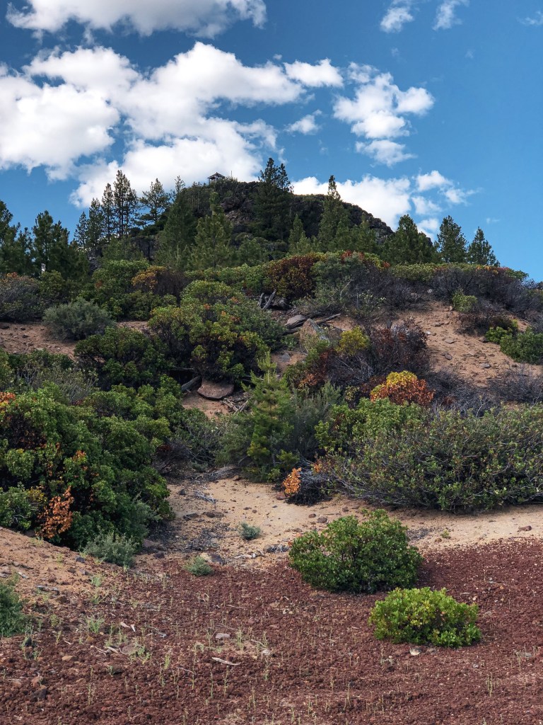
From Sugarpine Mountain (post), we continued southeast on NF-86 until we reached NF-76. This road is also considered CR-676 or Silver Lake Road. We turned left towards the community of Silver Lake and stayed on this road until we could visibly see Bear Butte. The roads off to the left before you reach the butte are not marked. You will need to turn left on to one of these roads before your pass the butte. There should be a road that parallels NF-76 and has two different access points. It can be hard to see and we had to turn around to make sure we were picking the right roads. Once the road turns away from NF-76, you will want to take a right at the second un-marked road. This road should take you to a large cinder pit with a view of the lookout. We ended up parking at the junction with this road and walking to the cinder pit. I personally didn’t feel like running into any additional road surprises for the day.

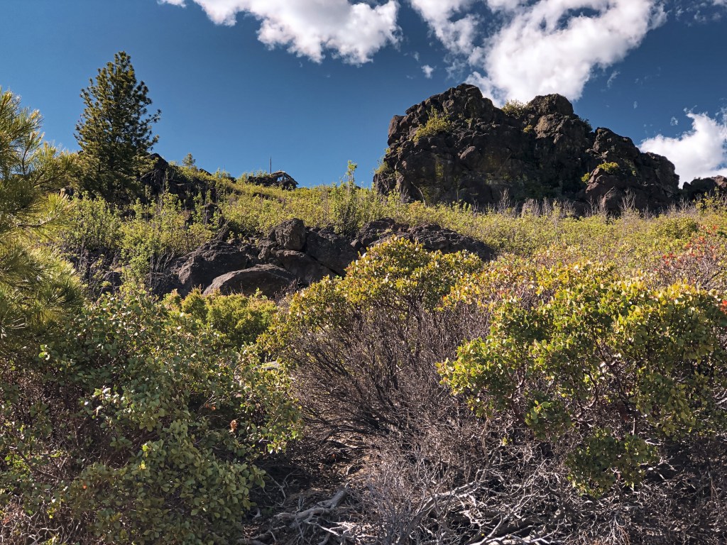
There are no formal trails to take you to the summit, so from here you will have to get creative. We headed to the right of the cinder pit and gradually climbed the slope at an angle. Eventually, we met up with the old road bed that used to circle the butte and followed it to a communication tower. Unfortunately, I don’t do well in soft terrain or rock scrambles. I accepted that this was most likely as close as I’ll ever be to Bear Butte L.O. and let my partner continue on without me. From the communication tower, he headed straight up the slope. He said he was able to find an old game trail from here that led to the rocky top. There are no longer any stairs to get to the structure and you will have to rock scramble the remainder of the way.


After we slid our way back down the side of Bear Butte, we continued east on Silver Lake Road. We re-entered the forest by turning right on to NF-2516 just past Antelope Flat. We were able to find a small camp a little ways down this road in a nice grove of Ponderosa Pine. This road would take us all the way to the needed spur for Bald Mountain (post) in the morning.
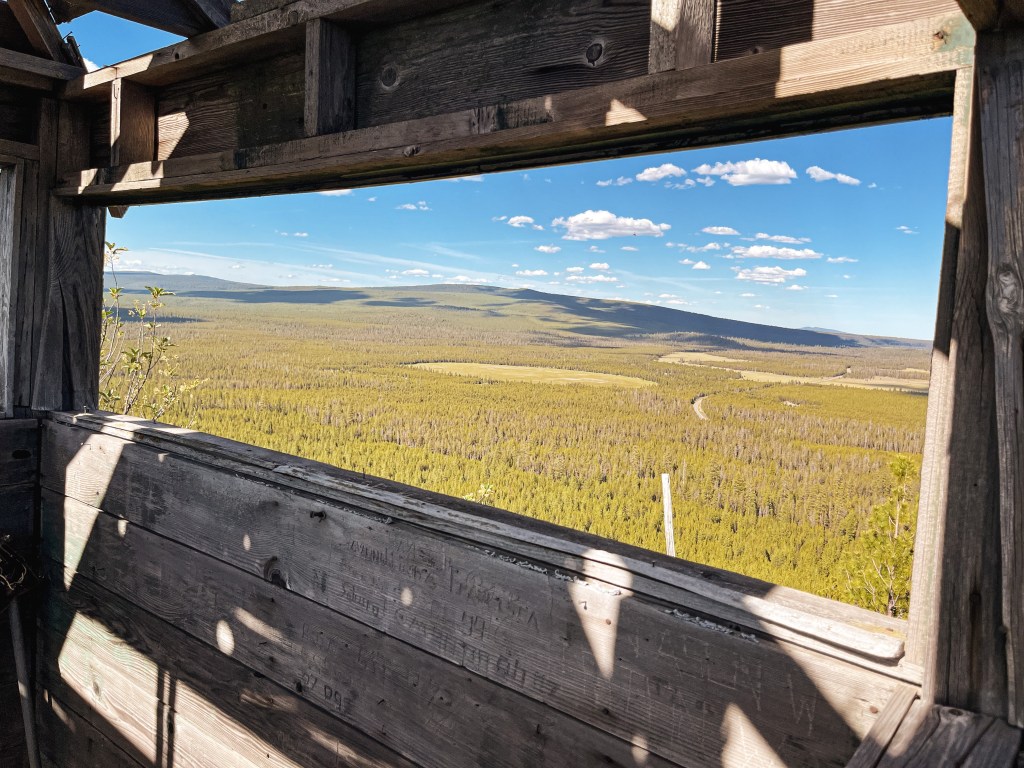
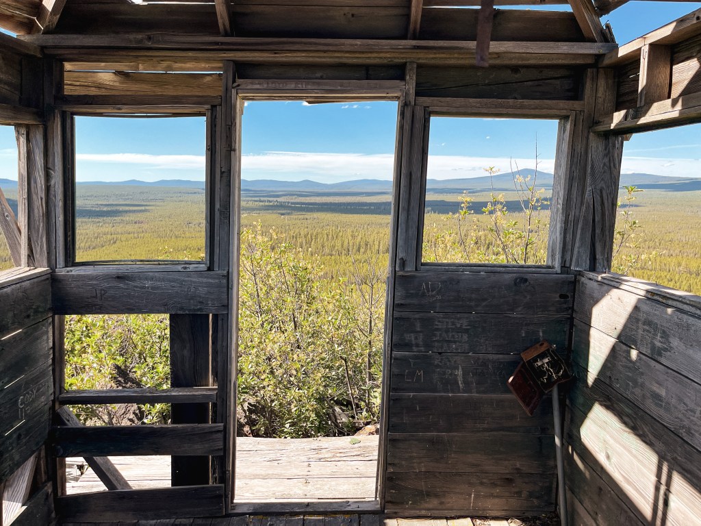
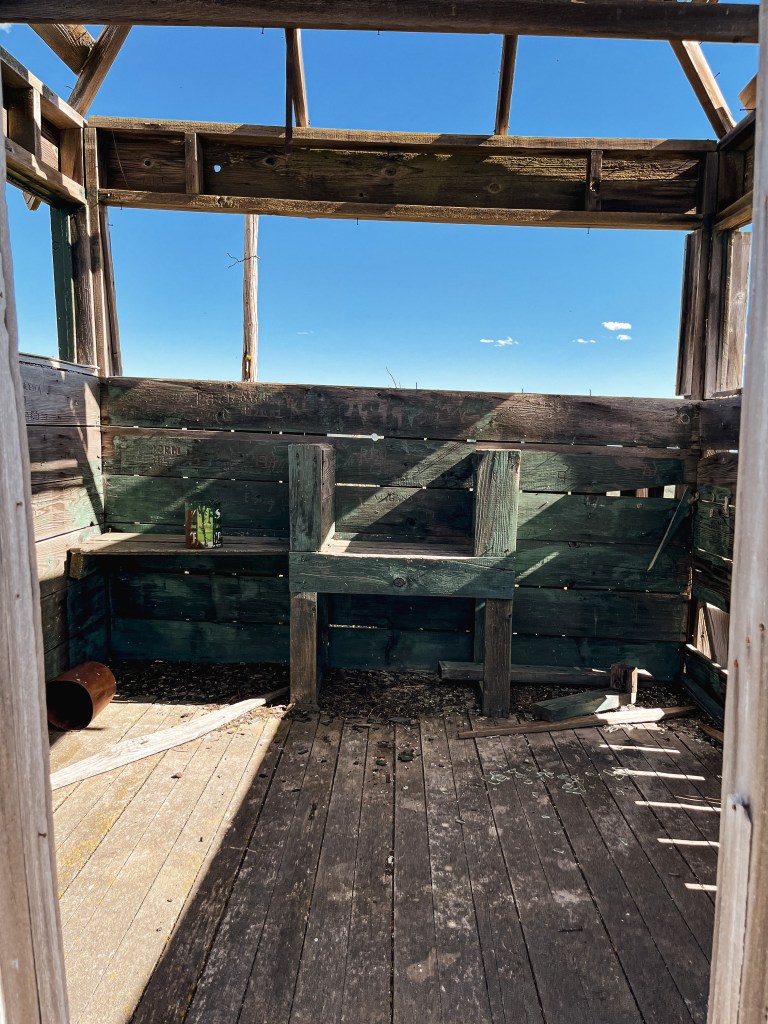
Pictures of Bear Butte cab courtesy of my partner


History.
Bear Butte was established as a lookout site in 1930 with a cabin stationed below and a firefinder set atop the butte. In 1949, a 9×9 wooden lookout cab was added to the summit. It was abandoned in 1966 when state radios were placed on Yamsay Mountain and Bald Mountain (post). It’s in bad shape, but has been standing strong for 70+ years.

Hi. New here. Love your posts. Such beautiful pictures.
LikeLike
Hello and welcome! I’m glad you enjoy them. Thank you for the kind words! 🙂
LikeLiked by 1 person
You’re very welcome. I like reading the history and seeing where the look outs are. We live near a national forest and from my mailbox, I can see a Forest Service fire tower. Pretty cool.
LikeLiked by 1 person
That is very cool! Do you know the name of the fire tower in your area?
LikeLike
It looks like it’s called Doniphan Towersite and it’s listed under Missouri Department of Conservation. There’s also a Doniphan Lookout Tower listed on a topo map. The one I can see is off of hwy 21 north. 🙂 There’s also another one near here called Briar. It’s a teeny tiny town, only a few houses, but there’s a fire tower there.
LikeLike
Neat! Thank you for sharing. I’ll have to check those out if we ever make our way out to Missouri.
LikeLiked by 1 person
Please do, if you ever get this way. This area is near Ozarks National Scenic Riverways. It’s beautiful around here. Lots of natural springs and clear water.
LikeLiked by 1 person