Snow Camp L.O.

Oregon Lookouts

Location.

Rogue River-Siskiyou National Forest

Status.

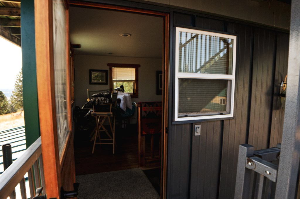
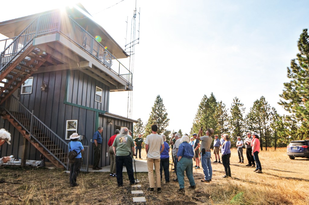
Rental program; Currently standing

Estimated drive time from Portland, OR.

6-1/2 hours

Date visited.

May 27, 2023

Elevation.

4,223′

National Historic Lookout Register.

US 13; OR 4

Trip Report.

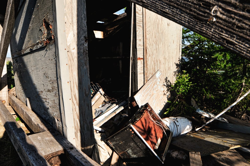
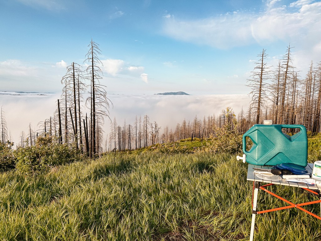
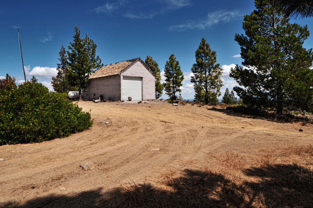
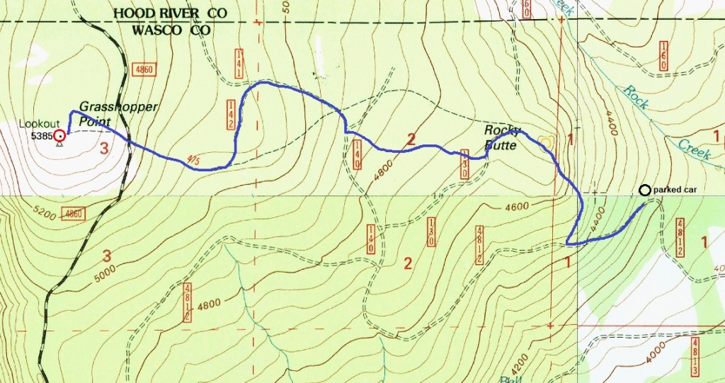
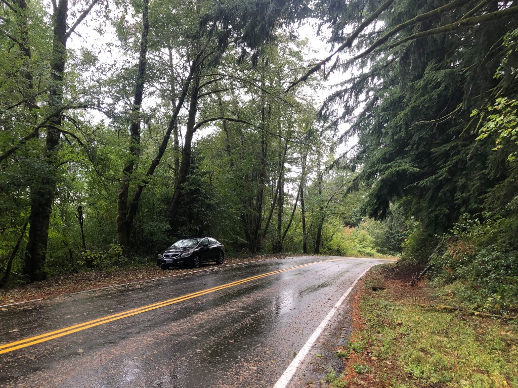
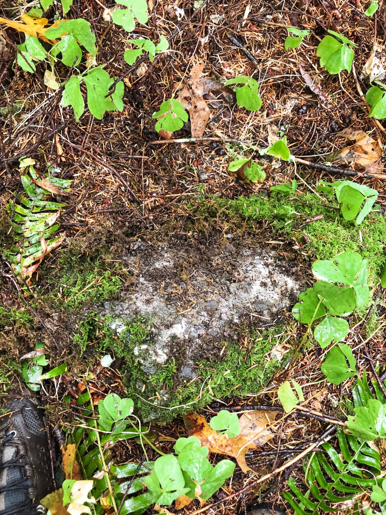
We packed up our camp near Quail Prairie and started to head back out of the forest. We made a brief pit stop to check out Packer’s Cabin since no one appeared to be staying there. We also tried to find the old lookout site along Long Ridge but there were no remnants to confirm we were in the right spot. We white knuckled our way back out on the N Bank Chetco River Road. Garnet would disagree with this statement since he was driving and thought it was fine. But, people really do drive too fast on this road. We watched someone swerve off the road to avoid us because they had taken the corner too fast. They were lucky to be on the side with the shoulder. If they did the same maneuver on our side of the road it would’ve been off the side and down the cliff instead. Big yikes. We made it safely out to HWY-101 without any other incidents and started back tracking towards Gold Beach. We planned to re-enter the forest via Jerrys Flat Road in Gold Beach that follows along the Rogue River and would eventually turn into NF-33. We wouldn’t exit the forest again until we were on the other side in Powers. The turn off for Jerrys Flat Road is right before or after the bridge depending on which way you are traveling. We were heading North on HWY-101, so it was right before the bridge off to the right. Despite the cautionary warning from the ranger the day prior we decided to try our luck with Snow Camp. The plan was to see how close we could get. If there was truly 14″ of snow on the road we would park and walk the remaining distance, assuming it wasn’t too far.

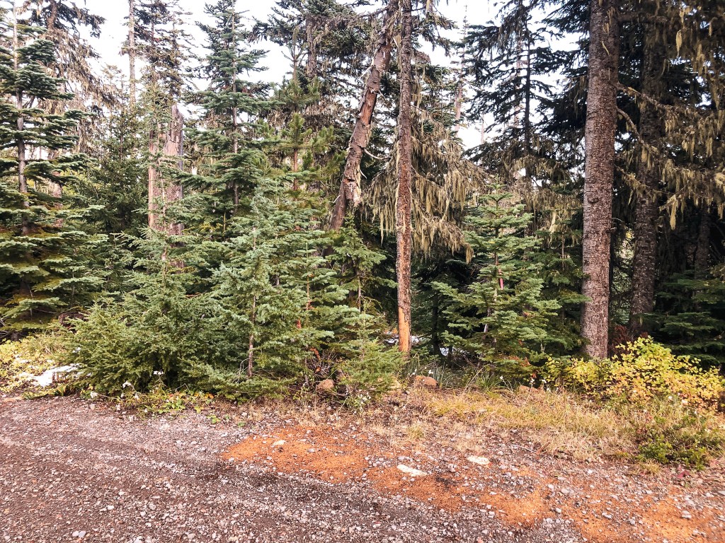
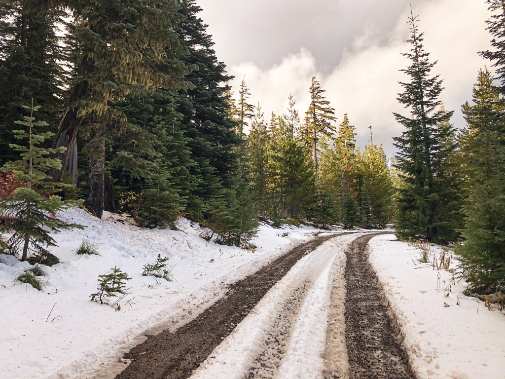
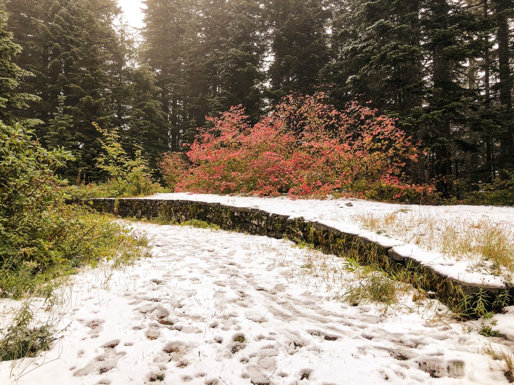
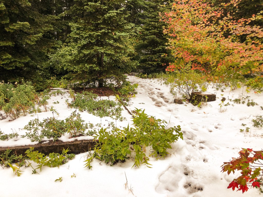
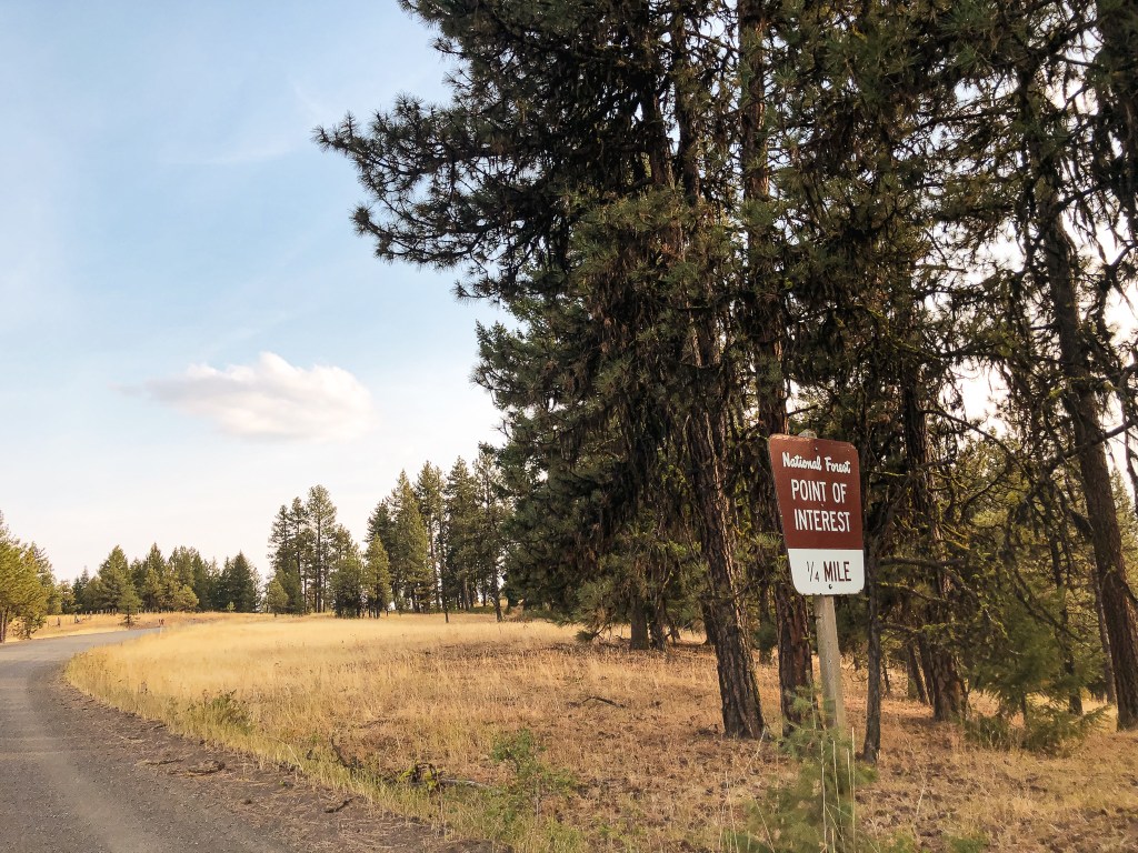
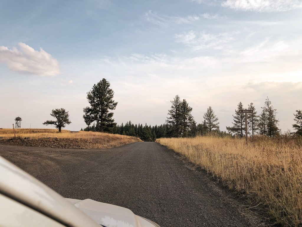
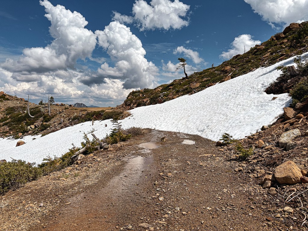
We winded along Jerrys Flat Road until we passed Lobster Creek Campground. There aren’t that many roads off to the right and we knew it would be the first major junction after this campground. The road is NF-3313, but we didn’t see a sign for it when we came to the junction. Garnet mentioned there was one if you were heading west but I didn’t see it. If you reach the Quosatana Campground, you’ve gone too far. We stayed on NF-3313 for a little over 8 miles until we came to a junction with NF-3680. The NF-3313 road was made up of good gravel. There was a sign for Snow Camp pointing to the left that noted it was only 7 miles away. We decided to stop and have a quick lunch here since there was enough room to park out of the way. We also knew we’d be too hungry to wait to have lunch on the summit. The directions on recreation.gov states that it is 6.7 miles along NF-3680 to the turn off for the lookout. We continued left as the sign suggested, but our odometer clocked in around 7.2 miles along NF-3680 before we reached the gate. All the flat sections along this road were filled with pot holes that slowed us down significantly, but it was otherwise a fine road. We did encounter one snow drift, but it had melted enough since last Tuesday to go around. Even if it had been blocking the road we would have been close enough to the gate to make the hike. After seeing the snow drift, I realized that is what they meant by 14″ of snow on the road. This made me feel better about the remaining conditions for the rest of the trip since Snow Camp was the highest of the fire lookouts we would be visiting. If we could make it this far, we should have no issues anywhere else. At least in relation to snow.

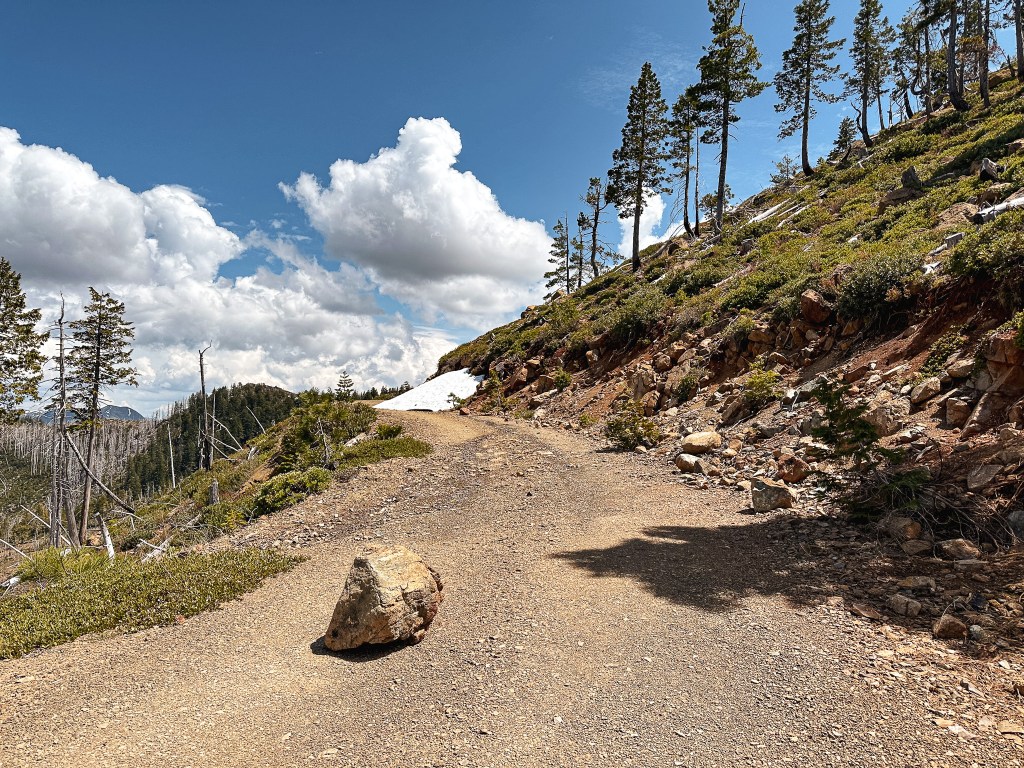
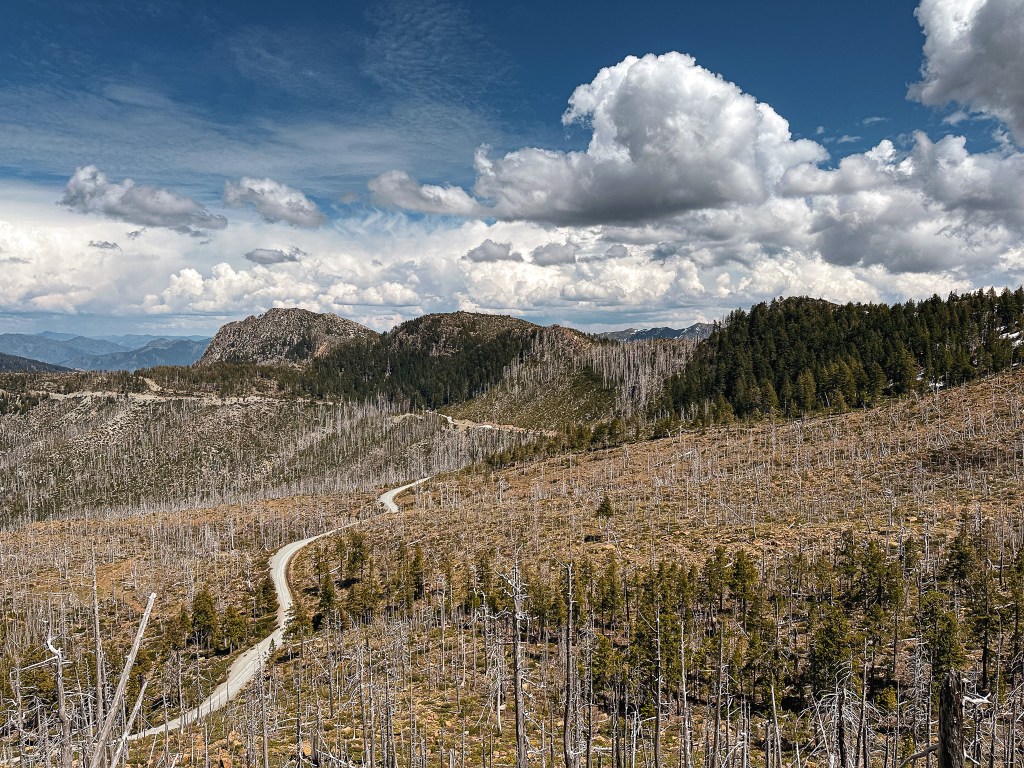
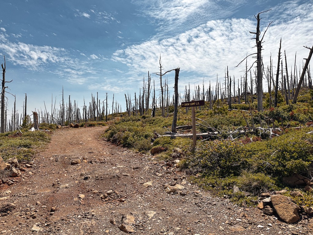
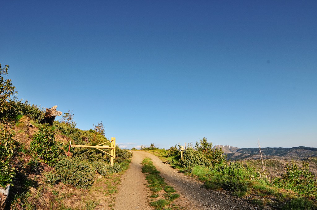
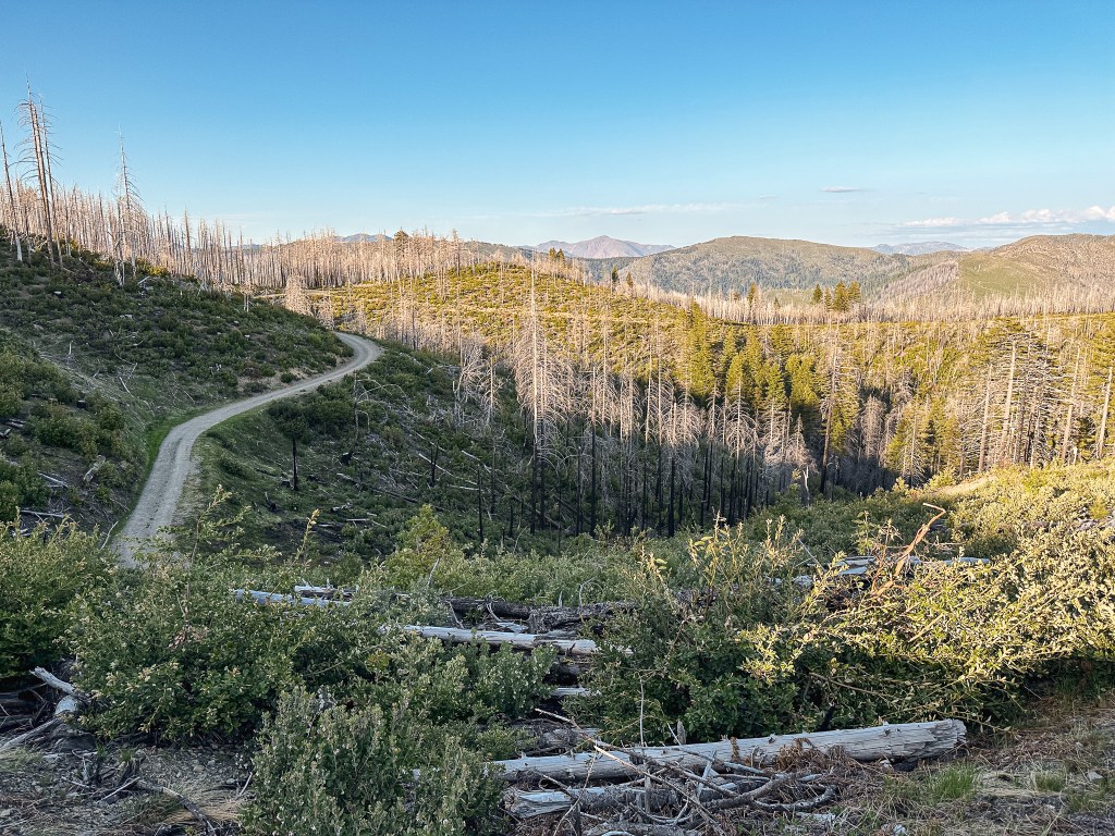
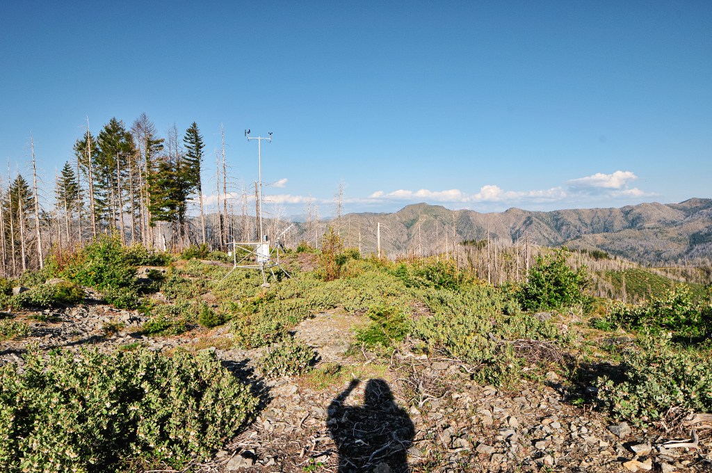
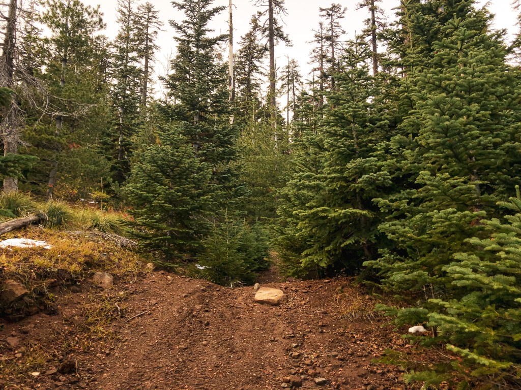
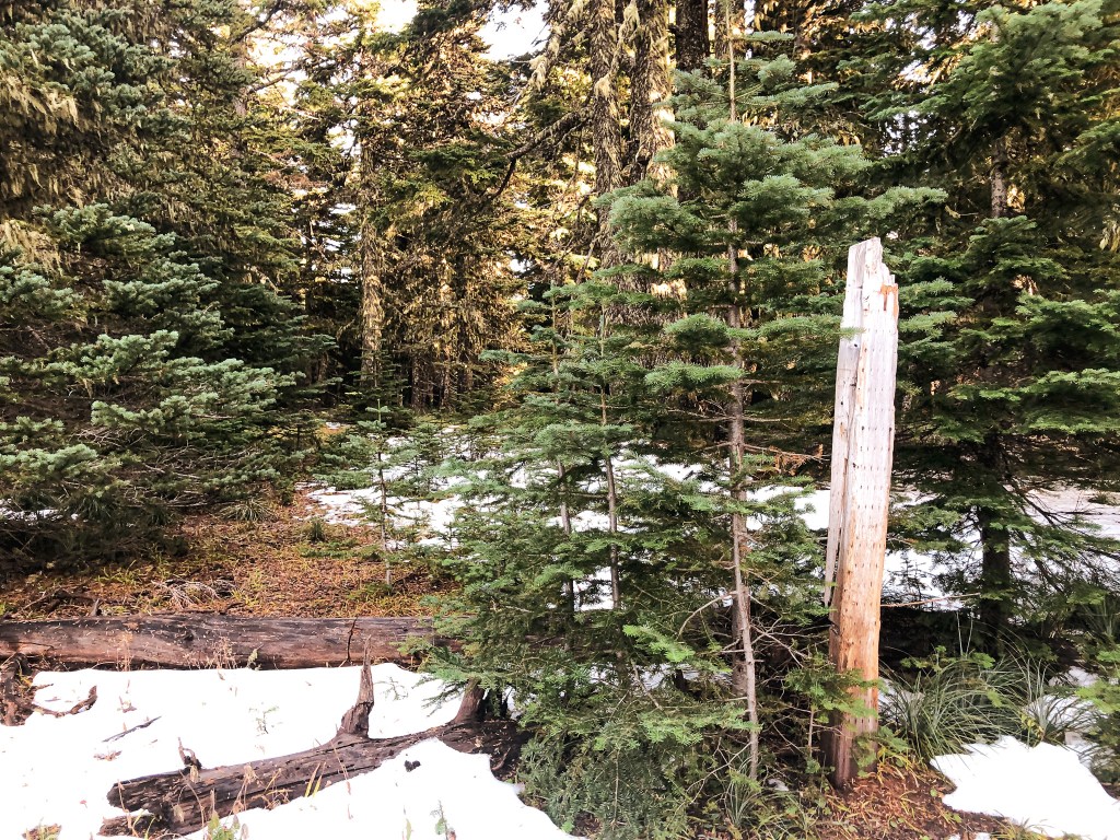
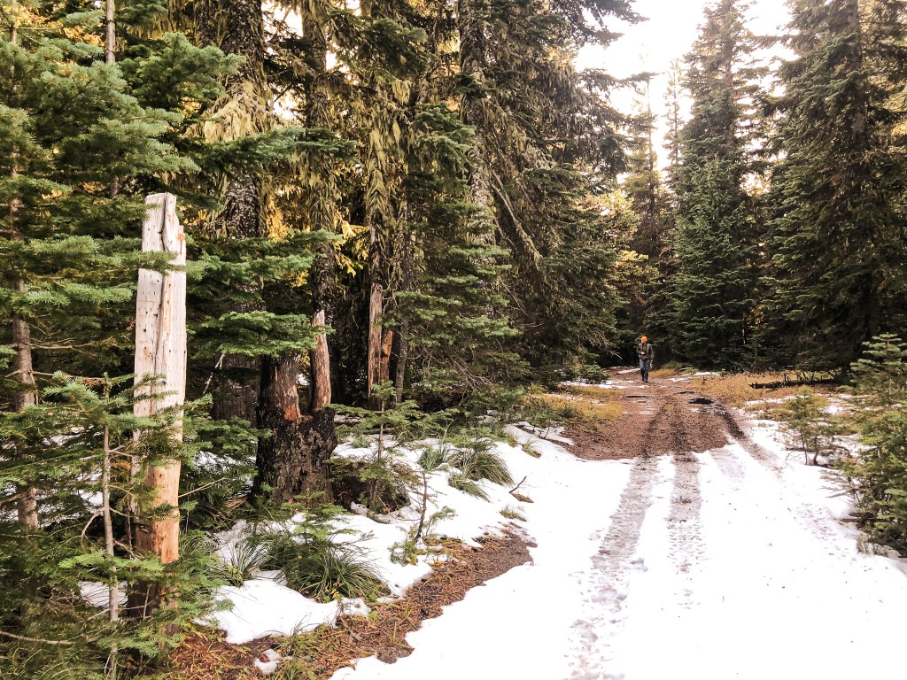
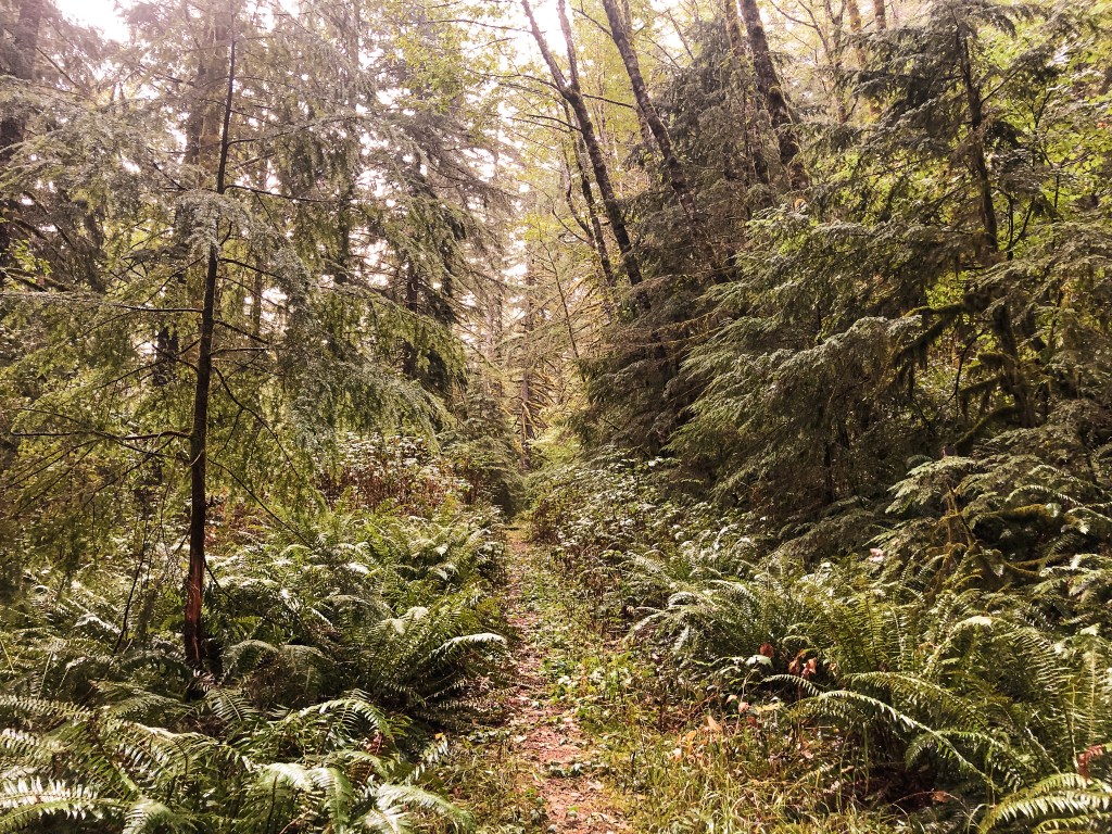
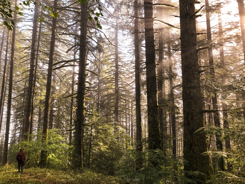
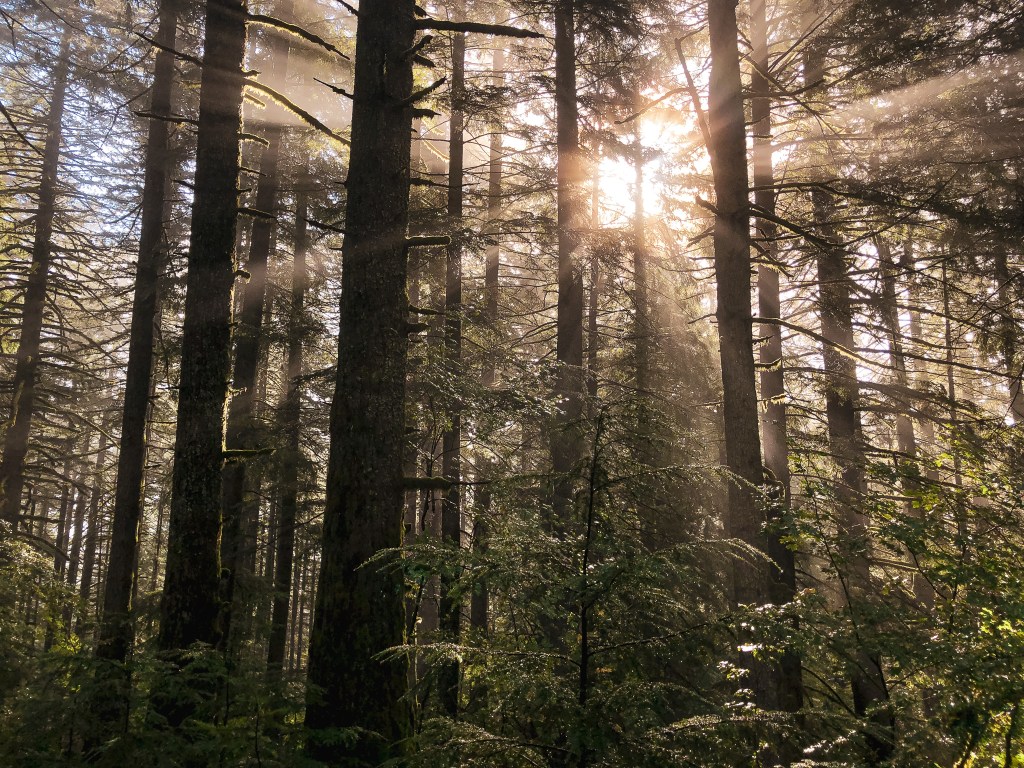
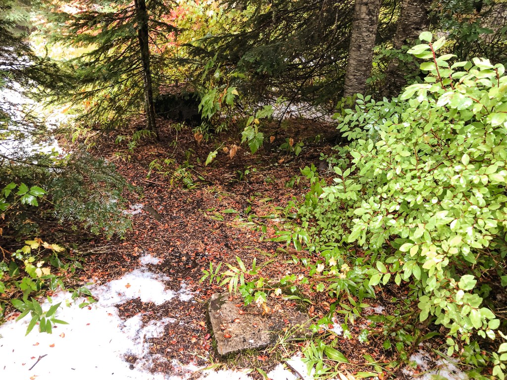
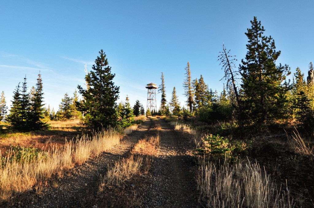
There are two options from here to get to Snow Camp. You can either hike the NF-1376 road or the trail. The sign at the gate stated that it was 2 miles to Snow Camp from here. I believe this gate is typically open when the fire lookout is open to renters in the summer. It was still closed for the season during our visit. The Snow Camp Trail #1103 starts from the same NF-3680 road a little ways back. There was a trailhead that we passed with a large group camping there. It’s roughly 3.25 miles along the trail to the summit. We decided to hike the road since it was shorter and would be easier to maneuver around any additional snow. Though it is a pretty area and I’m sure the trail is well worth the hike. We set off up the road and quickly climbed out of the shady forest on to an exposed slope. It felt like we had left the coastal range and stepped straight into Eastern Oregon. The landscape didn’t match what I thought it would be, it was much more. People often complain about how a fire destroys an area, but I don’t think they talk enough about the beauty that can come after. There is a different kind of beauty, that I really love, in a sea of ceanothus and manzanita with the matchstick ghosts of the forest past. This area was not only unique in landscape, but botanically too. We noticed a few young pines along the road that had pinecones growing directly out of their trunk. Garnet thought they might be Sugarpine (Pinus Lambertiana) at first, but later research found them to be Knobcone Pines (Pinus Attenuata). If you are unfamiliar with Knobcone Pines, their range is mainly in south-western Oregon with some patches in California. They are unique in that their reproduction is exclusively controlled by fire. They are a closed cone species meaning their cones remain sealed with a hard resin until a fire burns hot enough for them to open. An unburned Knobcone will remain unopened even after the parent tree has fallen. It favors harsher conditions and is typically associated with other plants that are fire-followers. Another interesting plant we had never seen before was a Groundcone (Kopsiopsis Hookeri). We initially thought someone had taken some pine cones and stuck them straight up in the dirt. Upon closer inspection we realized it was actually a plant. This one is considered parasitic, but was still really cool to see.

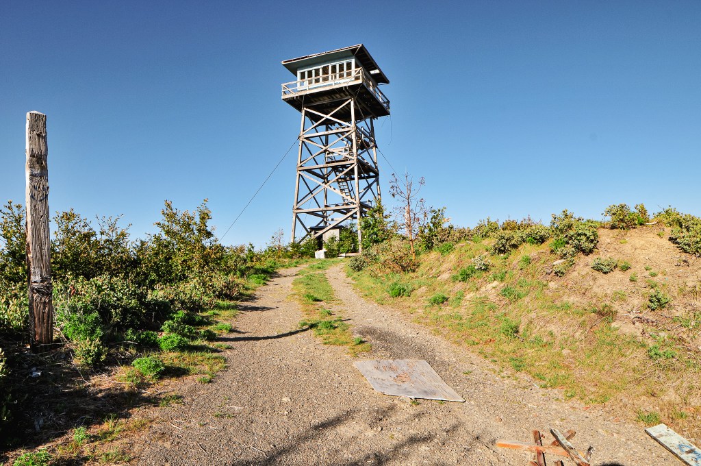
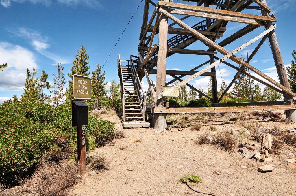
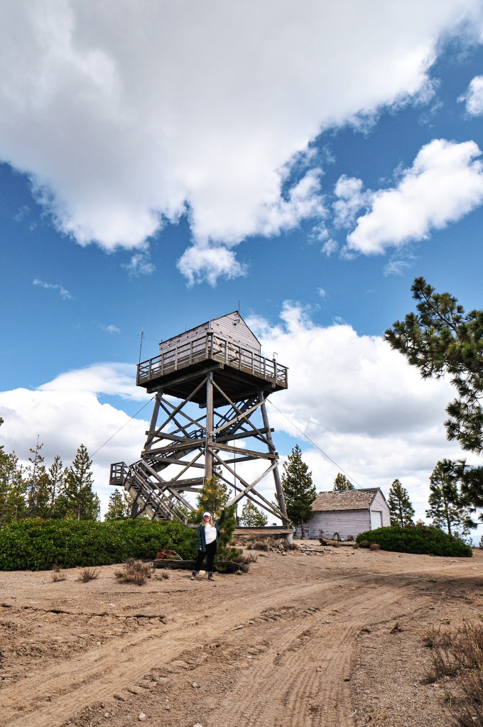
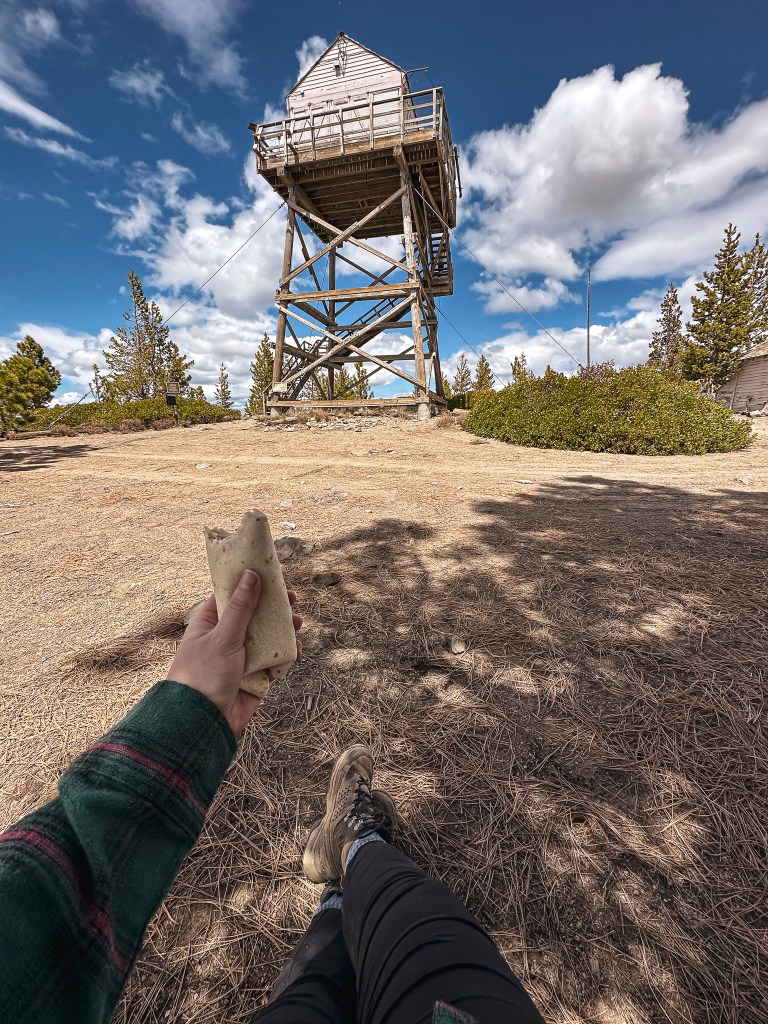
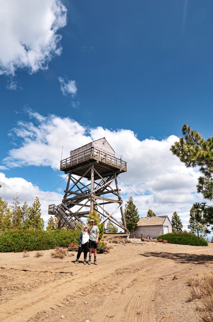
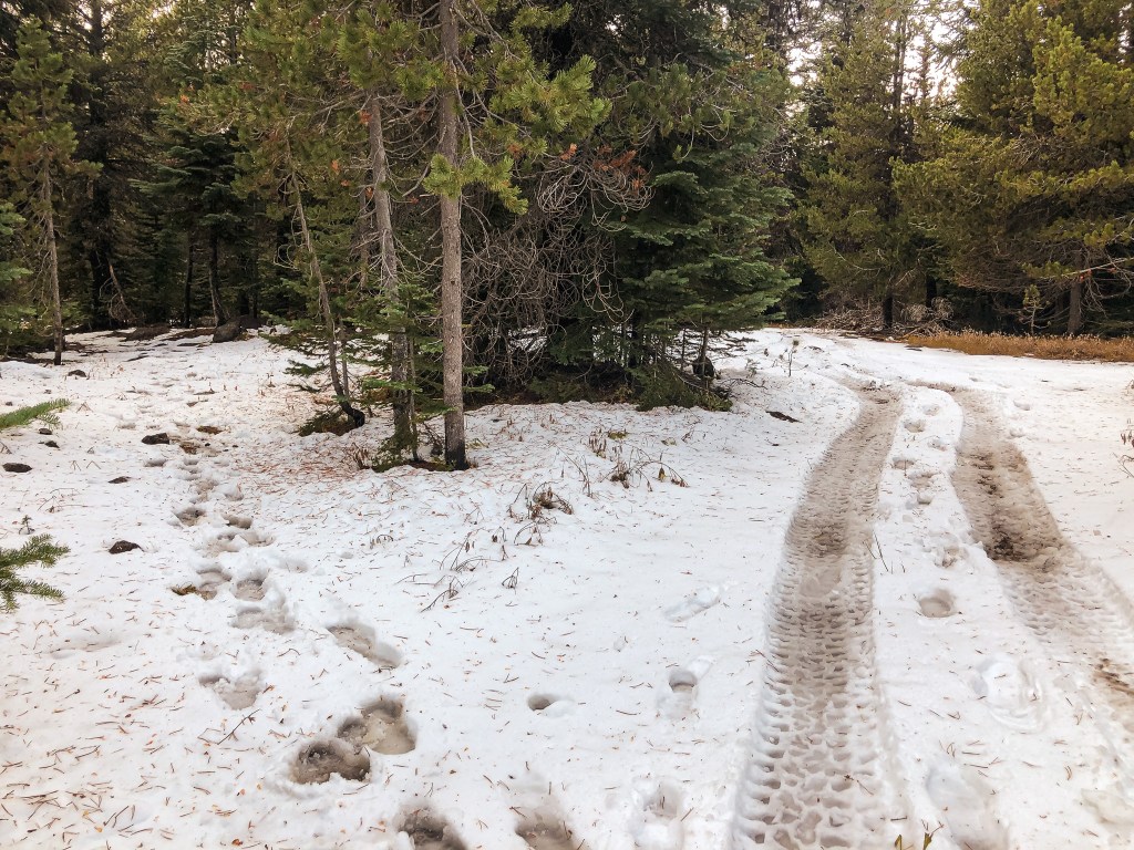
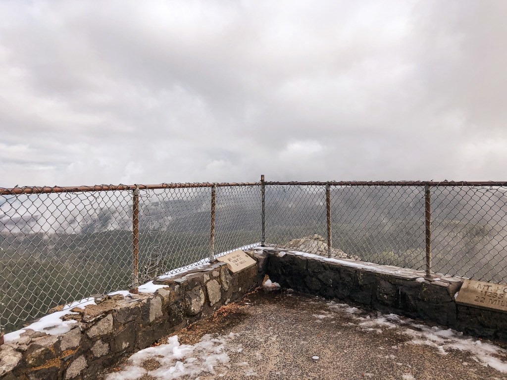
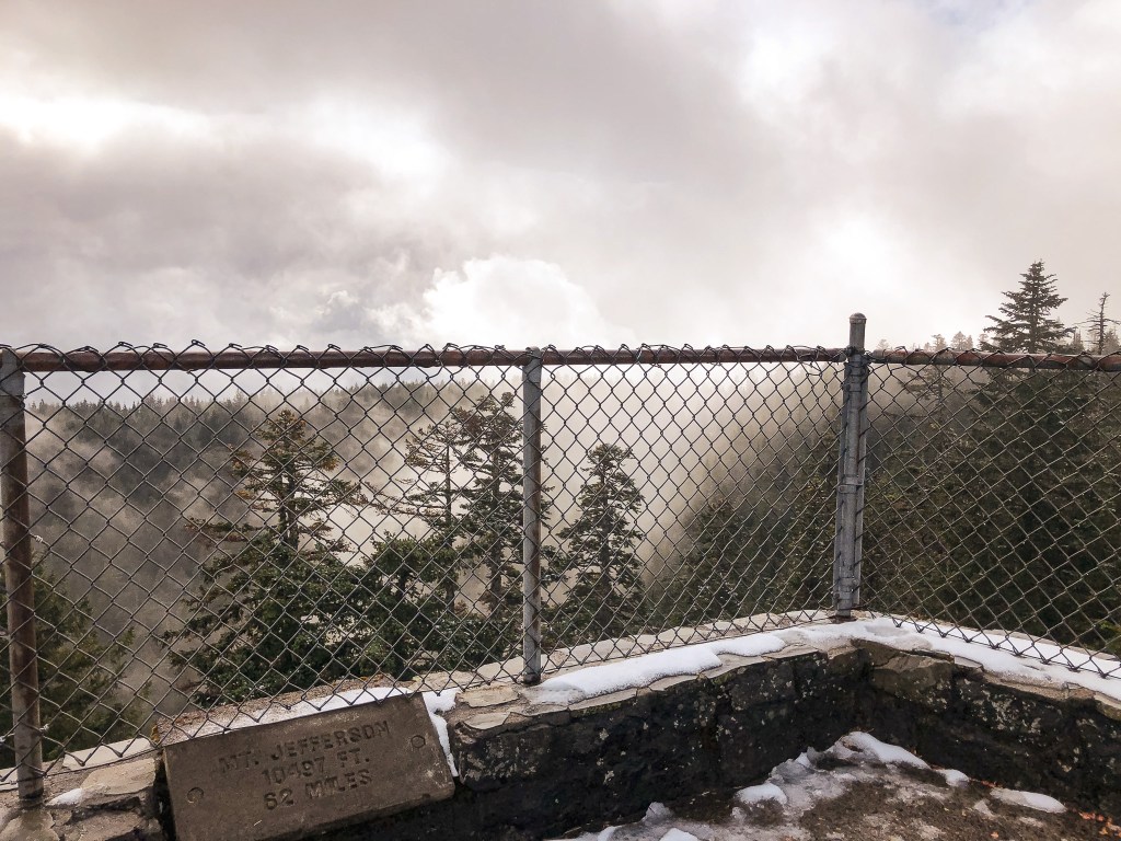
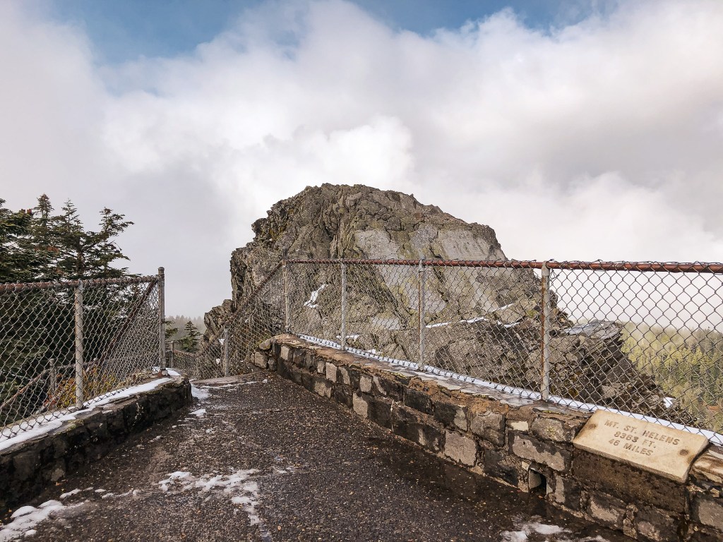
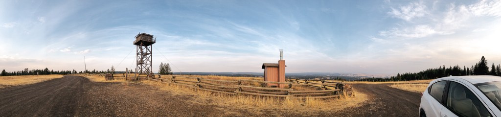
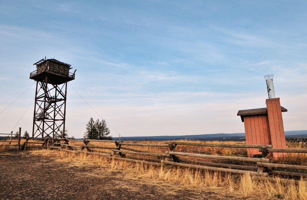
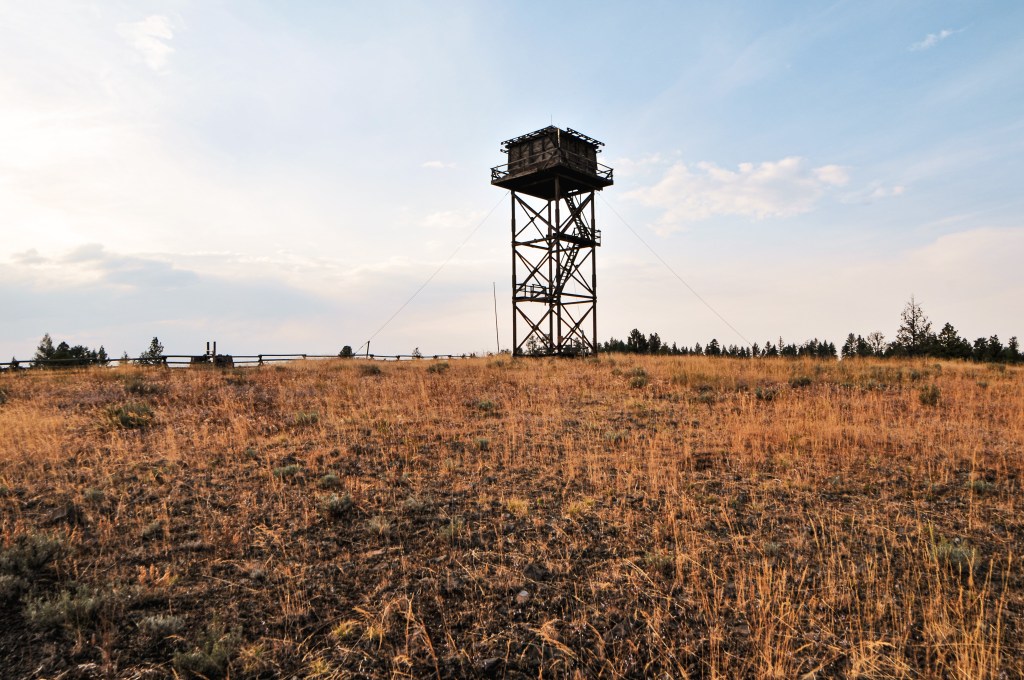
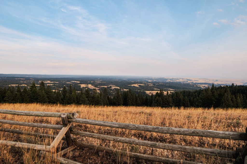
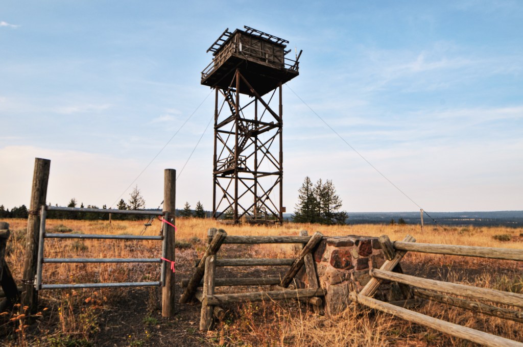
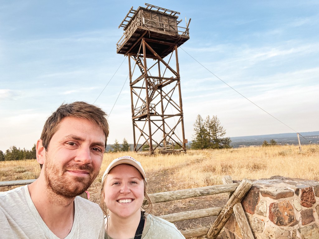
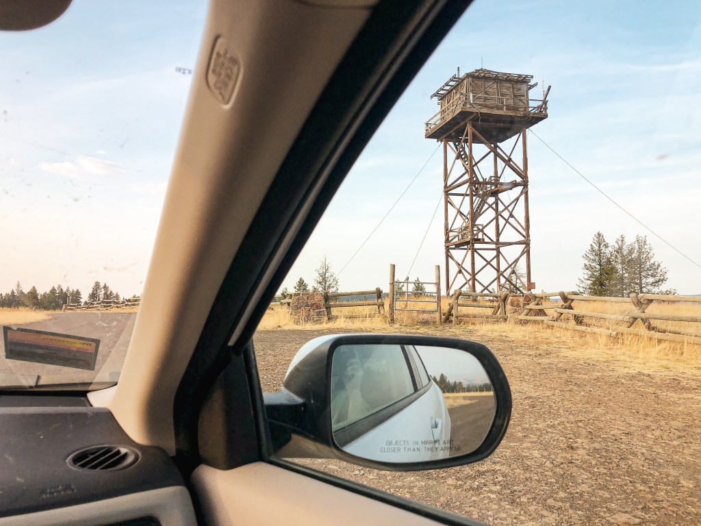
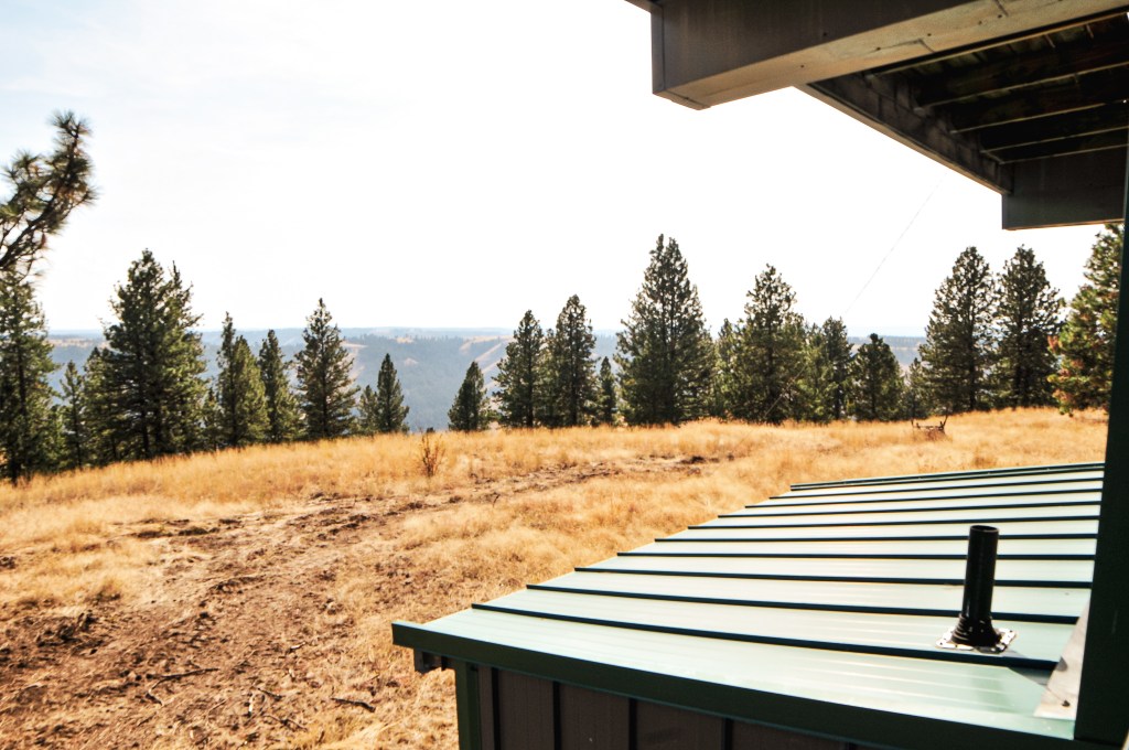
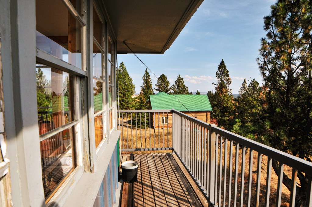
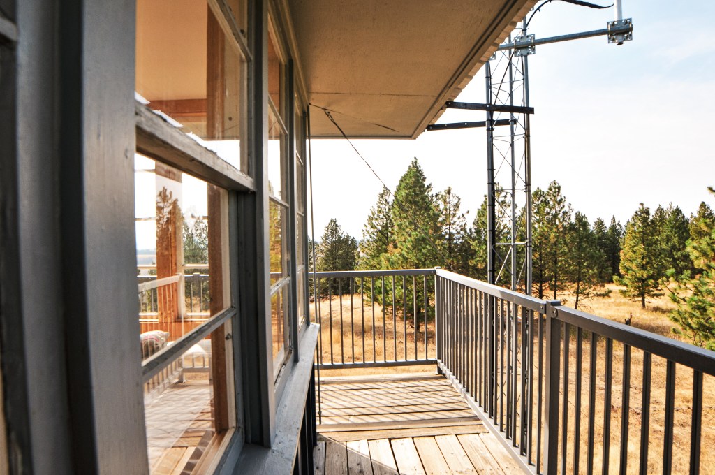
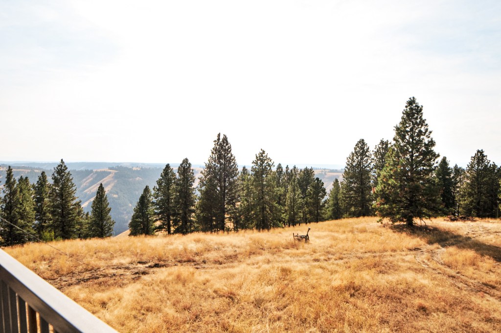
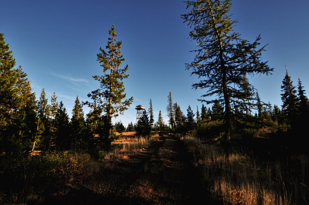
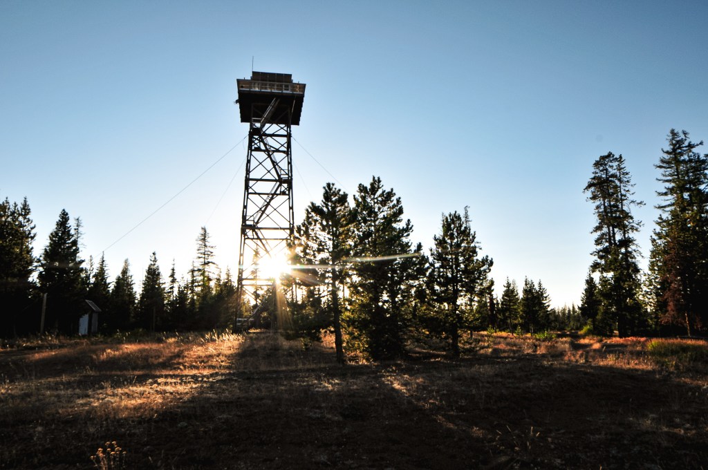
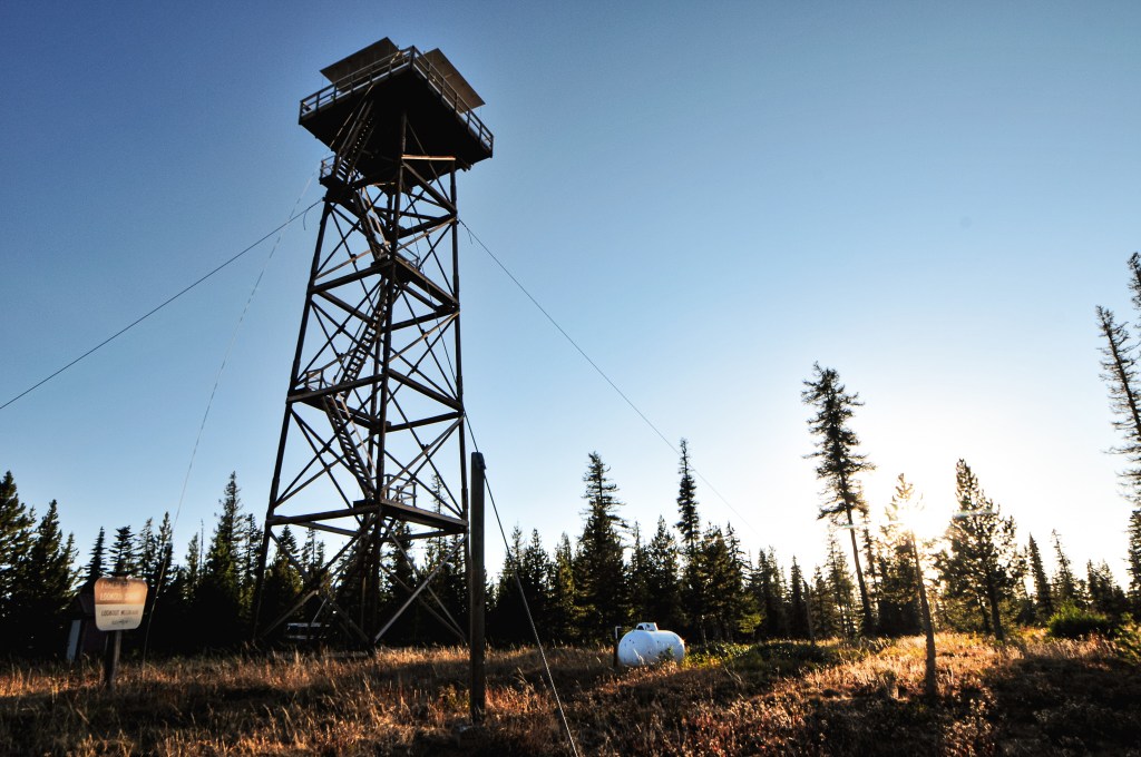
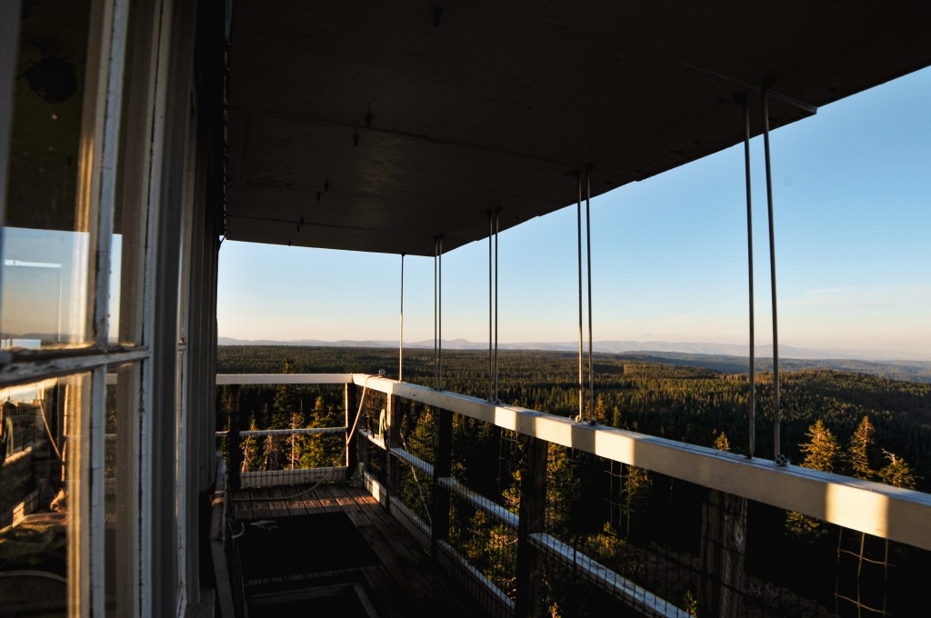
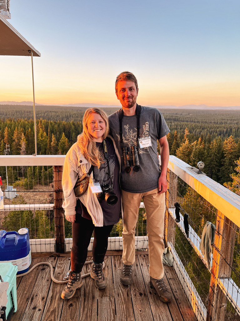
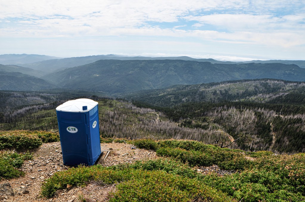
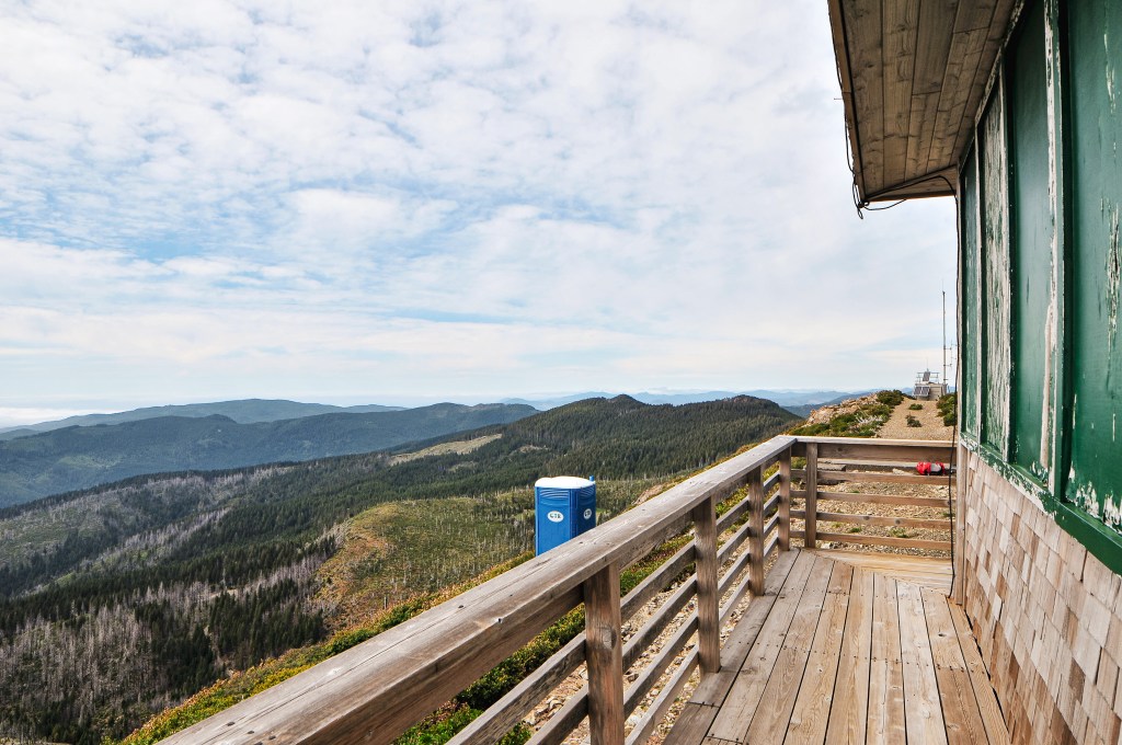
There was some major rock fall and a much larger snow drift that blocked a portion of the road we were hiking on. The Forest Service would need to spend time clearing this before they could open the fire lookout to renters for the season. There is a second gate when you come to a junction with the spur road to the lookout off to the right. There was a sign for the lookout here as well. It looked like there were recent tire tracks coming up from NF-1376 which was interesting given that the road is noted as closed and gated on the map in the other direction. We could have hypothetically connected to Snow Camp from Quail Prairie via this route, but it would have required driving 25 miles of gravel on NF-1376 from the N Bank Chetco River Road. There would also be no way of continuing north via that route due to the snow drift and other gate. We continued our hike past the second gate for the final stretch to the lookout. The Strava app tracked in around 1.725 miles from our parked car to the summit. It seems whoever made the mileage signs in this area was just rounding to the nearest full mile. The last pitch of road to the lookout is undriveable to most vehicles and very steep even to walk up. The views from the summit are spectacular though. You can see the ocean and a lot of the surrounding coastal range. I’m sure you could pick out some of the prominent peaks in the state as well on a clear day. We had some haze on the horizon obstructing our farther off views either from the wildfires in Canada or field burning. We didn’t stay for too long after taking pictures since we wanted to visit Wildhorse L.O. before setting up camp for the night. As we were hiking back to the junction with NF-1376 we saw a Jeep driving back down. We were just about to comment on how we hadn’t seen anyone too. They didn’t seem to notice us, but we could see from their tire marks and footprints in the snow bank that they got out to debate trying to drive over it. It’s a good thing they didn’t since they would have been very disappointed to find a locked gate at the end. Once back at the car we continued on to Wildhorse and hoped we would find a good camp along the way.

History.

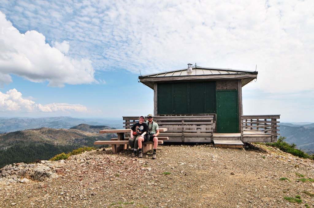
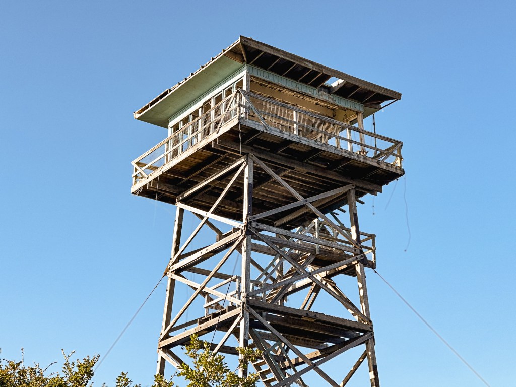
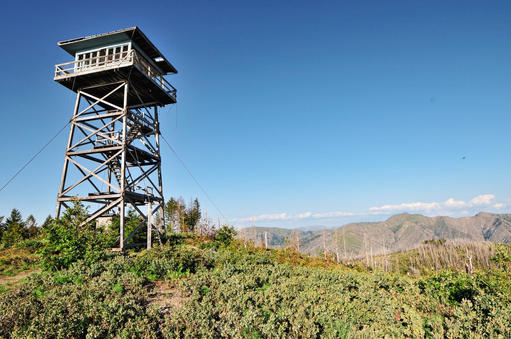
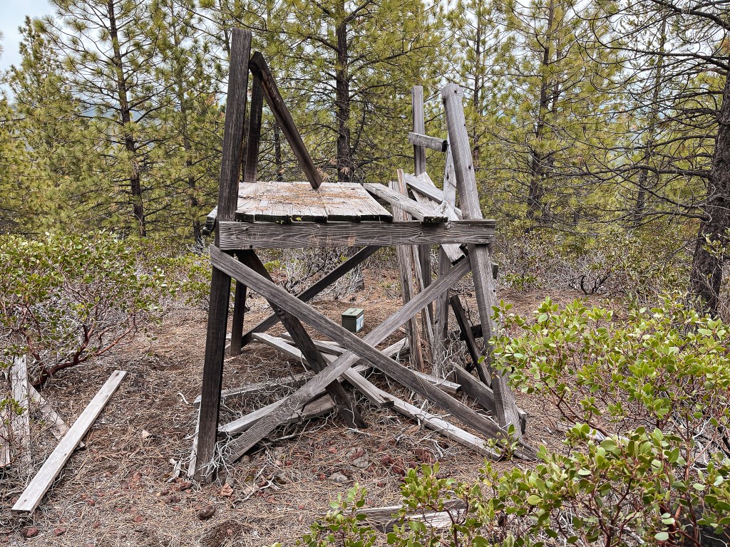
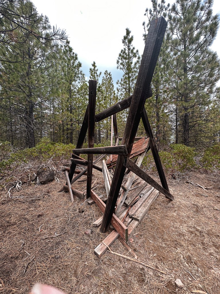
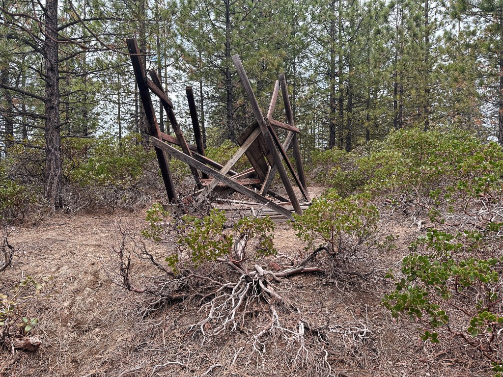
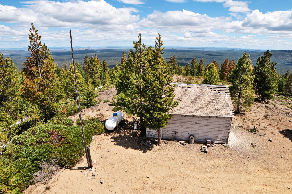
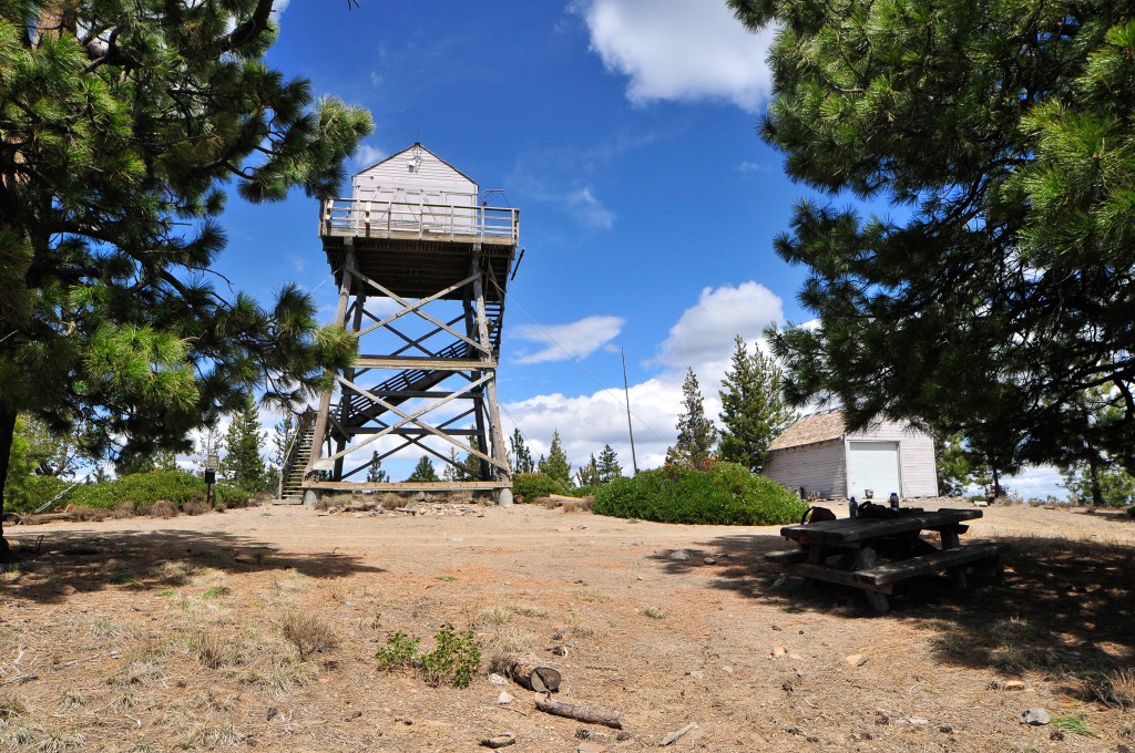
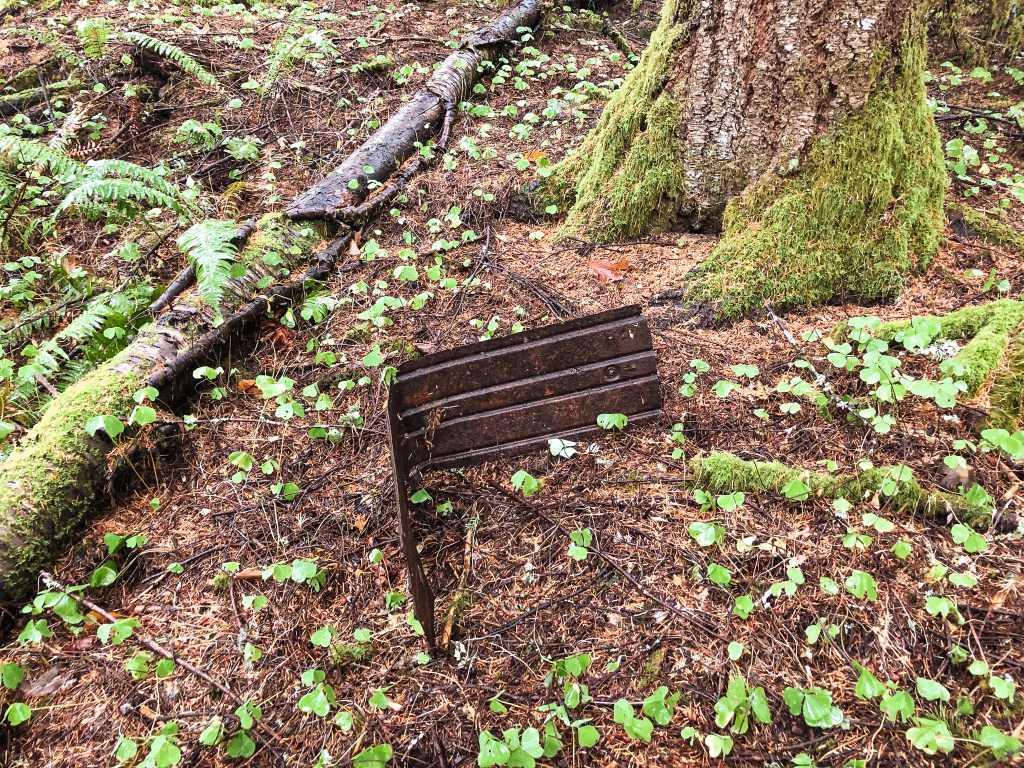
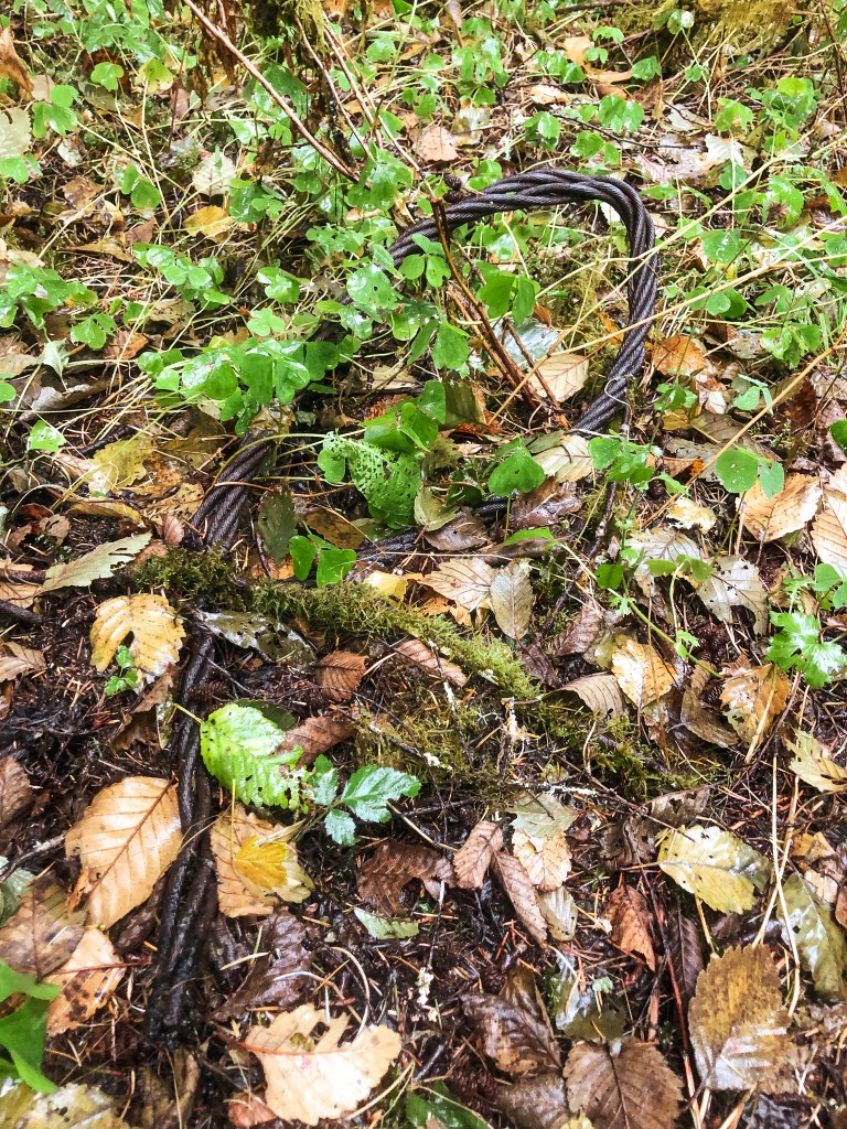
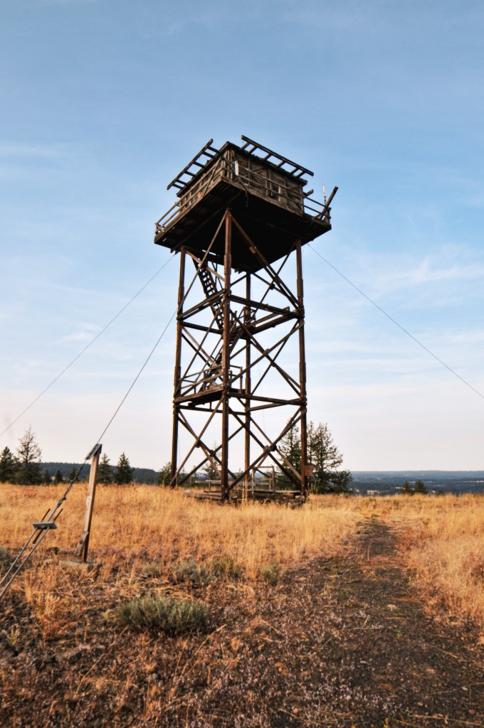
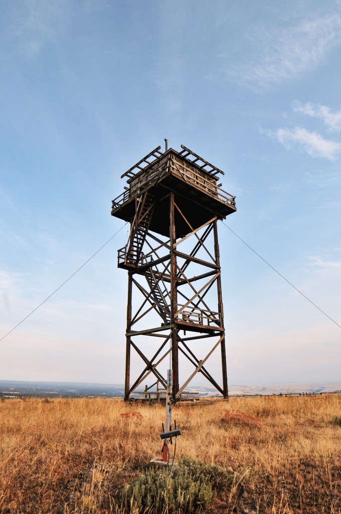
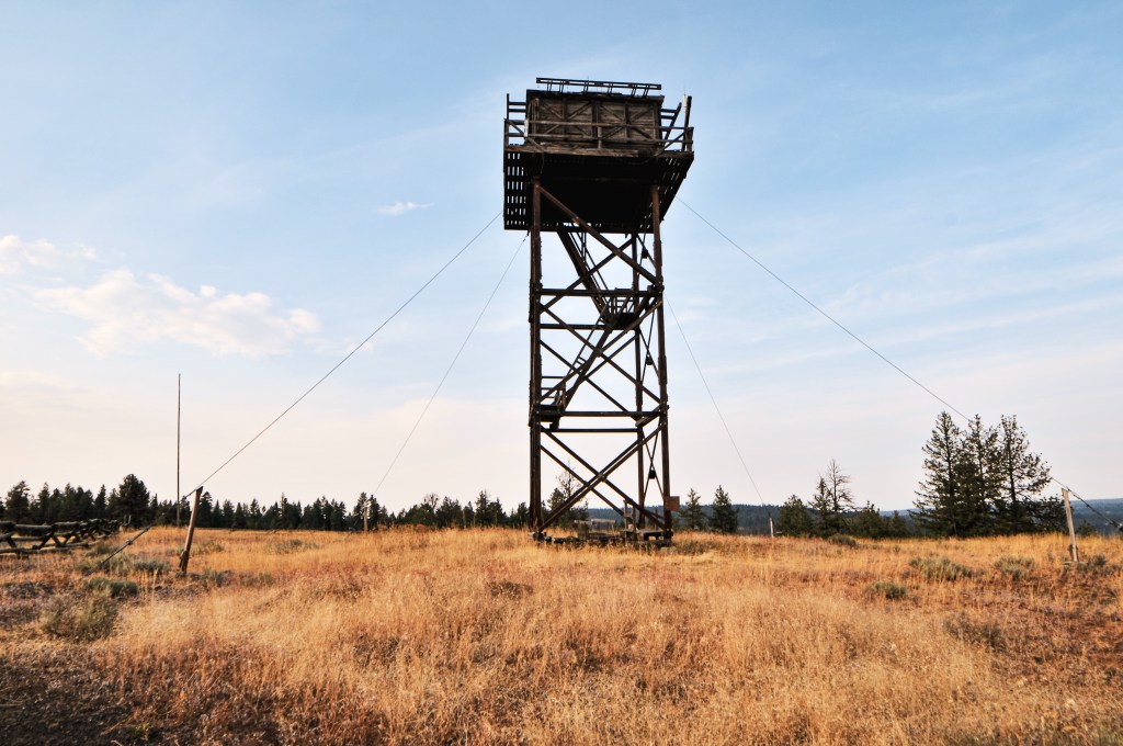
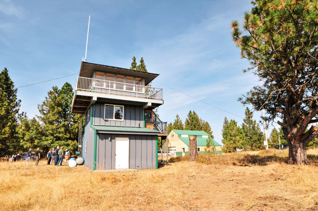
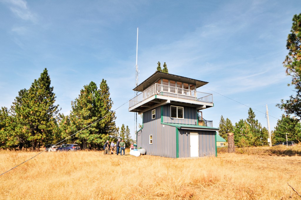
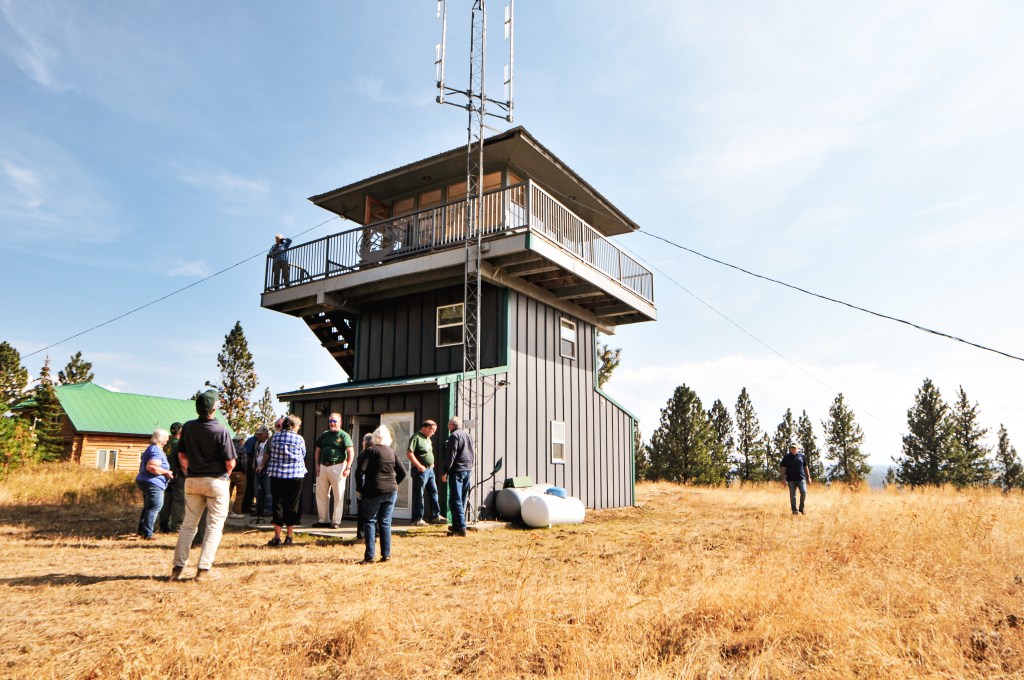
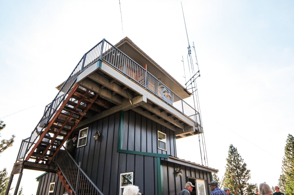
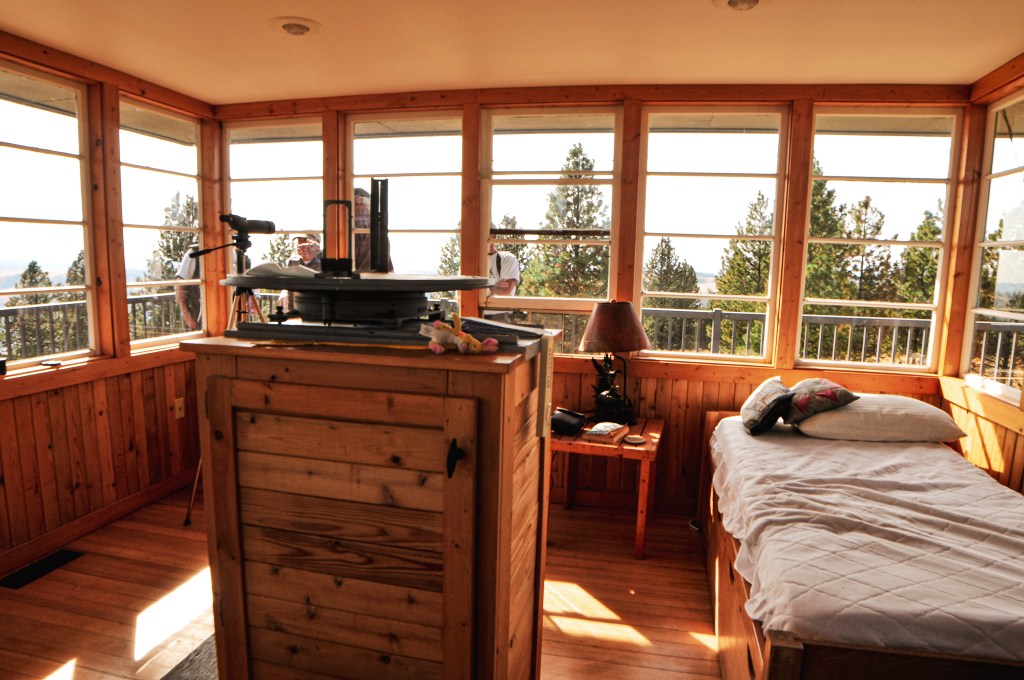
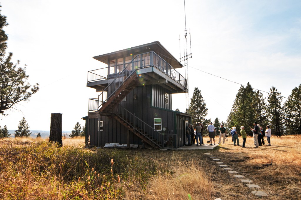
The existing fire lookout was built in 2004 by Don Hartley and a team of volunteers. Don Hartley is the owner of Don Hartley Construction in Crescent City, CA and was a frequent visitor to this area. It is a 15’x15′ original structure that has never been used for fire detection. It was built with the purpose to be a rental for the public after the original fire lookout burned down in the 2002 Biscuit Fire. The site was first established in 1910 for fire detection when an Alidade was mounted to a post. A canvas house or rag camp was built in 1915 to provide a more permanent place for the lookout attendant to live. It didn’t see its first structure until 9 years later in 1924. A 14’x14′ cabin considered a “Hall Special” was constructed at the time and was actively used until it was replaced in 1958. The site was in service during both World War I and World War II. It was apart of the Aircraft Warning System in 1942. The replacement lookout was a standard 15’x15′ R-6 flat cab. It’s unclear when they stopped actively staffing it and added it to the rental program. A portion of the Snow Camp Trail was identified by “Chief” Elwin Frye, a packer for the Forest Service, as an Indian travel route that provided access to Windy Valley. Many of the trails in the area follow historic aboriginal routes.

Quail Prairie L.O.

Oregon Lookouts

Location.

Rogue River-Siskiyou National Forest

Status.

Abandoned; Currently standing

Estimate drive time from Portland, OR.

7 hours

Date visited.

May 26, 2023

Elevation.

3,033′

National Historic Lookout Register.

US 467; OR 64

Trip Report.

The high holiday weekend was upon us and snow was still lingering lower than previous years. Similar to a relative that has overstayed their welcome. Memorial weekend is usually considered the official start of the camping season for the general population. But, I think a lot of plans changed as reservations were cancelled and campgrounds failed to open in time. We typically like to start our season earlier by creeping our way into the lower elevations as early as March. This year had been slow to start with the snow levels and our added responsibilities as new home owners. We still managed to make it to the Northern Redwoods for my birthday in April and Eastern Oregon for my partner’s birthday in May. Despite those two previous trips this felt like our first substantial trip of the season. It would also formally kick off our fire lookout season. Though I don’t think we’ll be able to top last year after visiting a little over 50 standing lookouts in one season. Our plan for the next 5-days was to take a tour of the fire lookouts within the Southern Oregon coast range. We figured they were all low enough elevation to be snow free by this time. Plus the coastal range tends to get less snow in general than the rest of the state. There were a few posts about rental reservations in that area being cancelled on the Oregon fire lookout Facebook page that were some cause for concern. But, we didn’t really have a plan B in mind and decided to leave it up to luck. We would only pivot and reroute if absolutely necessary.

My partner and I stayed up late Thursday packing the car and prepping the remaining items for the trip. No more packing our gear down three flights of stairs the morning of departure! We also didn’t have to get up as early with the car already packed, minus the cooler of food. We just had to make sure to leave early enough to make it to Gold Beach before their ranger station closed for the weekend. We were on the road by 9AM heading south via the I-5 corridor to cut over on HWY-38. There are a few different options to connect to the coast, but HWY-38 offers the least amount of curves and is flatter than most. We met up with HWY-101 from Reedsport and continued heading south. The Gold Beach ranger station closed around 4:30PM and we made it in time with an hour to spare. The ranger on duty was very helpful. He confirmed their current snow levels were around 5,100′ with a few lower elevation snow drifts in the northern slopes. This was good to hear since all the fire lookouts we planned to visit were around or below 4,000′. We told him our intended route and asked about road conditions. He thought we should be fine getting to most, even in our Civic, but he didn’t recommend Snow Camp or Eden Ridge. The last report on Snow Camp was from the previous Tuesday where there was still 14″ of snow on the road. I took that as the entire summit being covered in snow, but more on that later. He cautioned around visiting Eden Valley due to some recent timber theft and a few land slides in the area that they still needed to clean up. Our plan was to head to Quail Prairie after our visit to the ranger station and camp in that area for the night. Another ranger showed up while we were talking about this plan and they confirmed that area was accessible to at least Packer’s Cabin, which is located 3 miles below the lookout and rentable through the Forest Service. She cautioned us to be very careful heading up the Chetco River though due to the high traffic on a very narrow road. We bought a ranger district map of the area and thanked them for their helpful information.

We headed back out on HWY-101 continuing south to Brookings. We wanted to start with the southern most fire lookout and slowly work our way back north to set us up for a shorter drive home. From Brookings, we turned left onto the N Bank Chetco River Road to head into the forest. This is a narrow paved road that winds along the edge of the Chetco River with steep drop offs as the ranger had mentioned. There were a few gravel bar campgrounds along this route that were filled to the brim with campers. The pavement was in good shape minus one spot before the last campground that drops down due erosion. If you’re not careful you could bottom out. We were able to crawl over this at an angle and others had driven their trailers beyond this section. After passing the last campground, we crossed the South Fork of the Chetco River on a single lane bridge and came to a T-junction. We turned left onto NF-1376 and the pavement ended. We weren’t on this road for very long before we came to a major fork. The NF-1376 road continues to the left along the Chetco River, but we turned right to start our climb up NF-1917. Shortly after starting up this road, I let Garnet take over the driving when the road made a dip on a narrow section. No use in wasting our time having me freak out while driving. The NF-1917 road climbs up along Long Ridge and past the Packer’s Cabin. As we got closer to the summit, there were some downed trees along the road. Luckily, the wood cutters had been through here and cleared just enough room for us to make it around. The spur road NF-180 for the lookout will be obvious since there is a gate and you can see the tower from the road. The road continues past the spur but turns into an unmaintained jeep track from there. We parked at the junction and decided to walk the remaining distance. The Strava App tracked the road walk at a little under half of a mile to the summit. The gate was open and we probably could have driven the Civic up, but we were both ready to stretch our legs after a full day in the car. The roads getting here had been decent with a bit of caution needed over a few bumps and dips.

The fire lookout looks similar to Bald Butte in the Ochoco NF given that it is completely missing a wall on the R-6 cab. The first flight of stairs have been removed to keep visitors from climbing the tower. There is no glass in the windows either, but I’m unsure if they were intentionally removed or just broken. The storage shed has since been rummaged through with items tossed from it haphazardly. There was graffiti and trash on the summit that indicated people come up here fairly often too. It is a bit sad to see given that this was on the rental program as recently as 2007 and the Forest Service still lists it as closed for repairs. But, it seems the time and place for repairs has come and gone. It just goes to show if you don’t put in the maintenance on something how quickly it will fall into disrepair. It still stands and could possibly be salvaged if the local community found an advocate team for it through the FFLA. But, that is part of the problem it seems. The FFLA calls for more leaders and local chapters in their recent magazine, but I’ve learned you can’t force people to care about fire lookouts. You can only inform them about things they didn’t already know. Then you have people, such as Garnet and myself, that care but lack the skills or know how or are not centrally located to be of any help. Places like this will continue to fall into disrepair for that reason alone.

The area had been burned over a while back which opened up the views from the summit and road. You are mostly overlooking the peaks of the Kalmiopsis Wilderness. We could even spot Pearsoll Peak in the distance. Unfortunately, it was already late in the day when we arrived which gave us little time to explore. We briefly debated just camping on the summit since there were no official dispersed camp spots along the road. That was one down fall we encountered all weekend, the camp spots seem to be few and far between in the coastal range unless it was an established campground. The peaks might not be that high here, but you still have to climb up from sea level which leaves little flat areas to camp. We ultimately decided not to camp on the summit since there was a nice grassy landing a few miles below that I preferred instead. A cloud inversion started to roll in around sunset and stayed through the night into the late morning. It was gorgeous!

History.

Quail Prairie was built in 1963 and one of the last fire lookouts to be built by the Forest Service in southwestern Oregon. It was considered an important fire detection facility for this area due to the limited established road systems. The tower is a 41′ treated timber with 8×8 wooden legs and R-6 flat cab. It was built as a replacement for the neighboring Long Ridge L.O. that was destroyed during the Columbus Day Hurricane in 1962. The Forest Service actively staffed it up until the mid-1990s. It was moved to the rental program sometime after that until it was damaged in the early 2010s. It sustained substantial damage to the side causing part of the wall to buckle. I assume this is the same wall that is currently missing from the cab. It used to be furnished with a single bed, table, two chairs, a stool, broom and fire extinguisher. It also used to feature a wood burning stove, propane stove, and propane fridge. It has since been abandoned and fallen into a state of disrepair.

Green Butte L.O.

Oregon Lookouts

Location.

Deschutes National Forest

Status.

Abandoned; Currently standing

Estimated drive time from Portland, OR.

4-1/2 hours

Date visited.

May 15, 2023

Elevation.

5,754′

National Historic Lookout Register.

Not registered (Former Fire Lookout Register: US 2057, OR 570)

Trip Report.

In 2022, we had made an attempt to visit Green Butte around this same time in May. Garnet was successful in his attempt and I, unfortunately, was not due to the lack of time. Later that year in August lightning started a fire along the slope of Green Butte. After seeing the news we figured there was no way the small structure would remain. The fire ended up only burning around 23 acres but it was around the top of the butte. There was no way to confirm if it was gone until we made it back to the area, but we assumed the worst. That was until Garnet found a report from a Geocacher stating the structure remained intact. Despite the odds, I was given a second chance to see it in person. We hadn’t initially planned to come back to the area this soon, but the lingering winter snow gave us limited options.

2022 Photos courtesy of Garnet.

It was now the end of our 4-day camping trip and we were packing up to head out. We planned to make the hike up to Green Butte before our 4-hour drive back to Portland. We drove out on NF-22 to meet up with NF-2222. Our turn was off to the left since we were heading towards La Pine. If you were heading into the forest from La Pine, NF-22 starts out as Finley Butte Road and your turn would be on the right hand side. NF-2222 is a passable road to a low clearance vehicle, but I wouldn’t consider it a good road. Similar to other roads within this area, it’s made of cinder rock that tends to offer a road filled with larger rocks and washboards. Please use caution if traveling in a sedan. We stayed on NF-2222 until we met up with NF-700 off to the right. This road is not signed, but will be the first road after passing NF-600 off to the left. The NF-600 road is signed, but was not listed on our map. The road we needed was a more defined road than last time due to its use by the fire crew for access to the Green Butte Fire. Shortly after turning onto NF-700 we reached the junction with NF-720. This road is signed and off to the right. We parked at this junction to start our road walk. As we were hiking up the road we realized it had been brushed out by the fire crew to allow for larger fire vehicle clearance. Due to the heavy traffic from the equipment the road was a bit bumpy, but a higher clearance vehicle would have no issues driving farther than we did because of this. The fire crew had also taken the time to close off the NF-725 spur by covering it with downed trees. Last time we were here this spur was confusing since it looked like it headed towards the butte and we didn’t have the map with us to confirm. We were confident in our route this time as we turned right onto NF-550 and followed this to NF-555 where we turned right again. The NF-555 road will take you steeply up to the summit as it winds around the butte.

As I got closer to the summit, I could see where they used the road as the fire break. It came within a few feet of the structure. I eventually came to the end of the road with no platform or Garnet in sight. I called out a confused “hello?” and heard Garnet off to the left as he said “over here”. There is a small user trail that continues to the left after the road ends that will take you to the platform tower. It was still standing among the brush, but you could tell it was no longer standing strong. Garnet said some of it had fallen over since he was here last year. The heavy snow had taken its toll and will most likely claim it one of these winters. I would recommend visiting sooner than later if you want to see it while it still stands. I’ve added Garnet’s pictures from the previous year for comparison. We headed back to our car via the same route. Garnet even saw a badger on his walk back, he was ahead of me at the time though so I didn’t see it. Make sure to enjoy the view from the road since the summit is completely over grown with no view to offer.

History.

I’m not sure why the National Historic Lookout Register considers this a Former Fire Lookout Site because the original structure is still there. It states it was removed around 2000, but a visit to the site proves otherwise. The 6′ wooden platform tower was built in 1990 for use while the Spring Butte L.O. was being re-constructed. I don’t believe it had any use after the new lookout tower was completed for Spring Butte.

East Butte L.O.

Oregon Lookouts

Location.

Deschutes National Forest

Status.

Active; Currently standing

Estimated drive time from Portland, OR.

5-1/2 hours

Date visited.

May 14, 2023

Elevation.

6,371′

National Historic Lookout Register.

US 464; OR 61

Trip Report.

Garnet had already visited East Butte back in 2021 during a camping trip to the area with his dad. During his visit the fire lookout was staffed, but he wasn’t invited up given his late arrival. Though we’ve read due to the high traffic of people and ATVs in that area they don’t invite anyone up regardless. They did briefly exchange hello’s while Garnet took pictures around the base before heading back down to the truck. We were in the area again in 2022, but didn’t have enough time to visit East Butte with our other endeavors. This year we found ourselves back here again for a third year in a row given the lingering low level snow across Oregon. It’s a beautiful area, so we didn’t mind.

2021 Photos courtesy of Garnet.

This was the third day of our trip and our intentions were set to see East Butte and China Hat. We debated making the drive out to Pine Mountain afterwards if we finished earlier than expected. This plan was short lived since we didn’t get up as early as we had hoped. We headed out from camp on NF-23 to NF-22 until we reached the 4-way junction with NF-18. If you’re coming in from La Pine, you will head towards the forest via Finley Butte Road which eventually turns into NF-22. We headed north on NF-18 from the junction, if you head south you will end up in Fort Rock. Garnet remembered from his trip back in 2021 that NF-18 was a horrible mess of washboard. We were pleasantly surprised to find it was more recently graveled and graded which made for easy driving in the Civic. It’s also wide enough to be a highway in some sections. We stayed on NF-18 until we reached the signed junction with NF-1850. The NF-1850 road skirts between China Hat and East Butte. Eventually, we came to a weird four way junction where we turned right onto NF-200. We veered left at the fork to continue onto NF-220. We took another left onto NF-700 that started to gain elevation up the butte. This road continues on, but you will want to park at the gated junction with NF-750 that leads to the summit. All the roads getting here were in decent condition minus a few rocks and bumps to avoid. We could tell a grader had recently made some bumps in the NF-700 road that didn’t necessarily improve it. We parked near the sign at the junction, but there is additional parking for a few cars next to the gate as well. Please remember to not block the gate during your visit.

A little ways past the gate you will come to a junction with an ATV trail. You have two options to get to the summit from here. You can either follow the ATV trail that cuts around the southern and eastern side of the slope or you can walk the road that loops around to the northern side. It should be noted this is a popular ATV recreation area and hiking the designated trail comes with its own risk. Garnet decided to hike up the ATV trail this time since he had already walked the road previously. I chose to take the road since my experience with hiking ATV trails hasn’t been the best. There is minimal difference in the mileage, but the ATV track is slightly shorter. My Strava App tracked in around 1.7 miles via the road walk and about 1.4 miles for the ATV track. I made this into a nice 3.10 mile loop by walking up the road and hiking down the ATV trail for comparison. As I was hiking up the road an unmarked white vehicle was driving down from the lookout. We gave each other a wave and I wondered if that was the lookout attendant for the season. There was still snow on the northern slopes of the butte. I could tell the grader had driven up this way as well since the minimal snow on the road had a fresh layer of dirt over it.

Once I reached the summit, my partner confirmed the person I saw was a fire crew member but not the lookout on duty. The fire lookout was still shuttered for the season, but it should be opening up fairly soon. They were up here to scope out the current conditions prior to the season. Since the fire lookout was unoccupied and there was no one there for us to disturb, we climbed the stairs to get a better view of our surroundings. It’s always fun to try and pick out the peaks and other fire lookouts in the area. After taking some pictures, we enjoyed our lunch and headed back to the car. The hike back along the ATV track was very dusty. It had a lot of rolling bumps in it which is probably fun for an ATV but felt unnecessary on foot. Our next stop was to visit China Hat on the neighboring summit. We didn’t make it very far up the road since it ascends on the northern slope and was still covered in snow.

History.

This site was first used for fire detection when an emergency lookout was stationed on the butte in 1930. Between 1931 to 1934 they spent time developing the site each year with a road, then lookout tower, and then garage. The fire lookout constructed was a 14×14 gable-roofed cabin with 30′ round timber tower. The garage was a standard plan T-1E with wood frame and still stands today. This fire lookout was staffed until 1995 when they had to transfer the duties over to Fox Butte. During that time they cut down and burned the existing tower to make room for a new one. The existing tower was completed in 1996 as a replica of the original and duties were transferred back to the site. Though the National Historic Lookout Register lists it as only being a 20′ tower now. They also state that it will only be listed on the Historic Lookout Register until it reaches 50 years old. It is unclear why it would be removed after that time frame. East Butte is still actively staffed every summer.

Tillamook Forest Center

Oregon Lookouts

Location.

Tillamook State Forest

Status.

Built & maintained for educational purposes

Estimated drive time from Portland, OR.

1 hour

Date visited.

March 26, 2023

Elevation.

530′

National Historic Lookout Register.

Not registered

Trip Report.

This winter has been rough on us in every aspect; mentally, physically, and financially. We traded in our hiking sanity for house hunting this last November. This continued well into December and January leaving little time for any outdoor fun between holidays, birthdays, and other associated events. We finally had an offer on a home accepted at the end of January. After that we felt like we were in the home stretch to getting back outside, but the house hunting was only replaced by paperwork, moving, and home projects. Don’t get me wrong we are very excited to be home owners and to have a space that we can do with as we please. But, we are having a hard time finding the balance to get back outside between our opposite schedules and ever growing project list. The everlasting snow and wet winter weather hasn’t helped any either. I won’t elaborate on the nitty gritty since I’m sure many of you are already seasoned home owners and too familiar with the ups and downs that come with it. This isn’t to say we haven’t been outside at all this winter, but it has been far less than either of us would like.

We decided to put down our tools and carve out some time for something fun this last Sunday. The weather wasn’t promising and threatened for some lower elevation snow that almost kept us home. The Tillamook Forest Center has been on our list to visit, but it has been closed the last couple of years due to the pandemic. It finally re-opened its doors to visitors on March 17th with limited seasonal hours. They plan to resume regular operations in May. We decided this fit the bill for what we needed. We could check out a fire lookout, enjoy some fresh air away from our house, and read up on some history of the area. It is only 50 miles outside of Portland and is easily accessible off of HWY-6 within the Tillamook State Forest. I checked the trip check camera’s before heading out and everything looked free and clear. There was still a lot of fresh snow built up along the sides of HWY-6 though. A reminder to us that our higher elevation fun was going to be delayed even longer this season, I guess the groundhog was right about this one.

We got to the Forest Center around noon and started by climbing the lookout tower. The stairs were metal and nicely graded for public access. We only had the cab to ourselves for a brief moment and decided to climb back up on our way out instead. It gets easily crowded on a small catwalk, so be mindful of other people. We headed down to check out the interior of the museum and gift shop as well as deposit our donation in their adorable fire lookout kiosk. I am working on collecting magnets with fire lookout towers on them and their gift shop did not disappoint. We spent a good amount of time checking out the exhibits they had in place and reading up on the history. We didn’t stop to watch the 15-minute film “Legacy of Fire” that plays throughout the day, but I am sure it is worth a watch! The center definitely sparked my interest in expanding my knowledge on the state forest and the historic burn. We headed outside to walk along the interpretive trails that surround the center. While heading toward the trails, we noticed that the tower was currently unoccupied and decided to climbed it again to take some more pictures before continuing on. The back of the center is defined by its 250′ long pedestrian suspension bridge that crosses the Wilson River. It connects to the Wilson River Trail and Jones Creek Campground on the other side. We didn’t cross the bridge since we didn’t get up early enough for a longer hike along the Wilson River Trail, but we will be back to the area some other time for the things we missed. After walking along the Riverview trail, we found a picnic table directly in the sun that was calling our name for a late lunch. We soaked in as much vitamin-D as the clouds would allow before packing up to head home. The FFLA and many fire lookout enthusiasts would not consider this an actual fire lookout tower given that it was only built for display, but I still consider this our first of the season.

History.

This fire lookout has no true history in fighting fire on the forest, but it was built in 2006 as a replica with education in mind. The tower stands 40′ tall and is open to the public to climb when the center is open. The center is based around the history of the Tillamook Burn that devastated the forest in a series of large fires. It expands from that to provide information about the indigenous people, the first homesteaders, and how proper forest management can protect from future fires. I was surprised to find out that the Tillamook State Forest is a mostly hand planted forest due to the burn. The center is owned and operated by the Oregon Department of Forestry, but it is an extension of a major public-private partnership that took 10-years to develop. Admission is free, but donations are appreciated if you plan to visit. Make sure to check operating hours before visiting.

More Information.

Tillamook Forest Center

Grasshopper Point & Rocky Butte

Former Lookouts

Location.

Mt. Hood National Forest

Date visited.

October 29, 2022

Trip Report.

View from Rocky Butte
Conduit in tree
Where the trail meets NF-130
Dead end at NF-130
Where the trail continues from NF-130

Ever since our first trip up to Rocky Butte (post) last winter, we have wanted to connect the trail to Grasshopper Point. We also wanted to squeeze one last backpacking trip in before calling our end of season. This isn’t a traditional backpacking destination given that it’s not in a wilderness and the trail is short. We planned to hike to Rocky Butte and drop our gear before continuing our hike to Grasshopper Point. Directions to the trailhead for Rocky Butte can be found in my previous post. There is an old fire ring on the summit of Rocky Butte that was most likely left over from when it was in service and where we would set up camp for the night. Oregon Hikers (post) has marked this hike as a lost hike, so continue at your own risk. We pin pointed our bearing with a compass and ranger district map before starting the remainder of our hike. Or I should say, my partner did this and I watched to learn. This is helpful if you know where you are currently located on a map and where you are wanting to head. It will help keep you on track in the general direction from point A to point B. Continuing up and over Rocky Butte the trail is still well defined. We followed this to the first road crossing with NF-130 and picked the trail up down the road to the left. From here the trail alternated between visible tread and following the flagging. There were only a few spots that caused us to pause and search a bit harder for flagging, cut logs, or a blaze in the trees. The cross-country hiking here is fairly easy and could still be accomplished by following the path of least resistance along the compass bearing. We reached a second road crossing with NF-140 that had an OHV trail #475 sign on the ground pointing towards an old decommissioned road. We followed this well worn tread until we spotted an old trail sign for #475 nailed in a tree off to the left. Reading the detailed description from Oregon Hikers led us to believe we should turn here. There was also another old sign nailed to a tree off to the right side of the OHV trail. This implied that the hiker use trail crossed the OHV trail here. After searching around the signed tree we were unable to find any obvious tread or flagging to indicate a trail. We decided to follow the OHV trail instead since it was well defined and if it truly did follow the old NF-142 road it would get us close enough to cross country back to the actual trail.

Trail condition example: tree flagging & worn down log
Where the trail meets NF-140
Trail #475 OHV sign
Start of OHV trail on abandoned NF-142
Trail #475 hiker sign
Trail condition example: visible tread

We followed the road tread until it petered out and turned into a user trail with flagging to the left. This eventually connected to a more obvious trail that we could only assume was the one we needed. It seemed well defined heading both left and right, but given the lack of trail near the signs we found we didn’t believe it stayed that way for too long. We turned right to continue towards Grasshopper Point. There were patches of snow through out the trail as we gained elevation, but now most of the trail was covered. Someone had been here fairly recently as we started to follow footprints. I assumed they were a hunter given that it was Elk Season and not many other people head out this way during this time of year. It’s always good to be aware of your state hunting seasons when recreating in the shoulder season. We like to use the big game magazine to gauge the risk of the area by checking the type of hunt and number of tags taken out. We also wear blaze orange beanies while hiking during hunting season. This felt particularly necessary since we were hiking on a less traveled trail and somewhat cross-country. We followed the snowy track and footprints all the way to the NF-4860 road crossing. There is a post here to mark the trail for OHV users. The footprints and trail continued directly across the road to head up the final side of the point. We followed the footprints and flagging for a while but it seemed like the trail started to head down the slope. The footprints had also disappeared and deviated from the trail here. We decided to head straight up the slope instead of following the trail down. This is were things got confusing for us. We figured we were very close but couldn’t find anything in the obvious clearings. The description we had of the area wasn’t very helpful either and, if anything, confused us more. We spent a good chunk of time backtracking and circling around the broad summit. We were about to give up and start heading back when my partner stumbled upon the foundation blocks. Success! It looks like some of them have been moved from their original location, but they are still there. I will continue the directions from where we left the “trail”. After heading up the slope to the flat summit, you will continue farther until you reach a well defined road. This road was not listed on our ranger district map. Where we came out there was a post which made us think this was at one time a trail. Take a left on the road and follow it. The road makes a bend to the right where we found another post with a US Forest Service marker off to the left. This also seemed to be marking a “trail” and might be where the trail we were following earlier comes out but I can’t say for sure. We continued on the road past the bend. Shortly after this the road makes a fork. The left fork is faint while the right fork is defined. If you head down the faint left fork you can find the foundation off to the left of the road. It is in a rocky area and might be hard to spot if you’re not looking closely. We saved ourselves any further confusion on the way back by going the same way and avoiding the other potential “trails”. This hike was around 4.7 miles RT with 1,010′ in elevation gain.

The user trail we connected via NF-142 (left); Main #475 trail (right)
Where the trail meets NF-4860
NF-4860
Where the trail continues across NF-4860
Old post where we met the unmarked road
Unmarked road heading left
Where I think the real “trail” meets the unmarked road
Post at real “trail” junction
Fork in unmarked road, head left to find foundation

History.

Grasshopper Point (5,385′).

Former Fire Lookout Site Register: US 597; OR 38

A tower was first built on Grasshopper Point in 1933 as a 72′ timber tower with L-6 cab. The following winter it was blown over during a storm. They re-erected the tower in 1934. I’m inclined to believe they built it taller given other sources list it as an 84′ treater timber tower, but it’s also possible these are conflicting heights. It was used as an Aircraft Warning Station in the 1940s. Old photos show there was a cabin for living quarters and another structure that was either used for storage or a garage at the base. It was last staffed in 1964 and destroyed sometime between 1967 and 1969 by intentional burning.

Rocky Butte (4,796′).

Not registered on the National Historic Lookout or the Former Fire Lookout Site Register.

There is minimal information on when Rocky Butte was built but it pre-dates 1930. It was most likely abandoned in the 1930s or 1940s, but still stands today. This crows nest sits atop a 60′ Ponderosa pine. The guy wires, some of the top boards, and most of the ladder are still present.

a rudimentary outline of our route

Larch & Pepper Mountain

Former Lookouts

Location.

Mt. Hood National Forest; Columbia River Gorge Scenic Area

Date visited.

October 23, 2022

Trip Report.

The fires this season might have been late to arrive, but they have also been late to leave. Rain was finally in the forecast for the weekend after an unusually dry and smoky start to October. They were even calling for snow on peaks as low as 5,000′ which meant we would have to start limiting our options. We decided to focus on former lookout sites close by after I vetoed driving down to Bland Mountain and Tiller area for a one night trip. I was craving a slower weekend after being in Minnesota for a week, camping with Garnet’s dad for a weekend, and then Arizona the weekend after that. We settled on Pepper Mountain for one and decided to add Larch Mountain since they were off the same road. The gate up to Larch Mountain was still open for the season too (it closes around mid-November depending on snow levels). We headed out of town just after 8AM only briefly following I-84 into the Columbia River Gorge until we reached exit 22 towards Corbett. We followed Corbett Hill Road and signs towards the Vista House until it met up with E Larch Mountain Road. You will want to take the fork off to the right to head towards Larch Mountain. We stayed on this road for a little over 4 miles and turned left onto SE Brower Road. From this road we were looking for NF-1500 off to the right. This can be found just under 2 miles down Brower road and has a notable shelter at the junction. This is used as a private drive as well so we parked in a pull out just a few 100 yards past the road. This is where we started our hike up to Pepper Mountain.

Trail leading Left to summit
Trail leading Right to viewpoint

We hiked along the NF-1500 road to a junction just before we reached the residence. There is an old overgrown road off to the right of the house that you will want to take. We followed this until we met a fork in the trail. It is a faint junction, so pay close attention. If you head left, it will take you to the summit. If you head right, there is a view point out towards the Tualatin Hills. The trail heading left has a lot more brush and is less defined, but was still easy enough to follow. I would recommend long pants for this hike no matter the season since there are a lot of prickly berry bushes along the route. As we were hiking up, we spotted a cable along the side of the trail. I thought maybe it could be an old guy wire from the former lookout, but others mention it was used for logging the area. The trail eventually dead ends at a small clearing on the summit that was the former lookout site. There are no remaining views which made it an appealing pick for a rainy weekend. Most trip reports from the area mentioned there were no longer any remains on the summit. We found that hard to believe and did a thorough search of the surrounding area. I found a hole which I thought looked like a filled in pit toilet area (it’s possible it was just a hole though) and my partner was able to find some old cement blocks that must have been part of the foundation. Some were fairly mossy and appeared to just be large rocks at first, but upon closer inspection were obviously man made. They looked like they had been dug up and tossed from their original location. We speculated this probably happened whenever they logged the area. Fairly satisfied with our find, we headed back to the car to continue on to Larch Mountain. This hike was roughly 2 miles round trip with 700′ in elevation gain.

We headed back from SE Brower Road and turned left to head farther up E Larch Mountain Road. I didn’t do much prior research on how to get to Larch Mountain, but I was fairly certain this road would dead end at the summit. If not, I knew it was a popular enough area to have signs. Shortly after leaving Brower Road, we entered the Larch Mountain Corridor. This is a protected area around Larch Mountain designated for recreation. As we drove further up the mountain, we started passing multiple cars in pull outs. We joked that this was all the overflow parking for the Larch Mountain trailhead, but figured that they were more than likely mushroom foragers given the recent rain. That is until we passed the base camp of some very official white vehicles with flashing lights. It was a search and rescue operation. Who or what they were looking for was unclear, but there were a lot of them. Almost every pull out up to the summit of Larch Mountain was filled with official or volunteer vehicles. We continued on since there was no area closure or blockade, but it was a bit unsettling. A half of a mile from the summit we started seeing snow. It was mostly melted on the pavement, but it looked like it received at least an inch or two recently. This was a surprise given that the forecast only called for snow in the 5,000′ range. We seem to be making hard shifts into our seasons this year. We reached the summit shortly after we met the snow and parked the car. There were 11 other cars here around noon. I assume on a clear sunny day this parking lot is already full by this time.

From the parking lot, we decided to set out to find the old foundation spot first. We were able to locate this quickly by heading up the paved trail between the bathrooms and picnic area. It was less than half a mile from the parking lot. There isn’t much left besides a few foundation blocks, a cement slab where the storage shed was located, and the retaining wall. But, I’m glad they didn’t pave over it when developing the area. I believe you can connect to Sherrard Point from here and make a loop, but it looked slick with the recent snow coverage. We headed back to the parking lot and headed to the right where there’s a sign for Sherrard Point. This is a flatter portion of the paved trail that will take you to the stairs that lead up to the point. It is also less than half a mile from the parking lot. Both areas play a role in Larch Mountain’s fire history. We decided to have our lunch on Sherrard Point since no one else was here at the time. Unfortunately, we didn’t get much of a view due to the clouds. We had planned to continue our hike around the crater of Larch Mountain to get some additional exercise, but the unplanned snow and minimal day light left dissuaded us. We saw what we had set out to see and that was enough for us this time. We took the lazy approach to this summit by driving there and not hiking around the rim. But if you’re up for a challenge, Larch Mountain can also be accessed from the Multnomah Falls trailhead via a 14 mile round trip hike. As we drove back down the paved road, we passed the Search and Rescue team again. This time they had all gathered in a group and some of them even had overnight packs on. We tried to do more research on this when we were back in town, but they hadn’t posted anything about it. A healthy reminder to research an area before you visit, know your limits, and come prepared with the 10 essentials. We all assume a risk when recreating outside, but accidents can happen. I hope whoever they were searching for is ok and located quickly.

History.

Pepper Mountain (2,137′).

Former Fire Lookout Site Register: US 1759; OR 504

Built in 1937 as a 10′ wooden tower with L-4 cab. It was briefly used for the Aircraft Warning Service between 1942 and 1943. The tower was abandoned in 1955. It was removed sometime afterward 1957, but I couldn’t find a specific date or year. Old panoramic photos from 1933 show a crows nest style lookout in the picture. I am unsure how long the site was used for fire detection prior to that picture.

Larch Mountain (4,058′).

Former Fire Lookout Site Register: US 609; OR 50

The site was established for fire detection as early as 1910 when a fire finder was used on the rocky outcropping of Sherrard Point. Between 1914 and 1915 a platform cab was built atop two 90′ fir trees. It was replaced by a 90′ steel tower with 7’x7′ cab and accompanying ground house in 1924. This site was used for the Aircraft Warning Service as well between 1942 and 1943. The last structure to be built on the summit was in 1945. They replaced the steel tower with a tall timber tower and L-4 cab with observation deck below for visitors. I am unsure of the actual height of the tower due to conflicting information from multiple sites, but it was somewhere between 80′ and 100′. The lookout structure was removed in 1976.

More Information.

Oregon Hikers (Pepper; Larch)

AllTrails (Larch)

US Forest Service (Larch)

Friend of the Columbia Gorge (Larch)

Red Hill L.O.

Oregon Lookouts

Location.

Wallowa-Whitman National Forest

Status.

Abandoned; Currently standing

Estimated drive time from Portland, OR.

6-1/2 hours

Date visited.

September 17, 2022

Elevation.

5,020′

National Historic Lookout Register.

US 1679; OR 166

Trip Report.

We headed back out to HWY-3 from Courtney Butte once we were free from the confines of the caravan. We headed south towards Enterprise for another 20 miles until we reached the turn for NF-46 off to the left. According to the map, Red Hill would be situated just off of NF-46 and should be obvious. Though we knew this wasn’t always the case, an immediate example being our visit to Lookout Mountain the previous evening. As we headed up NF-46, I was less confident that we’d have enough time to get there and back before dinner. I wasn’t going to miss out on that this time! I gave us a cut off time of 5:30PM. If we hadn’t made it there by then we would ultimately turn around and plan to visit on Sunday instead. The first portion of NF-46 is paved and wide enough for two large vehicles to pass each other, it looked like relatively fresh pavement too. Once it turned to gravel there were some pot holes from wet condition drivers in certain areas. It was a mostly decent road and you would be able to drive it in a passenger vehicle with some caution.

We reached Red Hill almost exactly at 5:30PM. It was about 22-1/2 miles from HWY-3 to the lookout. There was a sign 1/4 of a mile from the turn off to Red Hill that just said “point of interest”. We thought that was interesting, but knew it was referring to the fire lookout. There was also a small sign for Red Hill L.O. at the turn. The lookout is located in a open field and would be hard to miss even without all the signage. We had planned to head to Kirkland Butte as well since it was so close, but there just wasn’t enough time to do it all. We would be back in the area sometime to get the ones we missed.

We parked and walked around the base of the lookout while taking pictures. We knew we couldn’t spend too much time here and gave ourselves 10 to 15 minutes to explore around. The first flight of stairs is completely removed to keep people from climbing the tower. I’m sure it helps to deter vandalism as well. The cab wasn’t in the best of shape, but the super structure looked fairly sturdy. This would make a good project for the FFLA. We left around 5:45PM and it took us almost an hour exactly to get back to the VFW post. I would’ve liked to spend more time on Red Hill, but I also really wanted the Pizza dinner they were offering.

History.

The site on Red Hill has been used for fire detection since 1922, possibly even as early as 1917. The first tower was a tree with added spikes to aid in climbing. This tree was over 115′ and the lookout attendant would climb to where the tree forked a few feet from the top. It even had its own 25′ flag pole attached to the top. In 1924, a pole tower with 10’x10′ cab was built to replace the tree. The current lookout was completed in 1949 as a 40′ treated timber tower with L-4 cab. It has since been abandoned and is in bad enough shape that they removed the first flight of stairs to prevent people from climbing the tower.

Courtney Butte L.O.

Oregon Lookouts

Location.

Wallowa County; Private property

Status.

Maintained; Currently standing

Estimated drive time from Portland, OR.

6-1/2 hours

Date visited.

September 17, 2022

Elevation.

4,813′

National Historic Lookout Register.

US 1184; OR 128

Trip Report.

The Saturday lookout tour hosted by the FFLA Western Conference was to Courtney Butte. This is another fire lookout located on private property and requires prior permission by the land owner to visit. Similar to the day before, we were expected to meet back at the VFW post after our lunch break around 1:30PM. Garnet and I made a point not to be late this time. We drove the HR-V this morning and only left the post to make a quick trip out to refuel. Otherwise, we brought and ate our lunch there. We were ready this time when the caravan rolled out almost exactly at 1:30PM. From the post, we all took a right to head out of Enterprise on HWY-3 towards Flora Junction. We stayed on this highway for over 30 miles through alternating sections of National Forest and private land. At one point we passed a junction that pointed left towards the community of Flora. My partner pointed this out and questioned whether that was our turn. The caravan had continued straight though, so we followed them instead. I nit picked at the written directions they had given us. I rationalized that it didn’t specifically say “turn at Flora Junction”, just that we needed to head towards it. I figured since we passed it we were looking for the turn to Courtney Butte Lane now. Eventually, the highway started to head steeply down the canyon towards the Grande Ronde River. It didn’t feel like we should be going this far, or down for that matter, but we continued to blindly follow the caravan. As we were half way down the grade, the head of the caravan pulled over to turn around. Oops! They did in fact miss the turn back at Flora Junction. We all quickly fixed our mistake and turned around to head towards Flora once again.

From HWY-3, heading south-bound now, we turned right onto Flora Lane. We only stayed on this road for 1-1/2 miles before reaching the junction with Courtney Butte Lane. Flora Lane continues to the right to reach the Community of Flora. While, Courtney Butte Lane is straight on and will take you all the way to the ranch. The road turned to gravel here and became a dusty show with the caravan. We stayed on this road for around 5 miles before reaching the fire lookout. We only had to pause briefly to open and close the gate. I assume this was to make sure no cattle escaped during our visit. We all parked in a line near the tower and got out to start exploring the area. I started by walking around the tower to take pictures. The owners were there to give us a brief presentation on their lookout and what they’ve done with it. The railing had some custom designs on it, one of which was a rattlesnake. The owner said they had that made, not only because it was rattlesnake country, but because one of their dogs was bit by one twice while here. The tower had some add-ons to convert it into a more live-able space for guests and it looked like it was kept in great condition. The cab still had its Osborne fire finder and stand. While walking around on the catwalk, we ran into the fire lookout attendant that staffs Spodue Mountain L.O. on the Fremont-Winema NF. She asked if we had been at the conference the whole time and we told her that we had. I mentioned that we had met her counter part, Sharon, earlier this summer on Calimus Butte. The only reason we hadn’t made it over to Spodue Mountain during that trip was because we thought it was still apart of the fire closure area. She mentioned that she vaguely remembered Sharon talking about our visit.

After taking some more pictures on the catwalk and in the cab, they gathered the group on the stairs to take a few pictures with everyone. I took some more pictures at the base for good measure and we eventually felt like we had our fill of Courtney Butte. We decided to pull out a map of the area while we waited for people to start leaving. The closest option if we wanted to visit another fire lookout before dinner was Red Hill. Kirkland Butte was also very close to there and would be a good second option if we had enough time. We unfortunately were boxed in by the caravan of cars and had to wait for them to move. Most people weren’t heading on to another lookout after this, so there was no sense of urgency to leave. This was our own fault though for not trying to park in a better spot for leaving early. Some of the other cars started leaving, but we had to wait for almost all of them because we had been near the end. Finally, the last car in front of us was getting ready to leave and we were free to continue on to Red Hill.

History.

In 1955, a 3-story enclosed ODF cab was built on the site of Courtney Butte. Prior to that, in the early 1950s, it was used for fire observation and the Ground Observer Corps station. It was regularly used by the ODF during emergencies into the early 2000s. The current owner mentioned that the ODF will still occasionally send someone up during thunderstorms. I am unsure when it changed hands to a private owner, but they have since modified and added to it for over-night stays. It’s not listed for public rental, but they let their friends and family stay in it. They seemed open to visitors as long as you get prior permission.

Lookout Mountain L.O.

Oregon Lookouts

Location.

Umatilla National Forest

Status.

Active; Currently standing

Estimated drive time from Portland, OR.

6 hours

Date visited.

September 16, 2022

Elevation.

5,229′

National Historic Lookout Register.

US 604; OR 105

Trip Report.

We headed down Whiskey Creek Road from Tope Creek L.O. towards HWY-82. Instead of turning back the way we came on Jim Town Road, we stayed on Whiskey Creek Road to meet up with HWY-82 in Wallowa. The directions we had for Howard Butte L.O. were part of a loop driving tour the FFLA Western Conference was planning on hosting Sunday. This meant we would be coming from the opposite direction mentioned which really only mattered for where the turn off would be along HWY-82. Once we made the turn-off the directions would be the same. We were also not going to be able to stay all day Sunday for this part of the lookout tours, so it was nice that we had time to see some others while here. We turned right onto Yarrington Road which was around 6 miles outside of Minam. The directions said it turned into county road 49 after 3 miles, but it seemed like we just stayed on the same road for roughly 12 miles. This road dropped down to cross the Grande Ronde River over a bridge and met up with Moses Creek Lane that took us to Palmer Junction. At Palmer Junction, there is a paved road that leads off to the left while the gravel continues off to the right. We kept right to stay on the gravel. As we were continuing on the gravel the road forked, this wasn’t mentioned in the directions but it looked like the fork to the right lead to a private residence. The left fork headed up which is typically a good sign when trying to reach a fire lookout and we continued in that direction. The last note on the directions mentioned that there should be a road that heads up the side of the butte to the lookout after 5 to 5-1/2 miles. It didn’t mention what side the road would be on or how far up from the road it would be. That made us assume it would be an obvious junction. After a while of driving, we realized it was getting late and that we wouldn’t make it back in time for the dinner. We also got the sneaking suspicion we were on the wrong road. We stopped after seeing a road marked with a Forest Service road number. Howard Butte is on state land and wouldn’t be marked as such. We decided to re-orient ourselves on a map.

The map we had confirmed our suspicion, we were pretty far off track for getting to Howard Butte L.O. now. We should have forked to the right to head down and across the Grande Ronde River again instead of heading up. We were kicking ourselves for not having the map open while trying to navigate. We had a few options now. The first was to scrap the plan and try to head back to make the dinner at the VFW post. Though it would be unlikely that we would make it back in time. The second was to back track to the correct turn and still try to get to Howard Butte. The third option was to continue further into the forest to reach Lookout Mountain and possibly Hoodoo Ridge too. We had gone far enough off track that we were fairly close to Lookout Mountain now. We figured we could try to stop somewhere, like Terminal Gravity Brewing, in town for dinner with the two latter options. We both agreed Lookout Mountain was the more appealing option and we’d be back in the area to visit Howard Butte some other time.

We continued on what was now NF-6231 with our new objective in mind. We stayed on this road until we reached a large four way junction with NF-62 and turned right. The map we had pulled out was the recreational forest map instead of our usual ranger district map. This showed Lookout Mountain being located right off NF-62 and we figured we’d be able to see it from the road. This wasn’t the case, but I luckily saw a gated road with a “no parking” sign posted on it as the road we were on started to head down. We stopped in the nearest pull out and walked back to check it out. Upon closer inspection, there was also a Covid-19 warning sign posted from when all the fire lookouts were closed to public access. We knew we had found the right road and started walking. This is NF-370 if you have a more detailed map, but I didn’t see any sign for it while there. The gate is recessed from the road as well so it could be easy to miss if you’re not paying attention.

It was already late in the day, much later than we normally would visit a fire lookout. Especially, one that we know is actively staffed. It’s better etiquette to visit between the hours of 9AM and 5PM like you would a business. A reminder that this is their personal space and home for the season. We walked up with that in mind and the intention of only getting pictures of the tower from the ground. The lookout attendant was on the ground working out with a punching bag when we walked up. We gave him his space while we took some pictures and looked at the view. He eventually noticed us and we gave him a wave. He stopped what he was doing and walked over to us to chat. He said he saw us when we first walked up but assumed we were just hunters until he noticed the lack of guns and my camera. He offered to let us climb the tower and take a look around. We told him we didn’t want to impose, but he said it was no problem. This would be the tallest tower I’ve made it to the top of with no issues to date. We talked with him for a while about his background and experience as a lookout. The sun was starting to set and we didn’t want to bother him for too long. We thanked him for his time and headed back to the car.

Before we had left he mentioned the easiest way out was to head back down NF-62 and follow it out until we saw signs for Elign. We followed his direction and turned at the signs for Elign which landed us back at Palmer Junction. This was confusing to us since he said that we’d eventually meet pavement. We also didn’t want to go back the way we came since the road wasn’t great and it was already dark. I thought maybe he meant the paved road that lead out of Palmer Junction, but it only lead us to a dead end at the fish hatchery. We continued back on the gravel road we came from and decided to stay on Moses Creek Lane instead of crossing the Grand Ronde River. This turned out to be the right call as we soon found the pavement and were able to follow it out to Elign. Side note: I would recommend starting in Elign and taking this route to get to Lookout Mountain, it’s low-clearance compatible too. The unfortunate part was Elign is over 50 miles from Wallowa Lake State Park and we still needed to figure out dinner. We realized quickly most places were going to be closed by the time we reached Enterprise. We figured our only option would be to stop at a bar that was open later or head back to camp for the food we already had with us. We cased a few bars as we drove back but none struck our fancy. Eventually, we were too tired to even want to order and wait for food anywhere. We surrendered to the fact that we had plenty of food in camp and had a sad dinner of snacks when we finally got back after 10PM.

Lookout Matt

Matt has been a lookout attendant on Lookout Mountain for 14 seasons. He is from Montana and currently resides in the Billings area during the off-season. He used to live in Portland, Oregon and professionally ice-skated for a while. He also used to staff Bear Mountain L.O. in Idaho that required roughly 8 miles one-way of hiking to reach. He was struck by lightning once while staffing Bear Mountain. He said he had his elbow on the refrigerator when the tower was struck. It sent a bolt from his elbow down through his leg. No scars or major injury, but it did knock the wind out of him. He said a good way to tell a fire lookout has been more recently struck by lightning is to look at the copper wires. If they look shiny and brand new, they were most-likely recently stripped by a lightning strike. If he could staff any fire lookout, he would choose Mineral Peak near Missoula, Montana since it holds a lot of sentimental value and is where he grew up visiting lookouts.

History.

Lookout Mountain was first established with a 60′ round timber tower and enclosed observation cab in 1935. The existing L-4 cab with 87′ treated timber tower replaced this in 1948. A few sources list this as an 82′ tower, but there were two Lookout Mountains in this area at one time. One was 87′ and the other was 82′, I believe the latter was the height of the one that has since been removed. This lookout was actively staffed until 2001 when it sustained damage during a strong wind storm. It was deemed un-safe to staff upon inspection and the lookout on duty was moved to High Ridge L.O. while repairs were completed. Repairs and remodeling were made in 2004. A crane was used to lower the cab from the tower to make the work easier. It received a new roof, wider catwalk, new hand rail, and door during this update. The tower also received work on the cross braces, stair treads, and lightning protection system. It is now actively staffed every season again.