Please reference our original trip report on Illahee Rock L.O. for information on the history of the lookout, status, our initial site visit, and directions (post).
Ever since our not so graceful redemption visit to Illahee Rock, we have wanted to revisit during more ideal conditions. It wasn’t a high priority since there are so many other fire lookouts to see and only a short window to see them. But, Illahee Rock holds a special place in our hearts. It was the catalyst that triggered our pursuit to visit as many standing fire lookouts as possible. We had this as a potential add on to our road trip if conditions were favorable and we had extra time while in the area. Thanks to a recent trip report by the Wandering Yuncks we knew it’d be snow free this time too (site).
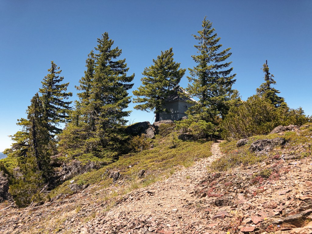
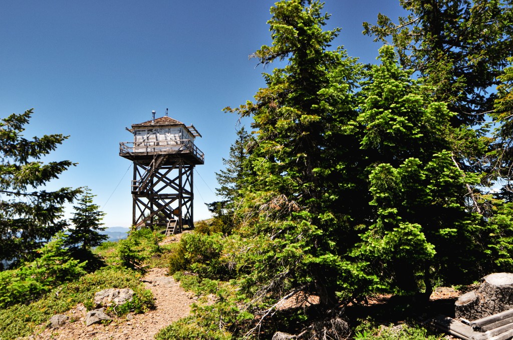
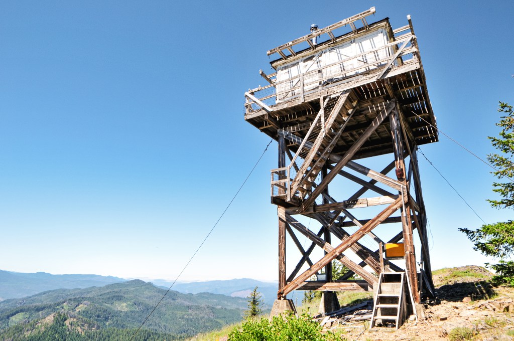
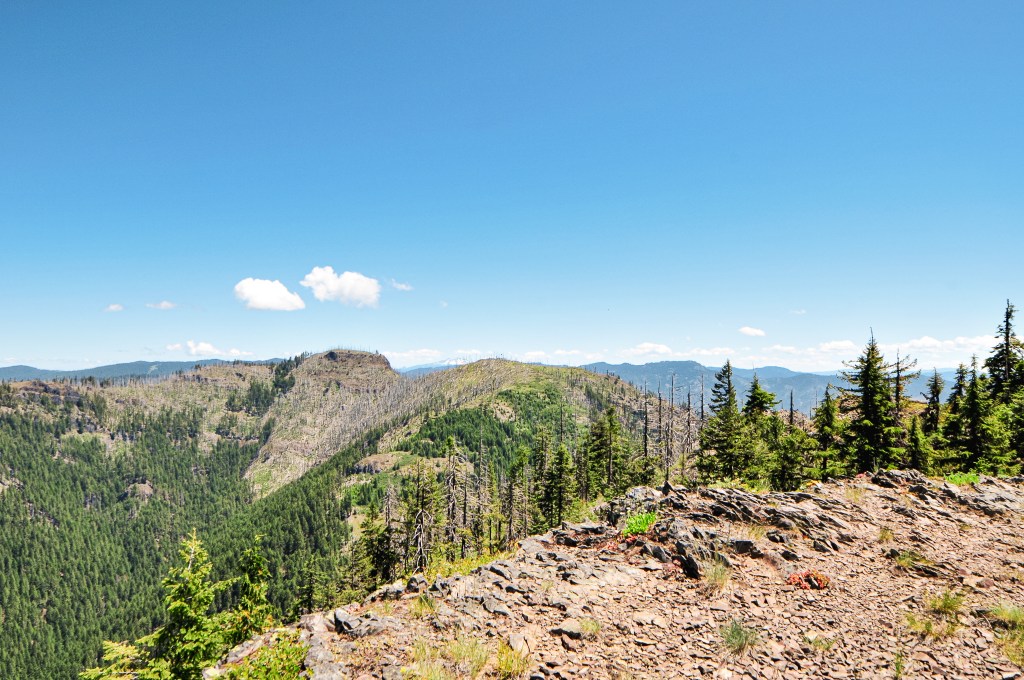
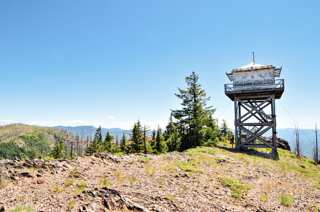
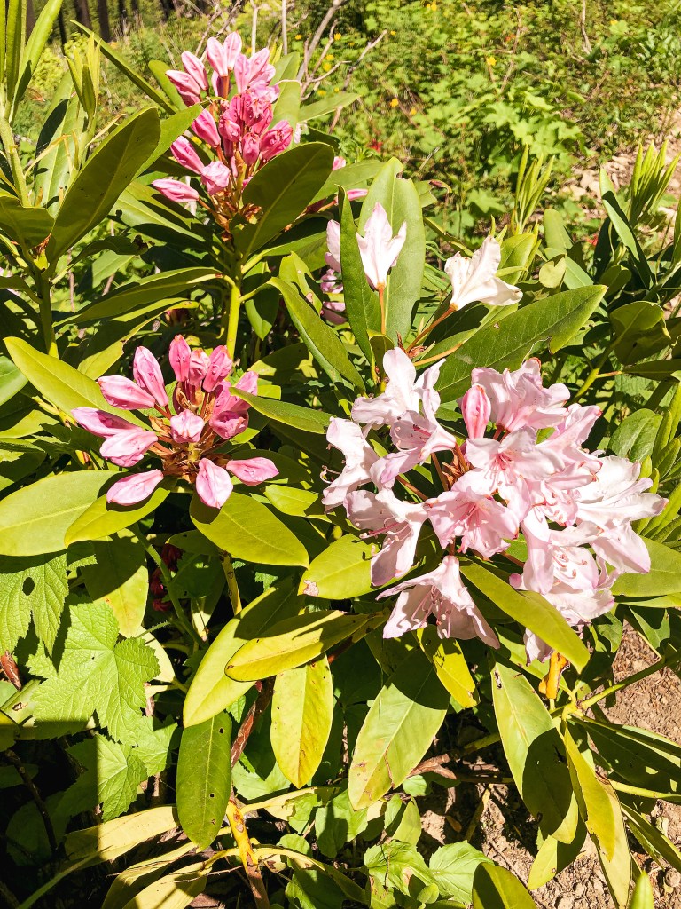
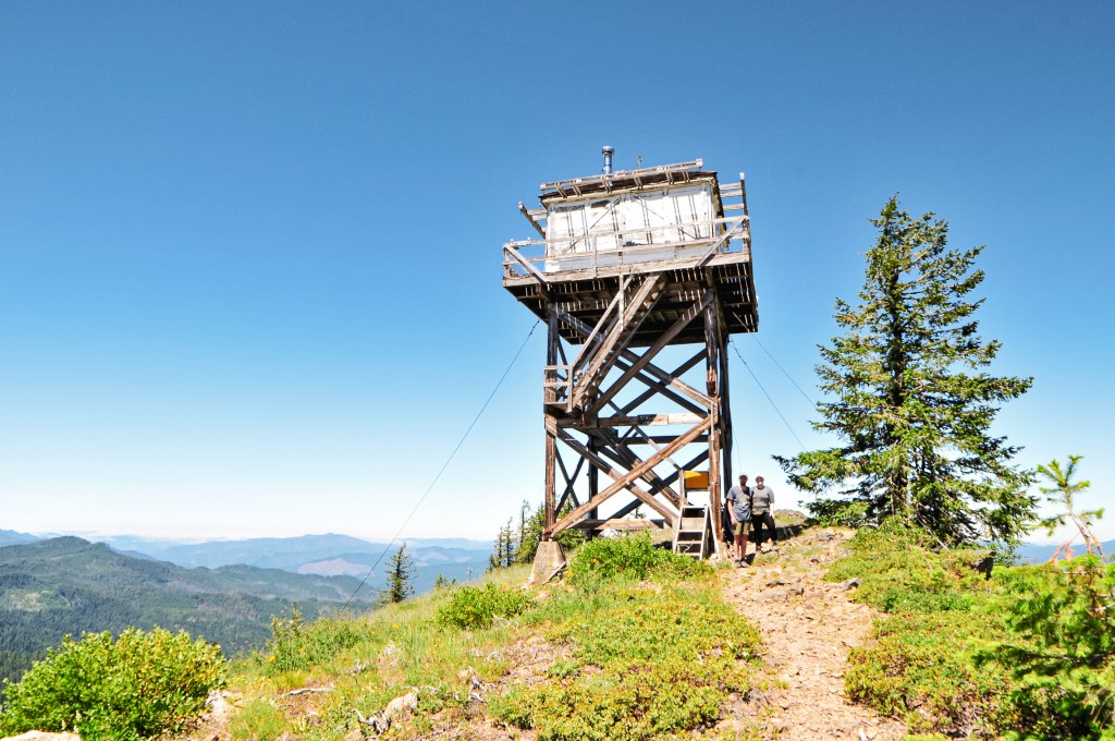
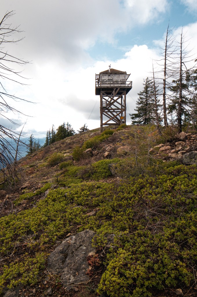
This was essentially a rest day for us from the go-go of the trip. We were already situated close to the access road for Illahee Rock and it was our only plan for the remainder of the day. We had a leisurely breakfast at camp before packing a lunch and heading out to HWY-138. The access road is fittingly named Illahee Road, which is also NF-4760. It is located just past the Umpqua’s Last Resort. You will wind up this decent gravel road for 7-1/2 miles to the junction with NF-100. Make sure to watch for fallen rocks along the way. We decided to park at this junction and walk since I recalled NF-100 having some larger potholes. After further inspection, all the potholes would have been passable to the Civic with caution. We stayed on NF-100 for about a mile before we reached the NF-104 spur off to the left. This will take you to the trailhead. The NF-104 spur is pretty overgrown and rocky. I wouldn’t attempt driving it in a low-clearance vehicle. From the trailhead, it is a short hike to the summit. It was really nice to see everything snow free for a change. The trail is still in great shape, even after the fires, with only a few downed trees to navigate. The wildflowers were in bloom too and we had commanding views in every direction. There is a hole in the catwalk that someone had cut just big enough for access. It was here during our last visit as well, but I didn’t have the energy to climb through it then. Also, in case it needs to be said, please do not cut holes in the catwalks of fire lookouts.But, since it was already there, I decided to get a better look. We had the trail and summit to ourselves aside from a kettle of Turkey Vultures that checked us out. I knew I didn’t smell great, but it must have been much worse than I thought to attract the Vultures. They eventually realized we weren’t road kill and moved on to something else. We enjoyed our lunch on the catwalk and soaked in the sunshine before heading back to the car.
The next day we were able to get a bit more clarification on the status of Illahee Rock from the lookout attendant we met on Pig Iron (post). She was the last lookout to staff Illahee Rock in 2016. She didn’t go into details on why they stopped staffing it or if they planned to staff it again. We could tell she was very passionate about Illahee Rock and would’ve preferred to be stationed there instead. The Forest Service had moved her to Pig Iron (post) as an alternative. Any friend of Illahee Rock is a friend to her.
NOTICE: As of July 20, 2024 this area is currently closed due to the active Diamond Complex.
Location.
Umpqua National Forest
Status.
Abandoned; Currently standing
Estimated drive time from Portland, OR.
6 hours
Date visited.
May 1, 2021
Elevation.
5,392′
National Historic Lookout Register.
US 98; OR 13
Trip Report.
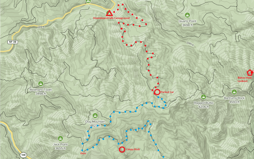
The first time my partner and I thought about visiting Illahee Rock Lookout was on my birthday weekend in April 2021. At the last minute, we had decided to travel to the Umpqua NF for the weekend instead of Olympic National Park. We did not do any proper research on what was in the area due to the last minute change and came unprepared without a topographic map. Illahee Rock Lookout was marked on our general road atlas and seemed to even note the Forest Service road needed to get there. It appeared to be direct and we figured we would give it a shot. We were closer to Steamboat Falls C.G., so we decided to take the back road to get there. We drove my Civic up NF-4760 that is just past the campground. The road was in great condition and we became optimistic as we caught a glimpse of the lookout sitting on the ridge. My car made it all the way to the junction with NF-300 where there was a deep patch of snow covering the road. We decided we were close enough to reach the lookout via a road hike and parked the car in a pullout. We started to trudge through the snow banks on the road, alternating between clear patches and deep snow. We came to a sharp fork in the road where neither of the roads had a visible number sign. It appeared to us that the main road continued straight and the road that sharply turned was a spur road. Later, we would come to find out it was the opposite. We continued straight on this road for miles, walking up and over a ridge that we assumed to be Ragged Butte. We even came to a junction that appeared to have parking and an old gate like you would find near a fire lookout. We continued down this road assuming we were finally at the road junction leading to the lookout trail. We even passed an extremely large rock that we assumed had to be Bartrums Rock or even Illahee Rock itself. It wasn’t until we met the road’s dead end that we realized how far off track we truly were. When I say we were hopeful that we were on the right track, I mean that we were so sure it was around the next corner that we convinced ourselves to hike 7.77 miles away from my car. Which meant we had to hike another 7.77 miles back. We didn’t make it back to the car until well past dark and got back to camp closer to midnight. To make matters worse, I had neglected to fully charge my headlamp before coming and we had to rely on my partner’s light on the way back. When I finally saw the reflection from our light on my Honda, I cried tears of joy.
After consulting a much better map upon our return to Portland, we realized we had ended up on NF-100. The ridge we thought was Ragged Butte was actually Dog Mountain. The junction with the gate was NF-120, which wasn’t marked. Otherwise, we would have known to turn around sooner. And the rock we saw was Limpy Rock, not Bartrums. After such a complete failure we were determined to redeem ourselves and make it to Illahee Rock Lookout as soon as humanly possible.
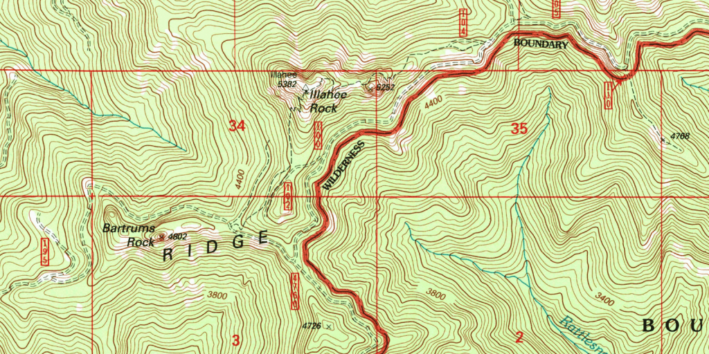
ILLAHEE ROCK LOOKOUT REDEMPTION! We decided on our next free weekend we would drive down early Saturday morning to hike to Illahee Rock Lookout and then camp at Steamboat Falls C.G. for a night before heading home. We did more research on the area, packed a better map, and decided to go up the more conventional route on the other side of NF-4760. This side of the road is just as well maintained and I had no issues driving my Civic up it. We were once again met with snow on the road and pulled my car into another pull out. This time I was happy to find we were just a 1/2 mile short of the junction with NF-100 (same number but different road from the last time we were in this area). We walked along this road until we met with NF-104, which leads to the trailhead. We were once again optimistic! That is until we rounded the corner and were met with deep snow drifts. Feeling uneasy about another trudge through more snow I convinced my partner we should go up the “other trail.” It was on the more exposed side of the mountain and in theory, would be snow free. According to the topographic map of this area there are two trails that lead up to Illahee Rock Lookout, one originating south of the lookout and one beginning north of the lookout. After backtracking, we started to search for where the other trail should be according to the map. At one point we found a game trail that we followed for a while but it only led to Bartrums Rock and wasn’t on the correct side of the road. We searched again and found an old road that might have led to where we needed to go but was too overgrown to know for sure. Accepting that this trail no longer exists, we backtracked again to NF-104. We made our way over the snow banks until we found the actual trailhead. It does exist! From there it is supposed to be a little less than a mile one way.
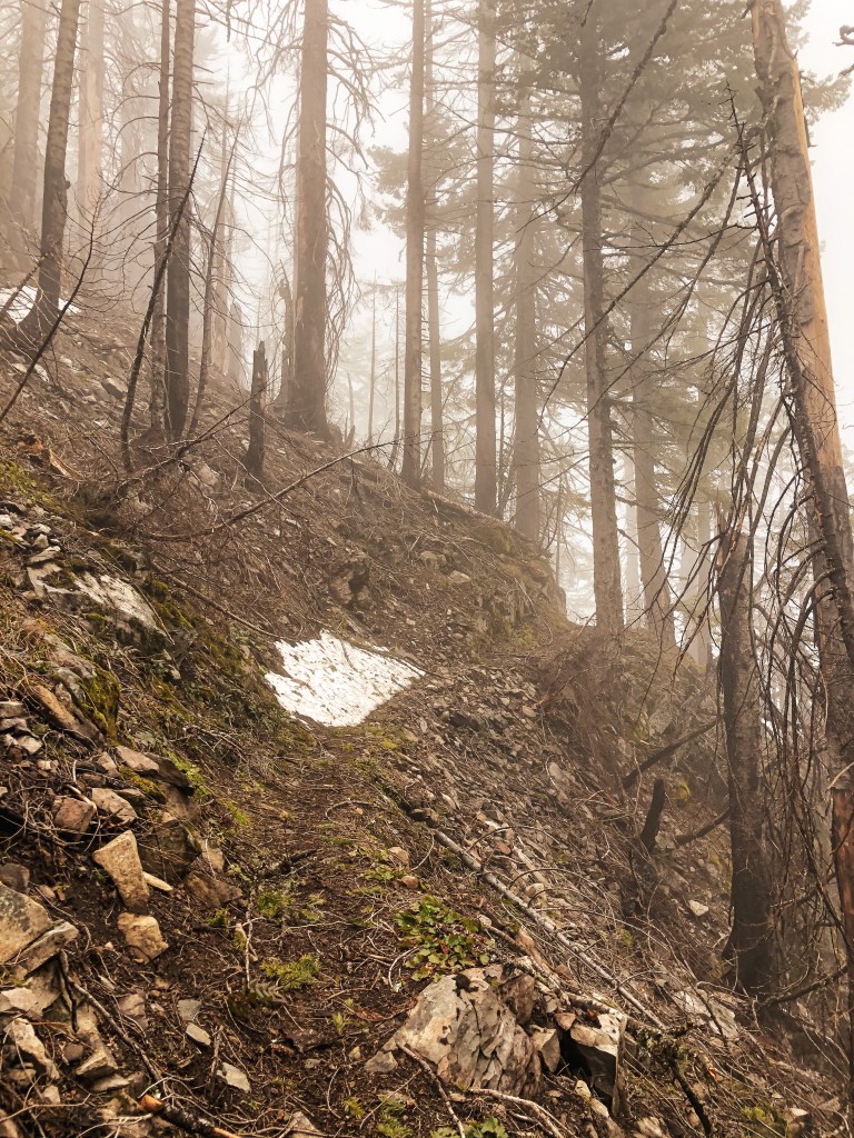
We started up the official Illahee Lookout trail #1539. We crossed one major snow bank that was easy to maneuver on a gradual slope. The trail seemed to be mostly snow free as we switchbacked up. It wasn’t until we went around to the northern side of the trail that we found we were wrong again. We became frustrated, knowing that we were so close to this lookout. However, these snowbanks were different than the ones we faced on the roads, they were now sloping off of a cliff covering a narrow trail. My fear of falling kicked in and I opted to turn around. My partner is more headstrong and was not going to leave without seeing this lookout. I decided to wait on the trail while he continued on over the snow. I waited there for a while hoping for the best and fearing the worst. I started to hear someone whistling down the trail and assumed it was him on his jolly way back. I was shocked to see another couple come around the bend instead of him. I was so shocked that I didn’t even bother to ask them if they saw my partner or how the trail conditions were. I could only muster up a “hello” as they passed by. I figured that if there were other people on this trail then it couldn’t be that bad around the corner and maybe I should have attempted to hike up the trail as well. Soon after my partner returned and told me how close we were. He claimed there weren’t too many snow banks to cross and it wasn’t as bad as it looked. He also told me that there were no footprints in the snow before his, so the couple we saw somehow climbed up the talus slope on the other side. They might have been crazier than us to try that from what I saw on that side of the mountain. After talking it over for a while he was able to convince me to head up the rest of the way to the lookout. It took a lot of hand holding and a bit of tears for me to make it because once I rounded the first snowbank there were many more to face and they were worse than I thought. I used kick steps to shuffle my way up and down them but my anxiety didn’t subside until I returned to the spot where I had originally waited for my partner.
History.
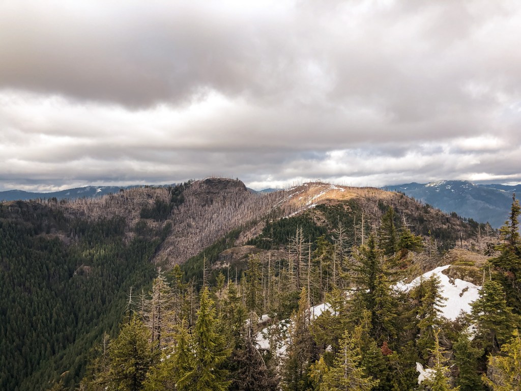
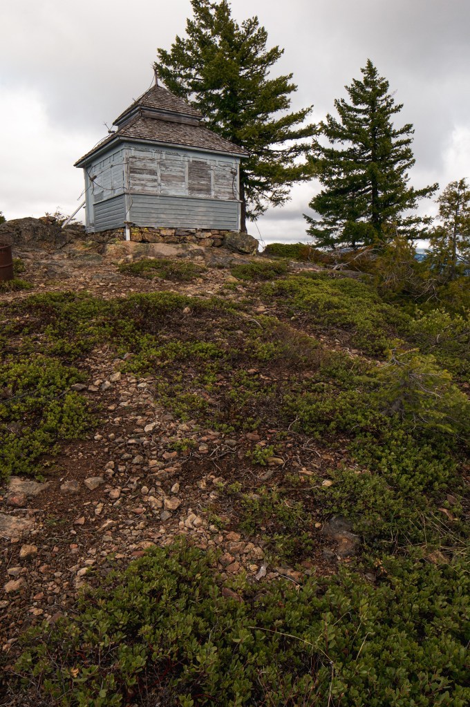
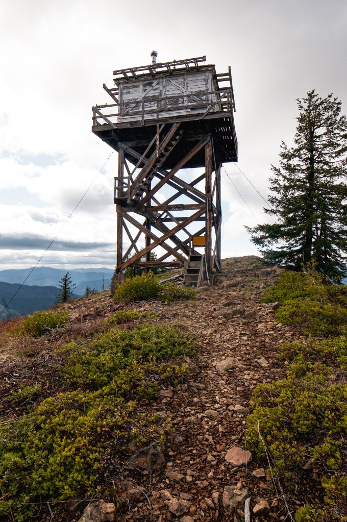
The whole day we had been circling this butte it had been clouded in fog. But now that we were both on the summit it had cleared out to a spectacular view. The original D-6 Cupola from 1925 is still standing and was converted to a tool shed in 1958. The L-4 tower was built in 1956 when the D-6 was considered too small to house two fire lookouts. Illahee Rock Lookout does not appear to be actively staffed anymore since there was no longer a solar panel when we visited. It might still be staffed in high fire danger but I couldn’t find any information to confirm.
Illahee Rock Lookout is a short, two mile round trip hike with roughly 600 feet of elevation gain. But in total we ended up hiking 24.74 miles trying to get to this lookout. The moral of the story is this: don’t go chasing fire lookouts in early spring!