Indian Rock L.O.

Oregon Lookouts

Location.

Malheur National Forest

Status.

Active; Currently standing

Estimated drive time from Portland, OR.

7 hours

Date visited.

July 10, 2023

Elevation.

7,353′

National Historic Lookout Register.

US 1625; OR 146

Trip Report.

Day 3/9: Lookout Road Trip 2023

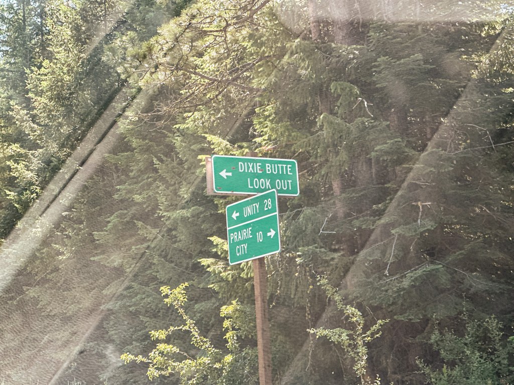
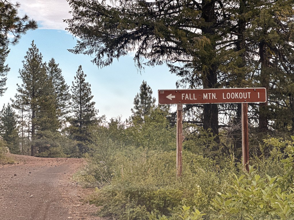
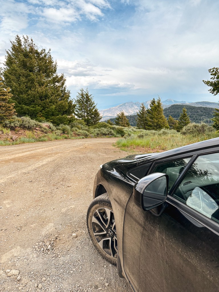
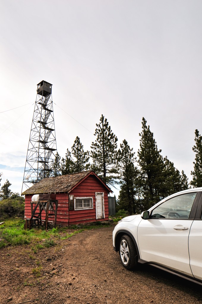
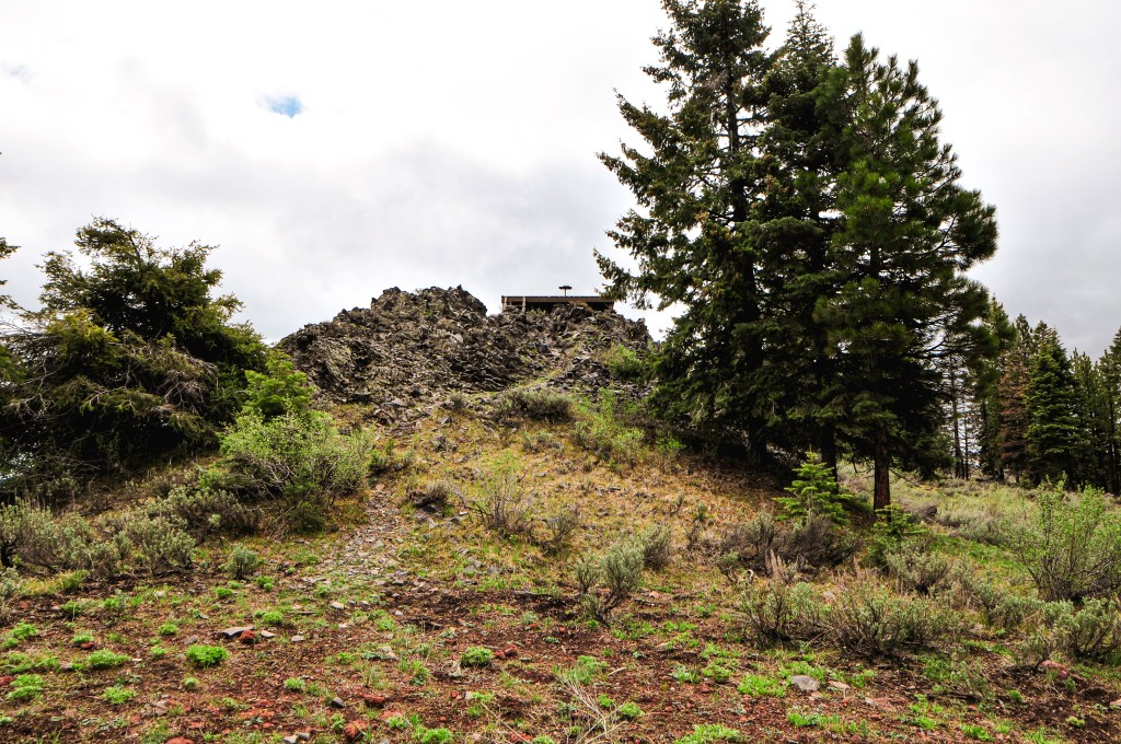
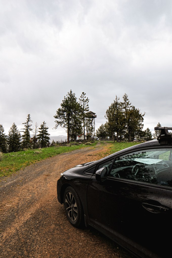
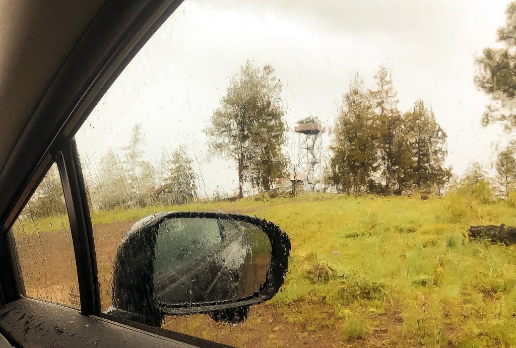
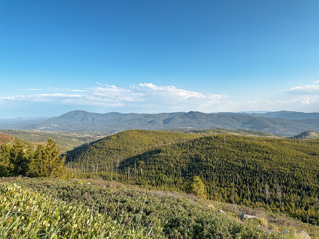
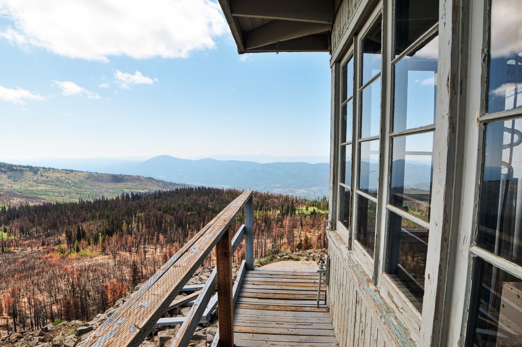
We continued our drive along HWY-26 heading east until we reached the Austin Junction with HWY-7. We turned left onto HWY-7 for a short time before making another left turn onto CR-20, Middle Fork Road. If you follow the signs for Bates State Park, you’ll head in the right direction. We briefly stopped at the campground to refill our water reservoirs and rinse off some of our sweat from the hike up to Dixie Butte (post). We continued on CR-20 until we passed the rentable Sunshine Guard station. The turn for NF-45 is only a little ways after this off to the right. There is a sign here that noted Indian Rock L.O. at 15 miles away. The rain had been heavy up until we made our turn onto NF-45. Once we started gaining elevation it cleared off to a nice view. The NF-45 road is in great condition but narrow. You wouldn’t want to meet someone heading down in some of the sections. There are two more signs for Indian Rock along the NF-45 road at the junctions with NF-4560 and NF-4550. Both note the lookout at 8 miles away. I’m not sure which one is the most accurate though since we weren’t tracking the mileage on the odometer. As you get closer to the lookout you will start to see signs of the 2022 Crockets Knob Fire. We stayed on NF-45 all the way to the junction with NF-537 off to the right. There is a sign for Indian Rock L.O. at this junction as well that states there’s only 2 more miles to go. We set up camp for the night instead of continuing all the way to the lookout, but it would be our first stop in the morning.

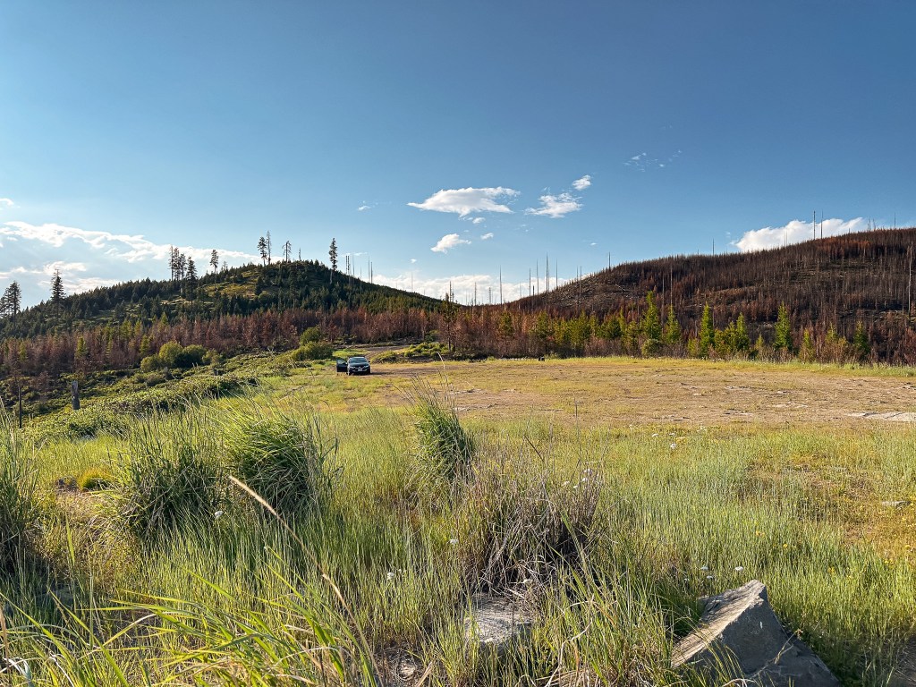
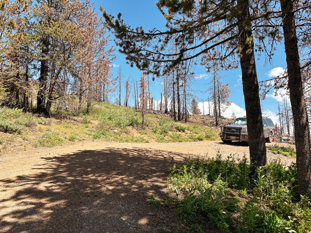
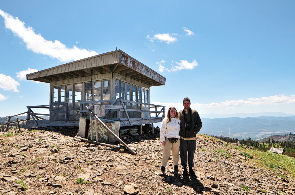
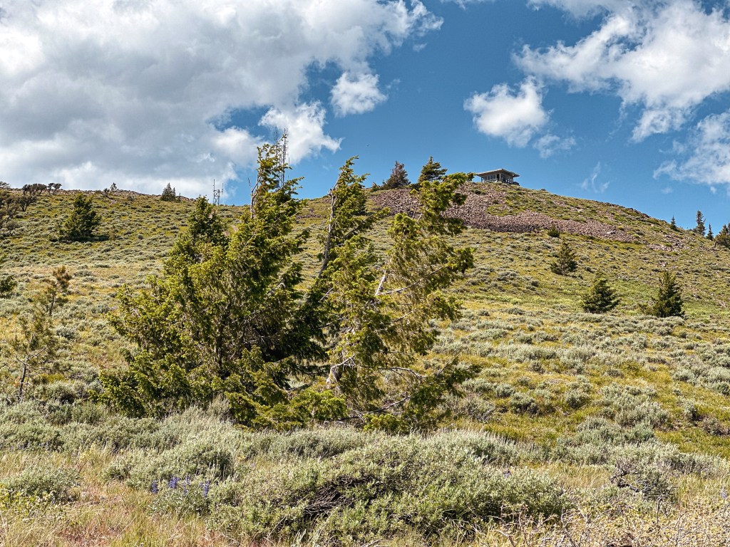
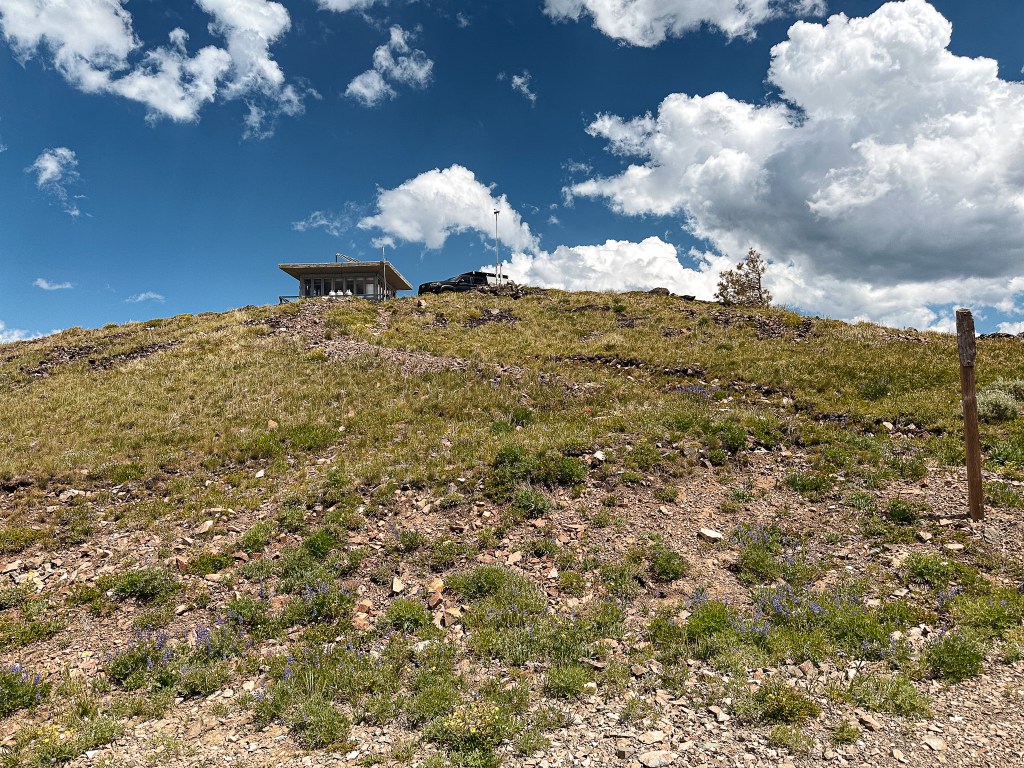
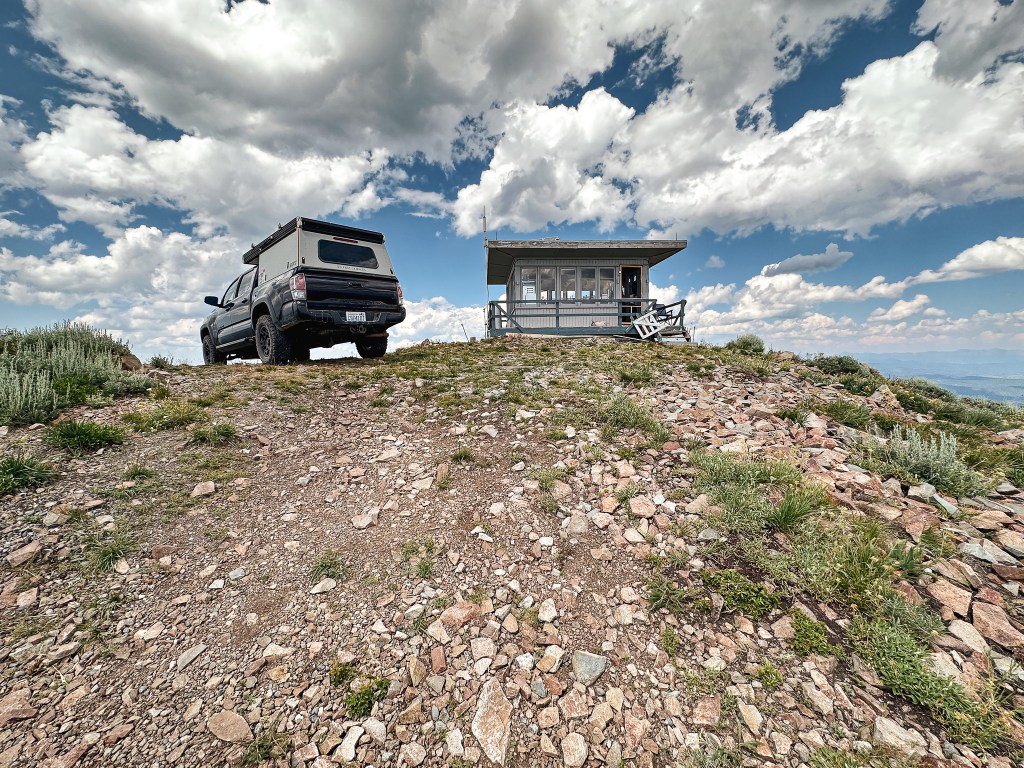
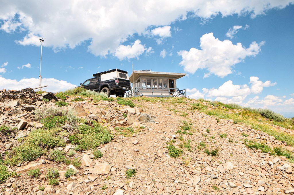
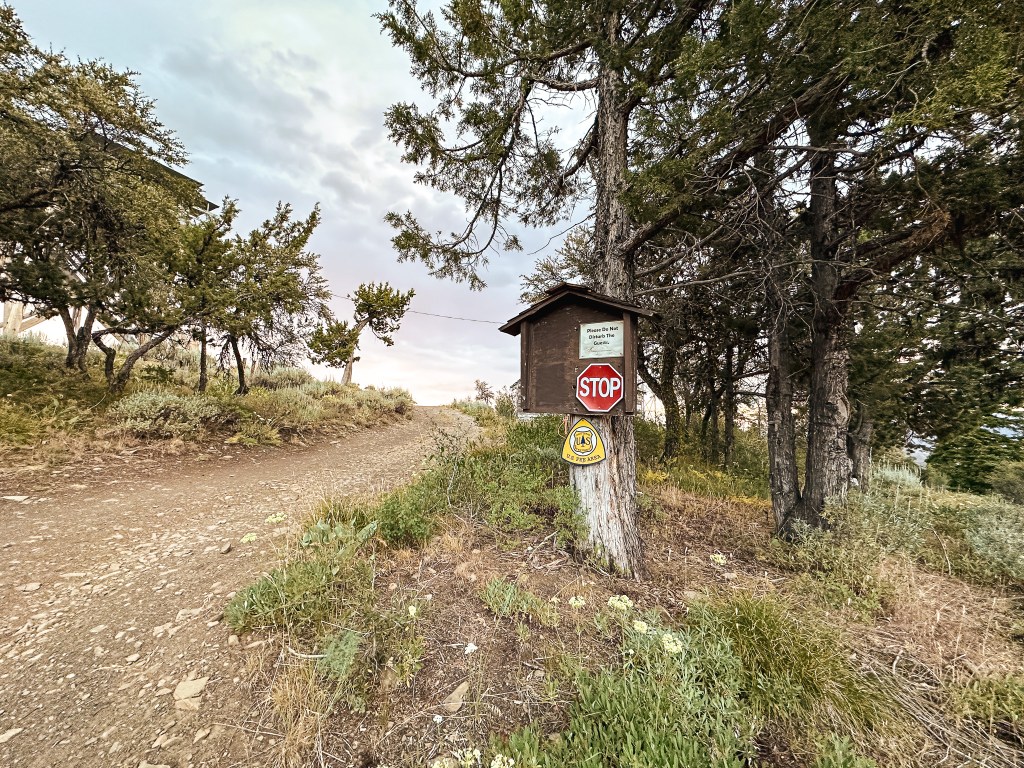
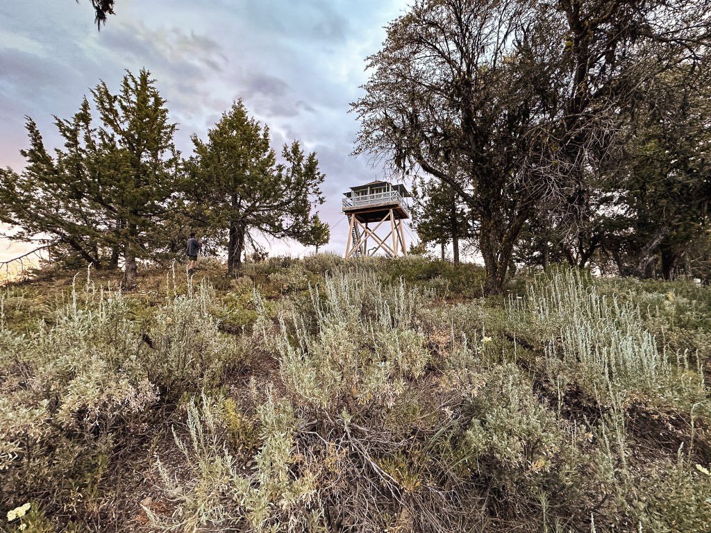
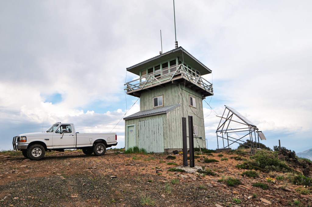
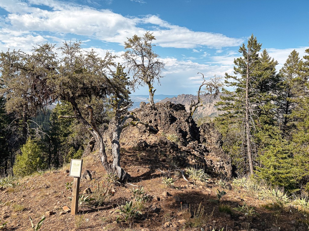
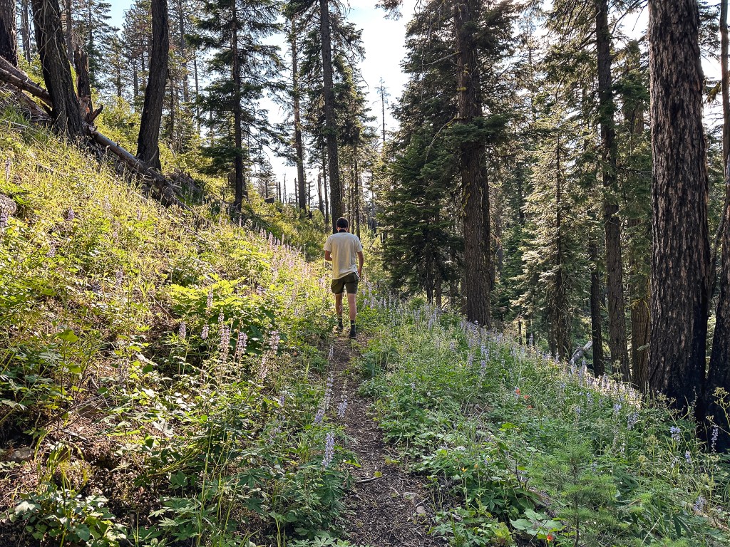
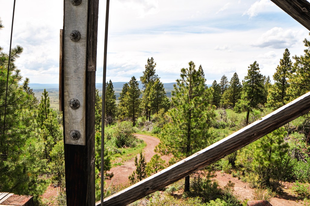
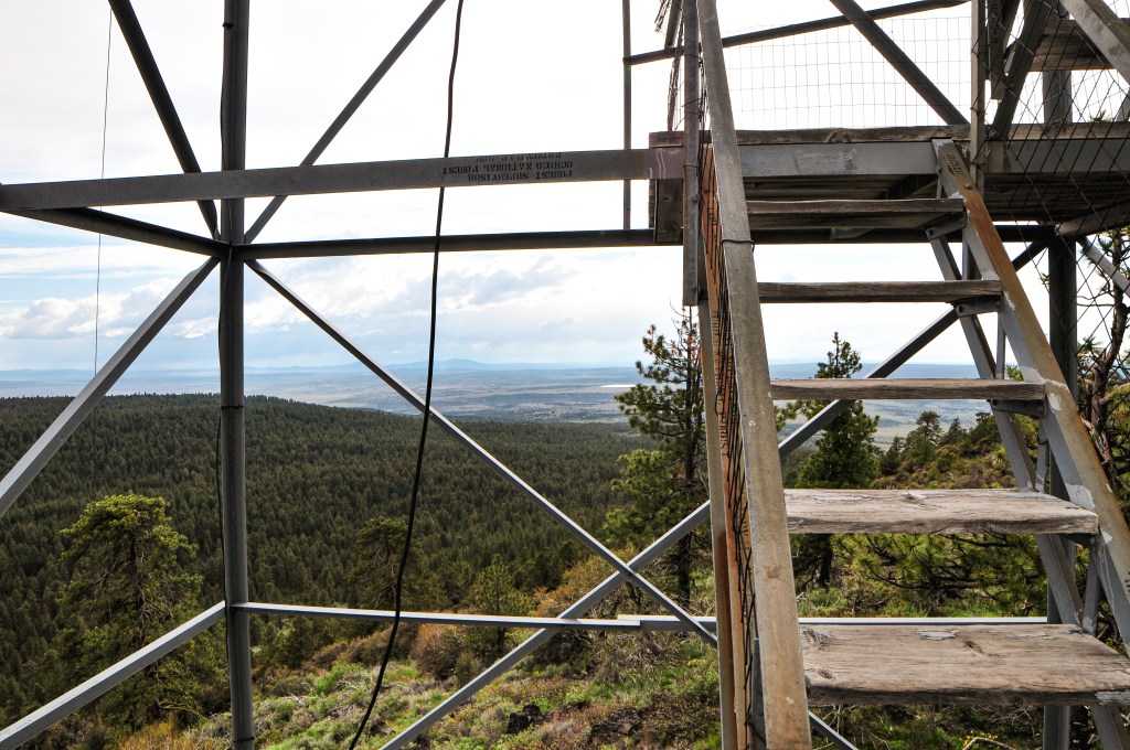
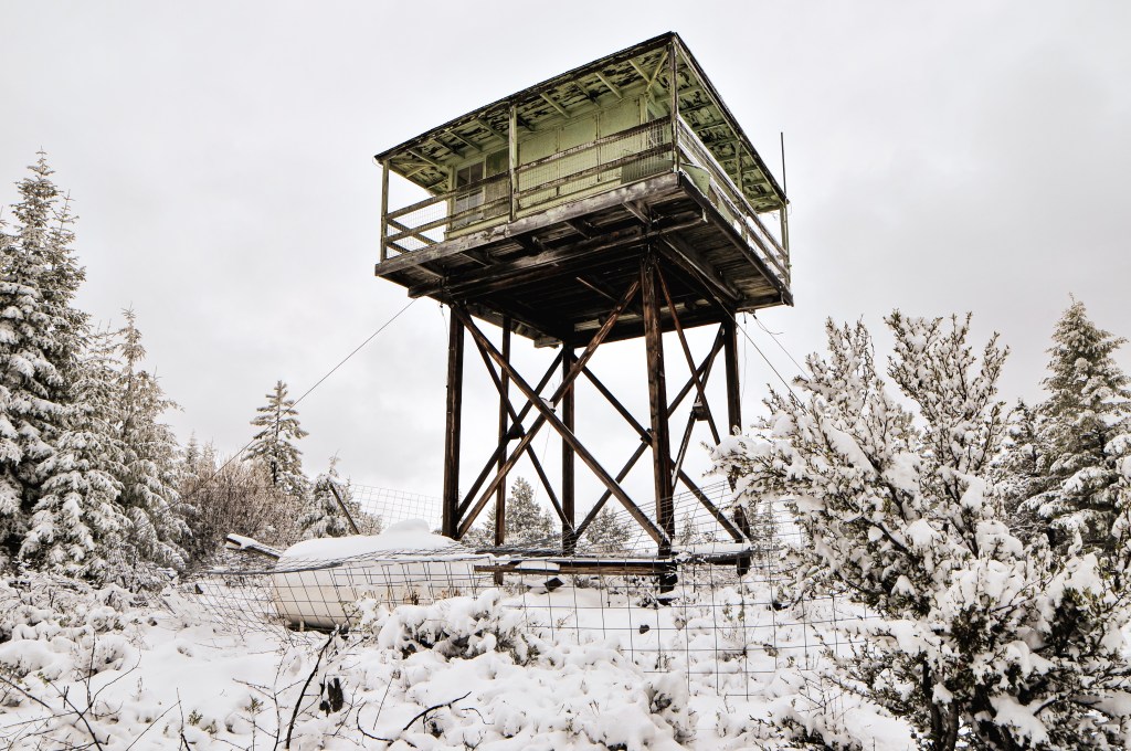
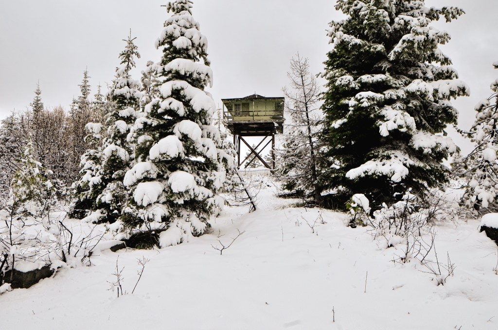
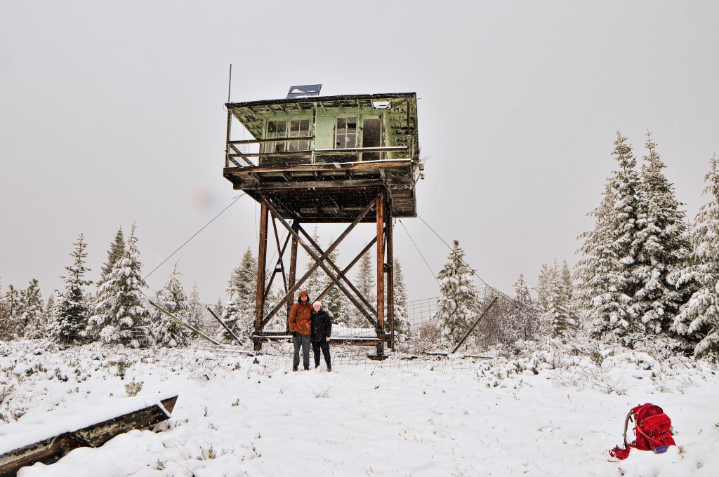
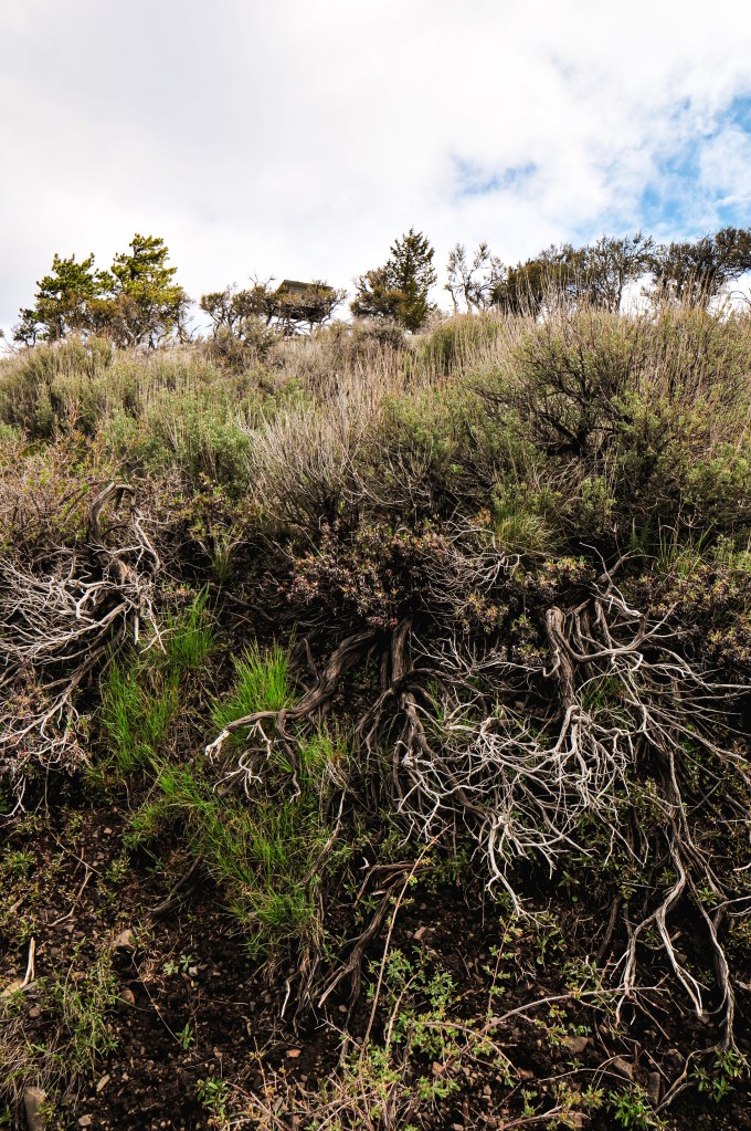
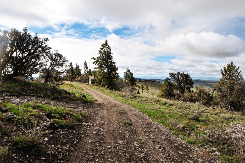
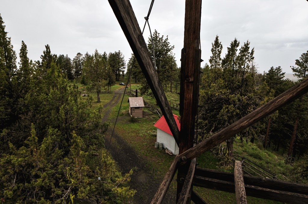
The NF-537 road is also in good condition with 6 water bars to bump over. There was only one section that had some rutting due to drivers using it in wet conditions. There’s a campground just below the lookout, Head O’ Boulder campground, that offers 3 or so camp spots with picnic tables, fire rings, and a vault toilet. There is also a trailhead here that branches into a few different trails that lead into the Vinegar Hill-Indian Rock Scenic Area. Fun fact: we had attempted to visit Indian Rock once before during a camping trip to the Vinegar Hill area in August 2020. I wasn’t convinced that we would make it up the NF-45 road and we attempted to access it via one of the trails instead. Looking at the map now, I’m not even sure which trailhead we were trying to reach. We somehow ended up on the wrong road just below the one we needed and tried to cross country hike to the trailhead. It was very close on the map, but the going was steep and in between was a thicket of lodgepole. Needless to say we didn’t even make it to the trailhead. We stopped at the campground to have breakfast bars and watch the birds since we were still a bit early for a reasonable visiting hour. This is an actively staffed lookout and should only be visited during working hours if possible. We waited until just before 9AM to drive the remaining distance up NF-537 to the base of the trail. It’s only a 0.2 mile hike with 128′ of elevation gain to the lookout according to Strava. As we were prepping for the short hike up, we could hear the lookout attendant yelling for their dog. Before we knew it we were greeted by a very large white, black and grey speckled dog. He was excited to see us and very friendly. He led us up the trail only stopping a few times to block the way for us to pet him. Occasionally, he grabbed my hand with his mouth as if to hold hands and direct me. All the while his owner was calling for him to return. He didn’t pay her any mind until we got closer and she started heading down the trail to grab him. She wasn’t very happy with her dog. She mentioned she wasn’t even on the clock yet and still trying to have breakfast when he took off down the trail. We felt terrible that we arrived too early even though she said we were fine.

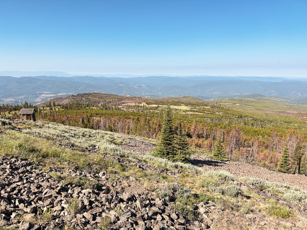
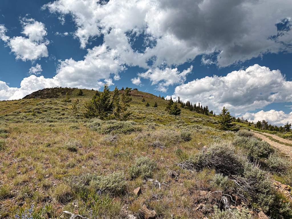
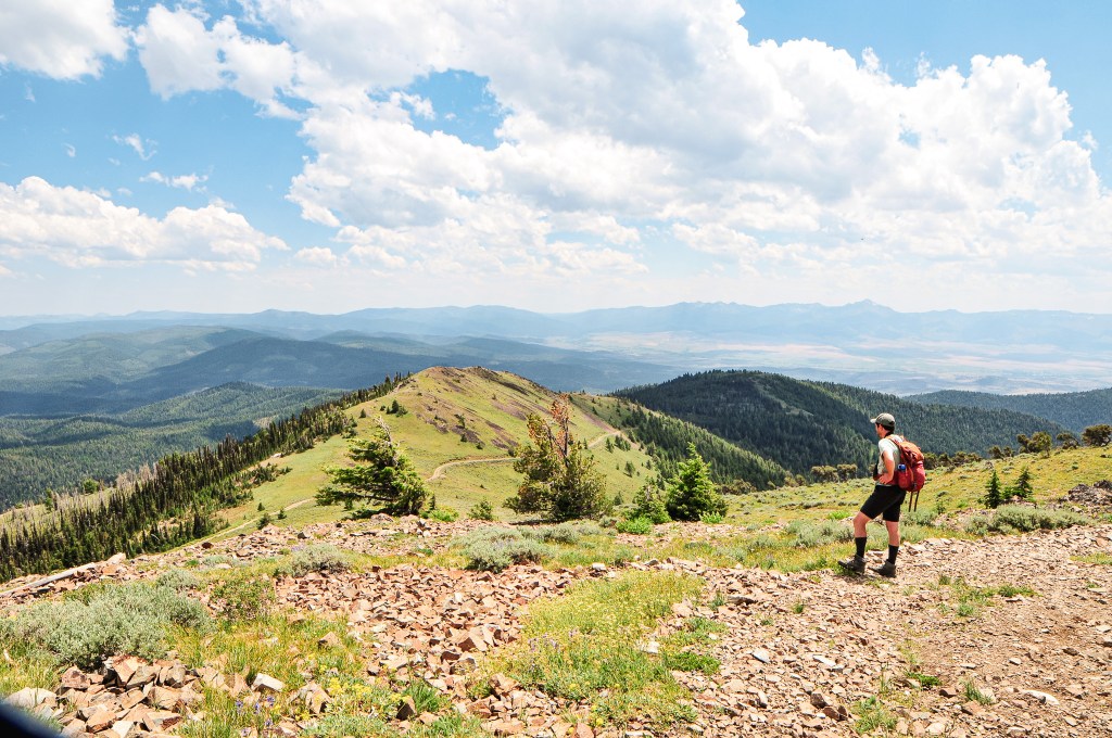
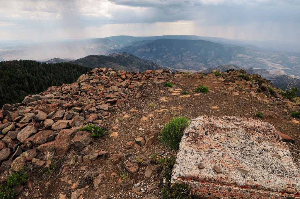
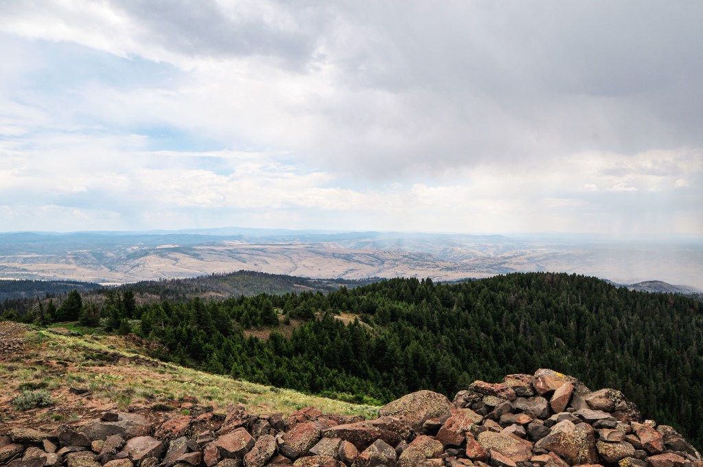
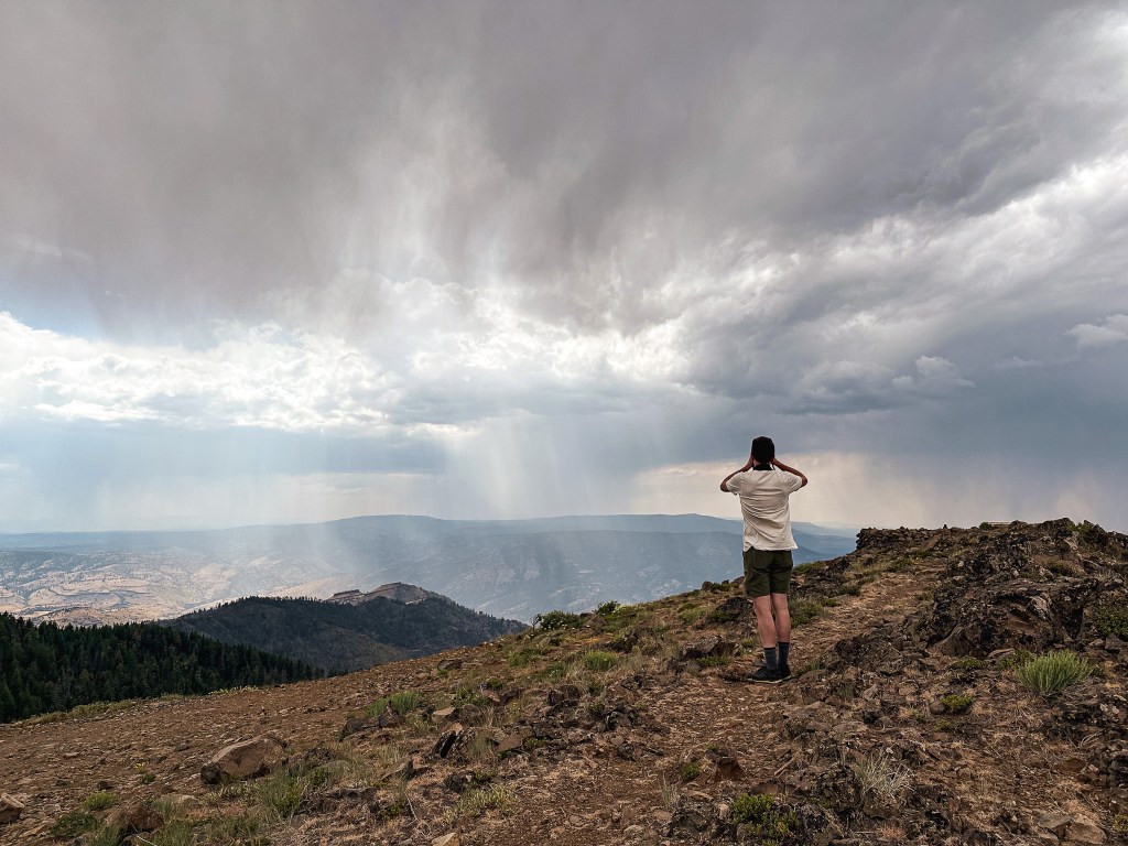
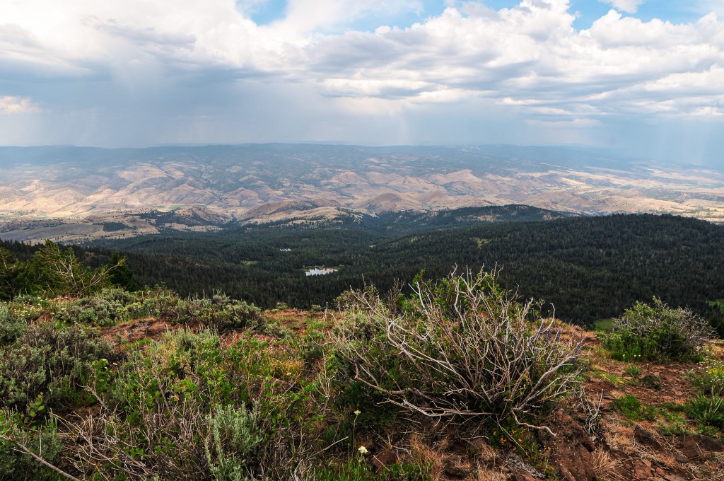
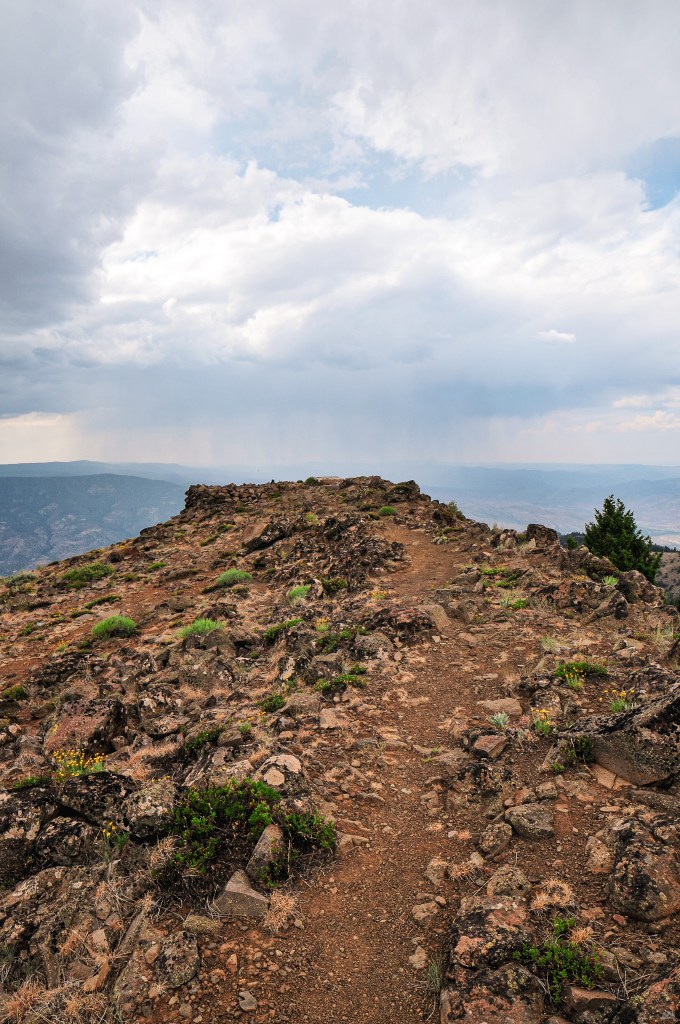
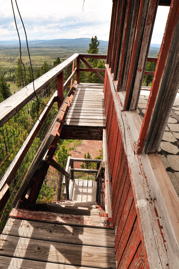
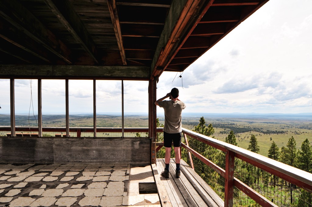
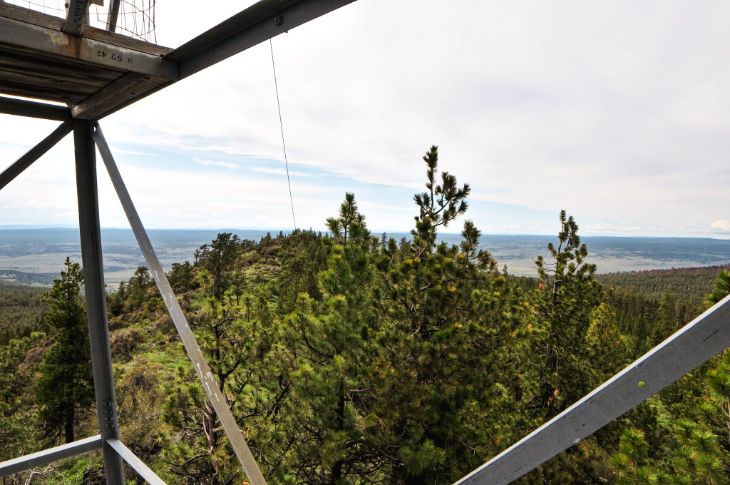
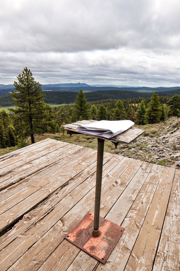
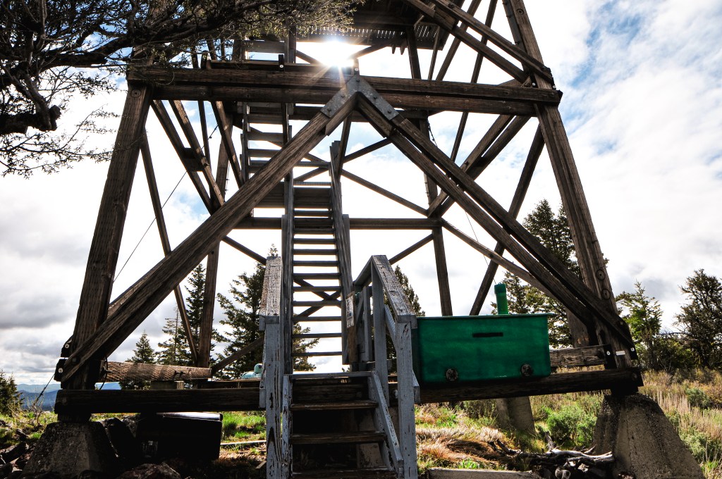
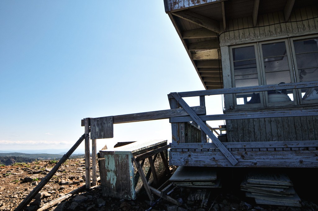
We decided to give her some space to finish breakfast and hiked the rocky ridge out to an overlook point. We spent time picking out surrounding peaks and different fire lookouts we could see from the area. Eventually, we headed back towards the lookout to take some more pictures before heading on. The lookout attendant came out to greet us this time and wanted a redo from our previous interaction. She apologized for possibly coming off rude earlier and for her dog. We apologized for coming too early as well. Everyone agreed no apologies were needed though. We talked for a long time, almost 3 hours, with the lookout about her history in fire lookouts, the different places she’s lived, her rescue animals, and stories of the area. If you’re lucky, you might even get a chance to see the resident mountain goats that frequent the area. They weren’t there during our visit, but she pointed out the damage they had done to her catwalk. She talked about the 2022 Crockets Knob Fire and how close it came to her tower last year. I was surprised to learn she was able to come back to finish off her season in September after it had been mostly contained. This fire was also the reason the road had been in such good condition. They already had all the equipment onsite for the fire and decided to do the much needed road maintenance while they had the time. I guess prior to this it was a long rocky road that took an hour and a half to drive even in a truck. It’s a good thing we didn’t attempt to drive it in 2020. She also talked about how lookouts will stay on the same fire lookout when they feel they have found their mountain. Indian Rock was her mountain and she believed Stacy on Dixie Butte (post) had also found her mountain there. She reconfirmed that no one was staffing Mt. Ireland (post) for the season yet, but they hoped a previous long term staffer might return in the future. We eventually had to find a break in the conversation since we still needed to pack up our camp and head on to Desolation Butte (post). It was already past noon and we needed to hurry if we wanted to stay on schedule. We thanked her for her time and headed on to our next destination.

Lookout Karen.

Karen has been the lookout attendant on Indian Rock for the last 7 seasons. She is accompanied by her three rescue dogs Yurik, Atlas, and Max. She’s originally from Florida but has lived in many different places such as California, Wyoming, and Oregon. The first lookout she staffed was Indian Mountain which she only staffed for 1 season. She also staffed another lookout in the black hills of Wyoming for 11 seasons. If I remember correctly, this was the Cement Ridge lookout.
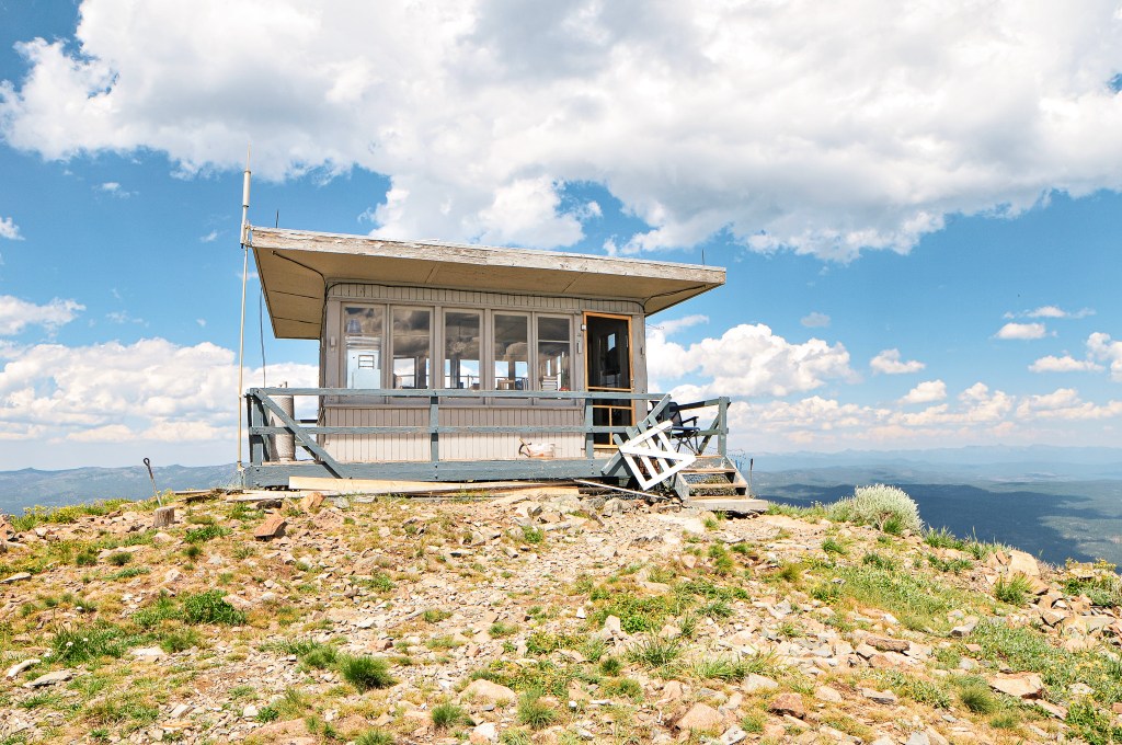
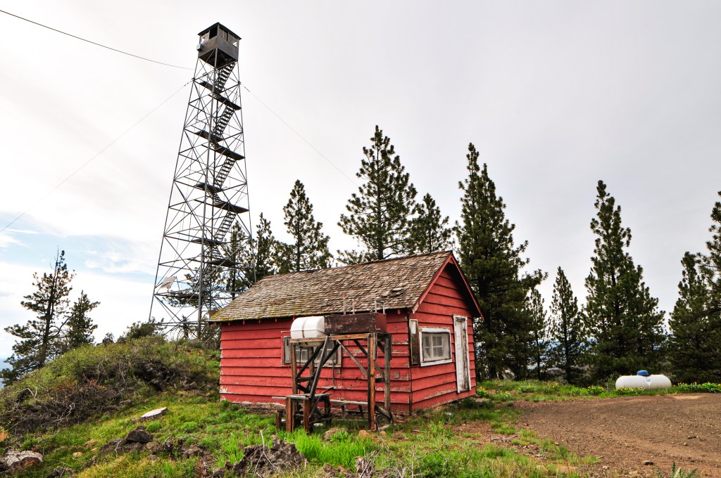
History.

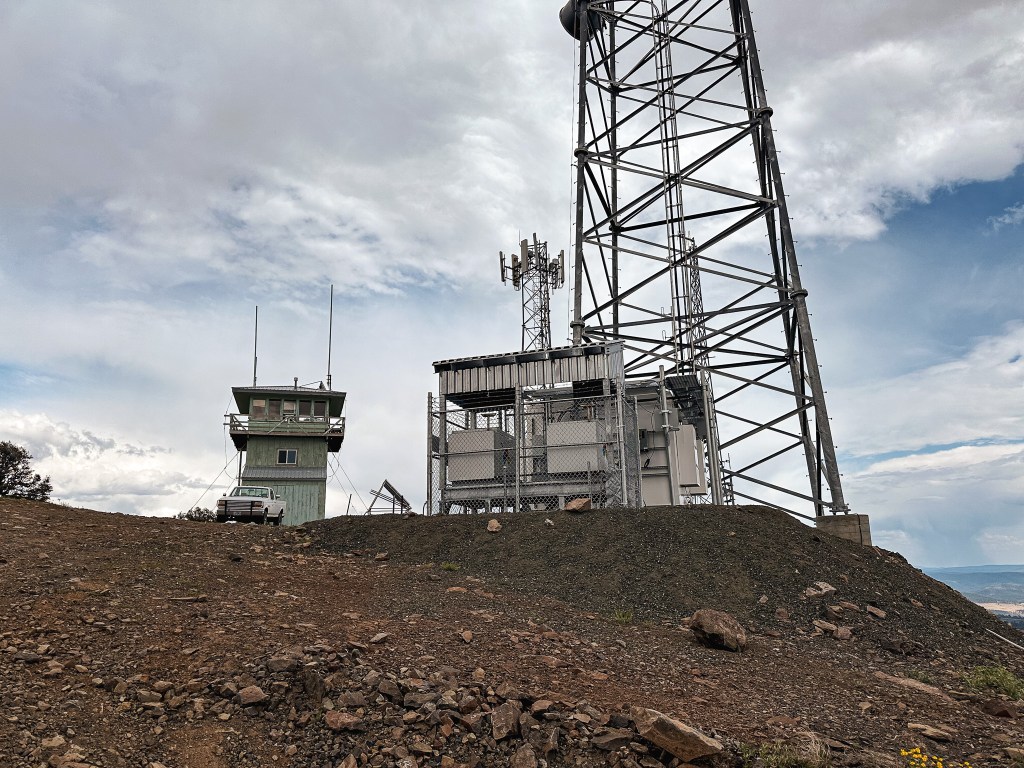
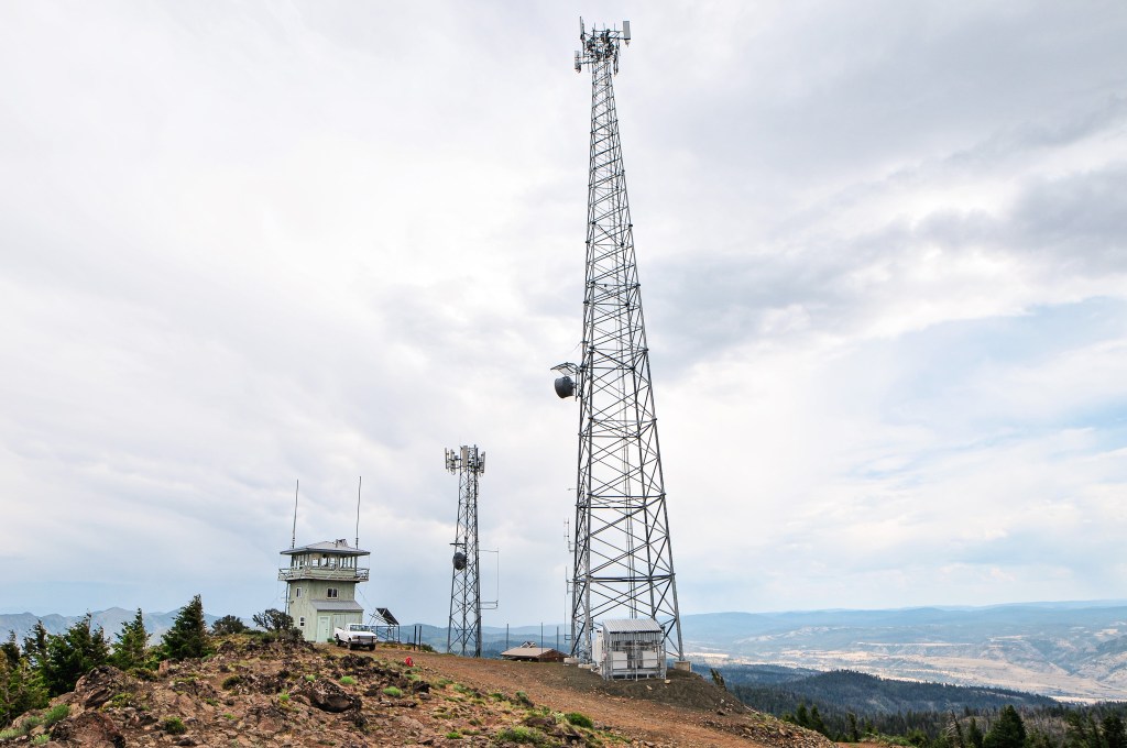
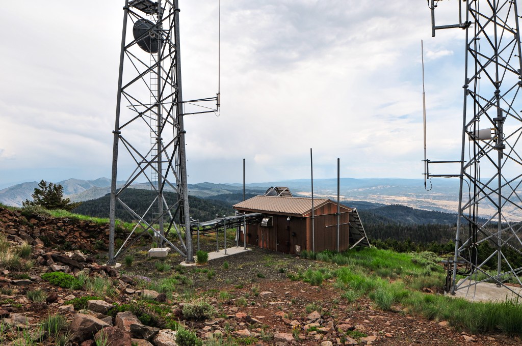
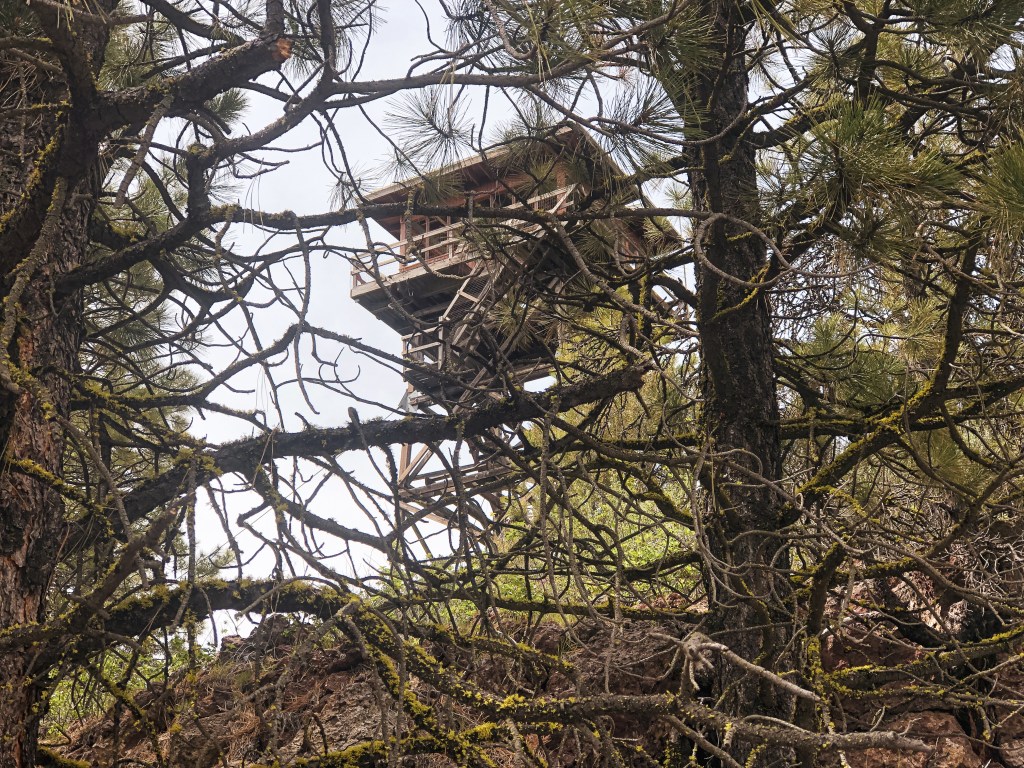
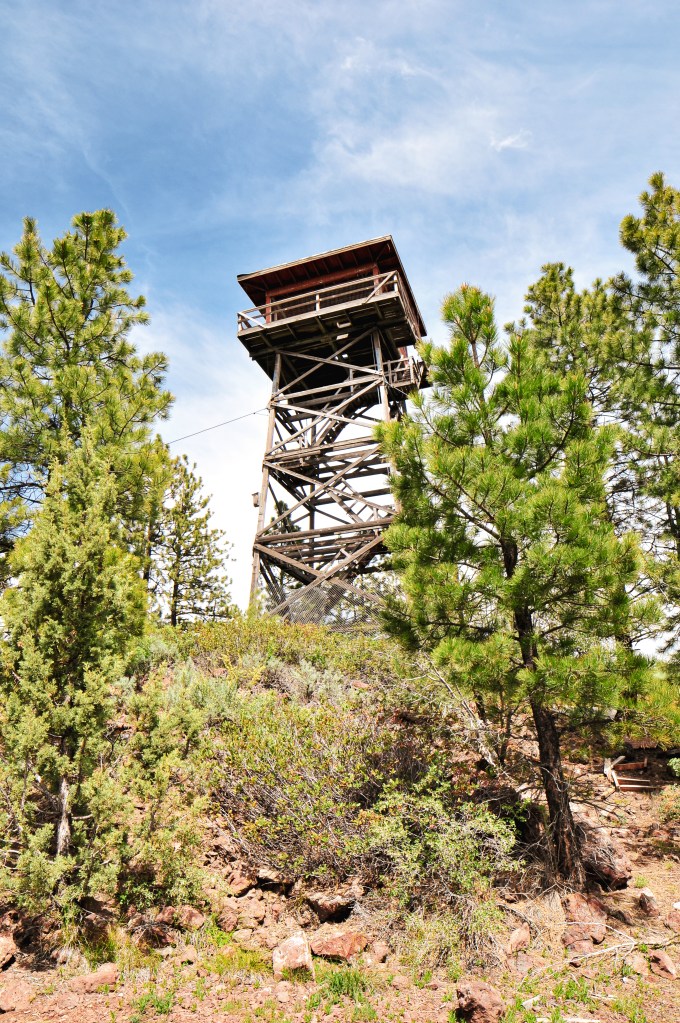
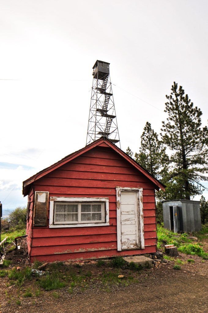
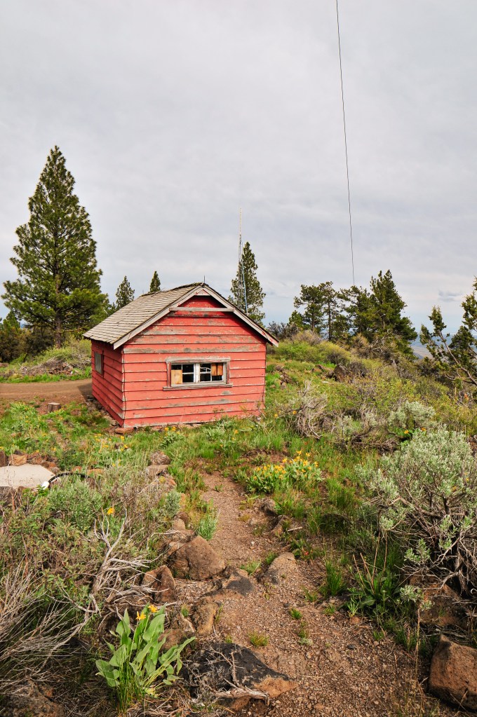
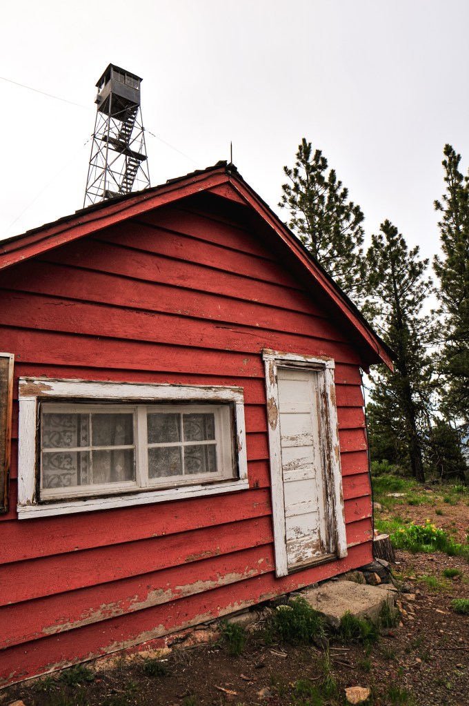
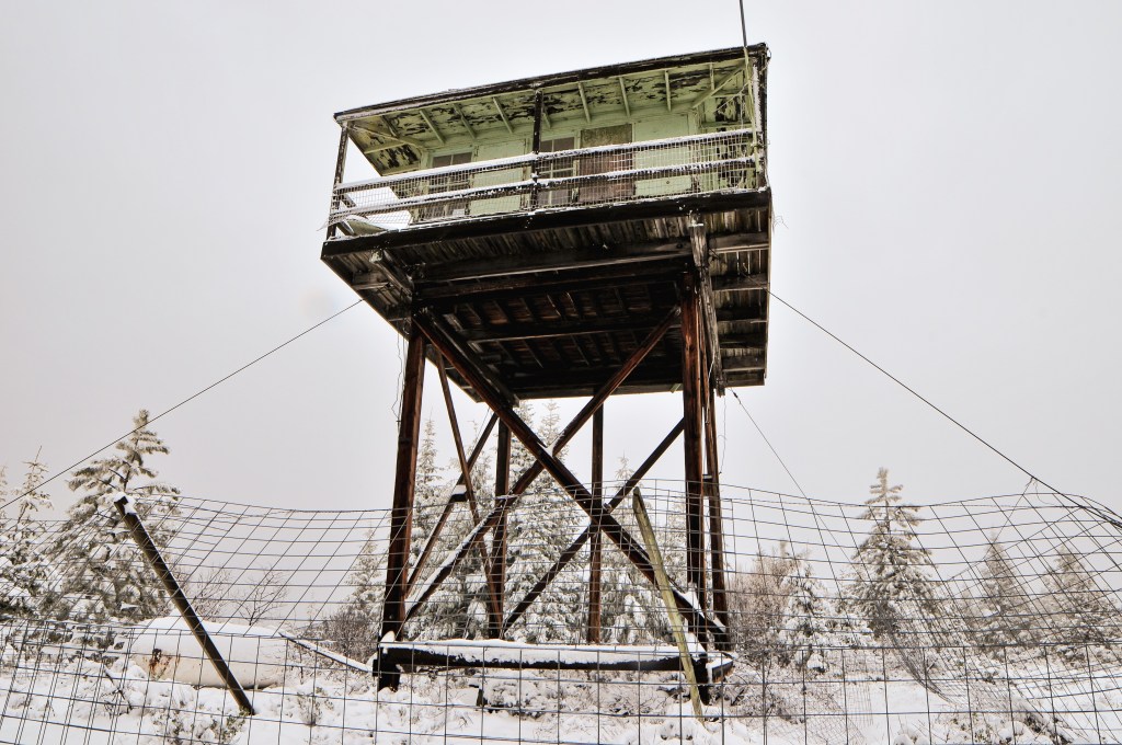
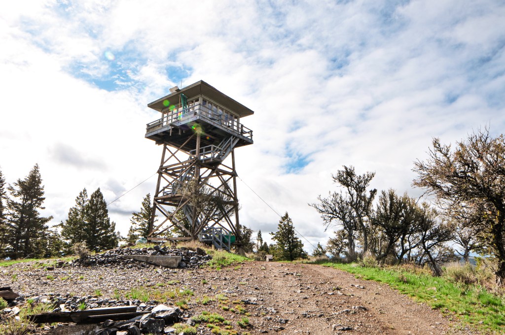
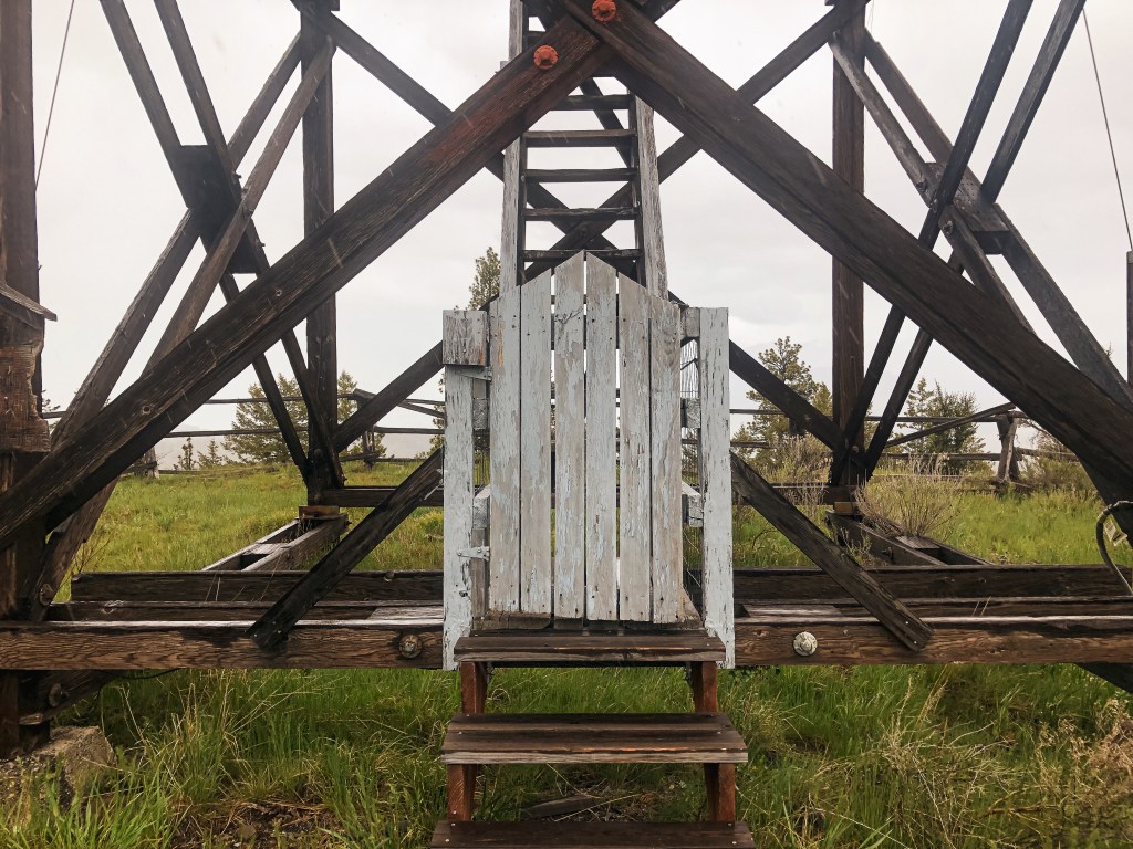
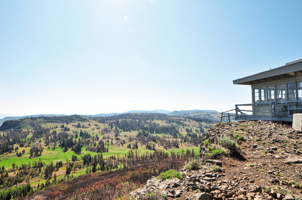
The first structure built on Indian Rock was a D-6 cupola style cabin in 1929. This stood for many years until it was replaced in 1957 by the existing lookout. The existing lookout is considered a wooden R-6 flattop ground cab and still stands today. It is actively staffed every season. The lookout was threatened by the Crockets Knob Fire in August 2022 and had to be wrapped in heat resistant fabric. It survived with minimal damage.

Dixie Butte L.O.

Oregon Lookouts

Location.

Malheur National Forest

Status.

Active; Currently standing

Estimated drive time from Portland, OR.

6 hours

Date visited.

July 9, 2023

Elevation.

7,592′

National Historic Lookout Register.

US 657; OR 108

Trip Report.

Day 2/9: Lookout Road Trip 2023

Our next stop for the day, after visiting the easy to find Prairie City Fire Finder (post), was more complicated. The road to Dixie Butte, no matter which way you slice it, is described as a no good downright terrible road. We knew we would be road walking part of this road, but we had hoped to make it some distance up before having to get out and hike. It’s about 5.3 miles from the highway to the summit according to a peakbagger report. We had met some other lookout enthusiasts last year while searching for the Eightmile crows nest (post) in the Mount Hood NF. One of them had been the former lookout on Dixie Butte for many seasons and this lookout is where they actually met. They had described the road as bad even back then, but were able to get a Honda Civic up there with a little motivation. There are other reports on Peakbagger that note people in sedans and low clearance vans making the harrowing drive up. I like to think we are pretty adventurous drivers, but we didn’t even make it a mile up the road before deciding it was not worth it. We had planned for Dixie being a whole day affair, but this complicated things.

From Prairie City, we drove 10 more miles east on HWY-26 until we reached the signed turn for Dixie Butte. This road is one of the first turns off to the left after entering the forest boundary. We kept right at the first fork and left at the second to stay on NF-2610 road. There were no visible road signs to indicate these were the correct turns. There is a primitive looking ski area and cabin you will have to pass through though. The first mile of road is rocky and bumpy. We stopped just shy of a mile up the road when we were met with a section covered in large embedded rocks. It covered the whole road in this section that would have made it tricky to avoid scraping our low clearance car. I don’t doubt people have done it though. Normally we can find a way to wiggle around sections like this, but we figured if it was already this bad it wasn’t going to get any better. We parked on a closed road in the shade and mentally prepared for a long road walk. We started our hike to Dixie around 11AM and didn’t make it to the summit until 2PM. The road improved past the rocky section for a mile and a half, but deteriorated again when it narrowed. Parts of this road are starting to wash out and could benefit from some water bars. Let’s just say that the bad parts of the road are really bad and the better sections are just ok. The last section of road where you start to leave the tree line is not for the faint of heart. We stopped to have lunch in the shade near a nice meadow area before hand. It was already really hot and we needed the energy to finish the final stretch along the exposed portion of road.

I’m sure the lookout attendant saw us coming well before we reached the summit. I thought about that every time I needed to stop and take another break where I could see the lookout. We had hoped it would be the same attendant from last year. When we were at the FFLA conference (post) in Enterprise the year prior, they had been apart of the group chat that sparked our meeting with Bob LaFrance after Garnet’s visit to Mt. Ireland (post). They had said to send us their way which led us to believe they were friendly. Though it’s not often that you meet an unfriendly lookout attendant. She didn’t immediately come out to greet us, so we tried to take pictures without being a nuisance. The one down fall to being a lookout on Dixie is you’re right on the ground which leaves no room for privacy. There’s also no gate to stop people from driving up at any hour of the day or night. But, the road conditions at least deter a few people. We happened to glance over at each other at the same time to which I gave her a wave. She waved back and popped out to say hi while warning us that there might be some lightning here soon. This area had a 20% chance of thunderstorms forecasted as well, but none of the immediate clouds looked like thunderheads yet. There had been some lightning the day before, so she was busy watching for any residual smoke. We did learn that her name is Stacy and she is from Washington. Washington has less standing fire lookouts than Oregon and staffs even fewer. We were also greeted by her cute dog, Nook, who was trying to coax us into throwing a stick he had. She mentioned that Antelope Mountain (post) and Mt Ireland (post) were both not staffed yet for the season. This was either due to staffing issues or their season not starting yet. We also talked about how we walked the majority of the road and she thanked us for not trying to drive it. She keeps an air compressor with her and has to help people often with flat tires that attempt the drive. She seemed distracted and we didn’t get to talk to her for very long.

We took a few more pictures before parting ways and starting our hot slog back to the car. From where we parked, my Strava app tracked that it was 4.63 miles (9.26 miles RT) of road walking and 1,984′ of elevation gain. We still needed to find a camp for the night since our original option didn’t pan out. We’ve found our best option when on these trips is to continue on our route towards the next destination until we are able to find something viable. They’re not always the prettiest camp spots, but there is always something. Thunder was rumbling in the distance by the time we got back to the car and we rejoiced as it started to rain.

History.

Dixie Butte was established as a fire detection site as early as 1911 when a lookout was stationed on the summit. They were connected by telephone line, but it is unclear if there were any permanent structures during this time. In 1921, a D-6 cupola lookout house was built. A wood frame garage was later added in 1934. The lookout house was replaced in 1935 by an 14’x14′ L-4 ground cab. The Malheur National Forest Archive references it as an Aladdin plan 14’x14′ lookout house. In the fall of 1967, the lookout structure was damaged by a windstorm that caused the roof to be lifted from the wall and the wall to be pushed out of place. The following year, in 1968, they were able to approve construction on a new lookout as long as they followed the standard plans for the region at that time. This was a 15’x15′ R-6 flattop ground house style lookout that still stands today. It is still actively staffed every season.

Fall Mountain L.O.

Oregon Lookouts

Location.

Malheur National Forest

Status.

Rental program; Currently standing

Estimated drive time from Portland, OR.

6 hours

Date visited.

July 8, 2023

Elevation.

5,946′

National Historic Lookout Register.

US 115; OR 15

Trip Report.

Day 1/9: Lookout Road Trip 2023

We turned right on NF-21 from the Aldrich Mountain (post) road to continue through the forest to Fall Mountain. This lookout is a rental and we figured we would see people while visiting. The NF-21 road is paved and follows along Murder’s Creek for most of the way. It turned to gravel with washboard once we left the forest boundary and it became a county road. We came out to a junction with CR-63 at the community of Logdell and turned left. We were only on this road for a short while before taking another left onto Geary Creek Road. This is the back way to Fall Mountain since most people come from John Day and HWY-395. The Geary Creek Road forked once we entered the forest again to NF-333 and NF-4920. The NF-333 road is deceiving and looks like the main road, but we turned left to continue onto NF-4920. The NF-4920 road will take you all the way to the NF-067 spur and continues down to HWY-395 where most people access it. It was a decent road in both directions albeit a bit less used from the way we came.

I had it in my mind for some reason that the spur road to the lookout was in bad condition and we decided to park at the junction to walk the remaining distance. It always feels like a weird move to drive up to a rental anyway. The road is just shy of one mile and my Stava app calculated it at 0.93 miles with 396′ of elevation gain. We realized quickly the road was definitely drivable to the Civic with only a few sections that might give the lower clearance some trouble. The walk was worth it though since we saw two Pileated Woodpeckers that we wouldn’t have noticed otherwise. This would be a theme for the trip, we’d continue to see a ton more woodpeckers and do a ton more road walking.

Once at the fire lookout we were surprised to see no vehicle onsite. The renters must have cancelled, gotten lost, or were driving from a very far distance. The sun was already starting to set and it was a Saturday after all. When I had checked the reservations prior to our trip it had been completely reserved. We’ve been lucky this year, so far, to visit a few rentable lookouts without the renters. It was odd that no one was here, but we were happy to not have to worry about intruding on anyone’s space. It gave us time to enjoy the sunset before heading back to the car. We weren’t sure where we were going to camp for the night and hadn’t seen any dispersed spots along this road yet. We headed down via NF-4920 towards HWY-395. We opted to camp at the Starr Campground where HWY-395 and NF-4920 meet. There were only a couple other campers here on a weekend and we had our pick of the spots. We did pass one dispersed spot back along the road but it sounded easier to utilize the picnic tables at the campground after a long day of driving.

History.

The lookout on Fall Mountain was constructed in 1933 and still stands today. I found some conflicting information online about the style of the tower and found it hard to determine which is the most accurate. Ron Kemnow’s site lists that it was originally built as an Aladdin Jr. 14’x14′ cab on a native round timber tower. It was accompanied by an Aladdin style 16’x18′ wood framed garage. A structural inspection done in 1968 noted the tower height at 30′ and that the legs had been replaced around 1954. Other sites note the cab as a 14’x14′ L-4 style. The NHLR and Forest Service note the tower height at 18′ but Rex’s site mentions that it is a 15′ pole tower. It is currently apart of the rental program, but it is unclear when it was added.

Aldrich Mountain L.O.

Oregon Lookouts

Location.

Malheur National Forest

Status.

Active; Currently standing

Estimated drive time from Portland, OR.

6 hours

Date visited.

July 8, 2023

Elevation.

6,988′

National Historic Lookout Register.

US 453; OR 56

Trip Report.

Day 1/9: Lookout Road Trip 2023

If you were around here during this time last year, reading this blog for some reason, you might remember we had taken a road trip to visit a bunch of fire lookouts in the southern part of Oregon. If not, you can find our route and associated posts here. We had managed to visit 18 fire lookouts over the course of 10 days. We planned to take a similar trip this year albeit a bit lacking in comparison. Our goal for this time around would be to visit 12 fire lookouts over 9 days in the eastern central portions of Oregon. We would be covering what one might call big country and although things might look close on a map they would not be as the car drives. We tried to give ourselves ample time for any mishaps or delays, but had hope that things would go as smooth as last time.

We had our sights set on Aldrich Mountain and Fall Mountain (post) in the Malheur NF for our first day. We headed out of Portland around 9AM via HWY-26 and followed this all the way to Dayville. We only briefly made a pit stop in Prineville to refuel our car and stomachs. From HWY-26, we made a right turn onto Fields Creek Road to head into the forest. This road eventually turns into NF-21 once you’ve crossed the boundary. We had been to this area once before on our first dispersed camping trip together in May 2020. We have since driven past this turn off many other times, but haven’t made the turn onto this road since that initial trip. During that trip, we visited a bunch of old mining areas and Flagtail Mountain (post). Believe it or not, this was prior to our fire lookout centered adventures. We followed paved NF-21 until it came to a junction with NF-2150 off to the right. This turn used to be marked with a sign for the Cedar Grove Botanical Area, but it appears to have since been removed. It’s roughly 15 miles along NF-2150 to Aldrich Mountain. There was a sign for Aldrich Mountain L.O. at the junction with the Cedar Grove Trail #203A. The NF-2150 road is a good gravel road all the way to the main parking area below the final pitch to the lookout. There is a sign here that states the road beyond is closed to all motorized vehicles, but there is no gate. We walked the remaining distance of the road, which my Strava app calculated at 0.2 miles.

We knew this fire lookout would be staffed during our visit and had hoped to meet the lookout attendant while there. Unfortunately, they seemed to be hunkered down in the second story of the tower. We figured this was probably due to the thunderstorm activity in the forecast. There had been a 20% chance of thunderstorms for the surrounding areas over the next two days, which probably should have been a warning for us to stay away from the high points. We decided to take a chance on visiting them regardless due to our inflexibility of route and timing. Don’t worry we’re not completely brain dead, we’d assess our risk based on each area during our time of visit. There was definitely storm clouds off in the distance, but none were close enough at the time to be of concern to us. There is also a 100′ communication tower on the summit that was more likely to get hit than us. We still didn’t want to waste any time lingering near a storm and quickly headed back to the car after taking in the view and some pictures. I later found out from the lookout attendant on Madison Butte (post) that Aldrich was staffed by someone named Danielle as well. She was on Tamarack Mountain (post) the year prior. It’s too bad we didn’t get a chance to meet while we were there, but maybe our paths will cross in the future. If she ever happens to stumble across this blog, Hi Danielle!

We decided to make a stop to check out the Cedar Grove Trail before heading on to Fall Mountain. We figured we wouldn’t be back to this area anytime soon and should see it while we were here (or maybe I should say while it’s still here). This trail is unique because it takes you to an isolated grove of Alaskan yellow cedar trees. The trail heads down from the road and takes you to a few interpretive signs about the common vegetation in the area before you reach the grove. Unfortunately, it seemed like a lot of the cedar trees were dead or dying. There were still a few of them alive though. We weren’t sure how far the trail continued since it’s designated as a National Recreation Trail and turned around when it started heading up a slope. Once we headed back the way we came we saw where the trail connected and looped around. The total mileage is slightly off due to this backtracking, but My Strava app calculated this hike at 1.89 miles with 395′ of elevation gain.

History.

The first fire lookout built on Aldrich Mountain was an L-4 hip-roofed ground cab in 1934. Four years later a garage and storage building were added to the summit. It was replaced in 1959 by a standard 14’x14′ 3-story ODF cab. This lookout was short lived as it was burned down by vandals later that same year. In 1960, an exact replica was built and still stands today. It is actively staffed every summer. Rex’s site mentions that it is currently managed by the Ochoco National Forest. The site has changed management over the years due to its prime location overlooking BLM, state, private, and national forest land that benefits all.

Bald Butte L.O. (Ochoco NF)

Oregon Lookouts

Location.

Ochoco National Forest; Managed by Malheur National Forest

Status.

Abandoned; Currently standing

Estimated drive time from Portland, OR.

6 hours

Date visited.

June 17th, 2022

Elevation.

5,920′

National Historic Lookout Register.

US 425; OR 50

Trip Report.

My partner, his mom, and I headed out on a 3-day camping trip to kick off her recent retirement. We left it up to her on what kind of trip she wanted to take, whether it be backpacking or car camping. She decided she was interested in visiting some fire lookouts with us and we set out to plan accordingly. Bald Butte, Dry Mountain (post), and Wagontire Mountain (post)were all lookouts we had planned for our road trip this summer. They were a bit farther out than the rest of our route and we figured it would make a decent 3-day trip instead. This way we could re-route our road trip to other fire lookouts farther south as well. We headed out early Friday morning towards Hines, Oregon. We decided to drive her Honda HR-V since it can fit three people plus camping gear more comfortably than my Civic. It also has the added benefit of additional clearance for the rougher Forest Service roads. From Hines, we headed into the forest via the Hines Logging Road that is right next to the Sinclair truck stop. It will eventually turn into NF-47 once you reach the boundary. Our plan was to visit Bald Butte and Dry Mountain (post) before setting up camp for two nights. You will want to take a left onto NF-41 after entering the forest to get to both of these. The turn is signed but it was hard to see from the approach out of Hines. We actually drove past it and had to turn around.

On our drive in we noticed there were interesting arrows and signage noting there would be bikes on the road tomorrow, June 18th. My partner and I joked that we always seem to run into these extreme races while out in the woods. It turns out we were right in assuming it was another one. We looked it up when we had service the next day and found the Skull 120/60/30, also considered America’s Gnarliest Gravel Race (site). It’s a gravel bike race hosted by Harney County to help showcase Eastern Oregon and help bring money into the county. There are three different lengths to the race you can sign up for; 38 miles, 65 miles, or the gnarliest 128 miles. We have also managed to stumbled upon the Baker City Cycling Classic during their Stage 4 Anthony Lakes Road Race in June of 2021 (site). We were driving home from a 9-day backpacking trip through the North Fork of the John Day Wilderness when we had to drive around the peloton. My partner was also passed by some racers from the America’s Toughest Race while camping in the Deschutes NF with his dad in May of 2021 (site). They even had a chance to talk to one of the racers and asked them where they were coming from to which they responded “a long ways away”. The America’s Toughest Race is a combination of foot travel, water travel, and cycle travel through rugged off trail routes. Everyone from your team must finish together otherwise you are disqualified. Anyway, it seems most of these races attract extreme masochists. It’s not what I would consider a fun time outside, but to each their own.

We were glad that we decided to do Bald Butte and Dry Mountain (post) on Friday instead of Saturday. It seemed that a lot of the bike route for the Skull 120/60/30 was along the roads we needed to take to get there. You will be able to see Bald Butte L.O. as you drive along NF-41. It is a surprisingly nice paved Forest Service road that I expected to be gravel. From NF-41, Bald Butte is less than a mile up NF-4117 off to the left. There is a sign but it is covered by trees and I wasn’t able to spot it until we were driving out. Luckily, even without the sign it is pretty obvious which road will take you to the summit. There are some deep washouts and water bars along NF-4117 that would make the drive difficult to impossible for lower clearance vehicles. I wasn’t comfortable driving the HR-V up the road, so we parked near the NF-050 spur and walked the remainder. It was a pleasant walk to the summit and the road had a lot of wildflowers along it. The lookout on Bald Butte, unfortunately, has seen better days. The tower seems to be standing strong but the cab has lost a supporting wall and a few support beams. I wouldn’t be surprised if the cab collapses under heavy snow within the next few years. I believe the glass was removed and salvaged by Howard Verschoor though. An assessment done by the Friends of the Blue Mountains Lookouts in 2021 found it to be too unstable for any additional salvage work. They even mentioned that it would be torn down later that year. We were happy to find that they were wrong and the lookout was still standing. There is a wire fence surrounding the base but someone had cut a hole in it and the trap door was open to the catwalk. Climb at your own risk. We savored the views and said our good-byes to the lookout before hiking down to the car and heading on to Dry Mountain (post).

History.

Established in 1931, Bald Butte originally had a 45′ pole tower with 8’x8′ cab. It was replaced in 1959 with the existing R-6 cab and 41′ treated timber tower. It was moved to emergency use in 1964 and on the emergency list up until the 1990s. As of 2017, it has been listed for decommission by the Forest Service.

Dry Mountain L.O.

Oregon Lookouts

Location.

Ochoco National Forest; Managed by Malheur National Forest

Status.

Emergency; Currently standing

Estimated drive time from Portland, OR.

6-1/2 hours

Date visited.

June 17, 2022

Elevation.

6,281′

National Historic Lookout Register.

US 426; OR 51

Trip Report.

After visiting Bald Butte L.O. (post), we headed farther west along NF-41 until we reached NF-4120 off to the left. This road will take you all the way to the summit of Dry Mountain. There are a couple of junctions along this road that could be mistaken for the route if you’re not careful but it is all signed and should be easy to follow if you’re paying attention. From the Junction of NF-41 and NF-4120 it is 12 miles of gravel to reach the fire lookout. The first 8 miles of gravel are well maintained and passable to any vehicle. It’s a really pretty drive through a canyon and ponderosa forest. The last 4 miles are a bit rough and rocky that could potentially be hazardous to low clearance vehicles. I was thankful for the additional clearance on the HR-V during this section and it had no issues driving all the way. My partner and I speculated whether we would be able to drive this section in my Civic. I don’t think I would’ve enjoyed it but I think we could have made it with a lot of caution, getting out to move rocks, riding high lines, and slow driving. It’s definitely a road for the heartier 2WD adventurers.

On the summit, there is a cabin and Aermotor tower with a couple of communication buildings. The cabin is completely wood rat infested and I was only able to comfortably look inside from the frame of the un-locked door. My partner climbed all the way to the top of the Aermotor where he found a 2006 Burns Interagency Fire Zone Mobilization Guide and an old log book that the lookout attendants used. His mom and I only felt the need to climb part way up the tower to a few of the landings. You are basically on the edge of the forest and there is a lovely view into the valleys below. For some reason, there were a bunch of mosquitos in this area. It would be the only time we ran into them this trip but we all walked away with a few bites. They were so distracting that we even forgot to take our group picture with the lookout. My partner and I realized this after bumping down the road a ways but it was a bit too far to justify turning around. We were both pretty bummed even though it’s mostly for posterity.

After leaving Dry Mountain, we were able to find a nice camp with a view of Bald Butte (post) and even enjoyed a camp fire. It wasn’t until we were getting ready to go to bed that it started raining on us. Yes, that’s right, more rain. Thunderstorms rolled in later that night and struck within less than a mile of our camp twice. My intrusive thoughts kept me up for most of the night after that. I ran through what I knew about thunderstorms and why or why not I would be its next target. Is being in a tent safe with metal poles? Does my air mattress act as a buffer since I’m not touching the ground? Is it more likely to hit the lightning rod on Bald Butte, the car, or the tree next to us? Is it better to be curled up or lay flat? Does moving around help or hinder? Does it matter if we’re on the highest point or not? Of course, the storm passed quickly and we were all fine, but it made me think about safety tips. There seems to be more thunderstorms on our recent trips and I’m sure there will continue to be more in the future as weather reaches more extremes and climates change.

Lightning Safety Outdoors

  1. The flash-to-bang method is the quickest way to calculate how close you are to a storm. It is calculated by how many seconds pass between the flash of lightning to the sound of thunder. You will then need to divide by 5 to estimate the distance it is in miles. I used to only count the seconds as the distance in miles which means some thunderstorms have been closer than I initially thought. If the time between lightning and thunder is less than 30 seconds, it is close enough to be dangerous.
  2. Minimize contact with the ground. Lightning is typically looking for the easiest path of least resistance to the ground. The best position to be in is crouched in a ball-like position with your head tucked and hands over your ears, avoid laying flat.
  3. Avoid elevated areas. If you’re on a peak or high point, attempt to reach lower ground and avoid sheltering under isolated trees. Lightning will most likely strike the tallest object.
  4. Avoid water and metal since both can carry an electrical current. If you’re in the water or on a boat, head to shore immediately.
  5. Find shelter. If going indoors is not an option, your hard-top vehicle with the windows rolled up or lower trees in a forest will work. Do not use a cliff or rocky overhang as shelter.
  6. Avoid open spaces. Avoid open vehicles and open structures since these will not sufficiently protect you from lightning.
  7. If you are in a group, separate. This will help reduce the number of injuries if lightning strikes the ground.

History.

In 1929, a platform was constructed near the top of a yellow pine tree making a 110′ crows nest. This was the highest platform occupied by a lookout on the Ochoco NF. A ground cabin was added in 1930 for the lookout’s living quarters. The existing 70′ Aermotor tower with 7’x7′ cab was built in 1932. It was moved to emergency use in the 1970s, but has been staffed more recently in the 2000s during extreme weather by the BLM. As of 2017, it has been listed for decommission by the Forest Service.

Black Butte L.O. (Malheur NF)

Oregon Lookouts

Location.

Malheur National Forest

Status.

Abandoned; Currently standing

Estimated drive time from Portland, OR.

5-1/2 hours

Date visited.

May 29, 2022

Elevation.

6,235′

National Historic Lookout Register.

US 951; OR 123

Trip Report.

We woke up to snow flurries in the morning. It was cold but a welcome drier form of precipitation. Due to our previous day pre-pack, we only had to pack up our tent and sleeping gear before heading out. We shoved a quick bagel in our mouths and drove out of the forest back to HWY-395. Our plan was to head farther north on HWY-395 past Mount Vernon to Black Butte L.O. on the Malheur NF. We knew there was a nice dispersed camp along the road to the lookout thanks to an online source. From HWY-395, we turned left on CR-88 just after leaving the Malheur NF and before reaching the community of Fox. There will be a sign for Black Butte L.O. from the turn on the highway. You will shortly re-enter the forest after you head down this road. From here you will turn left on NF-3955, left on NF-3956, and then left on NF-034 to reach the summit. As we started to gain elevation on the road we realized we would be hiking in snow today. I parked the car a little after the junction with NF-3955 and NF-3956 due to additional snow on the road. The camp we were originally planning on staying at for the night had a fresh blanket as well. We would need to revisit that plan once we were back at the car.

NF-3956 continues to the left

I was moving slower this morning and my partner had hiked ahead. I could still see him until he continued around a bend in the road. He had hesitated at a junction before continuing on straight. When I reached the junction myself I realized the road we needed continued to the left instead of straight. I headed straight to see if I could catch up with him but he was long gone. I mustered up all my lung power to call for him until he came back. Luckily, he wasn’t out of ear shot and was heading back shortly after I called out a few times. The road at the junction with NF-3956 is unmarked and can look like NF-3956 continues straight. There are road signs for NF-3956 though, so keep an eye out for those. If you reach the spur NF-146 on the right you have missed your turn. If you’re driving a grocery getter like me, you will want to park at this junction and walk the remaining 2 miles to the lookout. We couldn’t see the exact conditions of the road but even covered in snow it looked really bad with large rocks and wash outs.

These flowers weren’t expecting snow either

The fresh snow made the walking slow and we didn’t reach the summit until 2PM. It’s crazy to think just yesterday there was likely little to no snow here, but it now had at least 3 to 4 inches. Can you believe it’s the end of May?? As much as I complain, I know this precipitation is good for the east side and will hopefully delay the impending fire season. The lookout on Black Butte has seen better days. The solar panel is surprisingly still there, but they have removed the stairs and added a fence around it to help deter vandals. We briefly enjoyed the summit since it was cold and still snowing here and there. We once again said our good byes to Black Butte before hiking down since it is expected to be removed by the Forest Service. After 4 miles of cold feet, we decided camping in the snow sounded less than ideal. It seemed a bit ambitious to add Ritter Butte L.O. (post) to our agenda for the day, but we concluded our best bet for drier camp spots was to continue on to the Umatilla NF.

History.

Black Butte L.O. was constructed in 1933 as a 20′ tower with L-4 cab and still stands today. The tower legs, trap door, and roof were all replaced in the 1960’s. The foundation was later replaced in 1994. It was staffed during emergencies up until more recently. As of 2017, the structure has been listed as condemned and is slated to be removed by the Forest Service.

Crane Point L.O.

Oregon Lookouts

Location.

Malheur National Forest

Status.

Abandoned; Currently standing

Estimated drive time from Portland, OR.

7 hours

Date visited.

May 28, 2022

Elevation.

6,414′

Former Fire Lookout Site Register.

US 1057; OR 415

Trip Report.

We headed back out on NF-14 after visiting Antelope Mountain L.O. (post) until we reached NF-185. We were unsure how close we’d be able to get to Crane Point since we’d have to take three different three numbered roads. Three numbered roads in the forest are typically rough and best driven by high-clearance vehicles. Some were noted on the ranger district map as well maintained gravel, but I was skeptical. You will take NF-185 all the way to a major four way junction with NF-1450. From here you will turn right on to NF-1450, right on to NF-380, and then another right on NF-407 to get to Crane Point. We were able to drive all the way to NF-380 with no issues in my Civic. We made it about a mile down NF-380 before we decided to pull over and walk the remaining distance. The road was muddy and soft after all the recent rain. I think it would be a relatively drivable road in drier conditions for most.

I’d estimate we only walked a mile and a half to get to the platform. The road is signed for NF-407 but it would be easy to miss while driving. The platform used for Crane Point is still there along with the stand for the fire finder. It sits atop a rocky outcropping with views toward Monument Rock Wilderness and Strawberry Mountain Wilderness. We were even able to spot Antelope Mountain L.O. (post) and what we thought to be Table Rock L.O. in the distance. I was surprised to find the fire finder stand was not bolted down to anything and still there. It has a heavy metal base, but people will walk off with anything. The platform itself was still in decent condition minus a few boards that had signs of rot. We were lucky enough to get to enjoy this summit rain free as well. As we started our walk back to the car another storm rolled in and we were once again in a rain cloud. A couple out on their ATV even stopped to ask us if we were doing ok. I always think about how odd it must be to come upon a couple just walking down a random Forest Service road. We told them about the old lookout structure just up the road and continued on. They probably assumed we were lost or broken down initially, especially since we drove a Civic and parked it in a seemingly random spot. I personally have never seen another Civic or equivalent car in the nitty gritty of the forest driving around unless I’ve been at a trailhead.

We made it back to camp relatively early in the afternoon and I decided to take a nap in the tent. My partner chose to wonder down the spur road we were camping on to explore a bit more. Eventually the rain storm turned into a thunderstorm. I read a book in the tent for a while before I decided to check and see if he made it back. He was hiding out from the rain in the car by the time I checked. Neither of us were looking forward to cooking dinner in the rain. We waited in the car until what seemed like a break in the weather. Once we were out and cooking it started raining again. We enjoyed our dinner from the warmth of the car. It obviously wasn’t going to get any drier here, so we decided to pre-pack most things wet for tomorrow morning since we would be moving camps.

History.

Crane Point is listed on the Former Fire Lookout Site, but the platform and fire finder stand are still there. I would consider this an existing fire lookout site since the structure used is still partially there. It is also noted that fire crew’s will still use this area as a vantage point. The site was originally established in the 1930’s. The tent cabin used for the living quarters is no longer there. There is not much information on this lookout but based on older photos it was at least used up until the early 1960’s.

Antelope Mountain L.O.

Oregon Lookouts

Location.

Malheur National Forest

Status.

Active; Currently standing

Estimated drive time from Portland, OR.

7-1/2 hours

Date visited.

May 28, 2022

Elevation.

6,456′

National Historic Lookout Register.

US 913; OR 117

Our camp
Where the good gravel ends

Trip Report.

There are a surprising lack of dispersed camp spots off of the main four and two number roads in this area of the Malheur NF. We didn’t have a lot of day light left after visiting Dry Soda L.O. (post) and Frazier Point L.O. (post). Normally, we’d take the time to bump down every little spur that looked like it had potential until we found one that we both liked. We headed towards our next destinations in hopes that there would be a camp close to both. We eventually found one a few miles from the Antelope Mountain access road around 7:30PM and set up camp for the next two nights. After spending all day in a rain cloud, we were surprised that it had seemed to have cleared off for the evening. We were even able to muster up a nice camp fire before passing out. There was more rain in the forecast for tomorrow and we wanted to savor it while we could. My phone alarm abruptly woke us up the next morning at 6AM. I had forgotten to turn if off from the previous morning. We debated going back to bed for a few more hours but there were clear skies outside of our tent that told us to get up. We decided to catch the nice weather while it was here.

I made us a hearty breakfast of eggs, bacon, and potatoes to fuel us for the day ahead. Our plan was to head up to Antelope Mountain and Crane Point (post). We were camped very close to Antelope Mountain and it only took us a few minutes to reach the spur. The most direct route here is NF-14 to NF-1663 to NF-534. NF-534 is located just past the four way junction where NF-14 and NF-1663 meet. There is a sign for Antelope Mountain at the junction that makes it seem like you just need to continue straight on NF-1663 but you will need to turn right on to the first spur. The road up to Antelope Mountain was in great condition up until the last quarter mile. There seemed to be fresh gravel on this road as well. If you are driving a low clearance vehicle, you will want to park just before the fresh gravel ends and walk the remaining distance. There is no gate to stop you from continuing up the road, but the large rocks might.

We were surprised to see an SUV driving down the road when were parking to walk. We’ve hardly ever ran into anyone else while visiting fire lookouts unless they are off of a hiking trail or actively staffed. It was also still relatively early in the morning, we were on the summit before 9AM. Besides Steliko Point L.O. (post), where we were physically staying in the lookout, this is probably the earliest we’ve been able to reach a fire lookout. It looked like the Forest Service had been up here recently prepping the lookout for the season. The shutters had been removed and were still on the catwalk. A ladder was also on the catwalk to gain access to the solar panel. Antelope Mountain is quite a ways out there, you can even see the edge of where the forest ends from the summit. We appreciated the nice break in weather that provided some decent views, but didn’t stay too long. We wanted to head on to Crane Point (post) before anymore clouds rolled in for the day.

History.

Antelope Mountain L.O. was first established in 1930 when a 30′ tower and L-4 gable roofed cab. This original lookout was unique in that it didn’t have a catwalk. A 16’x18′ garage was constructed on the summit in 1934. An inspection of this lookout was done in 1966 which found many deficiencies that needed repair or replacement. In 1974, the Forest Service put out a bid for work to move the lookout structure from Lake Butte to Antelope Mountain and remove the existing. The lookout on Lake Butte was a 16’x16′ R-6 flat top cab with catwalk and 31′ tower. The work was awarded to the Emert Industrial Corp from Clackamas, OR. They were able to complete this work in the fall of 1974 by loading the tower on a lowboy and the house on a flatbed truck. They used an 80′ boom truck to lift the house back on the tower once they reached Antelope Mountain. The pictures from relocations are some of my favorites from the archives online. Nothing looks quite as out of place as a fully intact lookout cab on the back of a small truck. Antelope Mountain continues to be staffed every summer due to it being one of the most southern lookouts in the Malheur NF that covers the driest portions of the district.

Dry Soda L.O.

Oregon Lookouts

Location.

Malheur National Forest

Status.

Active; Currently standing

Estimated drive time from Portland, OR.

6 hours

Date visited.

May 27, 2022

Elevation.

5,593′

National Historic Lookout Register.

US 116; OR 16

Trip Report.

Memorial weekend we set out with a plan. We’ve decided to focus on fire lookouts listed for decommission by the Forest Service. Our original plan was to see 6 fire lookouts over 5 days within the Malheur NF and Umatilla NF. It eventually evolved into 7 fire lookouts and ended with 8 total visited. As my partner likes to quote Elwood from The Blues Brothers: “We’re on a mission from God”. Despite neither of us being religious, we do feel a strong drive to see them while they are still standing. Each year the fire season poses a threat to these historic structures as large wildfires become more common and dangerous. The irony is not lost on me that they’ve played a role in the fire suppression that has helped lead to our current situation. But that is a topic for another post.

Our long weekend started on Friday, we woke up at 6AM and began our drive out to the Malheur NF. Our goal for the first day was Dry Soda and Frazier Point (post) before setting up camp. Dry Soda is not on the list of fire lookouts for decommission, but it was on our way. Other trip reports mentioned the roads getting there were drivable to any vehicle. It’s one of the many aspects of the Malheur NF that I love. They always seem to have well maintained gravel roads, even the 3 number spurs, and are usually well signed. From HWY-395, you will turn onto CR-65. This county road turns into NF-15 once you have entered the forest. You will stay on this road until you reach the Wickiup Campground off to the right. You will turn right on this road and head up NF-1516 past the campground. This road will take you to a major four way junction where you will want to take another right on to NF-3925. The lookout is gated behind a short spur off of this major Forest Service road. We had no issues driving here in my Civic which added it to the short list of lookouts I’ve been able to drive all the way to.

Dry Soda is an active lookout, but it was still too early in the season for the lookout attendant to be there. Especially with this years late season snow and rain. While we were there, the rain clouds started to roll in for the weekend. I made a joke that we weren’t on Dry Soda anymore and that it should be called Wet Soda instead. We would continue to battle with this storm all weekend. We rejoiced on how easy it was to get here and hoped Frazier Point (post) would be similar as we headed back down to NF-15.

History.

The lookout on Dry Soda was built in 1941 as a 14’x14′ L-4 cab with treated timber tower. A few sources listed the tower height as 50′ and other sources listed it as 60′, but I’m unsure which of these sources are the most accurate. There is also a shed and pit toilet on the summit. The structure almost burned in the 2015 Canyon Creek Fire. You can see signs of how close the burn got on your drive up. It continues to be staffed every summer.