
Location.
Malheur National Forest
Status.
Active; Currently standing
Estimated drive time from Portland, OR.
6 hours
Date visited.
May 24, 2020
Elevation.
6,585′
National Historic Lookout Register.
US 454; OR 57
Trip Report.
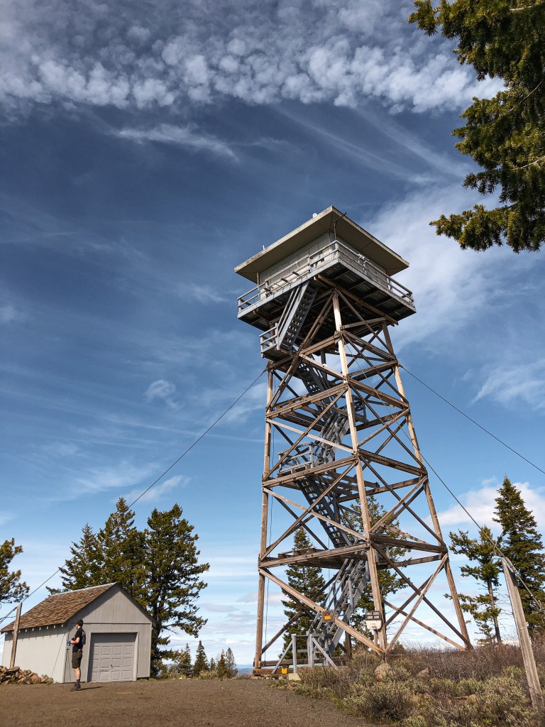
My partner and I were dispersed camping in the area for Memorial Day weekend. We were checking out the points of interest on our topographic maps and found Flagtail Mountain noted as a lookout. I drove my Civic on NF-63 until we met up with the junction of NF-594. Typically, three numbered Forest Service roads are rough and I didn’t want to find out the hard way. We parked my car at the junction at a pullout and started hiking up the road. From my recollection the road wasn’t terrible and I definitely would have been able to drive farther up the road to shorten our road walk. However, I wouldn’t have made it to the top in my Civic. There was a lot of ATV activity in this area and we were dusted up a few times by passing vehicles. I’m pretty sure they all thought we were crazy for choosing to walk up the road to see the lookout. During the summer this is a staffed lookout, but when we visited it was still closed up. On our way back down, we found an unattended fire left by a group of people on ATVs that we had passed on our way up the road. There was still some snow in the area and we decided to pack it on the fire to help douse it. Please always make sure your fires are dead out before leaving them!


History.
Flagtail mountain has been the site of a fire lookout since 1922. It started as a platform on a juniper tree, which still stands. In 1934, they built a 20′ round pole tower with L-4 cab. This was used until the current R-6 lookout was built in 1966. It is still actively staffed every summer.


One thought on “Flagtail Mountain L.O.”