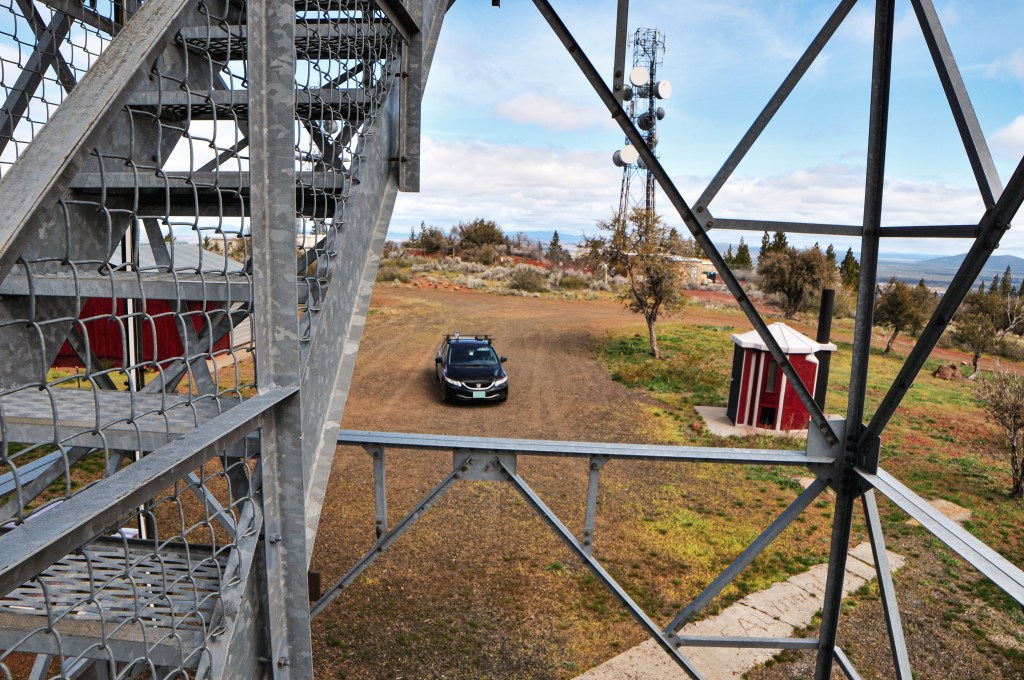
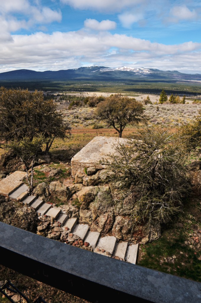
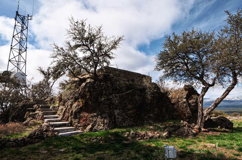
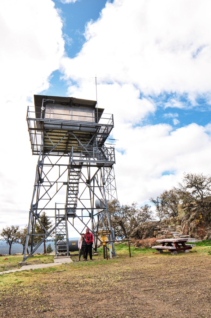
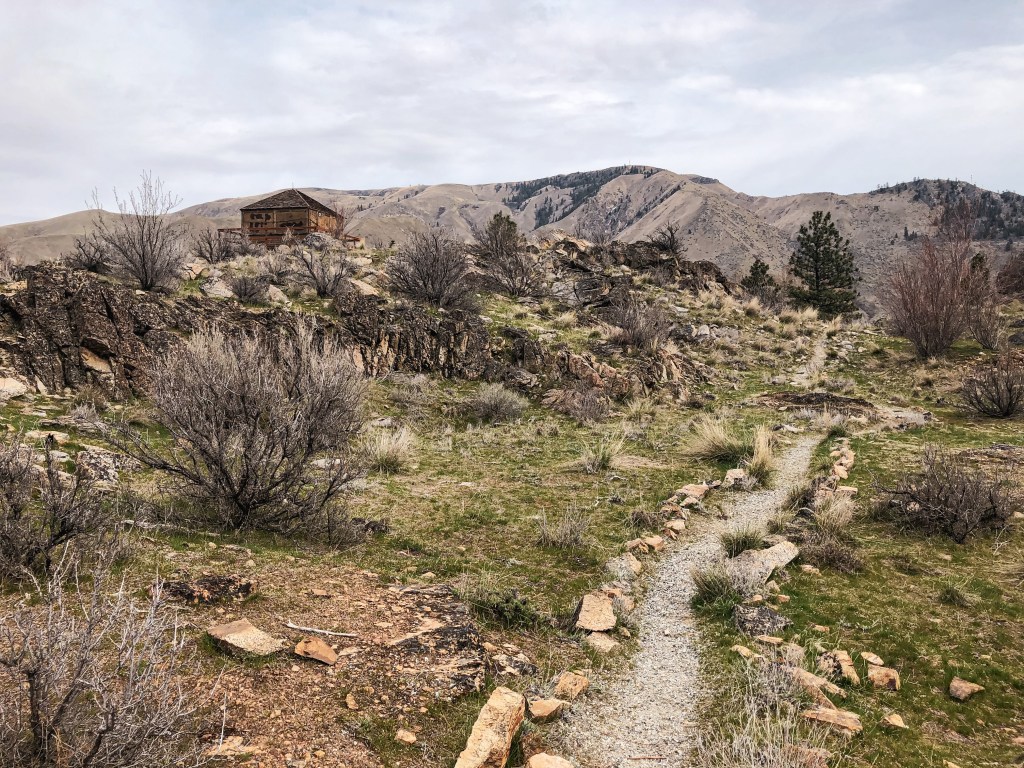
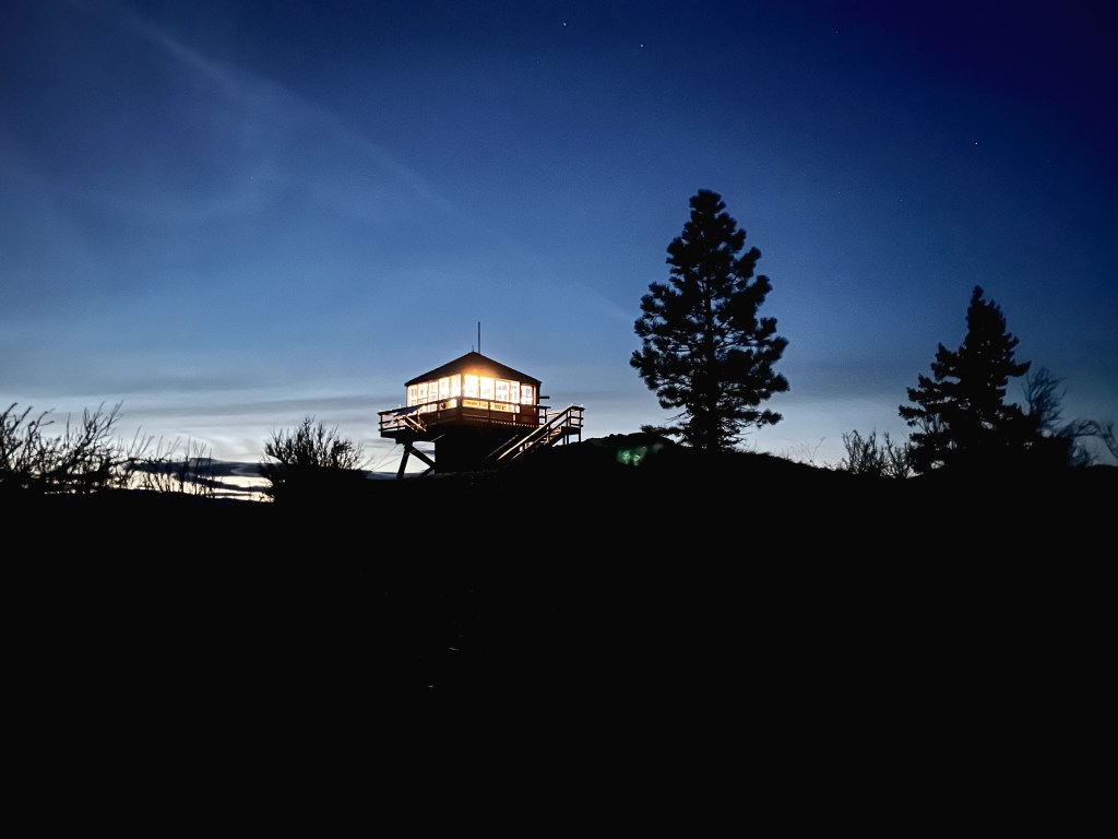
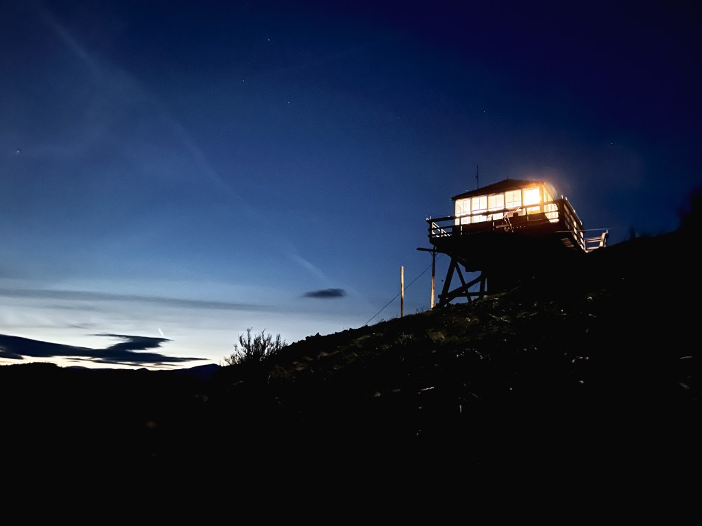
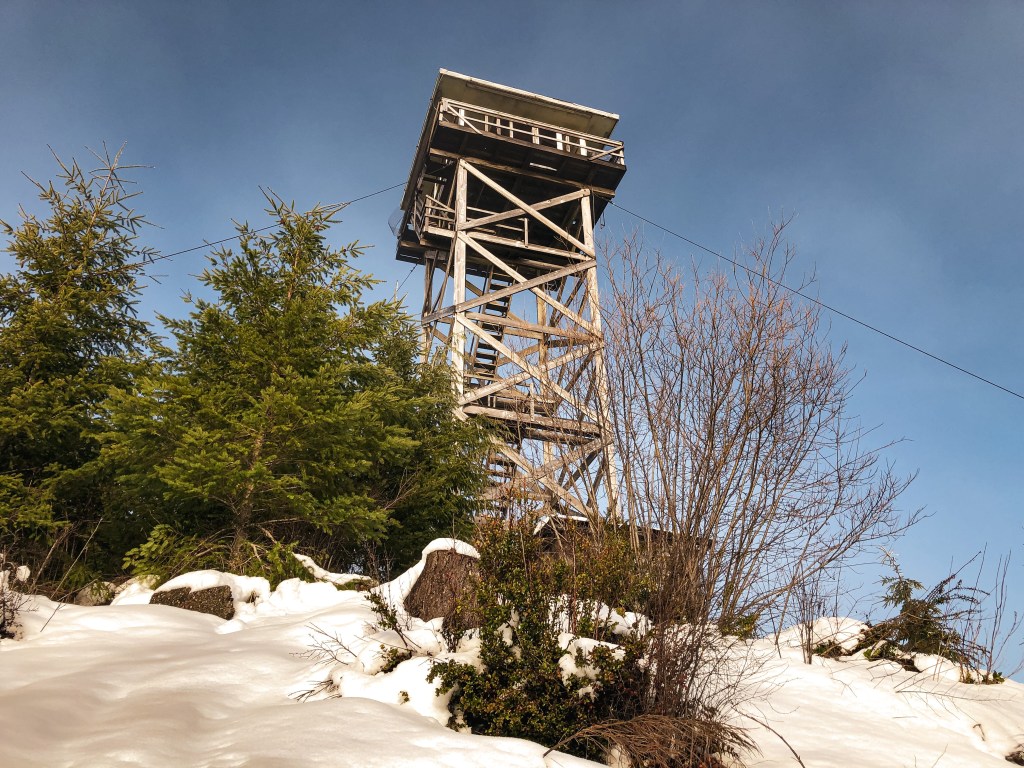
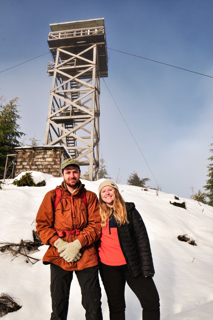
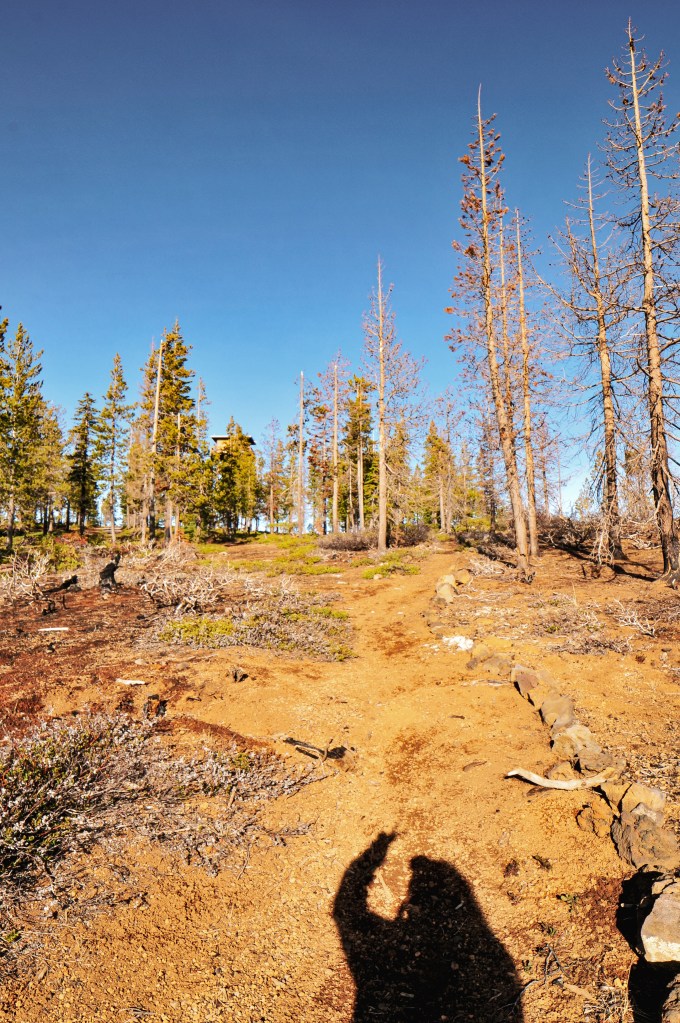
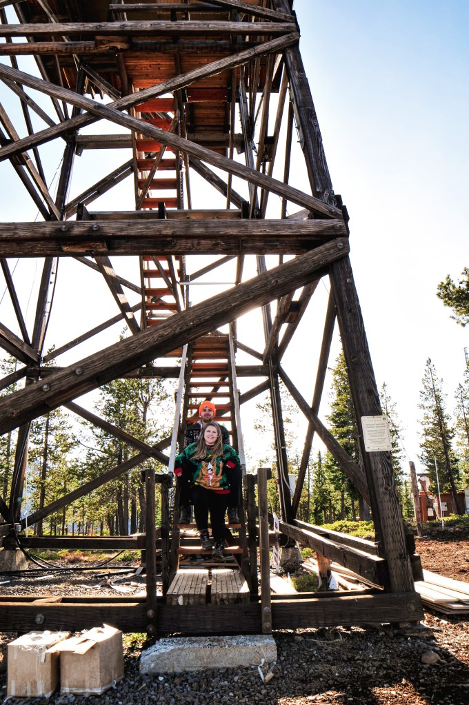
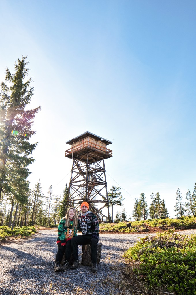
After deciding to visit Lava Beds NM, I wanted to see if there were any other fire lookouts close by that would be accessible. Unfortunately, there isn’t an equivalent map to Rex Kamstra’s fire lookout page for California, which is helpful in finding fire lookouts within the same area. I was able to find Timber Mountain L.O. after doing a bit of research. My partner downloaded the quadrangle map and the route looked simple enough. We figured in the worst case we would run into snow on the road but would be able to hike the remaining distance. We headed out in the morning towards the southern entrance of the Monument and the small community of Tionesta. The main paved road eventually turns into NF-10 that you will follow until it comes to a T-junction with CR-97. From the junction you will turn left. From here we were a bit turned around. The map shows that all the roads should connect but this is not exactly the case. We turned right on to CR-97A which leads to Eagle’s Nest RV Park. The road does in fact connect but there is a private party that has blocked the route with a gate. We headed back out to the main county road and turned right at the next CR-97C. We followed this road until it came to a three way junction. You will want to continue straight over the cattle guard on to road 44N18. This road will take you all the way to the summit. The road is well maintained gravel with only a few hazards. We were surprisingly able to drive all the way to the top in my Civic. There is a gate 1/2 mile from the summit that might be closed during different times of the year, but we found it open during our visit. We enjoyed the lookout to ourselves with lunch before heading back to the Monument for some caving. This was definitely one of the easier fire lookouts to access thus far.
Looking towards Lava Beds NM & Schonchin Butte L.O.
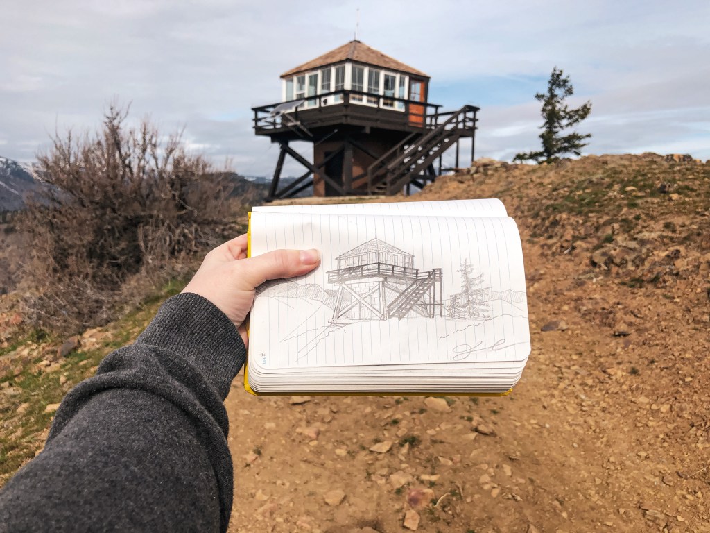
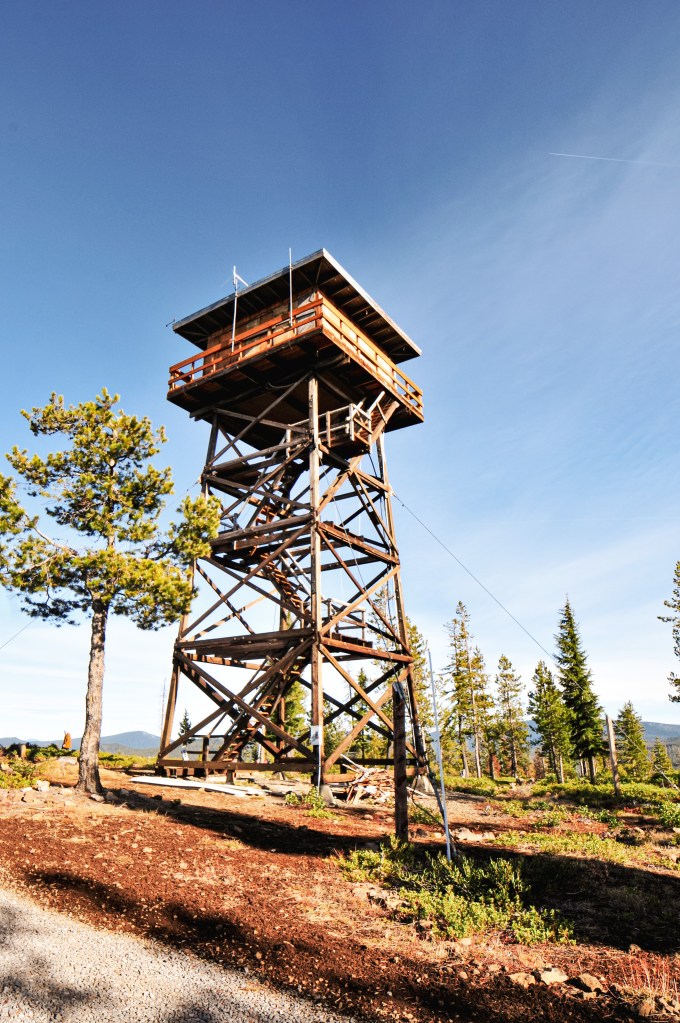
Timber Mountain L.O. From Indian Wells CG
History.
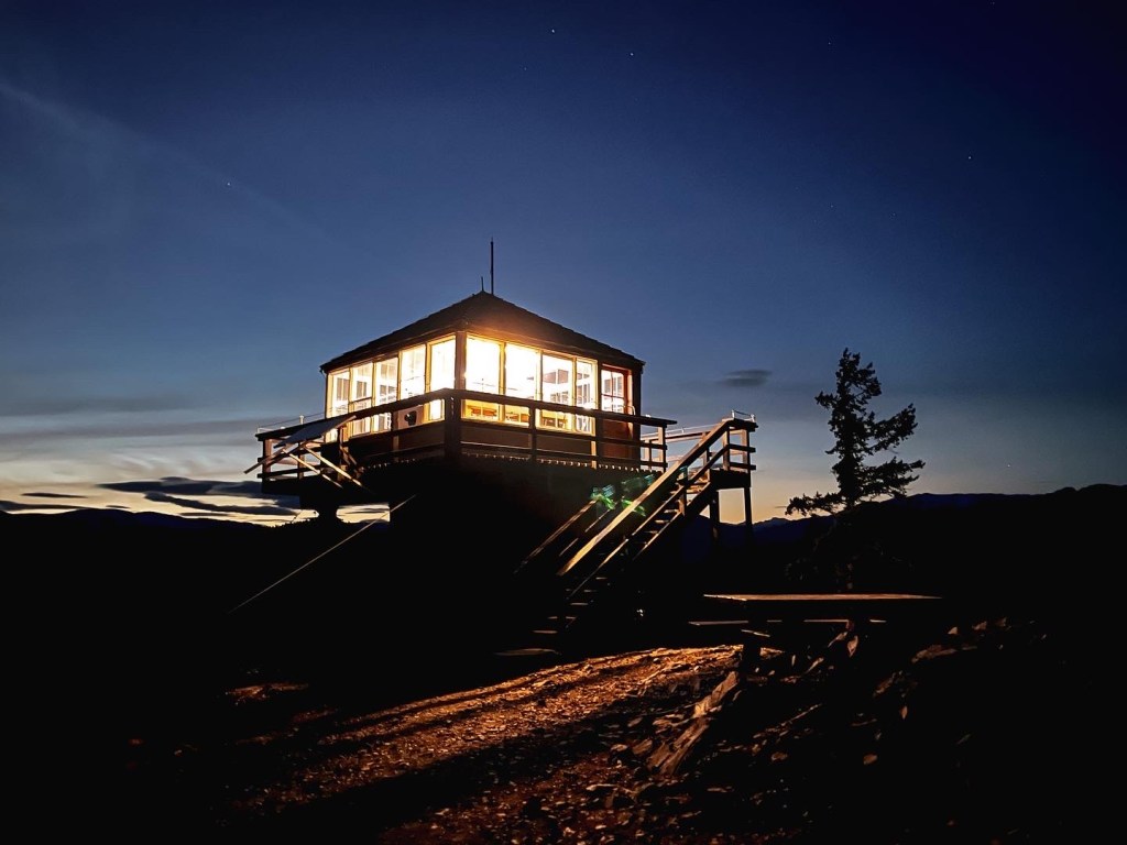
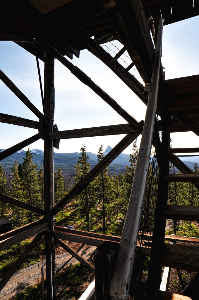
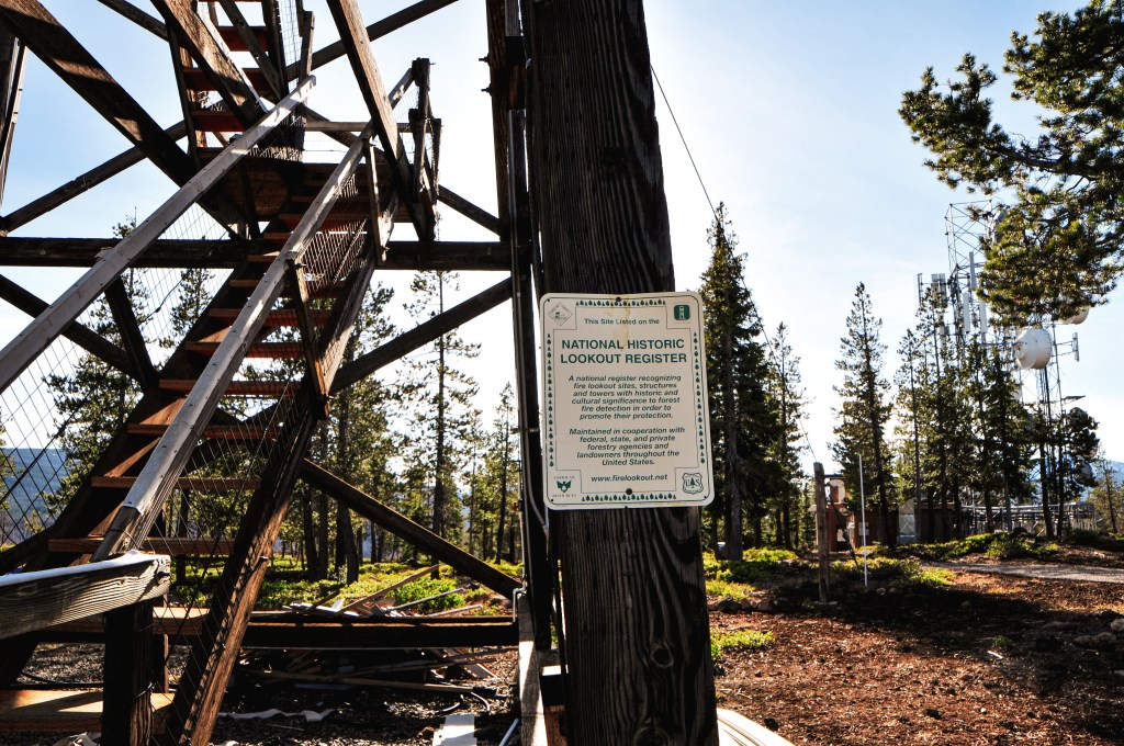
This site was recorded for administrative use as early as 1912. There isn’t much information on what structure, if any, was used back then besides a platform. There are remnants of an old foundation that can be found next to the existing lookout where the old platform used to sit. It is recorded in the National Historic Lookout Register that there was a previous L-4 or Region 5 BC-101 structure used from 1934. The current fire lookout was built in 1966 as a CL-100 plan with 30′ steel tower. It is even outfitted with running water and electricity. The Forest Service still actively staffs this lookout every season.
My partner found these two structures when researching other potential fire lookouts to visit in the area. Unfortunately, neither of these ended up having any recorded history in fire detection but were still interesting in their own unique way.
Sheepy Ridge Overlook
Date visited: April 8, 2022
We wanted to stop at this overlook on our way into the Lava Beds National Monument since it’s located on the same route but accidentally drove past it. We had some extra time in the day before sunset and were able to drive back out after setting up camp. It’s only a short 30 min drive from the campground. This overlook was built from lava rock by the CCC in the 1930s for observation purposes. We hoped there might be some history of it being used as a fire lookout but I was unsuccessful in finding any information. It is located behind the Tulelake National Wildlife Refuge Visitor Center and is a short hike up. The trail is only 0.5 miles and climbs 170ft of elevation. From the overlook you have a great overview of the wildlife refuge and part of the Klamath Basin.
We passed through the town of Tulelake while heading to the Lava Beds NM for the weekend. Located just outside the town is the Tule Lake National Monument. This National Monument is the site of the Segregation Center and Camp Tulelake which were used to detain Japanese Americans during World War II. The visitor center is temporarily located at the Tulelake-Butte Valley Fairgrounds along with some other important exhibits. The Rangers only staff the National Monument from Memorial Day through Labor Day. We wanted to make a quick stop at the visitor center since there appeared to be a fire lookout based on pictures online. One of the fairground employees that was working there was nice enough to let us view the exhibits onsite. We found that what we thought to be a fire lookout was actually an observation tower used by the guards at the camps. There are a lot of great historical artifacts at this location from this dark period in history and it is worth the stop if you are in the area.
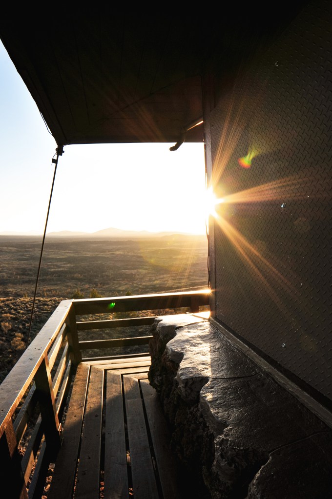
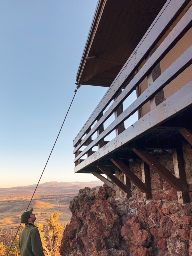
I had a four day weekend set aside to celebrate my 30th birthday this year. My original plan was to knock off a bucket list backpack to the Enchanted Valley in the Olympic NP but the weather forecast had other plans. With severe winter weather warnings across the state of Washington and Oregon, we decided to look farther south. I had never heard of Lava Beds National Monument until the week before when I was researching other options. It ticked all the boxes for what I was looking for in an alternate plan; somewhere my partner and I hadn’t been before, a sunny weather forecast, snow free, a fire lookout, and within reasonable driving distance for an extended weekend. We left Friday morning and spent the day driving across Oregon to the California border. There are multiple routes you can take to get to Lava Beds NM, but we took HWY-39 from Klamath Falls because wanted to stop in Tulelake beforehand to see part of the Tule Lake National Monument (post). There is a lot of history in this area that is often overlooked in our school systems and it is worth seeing first hand. We arrived at the Lava Beds NM early afternoon and had our pick of the camp spots in the Indian Wells campground. There was some daylight left after setting up camp and we decided to visit Sheepy Ridge Overlook (post) and Schonchin Butte L.O. for sunset. The hike up to Schonchin Butte L.O. is a short 0.7 mile trail that climbs 500′ in elevation to the top of a cinder cone. There is a signed road off the Volcanic Legacy Scenic Byway that you will take to get to the trailhead. It is a well maintained gravel road and drivable by any vehicle. We reached the summit just before sunset and enjoyed the lookout to ourselves. It was very windy and cold on the catwalk, but the sweeping views were worth it.
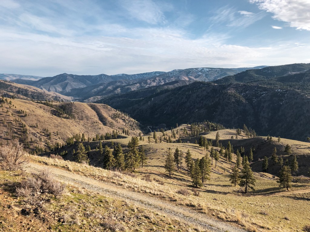
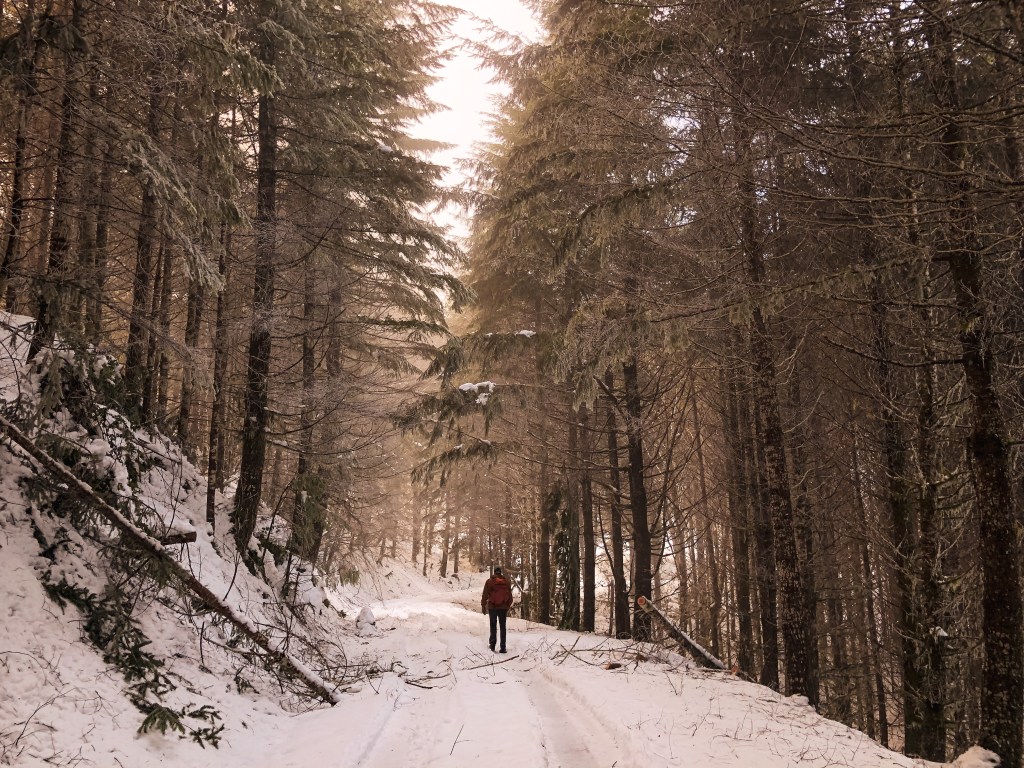
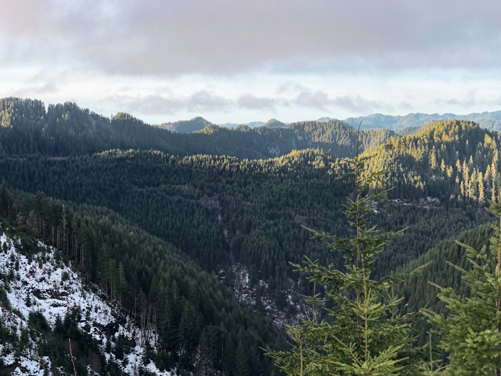
We spent the next few days checking out other points of interest in the park and drove out to see Timber Mountain L.O. (post) as well. Lava Beds NM offers a variety of things to do from caving their developed caves or hiking along historic sites. But no matter where you go in the park there seems to be a view of Schonchin Butte. Part of the Monument was still closed during our visit due to damage from the previous years wildfires. They also close some of their caves in the winter for hibernating bats that were still in affect. If you do plan on visiting any of their caves, you will need to stop at the visitor center for a caving permit and be aware of their protocols on White-Noise Syndrome. Despite having clear skies the first three days, we woke up to snow on our last morning. We quickly packed up camp and started our long drive home. The entire state of Oregon seemed to have been blanketed in snow as well. This meant avoiding all the high passes and taking the long way home.
Schonchin Butte from Fleener Chimneys
Schonchin Butte from Indian Wells Campground
History.
The cinder cone that makes up Schonchin Butte is one of many eruption sites from over 65,000 years ago on the Medicine Lake Shield Volcano. A shield volcano is a low profile volcano that is named after its resemblance to a warrior’s shield laying on the ground. These types of volcanos are formed from highly fluid lava that travels farther creating a thinner profile. The cinder cones are then made from a glassy rock filled with gas bubbles called scoria. Schonchin Butte’s large cone was developed from the initial eruption throwing scoria high in the air. The bowl shaped crater on the summit was created from trapped gasses below releasing and causing the lava to become heavier.
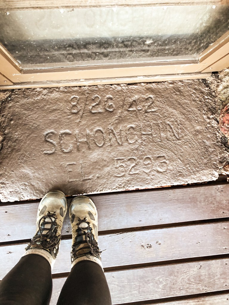
The lookout and trail on Schonchin Butte were built by the CCC camp stationed in Lava Beds. Construction started in 1939 and wasn’t completed until 1941. The CCC camp there contributed to making the monument what it is today. They even hand carried the needed materials to the summit which included lumber and cement. I couldn’t find specific information on the type of fire lookout since California designs are slightly different than Oregon, but it resembles a flat top R-6. The doorstep on the lookout has a date of 8/26/42 which is noted as the day it was installed. The elevation is also on the doorstep at 5,293′ but was later found to be 5,302′ by modern technology. Over the years the lookout has been updated and changed, but the physical structure has remained the same. The most recent renovations took place in June/July of 1994. The lookout is still staffed every summer from June to September, but the rangers no longer live in the lookout.
We decided to stop off at the Columbia Breaks Fire Interpretive Center for a quick stretch and lunch before heading to our weekend reservations at Steliko Point (post). The building was closed during our visit but the parking area and interpretive trail were still open to the public. The self guided trail is only 1/2 mile and features three fire lookouts that were relocated and restored. You might also see a few Marmot’s along the trail, they like to hide among the rocks. The main focus of the trail is to educate on the historic impact of wildfires and its importance in ecology. It also touches on the pros and cons of human effects in fire management. If you like fire lookouts and find the history of wildfires interesting this is worth the stop while in the area. The CBFIC is a non-profit and financed through donations. Places like this are important for preservation and education. Please donate if you are able or visit their website to learn about getting involved!
Chelan Butte L.O.
Former Fire Lookout Site Register: US 1391; WA 291
Chelan Butte L.O. is a 28′ treated timber tower with 14’x14′ standard L-4 cab. It was moved to the CBFIC in 1995, but originally sat at 3,835′ on a butte overlooking the town of Chelan and Lake Chelan. The current lookout was built in 1938 by the CCC as a replacement for the original tower that burned down. The original lookout built on Chelan Butte was a 40′ pole tower with L-4 cab in 1936. It was placed on the National Historic Register of Historic Places in 1990. The lookout, for the most part, maintains it’s original integrity but the shutters were replaced and the tower was lowered by 4′ to accommodate the CBFIC site.
Flattop Mountain L.O.
Former Fire Lookout Site Register: US 1315; WA 215
Flattop Mountain has had a unique history of lookouts throughout the years. It has an elevation of 4,394′ and is located in the Gifford Pinchot NF. It was named due to it’s broad and flat summit. It was so broad that they developed the site with two fire finders at each end in the 1920’s. The remaining lookout that can be found at the CBFIC is a replica of the lookout from the east point of the mountain. Some of the old wood from the lookout was used in the reconstruction, specifically the roof and wooden frame supports.
East Point
The first structure built on the summit of Flattop Mountain was a 16’x20′ frame house on the east point in the early 1920s. Around the 1930s they moved the frame house to the west point and built a 7’x7′ foot frame cab in it’s place. It was quickly replaced by an L-5 cab in 1933. The reconstructed replica that can be found at the CBFIC is based off the lookout that was built in 1946. It was a prototype 2-story 14’x14′ foot frame cab with slanted windows and curved hip roof. It is the only one of this style to ever be built. Originally it was thought to be the next generation of lookouts, but the Pacific Northwest was standardized on the R-6 flat top cab instead. The site was abandoned in 1960 where the lookout was subject to vandalism and fell into disrepair. There were plans to destroy it, but the Forest Fire Lookout Association was able to dismantle and relocate it to the CBFIC in 2005.
West Point
The history of the west point of Flattop started in 1930 when they moved the 16’x20′ frame house over from the east point. The house was updated in 1934 when they added two screen porches and an observation cupola. This was used until the site was abandoned and the west point house was destroyed in 1960.
Badger Mountain L.O.
Former Fire Lookout Site Register: US 1383; WA 283
Badger Mountain L.O. is a 14’x14′ standard L-4 cab that used to have a 18′ treated timber tower. It was originally constructed in the 1930s by the CCC for Lion Rock located in the Cle Elum Ranger District. It was later moved to Badger Mountain just outside the Wenatchee NF in Douglas County. The site was situated at 3,498′ and chosen due to its vantage point of the Wenatchee NF across the Columbia River. The lookout was actively staffed up until the 1970s where it was moved to emergency status. Its last recorded use was during the Dinkelman Fire in 1988. In 1990, it was placed on the National Historic Register of Historic Places and then relocated to the CBFIC in the fall of 1999. The shutters were replaced due to prolonged weather exposure but otherwise the lookout has undergone minimal change since it was originally constructed.
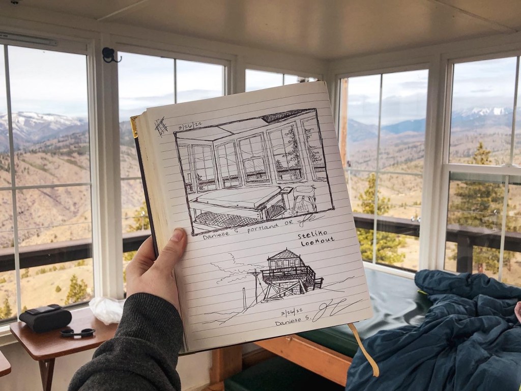
My partner and I found Steliko Point L.O. when we were researching how many lookouts are currently on the rental program in Washington. We were surprised to find that there were still a decent amount of openings for reservation, unlike Oregon lookout rentals that book up the instant they are listed as available. I’ve always wanted to stay in a lookout but never really took the time to do my research to obtain a reservation. We picked the last weekend in March because we wanted a weekend that would possibly be snow free, decent weather, and still have the gate up on the road. Based on past trip reports my Civic wouldn’t have made it up the road anyway and we wanted to decrease the amount of un-expected visitors possible.
Friday.
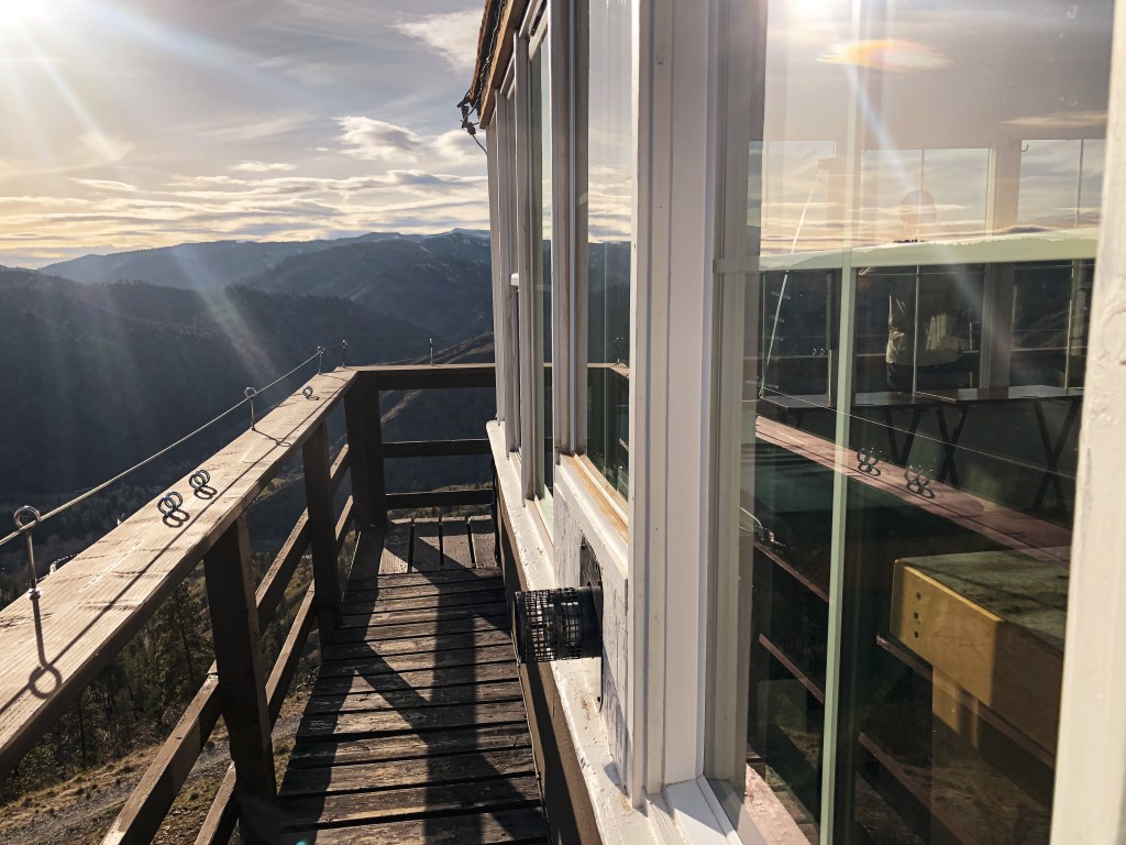
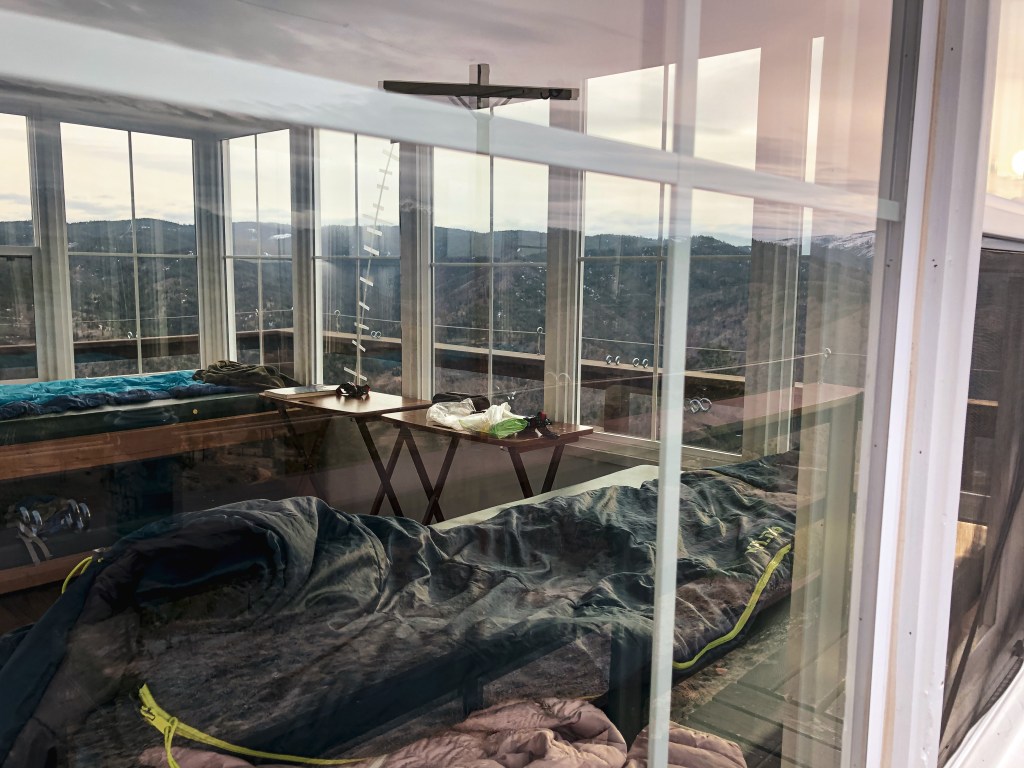
We woke up early Friday morning and started our long drive towards Steliko Point. There are a few ways to get there from Portland but we decided to head up I-5. From I-5 you will need to cross over via I-90 to connect with HWY-97 to eventually get to HWY-97A. We made a quick stop in Entiat to refuel and visit the Columbia Breaks Fire Interpretive Center (post). A must see if you are a lookout enthusiast like us! After visiting the museum, we headed back down HWY-97A and turned right on to Entiat River Road towards the town of Ardenvoir. Just past Ardenvoir you will turn right on to Steliko Canyon Road which turns into NF-5310. The road will be gated but there is a sign for parking near the Forest Service sheds. You will need to park parallel with the cement blocks. Once parked we had a quick lunch and loaded up our packs for the short but steep 1.6 mile trek up the road. You will gain around 1,200′ of elevation during your hike. The lookout is outfitted with mattresses, folding tables, a propane stove, a propane fridge, heater, and other basic cleaning amenities. This means you can leave your sleeping pad and camping stove at home. The only essentials we had to carry up were our clothes, cook ware, sleeping bags, food, and water. There is no water source at the summit and it is a very exposed area, so make sure to plan accordingly. We over shot on the amount of water needed by bringing (1) 3 gallon jug, (2) 3 liter hydro packs, and (8) 32oz Nalgene bottles worth. The amount of water weighing us down made the hike up harder than it needed to be. Once at the summit you are able to access the lookout via keyed entry. There is a lockbox that you are given the code to with your reservation. We were surprised to find that previous guests had stocked the lookout with even more amenities than listed. You shouldn’t assume there will be everything you need there but there are a lot of leave behinds incase you do forget something such as games, cooking utensils, books, food, and even water. I loved the community feel and connection it gave from past guests especially after reading the entries in the guest book. This lookout has only been on the rental program since November 2019 and had a brief gap where it was closed from April 2020 until May 2021 due to the Pandemic. Or at least that is what I gathered based on the gap in entries from the guest book. We enjoyed our dinner with a nice sunset before heading to bed early. We were both tired from the long day of driving to get there.
Photo taken by Garnet
Photo taken by Garnet
Photo taken by Garnet
Saturday.
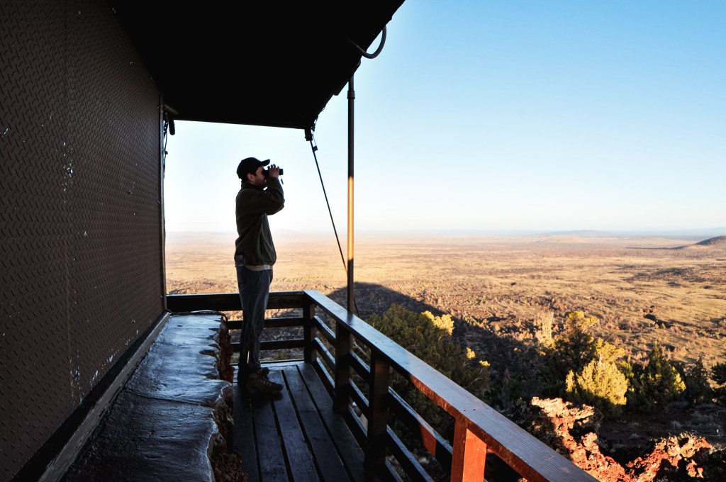
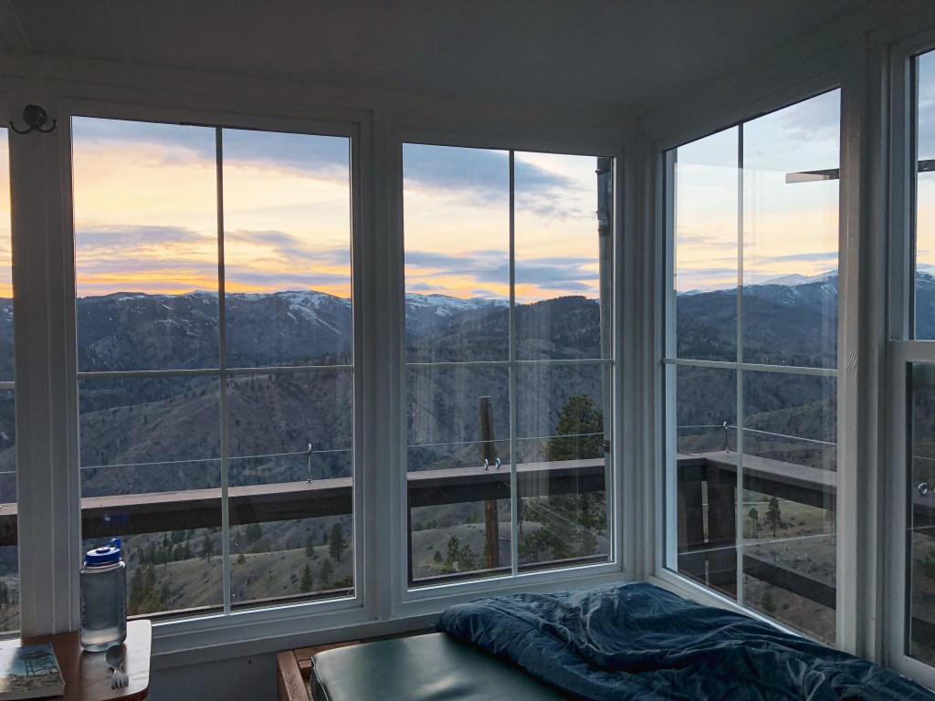
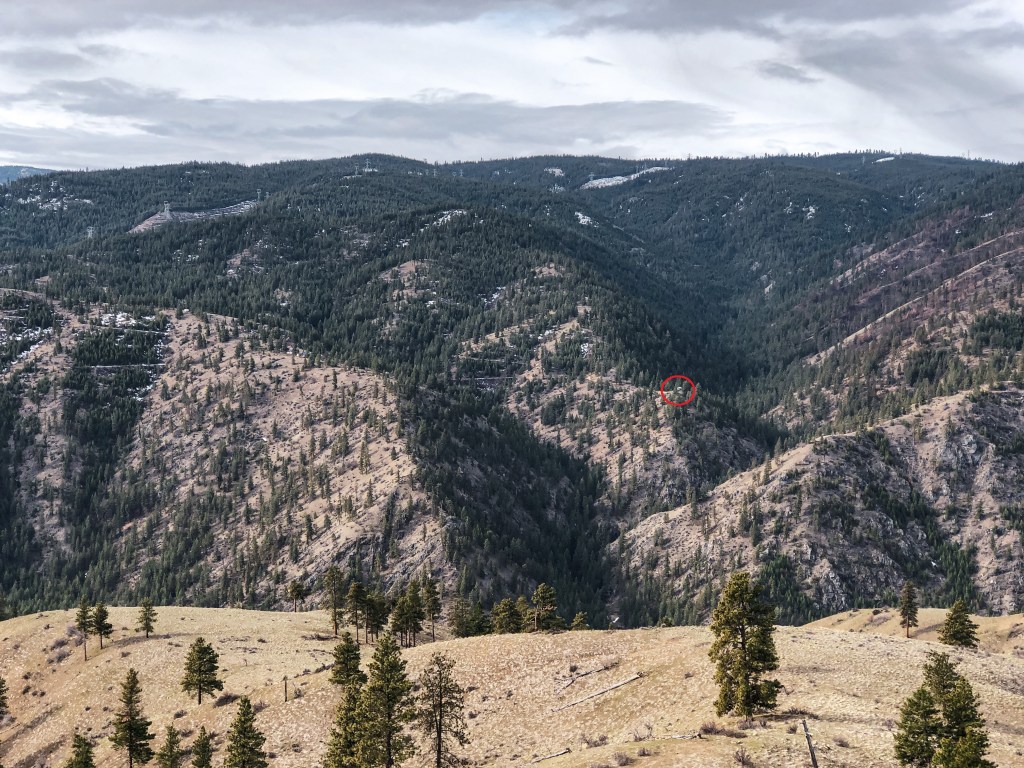
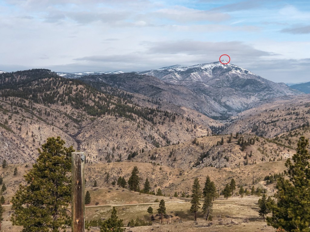
I woke up at 6:30AM to see if I could catch the sunrise but it was mostly clouded and didn’t offer anything spectacular. We still had great weather for most of our trip with mild temperatures and partly cloudy skies. During breakfast on the catwalk we were able to spot 40+ mule deer grazing on the hillsides. I read that this was a known area for their winter range and that they were frequently spotted from the lookout, but I didn’t think we’d see so many of them together. We were also able to spot Tyee L.O. and another lookout that someone built on private property. A trip report mentioned that you could see Sugarloaf Peak L.O. from here as well but the mountain that they identified was actually Baldy Mountain. After breakfast, my partner decided to hike along the ridge trail while I hung around the lookout to read and draw. He came back for lunch and we relaxed around the lookout for most of the afternoon. A day hiker with their dog was the only person we saw for most of the day. My guest book entry mentions that this is the only person we saw the whole trip but that is inaccurate. Later in the evening, we decided to hike down to the ridge below where there is another road and walk around. My partner ended up hiking cross-country in a different direction, so I was back at the lookout earlier than him. While I was waiting for his return, a runner came up the road and climbed the catwalk. He said he was training as a wildland firefighter in the area but didn’t realize anyone was up here this time of year. I don’t think he knew this was listed as a rental. He apologized for spooking me and invading my space before heading back down. Our interaction was brief and friendly but it might be worth adding a sign somewhere visible for day hikers and visitors to be aware. After eating dinner, we both read the books we brought until it got dark. I ended up finishing my book while there and decided to leave it behind for future guests to enjoy. Hopefully someone enjoys true crime as much as I do because I left behind a copy of Red River Girl: The Life and Death of Tina Fontaine by Joanna Jolly. Saturday night was a bit stormy with mild winds and a sprinkle of rain. We even saw a bit of lightning in the distance as we were trying to fall asleep.
Private Lookout
Tyee Lookout
Sunday.
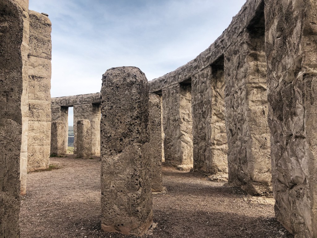
Sunday morning, we saw the same herd of 40+ mule deer while we savored our last few hours at the lookout. Part of the condition of your stay is to pack out your trash, sweep, and wipe down the counters. Although this rental is managed by Wenatchee Valley TREAD, It’s a collective responsibility to help keep this place in good condition for others to enjoy. We left behind any remaining water we didn’t use for future guest who might need it. We spotted some day hikers headed up the road while we were locking up and took that as our cue to leave. Our packs were significantly lighter than when we started and the hike down was a breeze. We passed another group of day hikers on our hike out and even saw the same wildland firefighter start his run up the road while we were having lunch at the car. Driving back to Portland, we decided to take the more scenic route following HWY-97 most of the way until it meets up with I-84. We could see Lorena Butte L.O. from our drive and stopped at the Stonehenge Memorial while in the area. Overall it was a relaxing and quiet weekend away.
History.
Steliko Point has been used as an observation camp site since 1925. The current lookout is a 16’x16′ L-4 cab with 10′ tower and was built in 1947. It was actively staffed up until the mid-1990s and is still registered for emergency use. There are signs of another foundation on the summit, but I couldn’t find any information online about previous additional structures. Steliko Point is one of only three remaining lookouts in the Entiat Ranger District. Given it’s proximity to Ardenvoir and low elevation, it is also one of the few lookouts wired on the power grid. Yes, that means you can charge your phone during your stay. There are only USB ports though, so don’t bring anything that requires a plug. Over the last few years it has undergone remodeling and updates by volunteers to open it up for the rental program. It is now mostly managed by the non-profit Wenatchee Valley TREAD for maintenance and overnight stays.
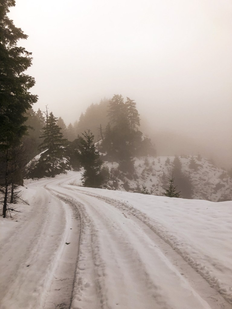
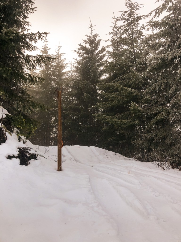
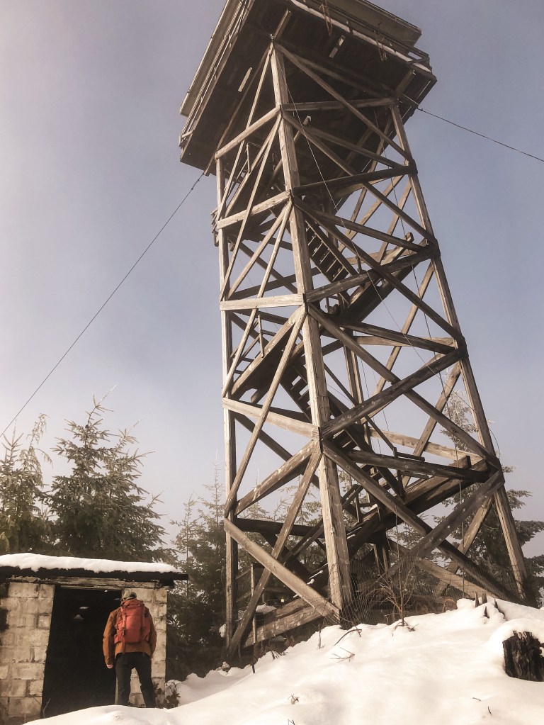
After an easy visit to Bunker Hill L.O. (post) the day before, we woke up ready for more of a challenge. We weren’t sure how the roads leading up to Cougar Pass would look, but figured we could get as close as possible and walk the remaining distance. We had been dealing with a state wide snow storm for the past week, so the chances of meeting snow here were high. Normally being just off the coast is a safe bet for no snow, but we never seem to be that lucky with our off season explorations. We headed east out of Reedsport on HWY-38 until we reached the turn off for Loon Lake Recreation Site. You will turn Right on to Loon Lake Road. The Loon Lake Recreation Site was already closed for the season but the road leading to Cougar Pass will be beforehand. The gravel road is noted as Cougar Pass Road on google maps but is actually state forest road 7700. There is a small yellow sign posted on one of the trees with this number. You will see the sign after you’ve started up the gravel road. There are no signs to notify you of the turn off from the main road. It is about 6 miles down Loon Lake Road and will be on the right hand side. We barely made it 1/2 mile up the road before we were met with some fallen trees and snow from the recent storm. We already planned on having to walk some of the road, so we were prepared. You will follow the main road until you reach a major T-junction with state forest road 7000. It was hard to find a detailed map of the Elliot State Forest. From what we had it seemed like the road to the lookout would be to the left of the junction. We walked a mile down this way but the only viable road headed steeply down. We retraced our steps and headed to the right instead. It was the first road after the junction and can be distinguished by the pole remaining from the old gate. From there it is only 1/4 of a mile to the lookout. You will reach another road junction before the summit, the lookout is to the left. The Elliot State Forest has taken steps to make this lookout harder to find by removing road signs and tank trapping the road in hopes to deter vandalism. We could tell it was a well trafficked area since there were tire tracks leading up the main roads the entire way even with a foot of snow on the road. We would have had an easier time finding the lookout if it had been a clearer day. We were in a fog cloud until we started to head back down the road to my car. As we were hiking out, we found you can see the lookout from the road. It was close to 6 miles round trip of road walking from where we parked, if you don’t include the additional 2 miles in the wrong direction.
History.
The first fire lookout was built on Cougar Pass summit in 1935 as a 40′ wooden tower and was managed by the Coos Fire Patrol. This tower was replaced by a 50′ CT3 tower with 14×14 cab in 1966. It was actively used up until 1985. Cougar Pass L.O. is the last remaining lookout in the Elliot State Forest and, as far as I know, the only one still located in any Oregon state forest. It is currently managed by the Department of State Lands and is in a state of disrepair. There is a public proposal out to restore and reconstruct Cougar Pass L.O. as an educational opportunity for the Southwestern Oregon Community College and general visitors. This proposal would not only preserve the history of this lookout but help to educate on the forestry management utilized in the Pacific Northwest during the period of 1910 to 1969.
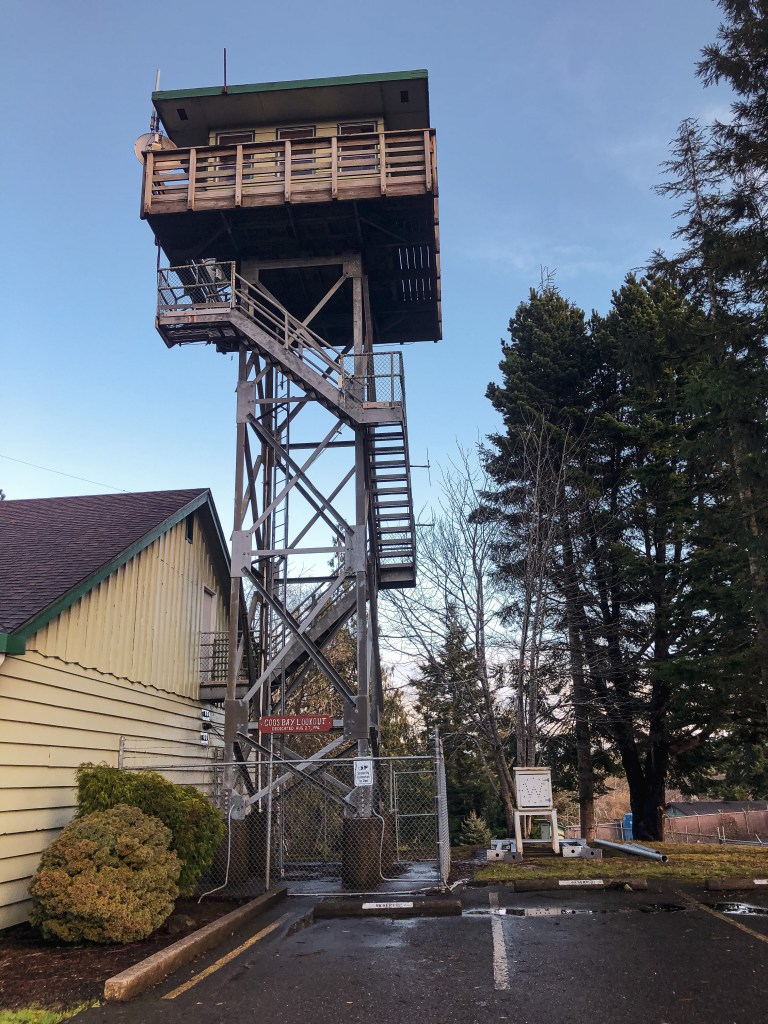
My partner and I decided to book a rental in Reedsport for the New Year and our 3-year anniversary. We chose Reedsport for it’s proximity to two lookouts along the coast. We figured we could end and start the year doing what we enjoyed most. We headed to Bunker Hill L.O. since we had some time to kill before checking into our rental. This will be our last lookout visit for the year! It’s located in the coastal town of Coos Bay at the Oregon Department of Forestry building. We were able to find it by following signs to the ODF building from HWY-101. Heading south on HWY-101 you will turn right on to Flanagan Road. You will stay on Flanagan Road until you reach Lookout Lane. Turn Left on to Lookout Lane. If you end up driving past Lookout Lane you can still get there by turning left on to Bay Park Lane and then another left on Fifth Road. The junction of Bay Park Lane and Fifth Road has an ODF sign. The buildings were closed for the holiday but we were still able to access the grounds and view the lookout from the parking lot. There is marked visitor parking just past the gate.
History.
In 1937, a combination lookout and water tower were built for the ODF by the CCC of Camp Walker. A 7’x7′ lookout cab was built atop a 3,000 gallon 52′ water tank. This lookout tower was used by the Coos Fire Patrol until the 1950’s. It was also used briefly for air raid spotting during the war, but it was found that most spotting had been done from the ground. The combined lookout and water tower was dismantled in 1965. It wasn’t until 1996 that they decided to build a new lookout tower on Bunker Hill for training. The existing 12’x12′ lookout sits atop a 40′ steel tower next to the district headquarters. The steel tower used was donated by the U.S. Coast Guard. It is currently an interpretive site for visitors and listed on the National Historic Lookout Register. it’s labeled as the Coos Bay Lookout on the tower itself.
Bonus: We visited the Umpqua Lighthouse State Park to check out the lighthouse before heading to Bunker Hill L.O. It is ran by the U.S. Coast Guard and tours are offered through the museum. While parked we spotted another structure closer to the ocean that resembled a lookout. I’m sure it’s used by the U.S. Coast Guard for some sort of training but the base looked almost identical to Bunker Hill L.O.
NOTICE: As of July 20, 2024 this area is currently closed due to the active Diamond Complex.
Location.
Umpqua National Forest
Status.
Active; Currently standing
Estimated drive time from Portland, OR.
4 hours
Date visited.
December 4, 2021
Elevation.
6,417′
National Historic Lookout Register.
US 486; OR 79
Trip Report.
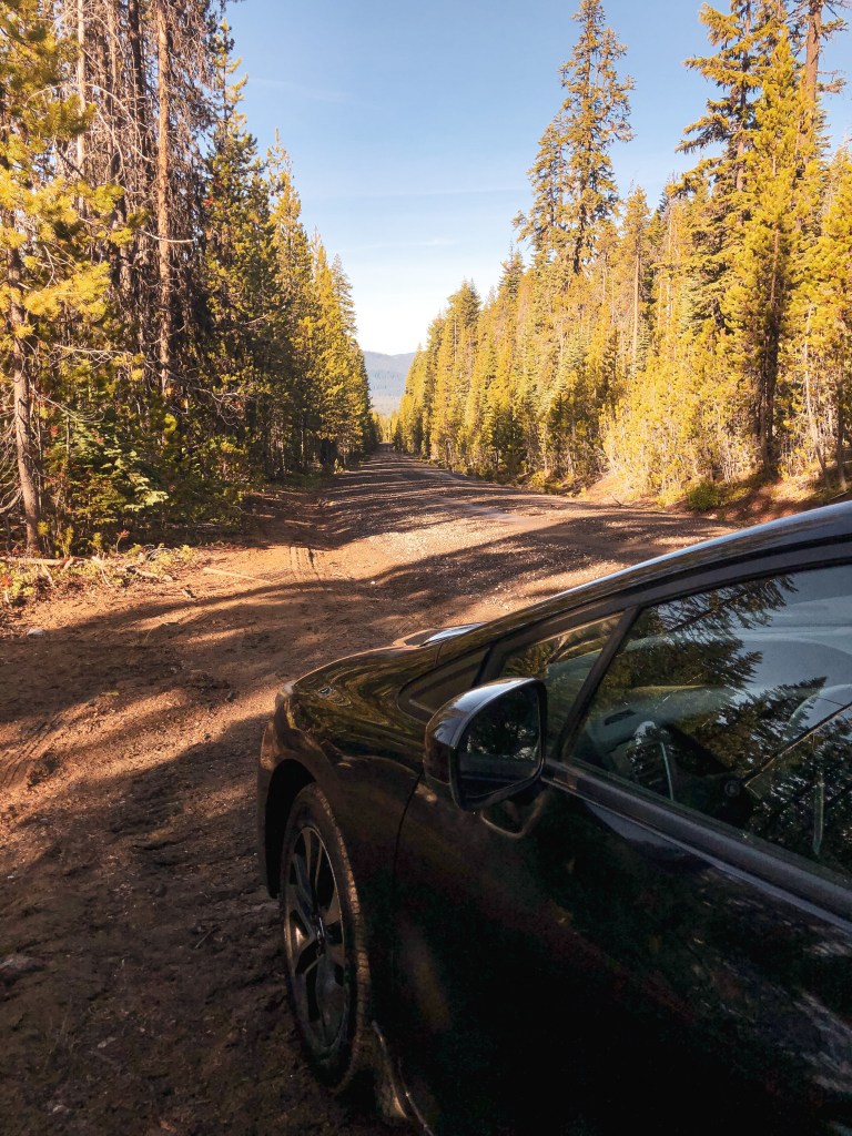
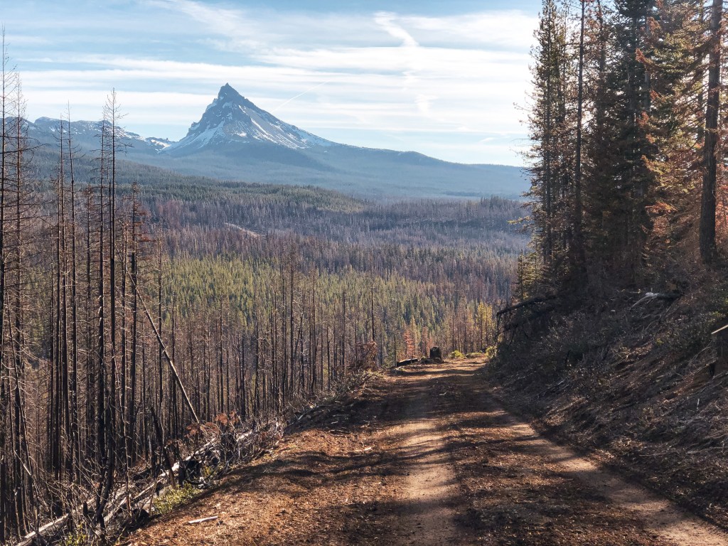
We debated visiting this lookout during the winter months and planning it as a snowshoe since the access road, NF-4793, is located right off of HWY-138. There’s also a small snow park located right at the turn off. This would be easy to access since it is plowed in the winter. There hadn’t been much snow in this area as of recently and we decided to check it out as a day hike instead. The weekend forecasted for cold but sunny skies. We were hopeful we wouldn’t be met with any snow and decided to try for Garwood Butte (post) while we were in the area too. As we made our way down to the Umpqua NF from Portland, we could see patchy snow on the tips of the high peaks. We decided to head for Garwood Butte (post) first but only made it a little less than a mile down the road before we were met with deep snow. It wasn’t worth the risk to drive, so we continued on to Cinnamon Butte. We turned on to NF-4793 and were uncertain if we’d be met with more snow. There is a sign for the lookout from HWY-138 and at the road junction off of NF-4793, so it is easy to find. The turn off for the lookout access road is only a mile and a half up NF-4793. I figure this road gets more sun exposure since we were able to drive to the junction with no issues. It is a gated road so you will need to park and walk the remaining distance. From the gate it is another 1.5 miles to the summit. As you hike up the road, you will already start to get some great views of Mt. Thielsen and the surrounding Diamond Lake area. There is a large parking lot on the summit which makes me believe you can drive there in the summer months. We had the summit to ourselves for the majority of the time. Another couple had hiked up while we were eating lunch but didn’t stay for very long. We took our time on the summit since we already had reservations in Roseburg for the night. It was a gorgeous day to visit!
History.
The current lookout tower was built for Buster Butte in 1955 as a 41′ treated tower and R-6 flat roof cab. It wasn’t moved to Cinnamon Butte until 1976. It has since seen some renovations. The original Cinnamon Butte L.O. was developed as a 35′ tower with L-4 cab in 1934 by the CCC. This lookout is one of the few that is still actively staffed every summer. The structure was threatened by the Thielsen Fire in September 2020. Evidence on how close the fire came can be seen on your hike up the road. It’s apparent that the access road was part of the fire break.
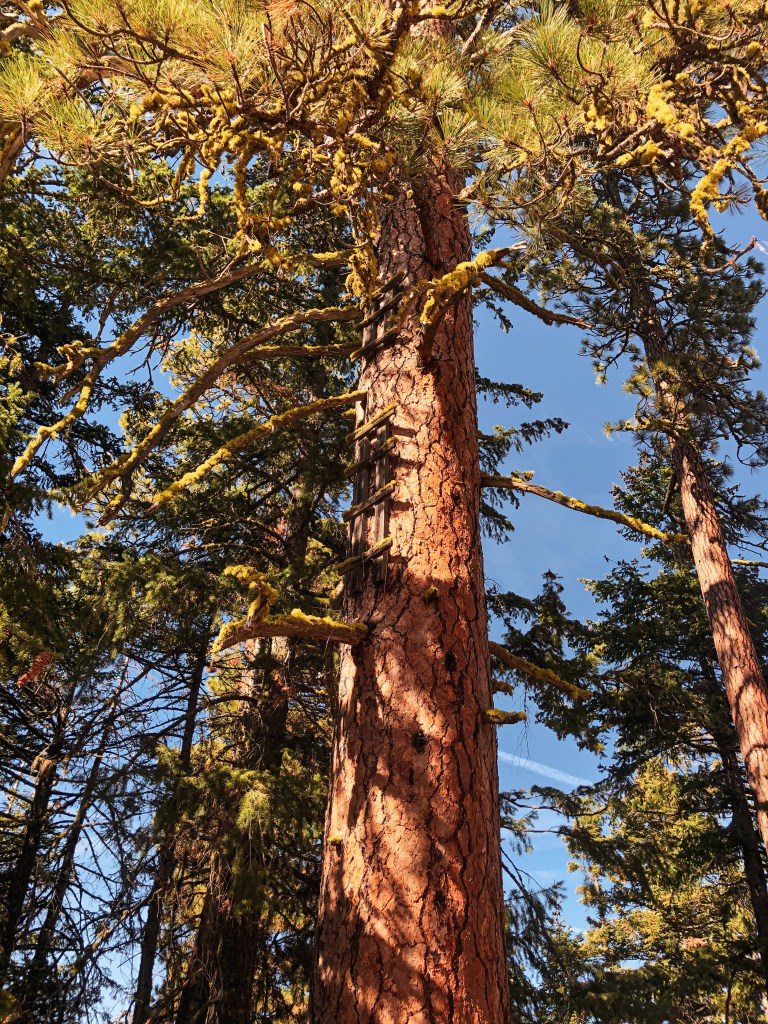
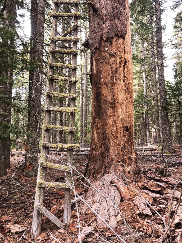
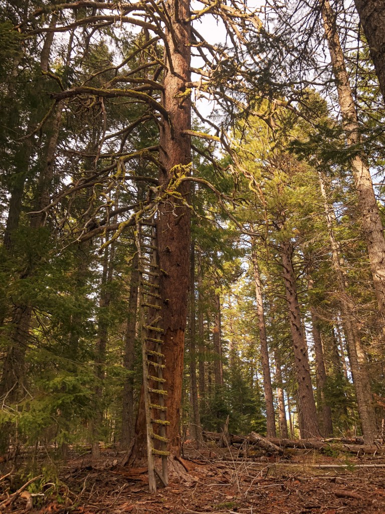
Remnants to the early days of fire detection can still be found in parts of the Mt Hood National Forest. Crow’s nest lookouts are typically a platform that sits on top of a tree with a ladder nailed to the trunk. Before there were lookout towers, fire attendants used to climb the trees to spot fires in the area.
Joe’s Point.
Date visited.
October 16, 2021; October 9, 2022
Elevation.
3,653′
History.
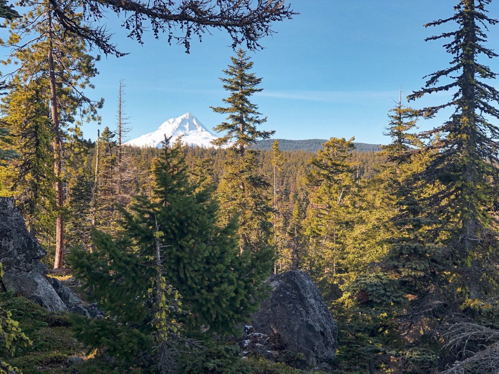
Joe’s point was an open platform built atop a large Ponderosa Pine in the 1930s. There was also a 12×12 cabin built for the lookout in the 1940s. The cabin is no longer on the summit, but you can still see pieces of the old platform and ladder. There’s a nice view of Mt Hood from the rock quarry where you park your car.
Directions.
Take NF-44 to NF-4440 to NF-140. Drive to the end of NF-140 and park your car. NF-140 is a bit bumpy in a passenger vehicle but doable. Once parked you will need to hike the old decommissioned road for about a mile. Follow the blue diamond markers on the trees, but be aware there are other roads in this area marked with blue diamonds that could lead you astray.
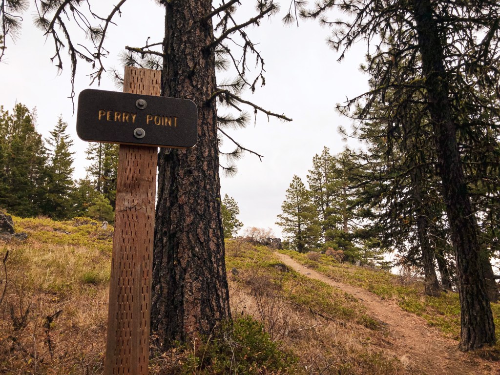
Perry Point.
Date visited.
October 17, 2021
Elevation.
4,920′
History.
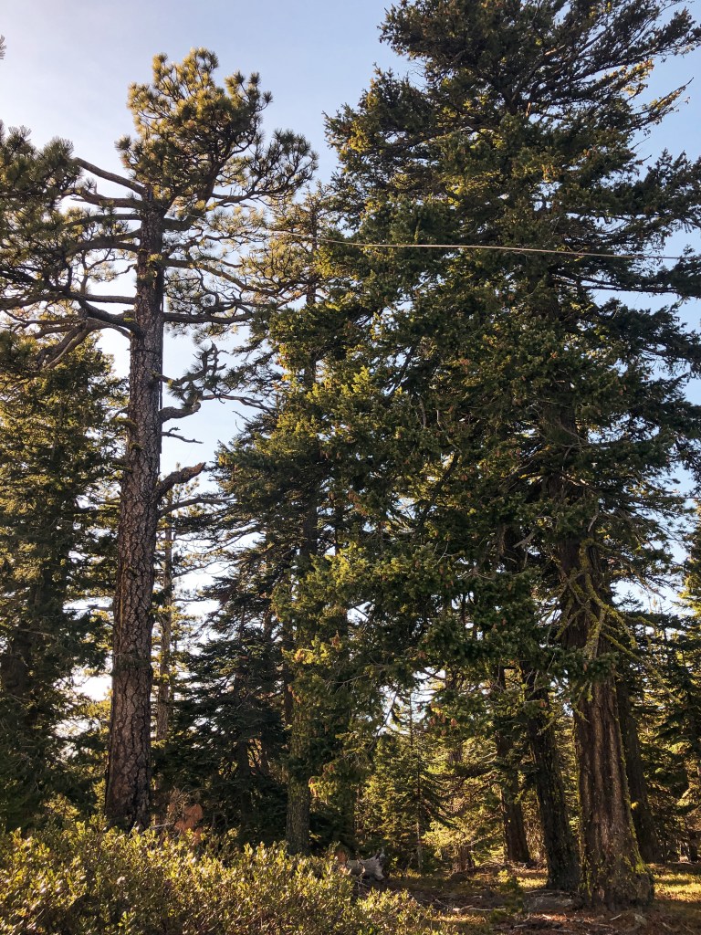
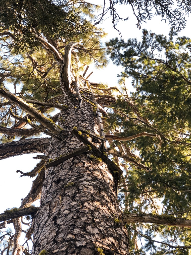
Perry point was a crow’s nest platform built atop a Douglas Fir in the 1930s and abandoned in the 1940s. It was noted as a potential patrol point for Fivemile Butte L.O. There are only a few boards left on top of the tree and will most likely not be there for much longer. The view from the point is still worth the short hike up.
Directions.
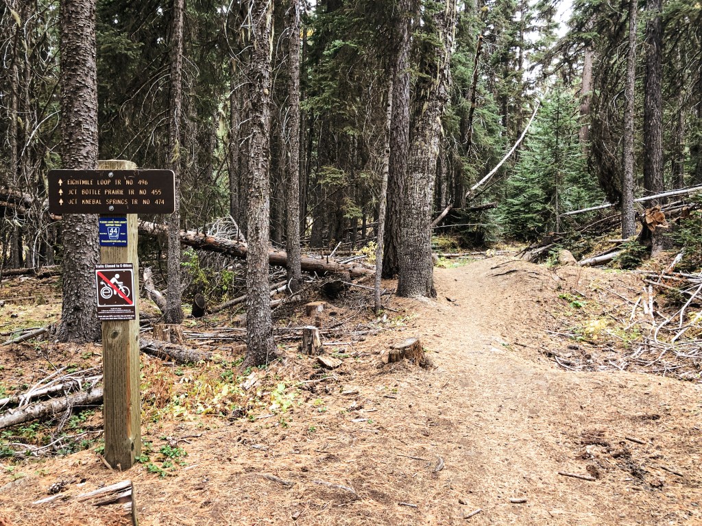
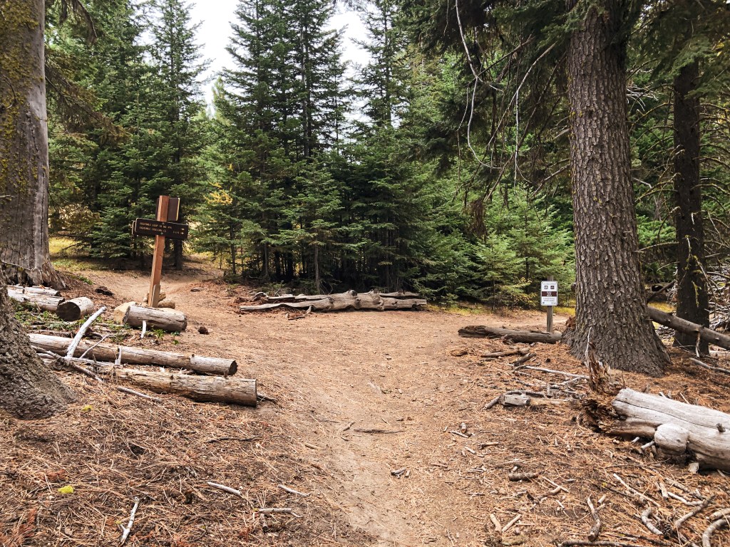
Take NF-44 to NF-120 and park you car at the trailhead for Eightmile Loop Trail #496. From the trailhead it is a little under a mile to Perry Point. You will want to follow the signs for Bottle Prairie Trail #455. The first trail junction is only marked in one direction. You will want to take the trail to the right until you meet the second junction. From the second junction stay left until you see a sign for Perry Point. The trail to the right of the sign will take you directly to the crow’s nest. It is the tree at the very end of a rocky butte and can be hard to spot.
Take the trail to the rightTake the trail to the leftTake the trail to the right of the sign
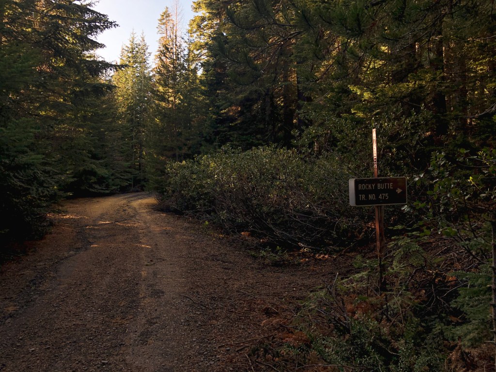
Rocky Butte.
Date visited.
November 20, 2021
Elevation.
4,796′
History.
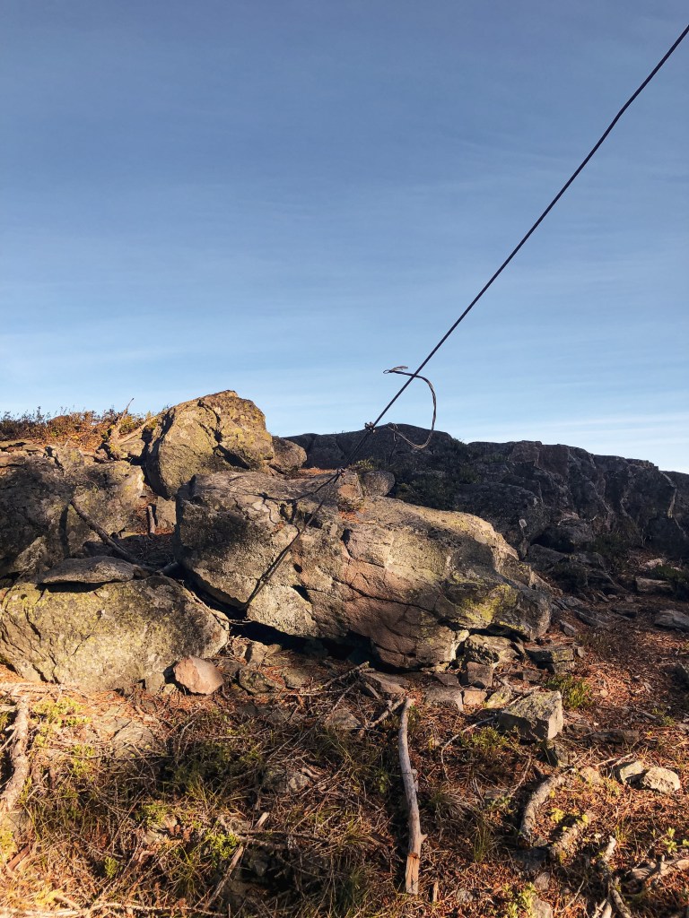
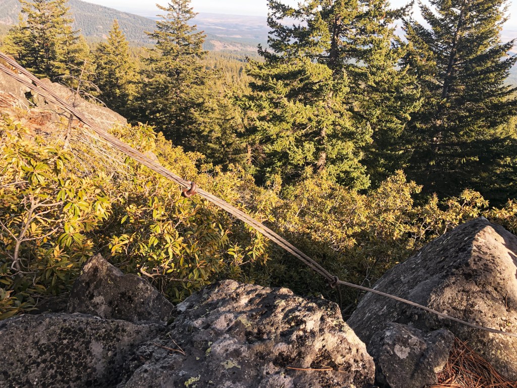
Rocky Butte crows nest was built in 1929 atop a 60′ Ponderosa Pine. It has been abandoned for a long time, but remnants of the ladder and guy wires can still be found on the summit. You can also find a USDA Forest Service Benchmark on the summit dated back to 1924. This is my favorite of the crow’s nests we’ve been able to locate. The views from the summit are worth the short climb up alone.
Directions.
From Tygh Valley take Wamic-Market Road through Wamic. This road eventually turns into NF-48. Turn right onto NF-4810 towards Camp Cody. Stay on NF-4810 until you reach a four way junction with NF-4811 and NF-4813. Turn right onto NF-4811 and then left on to NF-4812 shortly after. Continue on this road until you reach the trailhead sign. The road washes out about a 1/2 mile from the trailhead but a higher clearance vehicle will have no issues. There is limited pull out room for parking. It’s only a short 1/2 mile hike up the trail once you find the trailhead.
Bus Point.
Date visited.
November 21, 2021
Elevation.
3,333′
History.
Bus point was built as a crow’s nest in 1933 but has since been abandoned. It sat atop a 95′ Ponderosa Pine and was accessed via a 32′ ladder. The ladder leaned against the tree and was wired in place. From the ladder, the lookout attendant then had to navigate the branches to reach the top. The ladder and tree were still standing when we visited but the tree is no longer living and there are visible signs of rot. I would recommend seeing this one sooner than later.
Directions.
Same directions as Rocky Butte but instead of turning right on to NF-4811 at the four way junction, you will turn left. You will take NF-4811 until you reach an un-signed three way junction. NF-4811 in this directions has some large potholes but I was able to maneuver them with caution in my Civic. You will pass NF-4814 on the right and paved NF-4820 on the left before reaching the major junction where you will park. It’s good to have a detailed map of this area since there are a lot of skid roads you will pass as well and no definitive marker for this one. From the junction you will cross country hike off the road to the right following a game path. My tracker said we only went 0.16 miles before reaching the tree. We were able to find it right away with no issues.
Parking at Junction
Where the game trail starts
Eightmile Point.
Date visited.
October 8, 2022
Elevation.
5,280′
History.
There isn’t much history on this crow’s nest. It was built in the 1930’s atop a Fir and I presume abandoned in the 1940s with the rest of them. Unfortunately, this one is no longer standing and we were only able to find remnants of it. It was hard to pin point which tree was the previous lookout tree on the ground. But, we found the general area with some remaining wire, boards, an insulator, and the help of some other lookout enthusiasts that were also trying to find it that day.
Directions.
Head into the Mt. Hood NF from Dufur taking a right on Dufur Valley Road that eventually turns into NF-44 once you reach the forest. Turn left on NF-4420 until you reach a junction with a major gravel road leading right. From here, if you continue straight it turns into NF-2730. But, you will want to stay on NF-4420 and turn right onto the gravel. You will stay on this road until you reach the trailhead for Fifteenmile Trail #456 off to the left (parking on the right). It’s an obvious trail just past the junction with spur road NF-160. Park your car and walk the remaining distance up the trail to reach Eightmile Point. It is less than a half of a mile up the trail. The trail connects to other roads and can be reached from other directions, but we found this to be the most direct.
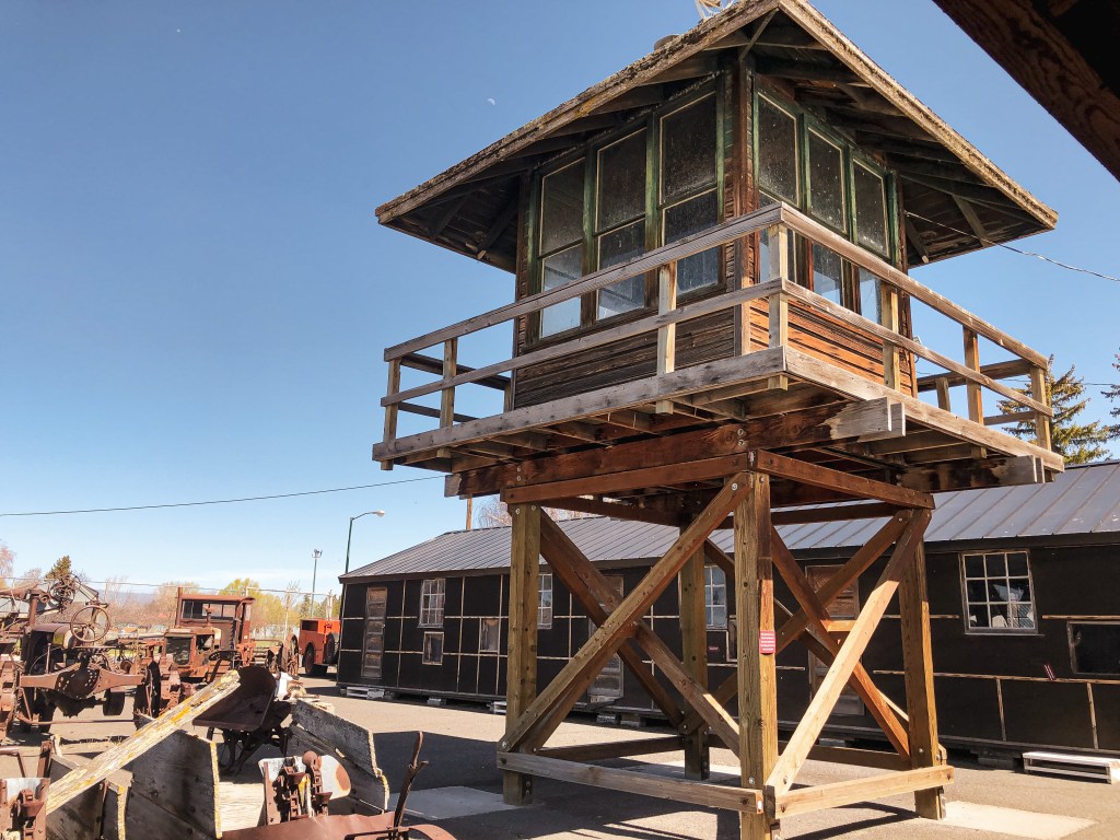
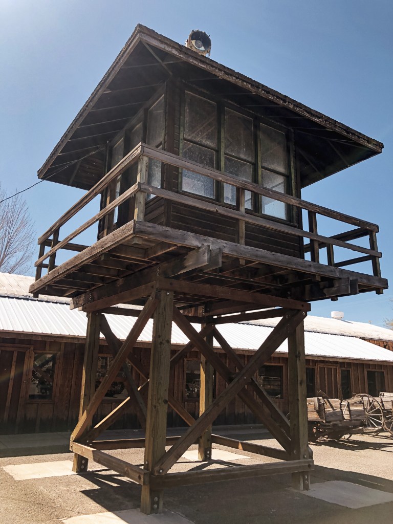
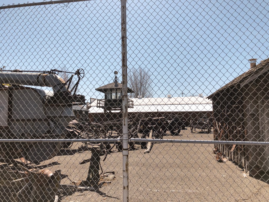
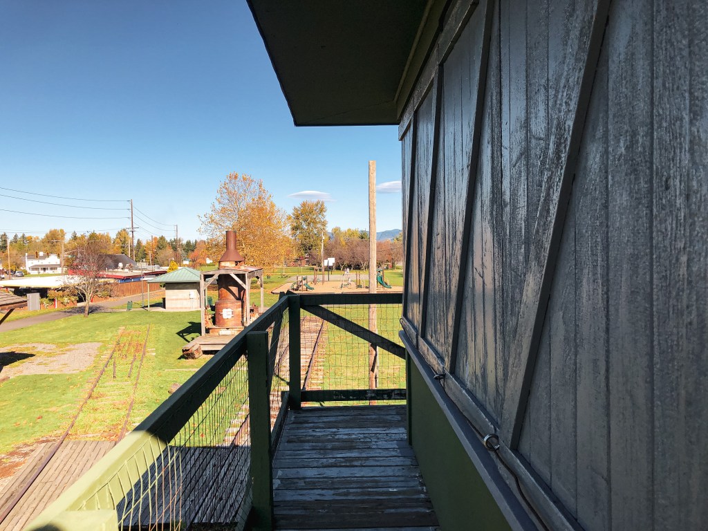
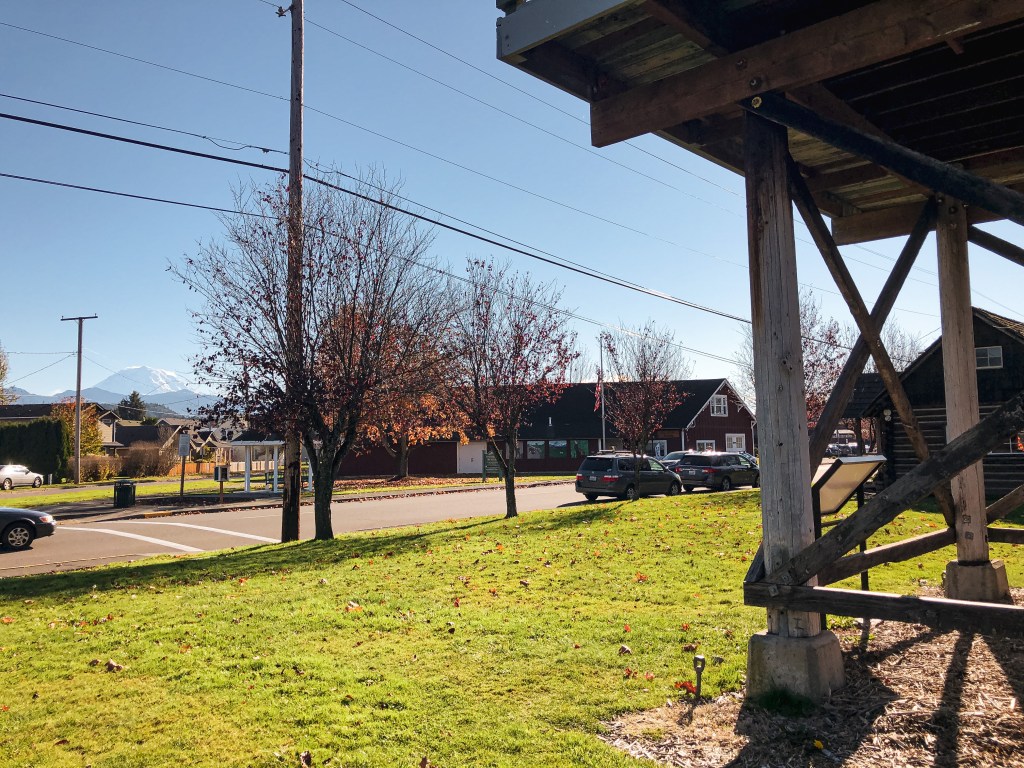
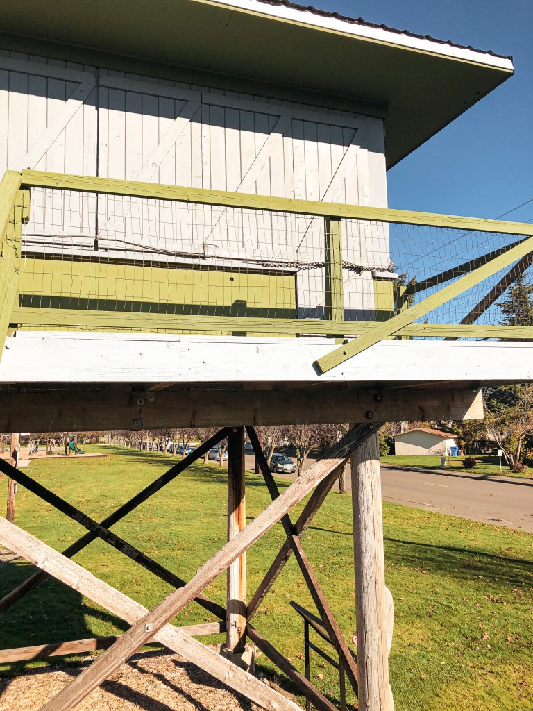
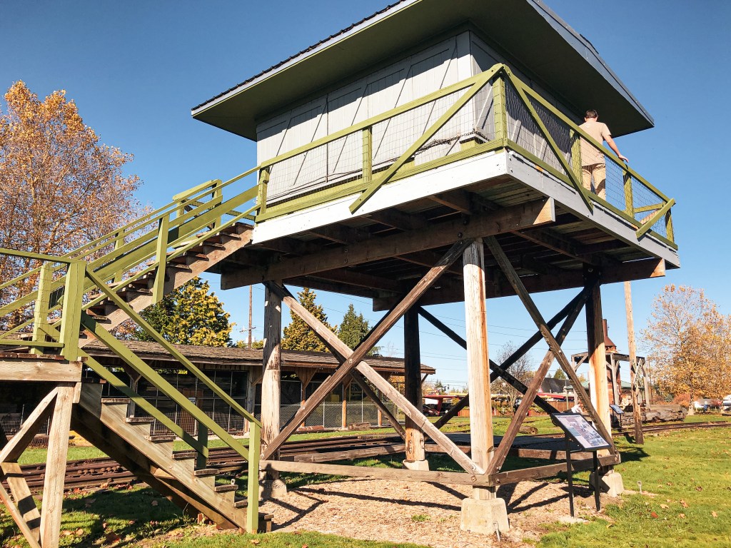
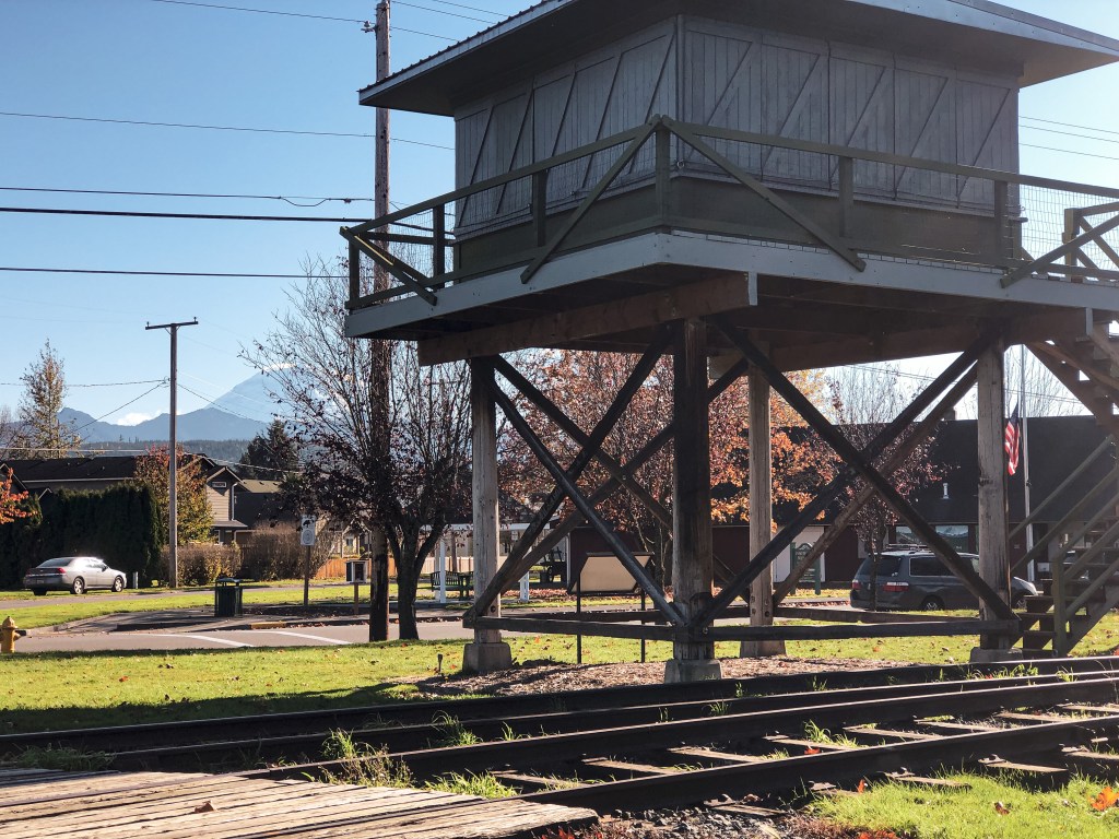
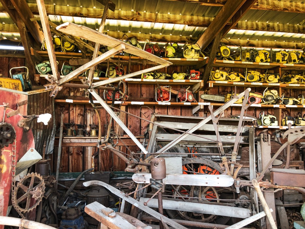
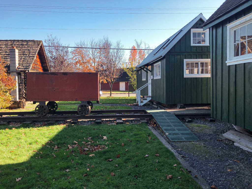
My partner and I decided to swing by the Foothills Historical Museum on our way home from visiting friends in Kirkland. It’s right off N River Avenue in the city of Buckley and easy to access. We parked on the street right across from Buckley Hall in front of the main museum building. The park that hosts these structures, Van Hoof Park, is across the street. You are welcome to climb the lookout tower and catwalk at anytime. The cab was shuttered and closed during our visit but I believe they open it during events and summer for visitors. The museum focuses on conservation of the history of Buckley and the surrounding Carbon River Corridor. The Foothills Historical Society that manages the museum is completely run by volunteers and financed through donations. Places like this are important for preservation and education. Please donate if you are able or visit their website to learn about getting involved!
History.
The Salmon River L.O. site was originally established in 1965 with a platform and trailer along Salmon River Ridge near Lake Quinault. In 1967, a 2-story live in cab was built on the summit and ran by the Washington Department of Natural Resources. It’s ownership was later transferred to the Quinault Nation after discovering it was built on their reservation land. They had believed it was just east of the boundary when the structure was originally built. In 2000, the Quinault Nation donated the structure to the Foothills Historical Society for preservation. The lookout was dismantled and then transported by pick up and flatbed trailers to its current location in Van Hoof Park. Volunteers and many locals helped rebuild the structure on a log tower with wooden steps instead of the original cinderblock.
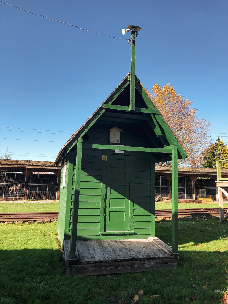
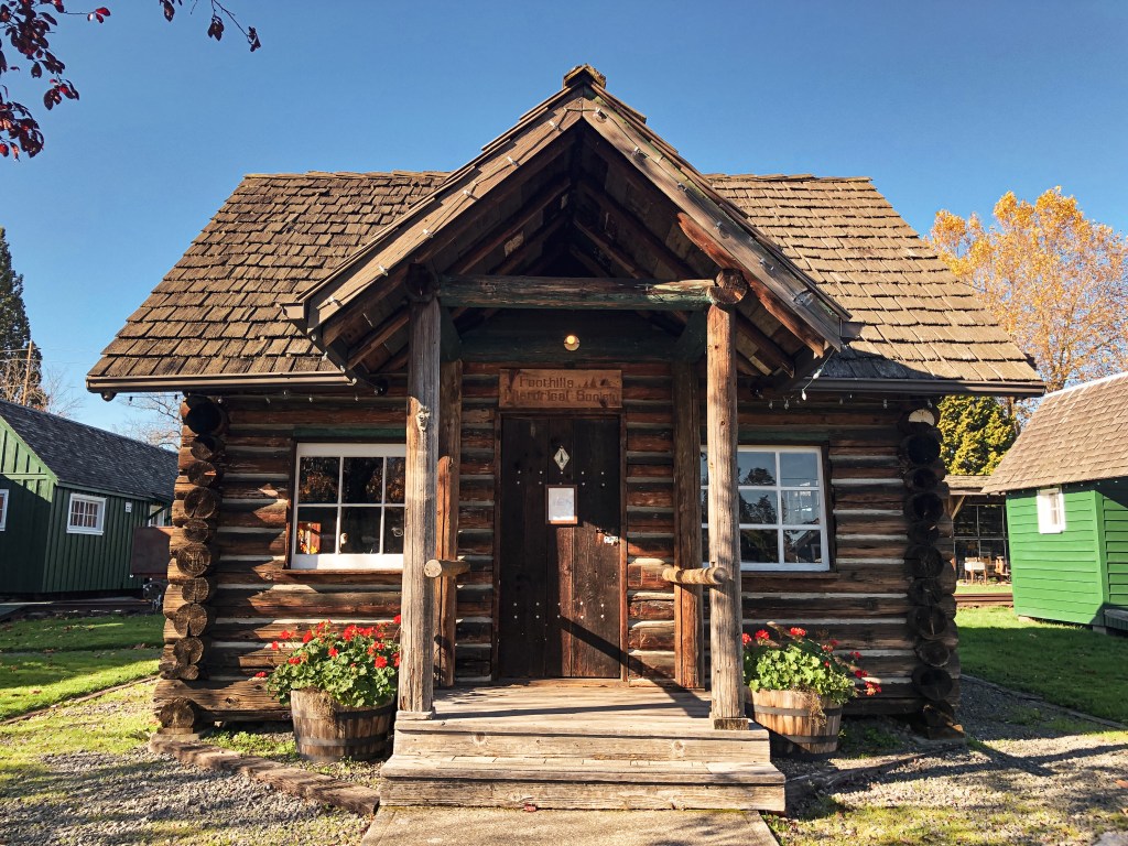
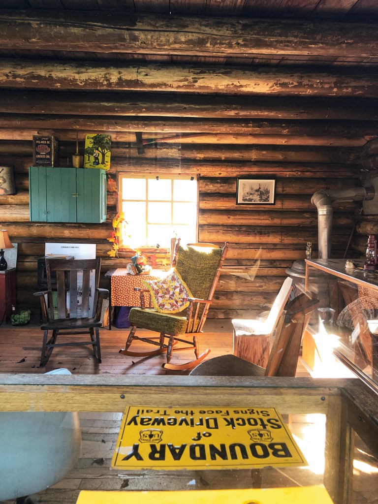
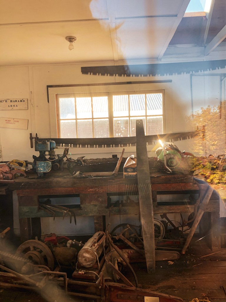
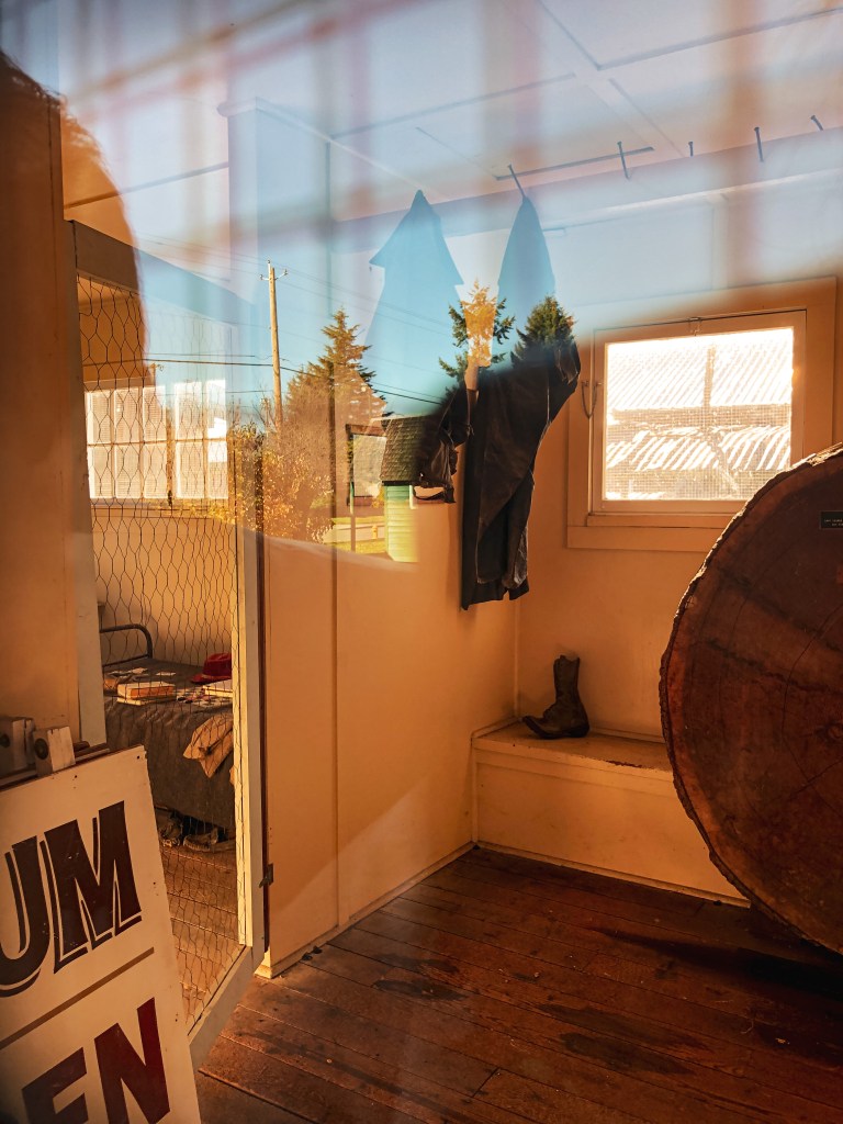
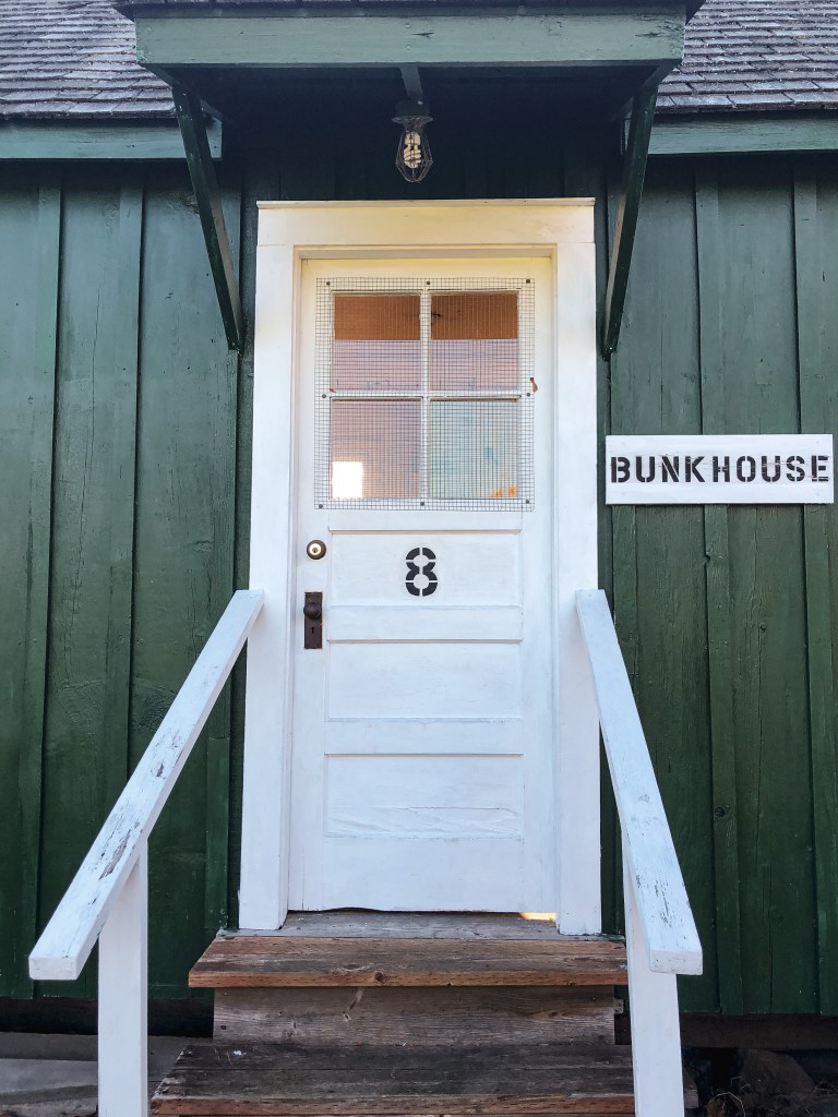
Next to the Salmon River L.O. is another observation structure that was built during World War II for aircraft spotting. It was originally located atop Huckleberry Mountain near Mule Springs. It was later used by fire patrols until it was moved to Buckley in 1991 by Southworth & Sons. Some other notable structures maintained on the property are a State Forest Ranger Cabin, 1870 Stiller Log Cabin, Lester Bunkhouse & Saw Shop, Blacksmith Shop, Steam Donkey, and Lester RR siding.