
Location.
Elliot State Forest
Status.
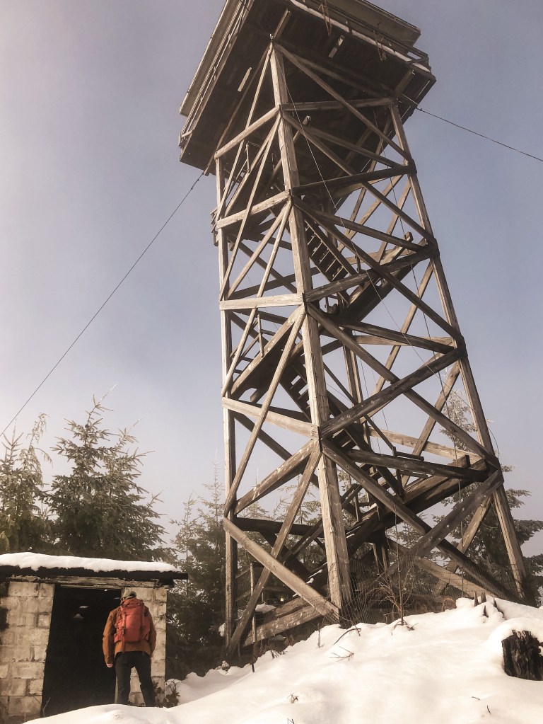
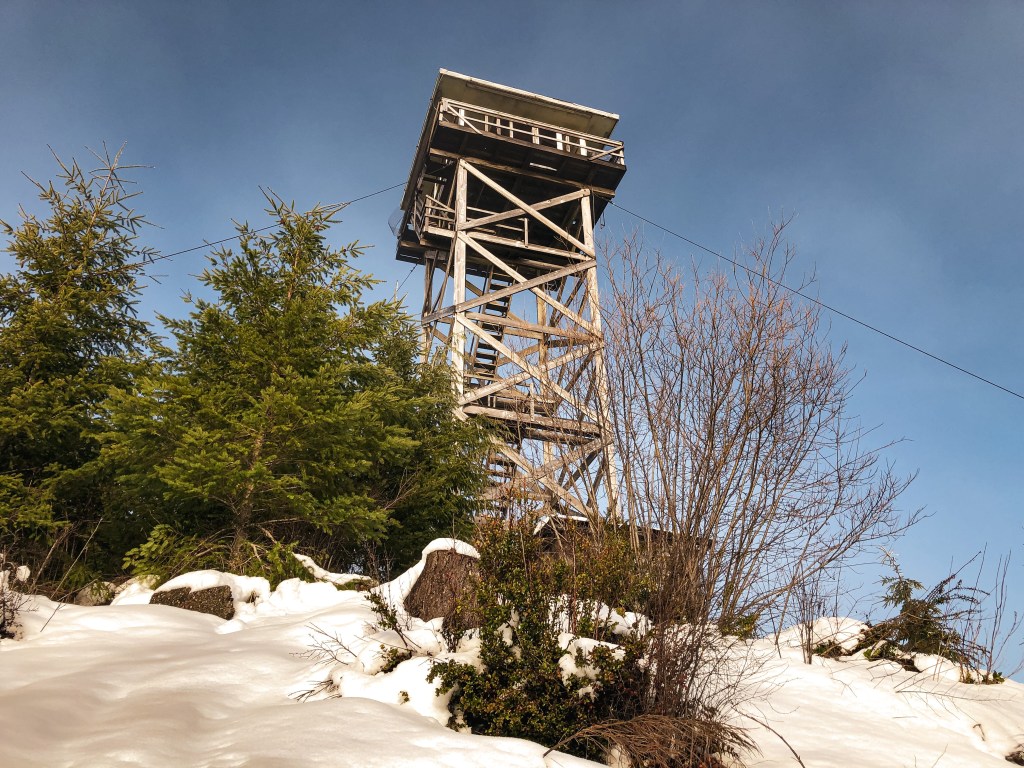
Abandoned; Currently standing
Estimated drive time from Portland, OR.
3-1/2 hours
Date visited.
January 1, 2022
Elevation.
1,750′
National Historic Lookout Register.
US 952; OR 124
Trip Report.
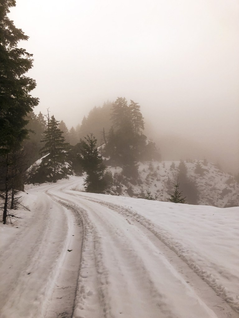
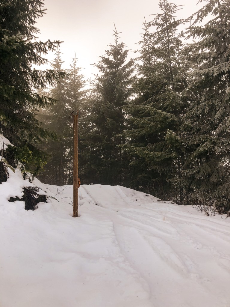
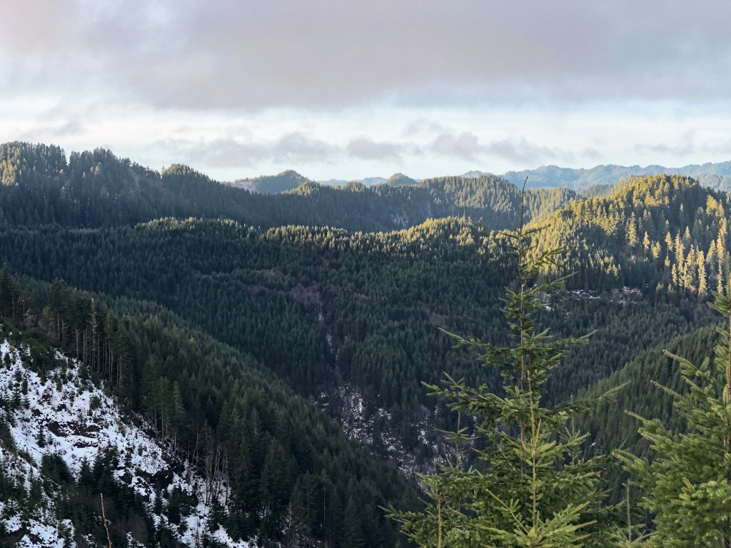
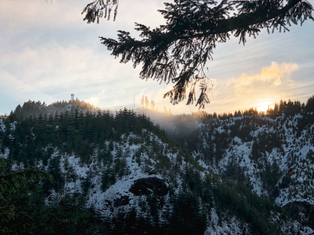
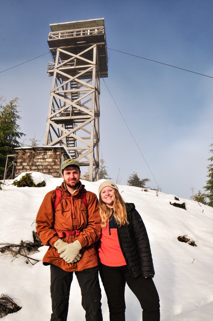
After an easy visit to Bunker Hill L.O. (post) the day before, we woke up ready for more of a challenge. We weren’t sure how the roads leading up to Cougar Pass would look, but figured we could get as close as possible and walk the remaining distance. We had been dealing with a state wide snow storm for the past week, so the chances of meeting snow here were high. Normally being just off the coast is a safe bet for no snow, but we never seem to be that lucky with our off season explorations. We headed east out of Reedsport on HWY-38 until we reached the turn off for Loon Lake Recreation Site. You will turn Right on to Loon Lake Road. The Loon Lake Recreation Site was already closed for the season but the road leading to Cougar Pass will be beforehand. The gravel road is noted as Cougar Pass Road on google maps but is actually state forest road 7700. There is a small yellow sign posted on one of the trees with this number. You will see the sign after you’ve started up the gravel road. There are no signs to notify you of the turn off from the main road. It is about 6 miles down Loon Lake Road and will be on the right hand side. We barely made it 1/2 mile up the road before we were met with some fallen trees and snow from the recent storm. We already planned on having to walk some of the road, so we were prepared. You will follow the main road until you reach a major T-junction with state forest road 7000. It was hard to find a detailed map of the Elliot State Forest. From what we had it seemed like the road to the lookout would be to the left of the junction. We walked a mile down this way but the only viable road headed steeply down. We retraced our steps and headed to the right instead. It was the first road after the junction and can be distinguished by the pole remaining from the old gate. From there it is only 1/4 of a mile to the lookout. You will reach another road junction before the summit, the lookout is to the left. The Elliot State Forest has taken steps to make this lookout harder to find by removing road signs and tank trapping the road in hopes to deter vandalism. We could tell it was a well trafficked area since there were tire tracks leading up the main roads the entire way even with a foot of snow on the road. We would have had an easier time finding the lookout if it had been a clearer day. We were in a fog cloud until we started to head back down the road to my car. As we were hiking out, we found you can see the lookout from the road. It was close to 6 miles round trip of road walking from where we parked, if you don’t include the additional 2 miles in the wrong direction.


History.
The first fire lookout was built on Cougar Pass summit in 1935 as a 40′ wooden tower and was managed by the Coos Fire Patrol. This tower was replaced by a 50′ CT3 tower with 14×14 cab in 1966. It was actively used up until 1985. Cougar Pass L.O. is the last remaining lookout in the Elliot State Forest and, as far as I know, the only one still located in any Oregon state forest. It is currently managed by the Department of State Lands and is in a state of disrepair. There is a public proposal out to restore and reconstruct Cougar Pass L.O. as an educational opportunity for the Southwestern Oregon Community College and general visitors. This proposal would not only preserve the history of this lookout but help to educate on the forestry management utilized in the Pacific Northwest during the period of 1910 to 1969.

More Information.
