In the prime of fire suppression, Oregon had over 800 fire lookouts and Washington had around 750 topped on almost every high peak within both states. Many were dismantled, destroyed, or burned down in a blaze of glory. But remains of the foundation can usually be found on the summits as a reminder to what once stood. Below lists 3 popular hikes close to Portland, OR that have a history in fire detection and lookouts.
Saddle Mountain
Former Fire Lookout Site Register: US 723; OR 134
Location.
Saddle Mountain State Natural Area
Estimated drive time from Portland, OR.
1-1/2 hours
Mileage.
5.2 miles RT
Elevation.
3,283′

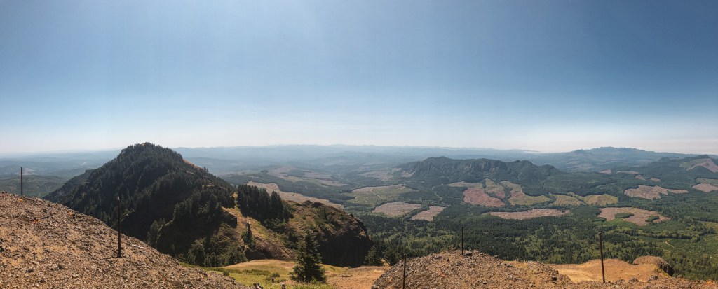
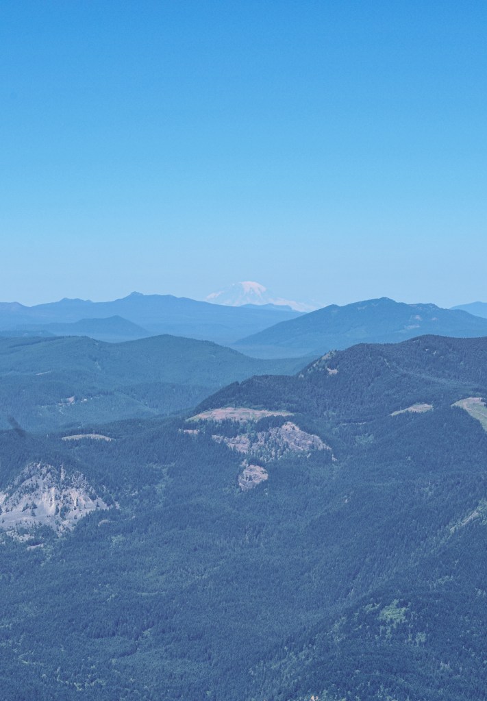
The top of Saddle Mountain offers expansive views from the Pacific Ocean all the way to Mt Hood. It is no question why they would want to have a lookout on this summit. The trail switchbacks through an old growth forest until you reach the last push up the rocky slope. Parts of the trail are covered in mesh wiring to help with erosion and traction. It is a steep 1,640′ gain in elevation over 2.5 miles to the summit. Saddle Mountain was established as a fire camp in 1913 with a log cabin situated below the summit. In 1920, a frame cabin with observation platform was built. It was replaced in 1953 by a 2-story live-in cabin. The lookout structure was destroyed in 1966. I have been on this summit a few different times but didn’t take the time to look for any remnants of foundation.

More Information.
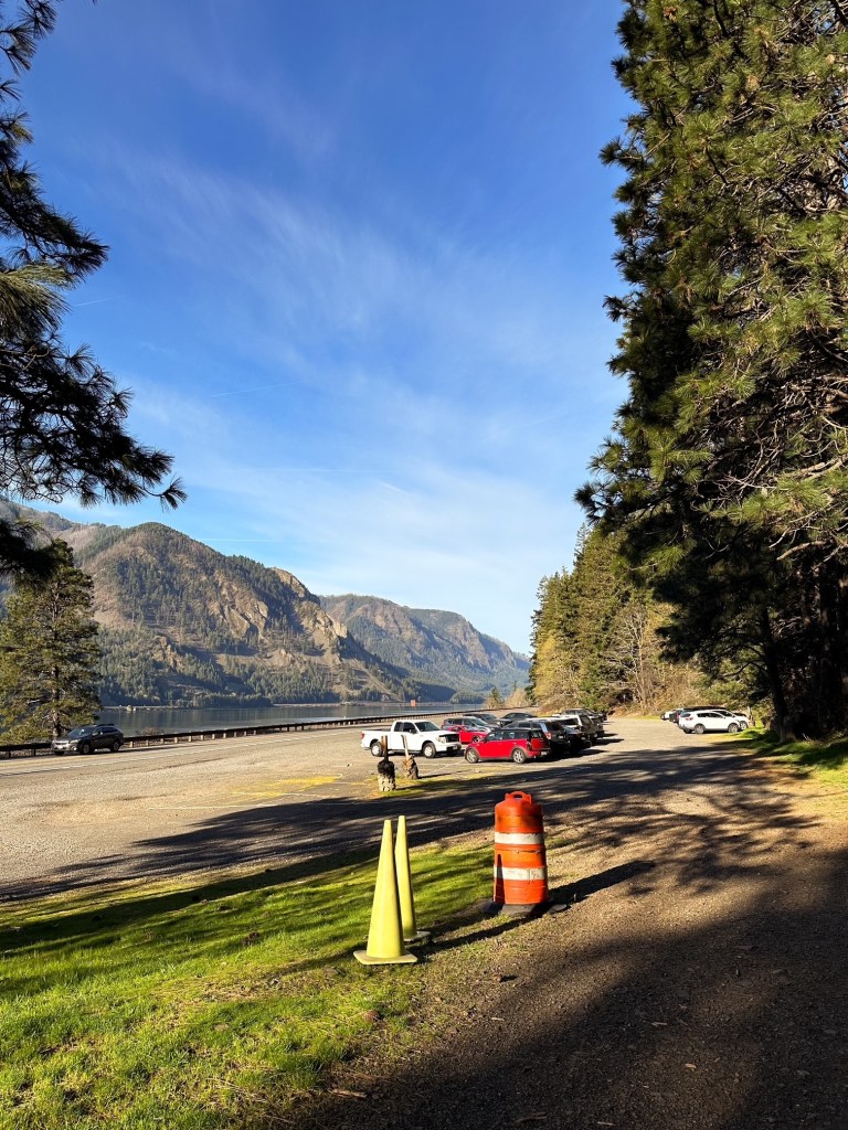
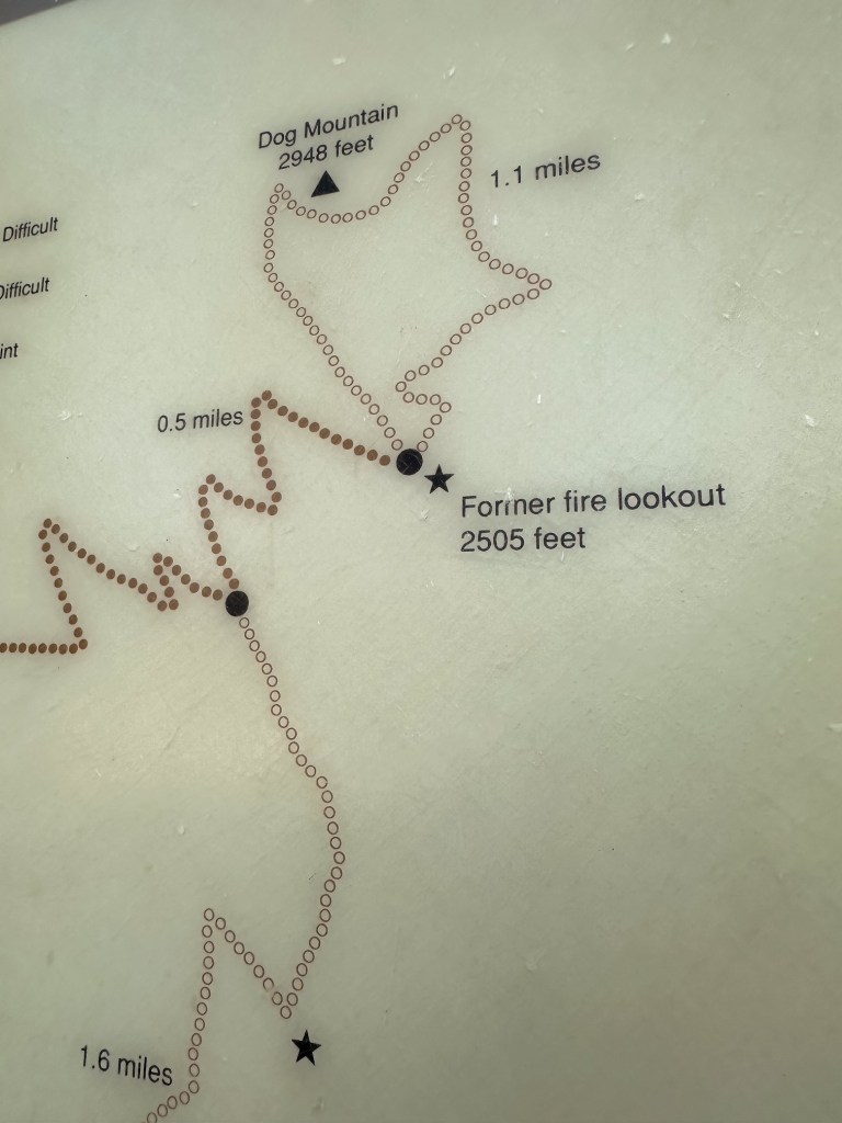
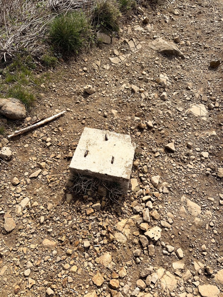
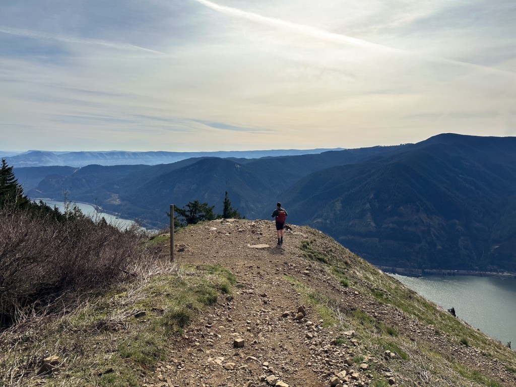
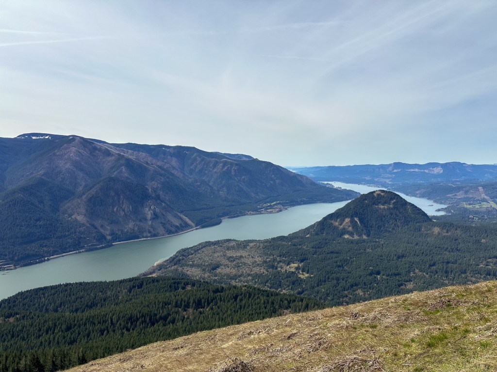
Dog Mountain
Former Fire Lookout Site Register: US 1313; WA 213
Location.
Gifford Pinchot National Forest – Columbia River Gorge
Estimated drive time from Portland, OR.
1-1/2 hours
Mileage.
6.5 miles RT
Elevation.
2,480′


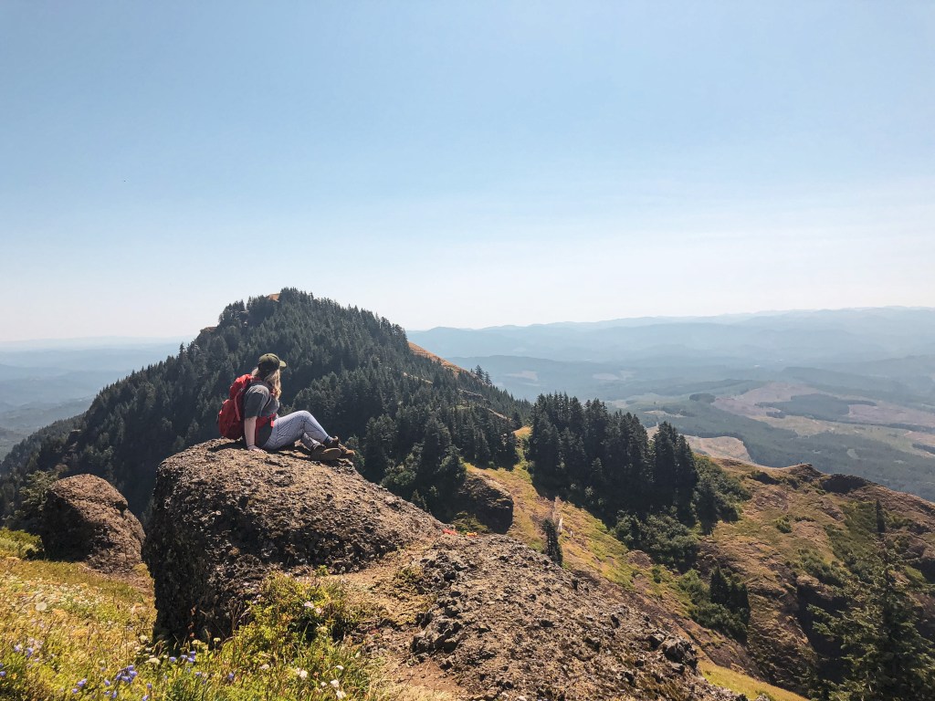
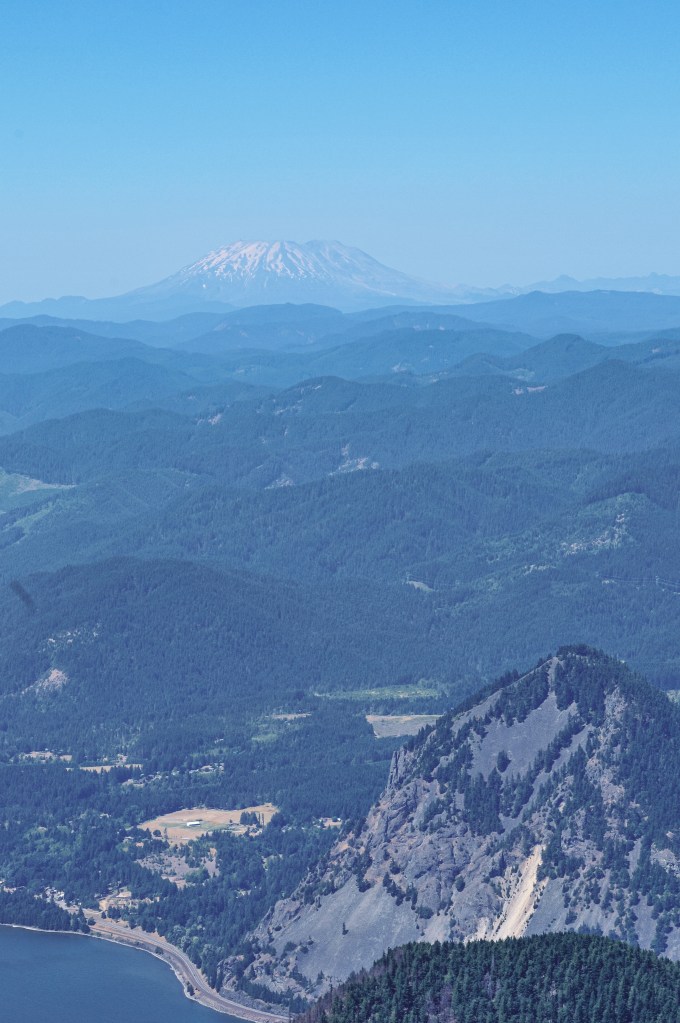
Dog Mountain is a very popular hike in the Columbia River Gorge due to its proximity to town and being right off of HWY-14. In the spring, between March 31st and July 1st, permits are required to hike this trail on the weekends. This is due to the hazardous conditions created for the cars on the highway by the overflow of people during wildflower season. There are a few different routes and loops that can be done to reach the summit once at the trailhead. My friend and I completed this hike on a hot July day before the permit system was in place. We arrived to the trailhead early to give us enough time to reach the summit and attempt to beat the crowds. We took the “less difficult” route which is the newer trail and offers more views on your steep climb up. We made it just past the former fire lookout site, also known as the Puppy Dog Lookout site, before turning around. I vaguely remember there still being some foundation there. The trail originally was developed to service this fire lookout that was destroyed in 1967. The original lookout was constructed in 1931 as a gable-roofed L-4 cab with windows only on three sides. It was replaced in 1953 by a standard L-4 cab. Both structures were located 1/4 mile from the actual summit of Dog Mountain. I used to have more pictures from this hike, even one of us standing on the former lookout site, but they have been lost in multiple phone transitions since 2017.
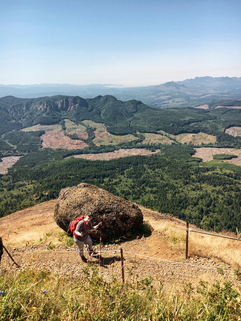
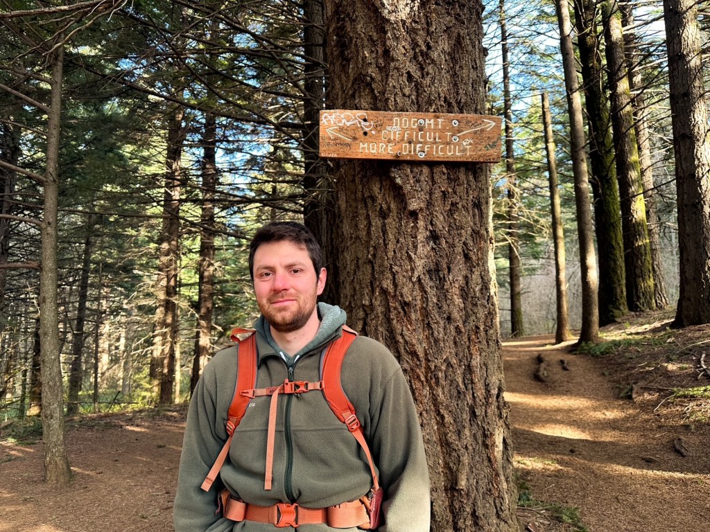
Update 03/22/2026: I finally decided to make a return trip to Dog Mountain with my partner who had never been. We went prior to the permit season, which helped curb the crowds and offered better temperatures than my previous visit in July. The hike was still a butt burner, but not as difficult as I remembered it. We opted to take the “more difficult” (most difficult) side up and come down the “difficult” (more difficult) side, depending on which sign you are referencing. I also made it to the official summit this time instead of just below it and looped around the back side as well. Aside from the summit it felt like we had the trail mostly to ourselves and only passed a handful of people despite a mostly full parking lot. My knees were definitely sore afterwards! Strava calculated this at 6.57 miles RT with 3,047′ of elevation gain.

More Information.
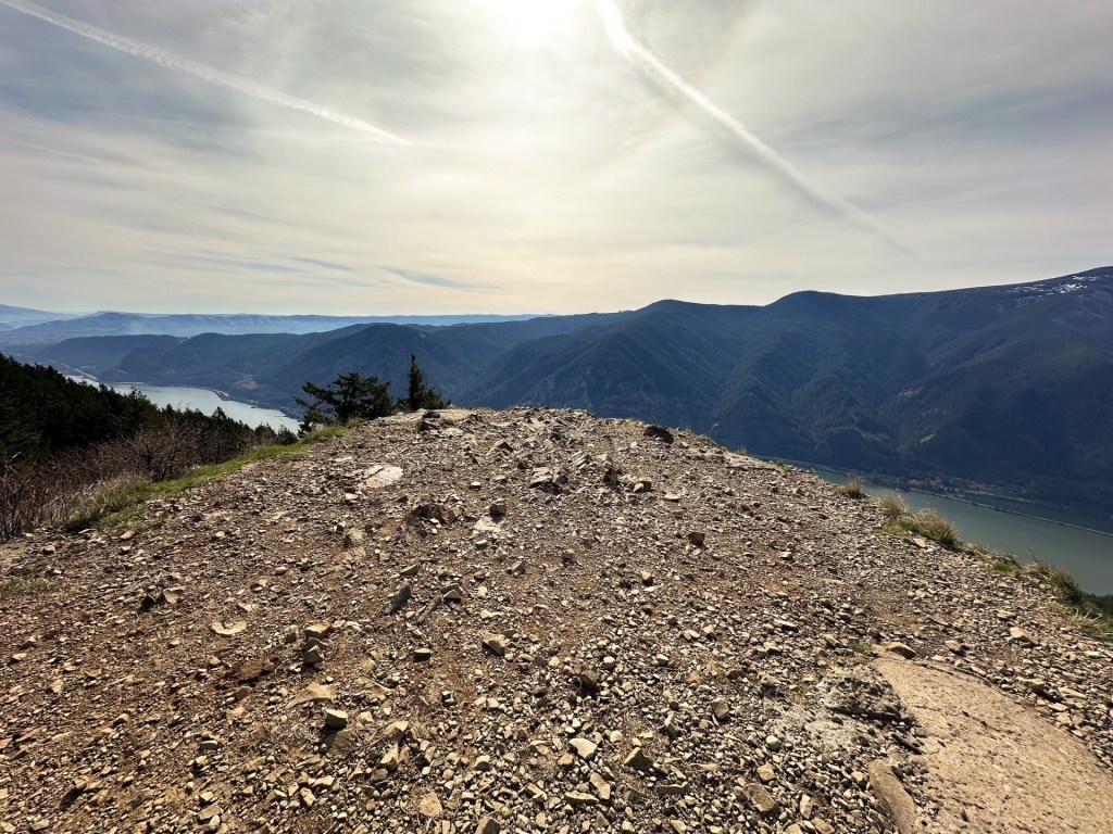
Mt. Defiance
Former Fire Lookout Site Register: US 585; OR 26
Location.
Mt Hood National Forest – Columbia River Gorge
Estimated drive time from Portland, OR.
1 hour
Mileage.
12.5 miles RT
Elevation.
4,960′


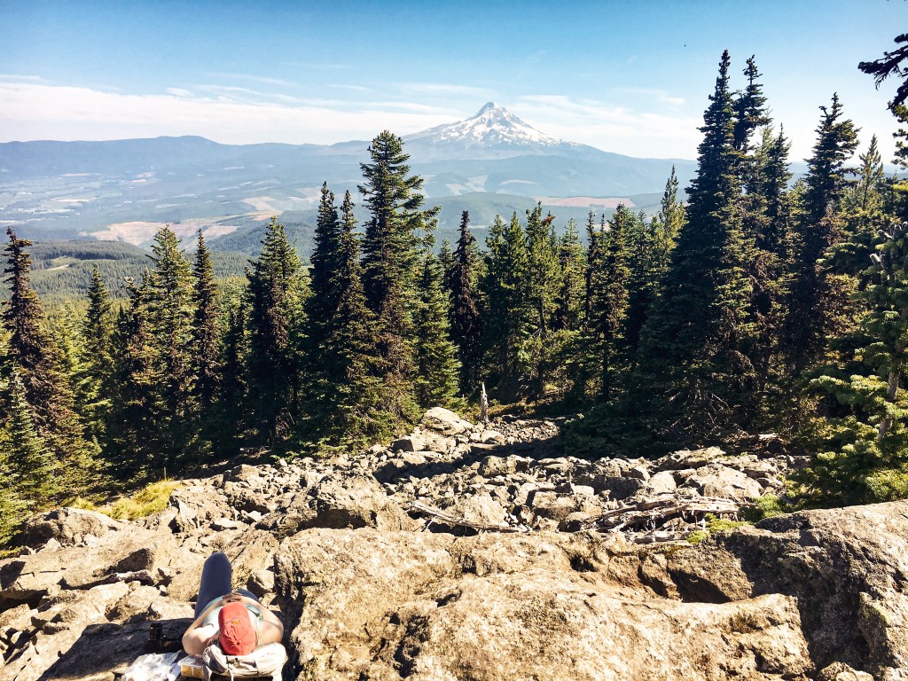
Mt. Defiance is one of the more brutal hikes I’ve done. It is the highest peak in the Columbia River Gorge and offers views out towards Mt Hood NF as well. This made it the perfect candidate for a fire lookout site. I recommend starting this hike early if you want to make it to the summit and back before dark. Or at least hike a lot faster than I do. We didn’t start this hike until mid-morning and ended up getting back to the car after dark. The hike starts out paved and passes some pretty waterfalls. Once you have reached the junction with the un-paved trail you will start to go up and continue to go up the rest of the way. There are still some communication buildings on the summit and I’m sure there are foundation remnants if you spend some time looking for them. We didn’t spend much time here since it took me so long to get there. The trail had recently re-opened after the Eagle Creek Fire in 2017. The ashy portions of the trail made for un-stable ground and was hard for me on the hike down. By the time I got back to the car my feet felt like they were going to fall off completely. The first fire lookout on this site was a crow’s nest and tent in 1925. A more substantial structure was built in 1934 as a 40′ pole tower with L-4 cab. This was eventually replaced by a 41′ treated timber tower with L-4 cab in 1952. In 1959, the lookout was destroyed by a windstorm. The Forest Service didn’t build a replacement lookout until 1962 which was a R-6 flat top cab and 41′ treated timber tower. It was completely removed from the summit in 1971.

More Information.

Puppy Dog on Dog Mountain was also the site of one of the first uses by the USFS of radio (rather single line telephone) for reporting fires.
LikeLike
Oh really? That’s a neat bit of information. Thank you for sharing!
LikeLike