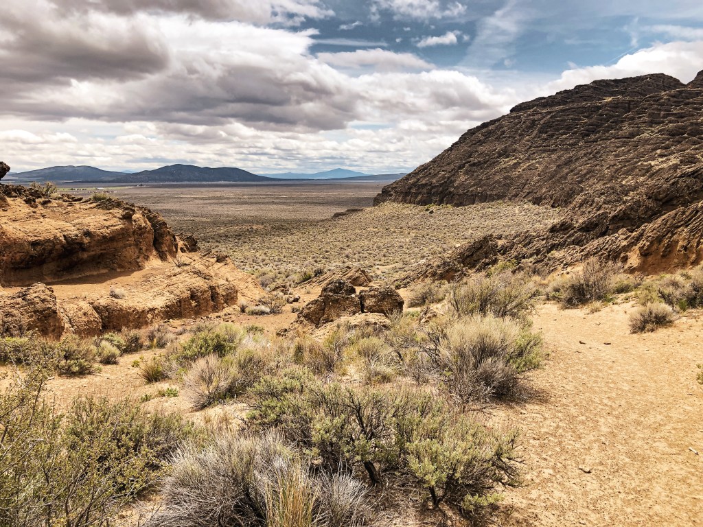
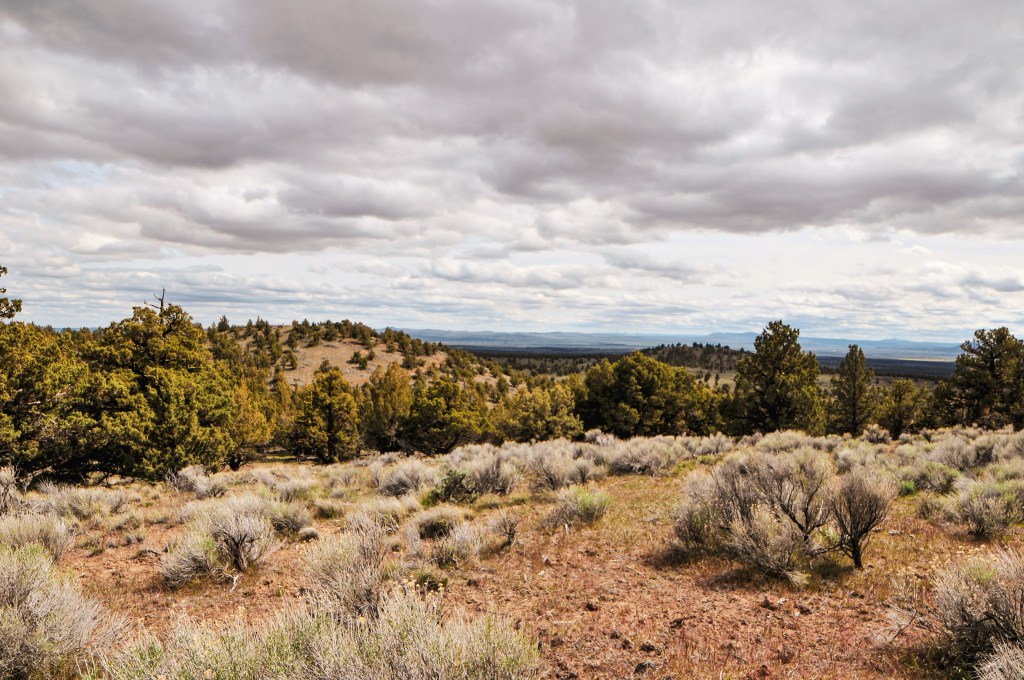
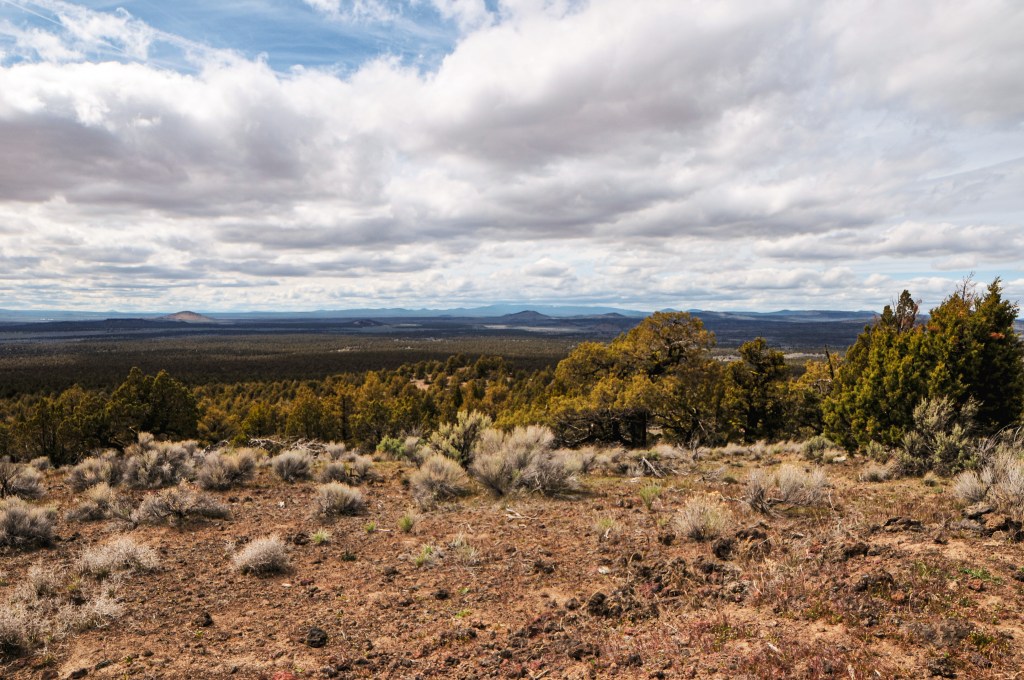
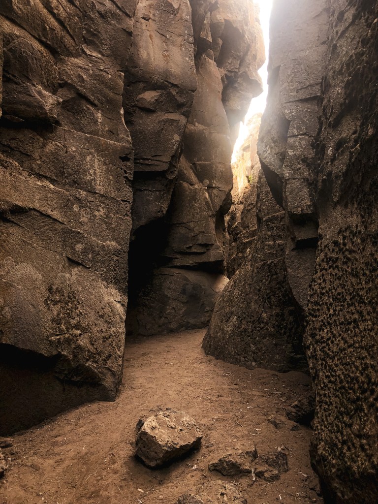
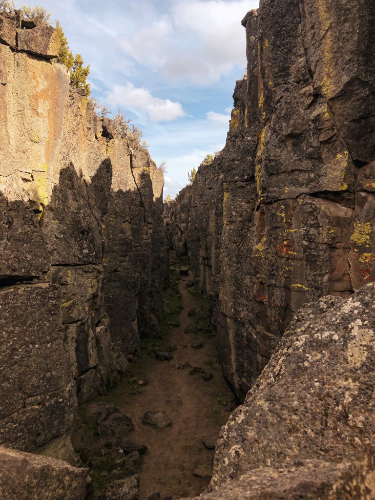
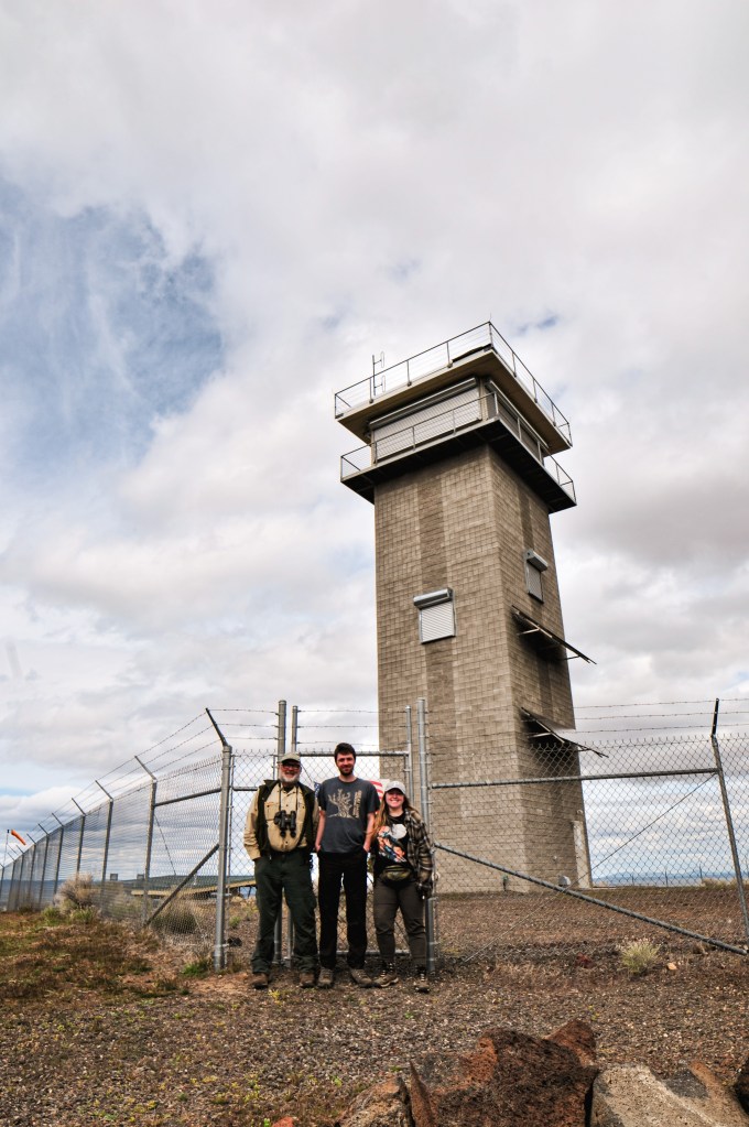
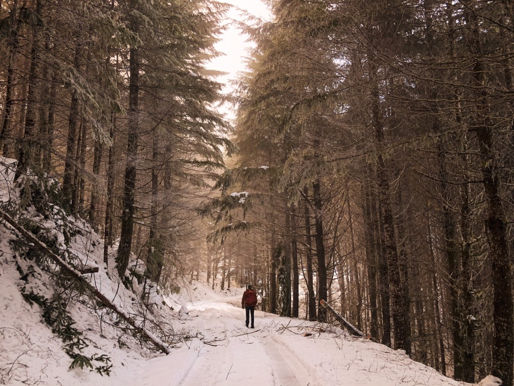
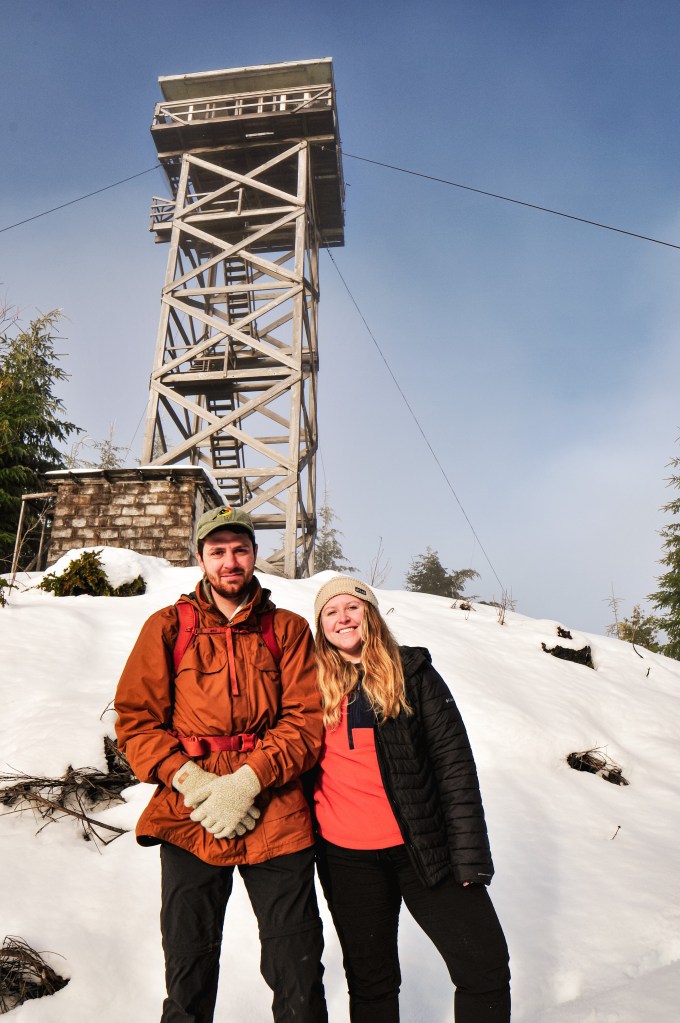
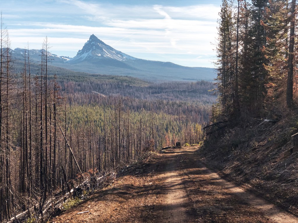
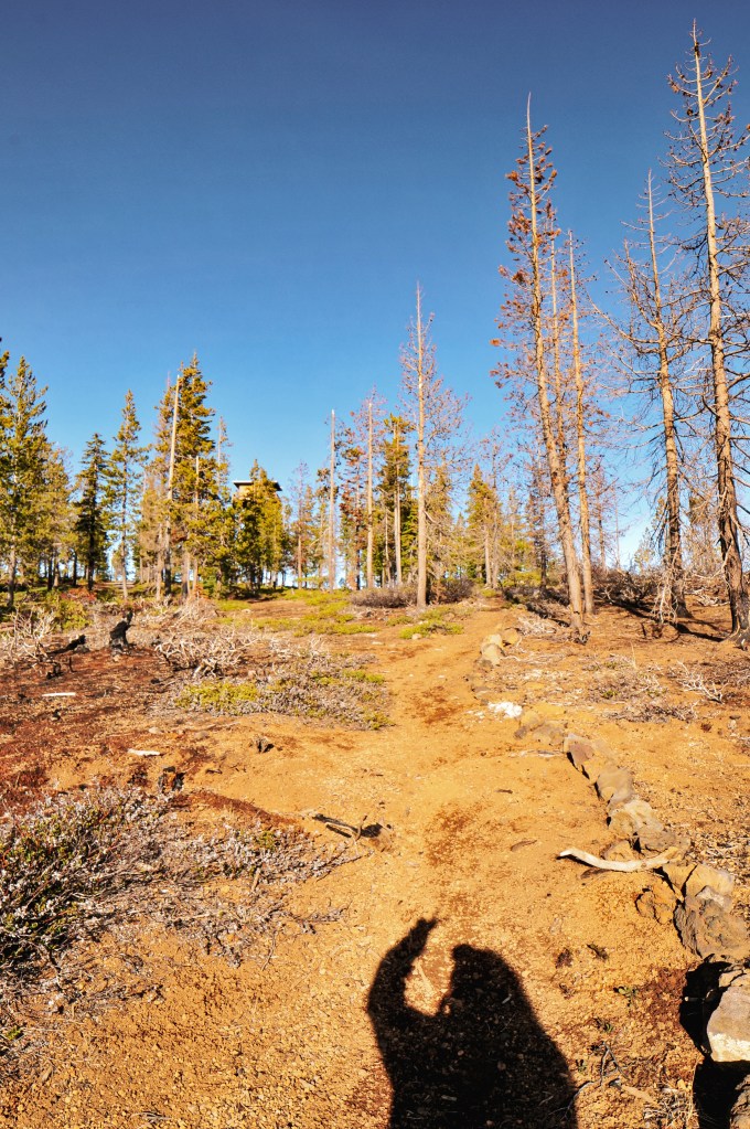
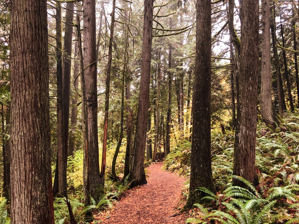
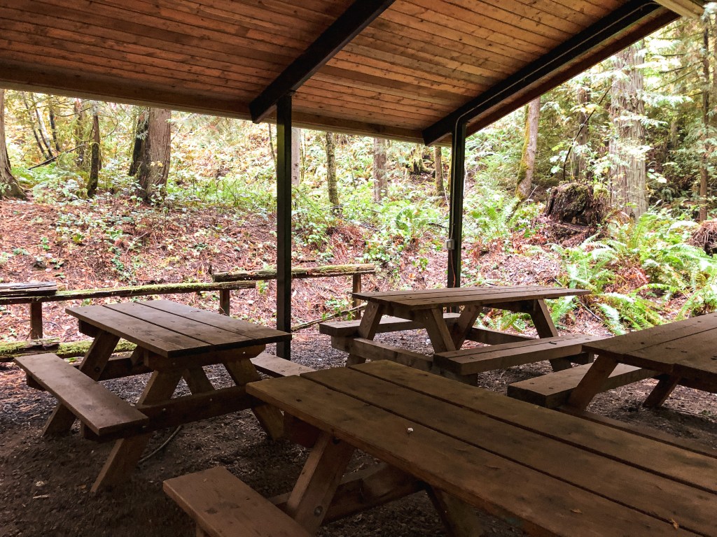
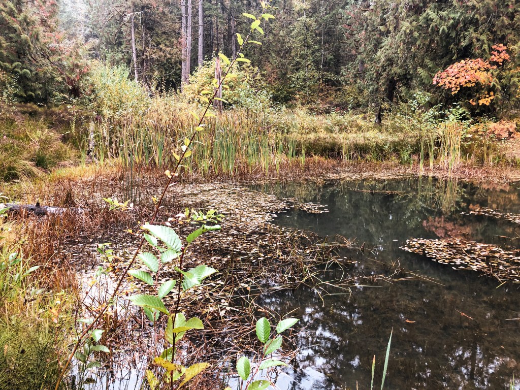
We woke up Saturday with a plan to make a day trip to Fort Rock, Green Mountain, and Crack in the Ground. We headed out of the Deschutes NF via NF-18 passing Cabin Lake Guard Station and made our first stop at the Fort Rock State Natural Area. This large semi-circle rock that now sits in Oregon’s high desert used to be an island in what was once a shallow sea. The oldest sandals dating back to 9,000-13,000 years old were discovered in this area. We hiked the short loop around the rock before moving on. We had to make an unexpected pit stop in Christmas Valley for gas and propane. For some reason our propane connection to our larger propane tank wasn’t working when we tried to make breakfast that morning. We had a half used disposable Coleman propane bottle that got the job done but it wouldn’t last us the remainder of the trip. We were relieved to find Christmas Valley was stocked with both despite one of the stores mentioning a supply shortage. Crisis averted. Just outside of Christmas Valley is a scenic byway aptly named Crack in the Ground Road that takes you directly to Green Mountain and Crack in the Ground. It is a rough and bumpy road but should be passable to most vehicles with caution. We drove past Crack in the Ground to Green Mountain Campground first. The small primitive campground is situated at the base of the lookout. From there it is only a few hundred feet up to the lookout. It was locked behind a barbed wire gate and still closed for the season. You still get a pretty good view from just the base. There were only a couple people camping in the campground, so we used one of the picnic tables for our lunch. On our way back out towards Christmas Valley we stopped at Crack in the Ground. This hike takes you through an old volcanic fissure that is roughly 2 miles long. We were running out of day again so we only went part way into the crack before heading back to camp.
History.
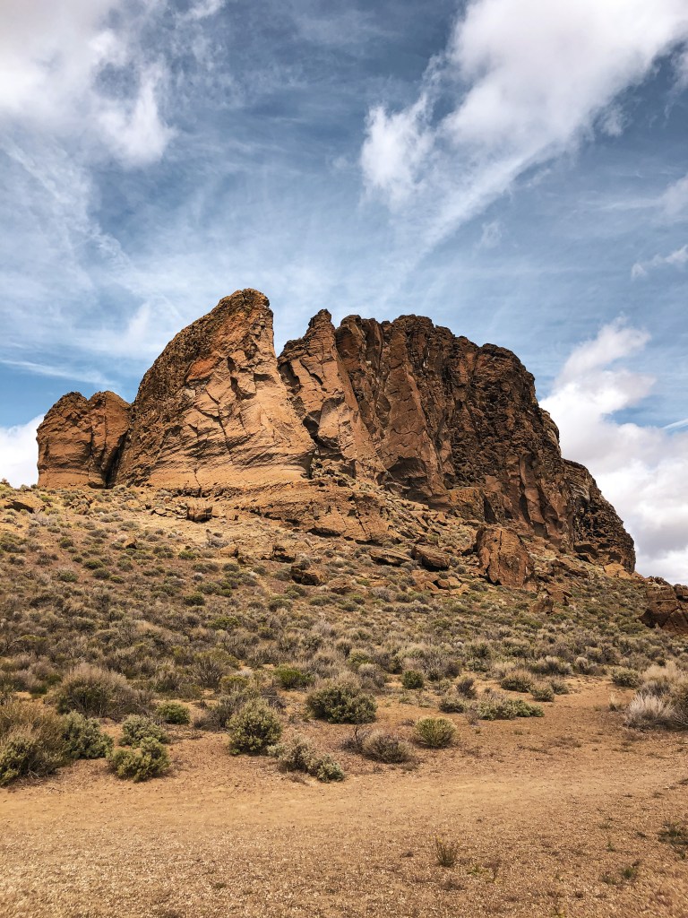
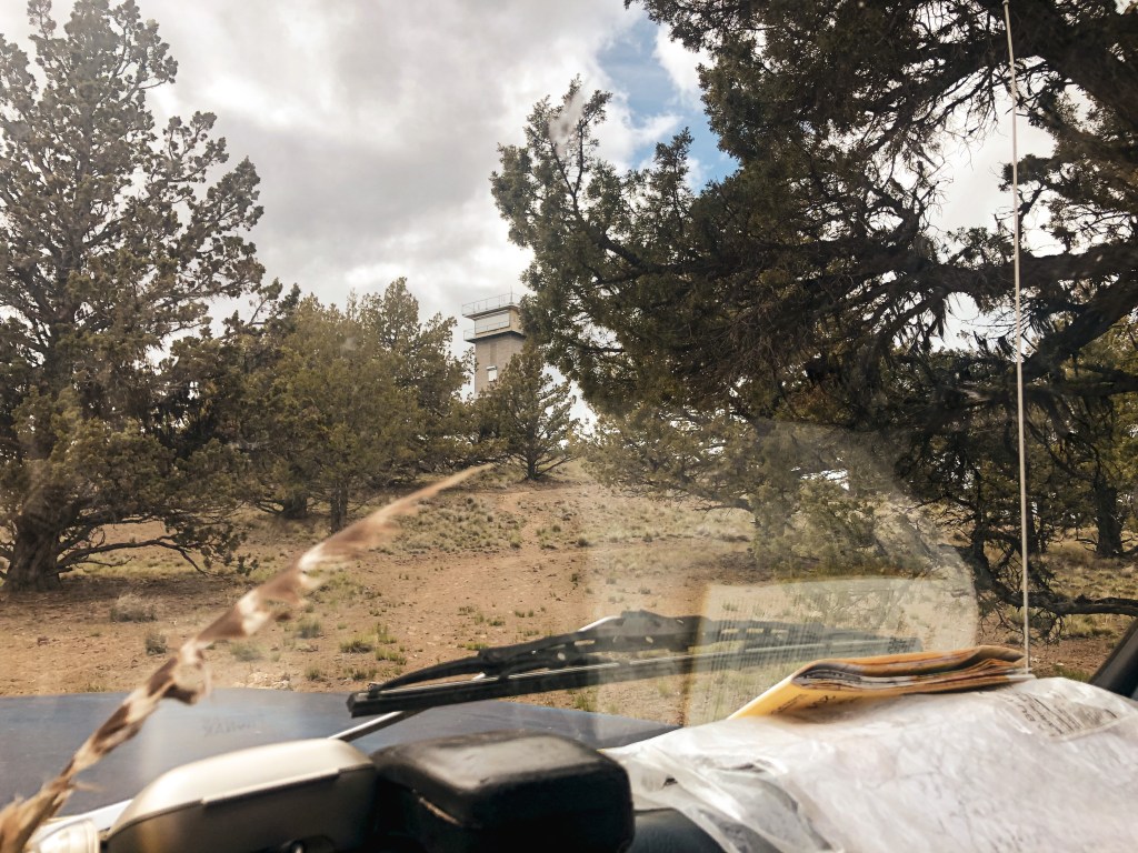
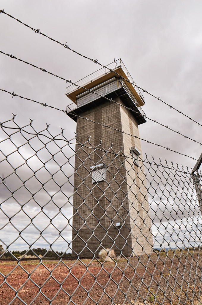
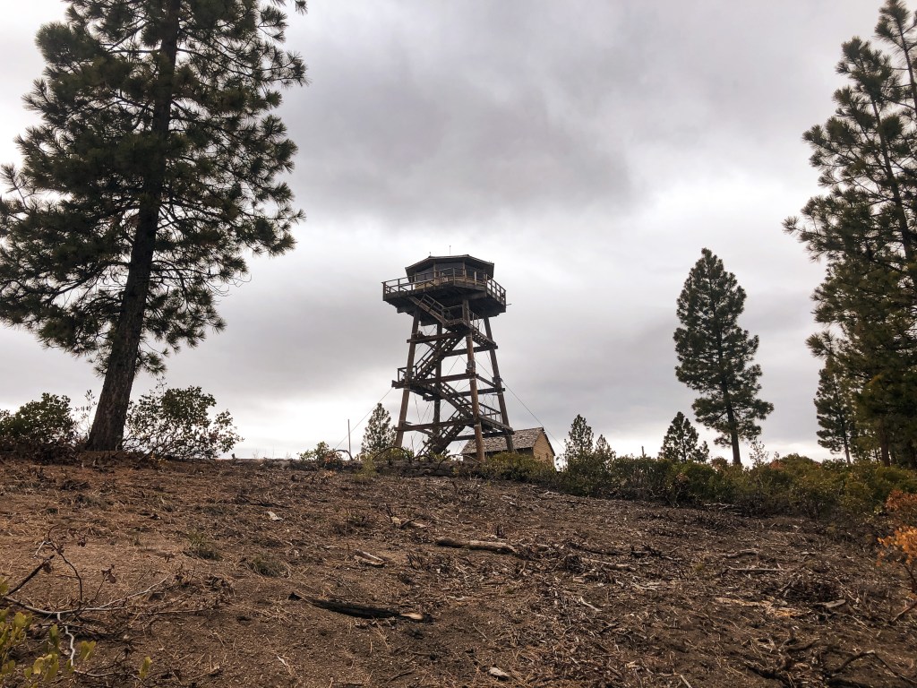
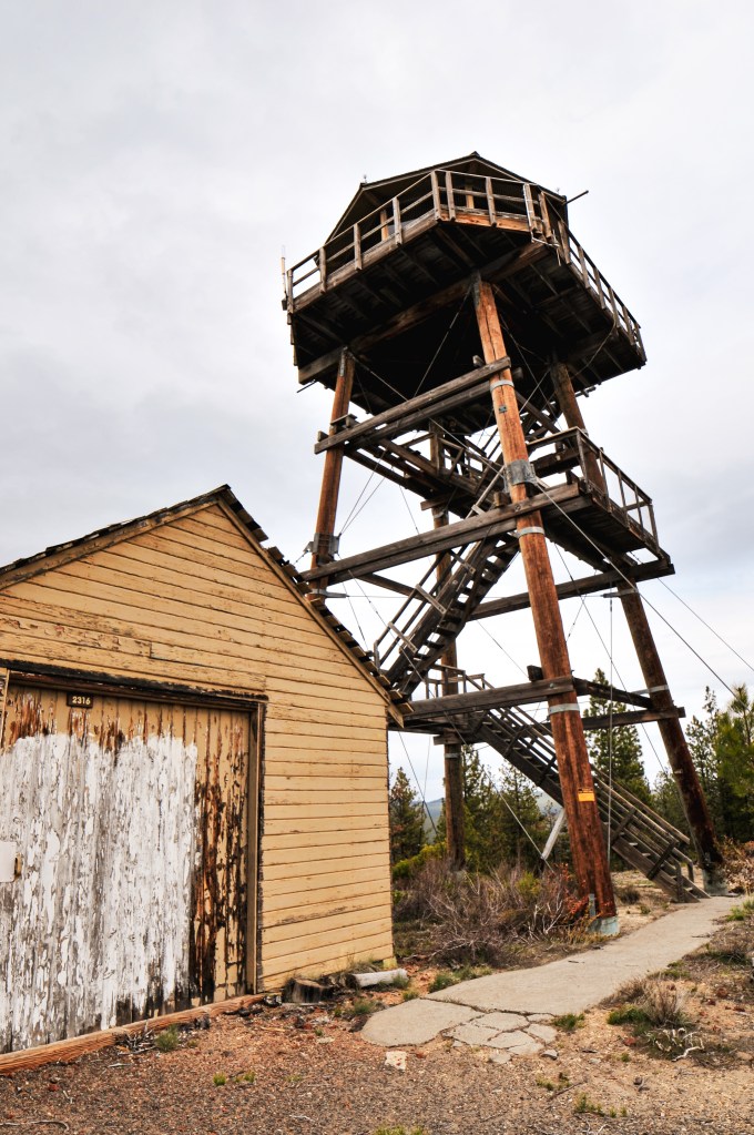
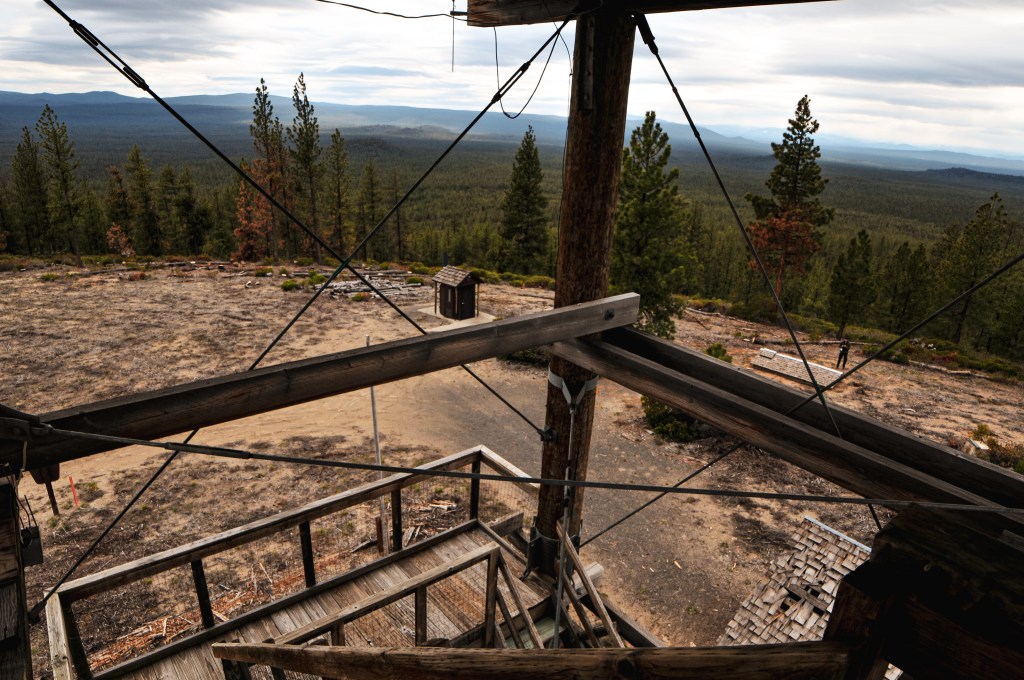
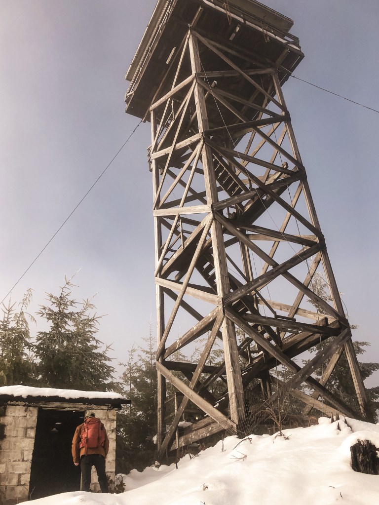
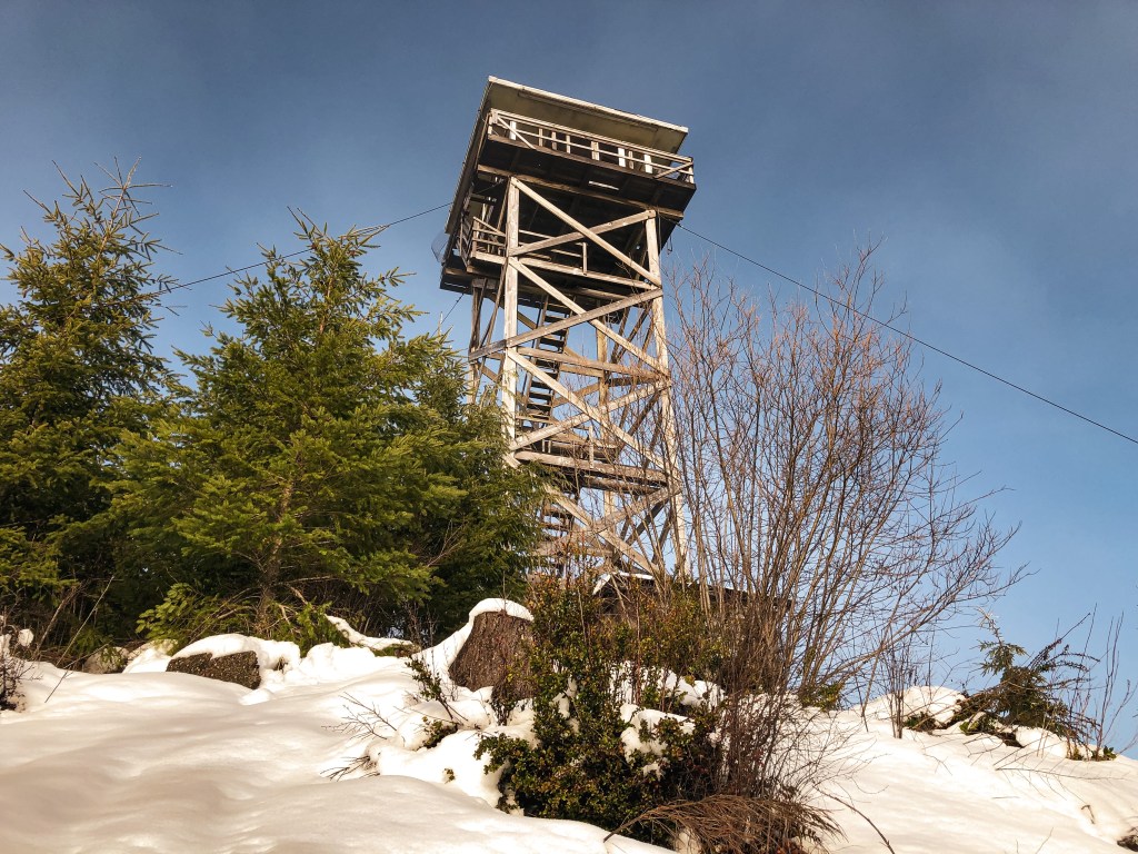
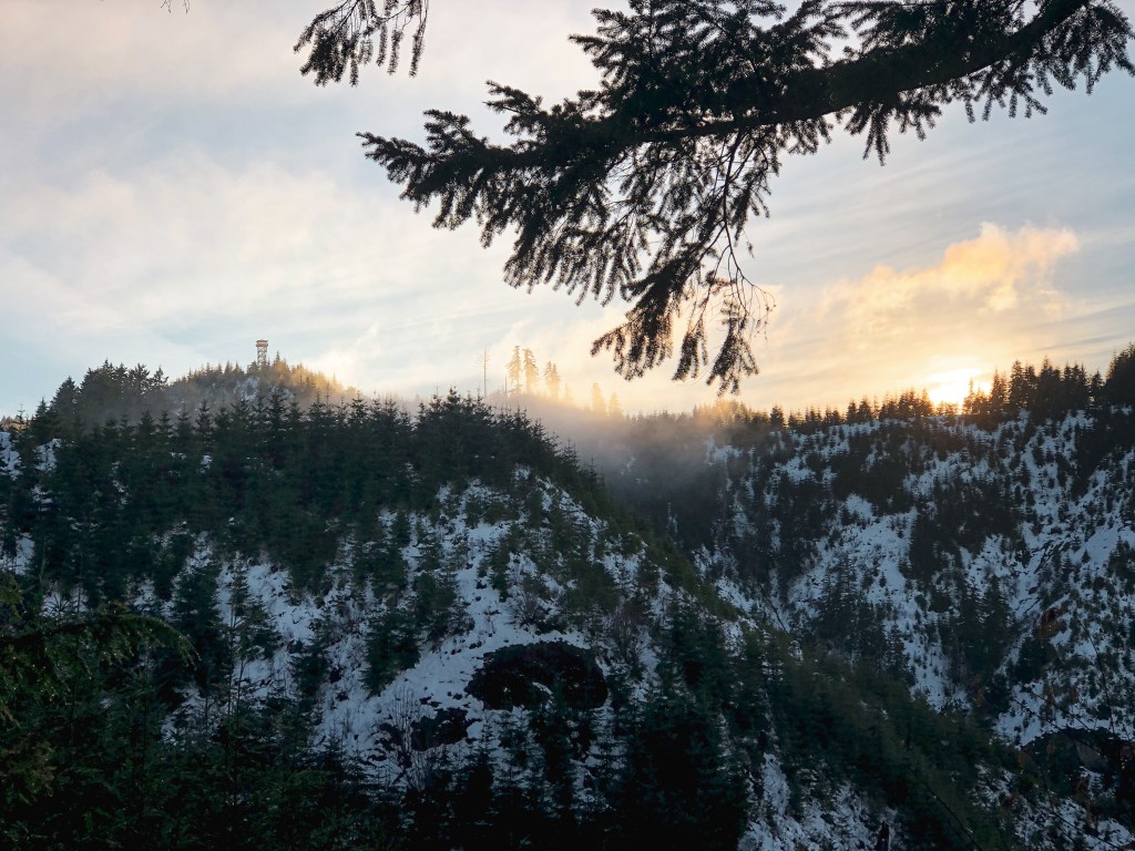
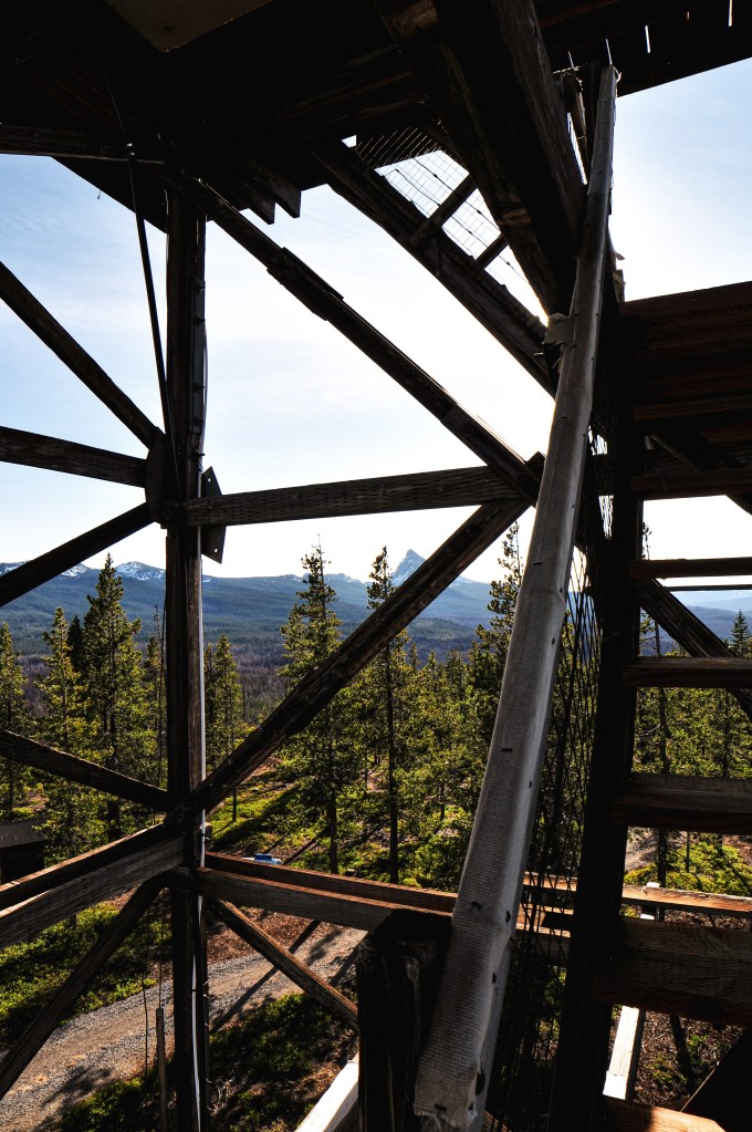
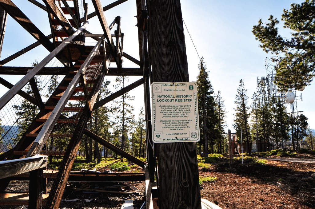
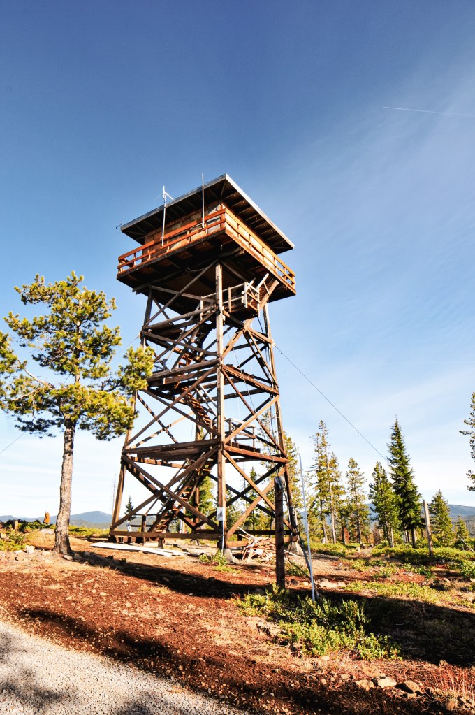
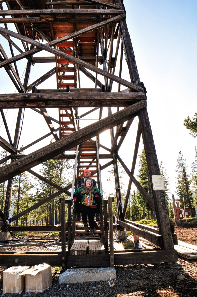
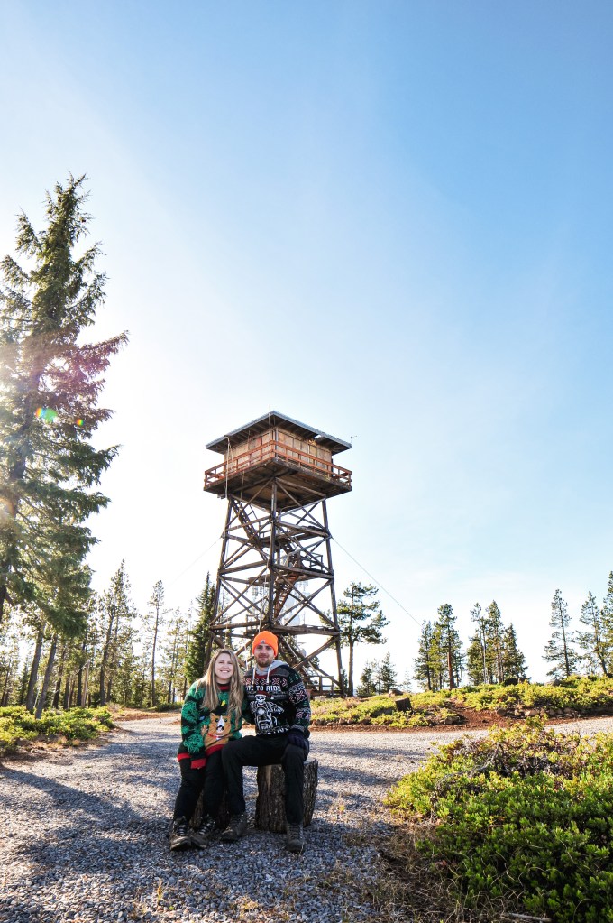
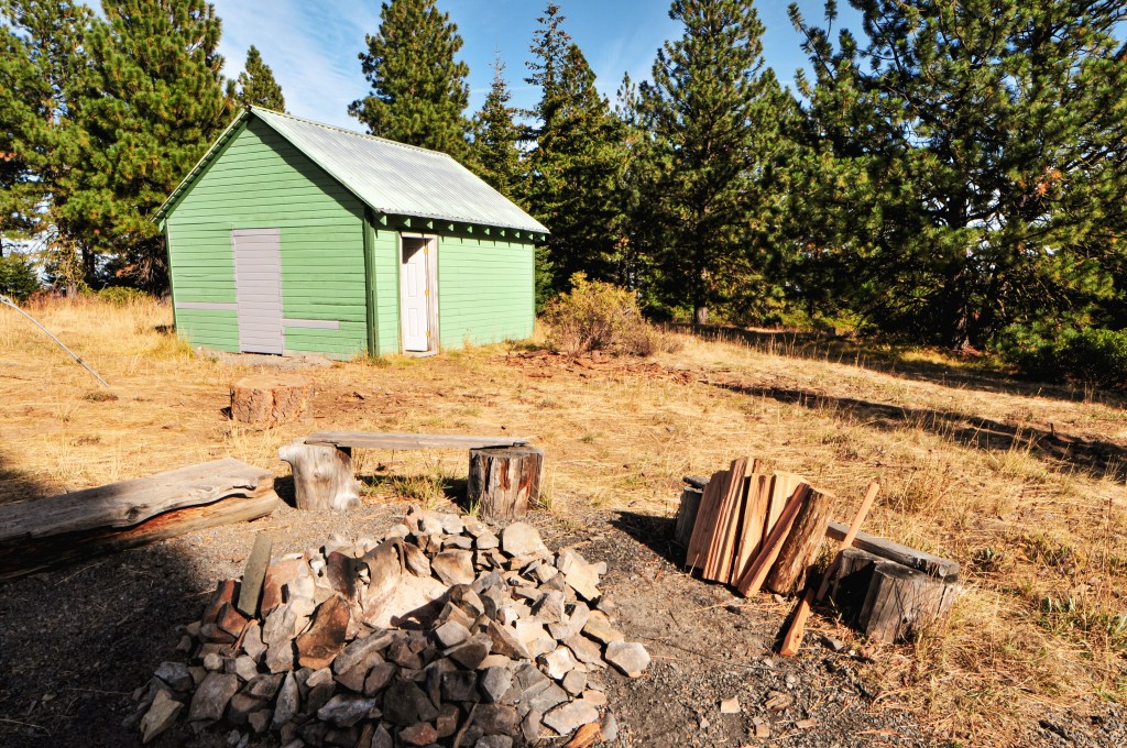
A fortress. A tower for a high-security prison. The tower that kept Rapunzel locked away. The current structure on Green Mountain hardly resembles what we would typically recognize as a fire lookout. The 50′ enclosed cinder block tower with observation cab was built in 2010. This lookout was funded by the American Recovery and Reinvestment Act of 2009. The recovery work consisted of demolishing the existing lookout, building the new lookout, and associated site work. The original 2-story lookout was built in 1963 with a 10′ concrete base and wooden live in cab.
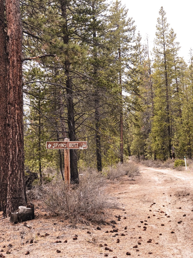
My partner had planned a 4-day camping trip to the Deschutes NF with his dad and myself to celebrate his birthday. We had an ambitious plan to see Spring Butte, Green Butte (post), Green Mountain (post), Pumice Springs, and Fox Butte (post) while in the area. This trip we had the luxury of taking his dad’s truck. Which meant what we didn’t have to worry about in road conditions were replaced with high gas prices and low gas mileage. We left Portland as early as possible to see if we could get to Spring Butte and Green Butte before setting up camp. Luckily, my partner and his dad had been to this area before and knew where there would be dispersed camp spots. This helped cut down on the travel time that we would normally have to allot to searching for a spot. The amount of Forest Service roads in this area are extensive and unmarked due to the OHV traffic. I strongly recommend having a ranger district map of the area if you plan to go down more than just the main roads. Never rely on GPS for navigation within the forest. We came upon a lost couple on our drive out of the forest on the last day of the trip that flagged us down to ask for help. They thought if they continued down the road long enough it would eventually turn to pavement and had ended up there due to their GPS. We warned them they were headed for more miles of gravel and should turn around since they were still close to the edge of the forest. Luckily, they took our word for it and followed us all the way out to La Pine.
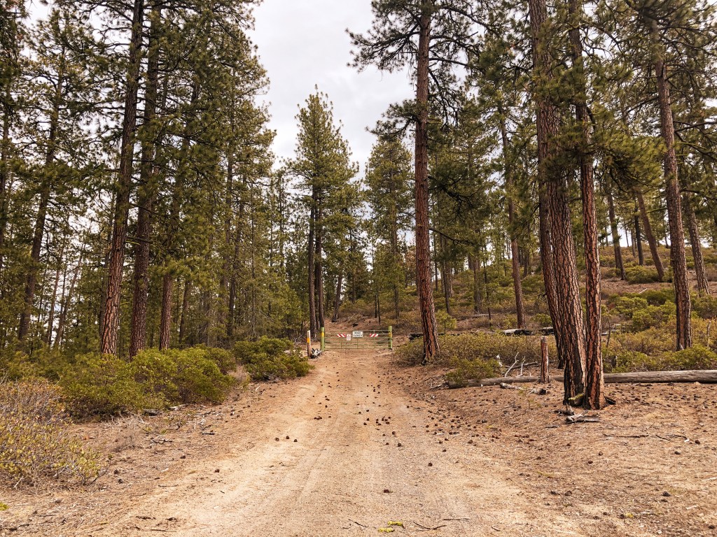
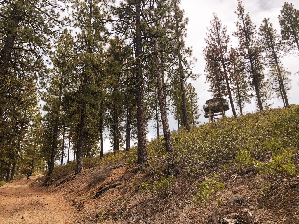
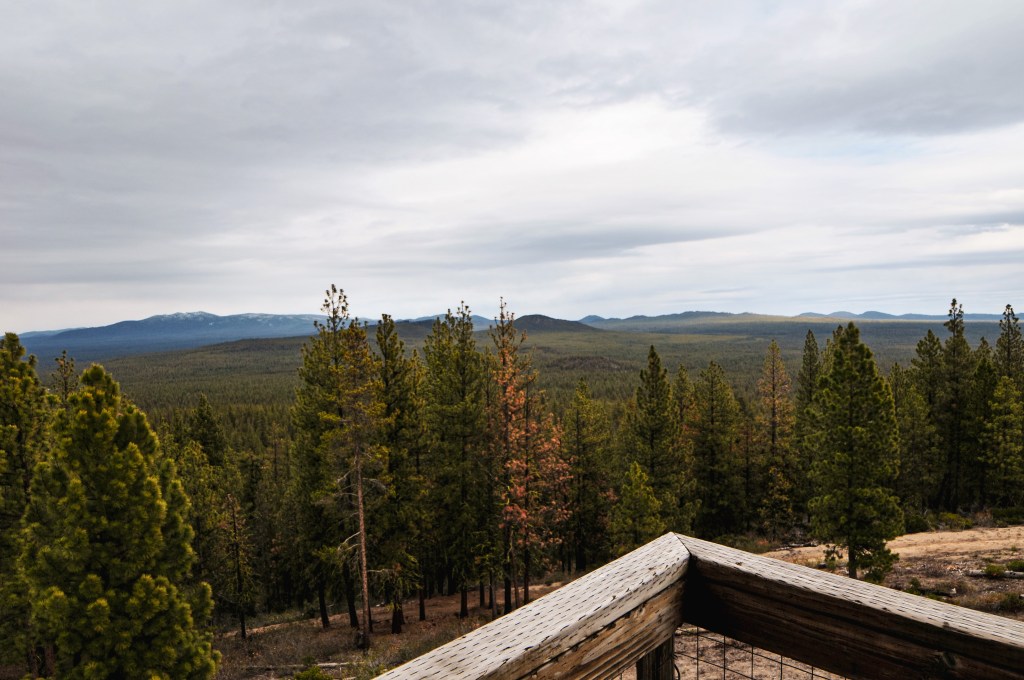
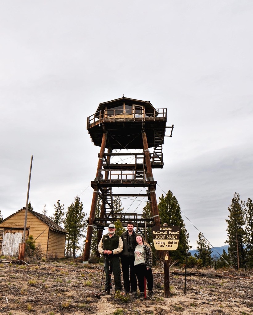
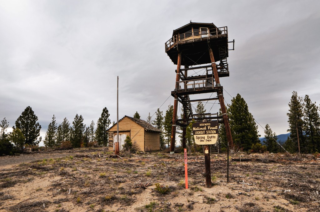
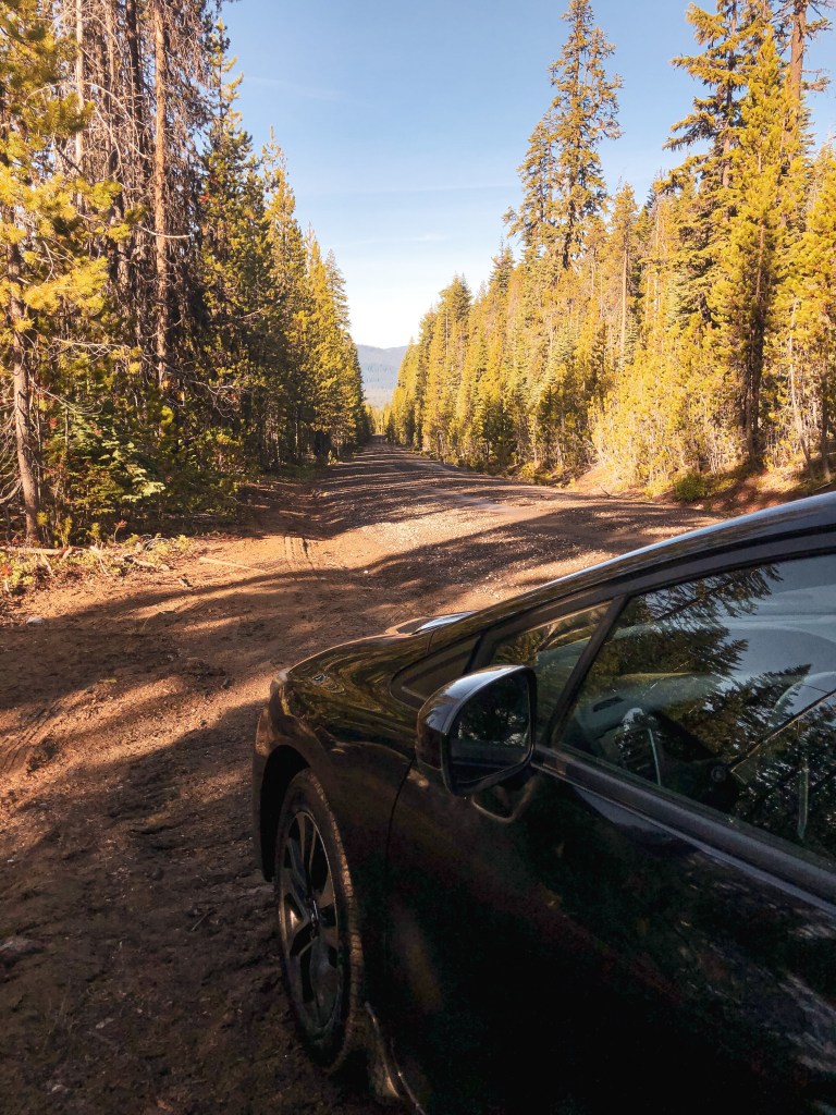
On the ranger district map the most direct route to Spring Butte looked like NF-2220 off of HWY-31. I think under normal circumstances this road would be a good route to take but since it was still early season we ran into a lot of debris and downed trees. I also wouldn’t recommend this route as the best way for lower clearance vehicles. We were able to drive down NF-2220 until it’s junction with NF-600. There was a large downed tree blocking the road that, even if we had remembered to bring our buck saw, would have been too big to cut without a chain saw. We noticed NF-600 basically paralleled NF-2220 and decided to attempt that route instead. NF-600 is a rocky spur road that doesn’t see a lot of use. On the map it appeared to connect back to NF-2220 via another spur road, but we quickly found out it was barely even a jeep track up a rocky slope. We continued on NF-600 until it met up with NF-2420. This took much longer than expected since we constantly had to stop and move downed trees out of the way. Thankfully they were all small lodgepole pines. From NF-2420 we took a left and headed towards NF-2430. You will turn left and stay on NF-2430 until you reach the spur road NF-830 that will take you all the way to the lookout. NF-2430 crosses NF-2220 before you reach the spur which is where we were hoping to come from originally. There is a sign for the turn to Spring Butte L.O. from NF-2430 as well. From this junction it is only a mile. If we had been driving my Civic this is where I would have parked and started to road walk. We drove the truck a half of a mile up the road but decided to walk the rest of the way after a particularly rutted section. The road is gated near the lookout so you would have to get out and walk no matter what. It looked like someone had been here recently prepping for the start of their fire season since the shutters on the lookout had already been removed. We spent a short time on the summit since we were pressed for time and still wanted to attempt to find Green Butte. This lookout completed our set for all the lookouts with octagonal cabs in Oregon.
Once back at the truck we started heading towards Green Butte (post) on the map. This meant taking NF-2430 back the way we came. You will want to stay on NF-2430 until you reach NF-2222 on the left. It looked like there were multiple connecting spurs that would take you to Green Butte (post) but the most direct route is from spur NF-700. This spur unfortunately wasn’t signed. We were able to guestimate the turn after we went too far and met a different spur that was signed. Once you’re on NF-700 you will turn right on to NF-720 which is in fact marked. My partner’s dad didn’t feel like road walking with us and parked the truck at the junction. From here my partner and I walked up NF-720. We made the mistake of not taking our map or taking a picture of the map before we left. We thought NF-720 would take us to the summit but quickly found that there were multiple spur roads heading towards the butte while NF-720 paralleled it. The two spurs we had to choose between were NF-725 and NF-550. We started up NF-550 first and it appeared to be headed in the right direction. I’m a significantly slower hiker than my partner and I was worried we wouldn’t have a enough time in the day to make it back to the truck and camp before dark. I turned back before the road got too steep but my partner continued on in hopes of finding the lookout. I made it back to the truck around 6PM and we waited for my partner to return. He was lucky that we had guessed the correct spur road to reach the summit and was successful in finding the lookout. From NF-550 you turn on to NF-555 that will take you all the way to the platform lookout. I’m bummed I didn’t make it this time but now I know how to get there in the future. My partner made it back to the truck around 6:30PM mostly because he ran the rest of the way after I turned around. We ended up setting up camp much later than expected but it was worth it.
If you are wanting to reach Spring Butte L.O. with a lower clearance vehicle, I recommend starting on NF-22 which leaves directly from La Pine. It is marked as Finley Butte Road in town but eventually turns into a Forest Service road. From NF-22 you can take the other side of NF-2220 to NF-2430 to NF-830 or you can go to NF-2222 to NF-2430 to NF-830. Since I can only speak on the roads I’ve been on, I’d recommend NF-2222 to NF-2430. I would consider these portions of the road passable to lower clearance vehicles.
History.
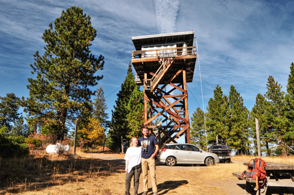
Similar to Sisi Butte (post) and Calamity Butte (post), the existing Spring Butte L.O. has an octagonal cab. It was constructed in 1991 as the first of its kind in Oregon. The 16’x16′ cab sits shorter than the other two with a 41′ pole tower. It is still actively staffed every summer, so always make sure to be respectful of the active lookout attendant’s space and only climb the tower if you’ve been invited up. The previous lookout structure was developed in 1932 as a 30′ tower with 14’x14′ L-4 cab. It was maintained regularly between the 1950s-1970s and used up until it was deemed unsafe in the 1990s. In November of 1997, the existing lookout was broken into and vandalized. The damages were estimated up to $10,000. The fire finder and other furniture were torn and tossed from the height of the tower with complete disregard. It is unfortunate to hear that some people have such a lack of respect for places like this which is often why they are hidden behind locked gates. It is our collective responsibility to help keep places like this intact for future use and others to enjoy.
Siuslaw National Forest; Cascade Head Experimental Forest
Status.
Abandoned; Partially standing
Estimated drive time from Portland, OR.
2 hours
Date visited.
April 23, 2022
Elevation.
1,303′
Former Fire Lookout Site Register.
US 711; OR 122
Trip Report.
Green Point, not to be confused with Green Mountain, Green Butte, Green Peter, or Green Ridge, is a crows nest located outside the community of Otis within the Oregon coastal range. You can access the community of Otis via HWY-101 or HWY-18. From Otis, you will want to follow the Old Scenic Highway towards the Cascade Experimental Forest Headquarters. Continue on past the headquarters until you reach a four way junction. Turn right here onto NF-1861 until you reach the road with a gate off to the left. Park here. All roads were in good condition for driving a low clearance vehicle.
The above map shows our rudimentary route. The black dots indicate our driving route with the larger dots representing Otis, Green Point, Cascade Experimental Forest Headquarters, and our parked car. The purple indicates our hiking route. We parked the car in a pull out across from an old road with a gate. You could potentially park at the gate, but someone was already parked here during our visit. I’m not sure what they were doing since they were just sitting in their car, but I’m sure they thought the same about us. Especially, after we headed uphill into the brush. We had drove to the junction past this gated road initially because there was supposed to be another road off to the left that headed closer to the summit. We weren’t able to find any indication of an old road along this section. We hiked a bit up the gated road, but it just followed around the point. It was also significantly overgrown and brushed over by prickly berry bushes. It seemed easier to head cross-country to the summit instead. We started up at an angle from the junction towards the high point. It was fairly easy and open walking for a while, but as we grew closer to the summit we were met with downed trees and thicker brush. I didn’t expect it to be a walk in the park, it is the coast range after all, but this section made me want to turn around. My partner encouraged me to continue on and we eventually broke through into another open area. We followed some game trails until we reached the plateau that is Green Point. It is fairly flat on the summit with a nice park-like stand of trees. We searched around for a while until we found the correct tree. It was on the more northern side of the summit right before it slopes down again.
Heading back down, it was much easier to find a more open route that avoided most of the brush. We were even able to find the old road bed. It was only visible due to the cut bank, otherwise completely overgrown. It was virtually invisible from the main road and un-walkable. Actually, the whole area was overgrown near the main road. We had to push through a dense thicket to get back on the road to our car. There were two bikers stopped and talking on the road where we were headed out. I’m sure they were caught off guard when we emerged out of the brush for no apparent reason. We tried to act casual and headed back to the car. The only marker to identify where to start is a paper plate nailed to a tree with a 3 spray painted on it. This is the better route even if it might not look like it from the road.
History.
Green Point used to have a 53′ pole lookout tower with L-4 cab and garage built by the CCC in 1939. It was used for aircraft surveillance in 1942 and later destroyed in a windstorm during 1951. The crows nest pre-dates the tower and was added to the summit in 1933. I’d say this one doubles as a former fire lookout site and existing lookout.
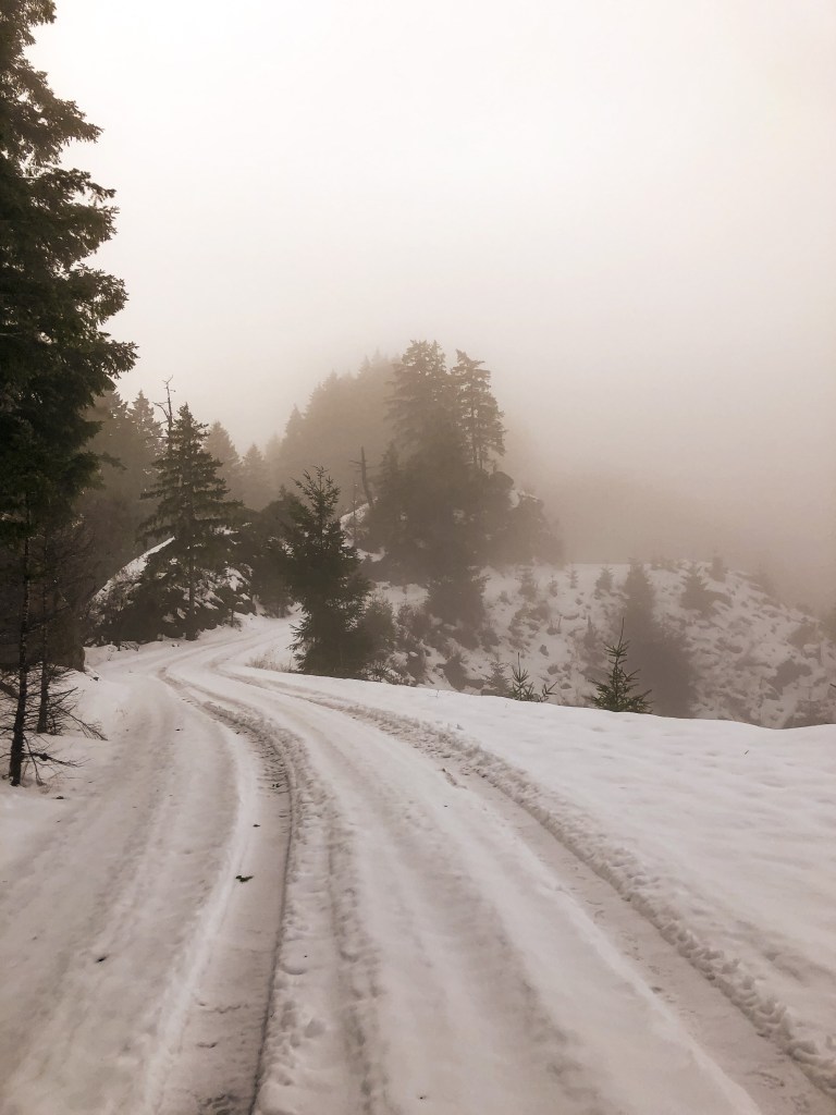
After an easy visit to Bunker Hill L.O. (post) the day before, we woke up ready for more of a challenge. We weren’t sure how the roads leading up to Cougar Pass would look, but figured we could get as close as possible and walk the remaining distance. We had been dealing with a state wide snow storm for the past week, so the chances of meeting snow here were high. Normally being just off the coast is a safe bet for no snow, but we never seem to be that lucky with our off season explorations. We headed east out of Reedsport on HWY-38 until we reached the turn off for Loon Lake Recreation Site. You will turn Right on to Loon Lake Road. The Loon Lake Recreation Site was already closed for the season but the road leading to Cougar Pass will be beforehand. The gravel road is noted as Cougar Pass Road on google maps but is actually state forest road 7700. There is a small yellow sign posted on one of the trees with this number. You will see the sign after you’ve started up the gravel road. There are no signs to notify you of the turn off from the main road. It is about 6 miles down Loon Lake Road and will be on the right hand side. We barely made it 1/2 mile up the road before we were met with some fallen trees and snow from the recent storm. We already planned on having to walk some of the road, so we were prepared. You will follow the main road until you reach a major T-junction with state forest road 7000. It was hard to find a detailed map of the Elliot State Forest. From what we had it seemed like the road to the lookout would be to the left of the junction. We walked a mile down this way but the only viable road headed steeply down. We retraced our steps and headed to the right instead. It was the first road after the junction and can be distinguished by the pole remaining from the old gate. From there it is only 1/4 of a mile to the lookout. You will reach another road junction before the summit, the lookout is to the left. The Elliot State Forest has taken steps to make this lookout harder to find by removing road signs and tank trapping the road in hopes to deter vandalism. We could tell it was a well trafficked area since there were tire tracks leading up the main roads the entire way even with a foot of snow on the road. We would have had an easier time finding the lookout if it had been a clearer day. We were in a fog cloud until we started to head back down the road to my car. As we were hiking out, we found you can see the lookout from the road. It was close to 6 miles round trip of road walking from where we parked, if you don’t include the additional 2 miles in the wrong direction.
History.
The first fire lookout was built on Cougar Pass summit in 1935 as a 40′ wooden tower and was managed by the Coos Fire Patrol. This tower was replaced by a 50′ CT3 tower with 14×14 cab in 1966. It was actively used up until 1985. Cougar Pass L.O. is the last remaining lookout in the Elliot State Forest and, as far as I know, the only one still located in any Oregon state forest. It is currently managed by the Department of State Lands and is in a state of disrepair. There is a public proposal out to restore and reconstruct Cougar Pass L.O. as an educational opportunity for the Southwestern Oregon Community College and general visitors. This proposal would not only preserve the history of this lookout but help to educate on the forestry management utilized in the Pacific Northwest during the period of 1910 to 1969.
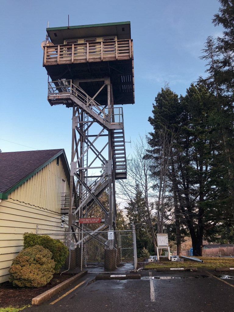
My partner and I decided to book a rental in Reedsport for the New Year and our 3-year anniversary. We chose Reedsport for it’s proximity to two lookouts along the coast. We figured we could end and start the year doing what we enjoyed most. We headed to Bunker Hill L.O. since we had some time to kill before checking into our rental. This will be our last lookout visit for the year! It’s located in the coastal town of Coos Bay at the Oregon Department of Forestry building. We were able to find it by following signs to the ODF building from HWY-101. Heading south on HWY-101 you will turn right on to Flanagan Road. You will stay on Flanagan Road until you reach Lookout Lane. Turn Left on to Lookout Lane. If you end up driving past Lookout Lane you can still get there by turning left on to Bay Park Lane and then another left on Fifth Road. The junction of Bay Park Lane and Fifth Road has an ODF sign. The buildings were closed for the holiday but we were still able to access the grounds and view the lookout from the parking lot. There is marked visitor parking just past the gate.
History.
In 1937, a combination lookout and water tower were built for the ODF by the CCC of Camp Walker. A 7’x7′ lookout cab was built atop a 3,000 gallon 52′ water tank. This lookout tower was used by the Coos Fire Patrol until the 1950’s. It was also used briefly for air raid spotting during the war, but it was found that most spotting had been done from the ground. The combined lookout and water tower was dismantled in 1965. It wasn’t until 1996 that they decided to build a new lookout tower on Bunker Hill for training. The existing 12’x12′ lookout sits atop a 40′ steel tower next to the district headquarters. The steel tower used was donated by the U.S. Coast Guard. It is currently an interpretive site for visitors and listed on the National Historic Lookout Register. it’s labeled as the Coos Bay Lookout on the tower itself.
Bonus: We visited the Umpqua Lighthouse State Park to check out the lighthouse before heading to Bunker Hill L.O. It is ran by the U.S. Coast Guard and tours are offered through the museum. While parked we spotted another structure closer to the ocean that resembled a lookout. I’m sure it’s used by the U.S. Coast Guard for some sort of training but the base looked almost identical to Bunker Hill L.O.
NOTICE: As of July 20, 2024 this area is currently closed due to the active Diamond Complex.
Location.
Umpqua National Forest
Status.
Active; Currently standing
Estimated drive time from Portland, OR.
4 hours
Date visited.
December 4, 2021
Elevation.
6,417′
National Historic Lookout Register.
US 486; OR 79
Trip Report.
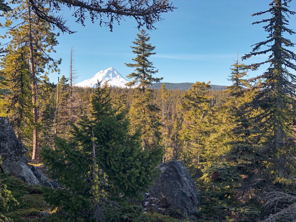
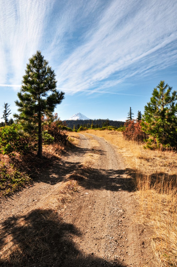
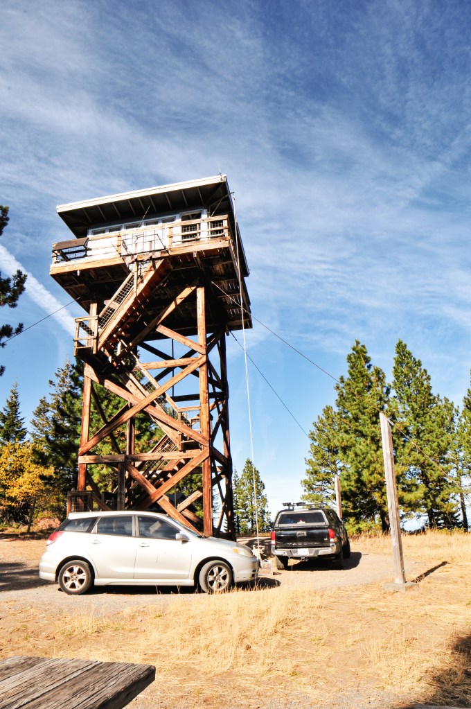
We debated visiting this lookout during the winter months and planning it as a snowshoe since the access road, NF-4793, is located right off of HWY-138. There’s also a small snow park located right at the turn off. This would be easy to access since it is plowed in the winter. There hadn’t been much snow in this area as of recently and we decided to check it out as a day hike instead. The weekend forecasted for cold but sunny skies. We were hopeful we wouldn’t be met with any snow and decided to try for Garwood Butte (post) while we were in the area too. As we made our way down to the Umpqua NF from Portland, we could see patchy snow on the tips of the high peaks. We decided to head for Garwood Butte (post) first but only made it a little less than a mile down the road before we were met with deep snow. It wasn’t worth the risk to drive, so we continued on to Cinnamon Butte. We turned on to NF-4793 and were uncertain if we’d be met with more snow. There is a sign for the lookout from HWY-138 and at the road junction off of NF-4793, so it is easy to find. The turn off for the lookout access road is only a mile and a half up NF-4793. I figure this road gets more sun exposure since we were able to drive to the junction with no issues. It is a gated road so you will need to park and walk the remaining distance. From the gate it is another 1.5 miles to the summit. As you hike up the road, you will already start to get some great views of Mt. Thielsen and the surrounding Diamond Lake area. There is a large parking lot on the summit which makes me believe you can drive there in the summer months. We had the summit to ourselves for the majority of the time. Another couple had hiked up while we were eating lunch but didn’t stay for very long. We took our time on the summit since we already had reservations in Roseburg for the night. It was a gorgeous day to visit!
History.
The current lookout tower was built for Buster Butte in 1955 as a 41′ treated tower and R-6 flat roof cab. It wasn’t moved to Cinnamon Butte until 1976. It has since seen some renovations. The original Cinnamon Butte L.O. was developed as a 35′ tower with L-4 cab in 1934 by the CCC. This lookout is one of the few that is still actively staffed every summer. The structure was threatened by the Thielsen Fire in September 2020. Evidence on how close the fire came can be seen on your hike up the road. It’s apparent that the access road was part of the fire break.
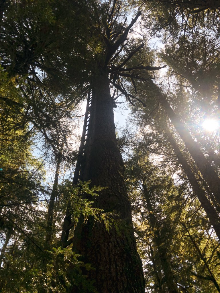
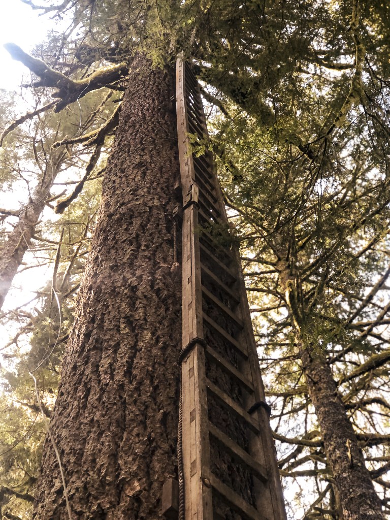
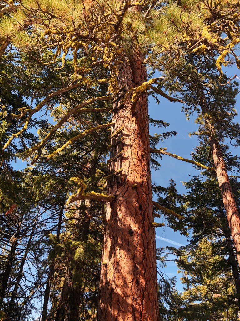
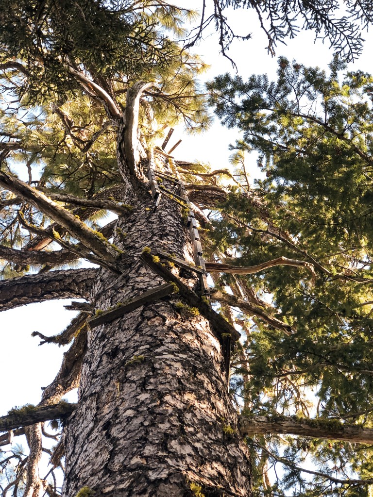
Remnants to the early days of fire detection can still be found in parts of the Mt Hood National Forest. Crow’s nest lookouts are typically a platform that sits on top of a tree with a ladder nailed to the trunk. Before there were lookout towers, fire attendants used to climb the trees to spot fires in the area.
Joe’s Point.
Date visited.
October 16, 2021; October 9, 2022
Elevation.
3,653′
History.
Joe’s point was an open platform built atop a large Ponderosa Pine in the 1930s. There was also a 12×12 cabin built for the lookout in the 1940s. The cabin is no longer on the summit, but you can still see pieces of the old platform and ladder. There’s a nice view of Mt Hood from the rock quarry where you park your car.
Directions.
Take NF-44 to NF-4440 to NF-140. Drive to the end of NF-140 and park your car. NF-140 is a bit bumpy in a passenger vehicle but doable. Once parked you will need to hike the old decommissioned road for about a mile. Follow the blue diamond markers on the trees, but be aware there are other roads in this area marked with blue diamonds that could lead you astray.
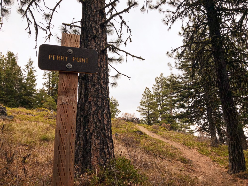
Perry Point.
Date visited.
October 17, 2021
Elevation.
4,920′
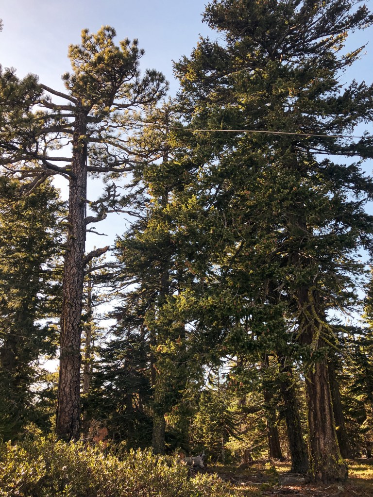
History.
Perry point was a crow’s nest platform built atop a Douglas Fir in the 1930s and abandoned in the 1940s. It was noted as a potential patrol point for Fivemile Butte L.O. There are only a few boards left on top of the tree and will most likely not be there for much longer. The view from the point is still worth the short hike up.
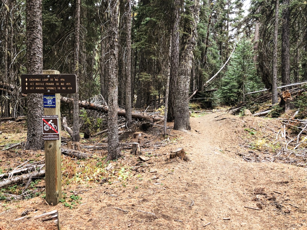
Directions.
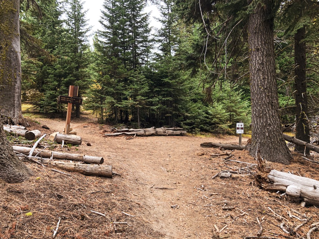
Take NF-44 to NF-120 and park you car at the trailhead for Eightmile Loop Trail #496. From the trailhead it is a little under a mile to Perry Point. You will want to follow the signs for Bottle Prairie Trail #455. The first trail junction is only marked in one direction. You will want to take the trail to the right until you meet the second junction. From the second junction stay left until you see a sign for Perry Point. The trail to the right of the sign will take you directly to the crow’s nest. It is the tree at the very end of a rocky butte and can be hard to spot.
Take the trail to the rightTake the trail to the leftTake the trail to the right of the sign
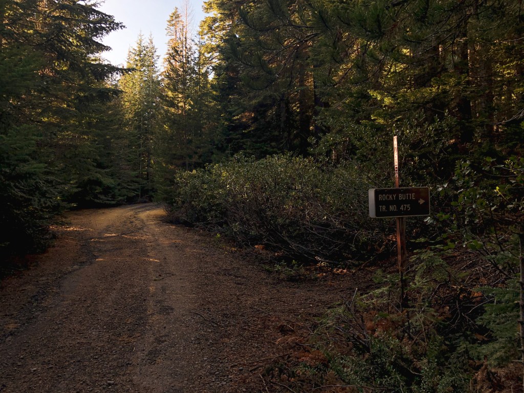
Rocky Butte.
Date visited.
November 20, 2021
Elevation.
4,796′
History.
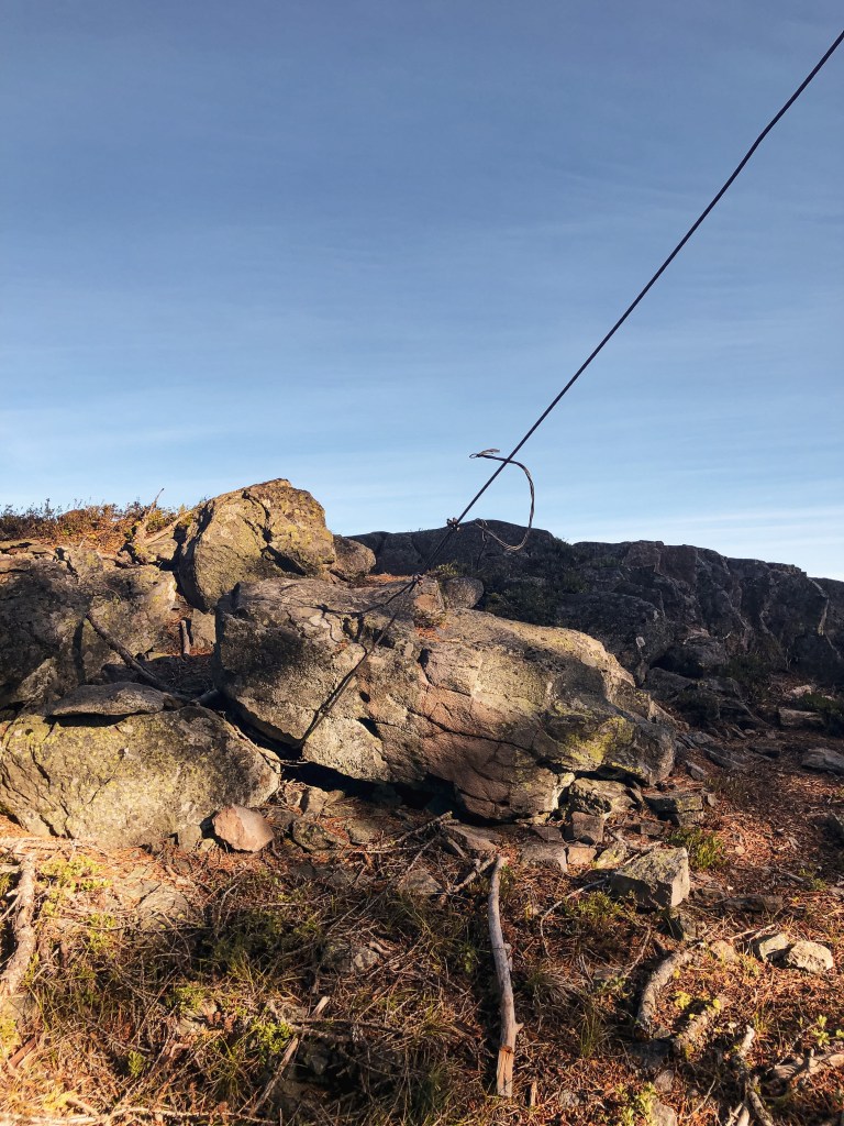
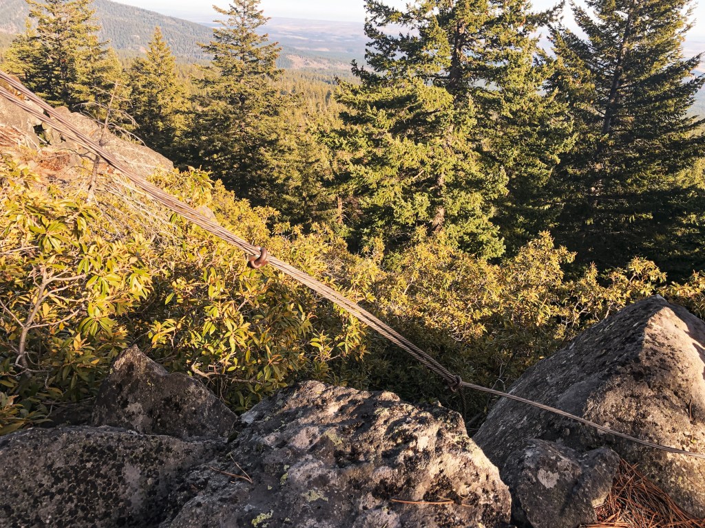
Rocky Butte crows nest was built in 1929 atop a 60′ Ponderosa Pine. It has been abandoned for a long time, but remnants of the ladder and guy wires can still be found on the summit. You can also find a USDA Forest Service Benchmark on the summit dated back to 1924. This is my favorite of the crow’s nests we’ve been able to locate. The views from the summit are worth the short climb up alone.
Directions.
From Tygh Valley take Wamic-Market Road through Wamic. This road eventually turns into NF-48. Turn right onto NF-4810 towards Camp Cody. Stay on NF-4810 until you reach a four way junction with NF-4811 and NF-4813. Turn right onto NF-4811 and then left on to NF-4812 shortly after. Continue on this road until you reach the trailhead sign. The road washes out about a 1/2 mile from the trailhead but a higher clearance vehicle will have no issues. There is limited pull out room for parking. It’s only a short 1/2 mile hike up the trail once you find the trailhead.
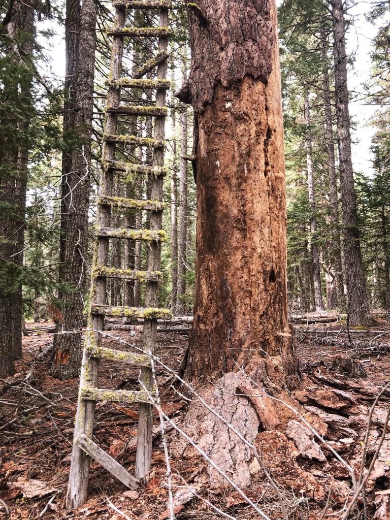
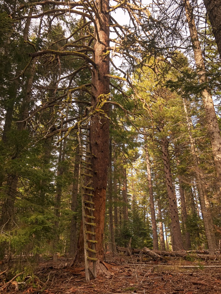
Bus Point.
Date visited.
November 21, 2021
Elevation.
3,333′
History.
Bus point was built as a crow’s nest in 1933 but has since been abandoned. It sat atop a 95′ Ponderosa Pine and was accessed via a 32′ ladder. The ladder leaned against the tree and was wired in place. From the ladder, the lookout attendant then had to navigate the branches to reach the top. The ladder and tree were still standing when we visited but the tree is no longer living and there are visible signs of rot. I would recommend seeing this one sooner than later.
Directions.
Same directions as Rocky Butte but instead of turning right on to NF-4811 at the four way junction, you will turn left. You will take NF-4811 until you reach an un-signed three way junction. NF-4811 in this directions has some large potholes but I was able to maneuver them with caution in my Civic. You will pass NF-4814 on the right and paved NF-4820 on the left before reaching the major junction where you will park. It’s good to have a detailed map of this area since there are a lot of skid roads you will pass as well and no definitive marker for this one. From the junction you will cross country hike off the road to the right following a game path. My tracker said we only went 0.16 miles before reaching the tree. We were able to find it right away with no issues.
Parking at Junction
Where the game trail starts
Eightmile Point.
Date visited.
October 8, 2022
Elevation.
5,280′
History.
There isn’t much history on this crow’s nest. It was built in the 1930’s atop a Fir and I presume abandoned in the 1940s with the rest of them. Unfortunately, this one is no longer standing and we were only able to find remnants of it. It was hard to pin point which tree was the previous lookout tree on the ground. But, we found the general area with some remaining wire, boards, an insulator, and the help of some other lookout enthusiasts that were also trying to find it that day.
Directions.
Head into the Mt. Hood NF from Dufur taking a right on Dufur Valley Road that eventually turns into NF-44 once you reach the forest. Turn left on NF-4420 until you reach a junction with a major gravel road leading right. From here, if you continue straight it turns into NF-2730. But, you will want to stay on NF-4420 and turn right onto the gravel. You will stay on this road until you reach the trailhead for Fifteenmile Trail #456 off to the left (parking on the right). It’s an obvious trail just past the junction with spur road NF-160. Park your car and walk the remaining distance up the trail to reach Eightmile Point. It is less than a half of a mile up the trail. The trail connects to other roads and can be reached from other directions, but we found this to be the most direct.
Maintained; Occupied by City of Portland Park Rangers
Estimated drive time from Portland, OR.
Within city limits
Date visited.
October 24, 2021
Elevation.
143′
National Historic Lookout Register.
Not registered
Trip Report.
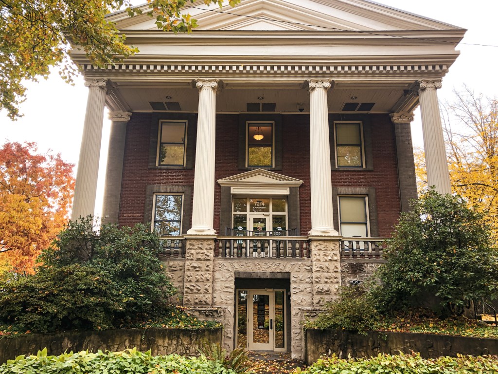
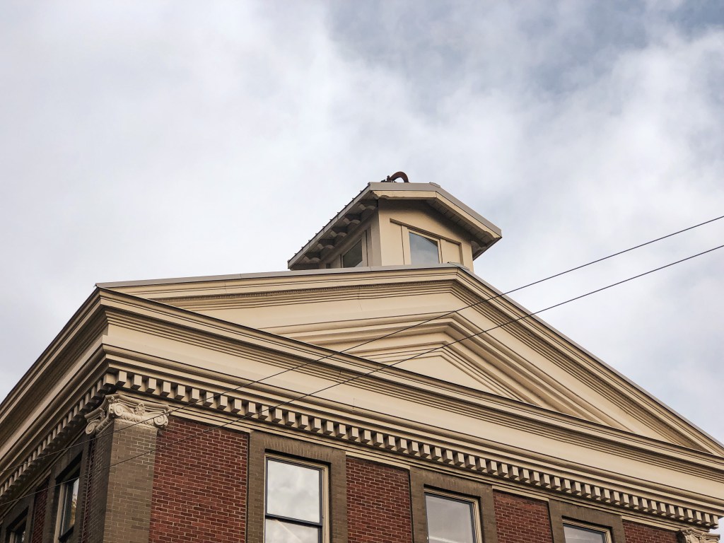
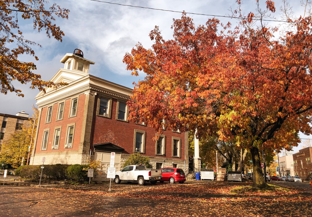
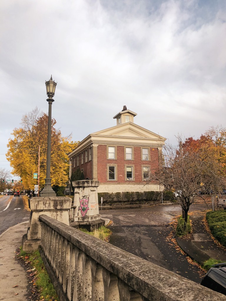
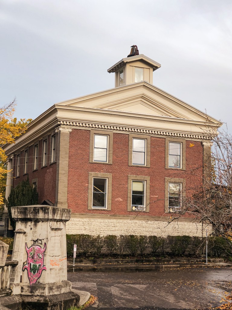
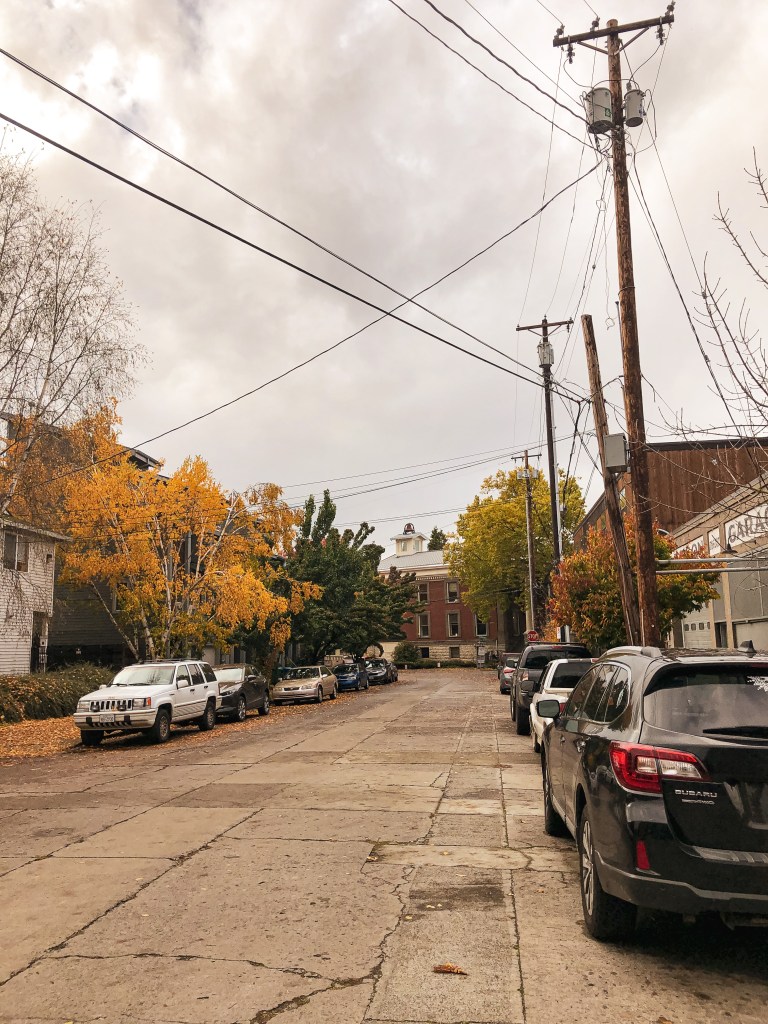
This is a building in the city of Portland that was used for fire detection in Forest Park. It’s located right next to the historic St Johns bridge and overlooks the Willamette River. The building is now used for the city Park Rangers office. My Partner and I decided to walk around the neighborhoods of North Portland and St Johns instead of driving directly to the site. I love looking at the different houses and architecture in this area. It was a rainy fall day but we got a break in the weather for our 6.5 mile walk. You are unable to access the building unless you have an appointment. I’m unsure if they’d grant access to the cupola though.
History.
This historical building was built in 1907 as the city hall for St Johns City. It was converted to a fire station in 1915. There was a fire in August 1951 that devastated Forest Park and lead to the construction of three emergency fire lookouts in the area. The fire burned 2,400 acres which was about 25 percent of the park. The Portland Parks Bureau with the assistance of Engine 32 of the Portland Fire Bureau erected the one in St Johns in 1952. They mounted a firefinder to the exterior wall from the second floor window. I couldn’t find confirmation on when the cupola tower was added. In 1959, it was noted by a survey crew that the original cupola and flagpole had been removed from the building. The building was later renovated in 1964 and 1996, but it’s unclear on which renovations lead to rebuilding the existing cupola.
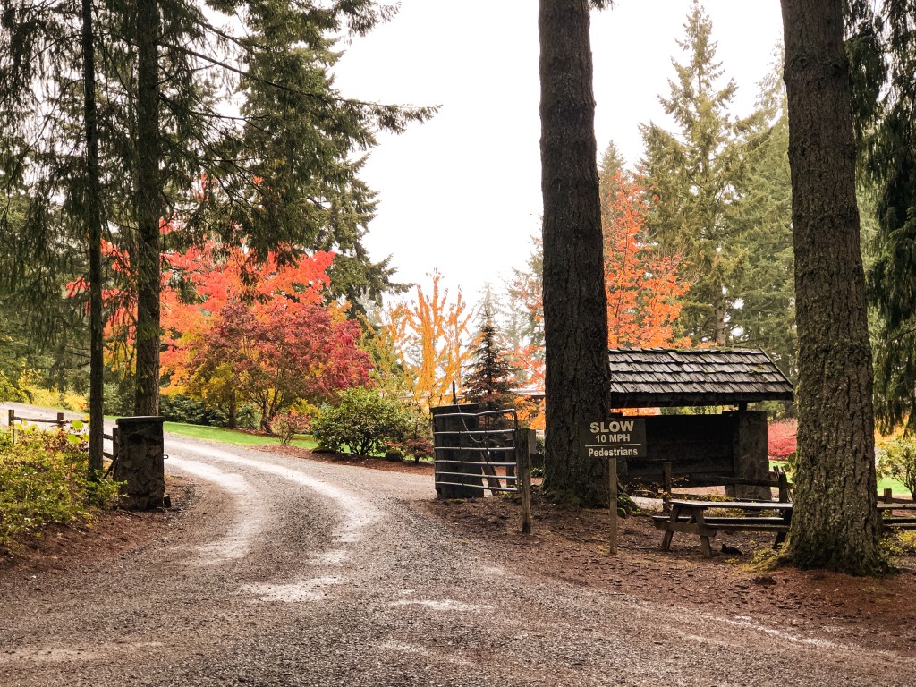
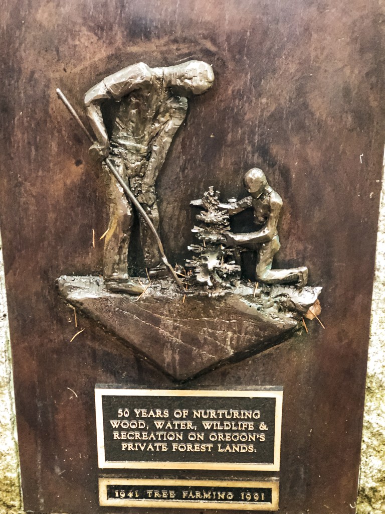
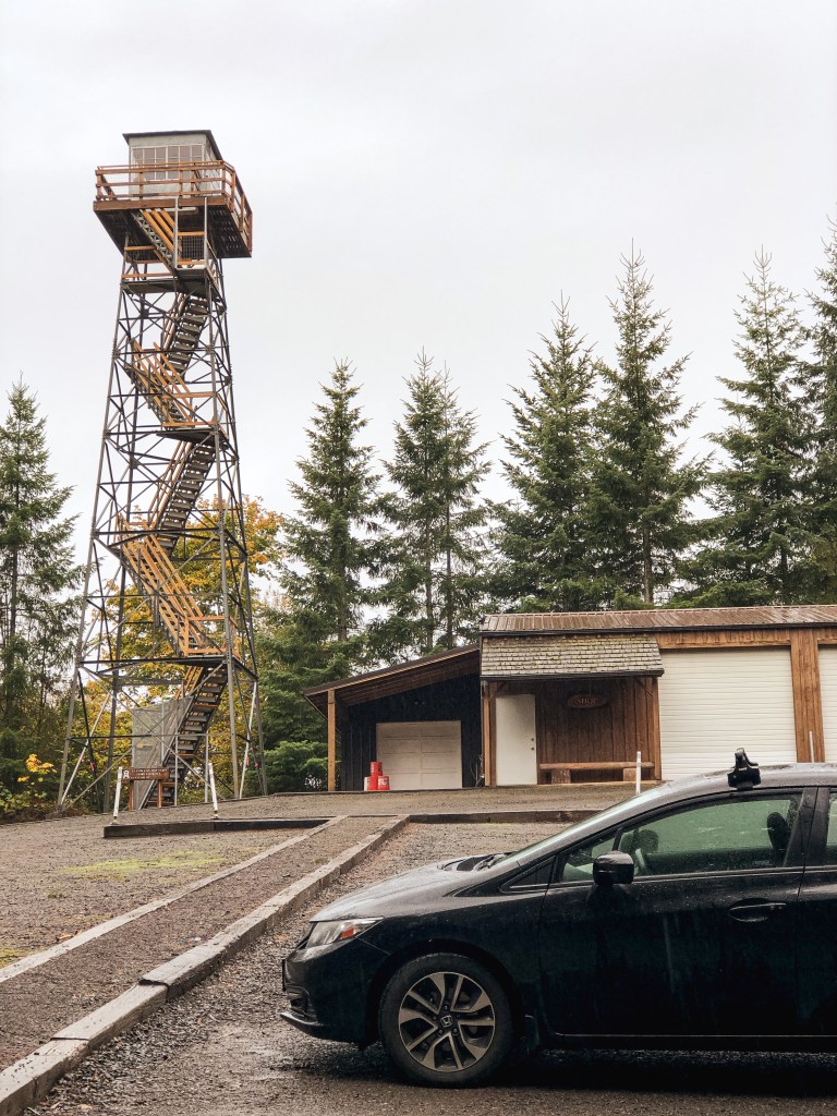
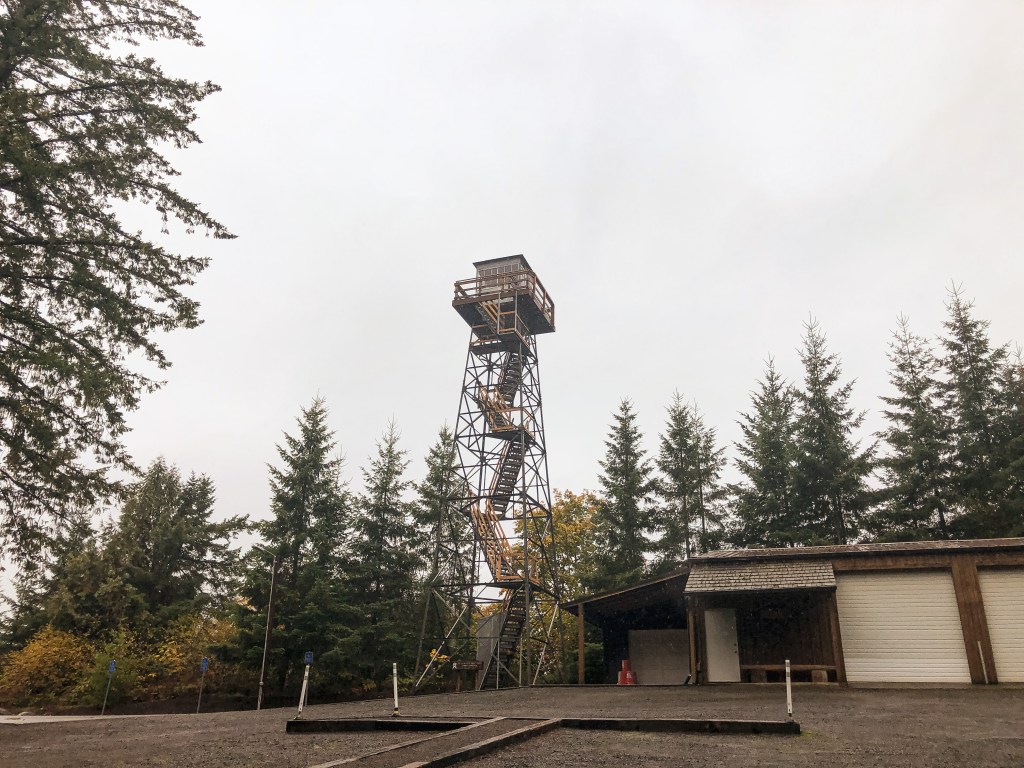
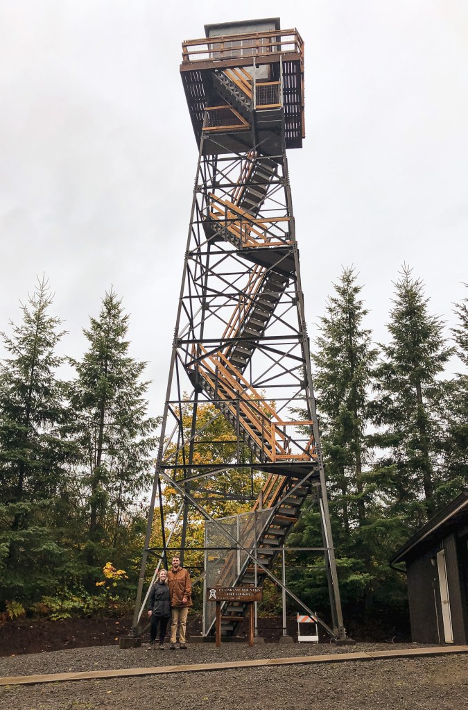
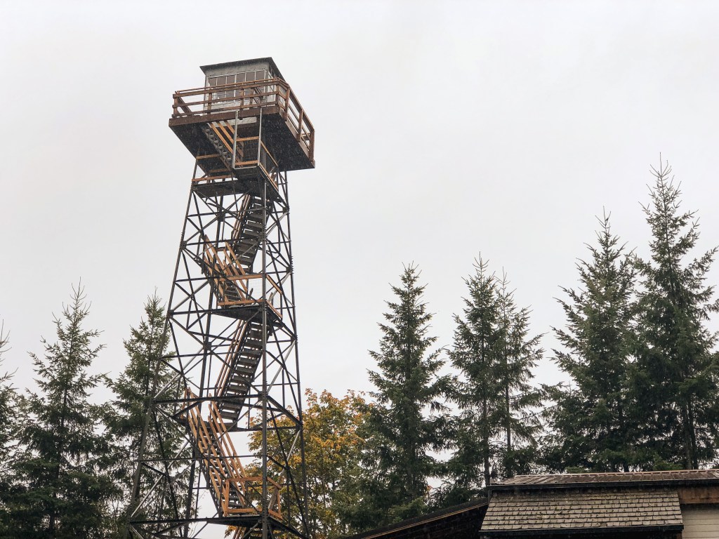
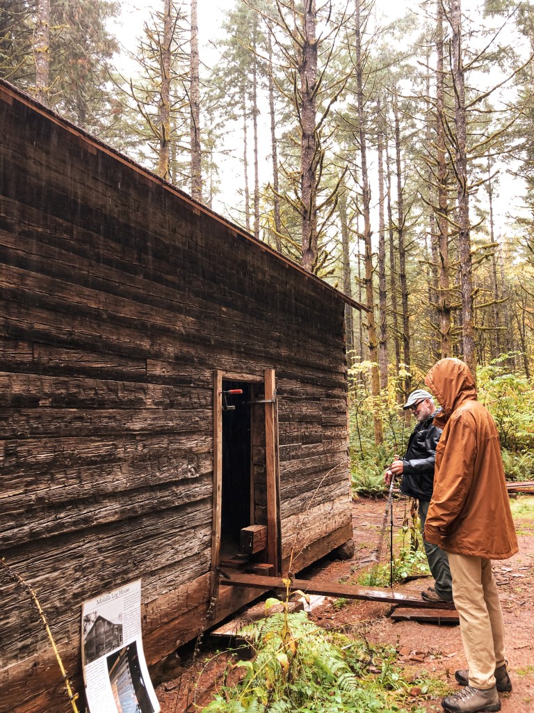
My partner, his dad, and I decided to take a trip to Hopkins Demonstration Forest in Beavercreek. They had recently finished reconstruction of the Clatskanie Mountain L.O. in February 2021. The lookout is located right in the parking lot and easy to access. It was a really rainy fall day, so we were unable to climb the tower. I believe they will open this to the public on nicer days for tours. We checked out the adjacent Everett Hall, historic Molalla Log House, and hiking trails on the property as well. Hopkins Demonstration Forest offers learning opportunities about different sustainable forest management techniques over 140-acres and is operated by Forest Forever Inc. Places like this are important for preservation and education. Please donate if you are able or visit their website to learn more about getting involved!
History.
The Clatskanie Mountain L.O. is a 65′ Aermotor tower with 7×7 cab. it was originally built in 1954 and managed by the ODF in the coastal range near Astoria. It was constructed as a replacement for the Benson Lookout. In 1984, it was dismantled and moved to the Magness Tree Farm. Fun Fact: It was dismantled by the same person, Don Rust, that had originally assembled it. The World Forestry Center operated it there as an educational exhibit and historic display. They experienced issues with vandalism and the continued maintenance over the years. In 2008, they decided to refurbish and relocate the tower. It stood on the Hopkins property for 9 years before reconstruction started in 2019. Finding the proper components, knowledge, and skills needed took time. They were able to find a company to fabricate all the needed components to restore the structure to it’s original specifications. The company, Fire Tower Restoration, specializes in finding and saving Fire Lookouts before they are sold for scrap. The remaining work of replacing treads, railings, and safety fencing was completed by Hopkins volunteers over the last year. It is now open and ready for the public thanks to all their hard work! It’s registered under the Former Fire Lookout Site Register, but not the National Historic Lookout Register.
The Hopkins Demonstration Forest is also currently working on restoring the Molalla Log House which will be completed in 2022. This historic log house is believed to be the oldest building in Oregon, if not the entire Pacific Northwest. It is made of Douglas Fir that had been hand hewn and held in place by tight half-dovetail notching. The origins of the log house are un-known even after extensive research, but believed to be built by fur hunters and trappers from Canada in the late 1790s. The building securely sat in the foothills of the cascades near Molalla for 200 years before it was dismantled in 2007. It was warehoused with plans for rehabilitation and preservation until it found it’s forever home in 2017. The building is a 18’x25′ log cabin with 1-1/2 stories. We will have to make a trip out to see it once completed!
My partner already visited Fivemile Butte L.O. earlier this year with his dad. We decided to come back for the weekend since I still needed to check it off my list. We also wanted to see if we could locate some of the crow’s nests in the area. The best access for passenger vehicles is to take NF-44 to NF-4430 until you reach the gate on NF-122. Reminder to not block the gate and park near the road junction instead. From the gate, it is a short 1/2 mile road walk. The road is drivable but requires caution on some of the more rutted out portions. It can also be accessed via hiking trails if you are not comfortable driving. In the winter, you can access it via the Billy Bob Sno-Park. This lookout is part of the rental program and can be booked year-round. Fivemile Butte L.O. is very popular due to its easy access and proximity. There were renters there when we checked it out which was expected but a bit awkward. Make sure to respect their space and do not climb the stairs. We didn’t stay long except to take a few pictures before heading back to my car for lunch. We were surprised to find no other visitors on the summit since we had passed a full trailhead. I think I would have a hard time staying here with all the day hikers and traffic. I assume you would get less visitation in the winter months though.
History.
The current lookout on Fivemile Butte was built in 1957 as a 14×14 R-6 flat roof cab atop a 40′ treated timber tower. It is furnished with a small bed, wood stove, propane cooking stove, table, chairs, and solar-powered lights. There is a vault toilet, storage shed full of firewood, picnic table, and fire ring on the summit as well. Everything else is on a pack it in, pack it out basis. The original lookout for this site was built in the 1920s. It was a 30′ pole tower with a small cab. It was replaced in 1932 by another 30′ tower with standard L-4 cab. This was later destroyed by heavy snow in 1942. The L-4 tower that replaced it untraditionally had a trap door inside the cab. I couldn’t find any information on when this lookout stopped being staffed and became part of the rental program.
Bonus pictures of our camp spot because we had a view of Flag Point (post) on the ridgeline.