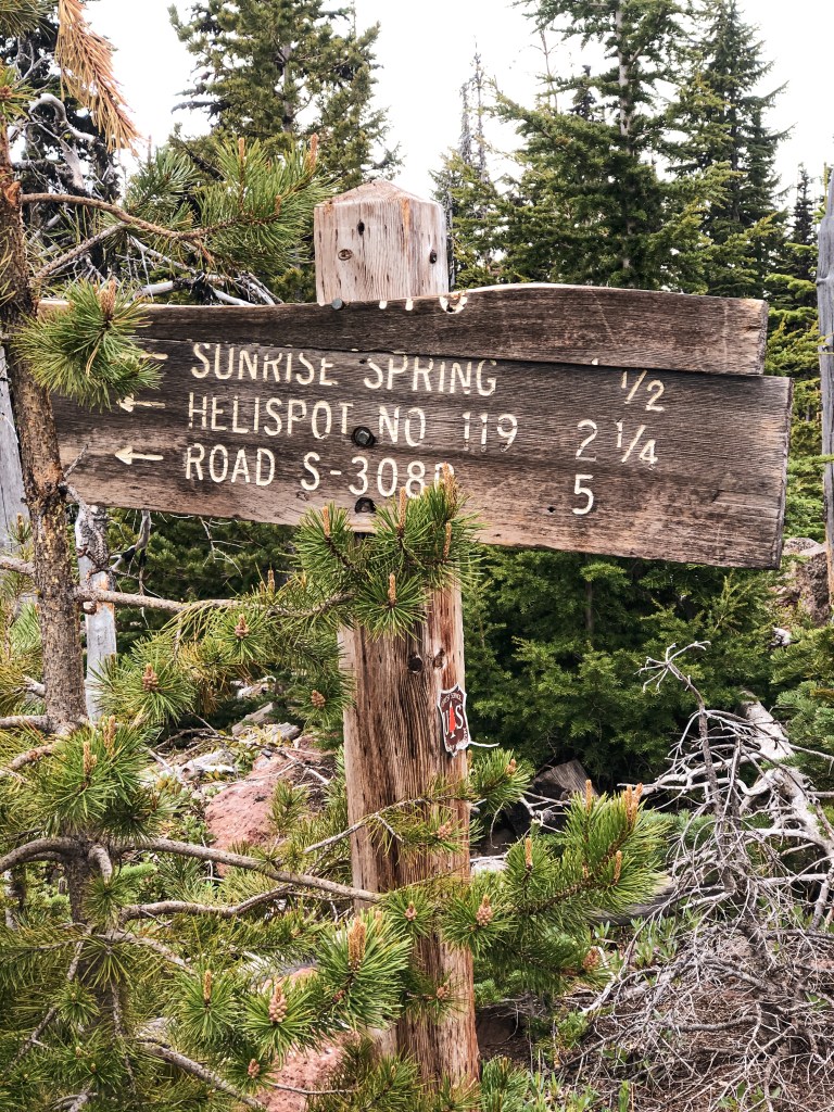
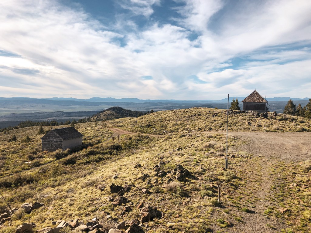
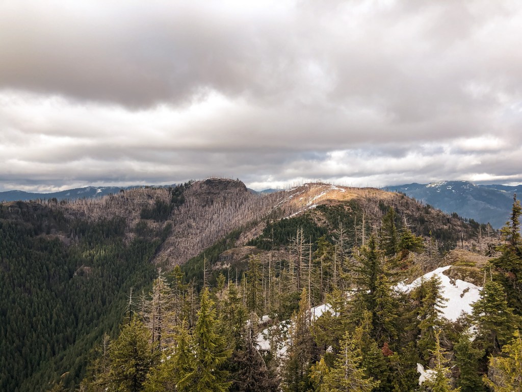
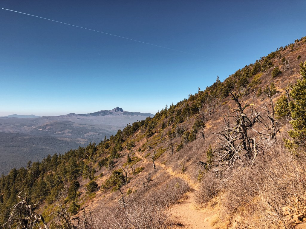
There are multiple ways to get to Flag Point Lookout via roads and trails. My partner and I had decided to disperse camp in the area for a night due to the proximity to Portland. We hadn’t planned on hiking this trail but knew we were close when we were looking for camp spots along NF-2720. We ended up reaching the end of the road and decided to hike to the lookout since we were already there. There is an un-marked connector trail that starts from the end of the road on the left side and meets up with Tygh Creek trail #460 in the Badger Creek Wilderness. You’ll follow this trail until you come to a fork where it continues up or down the ridge, you will want to continue up along the Tygh Creek trail #460. The trail leading down is the Tygh Creek Cut-Off trail #460A and will only take you farther into the wilderness. You could potentially do this as a loop using Little Badger Trail #469 from Tygh Creek Cut-Off Trail #460A . We did meet two people hiking out before we started that mentioned they had done this loop. They said there were still some patches of snow along Little Badger Trail #469 so we opted for an out and back. Eventually Tygh Creek trail #460 meets up with NF-200. You will have to road walk the remainder of the distance to get to the lookout. From NF-2720 to the lookout is about 2.5 miles one-way and gains 1,122 feet of elevation. It was a cold day with some stormy gusts of wind rolling through when we visited. We even had a rain and snow mix on the summit. Due to the weather we didn’t get the prominent view of Mount Hood that is visible from the summit. Be careful on your hike back down if you take this route. We completely missed the unmarked connector trail back to NF-2720 and ended up hiking along Tygh Creek Trail #460 for longer than we needed. Eventually we were able to find it after paying closer attention and back tracking a couple times.
History.
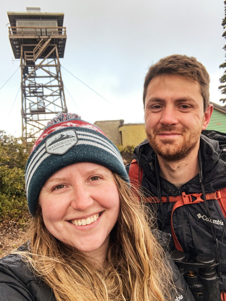
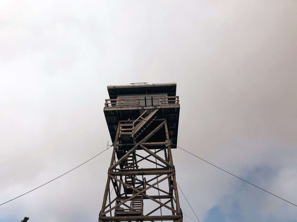
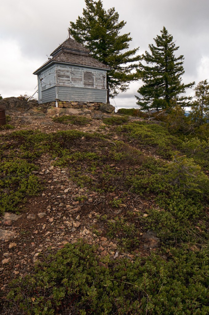
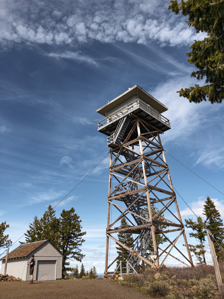
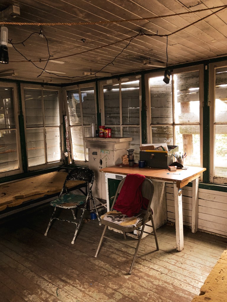
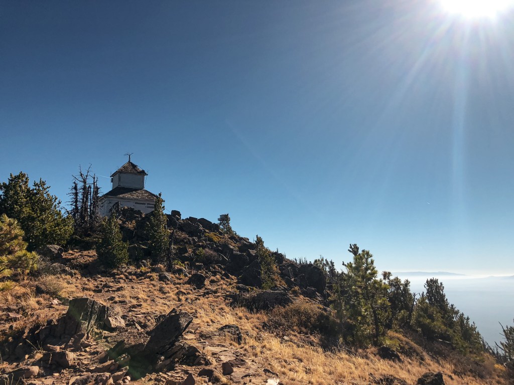
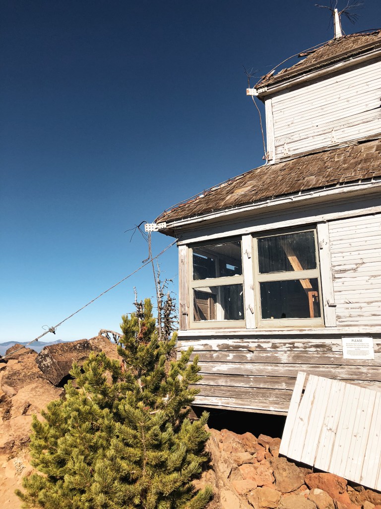
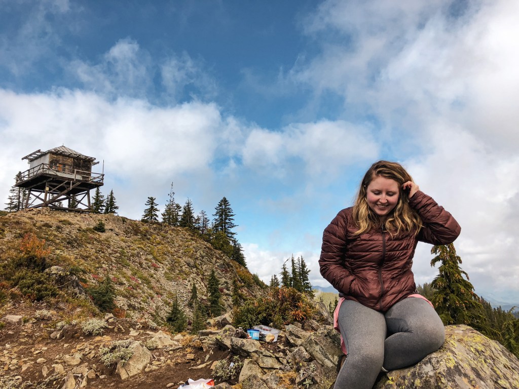
The current lookout is an R-6 15’x15′ flat top style cab that was built in 1973. It is still actively staffed in the summer but was boarded up for the season when we were there. Flag Point Butte had two other lookouts on the summit before being replaced with the current one. The first lookout was built in 1924 as a 6’x6′ observation cabin on a 40′ tower. The fire lookout used to tent camp below since it wasn’t a live in cabin. In 1932 the observation cabin was replaced by a standard L-4 cab on a 30′ tower. The existing lookout used to be available for rentals in the winter but was removed from the register in 2016. They had trouble maintaining this in the winter conditions due to the remote location and vandalism.
NOTICE: As of July 14, 2024 this area is currently closed due to the active Falls Fire and Telephone Fire.
Location.
Malheur National Forest
Status.
Abandoned; Currently standing
Estimated drive time from Portland, OR.
6-1/2 hours
Date visited.
May 30, 2021
Elevation.
6,025′
National Historic Lookout Register.
US 1705; OR 167
Trip Report.
My partner had found Craft Point through Rex’s Fire Lookout page (site), which lead to a Geocache (site) that provided some direction on how to get there. We were already camping in the area for a visit to Calamity Butte (post) and King Mountain (post) with my partner’s dad. Based on the directions, we followed NF-28 to NF-2815 heading east to NF-046. We parked in a pull out near where the road was blocked off by larger rocks. Unfortunately, I don’t recall much about the road conditions since we were in the truck. But, I’m inclined to believe it was passable with caution to most vehicles. From where we parked, the directions get a bit loosey-goosey and becomes more of a choose your own adventure. We essentially cut into the forest from the road directly towards the ridge line above until we met up with the fence line. We turned right at the fence and followed it along the ridge. A few times we had to cross over the fence to stay safely on the ridge. We came to an exposed rocky section that no longer followed the fence. Here it was unclear which side of the ridge to stay on to best access the higher point. I was ready to call it quits, but my partner wanted to continue on. His dad and I sat in the shade while he explored on ahead. He returned a short while after exclaiming that he had found it. We followed him to the left side of the ridge that skirted below some larger rocks. Eventually, we met up with an old game trail that took us directly to the summit. The last portion of the trail was steep and headed directly up the slope. We enjoyed lunch on the summit. Getting back to the car was a bit easier since we just had to retrace our steps as best as possible.
History.
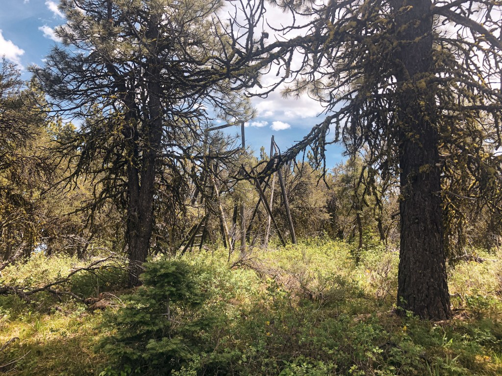
Craft Point was built in 1930 as a 15′ pole platform tower. The site was never upgraded to a more substantial structure and was abandoned in the 1940s. It’s possible it was used during emergencies, but there is little to no information online about it. It has fallen into a state of disrepair but still stands.
NOTICE: As of July 14, 2024 this area is currently closed due to the active Falls Fire and Telephone Fire.
Location.
Malheur National Forest
Status.
Active; Currently standing
Estimated drive time from Portland, OR.
6-1/2 hours
Date visited.
May 30, 2021
Elevation.
6,695′
National Historic Lookout Register.
US 73; OR 10
Trip Report.
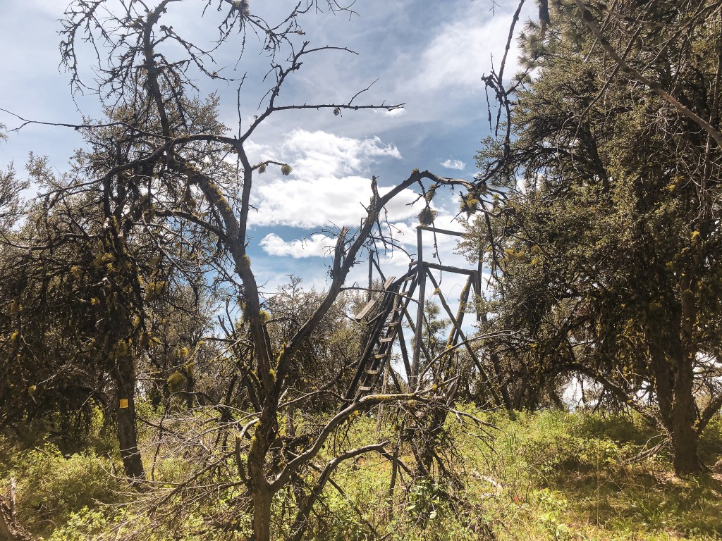
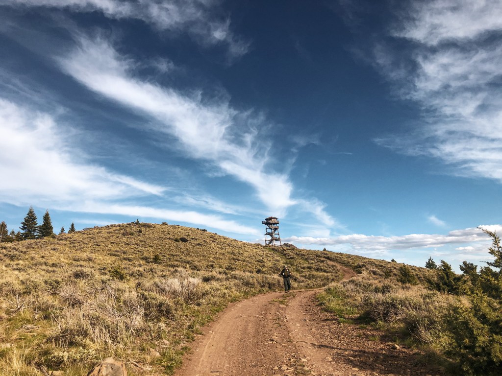
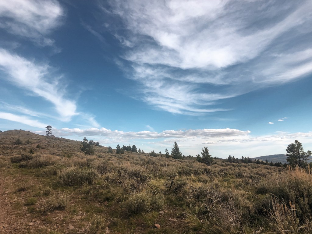
We decided to visit Calamity Butte L.O. the day after King Mountain L.O. to help break up our time in the truck. We took NF-28 to NF-2860. NF-28 might as well be considered a major highway. It is a well maintained double wide gravel road. NF-2860, on the other hand, is extremely rough, narrow, and bumpy. I would most likely have to park at the bottom of this road and road walk up it if we had drove my Civic here. Luckily we were in a truck this time and were able to make it up to the spur NF-155 that leads to the lookout. We parked on a pull out after turning on to NF-155 and walked the remainder of the road. A high clearance vehicle can make it to the lookout but we didn’t feel like maneuvering around the remaining road hazards. This is an actively staffed lookout but when we visited it was still boarded up for the season.
History.
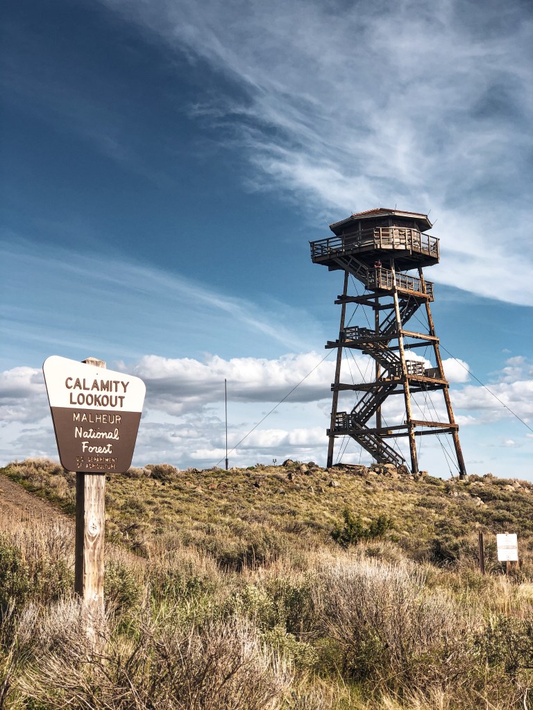
The first lookout that was built on Calamity Butte was a D-5 ground house in 1927 and can still be found on the summit today. It has a National Historic Lookout Register sign posted on the door front. The current lookout didn’t start construction until 1996 and was completed in 2001. It’s a 50′ tower with an octagonal cab. I’m not sure what lead the forest service to start building lookout cabs as octagonal, but it seems the newer structures built during that time frame were all moved to this shape. You can also find an older garage on the summit. Fun Fact: This point use to be named Bald Butte but it was later changed to Calamity.
NOTICE: As of July 14, 2024 this area is currently closed due to the active Falls Fire and Telephone Fire.
Location.
Malheur National Forest
Status.
Abandoned; Currently standing
Estimated drive time from Portland, OR.
6 hours
Date visited.
May 29, 2021
Elevation.
6,678′
National Historic Lookout Register.
US 469; OR 66
Trip Report.
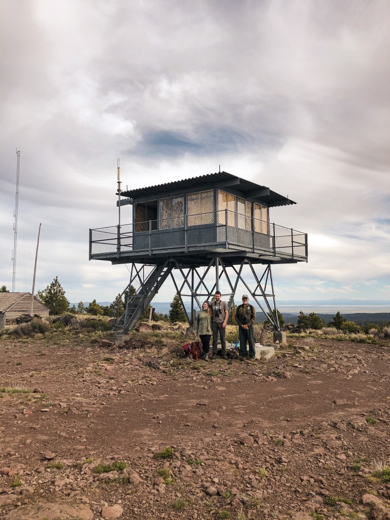
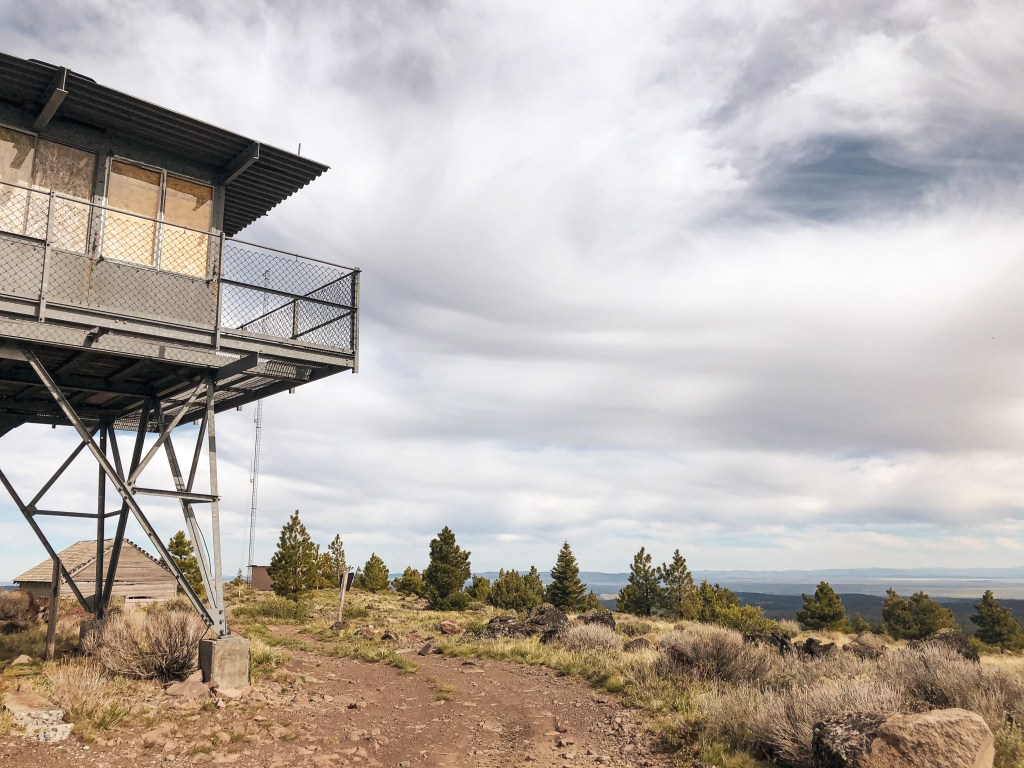
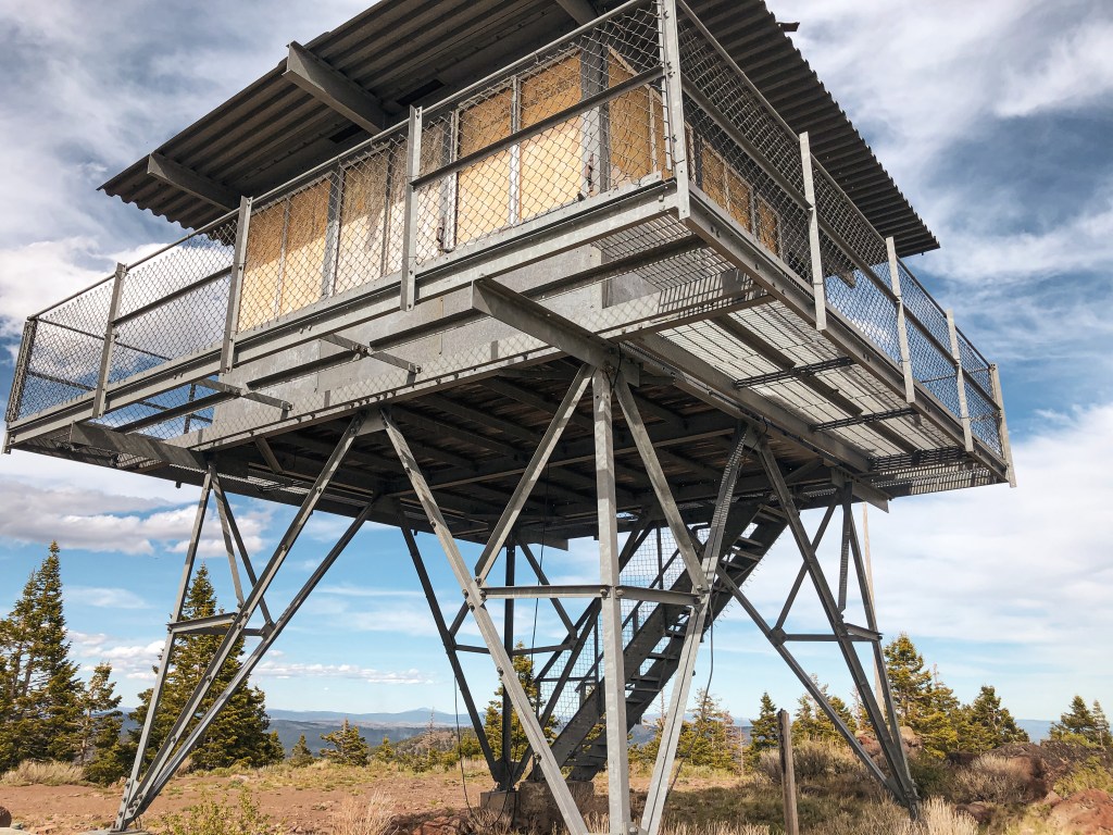
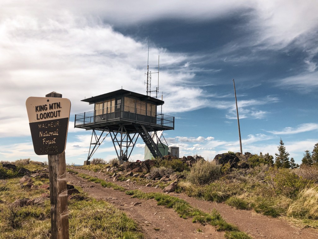
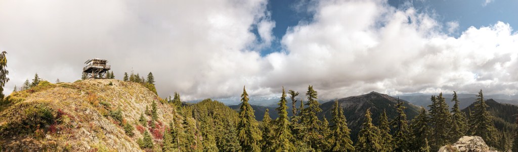
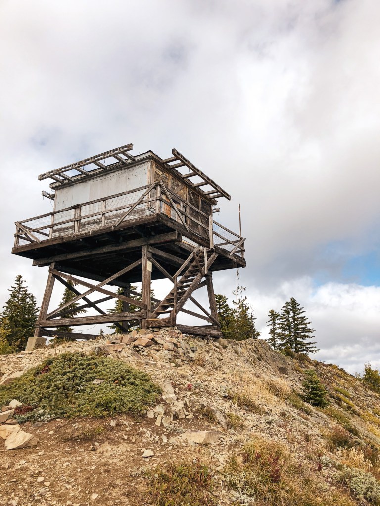
My partner, his dad, and I were dispersed camping in the area for the Memorial weekend. Our plan was to see the lookouts in this area along with a few other points of interest. We decided to go up to King Mountain L.O. for our lunch stop of the day. There is a sign off of NF-2820 that notes when you are at the road to the lookout which is NF-503. We had a truck for the weekend but NF-503 is in good condition for passenger vehicles up until the last 1/2 mile. The water run off from rain and snow is causing deep ruts and erosion on the last bit of the road. We parked the truck and walked the remaining distance.
History.
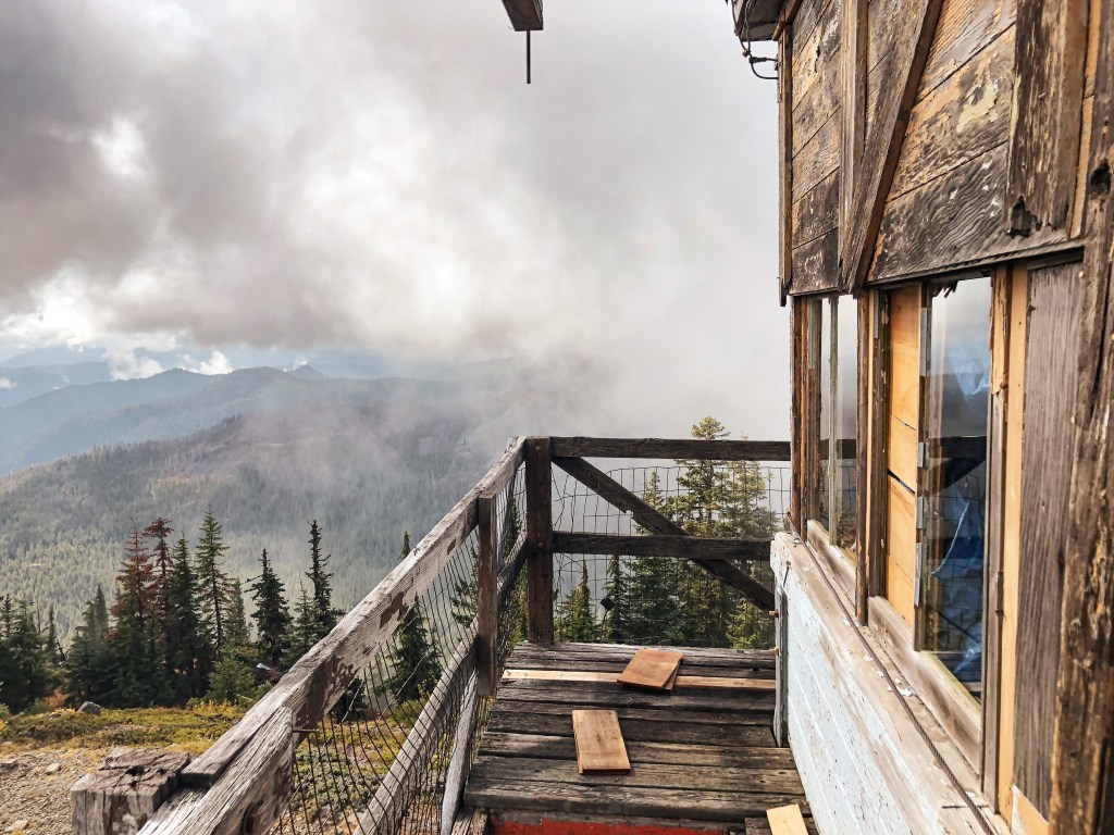
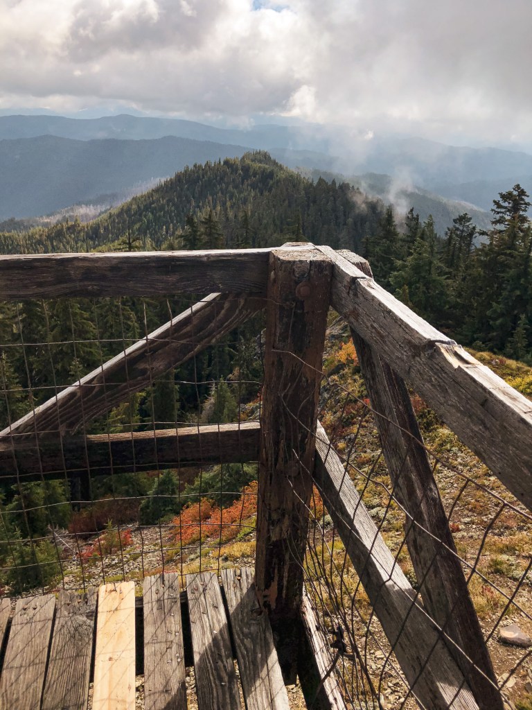
On the summit of King Mountain there is a 10′ steel tower lookout with steel cab, an old wooden garage, and communication towers. The steel fire lookout was built back in 1957 to replace the original Cupola cabin that was built in 1923. The garage looks like it’s the original from 1934 and I don’t believe it would be standing without the wire supports in place. Unfortunately, this lookout is no longer staffed and is slated to be torn down by the Forest Service. Due to the accessibility of this lookout, they had to remove part of the catwalk and board up the windows to deter vandalism. One of the windows was broken with the ply wood removed when we visited.
NOTICE: As of July 20, 2024 this area is currently closed due to the active Diamond Complex.
Location.
Umpqua National Forest
Status.
Abandoned; Currently standing
Estimated drive time from Portland, OR.
6 hours
Date visited.
May 1, 2021
Elevation.
5,392′
National Historic Lookout Register.
US 98; OR 13
Trip Report.
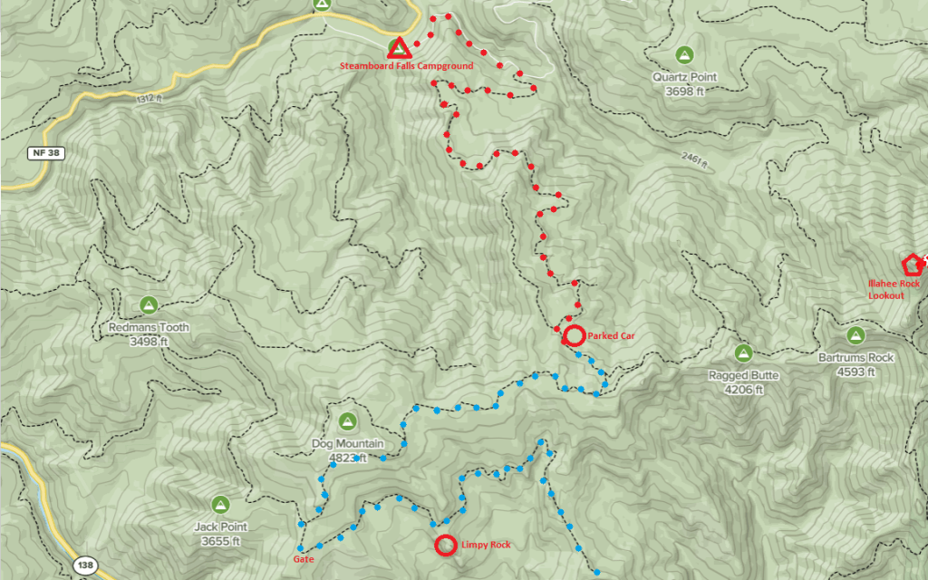
The first time my partner and I thought about visiting Illahee Rock Lookout was on my birthday weekend in April 2021. At the last minute, we had decided to travel to the Umpqua NF for the weekend instead of Olympic National Park. We did not do any proper research on what was in the area due to the last minute change and came unprepared without a topographic map. Illahee Rock Lookout was marked on our general road atlas and seemed to even note the Forest Service road needed to get there. It appeared to be direct and we figured we would give it a shot. We were closer to Steamboat Falls C.G., so we decided to take the back road to get there. We drove my Civic up NF-4760 that is just past the campground. The road was in great condition and we became optimistic as we caught a glimpse of the lookout sitting on the ridge. My car made it all the way to the junction with NF-300 where there was a deep patch of snow covering the road. We decided we were close enough to reach the lookout via a road hike and parked the car in a pullout. We started to trudge through the snow banks on the road, alternating between clear patches and deep snow. We came to a sharp fork in the road where neither of the roads had a visible number sign. It appeared to us that the main road continued straight and the road that sharply turned was a spur road. Later, we would come to find out it was the opposite. We continued straight on this road for miles, walking up and over a ridge that we assumed to be Ragged Butte. We even came to a junction that appeared to have parking and an old gate like you would find near a fire lookout. We continued down this road assuming we were finally at the road junction leading to the lookout trail. We even passed an extremely large rock that we assumed had to be Bartrums Rock or even Illahee Rock itself. It wasn’t until we met the road’s dead end that we realized how far off track we truly were. When I say we were hopeful that we were on the right track, I mean that we were so sure it was around the next corner that we convinced ourselves to hike 7.77 miles away from my car. Which meant we had to hike another 7.77 miles back. We didn’t make it back to the car until well past dark and got back to camp closer to midnight. To make matters worse, I had neglected to fully charge my headlamp before coming and we had to rely on my partner’s light on the way back. When I finally saw the reflection from our light on my Honda, I cried tears of joy.
After consulting a much better map upon our return to Portland, we realized we had ended up on NF-100. The ridge we thought was Ragged Butte was actually Dog Mountain. The junction with the gate was NF-120, which wasn’t marked. Otherwise, we would have known to turn around sooner. And the rock we saw was Limpy Rock, not Bartrums. After such a complete failure we were determined to redeem ourselves and make it to Illahee Rock Lookout as soon as humanly possible.
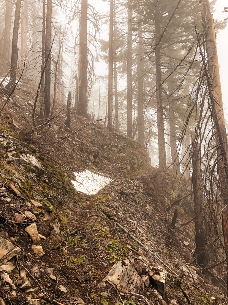
ILLAHEE ROCK LOOKOUT REDEMPTION! We decided on our next free weekend we would drive down early Saturday morning to hike to Illahee Rock Lookout and then camp at Steamboat Falls C.G. for a night before heading home. We did more research on the area, packed a better map, and decided to go up the more conventional route on the other side of NF-4760. This side of the road is just as well maintained and I had no issues driving my Civic up it. We were once again met with snow on the road and pulled my car into another pull out. This time I was happy to find we were just a 1/2 mile short of the junction with NF-100 (same number but different road from the last time we were in this area). We walked along this road until we met with NF-104, which leads to the trailhead. We were once again optimistic! That is until we rounded the corner and were met with deep snow drifts. Feeling uneasy about another trudge through more snow I convinced my partner we should go up the “other trail.” It was on the more exposed side of the mountain and in theory, would be snow free. According to the topographic map of this area there are two trails that lead up to Illahee Rock Lookout, one originating south of the lookout and one beginning north of the lookout. After backtracking, we started to search for where the other trail should be according to the map. At one point we found a game trail that we followed for a while but it only led to Bartrums Rock and wasn’t on the correct side of the road. We searched again and found an old road that might have led to where we needed to go but was too overgrown to know for sure. Accepting that this trail no longer exists, we backtracked again to NF-104. We made our way over the snow banks until we found the actual trailhead. It does exist! From there it is supposed to be a little less than a mile one way.
We started up the official Illahee Lookout trail #1539. We crossed one major snow bank that was easy to maneuver on a gradual slope. The trail seemed to be mostly snow free as we switchbacked up. It wasn’t until we went around to the northern side of the trail that we found we were wrong again. We became frustrated, knowing that we were so close to this lookout. However, these snowbanks were different than the ones we faced on the roads, they were now sloping off of a cliff covering a narrow trail. My fear of falling kicked in and I opted to turn around. My partner is more headstrong and was not going to leave without seeing this lookout. I decided to wait on the trail while he continued on over the snow. I waited there for a while hoping for the best and fearing the worst. I started to hear someone whistling down the trail and assumed it was him on his jolly way back. I was shocked to see another couple come around the bend instead of him. I was so shocked that I didn’t even bother to ask them if they saw my partner or how the trail conditions were. I could only muster up a “hello” as they passed by. I figured that if there were other people on this trail then it couldn’t be that bad around the corner and maybe I should have attempted to hike up the trail as well. Soon after my partner returned and told me how close we were. He claimed there weren’t too many snow banks to cross and it wasn’t as bad as it looked. He also told me that there were no footprints in the snow before his, so the couple we saw somehow climbed up the talus slope on the other side. They might have been crazier than us to try that from what I saw on that side of the mountain. After talking it over for a while he was able to convince me to head up the rest of the way to the lookout. It took a lot of hand holding and a bit of tears for me to make it because once I rounded the first snowbank there were many more to face and they were worse than I thought. I used kick steps to shuffle my way up and down them but my anxiety didn’t subside until I returned to the spot where I had originally waited for my partner.
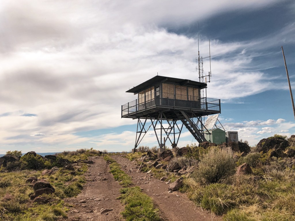
History.
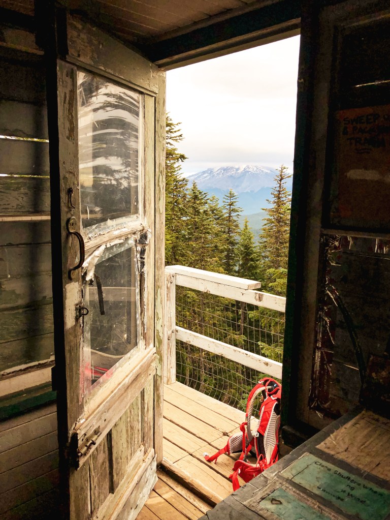
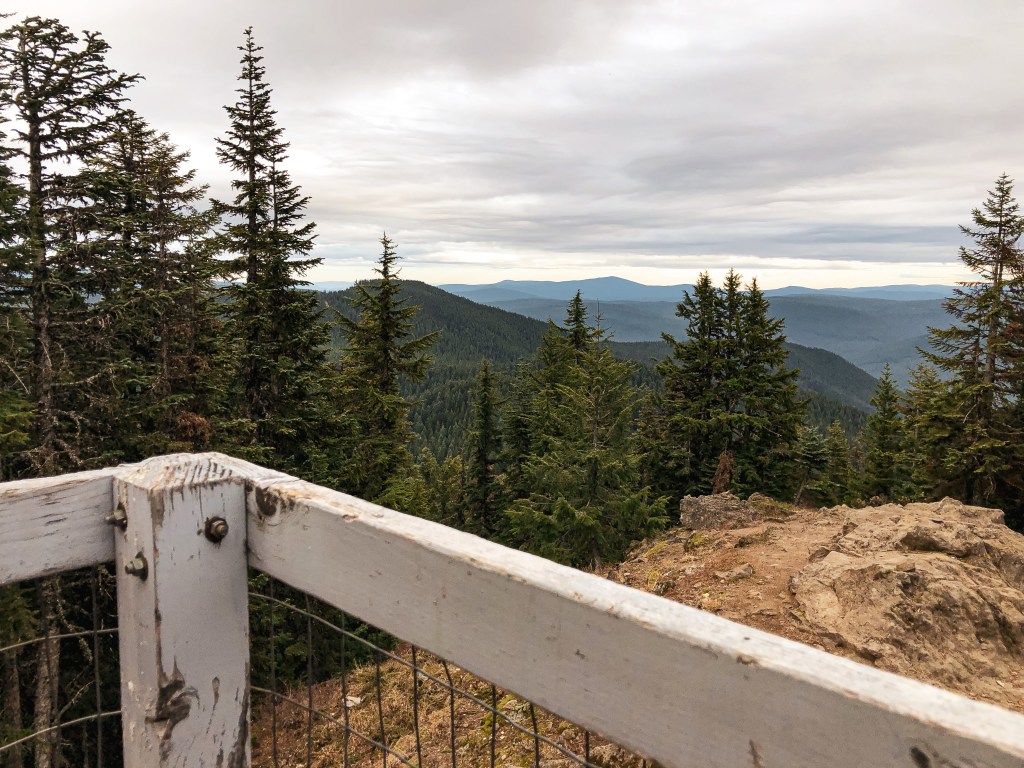
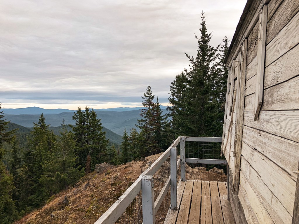
The whole day we had been circling this butte it had been clouded in fog. But now that we were both on the summit it had cleared out to a spectacular view. The original D-6 Cupola from 1925 is still standing and was converted to a tool shed in 1958. The L-4 tower was built in 1956 when the D-6 was considered too small to house two fire lookouts. Illahee Rock Lookout does not appear to be actively staffed anymore since there was no longer a solar panel when we visited. It might still be staffed in high fire danger but I couldn’t find any information to confirm.
Illahee Rock Lookout is a short, two mile round trip hike with roughly 600 feet of elevation gain. But in total we ended up hiking 24.74 miles trying to get to this lookout. The moral of the story is this: don’t go chasing fire lookouts in early spring!
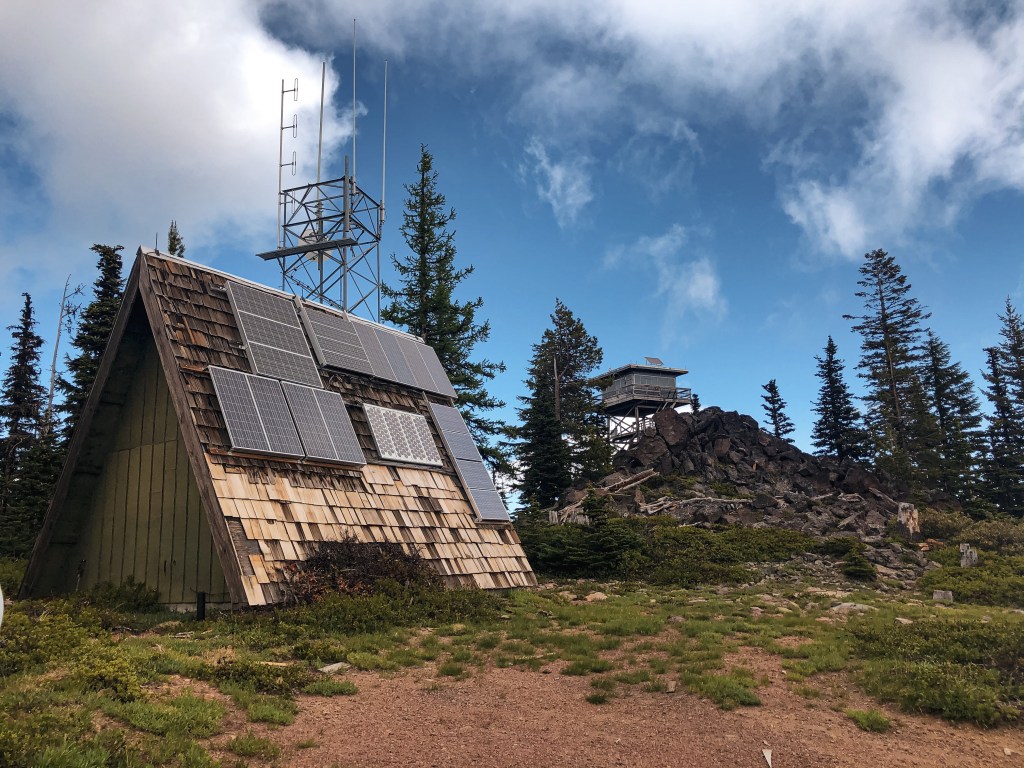
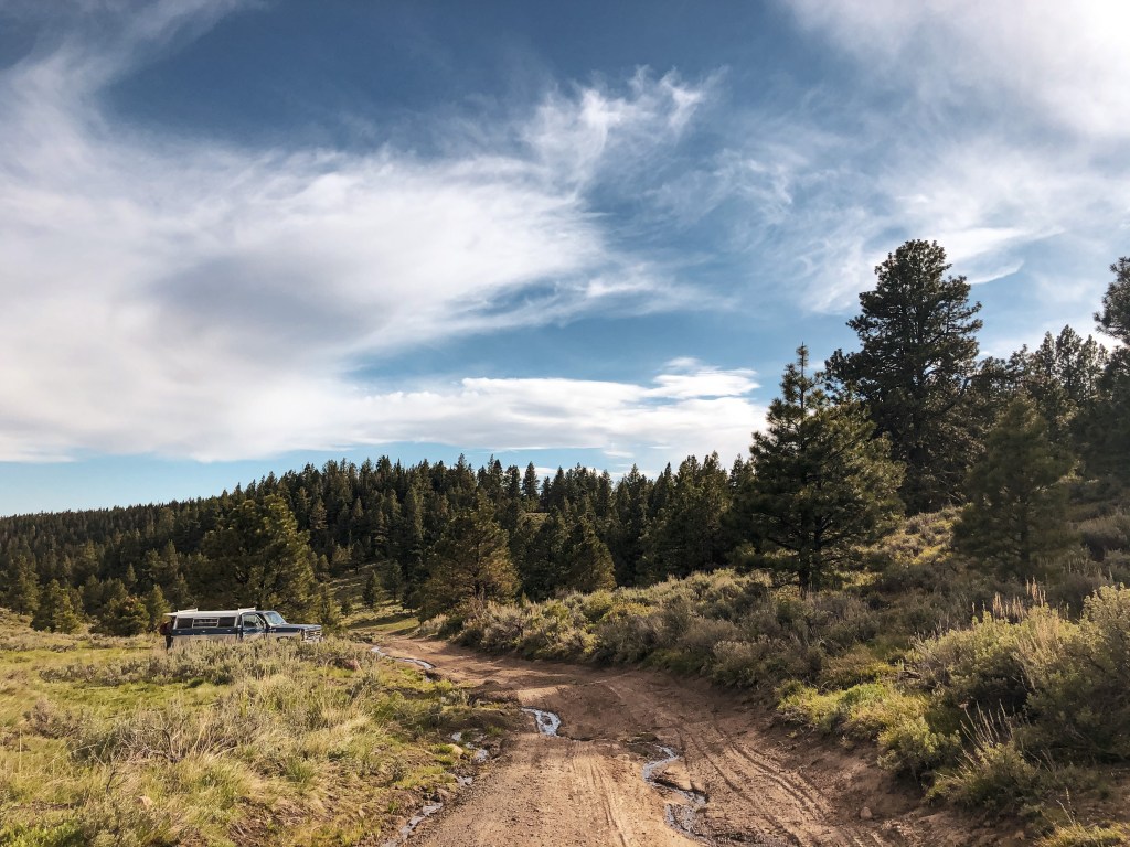
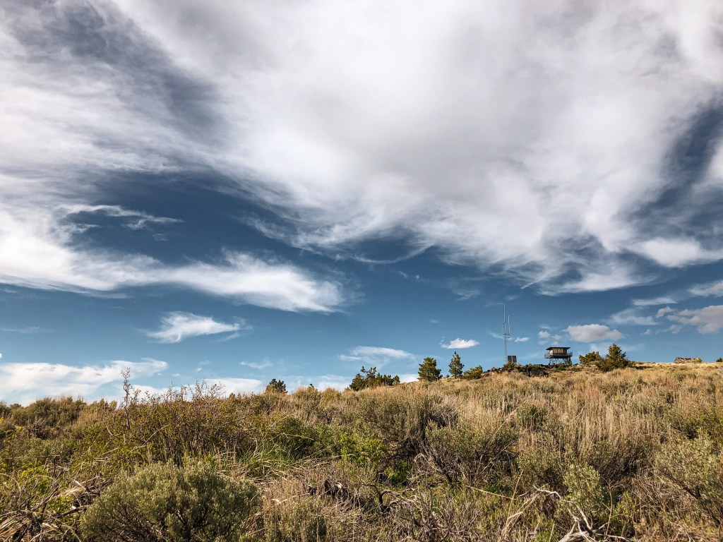
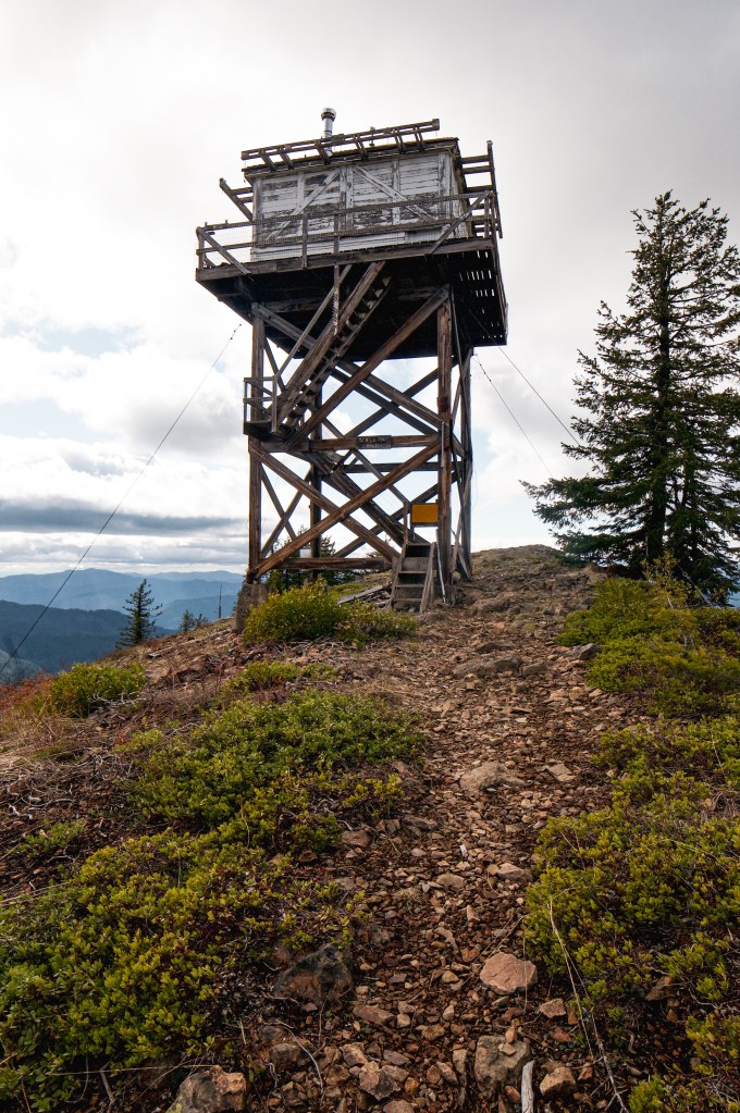
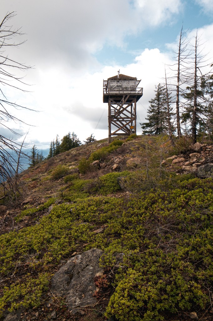
My partner and I were dispersed camping in the area for Memorial Day weekend. We were checking out the points of interest on our topographic maps and found Flagtail Mountain noted as a lookout. I drove my Civic on NF-63 until we met up with the junction of NF-594. Typically, three numbered Forest Service roads are rough and I didn’t want to find out the hard way. We parked my car at the junction at a pullout and started hiking up the road. From my recollection the road wasn’t terrible and I definitely would have been able to drive farther up the road to shorten our road walk. However, I wouldn’t have made it to the top in my Civic. There was a lot of ATV activity in this area and we were dusted up a few times by passing vehicles. I’m pretty sure they all thought we were crazy for choosing to walk up the road to see the lookout. During the summer this is a staffed lookout, but when we visited it was still closed up. On our way back down, we found an unattended fire left by a group of people on ATVs that we had passed on our way up the road. There was still some snow in the area and we decided to pack it on the fire to help douse it. Please always make sure your fires are dead out before leaving them!
History.
Flagtail mountain has been the site of a fire lookout since 1922. It started as a platform on a juniper tree, which still stands. In 1934, they built a 20′ round pole tower with L-4 cab. This was used until the current R-6 lookout was built in 1966. It is still actively staffed every summer.
Salmon-Huckleberry Wilderness; Mount Hood National Forest
Status.
Maintained by volunteers; Currently standing
Estimated drive time from Portland, OR.
1-1/2 hours
Date visited.
November 9, 2019
Elevation.
5, 045′
National Historic Lookout Register.
US 521; OR 102
Trip Report.
My partner and I decided to do Devil’s Peak L.O. as a day hike via Cool Creek Trail #794. There are other access trails to this lookout but this one seemed to be the most direct. And by most direct I mean very steep. It was like the Stairmaster of hikes. For 3.5 miles you are essentially walking straight up and when you think you’re close you will continue to hike up. It climbs a grueling 3,200 feet of elevation in those few miles. The trail starts off of NF-2612 which is also marked as Still Creek Road. It is paved most of the way until the last 1/2 mile where it turns to maintained gravel. The trailhead is just a pullout along the one lane road and can be missed if you’re not looking for the sign. We didn’t see anyone else our whole hike up to the lookout. We had a quick lunch at the summit as we explored the inside. It was a cloudy November day and we were rapidly losing sunlight. As we raced down the trail we passed another couple on their way to the summit. We were surprised to see someone else heading up so late. They only had day packs as well so we knew they weren’t staying the night. Most of our hike down was in blue hour and by the last mile we had our head lamps out. We didn’t reach my Civic until it was already dark out. The other couple came down shortly after us with their own set of head lamps. Off season hiking always becomes a race against the sun.
History.
Devil’s Peak L.O. was originally built in 1924 and decommissioned in 1964. It is an 8′ tower with an L-4 cab and listed on the National Historic Lookout Register. The lookout is maintained by volunteers and they have kept it in great condition. The entire structure is open to the public and you can even stay in it on a first-come first-serve basis. I really want to do this sometime but the thought of lugging a heavy backpack up this trail is less appealing. There is no water source up there either, so not only do you have to carry your standard gear but water as well. You still get views of Mt Hood and the surrounding peaks but since it hasn’t been active in years the trees are slowly obstructing the tower’s views.
This was another early morning hike where I met up with a friend from out of town. They were driving from Coos Bay and we were planning on spending the weekend in Bend after completing this hike. We met at Black Butte Ranch which is just down the highway from the Forest Service road you need to take to get to the trailhead. We decided to take their Subaru due to the AllTrails reviews of the road. The NF-1110 to the trailhead is rough but doable. I did see a few sedans up there. You can access the trail from Camp Sherman if you don’t want to make the trek up the “treacherous” road according to an AllTrails review. I did not attempt this road with my Civic. A Northwest Forest Pass is required for parking.
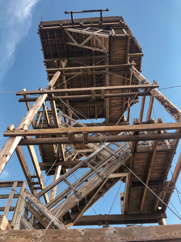
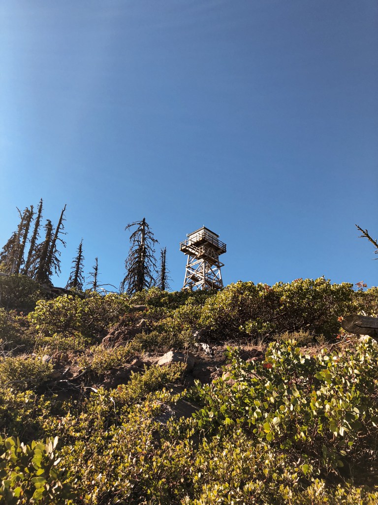
The hike itself was just shy of 2 miles one way and gained 1,538 feet of elevation. It will definitely get your blood pumping before you reach the top. The trail is rocky and exposed which makes the sun beat down much hotter than normal. Once on top you can check out the old D-6 cupola that use to be the main lookout. You can also see the taller lookout that is actively staffed, but you are not supposed to go within a few feet of it. There are posted signs due to the popularity of this hike. However, from the ground you can still see Mt. Jefferson, the Three Sisters, Mt. Saint Helens, Mt. Hood and beyond. From recent pictures and reviews on AllTrails, there seems to be an added platform with noted mountains and peaks. It also looks like they have made some repairs to the cupola and updated the staircase. These were not here when I visited in 2018.
History.
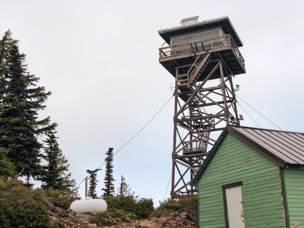
Black Butte became the first lookout site in the Deschutes NF in 1910 when two tree lookouts were built. They were replaced in 1919 by a platform lookout supported by the trunks of four trees. In 1922 an Aladdin D-6 Cupola was built. The D-6 was the first standardized lookout style for the Forest Service in the Pacific Northwest. The design was meant to simplify the construction of fire lookouts, requiring just few people, minimal tools, and simple diagrams. In 1934, the CCC built a 83′ tower with a 7’x7′ L-6 cab to increase visibility from the original cupola. This structure was used as the active lookout until 1993 when it was condemned due to unsafe conditions. The cupola again served as the lookout until the current 65′ lookout with 10’x10′ cab was completed in 1996. The condemned lookout collapsed during a heavy winter storm in December 2001. You can still see the 1922 D-6 Cupola and the 1996 structure on this hike.
Bull of the Woods Wilderness; Mount Hood National Forest
Status.
Burned in Bull Complex Fire; September 6, 2021
Estimated drive time from Portland, OR.
1-1/2 hours
Date visited.
September 23, 2018
Elevation.
5,520′
National Historic Lookout Register.
US 200; OR 26
Incident Management Team officials confirmed last night that the Bull of the Woods Lookout located within the Bull of the Woods Wilderness was lost due to fire activity yesterday. This lookout was listed on the National Register of Historic Places and frequently visited by those who enjoy the history and background of Fire Lookouts. “We acknowledge that losing this historic Lookout is a loss that will be felt by many in the area and beyond,” said Rick Connell, Incident Commander of NR Team 4.
Over the past several weeks as the fire moved towards the historic Lookout, several actions had been taken by firefighters to protect it. Plans to wrap the Lookout in structure wrap material were made several times but had to be cancelled due to dangerous conditions to firefighter safety and the unavailability of trained personnel. Working on dangerously high and structurally compromised materials in a remote wilderness location to wrap a structure requires firefighters who are specifically trained for that type of work. If a person falls from a high surface without appropriate fall protection training and equipment the consequences could be severe. The extremely steep terrain on all sides of the Lookout’s location also creates dangerous wildfire conditions where fire can move quickly uphill without warning. The combination of safe forecasted fire behavior conditions and trained personnel needed were never able to converge for structure wrapping. The safety of the public and firefighters is always the highest priority in fire response.
On August 31 a helicopter rappelling fire crew flew to the site and cleared trees and brush around the Lookout to make it more defensible. The crew could not safely remain at the site since it was on steep terrain directly in front of the approaching fire. For the past six days numerous hours of helicopter flight time had been used to drop water to slow the movement towards and intensity of the fire near the lookout. Yesterday, smoke obscured visibility on the north side of the fire and it wasn’t safe to fly aviation in that area.
On September 5 fire activity increased on three slope aspects below the Lookout site. This type of fire behavior is what was concerning for firefighter safety every time the discussion came up about firefighters working at the Lookout site. A smoke inversion and active fire behavior limited visibility for aircraft to safely fly and limited the tactical operations that could be performed for fire suppression. There are no safety zones or roads near the Lookout for firefighters to safely engage in firefighting on the ground. The fire was also making a push and threatening multiple values at risk on other portions of the fire at the same time. It is disappointing to see a historic structure like this Lookout destroyed by fire. However, many photos and stories have been preserved to continue to tell the story of the Bull of the Woods Lookout for years to come
-Mt Hood NF, September 6th 2021
Trip Report.
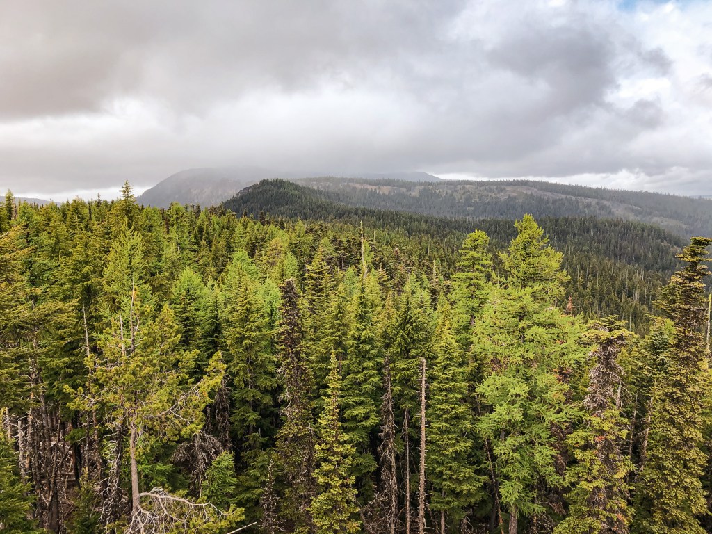
I’m reminiscing about this beautiful fire lookout in the middle of a rugged Oregon wilderness. Unlike most fire lookouts, there are no roads that lead here. Access was via the multiple interlocking trails found in the wilderness. The most direct route, and the one I took to get there, was the Bull of the Woods Trail #550. The trail switchbacks through shady woods until you crest the ridge line. You will gain 1,250 feet of elevation over 3.2 miles. Once you reach the ridge you are exposed to spectacular views as far as Three Sisters, Mount Jefferson, and Three Fingered Jack.
I hiked this trail with one of my good friends back in September 2018. I feel lucky now that we were able to see this when it was still standing. NF-6340 was a decent gravel road up until the end where it was rutted out due to people driving it in wet conditions. But my Civic was able to make it to the trailhead with some careful maneuvering. It was a colder day that felt like the beginning of fall. The understory was still wet from a recent rain and the clouds were rolling over the sun throughout the day. We had the trail to ourselves for the entire hike up and our summit lunch. It wasn’t until we were packing up to leave that we met an older couple and their dog at the summit. They even made a comment about my Civic being at the trailhead and that they were impressed it made it up there.
History.
This lookout was an L-4 built in 1942 and regularly used until 1963. The forest service intermittently staffed it in high fire danger until the mid-1980s. In the early 2000s, volunteers with the Sand Mountain Society helped renovate it but it had seen better days. When I visited in 2018 the cabin was shuttered and locked aside from the few boards that were pried off and a broken window. The catwalk was mostly useable but had some broken boards as well. Unfortunately, its structural integrity is a moot point, given that it burned in the 2021 Bull Complex fire. The trail and forest will recover and still make for a great day hike once the area is reopened.
My heart breaks as we lose more of these historic structures every year. All I can do is hope that I get a chance to experience them while they’re still here!