Location.
Gifford Pinchot National Forest
Status.
Maintained by volunteers; Currently standing
Estimated drive time from Portland, OR.
2 hours
Date visited.
September 25, 2021
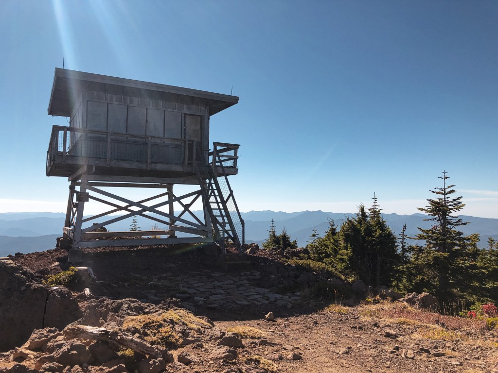
Elevation.
4,965′
National Historic Lookout Register.
US 189; WA 24


Trip Report.
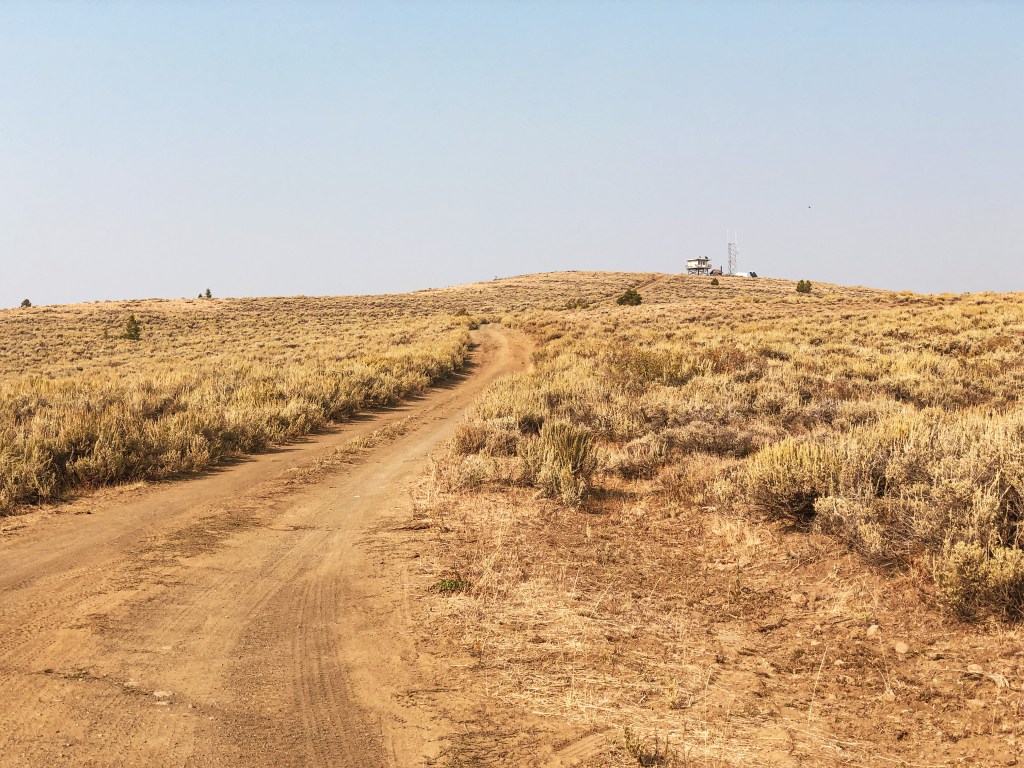
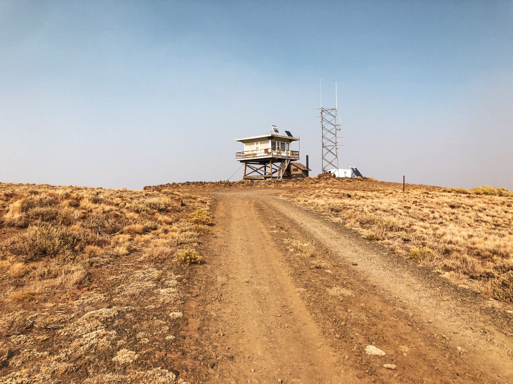
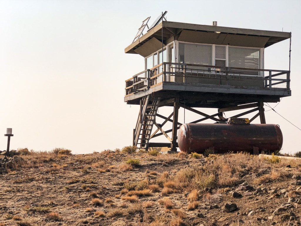
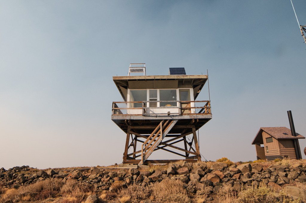
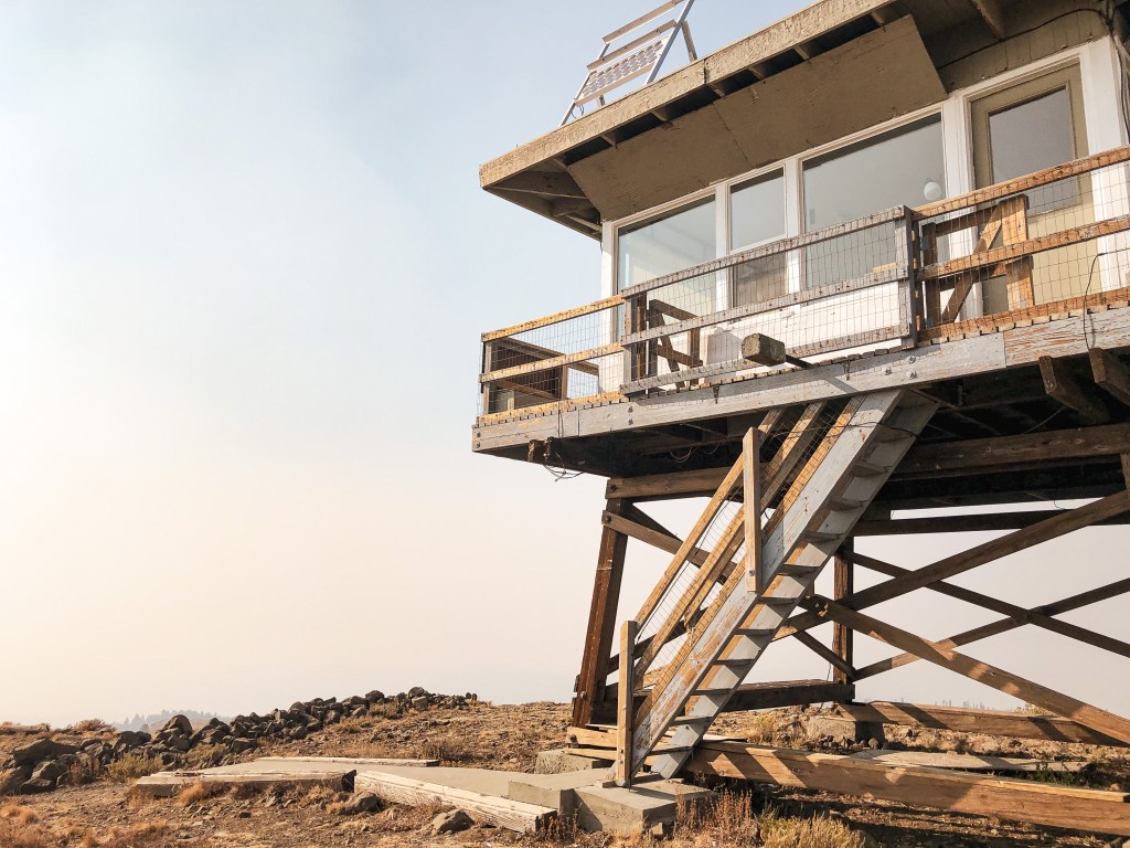
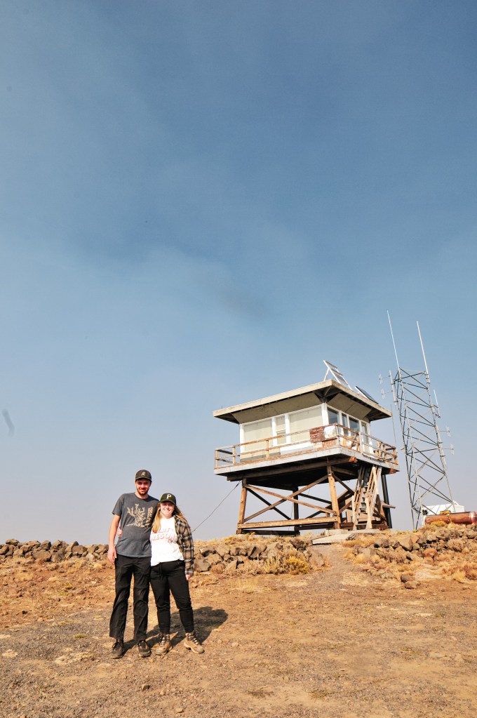
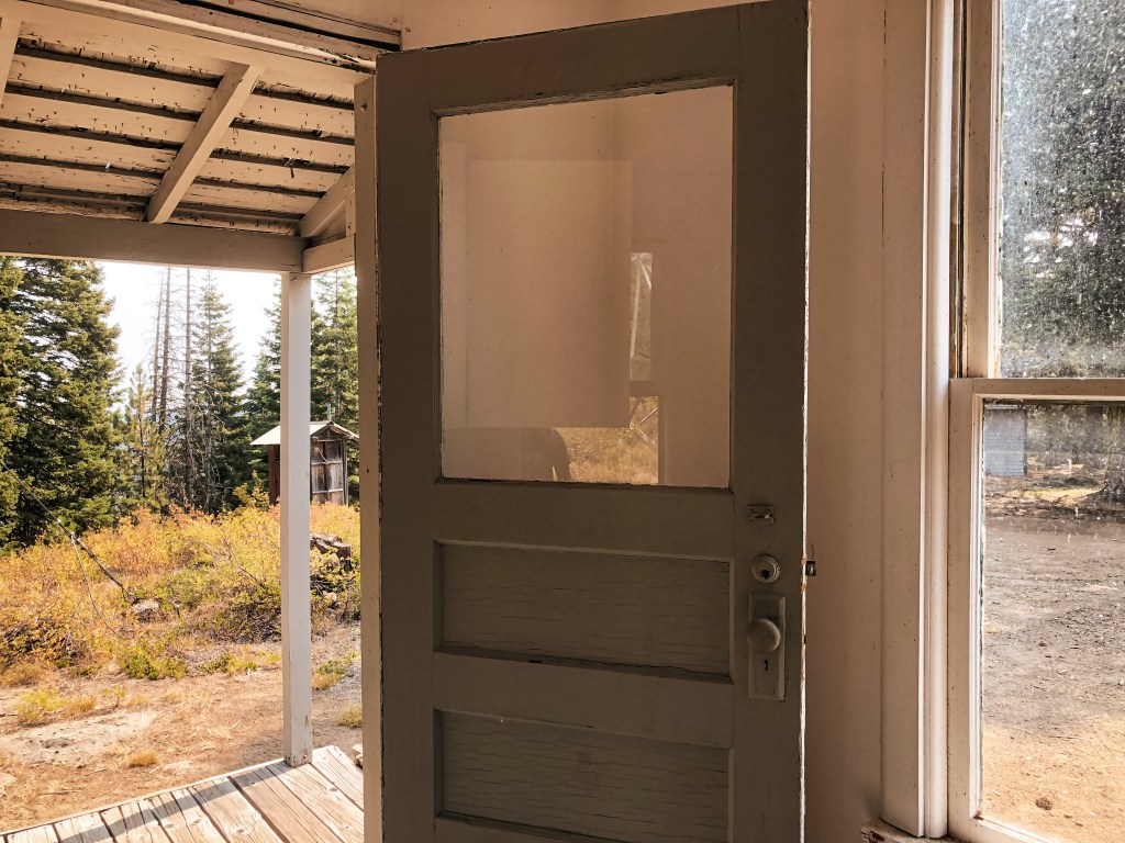
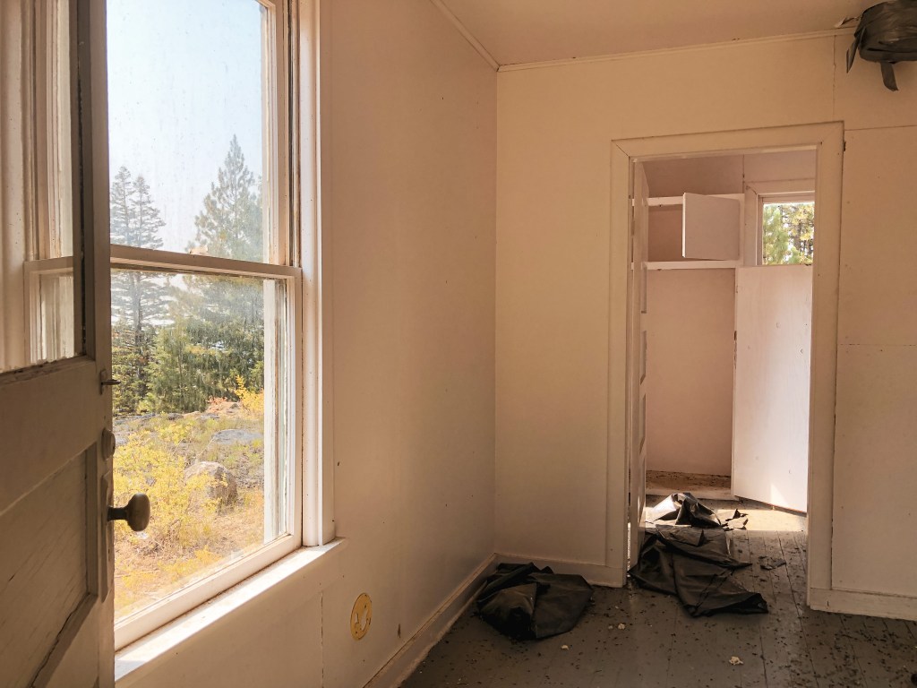
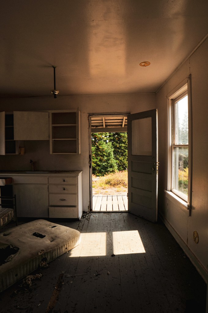
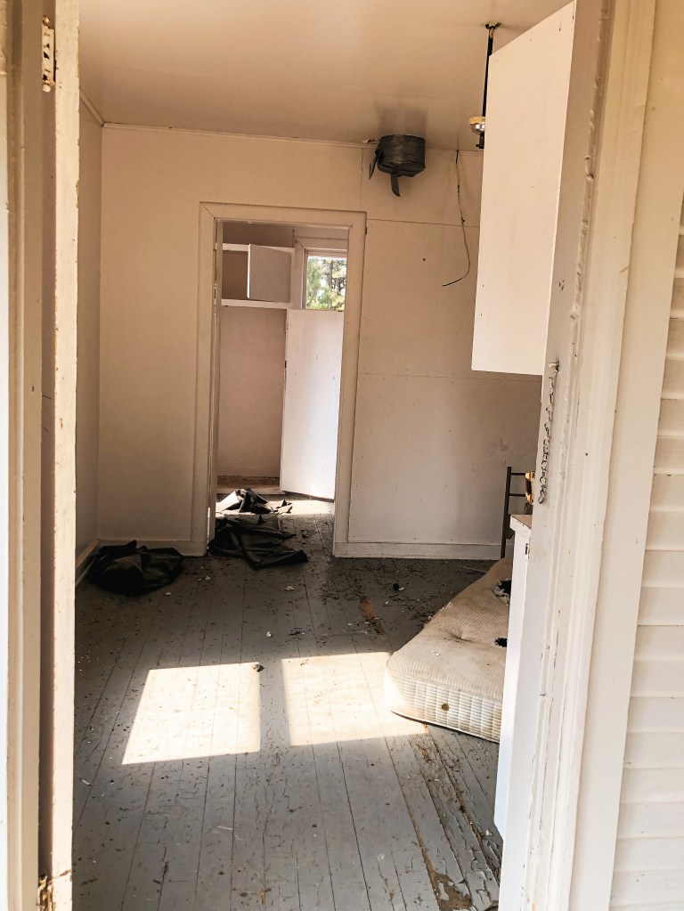
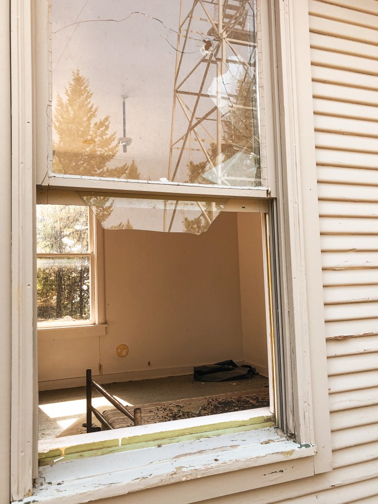
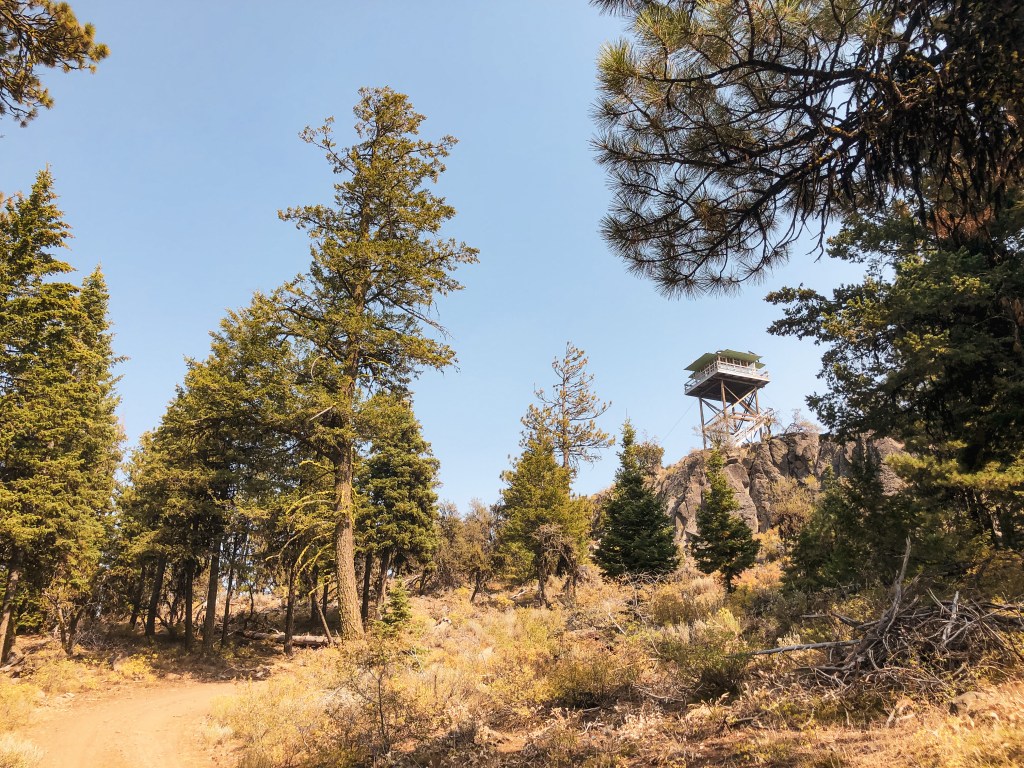
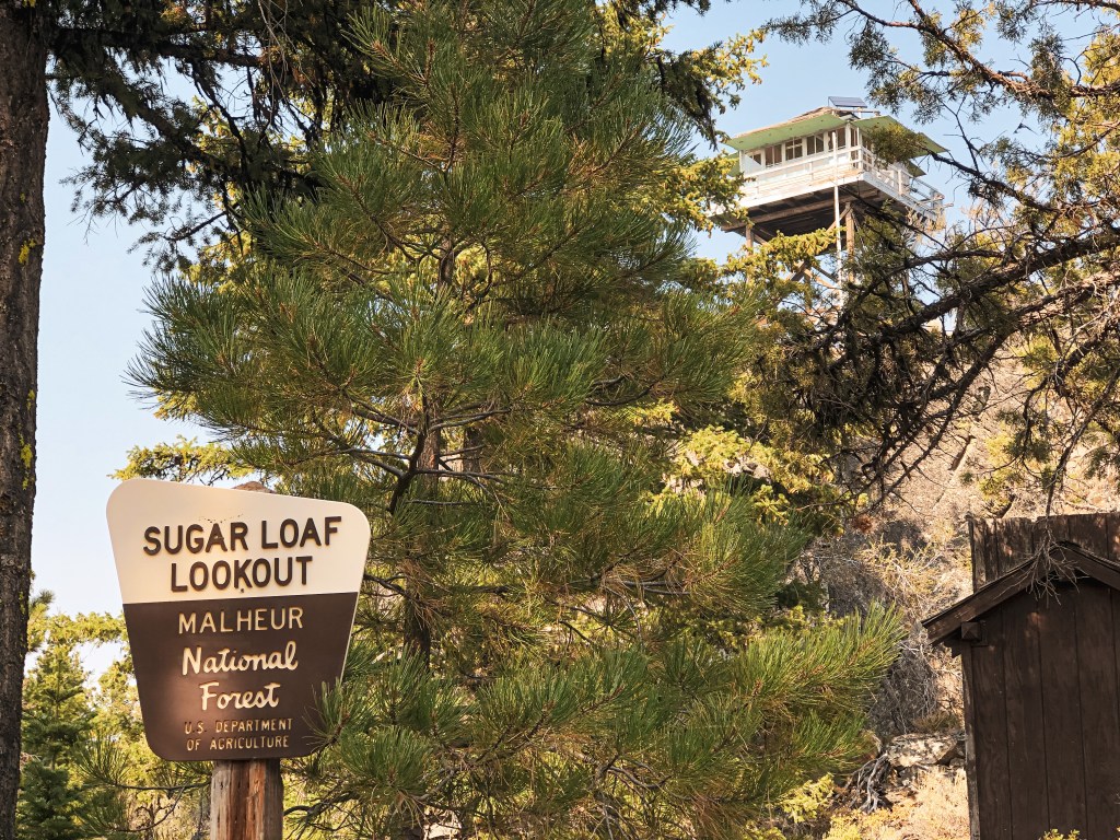
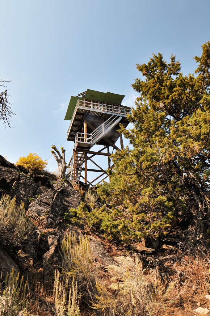
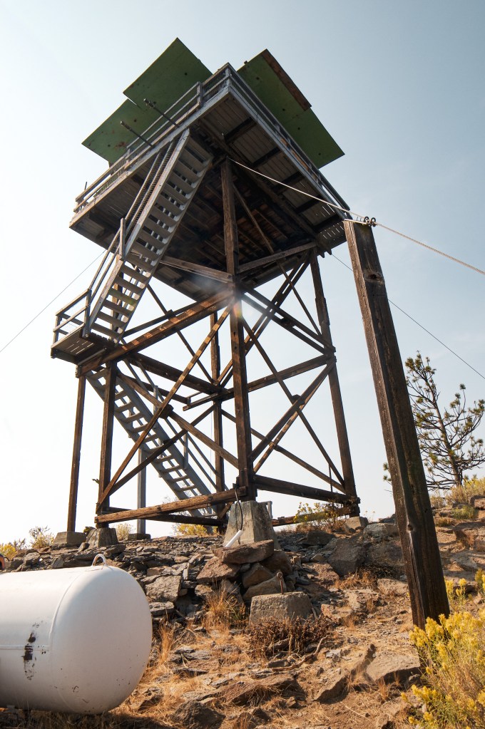
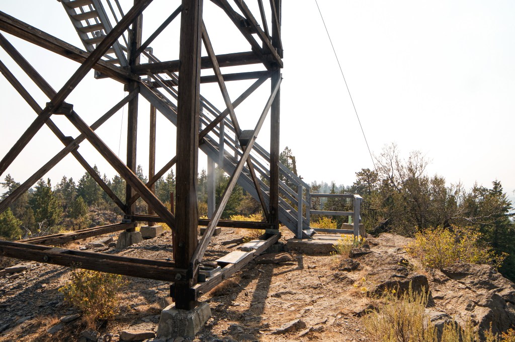
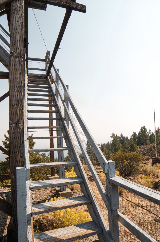
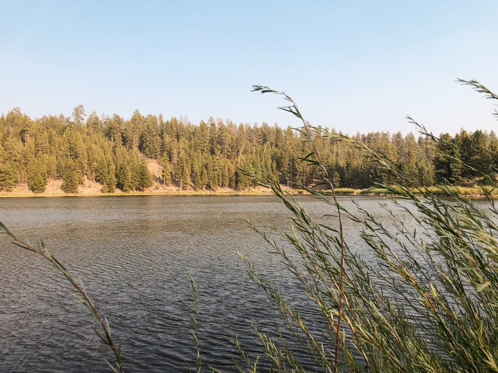
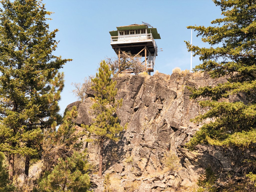
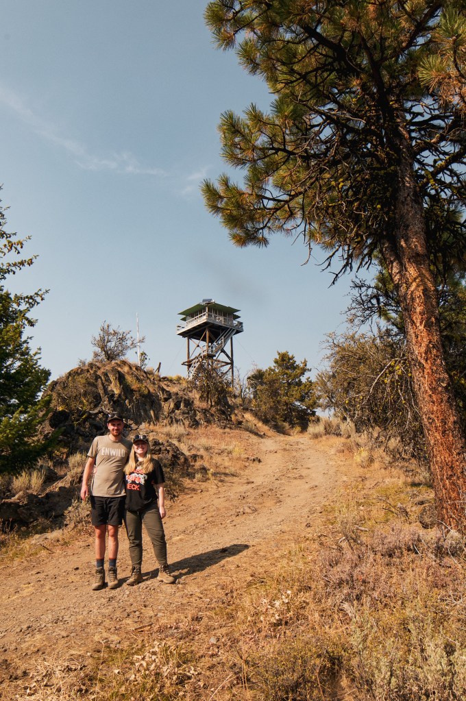
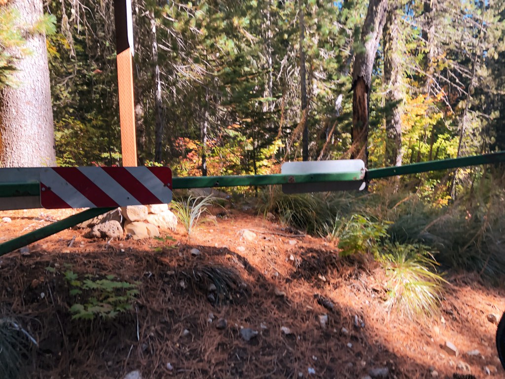
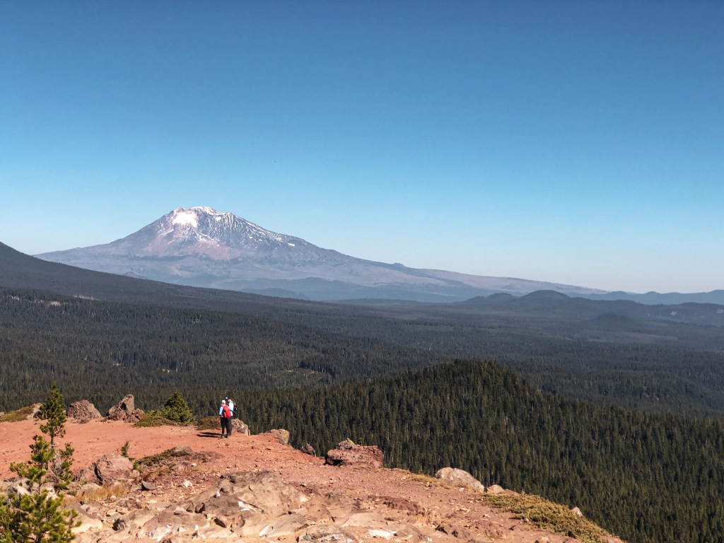
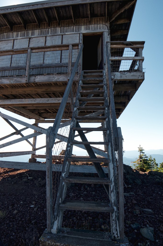
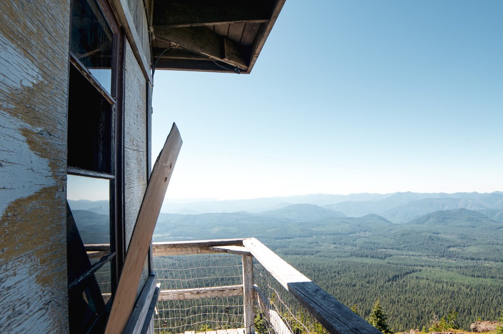
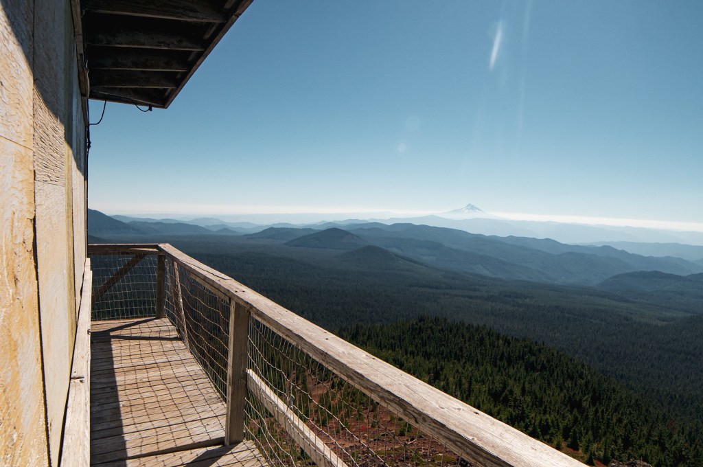
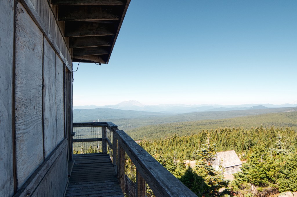
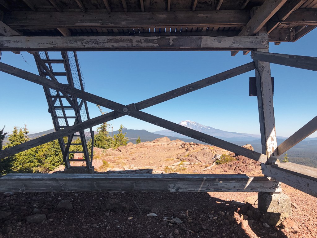
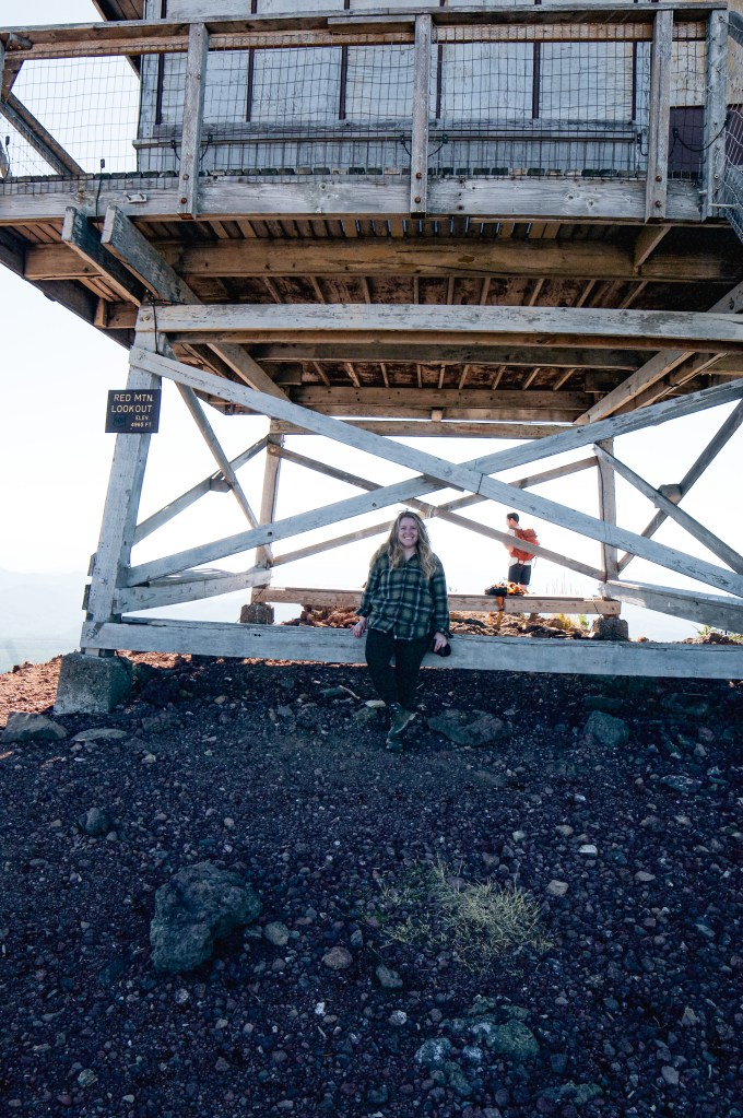
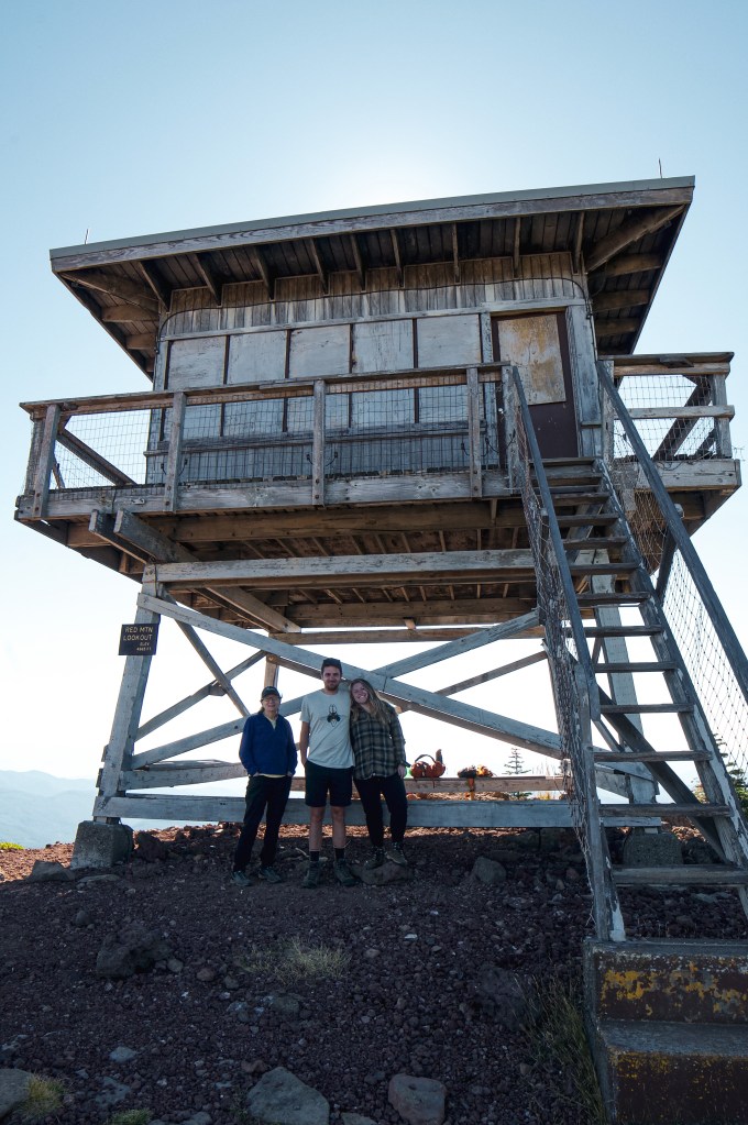
With some wildfires clinging on to the end of the season, my partner and I decided to head out to Red Mountain L.O. in the Gifford Pinchot NF. We brought my partner’s mom with us since she had been wanting to see this lookout as well. Red Mountain L.O. is one of the closest Washington lookouts to Portland. It skirts the edge of Indian Heaven Wilderness and is typically accessed via hiking trails. The main trail that leads to the lookout is Indian Racetrack Trail #171. We decided to go up via the road since it was a slightly shorter approach. From Carson, we drove towards Panther Creek C.G. and Panther Creek Falls on NF-65. You will stay on NF-65 until you come to a four way junction. Turn right onto NF-60 and continue down this road until you reach NF-6048. NF-6048 will be on the left hand side of NF-60 and will take you directly to the lookout. This is supposed to be a gated road to help deter vandals but is unfortunately open now. It looked like someone had hooked a chain to their car to pull it open given the large bend in it. We drove past the gate a little but were wary of the remaining road conditions. I was driving my partners’ mom’s car which is a Honda HR-V and I didn’t want to damage it. It gets better clearance than my Civic but is still not what I would consider a high-clearance vehicle. We walked the remaining 2 miles of the road which ended up being in great condition. We most likely would’ve been fine driving the HR-V to the summit. My Civic would have only been able to drive to the broken gate. We reached the lookout as a few groups were leaving and had some uninterrupted time to explore. The door to the lookout had been open when we were there so we were able to take a look inside. It was otherwise boarded up to keep the windows from breaking. One of the boards covering a window had fallen along with a glass pane. My partner and his mom tried to secure these two pieces back in place before shutting the door. Once we were joined by more people, we decided to exit the catwalk and sit below the tower for lunch. We absorbed the surrounding views of Mount Saint Helens, Mount Rainier, Mount Adams, Mount Hood, and the Gifford Pinchot NF as much as we could before heading back to the car to find camp. This lookout is close enough to be done as a day trip but we decided to stay the night in Crest Camp just down the road where NF-60 meets the PCT. There were dispersed camp spots in this area but they were all filled with commercial mushroom pickers during our trip.


History.
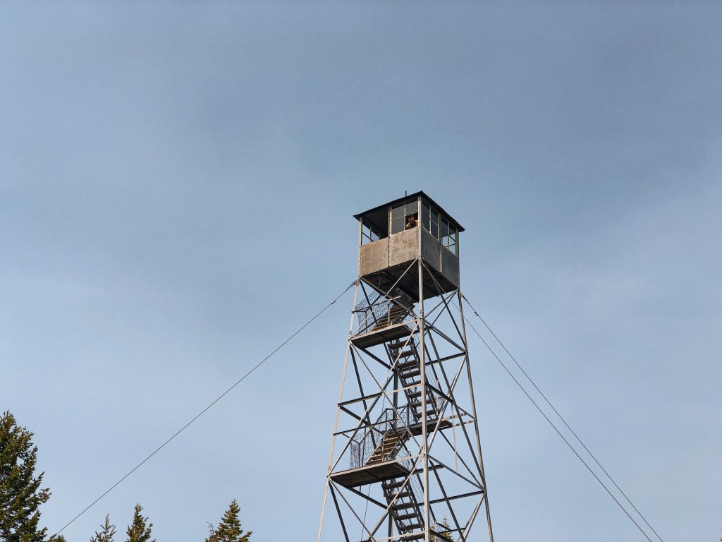
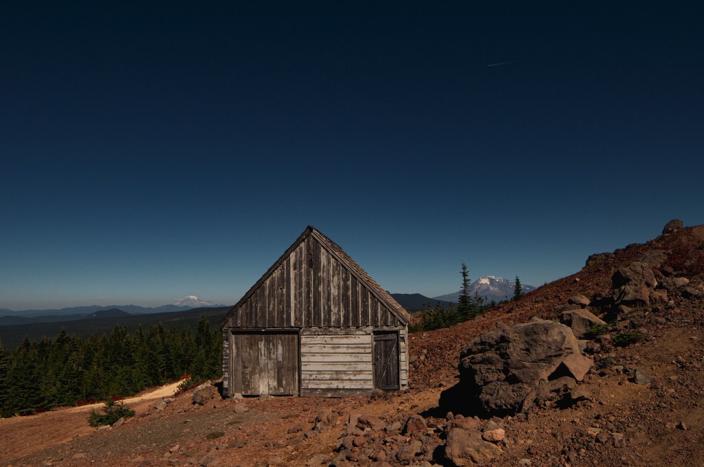
The Red Mountain L.O. was established in 1910 with an 8’x8′ cedar frame cab. It was replaced only 9 years later in 1919 by a standard cupola cabin. That was in turn replaced by an L-4 cab and added garage in 1935. The current structure is a 10′ tower with R-6 flat cab from 1959. The original garage is still standing and was used as living quarters during 1942 for World War II. Some of the fire lookouts were used for Aircraft Warning Services during this time. In 2006, the lookout along with some communication structures were torn apart by a violent winter storm. Volunteers came together to restore this lookout over the next few years. Matt Haldeman was the one that championed the project. As a Vancouver based custom home builder he was able to source the donated materials needed to complete the structure. The windows were salvaged from a decommissioned fire lookout in Oregon. And the man-power needed to reconstruct this lookout was donated by the volunteers of Passport in Time. After Restoration was complete, there were plans to add it to the Recreation Rental program but I don’t believe that is still the case. Red Mountain L.O. wouldn’t be in the condition it is today without the community volunteers. This is the last remaining fire lookout in Skamania County.


More Information.