Green Butte L.O.

Oregon Lookouts

Location.

Deschutes National Forest

Status.

Abandoned; Currently standing

Estimated drive time from Portland, OR.

4-1/2 hours

Date visited.

May 15, 2023

Elevation.

5,754′

National Historic Lookout Register.

Not registered (Former Fire Lookout Register: US 2057, OR 570)
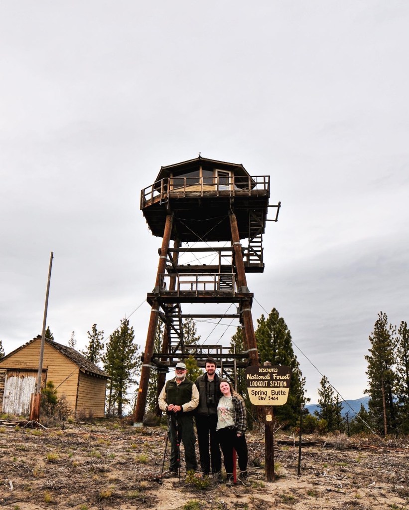
Trip Report.

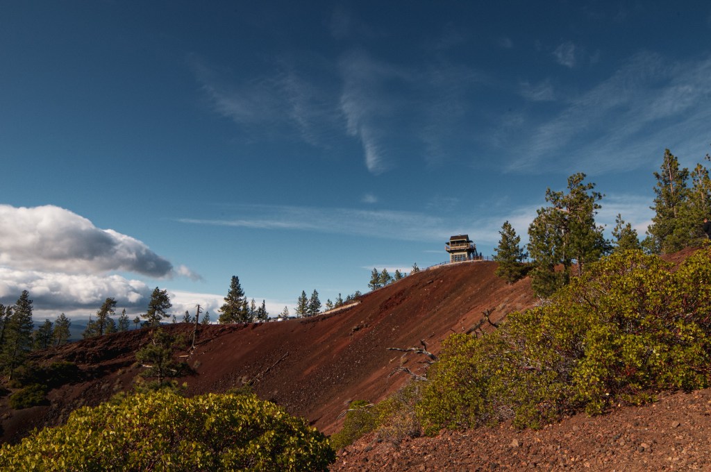
In 2022, we had made an attempt to visit Green Butte around this same time in May. Garnet was successful in his attempt and I, unfortunately, was not due to the lack of time. Later that year in August lightning started a fire along the slope of Green Butte. After seeing the news we figured there was no way the small structure would remain. The fire ended up only burning around 23 acres but it was around the top of the butte. There was no way to confirm if it was gone until we made it back to the area, but we assumed the worst. That was until Garnet found a report from a Geocacher stating the structure remained intact. Despite the odds, I was given a second chance to see it in person. We hadn’t initially planned to come back to the area this soon, but the lingering winter snow gave us limited options.

2022 Photos courtesy of Garnet.

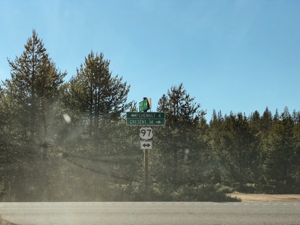
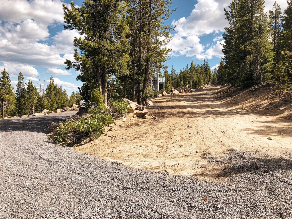
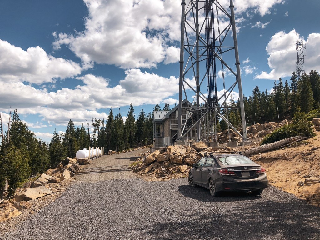
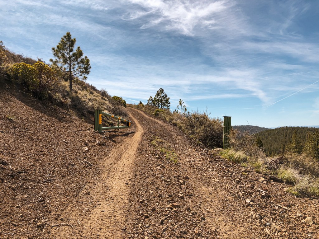
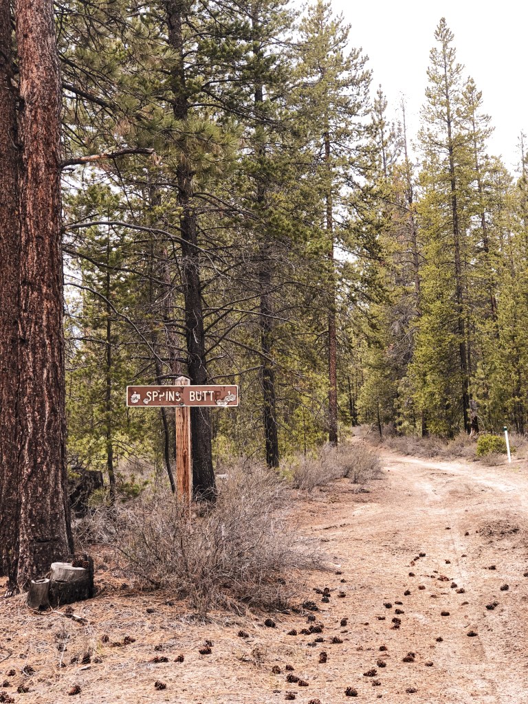
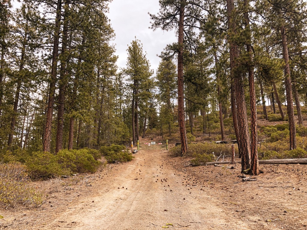
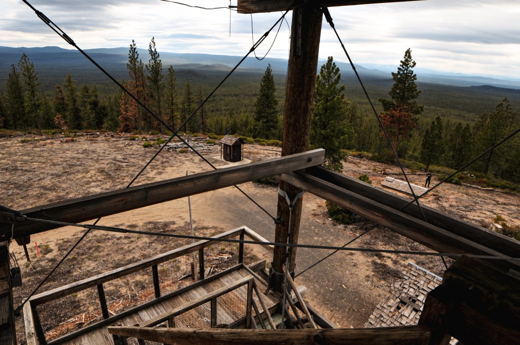
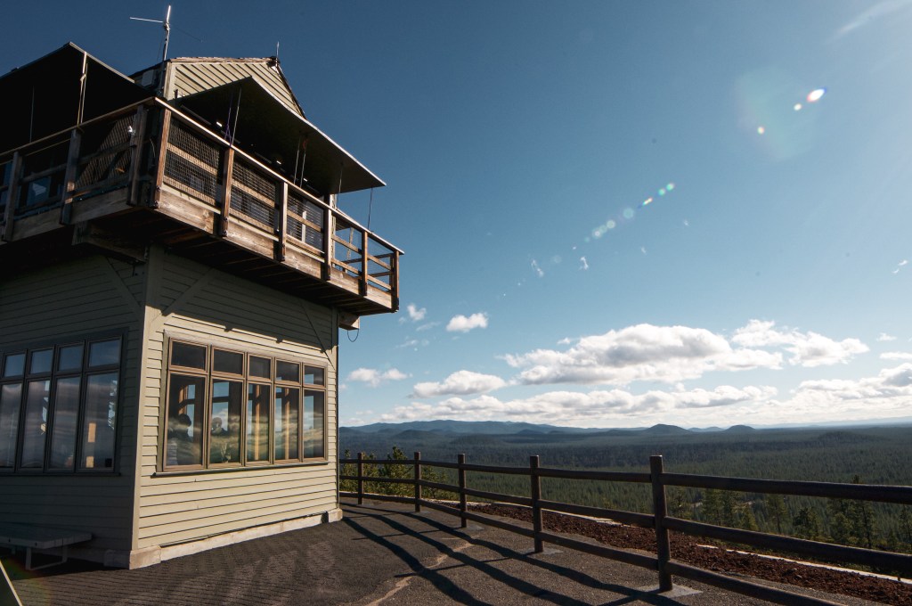
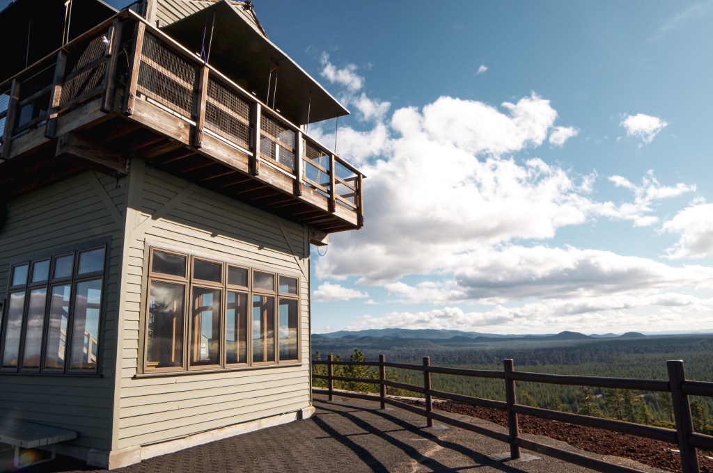
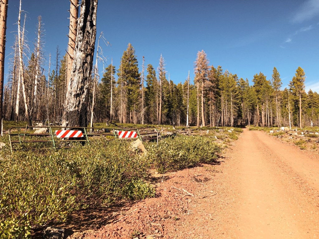
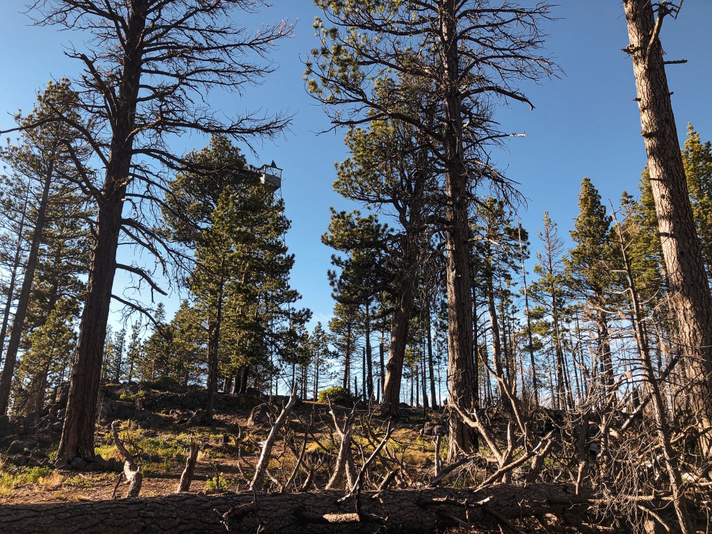
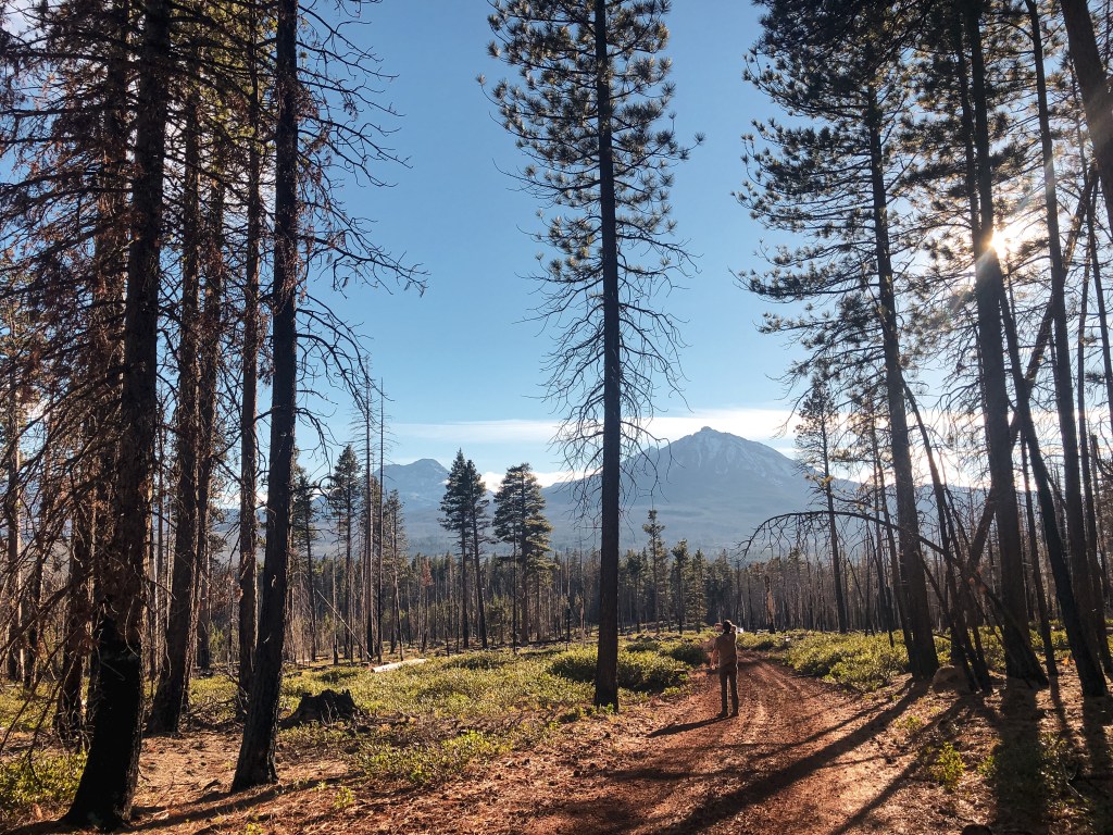
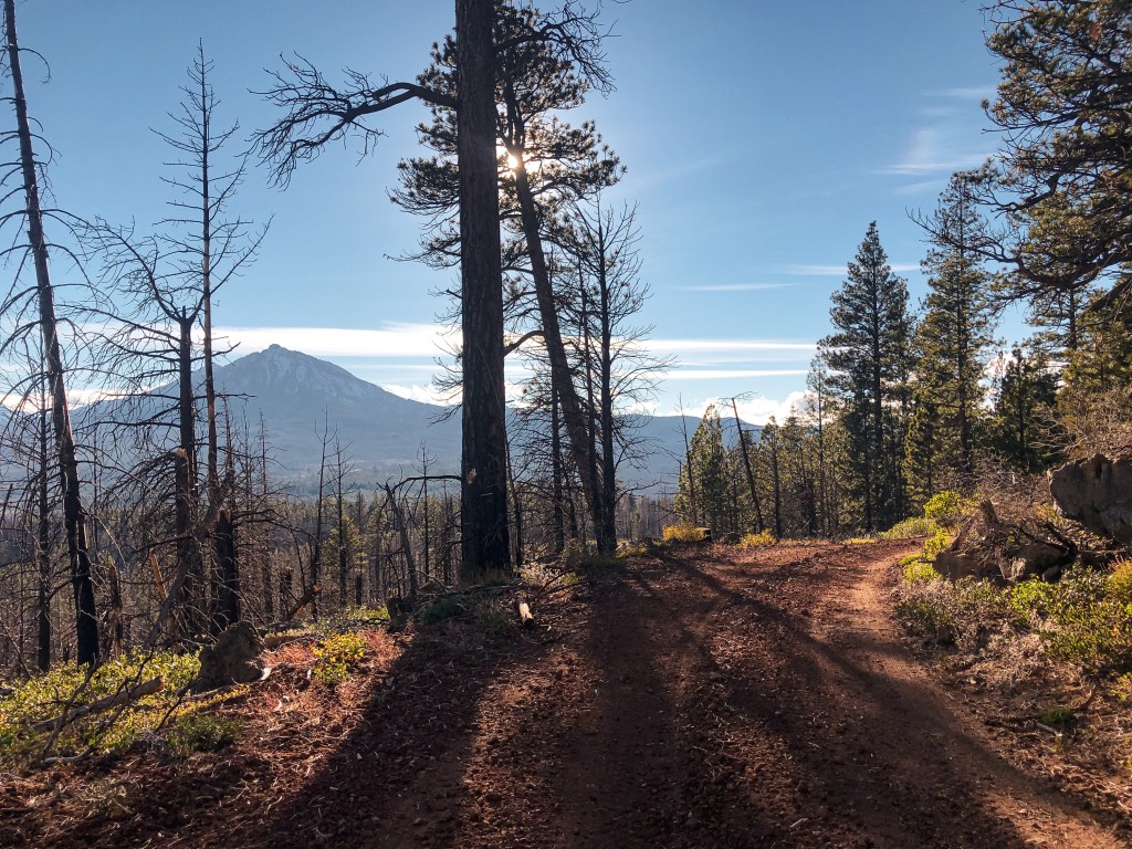
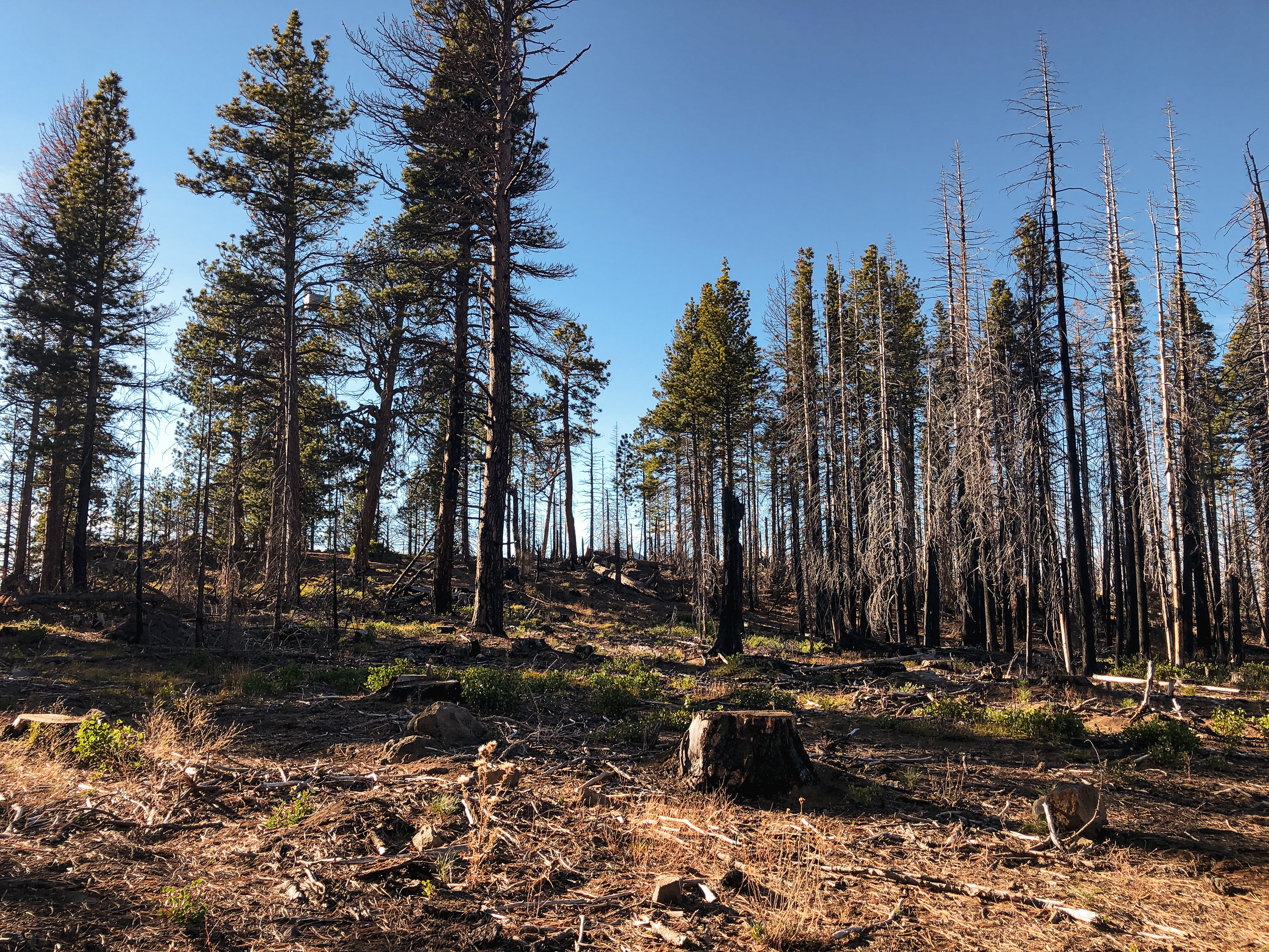
It was now the end of our 4-day camping trip and we were packing up to head out. We planned to make the hike up to Green Butte before our 4-hour drive back to Portland. We drove out on NF-22 to meet up with NF-2222. Our turn was off to the left since we were heading towards La Pine. If you were heading into the forest from La Pine, NF-22 starts out as Finley Butte Road and your turn would be on the right hand side. NF-2222 is a passable road to a low clearance vehicle, but I wouldn’t consider it a good road. Similar to other roads within this area, it’s made of cinder rock that tends to offer a road filled with larger rocks and washboards. Please use caution if traveling in a sedan. We stayed on NF-2222 until we met up with NF-700 off to the right. This road is not signed, but will be the first road after passing NF-600 off to the left. The NF-600 road is signed, but was not listed on our map. The road we needed was a more defined road than last time due to its use by the fire crew for access to the Green Butte Fire. Shortly after turning onto NF-700 we reached the junction with NF-720. This road is signed and off to the right. We parked at this junction to start our road walk. As we were hiking up the road we realized it had been brushed out by the fire crew to allow for larger fire vehicle clearance. Due to the heavy traffic from the equipment the road was a bit bumpy, but a higher clearance vehicle would have no issues driving farther than we did because of this. The fire crew had also taken the time to close off the NF-725 spur by covering it with downed trees. Last time we were here this spur was confusing since it looked like it headed towards the butte and we didn’t have the map with us to confirm. We were confident in our route this time as we turned right onto NF-550 and followed this to NF-555 where we turned right again. The NF-555 road will take you steeply up to the summit as it winds around the butte.

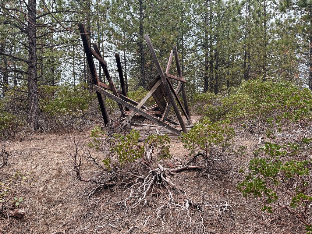
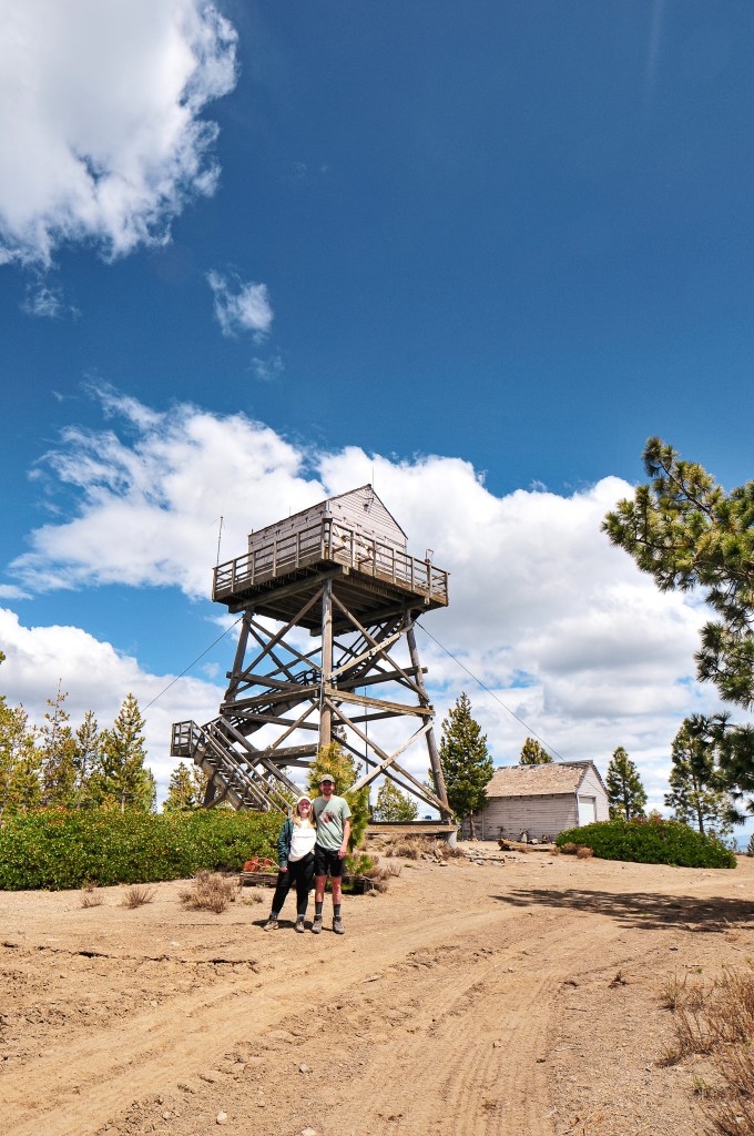
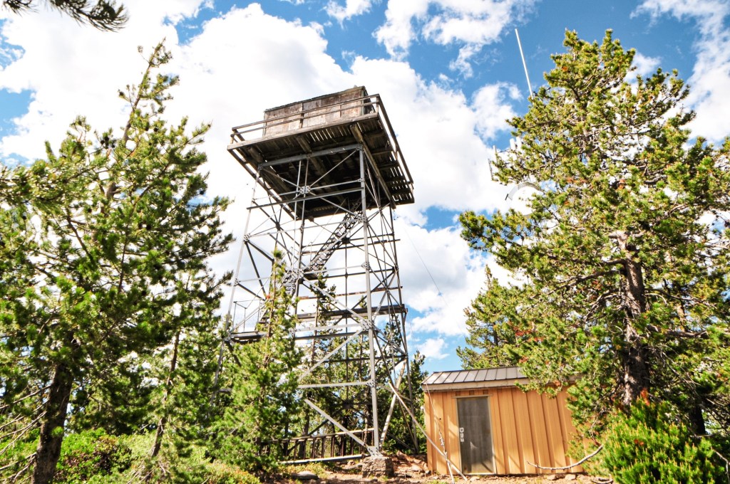
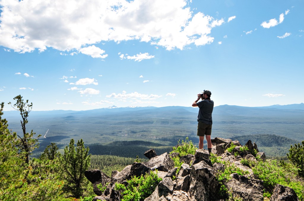
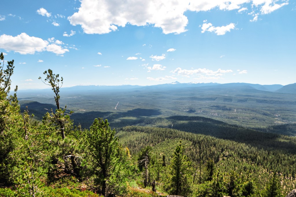
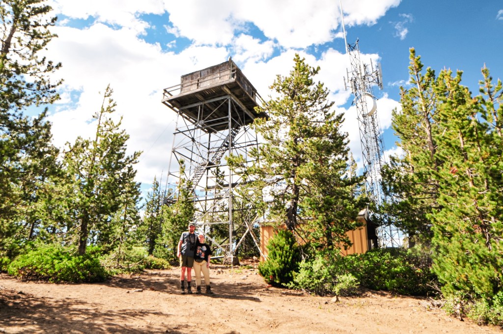
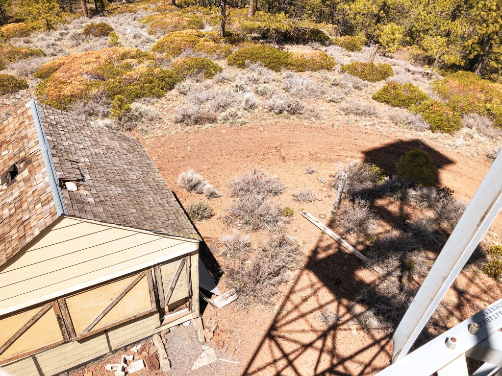
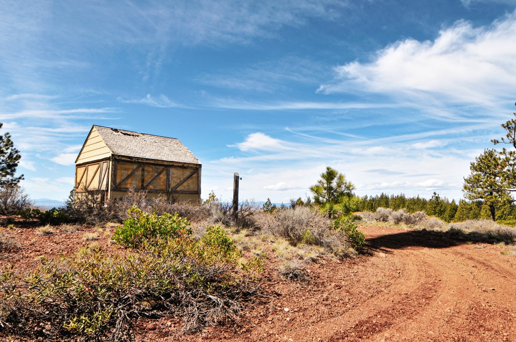
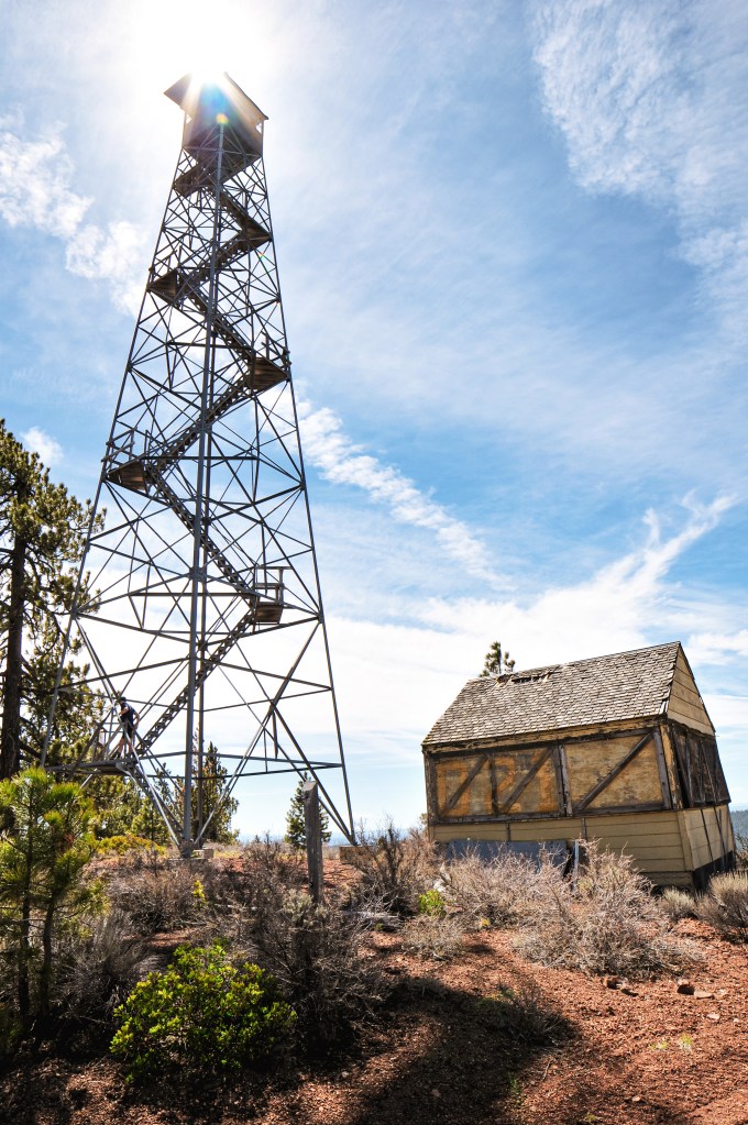
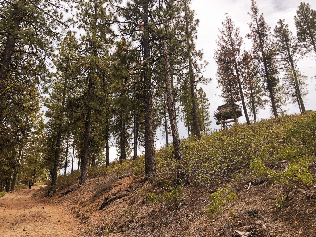
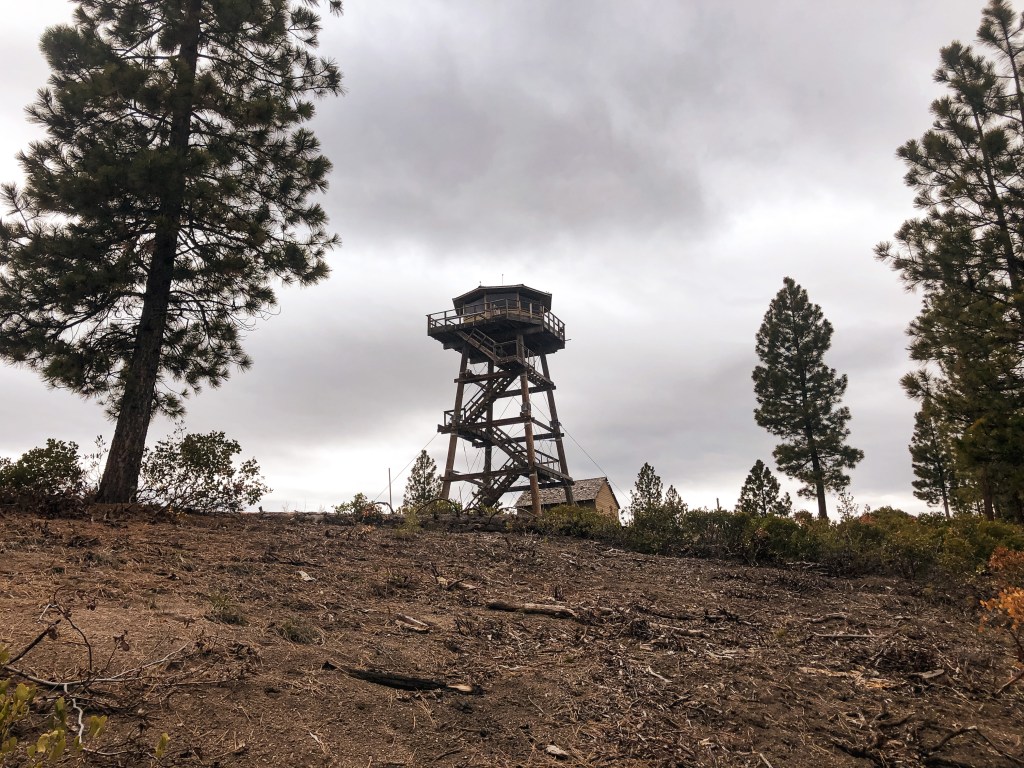
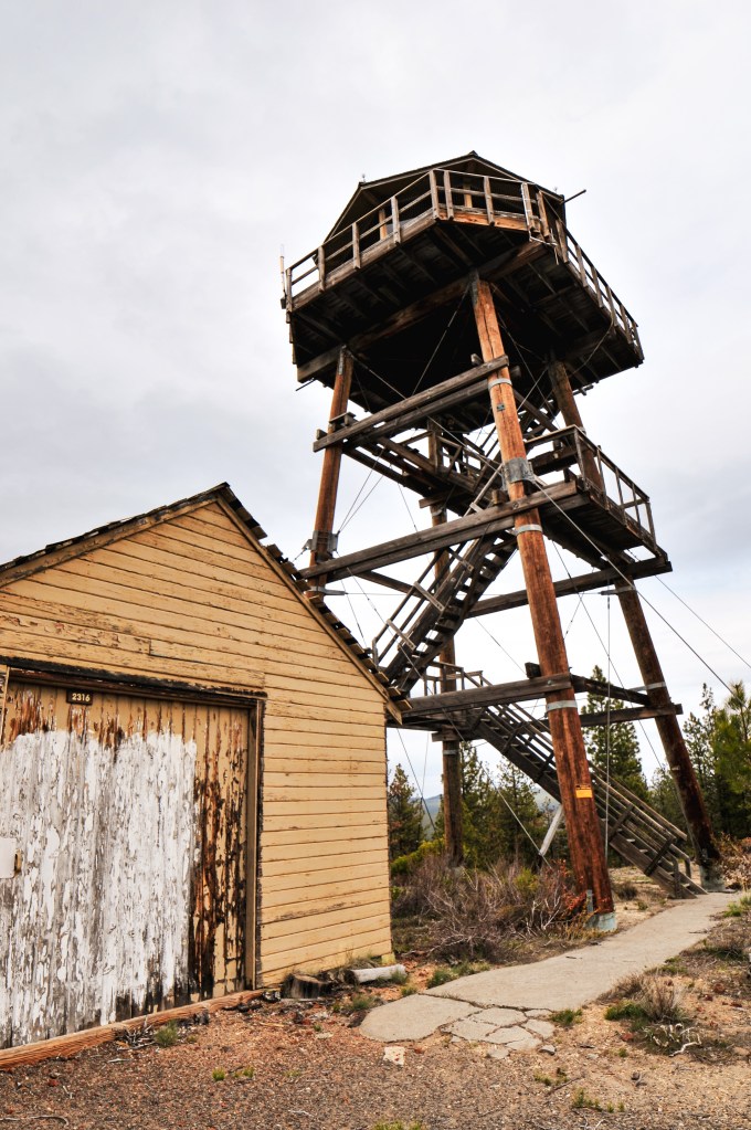
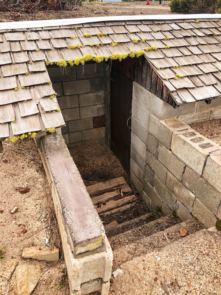
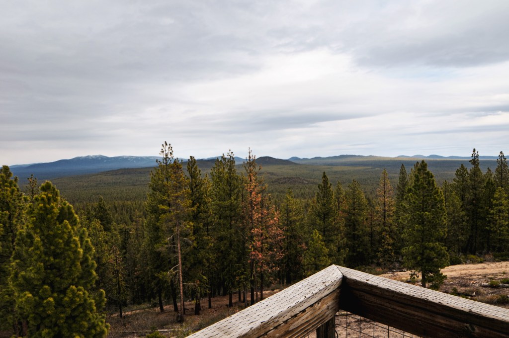
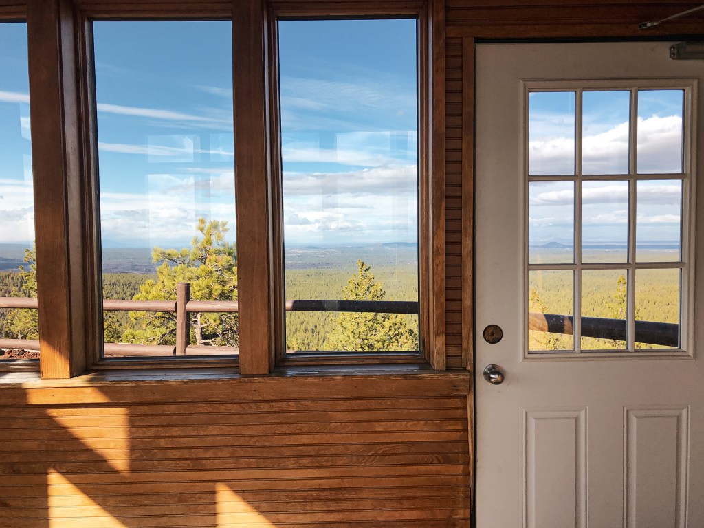
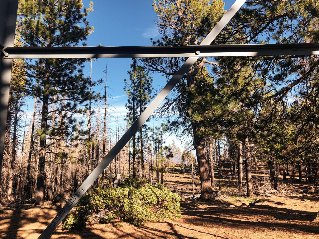
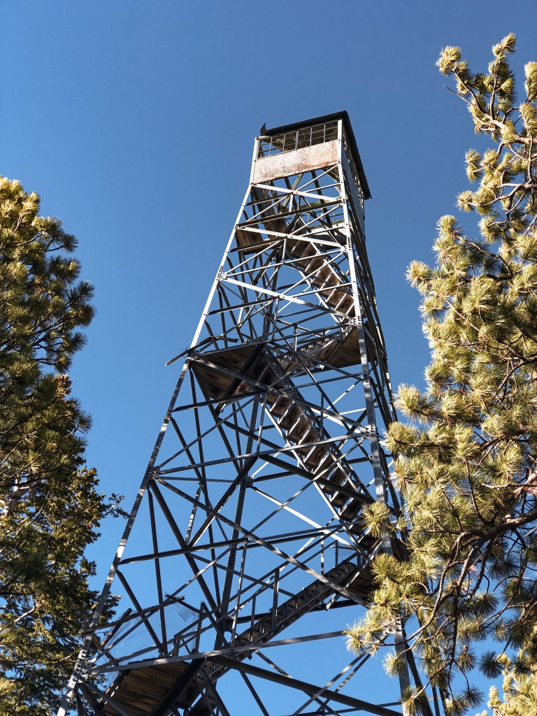
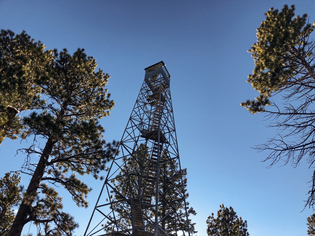
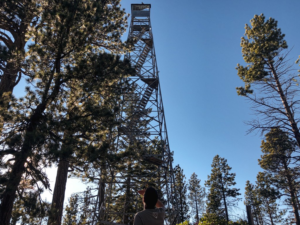
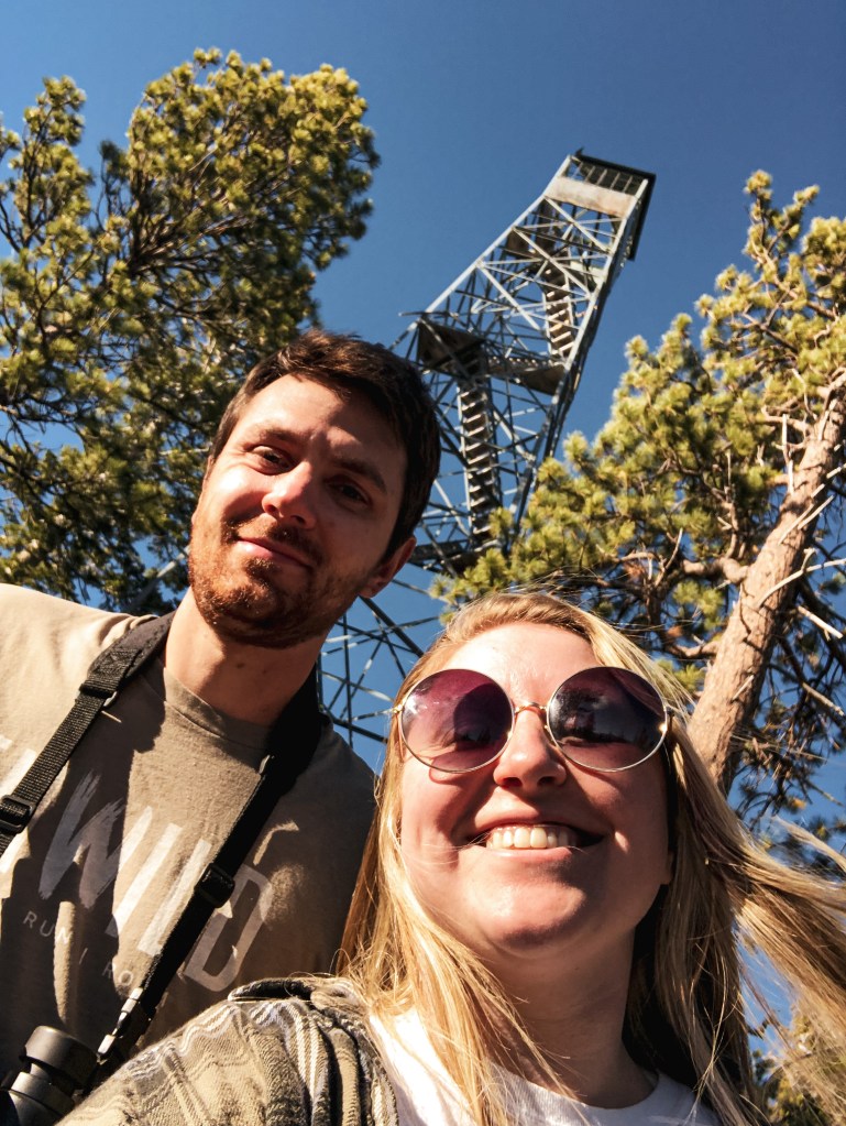
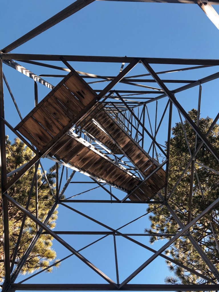
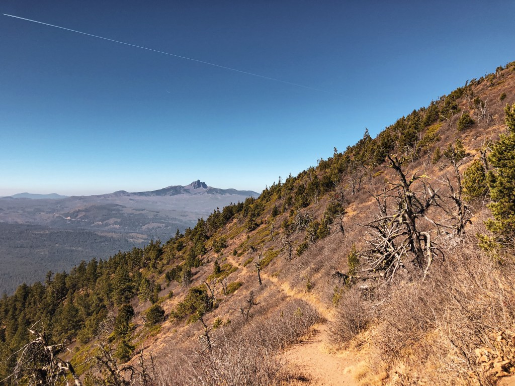
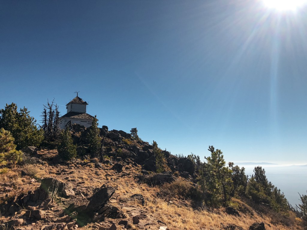
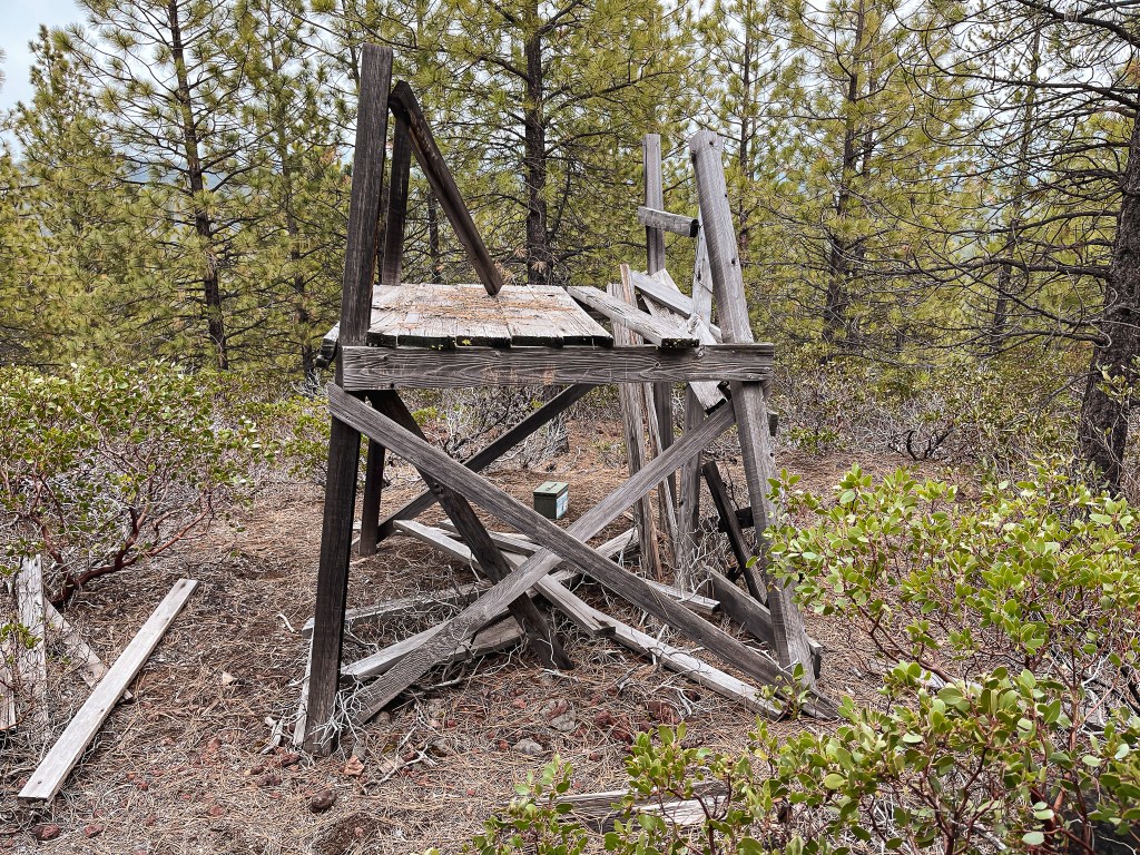
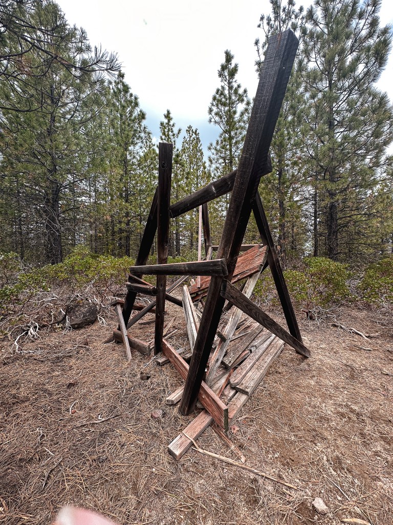
As I got closer to the summit, I could see where they used the road as the fire break. It came within a few feet of the structure. I eventually came to the end of the road with no platform or Garnet in sight. I called out a confused “hello?” and heard Garnet off to the left as he said “over here”. There is a small user trail that continues to the left after the road ends that will take you to the platform tower. It was still standing among the brush, but you could tell it was no longer standing strong. Garnet said some of it had fallen over since he was here last year. The heavy snow had taken its toll and will most likely claim it one of these winters. I would recommend visiting sooner than later if you want to see it while it still stands. I’ve added Garnet’s pictures from the previous year for comparison. We headed back to our car via the same route. Garnet even saw a badger on his walk back, he was ahead of me at the time though so I didn’t see it. Make sure to enjoy the view from the road since the summit is completely over grown with no view to offer.
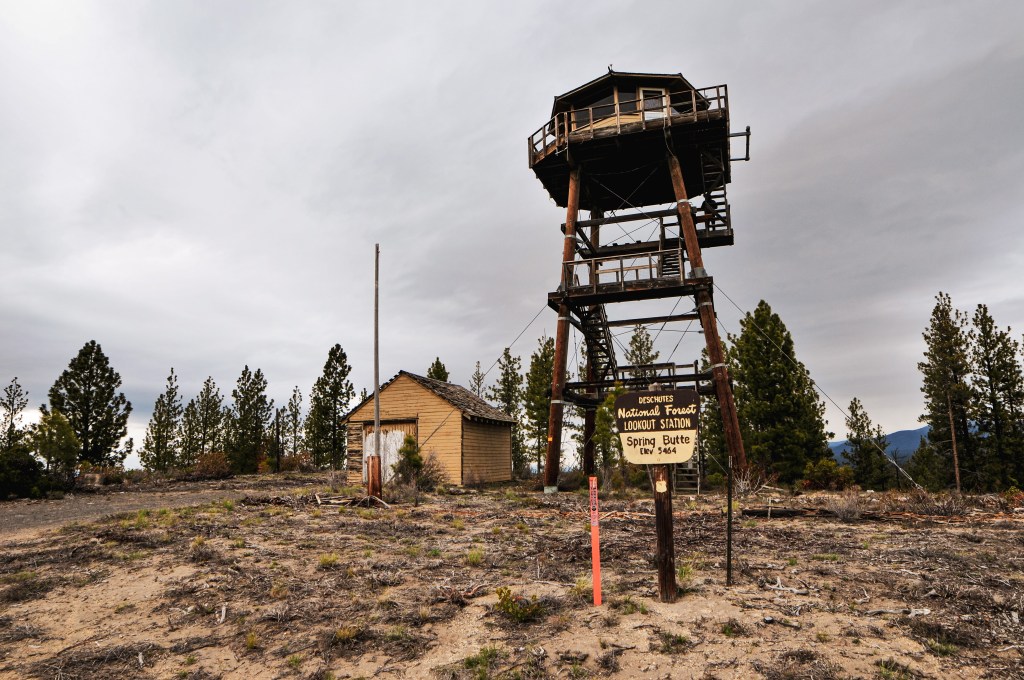
History.

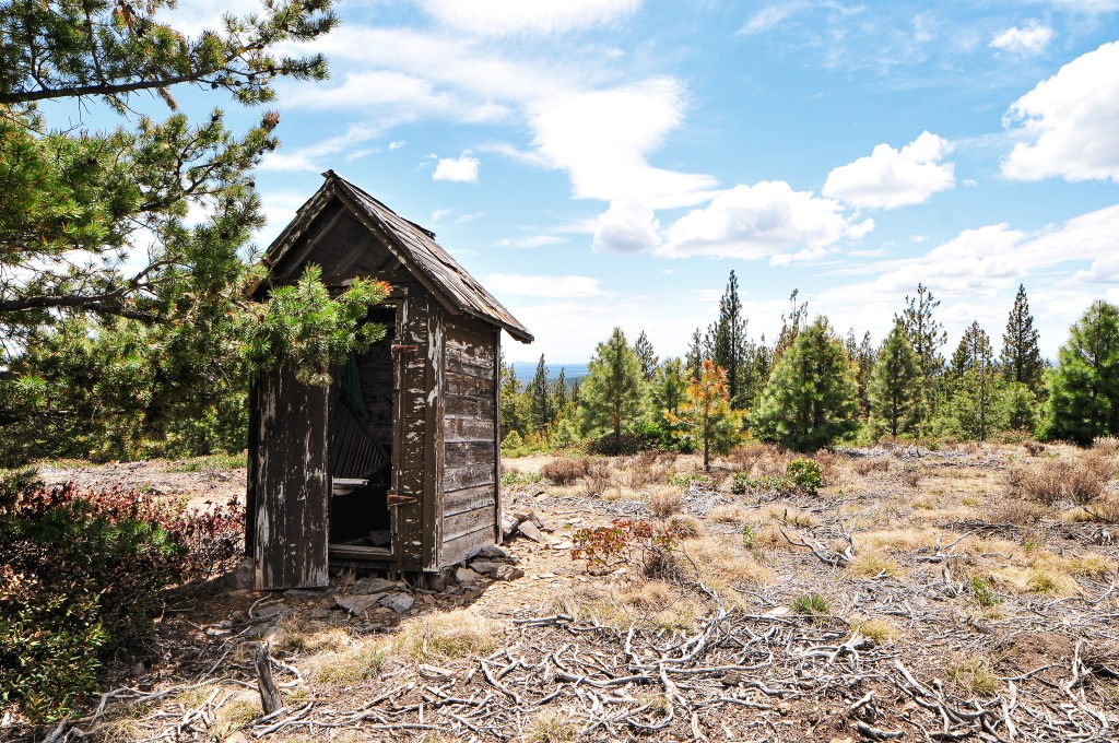
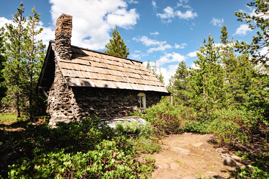
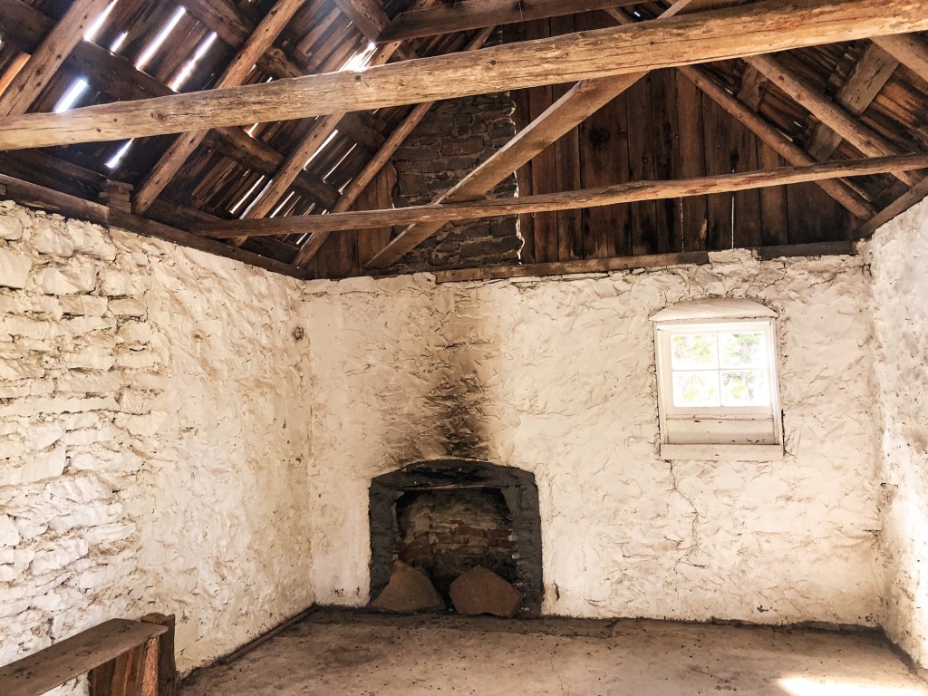
I’m not sure why the National Historic Lookout Register considers this a Former Fire Lookout Site because the original structure is still there. It states it was removed around 2000, but a visit to the site proves otherwise. The 6′ wooden platform tower was built in 1990 for use while the Spring Butte L.O. was being re-constructed. I don’t believe it had any use after the new lookout tower was completed for Spring Butte.

East Butte L.O.

Oregon Lookouts

Location.

Deschutes National Forest

Status.

Active; Currently standing

Estimated drive time from Portland, OR.

5-1/2 hours

Date visited.

May 14, 2023

Elevation.

6,371′

National Historic Lookout Register.

US 464; OR 61

Trip Report.

Garnet had already visited East Butte back in 2021 during a camping trip to the area with his dad. During his visit the fire lookout was staffed, but he wasn’t invited up given his late arrival. Though we’ve read due to the high traffic of people and ATVs in that area they don’t invite anyone up regardless. They did briefly exchange hello’s while Garnet took pictures around the base before heading back down to the truck. We were in the area again in 2022, but didn’t have enough time to visit East Butte with our other endeavors. This year we found ourselves back here again for a third year in a row given the lingering low level snow across Oregon. It’s a beautiful area, so we didn’t mind.

2021 Photos courtesy of Garnet.

This was the third day of our trip and our intentions were set to see East Butte and China Hat. We debated making the drive out to Pine Mountain afterwards if we finished earlier than expected. This plan was short lived since we didn’t get up as early as we had hoped. We headed out from camp on NF-23 to NF-22 until we reached the 4-way junction with NF-18. If you’re coming in from La Pine, you will head towards the forest via Finley Butte Road which eventually turns into NF-22. We headed north on NF-18 from the junction, if you head south you will end up in Fort Rock. Garnet remembered from his trip back in 2021 that NF-18 was a horrible mess of washboard. We were pleasantly surprised to find it was more recently graveled and graded which made for easy driving in the Civic. It’s also wide enough to be a highway in some sections. We stayed on NF-18 until we reached the signed junction with NF-1850. The NF-1850 road skirts between China Hat and East Butte. Eventually, we came to a weird four way junction where we turned right onto NF-200. We veered left at the fork to continue onto NF-220. We took another left onto NF-700 that started to gain elevation up the butte. This road continues on, but you will want to park at the gated junction with NF-750 that leads to the summit. All the roads getting here were in decent condition minus a few rocks and bumps to avoid. We could tell a grader had recently made some bumps in the NF-700 road that didn’t necessarily improve it. We parked near the sign at the junction, but there is additional parking for a few cars next to the gate as well. Please remember to not block the gate during your visit.

A little ways past the gate you will come to a junction with an ATV trail. You have two options to get to the summit from here. You can either follow the ATV trail that cuts around the southern and eastern side of the slope or you can walk the road that loops around to the northern side. It should be noted this is a popular ATV recreation area and hiking the designated trail comes with its own risk. Garnet decided to hike up the ATV trail this time since he had already walked the road previously. I chose to take the road since my experience with hiking ATV trails hasn’t been the best. There is minimal difference in the mileage, but the ATV track is slightly shorter. My Strava App tracked in around 1.7 miles via the road walk and about 1.4 miles for the ATV track. I made this into a nice 3.10 mile loop by walking up the road and hiking down the ATV trail for comparison. As I was hiking up the road an unmarked white vehicle was driving down from the lookout. We gave each other a wave and I wondered if that was the lookout attendant for the season. There was still snow on the northern slopes of the butte. I could tell the grader had driven up this way as well since the minimal snow on the road had a fresh layer of dirt over it.

Once I reached the summit, my partner confirmed the person I saw was a fire crew member but not the lookout on duty. The fire lookout was still shuttered for the season, but it should be opening up fairly soon. They were up here to scope out the current conditions prior to the season. Since the fire lookout was unoccupied and there was no one there for us to disturb, we climbed the stairs to get a better view of our surroundings. It’s always fun to try and pick out the peaks and other fire lookouts in the area. After taking some pictures, we enjoyed our lunch and headed back to the car. The hike back along the ATV track was very dusty. It had a lot of rolling bumps in it which is probably fun for an ATV but felt unnecessary on foot. Our next stop was to visit China Hat on the neighboring summit. We didn’t make it very far up the road since it ascends on the northern slope and was still covered in snow.

History.

This site was first used for fire detection when an emergency lookout was stationed on the butte in 1930. Between 1931 to 1934 they spent time developing the site each year with a road, then lookout tower, and then garage. The fire lookout constructed was a 14×14 gable-roofed cabin with 30′ round timber tower. The garage was a standard plan T-1E with wood frame and still stands today. This fire lookout was staffed until 1995 when they had to transfer the duties over to Fox Butte. During that time they cut down and burned the existing tower to make room for a new one. The existing tower was completed in 1996 as a replica of the original and duties were transferred back to the site. Though the National Historic Lookout Register lists it as only being a 20′ tower now. They also state that it will only be listed on the Historic Lookout Register until it reaches 50 years old. It is unclear why it would be removed after that time frame. East Butte is still actively staffed every summer.

Walker Mountain L.O.

Oregon Lookouts

Location.

Deschutes National Forest

Status.

Abandoned; Currently standing

Estimated drive time from Portland, OR.

4-1/2 hours

Date visited.

June 30, 2022

Elevation.

7,078′

National Historic Lookout Register.

US 145; OR 21

Trip Report.

Day 6/10: Lookout Road Trip 2022

If you’ve ever been on HWY-97 between the junction with HWY-58 and the community of Chemult, you might have noticed a sign for Walker Mountain L.O. You can even see the tower from the highway if you know where to look. It’s located on a peak east of the highway often overshadowed by the excessive amount of communication towers. The first time I remember seeing this sign was back in August 2017. My friends and I were headed south on HWY-97 towards Diamond Lake for a weekend camping trip. That’s not to say my family hasn’t ever driven this way before, but I hadn’t had the same attention or interest for such things. Similar to the millions of other people that drive this route, have driven this route, or even live in the area, I passed the sign many more times without paying a visit to lonely Walker Mountain.

After our visit to Bald Mountain (post), we headed north on NF-2516 towards HWY-31. On the map it looked like we could potentially cut across the forest via a three number spur to connect with NF-94. We were hesitant to commit to this road given that it was marked as different road numbers on our two maps and both had it noted as a high-clearance road. We know from experience that the maps aren’t always correct about the road conditions, but it felt too risky this time. We decided to go up and around via HWY-31 to HWY-97. Sometimes pavement is the faster option even if it’s not the most direct. The only other challenge from this route was that we had to cross HWY-97 once again. The road marked for Walker Mountain off of HWY-97 is NF-94. This road will take you up to the ridge of the mountain where you will want to take a left on to NF-9402. The NF-9402 road follows along the ridge and climbs the remaining way to the summit. We had asked all the lookout attendants we met if they knew the road conditions to Walker Mountain, but none were sure of the current conditions. Ed from Sugarpine Mountain (post) mentioned we would probably be fine since there are communication buildings and they want to maintain them. Turns out he was correct. NF-9402 had been recently regraded with fresh gravel. One might argue that it was even too fresh. From the junction with NF-94 and NF-9402, it is a little over 3-1/2 miles to the summit. As we headed up the ridge we found that the fresh gravel was pretty loose and soft in some spots. This made traction a bit of an issue in some of the steeper sections. It even created a highline from trucks driving up and pushing it around. Instead of water bars, the road had these rubber flaps to help divert the water off the road. There were over 30 of these water diversion flaps along the way. The gravel seemed to have piled up closer to them. All was passable in my Civic, but it’s something to be cautious of if you decide to visit. The last few hundred yards of the road turned to dirt, but it looked passable to most vehicles. We decided to park where the fresh gravel ended and walk the remaining distance.

On the summit, you will find Walker Mountain tucked behind a plethora of communication buildings. The lookout tower has seen better days and has been abandoned since the 1940s. They have since removed the bottom stairs to keep people from climbing the structure. There is an accompanying garage, privy, and stone cabin that you can visit on the summit as well. The stone cabin has seen more recent restoration work since it is considered one of the oldest administrative structures on the forest. It’s unfortunate that they didn’t put some time and effort into the tower as well. It was already fairly late in the day and we needed to get moving if we wanted to find a camp. We were also getting moved along by the amount of mosquitoes here. For some reason, we have met more mosquitoes on summits than in camp this trip. We said our good-byes to Walker Mountain and can now claim we’ve been here every time we pass it from HWY-97.

We were motivated to press on to the Umpqua NF since it would mean we could set up a base camp for the next few nights. We would also be leaving Klamath County and entering Douglas County. This meant we should be able to find water sources and refill our water reservoirs again. We stopped to refuel once more in Chemult. The gas attendant made a comment that our car looked like it had been on some great adventure. To be fair, it was completely covered in dust and looked a bit scratched up from our close encounters with the manzanita. I told him we had been intentionally bumping down some forest service roads for the past few days and left it at that. We made an additional pit stop at Broken Arrow Campground near Diamond Lake to refill our water. We were relieved to find the water was on here. We have dispersed camped in the Umpqua NF before and knew of areas to look. It was mostly a race to get there before the sun was set. The impending holiday weekend was finally upon us and our biggest worry was finding an open spot. We were surprised to find one of our favorite camps open and set up for the next few days.

History.

Walker Mountain was established in 1913 as one of the first few lookouts on the Deschutes NF, along with Black Butte (post) and Maiden Peak. The first lookout was a simple crows nest tree. It’s noted that the site was potentially used as a patrol lookout as early as 1907. A cabin made of stone and wood was built in 1915 for living quarters. In 1919, a small 25′ pole tower with 6×6 cab replaced the crows nest. The existing lookout was built in 1932 as a 35′ steel tower with hip-roofed 14×14 L-4 cab. The accompanying 16×18 garage was added in 1934. In 1996, a restoration and maintenance program was started to help preserve the historic stone cabin. The restoration work had been carefully completed on the cabin in 2005. The lookout tower itself is listed as condemned and proposed for removal by the Forest Service.

Fox Butte L.O.

Oregon Lookouts

Location.

Deschutes National Forest

Status.

Abandoned; Currently standing

Estimated drive time from Portland, OR.

4-1/2 hours

Date visited.

May 15, 2022

Elevation.

6,025′

National Historic Lookout Register.

US 146; OR 22

NF-550 road sign to Fox Butte
Park near this sign
Open gate
First view of the Aermotor from the road

Trip Report.

Sunday was our last full day of the trip. Our only set plan was to attempt to locate the Pumice Springs crows nest. I was given the choice to add on East Butte (post) or Fox Butte since my partner had already been to both last year. I decided Fox Butte made the most sense since it was closer to our camp and recently slated for decommission. My partner’s dad decided to hang back at camp instead. After breakfast and packing a lunch, we headed out on NF-23 to NF-550. It didn’t take us very long to get there from camp. There are three water bars along NF-550 that will need caution if you are in a lower clearance vehicle. We obviously had no issues in the truck and parked at the signed junction for Fox Butte. There is a locked gate up the road that doesn’t have a pull out or turn around spot. We were well aware of this gate beforehand and didn’t attempt to drive up. The lookout is about a mile or so road walk from this junction. As we headed up the road, we were surprised to find the gate was actually open. I speculated that maybe the Forest Service was on top of their plan for once and had already torn down the lookout. Luckily, I was wrong and someone had just cut the lock. We made sure to close the gate on our way out in hopes to deter at least some vandals. The weather was clear and it felt like summer as we hiked the road. Once on the summit we checked out the L-4 ground cabin that had seen better days and climbed part of the Aermotor tower. My partner climbed all the way to the top, but I stopped on the second landing. It seems to still be in somewhat decent shape, but be wary to climb at your own risk. We spent some extended time on the summit since this would most likely be our last time up here before it’s gone.

After hiking back down to the truck, we headed out on NF-23 towards Sand Springs Campground. We were following directions based on a Geocache that was supposed to take us to the area of the crows nest. We turned left at the four way junction near Sand Springs Campground than right on to NF-900. The cache and crows nest were supposed to be right off the NF-900 road according to the coordinates. We wondered around the area for 2 hours trying to find the tree but all existing pines looked too young to host a crows nest. It was definitely not down this road. Another source had mentioned it was located half way between Pumice Springs and Sand Springs. We drove out towards Pumice Springs and kept an eye out for significantly taller trees in the area. I assume it is probably farther off the road than the eye can see but we didn’t have the hours to spend hiking off of every road in the area. We were unsuccessful in our attempt which was disappointing. This just means another trip to the area is in our future.

History.

Fox Butte started as a lookout site in 1919 when a heliograph was set up on the west point. A year later, in 1920, they ran a telephone line to the butte from the Cabin Lake Ranger Station. A standard D-6 cupola was built on the western summit in 1924. The lookout was later destroyed by the Fox Butte Fire in 1926 that burned over 15,000 acres of timber. They started to rebuild a new lookout tower the following year. This was noted as a pole tower with ground cabin for living quarters. In 1933, they started construction on the eastern summit of the existing 80′ steel Aermotor tower. The living quarters from the western summit were moved to the eastern summit for use with the new tower. A 16×18 wood frame garage was added in 1934. The living quarters were eventually replaced with the L-4 ground house moved from Sixteen Butte in 1948. There is record of it being consistently staffed up until the late 1950s. It could have been used for longer but I wasn’t able to find a definitive date on when it was abandoned. The Forest Service briefly used the lookout for a season in 1995 while the East Butte L.O. was being reconstructed. It is now apart of their proposed plan to be removed.

Spring Butte L.O.

Oregon Lookouts

Location.

Deschutes National Forest

Status.

Active; Currently standing

Estimated drive time from Portland, OR.

4-1/2 hours

Date visited.

May 13, 2022

Elevation.

5,464′

National Historic Lookout Register.

US 174; OR 25

Trip Report.

My partner had planned a 4-day camping trip to the Deschutes NF with his dad and myself to celebrate his birthday. We had an ambitious plan to see Spring Butte, Green Butte (post), Green Mountain (post), Pumice Springs, and Fox Butte (post) while in the area. This trip we had the luxury of taking his dad’s truck. Which meant what we didn’t have to worry about in road conditions were replaced with high gas prices and low gas mileage. We left Portland as early as possible to see if we could get to Spring Butte and Green Butte before setting up camp. Luckily, my partner and his dad had been to this area before and knew where there would be dispersed camp spots. This helped cut down on the travel time that we would normally have to allot to searching for a spot. The amount of Forest Service roads in this area are extensive and unmarked due to the OHV traffic. I strongly recommend having a ranger district map of the area if you plan to go down more than just the main roads. Never rely on GPS for navigation within the forest. We came upon a lost couple on our drive out of the forest on the last day of the trip that flagged us down to ask for help. They thought if they continued down the road long enough it would eventually turn to pavement and had ended up there due to their GPS. We warned them they were headed for more miles of gravel and should turn around since they were still close to the edge of the forest. Luckily, they took our word for it and followed us all the way out to La Pine.

On the ranger district map the most direct route to Spring Butte looked like NF-2220 off of HWY-31. I think under normal circumstances this road would be a good route to take but since it was still early season we ran into a lot of debris and downed trees. I also wouldn’t recommend this route as the best way for lower clearance vehicles. We were able to drive down NF-2220 until it’s junction with NF-600. There was a large downed tree blocking the road that, even if we had remembered to bring our buck saw, would have been too big to cut without a chain saw. We noticed NF-600 basically paralleled NF-2220 and decided to attempt that route instead. NF-600 is a rocky spur road that doesn’t see a lot of use. On the map it appeared to connect back to NF-2220 via another spur road, but we quickly found out it was barely even a jeep track up a rocky slope. We continued on NF-600 until it met up with NF-2420. This took much longer than expected since we constantly had to stop and move downed trees out of the way. Thankfully they were all small lodgepole pines. From NF-2420 we took a left and headed towards NF-2430. You will turn left and stay on NF-2430 until you reach the spur road NF-830 that will take you all the way to the lookout. NF-2430 crosses NF-2220 before you reach the spur which is where we were hoping to come from originally. There is a sign for the turn to Spring Butte L.O. from NF-2430 as well. From this junction it is only a mile. If we had been driving my Civic this is where I would have parked and started to road walk. We drove the truck a half of a mile up the road but decided to walk the rest of the way after a particularly rutted section. The road is gated near the lookout so you would have to get out and walk no matter what. It looked like someone had been here recently prepping for the start of their fire season since the shutters on the lookout had already been removed. We spent a short time on the summit since we were pressed for time and still wanted to attempt to find Green Butte. This lookout completed our set for all the lookouts with octagonal cabs in Oregon.

Once back at the truck we started heading towards Green Butte (post) on the map. This meant taking NF-2430 back the way we came. You will want to stay on NF-2430 until you reach NF-2222 on the left. It looked like there were multiple connecting spurs that would take you to Green Butte (post) but the most direct route is from spur NF-700. This spur unfortunately wasn’t signed. We were able to guestimate the turn after we went too far and met a different spur that was signed. Once you’re on NF-700 you will turn right on to NF-720 which is in fact marked. My partner’s dad didn’t feel like road walking with us and parked the truck at the junction. From here my partner and I walked up NF-720. We made the mistake of not taking our map or taking a picture of the map before we left. We thought NF-720 would take us to the summit but quickly found that there were multiple spur roads heading towards the butte while NF-720 paralleled it. The two spurs we had to choose between were NF-725 and NF-550. We started up NF-550 first and it appeared to be headed in the right direction. I’m a significantly slower hiker than my partner and I was worried we wouldn’t have a enough time in the day to make it back to the truck and camp before dark. I turned back before the road got too steep but my partner continued on in hopes of finding the lookout. I made it back to the truck around 6PM and we waited for my partner to return. He was lucky that we had guessed the correct spur road to reach the summit and was successful in finding the lookout. From NF-550 you turn on to NF-555 that will take you all the way to the platform lookout. I’m bummed I didn’t make it this time but now I know how to get there in the future. My partner made it back to the truck around 6:30PM mostly because he ran the rest of the way after I turned around. We ended up setting up camp much later than expected but it was worth it.

If you are wanting to reach Spring Butte L.O. with a lower clearance vehicle, I recommend starting on NF-22 which leaves directly from La Pine. It is marked as Finley Butte Road in town but eventually turns into a Forest Service road. From NF-22 you can take the other side of NF-2220 to NF-2430 to NF-830 or you can go to NF-2222 to NF-2430 to NF-830. Since I can only speak on the roads I’ve been on, I’d recommend NF-2222 to NF-2430. I would consider these portions of the road passable to lower clearance vehicles.

History.

Similar to Sisi Butte (post) and Calamity Butte (post), the existing Spring Butte L.O. has an octagonal cab. It was constructed in 1991 as the first of its kind in Oregon. The 16’x16′ cab sits shorter than the other two with a 41′ pole tower. It is still actively staffed every summer, so always make sure to be respectful of the active lookout attendant’s space and only climb the tower if you’ve been invited up. The previous lookout structure was developed in 1932 as a 30′ tower with 14’x14′ L-4 cab. It was maintained regularly between the 1950s-1970s and used up until it was deemed unsafe in the 1990s. In November of 1997, the existing lookout was broken into and vandalized. The damages were estimated up to $10,000. The fire finder and other furniture were torn and tossed from the height of the tower with complete disregard. It is unfortunate to hear that some people have such a lack of respect for places like this which is often why they are hidden behind locked gates. It is our collective responsibility to help keep places like this intact for future use and others to enjoy.

Lava Butte L.O.

Oregon Lookouts

Location.

Newberry National Volcanic Monument; Deschutes National Forest

Status.

Active; Currently standing

Estimated drive time from Portland, OR.

3-hours

Date visited.

October 10, 2021

Elevation.

5,016′

National Historic Lookout Register.

US 508; OR 100

Looking at Lava Butte From Black Rock Trail

Trip Report.

Lava Butte L.O. is one of the easiest accessed active fire lookouts in Oregon and, no doubt, the most visited. We decided to stop here on our way back to Portland since it is only a short paved drive to the top. The lookout is within the Newberry National Volcanic Monument near the Lava Lands Visitor Center. You will need to have a Northwest Forest Pass, National Parks Pass, or pay an entry fee to access. Due to the limited parking at the top of the cinder cone, you need to have a time access permit. These are free to visitors and are handed out at the entry kiosk. We did not know this at the time of our visit and were told we’d have to wait an hour to gain access. Driving to the top of the cinder cone is only permitted from late May to mid-October. We just happened to be here on the last day it was open for the season. Hiking up the road to the top is permitted year-round and is an alternative option if you do not want to wait for a time permit. We figured by the time we hiked to the top and back it’d be our time to drive anyway. We decided to wait and check out the Black Rock trail on the other side of the parking lot in the mean time. Once on the summit it is a short paved walk to the base of the lookout. The top is actively staffed and inaccessible to the public. The base of the lookout acts as a visitor center that has informative signs to help locate the surrounding landmarks. There is also a short un-paved trail that hikes away from the lookout around the cone. The time permit for the top only allows for 30-minutes, but we found this was plenty of time to check it out and take some pictures.

History.

Lava Butte has been a site used for fire detection since 1913 and has had four different types of lookout structures. In 1913, they only had a telephone line to the summit and were expected to camp near the base. The fire attendants during this time were staffed by the Deschutes Valley Fire Patrol Association. It wasn’t adopted as a fire lookout by the Forest Service until 1924. The first lookout structure was built in 1931 as a 14×14 L-4 hip-roof house. It was one of the three first lookouts established in the Deschutes NF and was considered one of the most visited lookouts even then. The other two were Odell Butte L.O. and Black Butte L.O. (post) The second structure built on Lava Butte was a 2-story R-6 flat cab in 1957 to replace the existing. In 1960, the first floor was expanded to include a visitor center. It was later dismantled in 1997 to start construction on the current lookout. In 1998, they completed a 2-story replica of a gable-roofed L-4 cab with a 1st floor visitor center. Despite the easy access to this lookout and proximity to Bend, it plays a pivotal role and is noted as reporting more fires first than any other lookout on the Deschutes NF.

More Information.

US Forest Service

AllTrails

Trout Creek Butte L.O.

Oregon Lookouts

Location.

Deschutes National Forest

Status.

Abandoned; Currently standing

Estimated drive time from Portland, OR.

3-1/2 hours

Date Visited.

October 9, 2021

Elevation.

5,546′

National Historic Lookout Register.

US 506; OR 98

Trip Report.

My partner and I decided to make a quick one-night trip down to the Deschutes National Forest area for the weekend. We wanted to try and see Henkle Butte (post), Trout Creek Butte, and Lava Butte (post) lookouts. Trout Creek Butte L.O. is an easy drive just outside of Sisters. We took the Mackenzie HWY-242 to signed NF-15 to get there. The NF-15 road starts out paved and eventually turns into well-maintained gravel. After 5 miles it forks to become NF-1524 and NF-1522. We kept right to stay on NF-1524. Eventually it will fork again with NF-1524 continuing to the left and NF-1018 to the right. We stayed right at this junction as well. We continued on NF-1018 until we reached the NF-800 spur on the right. It was a pretty distinct road since it is made up of red rock instead of fresh gravel. NF-800 will take you the remaining way to the summit. All roads were in decent condition and are manageable in a passenger vehicle. There are a few bumps on NF-800 but you’ll make it with caution to at least the gate. We decided not to drive to the summit and parked in a pull out before the old gate. The gate is still there but no longer blocks the road. It’s about a 1/2 mile walk to the summit from this point in the road. As we were walking up the road to the summit, we became worried that the tower might have fallen or already been removed. The area was burned over in the 2017 Milli Fire but there are still a lot of tall trees on the summit obscuring the view. We weren’t able to see the tower until we were almost to the base of it. It was like playing Where’s Waldo? with a lookout. Scroll down if you want to try and spot it in my pictures. The first three levels of stairs are removed due to safety concerns and to help deter vandalism. The tower is in terrible condition. The cab on top is missing its floor, window glass, and part of the roof. Although there is not much of a view from the summit, the views from the road before the summit are worth the stop alone. We drove back down NF-800 to the junction with NF-1018. Instead of heading back out the way we came, we turned to take NF-1018 in the other direction. If you stay on NF-1018, it will eventually take you all the way back to HWY-242. We were running out of day light so we decided to camp at the Whispering Pine C.G. for the night.

History.

This 75′ steel Aermotor tower with 7×7 cab is the original built by the CCC in 1933. Some sources note this as a 86′ tower instead, but I believe this is counting the concrete poured for the tower. The tower was last used for emergencies up until the 1970s. There used to be a T-1E 16×18 garage and 14×16 wood living cabin on the summit as well. Both were built a year after the tower in 1934, but I couldn’t confirm any information on what happened to these structures. The outhouse was relocated to Sand Mountain L.O. as part of a restoration project in 1992. The tower is the only remaining structure on the summit and is slated to be decommissioned by the Deschutes NF.

Can you spot the lookout?

Pull the slider to the left to see where the lookout is located in the below pictures.

Black Butte L.O. (Deschutes NF)

Oregon Lookouts

Location.

Deschutes National Forest

Status.

Active; Currently standing

Estimated drive time from Portland, OR.

4 hours

Date visited.

October 20, 2018

Elevation.

6,436′

National Historic Lookout Register.

US 91; OR 12

Trip Report.

This was another early morning hike where I met up with a friend from out of town. They were driving from Coos Bay and we were planning on spending the weekend in Bend after completing this hike. We met at Black Butte Ranch which is just down the highway from the Forest Service road you need to take to get to the trailhead. We decided to take their Subaru due to the AllTrails reviews of the road. The NF-1110 to the trailhead is rough but doable. I did see a few sedans up there. You can access the trail from Camp Sherman if you don’t want to make the trek up the “treacherous” road according to an AllTrails review. I did not attempt this road with my Civic. A Northwest Forest Pass is required for parking.

The hike itself was just shy of 2 miles one way and gained 1,538 feet of elevation. It will definitely get your blood pumping before you reach the top. The trail is rocky and exposed which makes the sun beat down much hotter than normal. Once on top you can check out the old D-6 cupola that use to be the main lookout. You can also see the taller lookout that is actively staffed, but you are not supposed to go within a few feet of it. There are posted signs due to the popularity of this hike. However, from the ground you can still see Mt. Jefferson, the Three Sisters, Mt. Saint Helens, Mt. Hood and beyond. From recent pictures and reviews on AllTrails, there seems to be an added platform with noted mountains and peaks. It also looks like they have made some repairs to the cupola and updated the staircase. These were not here when I visited in 2018.

History.

Black Butte became the first lookout site in the Deschutes NF in 1910 when two tree lookouts were built. They were replaced in 1919 by a platform lookout supported by the trunks of four trees. In 1922 an Aladdin D-6 Cupola was built. The D-6 was the first standardized lookout style for the Forest Service in the Pacific Northwest. The design was meant to simplify the construction of fire lookouts, requiring just few people, minimal tools, and simple diagrams. In 1934, the CCC built a 83′ tower with a 7’x7′ L-6 cab to increase visibility from the original cupola. This structure was used as the active lookout until 1993 when it was condemned due to unsafe conditions. The cupola again served as the lookout until the current 65′ lookout with 10’x10′ cab was completed in 1996. The condemned lookout collapsed during a heavy winter storm in December 2001. You can still see the 1922 D-6 Cupola and the 1996 structure on this hike.

More Information.

US Forest Service

Oregon Hikers

AllTrails