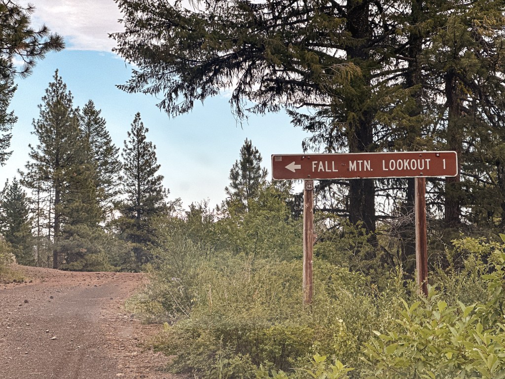
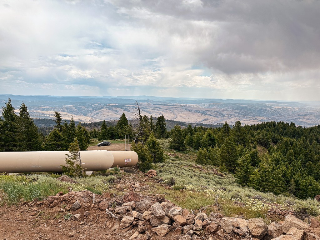
We turned right on NF-21 from the Aldrich Mountain (post) road to continue through the forest to Fall Mountain. This lookout is a rental and we figured we would see people while visiting. The NF-21 road is paved and follows along Murder’s Creek for most of the way. It turned to gravel with washboard once we left the forest boundary and it became a county road. We came out to a junction with CR-63 at the community of Logdell and turned left. We were only on this road for a short while before taking another left onto Geary Creek Road. This is the back way to Fall Mountain since most people come from John Day and HWY-395. The Geary Creek Road forked once we entered the forest again to NF-333 and NF-4920. The NF-333 road is deceiving and looks like the main road, but we turned left to continue onto NF-4920. The NF-4920 road will take you all the way to the NF-067 spur and continues down to HWY-395 where most people access it. It was a decent road in both directions albeit a bit less used from the way we came.
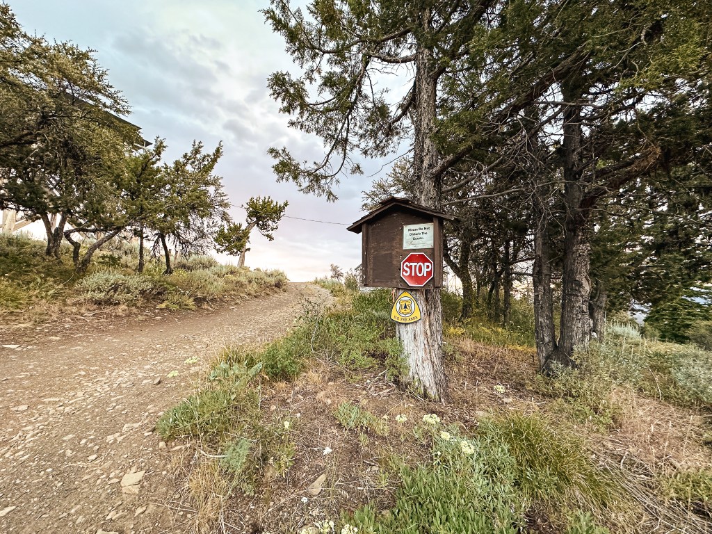
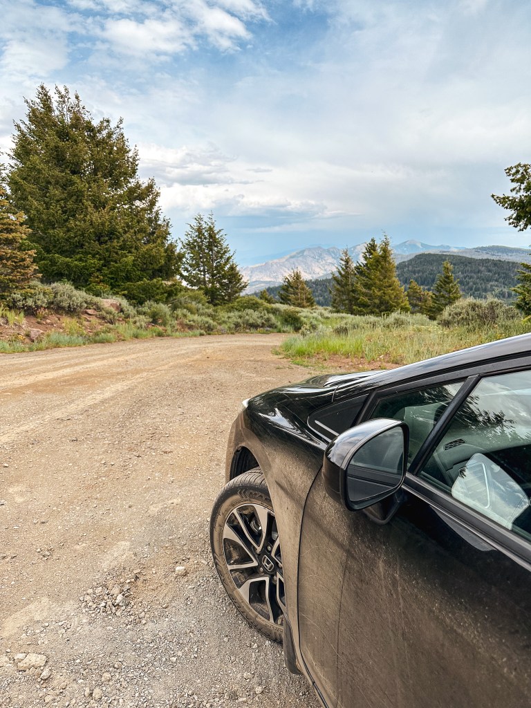
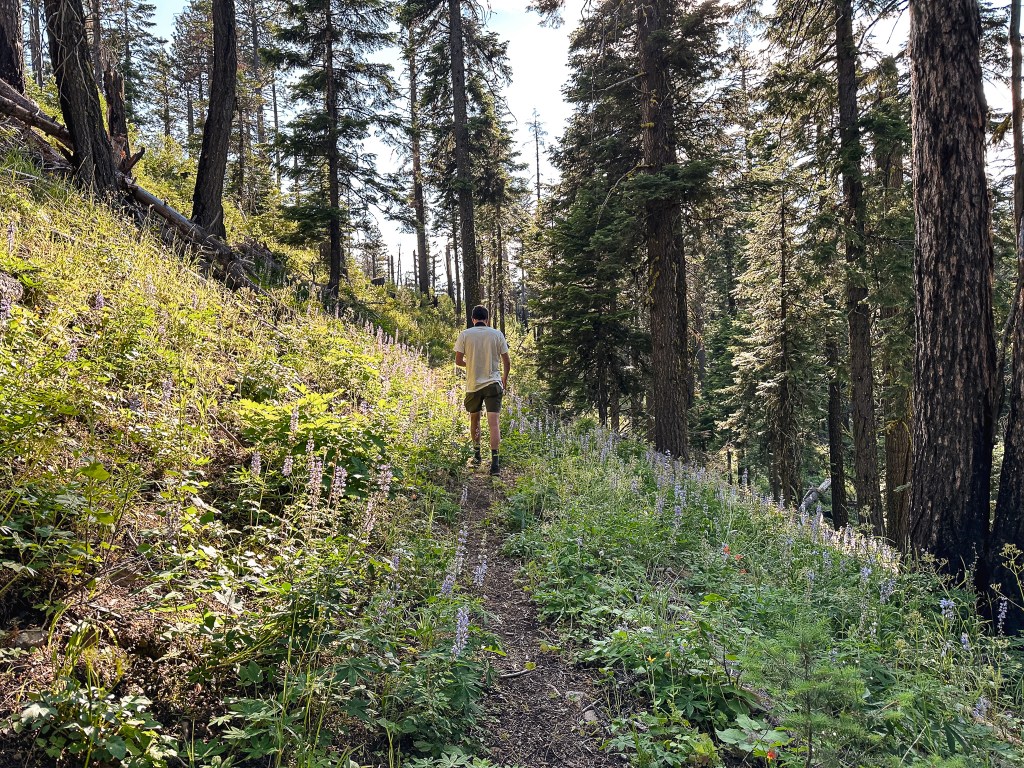
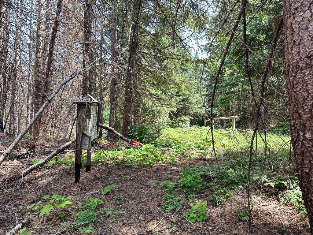
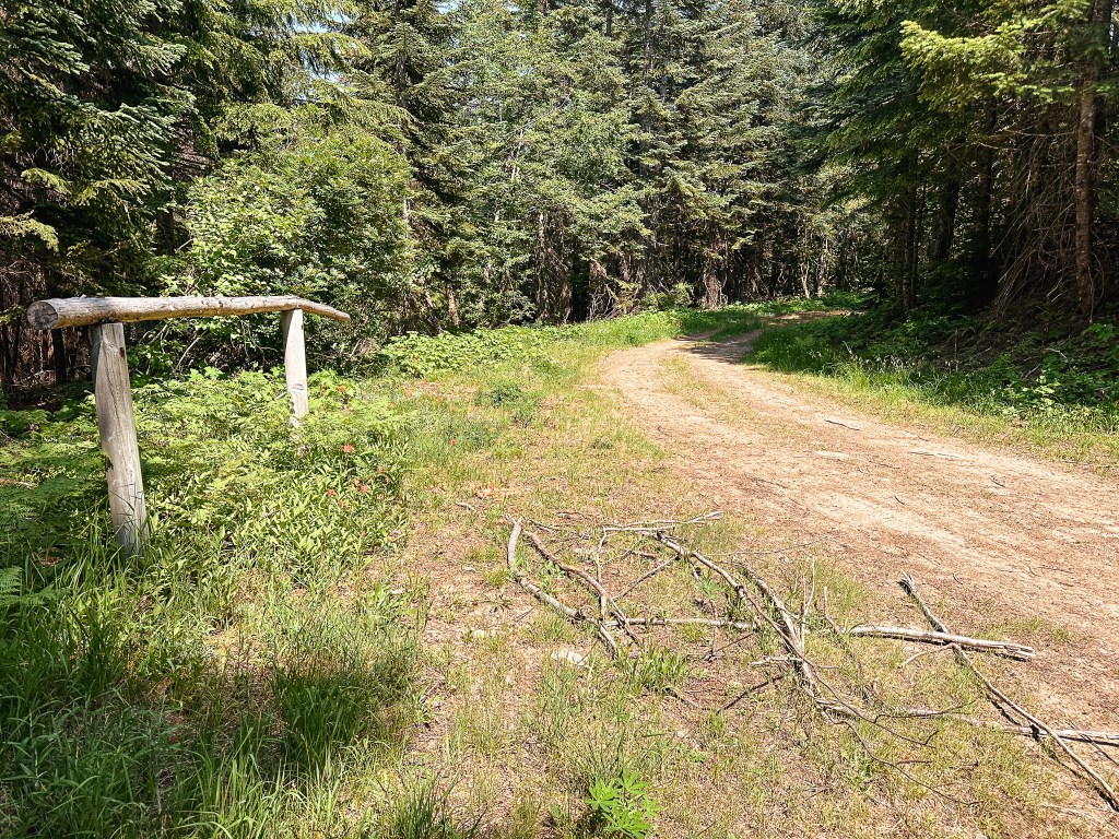
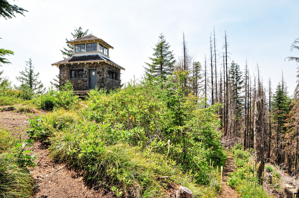
I had it in my mind for some reason that the spur road to the lookout was in bad condition and we decided to park at the junction to walk the remaining distance. It always feels like a weird move to drive up to a rental anyway. The road is just shy of one mile and my Stava app calculated it at 0.93 miles with 396′ of elevation gain. We realized quickly the road was definitely drivable to the Civic with only a few sections that might give the lower clearance some trouble. The walk was worth it though since we saw two Pileated Woodpeckers that we wouldn’t have noticed otherwise. This would be a theme for the trip, we’d continue to see a ton more woodpeckers and do a ton more road walking.
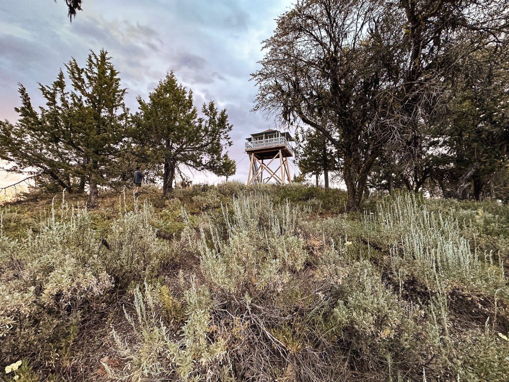
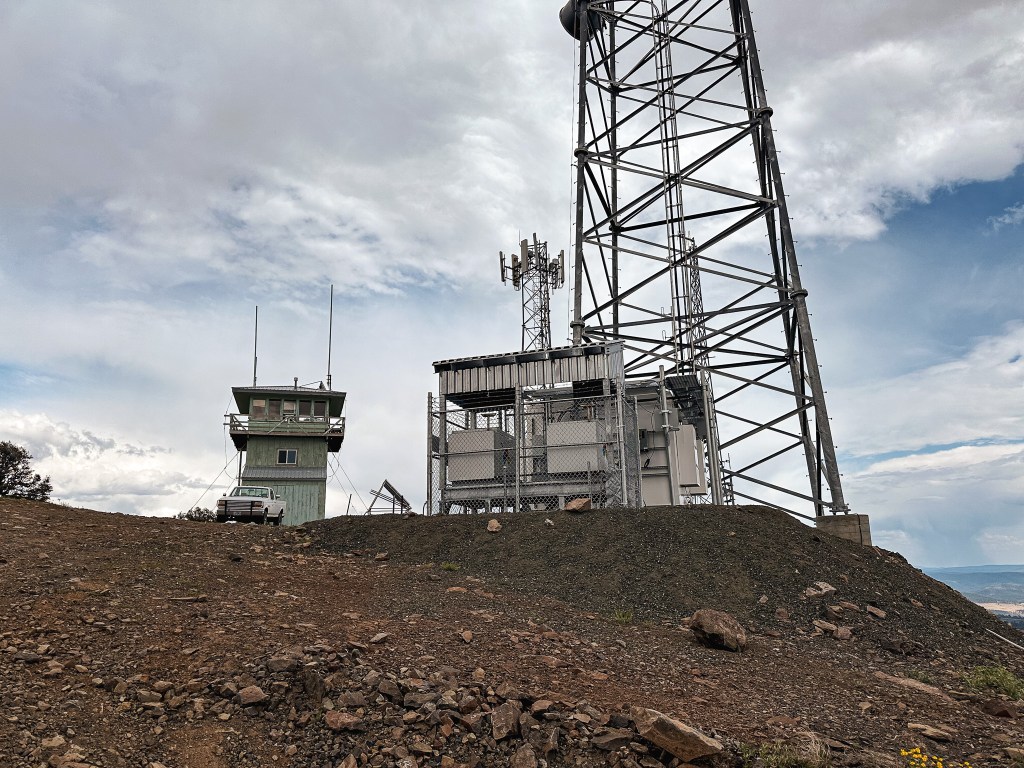
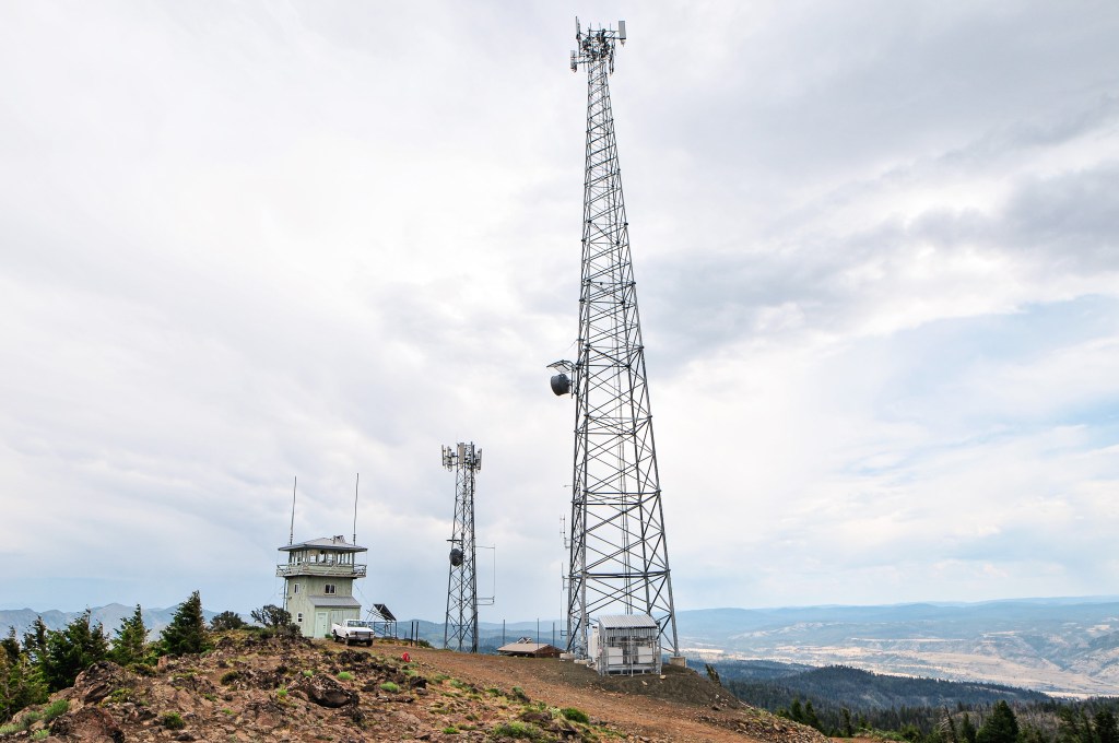
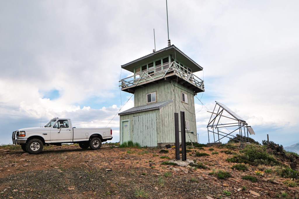
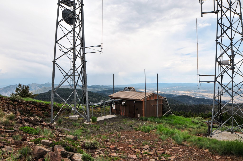
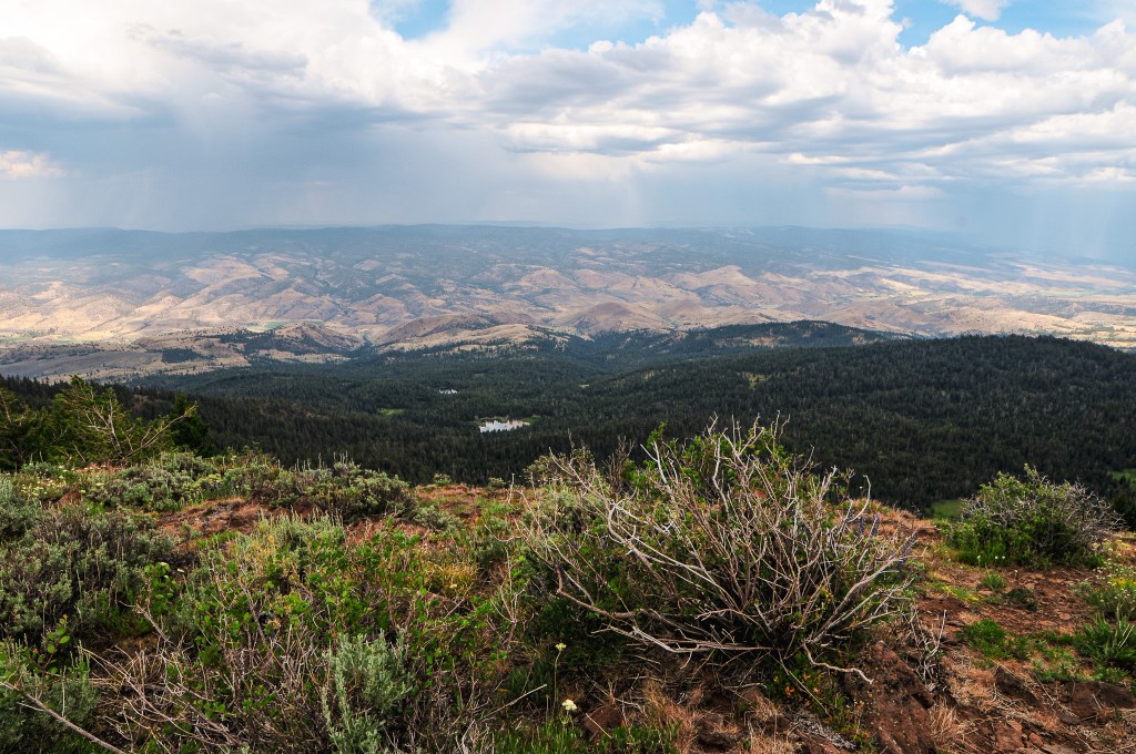
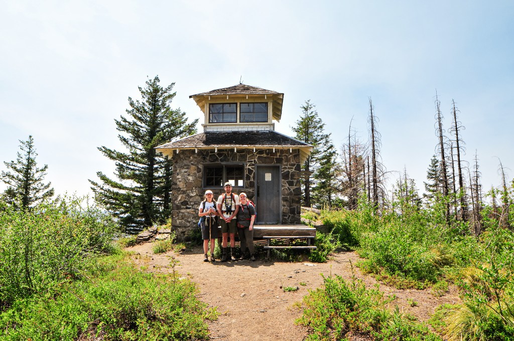
Once at the fire lookout we were surprised to see no vehicle onsite. The renters must have cancelled, gotten lost, or were driving from a very far distance. The sun was already starting to set and it was a Saturday after all. When I had checked the reservations prior to our trip it had been completely reserved. We’ve been lucky this year, so far, to visit a few rentable lookouts without the renters. It was odd that no one was here, but we were happy to not have to worry about intruding on anyone’s space. It gave us time to enjoy the sunset before heading back to the car. We weren’t sure where we were going to camp for the night and hadn’t seen any dispersed spots along this road yet. We headed down via NF-4920 towards HWY-395. We opted to camp at the Starr Campground where HWY-395 and NF-4920 meet. There were only a couple other campers here on a weekend and we had our pick of the spots. We did pass one dispersed spot back along the road but it sounded easier to utilize the picnic tables at the campground after a long day of driving.
History.
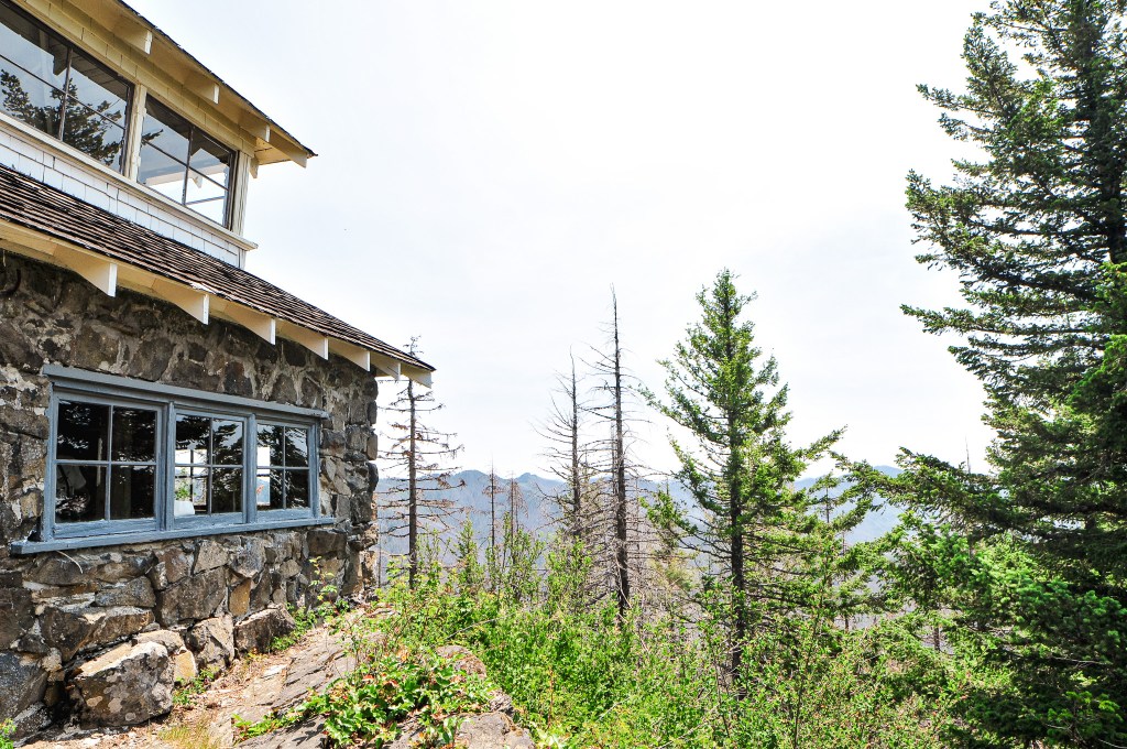
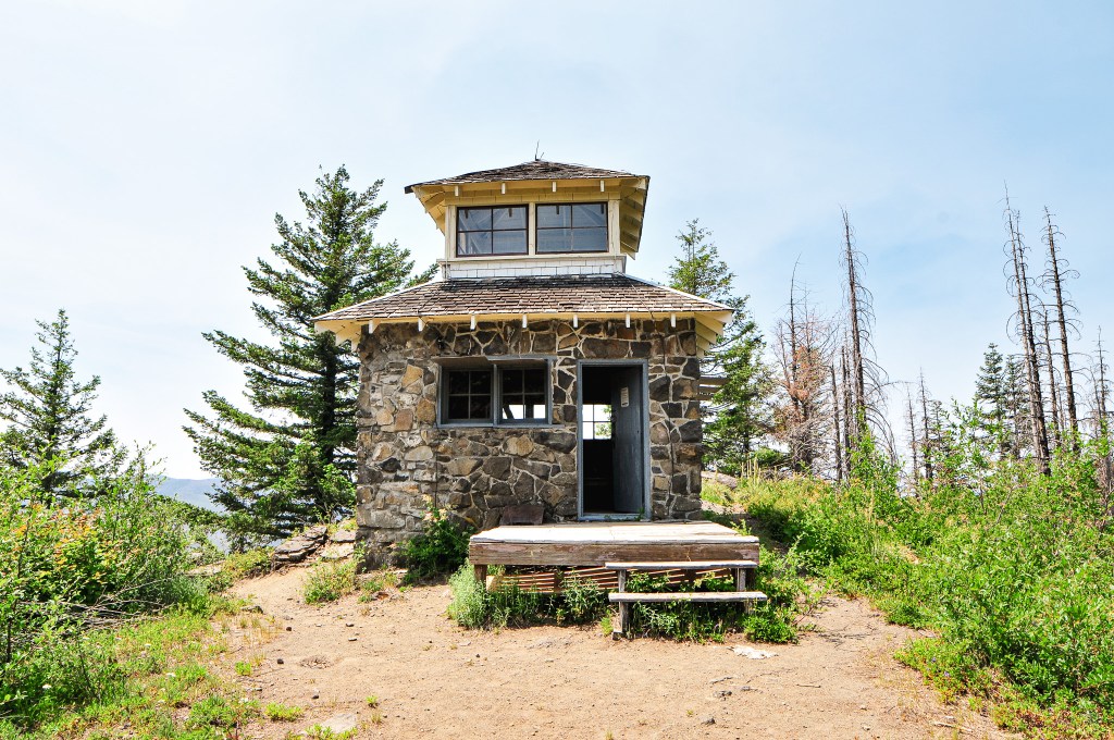
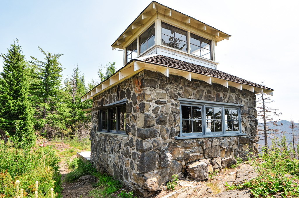
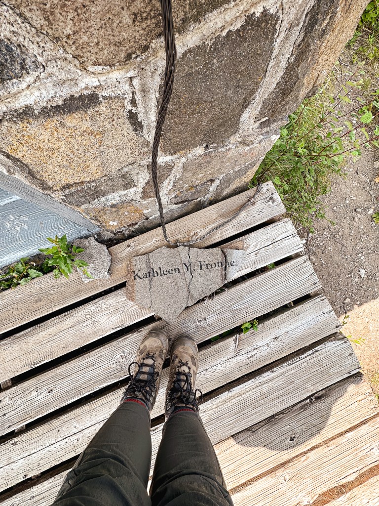
The lookout on Fall Mountain was constructed in 1933 and still stands today. I found some conflicting information online about the style of the tower and found it hard to determine which is the most accurate. Ron Kemnow’s site lists that it was originally built as an Aladdin Jr. 14’x14′ cab on a native round timber tower. It was accompanied by an Aladdin style 16’x18′ wood framed garage. A structural inspection done in 1968 noted the tower height at 30′ and that the legs had been replaced around 1954. Other sites note the cab as a 14’x14′ L-4 style. The NHLR and Forest Service note the tower height at 18′ but Rex’s site mentions that it is a 15′ pole tower. It is currently apart of the rental program, but it is unclear when it was added.
If you were around here during this time last year, reading this blog for some reason, you might remember we had taken a road trip to visit a bunch of fire lookouts in the southern part of Oregon. If not, you can find our route and associated posts here. We had managed to visit 18 fire lookouts over the course of 10 days. We planned to take a similar trip this year albeit a bit lacking in comparison. Our goal for this time around would be to visit 12 fire lookouts over 9 days in the eastern central portions of Oregon. We would be covering what one might call big country and although things might look close on a map they would not be as the car drives. We tried to give ourselves ample time for any mishaps or delays, but had hope that things would go as smooth as last time.
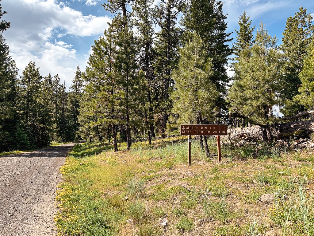
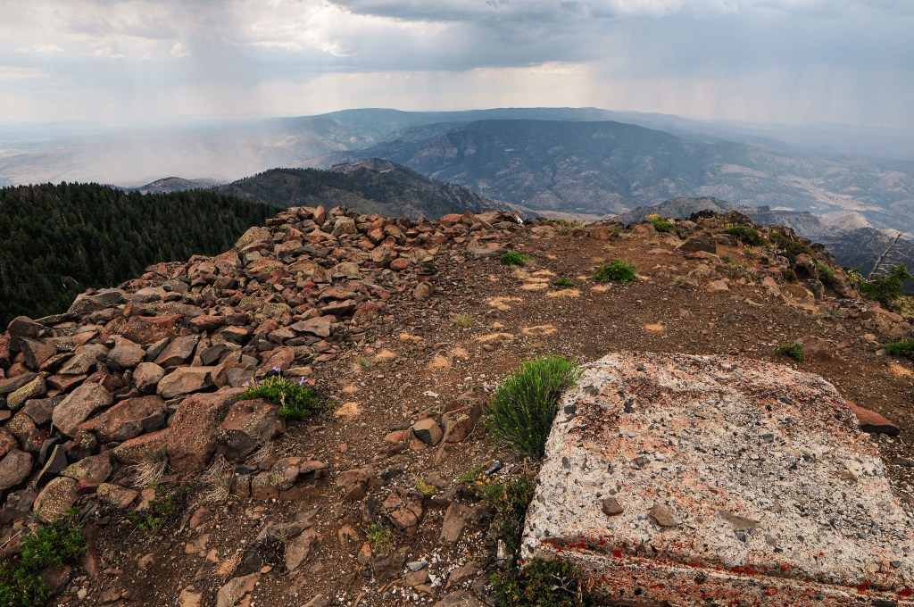
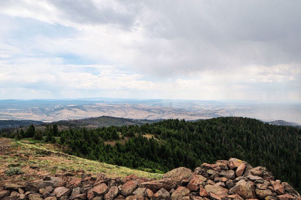
We had our sights set on Aldrich Mountain and Fall Mountain (post) in the Malheur NF for our first day. We headed out of Portland around 9AM via HWY-26 and followed this all the way to Dayville. We only briefly made a pit stop in Prineville to refuel our car and stomachs. From HWY-26, we made a right turn onto Fields Creek Road to head into the forest. This road eventually turns into NF-21 once you’ve crossed the boundary. We had been to this area once before on our first dispersed camping trip together in May 2020. We have since driven past this turn off many other times, but haven’t made the turn onto this road since that initial trip. During that trip, we visited a bunch of old mining areas and Flagtail Mountain (post). Believe it or not, this was prior to our fire lookout centered adventures. We followed paved NF-21 until it came to a junction with NF-2150 off to the right. This turn used to be marked with a sign for the Cedar Grove Botanical Area, but it appears to have since been removed. It’s roughly 15 miles along NF-2150 to Aldrich Mountain. There was a sign for Aldrich Mountain L.O. at the junction with the Cedar Grove Trail #203A. The NF-2150 road is a good gravel road all the way to the main parking area below the final pitch to the lookout. There is a sign here that states the road beyond is closed to all motorized vehicles, but there is no gate. We walked the remaining distance of the road, which my Strava app calculated at 0.2 miles.
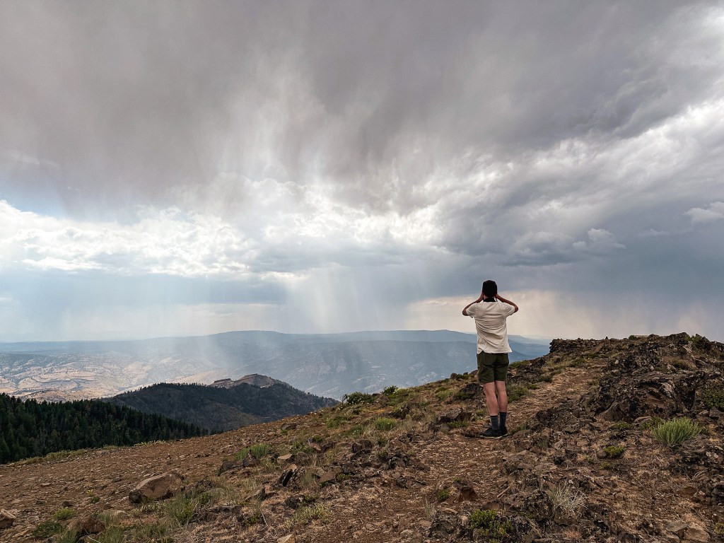
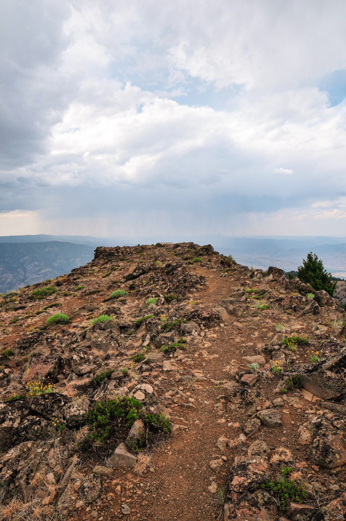
We knew this fire lookout would be staffed during our visit and had hoped to meet the lookout attendant while there. Unfortunately, they seemed to be hunkered down in the second story of the tower. We figured this was probably due to the thunderstorm activity in the forecast. There had been a 20% chance of thunderstorms for the surrounding areas over the next two days, which probably should have been a warning for us to stay away from the high points. We decided to take a chance on visiting them regardless due to our inflexibility of route and timing. Don’t worry we’re not completely brain dead, we’d assess our risk based on each area during our time of visit. There was definitely storm clouds off in the distance, but none were close enough at the time to be of concern to us. There is also a 100′ communication tower on the summit that was more likely to get hit than us. We still didn’t want to waste any time lingering near a storm and quickly headed back to the car after taking in the view and some pictures. I later found out from the lookout attendant on Madison Butte (post) that Aldrich was staffed by someone named Danielle as well. She was on Tamarack Mountain (post) the year prior. It’s too bad we didn’t get a chance to meet while we were there, but maybe our paths will cross in the future. If she ever happens to stumble across this blog, Hi Danielle!
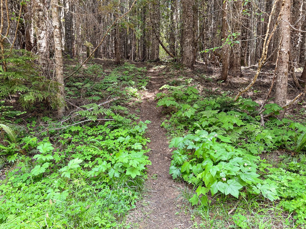
We decided to make a stop to check out the Cedar Grove Trail before heading on to Fall Mountain. We figured we wouldn’t be back to this area anytime soon and should see it while we were here (or maybe I should say while it’s still here). This trail is unique because it takes you to an isolated grove of Alaskan yellow cedar trees. The trail heads down from the road and takes you to a few interpretive signs about the common vegetation in the area before you reach the grove. Unfortunately, it seemed like a lot of the cedar trees were dead or dying. There were still a few of them alive though. We weren’t sure how far the trail continued since it’s designated as a National Recreation Trail and turned around when it started heading up a slope. Once we headed back the way we came we saw where the trail connected and looped around. The total mileage is slightly off due to this backtracking, but My Strava app calculated this hike at 1.89 miles with 395′ of elevation gain.
History.
The first fire lookout built on Aldrich Mountain was an L-4 hip-roofed ground cab in 1934. Four years later a garage and storage building were added to the summit. It was replaced in 1959 by a standard 14’x14′ 3-story ODF cab. This lookout was short lived as it was burned down by vandals later that same year. In 1960, an exact replica was built and still stands today. It is actively staffed every summer. Rex’s site mentions that it is currently managed by the Ochoco National Forest. The site has changed management over the years due to its prime location overlooking BLM, state, private, and national forest land that benefits all.
2020 has been a very long and difficult fire season for a lot of people across western Oregon, especially those who live in communities affected by fire and smoke. We encourage everyone who has sustained damage or losses from these fires to take full advantage of programs offered by FEMA and other relief organizations
We realize some of your favorite and most beloved places may have been impacted by fire. As land managers tasked with caring for the land, we’re also hurting and sad as we learn the extent of the damage to our favorite place.
We are anxious to survey the damage and to inventory repair work. Many places, such as the Opal Creek area, are no yet accessible even for us, due to very serious safety concerns. These hazards include burned out trees with weakened roots, ash pits, falling rocks and erosion. Likely, these hazards will increase as the wet fall and winter weather arrives. Some of these areas may be closed for a long time. It might even seem excessive.
We simply don’t know how long it will take us to mitigate hazards allowing us to work safely. These closures are in place to protect the life and safety of visitors and also rescue crews and firefighters. We ask you to please respect our closures. Thank you for your patience and resilience as we collectively try to recover from these devastating fires.
There will be many months and even years of healing for those of us who manage the land, communities and for the forest itself which provides so much for all of us.
-Willamette National Forest Supervisor, October 6th 2020
Trip Report.
In 2020, the Beachie Creek Fire decimated around 193,556 acres in Oregon. It burned 486 homes and 36 non-residential buildings which greatly impacted the communities of Detroit, Gates, Mill City, and Mehama. This doesn’t include the damage done by the Riverside (138,054 acres) or Lionshead (204,469 acres) Fires that burned around those areas during the same time. Pechuck L.O. managed to escape any damage due to the efforts of our Wildland Fire Crews, but has been closed to the public the last few years. The area is still listed as closed when doing a basic search on the BLM website and AllTrails app despite recent trip reports stating it has been re-opened. With that information in mind, we decided to add it to our list to visit as soon as possible.
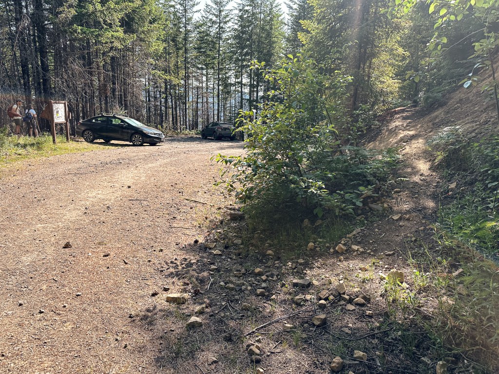
Garnet and I both had the day off on Tuesday in observance of the fourth of July holiday. Portland was predicting somewhere in the 90s for the high of the day. We decided this would be the perfect time to escape the heat in the mountains and finally check off Pechuck for a day hike. We invited Garnet’s mom to join us for the day and set off from SE Portland around 9:30AM. We briefly popped on I-205 to connect to HWY-213. We stayed on this highway through Mulino and Liberal, but turned left once we reached the junction with HWY-211 to head towards Molalla. From Molalla, we had planned to turn right onto Mathias Road. We didn’t account for the Main Street through downtown being closed off for a fourth of July parade. There were detour signs that took us around and dropped us on Mathias Road farther down than we needed. We back tracked to connect with S Feyrer Park Road. This road was unmarked and we initially missed the turn. It is more obvious coming from the other direction since Mathias Road curves into S Feyrer Park Road. We followed this until we passed Feyrer Park and crossed the bridge over the Molalla River to a T-junction. We turned right onto S Dickey Prairie Road and stayed on this road until we crossed another bridge over the North Fork of the Molalla River. Shortly after crossing the bridge you will want to take the first right onto another bridge to cross the Molalla River again. Most of these junctions are unmarked but it heads towards the Molalla River Recreation Area and then curves left to become S Molalla River Road. We stayed on this road for 13.6 miles. The road is paved the majority of the way. We crossed the Molalla River once again just shy of the 13 mile marker and the road became good gravel after that. Once we passed the 13-1/2 mile marker we turned left onto the first road heading up. This is allegedly the Upper Molalla River Road but is once again unsigned. Once you start heading up and away from the river you will come to a fork in the road. The left road will take you to the Table Rock Trailhead, but we stayed right to turn onto Rooster Rock Road. There was another fork after that where we stayed left to continue on Rooster Rock Road. Don’t expect to see any signage to indicate you’re on the correct road. Eventually, Rooster Rock Road will dead end at the Rooster Rock Trailhead. We arrived around 11:30AM and had the trailhead to ourselves. The roads getting here were mostly good gravel with only a few easy to navigate pot holes and rocky sections along the Rooster Rock Road.
Start of the trail
Old decommissioned road
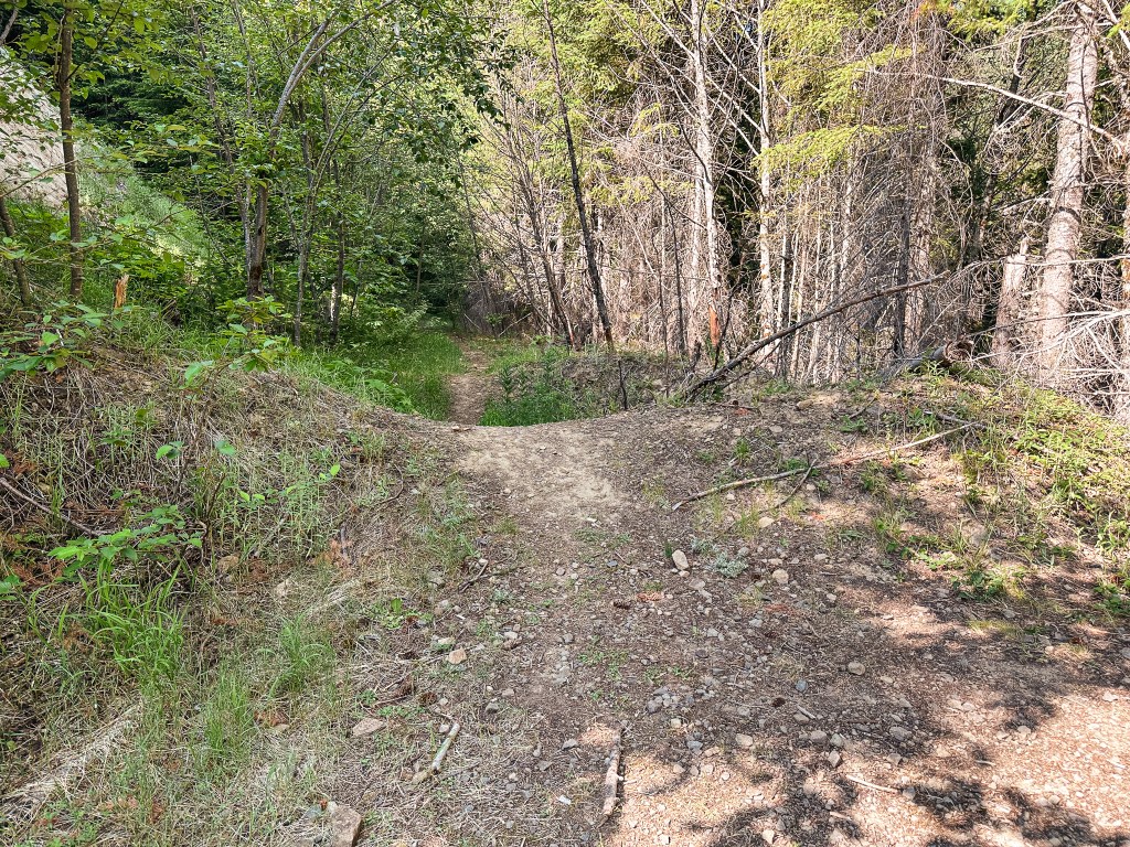
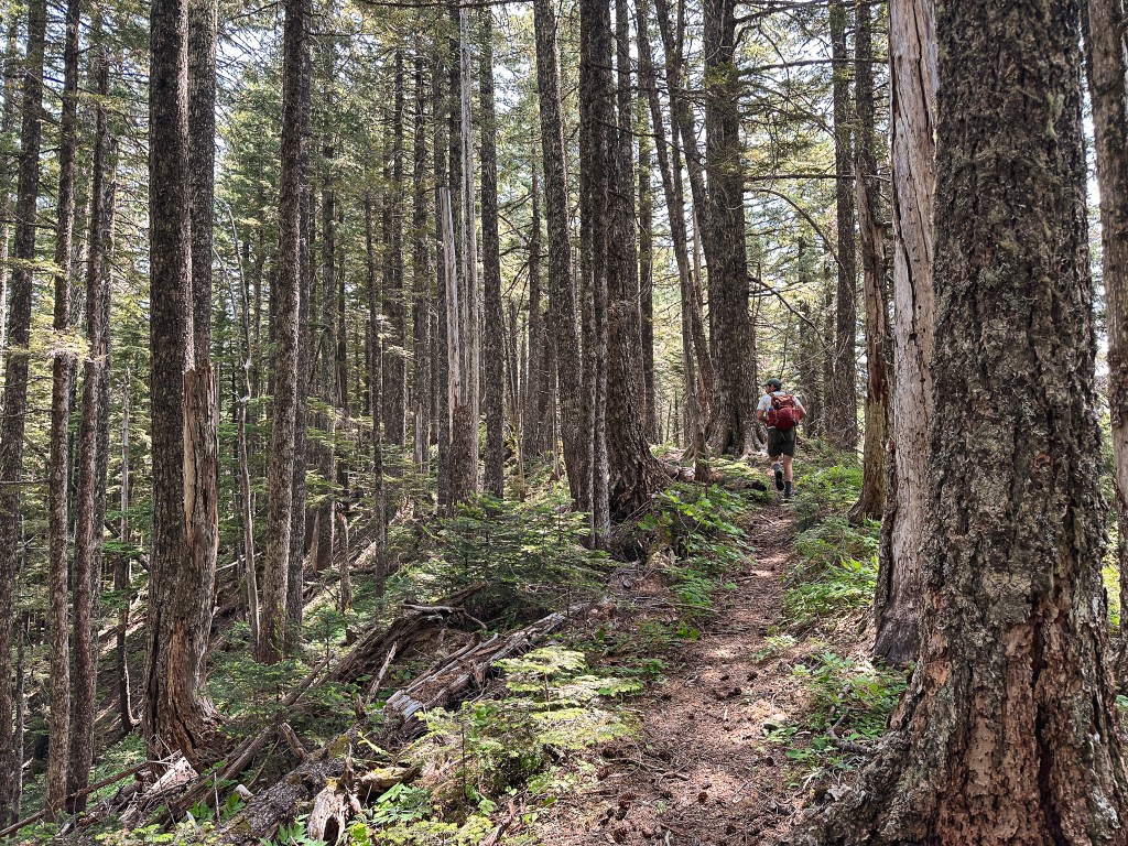
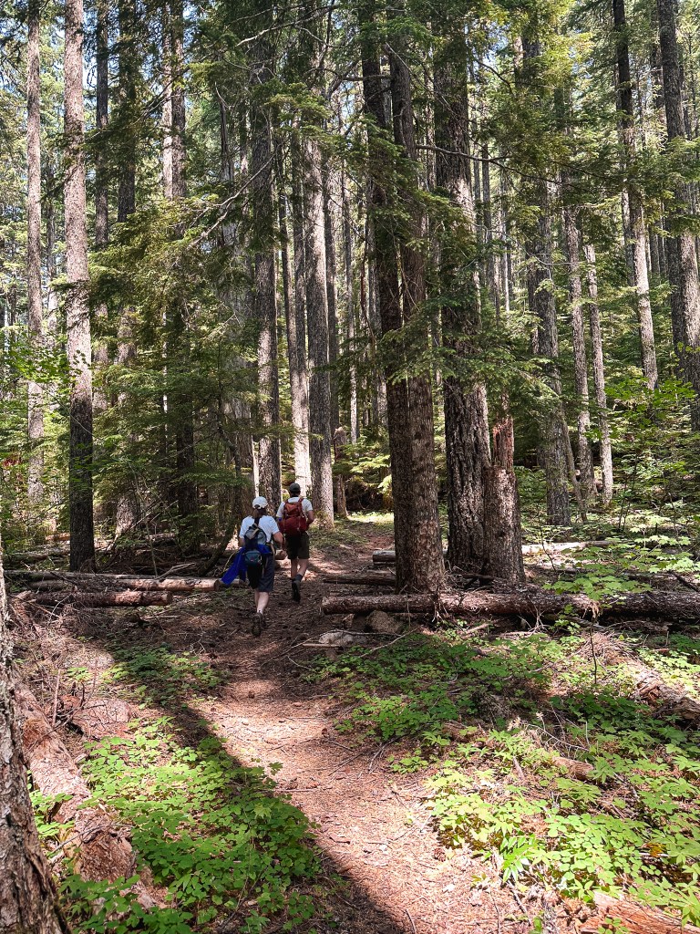
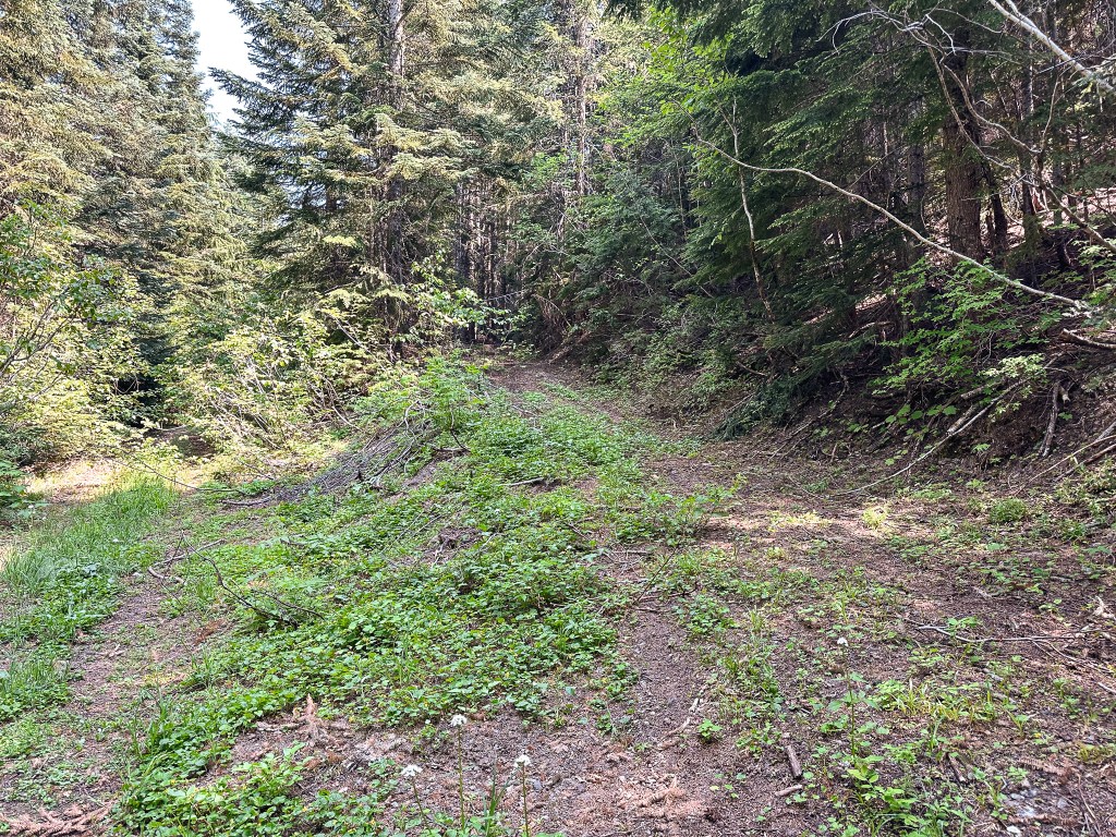
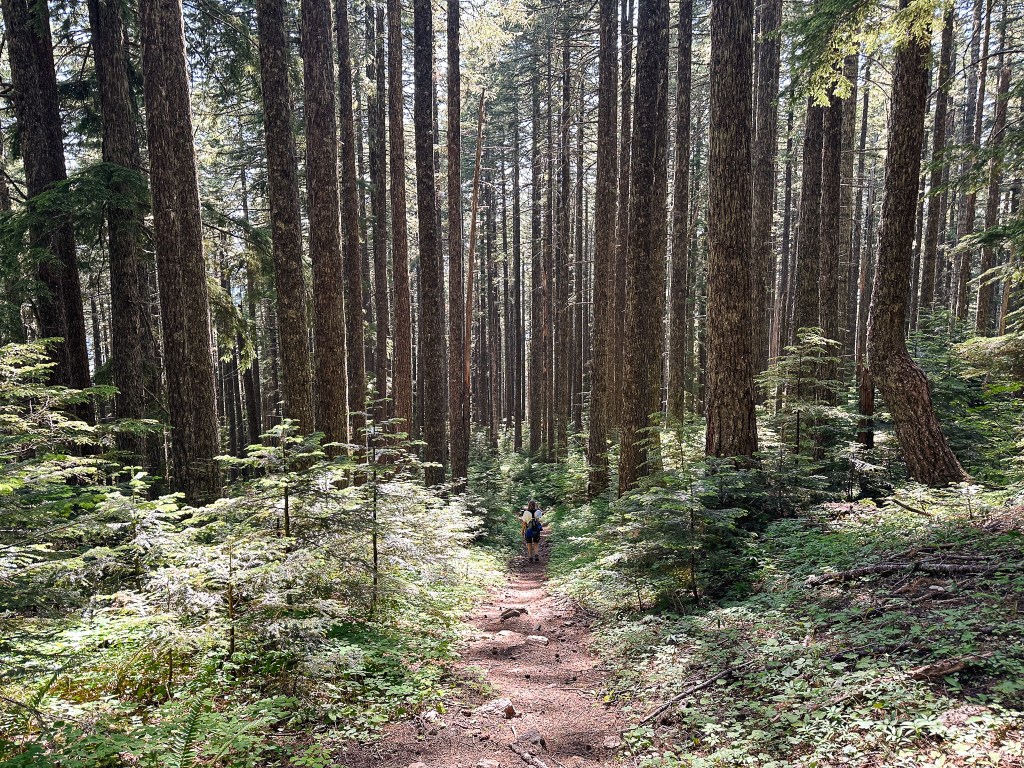
There are a few different routes you can take to get to Pechuck L.O., but we opted for the most common and shortest of options. I would classify Pechuck as a fairly popular hike on social media, so we were a bit surprised to see no one else here on a holiday. We passed plenty of people parked along the Molalla River on our way into the area too. We speculated that the online closure notice must have deterred a lot of people. We have also noticed people tend to celebrate the fourth in town or on the water. After setting up the car in the shade and packing our bags full of lunch, we headed up the trail directly across the road from the sign board. There is a more visible trail that continues on the decommissioned portion of the road, but this is not the route you want. The Rooster Rock trail climbs 1.1 miles up the ridge to meet up with the High Ridge trail. It varied between quick switch backs, steep uphill, and short flat sections to offer some reprieve from the elevation gain. There are no trail signs at the junction with the High Ridge trail, minus an R and arrow carved into a tree. The R points to the left which would take you to Rooster Rock, we turned right to head towards Pechuck. From the junction, it is 1.6 miles to the lookout. We followed a rolling ridge line that was my favorite portion of trail. Once we started to see signs of the burn from the Beachie Creek Fire the trail started to lose elevation. It flattened out before we reached a junction with the old road and Pechuck trailhead. This road is gated and no longer accessible. From here, you can either head up the trail that continues across the road or turn left to follow the road to the old lookout access road.
Looking left on the road from old trailhead
Were the trail continues across the road
Garnet had already continued on up the trail by the time his mom and I reached this junction. I remembered reading something about turning on a road but Garnet had the screenshot of the description. We decided to take the more obvious option and continued up the trail as well. This section of trail is where you will gain back all the elevation you lost as it quickly switchbacks up. Parts of it looked like it was beginning to erode due to damage from the fire and one particular section skirted along the edge of an old quarry that wasn’t super friendly to those afraid of heights. It flattens out again before the trail meets up with the old access road to finish the final climb. Once we saw the old access road, Garnet’s mom and I questioned whether it met up with the other road or not. We both agreed that we rather hike back that way if it does. We reached the composting toilet and knew we were almost there. You can just barely see the top of the lookout from it. The day was starting to heat up and I had already drank one of my 32oz bottles of water. We were overdue for lunch by the time we reached the lookout, but we were all determined to have it on the summit.
Composting toilet
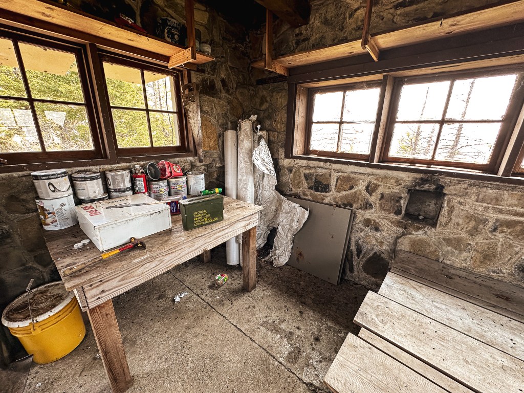
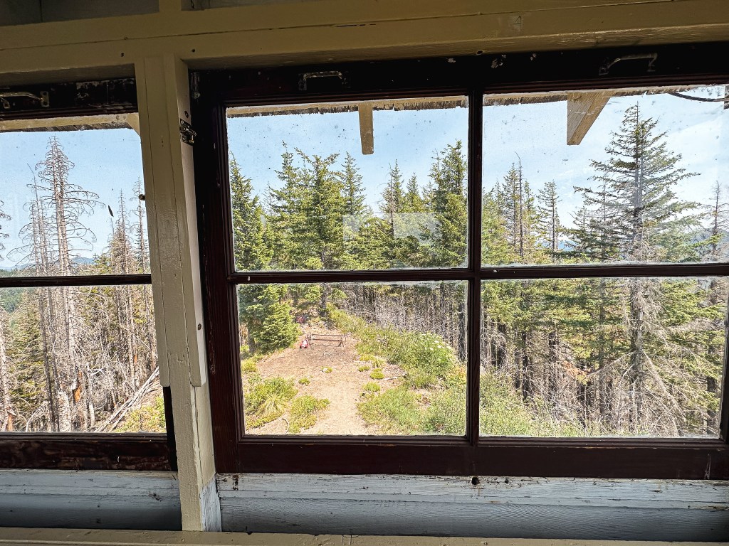
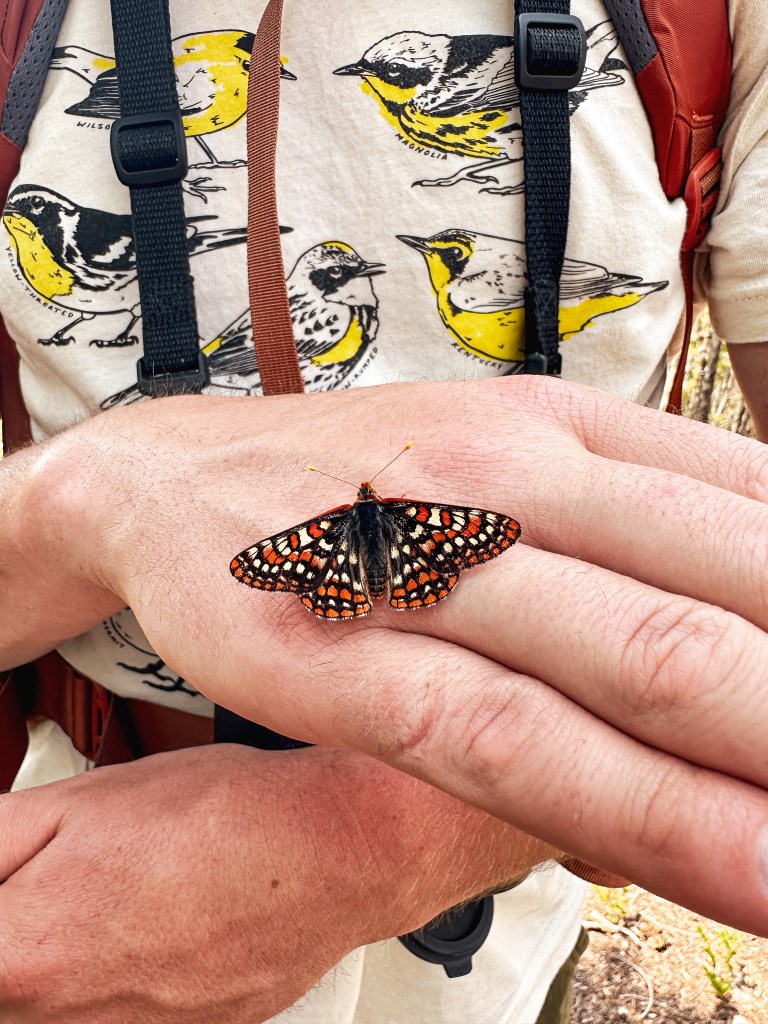
We decided to take some pictures around the lookout and in the cupola while Garnet’s mom headed off to find a good lunch spot in the shade. The lookout is in decent condition, but does have a smell to it from its rodent inhabitants over winter. The ladder to climb up to the cupola was a bit ricketier than I’d like but I was still able to manage. Personally, I’m not sure if I’d want to spend the night here with all the signs of rats unless it was an emergency. There was wide spread haze in Oregon obstructing the view from the cupola. I assumed this is mostly from the wildfires in Canada, but could also be from the newly formed Tunnel Five Fire in Washington. Though the site doesn’t offer much of an expansive view beyond the immediate ridge lines even on a clear day. Oregon has somehow escaped the wildfires so far this season, but I have a feeling this will be short lived as the heat advisory continues. I signed the log book in the geocache and headed for the shade. We all felt reenergized for the hike back after our lunch. While I was packing up, I noticed a butterfly sucking up the salt from my sweat that had made it on to my pack. I tried to remove it a couple times, but it kept flying back to my pack. Eventually, I had to coax it onto my finger so I could finish packing up without accidentally squishing it. The butterfly was unbothered and I encouraged it on to Garnet’s hand instead. It was really enjoying the salt we had to offer. It probably would have made the entire hike back with us if we let it.
As we started our hike back, we came to the junction where the trail forks from the old lookout access road. Garnet was unsure of going down the road since we didn’t know for sure if it met up with the road we needed. There was a rudimentary map on the back of the door in the lookout that showed this as a trail heading down to a spring. But, more importantly it also showed it meeting up with the road we needed. Garnet didn’t want to make the call incase the map was wrong, but I was confident and started to head down the road. There was a bit of blow down along the access road but nothing unmanageable. Sure enough the road made a sharp left turn before spitting us out on the road. We followed it past the quarry where the trail hikes above and continued until we were back at the old trailhead. This felt like a much easier route in my opinion as long as you know where you’re headed. From the trailhead, the hike back followed the same route as before. Make sure to keep an eye out for the unmarked junction back to the Rooster Rock trailhead, it is less visible from the High Ridge trail and could be easily missed. Especially, if you spend a lot of your hike staring at your boots like me.
Old lookout access road heads up to the right
Old Pechuck trailhead
Junction with Rooster Rock trail from High Ridge trail
My Strava app calculated our total hike at 5.62 miles with 1,529′ of elevation gain. We didn’t see anyone else on trail all day. We did however come back to another car parked at the trailhead. Garnet had made it back to the car first and had seen the people. He said they got out of their car and despite seeing him hiking down the actual trail headed off down the decommissioned road. As we were packing things into our car, they came back. Garnet’s mom asked if they were looking for the trail and pointed them towards the actual trail, but they said they were only looking for service on their phone. They stood at the base of the trail for a while and eventually started hiking up. We all agreed it seemed a bit late in the day to be starting this hike, especially since they only had a small hydration pack between the two of them. The days might be longer right now, but it is always good to be over prepared and plan for extra time when venturing out.
Mosaic burn pattern from the Beachie Creek Fire
History.
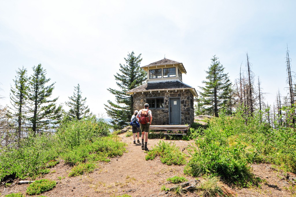
Pechuck was first defined as a fire detection site in 1918 when a fire finder was mounted to an open stand. The only access to this site at the time was from the Table Rock Trail through the Table Rock Wilderness. The existing structure was built in 1932 as a unique cupola style cabin. It was built primarily out of native stone from resources nearby with some wood frame details. The contractor that completed this lookout was John Oblack from Molalla with the assistance of an unnamed Portland stone mason. It was actively staffed until 1964 and completely abandoned in 1965. The building was restored and opened to public use in 1995 by Pete Bond and a group of volunteers. Pete Bond was a Trails Coordinator of the Oregon Department of State Parks in Salem. Thanks to his work the lookout is open to overnight stays on a first come, first serve basis. It was also one of the first couple of lookouts added to the NHLR.