Columbia Breaks Fire Interpretive Center

Washington Lookouts

Location.

Entiat, WA

Date visited.

March 25, 2022

Trip Report.

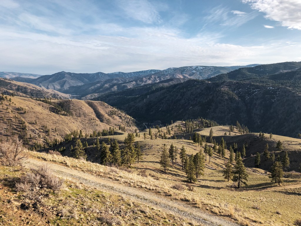
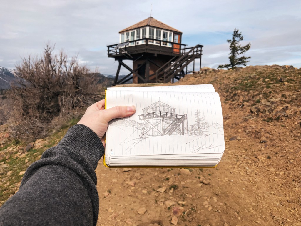
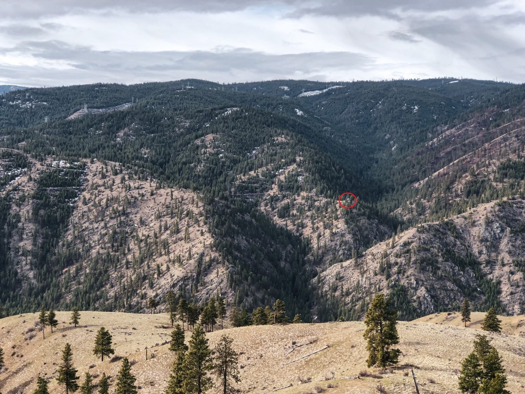
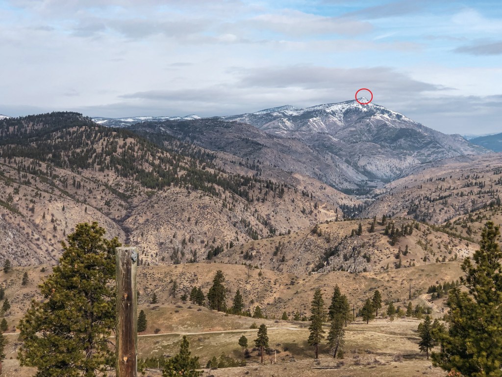
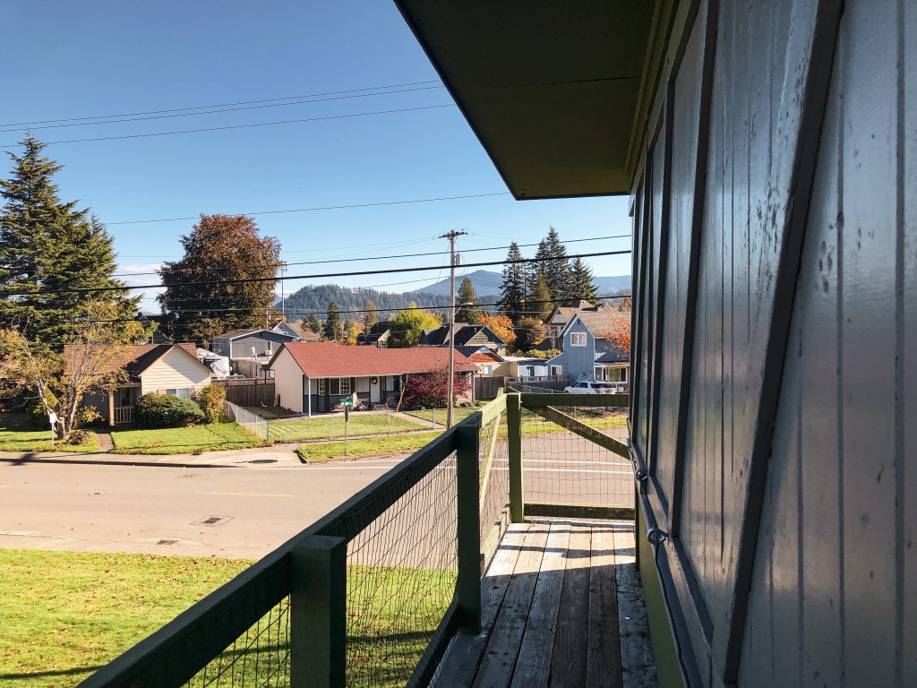
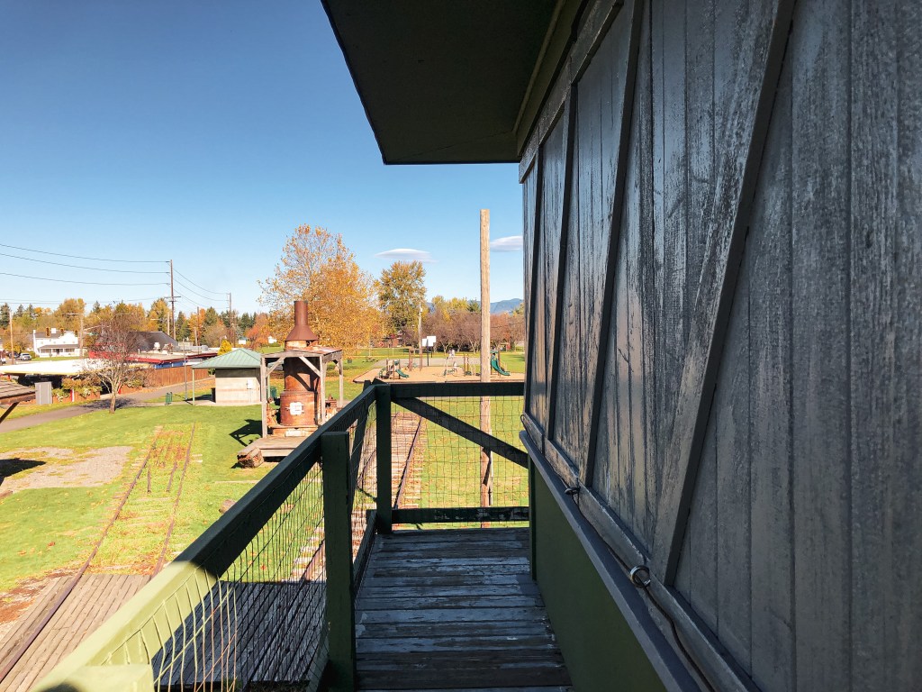
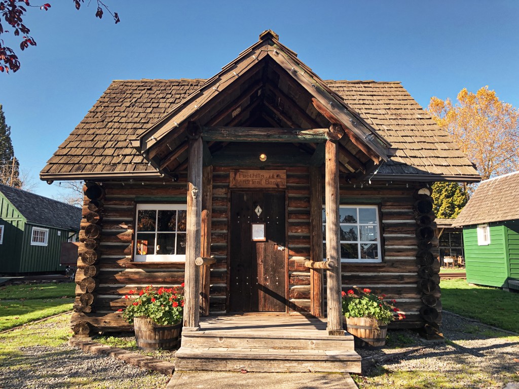
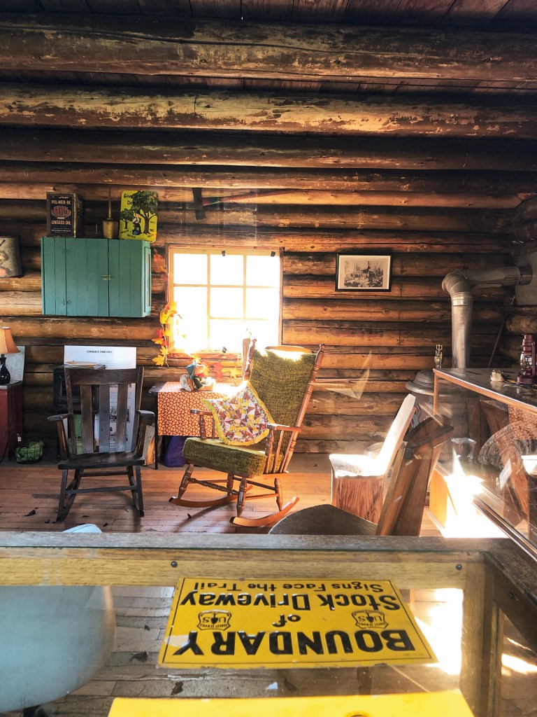
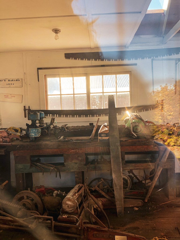
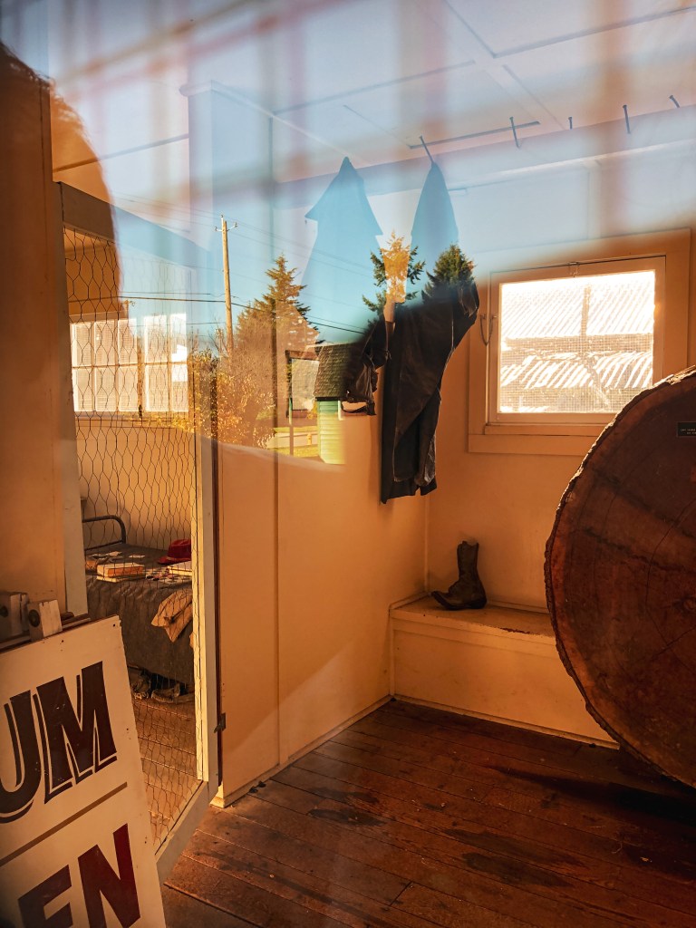
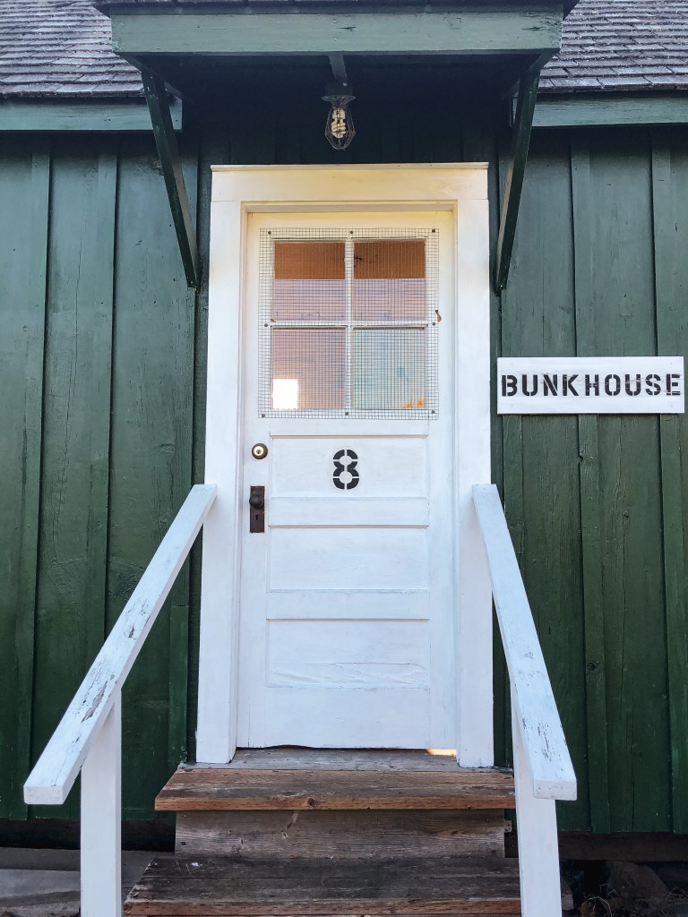
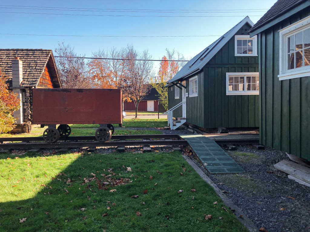
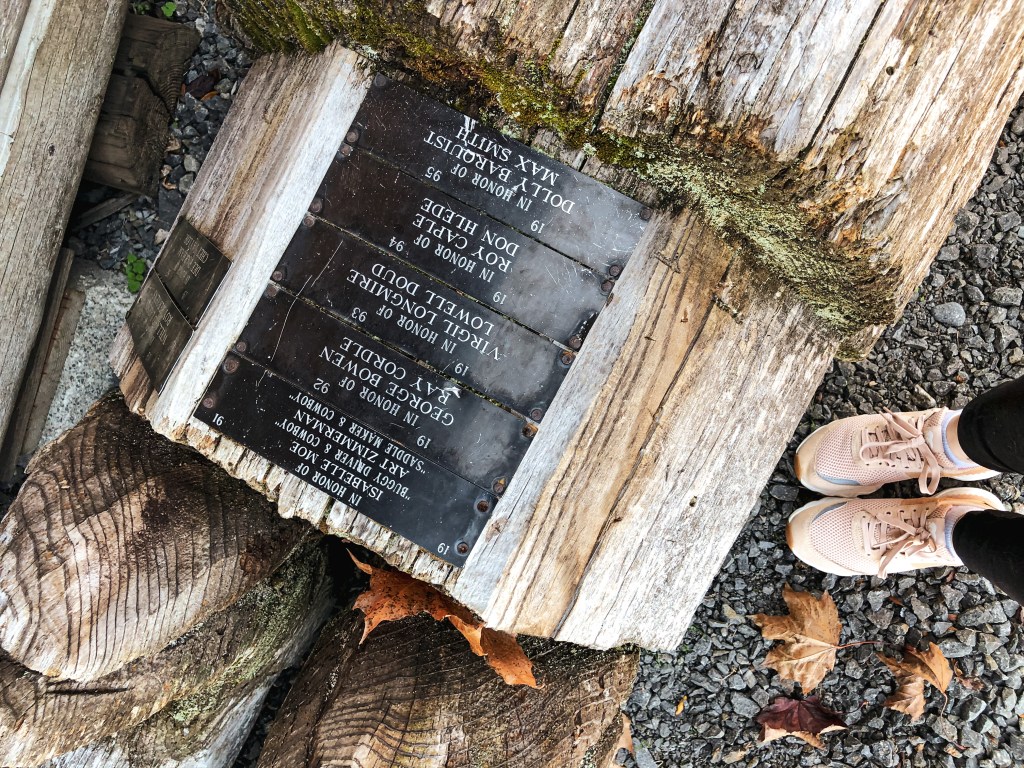
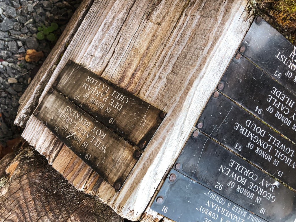
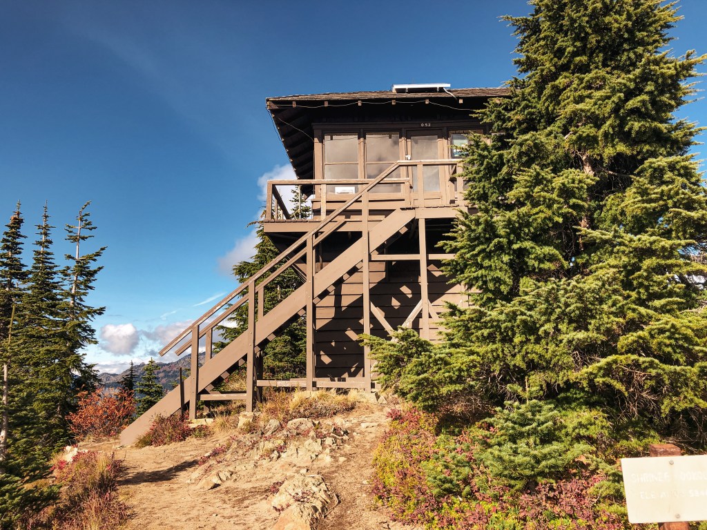
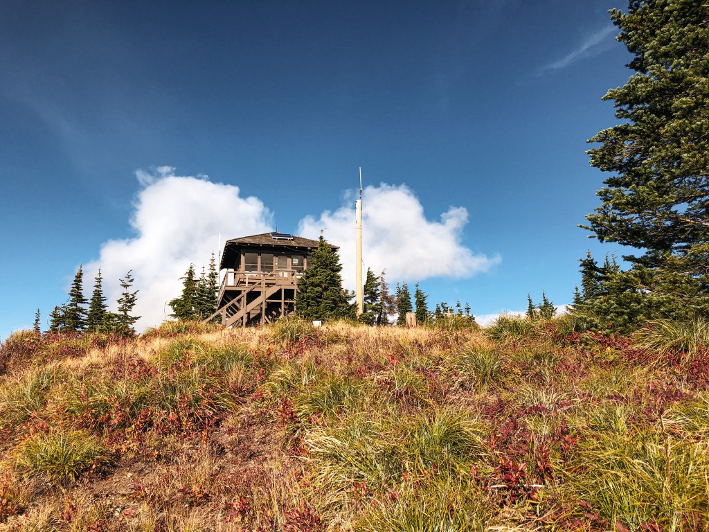
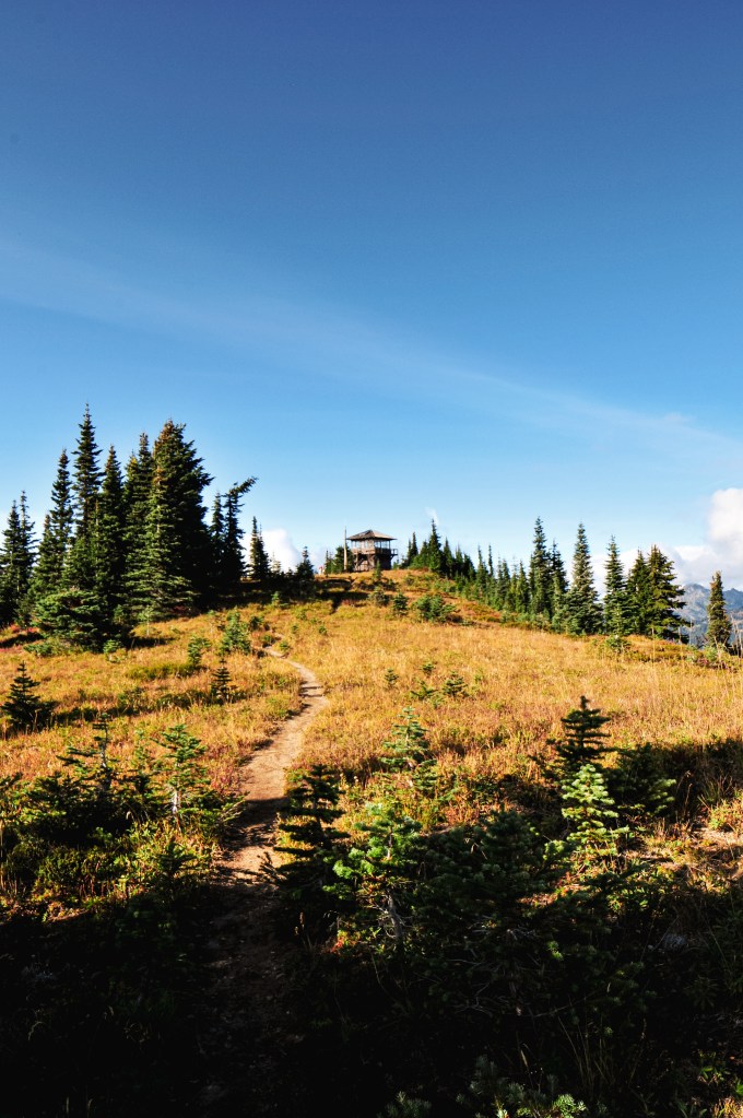
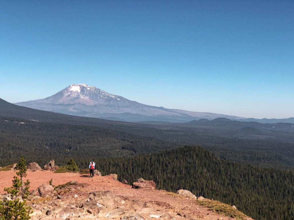
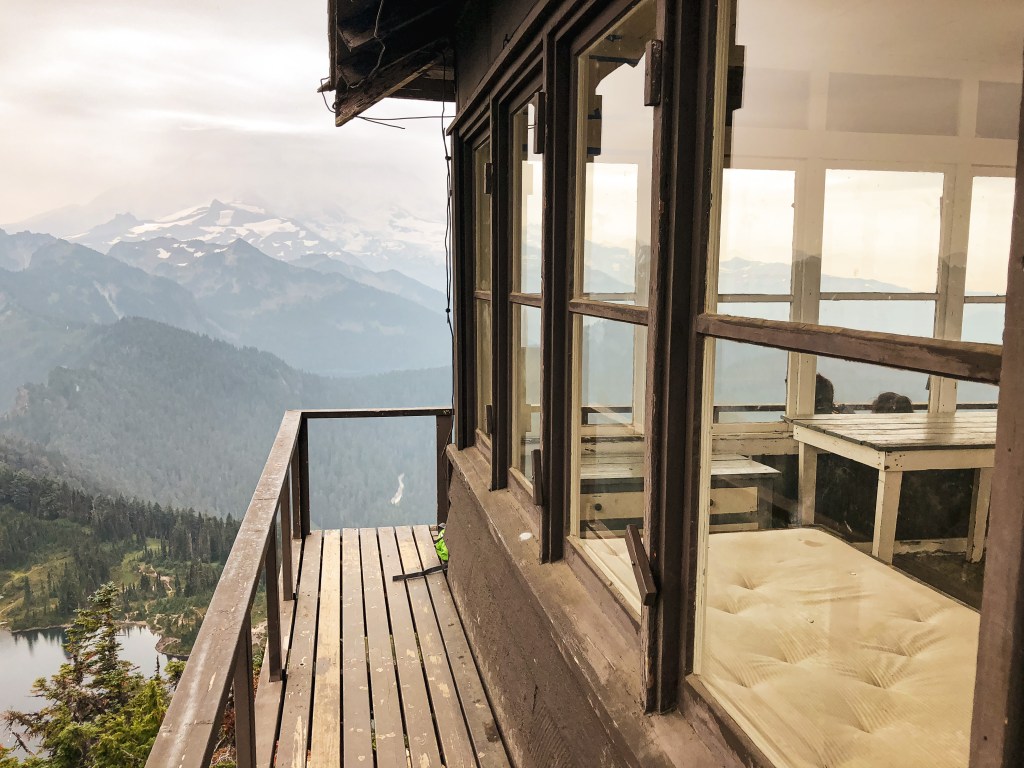
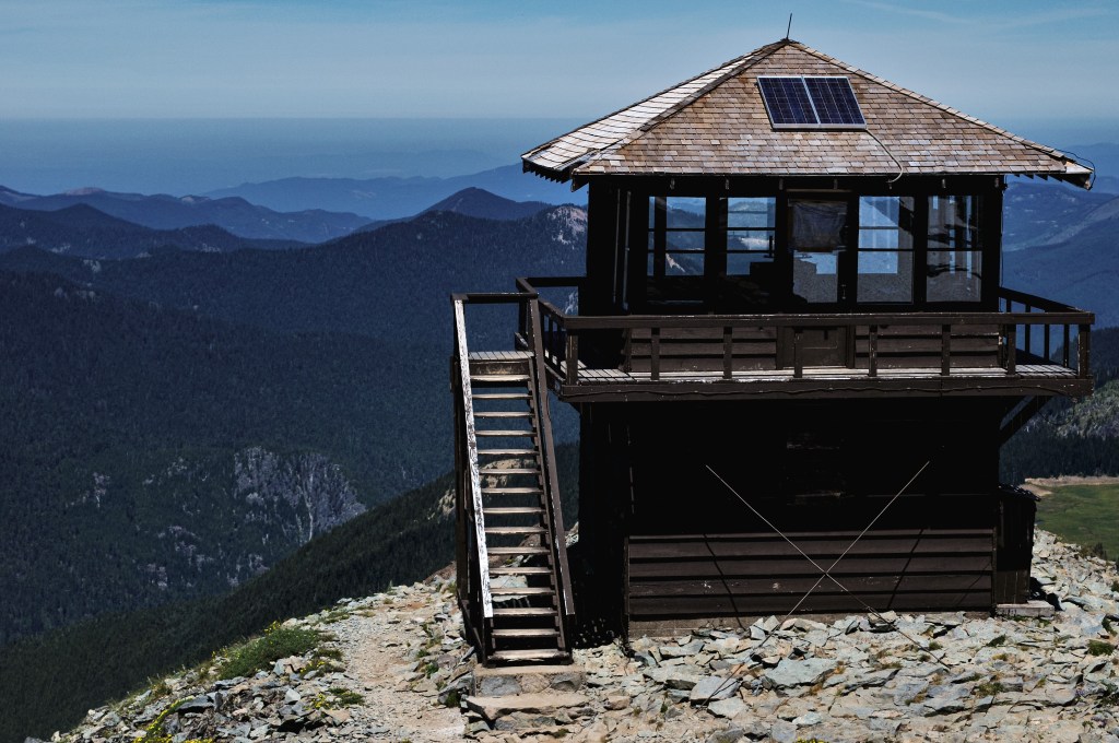
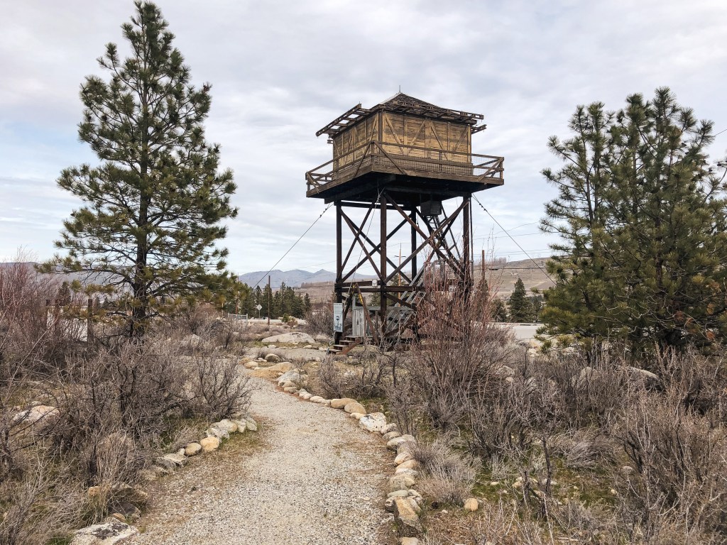
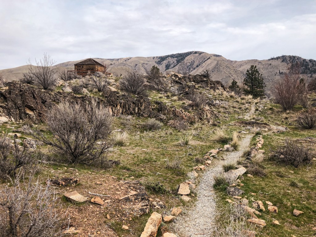
We decided to stop off at the Columbia Breaks Fire Interpretive Center for a quick stretch and lunch before heading to our weekend reservations at Steliko Point (post). The building was closed during our visit but the parking area and interpretive trail were still open to the public. The self guided trail is only 1/2 mile and features three fire lookouts that were relocated and restored. You might also see a few Marmot’s along the trail, they like to hide among the rocks. The main focus of the trail is to educate on the historic impact of wildfires and its importance in ecology. It also touches on the pros and cons of human effects in fire management. If you like fire lookouts and find the history of wildfires interesting this is worth the stop while in the area. The CBFIC is a non-profit and financed through donations. Places like this are important for preservation and education. Please donate if you are able or visit their website to learn about getting involved!

Chelan Butte L.O.

Former Fire Lookout Site Register: US 1391; WA 291

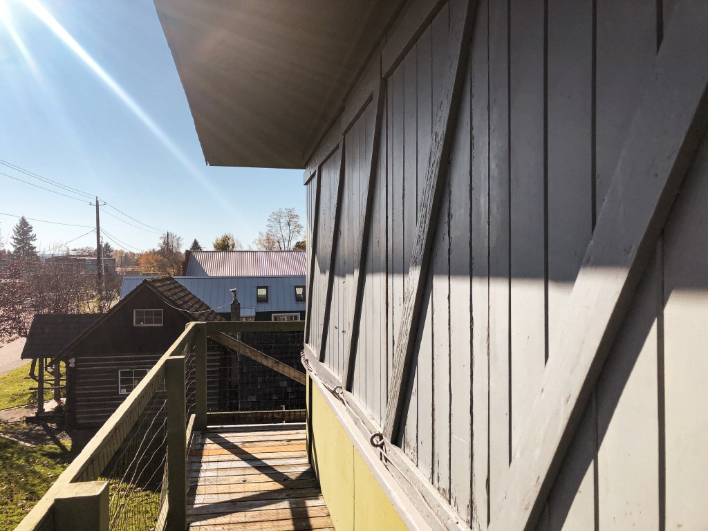
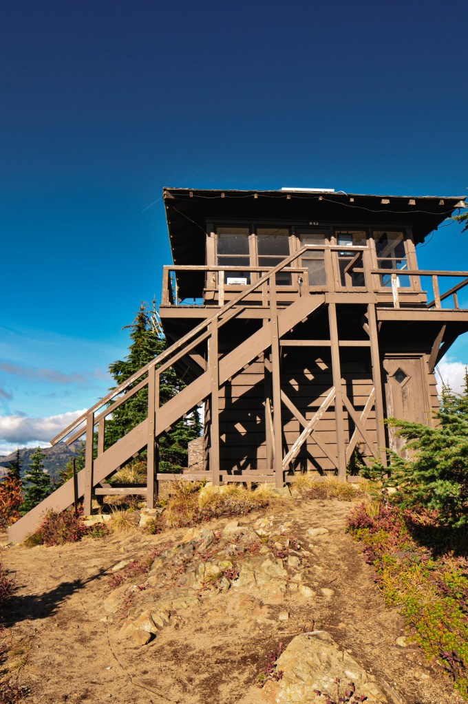
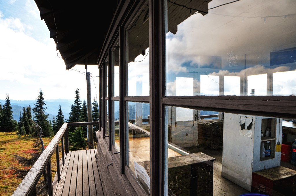
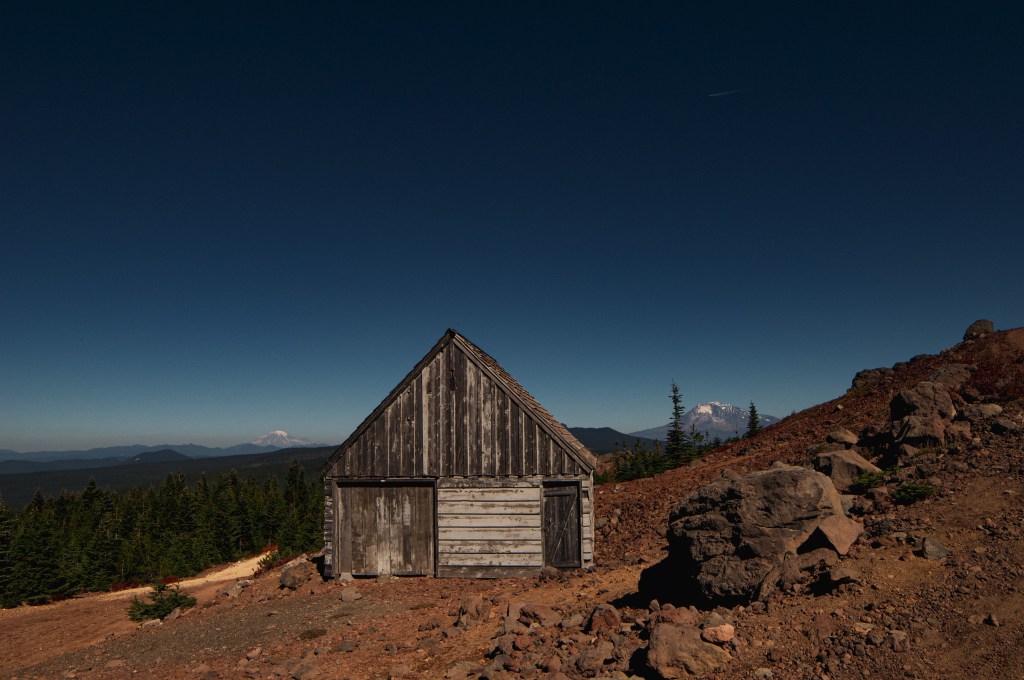
Chelan Butte L.O. is a 28′ treated timber tower with 14’x14′ standard L-4 cab. It was moved to the CBFIC in 1995, but originally sat at 3,835′ on a butte overlooking the town of Chelan and Lake Chelan. The current lookout was built in 1938 by the CCC as a replacement for the original tower that burned down. The original lookout built on Chelan Butte was a 40′ pole tower with L-4 cab in 1936. It was placed on the National Historic Register of Historic Places in 1990. The lookout, for the most part, maintains it’s original integrity but the shutters were replaced and the tower was lowered by 4′ to accommodate the CBFIC site.

Flattop Mountain L.O.

Former Fire Lookout Site Register: US 1315; WA 215

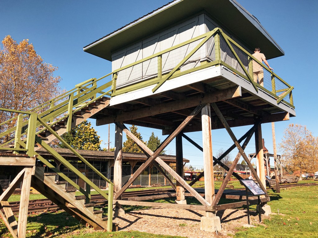
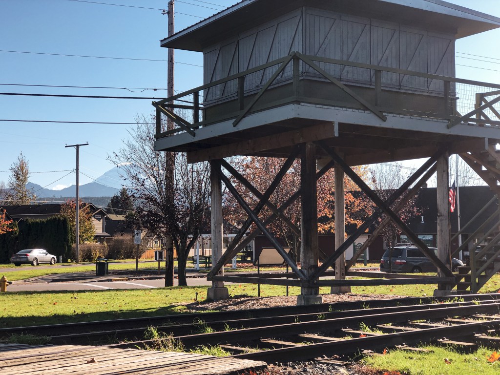
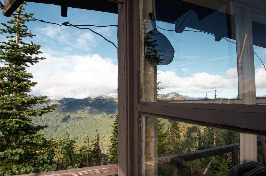
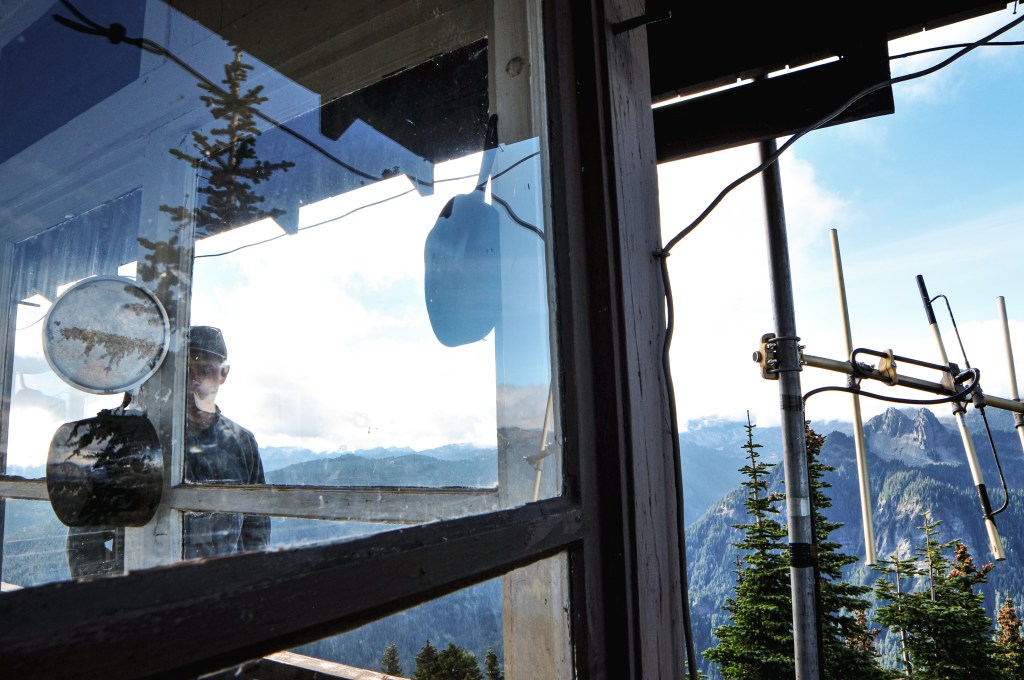
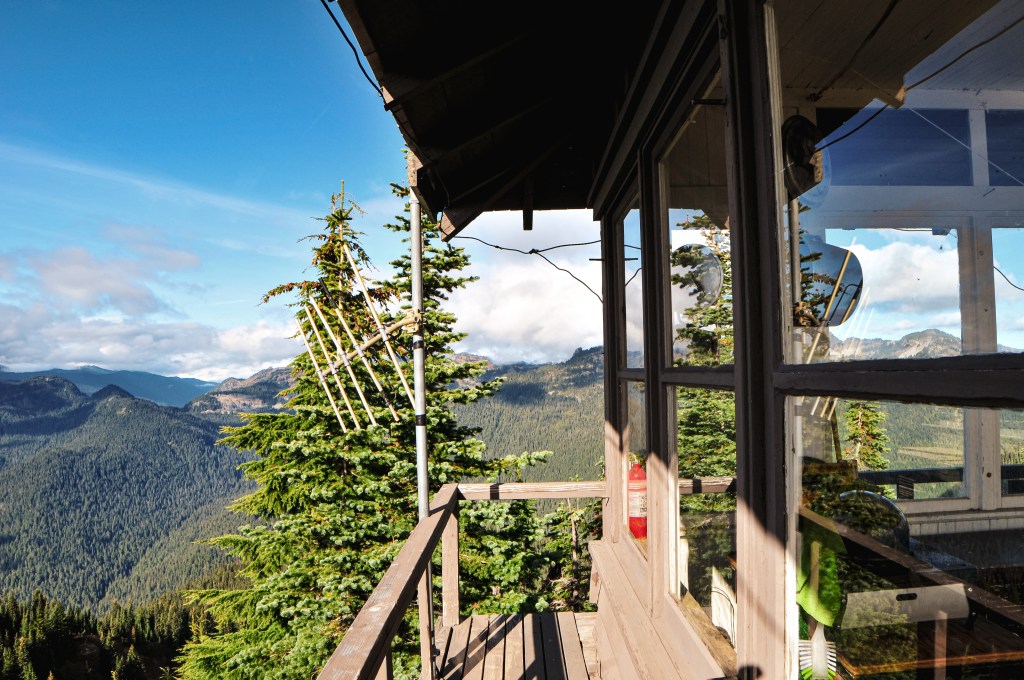
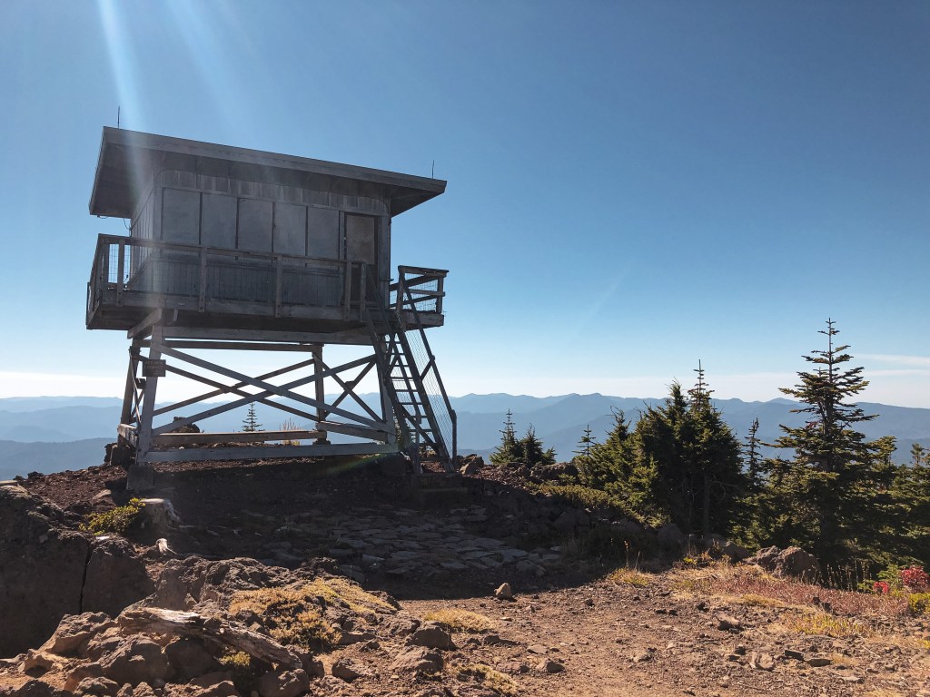
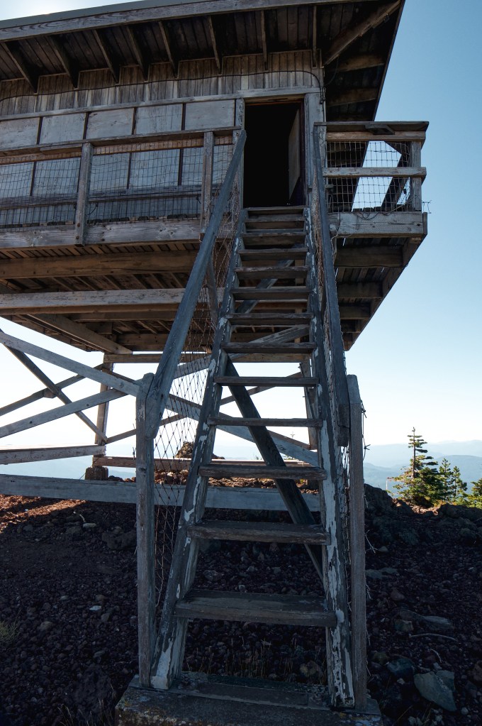
Flattop Mountain has had a unique history of lookouts throughout the years. It has an elevation of 4,394′ and is located in the Gifford Pinchot NF. It was named due to it’s broad and flat summit. It was so broad that they developed the site with two fire finders at each end in the 1920’s. The remaining lookout that can be found at the CBFIC is a replica of the lookout from the east point of the mountain. Some of the old wood from the lookout was used in the reconstruction, specifically the roof and wooden frame supports.

East Point

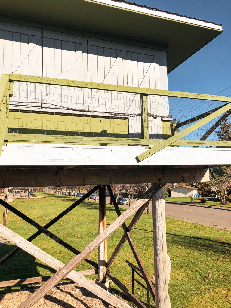
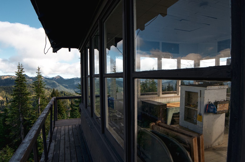
The first structure built on the summit of Flattop Mountain was a 16’x20′ frame house on the east point in the early 1920s. Around the 1930s they moved the frame house to the west point and built a 7’x7′ foot frame cab in it’s place. It was quickly replaced by an L-5 cab in 1933. The reconstructed replica that can be found at the CBFIC is based off the lookout that was built in 1946. It was a prototype 2-story 14’x14′ foot frame cab with slanted windows and curved hip roof. It is the only one of this style to ever be built. Originally it was thought to be the next generation of lookouts, but the Pacific Northwest was standardized on the R-6 flat top cab instead. The site was abandoned in 1960 where the lookout was subject to vandalism and fell into disrepair. There were plans to destroy it, but the Forest Fire Lookout Association was able to dismantle and relocate it to the CBFIC in 2005.

West Point

The history of the west point of Flattop started in 1930 when they moved the 16’x20′ frame house over from the east point. The house was updated in 1934 when they added two screen porches and an observation cupola. This was used until the site was abandoned and the west point house was destroyed in 1960.

Badger Mountain L.O.

Former Fire Lookout Site Register: US 1383; WA 283

Badger Mountain L.O. is a 14’x14′ standard L-4 cab that used to have a 18′ treated timber tower. It was originally constructed in the 1930s by the CCC for Lion Rock located in the Cle Elum Ranger District. It was later moved to Badger Mountain just outside the Wenatchee NF in Douglas County. The site was situated at 3,498′ and chosen due to its vantage point of the Wenatchee NF across the Columbia River. The lookout was actively staffed up until the 1970s where it was moved to emergency status. Its last recorded use was during the Dinkelman Fire in 1988. In 1990, it was placed on the National Historic Register of Historic Places and then relocated to the CBFIC in the fall of 1999. The shutters were replaced due to prolonged weather exposure but otherwise the lookout has undergone minimal change since it was originally constructed.

More Information.

Columbia Breaks Fire Interpretive Center

Steliko Point L.O.

Washington Lookouts

Location.

Okanogan-Wenatchee National Forest

Status.

Rental program; Currently standing

Estimated drive time from Portland, OR.

5-1/2 hours

Date visited.

March 25-27, 2022

Elevation.

2,586′

National Historic Lookout Register.

US 1096; WA 62

Trip Report.

My partner and I found Steliko Point L.O. when we were researching how many lookouts are currently on the rental program in Washington. We were surprised to find that there were still a decent amount of openings for reservation, unlike Oregon lookout rentals that book up the instant they are listed as available. I’ve always wanted to stay in a lookout but never really took the time to do my research to obtain a reservation. We picked the last weekend in March because we wanted a weekend that would possibly be snow free, decent weather, and still have the gate up on the road. Based on past trip reports my Civic wouldn’t have made it up the road anyway and we wanted to decrease the amount of un-expected visitors possible.

Friday.

We woke up early Friday morning and started our long drive towards Steliko Point. There are a few ways to get there from Portland but we decided to head up I-5. From I-5 you will need to cross over via I-90 to connect with HWY-97 to eventually get to HWY-97A. We made a quick stop in Entiat to refuel and visit the Columbia Breaks Fire Interpretive Center (post). A must see if you are a lookout enthusiast like us! After visiting the museum, we headed back down HWY-97A and turned right on to Entiat River Road towards the town of Ardenvoir. Just past Ardenvoir you will turn right on to Steliko Canyon Road which turns into NF-5310. The road will be gated but there is a sign for parking near the Forest Service sheds. You will need to park parallel with the cement blocks. Once parked we had a quick lunch and loaded up our packs for the short but steep 1.6 mile trek up the road. You will gain around 1,200′ of elevation during your hike. The lookout is outfitted with mattresses, folding tables, a propane stove, a propane fridge, heater, and other basic cleaning amenities. This means you can leave your sleeping pad and camping stove at home. The only essentials we had to carry up were our clothes, cook ware, sleeping bags, food, and water. There is no water source at the summit and it is a very exposed area, so make sure to plan accordingly. We over shot on the amount of water needed by bringing (1) 3 gallon jug, (2) 3 liter hydro packs, and (8) 32oz Nalgene bottles worth. The amount of water weighing us down made the hike up harder than it needed to be. Once at the summit you are able to access the lookout via keyed entry. There is a lockbox that you are given the code to with your reservation. We were surprised to find that previous guests had stocked the lookout with even more amenities than listed. You shouldn’t assume there will be everything you need there but there are a lot of leave behinds incase you do forget something such as games, cooking utensils, books, food, and even water. I loved the community feel and connection it gave from past guests especially after reading the entries in the guest book. This lookout has only been on the rental program since November 2019 and had a brief gap where it was closed from April 2020 until May 2021 due to the Pandemic. Or at least that is what I gathered based on the gap in entries from the guest book. We enjoyed our dinner with a nice sunset before heading to bed early. We were both tired from the long day of driving to get there.

Photo taken by Garnet

Saturday.

I woke up at 6:30AM to see if I could catch the sunrise but it was mostly clouded and didn’t offer anything spectacular. We still had great weather for most of our trip with mild temperatures and partly cloudy skies. During breakfast on the catwalk we were able to spot 40+ mule deer grazing on the hillsides. I read that this was a known area for their winter range and that they were frequently spotted from the lookout, but I didn’t think we’d see so many of them together. We were also able to spot Tyee L.O. and another lookout that someone built on private property. A trip report mentioned that you could see Sugarloaf Peak L.O. from here as well but the mountain that they identified was actually Baldy Mountain. After breakfast, my partner decided to hike along the ridge trail while I hung around the lookout to read and draw. He came back for lunch and we relaxed around the lookout for most of the afternoon. A day hiker with their dog was the only person we saw for most of the day. My guest book entry mentions that this is the only person we saw the whole trip but that is inaccurate. Later in the evening, we decided to hike down to the ridge below where there is another road and walk around. My partner ended up hiking cross-country in a different direction, so I was back at the lookout earlier than him. While I was waiting for his return, a runner came up the road and climbed the catwalk. He said he was training as a wildland firefighter in the area but didn’t realize anyone was up here this time of year. I don’t think he knew this was listed as a rental. He apologized for spooking me and invading my space before heading back down. Our interaction was brief and friendly but it might be worth adding a sign somewhere visible for day hikers and visitors to be aware. After eating dinner, we both read the books we brought until it got dark. I ended up finishing my book while there and decided to leave it behind for future guests to enjoy. Hopefully someone enjoys true crime as much as I do because I left behind a copy of Red River Girl: The Life and Death of Tina Fontaine by Joanna Jolly. Saturday night was a bit stormy with mild winds and a sprinkle of rain. We even saw a bit of lightning in the distance as we were trying to fall asleep.

Private Lookout
Tyee Lookout

Sunday.

Sunday morning, we saw the same herd of 40+ mule deer while we savored our last few hours at the lookout. Part of the condition of your stay is to pack out your trash, sweep, and wipe down the counters. Although this rental is managed by Wenatchee Valley TREAD, It’s a collective responsibility to help keep this place in good condition for others to enjoy. We left behind any remaining water we didn’t use for future guest who might need it. We spotted some day hikers headed up the road while we were locking up and took that as our cue to leave. Our packs were significantly lighter than when we started and the hike down was a breeze. We passed another group of day hikers on our hike out and even saw the same wildland firefighter start his run up the road while we were having lunch at the car. Driving back to Portland, we decided to take the more scenic route following HWY-97 most of the way until it meets up with I-84. We could see Lorena Butte L.O. from our drive and stopped at the Stonehenge Memorial while in the area. Overall it was a relaxing and quiet weekend away.

History.

Steliko Point has been used as an observation camp site since 1925. The current lookout is a 16’x16′ L-4 cab with 10′ tower and was built in 1947. It was actively staffed up until the mid-1990s and is still registered for emergency use. There are signs of another foundation on the summit, but I couldn’t find any information online about previous additional structures. Steliko Point is one of only three remaining lookouts in the Entiat Ranger District. Given it’s proximity to Ardenvoir and low elevation, it is also one of the few lookouts wired on the power grid. Yes, that means you can charge your phone during your stay. There are only USB ports though, so don’t bring anything that requires a plug. Over the last few years it has undergone remodeling and updates by volunteers to open it up for the rental program. It is now mostly managed by the non-profit Wenatchee Valley TREAD for maintenance and overnight stays.

More Information.

Washington Trails Association

US Forest Service

Recreation.gov

AllTrails

Salmon River L.O.

Washington Lookouts

Location.

The Foothills Historical Museum; Buckley, WA

Status.

Refurbished & maintained for educational purposes

Estimated drive time from Portland, OR.

3 hours

Date visited.

October 31, 2021

Elevation.

2,693′ (original)

Former Fire Lookout Site Register.

US 1205; WA 106

Trip Report.

My partner and I decided to swing by the Foothills Historical Museum on our way home from visiting friends in Kirkland. It’s right off N River Avenue in the city of Buckley and easy to access. We parked on the street right across from Buckley Hall in front of the main museum building. The park that hosts these structures, Van Hoof Park, is across the street. You are welcome to climb the lookout tower and catwalk at anytime. The cab was shuttered and closed during our visit but I believe they open it during events and summer for visitors. The museum focuses on conservation of the history of Buckley and the surrounding Carbon River Corridor. The Foothills Historical Society that manages the museum is completely run by volunteers and financed through donations. Places like this are important for preservation and education. Please donate if you are able or visit their website to learn about getting involved!

History.

The Salmon River L.O. site was originally established in 1965 with a platform and trailer along Salmon River Ridge near Lake Quinault. In 1967, a 2-story live in cab was built on the summit and ran by the Washington Department of Natural Resources. It’s ownership was later transferred to the Quinault Nation after discovering it was built on their reservation land. They had believed it was just east of the boundary when the structure was originally built. In 2000, the Quinault Nation donated the structure to the Foothills Historical Society for preservation. The lookout was dismantled and then transported by pick up and flatbed trailers to its current location in Van Hoof Park. Volunteers and many locals helped rebuild the structure on a log tower with wooden steps instead of the original cinderblock.

Next to the Salmon River L.O. is another observation structure that was built during World War II for aircraft spotting. It was originally located atop Huckleberry Mountain near Mule Springs. It was later used by fire patrols until it was moved to Buckley in 1991 by Southworth & Sons. Some other notable structures maintained on the property are a State Forest Ranger Cabin, 1870 Stiller Log Cabin, Lester Bunkhouse & Saw Shop, Blacksmith Shop, Steam Donkey, and Lester RR siding.

More Information.

Foothills Historical Museum

Shriner Peak L.O.

Washington Lookouts

Location.

Mount Rainier National Park

Status.

Maintained; Currently standing

Estimated drive time from Portland, OR.

2-1/2 hours

Date visited.

October 3, 2021

Elevation.

5,846′

National Historic Lookout Register.

US 207; WA 26

Trip Report.

Fall has arrived! And with it brings the hunting season and potential for snow. My partner and I decided to enjoy a weekend at home for a change despite the gorgeous weather forecast. We still planned on hiking to a lookout in the area as a day trip though. We debated between seeing Clear Lake (post), Shriner Peak, Gobblers Knob, or Burley Mountain (post). But, Shriner Peak had been calling my name for a while now, even with the daunting elevation and drive time. We compared the distance and elevation to other challenging hikes we’ve done and decided to go for it. The trailhead is easily accessible off of HWY-123 between the Ohanapecosh Campground and the White River Park Entrance. AllTrails noted the trail as 7.5 miles round trip with 3,356′ elevation gain, while the National Park noted the trail as 8 miles round trip and 3,434′ elevation gain. My phone tracked it closer to 8.5 miles round trip. It is described as difficult and strenuous, but we found it to be more of a moderate hike. It is a continuous up hill climb but nothing in comparison to other hikes we’ve done. If you’ve done Devil’s Peak (post) via Cool Creek Trail then this one will be a breeze in comparison. You will still want to bring a lot of water and lunch for the summit. Despite not feeling like a strenuous hike, I experienced 3 Charlie Horses in one of my calves. I repeat bring lots of water. I’d also recommend this as a late season hike, the cooler temperatures and breeze make a difference. The park notes this as one of their loneliest trails, if you’re looking for a less crowded place to hike. We still saw about 12 groups of people on this hike though. But, in comparison to other trails in the park it is definitely less visited. Some of the groups only hiked to the false summit, 2.5 miles in, which offers a great view of the mountain and below valley. By the time we reached the summit we had it to ourselves. The summit also has two nice backcountry camp spots only a short hike from the lookout. You need permits to backpack in this area and there is no reliable water source.

I love being able to meet the people that are knowledgeable of these places. We had the pleasure of meeting Ranger Pete from the National Park service while on the summit. He had hiked up when we were enjoying lunch on the catwalk of the lookout. He was staying there for the evening and going to be boarding up the windows in preparation for the winter season. He was kind enough to answer our questions about the area and lookout to the best of his knowledge. He used to work in Glacier National Park and mentioned they actually have active lookouts in the park still. The ones in Mount Rainier National Park function mostly as standing exhibits but are still used by staff and volunteers.

History.

Shriner Peak L.O. was built in 1932 by the National Park Branch of Plans and Designs. It’s the standard 2-story frame cab used by the National Park service that features a ground floor storage room and upper live-in space. It is one of the four remaining lookouts within the Mount Rainier National Park. It was actively staffed until the 1980’s and is listed on the National Register of Historic Places. I just need Gobblers Knob to finish visiting all the lookouts within this National Park.

Fly Amanita on the trail

More Information.

Washington Trails Association

National Park Service

AllTrails

Red Mountain L.O.

Washington Lookouts

Location.

Gifford Pinchot National Forest

Status.

Maintained by volunteers; Currently standing

Estimated drive time from Portland, OR.

2 hours

Date visited.

September 25, 2021

Elevation.

4,965′

National Historic Lookout Register.

US 189; WA 24

Indian Racetrack Trail #171 Junction
Damaged Gate on FS-6048
Mount Rainier
Mount Adams
Mount Saint Helens
Mount Hood

Trip Report.

With some wildfires clinging on to the end of the season, my partner and I decided to head out to Red Mountain L.O. in the Gifford Pinchot NF. We brought my partner’s mom with us since she had been wanting to see this lookout as well. Red Mountain L.O. is one of the closest Washington lookouts to Portland. It skirts the edge of Indian Heaven Wilderness and is typically accessed via hiking trails. The main trail that leads to the lookout is Indian Racetrack Trail #171. We decided to go up via the road since it was a slightly shorter approach. From Carson, we drove towards Panther Creek C.G. and Panther Creek Falls on NF-65. You will stay on NF-65 until you come to a four way junction. Turn right onto NF-60 and continue down this road until you reach NF-6048. NF-6048 will be on the left hand side of NF-60 and will take you directly to the lookout. This is supposed to be a gated road to help deter vandals but is unfortunately open now. It looked like someone had hooked a chain to their car to pull it open given the large bend in it. We drove past the gate a little but were wary of the remaining road conditions. I was driving my partners’ mom’s car which is a Honda HR-V and I didn’t want to damage it. It gets better clearance than my Civic but is still not what I would consider a high-clearance vehicle. We walked the remaining 2 miles of the road which ended up being in great condition. We most likely would’ve been fine driving the HR-V to the summit. My Civic would have only been able to drive to the broken gate. We reached the lookout as a few groups were leaving and had some uninterrupted time to explore. The door to the lookout had been open when we were there so we were able to take a look inside. It was otherwise boarded up to keep the windows from breaking. One of the boards covering a window had fallen along with a glass pane. My partner and his mom tried to secure these two pieces back in place before shutting the door. Once we were joined by more people, we decided to exit the catwalk and sit below the tower for lunch. We absorbed the surrounding views of Mount Saint Helens, Mount Rainier, Mount Adams, Mount Hood, and the Gifford Pinchot NF as much as we could before heading back to the car to find camp. This lookout is close enough to be done as a day trip but we decided to stay the night in Crest Camp just down the road where NF-60 meets the PCT. There were dispersed camp spots in this area but they were all filled with commercial mushroom pickers during our trip.

History.

The Red Mountain L.O. was established in 1910 with an 8’x8′ cedar frame cab. It was replaced only 9 years later in 1919 by a standard cupola cabin. That was in turn replaced by an L-4 cab and added garage in 1935. The current structure is a 10′ tower with R-6 flat cab from 1959. The original garage is still standing and was used as living quarters during 1942 for World War II. Some of the fire lookouts were used for Aircraft Warning Services during this time. In 2006, the lookout along with some communication structures were torn apart by a violent winter storm. Volunteers came together to restore this lookout over the next few years. Matt Haldeman was the one that championed the project. As a Vancouver based custom home builder he was able to source the donated materials needed to complete the structure. The windows were salvaged from a decommissioned fire lookout in Oregon. And the man-power needed to reconstruct this lookout was donated by the volunteers of Passport in Time. After Restoration was complete, there were plans to add it to the Recreation Rental program but I don’t believe that is still the case. Red Mountain L.O. wouldn’t be in the condition it is today without the community volunteers. This is the last remaining fire lookout in Skamania County.

More Information.

Washington Trails Association

Oregon Hikers

AllTrails

US Forest Service

Tolmie Peak L.O.

Washington Lookouts

Location.

Mount Rainier National Park

Status.

Maintained; Currently standing

Estimated drive time from Portland, OR.

4 hours

Date visited.

August 25, 2018

Elevation.

5,939′

National Historic Lookout Register.

US 1562; WA 89

Trip Report.

I woke up early in the morning to meet my friend in Tacoma. We wanted to get an early start for a hike, so I was on the road before sunrise. They live in the Seattle area while I’m located in Portland. The drive time to Tolmie Peak was about the same for both of us. We met in the middle to carpool the remainder of the way. The trail is located on the park’s northwestern corner off of Mowich Lake Road. Driving down Mowich Lake Road is 17 miles of dusty gravel one way. It’s a maintained gravel road and I had no issues in my Civic aside from the constant bump of washboard. Although you do not pass a National Park kiosk you will still need a National Park pass to park and recreate in this area. There was a park ranger checking passes when we had parked. The trail begins on the north side of Mowich Lake near Mowich Lake C.G. It starts to climb gradually up through the forest to Eunice Lake where you will get your first glimpse of the lookout. From Eunice Lake you only have a steep mile left to climb. Please note that the subalpine meadows and shores of Eunice Lake are delicate and easily damaged. You should only hike on the already constructed trails in this area to prevent further erosion.

After hiking a total of 3.25 miles and gaining 1,010 feet of elevation you will reach the summit. Tolmie Peak L.O. offers commanding views of Mount Rainier and the surrounding area. It’s a great place to stop and enjoy lunch before hiking back out. There are no backcountry camp spots in this area of the park and camping overnight is prohibited which means it can only be reached via a day hike.

History.

The lookout itself is in great condition and maintained by the National Park Service. It’s the original 2-story frame cab that was built by the CCC in 1933. It’s also one of the four remaining lookouts within the National Park. You have access to the cat walk but the doors to the inside are locked. The shutters were open when I visited, so I was able to get a glimpse into what life inside the lookout once was. The name Tolmie Peak comes from Dr. William Tolmie who allegedly led a botanical expedition into this area. But recent research disputes that Dr. Tolmie actually ascended Hessong Rock instead.

More Information.

Washington Trail Association

National Park Service

AllTrails

Mount Fremont L.O.

Washington Lookouts

Location.

Mountain Rainier National Park

Status.

Maintained; Currently standing

Estimated drive time from Portland, OR.

4 hours

Date visited.

July 8, 2017

Elevation.

7,180′

National Historic Lookout Register.

US 1562; WA 89

Trip Report.

This was the first fire lookout I ever visited! I was staying with a friend in Tacoma for the weekend and we decided to go on a hike with one of their friends. Their friend had done this trail before and thought I would love it. They, of course, were right. The views were stunning even from the Sunrise Visitor parking lot and only continued to get better. We took the Sourdough ridge trail until we met up with the other trail junctions near Frozen Lake. The Mount Fremont Lookout trail continues to the right up the ridge. It was only 2.8 miles to the lookout with 900 feet of elevation gain from the parking lot. The trail is very exposed most of the way up, so make sure to come prepared. I didn’t end up getting close to the lookout because I wasn’t sure if we were allowed to at the time. I thought it might have been actively staffed. It’s noted that it is still used by volunteers and park rangers occasionally, but open to climb the stairs and catwalk. The WTA was doing some major work on the trail when we visited. After looking at descriptions of the trail now it appears they were adding stairs to help with erosion. Their project took most of the summer in 2017 to complete.

History.

Mount Fremont Lookout is a standard National Park fashion 2-story frame cab that was built back in 1934 by the Emergency Conservation Works Association. This is one of four lookouts within the National Park and by far the easiest to access. It’s also the highest lookout in the park with an elevation above 7,000 feet.

More Information.

National Park Service

Washington Trails Association

AllTrails