Lookout Towers of the Malheur National Wildlife Refuge

Oregon Lookouts

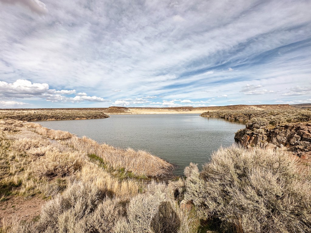
The Malheur National Wildlife Refuge is an important wetland for year round resident birds and wildlife managed by the U.S. Fish and Wildlife Service. It’s also a major stop over for migrating birds along the Pacific Flyway. It is located in the south-eastern portion of Oregon’s high desert and is considered part of the start of the Great Basin. The Refuge was established in 1908 to help protect the migratory bird population and now encompasses over 187,000 acres. Within the boundaries of the Refuge, you will find more than just a plethora of wildlife and resources. There is also a significant amount of history ranging from early Indigenous peoples (Petroglyphs) to the first European settlers of the area (Round Barn, P Ranch, & Sod House).

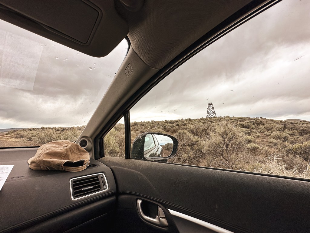
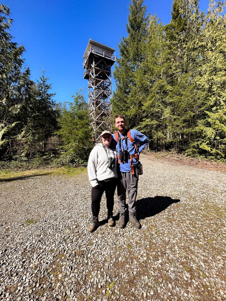
I decided to spend my birthday camping near the Malheur NWR in hopes of seeing a decent amount of birds and visiting the lookout towers noted in the area. Early April is always a challenging time when trying to locate a place to camp with decent weather. I was robbed again of visiting the Enchanted Valley in the Olympic National Park and almost everywhere in the state was forecast to be wet. I didn’t realize until the morning of our departure that this was the exact same weekend of the Migratory Bird Festival in Burns, OR. We were a bit concerned about not being able to secure a spot at the Page Springs Campground after reading about it. Many birders come to this area in early spring to watch the migrations. One might say they flock to the area, har har. But, we decided to risk it and hoped for the best. It took us around 7 hours from Portland to reach the area. We were lucky to be coming in on a Thursday and were able to find a camp spot, almost all were taken by the end of the day.

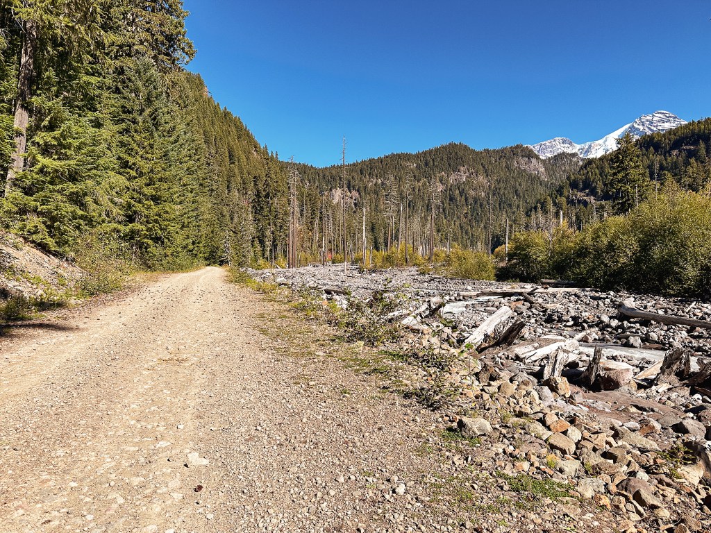
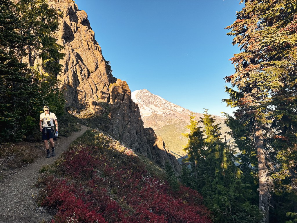
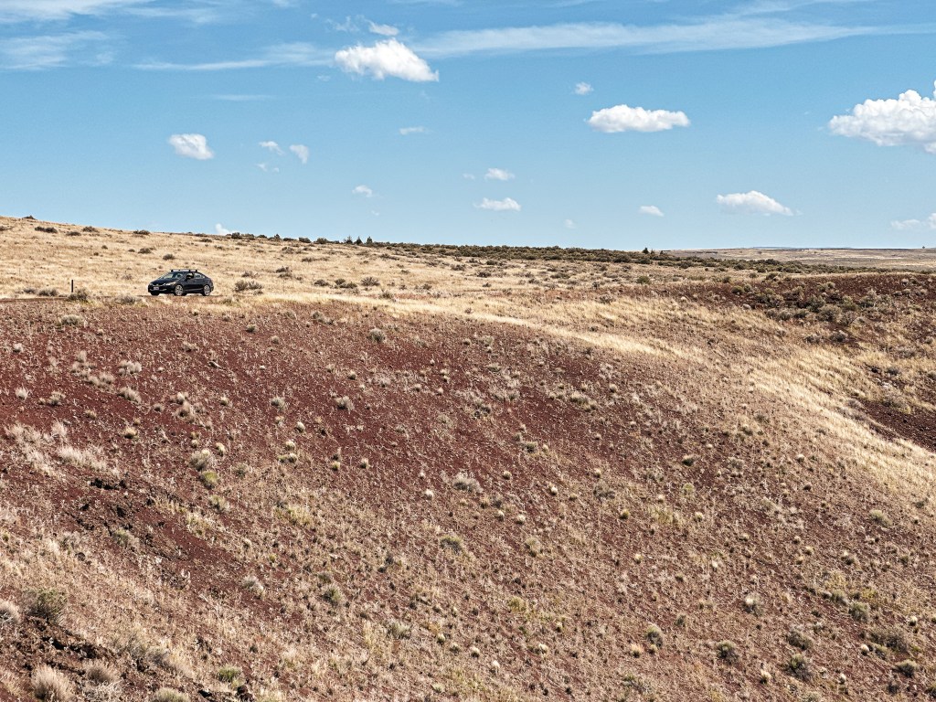
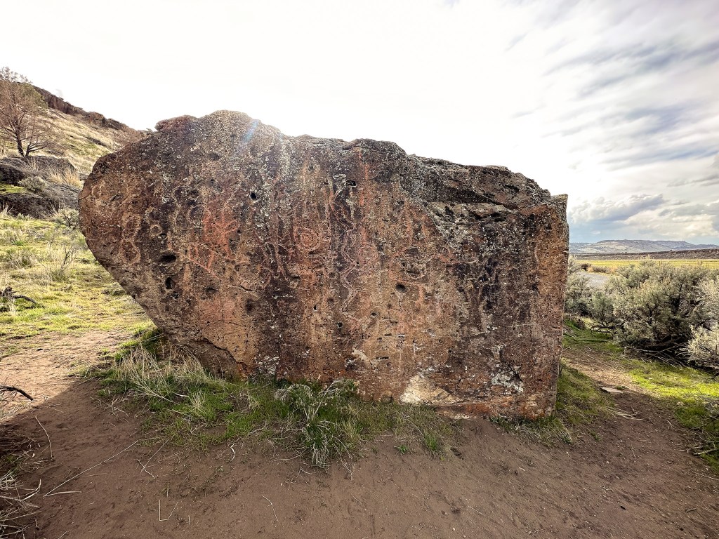
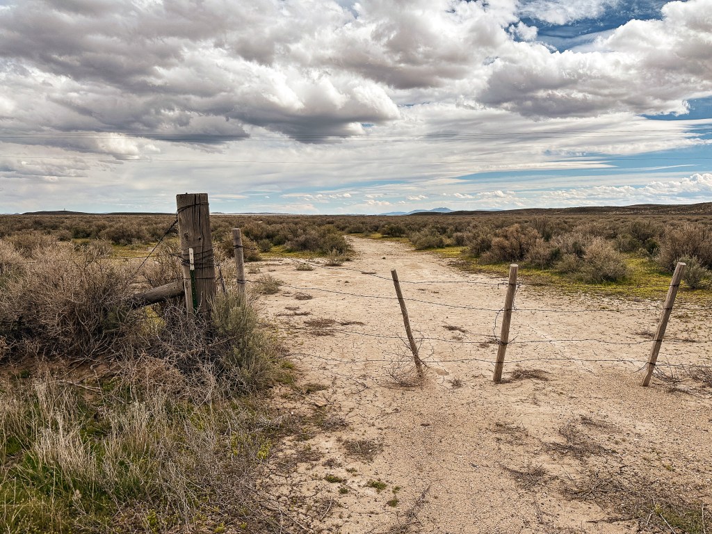
We were able to visit all four of the towers in one full day along with the visitor center and taking the auto tour through the Refuge. Our second day we had hoped to visit Riddle Mountain L.O., but decided not to continue our attempt after meeting a particularly muddy section on the road. Our tire had even sunk in a bit after making an attempt to circumvent it. We knew there was still snow on top from the AlertWildfire camera, but figured it was hikable if we could have driven closer. This one will have to wait for when we know the area will be dry. It was a bit of a disappointment since this one is very isolated to reach and will require its own trip. The trade off was that we now had time to see the Round Barn, the Diamond Craters Outstanding Natural Area, the petroglyphs near Krumbo reservoir, and the old homestead site at Benson Pond. We were pretty lucky on our weather conditions as well. The highs were in the 70s and we got mostly sunny skies during our trip. The forecasted thunderstorms and rain seemed to only roll in during the evening and were usually gone by the morning. Minus our final morning, where we had to pack up everything wet while it rained.

I will preface this list below with the fact that there doesn’t seem to be any confirmed evidence that any of these were used to detect wildfires. I am still going to count them towards my total, but I’m inclined to believe they were built and used primarily for wildlife viewing in the area. Two of them are even listed on the NHLR, but I think that mostly has to do with the fact that they are the same Aermotor design as a fire lookout. I found this interesting since I have gotten some push back on a couple sites I tried to nominate due to not meeting requirements. Everyone has their own qualifications on what they count as a fire lookout. My personal take is that if a structure, of any form, was used in the detection and spotting of wildfires it should still count no matter if it has been relocated or not. If said structure, of any form, is still intact at the original site or standing it should still count as existing. It becomes a former site, in my mind, once the structure has fully collapsed, been removed, or burned down. Take that for what it is, my opinion.

P Ranch.

Date visited.

April 11, 2024; April 12, 2024

National Historic Lookout Register.

US 430; OR 55

About.

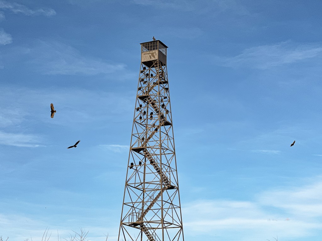
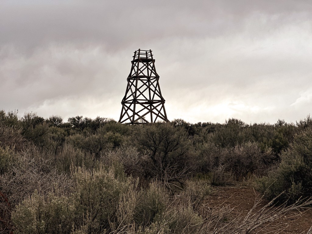
The 72′ Aermotor tower with 7’x7′ cab was built by the CCC in 1933 near the site of the original P Ranch. Most of the ranch buildings were demolished by the CCC during the same time and the main ranch house burned in 1947. In 1935, the site became a part of the adjacent Wildlife Refuge. This tower can be easily accessed from Frenchglen by taking the Steens Mountain Loop road and turning left onto the Center Patrol Road. It’ll be the first left off the Central Patrol Road and can be found by following the signs to P-Ranch. It sticks up high enough though that you will see. The area around the base of the tower is closed due to wildlife, but it can easily be viewed from the road, parking lot, or the Riverview trail. I really enjoyed how the Turkey Vultures used this one to roost at night. This is stop #19 on the Blitzen Valley Auto Tour Route.

Sod House (Headquarters).

Date visited.

April 12, 2024

National Historic Lookout Register.

US 429; OR 54

About.

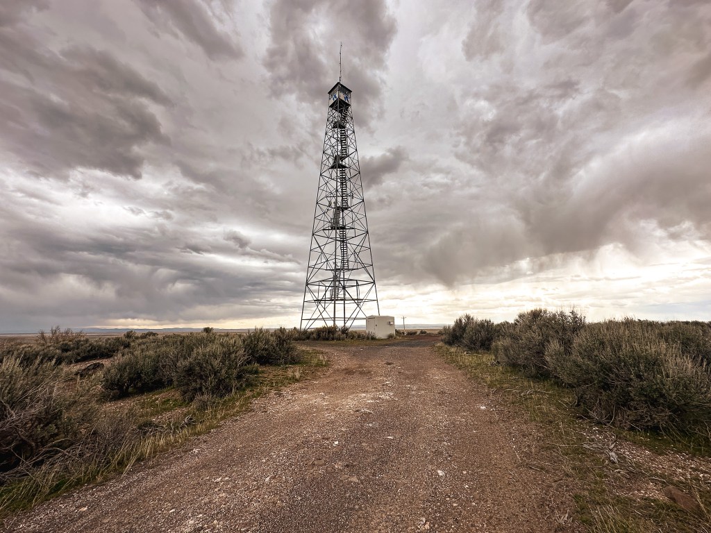
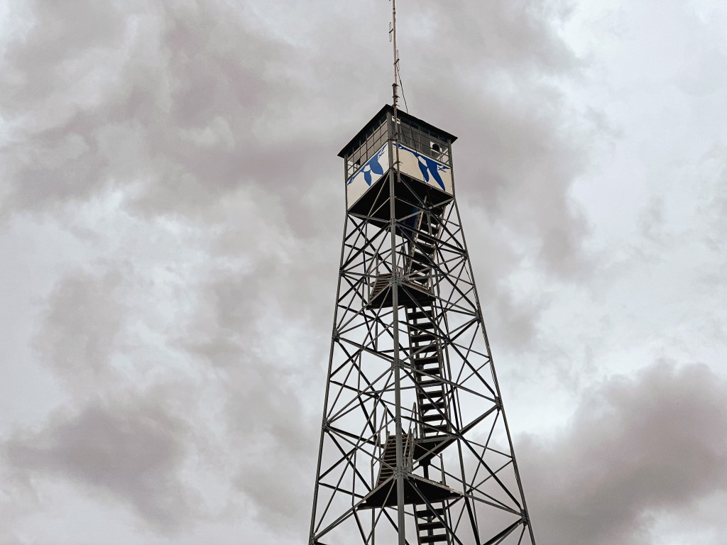
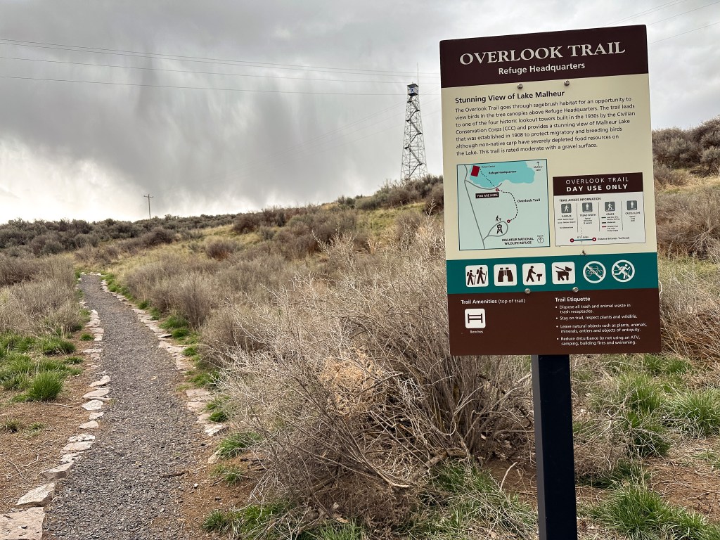
The Aermotor tower with 7’x7′ cab was also built by the CCC in the 1930s. It was most likely completed around the same time as the Refuge headquarters in 1935. I found conflicting information on height varying from 80′ (NHLR) to 90′ (Rex’s Fire Lookout Page) to 99′ (Burns Herald-Times). This tower is easily accessed from HWY-205 by turning on to Sodhouse Lane and following the signs for the Refuge visitor center. You can either drive right up to the base or access it from the short Overlook trail starting at the visitor center. The trail is only 0.11 miles of packed gravel. You can walk up to the base of this tower, but the bottom stairs have been removed to keep visitors from climbing it. The base of the tower offers a nice view out over Malheur Lake and the headquarter grounds below. This is stop #1 on the Blitzen Valley Auto Tour Route.

Stubblefield Butte.

Date visited.

April 12, 2024

National Historic Lookout Register.

Not registered.

About.

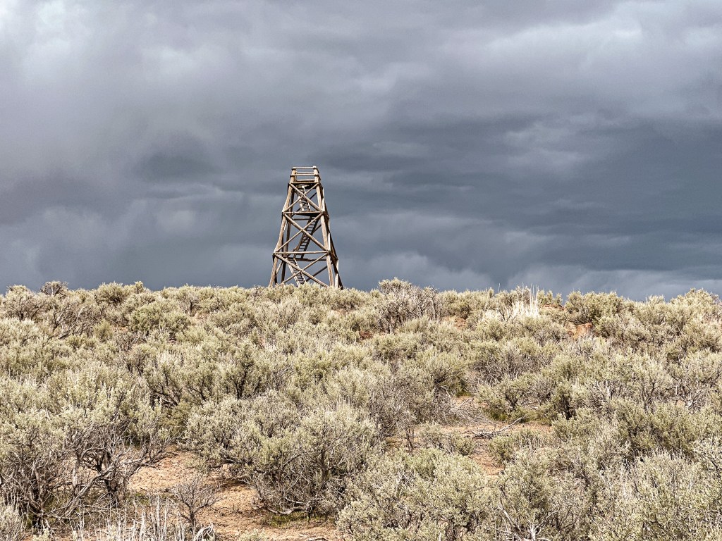
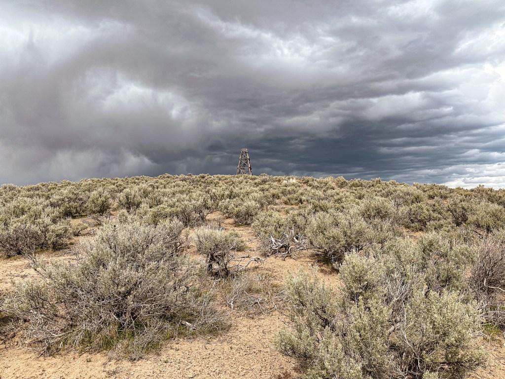
This 50′ tower with wooden platform was built by the CCC in the 1930s. It appears that the main access is from the road along the Stubblefied Canal, but the area has since been closed to the public due to wildlife. It is best viewed from HWY-205, but can be seen from the Center Patrol Road as well. We found the best view was from a small pull out just across the highway from a private residence near Saddle Butte. You might be able to get a closer look from hiking along adjoining BLM land, but make sure to have a decent map. It’s not completely clear on what is private and BLM land beyond the fence line. I recommend a good pair of binoculars for viewing. This tower still has it’s stairs intact due to the limited accessibility.

Rattlesnake.

Date visited.

April 12, 2024

National Historic Lookout Register.

Not registered.

About.

This 50′ tower with wooden platform was built by the CCC in the 1930s. It is best viewed from the Center Patrol Road that is considered a part of the Auto tour route of the Refuge. This is included in stop #6 on the Blitzen Valley Auto Tour Route. You can no longer walk up to the base of the tower, but the road gets you really close. The surrounding area is closed to the public due to wildlife. The stairs on the tower have been removed to dissuade visitors from attempting to climb the tower. The tower is named after the larger Rattlesnake Butte across the road that used to provide the only natural crossing of the Blitzen River for miles.

Heybrook L.O. (Revisited)

Washington Lookouts

Please reference our original trip report on Heybrook L.O. for information on the history of the lookout, status, our initial site visit, and directions (post).

Date revisited: March 31, 2024

Trip Report.

We found ourselves in Kirkland once again for the weekend visiting my friend, Anjelica. The reason for this trip was bittersweet since we were getting together to celebrate our mutual friend’s engagement and simultaneous going away party. Her and her now fiancé are moving to California to be closer to his family (and a multitude of other reasons). I already only get to see her a handful of times a year, so the move won’t be much of a change in that aspect. But, it still offers the emotional growing pains of early adulthood as we all search for our next steps in life. Last time Garnet and I were in the area together was for Friendsgiving in November, which is when said friends announced their upcoming move. We had debated making a trip to Heybrook L.O. before heading home then, since Garnet hadn’t been yet, but the weather wasn’t ideal at the time. This time around the forecasted weather was sunny with a potential high of 57 degrees. Where we were staying in Kirkland was conveniently located for a visit to Heybrook and it only took us 50 minutes to get to the trailhead off of HWY-2. Unfortunately, a lot of people had the same idea as us and the parking lot was completely full when we got there around 11AM. There was enough of a pull out across the highway to park our cars and no signs in sight prohibiting us. It’s a busy highway though so always be cautious and careful of oncoming traffic. We noticed a few people were double parked in the actual parking lot just waiting like sharks for someone else to leave. This is on par with most of what I’ve experienced from popular hikes in WA, there’s just so many more people in this area than Oregon and it seems to be a larger international tourist destination. This isn’t to say you can’t find uncrowded hikes there, they exist, but if you want to visit somewhere you’ve seen online close to Seattle you better be prepared to join the assembly lines or go extremely early (even then I’ve been to a popular trailhead and just barely snagged the last parking spot at 7AM). Oregon is much less competitive in my opinion. We spent the first steeper portions of the hike leap frogging with some other groups as we each stopped to catch our breath. I haven’t been on a trail since January 1st and my stamina reflected that significantly. This is my sign to start conditioning now for our summer season before I hurt myself later. Once we reached the ridgeline we had a little more breathing room from the other hikers until it bottle necked again right before the lookout. There were a good amount of people on and around the lookout when we got there. We waited awhile at the base before Garnet and Anjelica decided to hike up the tower while I opted to wait at the bottom. They said there weren’t too many people on the viewing platform, but squeezing past people on the stairs was difficult. We were surprised to see that the cab was completely boarded up for the season, I had thought it was rented year round. A quick search on Recreaton.gov confirmed it’s only rented from May 1st to October 31st. I’m sure I mentioned it in my other trip report, but I would feel like Rapunzel trapped in my tower if I ever stayed in this lookout during a weekend. It was still nice to get outside and absorb some much needed Vitamin D, but Garnet and I both agreed we probably won’t be back here again. The amount of people would not be as bad if everyone respected hiking etiquette and had more spatial awareness. But unfortunately, when you get a hike this busy you have people blasting their music and no yielding of any kind. And you kind of have to do the same in return to make any progress. On the hike down, Anjelica and I were separated from Garnet due to people not being able to wait to get by us going in both directions. We yielded for them, but no one yielded for us. Once back at the trailhead, the cars had multiplied in the pull out we had parked and was now full of cars as well. There were even some people walking along the highway from a more distant pull out. It starts to reach dangerous territory when you have this much crowding and is part of the reason places end up being permitted. I know it probably seems like I complain a lot about the amount of people, but it is meant to provide a realistic expectation. I am not out seeking nature to be apart of the crowds. If you still plan on visiting, I’d recommend it during a weekday. I saw significantly less people on an early Friday afternoon in August and it was much more enjoyable to me. My Strava app only calculated this hike at 2.07 Miles RT with 812′ of elevation, but I had forgotten to start it from the trailhead.

We have been in a deep hibernation this winter and are finally defrosting ourselves for the season. Although this is a repeat for me, this was a first for Garnet and is our first visited fire lookout for 2024. We will have to wait and see where else the Forest Service roads, weather, and fires take us this year. In the meantime, I will try to finish up our trip reports from Montana before our busy season begins. Happy Trails!

Gobblers Knob L.O.

Washington Lookouts

Location.

Mount Rainier National Park

Status.

Maintained; Currently standing

Estimated drive time from Portland, OR.

3 hours

Date visited.

October 7, 2023

Elevation.

5,485′

National Historic Lookout Register.

US 478; WA 51

Trip Report.

Gobbler’s Knob has been long standing in my back pocket for a decent late season hike or backpack. It has eluded us the last couple of years due to early season snow or bad weather during the weekends we had previously allotted for it. This was the last fire lookout I needed to visit to complete my set for Mount Rainier’s fire lookouts within the National Park. There are lists that include others, but they are technically not located within the park boundaries. Garnet still has Tolmie Peak (post) and Mount Fremont (post) to visit since I did both prior to meeting him. These are ones I look forward to revisiting when the time comes. Especially, Mount Fremont (post) since that was the first fire lookout I ever had the pleasure of visiting. We had just returned from our week away in Glacier National Park and there was definitely house projects and work to catch up on at home. September has been busy (the outdoorsy fun kind of busy) and progress has been slow. But, when we noticed the weekend forecast called for sunny skies and warm temperatures, decisions were made. The other late season backpackers must not have checked the forecast yet because there were still all the wilderness permits available online when this idea took shape Monday and was executed by Tuesday. At the time you did not need a permit to hike to this fire lookout as a day hike, just a National Parks Pass for access and parking. Though it sounds like Mount Rainier is going to be adopting the limited entry/day use permits in 2024 for high use areas of the park. Make sure to do your own due diligence when visiting the park. Our plan was to stay the night at Lake George for the evening to help break up the distance. For this, a backcountry permit is required and can be booked ahead of time via Recreation.gov. You will need to pick up the permit in person from your choice of Wilderness Information Centers. These are only held until noon the day your hike is scheduled to begin and can be picked up as early as one day prior. If you know you will be picking up your permit later than noon, you will need to notify the Rangers ahead of time to schedule a later pick up. Otherwise your permit reservation is cancelled and re-designated as a first-come, first-serve. You also have the option to try and snag a walk up permit but there are usually only two designated for walk up in this area and it’s never a guarantee. There are limited permits available and this can be a popular destination during the summer months, so additional planning may be required. The closest WIC to Gobbler’s Knob is located in Longmire, or the Longmire Museum if it’s during the off season. Always double check the operating hours before selecting your pick up location.

We planned to pick up our permit from the Longmire WIC since it wasn’t closing for the season until October 10th. This is just shy of a 3 hour drive from Portland depending on traffic. We knew this meant we would need to get an early start and set our alarms for 5:45AM. Our wheels didn’t hit the pavement until 7:30AM though, since we wanted to make a hearty breakfast and needed to button up things around the house. We set out via I-205 to I-5 to connect to HWY-12 and cut up via HWY-7 to eventually get to HWY-706 that would take us to our needed entrance of the park. By the time we reached Ashford, we realized everyone had a similar idea to us. October is supposed to be a time of the year when hiking trails settle down and get less use, but the unseasonably warm weekend brought everyone out for one last hoorah (ourselves included). The forecast called for clear skies and temperatures somewhere in the 70-80 degree range depending on what elevation you were situated. We joined the assembly line of vehicles and waited for our turn at the kiosk. I know Mount Rainier is a popular National Park, but after seeing the entrance back up at 10AM in October I can’t even fathom how the summer lines compare. As the line crept on at a snails pace with no entrance in sight, we started to get worried we wouldn’t make it through before our noon deadline. We debated calling the ranger station, but had spotty service near the entrance. Luckily we did end up making it through just fine after a 30-40 minute wait, but it’s definitely something one should factor in to their travel time. Once in the park you will still need to drive a little ways past the entrance to get to Longmire. We even passed the turn to access the trailhead and had to back track after picking up our permit. The WIC was easy to find and was one of the farthest buildings to the left of the lodge. Something else to note is this backcountry campsite requires you to use their bear hang or a bear canister. We were aware of this but didn’t bring our bear canister with us since it said online the bear pole was usually up until there is snow on the ground. The ranger informed us due to how late in the season it was the pole had already been removed for winter and offered to let us check out one of their bear canisters for the night. The National Park offers these for free to check out as long as their supplies last. You only need to provide a drivers license to obtain this. Once again something to keep in mind if you’re visiting in the off season. Now with permit and bear canister in hand, we headed for the trailhead.

To access the trailhead, we turned on to the Westside road and followed it until the road closure. The road is off to the left if you’re heading in from the entrance of the park, but off to the right if you’re heading back from Longmire. There was ample parking for 15-20 vehicles where the road was closed (possibly more). It should be noted the Westside road is made up of gravel, but in decent condition with only minor potholes and rocks to avoid. Any standard low clearance vehicle should be able to make it without issue, but you can always ask the Ranger for current conditions. Once parked, we readied our packs and started up the road. At the time, I didn’t connect that this road continued on past the Lake George trailhead to access other areas within the park. I thought every car parked here was either at Lake George, the fire lookout, or on their way there as we hiked the road. With a mostly full parking lot this left us speculating for the next four miles on how busy it was going to be there, if there might be people there trying to backpack without a permit, or if last nights backpackers hadn’t left their camp spots yet. The hike along the road is fairly uneventful and mostly shaded by the surrounding trees. Don’t get me wrong though, it’s a nice walk in the woods. You will start out by passing around a large locked gate that marks the beginning of your road walk. Shortly after you will cross a bridge over Fish Creek. Once over the bridge there will be signs of washouts until it eventually opens up to a view of the mountain top and a ragging creek. This section parallels what I believe to be Tahoma Creek. There are plenty of signs of how this creek has pushed, overflowed, and manipulated the landscape around it which I can only assume is part of the reason why the road is kept closed. You will wind your way along the road for roughly 4 miles until you see a hiker sign off to your left. There is a distinguishable bike rack made from a tree trunk to mark the trailhead as well. It was full of bikes when we reached the trailhead despite not seeing many people along the road. The official hiking trail starts to the left of the bike rack. From here, it is 0.9 miles to reach Lake George and 2.5 miles if you are headed for the fire lookout. The tread becomes steeper once you leave the road and the real climb to the fire lookout begins.

We were surprised to find all the camp spots were empty when we reached Lake George and had our pick of the five. We only passed one group of four day hikers hiking out and were left wondering where the heck everyone was? Were they all at the fire lookout? Did they hike farther into the Goat Lake Wilderness? At this point, I knew the road continued to other trails which explained the amount of cars but why were there so many bikes at the trailhead and so few people on this trail? We decided to set our speculations aside for awhile to pick our camp spot for the night. We both agreed on number 4 since it was the farthest spot to the back and offered the most amount of privacy from the other camps. This was strategic since we knew we’d be joined by at least two other groups later in the day (potentially more if people snagged the walk up permits as well). After our stake was claimed and lunch was devoured, we felt re-energized to continue our ascent to the fire lookout. You gain most of the elevation during this hike within this last 1.6 miles from Lake Georg to Gobblers Knob. We kept our loads light by leaving most of our gear in camp for the remainder of the hike. I only brought my valuables (i.e. car keys, wallet, phone) in a fanny pack, a warm puffy layer, headlamp, a 32oz Nalgene, and my trekking poles. We passed a couple of day hikers coming back from their visit to the fire lookout and asked them if anyone else was currently up there. They said they had it to themselves and were wondering where everyone else was as well (they too mentioned a full bike rack). So, the mystery continues. We were excited at the potential of having the summit to ourselves though. This section was slow going since my body was still feeling the fatigue of hiking in Glacier NP. There are not too many views to expect from the trail since it is mostly treed until you get closer to the summit. But eventually your slog ends, you round that corner, and the views open up. And what a spectacular view it is.

Per usual, the hike back down felt like a breeze in comparison to the hike up. We didn’t see anyone else while on the summit or on the hike down, but the other two groups of backpackers had finally showed up in camp. It was almost dark by the time we reached our camp again, started filtering water, and making dinner. This was partially due to us lingering on the summit longer than normal and partially due to the days getting shorter. This was our official end to the 2023 season and we felt it. We slept in a bit the next morning holding on to the last glimpses of summer. We were the last group to leave camp. Our hike out was spent forecasting where we wanted to go in 2024 and what our favorite trips were from 2023. We never did figure out the mystery of where everyone else was either because the bikes were no longer at the trailhead when we left and most of the cars were gone from the parking lot. The hike from the trailhead to the summit came out at 6.7 miles with 2,744′ in elevation gain on the Strava app. In total, it was 13.34 miles and 2,792′ in elevation. Depending on what kind of adventure you are looking for this can make for a hardy day hike or a fair backpack.

History.

This is one of the four remaining Fire Lookouts within the Mount Rainier NP and the closest to the peak. This lookout was built in 1933 and is the same standard 2-story frame cab design that you will find within the park. It was staffed into the 1980’s but stands now as an educational site. It is also occasionally used as a standby detection or recreation site for backcountry rangers.

More Information.

Washington Trails Association

National Park Service

AllTrails