
Location.
Wallowa-Whitman National Forest
Status.
Active; Currently standing
Estimated drive time from Portland, OR.
7 hours
Date visited.
July 11, 2023
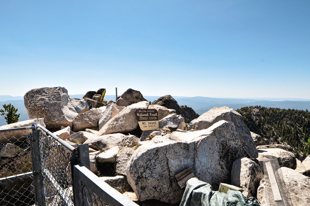
Elevation.
8,346′
National Historic Lookout Register.
US 1338; OR 153
Trip Report.
Day 4/9: Lookout Road Trip 2023
Garnet had already visited Mount Ireland in September 2022 while heading to the FFLA Western Regional Conference (post). He had met the lookout attendant staffing the lookout at the time, Warren, and his wife. Garnet ended up talking to him for hours, helping around the lookout, and exchanging phone numbers. He talked very highly about Warren and his passion for Mount Ireland. We knew we wanted to go back sooner than later in hopes that I would get a chance to meet him as well. Unfortunately, his wife was having back issues and struggling to make the climb by the end of season. We were disappointed to find they wouldn’t be back this season after working it into our route. I believe she was having surgery to help with her back issues and I’m hoping she makes a good recovery. Hopefully, we will get a chance for our paths to cross again. Based on the information we had from the other lookouts in the area, the Forest Service hadn’t found a suitable replacement and there wouldn’t be anyone staffing it during our visit.

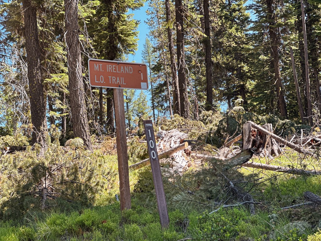
While packing up our camp, a truck driving by stopped to let us know the O’Rouick spring on NF-1010 had good water for drinking. They appeared to be locals, so we took their word for it and topped off our water reservoirs. Normally we wouldn’t trust drinking untreated water directly from a spring, but this one was piped and we had no issues with it afterwards. We headed out of the Umatilla NF via NF-10 towards Granite. You are essentially in the Wallowa-Whitman NF by the time you reach the small mining town. We took a quick spin through Granite while we were there. The main convenience store with gas was posted for sale, so I’m not sure if this would be a reliable source for fuel. We turned onto NF-73 to head towards Sumpter (a left turn if you’re coming out of Granite, but a right turn if you’re coming from NF-10). We followed this until we reached NF-7370 off to the left. It was on a blind corner from the direction we were coming and we initially drove past it. Garnet noticed it as we were already driving by, so it was a quick turn around. It’s a more obvious road coming from the other direction. There is actually a sign for the Mt Ireland L.O., but it is offset from the road and slightly being overtaken by brush. We followed the NF-7370 road to the junction with NF-100 that will take you the last bit to the trailhead. This is a drivable road for low-clearance vehicles, but it is narrow and steep with drop offs along some sections. We arrived at the trailhead, or what was left of it, just before noon. Garnet said that last year there was a big flat pull around area that used to offer a lot more parking. It appeared they had done some much needed thinning of the trees in the area, but used the previous trailhead for the slash piles. There’s only a few pull outs left for parking now. We picked one in the shade and started prepping for the hike. There was also a large white truck parked in the pull out closest to the start of the trail. We were surprised to see anyone else here since it’s already considered a pretty lonely trail and we were here on a Tuesday.
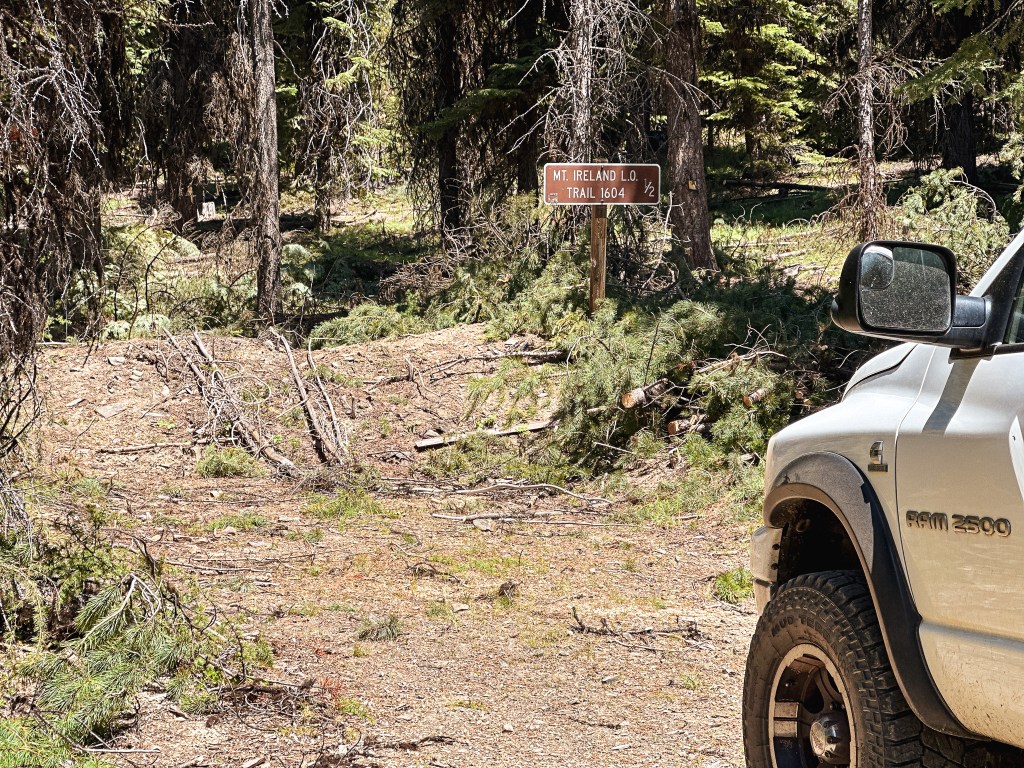
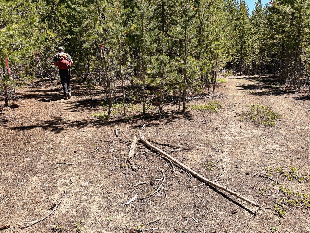
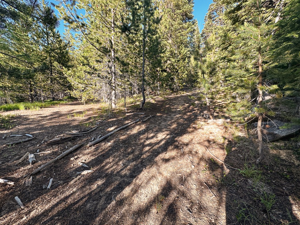

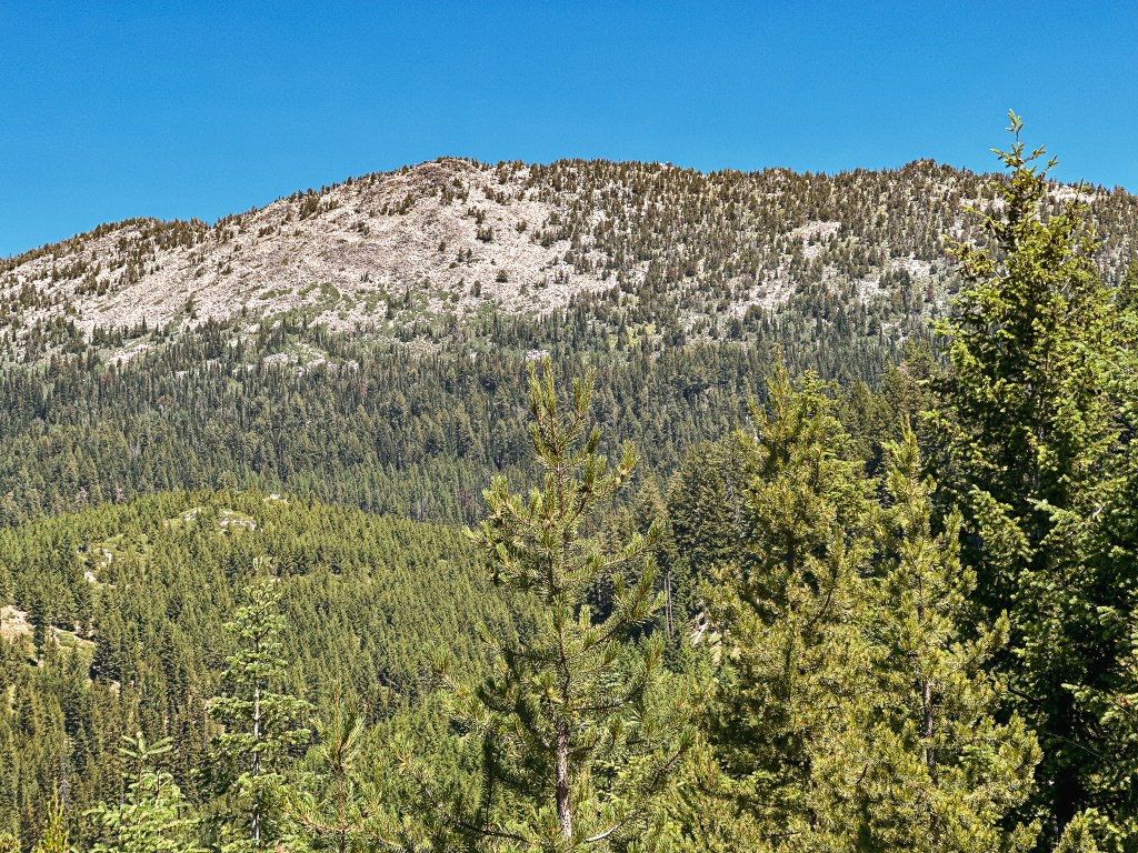

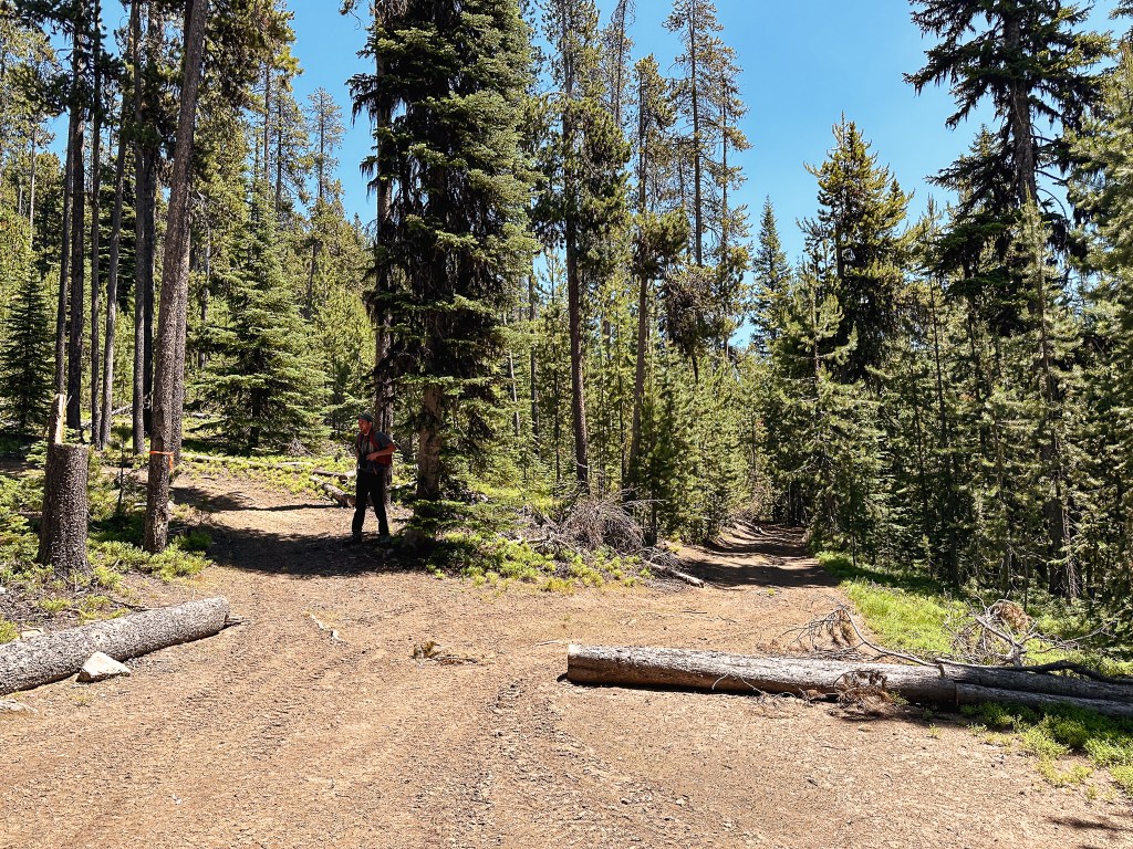


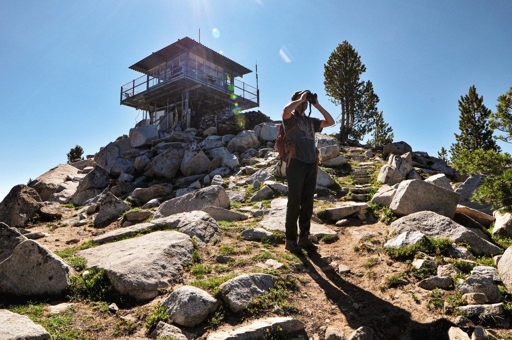
There is a surprising lack of online information for this trail. It’s not listed on AllTrails, Oregon Hikers (minus a trip report), or even the Forest Service’s website. This probably explains why it’s not heavily trafficked. The hike starts along the old decommissioned road that is marked with a sign post for Mt. Ireland L.O. Trail #1604. The road steeply climbs for a half of a mile to meet up with the trail. There are a few turns along the road to note, but all seemed to be well flagged or blocked off to corral you in the right direction. The first turn was off to the left where some flagging and a make shift arrow pointed the way. The second was shortly after to the right, the path to the left had some branches laid across it to signal not to head that direction. The final turn is off to the left after a particularly steep section of road where the official trail begins. It looks like the road might continue straight, but there were once again more branches laid across to signal you shouldn’t go that way. Once on the trail it starts to level out for the next mile. Make sure to look up occasionally for old insulators in the trees along this section, we were able to spot more than a few. You will get glimpses of where you are headed through the trees, which will either be encouraging or discouraging to your progress. While we were stopped to look at the fire lookout through the binoculars we heard a helicopter in the distance. We patiently watched as it landed on the helispot for Mt. Ireland and took off again. This could only mean one thing, they found someone to staff the lookout. Now it made sense why someone else was parked at the trailhead on a Tuesday. The trail eventually crosses an old road with a camp spot and starts to gain elevation again. Garnet remembered there being a trail sign here, but it looks like the sign or the tree have since been removed. A trip report from the Wandering Yuncks a year prior confirms this sign existed (post). We came to an exposed junction with an ATV trail around the 2.5 mile mark. We turned left to head up the last steep mile to the lookout. You will start to lose tree coverage here, so make sure to take advantage of the shade and bring lots of water. The whole while we were hiking we were able to watch the helicopter return 3 or 4 more times. Unfortunately, we didn’t make it to the summit in time to see their last run up close but it was still neat to watch from the trail below. There was an official U.S. Forest Service ATV parked on the trail where it became significantly more rocky. This allegedly used to be the old road to the lookout, but even an ATV wouldn’t be able to make it all the way now. The last pitch of trail before you reach the summit is steep, dusty, and loose for footings. Along this section we were passed by a group of four fire crew members heading back to the ATV. They had been there to help open up the fire lookout for the season and get the new lookout situated, it was his first day! It looks like we had just missed all the commotion, most likely for the better though since we’d probably be in their way.

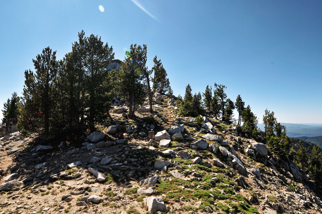


As I reached the saddle below the fire lookout, I looked up to see someone on the catwalk looking down at us. I waved up to them to say hello to which they said “you’re doing better than I did”. I laughed and replied “I’m not so sure about that” as I wheezed my way closer to the lookout. He ended up inviting us on the catwalk if we were interested. We gladly joined him and talked for a while about fire lookouts, our trip, and the surrounding area. He joked about how he couldn’t wait to get up here for the peace and quiet only to have his first visitors come mere minutes after the fire crews had left. He was very hospitable as he offered his stools for us to sit on in the shade and even refilled our empty water bottles before we left. We mentioned how we could see the helicopter making deliveries on our way up and he said that they only get one for the season so he had to make it count. Anything else that he might want throughout his season he would have to be pack up himself. This is also typically a good spot to see mountain goats, there is even a salt lick for them provided by the Forest Service, but they were no where to be seen after all the noise. We thanked him for his time and wished him a good (and more importantly quiet) first season!
Lookout Darren.
This was not only Darren’s first day on the job, but also his first season as a fire lookout ever. He said it had been a bucket list item for him ever since he visited a family member that used to staff one. He has two dogs that he plans to accompany him, but they weren’t there yet since he was planning to hike out the next day. His official season didn’t start until that following Monday. He used to be a state trooper for the Oregon State Police and has also done work for ODOT auditing trucking companies. He grew up in Baker City and currently resides there now, but has lived in different parts of Oregon as well during his time working for the state.
History.
A cabin with open platform on the roof was constructed on a stacked rock foundation in 1916. It was first staffed by Orlin L. Ireland, the son of Henry Ireland who was the mountains namesake. At the time, the mountain was named Bald Mountain. The US Geographic board approved the name change to Ireland Mountain in 1917. This was to commemorate the late Henry Ireland who was the supervisor of the Whitman NF for a decade. A cupola was added in 1928 to enclose the fire finder. In 1957, the cupola and previous foundation were destroyed by blasting it off the mountain to prep for the new lookout. It was replaced with a 13×13 CL-100 all steel live-in cab that still stands today. It is actively staffed every season.

More Information.
