
Location.
Malheur National Forest
Status.
Active; Currently standing
Estimated drive time from Portland, OR.
6 hours
Date visited.
July 9, 2023
Elevation.
7,592′
National Historic Lookout Register.
US 657; OR 108
Trip Report.
Day 2/9: Lookout Road Trip 2023
Our next stop for the day, after visiting the easy to find Prairie City Fire Finder (post), was more complicated. The road to Dixie Butte, no matter which way you slice it, is described as a no good downright terrible road. We knew we would be road walking part of this road, but we had hoped to make it some distance up before having to get out and hike. It’s about 5.3 miles from the highway to the summit according to a peakbagger report. We had met some other lookout enthusiasts last year while searching for the Eightmile crows nest (post) in the Mount Hood NF. One of them had been the former lookout on Dixie Butte for many seasons and this lookout is where they actually met. They had described the road as bad even back then, but were able to get a Honda Civic up there with a little motivation. There are other reports on Peakbagger that note people in sedans and low clearance vans making the harrowing drive up. I like to think we are pretty adventurous drivers, but we didn’t even make it a mile up the road before deciding it was not worth it. We had planned for Dixie being a whole day affair, but this complicated things.
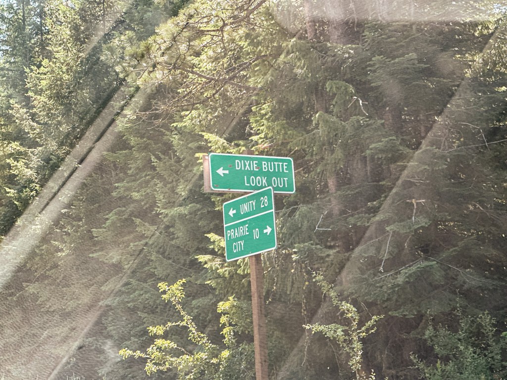
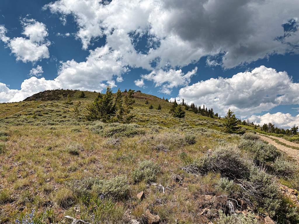
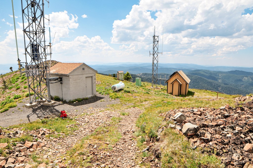
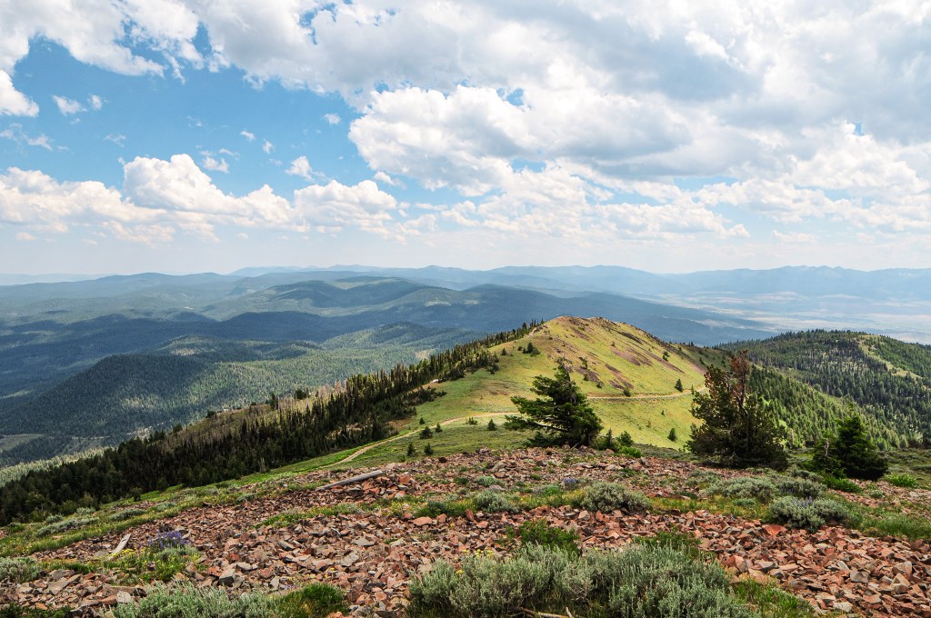
From Prairie City, we drove 10 more miles east on HWY-26 until we reached the signed turn for Dixie Butte. This road is one of the first turns off to the left after entering the forest boundary. We kept right at the first fork and left at the second to stay on NF-2610 road. There were no visible road signs to indicate these were the correct turns. There is a primitive looking ski area and cabin you will have to pass through though. The first mile of road is rocky and bumpy. We stopped just shy of a mile up the road when we were met with a section covered in large embedded rocks. It covered the whole road in this section that would have made it tricky to avoid scraping our low clearance car. I don’t doubt people have done it though. Normally we can find a way to wiggle around sections like this, but we figured if it was already this bad it wasn’t going to get any better. We parked on a closed road in the shade and mentally prepared for a long road walk. We started our hike to Dixie around 11AM and didn’t make it to the summit until 2PM. The road improved past the rocky section for a mile and a half, but deteriorated again when it narrowed. Parts of this road are starting to wash out and could benefit from some water bars. Let’s just say that the bad parts of the road are really bad and the better sections are just ok. The last section of road where you start to leave the tree line is not for the faint of heart. We stopped to have lunch in the shade near a nice meadow area before hand. It was already really hot and we needed the energy to finish the final stretch along the exposed portion of road.

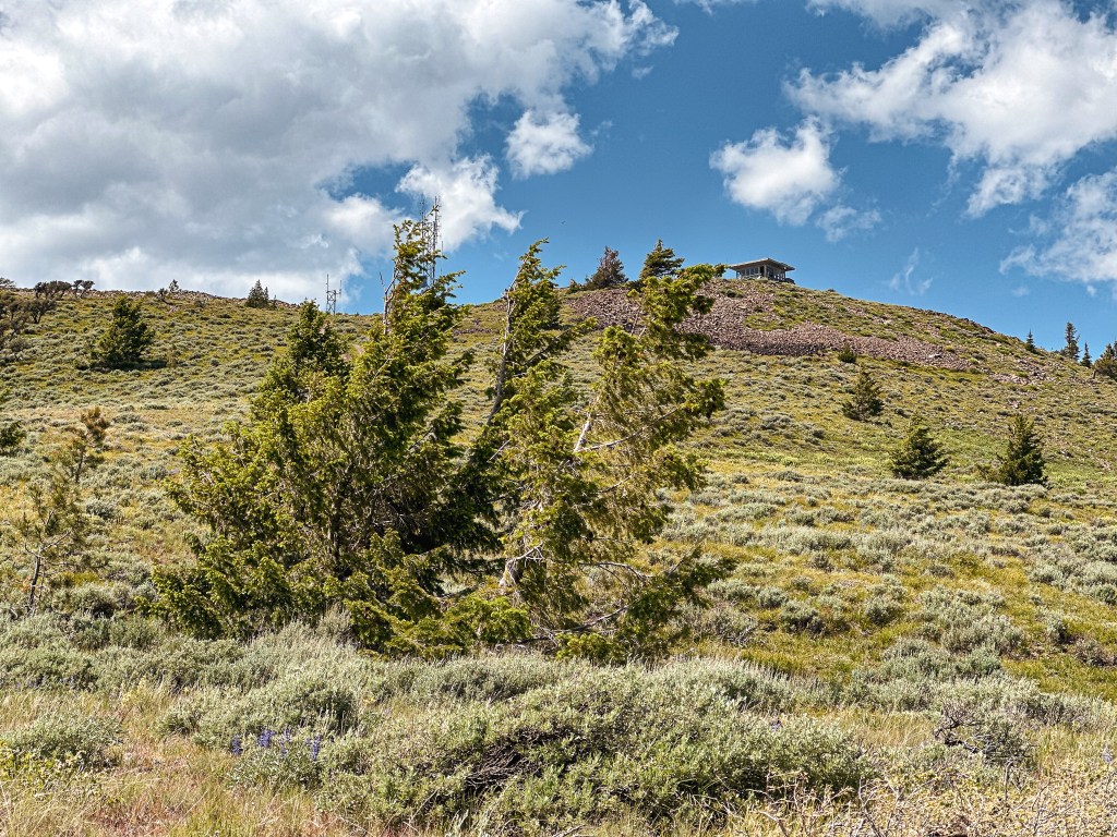
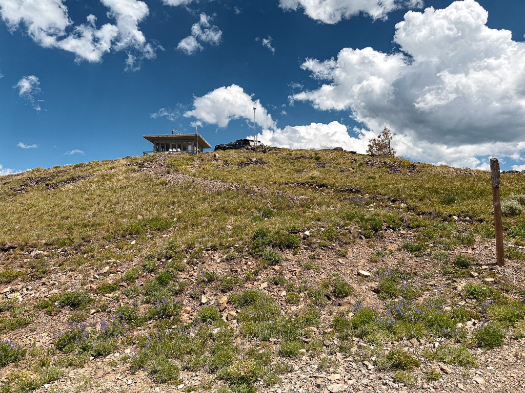


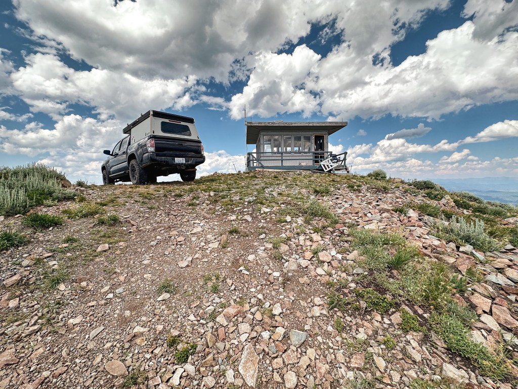
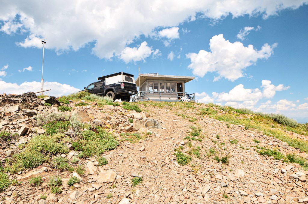
I’m sure the lookout attendant saw us coming well before we reached the summit. I thought about that every time I needed to stop and take another break where I could see the lookout. We had hoped it would be the same attendant from last year. When we were at the FFLA conference (post) in Enterprise the year prior, they had been apart of the group chat that sparked our meeting with Bob LaFrance after Garnet’s visit to Mt. Ireland (post). They had said to send us their way which led us to believe they were friendly. Though it’s not often that you meet an unfriendly lookout attendant. She didn’t immediately come out to greet us, so we tried to take pictures without being a nuisance. The one down fall to being a lookout on Dixie is you’re right on the ground which leaves no room for privacy. There’s also no gate to stop people from driving up at any hour of the day or night. But, the road conditions at least deter a few people. We happened to glance over at each other at the same time to which I gave her a wave. She waved back and popped out to say hi while warning us that there might be some lightning here soon. This area had a 20% chance of thunderstorms forecasted as well, but none of the immediate clouds looked like thunderheads yet. There had been some lightning the day before, so she was busy watching for any residual smoke. We did learn that her name is Stacy and she is from Washington. Washington has less standing fire lookouts than Oregon and staffs even fewer. We were also greeted by her cute dog, Nook, who was trying to coax us into throwing a stick he had. She mentioned that Antelope Mountain (post) and Mt Ireland (post) were both not staffed yet for the season. This was either due to staffing issues or their season not starting yet. We also talked about how we walked the majority of the road and she thanked us for not trying to drive it. She keeps an air compressor with her and has to help people often with flat tires that attempt the drive. She seemed distracted and we didn’t get to talk to her for very long.
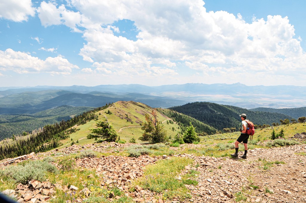


We took a few more pictures before parting ways and starting our hot slog back to the car. From where we parked, my Strava app tracked that it was 4.63 miles (9.26 miles RT) of road walking and 1,984′ of elevation gain. We still needed to find a camp for the night since our original option didn’t pan out. We’ve found our best option when on these trips is to continue on our route towards the next destination until we are able to find something viable. They’re not always the prettiest camp spots, but there is always something. Thunder was rumbling in the distance by the time we got back to the car and we rejoiced as it started to rain.
History.
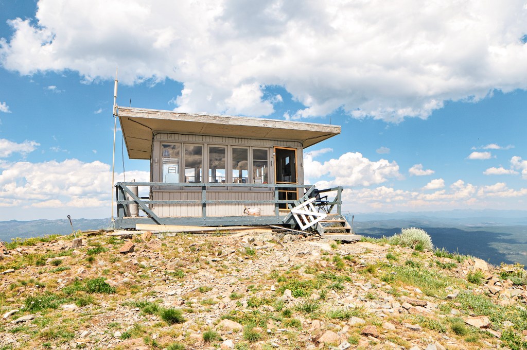
Dixie Butte was established as a fire detection site as early as 1911 when a lookout was stationed on the summit. They were connected by telephone line, but it is unclear if there were any permanent structures during this time. In 1921, a D-6 cupola lookout house was built. A wood frame garage was later added in 1934. The lookout house was replaced in 1935 by an 14’x14′ L-4 ground cab. The Malheur National Forest Archive references it as an Aladdin plan 14’x14′ lookout house. In the fall of 1967, the lookout structure was damaged by a windstorm that caused the roof to be lifted from the wall and the wall to be pushed out of place. The following year, in 1968, they were able to approve construction on a new lookout as long as they followed the standard plans for the region at that time. This was a 15’x15′ R-6 flattop ground house style lookout that still stands today. It is still actively staffed every season.

