Location.
Bull of the Woods Wilderness; Mount Hood National Forest
Status.
Burned in Bull Complex Fire; September 6, 2021
Estimated drive time from Portland, OR.
1-1/2 hours
Date visited.
September 23, 2018
Elevation.
5,520′
National Historic Lookout Register.
US 200; OR 26
Incident Management Team officials confirmed last night that the Bull of the Woods Lookout located within the Bull of the Woods Wilderness was lost due to fire activity yesterday. This lookout was listed on the National Register of Historic Places and frequently visited by those who enjoy the history and background of Fire Lookouts. “We acknowledge that losing this historic Lookout is a loss that will be felt by many in the area and beyond,” said Rick Connell, Incident Commander of NR Team 4.
Over the past several weeks as the fire moved towards the historic Lookout, several actions had been taken by firefighters to protect it. Plans to wrap the Lookout in structure wrap material were made several times but had to be cancelled due to dangerous conditions to firefighter safety and the unavailability of trained personnel. Working on dangerously high and structurally compromised materials in a remote wilderness location to wrap a structure requires firefighters who are specifically trained for that type of work. If a person falls from a high surface without appropriate fall protection training and equipment the consequences could be severe. The extremely steep terrain on all sides of the Lookout’s location also creates dangerous wildfire conditions where fire can move quickly uphill without warning. The combination of safe forecasted fire behavior conditions and trained personnel needed were never able to converge for structure wrapping. The safety of the public and firefighters is always the highest priority in fire response.
On August 31 a helicopter rappelling fire crew flew to the site and cleared trees and brush around the Lookout to make it more defensible. The crew could not safely remain at the site since it was on steep terrain directly in front of the approaching fire. For the past six days numerous hours of helicopter flight time had been used to drop water to slow the movement towards and intensity of the fire near the lookout. Yesterday, smoke obscured visibility on the north side of the fire and it wasn’t safe to fly aviation in that area.
On September 5 fire activity increased on three slope aspects below the Lookout site. This type of fire behavior is what was concerning for firefighter safety every time the discussion came up about firefighters working at the Lookout site. A smoke inversion and active fire behavior limited visibility for aircraft to safely fly and limited the tactical operations that could be performed for fire suppression. There are no safety zones or roads near the Lookout for firefighters to safely engage in firefighting on the ground. The fire was also making a push and threatening multiple values at risk on other portions of the fire at the same time. It is disappointing to see a historic structure like this Lookout destroyed by fire. However, many photos and stories have been preserved to continue to tell the story of the Bull of the Woods Lookout for years to come
-Mt Hood NF, September 6th 2021
Trip Report.
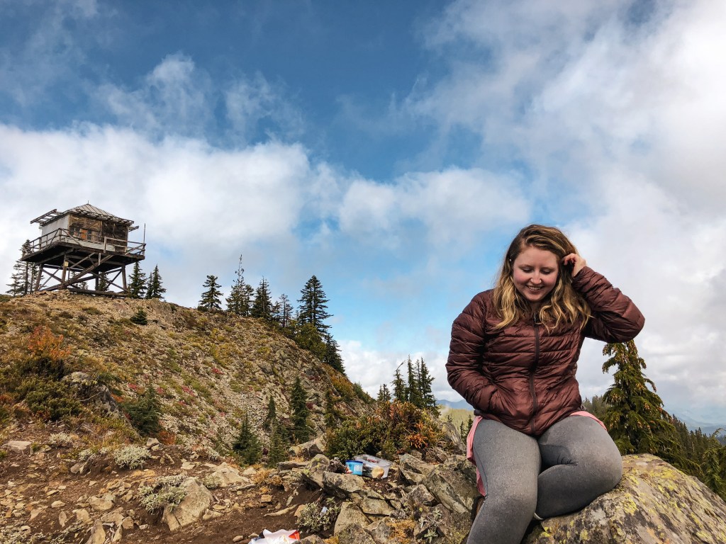
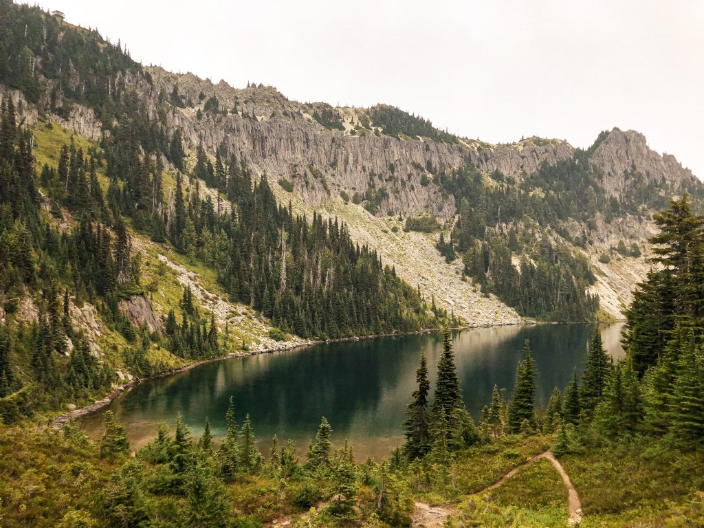
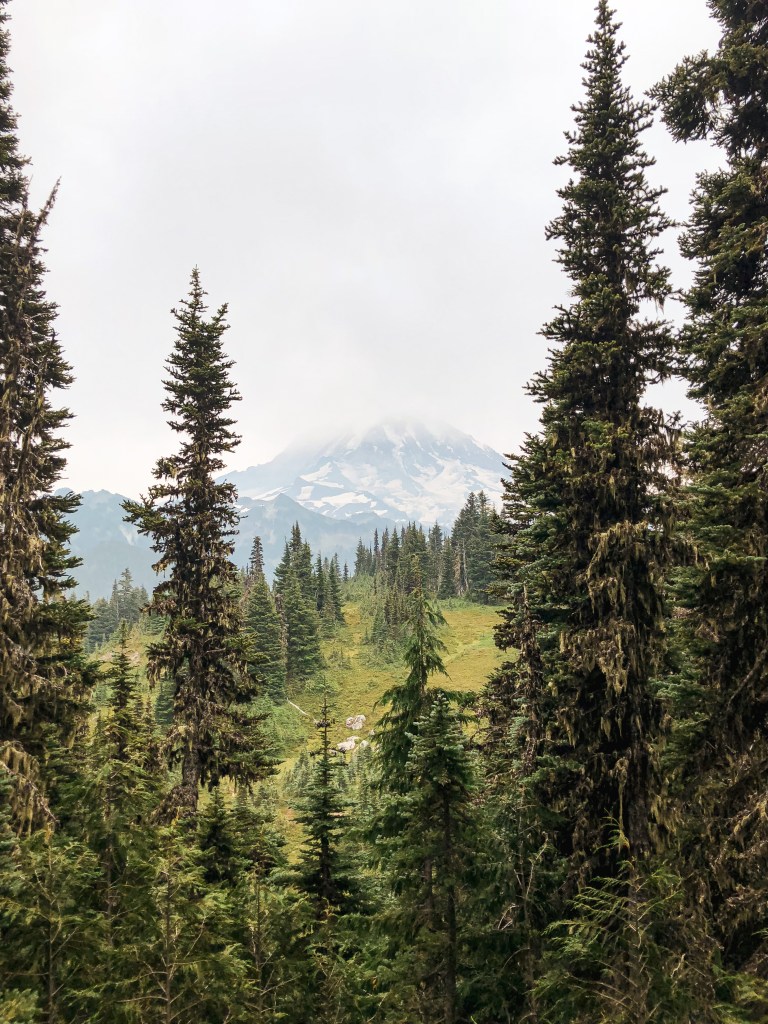
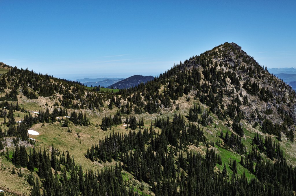
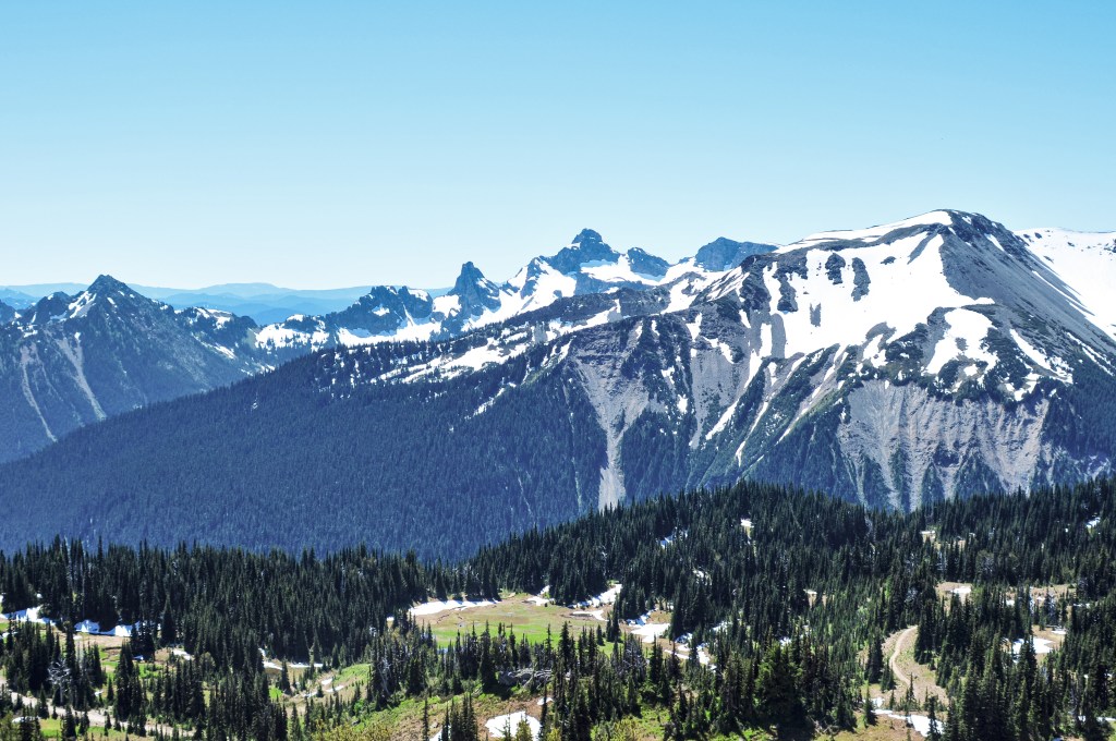
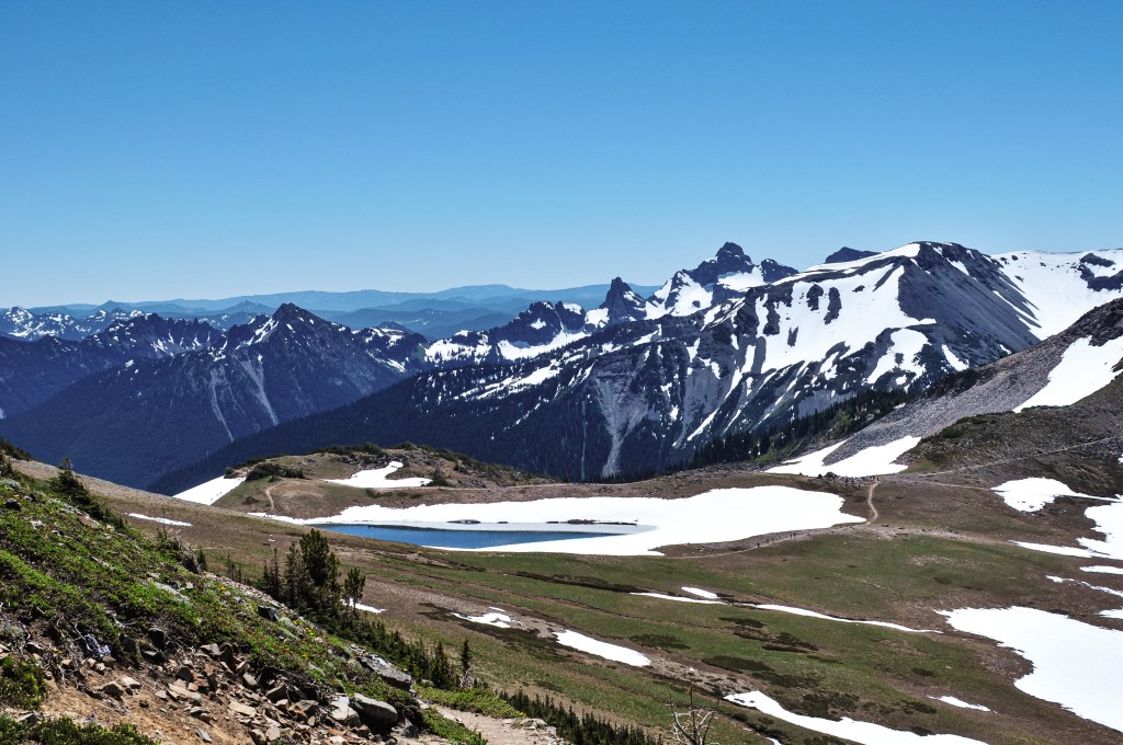
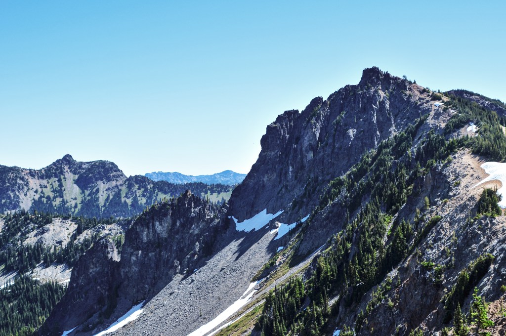
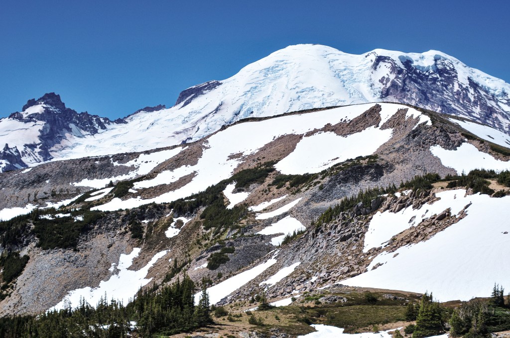
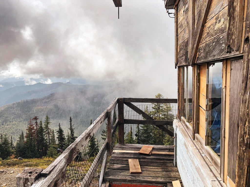
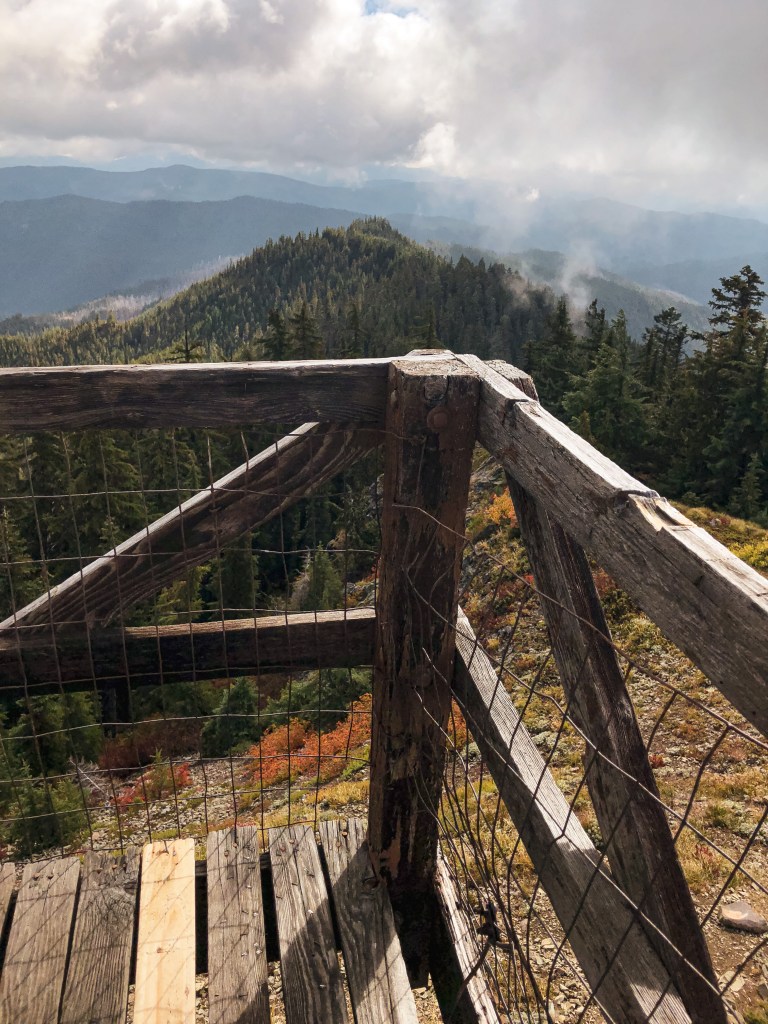
I’m reminiscing about this beautiful fire lookout in the middle of a rugged Oregon wilderness. Unlike most fire lookouts, there are no roads that lead here. Access was via the multiple interlocking trails found in the wilderness. The most direct route, and the one I took to get there, was the Bull of the Woods Trail #550. The trail switchbacks through shady woods until you crest the ridge line. You will gain 1,250 feet of elevation over 3.2 miles. Once you reach the ridge you are exposed to spectacular views as far as Three Sisters, Mount Jefferson, and Three Fingered Jack.
I hiked this trail with one of my good friends back in September 2018. I feel lucky now that we were able to see this when it was still standing. NF-6340 was a decent gravel road up until the end where it was rutted out due to people driving it in wet conditions. But my Civic was able to make it to the trailhead with some careful maneuvering. It was a colder day that felt like the beginning of fall. The understory was still wet from a recent rain and the clouds were rolling over the sun throughout the day. We had the trail to ourselves for the entire hike up and our summit lunch. It wasn’t until we were packing up to leave that we met an older couple and their dog at the summit. They even made a comment about my Civic being at the trailhead and that they were impressed it made it up there.

History.
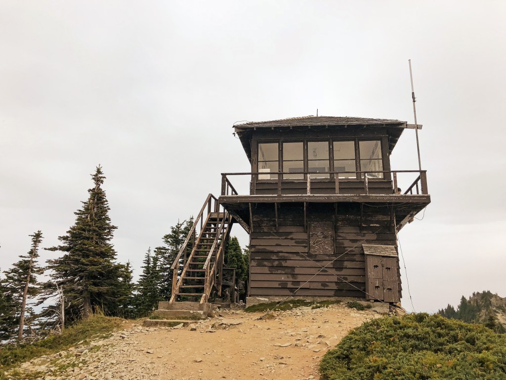
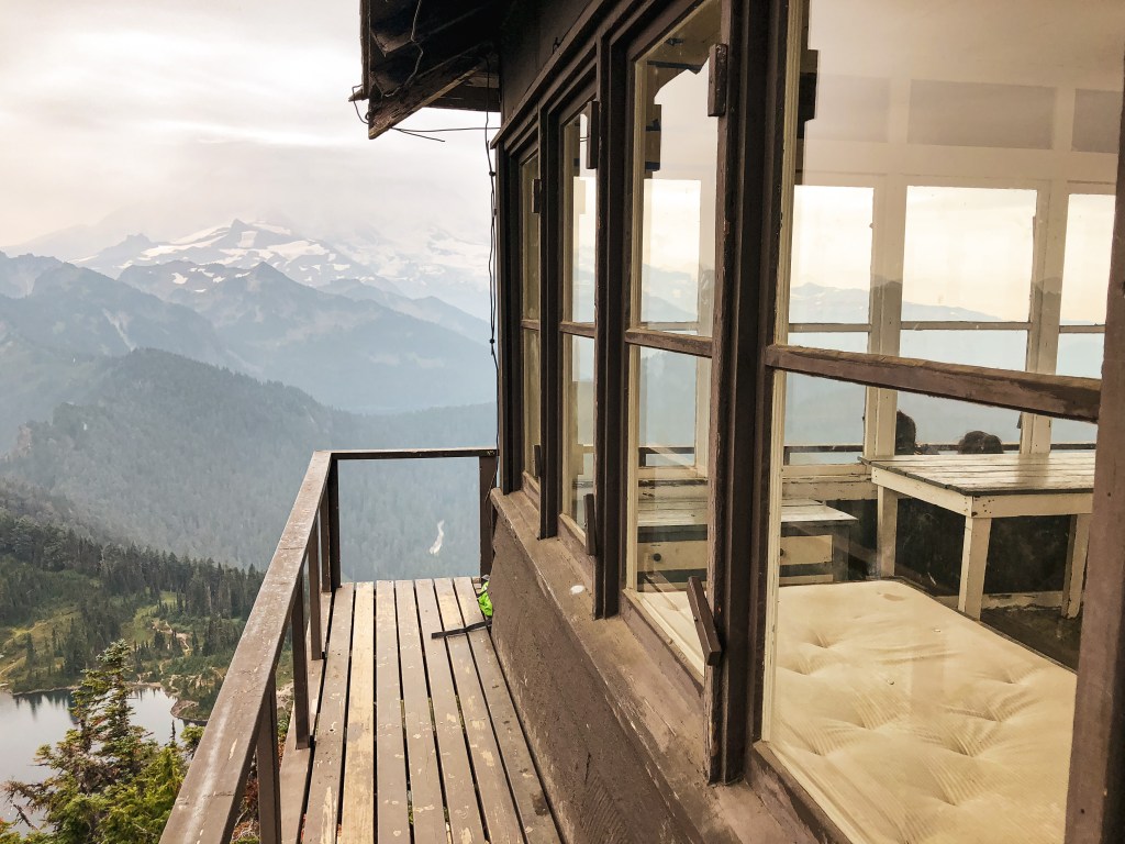
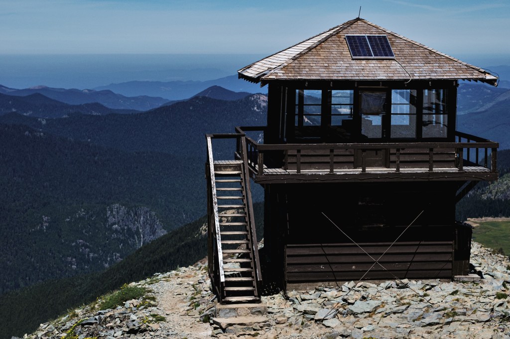
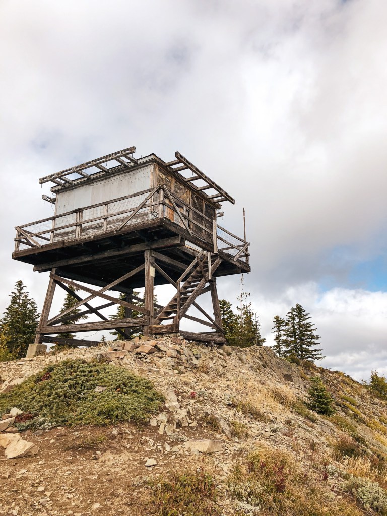
This lookout was an L-4 built in 1942 and regularly used until 1963. The forest service intermittently staffed it in high fire danger until the mid-1980s. In the early 2000s, volunteers with the Sand Mountain Society helped renovate it but it had seen better days. When I visited in 2018 the cabin was shuttered and locked aside from the few boards that were pried off and a broken window. The catwalk was mostly useable but had some broken boards as well. Unfortunately, its structural integrity is a moot point, given that it burned in the 2021 Bull Complex fire. The trail and forest will recover and still make for a great day hike once the area is reopened.

My heart breaks as we lose more of these historic structures every year. All I can do is hope that I get a chance to experience them while they’re still here!