
Location.
Umatilla National Forest
Status.
Active; Currently standing
Estimated drive time from Portland, OR.
7 hours
Date visited.
July 10, 2023
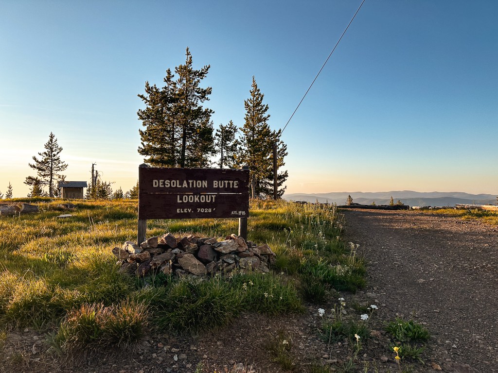
Elevation.
7,028′
National Historic Lookout Register.
US 1610; OR 137
Trip Report.
Day 3/9: Lookout Road Trip 2023
There is no quick way to get to Desolation Butte, but I think our route this trip might have been the worst of them all. We’ve been fairly close to Desolation Butte two separate times. The first was the closest on an extended weekend backpacking trip to the North Fork of the John Day wilderness in September 2019. We came in from Dale and drove to the Lost Horse trailhead off of NF-800 which is only about 4 square miles away on the map from the fire lookout. I can only vouch for the roads we drove on, but NF-1010 and NF-10 were drivable to at least the trailhead in the Civic. The NF-55 and NF-5505 were good up until it got closer to the junction with NF-1010. The second time was for a week long backpack through the main part of the North Fork of the John Day wilderness in June 2021. We were at the main trailhead that starts in the North Fork John Day campground. This would have required an extra day to drive down NF-73 to NF-10 from Granite to get to the lookout. The roads getting to the campground are paved and were in good condition. This time we were attempting to connect through the forest via NF-45 from Indian Rock (post). We were already limited on time due to our extended conversation with the lookout that morning. We ended up eating even more of our time when I thought I had lost one of my Nalgene bottles. This resulted in us driving back up to the base of Indian Rock (post) to search for it after packing up camp. We didn’t find it there and I accepted it as a loss. The NF-45 road past the junction with NF-537 is not marked as a good road on the map. We had asked Karen at Indian Rock (post) about the conditions, but she said she hadn’t been that way in years. She knew it was at least passable since people would visit her from Olive Lake, but all have had trucks or higher clearance. We decided to test our luck anyway. It’s considered a main connection road from the Malheur NF to the Umatilla NF, how bad could it really be?
The next 8.2 miles of road were some of the worst we’ve ever driven in the Civic. We had thought the Dixie Butte (post) road was bad, but this was definitely worse. It immediately deteriorate after passing the NF-537 road and we briefly debated turning around to head in through Sumpter instead. The only reason we continued on was because I left the decision up to my partner who was currently driving the car. He was head strong and didn’t want to miss out on seeing Desolation Butte again. Unfortunately, this decision was made before we got to the worst parts of the road. I whined multiple times for us to turn around, but eventually we reached a point where we were so far into it that it made more sense to continue through. There were large rocks embedded in the road that required skillful maneuvering in a low clearance vehicle and I had to get out multiple times to move the smaller of large rocks. We eventually reached the boundary where the two forests meet. There is a trailhead here that leads off in both directions. Now that we were on the Umatilla NF the road improved significantly. It still wasn’t a great road as it was made up from larger rock gravel and had some potholes along the way. But, we felt much more relaxed after the boulder field we had experienced on the Malheur NF side. After what felt like an eternity we reached NF-10 which looked like a gravel highway in comparison. We turned right to head towards the Desolation Guard station. The NF-1010 road is immediately after the guard station off to the left. This was a good road up until the large 5-way intersection. The NF-1010 road makes a hard left turn here. We were stopped shortly after that by a rocky section that crossed the entire road. After the trauma from the NF-45 road, we decided to walk the remaining distance to the lookout. It was already getting late in the day so we decided to set up camp and make dinner before heading out. While we were setting up camp I found my missing Nalgene in the smaller cooler we had brought in addition to our larger cooler. I guess when Garnet was collecting our water bottles to refill them for the day a car drove by and he placed it in the cooler to look busy. He immediately forgot about it and we had a good laugh.

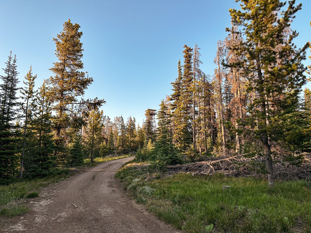
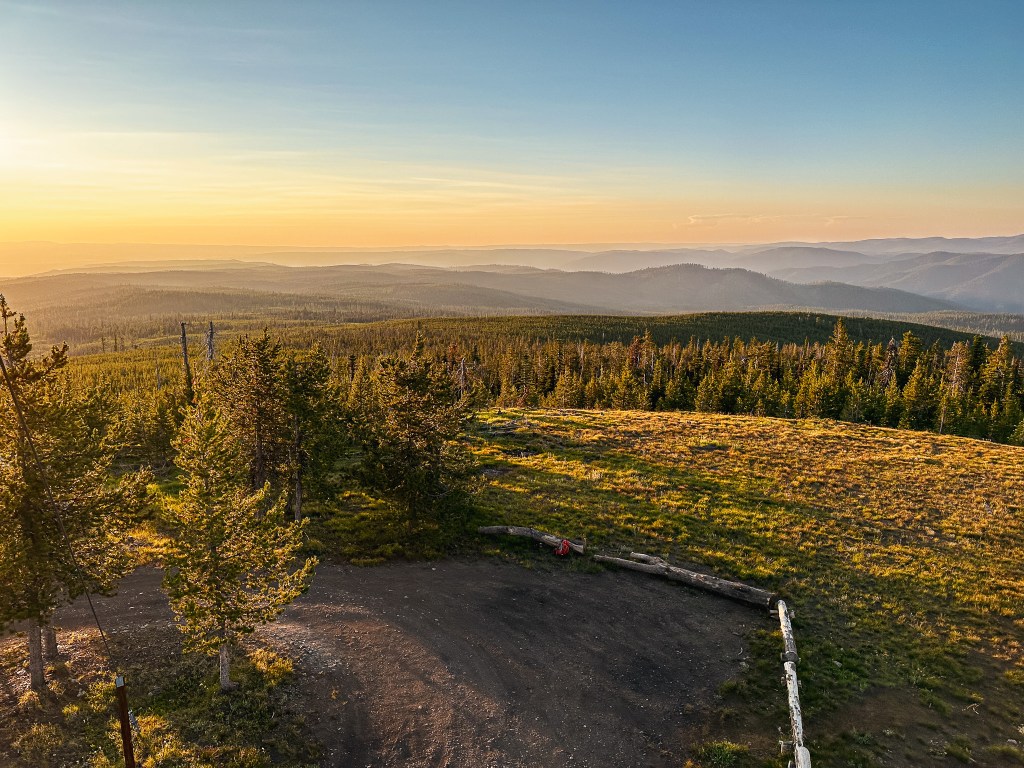
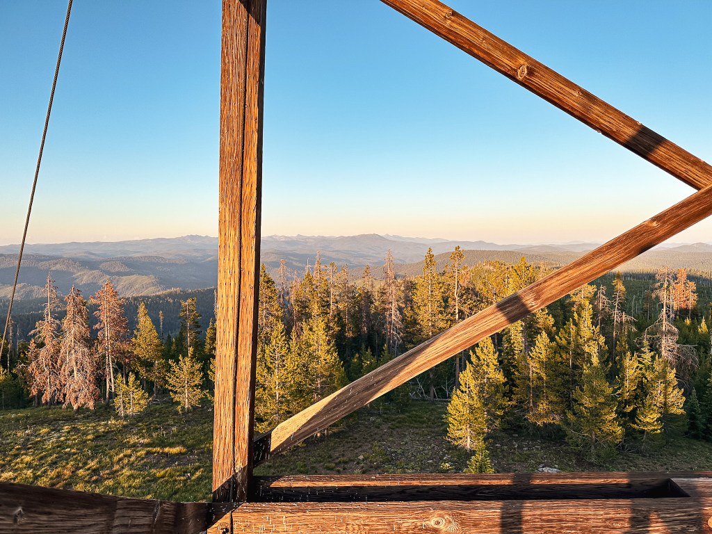
I started my hike up the road while Garnet cleaned up the dishes from dinner. He’s a much faster hiker than I am and I figured he’d catch up easily. After the one rocky patch, the road improved which was frustrating. We had already committed to the road walk though and there were a few other rocky patches along the way that would be troublesome in a low clearance vehicle. That’s what I am telling myself at least. The road is mostly treed in on each side which doesn’t offer much for notable landmarks. There is a trailhead within the first 1/2 mile from the junction for the Lake Creek Trail. I stayed on NF-1010 for around 2.5 miles until I reached the junction with NF-300. The NF-300 road was also in decent shape. It was roughly another 1.5 miles along NF-300 to the summit. I was surprised I made it to the summit before Garnet caught up. Every time I turned around to see if he was coming he was no where to be found. My irrational thoughts started to wonder if he accidentally turned onto one of the unmarked spurs off of NF-1010. I was able to talk my anxiety down since I know he’s much more competent than that. He showed up a little while later after I had already finished taking pictures. The sun was already starting to set and I wanted to minimize as much road walking in the dark as possible. I headed off again before Garnet thinking he’d be shortly behind me. It quickly started to get dark and I had already pulled out my head lamp before reaching the end of NF-300. There’s an interesting fork in the NF-300 road which I think is just a continuation of NF-300 from the other direction if you came in via NF-1010 from Dale. I’m not completely sure though.

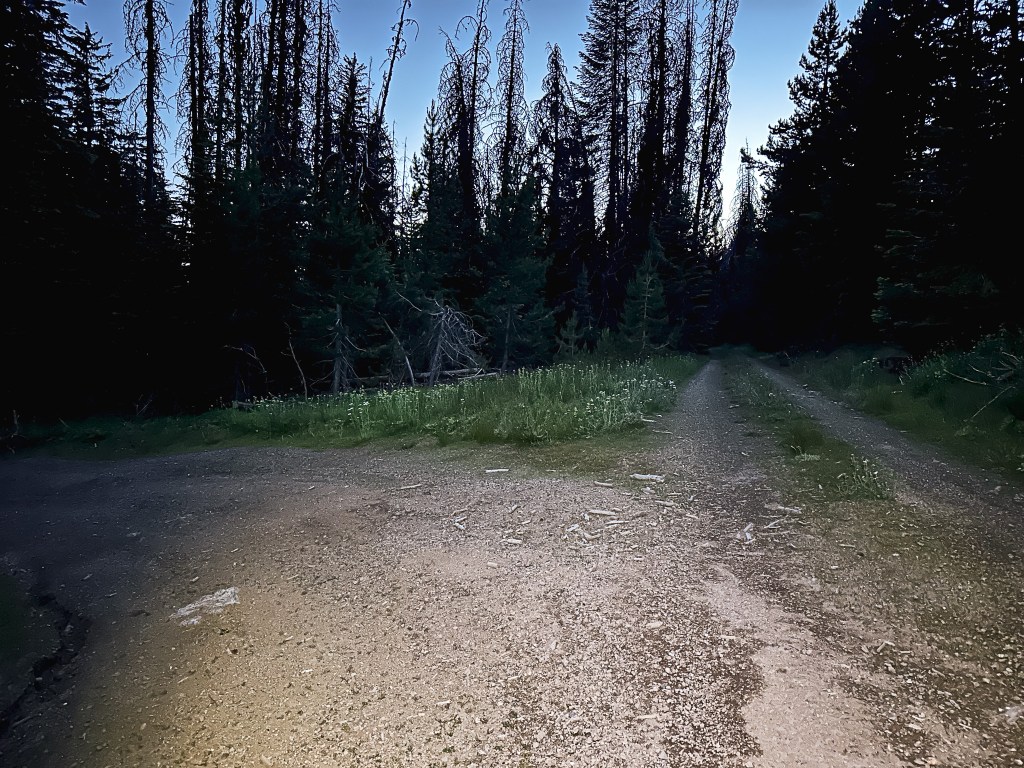
Something important to note is that I am afraid of the dark or more specifically what I can’t see in the dark. I kept scanning the edges of the road with my head lamp expecting something to be there. Once again, every time I turned around to see if Garnet was coming he was no where to be found. This only put me on edge even more. I made it most of the way without anything notable happening and no Garnet in sight. That was until I was within the last mile of the road walk. I turned around again to see if I could see his headlamp, but my headlamp passed over a shiny pair of eyes in the brush. I stopped in my tracks and stared back at it. I couldn’t tell what it was besides that it was a larger animal. Unsure of what to do I clapped my trekking poles together to see what it would do. Sure enough it started bouncing away, it was just a deer. I started walking faster and occasionally clapping my poles together to alert anything else of my presence. I could finally see the 5-way junction and turned around to see Garnet’s head lamp in the distance. I guess he was a bit spooked too. He said when he was on the tower he had felt someone tap his shoulder but no one was there. The road walk ended up being 8.3 miles RT with 1,103′ of elevation gain.


Desolation Butte is an actively staffed fire lookout but we knew they wouldn’t be there during our visit. Otherwise we would’ve had to rethink our timing. We had tried to connect with Bob LaFrance while we were in the area, but he seemed to be bouncing around and elusive. It was unclear if he was still working as a lookout relief. Based on what Karen on Indian Rock (post) told us no one really knew what he was officially doing this season. He did help us by starting a group chat with the lookout attendants staffing Tower Mountain (post) and Desolation Butte though. This is how we became aware it would be vacant on the day we were visiting.


History.
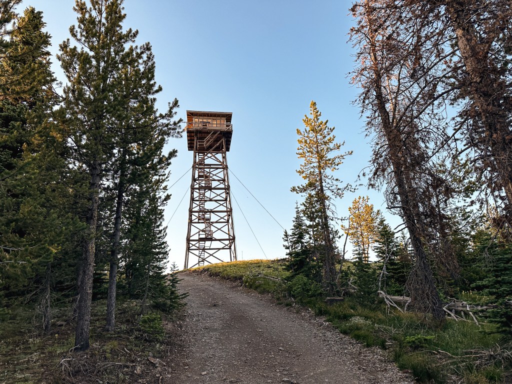
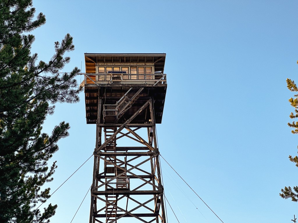
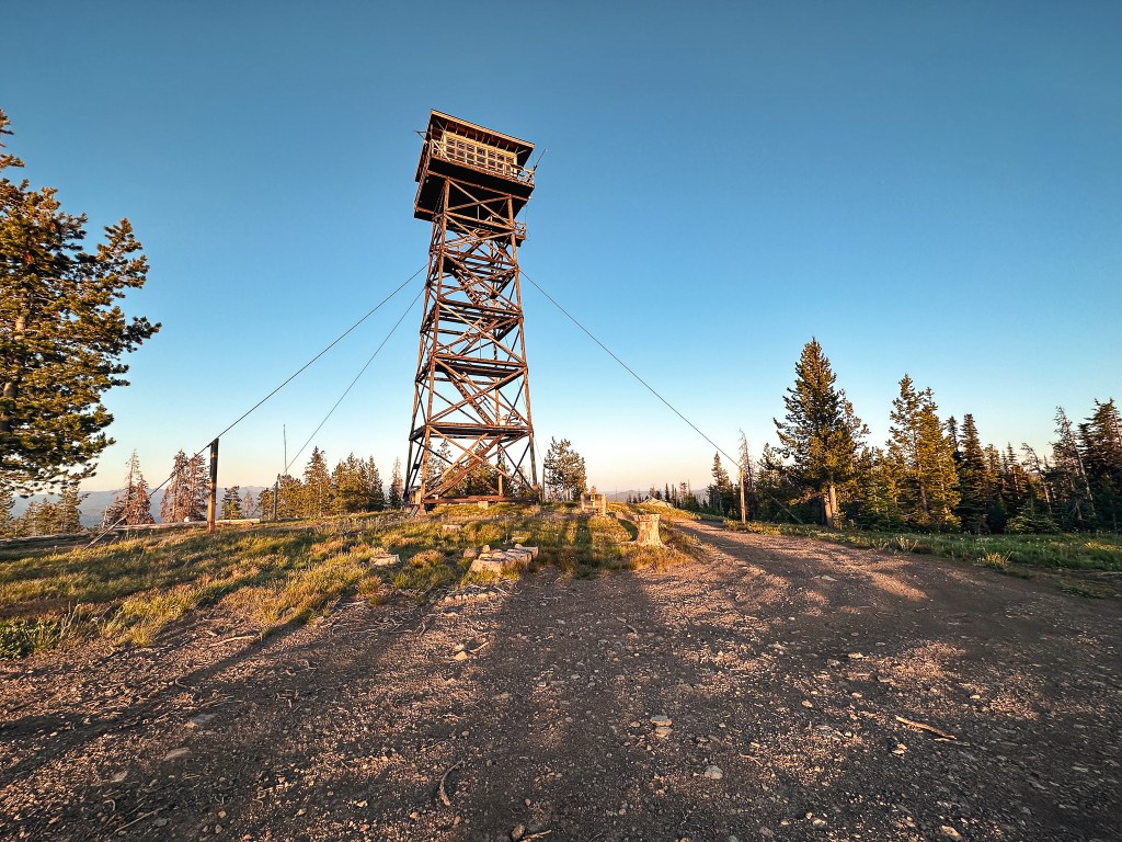
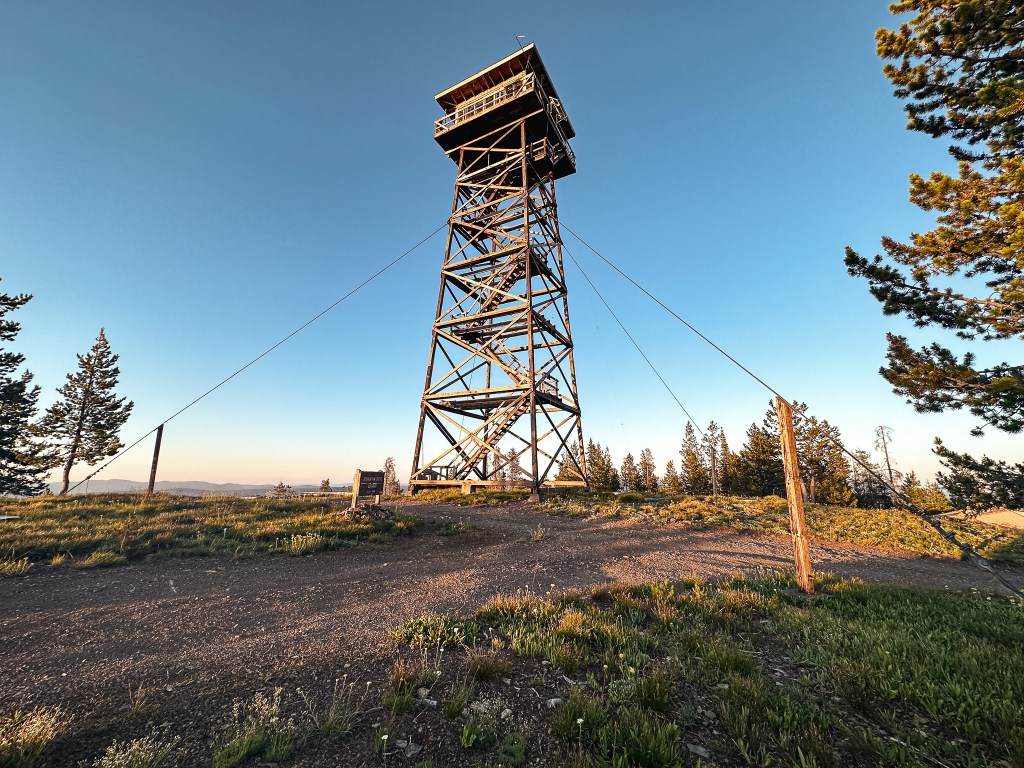
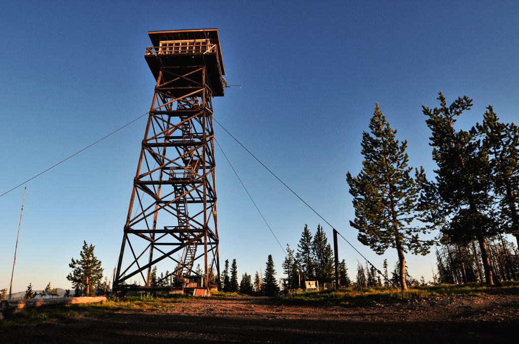
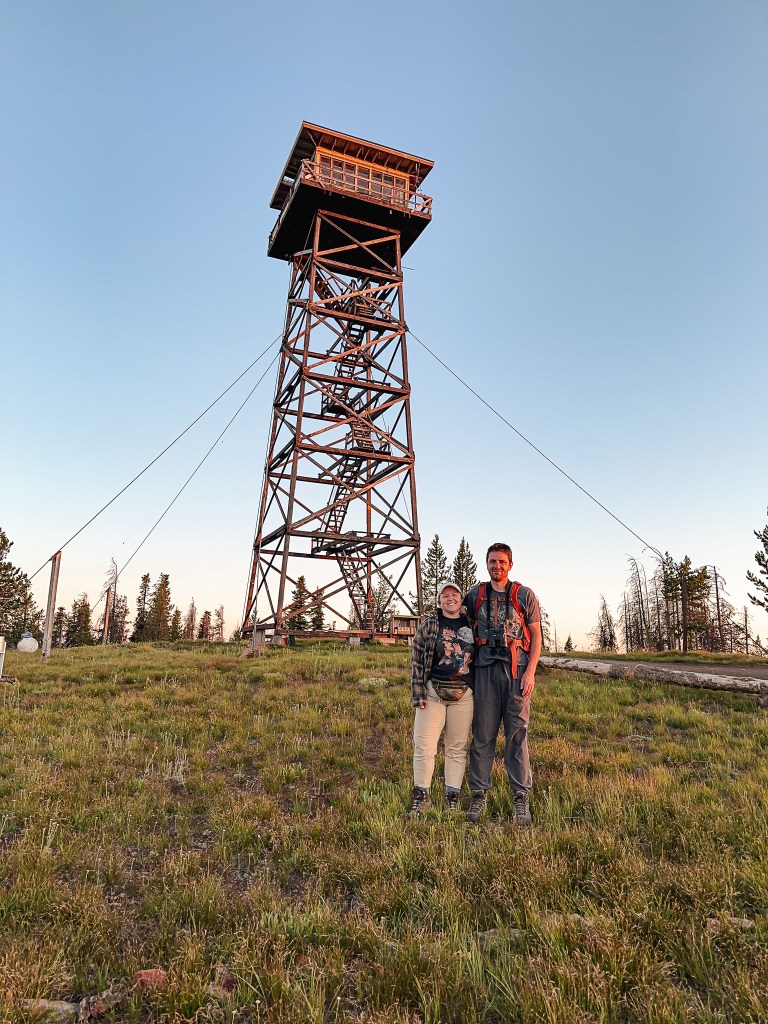
In 1918, the East Oregonian mentions a big steel lookout tower receiving storm damage on Desolation Butte. I could only find mention of this on Ron Kemnow’s site, but there must have been some sort of steel tower added during the 1910s. It was replaced in 1923 by a 50′ steel Aermotor tower with 7×7 cab. There was also a wood frame cabin for the living quarters. The existing tower was constructed in 1961 as a 67′ treated timber tower with R-6 flat roof cab. It was threatened in 1996 by the Bull Complex Fire but survived along with the Olive Lake Campground thanks to the hard work of our Wildland fire fighters. It is still actively staffed every season.


One thought on “Desolation Butte L.O.”