
NOTICE: As of July 22, 2024 this area is currently closed due to the active Boneyard Fire.
Location.
Umatilla National Forest
Status.
Active; Rental program; Currently standing
Estimated drive time from Portland, OR.
4 hours
Date visited.
July 15, 2023
Elevation.
4,979′
National Historic Lookout Register.
US 1516; OR 130
Trip Report.
Day 8/9: Lookout Road Trip 2023
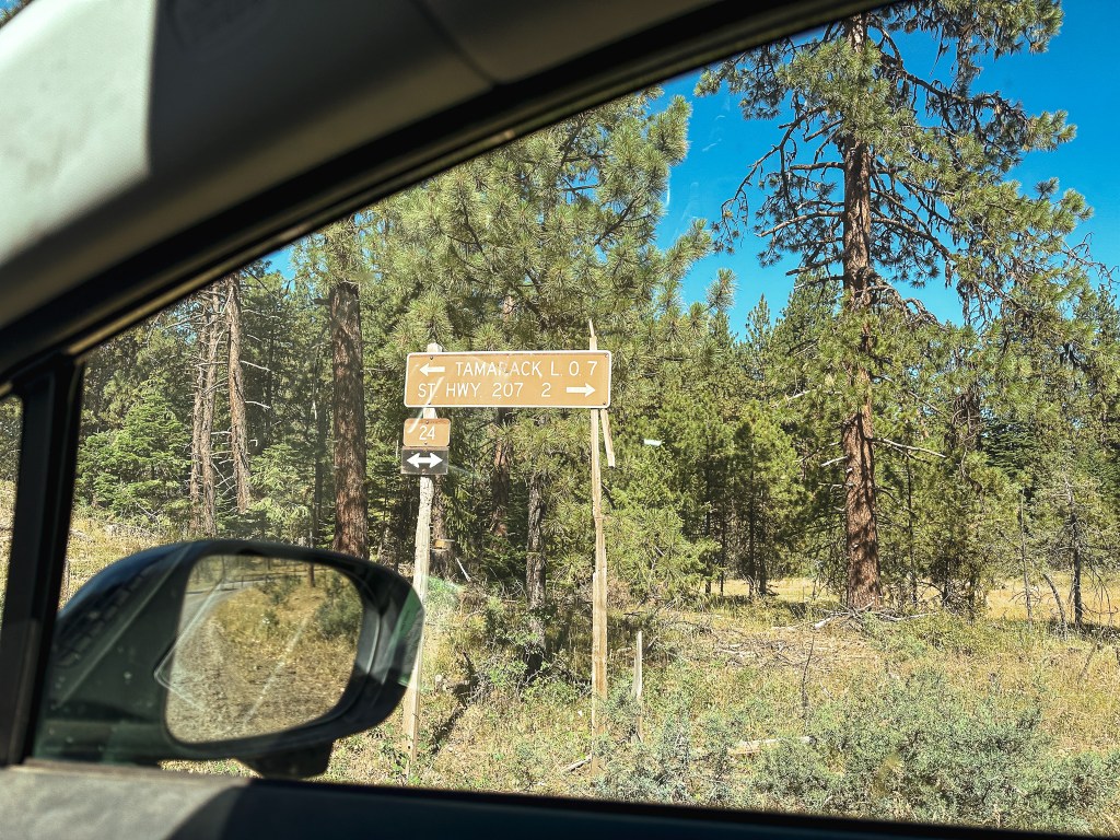
We leisurely packed up our camp to move towards Tamarack and Ant Hill (post) for the day. We didn’t have to drive very far from where we were currently situated. Garnet had previously been to that area of the Umatilla NF during the 2017 solar eclipse and already had an idea of where we could camp. We followed NF-21 out of the forest until it turned into CR-847. This took us all the way out to HWY-207 where we turned left to head south. We didn’t have to stay on HWY-207 for very long before we took another left onto NF-24. There was a sign for Tamarack L.O. at the junction that stated it was only 9 miles away. This area seemed to be well signed and the road was made up of good gravel. We stayed on NF-24 until we reached another signed junction with NF-2407. This stated we only had 3 miles left to go to Tamarack L.O. as we turned right. Prior trip reports and some helpful information from other lookout enthusiasts we met told us the road would be good most of the way. After 2 miles the road turns into NF-040 and becomes rockier. We started up this section before deciding to abort and walk the remaining distance. Unfortunately, I was already in the rockiest section and the heat shield once again caught on something as I was backing down to the saddle. It was already hanging lower than normal from our mishap at the Mt. Ireland trailhead (post). Garnet had spent some time bending it back as best as he could for not having much more than some basic tools with us. This basically undid all the work he had done. It was even worse than before but we wouldn’t be able to touch it until it cooled down. I was annoyed at myself for not being more cautious and I was annoyed at the heat shield for causing more problems. We parked in the saddle between Tamarack and Little Tamarack to start our hike up the road. The last mile isn’t terrible, but it would have required some caution in a lower clearance vehicle.

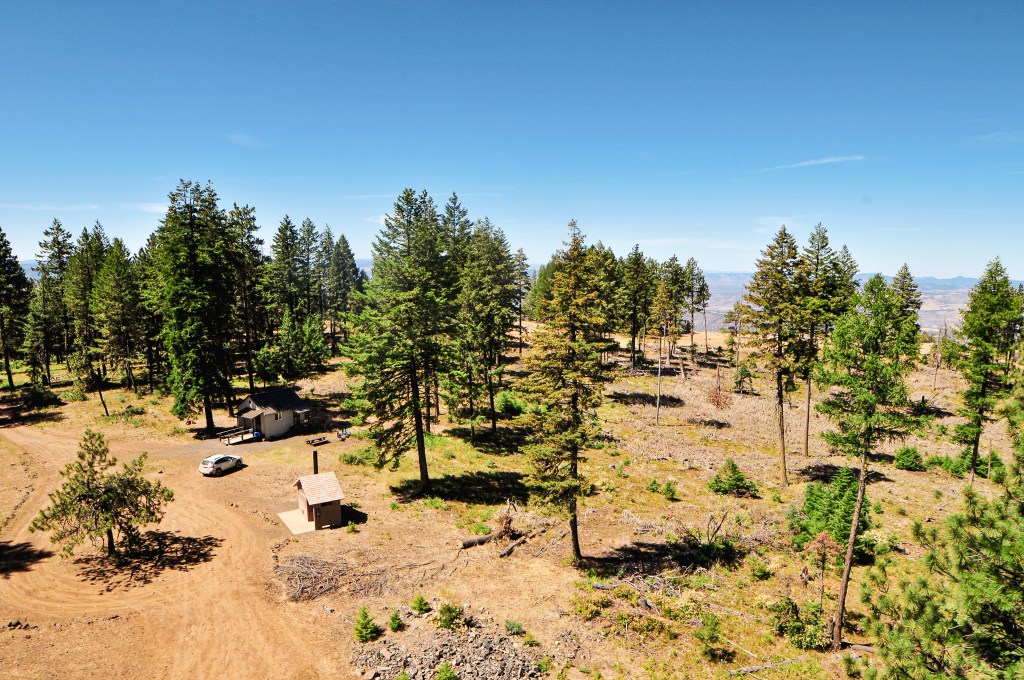
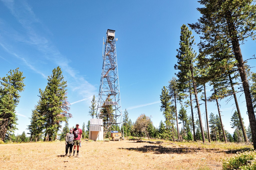
It didn’t take us long to reach the summit. It was only a 0.8 mile hike (1.66 RT) with 304′ of elevation gain from where we parked. The lookout tower on Tamarack is a tall Aermotor with a cabin at the base. It’s unique in that the cabin is rented out for recreational use, while the tower is still staffed every season. This leaves the lookout attendant to provide their own means of housing. A bit backwards and greedy in my opinion. We learned from Chuck on Madison Butte (post) that this was due to it being managed by two separate agencies. The Forest Service no longer wanted to staff the fire lookout and moved it to the rental program to make some profit. The state felt it was a crucial lookout to keep staffed and started staffing it themselves. The Forest Service let the state use the tower, but decided to keep the cabin for rentals. It’s not surprising that two government agencies wouldn’t agree on something, but it is unfortunate to those staffing the lookout. I would also feel terrible as a renter at this location. I’m sure most are unaware of the situation or at least I hope that is the case. There were renters onsite during our visit, but the lookout attendant was gone for the day. We knew their name was Sarah from our conversation with Chuck. We were bummed we didn’t get to meet them, but I left a note in their visitor log. I was able to connect with them later via Instagram.


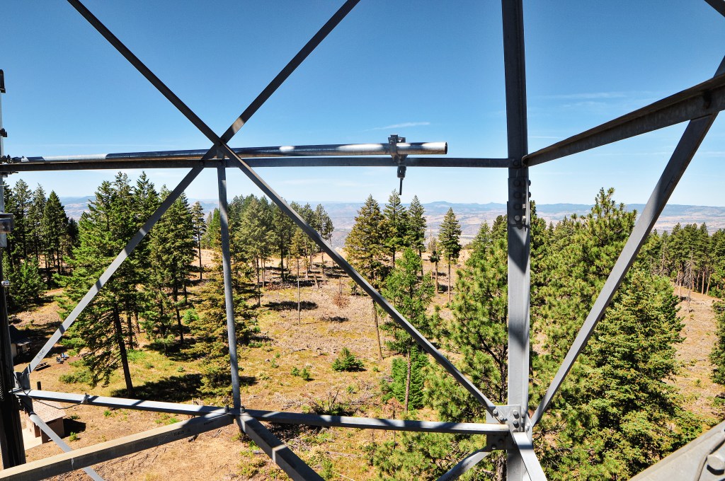
We climbed the tower to get a better view since there was not much to see from the base and no one was onsite to disturb. Garnet climbed all the way to the last landing while I stopped around the 5th landing. There was a custom camper, hammock, and veggie garden at the base of the tower as well. It looked like a nice set up despite the circumstances. We had never seen a lookout trying to grow fresh veggies before and I thought it was a neat touch. After taking in the view, we headed back to the car to deal with the heat shield. Garnet was able to bend it back to a better position, but we would have to address it again once we were back home. Driving a Civic through the forest always keeps things interesting. Our next stop for the day would be Ant Hill (post).


History.
Tamarack Mountain is named after the Western Larch, a tree that frequently grows under the drier conditions of the Blue and Wallowa Mountain ranges. I guess Tamarack is another common name used for larch trees of all varieties. The site was first established for fire detection with a crows nest platform on top of a tree. Most resources, including the Forest Service website, state this platform was built in 1925. But, Ron Kemnow’s collection of articles from withdrawal records, Morning Oregonian, Heppner Harold, and Heppner Gazette Times shows the site could have been used as early as 1908. In 1933, a 96′ steel Aermotor tower was built with a cabin for living quarters. The cabin accidentally burned down in 1966, but the original tower still stands today. Instead of rebuilding the cabin, the garage/utility shed was converted for the living quarters. It’s unclear when the Forest Service decided to stop staffing the fire lookout and add it to the rental program. The cabin is rentable to the public from May 15th to November 23rd. The lookout is currently actively staffed by the Oregon Department of Forestry every season, but I am unsure when they took this over. The Friends of Blue Mountain Lookouts, a volunteer run group, replaced the stairs in September 2021.

3 thoughts on “Tamarack Mountain L.O.”