
NOTICE: As of July 22, 2024 this trailhead is currently closed due to the active Boneyard Fire.
Location.
Umatilla National Forest
Status.
Active; Currently standing
Estimated drive time from Portland, OR.
4-1/2 hours
Date visited.
July 14, 2023
Elevation.
5,711′
National Historic Lookout Register.
US 1632; OR 150
Trip Report.
Day 7/9: Lookout Road Trip 2023
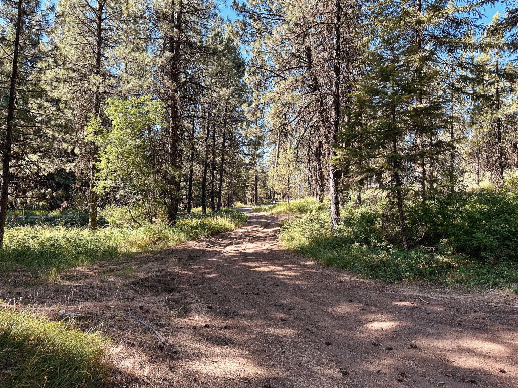
From Ukiah, we headed west on HWY-244 to cross HWY-395 into the Umatilla NF via NF-53. This starts out as a county road before entering the forest, but I don’t recall seeing a sign with a road name. There was a road construction sign at the junction noting they were doing a chip seal on this road and to expect delays. We seemed to be hitting all the activity this trip with work around the fire lookouts or on the roads getting there. Luckily, this time we missed the crews working on the road or they had already completed most of the work when we drove through. The NF-53 road is paved all the way to the junction with NF-21 and is in good condition. We turned left to continue on NF-21 which winds its way in and out of drainages. This was made up of good gravel and took us past the rentable Ditch Creek guard station and the staffed Tupper work center. Our plan was to camp in the area and hike the trail to Madison Butte the following day. Madison Butte can be accessed via a road as well from a completely different direction, but I believe it is seasonally gated and in terrible condition. Garnet’s dad mentioned the road getting there was not great years ago when he had been there and we were inclined to believe it hadn’t improved. Our biggest concern would be the conditions of the trail instead. Upon setting up camp, we came to the conclusion we wouldn’t have to move camps for the first time this trip. We had buffered an entire day for Madison Butte and since we were already in the area there was no need to move camps for 2 nights. The only stops we had left on our itinerary (after Madison Butte, of course!) were Tamarack (post) and Ant Hill (post), both easily accessible and close to each other.
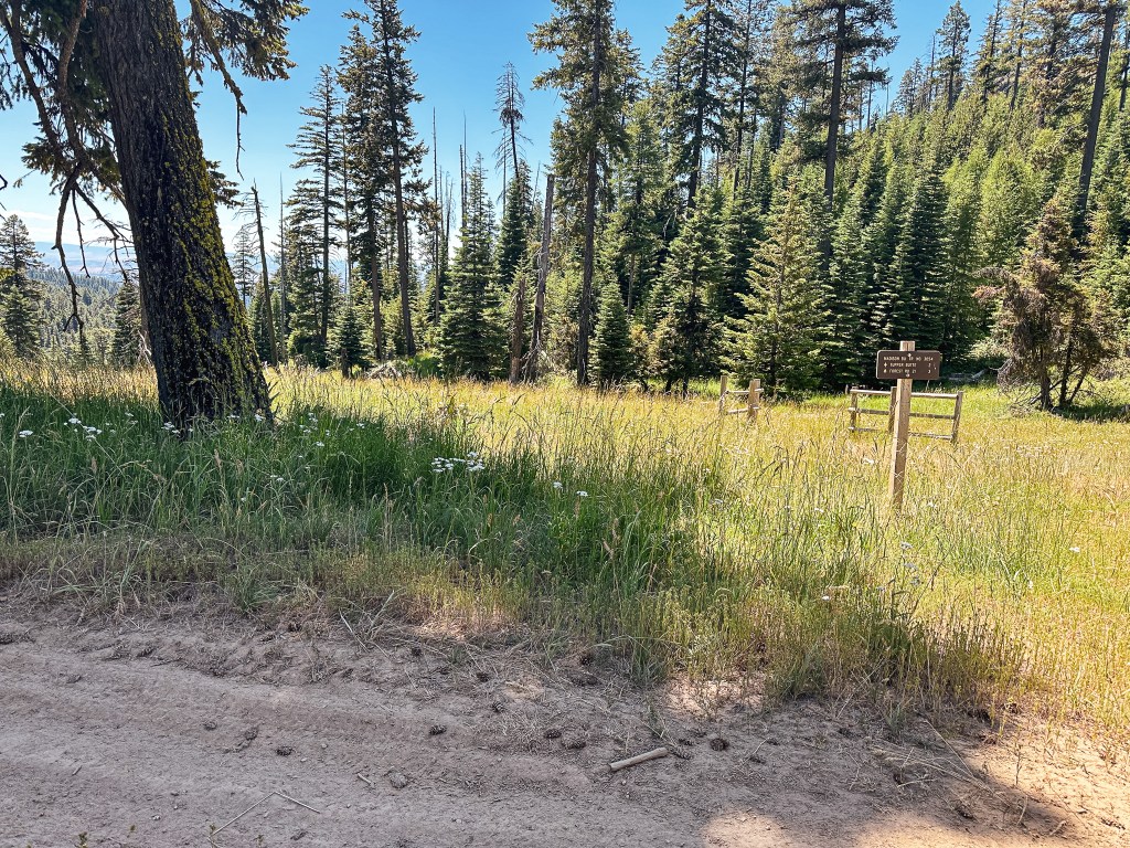
The Madison Butte Trail #3054 starts from a trailhead just off NF-21 adjacent to the Tupper work center. There was a sign at the junction, but it only faced the direction we came in from. This is just something to keep in mind if you are heading in from HWY-207 instead of Ukiah. There’s not much else in the area so it should be fairly easy to find. We parked the car near the gate just before 9:30AM and prepped for our hike. The trail sign looked fairly new and listed Tupper Butte at 1 mile, NF-033 at 3 miles, and Madison Butte at 3-1/2 miles. There was also a warning notice posted to the tree next to the trail sign stating there was fire activity along one of the connecting trails. This was not new and out of date information from a previous fire in the area. We thought it was ironic that even with a work center full of fire crews right across the road no one had removed the warning sign. It just goes to show this is not a frequently visited trail.

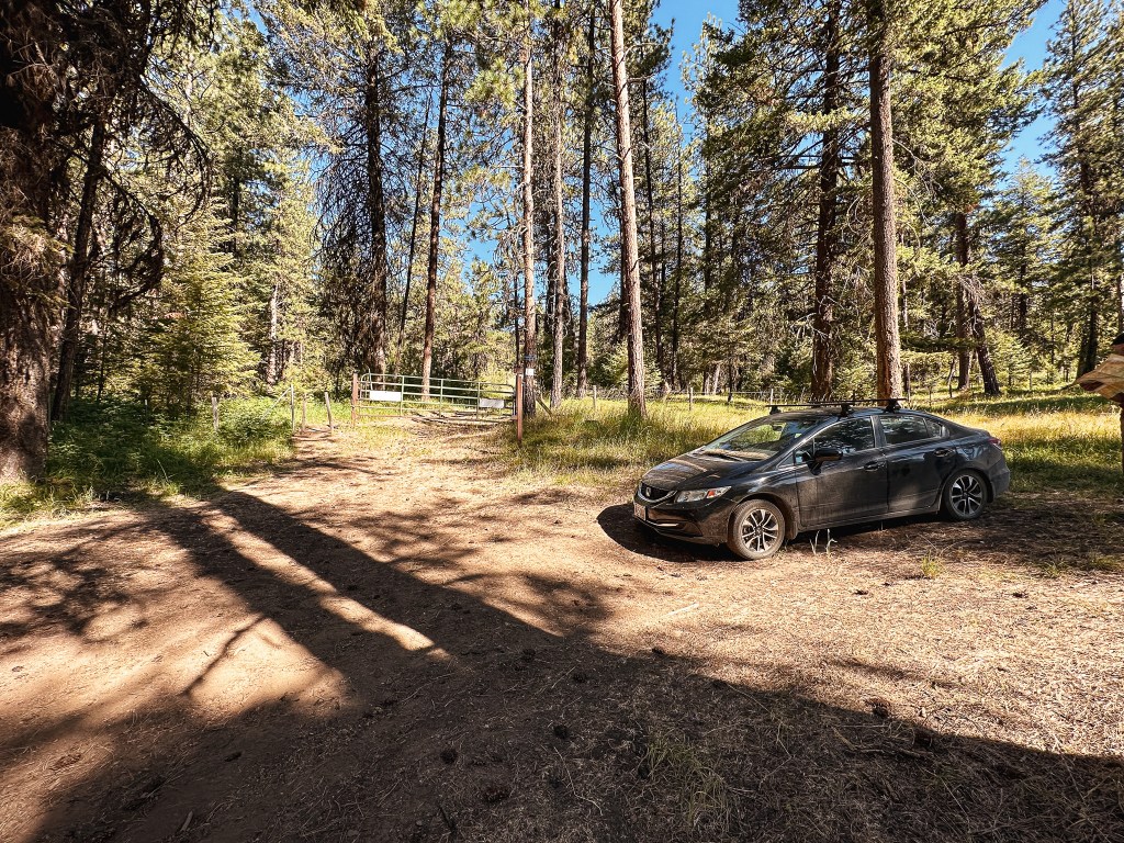

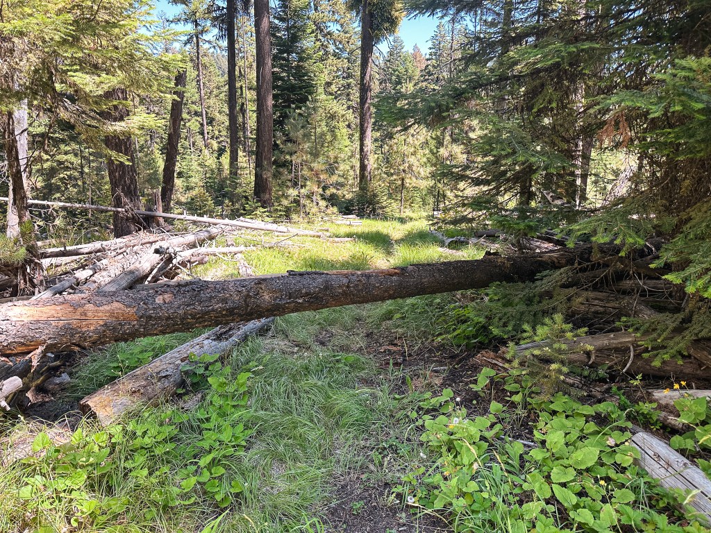
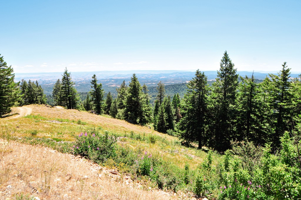
The trail starts from behind the gate. You will need to pass through a cattle fence on the side or squeeze below the gate for access. The trail starts out as an old road bed and wastes no time gaining elevation in the first 1/2 mile. It follows up the side of Tupper Butte gaining around 700′ by the time you reach the junction with the Tupper Butte Trail #3065. The trail to Tupper Butte continues to the left for another 1/2 mile to the summit. This junction was only indicated by a wooden post. We decided against visiting Tupper Butte this time and continued straight to stay on the Madison Butte trail. Once the trail gains the side of Tupper Butte it levels out to enter a dense forest. There is a cattle gate here that you will have to pass through. Make sure to always close any gate behind you after you’ve passed through it. There was a confusing makeshift arrow at the base of the gate pointing to follow the fence line. This could be misleading to hikers who haven’t done prior research. There even appeared to be a trail along the fence line, but it was nothing more than a game trail. The trail started to gradually lose elevation from here until it opened up to an exposed slope where we were greeted with a view out to Madison Butte (and how far we still had to hike). The trail sharply turned down to reach a saddle and lost a lot of the elevation we previously gained. Make sure to pay attention in this section, there was a tricky switch back that appeared to continue straight. From the saddle, the trail turns up again to skirt around another butte before dipping into another saddle. The final climb up to the NF-033 road is more gradual and continuous. Once we reached the piped Bottle Spring, we knew we were almost to the road. The plants around the spring have started to over take the trail and it was hard to see where it continued. I headed up the drainage cross country toward what looked like a fence post (it was definitely man made) and was able to meet up with the last portion of trail. The fence post ended up being the trailhead and I was at the road. Garnet was still cooling off at the spring, but he planned to catch up shortly. I turned right to head the last 1/2 mile up the road to the summit.


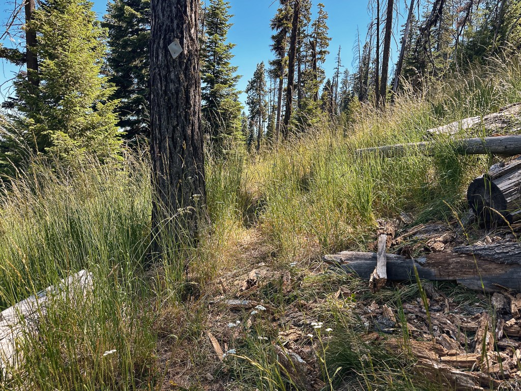

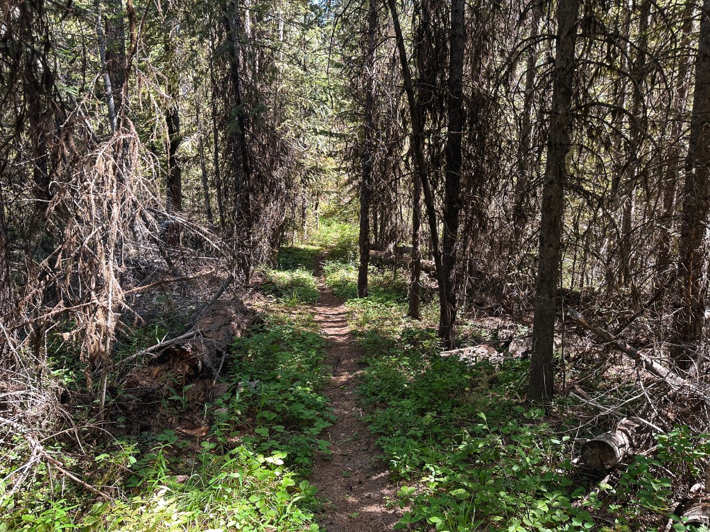
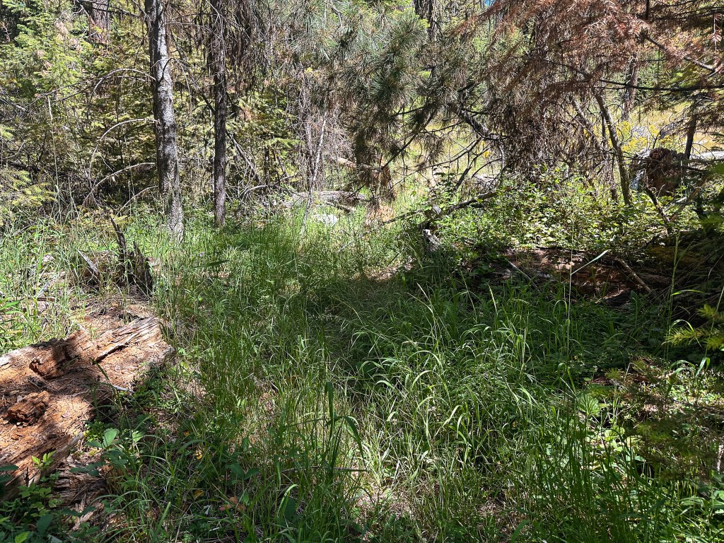


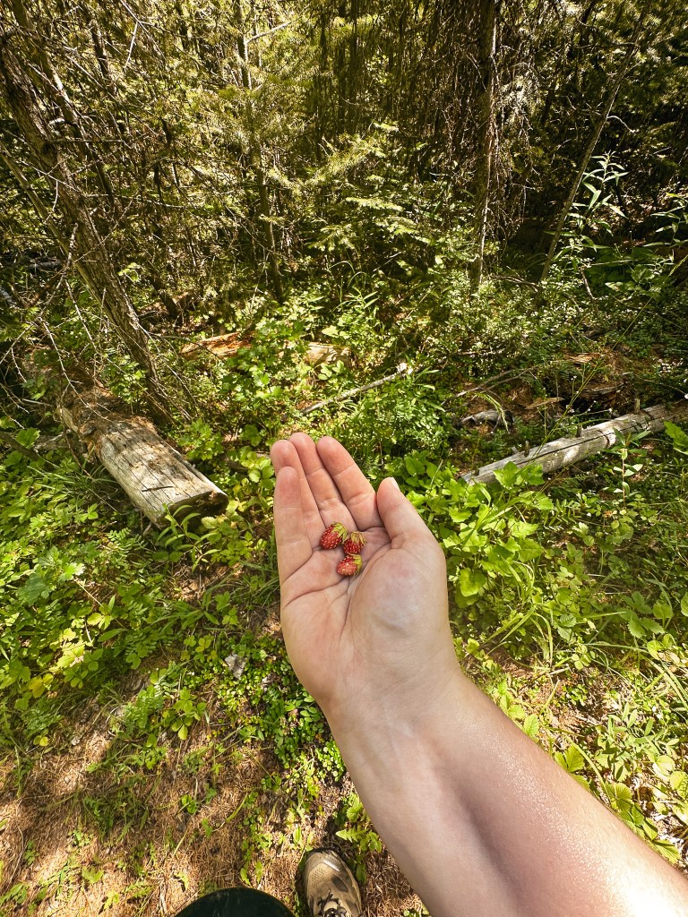
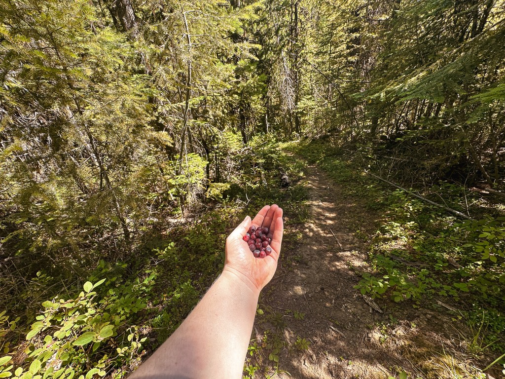
The heat was starting to get to me and I couldn’t seem to keep up on my water intake. The trail had varied between shaded forest and exposed slopes with tall grass. It was faint in some sections with a bit of blow down, but we never had any trouble staying on track. There were white markers in the trees to help. I wouldn’t classify it as a lost trail yet, but it definitely doesn’t see a lot of foot traffic. The tall grass also really aggravated my allergies and had me sniffling the majority of the way. Despite the ups and downs, the grass allergies, and the heat we were constantly rewarded with huckleberries and wild strawberries along the way. This helped to keep us motivated. On a small section of road just below the lookout there were tons of butterflies enjoying the flowers. I had never seen so many in an area all at once. This trail had a lot of fun surprises that I didn’t expect.


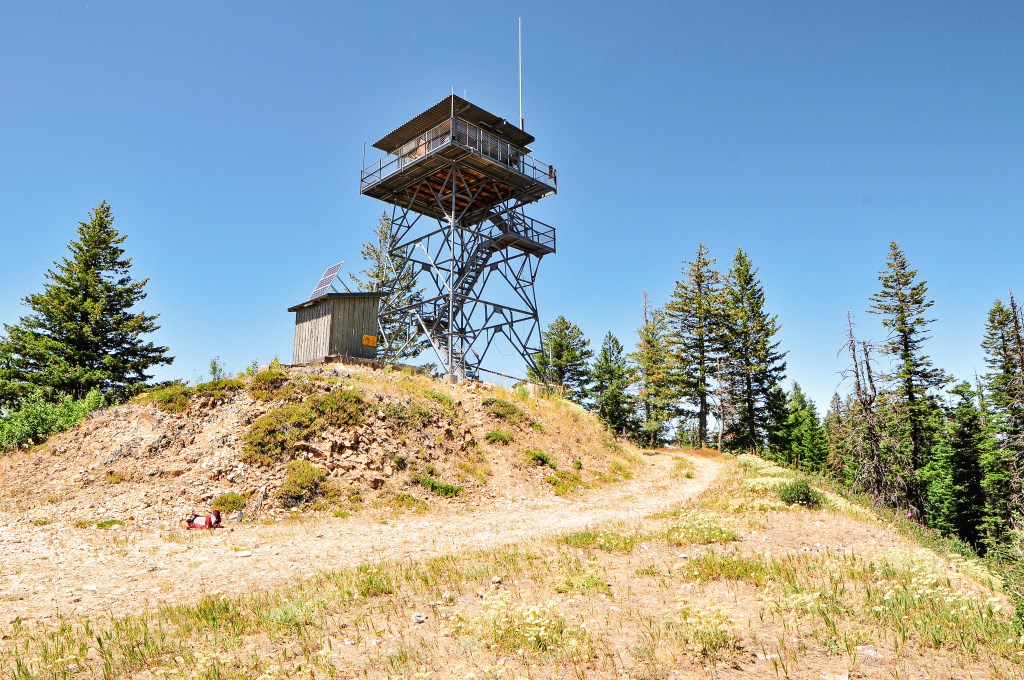
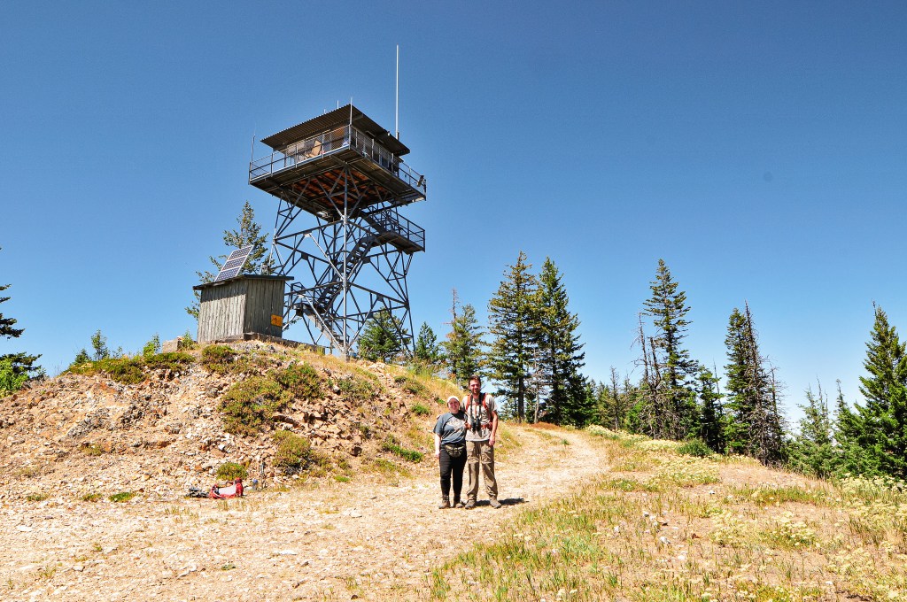
We were greeted by the lookout attendant, Chuck, shortly after approaching the base of the fire lookout. His dog seemed protective of the space so we didn’t get too close, but we did have a nice conversation from the road. He had been at the base of the tower grabbing some more water to haul up when we arrived. He asked if we came up the road or the trail. We said the trail to which he confirmed we missed the “fun” road conditions below. We talked for a while about his experiences as a lookout and our trip as well. When I introduced myself, he mentioned the lookout attendant on Aldrich Mountain (post) was also named Danielle. She had staffed Tamarack Mountain (post) the year prior, but it was now staffed by her friend Sarah. He also seemed passionate about the cryptocurrency market. I’ve never dabbled myself because, just like the stock market, it requires a lot of time and effort to be successful in knowing the trends. It all feels like made up monopoly money to me anyway (no offense to the finance bros!). He asked me about my camera and tripod, which made me realize I actually know very little about it. I had more interest and momentum in learning the dynamics of it when I first started, but have become more of a point and shoot photographer along the way. My Nikon doesn’t work as an auto adjust point and shoot since I have an off brand lens. But, I don’t fuss with it beyond the ISO, shutter speed, and aperture. My tripod on the other hand is a low grade Manfrotto, which is a brand that came recommended by a photographer I knew. It’s sturdy but definitely not as robust as some. I couldn’t justify spending more as an amateur though. He told me about his camera and that he found a nice tripod package on sale at Walmart for around $30. It came with a few attachments for his camera and even his phone. I told him that seemed like a nice deal since I spent closer to $80 on mine and it didn’t come with any of those fun attachments. I also mentioned how it would be nice to have an attachment for my phone when I don’t need or want to use my camera. He quickly offered me one of his since he ended up getting two of the tripod packs, but had no use for two phone attachments. I insisted he didn’t have to do that, but before I knew it he had climbed his tower and came back with the attachment still in the package. I accepted his gift and thanked him profusely for the kindness. It has already come in handy a few times and I will forever remember that it came from the lookout on Madison Butte.


We didn’t get invited up to check out the view from the cab, but it is their home for the summer and should always be respected. We said our goodbyes after taking a few more pictures and headed down the road to have lunch on the slope below with a view. I think the dry conditions along with the grass allergies really irritated my nose because while we were enjoying lunch it started bleeding for no apparent reason. It was an inconvenient place for a bloody nose. The quick loss of blood made me a bit light headed as well which wasn’t a great way to start our hike back. I had already drank my 32oz Nalgene full of water and was half way through my 32oz Nalgene of electrolytes. Garnet had already drank a lot of his 64 ounces of water as well. Typically, this would be enough water to get us back since we are usually hiking down hill on the return. But, something to keep in mind about this trail is the return trip takes just as much energy as the hike there. We tried to keep ourselves cool by soaking our shirts and hats in the Bottle Spring. We took more breaks on the return and kept our energy up with huckleberries. By the time we reached the final mile, both of us had diminished our water supply. We were both feeling the effects of dehydration. At least we knew there would be water waiting for us back at the car and we were close. This hike made me realize I really need to start packing my water filter on day hikes. If I had it with me, we could have easily replenished water at the Bottle Spring and would have been in much better shape on our return. I was even tempted to risk drinking the unfiltered water directly from the spring, but Garnet had advised against this. We made it back in one piece and chugged as much water as we could safely handle. My Strava App calculated this hike at 8.44 miles with 2,638′ of elevation gain. This made us extra thankful that we didn’t have to move camps until the morning.


Lookout Chuck.
Chuck has been the lookout on Madison Butte for 10 seasons, but has also worked on Lookout Mountain and Goat Peak in Washington. He is accompanied by his most recent rescue dog, Oliver. He lives in Northern Washington in his off seasons. He used to do work as a wildland fire fighter prior to becoming a fire lookout. This has allowed him to extend his seasons by assisting with slash pile burning in the shoulder seasons. His hobbies include photography and cryptocurrency. His favorite things to photographs are the thunderstorms that roll through the area.
History.
It’s possible the site of Madison Butte has been used for fire detection as early as 1909. Some old withdrawal records listed on Ron Kemnow’s site makes mention of plans to build a small cabin for men on lookout at this station once funds are available. It is unclear if that ever happened. A new telephone line was constructed to the summit in 1922 and by 1923 a D-6 Cupola ground cabin had been built to house the lookout. It was replaced in 1957 by a 37′ steel tower with CL-100 cab. We’ve realized the majority of CL-100’s in Oregon were built during that year. It is still actively staffed every season.
More Information.

3 thoughts on “Madison Butte L.O.”