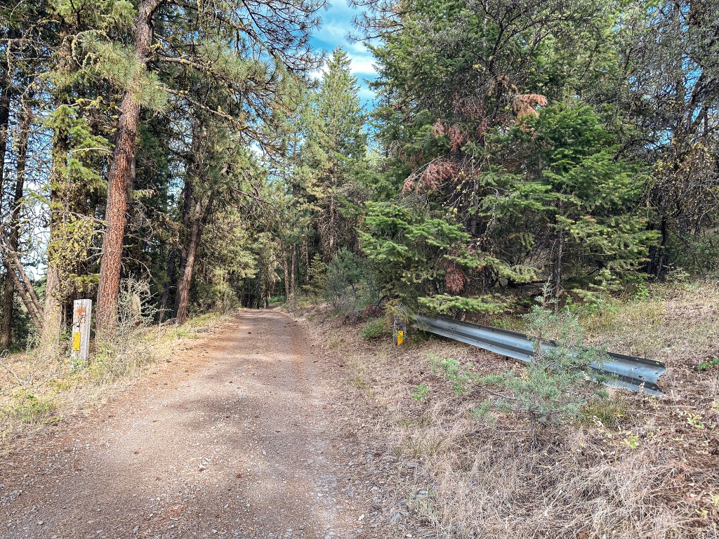
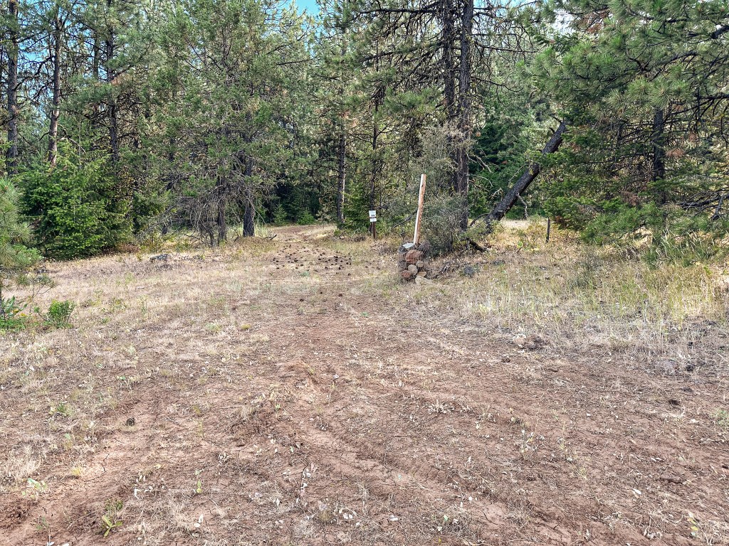
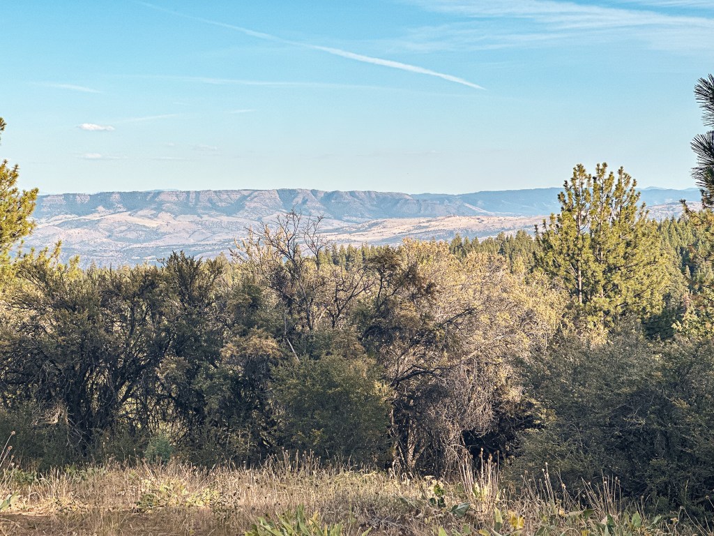
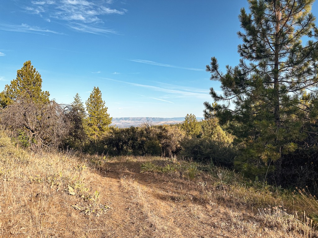
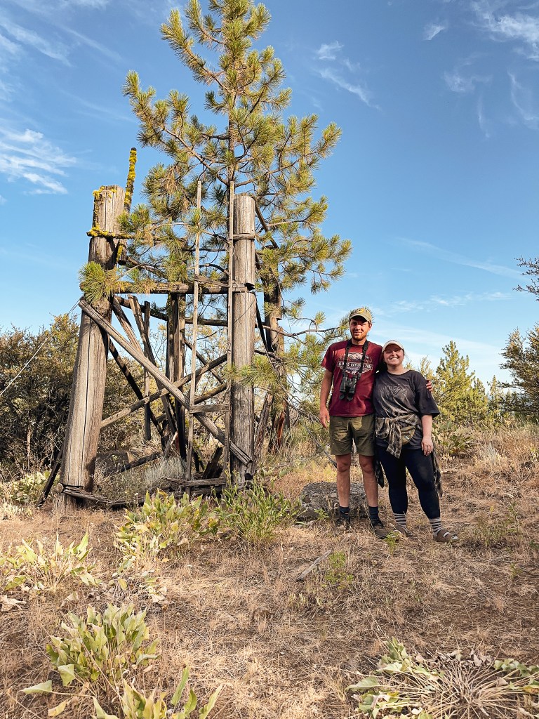
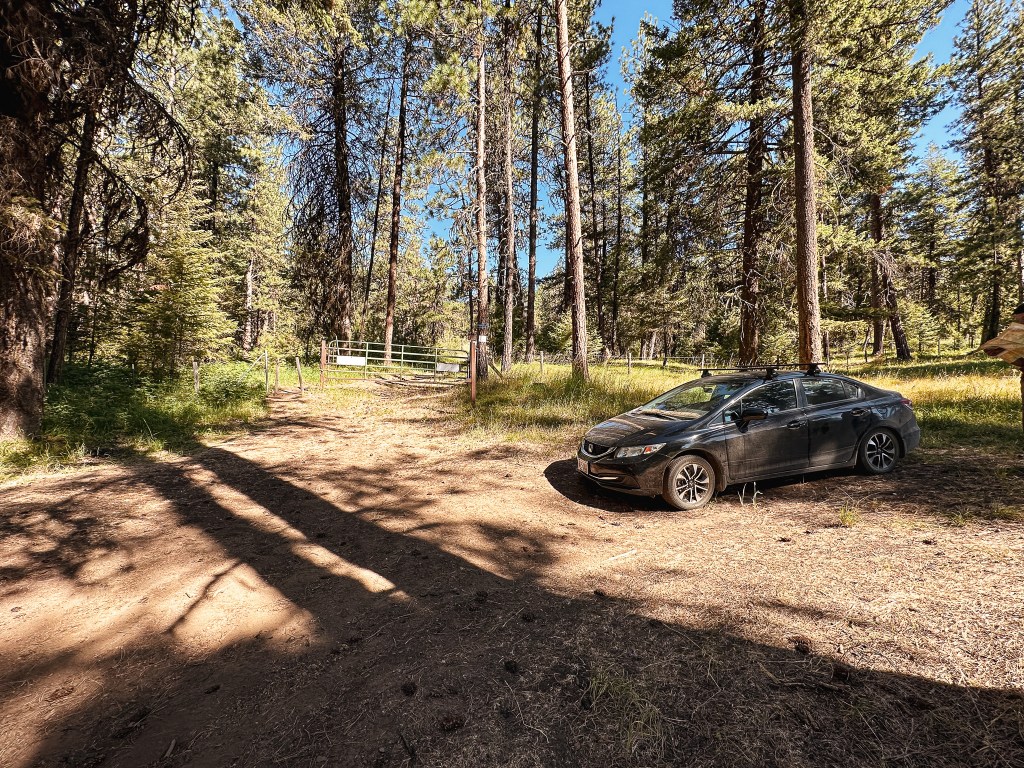
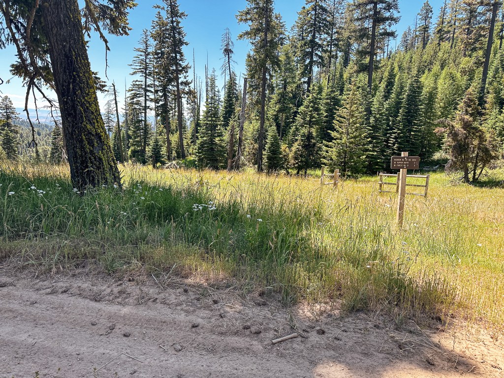
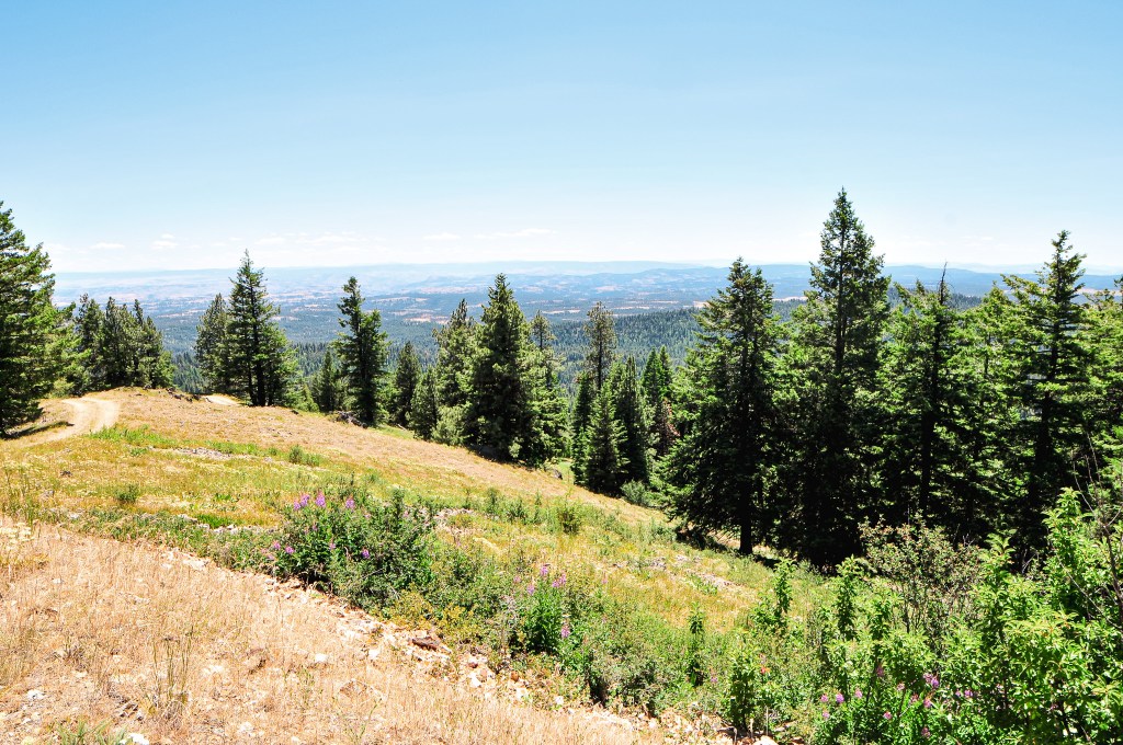
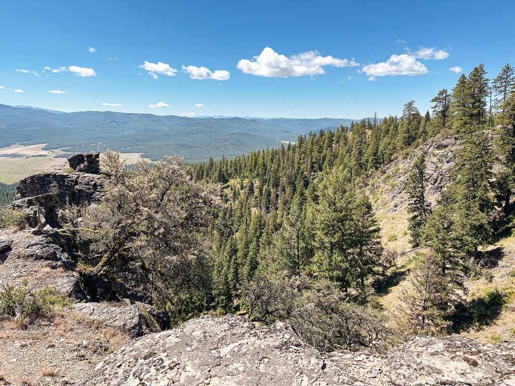
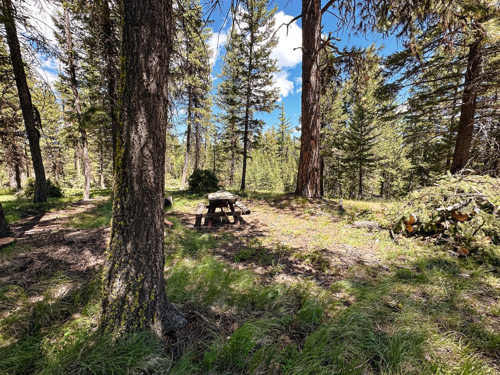
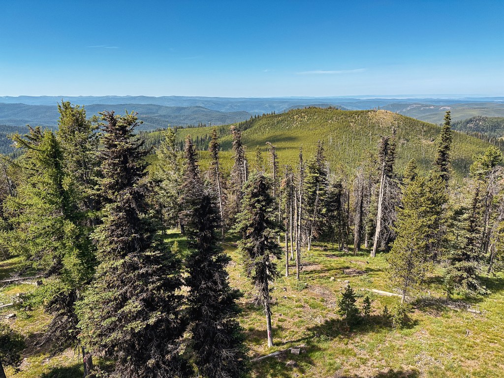
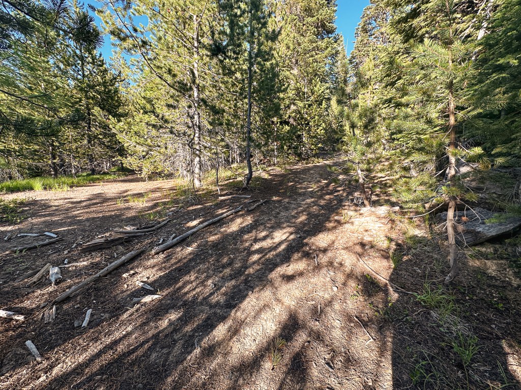
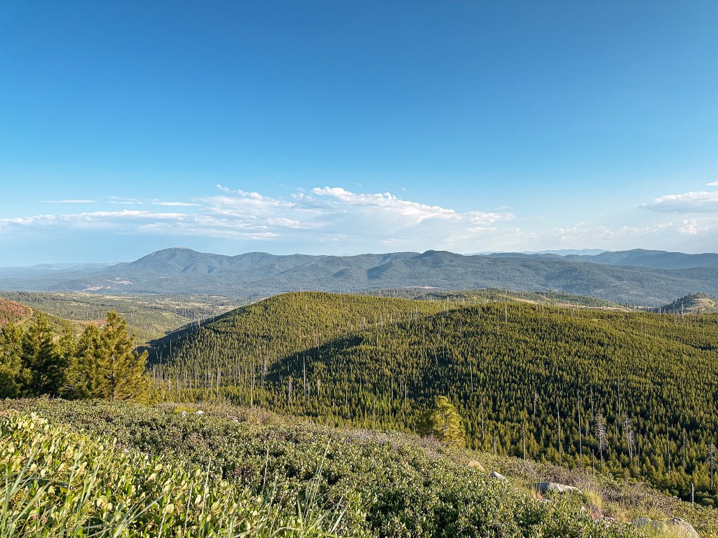
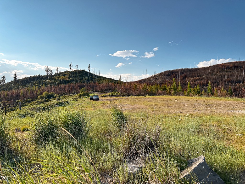
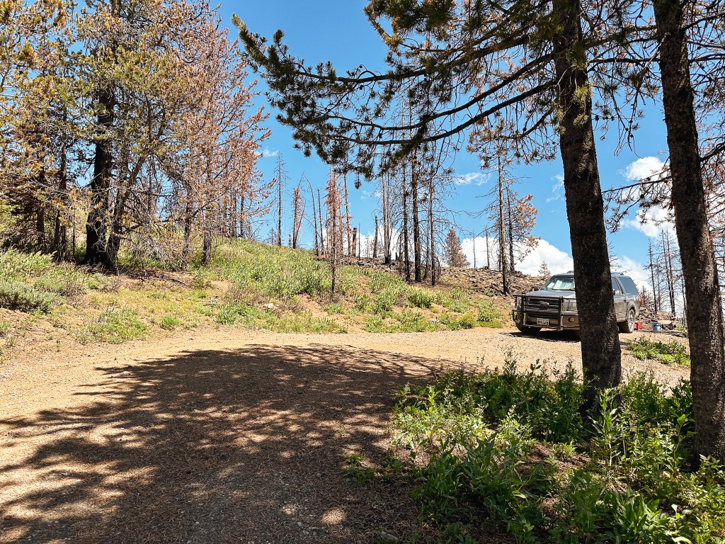
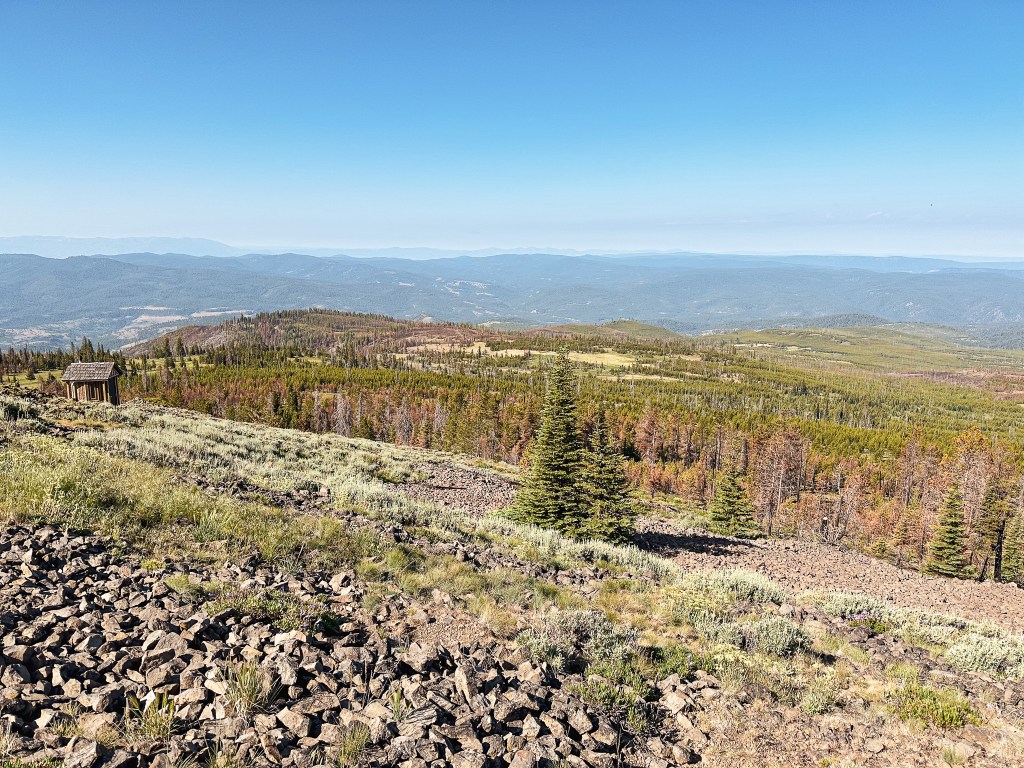
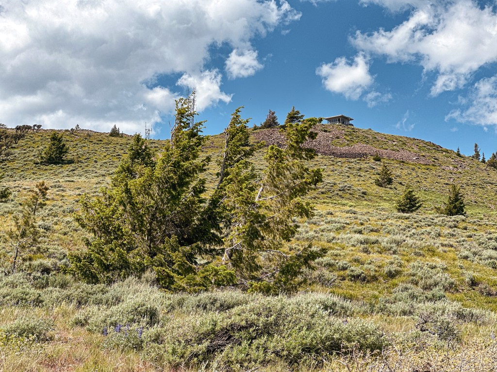
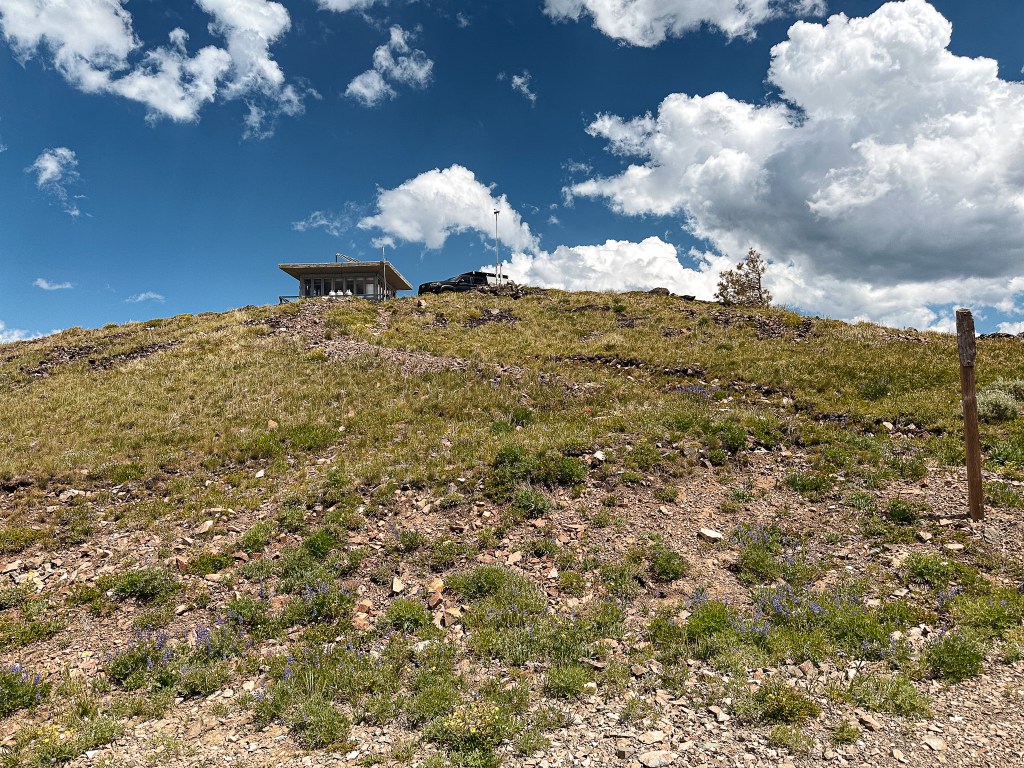
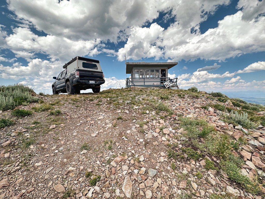
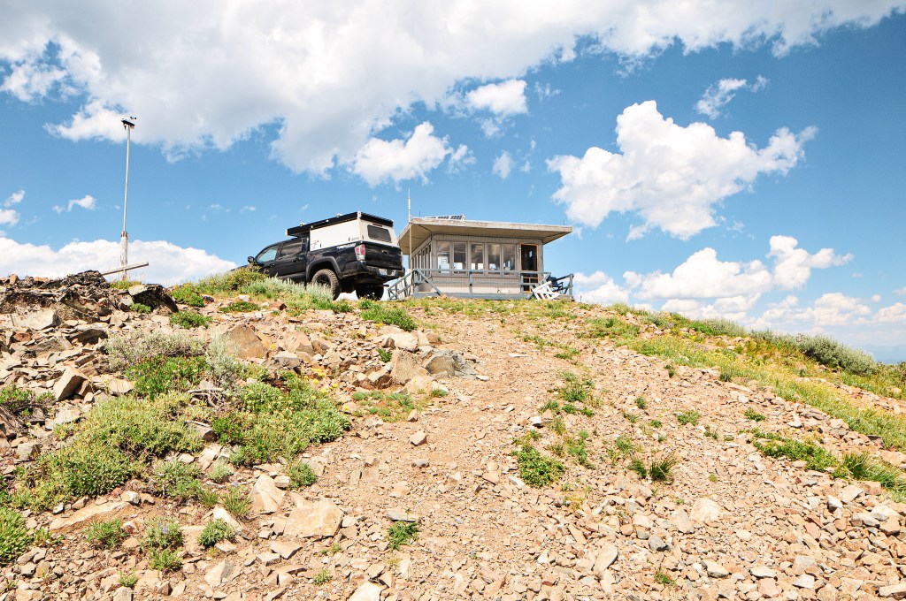
We headed back to NF-24 from Tamarack Mountain (post) and turned right to continue through the forest. We stayed on NF-24 until we reached NF-180 off to the right. We decided to park here to wait out the heat of the day. Ant Hill was only a little bit farther up the road, but it was so hot that the air was thick with heat even in the shade. We ate lunch and killed time by napping in our camp chairs or reading until we could feel the day starting to cool down. We walked the remaining distance up NF-180 to the junction with the decommissioned road NF-182. You could easily drive to this junction as well, the road is in decent condition. There is no sign at the NF-182 junction to indicate the turn besides a “closed to all motorized equipment” sign and a post with rocks. It’ll be off to the right once the road starts to curve and opens up to a view. The NF-182 road is closed to motorized traffic and you will need to walk from here. Though there is no gate or berm to stop someone from driving up. We could see tire tracks leading up the road despite the sign. Obviously, don’t be those people. No one likes those kinds of people. The NF-182 road will wind you around until you reach the summit of Ant Hill. There are no views from the summit except for just below it on the road. From where we parked our car at the junction with NF-180 and NF-24, the Strava app calculated the road walk at 1.30 miles RT with 136′ elevation gain.
Day 9/9: We drove home without incident. This trip might not have gone as smoothly as we initially hoped, but we still successfully made it to all our destinations with only a few additional scrapes added to the car. Somewhere along the way I visited my 100th fire lookout as well. I can’t say for sure which one it was since it’s dependent on your definition of an official fire lookout. One could make arguments for or against some of the ones I have listed and for that reason I am not going to claim one specific lookout as my official 100th visited. We can celebrate once I reach my 100th visited in Oregon, but even that might come with a few asterisks in place.
History.
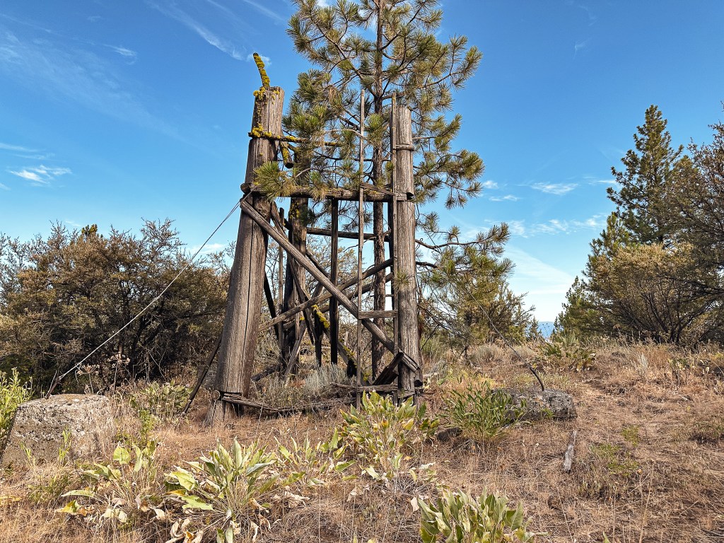
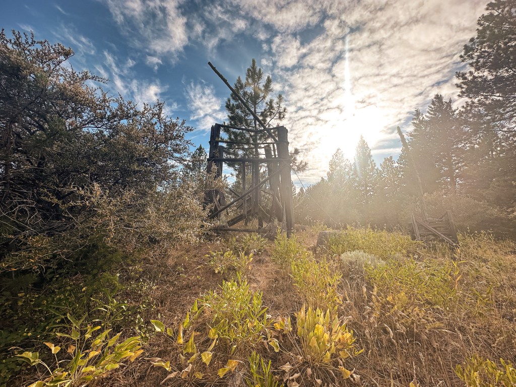
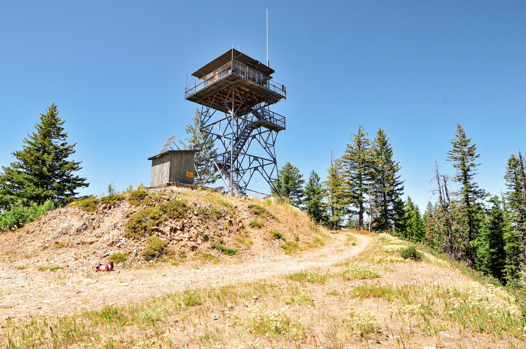
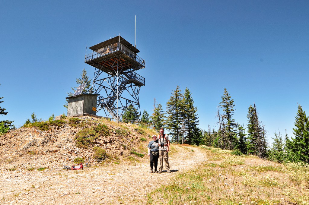
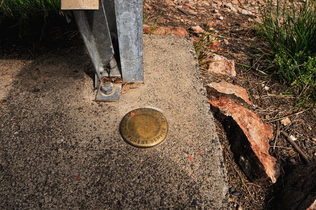
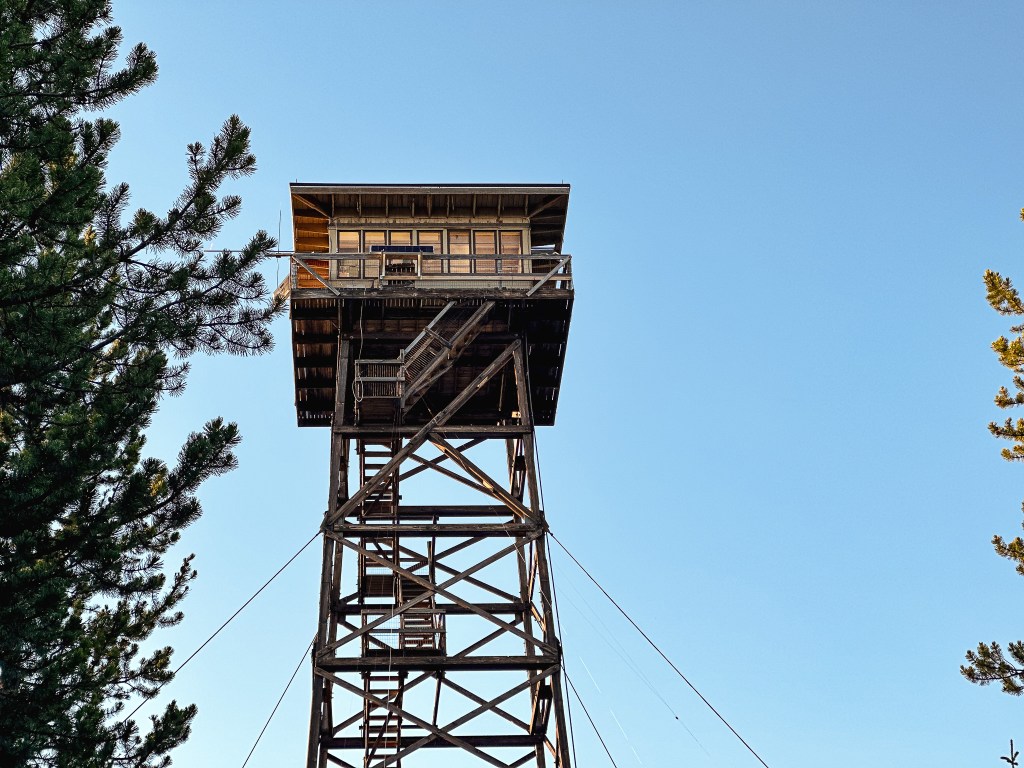
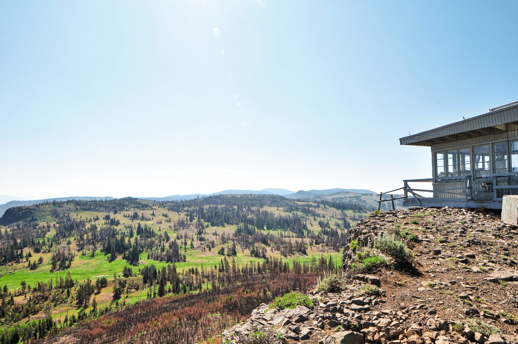
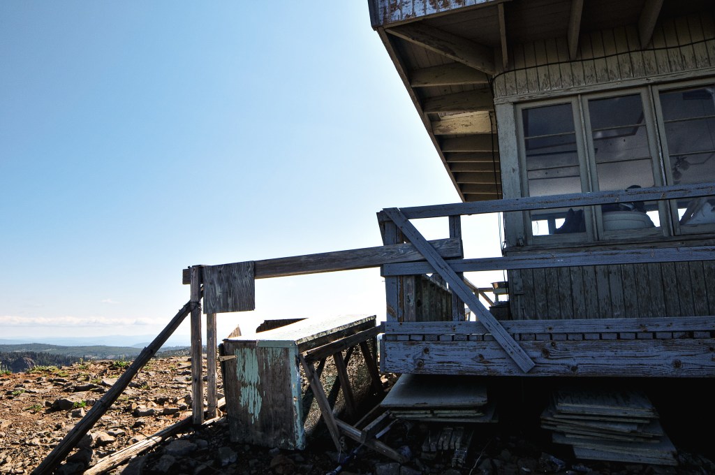
The first lookout structure was built on the summit in 1935. It was a pole timber tower between 16′ to 24′ with an L-4 cab. I’m unsure of the exact height. It is listed on the Former Fire Lookout Site register due to the tower being dismantled and removed in 1956. I personally would consider this an existing lookout site due to the 10′ open platform tower that still stands today. There is no information on when this structure was built or if it was utilized for fire detection. The only mention of it I could find was on the geocache site. It states this structure was built from recycled material of the previous lookout. It reminds me of the lookout structures utilized on Green Butte (post) and Craft Point (post).
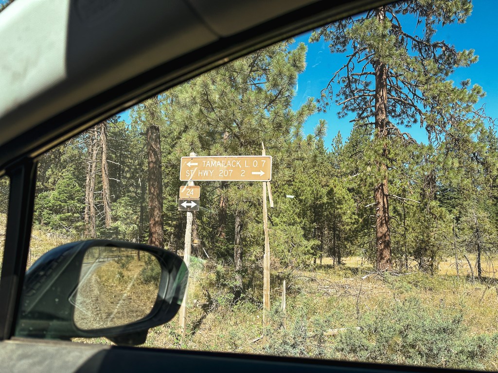
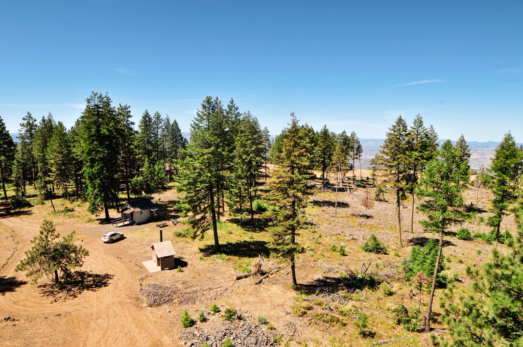
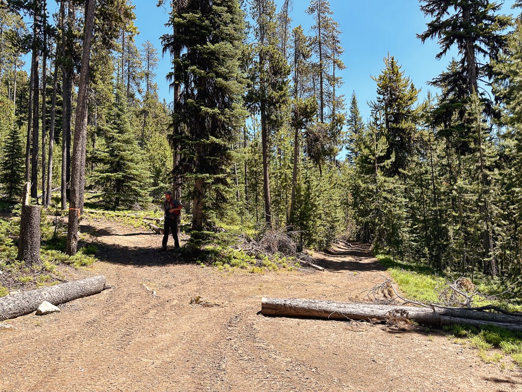
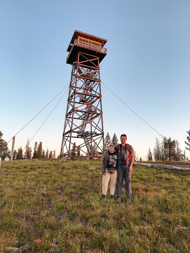
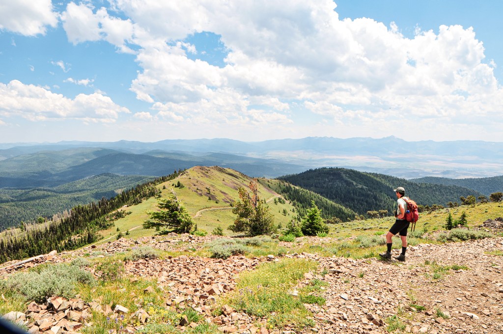
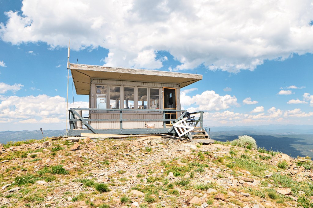
We leisurely packed up our camp to move towards Tamarack and Ant Hill (post) for the day. We didn’t have to drive very far from where we were currently situated. Garnet had previously been to that area of the Umatilla NF during the 2017 solar eclipse and already had an idea of where we could camp. We followed NF-21 out of the forest until it turned into CR-847. This took us all the way out to HWY-207 where we turned left to head south. We didn’t have to stay on HWY-207 for very long before we took another left onto NF-24. There was a sign for Tamarack L.O. at the junction that stated it was only 9 miles away. This area seemed to be well signed and the road was made up of good gravel. We stayed on NF-24 until we reached another signed junction with NF-2407. This stated we only had 3 miles left to go to Tamarack L.O. as we turned right. Prior trip reports and some helpful information from other lookout enthusiasts we met told us the road would be good most of the way. After 2 miles the road turns into NF-040 and becomes rockier. We started up this section before deciding to abort and walk the remaining distance. Unfortunately, I was already in the rockiest section and the heat shield once again caught on something as I was backing down to the saddle. It was already hanging lower than normal from our mishap at the Mt. Ireland trailhead (post). Garnet had spent some time bending it back as best as he could for not having much more than some basic tools with us. This basically undid all the work he had done. It was even worse than before but we wouldn’t be able to touch it until it cooled down. I was annoyed at myself for not being more cautious and I was annoyed at the heat shield for causing more problems. We parked in the saddle between Tamarack and Little Tamarack to start our hike up the road. The last mile isn’t terrible, but it would have required some caution in a lower clearance vehicle.
Sign at junction along NF-24
Sign at NF-2407 junction
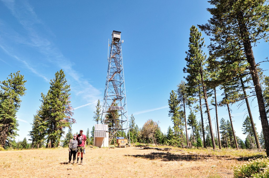
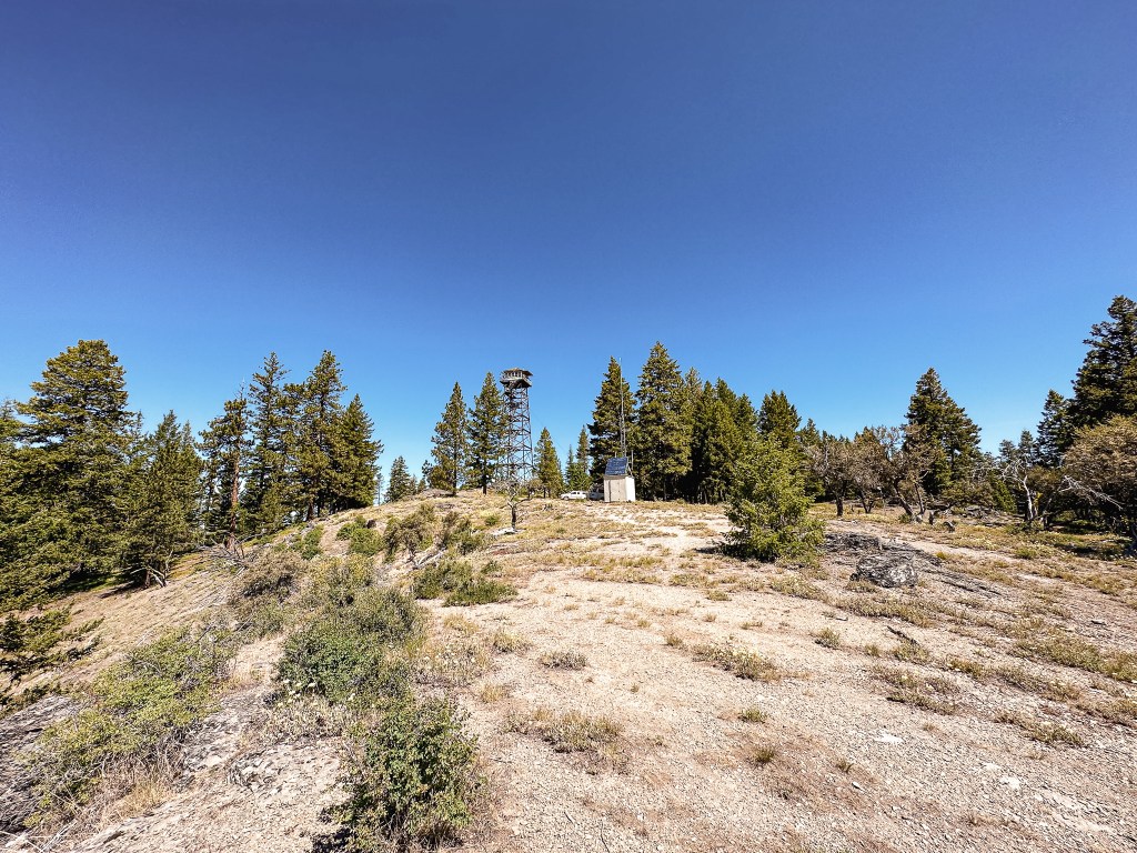
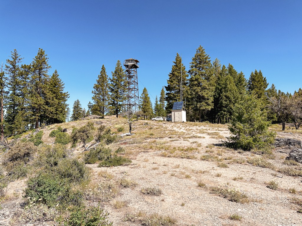
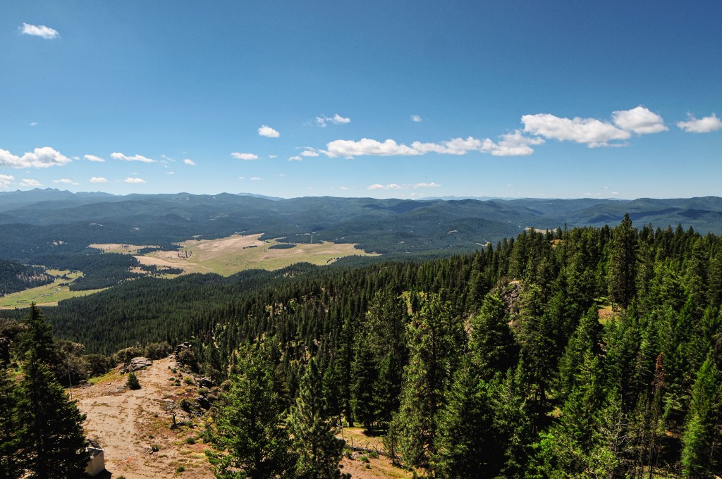
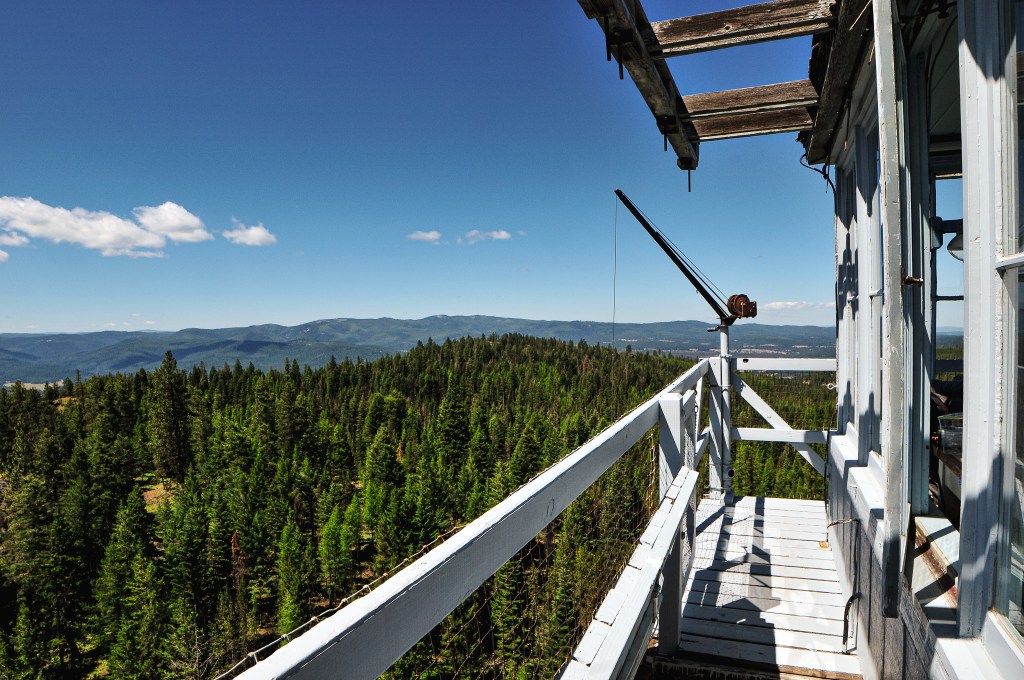
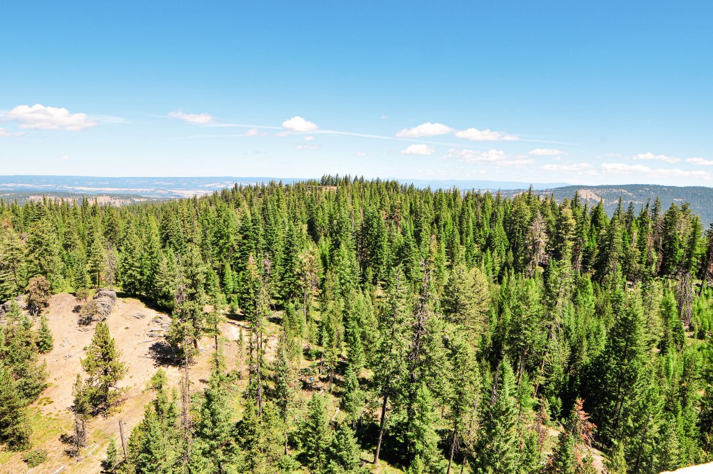
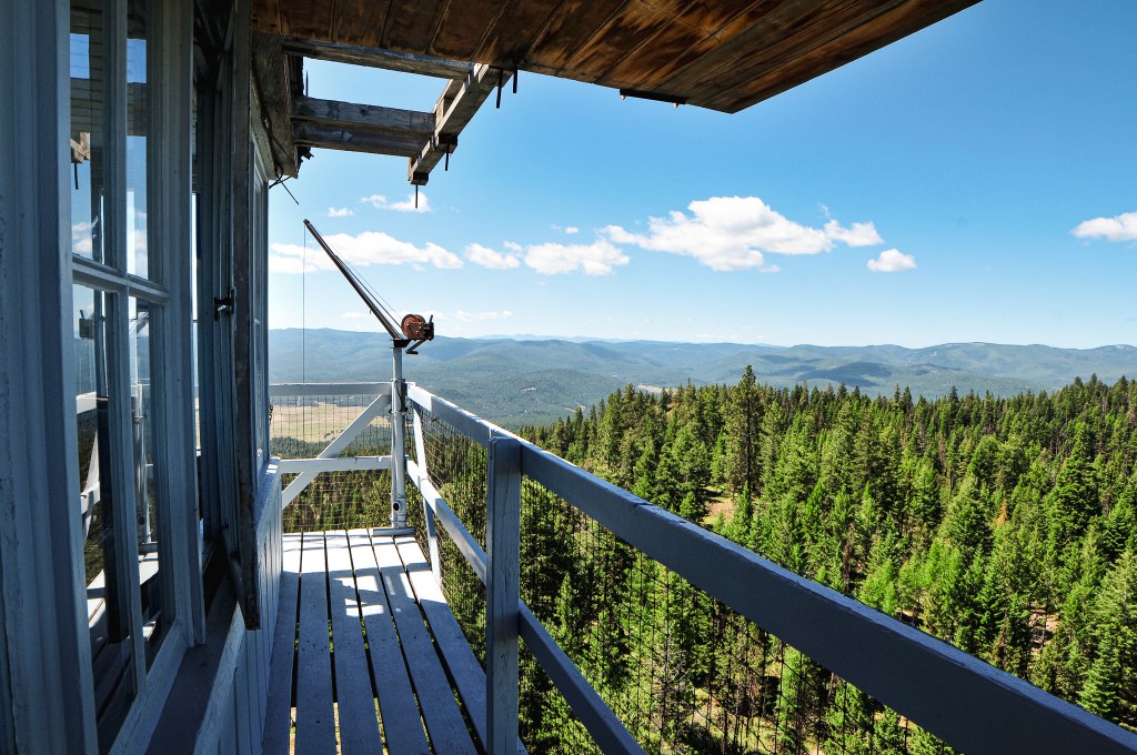
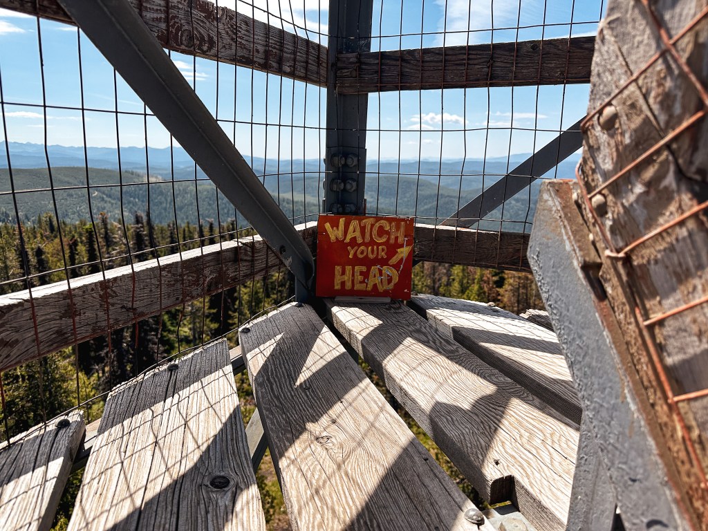
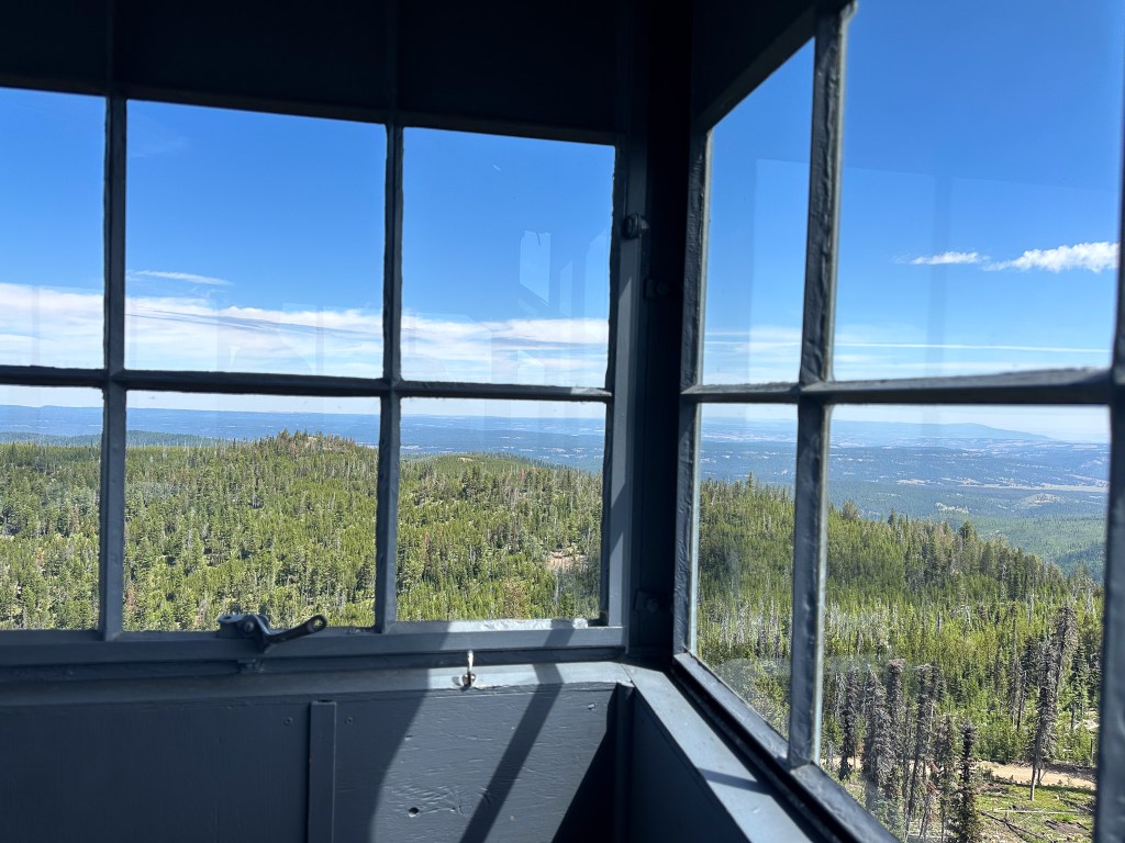
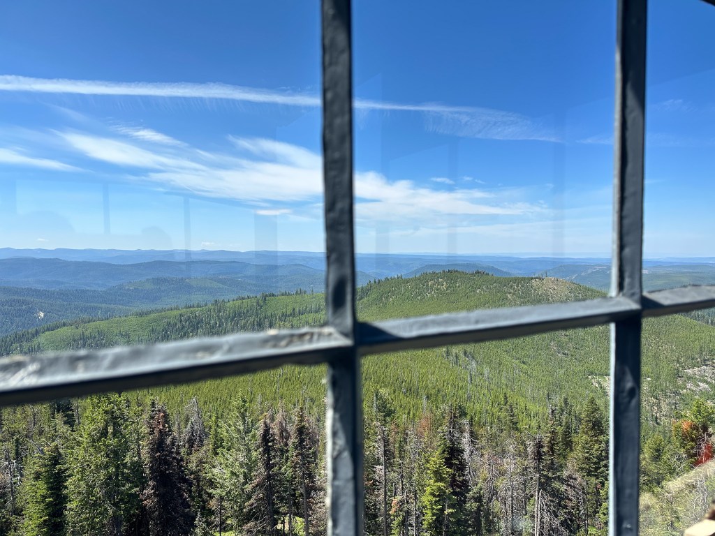
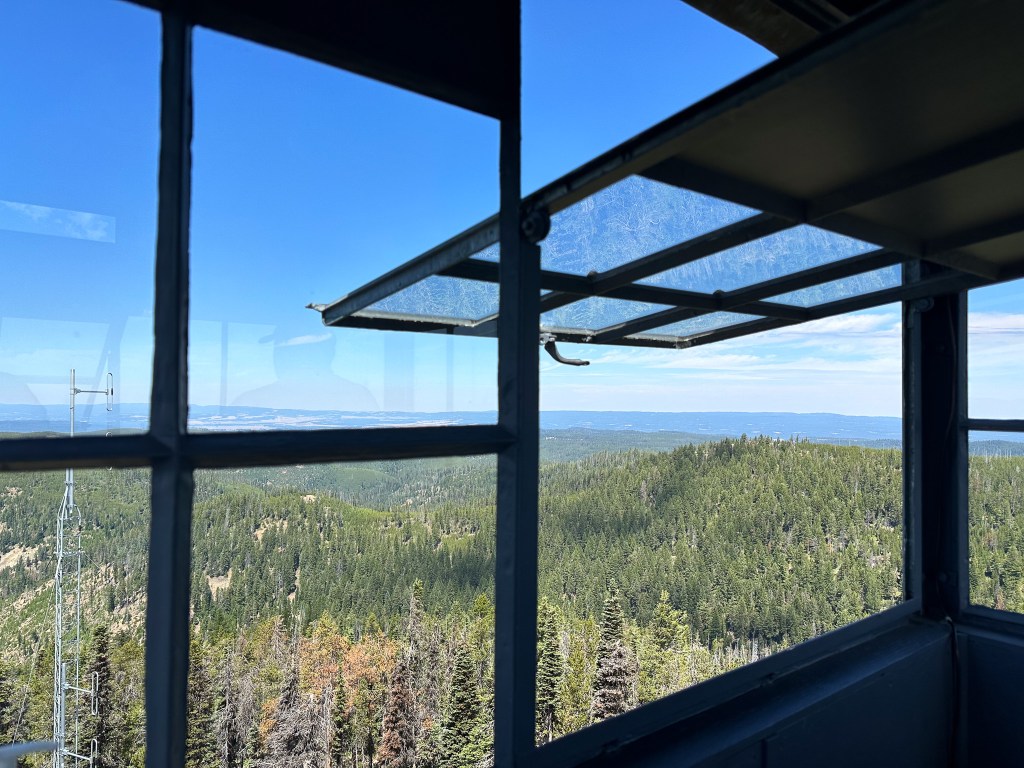
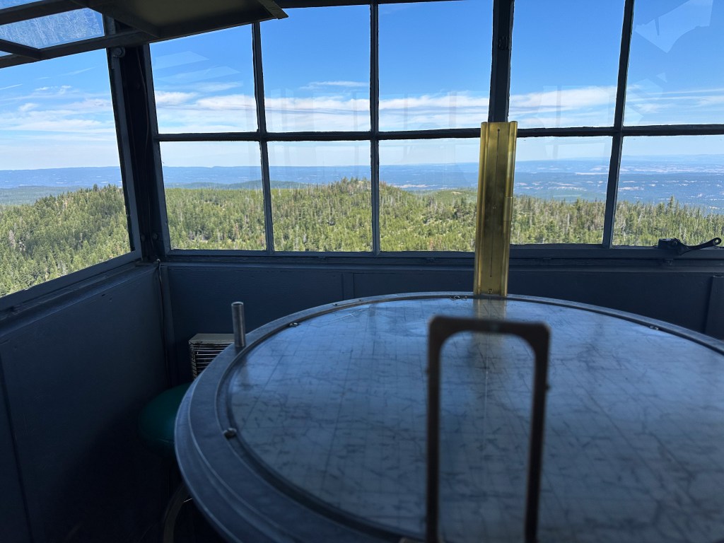
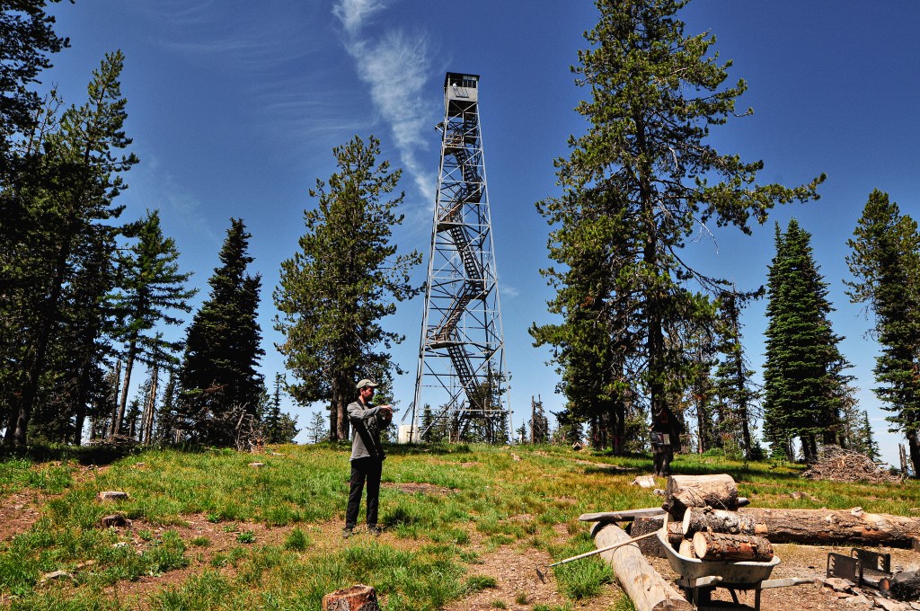
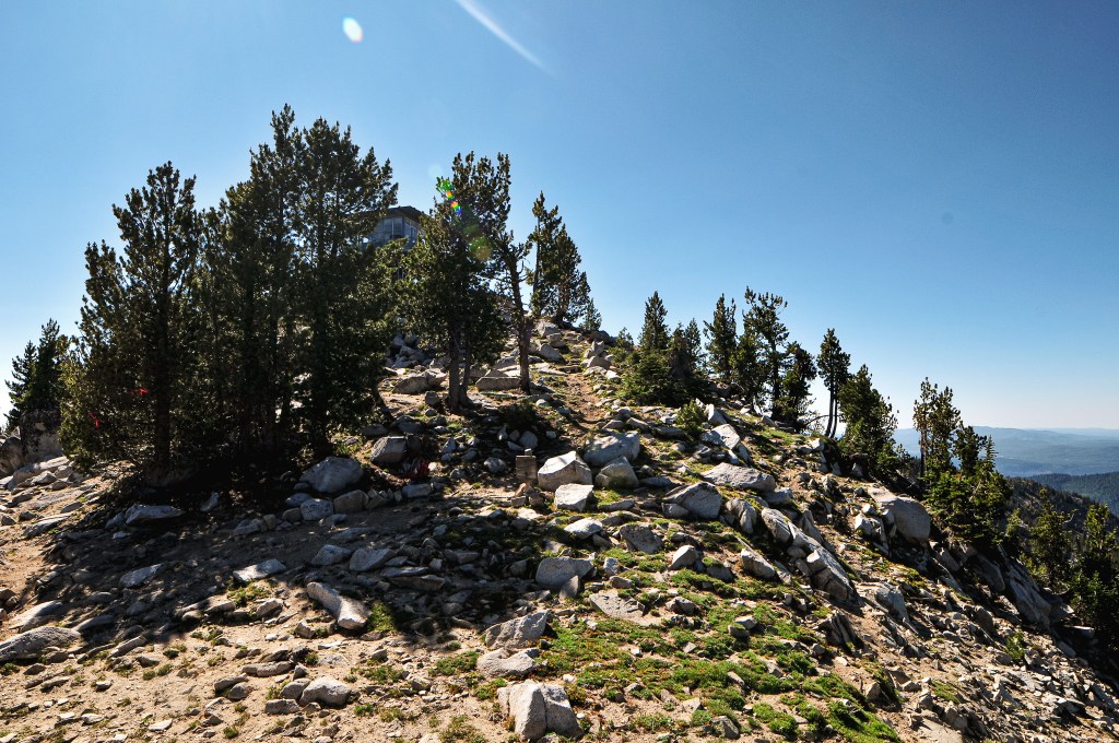
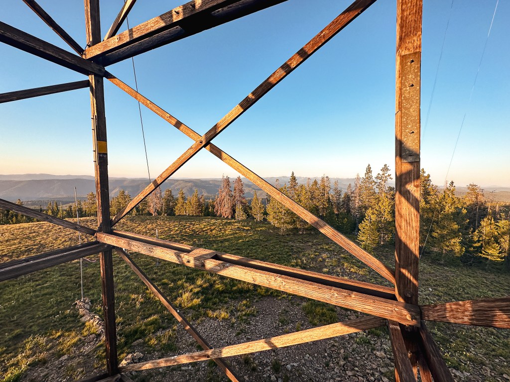
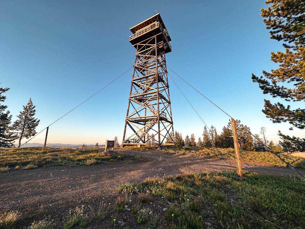
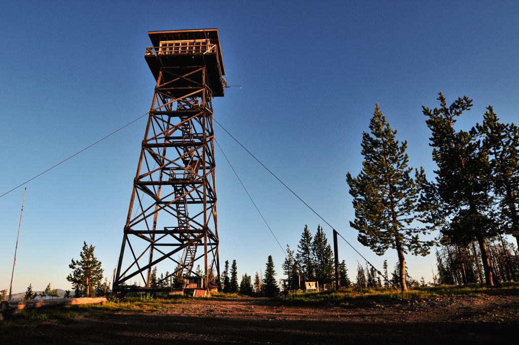
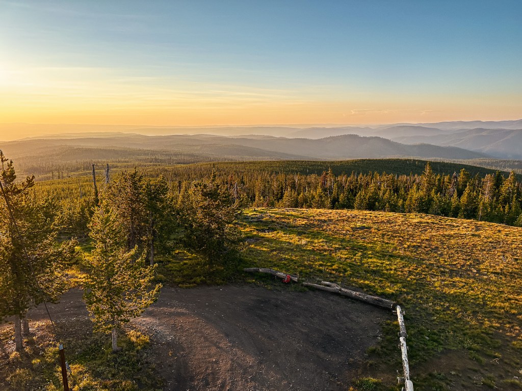
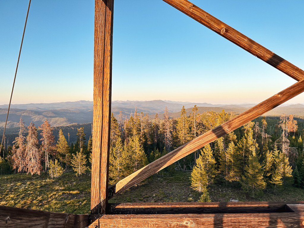
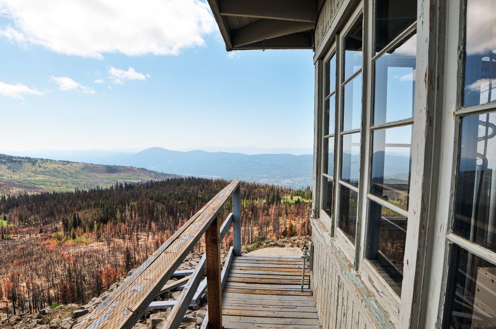
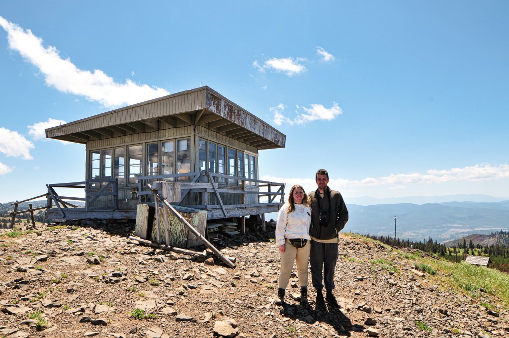
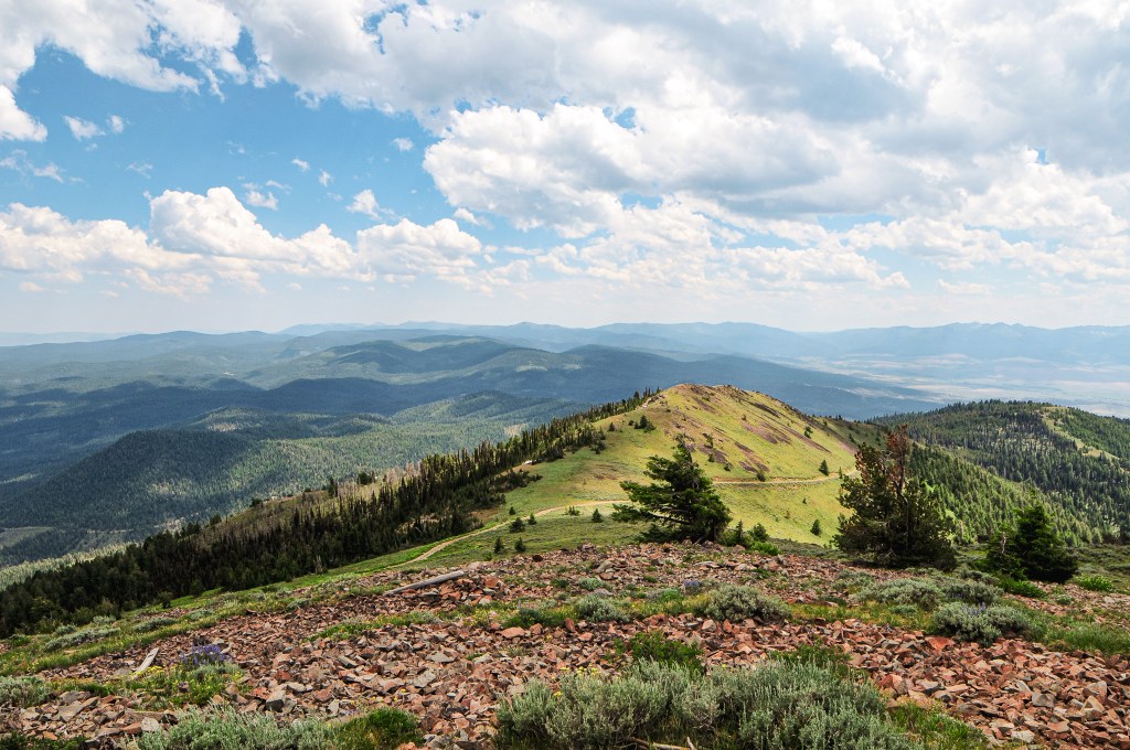
It didn’t take us long to reach the summit. It was only a 0.8 mile hike (1.66 RT) with 304′ of elevation gain from where we parked. The lookout tower on Tamarack is a tall Aermotor with a cabin at the base. It’s unique in that the cabin is rented out for recreational use, while the tower is still staffed every season. This leaves the lookout attendant to provide their own means of housing. A bit backwards and greedy in my opinion. We learned from Chuck on Madison Butte (post) that this was due to it being managed by two separate agencies. The Forest Service no longer wanted to staff the fire lookout and moved it to the rental program to make some profit. The state felt it was a crucial lookout to keep staffed and started staffing it themselves. The Forest Service let the state use the tower, but decided to keep the cabin for rentals. It’s not surprising that two government agencies wouldn’t agree on something, but it is unfortunate to those staffing the lookout. I would also feel terrible as a renter at this location. I’m sure most are unaware of the situation or at least I hope that is the case. There were renters onsite during our visit, but the lookout attendant was gone for the day. We knew their name was Sarah from our conversation with Chuck. We were bummed we didn’t get to meet them, but I left a note in their visitor log. I was able to connect with them later via Instagram.
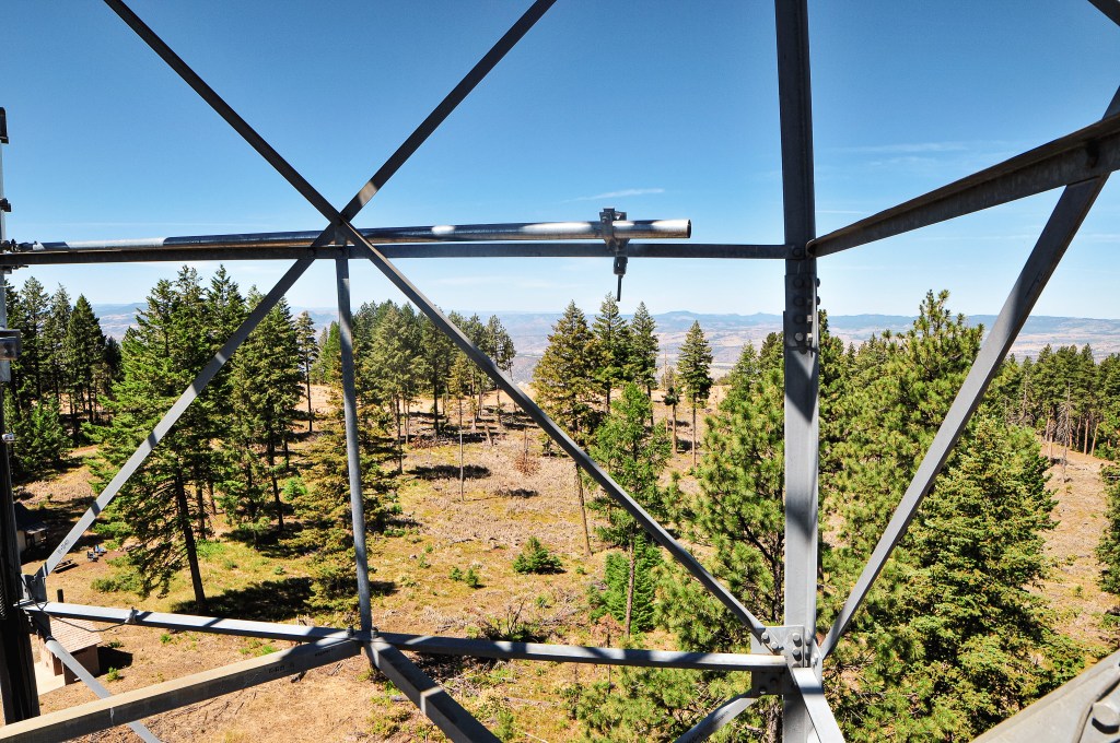
We climbed the tower to get a better view since there was not much to see from the base and no one was onsite to disturb. Garnet climbed all the way to the last landing while I stopped around the 5th landing. There was a custom camper, hammock, and veggie garden at the base of the tower as well. It looked like a nice set up despite the circumstances. We had never seen a lookout trying to grow fresh veggies before and I thought it was a neat touch. After taking in the view, we headed back to the car to deal with the heat shield. Garnet was able to bend it back to a better position, but we would have to address it again once we were back home. Driving a Civic through the forest always keeps things interesting. Our next stop for the day would be Ant Hill (post).
History.
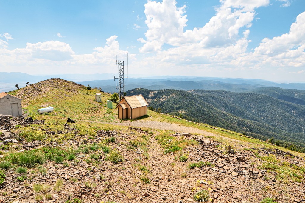
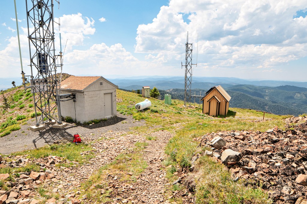
Tamarack Mountain is named after the Western Larch, a tree that frequently grows under the drier conditions of the Blue and Wallowa Mountain ranges. I guess Tamarack is another common name used for larch trees of all varieties. The site was first established for fire detection with a crows nest platform on top of a tree. Most resources, including the Forest Service website, state this platform was built in 1925. But, Ron Kemnow’s collection of articles from withdrawal records, Morning Oregonian, Heppner Harold, and Heppner Gazette Times shows the site could have been used as early as 1908. In 1933, a 96′ steel Aermotor tower was built with a cabin for living quarters. The cabin accidentally burned down in 1966, but the original tower still stands today. Instead of rebuilding the cabin, the garage/utility shed was converted for the living quarters. It’s unclear when the Forest Service decided to stop staffing the fire lookout and add it to the rental program. The cabin is rentable to the public from May 15th to November 23rd. The lookout is currently actively staffed by the Oregon Department of Forestry every season, but I am unsure when they took this over. The Friends of Blue Mountain Lookouts, a volunteer run group, replaced the stairs in September 2021.
From Ukiah, we headed west on HWY-244 to cross HWY-395 into the Umatilla NF via NF-53. This starts out as a county road before entering the forest, but I don’t recall seeing a sign with a road name. There was a road construction sign at the junction noting they were doing a chip seal on this road and to expect delays. We seemed to be hitting all the activity this trip with work around the fire lookouts or on the roads getting there. Luckily, this time we missed the crews working on the road or they had already completed most of the work when we drove through. The NF-53 road is paved all the way to the junction with NF-21 and is in good condition. We turned left to continue on NF-21 which winds its way in and out of drainages. This was made up of good gravel and took us past the rentable Ditch Creek guard station and the staffed Tupper work center. Our plan was to camp in the area and hike the trail to Madison Butte the following day. Madison Butte can be accessed via a road as well from a completely different direction, but I believe it is seasonally gated and in terrible condition. Garnet’s dad mentioned the road getting there was not great years ago when he had been there and we were inclined to believe it hadn’t improved. Our biggest concern would be the conditions of the trail instead. Upon setting up camp, we came to the conclusion we wouldn’t have to move camps for the first time this trip. We had buffered an entire day for Madison Butte and since we were already in the area there was no need to move camps for 2 nights. The only stops we had left on our itinerary (after Madison Butte, of course!) were Tamarack (post) and Ant Hill (post), both easily accessible and close to each other.
The Madison Butte Trail #3054 starts from a trailhead just off NF-21 adjacent to the Tupper work center. There was a sign at the junction, but it only faced the direction we came in from. This is just something to keep in mind if you are heading in from HWY-207 instead of Ukiah. There’s not much else in the area so it should be fairly easy to find. We parked the car near the gate just before 9:30AM and prepped for our hike. The trail sign looked fairly new and listed Tupper Butte at 1 mile, NF-033 at 3 miles, and Madison Butte at 3-1/2 miles. There was also a warning notice posted to the tree next to the trail sign stating there was fire activity along one of the connecting trails. This was not new and out of date information from a previous fire in the area. We thought it was ironic that even with a work center full of fire crews right across the road no one had removed the warning sign. It just goes to show this is not a frequently visited trail.
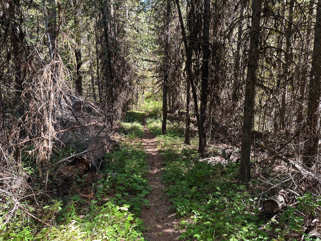
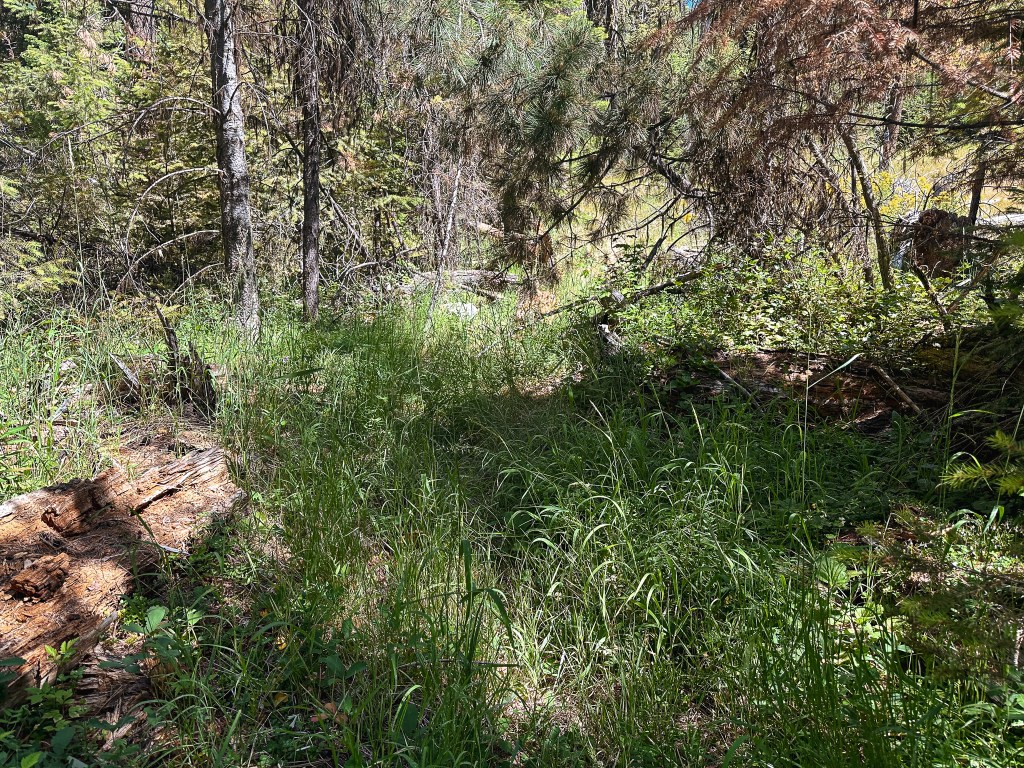
The trail starts from behind the gate. You will need to pass through a cattle fence on the side or squeeze below the gate for access. The trail starts out as an old road bed and wastes no time gaining elevation in the first 1/2 mile. It follows up the side of Tupper Butte gaining around 700′ by the time you reach the junction with the Tupper Butte Trail #3065. The trail to Tupper Butte continues to the left for another 1/2 mile to the summit. This junction was only indicated by a wooden post. We decided against visiting Tupper Butte this time and continued straight to stay on the Madison Butte trail. Once the trail gains the side of Tupper Butte it levels out to enter a dense forest. There is a cattle gate here that you will have to pass through. Make sure to always close any gate behind you after you’ve passed through it. There was a confusing makeshift arrow at the base of the gate pointing to follow the fence line. This could be misleading to hikers who haven’t done prior research. There even appeared to be a trail along the fence line, but it was nothing more than a game trail. The trail started to gradually lose elevation from here until it opened up to an exposed slope where we were greeted with a view out to Madison Butte (and how far we still had to hike). The trail sharply turned down to reach a saddle and lost a lot of the elevation we previously gained. Make sure to pay attention in this section, there was a tricky switch back that appeared to continue straight. From the saddle, the trail turns up again to skirt around another butte before dipping into another saddle. The final climb up to the NF-033 road is more gradual and continuous. Once we reached the piped Bottle Spring, we knew we were almost to the road. The plants around the spring have started to over take the trail and it was hard to see where it continued. I headed up the drainage cross country toward what looked like a fence post (it was definitely man made) and was able to meet up with the last portion of trail. The fence post ended up being the trailhead and I was at the road. Garnet was still cooling off at the spring, but he planned to catch up shortly. I turned right to head the last 1/2 mile up the road to the summit.
Tupper Butte Junction
Cattle Gate with Arrow
Bottle Spring
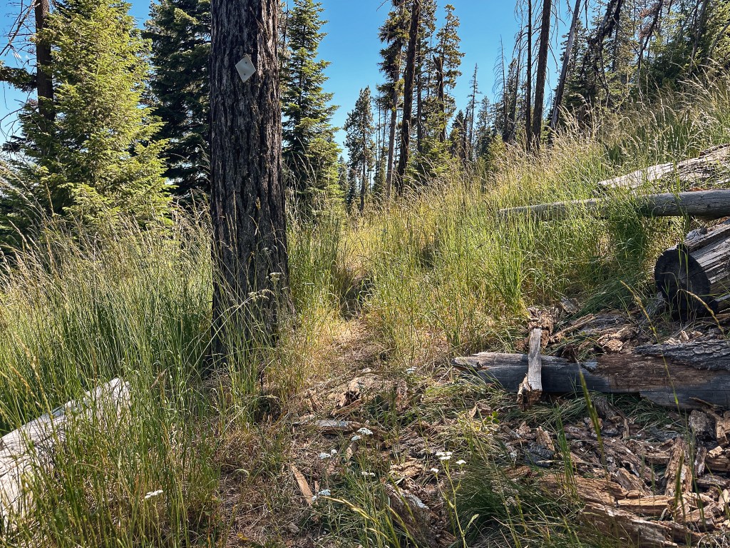
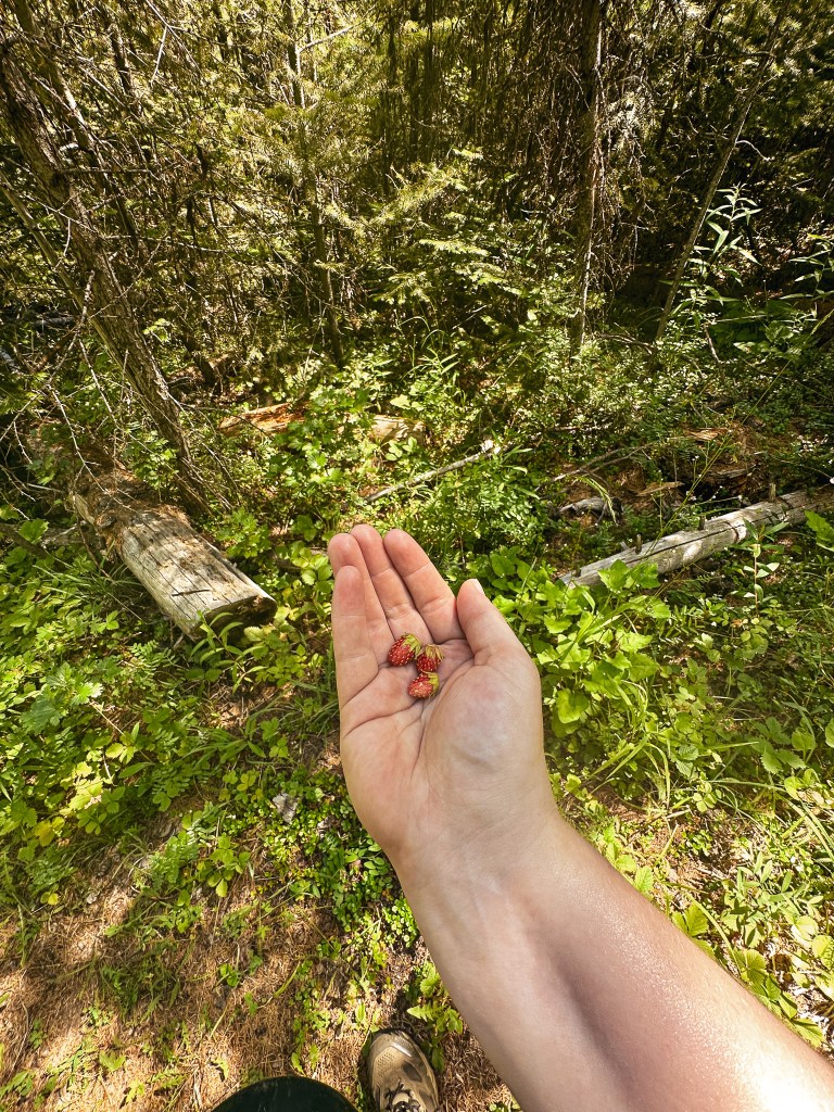
The heat was starting to get to me and I couldn’t seem to keep up on my water intake. The trail had varied between shaded forest and exposed slopes with tall grass. It was faint in some sections with a bit of blow down, but we never had any trouble staying on track. There were white markers in the trees to help. I wouldn’t classify it as a lost trail yet, but it definitely doesn’t see a lot of foot traffic. The tall grass also really aggravated my allergies and had me sniffling the majority of the way. Despite the ups and downs, the grass allergies, and the heat we were constantly rewarded with huckleberries and wild strawberries along the way. This helped to keep us motivated. On a small section of road just below the lookout there were tons of butterflies enjoying the flowers. I had never seen so many in an area all at once. This trail had a lot of fun surprises that I didn’t expect.
We were greeted by the lookout attendant, Chuck, shortly after approaching the base of the fire lookout. His dog seemed protective of the space so we didn’t get too close, but we did have a nice conversation from the road. He had been at the base of the tower grabbing some more water to haul up when we arrived. He asked if we came up the road or the trail. We said the trail to which he confirmed we missed the “fun” road conditions below. We talked for a while about his experiences as a lookout and our trip as well. When I introduced myself, he mentioned the lookout attendant on Aldrich Mountain (post) was also named Danielle. She had staffed Tamarack Mountain (post) the year prior, but it was now staffed by her friend Sarah. He also seemed passionate about the cryptocurrency market. I’ve never dabbled myself because, just like the stock market, it requires a lot of time and effort to be successful in knowing the trends. It all feels like made up monopoly money to me anyway (no offense to the finance bros!). He asked me about my camera and tripod, which made me realize I actually know very little about it. I had more interest and momentum in learning the dynamics of it when I first started, but have become more of a point and shoot photographer along the way. My Nikon doesn’t work as an auto adjust point and shoot since I have an off brand lens. But, I don’t fuss with it beyond the ISO, shutter speed, and aperture. My tripod on the other hand is a low grade Manfrotto, which is a brand that came recommended by a photographer I knew. It’s sturdy but definitely not as robust as some. I couldn’t justify spending more as an amateur though. He told me about his camera and that he found a nice tripod package on sale at Walmart for around $30. It came with a few attachments for his camera and even his phone. I told him that seemed like a nice deal since I spent closer to $80 on mine and it didn’t come with any of those fun attachments. I also mentioned how it would be nice to have an attachment for my phone when I don’t need or want to use my camera. He quickly offered me one of his since he ended up getting two of the tripod packs, but had no use for two phone attachments. I insisted he didn’t have to do that, but before I knew it he had climbed his tower and came back with the attachment still in the package. I accepted his gift and thanked him profusely for the kindness. It has already come in handy a few times and I will forever remember that it came from the lookout on Madison Butte.
We didn’t get invited up to check out the view from the cab, but it is their home for the summer and should always be respected. We said our goodbyes after taking a few more pictures and headed down the road to have lunch on the slope below with a view. I think the dry conditions along with the grass allergies really irritated my nose because while we were enjoying lunch it started bleeding for no apparent reason. It was an inconvenient place for a bloody nose. The quick loss of blood made me a bit light headed as well which wasn’t a great way to start our hike back. I had already drank my 32oz Nalgene full of water and was half way through my 32oz Nalgene of electrolytes. Garnet had already drank a lot of his 64 ounces of water as well. Typically, this would be enough water to get us back since we are usually hiking down hill on the return. But, something to keep in mind about this trail is the return trip takes just as much energy as the hike there. We tried to keep ourselves cool by soaking our shirts and hats in the Bottle Spring. We took more breaks on the return and kept our energy up with huckleberries. By the time we reached the final mile, both of us had diminished our water supply. We were both feeling the effects of dehydration. At least we knew there would be water waiting for us back at the car and we were close. This hike made me realize I really need to start packing my water filter on day hikes. If I had it with me, we could have easily replenished water at the Bottle Spring and would have been in much better shape on our return. I was even tempted to risk drinking the unfiltered water directly from the spring, but Garnet had advised against this. We made it back in one piece and chugged as much water as we could safely handle. My Strava App calculated this hike at 8.44 miles with 2,638′ of elevation gain. This made us extra thankful that we didn’t have to move camps until the morning.
Lookout Chuck.
Chuck has been the lookout on Madison Butte for 10 seasons, but has also worked on Lookout Mountain and Goat Peak in Washington. He is accompanied by his most recent rescue dog, Oliver. He lives in Northern Washington in his off seasons. He used to do work as a wildland fire fighter prior to becoming a fire lookout. This has allowed him to extend his seasons by assisting with slash pile burning in the shoulder seasons. His hobbies include photography and cryptocurrency. His favorite things to photographs are the thunderstorms that roll through the area.
History.
It’s possible the site of Madison Butte has been used for fire detection as early as 1909. Some old withdrawal records listed on Ron Kemnow’s site makes mention of plans to build a small cabin for men on lookout at this station once funds are available. It is unclear if that ever happened. A new telephone line was constructed to the summit in 1922 and by 1923 a D-6 Cupola ground cabin had been built to house the lookout. It was replaced in 1957 by a 37′ steel tower with CL-100 cab. We’ve realized the majority of CL-100’s in Oregon were built during that year. It is still actively staffed every season.
We headed out from Tower Mountain (post) the same way we came in on NF-5226. One might argue we should have continued through the forest on NF-5226 to connect with HWY-244 since we were planning on going that way to get to Johnson Rock. But, I didn’t feel like taking any chances on another forest service road and we wanted to stop in Ukiah for amenities. We drove the remaining distance of NF-52 out of the forest until it turned into CR-1475. This county road will dump you into the heart of Ukiah. We decided to check the Ranger Station in Ukiah to see if they knew anything about the NF-51 road closure. It was technically out of their forest management, but we figured they might know anyway. Unfortunately, when we got there the station was only open to visitors by appointment. Strike one. Ukiah also didn’t have any cell service for us, so we weren’t able to call the La Grande station from here. Strike two. We moved on to check out the local business we thought would have gas, but it appeared to be closed indefinitely. Strike three. It appeared our luck had run out completely. The only amenities we were able to secure were refilling our water reservoirs in the local county park. Ukiah did have another convenience store that was open where we were able to buy some ice for our cooler too. In hindsight we probably should have asked the locals about their gas station, but we just assumed they no longer had any available. For future reference, I think they still offer gas at the Byrnes Oil off of Pine Street. It appeared people were stopped there filling their tanks when we drove through again the following day.
We sat along side the county park for a while debating what we should do. Do we risk it and drive to see if the road is open for ourselves? Or do we assume the worst and move on to our next destination? Garnet had the idea to start driving in the direction of Johnson Rock until we could find suitable service to call the La Grande Ranger Station. We decided to go that route and headed east out of Ukiah on HWY-244. We didn’t get service until we were on the Blue Mountain summit and pulled over to make the call. The ranger we spoke with was aware of the NF-51 closure but wasn’t sure when it would be re-opened. Also, just doing a basic search on the Forest Service road closure notices there was nothing mentioned about this road being closed (so any prior research wouldn’t have brought this to our attention). We asked the ranger about access to the Johnson Rock lookout. He wasn’t sure if that was part of the closure which meant he would have to get back to us, but he knew you could at least drive to the Spool Cart campground which is just before the turn. We gave him our contact information and we were back at square one. No one seemed to know much about this closure or at least the information we needed. We sat on the side of HWY-244 debating our options again. How long should we wait to see if he’ll call back? Do we drive to see if the road is open for ourselves? Or, once again, do we assume the worst and move on to our next destination?
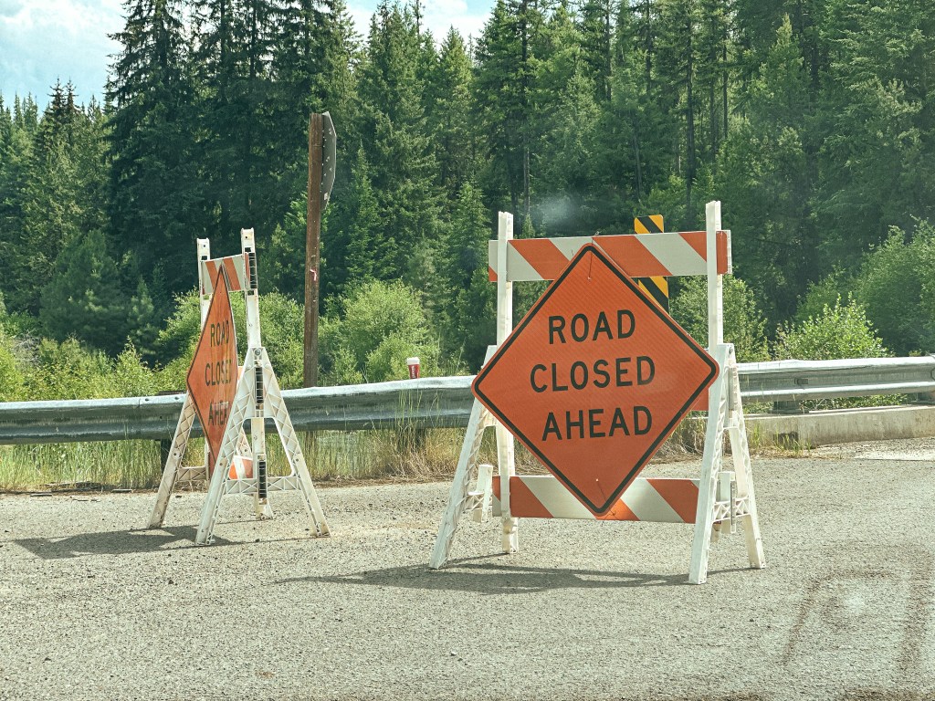
We decided we were close enough that it made sense to check it out for ourselves. We also knew we should probably refuel soon and La Grande was our next closest option. We turned right onto NF-51 from HWY-244 towards the community of Starkey, this was marked as the Grande Ronde River Road prior to entering the forest again. There was no road closure sign posted at the junction, but we passed one that said “Road Closed 16 miles Ahead” once we got closer to the boundary. Based on our estimated mileage calculation prior this would put the road closure past the turn off we needed. We passed the Spool Cart campground with no issues and figured we’d make it to our turn after all. We reached NF-5115 off to the right only to be met with two more signs. Both said “Road Closed Ahead” and were partially blocking the road. Garnet and I debated what that meant. Did it mean the road behind the sign was closed ahead? Or was it referring to the other road closure on NF-51? At this point I was willing to throw in the towel on Johnson Rock, no one knew anything and it was unclear if we should be driving up this road. Garnet rationalized with me that if the road was actually closed there would be a road block farther up and we could turn around from there if needed. We continued up NF-5115 past the signs and hoped for the best. The NF-5115 road was in good shape and after a mile and a half we came to the junction with NF-5120. We turned left onto NF-5120 that would take us the remaining distance to the lookout, if road conditions were on our side. The conditions of the road deteriorated after leaving NF-5115. There were quite a few wide shallow pot holes that consumed the whole road and blind hills that would be a bad spot to meet oncoming traffic. Minor highlines and wash outs were also something to be aware of along this road. John was right about the road deteriorating significantly around 2 miles from the lookout. We made it to the NF-500 spur before deciding this was as far as we should probably drive. This was just beyond where the map said the road stopped being maintained. We set up camp in the flattest spot we could find and planned to hike to the fire lookout in the morning. We still weren’t 100% sure if we should be here, but we were never met with a road closure beyond the signs. We could hear and see the large helicopter doing work along the Grande Ronde. I had thought that I heard John mention they were practicing water drops on the phone with Mike. This lead to the irrational thought that they would accidentally drop a metric ton of water on us thinking no one would be in the area. I asked Garnet what would happen if they dropped that amount of water on someone and he said one would probably die from the shear force. A comforting thought.
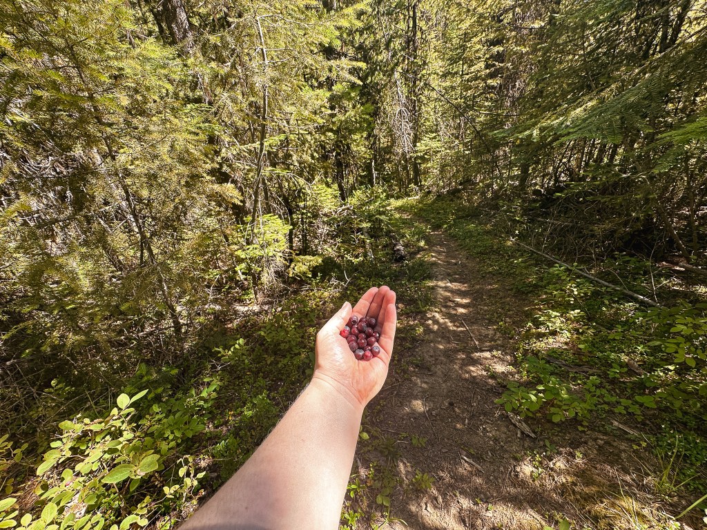
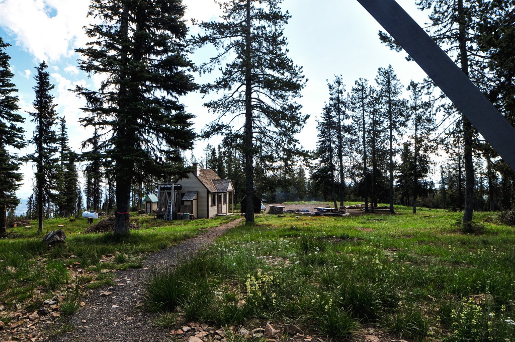
The next morning, I woke up early to the sound of the helicopter again and had a hard time going back to sleep since it sounded closer to us than it was yesterday. We eventually got up and packed lunch for our hike up the road. We also packed up our camp so things would be ready to move when we got back to the car. As we started up the road we realized quickly where we had stopped was a good call. There were portions of the road that were fine, but the few significant rocky sections would be un-passable in our car without bottoming out. When Mike had talked to John the day before he mentioned there was a private contractor thinning the trees around the lookout that kept starting their chainsaws at 5am every morning. I didn’t recall hearing a car drive by that morning but it’s possible we didn’t hear it due to the helicopter starting around the same time. It was a pleasant walk from where we had parked but it was already getting hot for the day. The most notable things from our road walk were an occasional Pileated woodpecker flying across it, wild strawberries, and having something grunt at us from the bushes. We were pretty sure this was an elk but never saw it to confirm. As we got closer to the fire lookout, we could finally hear the symphony of chainsaws. I’m sure this wasn’t relaxing for John to hear all day, but they were making good work of thinning out the area. John was aware we’d be attempting to visit him sometime based on his call with Mike. We walked over to the viewpoint at the edge of the rock and wondered if we should try to make ourselves known. Before we could decide what to do, John called down from his catwalk and asked if we wanted to come up.
We climbed the tower and were not only greeted by John but his very large string bass. He also had a guitar and a mandolin there as well. I couldn’t believe he had hauled such a large string instrument all the way up there. He said he didn’t use the winch either because he didn’t trust it with such an item. He also confirmed that the helicopter we had seen along the Grande Ronde was moving logs to build salmon habitat. This made more sense than practicing water drops and I was happy to know my fears were unwarranted. We chatted for a bit about his experiences as a lookout and our trip around the area before heading back down to have lunch. While enjoying our lunch under the shade of a tree, an official Forest Service vehicle drove up. There were two rangers in the vehicle, and we wondered if they’d say anything to us about being there. It was still a grey area in our minds at this point, but less so now that we had made it to the lookout itself. They were only here to inspect the work of the private contractors and didn’t give us much more than a wave. I’m sure they were more confused than concerned about why we were there. We didn’t dilly dally much after we finished lunch and made the short hike back to the car. My Strava App recorded this road walk at 5.02 miles RT with 905’ of elevation gain.
The drive out felt much shorter than the day before. The signs that had previously blocked the road were now gone. Garnet’s phone also had a voicemail from the ranger we spoke with in La Grande confirming the road was open for recreation. It was good to know we had no reason to worry, but it felt a little too late at this point. We drove the remaining distance of HWY-244 to La Grande in search of fuel. Once we had a full tank, we backtracked to Ukiah again. We can now say we’ve driven the full length of HWY-244 twice. Our next destination was Madison Butte (post) on the Umatilla NF.
Lookout John.
This was John’s first season on Johnson Rock, a fittingly named lookout for him. He has worked as a fire lookout for 9 seasons on different towers such as Numa Ridge in Glacier NP, Tower Point in Oregon, and Aztec in Arizona to name a few. Prior to his seasonal work as a fire lookout he was a teacher. He uses his free time as a fire lookout to learn new skills and hobbies such as playing the string bass, guitar, and mandolin.
History.
There isn’t too much history behind the fire lookout on Johnson Rock. The first structure was built in 1938 as an L-4, but there is no information listed on if this was a ground cabin or tower. Given that the current 14’x14’ L-4 cab was built on an 82’ treated timber tower, I can only assume its predecessor also had a tall tower. The existing lookout was built in 1952 and is still actively staffed every season. Although the structure is still utilized the cab could use some work. The shutters on own side were blown off during the previous season and it would benefit from a new roof.
Not sure what happened to our picture together so here’s another picture of the lookout
I got back to the car from our hike up to Mount Ireland (post) much later than my partner. He said he had been waiting for me for close to 40 minutes. I didn’t feel like I was going much slower than normal, but the back to back mileage must have been taking its toll. I felt it mostly on the downhill. We had to rethink our camping plans since the flat area near the trailhead was no longer viable. We decided to start heading towards Johnson Rock (post) and hoped to find a camp along the way. As we were backing out from the trailhead, my car’s heat shield caught on a small tree we had rolled over to get into the spot. This ended up bending it to hang lower than normal which caused us to scrape on the loose bits of gravel on our way out. It has never been the same since our Tower Point incident (post) and has been a reoccurring issue. It’s just a protective plate so it’s not a concern to my car’s functionality, but it is definitely an annoyance that I need to find a better solution for. This is just some of the joys that come with driving a low clearance vehicle to these kinds of places.
We backtracked on NF-73 towards Granite passing the junction to head into the Umatilla NF again. The NF-73 road skirts along the boundary of the Umatilla NF and Wallowa-Whitman NF until it makes a hard right turn to head towards Anthony Lakes. We stayed straight to continue onto NF-52 past the North Fork John Day campground. We briefly debated camping here since it was getting late, but ultimately decided to continue on to find a dispersed spot. A little ways past the campground we came to another junction where NF-52 continued left and NF-51 was to the right. We had planned to take NF-51 to connect to the Johnson Rock road, but we were met with a sign that said “Road Closed 3 Miles Ahead”. We optimistically headed on NF-51 anyway in hopes that it was an old road closure sign. Sure enough though, around the three mile mark, the road was completely closed. We cursed ourselves for not checking on road closures prior to the trip. We decided to pivot our plans to Tower Mountain instead and would check the road status once we had service again. This meant continuing farther on NF-52 until we reached the NF-5226 road. We eventually found a place to camp before the last bit of day light was gone, but we had to set everything up in the dark.
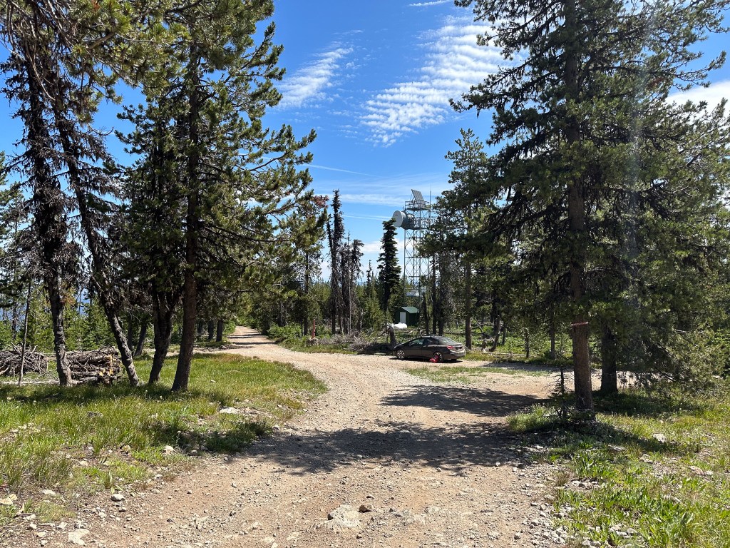
The next morning we headed up NF-5226 and kept our fingers crossed that we would make it all the way to the tower without any road walking. The research I found prior to our trip said that the NF-5226 road was best coming from the south and should be suitable for most. You have the option to access Tower Mountain and NF-5226 from HWY-244 in the north, but it is a much longer route. There is also access via a hiking trail, Tower Mountain Trail #3156, through the North Fork of the John Day wilderness that starts from the NF-52 road. The Wandering Yuncks have a trip report from June 2021 that describes the conditions of the trail in detail (post). We caught glimpses of the tower and where we were headed as we drove along NF-5226. It was a mostly decent road with only a few bumps, ruts, and narrow sections to mind. We parked at the junction where the road leads to the cabin and tower to walk the remaining distance.
We could see someone looking out of the tower from where we parked. Garnet had been in contact with the lookout attendant, Mike, prior to our visit via a group chat. He was aware we’d be coming within the next couple of days. We were a day early though given our change in plans. He gave us a wave as we started to walk towards the tower and asked if we were planning on coming up. We both said yes and started up the stairs. Half way up the tower I got a bit squeamish of the height and decided to take pictures around the base instead. Garnet ended up talking to Mike for well over an hour. I had been waiting at the base checking updates on my phone, but the service was slow and spotty. Eventually, I decided to suck it up and make the final push to the top of the tower. When I reached the cab, Mike said I looked like I was doing well for someone afraid of heights. It wasn’t so bad once I finally got up there, but it’s more a fear of falling than being high up. I didn’t ask as many questions as I normally would since I wasn’t sure what they had already talked about and I didn’t want to make him repeat himself. We asked if he knew about the NF-51 road closure, but he didn’t. He reached out to John, who is currently staffing Johnson Rock (post), but he wasn’t sure if the road was closed before or after the turn off from the north end. There was a wash out somewhere along the NF-51 road with some helicopter activity on the Grande Ronde. We were able to ask him about the road conditions and he said it depended on how adventurous we were. He said the worst of it was within the last 2 miles. He suggested calling the Ranger Station in La Grande to confirm access. While we were still visiting with Mike, a fire crew drove up and the foreman climbed the tower. It’s a pretty tight fit to have four adults in an Aermotor cab. She climbed to ask Mike about the trees that needed to be removed around the tower. They were going to replace the communication tower for the lookout and needed to clear a path for the equipment. We took that as our cue to head out and thanked Mike for his time.
Lookout Mike.
Mike Duffy has been a lookout on Tower Mountain for 14 non-consecutive seasons. He has also worked on Madison and Desolation Butte. He keeps in contact with Table Rock, Desolation Butte, and Indian Rock during his season. He is gregarious and will invite most people up for a chat in the tower if they are willing to make the climb. The area gets a lot of visitors due to the extensive ATV trails in the vicinity. His most asked question is about the wildlife he sees in the area. The most unique animal he has seen from the tower is a Lynx.
History.
The existing fire lookout on Tower Mountain is a 92′ Aermotor with 7’x7′ steel cab and was built in 1935. The living quarters were moved from the Lucky Strike lookout site sometime in the late 1940s. Prior to its move, the ground cabin was built on the Lucky Strike site in 1936. The surrounding area was burned by the 1996 Tower Complex that threatened the lookout, but was saved due to the efforts of our Wildland Fire Crews. Rex’s website also mentions there being a previous fire lookout on the summit in the 1920s. It states that this was a 60′ pole tower with 6’x6′ cab. This wasn’t mentioned anywhere else to confirm. He also states that Tower Mountain used to be Lookout Mountain until it was renamed in 1925. I wasn’t able to confirm this anywhere else either, but I wouldn’t be surprised if that’s true. There is a Lookout Mountain in every forest, if not multiple.
I’m not sure what happened to the picture of us together, but for every picture of us there is a picture of Garnet waiting
Garnet had already visited Mount Ireland in September 2022 while heading to the FFLA Western Regional Conference (post). He had met the lookout attendant staffing the lookout at the time, Warren, and his wife. Garnet ended up talking to him for hours, helping around the lookout, and exchanging phone numbers. He talked very highly about Warren and his passion for Mount Ireland. We knew we wanted to go back sooner than later in hopes that I would get a chance to meet him as well. Unfortunately, his wife was having back issues and struggling to make the climb by the end of season. We were disappointed to find they wouldn’t be back this season after working it into our route. I believe she was having surgery to help with her back issues and I’m hoping she makes a good recovery. Hopefully, we will get a chance for our paths to cross again. Based on the information we had from the other lookouts in the area, the Forest Service hadn’t found a suitable replacement and there wouldn’t be anyone staffing it during our visit.
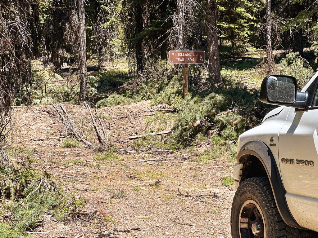
While packing up our camp, a truck driving by stopped to let us know the O’Rouick spring on NF-1010 had good water for drinking. They appeared to be locals, so we took their word for it and topped off our water reservoirs. Normally we wouldn’t trust drinking untreated water directly from a spring, but this one was piped and we had no issues with it afterwards. We headed out of the Umatilla NF via NF-10 towards Granite. You are essentially in the Wallowa-Whitman NF by the time you reach the small mining town. We took a quick spin through Granite while we were there. The main convenience store with gas was posted for sale, so I’m not sure if this would be a reliable source for fuel. We turned onto NF-73 to head towards Sumpter (a left turn if you’re coming out of Granite, but a right turn if you’re coming from NF-10). We followed this until we reached NF-7370 off to the left. It was on a blind corner from the direction we were coming and we initially drove past it. Garnet noticed it as we were already driving by, so it was a quick turn around. It’s a more obvious road coming from the other direction. There is actually a sign for the Mt Ireland L.O., but it is offset from the road and slightly being overtaken by brush. We followed the NF-7370 road to the junction with NF-100 that will take you the last bit to the trailhead. This is a drivable road for low-clearance vehicles, but it is narrow and steep with drop offs along some sections. We arrived at the trailhead, or what was left of it, just before noon. Garnet said that last year there was a big flat pull around area that used to offer a lot more parking. It appeared they had done some much needed thinning of the trees in the area, but used the previous trailhead for the slash piles. There’s only a few pull outs left for parking now. We picked one in the shade and started prepping for the hike. There was also a large white truck parked in the pull out closest to the start of the trail. We were surprised to see anyone else here since it’s already considered a pretty lonely trail and we were here on a Tuesday.
Trail heads to the left
Trail heads to the right
Trail heads to the left
Where we were headed
Campsite at the road crossing
Headed towards Mt. Ireland, trail heads left
Headed towards the trailhead, trail heads right
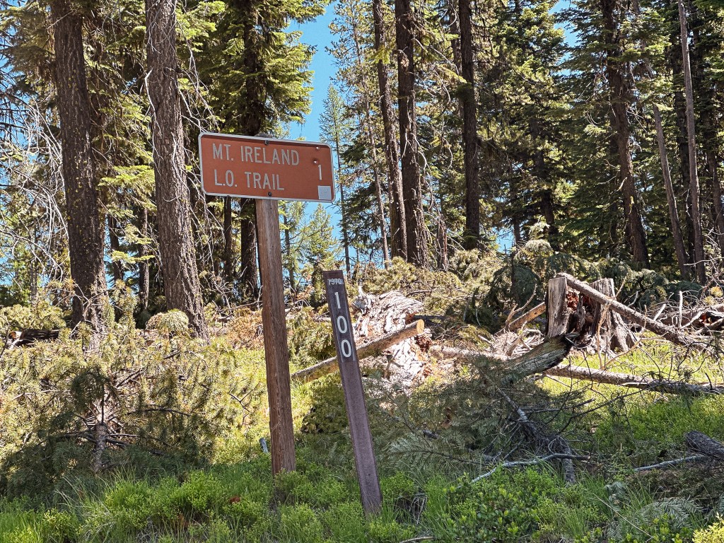
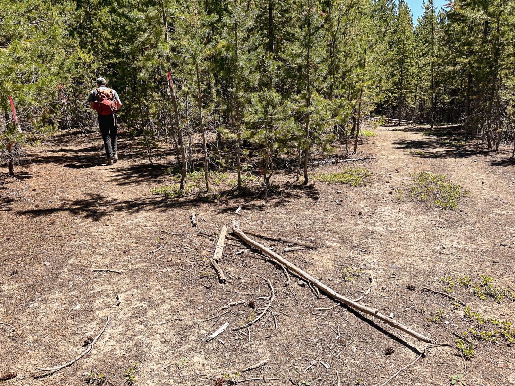
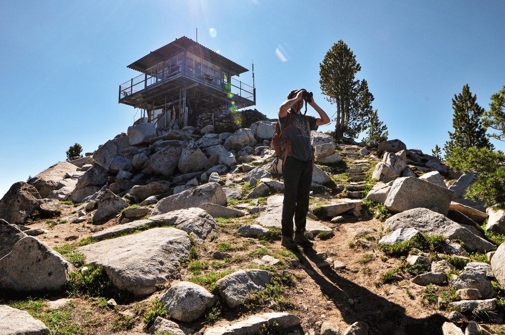
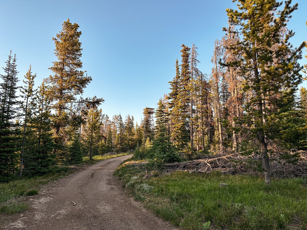
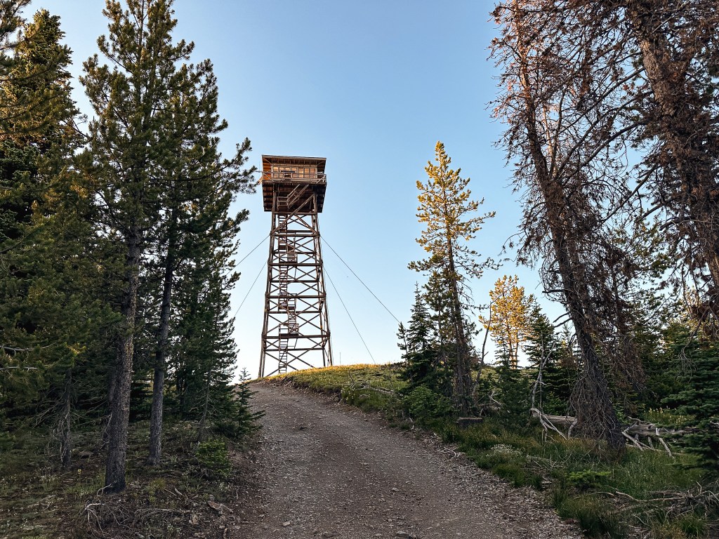
There is a surprising lack of online information for this trail. It’s not listed on AllTrails, Oregon Hikers (minus a trip report), or even the Forest Service’s website. This probably explains why it’s not heavily trafficked. The hike starts along the old decommissioned road that is marked with a sign post for Mt. Ireland L.O. Trail #1604. The road steeply climbs for a half of a mile to meet up with the trail. There are a few turns along the road to note, but all seemed to be well flagged or blocked off to corral you in the right direction. The first turn was off to the left where some flagging and a make shift arrow pointed the way. The second was shortly after to the right, the path to the left had some branches laid across it to signal not to head that direction. The final turn is off to the left after a particularly steep section of road where the official trail begins. It looks like the road might continue straight, but there were once again more branches laid across to signal you shouldn’t go that way. Once on the trail it starts to level out for the next mile. Make sure to look up occasionally for old insulators in the trees along this section, we were able to spot more than a few. You will get glimpses of where you are headed through the trees, which will either be encouraging or discouraging to your progress. While we were stopped to look at the fire lookout through the binoculars we heard a helicopter in the distance. We patiently watched as it landed on the helispot for Mt. Ireland and took off again. This could only mean one thing, they found someone to staff the lookout. Now it made sense why someone else was parked at the trailhead on a Tuesday. The trail eventually crosses an old road with a camp spot and starts to gain elevation again. Garnet remembered there being a trail sign here, but it looks like the sign or the tree have since been removed. A trip report from the Wandering Yuncks a year prior confirms this sign existed (post). We came to an exposed junction with an ATV trail around the 2.5 mile mark. We turned left to head up the last steep mile to the lookout. You will start to lose tree coverage here, so make sure to take advantage of the shade and bring lots of water. The whole while we were hiking we were able to watch the helicopter return 3 or 4 more times. Unfortunately, we didn’t make it to the summit in time to see their last run up close but it was still neat to watch from the trail below. There was an official U.S. Forest Service ATV parked on the trail where it became significantly more rocky. This allegedly used to be the old road to the lookout, but even an ATV wouldn’t be able to make it all the way now. The last pitch of trail before you reach the summit is steep, dusty, and loose for footings. Along this section we were passed by a group of four fire crew members heading back to the ATV. They had been there to help open up the fire lookout for the season and get the new lookout situated, it was his first day! It looks like we had just missed all the commotion, most likely for the better though since we’d probably be in their way.
Photo taken by Garnet
As I reached the saddle below the fire lookout, I looked up to see someone on the catwalk looking down at us. I waved up to them to say hello to which they said “you’re doing better than I did”. I laughed and replied “I’m not so sure about that” as I wheezed my way closer to the lookout. He ended up inviting us on the catwalk if we were interested. We gladly joined him and talked for a while about fire lookouts, our trip, and the surrounding area. He joked about how he couldn’t wait to get up here for the peace and quiet only to have his first visitors come mere minutes after the fire crews had left. He was very hospitable as he offered his stools for us to sit on in the shade and even refilled our empty water bottles before we left. We mentioned how we could see the helicopter making deliveries on our way up and he said that they only get one for the season so he had to make it count. Anything else that he might want throughout his season he would have to be pack up himself. This is also typically a good spot to see mountain goats, there is even a salt lick for them provided by the Forest Service, but they were no where to be seen after all the noise. We thanked him for his time and wished him a good (and more importantly quiet) first season!
Lookout Darren.
This was not only Darren’s first day on the job, but also his first season as a fire lookout ever. He said it had been a bucket list item for him ever since he visited a family member that used to staff one. He has two dogs that he plans to accompany him, but they weren’t there yet since he was planning to hike out the next day. His official season didn’t start until that following Monday. He used to be a state trooper for the Oregon State Police and has also done work for ODOT auditing trucking companies. He grew up in Baker City and currently resides there now, but has lived in different parts of Oregon as well during his time working for the state.
History.
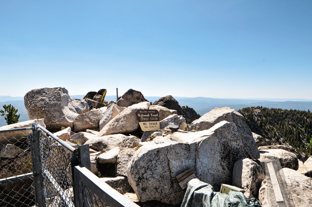
A cabin with open platform on the roof was constructed on a stacked rock foundation in 1916. It was first staffed by Orlin L. Ireland, the son of Henry Ireland who was the mountains namesake. At the time, the mountain was named Bald Mountain. The US Geographic board approved the name change to Ireland Mountain in 1917. This was to commemorate the late Henry Ireland who was the supervisor of the Whitman NF for a decade. A cupola was added in 1928 to enclose the fire finder. In 1957, the cupola and previous foundation were destroyed by blasting it off the mountain to prep for the new lookout. It was replaced with a 13×13 CL-100 all steel live-in cab that still stands today. It is actively staffed every season.
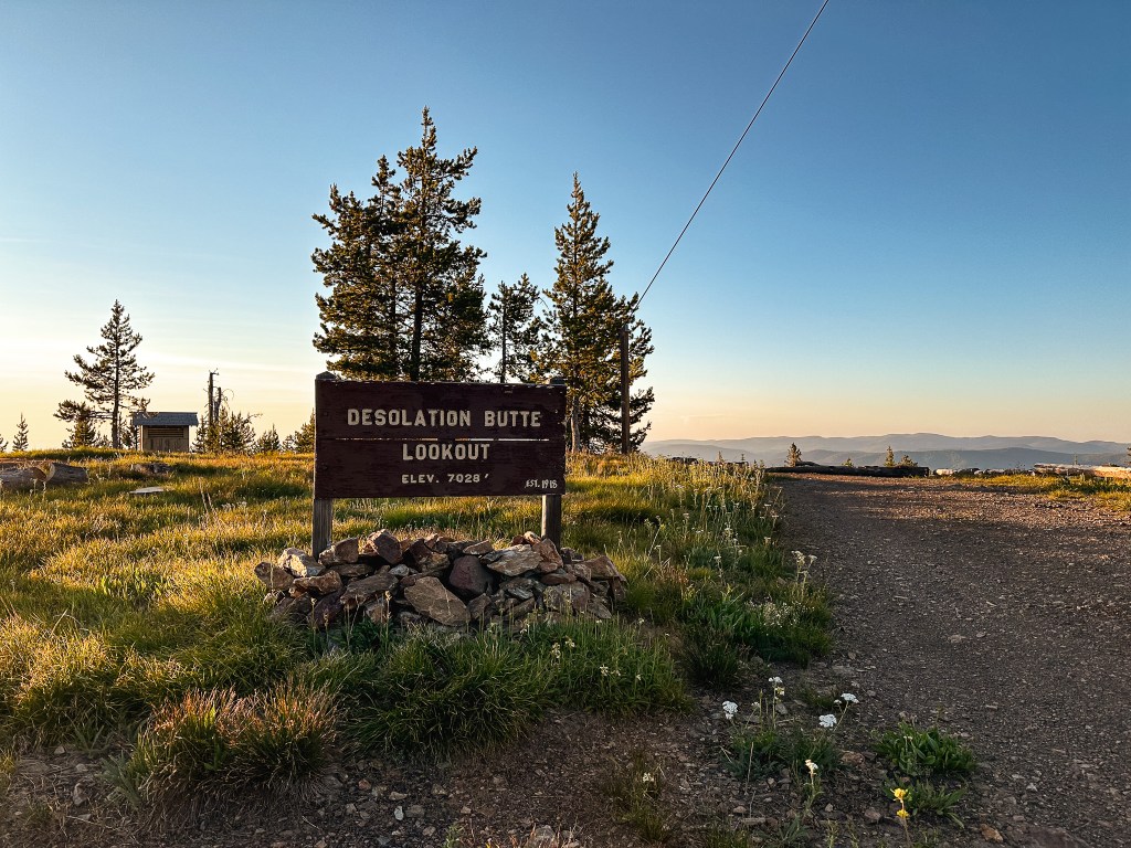
There is no quick way to get to Desolation Butte, but I think our route this trip might have been the worst of them all. We’ve been fairly close to Desolation Butte two separate times. The first was the closest on an extended weekend backpacking trip to the North Fork of the John Day wilderness in September 2019. We came in from Dale and drove to the Lost Horse trailhead off of NF-800 which is only about 4 square miles away on the map from the fire lookout. I can only vouch for the roads we drove on, but NF-1010 and NF-10 were drivable to at least the trailhead in the Civic. The NF-55 and NF-5505 were good up until it got closer to the junction with NF-1010. The second time was for a week long backpack through the main part of the North Fork of the John Day wilderness in June 2021. We were at the main trailhead that starts in the North Fork John Day campground. This would have required an extra day to drive down NF-73 to NF-10 from Granite to get to the lookout. The roads getting to the campground are paved and were in good condition. This time we were attempting to connect through the forest via NF-45 from Indian Rock (post). We were already limited on time due to our extended conversation with the lookout that morning. We ended up eating even more of our time when I thought I had lost one of my Nalgene bottles. This resulted in us driving back up to the base of Indian Rock (post) to search for it after packing up camp. We didn’t find it there and I accepted it as a loss. The NF-45 road past the junction with NF-537 is not marked as a good road on the map. We had asked Karen at Indian Rock (post) about the conditions, but she said she hadn’t been that way in years. She knew it was at least passable since people would visit her from Olive Lake, but all have had trucks or higher clearance. We decided to test our luck anyway. It’s considered a main connection road from the Malheur NF to the Umatilla NF, how bad could it really be?
The next 8.2 miles of road were some of the worst we’ve ever driven in the Civic. We had thought the Dixie Butte (post) road was bad, but this was definitely worse. It immediately deteriorate after passing the NF-537 road and we briefly debated turning around to head in through Sumpter instead. The only reason we continued on was because I left the decision up to my partner who was currently driving the car. He was head strong and didn’t want to miss out on seeing Desolation Butte again. Unfortunately, this decision was made before we got to the worst parts of the road. I whined multiple times for us to turn around, but eventually we reached a point where we were so far into it that it made more sense to continue through. There were large rocks embedded in the road that required skillful maneuvering in a low clearance vehicle and I had to get out multiple times to move the smaller of large rocks. We eventually reached the boundary where the two forests meet. There is a trailhead here that leads off in both directions. Now that we were on the Umatilla NF the road improved significantly. It still wasn’t a great road as it was made up from larger rock gravel and had some potholes along the way. But, we felt much more relaxed after the boulder field we had experienced on the Malheur NF side. After what felt like an eternity we reached NF-10 which looked like a gravel highway in comparison. We turned right to head towards the Desolation Guard station. The NF-1010 road is immediately after the guard station off to the left. This was a good road up until the large 5-way intersection. The NF-1010 road makes a hard left turn here. We were stopped shortly after that by a rocky section that crossed the entire road. After the trauma from the NF-45 road, we decided to walk the remaining distance to the lookout. It was already getting late in the day so we decided to set up camp and make dinner before heading out. While we were setting up camp I found my missing Nalgene in the smaller cooler we had brought in addition to our larger cooler. I guess when Garnet was collecting our water bottles to refill them for the day a car drove by and he placed it in the cooler to look busy. He immediately forgot about it and we had a good laugh.
NF-1010 left, NF-300 right
I started my hike up the road while Garnet cleaned up the dishes from dinner. He’s a much faster hiker than I am and I figured he’d catch up easily. After the one rocky patch, the road improved which was frustrating. We had already committed to the road walk though and there were a few other rocky patches along the way that would be troublesome in a low clearance vehicle. That’s what I am telling myself at least. The road is mostly treed in on each side which doesn’t offer much for notable landmarks. There is a trailhead within the first 1/2 mile from the junction for the Lake Creek Trail. I stayed on NF-1010 for around 2.5 miles until I reached the junction with NF-300. The NF-300 road was also in decent shape. It was roughly another 1.5 miles along NF-300 to the summit. I was surprised I made it to the summit before Garnet caught up. Every time I turned around to see if he was coming he was no where to be found. My irrational thoughts started to wonder if he accidentally turned onto one of the unmarked spurs off of NF-1010. I was able to talk my anxiety down since I know he’s much more competent than that. He showed up a little while later after I had already finished taking pictures. The sun was already starting to set and I wanted to minimize as much road walking in the dark as possible. I headed off again before Garnet thinking he’d be shortly behind me. It quickly started to get dark and I had already pulled out my head lamp before reaching the end of NF-300. There’s an interesting fork in the NF-300 road which I think is just a continuation of NF-300 from the other direction if you came in via NF-1010 from Dale. I’m not completely sure though.
Something important to note is that I am afraid of the dark or more specifically what I can’t see in the dark. I kept scanning the edges of the road with my head lamp expecting something to be there. Once again, every time I turned around to see if Garnet was coming he was no where to be found. This only put me on edge even more. I made it most of the way without anything notable happening and no Garnet in sight. That was until I was within the last mile of the road walk. I turned around again to see if I could see his headlamp, but my headlamp passed over a shiny pair of eyes in the brush. I stopped in my tracks and stared back at it. I couldn’t tell what it was besides that it was a larger animal. Unsure of what to do I clapped my trekking poles together to see what it would do. Sure enough it started bouncing away, it was just a deer. I started walking faster and occasionally clapping my poles together to alert anything else of my presence. I could finally see the 5-way junction and turned around to see Garnet’s head lamp in the distance. I guess he was a bit spooked too. He said when he was on the tower he had felt someone tap his shoulder but no one was there. The road walk ended up being 8.3 miles RT with 1,103′ of elevation gain.
Desolation Butte is an actively staffed fire lookout but we knew they wouldn’t be there during our visit. Otherwise we would’ve had to rethink our timing. We had tried to connect with Bob LaFrance while we were in the area, but he seemed to be bouncing around and elusive. It was unclear if he was still working as a lookout relief. Based on what Karen on Indian Rock (post) told us no one really knew what he was officially doing this season. He did help us by starting a group chat with the lookout attendants staffing Tower Mountain (post) and Desolation Butte though. This is how we became aware it would be vacant on the day we were visiting.
NF-300 junction with NF-300?
History.
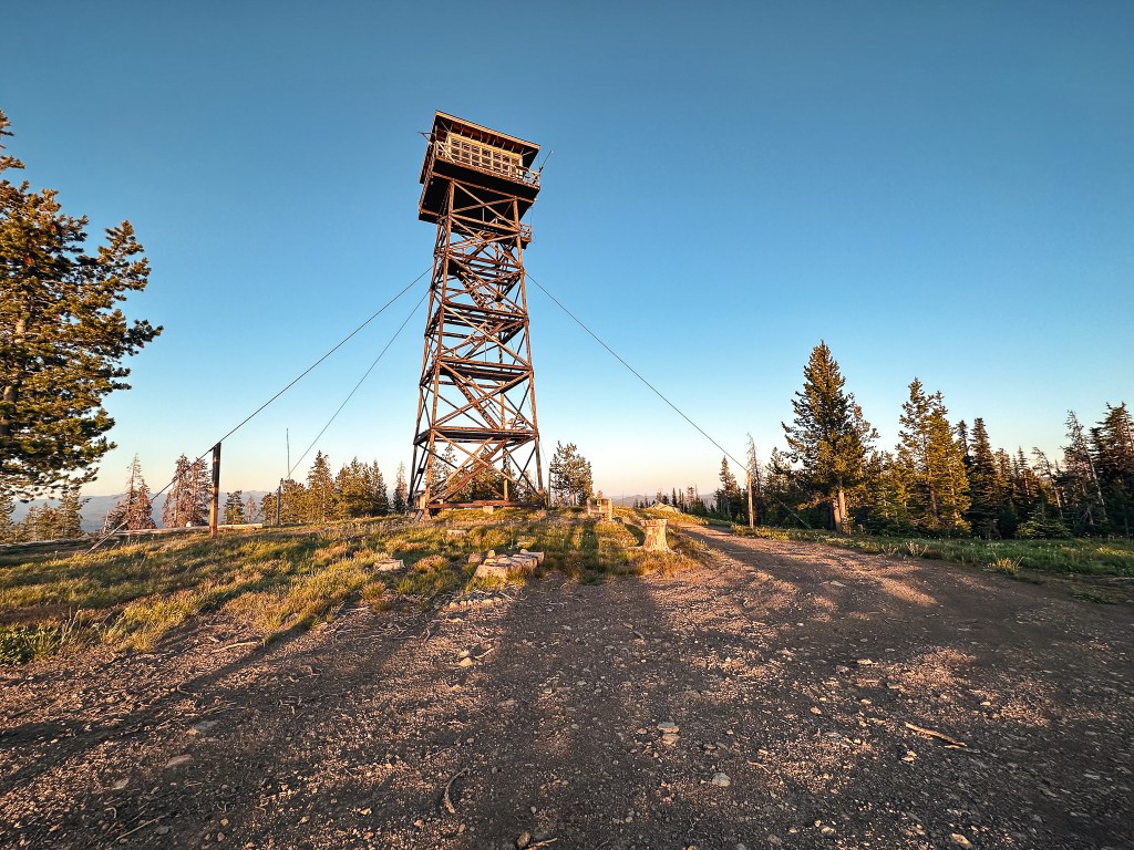
In 1918, the East Oregonian mentions a big steel lookout tower receiving storm damage on Desolation Butte. I could only find mention of this on Ron Kemnow’s site, but there must have been some sort of steel tower added during the 1910s. It was replaced in 1923 by a 50′ steel Aermotor tower with 7×7 cab. There was also a wood frame cabin for the living quarters. The existing tower was constructed in 1961 as a 67′ treated timber tower with R-6 flat roof cab. It was threatened in 1996 by the Bull Complex Fire but survived along with the Olive Lake Campground thanks to the hard work of our Wildland fire fighters. It is still actively staffed every season.
We continued our drive along HWY-26 heading east until we reached the Austin Junction with HWY-7. We turned left onto HWY-7 for a short time before making another left turn onto CR-20, Middle Fork Road. If you follow the signs for Bates State Park, you’ll head in the right direction. We briefly stopped at the campground to refill our water reservoirs and rinse off some of our sweat from the hike up to Dixie Butte (post). We continued on CR-20 until we passed the rentable Sunshine Guard station. The turn for NF-45 is only a little ways after this off to the right. There is a sign here that noted Indian Rock L.O. at 15 miles away. The rain had been heavy up until we made our turn onto NF-45. Once we started gaining elevation it cleared off to a nice view. The NF-45 road is in great condition but narrow. You wouldn’t want to meet someone heading down in some of the sections. There are two more signs for Indian Rock along the NF-45 road at the junctions with NF-4560 and NF-4550. Both note the lookout at 8 miles away. I’m not sure which one is the most accurate though since we weren’t tracking the mileage on the odometer. As you get closer to the lookout you will start to see signs of the 2022 Crockets Knob Fire. We stayed on NF-45 all the way to the junction with NF-537 off to the right. There is a sign for Indian Rock L.O. at this junction as well that states there’s only 2 more miles to go. We set up camp for the night instead of continuing all the way to the lookout, but it would be our first stop in the morning.
The NF-537 road is also in good condition with 6 water bars to bump over. There was only one section that had some rutting due to drivers using it in wet conditions. There’s a campground just below the lookout, Head O’ Boulder campground, that offers 3 or so camp spots with picnic tables, fire rings, and a vault toilet. There is also a trailhead here that branches into a few different trails that lead into the Vinegar Hill-Indian Rock Scenic Area. Fun fact: we had attempted to visit Indian Rock once before during a camping trip to the Vinegar Hill area in August 2020. I wasn’t convinced that we would make it up the NF-45 road and we attempted to access it via one of the trails instead. Looking at the map now, I’m not even sure which trailhead we were trying to reach. We somehow ended up on the wrong road just below the one we needed and tried to cross country hike to the trailhead. It was very close on the map, but the going was steep and in between was a thicket of lodgepole. Needless to say we didn’t even make it to the trailhead. We stopped at the campground to have breakfast bars and watch the birds since we were still a bit early for a reasonable visiting hour. This is an actively staffed lookout and should only be visited during working hours if possible. We waited until just before 9AM to drive the remaining distance up NF-537 to the base of the trail. It’s only a 0.2 mile hike with 128′ of elevation gain to the lookout according to Strava. As we were prepping for the short hike up, we could hear the lookout attendant yelling for their dog. Before we knew it we were greeted by a very large white, black and grey speckled dog. He was excited to see us and very friendly. He led us up the trail only stopping a few times to block the way for us to pet him. Occasionally, he grabbed my hand with his mouth as if to hold hands and direct me. All the while his owner was calling for him to return. He didn’t pay her any mind until we got closer and she started heading down the trail to grab him. She wasn’t very happy with her dog. She mentioned she wasn’t even on the clock yet and still trying to have breakfast when he took off down the trail. We felt terrible that we arrived too early even though she said we were fine.
We decided to give her some space to finish breakfast and hiked the rocky ridge out to an overlook point. We spent time picking out surrounding peaks and different fire lookouts we could see from the area. Eventually, we headed back towards the lookout to take some more pictures before heading on. The lookout attendant came out to greet us this time and wanted a redo from our previous interaction. She apologized for possibly coming off rude earlier and for her dog. We apologized for coming too early as well. Everyone agreed no apologies were needed though. We talked for a long time, almost 3 hours, with the lookout about her history in fire lookouts, the different places she’s lived, her rescue animals, and stories of the area. If you’re lucky, you might even get a chance to see the resident mountain goats that frequent the area. They weren’t there during our visit, but she pointed out the damage they had done to her catwalk. She talked about the 2022 Crockets Knob Fire and how close it came to her tower last year. I was surprised to learn she was able to come back to finish off her season in September after it had been mostly contained. This fire was also the reason the road had been in such good condition. They already had all the equipment onsite for the fire and decided to do the much needed road maintenance while they had the time. I guess prior to this it was a long rocky road that took an hour and a half to drive even in a truck. It’s a good thing we didn’t attempt to drive it in 2020. She also talked about how lookouts will stay on the same fire lookout when they feel they have found their mountain. Indian Rock was her mountain and she believed Stacy on Dixie Butte (post) had also found her mountain there. She reconfirmed that no one was staffing Mt. Ireland (post) for the season yet, but they hoped a previous long term staffer might return in the future. We eventually had to find a break in the conversation since we still needed to pack up our camp and head on to Desolation Butte (post). It was already past noon and we needed to hurry if we wanted to stay on schedule. We thanked her for her time and headed on to our next destination.
Lookout Karen.
Karen has been the lookout attendant on Indian Rock for the last 7 seasons. She is accompanied by her three rescue dogs Yurik, Atlas, and Max. She’s originally from Florida but has lived in many different places such as California, Wyoming, and Oregon. The first lookout she staffed was Indian Mountain which she only staffed for 1 season. She also staffed another lookout in the black hills of Wyoming for 11 seasons. If I remember correctly, this was the Cement Ridge lookout.
History.
The first structure built on Indian Rock was a D-6 cupola style cabin in 1929. This stood for many years until it was replaced in 1957 by the existing lookout. The existing lookout is considered a wooden R-6 flattop ground cab and still stands today. It is actively staffed every season. The lookout was threatened by the Crockets Knob Fire in August 2022 and had to be wrapped in heat resistant fabric. It survived with minimal damage.
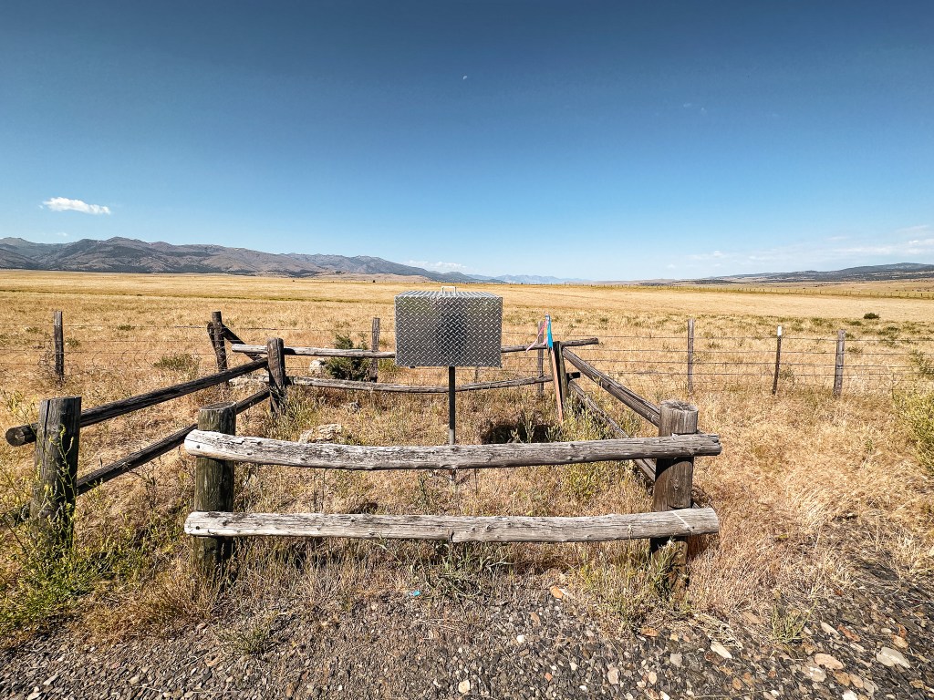
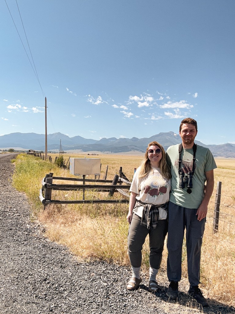
We packed up our camp and headed out of the Starr Campground before 9AM. Our next stop was an easy one. We headed North on HWY-395 towards Canyon City and John Day. We had plenty of gas in the tank, but decided to refuel and fill our Jerry Can in Canyon City. We didn’t want to make the same mistake from our Memorial weekend trip (post). Over the next few days we would be driving through the forest without any access to services. This made our water and gas refills a bit trickier than normal. Once in John Day, we turned right to head farther east on HWY-26 to Prairie City. There are no signs in town that will point you in the right direction of such fire finder, but it’s on the same route you’d take to get to the Strawberry Lake Campground. From Prairie City, we turned right on S Main Street and then left on SW Bridge Street. There is an almost immediate right turn onto to S Bridget Street after this. We followed this road out of town until it turned into CR-60 and Strawberry Road. You will see the box on the right hand side of the road with a small pull out for one or two vehicles. This is an easy pitstop to see some fire finding history if you are ever in the area.
History.
A stand alone Osborne fire finder was built just a mile outside of Prairie City to be used for fire detection in the early 1930s. It is secured in a locked box and used only in emergencies during heavy lightning activity. The box used to be wooden but was replaced sometime between 2016-2018 with a more robust metal box. It has a direct view of the Strawberry Mountain Wilderness with some surrounding views of the Malhuer NF.
Our next stop for the day, after visiting the easy to find Prairie City Fire Finder (post), was more complicated. The road to Dixie Butte, no matter which way you slice it, is described as a no good downright terrible road. We knew we would be road walking part of this road, but we had hoped to make it some distance up before having to get out and hike. It’s about 5.3 miles from the highway to the summit according to a peakbagger report. We had met some other lookout enthusiasts last year while searching for the Eightmile crows nest (post) in the Mount Hood NF. One of them had been the former lookout on Dixie Butte for many seasons and this lookout is where they actually met. They had described the road as bad even back then, but were able to get a Honda Civic up there with a little motivation. There are other reports on Peakbagger that note people in sedans and low clearance vans making the harrowing drive up. I like to think we are pretty adventurous drivers, but we didn’t even make it a mile up the road before deciding it was not worth it. We had planned for Dixie being a whole day affair, but this complicated things.
From Prairie City, we drove 10 more miles east on HWY-26 until we reached the signed turn for Dixie Butte. This road is one of the first turns off to the left after entering the forest boundary. We kept right at the first fork and left at the second to stay on NF-2610 road. There were no visible road signs to indicate these were the correct turns. There is a primitive looking ski area and cabin you will have to pass through though. The first mile of road is rocky and bumpy. We stopped just shy of a mile up the road when we were met with a section covered in large embedded rocks. It covered the whole road in this section that would have made it tricky to avoid scraping our low clearance car. I don’t doubt people have done it though. Normally we can find a way to wiggle around sections like this, but we figured if it was already this bad it wasn’t going to get any better. We parked on a closed road in the shade and mentally prepared for a long road walk. We started our hike to Dixie around 11AM and didn’t make it to the summit until 2PM. The road improved past the rocky section for a mile and a half, but deteriorated again when it narrowed. Parts of this road are starting to wash out and could benefit from some water bars. Let’s just say that the bad parts of the road are really bad and the better sections are just ok. The last section of road where you start to leave the tree line is not for the faint of heart. We stopped to have lunch in the shade near a nice meadow area before hand. It was already really hot and we needed the energy to finish the final stretch along the exposed portion of road.
I’m sure the lookout attendant saw us coming well before we reached the summit. I thought about that every time I needed to stop and take another break where I could see the lookout. We had hoped it would be the same attendant from last year. When we were at the FFLA conference (post) in Enterprise the year prior, they had been apart of the group chat that sparked our meeting with Bob LaFrance after Garnet’s visit to Mt. Ireland (post). They had said to send us their way which led us to believe they were friendly. Though it’s not often that you meet an unfriendly lookout attendant. She didn’t immediately come out to greet us, so we tried to take pictures without being a nuisance. The one down fall to being a lookout on Dixie is you’re right on the ground which leaves no room for privacy. There’s also no gate to stop people from driving up at any hour of the day or night. But, the road conditions at least deter a few people. We happened to glance over at each other at the same time to which I gave her a wave. She waved back and popped out to say hi while warning us that there might be some lightning here soon. This area had a 20% chance of thunderstorms forecasted as well, but none of the immediate clouds looked like thunderheads yet. There had been some lightning the day before, so she was busy watching for any residual smoke. We did learn that her name is Stacy and she is from Washington. Washington has less standing fire lookouts than Oregon and staffs even fewer. We were also greeted by her cute dog, Nook, who was trying to coax us into throwing a stick he had. She mentioned that Antelope Mountain (post) and Mt Ireland (post) were both not staffed yet for the season. This was either due to staffing issues or their season not starting yet. We also talked about how we walked the majority of the road and she thanked us for not trying to drive it. She keeps an air compressor with her and has to help people often with flat tires that attempt the drive. She seemed distracted and we didn’t get to talk to her for very long.
We took a few more pictures before parting ways and starting our hot slog back to the car. From where we parked, my Strava app tracked that it was 4.63 miles (9.26 miles RT) of road walking and 1,984′ of elevation gain. We still needed to find a camp for the night since our original option didn’t pan out. We’ve found our best option when on these trips is to continue on our route towards the next destination until we are able to find something viable. They’re not always the prettiest camp spots, but there is always something. Thunder was rumbling in the distance by the time we got back to the car and we rejoiced as it started to rain.
History.
Dixie Butte was established as a fire detection site as early as 1911 when a lookout was stationed on the summit. They were connected by telephone line, but it is unclear if there were any permanent structures during this time. In 1921, a D-6 cupola lookout house was built. A wood frame garage was later added in 1934. The lookout house was replaced in 1935 by an 14’x14′ L-4 ground cab. The Malheur National Forest Archive references it as an Aladdin plan 14’x14′ lookout house. In the fall of 1967, the lookout structure was damaged by a windstorm that caused the roof to be lifted from the wall and the wall to be pushed out of place. The following year, in 1968, they were able to approve construction on a new lookout as long as they followed the standard plans for the region at that time. This was a 15’x15′ R-6 flattop ground house style lookout that still stands today. It is still actively staffed every season.