
Location.
Deschutes National Forest
Status.
Active; Currently standing
Estimated drive time from Portland, OR.
5-1/2 hours
Date visited.
May 14, 2023
Elevation.
6,371′
National Historic Lookout Register.
US 464; OR 61
Trip Report.
Garnet had already visited East Butte back in 2021 during a camping trip to the area with his dad. During his visit the fire lookout was staffed, but he wasn’t invited up given his late arrival. Though we’ve read due to the high traffic of people and ATVs in that area they don’t invite anyone up regardless. They did briefly exchange hello’s while Garnet took pictures around the base before heading back down to the truck. We were in the area again in 2022, but didn’t have enough time to visit East Butte with our other endeavors. This year we found ourselves back here again for a third year in a row given the lingering low level snow across Oregon. It’s a beautiful area, so we didn’t mind.
2021 Photos courtesy of Garnet.


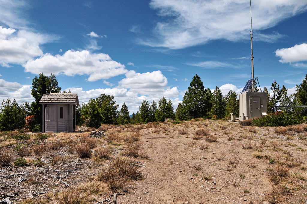
This was the third day of our trip and our intentions were set to see East Butte and China Hat. We debated making the drive out to Pine Mountain afterwards if we finished earlier than expected. This plan was short lived since we didn’t get up as early as we had hoped. We headed out from camp on NF-23 to NF-22 until we reached the 4-way junction with NF-18. If you’re coming in from La Pine, you will head towards the forest via Finley Butte Road which eventually turns into NF-22. We headed north on NF-18 from the junction, if you head south you will end up in Fort Rock. Garnet remembered from his trip back in 2021 that NF-18 was a horrible mess of washboard. We were pleasantly surprised to find it was more recently graveled and graded which made for easy driving in the Civic. It’s also wide enough to be a highway in some sections. We stayed on NF-18 until we reached the signed junction with NF-1850. The NF-1850 road skirts between China Hat and East Butte. Eventually, we came to a weird four way junction where we turned right onto NF-200. We veered left at the fork to continue onto NF-220. We took another left onto NF-700 that started to gain elevation up the butte. This road continues on, but you will want to park at the gated junction with NF-750 that leads to the summit. All the roads getting here were in decent condition minus a few rocks and bumps to avoid. We could tell a grader had recently made some bumps in the NF-700 road that didn’t necessarily improve it. We parked near the sign at the junction, but there is additional parking for a few cars next to the gate as well. Please remember to not block the gate during your visit.


A little ways past the gate you will come to a junction with an ATV trail. You have two options to get to the summit from here. You can either follow the ATV trail that cuts around the southern and eastern side of the slope or you can walk the road that loops around to the northern side. It should be noted this is a popular ATV recreation area and hiking the designated trail comes with its own risk. Garnet decided to hike up the ATV trail this time since he had already walked the road previously. I chose to take the road since my experience with hiking ATV trails hasn’t been the best. There is minimal difference in the mileage, but the ATV track is slightly shorter. My Strava App tracked in around 1.7 miles via the road walk and about 1.4 miles for the ATV track. I made this into a nice 3.10 mile loop by walking up the road and hiking down the ATV trail for comparison. As I was hiking up the road an unmarked white vehicle was driving down from the lookout. We gave each other a wave and I wondered if that was the lookout attendant for the season. There was still snow on the northern slopes of the butte. I could tell the grader had driven up this way as well since the minimal snow on the road had a fresh layer of dirt over it.

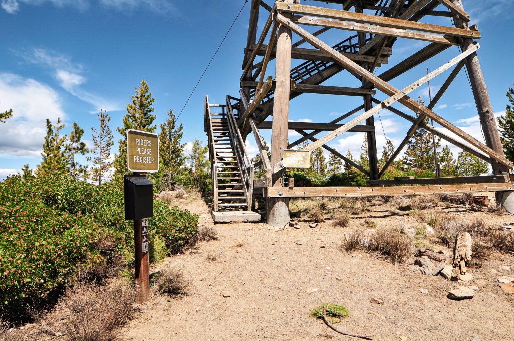

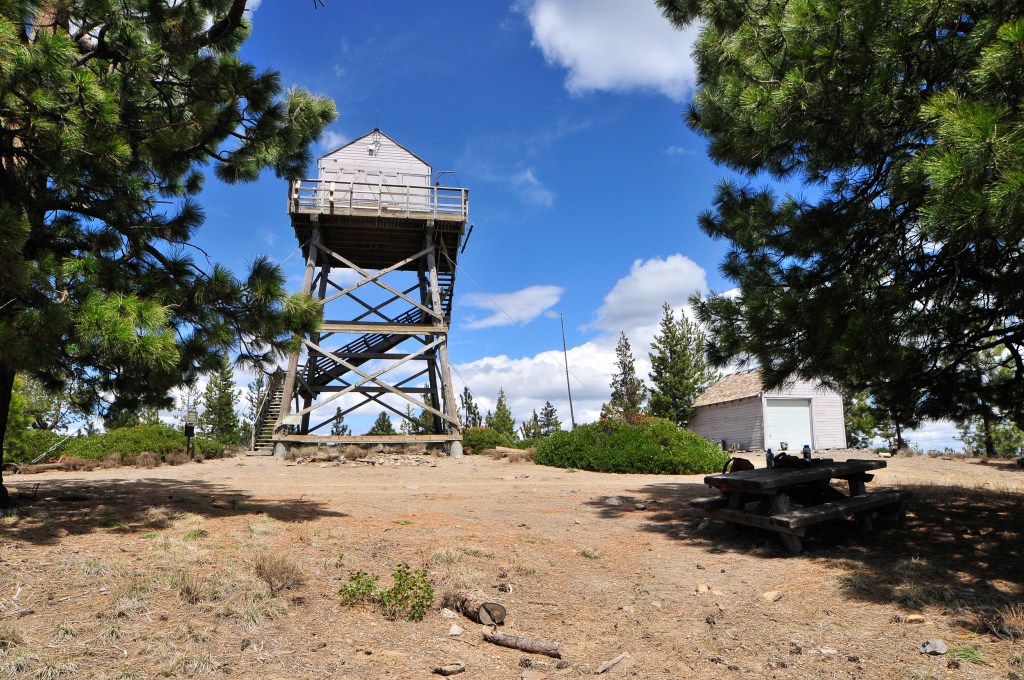
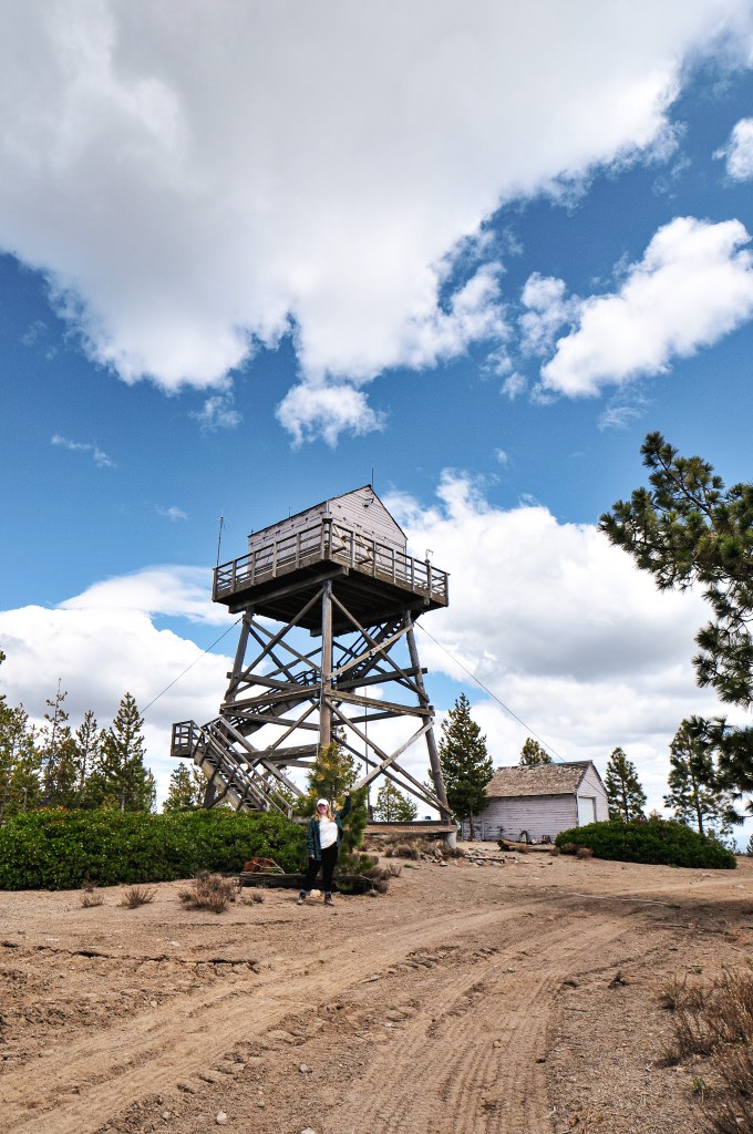
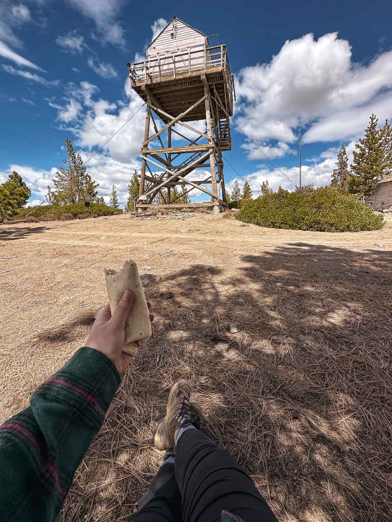
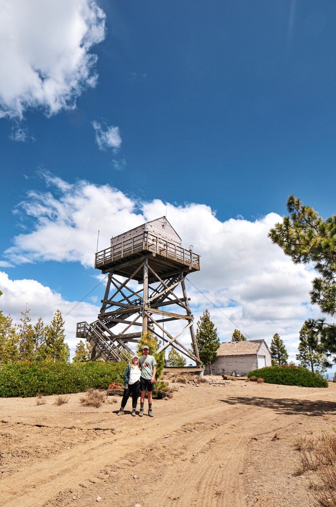
Once I reached the summit, my partner confirmed the person I saw was a fire crew member but not the lookout on duty. The fire lookout was still shuttered for the season, but it should be opening up fairly soon. They were up here to scope out the current conditions prior to the season. Since the fire lookout was unoccupied and there was no one there for us to disturb, we climbed the stairs to get a better view of our surroundings. It’s always fun to try and pick out the peaks and other fire lookouts in the area. After taking some pictures, we enjoyed our lunch and headed back to the car. The hike back along the ATV track was very dusty. It had a lot of rolling bumps in it which is probably fun for an ATV but felt unnecessary on foot. Our next stop was to visit China Hat on the neighboring summit. We didn’t make it very far up the road since it ascends on the northern slope and was still covered in snow.


History.
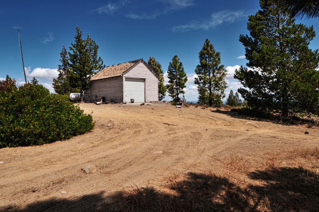
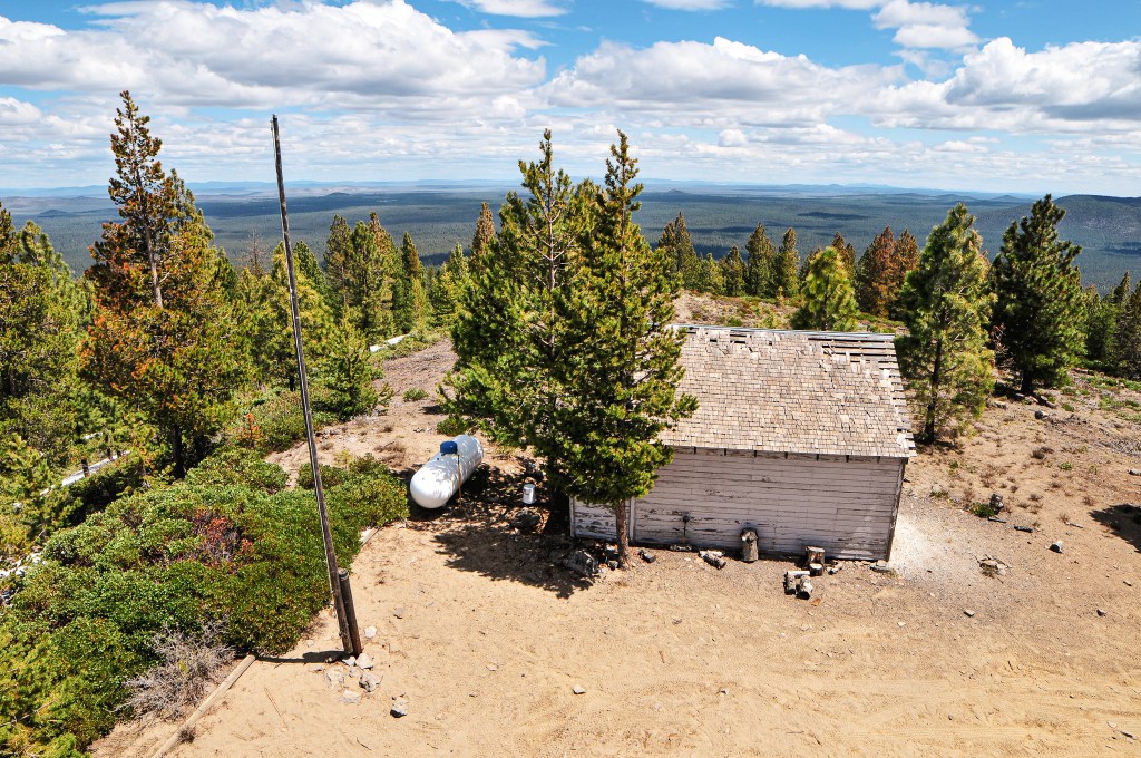
This site was first used for fire detection when an emergency lookout was stationed on the butte in 1930. Between 1931 to 1934 they spent time developing the site each year with a road, then lookout tower, and then garage. The fire lookout constructed was a 14×14 gable-roofed cabin with 30′ round timber tower. The garage was a standard plan T-1E with wood frame and still stands today. This fire lookout was staffed until 1995 when they had to transfer the duties over to Fox Butte. During that time they cut down and burned the existing tower to make room for a new one. The existing tower was completed in 1996 as a replica of the original and duties were transferred back to the site. Though the National Historic Lookout Register lists it as only being a 20′ tower now. They also state that it will only be listed on the Historic Lookout Register until it reaches 50 years old. It is unclear why it would be removed after that time frame. East Butte is still actively staffed every summer.

2 thoughts on “East Butte L.O.”