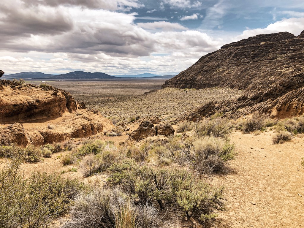
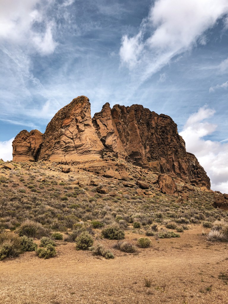
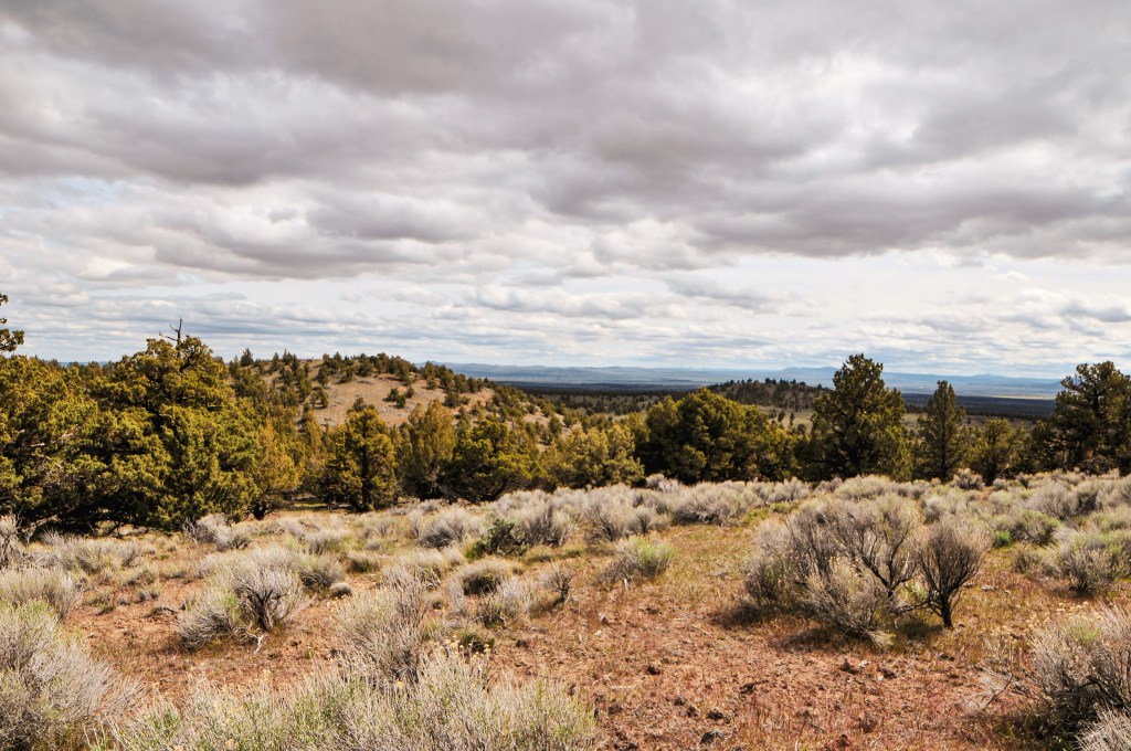
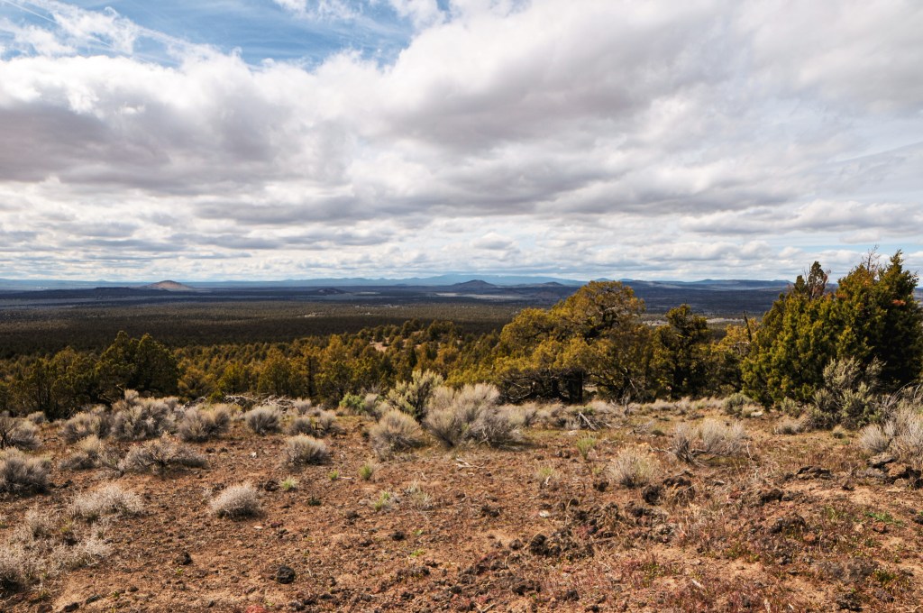
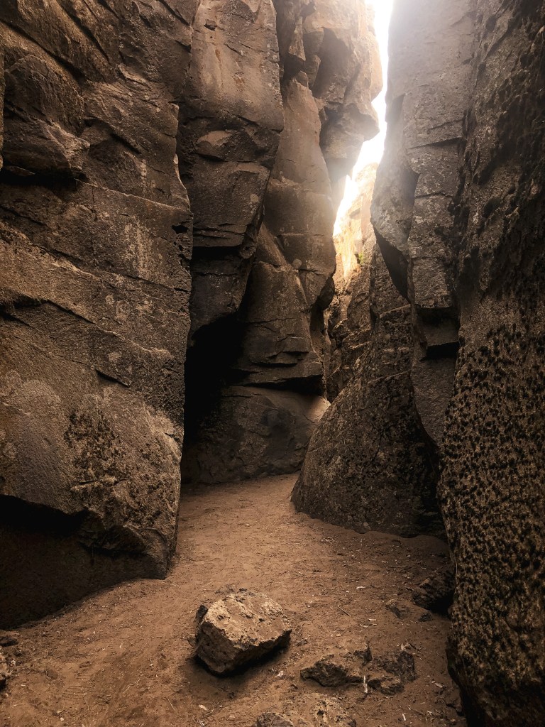
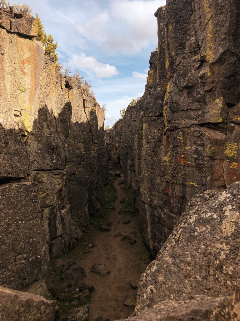
We woke up Saturday with a plan to make a day trip to Fort Rock, Green Mountain, and Crack in the Ground. We headed out of the Deschutes NF via NF-18 passing Cabin Lake Guard Station and made our first stop at the Fort Rock State Natural Area. This large semi-circle rock that now sits in Oregon’s high desert used to be an island in what was once a shallow sea. The oldest sandals dating back to 9,000-13,000 years old were discovered in this area. We hiked the short loop around the rock before moving on. We had to make an unexpected pit stop in Christmas Valley for gas and propane. For some reason our propane connection to our larger propane tank wasn’t working when we tried to make breakfast that morning. We had a half used disposable Coleman propane bottle that got the job done but it wouldn’t last us the remainder of the trip. We were relieved to find Christmas Valley was stocked with both despite one of the stores mentioning a supply shortage. Crisis averted. Just outside of Christmas Valley is a scenic byway aptly named Crack in the Ground Road that takes you directly to Green Mountain and Crack in the Ground. It is a rough and bumpy road but should be passable to most vehicles with caution. We drove past Crack in the Ground to Green Mountain Campground first. The small primitive campground is situated at the base of the lookout. From there it is only a few hundred feet up to the lookout. It was locked behind a barbed wire gate and still closed for the season. You still get a pretty good view from just the base. There were only a couple people camping in the campground, so we used one of the picnic tables for our lunch. On our way back out towards Christmas Valley we stopped at Crack in the Ground. This hike takes you through an old volcanic fissure that is roughly 2 miles long. We were running out of day again so we only went part way into the crack before heading back to camp.
History.
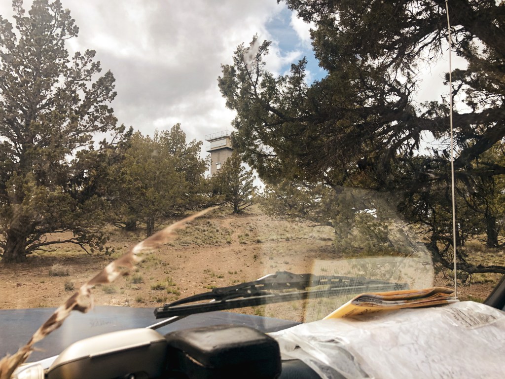
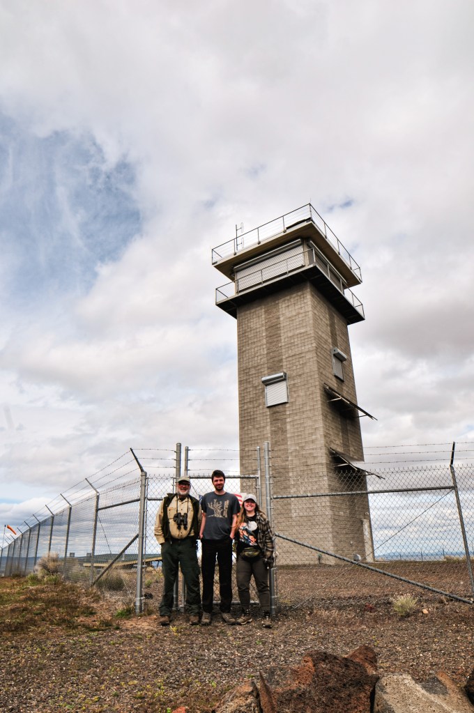
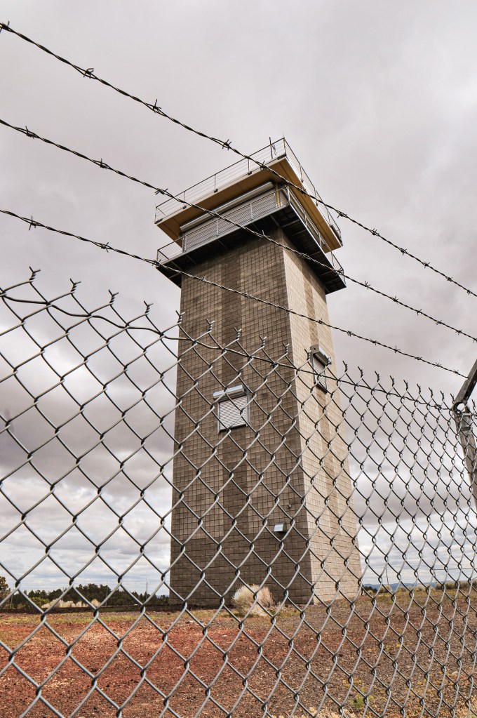
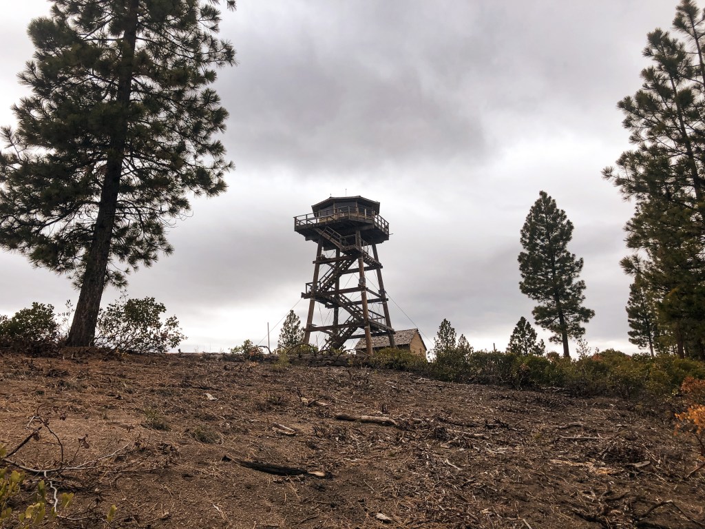
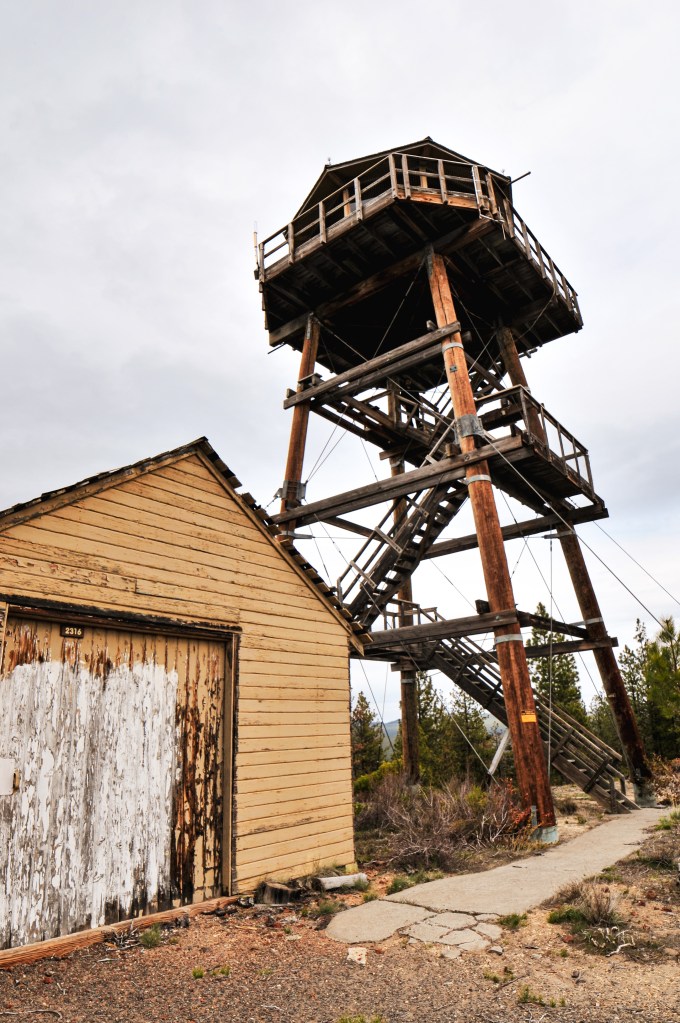
A fortress. A tower for a high-security prison. The tower that kept Rapunzel locked away. The current structure on Green Mountain hardly resembles what we would typically recognize as a fire lookout. The 50′ enclosed cinder block tower with observation cab was built in 2010. This lookout was funded by the American Recovery and Reinvestment Act of 2009. The recovery work consisted of demolishing the existing lookout, building the new lookout, and associated site work. The original 2-story lookout was built in 1963 with a 10′ concrete base and wooden live in cab.
My partner had planned a 4-day camping trip to the Deschutes NF with his dad and myself to celebrate his birthday. We had an ambitious plan to see Spring Butte, Green Butte (post), Green Mountain (post), Pumice Springs, and Fox Butte (post) while in the area. This trip we had the luxury of taking his dad’s truck. Which meant what we didn’t have to worry about in road conditions were replaced with high gas prices and low gas mileage. We left Portland as early as possible to see if we could get to Spring Butte and Green Butte before setting up camp. Luckily, my partner and his dad had been to this area before and knew where there would be dispersed camp spots. This helped cut down on the travel time that we would normally have to allot to searching for a spot. The amount of Forest Service roads in this area are extensive and unmarked due to the OHV traffic. I strongly recommend having a ranger district map of the area if you plan to go down more than just the main roads. Never rely on GPS for navigation within the forest. We came upon a lost couple on our drive out of the forest on the last day of the trip that flagged us down to ask for help. They thought if they continued down the road long enough it would eventually turn to pavement and had ended up there due to their GPS. We warned them they were headed for more miles of gravel and should turn around since they were still close to the edge of the forest. Luckily, they took our word for it and followed us all the way out to La Pine.
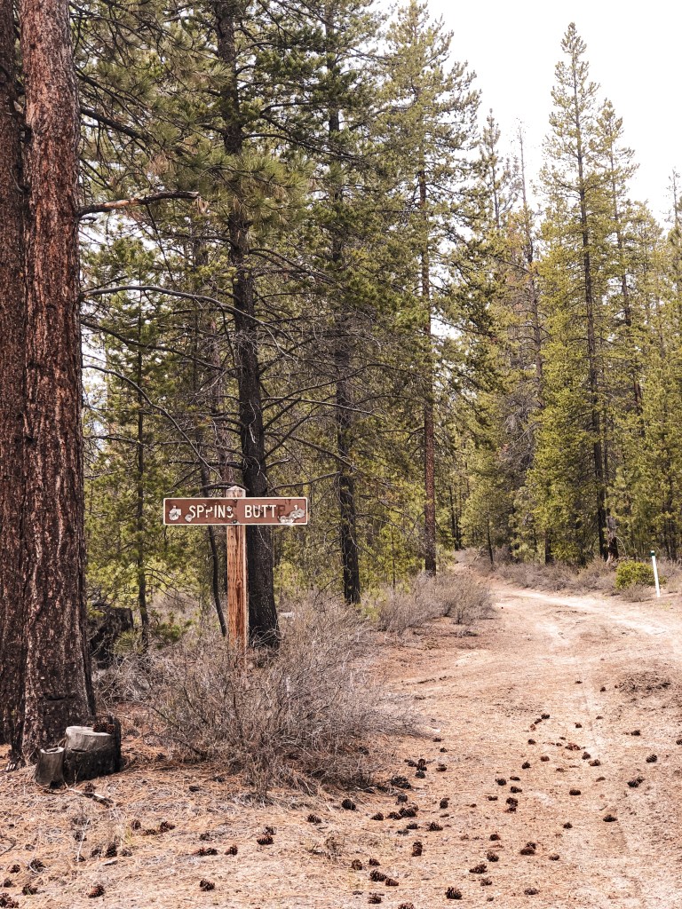
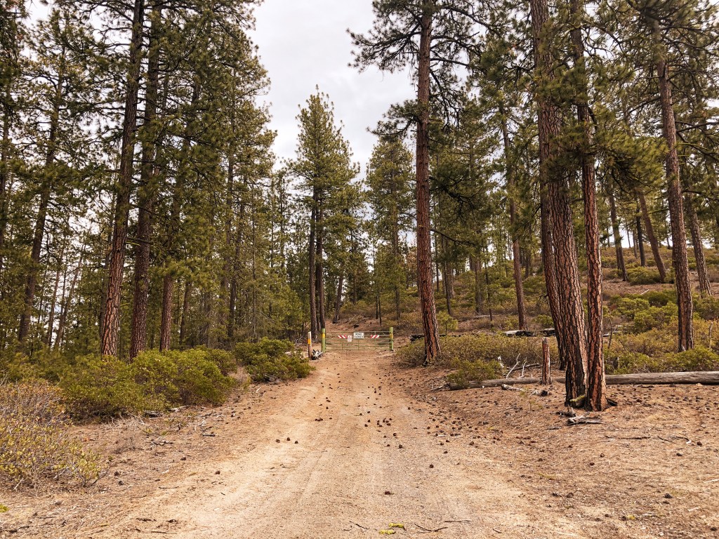
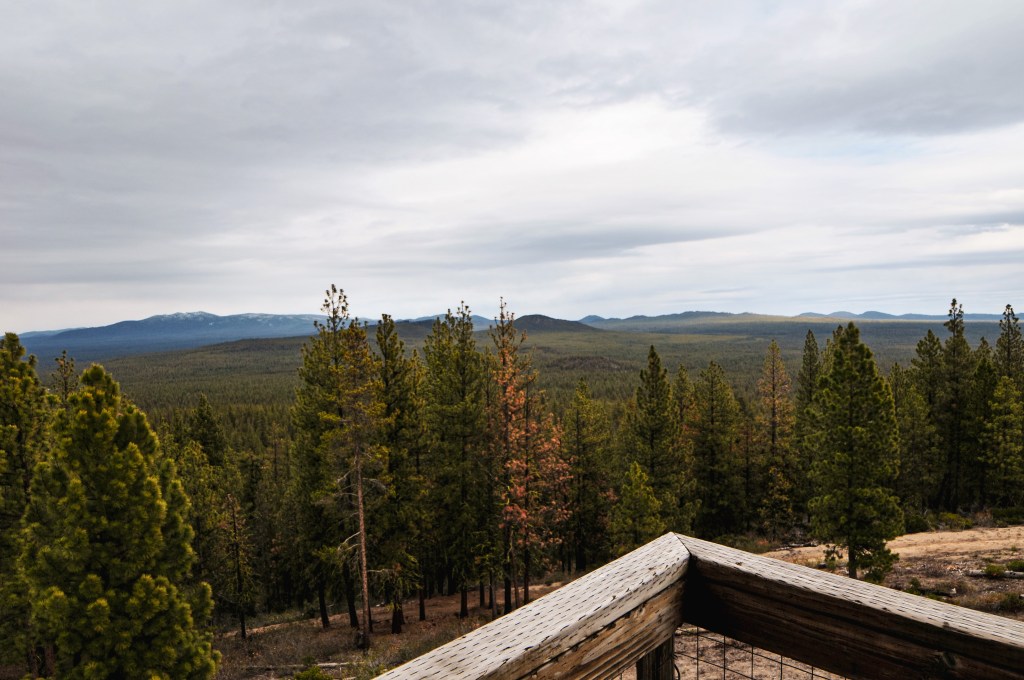
On the ranger district map the most direct route to Spring Butte looked like NF-2220 off of HWY-31. I think under normal circumstances this road would be a good route to take but since it was still early season we ran into a lot of debris and downed trees. I also wouldn’t recommend this route as the best way for lower clearance vehicles. We were able to drive down NF-2220 until it’s junction with NF-600. There was a large downed tree blocking the road that, even if we had remembered to bring our buck saw, would have been too big to cut without a chain saw. We noticed NF-600 basically paralleled NF-2220 and decided to attempt that route instead. NF-600 is a rocky spur road that doesn’t see a lot of use. On the map it appeared to connect back to NF-2220 via another spur road, but we quickly found out it was barely even a jeep track up a rocky slope. We continued on NF-600 until it met up with NF-2420. This took much longer than expected since we constantly had to stop and move downed trees out of the way. Thankfully they were all small lodgepole pines. From NF-2420 we took a left and headed towards NF-2430. You will turn left and stay on NF-2430 until you reach the spur road NF-830 that will take you all the way to the lookout. NF-2430 crosses NF-2220 before you reach the spur which is where we were hoping to come from originally. There is a sign for the turn to Spring Butte L.O. from NF-2430 as well. From this junction it is only a mile. If we had been driving my Civic this is where I would have parked and started to road walk. We drove the truck a half of a mile up the road but decided to walk the rest of the way after a particularly rutted section. The road is gated near the lookout so you would have to get out and walk no matter what. It looked like someone had been here recently prepping for the start of their fire season since the shutters on the lookout had already been removed. We spent a short time on the summit since we were pressed for time and still wanted to attempt to find Green Butte. This lookout completed our set for all the lookouts with octagonal cabs in Oregon.
Once back at the truck we started heading towards Green Butte (post) on the map. This meant taking NF-2430 back the way we came. You will want to stay on NF-2430 until you reach NF-2222 on the left. It looked like there were multiple connecting spurs that would take you to Green Butte (post) but the most direct route is from spur NF-700. This spur unfortunately wasn’t signed. We were able to guestimate the turn after we went too far and met a different spur that was signed. Once you’re on NF-700 you will turn right on to NF-720 which is in fact marked. My partner’s dad didn’t feel like road walking with us and parked the truck at the junction. From here my partner and I walked up NF-720. We made the mistake of not taking our map or taking a picture of the map before we left. We thought NF-720 would take us to the summit but quickly found that there were multiple spur roads heading towards the butte while NF-720 paralleled it. The two spurs we had to choose between were NF-725 and NF-550. We started up NF-550 first and it appeared to be headed in the right direction. I’m a significantly slower hiker than my partner and I was worried we wouldn’t have a enough time in the day to make it back to the truck and camp before dark. I turned back before the road got too steep but my partner continued on in hopes of finding the lookout. I made it back to the truck around 6PM and we waited for my partner to return. He was lucky that we had guessed the correct spur road to reach the summit and was successful in finding the lookout. From NF-550 you turn on to NF-555 that will take you all the way to the platform lookout. I’m bummed I didn’t make it this time but now I know how to get there in the future. My partner made it back to the truck around 6:30PM mostly because he ran the rest of the way after I turned around. We ended up setting up camp much later than expected but it was worth it.
If you are wanting to reach Spring Butte L.O. with a lower clearance vehicle, I recommend starting on NF-22 which leaves directly from La Pine. It is marked as Finley Butte Road in town but eventually turns into a Forest Service road. From NF-22 you can take the other side of NF-2220 to NF-2430 to NF-830 or you can go to NF-2222 to NF-2430 to NF-830. Since I can only speak on the roads I’ve been on, I’d recommend NF-2222 to NF-2430. I would consider these portions of the road passable to lower clearance vehicles.
History.
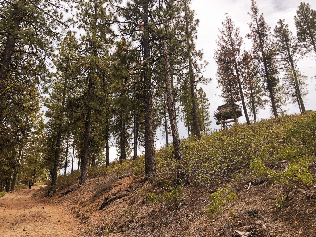
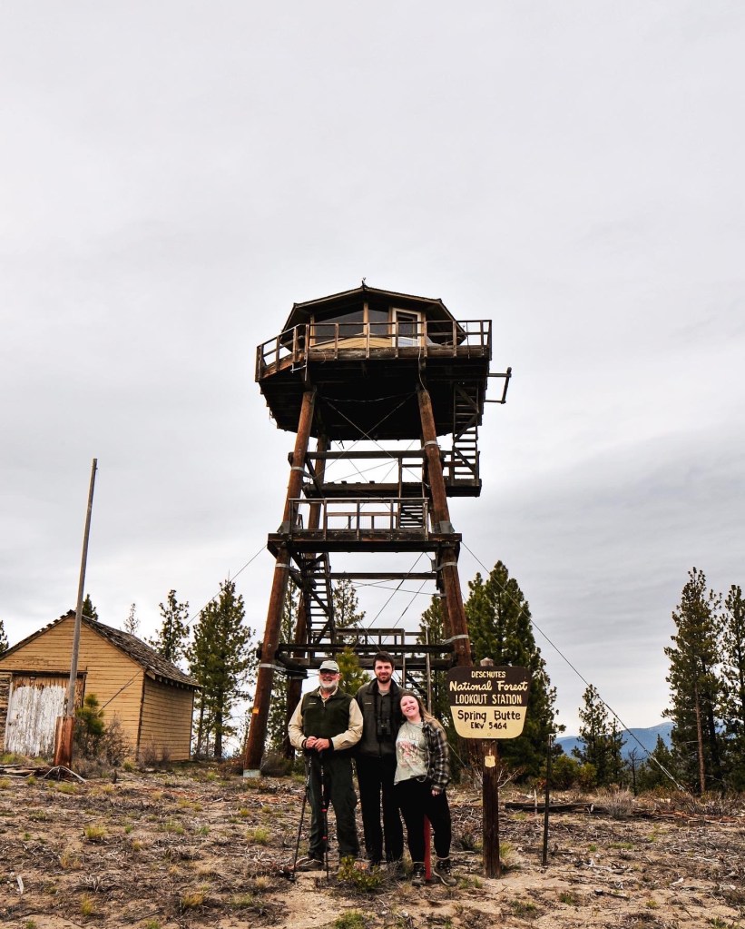
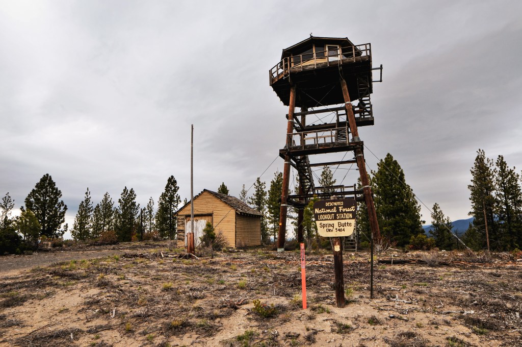
Similar to Sisi Butte (post) and Calamity Butte (post), the existing Spring Butte L.O. has an octagonal cab. It was constructed in 1991 as the first of its kind in Oregon. The 16’x16′ cab sits shorter than the other two with a 41′ pole tower. It is still actively staffed every summer, so always make sure to be respectful of the active lookout attendant’s space and only climb the tower if you’ve been invited up. The previous lookout structure was developed in 1932 as a 30′ tower with 14’x14′ L-4 cab. It was maintained regularly between the 1950s-1970s and used up until it was deemed unsafe in the 1990s. In November of 1997, the existing lookout was broken into and vandalized. The damages were estimated up to $10,000. The fire finder and other furniture were torn and tossed from the height of the tower with complete disregard. It is unfortunate to hear that some people have such a lack of respect for places like this which is often why they are hidden behind locked gates. It is our collective responsibility to help keep places like this intact for future use and others to enjoy.