
Location.
William O. Douglas Wilderness
Status.
Intentionally removed by 1968
Estimated drive time from Portland, OR.
5 hours
Date visited.
August 10, 2024
Elevation.
6,340′
Former Fire Lookout Site Register.
US 1303; WA 203
Trip Report.
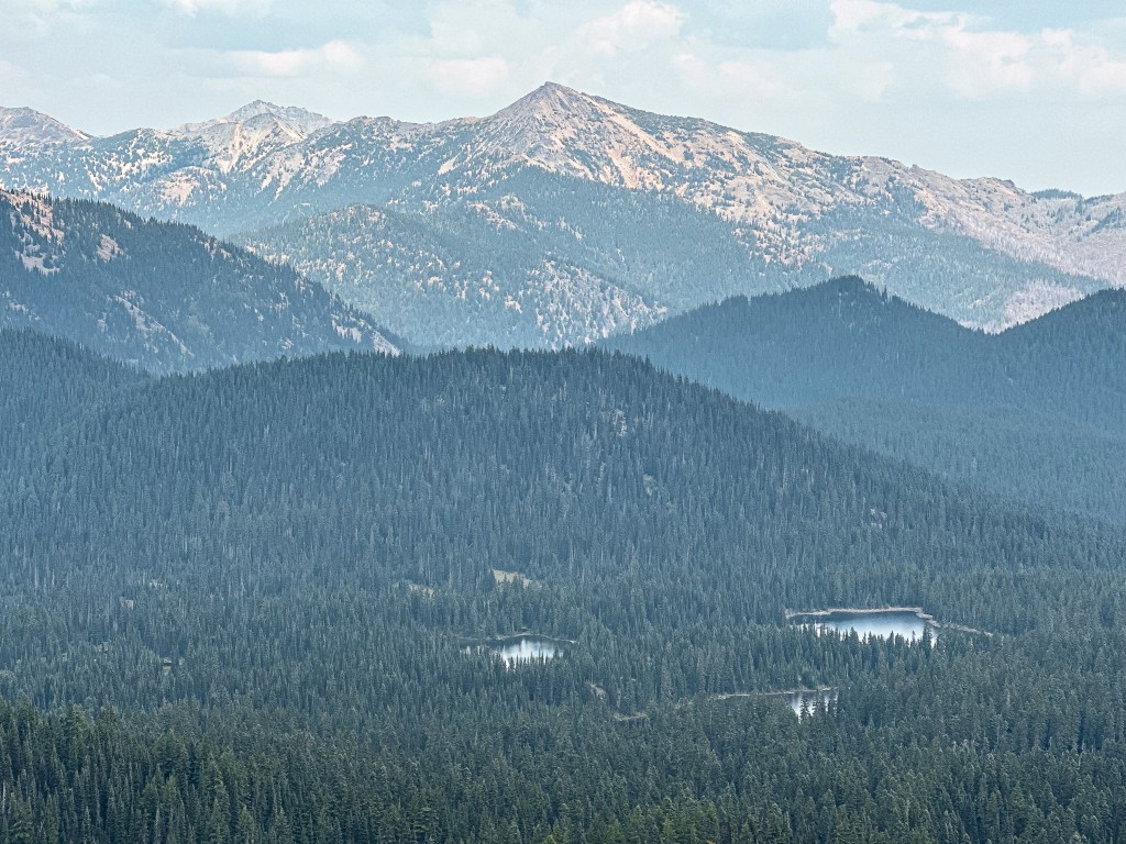
We spent two nights over the weekend backpacking in Washington’s William O. Douglas wilderness with two of our friends. Every time I come back to this wilderness I fall in love a little bit more. This might arguably be my favorite wilderness in the state (that I’ve been to so far). The plan was to backpack in to Blankenship Lakes via Indian Creek trail #1105 and establish a base camp at one of the lakes. From the Blankenship Lakes, there are a few good options for day hikes. You can do a lollie loop to Pear and Apple Lakes, or an out and back to Twin Sister Lakes, or an out and back to Tumac Mountain. There are plenty of interconnecting trails to choose your own adventure. Garnet was set on visiting the former fire lookout site on top of Tumac Mountain, but I was a bit skeptical about the distance and if our friends would want to join. There are plenty of routes to reach the summit of Tumac Mountain, please note that this one is not the most direct. It does appear that the northern trail is the preferred route for peak baggers via the Deep Creek trailhead.
Friday.
We left Portland around 8:30AM with the plan to meet our friends from Kirkland at the trailhead around noon. Our route took us through Mount Rainier National Park via HWY-123 to HWY-410. From HWY-410, we turned right onto Bumping River Road toward the Bumping Lake Recreation Area. The road is paved until you pass the main Bumping Lake campground and it turns into NF-1800. It was just after 12:30PM when we reached the end of the pavement. Our prior research of the area mentioned this road being rough, but that low clearance vehicles could make it with caution. We figured with our experience it would be fine and that maybe the conditions were over exaggerated online. They were right that you could make it if you really wanted to in a low clearance vehicle, but let me be the first to say AT WHAT COST?! The road is about 8 miles from when you leave the pavement to the Indian Creek Trailhead. It took us 2-1/2 hours to drive those 8 miles in the Civic. The conditions were terrible from start to finish with minimal sections of decent road. Most cars with clearance will have no issues aside from potentially popping a tire on the imbedded rocks. Our friends were able to drive the same section of road in 45 minutes which left them concerned and waiting. There are not too many junctions along this route besides one major fork. We continued to the left to stay on Deep Creek Road. The right fork takes you to alternative trailheads that enter the wilderness from the eastern side of Bumping Lake. I’ve read that road is in similar condition. There were a few minutes of panic once we pulled into the trailhead parking and didn’t see their car. We decided to walk back out to the main road and wait for them. As we reached the road we heard a car pulling up and it was thankfully them. They had been waiting for an hour and were concerned we continued on to the Deep Creek TH instead. They were just coming back from scoping it out and were going to check the Indian Creek TH again before heading out to find us. We read the road is washed out beyond the Indian Creek TH and our friends confirmed our car would not have made it that far.
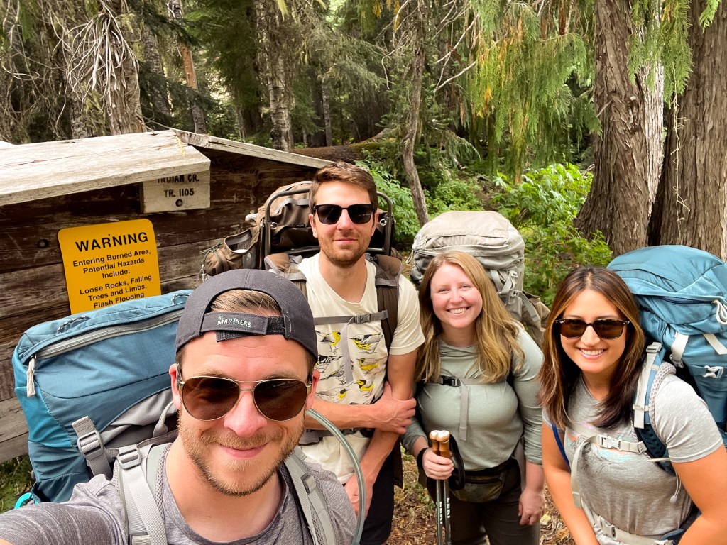

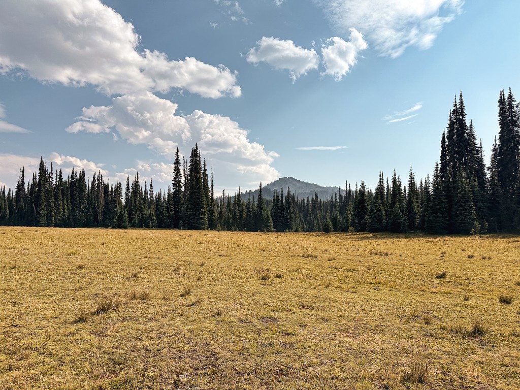
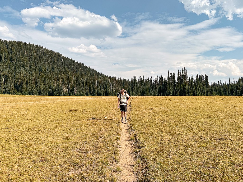
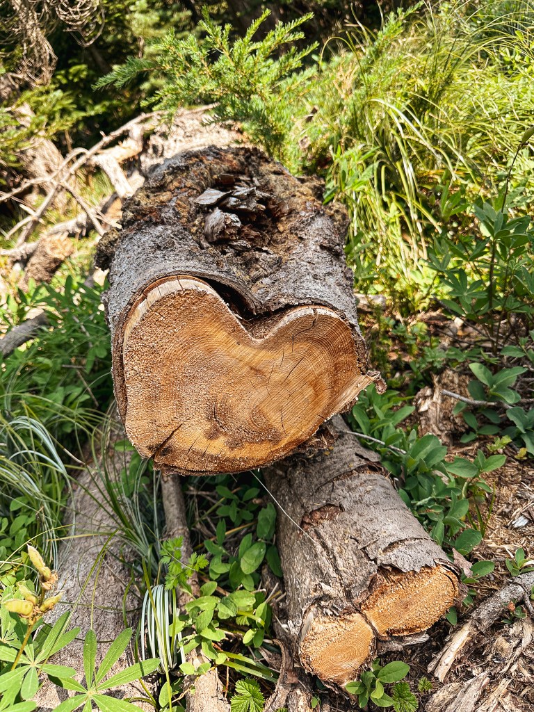
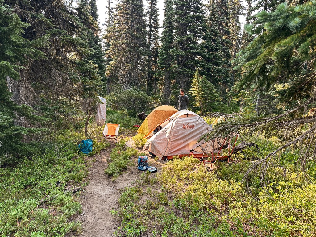
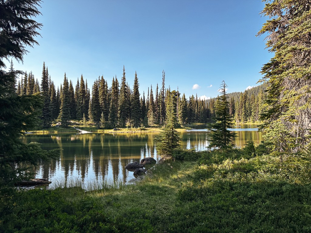
After a quick reunion, we saddled up our packs and headed out on the trail. We were getting a later start than expected but we didn’t have too far to hike to reach the Blankenship Lakes. It is roughly 3-1/2 miles with 1,170′ of elevation gain to reach the lakes from the trailhead. Shortly after starting the hike, we met a fork in the trail and stayed left to continue on the Indian Creek trail #1105. The trail heading to the right will eventually lead you to the Deep Creek TH and the Twin Sisters trail #980 which is a quicker access point for Tumac Mountain. For 2 miles, we gradually climbed our way up switchbacks to the Blankenship Meadows. The trail opens up and flattens out from here. In the meadow, we passed a faint trail junction that was only discernable due to the cairns heading to the right. This was the Round Lake trail #1105A. We continued straight through the meadow noticing our first glimpse of Tumac Mountain before heading back into a forested section of trail. The next junction we reached was more defined and signed with Sandy Trail #1104A. We turned right at this junction to reach the lakes. The first and largest of the lakes offered another nice view of Tumac. There was a tent already pitched at the main campsite here. We continued around parts of this lake and the next in search of options. There was a surprising lack of viable camp spots that we could find. We didn’t search the entire area, so it’s plausible there are more hidden away, but we were surprised nonetheless. We eventually settled on a spot located on the edge of the smallest northern lake. It was just barely large enough to fit our two tents and was sloped on one side. The forecast had mentioned a 20% chance of rain and thunder, this held true as some loud thunder cracked closer than we’d like to our camp. It was a bit concerning with all the wildfires already this season. It made us think about at what point do you know or decide to evacuate an area. Thankfully it didn’t come to that, but it is something to consider when you’re deep in the backcountry. The rain that followed later in the evening was a welcome sound as we fell asleep.


Saturday.
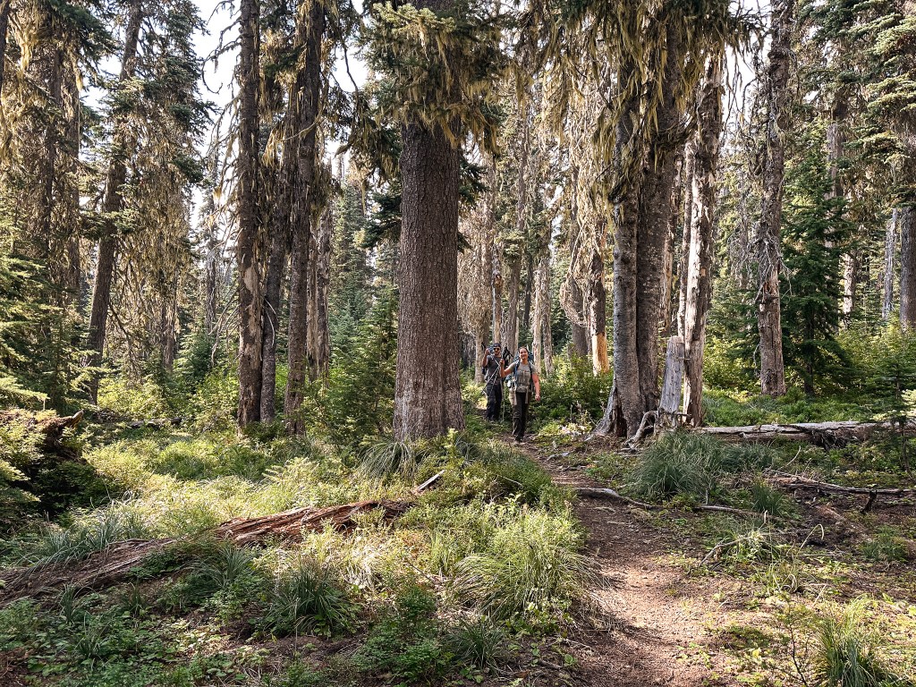
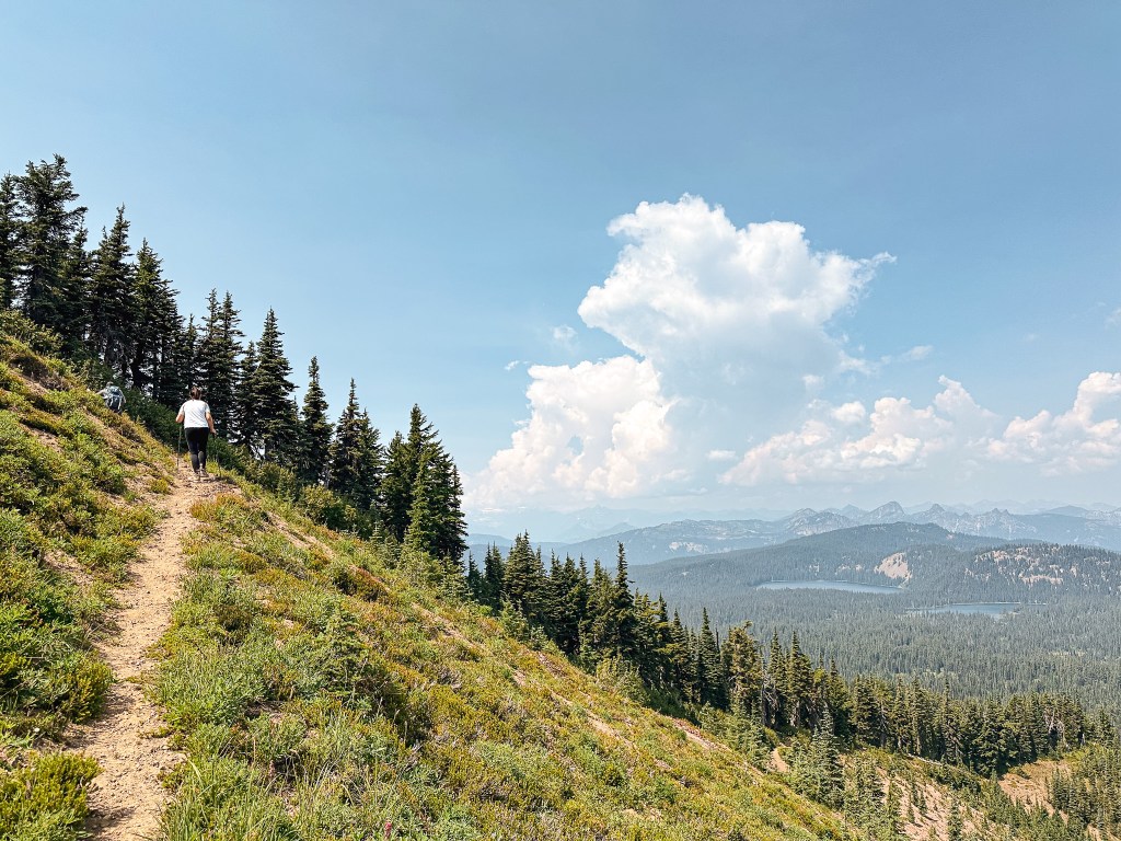
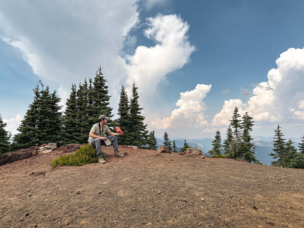
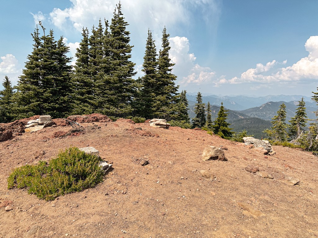
We woke up to clear skies and all collectively agreed to attempt the trek to Tumac Mountain together. After a leisurely breakfast, we packed a lunch and continued along the Sandy Trail #1104A to connect to the Sand Ridge Trail #1104. Despite being almost parallel with the mountain at Blankenship Lakes the trail does not offer an eastern approach to the summit. We had to head north towards Twin Lakes to connect to the Tumac Trail #944 before turning south again. There are a lot of well defined game trails in this wilderness, so it can be easy to get turned around if you’re not aware of your surroundings. We found all the junctions here well signed or defined enough to stay on track though. The biggest difference to note is the Tumac Trail sign is numbered as #44 instead of #944 like the maps suggest. This trail eventually connects to Cowlitz Trail #44 and was probably a continuation of it before being redesignated. My biggest concern had been the potential trail conditions towards the summit of Tumac since previous reports mentioned parts of the trail being washed out. It seems all those reports were from those taking the trail along the southern slope. The trail we took from the north was in great condition. Based on trip reports the northern approach sees more use and is more popular among equestrians as well. We reached the summit around 1:20PM and spent an hour enjoying our lunch with the surprisingly clear views. There was some cloud coverage and the trees were obstructing some of the original views, but I was still impressed. I signed the summit register staking my claim as a minor peak bagger that only visits former and standing fire lookout summits. It’s always fun to see when and who was the last person to sign the register. On the way back I decided to track our route to get a more accurate mileage count from our camp. Unfortunately I did not remember to start the tracker until I was a switch back or two down from the summit. Strava came in at 3.94 miles from where I started it on Tumac to the Blankenship Lakes. The exact mileage is probably closer to an even 4 miles. Most of the trails in this area are relatively flat with minimal elevation gain until you reach the base of the mountain. I don’t have the exact elevation gain but it is somewhere around 1,000′ from the lakes. On our hike back down Garnet started to notice insulators and signs of the old telephone line along the Sand Ridge Trail. We thought this was interesting since we didn’t see signs of any along the Tumac Trail. The heat of the day wore us all down and we wasted no time taking a dip in the lake once back in camp. The hike to Tumac was an all day affair and we were all ready for bed early.


Sunday.
We didn’t get any precipitation that night, but a fog rolled in dense enough to wet our gear and surroundings. I figured we would get more smoke during our trip being so close to the Retreat wildfire. This was a welcome alternative. Our route out was the same as our route in, but you could arguably make this a loop if you wanted to hike out near Twin Lakes. As we were leaving we noticed the same tent still at the main camp off the largest of the Blankenship Lakes. Normally this wouldn’t cause much question, but there were a few pieces of gear such as their food bag, a hanging shirt, and their chairs that looked like they had not moved since Friday. Part of me wishes we had investigated it a bit closer, but we didn’t want to accidentally disturb them if we were wrong. It’s possible they were just out on day hikes both times we passed their camp. We had even smelled someone having a camp fire Friday night that we had assumed was them (despite being in a burn ban). Another weird thing to note was it sounded like someone had walked near our camp that morning, but from the trail leading around the lake not off the main trail. We figured it could have been whoever was camped near by but Garnet didn’t see anyone when he poked his head outside of the tent. It was odd enough that it left us thinking about it the majority of the hike out. I decided to continue tracking our route back to the trailhead for an overall mileage count. Strava calculated from our camp to the trailhead was 3.7 miles. I don’t have the exact elevation recorded since it was all gained on the way in. This would put our total estimated mileage to Tumac Mountain and back at 15.4 miles with 2,170′ of elevation gain/loss. We saw plenty of signs of people and wildlife around us but didn’t end up seeing anyone during our entire trip. The road was our least favorite part and felt even longer on our way out. The estimated drive time above does not factor in the 2-1/2 hours along the 8 miles of gravel road since most people seem to have a higher clearance vehicle. I can definitely say I will be back to William O. Douglas wilderness in my future, but given the road conditions I don’t think we will attempt to access it from this side again.

History.
Tumac Mountain was considered a fire lookout site as early as the 1930s when a camp was established. The first and only structure was built on the summit in 1937 as a standard L-4 ground cabin. The site sits atop an old cinder cone that had an impressive 360 view of the surrounding area. An excerpt from The Daily Chronicle in 1961 notes that according to the district records the fire lookout attendant onsite for the season had 179 visitors between July 15 to Sept 15 despite its remote location. The lookout was removed or purposefully destroyed by 1968. Remote structures like this one were typically burned onsite by the Forest Service for liability issues.


