
Location.
Glacier National Park
Status.
Active; Currently standing
Estimated drive time from Portland, OR.
12-1/2 hours
Date visited.
September 25, 2023
Elevation.
8,436′
National Historic Lookout Register.
US 40; MT 8
Trip Report.
Monday was forecasted to be our nicest day of the week, so we allotted this for our hardest and highest elevation hike in the park. The end goal of the day was to reach Swiftcurrent lookout. No matter which way we sliced it the ascent was going to be difficult. You have three options when picking your starting point; the Loop, Logan Pass, or Many Glacier. The shortest option starts from the Loop trailhead, but requires the most elevation gain. This route is estimated around 12.5 miles RT with 4,200′ of elevation gain. If you start from Logan Pass instead, you are rewarded with the least amount of elevation gain but will have the most amount of mileage. This is estimated around 19 miles RT with only a little over 2,000′ of elevation gain out and back. During the peak season, you could shave off 3 miles by ending at the Loop trailhead and taking the shuttle back to Logan Pass. We unfortunately did not have the option for a shuttle during our visit. Your middle of the road option would be to start from Many Glacier. The route is estimated around 15 miles RT with 3,000′ of elevation gain. We immediately eliminated the Many Glacier route due to the location being on the Eastern side of the park and adding too much drive time. I debated starting us from Logan Pass since I can handle more mileage better than I can steep elevation, but 19 miles felt a bit out of reach for both of us. The only route that seemed obtainable during our visit was the one starting from the Loop. I wasn’t confident I would make it, but I wanted to at least give it a shot.


We tried to give ourselves as early of a start as possible and were at the parking lot by 9AM. This trailhead is easy to locate as a main pull off from the Going-to-the-Sun road on the western side of the park. It’s situated on a tight hairpin turn with parking above and below the corner. Make sure to be careful when crossing the road from the parking lot to the start of the trail, it is a blind corner and people take it faster than they should. The trailhead is fairly small since most visitors choose this as an ending point instead of a starting point. It sees most of its use during the summer when the shuttles are running and visitors are completing their hike of the highline trail. I didn’t expect to see as many people as you would in the summer, but I was surprised on how quiet it was for us. It seemed most cars were only parked for the roadside view point. We only saw a handful of people on the trail to and from the Granite Park Chalet. The amount of people around the chalet was a different story.
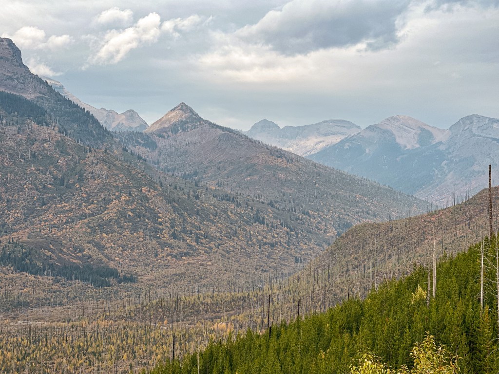


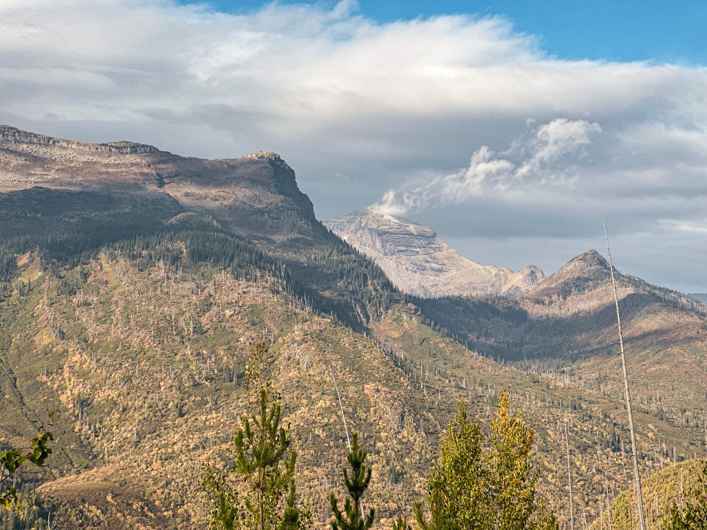

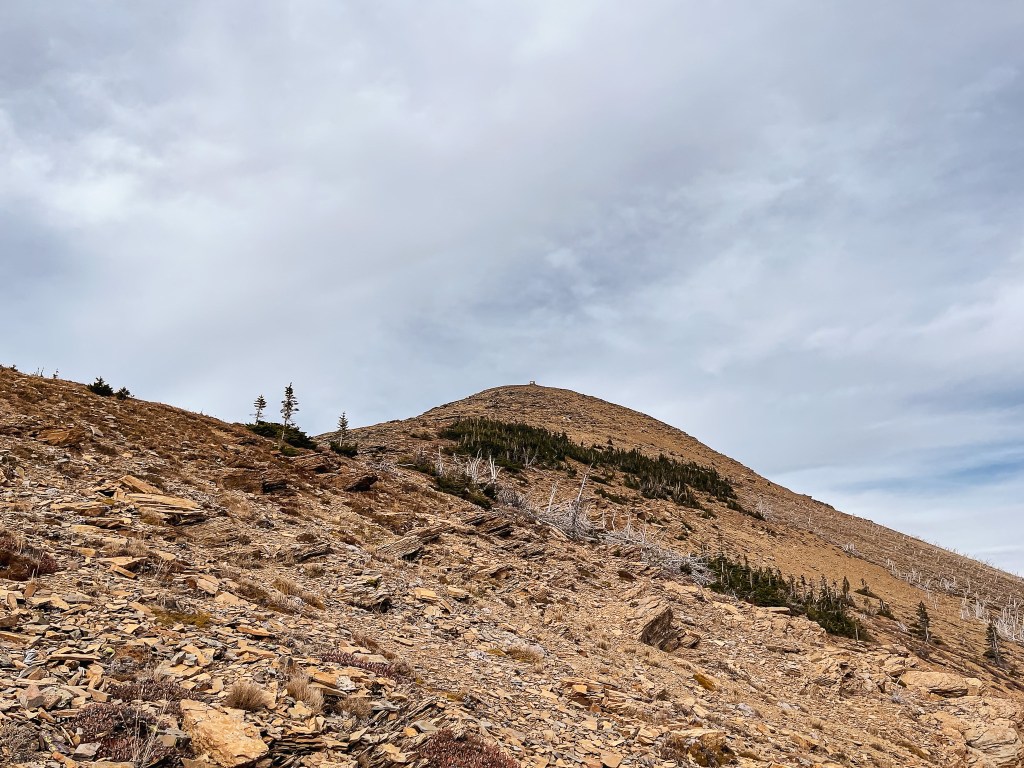
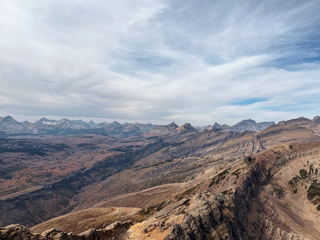
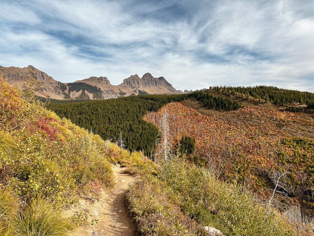
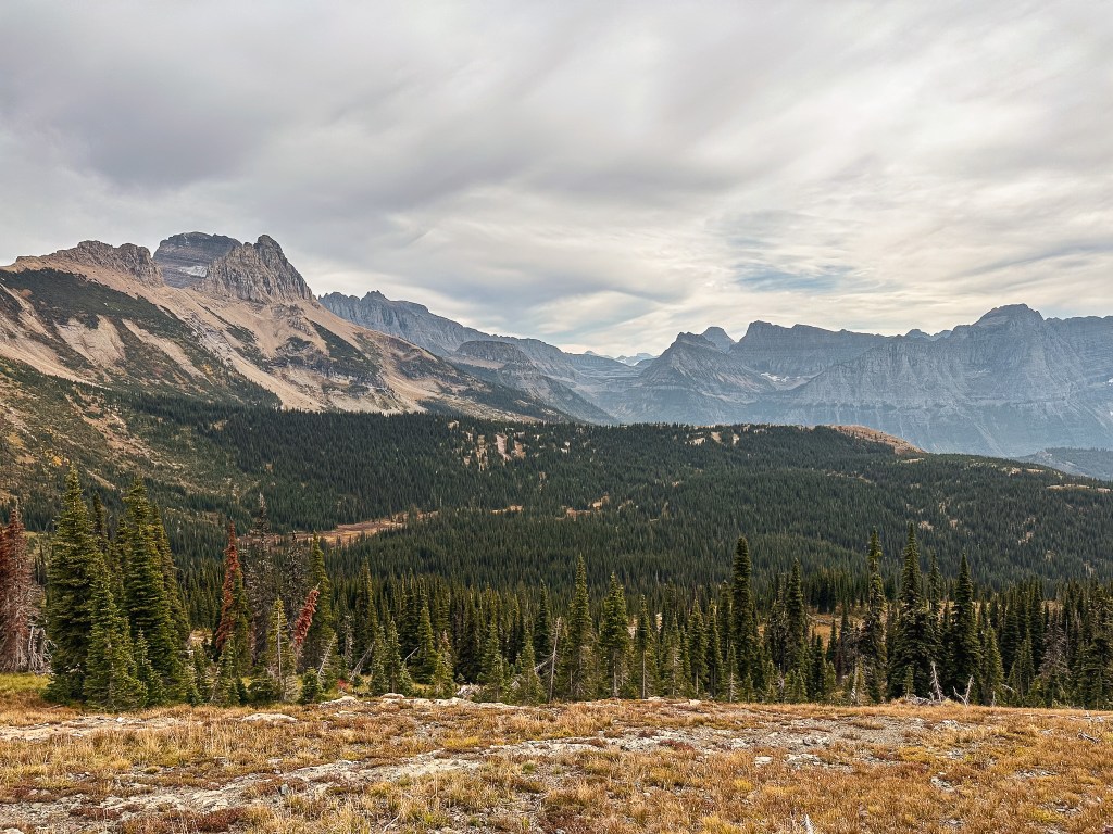
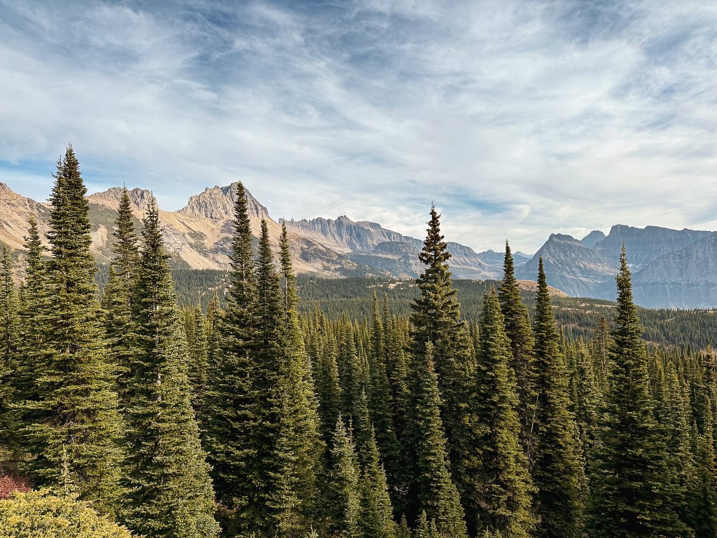
The trail starts out by undulating along a gradual slope for the first mile. The elevation starts to pick up gain around the first switch back. We had a decent view into the drainage below due to the area being burned over. This opened up the view to not only see Swiftcurrent throughout parts of the hike, but Heaven’s Peak for most of it as well. At first glance you might not notice the fire lookout on the edge of the ridge due to its stone structure blending with the surroundings. But, once we knew where to look it felt like the always watchful eye of Sauron (if you know, you know lol). It can be seen from a lot of hikes within the heart of the park if you know where to look. Despite its ever visual presence, the route to Heaven’s Peak has long since been abandoned. Although interesting this wasn’t on our agenda for the trip, so we turned our focus back towards Swiftcurrent. It wasn’t until after the second switchback that I started to feel a dull ache in my hip. I was already moving slow and knew I should have done more conditioning for this trip. I tried to convince my partner that he should hike on ahead, but he wasn’t willing to give up on me making it to the summit. It’s possible I was just too deep in my head about this one, but I knew I wasn’t going to make it and had that feeling from the start. I even had that feeling the day before, if I’m being honest. I started to feel bad that I was slowing my partner down and I didn’t want him to miss out on something I knew he’d have no problem completing otherwise. We had a direct view of Swiftcurrent once the trail started to turn away from the valley and into a more forested part of the slope. It looked deceivingly close from the vantage point. We hiked on with more determination, but seemingly not getting any closer. We knew we were finally close to the chalet when we reached the trail junction that lead to the backcountry campsites. We briefly debated whether we should check it out now or later, but I was hungry and tired and wanted to make it to the Chalet for lunch. We continued right at the fork for another 1/2 mile to the Chalet. It was just after 12PM and we had hiked roughly 4 miles with 2,600′ of elevation gain to get here. We had only seen three pairs of hikers on trail from the trailhead and there was only one couple sitting at a picnic table enjoying the view when we arrived. We decided on a table in the shade to have our lunch and figured the quiet was due to the lack of shuttles running.

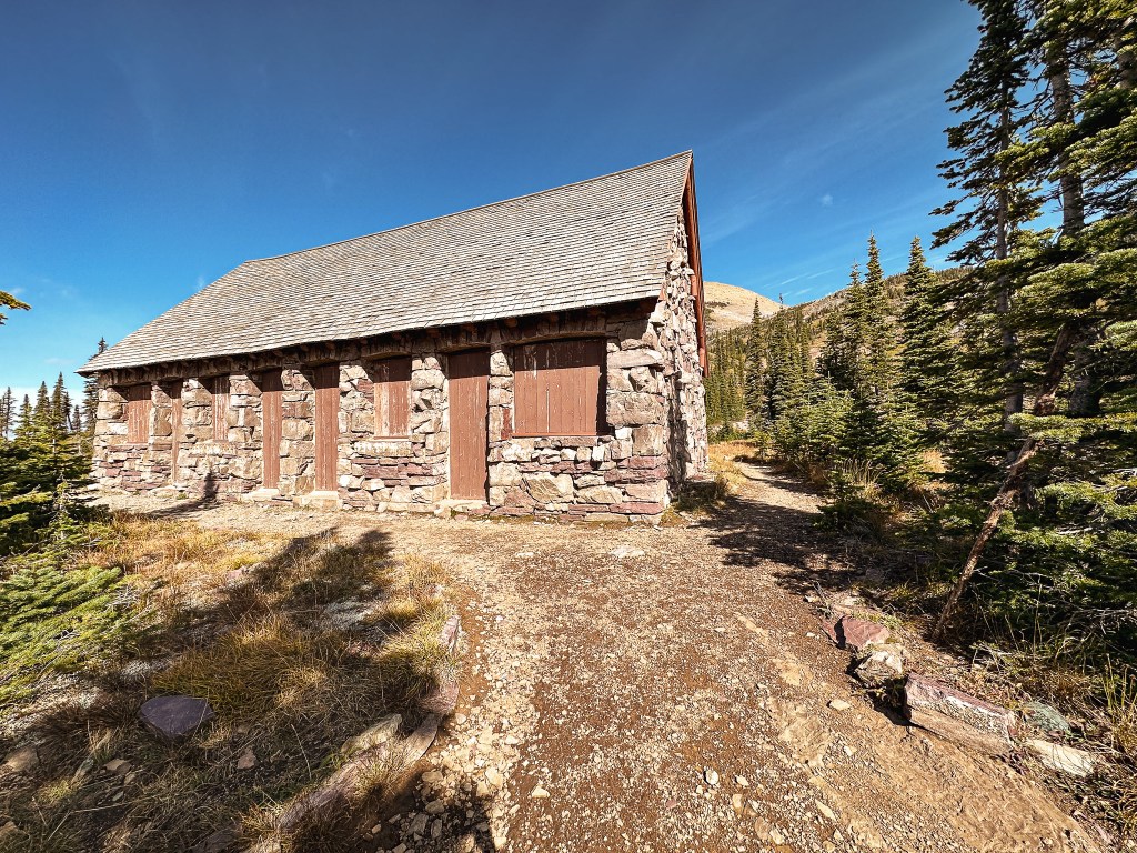
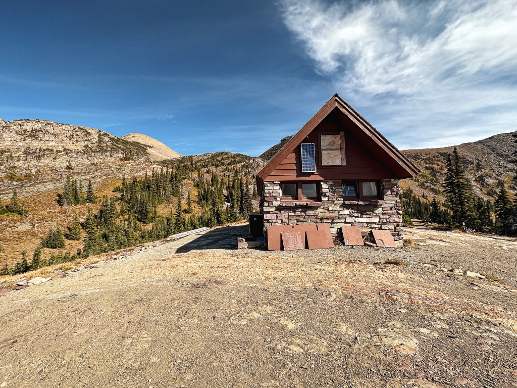


It would have been novel to see the Chalet when it was open for the season and be able to buy convenience store snacks in the backcountry. I day dreamt about the combination I would have bought while we ate what we brought with us. I also considered how much easier it would have been to make it to Swiftcurrent if we were staying the night at the Chalet or even the backcountry campground. From the Chalet, it is roughly an additional 2 miles (4 miles RT) with 1,650′ of elevation gain and 40 switchbacks (yes, someone else counted them) to reach the lookout. I decided to seal my fate and hang back at the Chalet while Garnet made his summit attempt. If I ever get a chance to make another attempt, I would choose to break it up with a night at the campground. It took him around 3 hours round trip to make it there and back. I had a bit of service at the Chalet and was able to download an e-book from my library to read while I waited. The amount of people that were at the Chalet ebbed and flowed throughout the day ranging from only a handful to large loud groups. Most had hiked from Logan Pass and didn’t stay long since they still had to make the trek back. I had since moved myself to another picnic table facing the view in the sun after Garnet had departed. It was cold and windy in the shade after I had cooled down from our ascent. I was just trying to stay warm and entertained while I waited, but to the on lookers it appeared I was just another kid engulfed in my phone not appreciating the view. One might argue I’m projecting, but someone felt the need to make a comment close and loud enough so I would hear them. Little did they know I had been there for 2 hours already. It rubbed me the wrong way, plus the book I was reading wasn’t that engaging, so I decided to stew on it for the remaining hour instead. It made me regret not bringing the extra weight of my book up with me, no one would have said anything if I had my nose in a physical book. Eventually, the flow of people dwindled and the Chalet was eerily quiet. I figured he must be getting close and decided to stroll around the grounds. My intrusive thoughts decided to take hold at this point. What if he already came back and didn’t find me so he continued back to the car? What if he’s hurt? Does it make more sense to start hiking back to the car without him before it gets dark? I picked a different bench to sit on with these thoughts for a while that had a plain view of the trail junction. There was only a late afternoon pair of hikers that came while I was sitting here and then a solo hiker that was very excited to have made it. He said something about his time that it took to get there from Logan Pass and it sounded quick for the mileage. I took a few pictures for him to help him commemorate. He wondered off toward the Chalet and I was finally able to see Garnet headed down the trail. He looked tired, sweaty, and happy. All the signs of a successful summit.
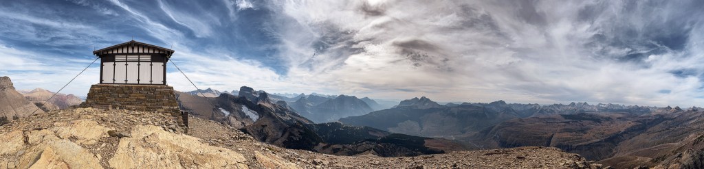
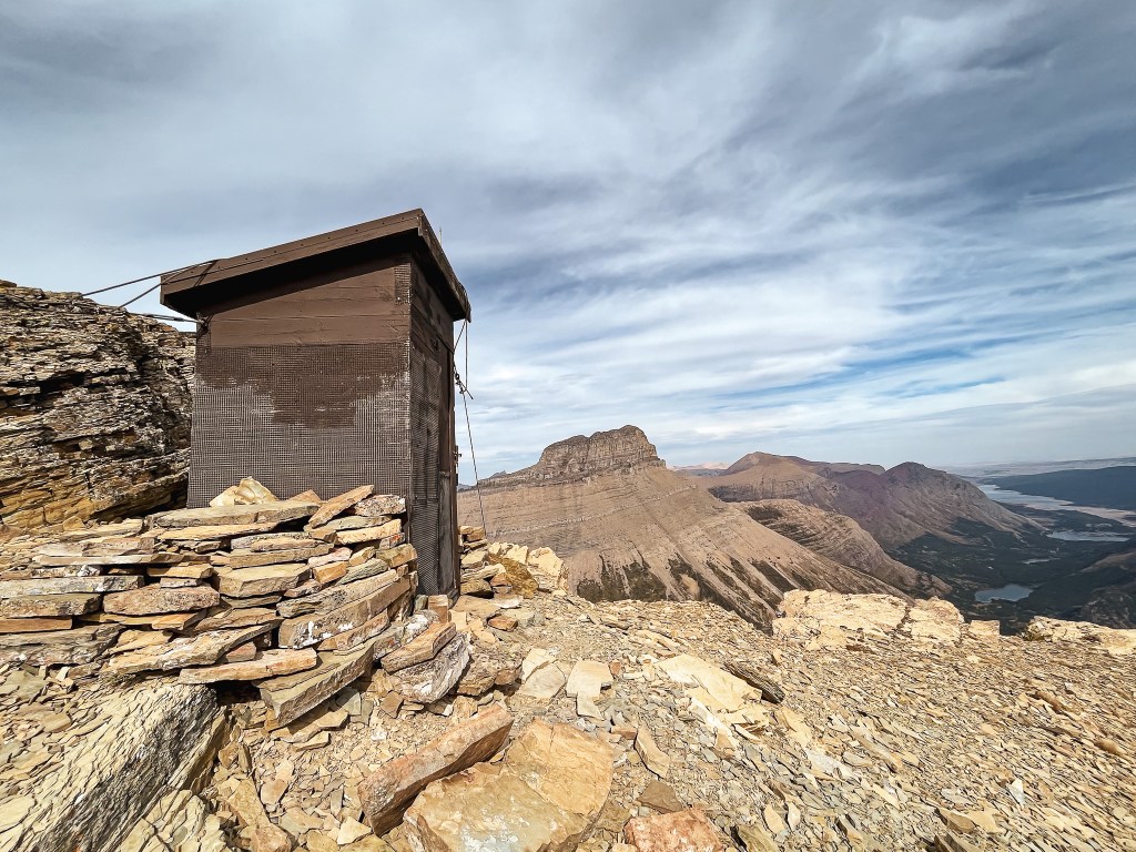
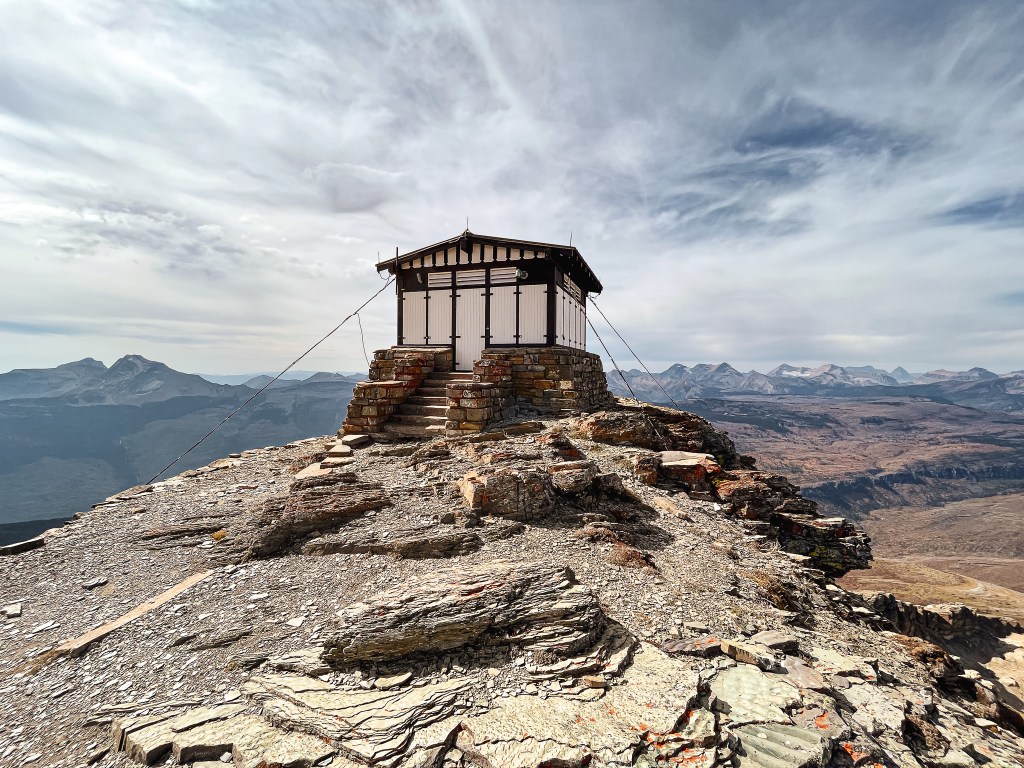
Garnet’s Pictures from the Summit


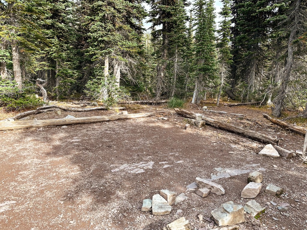
Our reunion was brief as we needed to continue our hike if we wanted to make it back to the car before dark. On our descent we decided to quickly stop over at the backcountry campground. We figured we wouldn’t be back for a while and that we might as well see it while we were here. There was also a slight morbid fascination with The Night of the Grizzlies story that motivated our visit. It was a simple backcountry campground with about 4 spots to choose from and a designated cooking/food area. We continued our hike down with little to note besides stopping to check out a couple birds (bohemian waxwings?) and leap frogging with another pair of hikers to the parking lot. The sun was starting to set by the time we reached the car and it was almost completely set by the time we made it back to camp. It was a whole day affair. In total, I tracked our hike at 8.86 miles RT with 2,631′ of elevation gain (Garnet obviously hiked more to reach Swiftcurrent but doesn’t use a tracker).


History.
Built in 1936 by the CCC, Swiftcurrent is one of the few remaining fire lookouts staffed within the Glacier National Park. It offers a unique design mimicking a Swiss Chalet similar to the same design elements applied to the Many Glacier Hotel. The two-story 14’x14′ timber cab with gabled roof sits atop a 10′ natural stone base. It offers the highest point accessible via trial within the park. It is listed on the National Register of Historic Places.

