Please reference our original trip report on Heybrook L.O. for information on the history of the lookout, status, our initial site visit, and directions (post).
Date revisited: March 31, 2024
Trip Report.
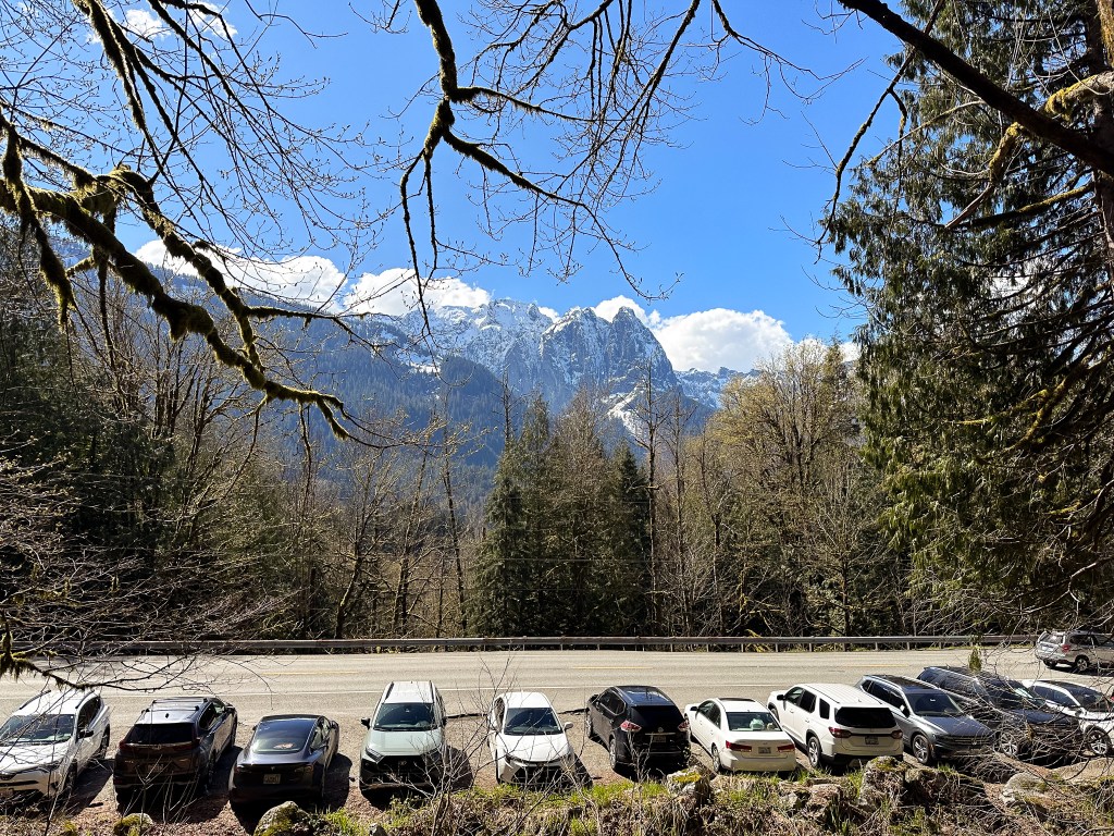
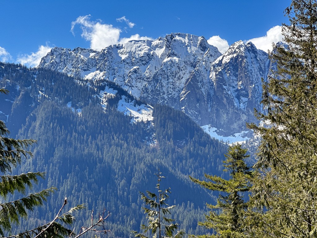
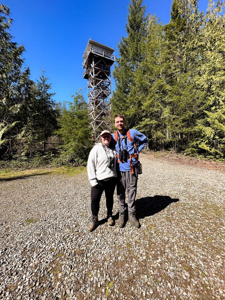
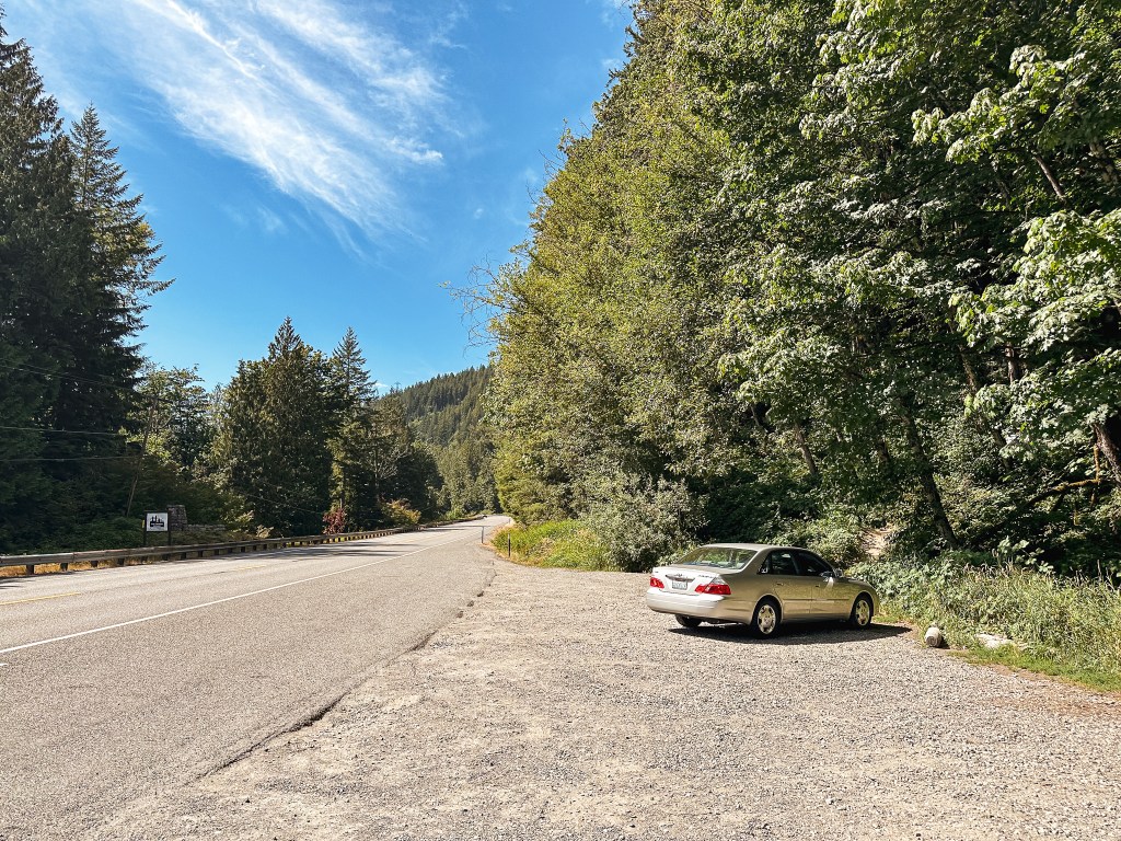
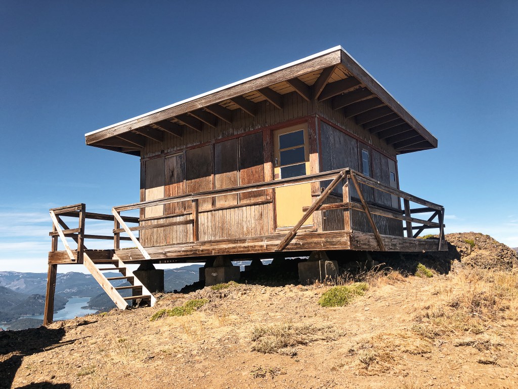
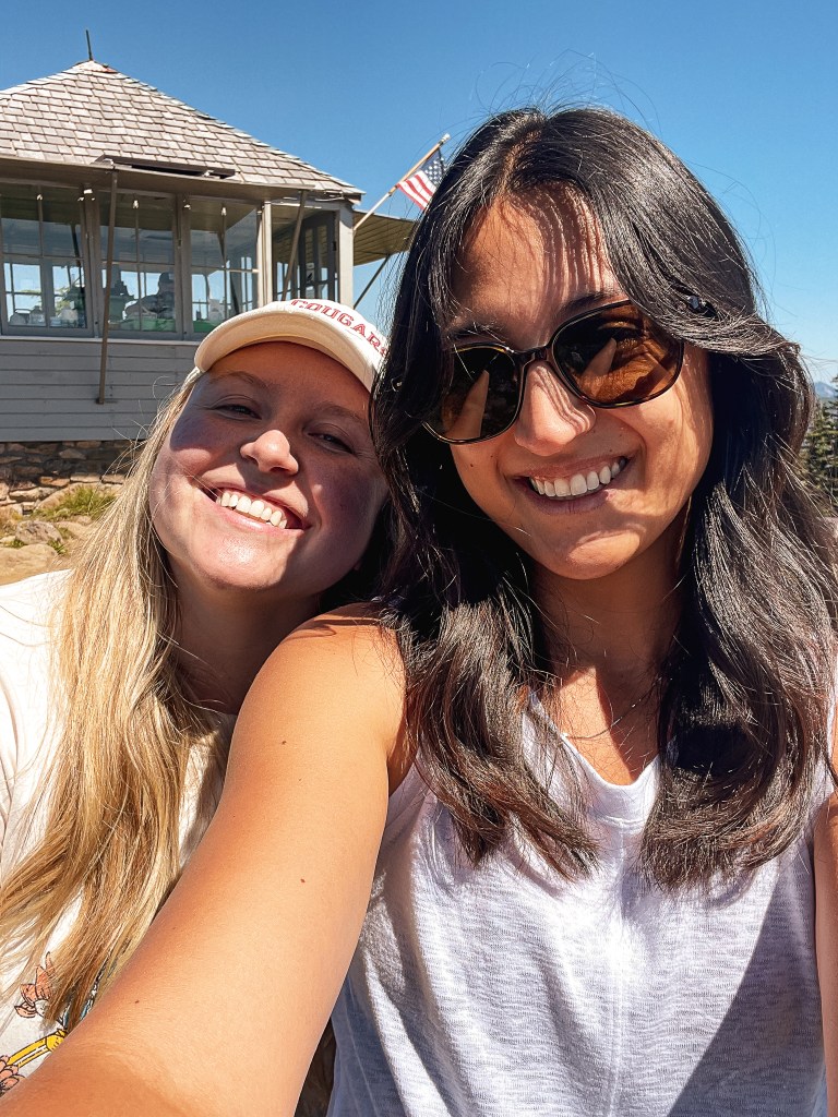
We found ourselves in Kirkland once again for the weekend visiting my friend, Anjelica. The reason for this trip was bittersweet since we were getting together to celebrate our mutual friend’s engagement and simultaneous going away party. Her and her now fiancé are moving to California to be closer to his family (and a multitude of other reasons). I already only get to see her a handful of times a year, so the move won’t be much of a change in that aspect. But, it still offers the emotional growing pains of early adulthood as we all search for our next steps in life. Last time Garnet and I were in the area together was for Friendsgiving in November, which is when said friends announced their upcoming move. We had debated making a trip to Heybrook L.O. before heading home then, since Garnet hadn’t been yet, but the weather wasn’t ideal at the time. This time around the forecasted weather was sunny with a potential high of 57 degrees. Where we were staying in Kirkland was conveniently located for a visit to Heybrook and it only took us 50 minutes to get to the trailhead off of HWY-2. Unfortunately, a lot of people had the same idea as us and the parking lot was completely full when we got there around 11AM. There was enough of a pull out across the highway to park our cars and no signs in sight prohibiting us. It’s a busy highway though so always be cautious and careful of oncoming traffic. We noticed a few people were double parked in the actual parking lot just waiting like sharks for someone else to leave. This is on par with most of what I’ve experienced from popular hikes in WA, there’s just so many more people in this area than Oregon and it seems to be a larger international tourist destination. This isn’t to say you can’t find uncrowded hikes there, they exist, but if you want to visit somewhere you’ve seen online close to Seattle you better be prepared to join the assembly lines or go extremely early (even then I’ve been to a popular trailhead and just barely snagged the last parking spot at 7AM). Oregon is much less competitive in my opinion. We spent the first steeper portions of the hike leap frogging with some other groups as we each stopped to catch our breath. I haven’t been on a trail since January 1st and my stamina reflected that significantly. This is my sign to start conditioning now for our summer season before I hurt myself later. Once we reached the ridgeline we had a little more breathing room from the other hikers until it bottle necked again right before the lookout. There were a good amount of people on and around the lookout when we got there. We waited awhile at the base before Garnet and Anjelica decided to hike up the tower while I opted to wait at the bottom. They said there weren’t too many people on the viewing platform, but squeezing past people on the stairs was difficult. We were surprised to see that the cab was completely boarded up for the season, I had thought it was rented year round. A quick search on Recreaton.gov confirmed it’s only rented from May 1st to October 31st. I’m sure I mentioned it in my other trip report, but I would feel like Rapunzel trapped in my tower if I ever stayed in this lookout during a weekend. It was still nice to get outside and absorb some much needed Vitamin D, but Garnet and I both agreed we probably won’t be back here again. The amount of people would not be as bad if everyone respected hiking etiquette and had more spatial awareness. But unfortunately, when you get a hike this busy you have people blasting their music and no yielding of any kind. And you kind of have to do the same in return to make any progress. On the hike down, Anjelica and I were separated from Garnet due to people not being able to wait to get by us going in both directions. We yielded for them, but no one yielded for us. Once back at the trailhead, the cars had multiplied in the pull out we had parked and was now full of cars as well. There were even some people walking along the highway from a more distant pull out. It starts to reach dangerous territory when you have this much crowding and is part of the reason places end up being permitted. I know it probably seems like I complain a lot about the amount of people, but it is meant to provide a realistic expectation. I am not out seeking nature to be apart of the crowds. If you still plan on visiting, I’d recommend it during a weekday. I saw significantly less people on an early Friday afternoon in August and it was much more enjoyable to me. My Strava app only calculated this hike at 2.07 Miles RT with 812′ of elevation, but I had forgotten to start it from the trailhead.
We have been in a deep hibernation this winter and are finally defrosting ourselves for the season. Although this is a repeat for me, this was a first for Garnet and is our first visited fire lookout for 2024. We will have to wait and see where else the Forest Service roads, weather, and fires take us this year. In the meantime, I will try to finish up our trip reports from Montana before our busy season begins. Happy Trails!
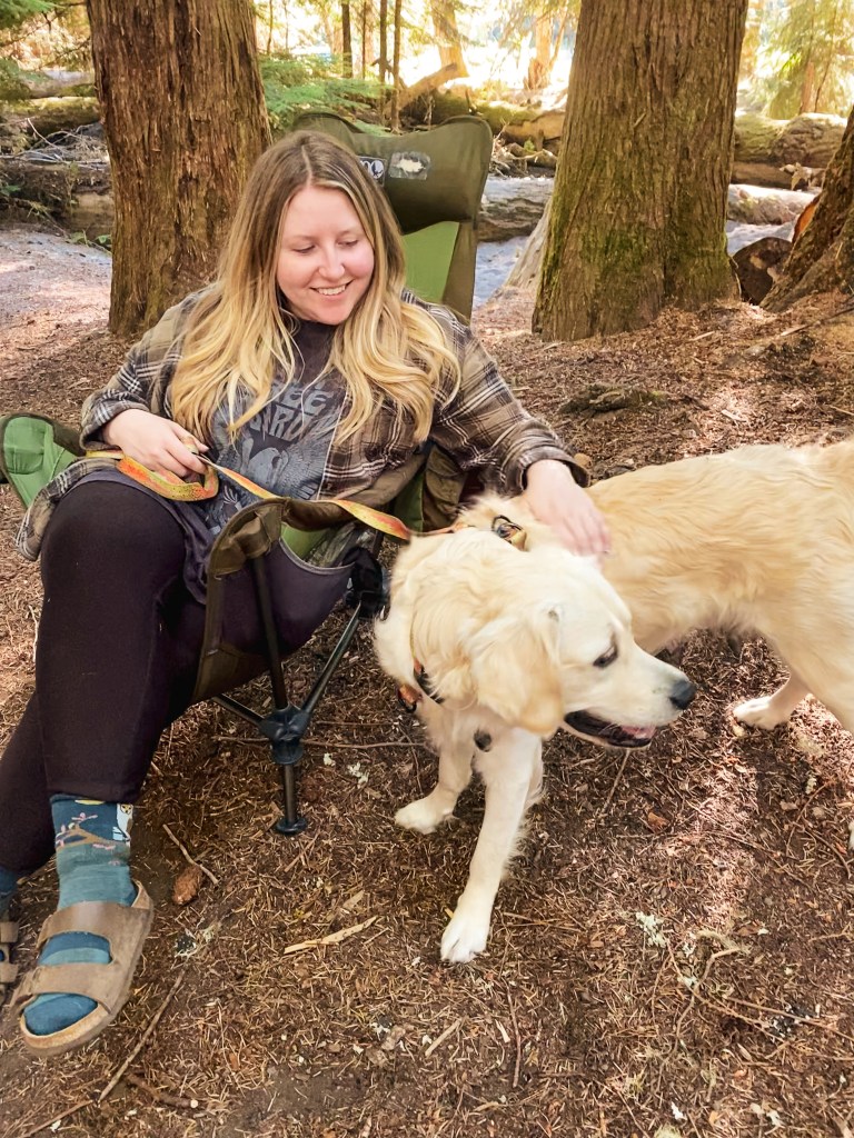
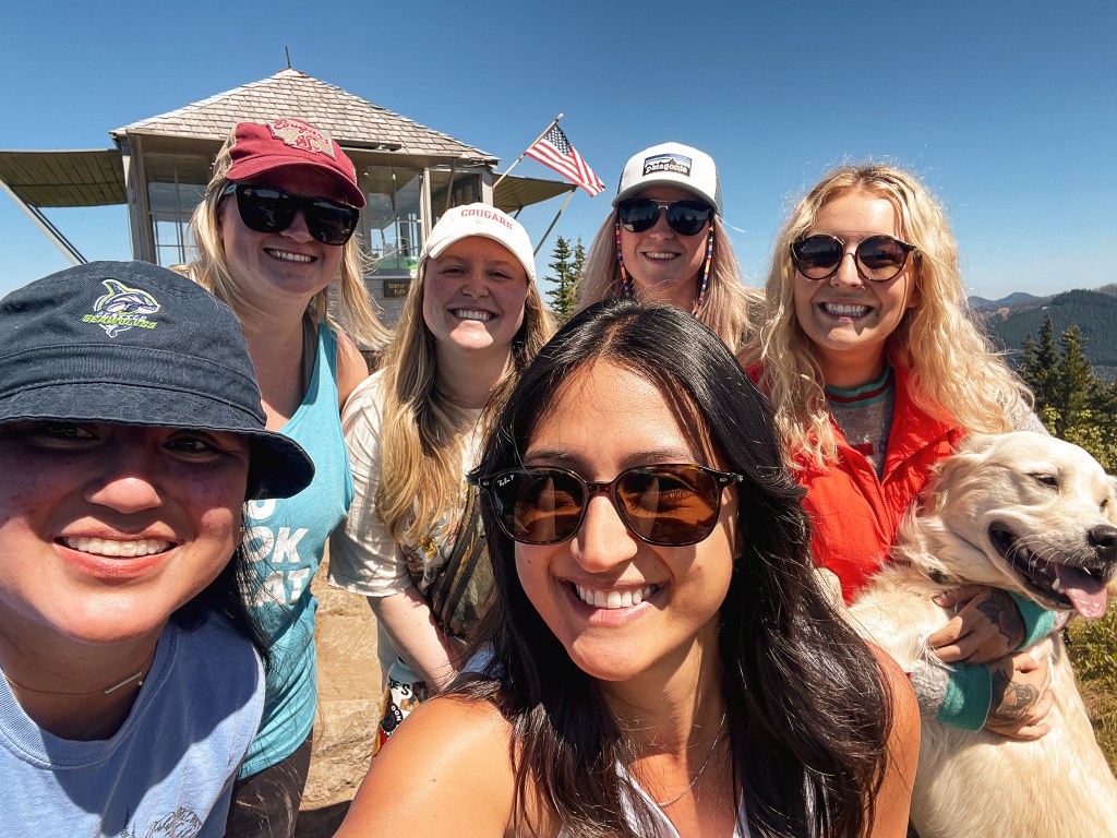
One thing I try and do every year is make time to go on a ladies only backpacking trip with my friend, Anjelica. I always think it’s important to make time for friends and yourself outside of a relationship, sorry Garnet! We’ve invited other lady friends in the past, but most have not been interested in taking the extra step from car camping to backpacking. This trip was just the two of us. Our original plan was to spend two nights somewhere in northern Washington, but her work schedule recently changed which limited us to one night. I don’t work on Fridays so I was left with an extra day to potentially do something else in the area after my drive up. She lives in Kirkland and I noticed her place was less than an hour from Heybrook. This is a popular fire lookout that is shared all over social media and it was still on my list of Washington lookouts to check off. This felt like the perfect solution to drive up earlier to beat traffic, but still be able get to her house around the same time she’d be off work.
I set out from Portland around 10AM via I-205 north towards Washington and eventually merged with I-5 after passing Vancouver. There are more than a few ways that you can take to get to HWY-2 from I-5. Given the accessibility and popularity of this trail, you can easily get here via GPS navigation without getting lost. This goes against my normal recommendation to always use a paper map. But, I didn’t have the luxury of Garnet being my navigator, so GPS it was. The route it took me was most likely an unnecessary maze of turns through rural roads, but it could have also been avoiding the afternoon traffic. From I-5, I headed on I-405 to HWY-520 until the highway ended and turned into Avondale Road. I turned right on to Novelty Hill Road, left onto Snoqualmie Valley Road, and then right onto Woodinville-Duval Road until I reached the community of Duval. This road met up with HWY-203 in the center of Duval where I turned left to continue heading north. HWY-203 will take you all the way to Monroe where it meets up with HWY-2. I turned right to head east on HWY-2 passing through the towns of Sultan, Startup, and Gold Bar. I passed the turn off for Index and the trailhead was only a little farther past this off to the left. There wasn’t a sign from the highway to indicate the pull out was for the trailhead, but most likely there will be other cars to make it obvious. This is where the GPS actually came in handy for a change.
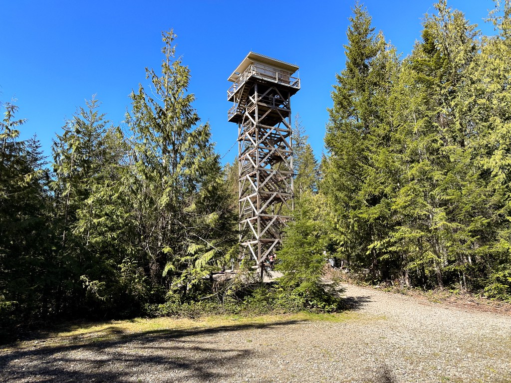
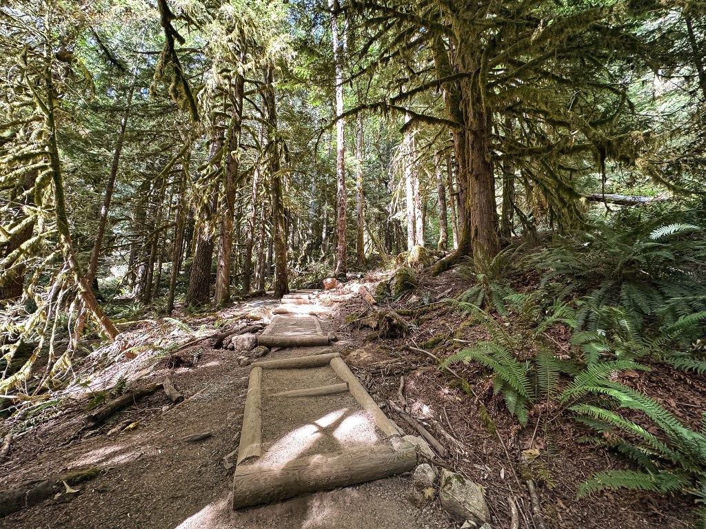
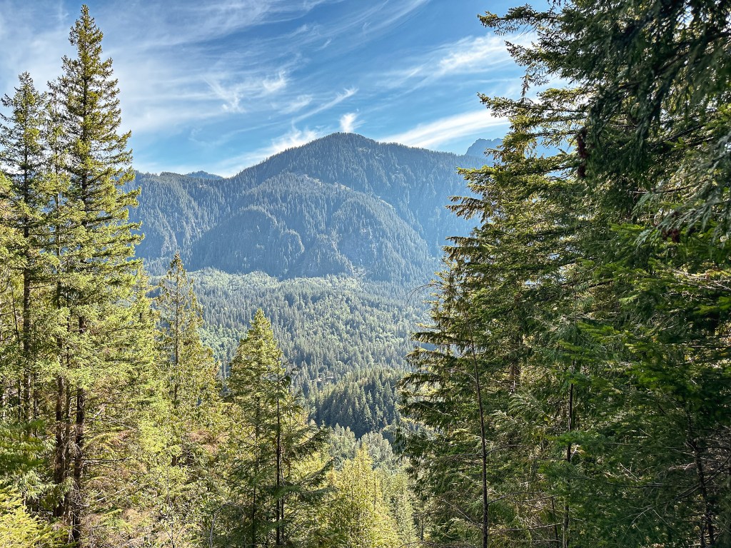
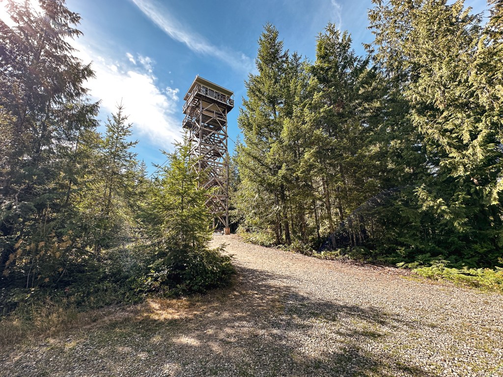
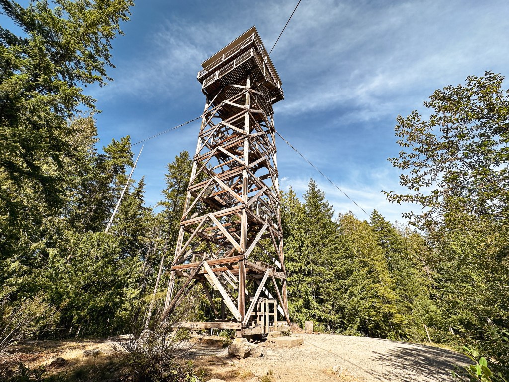
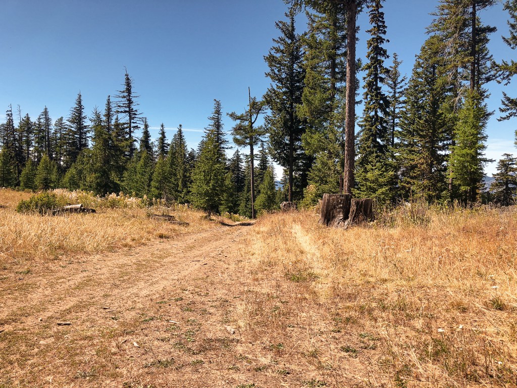
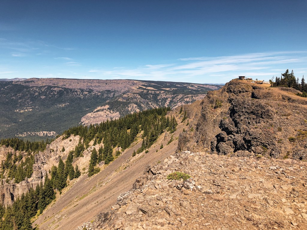
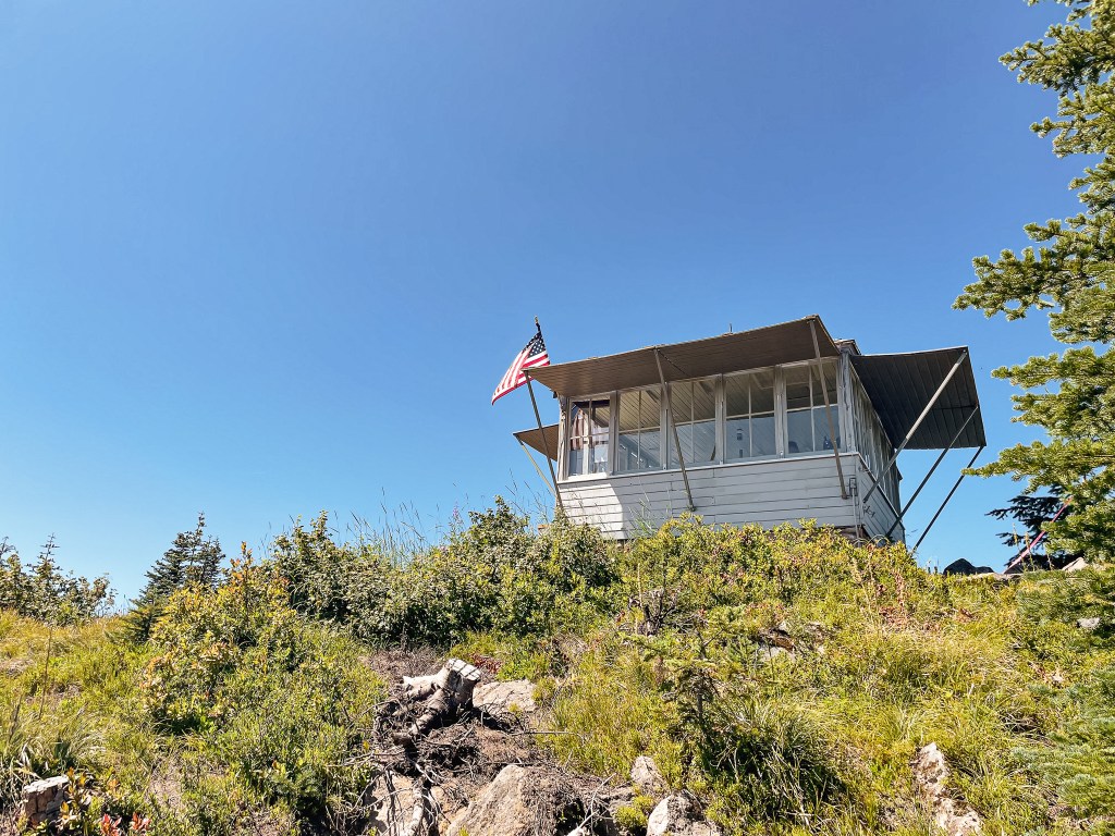
I pulled into the parking area just after 3PM and there were only 5 other cars besides mine. I would barely count one of those since there was a couple getting into their car to leave when I arrived. There is plenty of space for parking right off of HWY-2, but I can imagine it fills up quickly on weekends. I actually expected to see more people here on a Friday afternoon. I stopped briefly to read the trailhead board to see if there was anything of note I should be aware of. I noticed a sign asking to count the cars at the trailhead and to text it to a phone number. This was for an Outdoor Recreation & Data lab hosted by the University of Washington (link). I thought it was interesting that they were collecting data on usage of this trail and sent them a text. You will get an automated response that takes you through a few other questions and prompts about your visit to the area. I started my hike up the trail and could immediately feel the heat from the day. Since I was hiking alone, I made sure to stop and take breaks often. I didn’t make it very far up the trail before I was met by another pair of hikers coming back to the trailhead. But, after I had passed them, I had the entire hike up to the fire lookout to myself. There are a lot of steps in the first steeper portions of the trail that you can tell the WTA has put effort into for erosion control. Once you reach the ridge line the trail becomes more gradual until the final steps to the lookout. The trail is completely forested until you reach the base of the lookout, but even then most of the views are gained from the viewing platform on the tower.
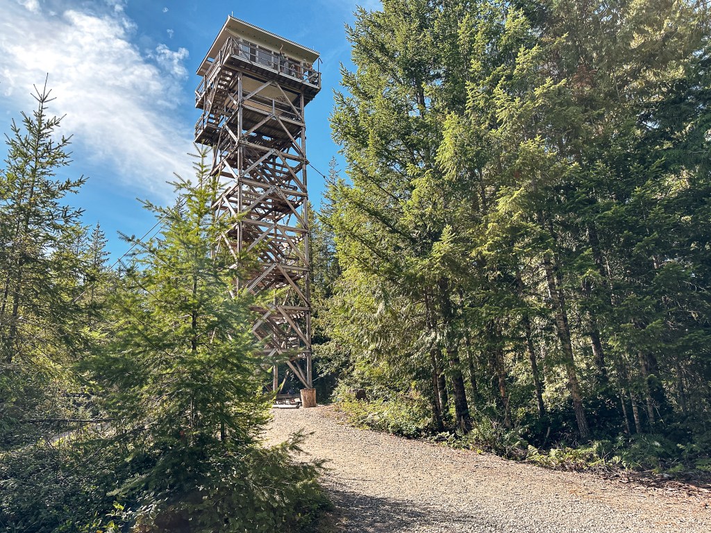
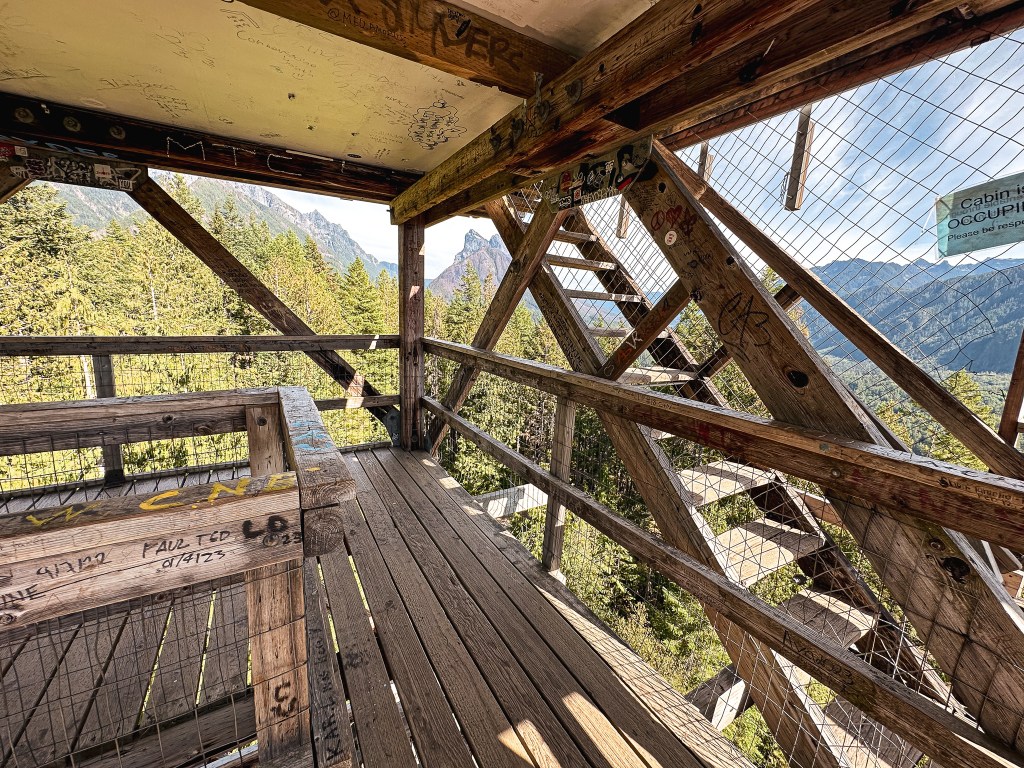
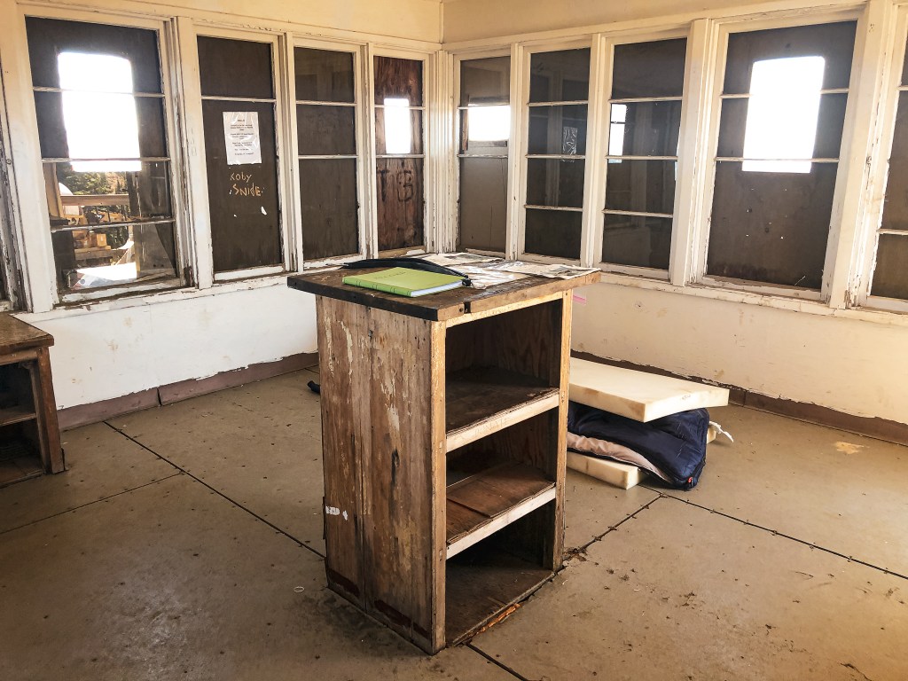
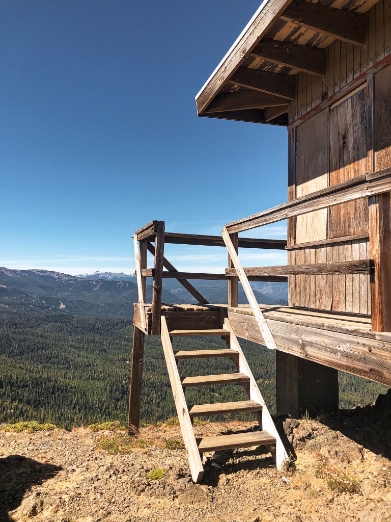
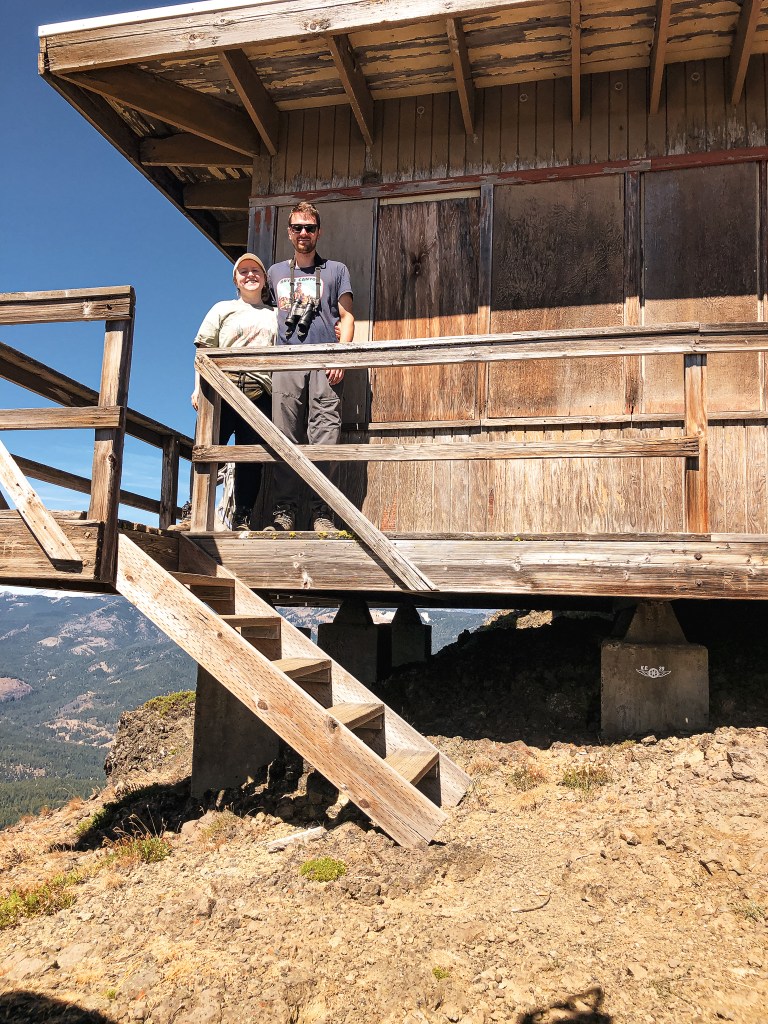
I walked around the base of the fire lookout first to take a few pictures before heading up the stairs. There was a group of four on the catwalk which I assumed were the renters for the evening. I think they thought I waved at them when I raised my hand to shield my face from the sun while taking a picture. I said hello back, but you can see them waving in one of the pictures. Aside from them there was no one else on the summit. I climbed the stairs to the viewing platform that sits just below the catwalk. It’s nice that they added this for day hikers to take in the view, but as a renter I personally would find this slightly annoying. I’m sure you can hear people climbing the stairs at all hours. I did appreciate that there were a couple signs stating not to bother the renters. Not all fire lookout rentals will include this small step to offer some privacy. There was also a disappointing amount of graffiti on the platform. Unfortunately, busier places like this attract all walks of life including the disrespectful and damaging.
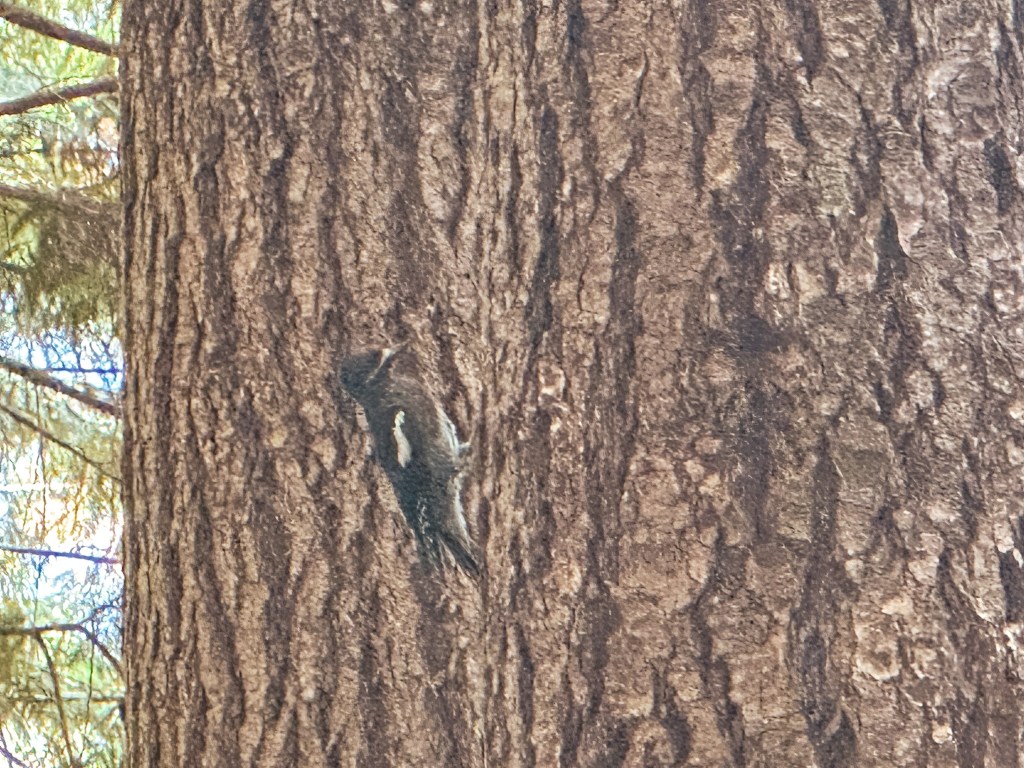
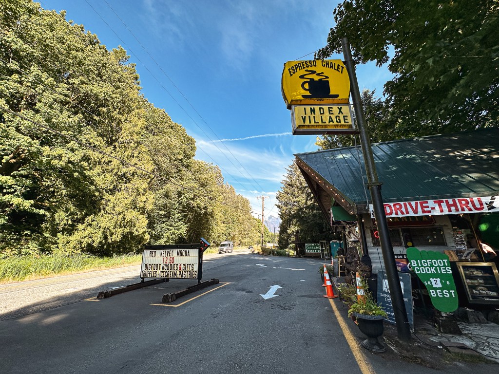
I was passed by another pair of hikers as I headed down the stairs. Once back on the more gradual portion of trail along the ridge, I was typing some notes on my phone from the hike and ended up slipping on some loose dirt. This caught me off balance and I slowly slid right onto my butt. I chuckled to myself and was glad no one else was around to see it. I’m normally more paranoid of falling and take extra careful steps, especially by myself. I had put too much faith in the well graded trail this time. I once again had most of the trail to myself until just before the trailhead. There wasn’t much wildlife around either except for a few ground squirrels and robins. I did stop to watch a mostly black woodpecker for a while though. I originally thought it was a female black backed woodpecker, but after doing some research it appears to be a type of sapsucker instead. The white wing bar was a defining characteristic. I passed two more groups of hikers just before reaching the trailhead, but it was an overall quiet hike for me. It felt good to complete a solo hike for a change. I used to solo hike all the time and it was how I reintroduced myself to nature. But I don’t often find myself alone anymore between my friends and partner that are down to adventure. My Strava app calculated this hike at 2.25 miles RT with 897′ of elevation gain. I decided to stop to get a small latte, as a treat, at the Index Espresso Chalet before heading on to meet my friend in Kirkland. It’s a cute road side coffee stand that offers views from the back deck and sasquatch merch.
History.
Heybrook has been used as a fire detection site since 1925 when a platform tower was built. This was later replaced by a 45′ tower with L-4 cab in 1932. The existing 67′ treated timber tower with 14’x14′ cab was built sometime between 1963 to 1965. The cab was specially designed by the Forest Product Labs per the request of USFS Region 6 engineers. It looks similar to an R-6 cab but was designed to use lighter weight material and be prefabricated off site. It was built with the intention of being packaged and bundled to be delivered by helicopter. This was the only lookout to use this cab design. It was actively staffed into the early 1970s until it was abandoned. The Forest Service site states that the lookout was rebuilt by the Everett Mountaineer Volunteers. But, Rex’s site mentions that volunteers worked on reconstructing the cab during the late 1990s. While TrailChick’s site states the outdoor retailer, Filson, partnered with the National Forest Foundation to refurbish the lookout for rentals. It’s unclear if those three things are referencing the same incident of the lookout being reconstructed or if there were multiple times it received work. Either way, it was opened to the public for overnight stays in 2017 and is still a part of the rental program today.
NOTICE: As of July 17, 2024 this area is currently closed due to the active Retreat Fire.
Location.
Mt. Baker Snoqualmie National Forest; Administered by Wenatchee National Forest
Status.
Maintained by Volunteers; Currently standing
Estimated drive time from Portland, OR.
4 hours
Date visited.
August 21, 2022
Elevation.
5,670′
National Historic Lookout Register.
US 1518; WA 69
Trip Report.
I’ve come to the conclusion that August is my least favorite month. It has nice longer days, but that is about all it has going for it in my opinion. It is otherwise too hot and things are usually on fire by now. This tends to mean trail closures and lingering smoke as well. My partner often says he’ll fight anyone who prefers 90 to 100 degree temps. I’ll complain about the rain, but I eventually long for it. The smell before it rains. The cooler temperatures associated with it. The fresh air that comes with a well hydrated forest. But I absolutely, whole-heartedly, never long for 100 degree summer days. Maybe I’m being dramatic, but the heat really kicked my butt this weekend. It wasn’t even forecasted to be as hot as it has been the last few weeks. We had just emerged from a one-night backpacking trip with our friends in the William O. Douglas Wilderness. We had an extra day left over for the weekend due to our friends schedules not quite lining up. It was a pretty gradual 5-mile hike out (10-miles RT), but the heat had zapped all the energy from me. Our plan was to head over to Jumpoff L.O. for another night of backpacking without friends. Based on the description from the WTA site there was a nice dry camp 2-1/2 miles into the hike to Jumpoff from Long Lake. But, I vetoed this after getting back to the car and we opted to disperse camp for the night. I needed to recoup if I was going to make the 8-mile RT hike up with over 2,500′ of elevation gain. We would later agree that this was a good call for a multitude of reasons.
Start of NF-653
Pull out parking
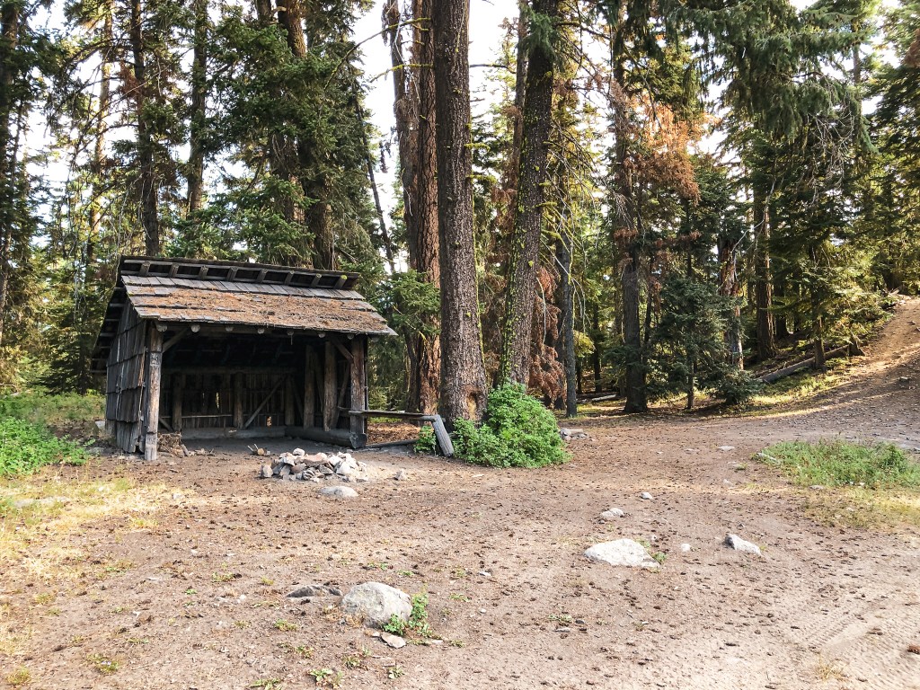
Long Lake
Shelter at Long Lake
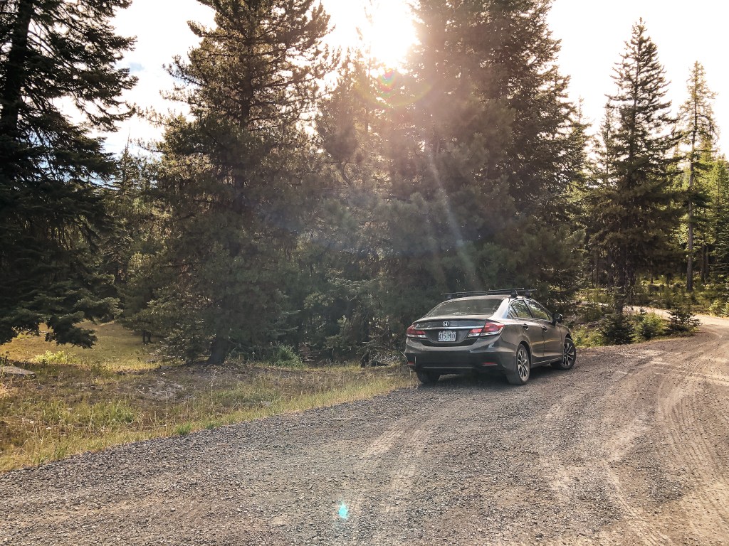
From HWY-12, we headed east towards Yakima. This was the farthest either of us had been on this highway. We turned right at the junction marked for Rimrock Lake Recreation Area. This is NF-12 on the map, but there were no signs noting that on the road. We followed this paved road until we reached Milk Creed Road, NF-570, off to the left. This is a well-graded gravel road that we took to reach NF-1201. I read online that the paved portion of NF-1201 is a terrible road and this was the better route to access Long or Lost Lake. We didn’t spend much time scoping out the best dispersed spots in the area and picked one in close proximity to where we wanted to be in the morning. Our alarm was set for 5AM with the intention of starting our hike early to avoid the heat. It was still dark when the alarm went off the next morning which prompted us to reset it for 6AM. We then proceed to hit snooze until a little after 6:30AM. We weren’t up and moving as quickly as we had hoped. We turned right onto NF-1201 to head towards Long Lake. You can start the hike at Lost Lake as well but it adds an extra mile both ways that felt unnecessary for this trip. The gravel portion of NF-1201 was well graded as well and only had a few minor bumps to avoid. We parked in a pull out at the junction with NF-653, off to the left, based on a recommendation from a trip report posted to WTA. This is where we would start our hike.
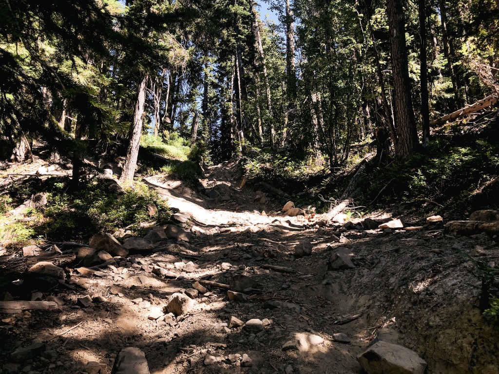
First steep section looking up (sorry bad lighting)
First steep section looking down
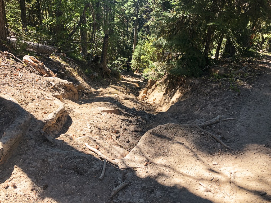
Second steep section looking up
Second steep section looking down
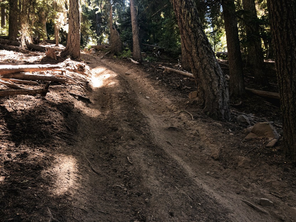
Third steep section looking up (bad lighting again)
Third steep section looking down
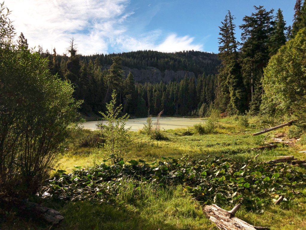
The morning temps were still cool and bearable as we started walking down NF-653. It appeared to be a crummy spur road from the junction, but quickly turned into more of an ATV track with roots and embedded large rocks. Shortly after we reached the north side of Long Lake, which was blanketed in a green algae, and the notable shelter that marks the start of the route. We were surprised to see a truck on this portion of road too. It’s amazing where people are willing to drive instead of walk. From the shelter, the road continues steeply up a small hill. I had a screenshot of the trail description from WTA since many have mentioned it can be a confusing maze of roads and trails to the summit. Although, I didn’t find the route finding as difficult as mentioned, it was helpful to have for some of the way points. We also had a ranger district map for reference as well. After heading up the road away from the shelter, we were met with an immediate fork. Both routes meet back up with each other a short distance later, but the left is easier on foot. The second fork we headed left again, or straight depending on how you want to look at it. The trail you are following is an OHV trail and has no directional markings for you to follow to the summit. I thought that meant it would be similar to a road walk with some steeper sections thrown in. But, boy was I wrong! In the more gradual sections it was basically a road walk, but the steep sections were no joke. Toss in my fear of heights for good measure and this was now a challenging route for me. There were three notably steep sections that were problematic. All are within the first mile and a half before you reach Louie Way Gap. In all three sections, the road heads up at a steep angle that would be difficult even in an ATV to traverse. It is also made up of loose, rocky, and slick dirt that can make it hard to find stable footings. Heading up wasn’t great, but I knew heading down would be much worse. I took pictures for reference, but you can never quite capture the depth of field in a picture. The second steep section is avoidable by hiking cross country on the slope next to it. The ground is much more stable there than on the road. After the last steep section, we reached Louie Way Gap. It is an open field with a four way junction. I thought the hard climbing was over from here and that we’d have a gradual few miles to the lookout. Wrong again!
Louie Way Gap looking toward the road you came up
Louie Way Gap looking toward the road to Jumpoff
Louie Way Gap
Trail #1127 sign heading back down
It looked so far away from here
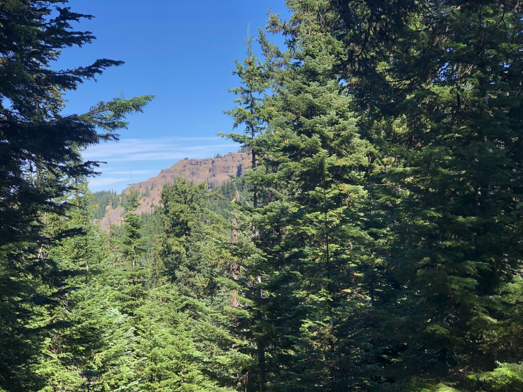
We turned left from Louie Way Gap on to NF-613. This is shown as trail #1127 on most maps, but it was once an old continuation of NF-613. It does eventually turn into a single track trail and is no longer drivable to any four wheeled vehicle. There were a few warning signs posted to trees about the upcoming side hill before the road deteriorated in case someone was to try it. The road from Louie Way Gap headed steeply up again. Nothing unmanageable, but it was starting to wear us down as the day was heating up. I thought this would be our final push to the gradual slopes of the Divide Ridge. but wrong, wrong, wrong I was! We found the aforementioned dry camp that had a nice view to the valley below. I would have struggled greatly with a loaded pack to make it here. I’m not sure if that is more a commentary on my fitness level or to the trail conditions. This marked that we were a little over half way there. The trail started to head down from here and the trees opened briefly to a view of our end goal. I stared on in confusion, the lookout appeared to be on a completely different ridge line from where we were. We both had the thought that we were somehow on the wrong trail, but that was impossible given that we followed all the directions. It just so happens that the trail heads down again to a saddle before the final climb. Something I completely missed when looking at the topo map. We could see where the trail crossed the exposed slope to the final ridge line, but it was a bit defeating to see. I already made it this far though, there was no turning back now. The WTA description describes the trail as Jekyll-and-Hyde conditions, which is accurate. Despite drinking water constantly, I could feel my body drying up on the final push, the actual final push, to the ridge. It stayed exposed the remainder of the way to the lookout, but was fairly flat from there. We crossed another four way junction where we headed straight. The NF-613, or Trail #1127, route eventually meets up with the drivable road NF-1302 to the summit.
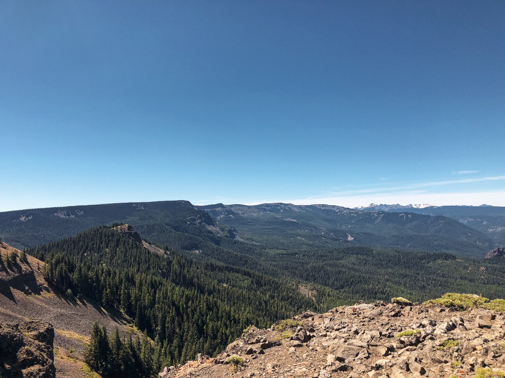
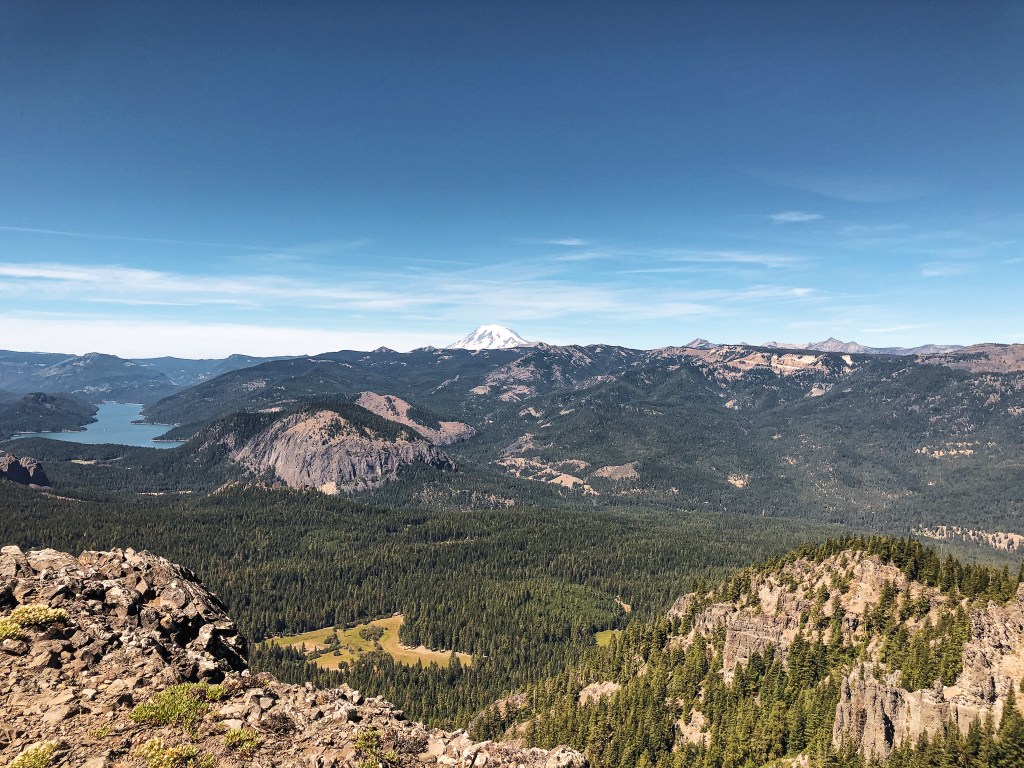
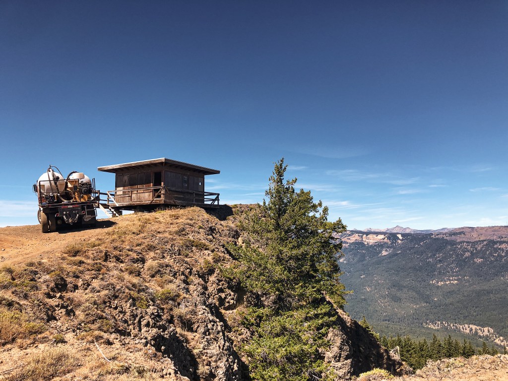
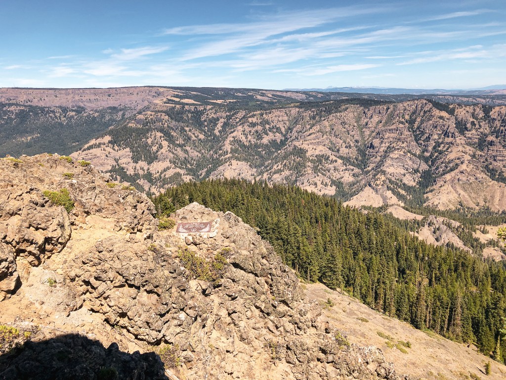
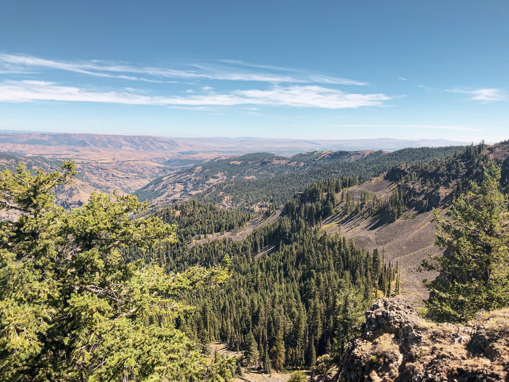
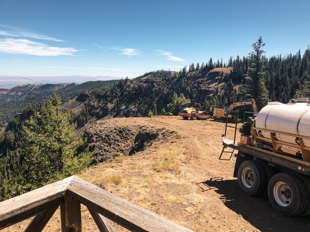
I’ve read the NF-1302 road is 13 miles of rough and rocky conditions. But, they are in the process of building a communication tower on the summit which means improvements could be made. This was partially our motivation for making it up here sooner than later. We wanted to see the fire lookout before the area was obstructed by more communication buildings. The 100′ communication tower is already in process and the summit was littered with building equipment. We had the lookout to ourselves while we took pictures, signed the log book, and enjoyed a brief lunch. As we were finishing lunch, a couple drove up in their Jeep and greeted us on the catwalk. We asked about the road conditions and the guy said they had improved since the last time he was up there on his motorcycle. They joked that they took the easy way up in comparison. We only saw them and a group of three ATVs near the summit. We had the trail to ourselves the remainder of the time.
The hike back down was less grueling, but the heat was still giving me a hard time. I was dehydrated and dreaded descending the steep sections. The first one I ended up making it down by half sliding on my hip while I braced and stepped with my dominant foot. Mind you this is only a me problem between the two of us. My partner has little to no issues scrambling down these kinds of slopes. Yes, he’d agree it was steep and a bit sketchy, but he can at least descend while standing up. My main issue, besides just having the fear of heights, is that my center of gravity is in my ankles. It should be located somewhere like your core, but for me it’s not. Or at least I have that perception and my body acts accordingly to that perception. I typically use trekking poles to help stabilize my upper body. Anyway, this means that any time I feel unstable or like I’m going to fall I get low to find my stability. This leads to crab-walking, side-stepping, butt-scooting, or bear-crawling my way down steep loose slopes. I have no shame in getting dirty if I don’t feel safe. I’ve done it before and I will continue to do so in the future. Though I will note there have only been a few trails steep enough for me to roll around in the dirt like this. The second steep portion was once again easily avoided by cross country hiking the stable slope on the side of the road. I was already covered in dirt by the third steep section that I decided to take it low again. We made it back to the car in one piece, but not before this trail chewed me up and spit me out rotten. I conceded the car to my partner to drive us most of the way home.
History.
Jumpoff, often mistakenly labelled as Jumpoff Joe, was first established in 1923 with a D-6 cupola cabin. It was replaced by the existing R-6 flat cab sometime between 1958 and 1961. It was only sporadically staffed after the 1960s for emergencies. It fell into a state of disrepair with heavy vandalism and neglect. Starting in 2010, a group of volunteers decided to start restoring and maintaining it. Mike Hiller, who staffed the lookout during the summers of 1969 to 1973, was the driving force along with the “Friends of Jumpoff” volunteers. They completed a lot of their work by the summer of 2018. It is in better shape and still standing thanks to their efforts.
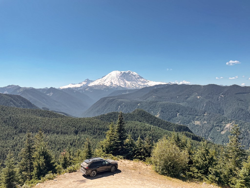
Every year I like to plan a camping trip for my friends and I, or at least for the ones that are interested in camping. It started as a tradition with my friend, Anjelica, at South Beach State Park in 2016. It was the first time we came to the realization that we could plan a camping trip without our parents. It was just us and her boyfriend at the time. In 2017, it really took on its true form as a girls trip when two more friends joined us. During that trip, on a hike, there was a trail sign that someone had carved in the words “Lost Boys” and the year they were there. We joked that we were now considered the Lost Girls. Since then our little group of four has managed to go camping every year (minus a year for the Pandemic) and we still jokingly refer to ourselves as the Lost Girls. I always try and pick somewhere new for us to explore when planning. It generally ends up being in central or northern portions of Washington since we are split between Portland and Seattle. This year was a bit different since we had two more friends and three dogs joining us. The campground I picked this year, Silver Springs, was in the Mt. Baker-Snoqualmie NF and close to plenty of recreation opportunities. I didn’t expect to explore as much as we usually do just based on the logistics of getting us all around. Traveling with dogs immediately cuts out any trail options in the National Park too. Out of curiosity, I decided to look at the potential fire lookouts in the area. I saw we were really close to Suntop, which is just outside of the National Park with a great view of Mount Rainier. I recommended it to my friends who all seemed to be down. Step one in slowly tricking my friends into going to fire lookouts. I was still skeptical we’d be able to round up everyone for the caravan and short hike though. But, even after we all made it to camp they seemed motivated to make it happen. Not that any of them read this blog, but thanks friends!
We left camp around late-morning on Saturday with a two car caravan. I made the mistake of not bringing a map or doing much research on the route needed to get there. That’s on me, but I truly didn’t think it was going to happen. Luckily, I had a vague idea on where we needed to turn from looking at the route prior to the trip and guessed correctly. From HWY-410, we headed north and turned left onto NF-73. There wasn’t a sign for this road, so it would have most likely been a guessing game regardless. We were able to get service here and confirmed the remainder of the route. We stayed on NF-73 for a little over a mile before we turned left onto NF-7315 which was signed. You will stay on NF-7315 for around 5 miles until you reach the trailhead or summit. There is a gate just past the trailhead that might be open depending on when you visit. We were able to continue past the gate since it was open and I have the luxury of friends with high-clearance vehicles. The road getting there was rough and would need caution in a low-clearance vehicle just to reach the trailhead. Past the gate the road is significantly worse, but we were able to roll around the large embedded rocks with no issues in a Toyota RAV4 and Subaru Outback. There was a sedan that had made it to the summit too, but it didn’t look like it would have been worth it. We also passed a large RV broken down in a pull out along NF-7315 which is a skinny and steep mostly single track road. A reminder that just because someone has done it doesn’t necessarily mean it’s a good idea. My partner and I always joke about meeting something like that on these back roads, but I never thought I’d actually ever see one.
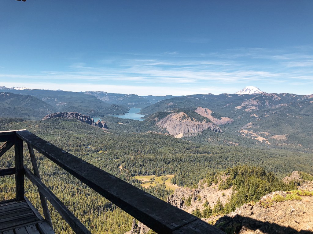
From the parking area on the summit, which has room for 10 to 15 vehicles, it was a short easy walk to the lookout. I was hoping to at least do a little portion of the hike, but I can’t complain about being chauffeured to the summit. The fire lookout can also be reached via the Suntop Trail #1183. If you park at the trailhead along NF-7315 it is only a half of a mile to the summit. But, if you are looking for more of an adventure you can start at the Suntop trailhead, which is accessed from a different road, and hike the 16 miles round trip. When we approached the fire lookout we were greeted by the friendly attendant on duty. I didn’t catch his name or ask as many questions as I wanted to because of all the people. But, he did mention he was staffing it through a volunteer partnership with the Forest Service. He was also only staffing it for two or three days before someone else would come up to volunteer and rotate service. We didn’t stay for long after taking pictures since we left our lunch at camp. I ended up driving my friend’s RAV4 back to camp since she wasn’t keen on the steep drop offs along the road. She also has a fear of heights like me, but I’m more used to driving on these kinds of roads. It was helpful for me to see the road conditions from the drivers seat for when I inevitably come back with my partner.
History.
Suntop was built in 1933 as a 14’x14′ L-4 ground cab. It is one of two remaining lookouts of its kind on the Snoqualmie NF. It was used for the Aircraft Warning Service from 1942 to 1943 during World War II. An access road wasn’t built to the summit until 1956. Although the same structure still stands today, it was refurbished in 1989. It is still staffed on a volunteer basis through the Forest Service.