Scalplock Mountain L.O.

Montana Lookouts

Location.

Glacier National Park

Status.

Active; Currently standing

Estimated drive time from Portland, OR.

12 hours

Date visited.

September 30, 2023

Elevation.

6,919′

National Historic Lookout Regiser.

US 39; MT 7

Trip Report.

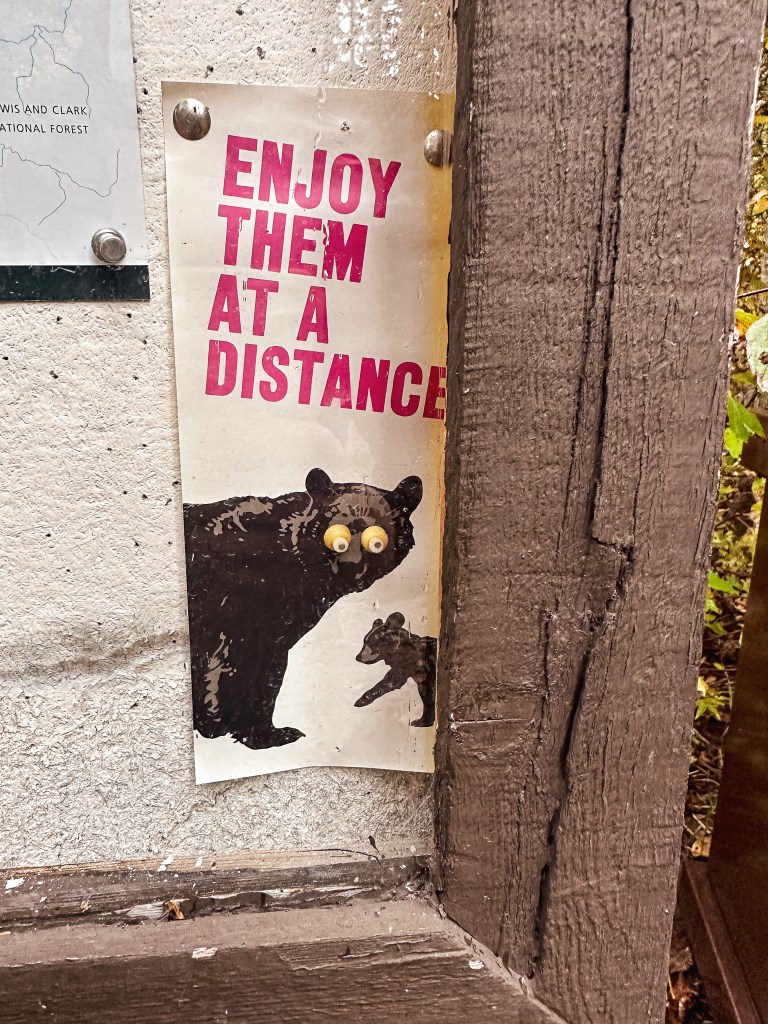
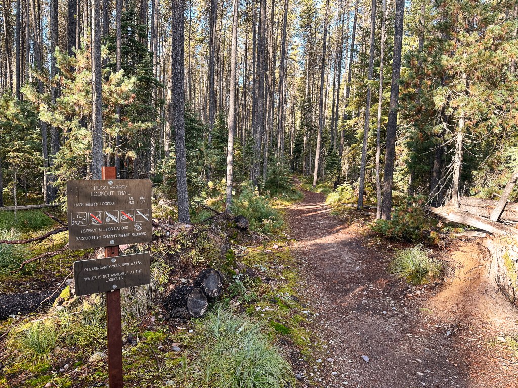
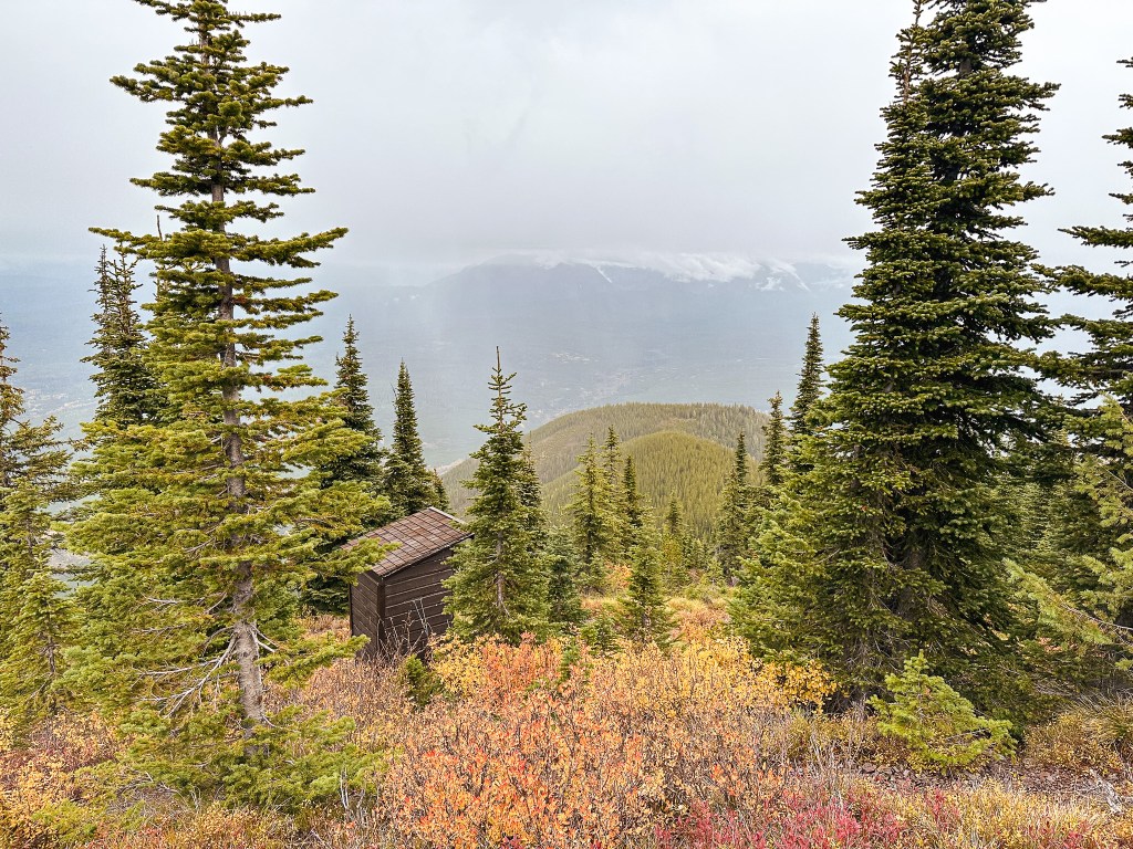
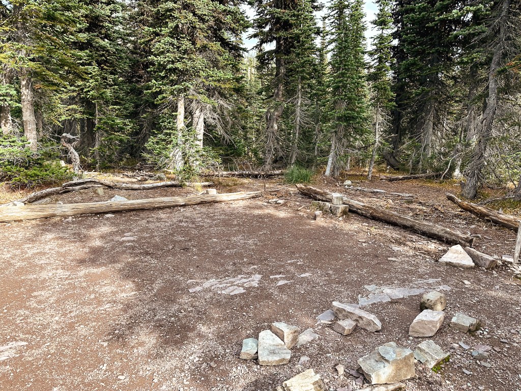
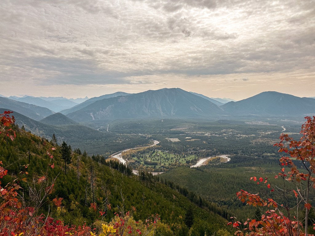
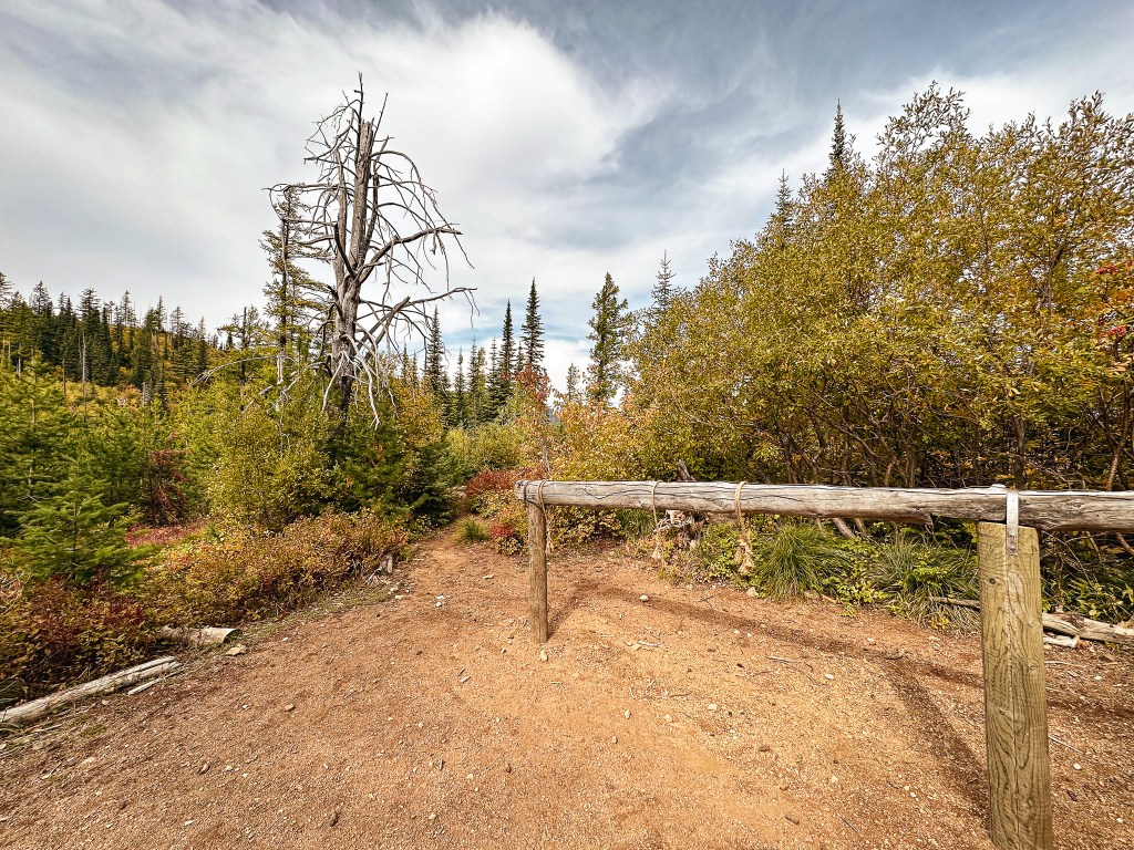
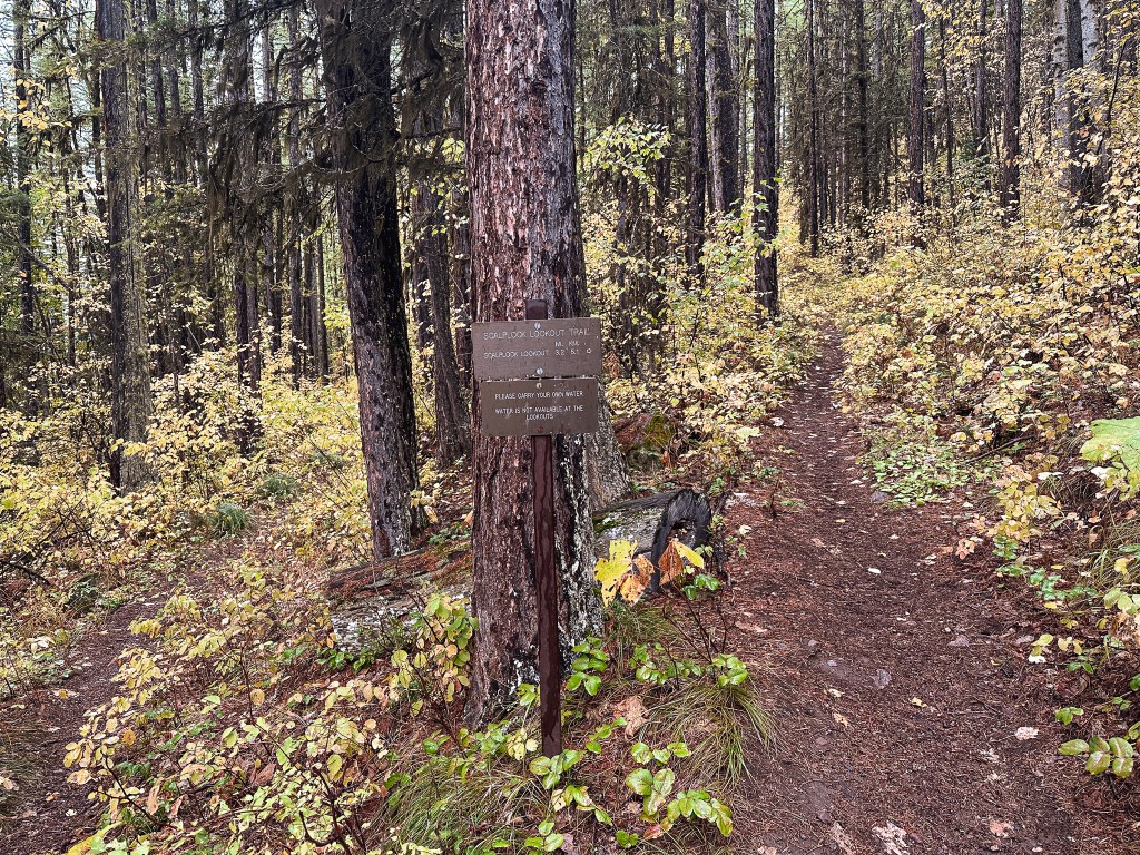
It was the final day of our trip before we had to make the long drive back to Oregon. The fall weather the forecast had been threatening had finally arrived and the Going-to-Sun road was officially closed for the season. We had one more fire lookout on our list to visit in the park and we weren’t going to let a little bad weather stop us. Although this hike and lookout are within the park boundaries, you have to exit the park to get there. We left our camp towards West Glacier and turned left onto HWY-2 to head farther east toward grey wet skies. The trailhead is located near the most southern tip of the park boundary behind the Walton Ranger station. It is signed and right off the highway on the lefthand side if you’re coming from West Glacier. We reached the trailhead just before 9:30AM and I was a little uneasy as we pulled into another empty parking lot. It wasn’t all too surprising given the conditions, but even still you could tell this trail saw less use than others. There were five spots with picnic tables that I assume are mostly for day use and an additional area for back country parking that could fit 3-4 cars. Our goal was Scalplock Mountain, but this was also a starting point for many different interconnecting trails into the back country.

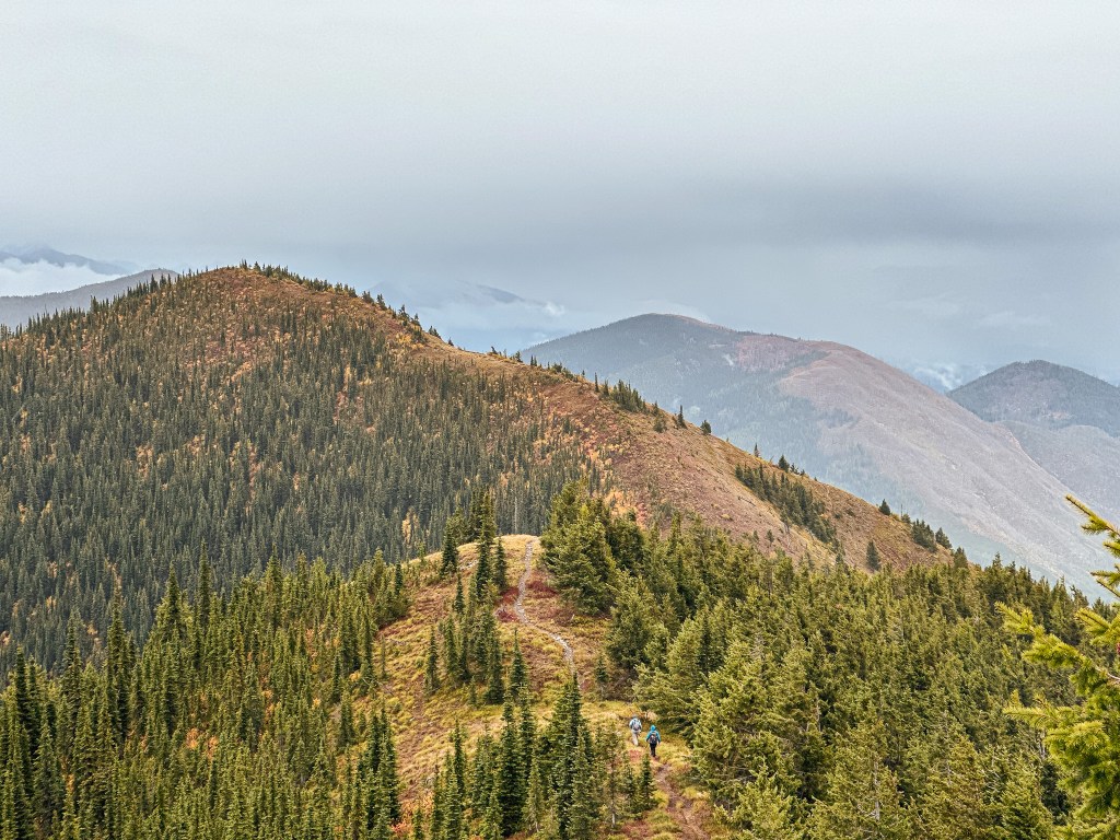
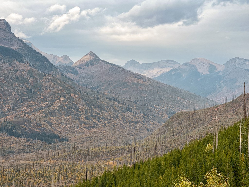
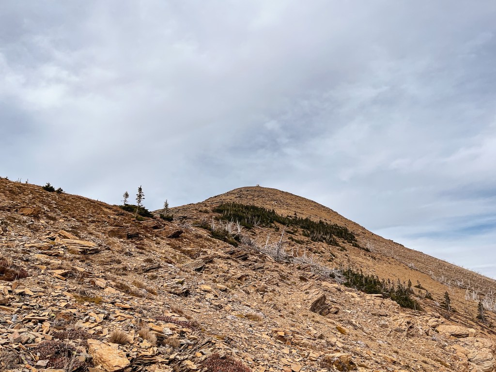
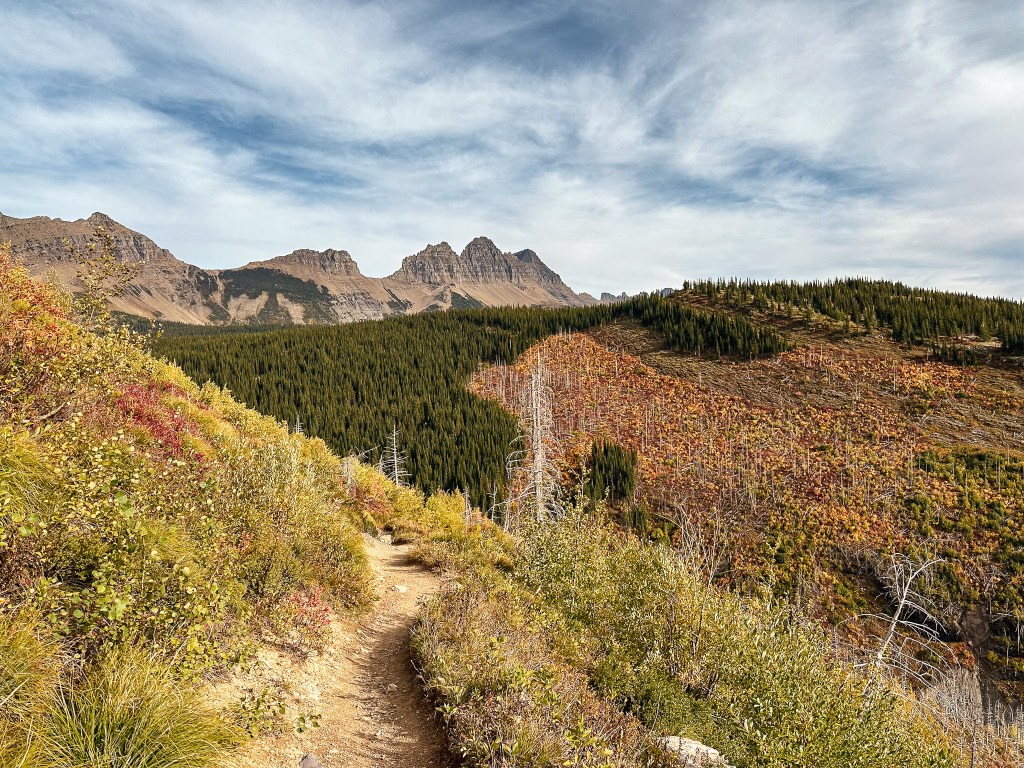
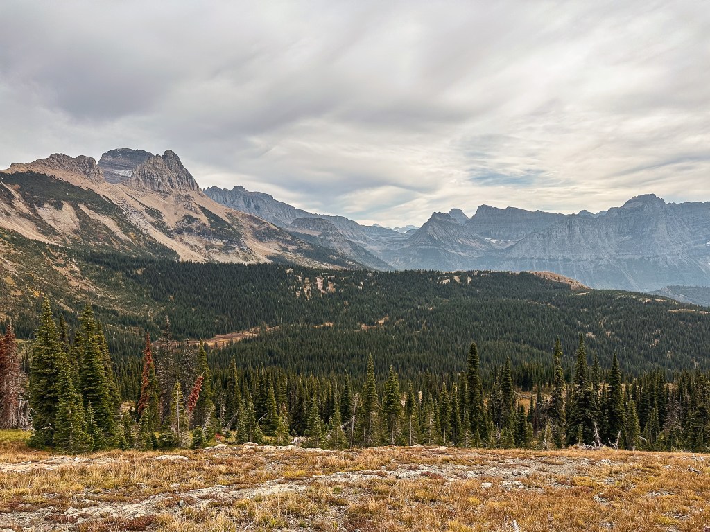
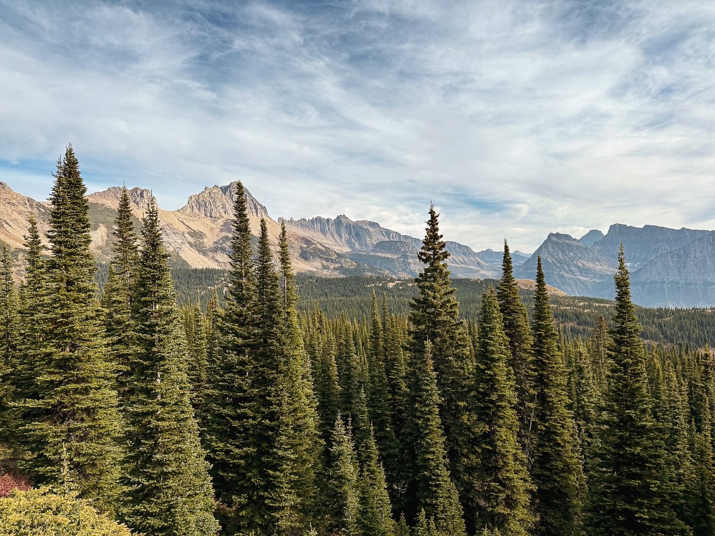
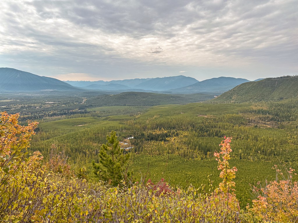
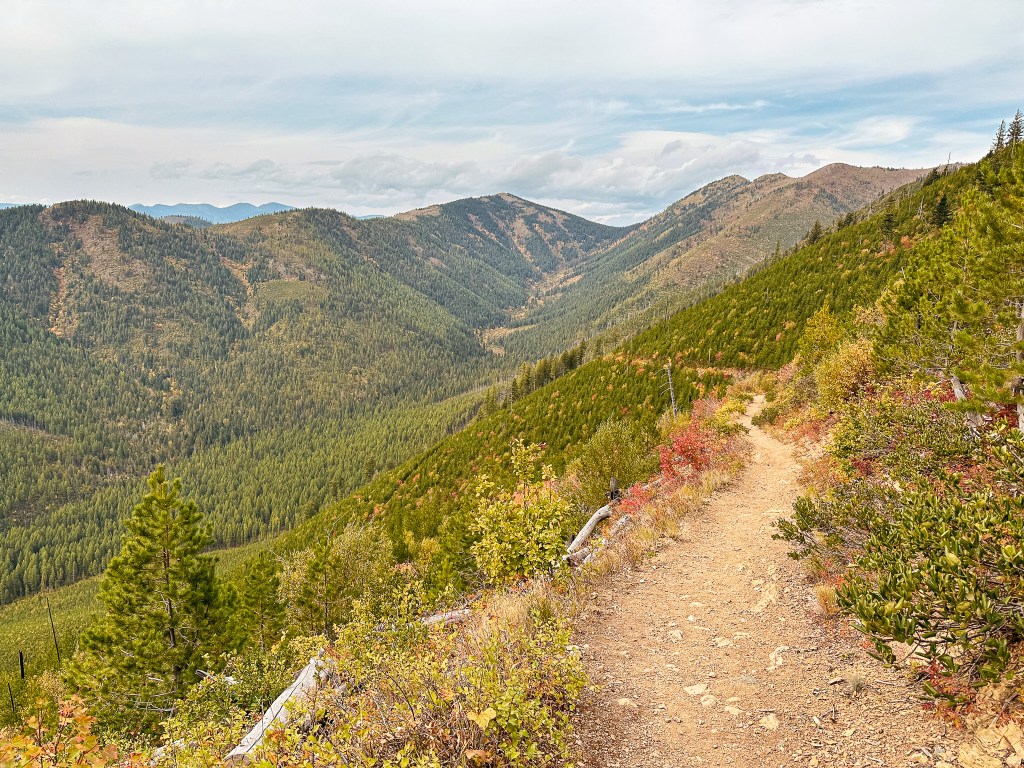
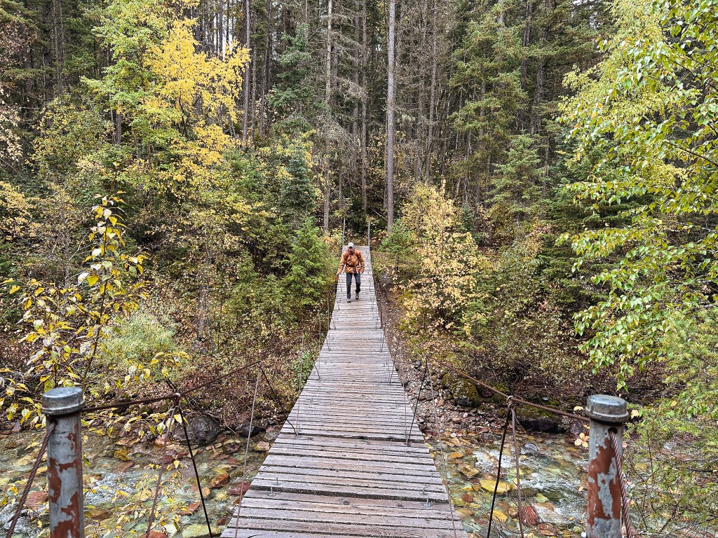
It wasn’t raining when we started our hike, but all the plants were damp from the previous night. This quickly saturated our pants as we brushed through the denser areas. The hike starts along the Boundary Trail following the Middle Fork of the Flathead River and quickly turns into the forest to cross Ole Creek on a suspension bridge. Please only cross one hiker at a time as the sign states. After the crossing, the trail made a sharp turn to gain a bit of a hill which brought us to an open view. The low hanging clouds were lifting slightly, but we figured we would be hiking up to reach them soon enough. There was a light dusting of snow on top of the next ridge over. We decided not to consult our map to confirm if we’d be going that high. A little over one mile from the trailhead, we reached our first junction with the Ole Creek Trail. We turned left to stay on the Boundary Trail for another half of a mile to the next junction. The official Scalplock trail forked to the right here. This area seemed to be well signed and it was easy to stay on track. Once we left the Boundary Trail the real ascent began. The majority of the elevation gain was concentrated within the next 3-1/2 miles to the summit.

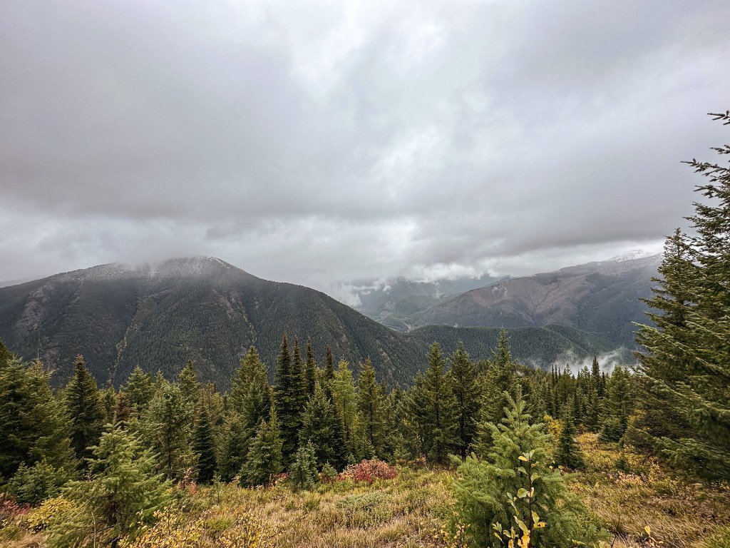
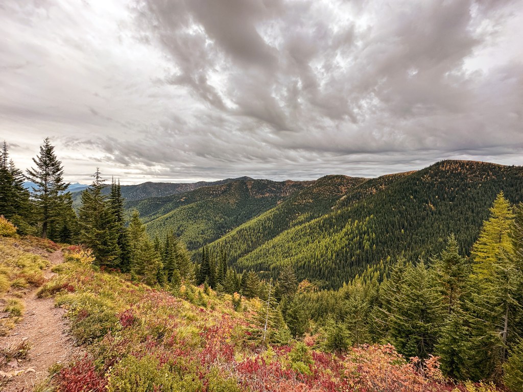
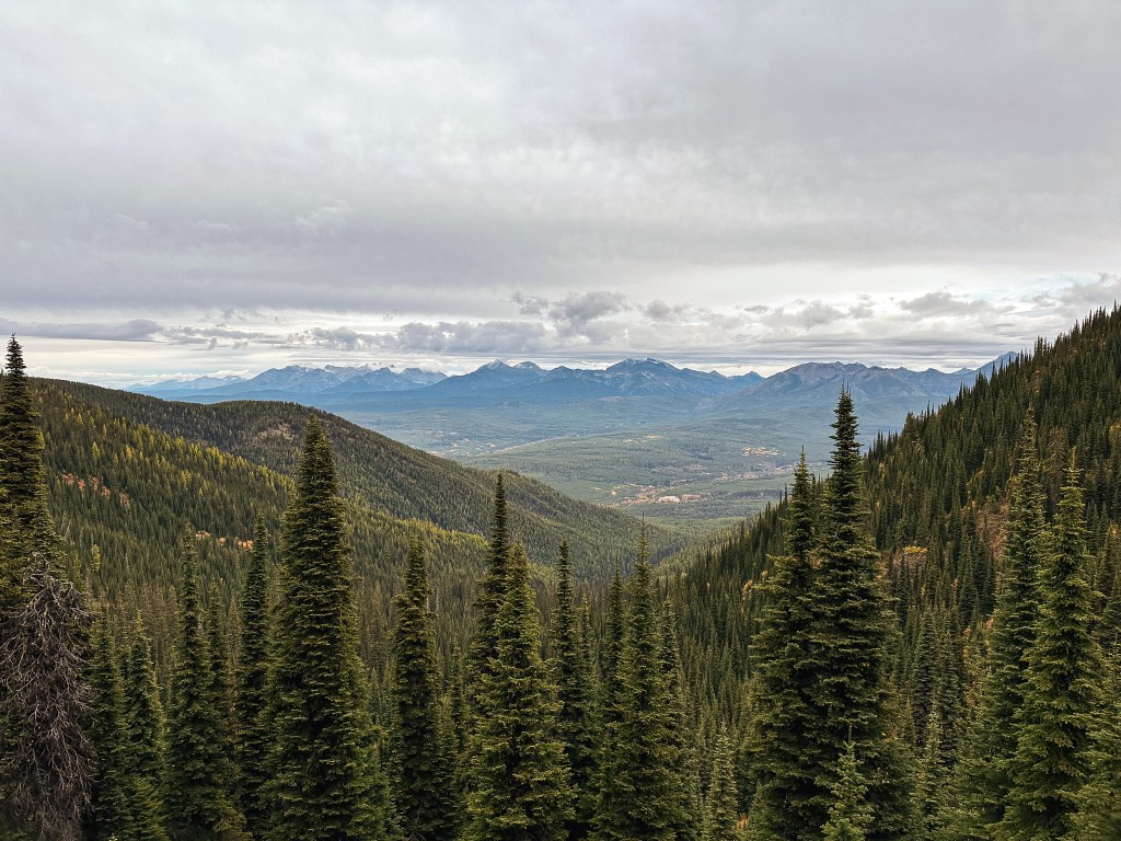
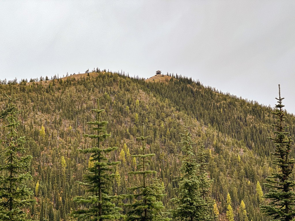
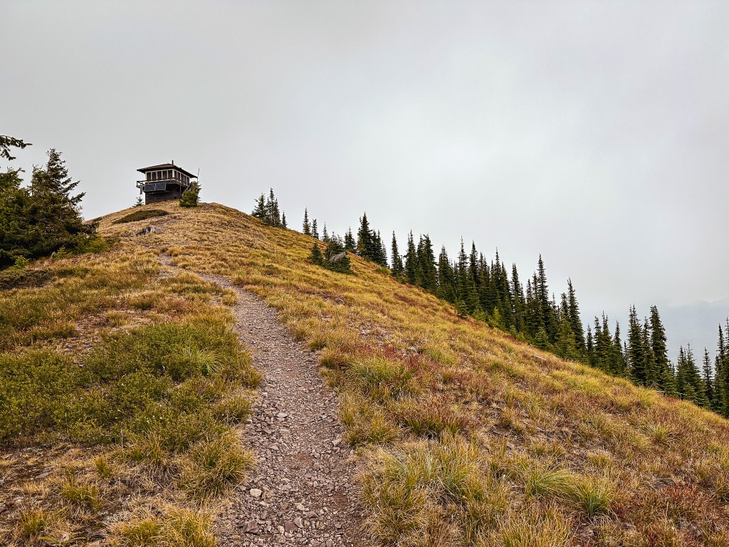
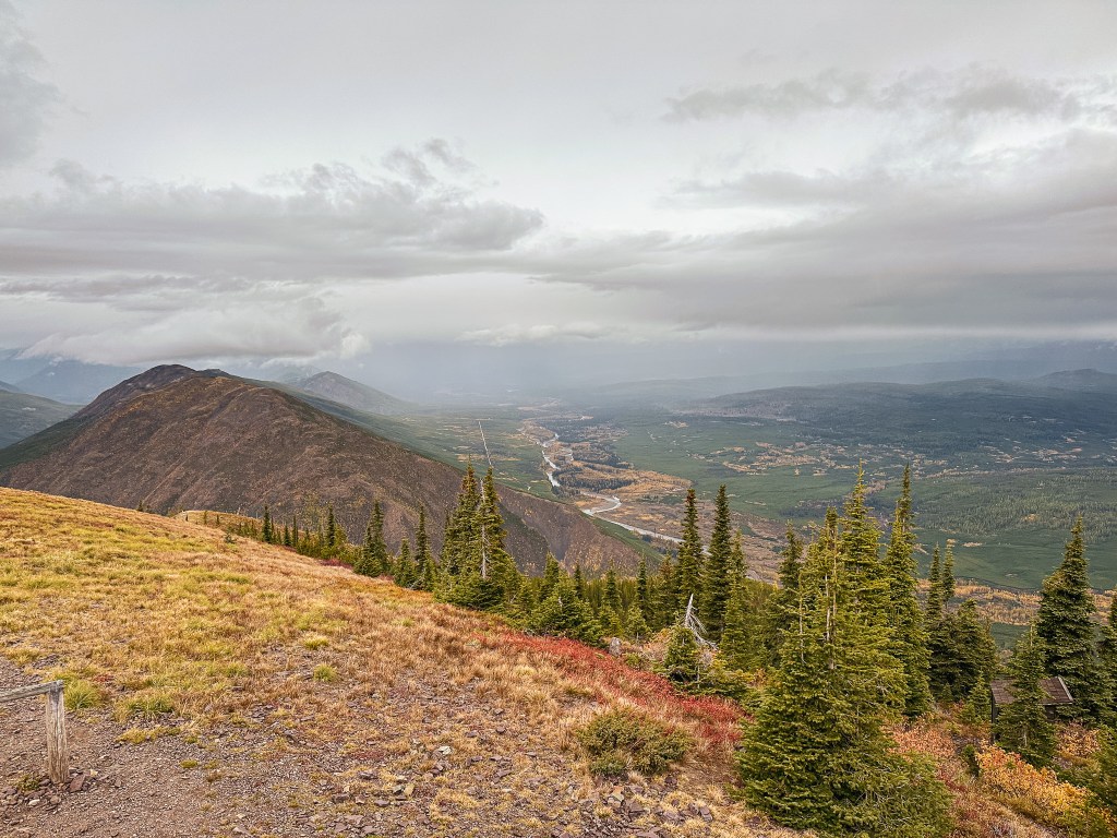
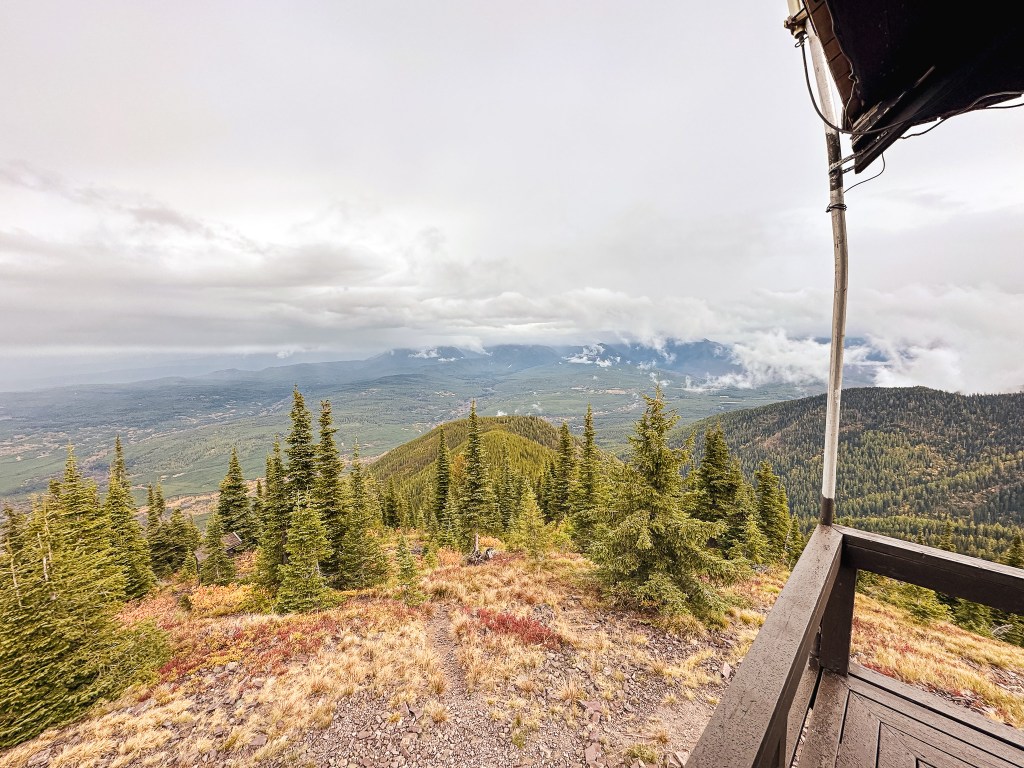
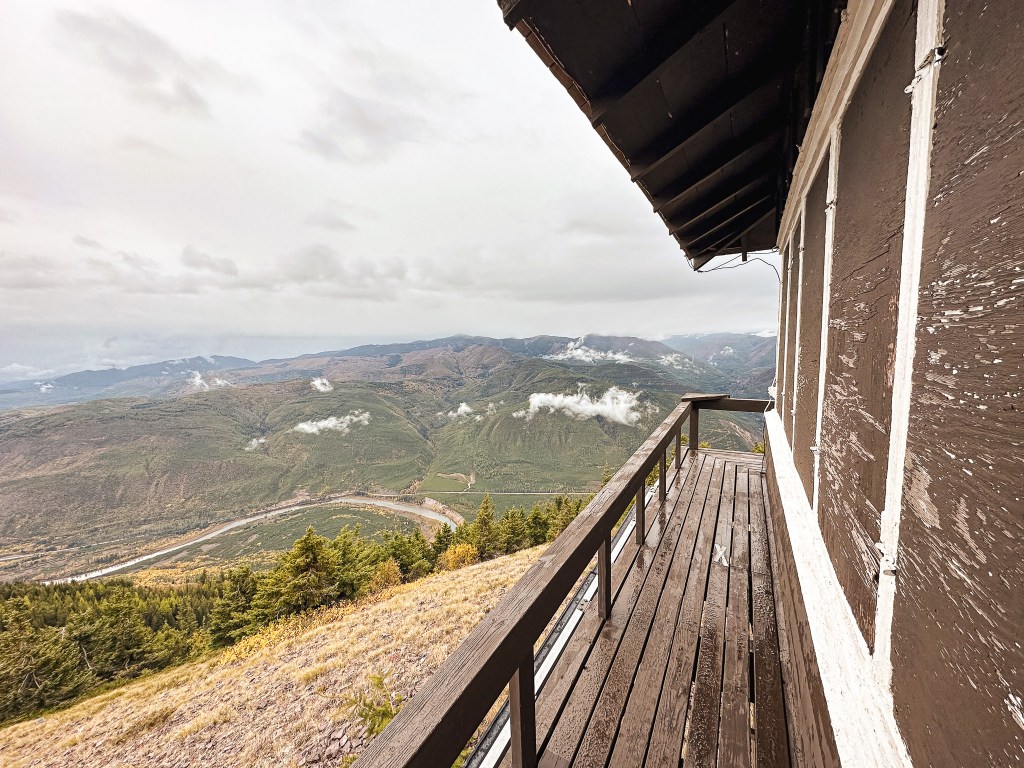
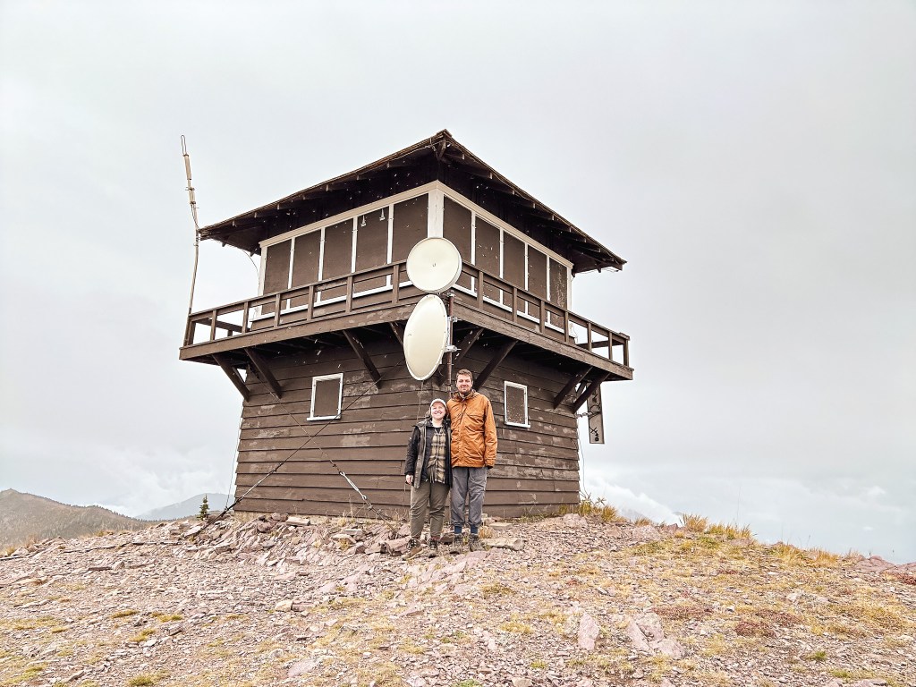
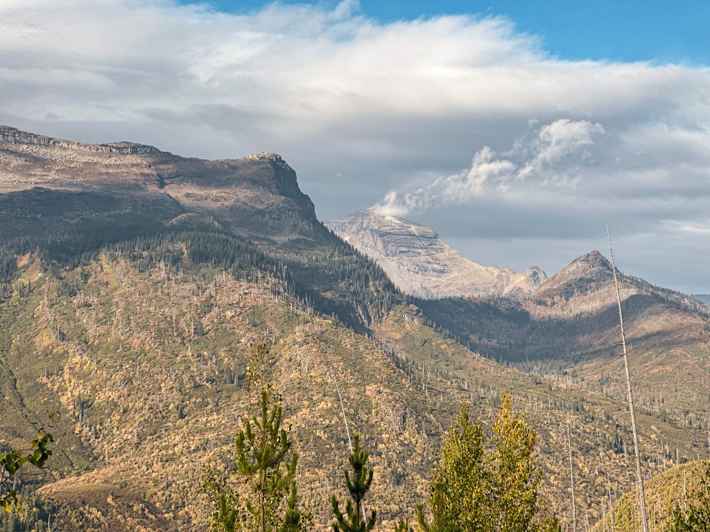
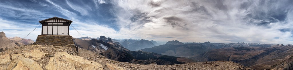
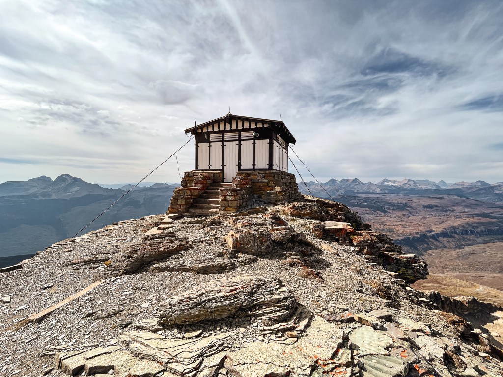
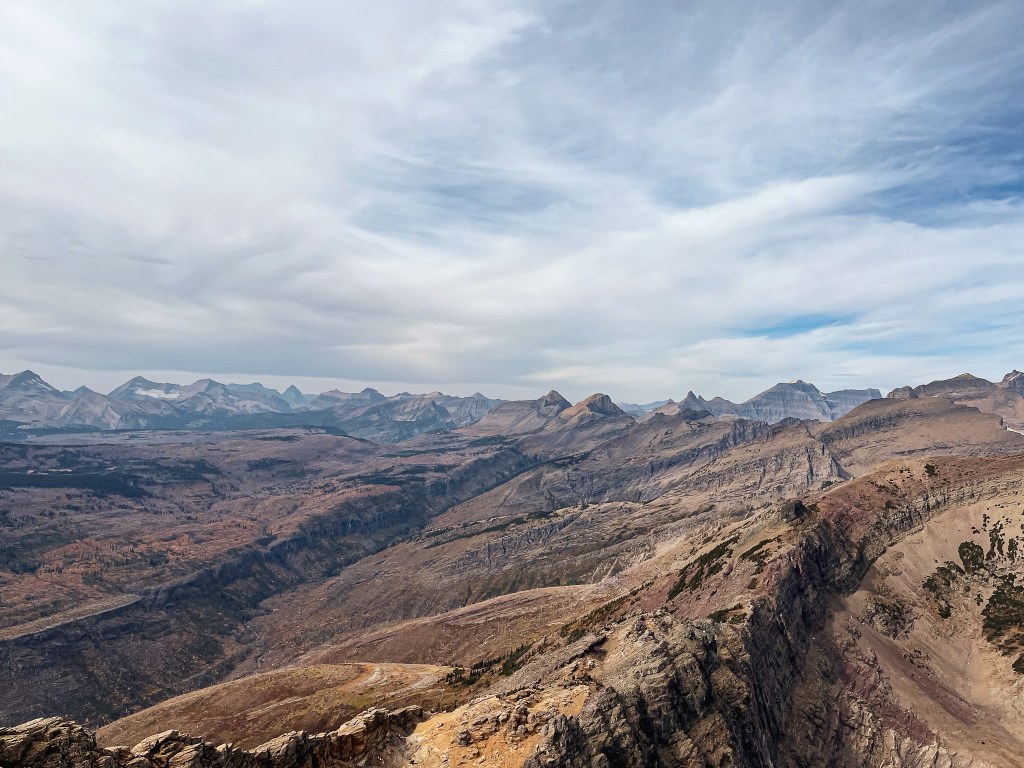
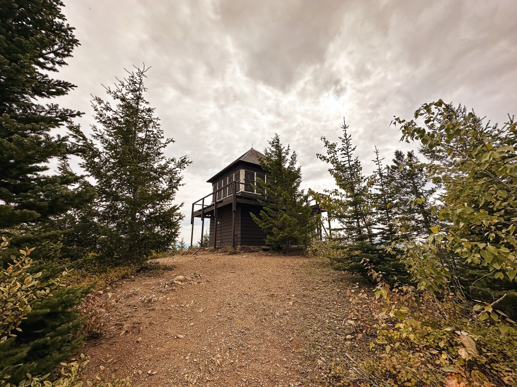
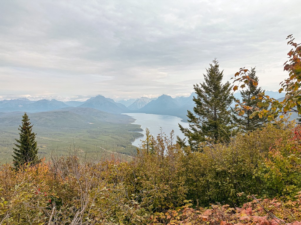
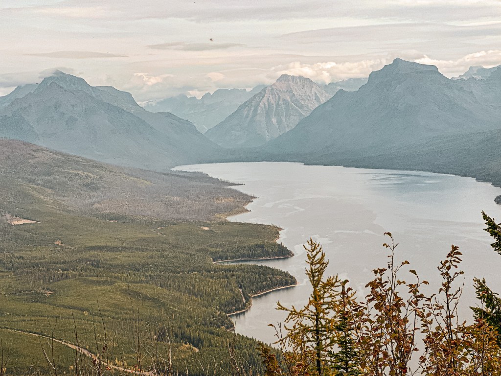
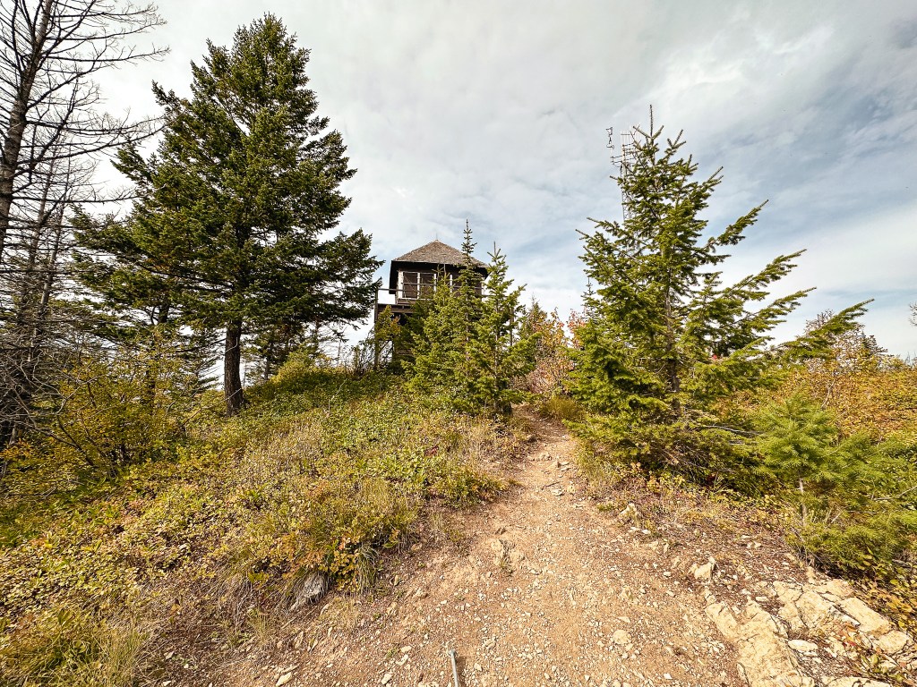
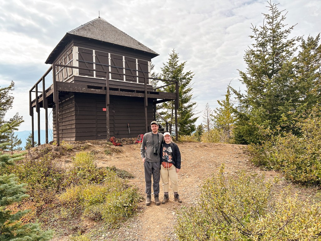
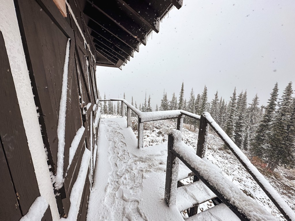
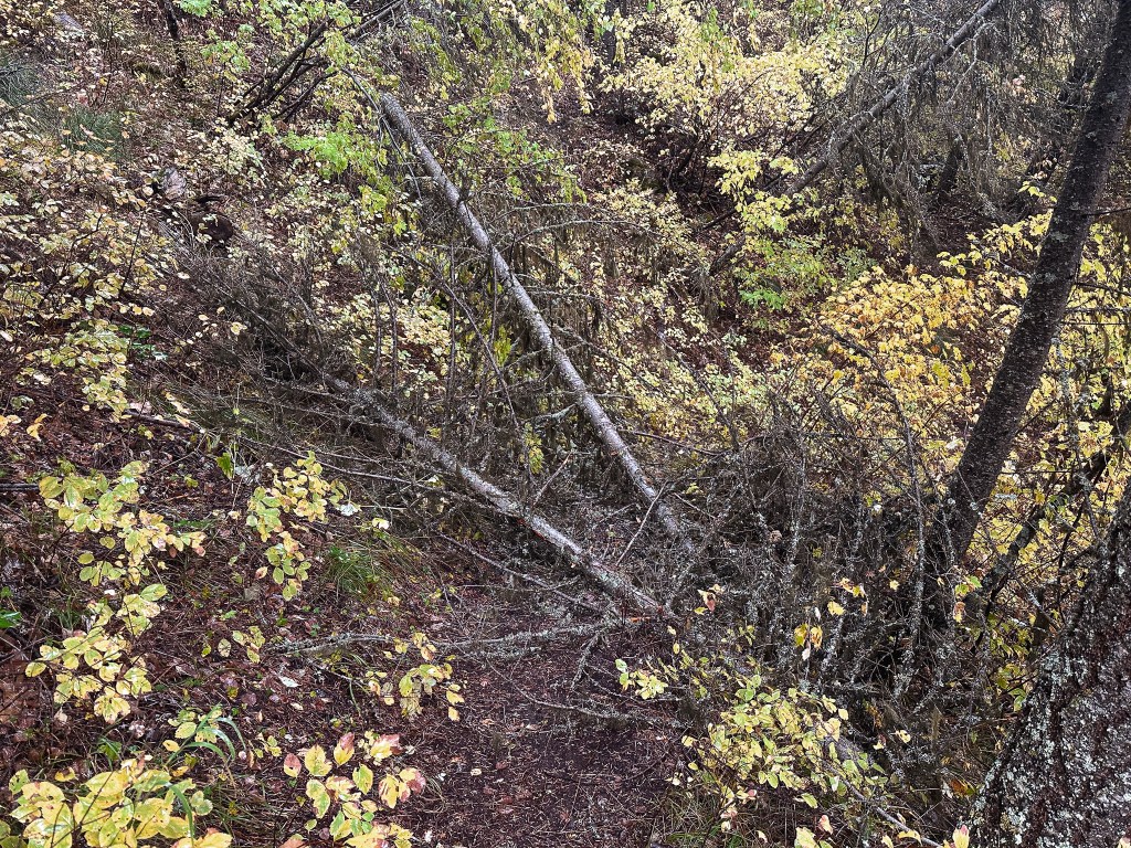
The water collected from the brush had completely soaked through my pants and was starting to seep into my shoes and socks. My rain jacket was able to keep the top half of me dry but the water made each step a little heavier. It was hard to tell if it was actually raining on us as the water dripped from trees above and fog rolled around us. Occasionally we’d get a break in clouds that offered views of the valley below. There are around 19 switchbacks to reach the summit from the Boundary Trail. There was only one spot that had some blow down. As we grew closer to the summit there were even a couple of sections that felt like false summits. We got our answer on if there would be snow within the last half mile as we crested an open portion of the ridge. Spoiler: there was snow. Garnet had hiked ahead at this point because I wanted to take more breaks than he needed. There was a bit more than a dusting on the protected slopes of the trail as it continued to gain elevation. This quickly turned our damp clothes painfully cold. It wasn’t too much farther to the lookout after I reached the snow line. We attempted to have our lunch on the summit but the combination of damp clothes, wind, and snow starting to fall kept our time short. I kept myself moving and stayed long enough to take a few pictures and finish my sandwich before heading back down. I didn’t expect much of a view but it was still disappointing there wasn’t a small break. Looking at other pictures online the summit offers great views of Mount Saint Nicolas and Mount Jackson to the north. Unfortunately, you can’t always wait around for the perfect weather to visit these places. I mean technically you can wait all you want (don’t let me stop you). But we’ve personally found waiting can be a matter of a fire lookout being there or not. It’s always a race against time as wildfires and age continue to claim them.

The hike down was fairly uneventful as rain settled in and we didn’t see anyone the entire hike. I thought this would have been a good place to see a bear, but we didn’t encounter much wildlife at all. It was very cold and wet by the time we reached the car. I decided to change at the trailhead to help myself warm up. We stopped to get warm food and drinks at the Glacier Highland Restaurant before returning to camp. Strava tracked this hike at 9.86 miles with 3,271′ of elevation gain.

History.

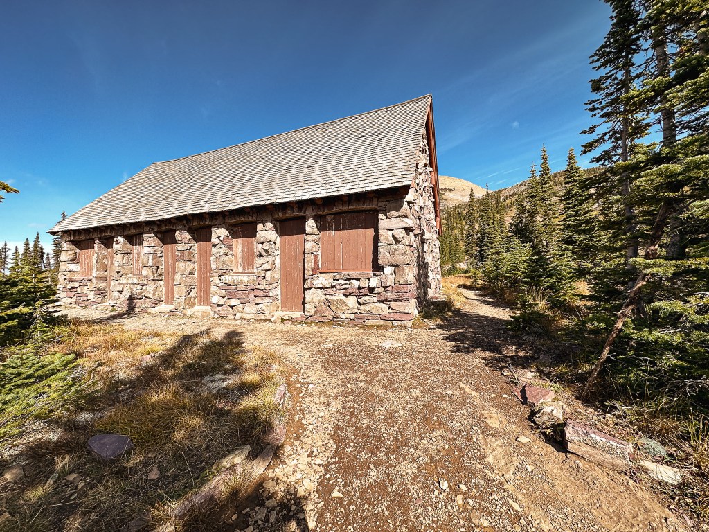
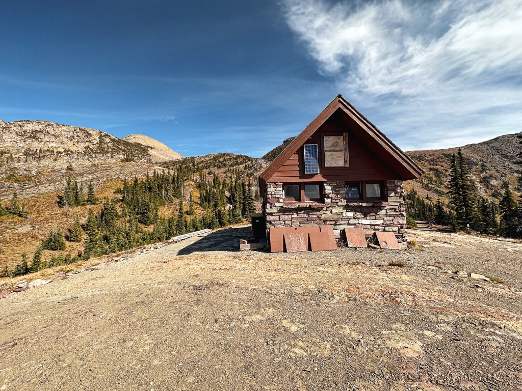
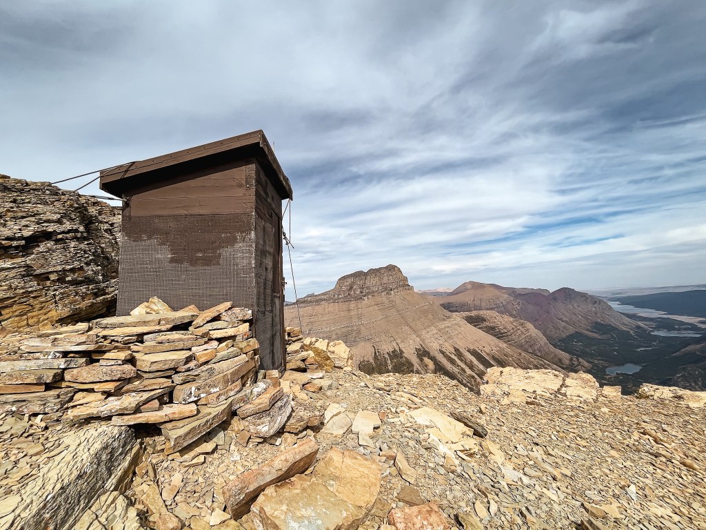
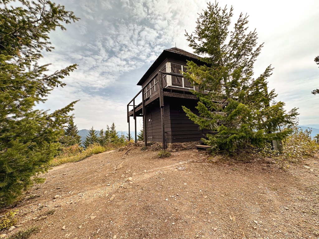
Scalplock Mountain is the southern most standing fire lookout within Glacier National Park and one of the four remaining that are still actively staffed in the summer. Though with budget cuts, staffing issues, and a push to move to camera surveillance it’s unclear how long this will remain to be true. It was built in 1931 as a 14’x14′ cab with 10′ enclosed tower and overhanging roof, a style favored by the NPS. The term Scalplock refers to a long lock of hair remaining on a shaved head worn by certain Native American warriors. According to Glacier Administrative History, the mountain received it’s name after a small tuft of trees remained on the summit after a fire burned through the area resembling a Native American’s scalplock. It was last refurbished in 1999 but appears to receive basic maintenance for upkeep. It is one of the nine fire lookouts that remain standing within the National Park.

Huckleberry Mountain L.O. (Glacier NP)

Montana Lookouts

Location.

Glacier National Park

Status.

Active; Currently standing

Estimated drive time from Portland, OR.

11-1/2 hours

Date visited.

September 27, 2023

Elevation.

6,593′

National Historic Lookout Register.

US 35; MT 3

Trip Report.

Tuesday evening the weather started to shift towards colder temps and rain. We knew the rest of the trip would be a gamble weather-wise, but we were going to roll with whatever it dealt us. We were pleasantly surprised to wake up to blue skies Wednesday morning after a night of heavy rain. Our goal for the day was Huckleberry Mountain, a commonly used name. We even have one here in Oregon. This is another easy to locate trailhead right off a main road. From the Apgar Campground, we headed back towards the visitor center. At the intersection, we kept straight to continue on to Camas Road. If you were heading into the park from the West Glacier entrance, you would come to the same intersection but turn left to reach Camas Road. You will stay on this road, exiting through the Camas entrance kiosk, until you see the trailhead off to the left. There was enough parking for at least 7 or so vehicles, but we were the only ones there at 9AM. It was a bit unsettling knowing we’d be heading into bear country with no one else on the trail with us. Everywhere else we’ve been so far has had at least some people on the trails. The clear morning skies made it crisp and cold as we started our hike. You could tell this trail was less frequently used than the others just based on the width of the tread. The busier trails tend to widen as crowds circumvent each other, but this was nothing more than a single track with a bit of brush encroaching on it. The surrounding brush was still damp from the rain and slowly started to soak through our clothes.

The hike starts out flat through a dense forest and crosses a creek on a log foot bridge before it starts to gradually climb. Once the trail starts to turn up it continues that way until you reach a saddle. It is consistent but gradual. The trail flattens out for a bit after reaching the saddle before continuing the final climb to the fire lookout. The steepest portion of trail is the last half mile. We thought we might have the entire hike to ourselves, but were passed by a pair of hikers on our way up the gradual section. The day had heated up significantly after we started this hike making it slow going. Garnet decided to continue up ahead prior to the saddle to find a good spot to step off the trail while I picked my way up the slope. I thought I’d meet up with him once I reached the saddle, but I was greeted by the other pair of hikers picking huckleberries and having lunch. I asked them if my partner came through here while I caught my breath. They mentioned he passed through and offered to let me hike with them the rest of the way to the lookout. I was no longer too concerned about running into wild life at this point, but figured it couldn’t hurt to stick with more people. They were two older ladies and one lived in the area locally while the other was a visiting friend. The local had been on this hike before and had even met the lady that staffed the fire lookout that summer. She spent the rest of the hike pointing out different peaks we could see through the clouds and I talked about the other fire lookouts my partner and I visited so far in the area. I trailed behind a bit since my pace wasn’t quite as quick until I rejoined with them on the summit. I had once again assumed we would find my partner on the summit, but we were surprised to find no one else. I thought maybe he was in the privy, but that was locked up for the season. I was only mildly concerned since I knew he hiked ahead and planned to step off the trail to use the “facilities”, but I figured he would have still beat us to the summit. The ladies were nice enough to wait with me for a bit and even offered to let me hike back with them. I politely declined since we were still planning to have lunch on the summit and take our pictures, but we exchanged numbers just incase. We said our farewells and just as they started to hike away we could spot Garnet headed up the trail. The clouds were starting to roll in and the temps were getting cold again by the time he reached the summit.

We spent a while longer on the summit enjoying our lunch, but eventually it started to drizzle which was our cue to leave. Just as we were taking one final lap around the lookout and collecting our pictures, we spotted a deer in the brush. Then another. And another. And another. And another. It was a group of four adults and three baby mule deer. We decided to watch them for a while until they started to head closer to our packs, which were now sitting below the lookout and not on our backs. I assume they smelt our food, but I didn’t want them rummaging through it. They seemed habituated enough to not be concerned by our presence but our movement towards the packs was enough to keep them away. Heavier clouds were growing closer and the rain was finally upon us – that was enough dilly dallying. Garnet wanted to snag a few more pictures, so I gave myself a head start knowing he’d easily catch up to me. The hike back down was a wet one and we were completely soaked by the time we reached the car. The final mileage according to my Strava was 11.88 miles with 2,699′ of elevation.

Before heading back to camp we drove out to the edge of the park and did a small loop trail called the Forest and Fire trail. It was only an additional 0.95 miles with 66′ of elevation change. This had a few signs about the relationship between the forest and wildfires which we enjoyed.

History.

The first structure built on Huckleberry Mountain for fire detection was a cupola style cab in 1923. It even had a telephone line running to the summit. It was replaced in 1933 by the existing lookout structure. The current structure is noted as a 14’x14′ two story cab with a hip roof that extends to cover the catwalk. These national park designs differ from the USFS L-4 designs in that their shutters are removable instead of folding. This is one of nine remaining fire lookouts within Glacier National Park and is still regularly staffed during the season.

Swiftcurrent Mountain L.O.

Montana Lookouts

Location.

Glacier National Park

Status.

Active; Currently standing

Estimated drive time from Portland, OR.

12-1/2 hours

Date visited.

September 25, 2023

Elevation.

8,436′

National Historic Lookout Register.

US 40; MT 8

Trip Report.

Monday was forecasted to be our nicest day of the week, so we allotted this for our hardest and highest elevation hike in the park. The end goal of the day was to reach Swiftcurrent lookout. No matter which way we sliced it the ascent was going to be difficult. You have three options when picking your starting point; the Loop, Logan Pass, or Many Glacier. The shortest option starts from the Loop trailhead, but requires the most elevation gain. This route is estimated around 12.5 miles RT with 4,200′ of elevation gain. If you start from Logan Pass instead, you are rewarded with the least amount of elevation gain but will have the most amount of mileage. This is estimated around 19 miles RT with only a little over 2,000′ of elevation gain out and back. During the peak season, you could shave off 3 miles by ending at the Loop trailhead and taking the shuttle back to Logan Pass. We unfortunately did not have the option for a shuttle during our visit. Your middle of the road option would be to start from Many Glacier. The route is estimated around 15 miles RT with 3,000′ of elevation gain. We immediately eliminated the Many Glacier route due to the location being on the Eastern side of the park and adding too much drive time. I debated starting us from Logan Pass since I can handle more mileage better than I can steep elevation, but 19 miles felt a bit out of reach for both of us. The only route that seemed obtainable during our visit was the one starting from the Loop. I wasn’t confident I would make it, but I wanted to at least give it a shot.

We tried to give ourselves as early of a start as possible and were at the parking lot by 9AM. This trailhead is easy to locate as a main pull off from the Going-to-the-Sun road on the western side of the park. It’s situated on a tight hairpin turn with parking above and below the corner. Make sure to be careful when crossing the road from the parking lot to the start of the trail, it is a blind corner and people take it faster than they should. The trailhead is fairly small since most visitors choose this as an ending point instead of a starting point. It sees most of its use during the summer when the shuttles are running and visitors are completing their hike of the highline trail. I didn’t expect to see as many people as you would in the summer, but I was surprised on how quiet it was for us. It seemed most cars were only parked for the roadside view point. We only saw a handful of people on the trail to and from the Granite Park Chalet. The amount of people around the chalet was a different story.

The trail starts out by undulating along a gradual slope for the first mile. The elevation starts to pick up gain around the first switch back. We had a decent view into the drainage below due to the area being burned over. This opened up the view to not only see Swiftcurrent throughout parts of the hike, but Heaven’s Peak for most of it as well. At first glance you might not notice the fire lookout on the edge of the ridge due to its stone structure blending with the surroundings. But, once we knew where to look it felt like the always watchful eye of Sauron (if you know, you know lol). It can be seen from a lot of hikes within the heart of the park if you know where to look. Despite its ever visual presence, the route to Heaven’s Peak has long since been abandoned. Although interesting this wasn’t on our agenda for the trip, so we turned our focus back towards Swiftcurrent. It wasn’t until after the second switchback that I started to feel a dull ache in my hip. I was already moving slow and knew I should have done more conditioning for this trip. I tried to convince my partner that he should hike on ahead, but he wasn’t willing to give up on me making it to the summit. It’s possible I was just too deep in my head about this one, but I knew I wasn’t going to make it and had that feeling from the start. I even had that feeling the day before, if I’m being honest. I started to feel bad that I was slowing my partner down and I didn’t want him to miss out on something I knew he’d have no problem completing otherwise. We had a direct view of Swiftcurrent once the trail started to turn away from the valley and into a more forested part of the slope. It looked deceivingly close from the vantage point. We hiked on with more determination, but seemingly not getting any closer. We knew we were finally close to the chalet when we reached the trail junction that lead to the backcountry campsites. We briefly debated whether we should check it out now or later, but I was hungry and tired and wanted to make it to the Chalet for lunch. We continued right at the fork for another 1/2 mile to the Chalet. It was just after 12PM and we had hiked roughly 4 miles with 2,600′ of elevation gain to get here. We had only seen three pairs of hikers on trail from the trailhead and there was only one couple sitting at a picnic table enjoying the view when we arrived. We decided on a table in the shade to have our lunch and figured the quiet was due to the lack of shuttles running.

It would have been novel to see the Chalet when it was open for the season and be able to buy convenience store snacks in the backcountry. I day dreamt about the combination I would have bought while we ate what we brought with us. I also considered how much easier it would have been to make it to Swiftcurrent if we were staying the night at the Chalet or even the backcountry campground. From the Chalet, it is roughly an additional 2 miles (4 miles RT) with 1,650′ of elevation gain and 40 switchbacks (yes, someone else counted them) to reach the lookout. I decided to seal my fate and hang back at the Chalet while Garnet made his summit attempt. If I ever get a chance to make another attempt, I would choose to break it up with a night at the campground. It took him around 3 hours round trip to make it there and back. I had a bit of service at the Chalet and was able to download an e-book from my library to read while I waited. The amount of people that were at the Chalet ebbed and flowed throughout the day ranging from only a handful to large loud groups. Most had hiked from Logan Pass and didn’t stay long since they still had to make the trek back. I had since moved myself to another picnic table facing the view in the sun after Garnet had departed. It was cold and windy in the shade after I had cooled down from our ascent. I was just trying to stay warm and entertained while I waited, but to the on lookers it appeared I was just another kid engulfed in my phone not appreciating the view. One might argue I’m projecting, but someone felt the need to make a comment close and loud enough so I would hear them. Little did they know I had been there for 2 hours already. It rubbed me the wrong way, plus the book I was reading wasn’t that engaging, so I decided to stew on it for the remaining hour instead. It made me regret not bringing the extra weight of my book up with me, no one would have said anything if I had my nose in a physical book. Eventually, the flow of people dwindled and the Chalet was eerily quiet. I figured he must be getting close and decided to stroll around the grounds. My intrusive thoughts decided to take hold at this point. What if he already came back and didn’t find me so he continued back to the car? What if he’s hurt? Does it make more sense to start hiking back to the car without him before it gets dark? I picked a different bench to sit on with these thoughts for a while that had a plain view of the trail junction. There was only a late afternoon pair of hikers that came while I was sitting here and then a solo hiker that was very excited to have made it. He said something about his time that it took to get there from Logan Pass and it sounded quick for the mileage. I took a few pictures for him to help him commemorate. He wondered off toward the Chalet and I was finally able to see Garnet headed down the trail. He looked tired, sweaty, and happy. All the signs of a successful summit.

Garnet’s Pictures from the Summit

Our reunion was brief as we needed to continue our hike if we wanted to make it back to the car before dark. On our descent we decided to quickly stop over at the backcountry campground. We figured we wouldn’t be back for a while and that we might as well see it while we were here. There was also a slight morbid fascination with The Night of the Grizzlies story that motivated our visit. It was a simple backcountry campground with about 4 spots to choose from and a designated cooking/food area. We continued our hike down with little to note besides stopping to check out a couple birds (bohemian waxwings?) and leap frogging with another pair of hikers to the parking lot. The sun was starting to set by the time we reached the car and it was almost completely set by the time we made it back to camp. It was a whole day affair. In total, I tracked our hike at 8.86 miles RT with 2,631′ of elevation gain (Garnet obviously hiked more to reach Swiftcurrent but doesn’t use a tracker).

History.

Built in 1936 by the CCC, Swiftcurrent is one of the few remaining fire lookouts staffed within the Glacier National Park. It offers a unique design mimicking a Swiss Chalet similar to the same design elements applied to the Many Glacier Hotel. The two-story 14’x14′ timber cab with gabled roof sits atop a 10′ natural stone base. It offers the highest point accessible via trial within the park. It is listed on the National Register of Historic Places.

Apgar L.O.

Montana Lookouts

Location.

Glacier National Park

Status.

Emergency; Currently standing

Estimated drive time from Portland, OR.

11 hours

Date visited.

September 24, 2023

Elevation.

5,236′

National Historic Lookout Register.

US 33; MT 1

Trip Report.

My partner and I usually like to plan 2 separate week long trips during the year. These are sometimes combined to make a longer 2-week trip, but those are usually allotted for above and beyond destinations we both agree upon. To keep things fair, we each get to plan what we do during one of the weeks. Garnet’s decision for 2023 was another lookout road trip around Oregon (post). My destination of choice took us a bit farther to break ground in a new state and National Park, or new to me at least. I can’t explain what draws one destination or another to the top of my list, but Montana and Glacier National Park were calling my name this year. We decided to gamble on a late season arrival to help mitigate the crowds. It is arguably our favorite time to travel. But, you always run the risk of early season snow, late season fires, or rain for 9-days straight. It’s always good to have some sort of back up plan incase of said conditions. Once the forecast was in reach, it wasn’t looking promising with rain and snow predicted for higher elevations most of the week. I’m not sure why, but I couldn’t bring myself to move on or even think about a potential plan B. the weather be damned I wanted to go to Montana.

I won’t bore you with the details of our route from Portland to West Glacier, but we were roughly on the road for 11 hours straight Saturday. We made minimal stops with breaks to stretch our legs and refuel the car. Keep in mind you do lose an hour of your day when traveling from Pacific to Mountain time. We left early enough to watch the sunrise from our vehicle and arrive in Glacier NP late afternoon before sunset. Glacier offers many different types of campgrounds to choose from throughout the park depending on where you want to be located and what time of year you are visiting. A few of the campgrounds were already closed for the winter season and a few more would be closing during our stay. I decided on the Apgar Campground given its year round availability and proximity to our intended destinations. I didn’t have to fight for my life on Recreation.gov to get a reservation at the 6-month opening either (something you might have to do during the peak season). I did delay my booking a bit too long though (I got too comfortable) and missed out on having the same camp spot for the entire trip. Luckily, I noticed the dwindling options before it was out of hand and we only had a different camp spot for our first night. There are some things to keep in mind if you decide to visit that might differ from our experiences. For example, the Going-to-the-Sun road was being repaved along Lake McDonald during our visit. This added wait time and a bumpy gravel portion to enter the park. Most of the amenities such as shuttles, lodges, chalets, and higher elevation visitor centers were already closed for the season. The Going-to-the-Sun road closed for the season mid-way through our trip. Access to the Bowman and Kintla areas were closed due to road construction. We were visiting outside the needed day-use vehicle registration period. These were all things we were aware of and prepared for during our stay. It’s just a reminder that I can’t stress enough – it is always important to do your own due diligence before visiting a National Park.

Our first full day in the park, Sunday, was more of what I would like to consider an introductory day. The first hike I had planned was the easiest of our fire lookout hikes and would help set the tone for the rest of the week. It was still located close enough to camp for us to pack up and move spots. And if time allowed, I wanted to stop in at the Apgar visitor center. Getting to the Apgar Lookout trailhead can be a bit confusing since it’s not as well marked as other trailheads. The road is located between the west entrance kiosk and the Apgar visitor center before you turn onto the Going-to-the-Sun road. It’ll be off to your left with a sign for Apgar L.O. if you are just entering the park or off to your right if coming from the campground. Continue straight until the road bends. There will be a gravel road off to the left (this heads towards the Glacier Institute Field Camp) but you will want to stay on the main paved road that continues right. Shortly after bearing right there will be an open gravel area to the left with a skinny one lane gravel road – head for this road. If you continue straight you will enter private property. From this junction, it is roughly 2 miles to the trailhead. There was no signage that I could see to indicate we were on the right road during our visit. The road eventually leads you over an old wooden bridge to cross McDonald Creek. Once across the bridge, we followed the gravel road to where it dead ends. This road can be narrow and a little rough in some sections, but any standard clearance vehicle should be able to make it here with caution.

We reached the trailhead around 9:30AM with only three other cars parked in the lot (our car being the fourth). This is definitely one of the less popular trails within the park despite it being closest to the west entrance. I had a bit of anxiety starting this hike since we both had no real experience hiking in grizzly country. We had extensively read up on the recommended Bear Safety tips prior to this trip, but putting them to practice is a different story. The basics are to make noise, travel in groups, don’t run on trails, carry bear spray, be aware of your surroundings, and secure your food/garbage. We had bear spray strapped to the outside of both of our packs. An important step as this does not provide any defense if it’s tucked away within your backpack. But, we found the hardest for us was learning to make noise on the trail. This went against our norm and felt unnatural to call out occasionally. We found clapping our hands or my trekking poles was an easier alternative. I thought about acquiring a bear bell to help with this, but I found that REI does not carry them anymore and it is no longer recommended as an adequate tool for bear safety. I even read somewhere that bears can mistake the jingle as the sound of prey having the opposite effect. These are just words of caution since we saw plenty of unprepared visitors during our stay. I understand that most people have the mentality that this won’t ever happen to them and in most instances that will be true, but it only takes one chance encounter for things to escalate. This applies to most things when recreating outside though. If you are wondering why these precautions are in place then I’d recommend reading the true story of Night of the Grizzlies by Jack Olsen and how the park was managed prior to that.

The trail starts out fairly flat following the old road bed and climbing gradually towards the base of the mountain. The surrounding forest is brushy and dense due to fire damage accumulated from two major fire scars. The first was in 2003 when the Roberts Fire burned through 58,000 acres near Lake McDonald. That year was considered one of the most destructive fire seasons for Glacier, totaling 136,000 acres burned or around 13% of the park. The second was more recently in 2018 when the Howe Ridge Fire burned 14,522 acres through the existing scar. After about a mile you will reach the base of the mountain and start the real climb via three long switch backs to the summit. Make sure to carry enough water since the majority of this hike is exposed. We found it to be overly humid and hot even this late in the season. The next 2.5 miles are spent climbing around 1,700′ of elevation. You will know you are close once the trail flattens out to hike towards the eastern slope of the ridge. Situated just below the fire lookout is a pit toilet and hitching post for horses.

We only passed one trail runner and a group of four heading down while on our way to the summit. We had the lookout to ourselves briefly before another pair and a solo hiker joined us. We decided to eat our lunch just below the catwalk in the shade of the lookout. The views from the fire lookout and base are slowly becoming obstructed by the surrounding trees. We could still see out to a nice view of Lake McDonald and the Apgar village below. I briefly chatted with the other pair of hikers about Washington and our travel time/distance to Glacier as we were getting ready to start our hike down. They had noticed my WSU hat and mentioned they used to live in Seattle (but now resided in Pennsylvania if I remembered correctly). They had flown in and rented a car to get here, but still had a travel day just as long as us. Our consensus was that there is no quick way to get to Glacier NP and wished each other a good remainder of our respective trips. The hike back down was brutally hot and we passed a lot more people than we saw that morning, even a couple on horses. This was still nothing in comparison to the amount of people we would see on other trails in the park. The Strava app tracked our hike at 7.24 miles RT with 1,923′ of elevation gain.

I was happy to see we still had enough time to stop in at the visitor center before heading back to camp. Though I was disappointed to find they had no magnets or other paraphernalia that showcased their many fire lookouts. I still decided to get a magnet with Lake McDonald and we upgraded to a more detailed map of the park. We also decided to talk to the rangers onsite to see if they had any additional insight. Unfortunately the ranger we spoke with did not have the detailed information we were hoping for, but he did his best to answer our obscure questions about the fire lookouts in the park.

History.

The fire lookout and surrounding area are all named after Milo Apgar. He was among one of the first settlers to set up permanent residence along Lake McDonald in the early 1890s. Milo helped develop the area by building homes and cabins for tourists, which is now known as the Apgar Village within the park. Though I highly doubt Apgar was the first, he just happened to be one of the first of the white men. The original lookout structure on Apgar was completed in 1929. Ironically, the structure burned down only 2 weeks later during a forest fire. It was immediately replaced with an exact replica in the spring of 1930 and still stands today. This is a standard national park 2-story cab design that has a 10′ tower and 14’x14′ cab. It is listed on the National Register of Historic Places and is one of nine remaining fire lookouts within Glacier National Park. Although this tower is no longer staffed during the season, it remains as a standing exhibit for visitors to enjoy.